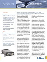
Trimble Survey Controller Software - Accupoint
Trimble Survey Controller Software - Accupoint
Trimble Survey Controller Software - Accupoint

Create successful ePaper yourself
Turn your PDF publications into a flip-book with our unique Google optimized e-Paper software.
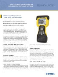
<strong>Trimble</strong> survey conTroller field sofTware technical notes<br />
Monitoring Applications – Extension to Automated Rounds<br />
An extension to the familiar rounds program in the <strong>Trimble</strong> <strong>Survey</strong><br />
<strong>Controller</strong> software expedites data collection for monitoring applications.<br />
On a first site visit you can create and save target files. Then on subsequent<br />
visits you can quickly measure to the same targets—manual measurements<br />
are not necessary.<br />
You can read more about the Engineering option, its features, and<br />
applications, in the <strong>Trimble</strong> <strong>Survey</strong> <strong>Controller</strong> – Engineering Option<br />
Technical Notes.<br />
IN-FIELD CHECKS AND QUALITY ASSURANCE<br />
Job Review and Point Manager<br />
The Review Current Job feature gives you a complete and detailed record<br />
of everything that happened in the field—it is a real electronic field book.<br />
Alternatively use the Point Manager feature to manage your data.<br />
Easily review:<br />
• Coordinates and observations<br />
• The best point and all duplicate points<br />
• Target and antenna heights<br />
• Codes and notes<br />
QC Graph<br />
The QC Graph screen displays quality indicators available from data in a job.<br />
Use this tool to quickly identify an erroneous measurement or an incorrect<br />
target height.<br />
View a graph of:<br />
• Horizontal and vertical precision<br />
• Satellites<br />
• PDOP, RMS, and standard errors for HA, VA, and Slope distance<br />
• Elevation<br />
• Target height<br />
Custom Reports<br />
The <strong>Trimble</strong> <strong>Survey</strong> <strong>Controller</strong> software exports data in many different<br />
formats. The flexibility to create different files is invaluable for checking data<br />
in the field, and for producing reports to e-mail to the office or your client.<br />
Use the default styles provided with the <strong>Trimble</strong> <strong>Survey</strong> <strong>Controller</strong> software<br />
or create your own XML style sheet to set up a custom format.<br />
Quickly and easily edit:<br />
• Target and antenna heights (single or multiple)<br />
• Codes and notes<br />
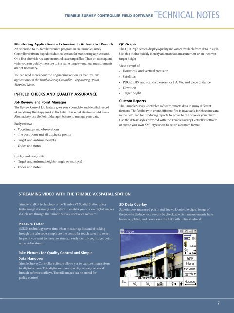
STREAMING VIDEO WITH THE TRIMBLE VX SPATIAL STATION<br />
<strong>Trimble</strong> VISION technology in the <strong>Trimble</strong> VX Spatial Station offers<br />
digital image streaming and capture. It enables you to view digital images<br />
of a job site through the <strong>Trimble</strong> <strong>Survey</strong> <strong>Controller</strong> software.<br />
Measure Faster<br />
VISION technology saves time when measuring: Instead of looking<br />
through the telescope, simply use the controller touch screen to select<br />
the point you want to measure. You can easily identify your target point<br />
in the video stream.<br />
3D Data Overlay<br />
Superimpose measured points and linework onto the digital image of<br />
the job site. Reduce your rework by checking which measurements have<br />
been completed, and never leave the field with unfinished work.<br />
Take Pictures for Quality Control and Simple<br />
Data Handover<br />
<strong>Trimble</strong> <strong>Survey</strong> <strong>Controller</strong> software allows you to capture images from<br />
the digital stream. This digital camera capability is easily accessed<br />
through software softkeys. The still images can be stored for<br />
quality control.<br />
7