Downton Village Design Statement.pdf 860kb - Wiltshire Council
Downton Village Design Statement.pdf 860kb - Wiltshire Council
Downton Village Design Statement.pdf 860kb - Wiltshire Council

Create successful ePaper yourself
Turn your PDF publications into a flip-book with our unique Google optimized e-Paper software.
<strong>Village</strong> <strong>Design</strong> <strong>Statement</strong><br />
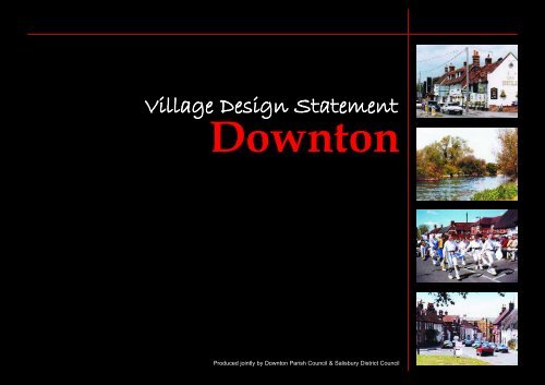
<strong>Downton</strong><br />
Produced jointly by <strong>Downton</strong> Parish <strong>Council</strong> & Salisbury District <strong>Council</strong>
<strong>Village</strong> <strong>Design</strong> <strong>Statement</strong><br />
Content<br />
• Introduction<br />
• Aims<br />
• How is the <strong>Statement</strong> to be used<br />
• History<br />
• Landscape Setting<br />
• Settlement Pattern<br />
• Open Spaces and Landscaping<br />
• Buildings and Materials<br />
• Roads and Traffic Management<br />
• Streetscape<br />
• Map<br />
Page 1
Introduction<br />
This village design statement is based<br />
on a ‘skeleton’ document prepared by<br />
the <strong>Downton</strong> Society in conjunction<br />
with <strong>Downton</strong> Parish <strong>Council</strong>. The<br />
<strong>Downton</strong> Society is a village<br />
organisation founded in 1973 to<br />
stimulate interest in the village and<br />
its history, encourage high standards<br />
of planning in the village and<br />
influence the preservation and<br />
improvement of its historic sites and<br />
buildings. The ‘skeleton’ document<br />
was sent to every organisation in the<br />
village and some individuals for their<br />
input and comments. A public<br />
exhibition was also held where the<br />
general public were invited to<br />
complete questionnaires and<br />
comment on the document. This final<br />
document has been prepared by<br />
<strong>Downton</strong> Parish <strong>Council</strong> in<br />
conjunction with Salisbury District<br />
<strong>Council</strong>.<br />
Aims<br />
The aim of this village design<br />
statement is to ensure that the design<br />
of any future development and any<br />
change to existing dwellings in<br />
<strong>Downton</strong>, are based on an<br />
understanding both of the village’s<br />
past and present character and of its<br />
precious environmental setting, so<br />
that it can contribute sensitively to<br />
the protection and improvement of<br />
<strong>Downton</strong>.<br />
The document therefore aims to offer<br />
design advice on the preservation of<br />
the present character of the village in<br />
the relationships between buildings,<br />
open spaces, the treatment of<br />
boundaries and the planting of trees,<br />
and on the wider perspective of the<br />
village as a whole, from surrounding<br />
viewpoints.<br />
How is the <strong>Statement</strong><br />
to be Used<br />
The <strong>Statement</strong> has been adopted by<br />
Salisbury District <strong>Council</strong> as<br />
supplementary planning guidance<br />
and is for the use of all involved in<br />
the development process. It will also<br />
help inform the wider public on the<br />
distinctive characteristics of<br />
<strong>Downton</strong>.<br />
This <strong>Statement</strong> takes account of<br />
policies in the Salisbury District Local<br />
Plan which reflect government<br />
guidance.<br />
<strong>Village</strong> <strong>Design</strong> <strong>Statement</strong><br />
Introduction<br />
The Sidings<br />
St Laurence’s Church<br />
The Borough<br />
Page 2
<strong>Village</strong> <strong>Design</strong> <strong>Statement</strong><br />
History<br />
History<br />
<strong>Downton</strong> is a large village in the<br />
Avon Valley approximately 7 miles<br />
south of Salisbury, close to the county<br />
border with Hampshire. It is an old<br />
settlement with the surrounding<br />
landscape holding evidence of<br />
occupation from the Neolithic and<br />
Bronze Age. Named in the Anglo<br />
Saxon Charter of 672 AD, the village<br />
was known as Dunton, ‘“the village<br />
by the hill”.<br />
Page 3<br />
Memorial Cross<br />
By 300AD the Romans had built a<br />
Villa and to the Saxons, <strong>Downton</strong><br />
was an important centre of<br />
government. In 638 AD a wooden<br />
Christian church was consecrated in<br />
the village, probably to be rebuilt in<br />
stone in 700AD and as early as 850<br />
AD the Manor House was built to<br />
house a Ministry of five clergy. By<br />
1066 <strong>Downton</strong> was a long established<br />
community which gave its name to a<br />
‘Hundred’ stretching from Nunton to<br />
Nomansland.<br />
In the past employment was mainly<br />
connected with agriculture, The<br />
Tannery, a bacon factory, corn and<br />
paper mills and small cottage<br />
industries such as lace making and<br />
basket weaving. Today, agriculture is<br />
less important. Manufacturing has<br />
been sustained through the<br />
development of the business park,<br />
whilst a number of residents<br />
commute to Salisbury, Southampton,<br />
Bournemouth and beyond.<br />
Fairs were first recorded in <strong>Downton</strong><br />
in the 13th century when the Bishop<br />
of Winchester claimed a Thursday market. In 1979 after a<br />
break since the First World War the “Cuckoo Fair” was<br />
established in its present form. It was called Cuckoo Fair<br />
because it was said by neighbouring villages that the<br />
cuckoo was released from its pen on <strong>Downton</strong>’s Spring<br />
Fair day. The Fair is now held on the Saturday nearest to<br />
May Day each year.<br />
The Fair is run on a non-profit charitable basis by<br />
volunteers from the village’s various clubs and<br />
organisations. The objectives are to encourage art and craft<br />
and assist the provision of local leisure time activities in<br />
the interest of social welfare. The Fair has over 250 craft<br />
and other stands and other attractions including a<br />
Maypole, street entertainment<br />
and Punch and Judy.<br />
In the centre of the village is a<br />
Conservation Area whose<br />
character is derived from a<br />
number of features, notably: it’s<br />
historic layout; the quantity,<br />
quality and variety of its historic<br />
building; the consistent use of<br />
local building materials and<br />
St Laurence’s Church<br />
Cuckcoo Fair
vernacular building styles; the landscape setting on the<br />
banks of the Avon, open spaces and boundaries. The<br />
Conservation Area has two main parts; the older original<br />
village around the High Street, St Laurence’s Church, the<br />
Manor House and The Moot, and The Borough a ‘new<br />
town’ built in the 13th Century on either side of the long<br />
Greens which were to be used for markets. An interesting<br />
individual feature of some houses along The Borough is<br />
the evidence of burgage tenure: numbers set in stone above<br />
the doors of properties where some tenants were given the<br />
right to vote one of two <strong>Downton</strong> burgesses to Parliament.<br />
<strong>Wiltshire</strong> County <strong>Council</strong> designated the Conservation<br />
Area in 1973 after consultation with Salisbury District<br />
<strong>Council</strong> and <strong>Downton</strong> Parish <strong>Council</strong>. Amendments to the<br />
boundary were made by the District <strong>Council</strong> in 1992.<br />
Lode Hill<br />
<strong>Village</strong> <strong>Design</strong> <strong>Statement</strong><br />
The Pictures on the right were taken<br />
at the turn of the 20th Century<br />
High Street<br />
Moot House<br />
Barford Lane<br />
An interesting individual feature of<br />
some houses along The Borough is<br />
the evidence of burgage tenure:<br />
Mill Bridge<br />
Page 4
<strong>Village</strong> <strong>Design</strong> <strong>Statement</strong><br />
Landscape<br />
Setting<br />
Landscape Setting<br />
<strong>Downton</strong> sits on the valley floor of<br />
the River Avon. Flanked by ancient<br />
water meadows, it is enclosed to east<br />
and west by a range of hills from<br />
which it is very visible as a neat<br />
grouping of generally small houses<br />
around a few large buildings such as<br />
the churches, the tannery building<br />
and schools.<br />
Particularly noteworthy is the way it<br />
is enveloped by trees and hedges and<br />
surrounded by fields giving it a rural<br />
rather than urban look. To the west<br />
of the village lies the eastern<br />
boundary of the Cranborne Chase<br />
and West <strong>Wiltshire</strong> Downs Area of<br />
Outstanding Natural Beauty. To the<br />
south and south-west, lies the New<br />
Forest Heritage Area which is likely<br />
to become a National Park.<br />
There are many views of this wider<br />
landscape from within the village,<br />
including those north and west from<br />
the Moot, west from St Laurence’s<br />
Church, from the fields north of<br />
Hamilton Park, and indeed there are<br />
glimpses of downland east and west<br />
from along the Borough.<br />
through extensive watermeadows.<br />
The meadows were originally laid<br />
out in the 17th Century to develop<br />
dairy farming and the extensive<br />
irrigation system is still clearly visible<br />
although largely disused. These<br />
meadows are essential to the setting<br />
of the village and provide good views<br />
across and out of the village.<br />
In addition to the agricultural land<br />
which surrounds and in places enters<br />
the village, there are a number of<br />
open spaces within the settlement.<br />
Of particular interest and importance<br />
is The Moot, a scheduled Ancient<br />
Monument and 18th century<br />
landscape garden superimposed on a<br />
twelfth century Mott and Bailey<br />
Castle. This public garden is an<br />
attractive feature, containing many<br />
good trees. From the highest points,<br />
excellent views are available over the<br />
village.<br />
Page 5<br />
The River Avon recognised through its<br />
designation as a Site of Special<br />
Scientific Interest.<br />
The River Avon and its associated<br />
watercourses is an essential<br />
landscape feature of <strong>Downton</strong>, along<br />
with the river’s international<br />
importance as a wildlife habitat being<br />
recognised through its designation as<br />
a Site of Special Scientific Interest and<br />
a candidate Special Area of<br />
Conservation. The River Avon<br />
enters the village from the north
The Moot, a scheduled Ancient<br />
Monument and 18th century<br />
landscape garden<br />
<strong>Village</strong> <strong>Design</strong> <strong>Statement</strong><br />
Guidelines<br />
1. Views into and out of the village<br />
should be retained and the opportunity<br />
taken to improve or create additional<br />
views where possible.<br />
2. Any extension of the existing built<br />
edge boundaries should maintain the<br />
grouping of the village and its setting<br />
in the wider landscape, and present a<br />
well designed frontage to the<br />
countryside.<br />
3. The River Avon and its extensive<br />
irrigation system should be respected<br />
and considered in the design of new<br />
development. The opportunity should<br />
also be taken to create additional<br />
public access to the riverbanks where<br />
practicable.<br />
4. The conservation and management of<br />
existing water features should be<br />
encouraged.<br />
These meadows are essential to the<br />
setting of the village and provide<br />
good views across and out of the<br />
village.<br />
Page 6
<strong>Village</strong> <strong>Design</strong> <strong>Statement</strong><br />
Guidelines<br />
Page 7<br />
Settlement<br />
Pattern<br />
1. New development should respect the<br />
existing settlement’s patterns,<br />
contribute to the character of the<br />
village and, where appropriate,<br />
incorporate its own open space.<br />
2. The overall roofscape, tree and green<br />
space pattern should be retained.<br />
3. Urban sprawl is considered<br />
inappropriate for <strong>Downton</strong>. Future<br />
development should avoid large<br />
single sites grafted onto the outside<br />
of the village as has occurred in the<br />
past. As such encouragement will be<br />
given to new development which is<br />
modest in scale, which continues the<br />
sense of evolutionary growth and<br />
reflects the character and variety of<br />
the village.<br />
4. Infilling and new developments<br />
should follow the line of existing<br />
roads and buildings.<br />
Rooftop view of Tannery Building<br />
Settlement Pattern<br />
In the east, the original settlement of <strong>Downton</strong><br />
developed from a Saxon community centred on the<br />
enclosed High Street, the Manor House, St Laurence’s<br />
Church and The Moot. The High Street’s character is of<br />
mainly terraced houses hugging the back of pavements<br />
on either side of the street and dominated at the western<br />
end by The Tannery building. The ending of the tanning<br />
industry in 1999 rendered the building redundant. New<br />
proposals for the re-use of this site, including new<br />
development provide the opportunity for an<br />
enhancement of this part of the village. A 19th century<br />
water wheel by the river is an attractive feature of this<br />
site.<br />
The Borough, which was developed by Peter des Roches,<br />
Bishop of Winchester in the early 13th century remains<br />
one of <strong>Downton</strong>’s most distinctive features and is a near<br />
perfect impressive example of medieval town planning.<br />
It is characterised by an unusually wide street and still<br />
maintains its village greens along most of its length.<br />
The majority of dwellings are terraced or semi-detached<br />
and are typically constructed of red brick, although<br />
render is also well used. Many are timber framed and<br />
have retained their thatched roofs, while others are<br />
roofed in slate or tile. Traditionally the housing is set at<br />
the back of pavement, without front gardens, producing<br />
a tight knit streetscape.<br />
The western end of The Borough remains relatively<br />
unscathed by modern development, with new limited<br />
infill development generally in sympathetic styles and<br />
materials. The centre of the Borough has suffered from<br />
20th century rebuild amongst the older listed buildings.<br />
Much of this 1960s development is unsympathetic,<br />
comprising modern single storey houses set back from<br />
the road, large glass windows in shop fronts and the use<br />
of artificial or foreign materials. Although these modern<br />
developments do detract from the older buildings along<br />
The Borough, its overall character is retained.<br />
Further post war development of modern houses and<br />
bungalows at either end of the village has doubled the<br />
size of <strong>Downton</strong>. At the south-eastern edge of the village<br />
is a substantial development of local authority housing<br />
dating from the 1950s and 1960s which reflects very few<br />
of the original village characteristics. On the northeastern<br />
edge is more modern development, some of<br />
which reflects more traditional characteristics such as<br />
small dormers, suspended porches and more sympathetic<br />
materials. The majority of new development at the<br />
western end of the village, to the rear of properties<br />
fronting the A338, is standard modern contemporary<br />
development of the 1960s and 1970s, which bears little<br />
resemblance to the historical village core.<br />
The main employment area in <strong>Downton</strong> today is at the<br />
business park at the west end of the village. Set on the<br />
northern edge of the village, off the A338 Salisbury Road<br />
the area has gradually been developing since the 1950s<br />
Business Park
<strong>Village</strong> <strong>Design</strong> <strong>Statement</strong><br />
5. The appropriate redevelopment or<br />
re-use of disused buildings or sites<br />
within the built-up area of the village<br />
is preferred to development on<br />
greenfield sites.<br />
The Borough<br />
6. Expansion of the business park<br />
should, as far as possible, be<br />
screened from the A338 and<br />
residential areas in Gravel Close,<br />
Long Close and on the Salisbury<br />
Road by the planting of indigenous<br />
trees and shrubs.<br />
Mill Bridge<br />
<strong>Downton</strong> Primary School<br />
and includes manufacturing, warehousing and<br />
distribution companies, and service industries. The<br />
designs of the different units reflect the changes in<br />
construction methods over the years. Some older<br />
buildings have been replaced by modern architectural<br />
styles.<br />
The village has a good range of amenities, including<br />
churches, schools, doctors, dentists, library, leisure centre,<br />
shops, pubs, garages, a bank, a chemist, and an optician.<br />
The primary school is a good example of a Board School<br />
founded after the Elementary Act of 1870. The nearby<br />
Parish of Redlynch helps to sustain many of these<br />
amenities.<br />
High Street<br />
Moot Lane<br />
Page 8
<strong>Village</strong> <strong>Design</strong> <strong>Statement</strong><br />
Open Spaces<br />
and<br />
Landscape<br />
Guidelines<br />
1. The retention of valued open spaces<br />
is essential to the overall character of<br />
the village. The opportunity should<br />
be taken to provide new or improve<br />
existing recreation land and facilities,<br />
especially in association with new<br />
development.<br />
2. Landscaping and planting plans<br />
should be prepared as part of any<br />
new development proposals, and<br />
should incorporate locally distinctive<br />
and indigenous tree and shrub<br />
planting, especially where a<br />
development might intrude visually.<br />
3. Wherever practicable existing trees<br />
and hedgerows, which contribute to<br />
the village character, should be<br />
preserved and protected.<br />
Open Spaces and<br />
Landscapes<br />
The village contains a mixture of both<br />
informal and formal open space.<br />
The village greens of The Borough<br />
are themselves a major open feature<br />
through the centre of the village.<br />
Mature and growing trees and other<br />
vegetation in private gardens, open<br />
spaces and within the wider<br />
landscape add significantly to the<br />
character and ambience of the village.<br />
In particular, the mature trees in the<br />
garden of Fairfield House and in the<br />
Memorial Gardens form a significant<br />
feature group in the centre of The<br />
Borough.<br />
The Moot offers a peaceful public area for informal use at<br />
the eastern end of the village. The gardens provide an<br />
ideal spot for walking, picnics, open air plays and concerts.<br />
Formal recreation areas are to be found at the Brian<br />
Whitehead Sports Centre, Long Close Cricket ground, the<br />
Memorial Gardens and Moot Lane Recreation Ground.<br />
A recent addition to the village is the creation of the<br />
Millennium Green.<br />
The Millennium Green is an area of over 10 acres of<br />
watermeadow criss-crossed with footpaths, which lies<br />
alongside the River Avon at the southern end of <strong>Downton</strong>.<br />
The land was purchased with funding from the<br />
Millennium Commission, the Parish <strong>Council</strong> and local<br />
residents. A charitable trust made up on village residents<br />
presently manages the green.<br />
Page 9
Memorial Gardens in the centre of<br />
The Borough.<br />
<strong>Village</strong> <strong>Design</strong> <strong>Statement</strong><br />
4. The conversion of buildings or<br />
extensions to existing buildings<br />
should retain existing walls, natural<br />
boundary features and planting<br />
wherever possible.<br />
Moot Lane<br />
Recreation Ground<br />
Page 10
Buildings and Materials<br />
<strong>Village</strong> <strong>Design</strong> <strong>Statement</strong><br />
Buildings &<br />
Materials<br />
Guidelines<br />
1. New housing should generally be of a<br />
simple 2 storey design reflecting the<br />
traditional linear style of existing<br />
properties in the village, and be based<br />
on the scale, particularly roof and<br />
eaves height and pattern of existing<br />
buildings of quality<br />
2. Future development should take<br />
account of the variety and<br />
individuality of housing design that<br />
gives the village its harmonious and<br />
mature look. The use of developers’<br />
standard designs, which create<br />
uniform suburban development,<br />
should be avoided.<br />
3. The use of unnatural or alien building<br />
materials is to be discouraged, in<br />
particular the use of reconstituted<br />
stone cladding. Bricks should<br />
harmonise with the traditional local<br />
red brick.<br />
4. Modern contemporary, vernacular<br />
building materials and methods may<br />
be acceptable where they are<br />
designed to blend both in materials<br />
and in proportion with surrounding<br />
buildings.<br />
5. Extensions and alterations to houses<br />
should use quality materials and<br />
components that match or blend with<br />
the existing construction and<br />
adjoining properties.<br />
Page 11<br />
In <strong>Downton</strong> every period from the 14th century<br />
is represented. Certain features blend and unify<br />
these varied styles. The majority of the<br />
dwellings within the Conservation Area are<br />
terraced or semi-detached, although most are<br />
clearly identifiable as individual homes even<br />
where they form a terrace. Most houses are of<br />
two storeys and front onto the road serving<br />
them, with gardens to the rear.<br />
The village contains over 85 listed buildings,<br />
including the Grade 1 listed Church of St<br />
Laurence, Moot House and the Manor House.<br />
Visible from many points within the village, the<br />
church is an important landmark. Other public<br />
buildings of note in <strong>Downton</strong> are the primary<br />
school in Gravel Close, the neo-classical<br />
Memorial Hall, the Kings Arms and White Horse<br />
Public Houses which date from the 15th century,<br />
and the Bull Public House. The High Street<br />
contains a number of listed shops, some with<br />
19th century shop fronts.<br />
The predominant building material is brick,<br />
traditionally of local mellowed red brick,<br />
although render is also used. In buildings<br />
constructed in the sixties and seventies however,<br />
foreign bricks, reconstituted stone and other<br />
forms of cladding have been used with<br />
unsympathetic results.<br />
The roofs are predominantly tile and slate,<br />
although some cottages have retained their<br />
thatched roofs. Gabled roofs are common. Roof<br />
pitches are usually set at about 45 degrees with a<br />
fairly low eaves height. The mix of materials and<br />
roof heights contributes towards the variety of<br />
the street scene.<br />
Most doors and windows are in keeping with the<br />
period of the house’s construction and are
predominantly of timber. Sash windows are<br />
common. Traditional dormer windows are<br />
apparent throughout the village, but they tend<br />
to be small and subservient to other features.<br />
Doors are traditionally wooden, mainly of solid<br />
construction, although simple fanlights are also<br />
used. A number of properties have interesting<br />
wooden door surrounds and the use of simple<br />
suspended porches is common.<br />
Chimneys are usually brick. Interesting<br />
examples are found on the cottages along<br />
Waterside and the building on the corner of the<br />
High Street and Barford Lane. Recent<br />
development has in some cases incorporated<br />
chimneys, which adds to its character.<br />
Some 20th century development has been<br />
unsympathetic in terms of design and use of<br />
materials and consequently much of this<br />
development does not blend well with the older<br />
buildings.<br />
Chimney Detail<br />
Small Dorma Windows<br />
<strong>Village</strong> <strong>Design</strong> <strong>Statement</strong><br />
6. Roofs should generally be covered<br />
with slates, tiles or thatch and be a<br />
minimum of 45 degree pitch,<br />
depending on the type of covering to<br />
be used. Variety in roof heights,<br />
pitches and materials should be<br />
encouraged, especially where a<br />
number of dwellings are to be built<br />
together.<br />
7. Gables are preferable to hipped roofs.<br />
8. Dormer windows should be small with<br />
pitched roofs.<br />
9. Chimneys should be incorporated into<br />
all new development with the<br />
opportunity taken to incorporate<br />
interesting designs where appropriate.<br />
10. Local characteristics such as<br />
cantilevered porches, brick stacks and<br />
sash windows are to be encouraged.<br />
11. Developers should provide accurate<br />
elevations which show new proposals<br />
in relation to existing adjoining<br />
properties and the wider village context.<br />
12. Joinery should generally be of a<br />
traditional design and proportional to<br />
the property. Lintels should be<br />
incorporated as functional and<br />
decorative architectural features. UPVC<br />
windows and doors should be actively<br />
discouraged on front elevations.<br />
13. Boundary treatments should use<br />
traditional materials appropriate to the<br />
locality such as brick walls, railings, low<br />
paling fencing or hedges.<br />
14. Any development of affordable housing<br />
should conform to the general<br />
standards of design and materials.<br />
Page 12<br />
Gabled Roofs
Roads and Traffic Management<br />
<strong>Village</strong> <strong>Design</strong> <strong>Statement</strong><br />
Roads &<br />
Traffic<br />
Management<br />
Guidelines<br />
1. The local highway authority should be<br />
encouraged to introduce appropriate<br />
measures to minimise additional traffic<br />
in <strong>Downton</strong>, particularly through traffic.<br />
2. Developers should avoid cul-de-sacs<br />
wherever possible, and seek to form<br />
linking roads to encourage social<br />
integration and cohesion and reduce<br />
the length of car journeys.<br />
Pedestrian/cycle links should be<br />
provided to existing areas or roads.<br />
3. Garaging or off-street parking should<br />
be provided for in new development<br />
and, where appropriate, be located at<br />
the rear of the property.<br />
4. The local highway authority should be<br />
encouraged to apply flexibility to<br />
highway guidelines to avoid changing<br />
the rural character of the village by the<br />
urbanisation of minor roads and new<br />
developments by using inappropriate<br />
standards and materials.<br />
5. Large visibility splays, obtrusive signs,<br />
excessive road markings, concrete<br />
curbs and unnecessarily wide<br />
pavements should be avoided.<br />
The western end of the village is affected by the<br />
busy A338 Salisbury-Bournemouth road.<br />
Branching east off this, at the traffic lights, is the<br />
B3080 leading through the historic centre of the<br />
village towards the New Forest. The effect of<br />
through traffic has been a local concern for some<br />
time, although a number of recent measures<br />
have helped. This includes road narrowing<br />
together with traffic priority measures.<br />
The minor roads running off the High Street,<br />
The Borough and the A338 are generally<br />
unaffected by through traffic, although<br />
congestion occurs in places due to narrow roads<br />
and on-street parking. A number of the older<br />
lanes such as Barford Lane and South Lane have<br />
no pavements. In contrast, many of the<br />
developments of the last 40 years have wide<br />
tarmac pavements with concrete kerbs.<br />
Although pedestrian and cycle links exist<br />
between certain parts of the village, due to the<br />
rivers which flow through <strong>Downton</strong>, all traffic<br />
converges at the pinch points created by the 3<br />
crossing points of the river and its tributaries.<br />
Modern developments have tended to be cardominated,<br />
in some cases with prominent<br />
garage blocks. Newer developments have to<br />
some extent been an advance on this, although<br />
there is still scope for further improvement.<br />
A338<br />
The Borough<br />
Page 13<br />
Traffic Calming
Streetscape<br />
<strong>Downton</strong> possesses a particularly attractive<br />
varied streetscape. In The Borough, the road is<br />
straight and wide with attractive greens down<br />
the centre. Buildings are, on the whole, of a<br />
consistent scale, and many older buildings form<br />
attractive groups, within a formal planned<br />
layout. The High Street is more informal and<br />
gradually climbs up towards Lode Hill although<br />
buildings remain close knit. Two parts of the<br />
village have recently been enhanced with new<br />
sympathetic materials and street furniture; the<br />
bottom of the High Street and by the White<br />
Horse Public House. A traditional red telephone<br />
kiosk still remains in the High Street.<br />
Modern street furniture in places detracts from<br />
the street scene, including overhead poles and<br />
cables, street lighting and wide tarmac<br />
pavements. Although it is accepted that some of<br />
this is a necessary requirement, there is potential<br />
for this to be improved in association with the<br />
responsible agencies.<br />
<strong>Village</strong> <strong>Design</strong> <strong>Statement</strong><br />
Streetscape<br />
Guidelines<br />
1. The relevant agencies should be<br />
encouraged to underground utility<br />
services in order to reduce the<br />
number of poles and overhead cables.<br />
2. The opportunity should be taken when<br />
it arises, to replace any existing<br />
unsuitable street furniture and<br />
signage with a style more appropriate<br />
to the character of the village.<br />
Similarly, new street furniture in<br />
association with new development<br />
should be of an appropriate design to<br />
suit its rural location.<br />
The Borough Cross, a Listed 14th century cross is<br />
a feature in the centre of The Borough. Recent<br />
enhancement work has improved the setting of<br />
this feature, removing parked cars from its<br />
immediate setting.<br />
Use of railings and occasional walls contributes<br />
towards the streetscene. For example, the<br />
railings which front the Memorial Gardens, the<br />
bridges over the River Avon and the Millrace,<br />
and the cast iron gates of Moot House.<br />
Page 14<br />
High Street Looking west
<strong>Village</strong> <strong>Design</strong> <strong>Statement</strong><br />
Map Key<br />
Page 15<br />
Conservation Area<br />
<strong>Downton</strong> Conservation Area was designated in May 1973 and<br />
amended in August 1992. The character of the conservation area<br />
is derived from a number of features, notably: it’s historic<br />
layout; the quantity, quality and variety of its historic buildings;<br />
the consistent use of local building materials and vernacular<br />
building styles; the landscape setting on the banks of the Avon,<br />
open spaces and boundaries.<br />
The Moot<br />
The Moot is an 8 acre historic garden, listed Grade II* stretching<br />
from opposite Moot House down to the eastern bank of the<br />
River Avon. The Moot is one of the largest ring work and<br />
bailey castles in England and in 1725 the earthworks were<br />
overlaid with landscaped gardens for Moot House. This public<br />
garden is an attractive feature and contains many good trees.<br />
From the highest points there are excellent views across the<br />
village to the downland beyond.<br />
Moot House<br />
Moot House is an attractive Grade I listed large detached brick<br />
house. It was constructed around 1650 although the interior of<br />
the house is largely 20th century, reconstructed after a fire in<br />
1923.<br />
Schools<br />
The Primary School (Grade II listed) is a good unaltered<br />
example of a Board School founded after the Elementary<br />
Education Act of 1870. It dates from 1895. <strong>Downton</strong> Secondary<br />
School provides education for children up to age 16 from both<br />
<strong>Downton</strong> and neighbouring villages.<br />
Church<br />
The Church of St Laurence is a substantial prominent cruciform<br />
church set back off the High Street up a side street called<br />
Church Hatch. It is a fine Grade I listed building with a nave<br />
dating from the 11th century. The Church is surrounded by an<br />
attractive churchyard that contains a listed 14th century<br />
limestone cross, 17 listed (Grade II) limestone chest tombs and<br />
an attractive late 19th century lychgate with flint and limestone<br />
walling and fine carved panels and bargeboards.<br />
River Avon & Water Meadows<br />
The River Avon is an essential landscape feature of the village.<br />
It enters <strong>Downton</strong> from the north through extensive<br />
watermeadows which were laid out in the 17th century by Sir<br />
Joseph Ashe to develop dairy farming. The extensive irrigation<br />
system is still clearly visible although the meadows have now<br />
reverted to dry pasture and are largely disused. These meadows<br />
are essential to the setting of the village and provide good views<br />
across and out of the conservation area.<br />
Public Open Spaces<br />
In addition to the greens running through the centre of the<br />
Borough and the extensive watermeadows, there are a number of<br />
other undeveloped open spaces within the village. These provide<br />
both formal play facilities and informal areas of recreation, and<br />
include the Memorial Gardens, Long Close Park (cricket ground),<br />
Moot Lane Recreation Ground and The Moot.<br />
The Borough<br />
In the early 13th century <strong>Downton</strong> was enlarged by Peter des<br />
Roches, Bishop of Winchester, into a ‘new town’ by the addition<br />
of a long wide street continuing on from the High Street. This is<br />
now known as ‘The Borough’ although it was previously called<br />
‘New Market’ and is a near perfect impressive example of<br />
medieval town planning. It boasts an unusually wide street and<br />
still retains its greens running down the centre. This section of<br />
the village assists greatly in giving <strong>Downton</strong> its unique character.<br />
High Street<br />
The High Street itself contains a mixture of small brick and tiled<br />
terraced cottages and larger houses, together a number of shops,<br />
some with 19th century shopfronts. At the foot of the High Street<br />
stands the old Tannery building which, due to its size, dominates<br />
the southern end of the High Street. Although a long established<br />
trade in the village, tanning ceased in 1999 and the building is<br />
now being converted for residential use. The cottages along<br />
Waterside also enhance the character of this part of the village.<br />
They are Elizabethan in style with impressive chimneys.<br />
<strong>Downton</strong> Business Park<br />
The main employment area for <strong>Downton</strong> is the west end of the<br />
village. Set on the northern edge of the village, off the A338<br />
Salisbury Road the area has gradually been developing since the<br />
1950s and includes manufacturing, warehousing and distribution<br />
companies, and service industries. The designs of the different<br />
units reflect the changes in construction methods over the years.<br />
Some older buildings have been replaced by modern<br />
architectural styles.<br />
A338<br />
The A338 is the main road linking Bournemouth with Salisbury<br />
and beyond. Traffic lights control the junction of the A338 with<br />
The Borough.<br />
B3080<br />
Running east from the A338, the B3080 passes through the<br />
historic centre of the village towards the New Forest. Recent<br />
traffic priority measures at the eastern end of The Borough assist<br />
in controlling through traffic.