Downton Village Design Statement.pdf 860kb - Wiltshire Council
Downton Village Design Statement.pdf 860kb - Wiltshire Council
Downton Village Design Statement.pdf 860kb - Wiltshire Council

Create successful ePaper yourself
Turn your PDF publications into a flip-book with our unique Google optimized e-Paper software.
<strong>Village</strong> <strong>Design</strong> <strong>Statement</strong><br />
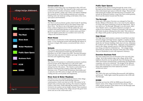
Map Key<br />
Page 15<br />
Conservation Area<br />
<strong>Downton</strong> Conservation Area was designated in May 1973 and<br />
amended in August 1992. The character of the conservation area<br />
is derived from a number of features, notably: it’s historic<br />
layout; the quantity, quality and variety of its historic buildings;<br />
the consistent use of local building materials and vernacular<br />
building styles; the landscape setting on the banks of the Avon,<br />
open spaces and boundaries.<br />
The Moot<br />
The Moot is an 8 acre historic garden, listed Grade II* stretching<br />
from opposite Moot House down to the eastern bank of the<br />
River Avon. The Moot is one of the largest ring work and<br />
bailey castles in England and in 1725 the earthworks were<br />
overlaid with landscaped gardens for Moot House. This public<br />
garden is an attractive feature and contains many good trees.<br />
From the highest points there are excellent views across the<br />
village to the downland beyond.<br />
Moot House<br />
Moot House is an attractive Grade I listed large detached brick<br />
house. It was constructed around 1650 although the interior of<br />
the house is largely 20th century, reconstructed after a fire in<br />
1923.<br />
Schools<br />
The Primary School (Grade II listed) is a good unaltered<br />
example of a Board School founded after the Elementary<br />
Education Act of 1870. It dates from 1895. <strong>Downton</strong> Secondary<br />
School provides education for children up to age 16 from both<br />
<strong>Downton</strong> and neighbouring villages.<br />
Church<br />
The Church of St Laurence is a substantial prominent cruciform<br />
church set back off the High Street up a side street called<br />
Church Hatch. It is a fine Grade I listed building with a nave<br />
dating from the 11th century. The Church is surrounded by an<br />
attractive churchyard that contains a listed 14th century<br />
limestone cross, 17 listed (Grade II) limestone chest tombs and<br />
an attractive late 19th century lychgate with flint and limestone<br />
walling and fine carved panels and bargeboards.<br />
River Avon & Water Meadows<br />
The River Avon is an essential landscape feature of the village.<br />
It enters <strong>Downton</strong> from the north through extensive<br />
watermeadows which were laid out in the 17th century by Sir<br />
Joseph Ashe to develop dairy farming. The extensive irrigation<br />
system is still clearly visible although the meadows have now<br />
reverted to dry pasture and are largely disused. These meadows<br />
are essential to the setting of the village and provide good views<br />
across and out of the conservation area.<br />
Public Open Spaces<br />
In addition to the greens running through the centre of the<br />
Borough and the extensive watermeadows, there are a number of<br />
other undeveloped open spaces within the village. These provide<br />
both formal play facilities and informal areas of recreation, and<br />
include the Memorial Gardens, Long Close Park (cricket ground),<br />
Moot Lane Recreation Ground and The Moot.<br />
The Borough<br />
In the early 13th century <strong>Downton</strong> was enlarged by Peter des<br />
Roches, Bishop of Winchester, into a ‘new town’ by the addition<br />
of a long wide street continuing on from the High Street. This is<br />
now known as ‘The Borough’ although it was previously called<br />
‘New Market’ and is a near perfect impressive example of<br />
medieval town planning. It boasts an unusually wide street and<br />
still retains its greens running down the centre. This section of<br />
the village assists greatly in giving <strong>Downton</strong> its unique character.<br />
High Street<br />
The High Street itself contains a mixture of small brick and tiled<br />
terraced cottages and larger houses, together a number of shops,<br />
some with 19th century shopfronts. At the foot of the High Street<br />
stands the old Tannery building which, due to its size, dominates<br />
the southern end of the High Street. Although a long established<br />
trade in the village, tanning ceased in 1999 and the building is<br />
now being converted for residential use. The cottages along<br />
Waterside also enhance the character of this part of the village.<br />
They are Elizabethan in style with impressive chimneys.<br />
<strong>Downton</strong> Business Park<br />
The main employment area for <strong>Downton</strong> is the west end of the<br />
village. Set on the northern edge of the village, off the A338<br />
Salisbury Road the area has gradually been developing since the<br />
1950s and includes manufacturing, warehousing and distribution<br />
companies, and service industries. The designs of the different<br />
units reflect the changes in construction methods over the years.<br />
Some older buildings have been replaced by modern<br />
architectural styles.<br />
A338<br />
The A338 is the main road linking Bournemouth with Salisbury<br />
and beyond. Traffic lights control the junction of the A338 with<br />
The Borough.<br />
B3080<br />
Running east from the A338, the B3080 passes through the<br />
historic centre of the village towards the New Forest. Recent<br />
traffic priority measures at the eastern end of The Borough assist<br />
in controlling through traffic.