Durrington CAA_doc.qxp - Wiltshire Council
Durrington CAA_doc.qxp - Wiltshire Council
Durrington CAA_doc.qxp - Wiltshire Council
- No tags were found...
You also want an ePaper? Increase the reach of your titles
YUMPU automatically turns print PDFs into web optimized ePapers that Google loves.
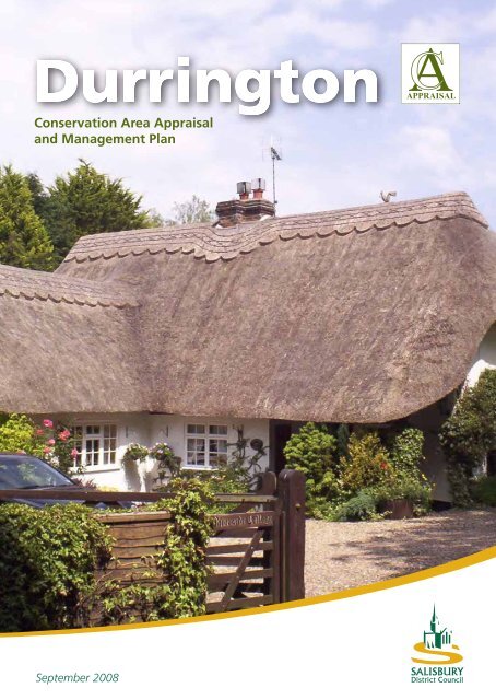
ACAPPRAISALConservation Area Appraisaland Management PlanSeptember 2008
<strong>Durrington</strong> Conservation Area Appraisal and Management PlanContentsPart 1: IntroductionBackground to the appraisalPlanning policy contextPurpose and scope of the <strong>doc</strong>umentExecutive summaryConsultation DraftPage No.1112Part 2: AppraisalLocation and settingHistoric development and archaeologySettlement planArchaeological potentialKey historic influencesSpatial analysisCharacter areas:General overview1. Village Core; Church Street2. High Street – West End3. Hackthorne Road4. College Road5. Bulford Road - East End6. River and Water meadowsArchitectural and historic qualities of buildingsActivity: prevailing and former usesContribution made by key unlisted buildingsPrevalent local and traditional materialsLocal detailsContribution made by green spaces, trees, hedges and natural boundariesKey views, vistas and panoramasDegree of loss of architectural and/or historic elementsNegative elementsConclusion3335555667788910101111121213131314Part 3: Management planVulnerable buildings and buildings at riskArticle 4(2) DirectionsBoundary revisionsProposals for enhancementPotential redevelopment/development sitesPolicies/recommendations for new buildingsTraffic management/street improvementsBibliography and referencesAppendix 1 Schematic mapsAppendix 2 Historical mapsAppendix 3 Proposed Article 4 DirectionsAppendix 4 List of buildings of liocal importanceGlossary1515161717202123
<strong>Durrington</strong> Conservation Area Appraisal and Management PlanConsultation DraftPart 1: IntroductionBackground to the appraisalThere are seventy conservation areas in Salisbury district covering historic settlements and smallvillages. A conservation area is described in the Planning (Listed Buildings and Conservation Areas)Act 1990 as “an area of special architectural or historic interest, the character or appearance ofwhich it is desirable to preserve or enhance”.Conservation areas are designated by the local authority and designation is the recognition of anarea’s special qualities, which the council intends to safeguard as an important part of the district’sheritage. It is the accumulation of an area’s positive architectural or historic attributes, rather than thequality of its individual buildings, which makes it worthy of conservation area status. The attributesmight include: the landscape setting of the area; the grouping of traditional buildings and theresultant spaces and sense of enclosure; the scale, design, type and materials of the buildings; historicboundaries; public realm; landmarks, views and vistas; and the present and former pattern ofactivities or land uses.Conservation area designation allows for strengthened planning controls, gives protection to trees,and provides control over the demolition of unlisted buildings.Planning policy contextThe local planning authority is required by the legislation to periodically review their existingconservation areas. An appraisal of each area is therefore required in order to identify the particularattributes that make each conservation area special. Guidance is provided to the local authority incarrying out this task in the English Heritage publication Guidance on Conservation Area Appraisalsand its companion <strong>doc</strong>ument Guidance on the Management of Conservation Areas, both publishedin August 2005.There is also guidance from central government in Planning Policy Guidance Note 15: Planning andthe Historic Environment (1994), which advises that the local authority should formulate and publishproposals for the preservation and enhancement of its conservation areas. This is achieved byproducing management plans for each conservation area.Salisbury District <strong>Council</strong> has encapsulated the broad principles of the government guidance in itsexisting local plan policies (policies CN8-CN17). This will shortly be reviewed as the council starts toproduce new policies through the local development framework. Planning applications that affect thecharacter of the conservation area should be considered on their individual merits, in the light of theLocal Plan policies, and taking into account all other material considerations. The appraisals andmanagement plans are used to guide and inform the decision-making process.Purpose and scope of the <strong>doc</strong>umentConservation area appraisals and management plans are seen as the first steps in a dynamic process,the aim of which is to seek the preservation and enhancement of the character and appearance ofconservation areas and to provide a basis for making decisions about their future management.Each appraisal and management plan aims to:• identify those elements of the conservation area that contribute to its character;• identify elements that detract from the character;1
Consultation Draft<strong>Durrington</strong> Conservation Area Appraisal and Management Plan• propose measures to maintain or improve the positive character, local distinctiveness and senseof place of the conservation area.The importance of conservation area appraisals and their associated management plans is expressedin central government Best Value Performance Indicators BVPI 219a, b and c. The indicatorsemphasise the need to follow the English Heritage guidance and the importance of involving the localcommunity.All reasonable steps have been taken to carry out a thorough appraisal of the conservation area, andwith the exception of some areas of private land that it has not been possible to access for thesurvey, the appraisal is as comprehensive as it can be.Executive summary<strong>Durrington</strong> Conservation Area was designated on 8th February 1989. The boundary of theconservation area as designated is shown in Appendix 1The key characteristics of the <strong>Durrington</strong> Conservation Area are:• The valuable survival of locally distinctive chalk cob walls.• Local and extended views of the church tower from inside and beyond the conservation areaboundary.• Important mature trees having an architectural quality in terms of providing enclosure andframing and terminating key views.• Some survival of the former agricultural character of the two manors – East End and West End(farmhouses, walls and outbuildings).• A mix of polite and vernacular buildings of a high quality.• A diversity of building line with some formal terraces (Avon Cottages and Cross Stones) andinformal groups (cottages to College Road).• An important relationship with the river which defines boundaries and reinforces the maturelandscape setting.• A important survival of thatched buildings..The summary of recommendations for <strong>Durrington</strong> Conservation Area arising out of this <strong>doc</strong>umentare:• The boundary be revised as follows –• Removal of part of the water meadows.• Inclusion of historic buildings, which form an important ‘gateway’ to the eastern andsoutheastern sections of the conservation area.• The issue of the vulnerability of many of the important survivals of chalk cob walls beaddressed.• A list of buildings of local importance which contribute to the character of the conservationarea be considered for Article 4(2) directions.• Important development sites address the sensitivities of the conservation area and respondpositively to the established character.2
<strong>Durrington</strong> Conservation Area Appraisal and Management PlanConsultation DraftPart 2: AppraisalLocation and settingThe village of <strong>Durrington</strong> lies at the eastern end of a characteristic downland parish – a long, narrow,land unit that stretches from the banks of the River Avon across a gently rolling landscape toSalisbury Plain in the west. Close to the river the village lies on a gravel terrace at around 70m aboveOrdnance Datum, the land rising to the highest point of 134m above OD close to the centre of parishbefore gently undulating to around 100m above OD on <strong>Durrington</strong> Down. Most of the parish lies onUpper Chalk.Characteristic of most of the chalk valley parishes of <strong>Wiltshire</strong> the village, located by the river,contained the farmsteads of the parish. However, in contrast to many such villages, <strong>Durrington</strong> doesnot lie along a road that follows the line of the valley but sits within a deep eastern meander of theriver.Historic development and archaeologySalisbury Plain is world famous for its prehistoric archaeology. Stonehenge lies 3km south-west of thevillage in the neighbouring parish of Amesbury, the Cursus, a Neolithic monument almost 3km long,forms a section of the parish boundary to the south. Within the parish is Woodhenge, a Neolithic andBronze Age monument formed by concentric rings of upright wooden posts. Adjacent toWoodhenge is <strong>Durrington</strong> Walls, a large henge also of Neolithic origin although excavation hasshown that Mesolithic people had previously occupied the site and later a Romano-British settlementwas located nearby.The long, narrow, shape of the parish – a form taken by many parishes in chalk landscapes – isusually interpreted as being a Saxon creation. Such land units allowed each community an allocationof the available resources – river and meadow, arable on the valley slopes and grazing on the higherdownland. The first mention of <strong>Durrington</strong> comes however, from the Domesday Book (AD 1086),but refers to only part of the land of the parish, as there were once two manors here – East End andWest End. East End manor, the part referred to in the Domesday Book, is represented by the BulfordRoad area. West End, the larger of the two manors is represented by the High Street area of thevillage. West End is not directly referred to in the Domesday Book but is thought to have formedpart of the king’s estate of Amesbury. From 1399 until the twentieth century the manor was ownedby Winchester College – hence College Road. The college’s ownership of the manor has resulted inthe preservation of many records from which the history of some of the farms in the village can betraced.In 1377 <strong>Durrington</strong> had 139 poll tax payers (suggesting a population of around 500) making it one ofthe most populous settlements in the hundred. By the mid- nineteenth century the population stoodat 4770 but in the early twentieth century the population grew rapidly with the creation of militarycamps on the downs and the growth of the village to the south, reaching almost 7,000 people in1991.Settlement planFrom the Tithe map of 1839 (historic map 1) the two settlement foci of West End and East End canbe identified. West End has a typical row form with a series of farmsteads ranged along High Street.Four of the farmsteads on the west side of High Street sit in plots of similar width with regular stripsof land extending to the west as far as the road that passes the village, whilst one farm (the site of<strong>Durrington</strong> Manor) was set back from the street frontage. The rear boundary to the farmstead plots3
Consultation Draft<strong>Durrington</strong> Conservation Area Appraisal and Management Planon High Street is a continuous feature which also suggests regularity and planning, although it doesnot stay parallel to High Street, as it gradually gives increased depth to the northern plots. However,it is possible that these deeper northern plots are the result of encroachment onto a once widertriangular area at the north end of High Street and its junction with Hackthorne Road and ChurchStreet. The Tithe Map shows the plot of the modern-day Colins Farm protruding to the east into thewider area at the junction. Taking the line of the road from the curve of Hackthorne Road as itapproaches the junction would give a boundary much more closely parallel to the rear boundary lineof the plots on the west side of the street. To the east side of High Street there was considerably lessconformity in the layout and size of the plots.The East End part of the village has a more complex plan form with Bulford Road, the windingCollege Road and a path, Little Lane, linking the two creating a small irregular grid. Within the areabounded by these roads are small plots with cottages. Although initially there is the appearance ofregularity, especially with the right-angled turn at the south of College Road and the adjacent parallelboundaries, examination of the area north of Little Lane shows a series of small irregular plots withcottages such as Bethany dating from the seventeenth century. It is also clear on the ground that thenorthern part of the area has been excavated to create an area level with Church Street, resulting in ascarp slope behind Camellia Cottage and <strong>Durrington</strong> House – as shown on the 1st Edition 25”Ordnance Survey map of 1880 (historic map 2). On the east side of Bulford Road one propertydominates – East End Manor with its former farmyard to the south of the house. The Ham, a smalllane leading to the east was mainly built up along its south side, although at least two of thecottages appear to be encroaching onto the road and the slightly projecting plots of the remaindermay suggest that they too were the result of encroachment. Most of these houses have since beendemolished.Between these two main areas of settlement is Church Street. The church stands on a prominent siteat the western end of this street near the junction with High Street. A church has stood here sincethe twelfth century – evidenced by surviving architecture in the church and <strong>doc</strong>umentary sources andit is clearly associated with the West End manor. However, the site appears somewhat peripheral tothe main core of settlement along High Street and this may suggest that the church was a late arrivalto a settlement that by the twelfth century may have largely developed to its nineteenth centuryform. Most of the land north of Church Street, lying close to the river, was undeveloped even intothe late nineteenth century, although Avon Cottages (figure 1) may incorporate an open hall ofpossibly sixteenth century date, whilst the Old Rectory (figure 2), rebuilt c.1920 after a fire, was aseventeenth century former farmhouse that was used as the rectory from the nineteenth century. Ofthe three houses that stood on the south side of Church Street between the church and CollegeRoad, only the seventeenth century Church Cottage (figure 3) survives.To the west of the Old Rectory, at the point Hackthorne Road approaches the junction with HighStreet, there were a few cottages leading down to the mill which was of medieval origin. The TitheFigure 1 Avon CottagesFigure 2 Old RectoryFigure 3 Church cottage4
<strong>Durrington</strong> Conservation Area Appraisal and Management PlanConsultation DraftMap shows Hackthorne Cottage in a narrow roadside plot which is probably an in-take from ‘waste’alongside the road.The analysis of the plan of <strong>Durrington</strong> indicates that the village contains areas that historically hadvery different character. West End was the largest manor and contained the largest and greatestnumber of farms. The settlement associated with this manor consisted principally, even into the midnineteenthcentury, of large farmsteads and relatively few cottages within an apparently plannedlayout. Farmhouses lined the High Street with loose courtyard or L-plan farmsteads behind. Incontrast East End was a settlement of cottages and small houses with only the manor farmcomparable in size to those of West End. The property plots were irregular and the feeling ofirregularity is enhanced by the twists and turns of College Road and Little Lane. On the fringes ofthese two principal areas cottages were built on roadside plots, sometimes encroaching onto the‘waste’.Archaeological potential (Archaeological Potential Map)<strong>Durrington</strong> has been a focus for settlement since Saxon times at least, and possibly from the late IronAge/Romano-British period as evidenced by pottery and flint found near <strong>Durrington</strong> Manor.Although there has been limited archaeological fieldwork in the village, it is possible to define an areaof archaeological potential based on the extent of the village in the mid-nineteenth century. Apartfrom sites that have been subject to modern development where archaeological deposits are likely tohave been destroyed or compromised, there is the possibility that evidence for the origins anddevelopment of the village and its occupants could be encountered which would further illuminatethe known history of the settlement. As well as covering the core of the settlement, the Area ofArchaeological Potential includes the site of the mill on the north side of Hackthorne Road and therear plots of properties on the north side of Church Street as any small-scale industrial activitiesrequiring water may have been located within this area.There are no Scheduled Ancient Monuments in or adjacent to the conservation area.Key historic influences• Two distinct areas of settlement representing the medieval manors of East End and WestEnd.• West End was the larger of the two manors – large farmsteads lay in regular, planned plotsalong the west side of High Street. The church lies within the area of this manor.• East End had a greater mixture of farmsteads, small houses and cottages. Narrow, twistinglanes and paths lend a different character to this part of the village.• Many of the farmsteads have lost their working farm buildings.Spatial analysisCharacter areasConservation Areas often vary in character within the broad designation. It is important to definethese ‘sub areas’ and provide a clear understanding of the defining elements, which make up thecharacter of a particular part of the conservation area. This can lead to a much more useful andcomprehensive <strong>doc</strong>ument in development control terms and provide a clear idea of the make up ofdistinctive areas which have some cohesion.It should be noted that whilst sub areas have been identified, the transition between areas is also5
Consultation Draft<strong>Durrington</strong> Conservation Area Appraisal and Management Planimportant and there is a cohesion to the whole conservation area, which should always be consideredwhen addressing the character of the <strong>Durrington</strong> Conservation Area.Each character area makes reference to the following in bullet points• Form (cohesiveness-why a character area)• Scale and building line• Significant groups• Materials• Views• Local featuresGeneral overviewThe conservation area defines an important survival of the historic village of <strong>Durrington</strong>. It definesthe gently sloping land leading to the water meadows of the River Avon and centres on the flint andstone All Saints Church and the road junction and War Memorial adjacent to the church.Of particular note throughout the conservation area is the quality and scale of the trees and greenboundaries. They enclose narrow lanes and form the backdrop to and frame many of the historicbuildings within the conservation area. Key views into the conservation area are also characterised bythe presence of mature trees.The agricultural origins of the village are evidenced by the survival of a number of farm houses, thepredominant use of vernacular materials – flint, chalk, cob and thatch, and the presence of cobboundary walls throughout. The latter are particularly notable and prolific and form many of theboundaries to the highway and between building plots.1. Village Core; Church Street• Historic buildings seen within or formingthe immediate setting of the churchfocussed around the junction of HighStreet, Church Street and HackthorneRoad.• Buildings are 2 storey throughout,eyebrow dormers to the thatch cottagesput the first floor within the roofspace.• The listed and unlisted buildings centredon the War Memorial form an attractiveand important group and focus within theconservation area.• A diverse and interesting combination ofbrick, slate, rendered cob and flint andclay tile.Figure 4View looking west along Church Street towards ColinsFarmhouse• Important views along Church Street are closed by Colins Farm (figure 4). Trees arearchitectural; they frame some views and terminate others. The church tower is set high offthe road and is both glimpsed and in full view on travelling along the road.6
<strong>Durrington</strong> Conservation Area Appraisal and Management PlanConsultation Draft• Patched and repaired cob walls with their‘Bridgewater’ interlocking tiles are seen inthis sub area and form important parts ofthe local character of <strong>Durrington</strong> (figure5)2. High Street; ‘West End’• Predominantly historic farmhouses ofvarying scale and quality line this gentlysloping route to the village core.• 2 storey throughout set on or just backfrom the road line. Mostly detached andset in their own small to medium plots.Figure 5• The Red House (figure 6) and attached Cob walls with ‘Bridgewater’ interlocking tilesoffice complex form a good group setaround a grassed open courtyard.• 29/31 High Street- good example of flint (knapped and dressed and carefully laid to courses)and stone dressings, particularly attractive when combined with the thatch (figure 7). Redbrick, slate and tile is seen on the remaining historic buildings.• The views into the conservation area are funnelled towards nos 29/31 by the heavily treedboundary to Pinckneys Farm House (figure 8). Local views are dominated by the naturalboundaries giving a very rural feel to this part of the conservation area.Figure 6 Red HouseFigure 7 High StreetFigure 8View looking north along High Street3. Hackthorne Road• Buildings having a strong relationship with the adjacent riverside setting (in the case of<strong>Durrington</strong> Manor – this has since been lost due to trees and mature hedges)• 2 storey (except for <strong>Durrington</strong> Manor) and set informally to the road.• Rendered cob and thatch and the red brick and slate of <strong>Durrington</strong> Manor. Of note are thesurvival of cast iron casements to nos.1 & 4 Cross Stones cottages (figure 9).• Important framed view east towards Cross Stones cottages which in part frame the flint towerof the church (figure 10). View west is nicely terminated by Hackthorne Cottage placed in itsrural setting.7
Consultation Draft<strong>Durrington</strong> Conservation Area Appraisal and Management PlanFigure 9 1 & 4 Cross StonesFigure 10View looking east along Hackthorne Road towards churchtower.• Very deep distinct combed wheat reed eyebrow dormers to Hackthorne Cottage and survivalof cast iron casement windows to cottages.4. College Road• A distinct group of modest cottagesforming an interesting street pattern.• 2 storey intimate scale and arrangedinformally (some set back and some hardonto pavement) along the lane providingpinch points and good streetscape.• This sub area comprises an importantcohesive group in its entirety with allbuildings having a close relationship witheach other (figure 11).• Cob and painted rendered walls givingthe impression of cob, tile and slate.• Very short intimate views closed bydevelopment or mature landscaping.• Some survival of original windows (timbercasements) make a very positivecontribution to the character of theindividual cottages.Figure 11 Important grouping - College Road5. Bulford Road; ‘East End’• More formal ‘entrance’ to the conservation area, with a welcome mix of uses not seenanywhere else in the conservation area.• 2 storey houses and cottages mostly addressing the street very positively, either front or gableon to the street.8
<strong>Durrington</strong> Conservation Area Appraisal and Management PlanConsultation DraftFigure 12 Projecting ShopfrontFigure 13View looking north along Bulford Roadinto present conservation areaFigure 14Office by arch Robert Townsend• Grouping of buildings is not immediately apparent, however the projection of the shopfront(presently outside the boundary) (figure 12) and the gable on to the roadside of the PloughInn make for an important tightening of townscape which then focuses on the matureChestnut tree to the garden of No. 191 (figure 13). Of note are the house and office (193and 202 respectively) by Robert Townsend (with Wright and Aalto influences). (figure 14)• Red brick and tile is dominant in this sub area, however the flint walls with stone dressings ofNo.212 (East End Manor) are particularly attractive and contrast with the brick.• Views into the conservation area are closed by trees and mature planting. The roof of No.212(East End Manor) is particularly prominent. The thatched cottage Camellia forms a focal pointfor the lower part of the sub area but is a heavily restored example of the type with distinctchoice of paint finish.• A good variety of local materials provides interest and vibrancy to this part of the conservationarea.6. River and Water meadows• <strong>Durrington</strong> Conservation Area has animportant relationship with the river watermeadows and the open countrysidebeyond (protected by Local Plan policy).• This area has, in part, important survivalsof former systems of drainage to aid theprocess of water management across thewater meadows. These features, largelyearthworks but with the potential survivalof stone sluices, channels and weirs coulddate from as early as the seventeenthcentury and are an important part of thehistoric character of the conservationarea.• Of particular significance within this ruralfringe is the general view looking towardsthe church tower from the north (figure15) which is framed by mature trees.Figure 15View from the south, northwards towards the church tower9
Consultation Draft<strong>Durrington</strong> Conservation Area Appraisal and Management PlanFigure 16West End ManorFigure 17East End ManorFigure 18Bulford RoadArchitectural and historic qualities of buildings<strong>Durrington</strong> has a broad range of buildings of quality which span a significant time frame. The survivalof the farmhouses which made up the essence of historic <strong>Durrington</strong> are important elements of theconservation area and display good use of materials and finishes.These former farmhouses can be easily divided into the formal, polite houses of the eighteenth andnineteenth centuries – Colins Farmhouse, West End Manor (figure 16) and <strong>Durrington</strong> Manor and themore vernacular but high quality of no.212 (East End Manor) (figure 17) a fine house dating from theC15th with significant phases of development and remodelling. In addition to this, The Old Rectoryis a confidently executed example of the Arts and Crafts movement.Unfortunately some of the true vernacular cottages have suffered from over restoration and/orunsympathetic replacements (windows, doors and roofs). This has in places significantly diminishedtheir historic value.Almost no agricultural buildings of any significant date survive, however the cob boundary wallswhich played such an important part in the agricultural character of early <strong>Durrington</strong> are still presentin parts and small pieces (see figure 5). These are important historic records.<strong>Durrington</strong> has also seen some unsympathetic new houses built within the conservation areaalthough two contemporary buildings of note, by Robert Townsend, display a confident use ofmodern materials in innovative and interesting ways – nos. 193 (figure 18) and 202 Bulford Road (seefigure 14) (despite the latter being rather unsympathetically placed within a former farmyard andcompromising the setting of the converted barn to the rear).Activity: prevailing and former usesThe settlement was formerly given over to a number of small farms, primarily located in the WestEnd. The East End has survivals of the modest cottages that would have housed the farm workersand trades which would have serviced the farmsteads and the associated manors.Presently, the conservation area is almost entirely residential. The exceptions being the offices locatedin the Red House complex, the Plough Inn, and the church. Additional pressure for residentialaccommodation in the conservation area (which is on the fringe of some large suburbandevelopments) is great and there is the potential for significant change through realising the fullpotential of sites.10
<strong>Durrington</strong> Conservation Area Appraisal and Management PlanConsultation DraftFigure 19 1 & 4 Cross StonesFigure 20Groups of Cottages to College RoadContribution made by key unlisted buildingsAppendix 1, Schematic Map 2 identifies the buildings which make a positive contribution to thecharacter and appearance of the conservation area. A list can be found in Appendix 4.There are two significant groups; Cottage Nos.1-4 Cross Stones (figure 19) and ‘The Old Rectory’ (seefigure 2) form an important part of the setting of the church and maintain enclosure to the streetfrontage. The Old Rectory in particular is a fine, well detailed Arts and Crafts house and is possibly ofsufficient quality to be added to the list of Buildings of Special Architectural and Historic Interest.The group of cottages to the College Road area are also of significance (figure 20), given theirinformal grouping, modest scale and character and vernacular materials and detailing. They arehowever compromised by the unfortunate use of modern materials, particularly uPVC windows.Prevalent local and traditional materialsThe predominantly chalk geology of the area has had a significant impact on the materials used inthe conservation area. In the absence of a good quality building stone, the traditional buildingmaterials were chalk cob and flint which was often combined with brick. The arable farming of thearea produced straw for thatch.Cob plays an important role in the character of the conservation area. There are a number ofsurvivals of cob cottages and boundary walls. Most of the walls have lost their traditional thatchcapping which has been replaced by clay ‘Bridgewater’ tiles. Salisbury District <strong>Council</strong> has produced1a separate leaflet on traditional materials used in the District. Reference should be made to this<strong>doc</strong>ument when considering the repair and maintenance of cob structures.There are some good examples of the use flint, notably St Mary’s Church, No.212 Bulford Road (EastEnd Manor) (figure 17) and Nos. .29 & 31 High Street (see figure 7), The flint is usually combinedwith brick used for quoins, window surrounds and banding although a few buildings including thechurch and No.212 (East End Manor) also incorporate various types of stone (Chilmark andGreensand) reflecting the higher status of these buildings.1Traditional Building Materials in Salisbury District, Salisbury District <strong>Council</strong> (2001)11
Consultation Draft<strong>Durrington</strong> Conservation Area Appraisal and Management PlanFigure 21 Church CottageFigure 23View closed by tree adjacent ‘The OldRectory’Brickwork, typically laid in Flemish bond, displays strong colours and usually includes burnt andvitrified headers. The use of brick and Welsh slate tends to denote a more polite, formal built form(see figure 6) which contrasts nicely with the use of cob, thatch and flint vernacular. This sets up aform of hierarchy and status within the conservation area.Thatch is notable in some defining views for example along Church Street. Where found it is combedwheat reed with a mix of raised plain and patterned block cut ridges (Avon Cottages and Camelliarespectively) and flush wrapover finishes (Nos. 29 & 31 High Street and Church Cottage) (see figure 7and figure 20 respectively).Clay tiles are seen on the roof of the church (appears to have been recently reroofed) and areparticularly pleasing on East End Manor (although in part at least these probably replaced thatch.)Local detailsFigure 22Cedar tree at Churchyards entranceCob buildings and boundary walls are a particularly important part of the character of the village aswell as the wider <strong>Wiltshire</strong> vernacular.Contribution made by green spaces, trees, hedges and naturalboundaries (see Townscape Map in appendix 1)Much of the primary routes through the conservation area are defined and enclosed by mature treesand historic hedgerows. A number of very substantial trees form significant landmarks in their ownright, for example the cedar tree to the churchyard entrance (see figure 21). Many of the largerhouses, sitting in their generous plots are framed by mature trees. Hedges perform importantenclosure roles throughout the conservation area, particularly to College Road where the softening ofthe townscape with trees and hedges is part of its intrinsic character.From the footpath to the north of the river, the church and other buildings are seen within the widersetting of the river and its floodplain. A number of good quality substantial trees within the curtilageof these buildings form in integral part of the quality of these views (figure 27).The larger trees are often ‘architectural’ in their important role of framing and closing views within12
<strong>Durrington</strong> Conservation Area Appraisal and Management PlanConsultation Draftthe conservation area. Good examples of this are the trees adjacent to The Old Rectory (figure 23),the horse chestnut (figure 28) and others to the grounds of Pinckneys Farm house and the horsechestnut tree on the back of pavement to no.191 Bulford Road.Key views, vistas andpanoramas (see Townscape Map)The church tower forms a focal point for localand extended views from the landscape settingand within the conservation area. Views areoften closed by historic buildings, for examplethe view towards Hackthorne Cottage (figure 25)and funnelled by mature hedgerows andboundary treatments (view looking west alongChurch Street towards Colins Farmhouse (figure4). Views out to the wider open countryside arealso important and help provide a context andscale to the historic settlement on the edge of amuch larger and later settlement.Figure 25Local view of Hackthorne CottageDegree of loss of architectural and/or historic elementsThe loss of original details and materials to unlisted buildings is particularly noticeable with windowsand roofs being much altered throughout.Negative elements• New development to the setting ofPinckneys Farm House;• Wirescape is particularly prominent;• The highways setting to the WarMemorial (figure 26);• Tamarisk and Stonegrove, Church Street(including prominent solar panels toroofs);• Lybus House, Dhala and Avon View,Church Street;• Poor road surfacing and treatment ofkerbs, detailing (figure 29)Figure 26Highways setting to the war memorialFigure 27Views from footpath north of river toChurch StreetFigure 28Horse Chestnut, Pinckneys Farmhouse13Figure 29Present surface treatments to bus stop,Church Street
Consultation Draft<strong>Durrington</strong> Conservation Area Appraisal and Management PlanConclusionHistoric <strong>Durrington</strong> village has experienced significant pressure for change over recent years.Conservation area status is still valid, however the historic core has seen the loss of importantelements of the agricultural character of the early settlement.There are no Scheduled Ancient Monuments in or adjacent to the conservation area, however<strong>Durrington</strong> has been a focus for settlement since Saxon times. There is the possibility thatevidence for the origins and development of the village and its occupants could beencountered, which would further illuminate the known history of the settlement. In additionto the core of the settlement, the Area of Archaeological Potential includes potential sites ofsmall-scale industrial activities requiring water, in particular the site of the mill, north side ofHackthorne Road.Recent development within the last 15-30 years has seriously impacted on the quality of thehistoric core of the village. A relatively small percentage of the total number of buildings in theconservation area are statutorily listed. However, a significant proportion of the remainingbuildings, mainly in domestic use, make a positive contribution to the conservation area and areof local importance. (See appendix A/ map 2)The relative lack of control over changes to particularly windows, doors and roofs in unlistedbuildings has meant significant erosion of the character of these buildings throughunsympathetic modern replacement. Article 4(2) Directions could protect surviving features andraise the quality by replacing those features; plastic windows, doors, artificial roof slates andconcrete tiles considered to detract from the character and appearance at present.Generally, the agricultural origins of the settlement have been eroded to a significant degreethrough the loss of historic farm buildings and yards. Although most farmhouses survive,theyhave lost their original setting and it is now difficult to read the settlement as a series of historicfarmsteads. Part of the early morphology of the settlement is the valuable survival of a seriesof cob walls which denote historic boundaries and provide a strong historic link to thesettlement’s former agricultural character.The cob walls are generally in a poor state of repair and need to be recognised as importantand addressed in future planning proposals by way of possible planning obligations.Twentieth century infill development is of indifferent to poor quality with some additions havingno relationship to the form, grain, spatial qualities, building line or materials of the traditionaldevelopment in the village and as such they significantly detract from the overall quality of thewhole.With significant sites for development/ redevelopment adjacent to the conservation area andcontinued pressure to infill within and adjacent to the boundary and often in the setting oflisted buildings, the overall quality and character could be enhanced or seriously eroded byplanned future development.Careful analysis of the context of these sites should be undertaken in order to fully understandthe sensitivities of the conservation area and the fragility of the survival of historic character atpresent. Poorly executed future proposals could render this area so eroded that the localauthority would need to consider de-designation.14
<strong>Durrington</strong> Conservation Area Appraisal and Management PlanConsultation DraftPart 3: Management planVulnerable buildings and buildings at riskListed Buildings (or curtilage)• Church Farm (Grade II). -. Roof in need of repair.Action: Contact owner and agree a schedule of works.• Cob wall to north of Church Farm (curtilage Grade II)-. heavily overgrown with vegetation,capping could be compromised. (figure 30)Action: contact owner to discuss. Use of urgent works notice if necessary.• Cob boundary wall to south of Church (Grade II)- some repairs required to cob; limewash,capping and removal of ivy. (figure 31)Action: Contact Parochial Church <strong>Council</strong> and agree remedial works.• Cob wall to south of No.12 East End Manor (curtilage Grade II) - removal of vegetation.Action: contact owner to advise of potential for failure. Monitor.• <strong>Durrington</strong> House (Grade II) - Early signs of neglect, some failing render over what appears tobe cob rather than the brick suggested in the list description.Action: Contact owner and discuss. Further research needed into materials. If cob, swift actionis required to prevent further potential rapid deterioration. Agree Schedule of repairs.Figure 30Cob wall to north of Church FarmFigure 31Cob wall to south of churchArticle 4(2) Directions‘The character of areas of high environmental quality can be eroded by unsympathetic alterations toindividual properties’ (para 6.17 Salisbury District Local Plan, adopted June 2003)Within the <strong>Durrington</strong> Conservation Area there are some important groups of cottages and houses15
Consultation Draft<strong>Durrington</strong> Conservation Area Appraisal and Management Planwhich would benefit from the protection afforded by additional planning controls in order to retainelements of particular historic or architectural interest.Appendix 4 contains a list of buildings of local importance, which make a positive contribution to thecharacter and appearance of the <strong>Durrington</strong> Conservation Area. The list identifies which types ofalteration should be controlled through Article 4(2) Directions for each building.Boundary revisionsAs a result of analysis undertaken, the following are suggested boundary revisions to reflectownership changes, recent development and local and national policy designations and changes.Remove:There are no areas identified for removal from the conservation area.Include:Bulford Road ‘Gateway’:The building to the junction of Bulford Road and School Road; <strong>Durrington</strong> Free Church (figure 32)is an important and attractive, largely unaltered late nineteenth/early twentieth century historicchurch located on the corner of the road and providing a good setting and gateway to ‘old’<strong>Durrington</strong>. No. 194 and the late nineteenth century shopfront and house (No.198 and 200)form robust traditional townscape with the shopfront providing a pleasant punctuation to theroadside. The loss of the thatch roof to No.194 is regrettable however the building nonethelessmakes a positive contribution to the streetscene and forms agroup with the shop and house to the north. On the oppositeside of the road, the car park to The Plough forms an importantpart of the setting to this buildings and the open space to thesouth forms part of the gateway to the conservation area.Potential development on either of these sites would need tovery carefully considered in light of their importance in thestreetscene. For this reason it is proposed to include theseareas within the conservation area.The garden to No.192 has some attractive trees which form agreen backdrop to the church and houses fronting BulfordRoad. These gardens and the houses set back from the roadare an important part of the setting of Bulford Road and soinclusion of these houses and their generous gardens issuggested. Individually some of these buildings proposed forinclusion are deemed to make a positive contribution towardsthe character and appearance of the <strong>Durrington</strong> ConservationArea as proposed (see Townscape Map) and cumulatively and interms of their contribution to setting all buildings and theirplots within the proposed extension are considered to be ofsufficient importance to warrant inclusion in the conservationarea.Figure 32<strong>Durrington</strong> Free Church and suggestedentrance to conservation area (BulfordRoad)Figure 33Nos. 9 & 10 The Ham16
<strong>Durrington</strong> Conservation Area Appraisal and Management PlanConsultation DraftNos. 9 and 10 The Ham (figure 33)Cottages in this location appear on the 1839 Tithe map(Historic Map 1) and contribute to the minor ‘gateway’ to theconservation area at this point [40]. Despite undergoingalterations, their cob construction and simple form arecharacteristic survivals of the modest dwelling houses of thefarm labourers who occupied this part of the village. Theirinclusion with Article 4(2) Directions would contribute to thecharacter and appearance of this part of the conservationarea. There are no further historic buildings in this road. Thiswould be a logical and defendable boundary.Figure 34Cherry Tree CottageHigh Street setting and ‘Gateway’The approach to the core of the village along High Street is a series of developing framed viewsthat are semi rural in character. Whilst the houses lining the southern end of High Street are notof sufficient quality to warrant inclusion, the road itself and the boundary walls and hedgesshould be considered for inclusion. Any trees of merit should be considered for tree preservationorders but are unlikely to fall within the boundary proposed. Cherry Tree Cottage [59] is of localinterest and makes a positive contribution to the character of this area and with its boundary wallforms a group with The Croft adjacent. For this reason, Cherry Tree Cottage is recommended forinclusion.Proposals for enhancementCob wallsParticular attention should be paid to the care and repair of boundary walls-mostly cob with somebrick and flint and in varying degrees of repair from fair to poor (see Vulnerable Buildings andBuildings at Risk section). Cob walls are a characteristic building type of the chalkland countrysideand could be considered to be of national importance. Cob boundary walls make a very importantcontribution to the character and appearance of the <strong>Durrington</strong> conservation area and are valuablesurvivals of former historic boundaries to farmsteads.With regard to the repair and maintenance of cob structures, reference should be made to SalisburyDistrict <strong>Council</strong>’s publication; Traditional Building Materials in Salisbury District (2005)Action: SDC may wish to consider the use of commuted sums from development to secure a historicbuildings grant budget specifically for the repair of cob walls in the district with particular emphasison conservation areas in the chalk areas of the district.Potential redevelopment/ development of sitesLand is allocated for housing on the ‘depot’ site adjacent to the conservation area boundary (policyH12)- A development brief has been prepared for this site and an application is imminent (Aug.2005).17
Consultation Draft<strong>Durrington</strong> Conservation Area Appraisal and Management PlanThe need for development briefsThere are no site allocations within the conservation area at present.Land east of NetheravonPolicy H12 of the Salisbury District Local Plan identifies Land east of Netheravon Road, <strong>Durrington</strong> forpotential residential development (including 25% affordable provision). This site is adjacent to thewestern boundary of the conservation area and very careful consideration (in accordance with PolicyCN11 of the SDC Local Plan) of views into and out of the conservation area need to be consideredwhen writing the brief for this site. In addition an important consideration should be the integrationof this site with the established village. They should be carefully linked to allow permeability acrossthe site into and out of the village and the conservation area.Indicative design criteria:• The proposed layout should be considered as an organic extension of the village rather thanan inward-looking housing estate dominated by its estate road.• Due to the rural and semi rural fringes on the west and north of the site, the low densityhousing on the southern boundary and the loose grain of the development on the villageside of the site to the east, the proposed development should have a hierarchy of spacesand density ranging from a higher density core to a lower density periphery.• Development on the eastern, northern and western edges of the site should be outwardlooking, with loose groups of wide fronted houses interspersed with planting of nativespecies and linked by low structures such as garages and walls. The eastern frontagehowever should be the more compact of the three. The southern boundary should consist ofthe private or rear facing elevations and back gardens, to complement existing developmenton this boundary.• The site shall be accessed from the western frontage on Netheravon Road and from theexisting roadway to the north of the residential property “Scotia”. The alignment andcharacter of the resulting spine road should be that of a village street, ie with frequent sharpchanges of direction, where buildings deflect and terminate views. The aim should be toensure a speed limit of 20 mph is achieved by design and layout, not by the imposition ofspeed ramps and cushions or by surface painted signage. The profile of the street should beirregular ie determined by built form. However, tracking diagrams should demonstrate thatvehicles, including refuse vehicles and removal vans can make the necessary turns. Thedesigner should consult “Places Streets and Movement” DETR 1998.• Built form should be designed to achieve a satisfactory roofline, especially when viewed fromthe west and north. Advantage should be taken of contours and the effects of achievingvariety by lowering eaves to first floor cill height or to approx 1.7 metres above first floorlevel as well as the conventional height of 2.3 metres above first floor level. Furthermore,chimneys or similar vertical features for vents should complement the roofline.• The majority of buildings should have a marked relatively narrow rectangular (rather thansquare) footprint. They should have short front gardens (max 2-3 metres) if frontages facesouth or west and a front margin of max 1 metre if facing north or east. Some garages canbe set back up to 3 metres from the building line. Some rear access garage courts could beused, but they should not dominate the layout as this can lead to underused front doors.• Streets should be designed to accommodate ‘overspill’ parking in small groups of bays.• Any Locally Equipped Area of Play should be integrated into the scheme with buildings18
<strong>Durrington</strong> Conservation Area Appraisal and Management PlanConsultation Draftoverlooking the space. The LEAP could be integrated into a “village green” focal space.• Buildings should have pitched roofs preferably at the range of pitch of the local vernacular(between 35-50º). Eaves should be shallow and windows of vertical proportion, set backfrom the front façade. Roofs should have gable ends. Whilst the buildings shouldcomplement the positive aspects of the local building traditions, designers can considercontemporary designs if the aims of this guidance are reflected in the design.• The north eastern corner of the site is perhaps the most challenging, regarding therelationships of any proposals to the land usages of the Defence Estates property. Whilstsome tree screening may be desirable, this should not be out of character with theremainder of the site.• Prospective Applicants shall be required to produce a Design Statement with theirapplication. This must include an appraisal of(a) the context of the site; its adjacency to the Conservation Area and a study of the positiveaspects of the local townscape and building traditions.(b) The site; its boundaries, levels, vegetation and man-made features, orientation and exposureetc.(c) Also a Design Concept, outlining the intentions and philosophies behind the design. Theconcept should include a note on the rationale for the choice of materials for boundariesand buildings.Church Park Caravan ParkGiven the potentially transient nature of the use and the importance of this site to the character ofthe conservation area, particularly the setting of the Grade II* listed church, the local authority maywish to consider the potential for a development brief for this site which could enhance and reinforcethe character of this part of the conservation area.Indicative design criteria• This compact site stands slightly above the level of the High Street and is at the crest of theland rising from the north. Thus it has a potential skyline impact when viewed from pointsnorth of the village. Within this context, the possible relationship of the proposeddevelopment and the Church tower should be investigated to eliminate intrusive views.• The frontage to the High Street is crucial, as the western boundary is also the boundary ofthe Conservation Area. The existing mature trees on this boundary have a key impact on thecharacter of the Conservation Area at this point, creating a funnelling of views from thesouth and an arched entrance to the core of the village.• The existing entry point to the site should be utilised and buildings on this western boundaryshould have frontages facing the High Street. Views into the site should be terminated by abuilding or buildings facing west.• All other boundaries are sensitive, in that they face the rear gardens of adjacentdevelopment. In these cases it is likely that rear elevations should face these boundaries. Theonly potential exception to this is the south eastern corner of the site, where an outwardlooking building might effectively terminate the long view from Glebe Road.• Whilst it may not be desirable to create a footpath link to Glebe Road for community safetyreasons, this may be outweighed by considerations of creating a permeable layout for easeof foot access to the amenities of <strong>Durrington</strong>.• Vehicular access should change in nature from an entry street to shared surface private19
Consultation Draft<strong>Durrington</strong> Conservation Area Appraisal and Management Plandrives and courts enclosed by buildings. It is this character, rather than a standard radiushammerhead cul-de-sac with 1.8 metre pavements fringing the roadway, which shouldpredominate.• Built form should echo traditional village type buildings rather than suburban forms. Thusrectangular floor plates with limited projections should be the main form.• A small green could be used as a focus for the development, possibly associated with theentrance to the site. This could echo the relatively spacious settings of some of the largerhouses in the village.• Materials could echo the appropriate colours of brickwork in the Conservation Area, withrender used on link walls and outbuildings. A key building, or group, could employ a sparinguse of stone or flintwork, if this is reflected in appropriate detailing and choice of stone inparticular.Policies/recommendations for new buildings (generally smallerinfill sites)This guidance provides generic advice for smaller developments up to approximately 5 - 8 housingunits. Salisbury Local Plan (adopted June 2003) contains in Policy H16 criteria relating to small-scaledevelopment sites and should, in the case of development in/ adjacent to or within the setting of aconservation area, be considered in conjunction with this advice (particularly bullet point (ii) relatingto the character of an area). Sites of a larger number will require considerable pre applicationnegotiation and may be the subject of design briefs. Some small developments may be in suchsensitive locations that they may require a concise brief from the Local Authority. In all cases a DesignStatement will be required to accompany the application drawings. Where a Character Appraisalexists for a Conservation Area, this must be consulted by the applicant’s agent, the developer and theplanning officer, as it will assist in setting the context of the development.It is strongly advised that all parties visit the site and it’s setting. The setting will vary in virtually everycase, but as a guide it should be taken as the area from which the site can be seen and thesurroundings seen from the site. The setting can also be defined as the general pattern of uses in thevicinity. These may vary on each side of the site.It is important to consider specifically: surrounding skylines, rooflines and landmarks (e.g. churchtowers etc), or if the development will have an impact on cherished views of the landscape or“signature” skylines.The surrounding built form should be appraised:- What are the typical sizes and shapes of building plots? Are these uniform or varied? Ifvaried, consider largest and smallest types.- How do buildings relate to the back edge of the footpath or carriageway? This factoralone can help to assimilate new buildings into the streetscene.- Are the buildings in the street freestanding, or are they in small informal groups or moreregular terraces?- Are buildings linked in a particular way, for example with boundary walls?- Do the buildings generally have their main ridgeline parallel to the street or at rightangles?- Are the buildings generally “grand” or modestly proportioned and styled?- The character of the front boundary walls or fences is an integral part of the character of20
<strong>Durrington</strong> Conservation Area Appraisal and Management PlanConsultation Draftthe area.- Identify the predominant materials and colour of material in the area and if any areunique.• The character of the site should be considered. The boundaries should be noted, especially ifthey comprise hedgerows, mature trees, vernacular walls, fences or railings.• The access point to the site will have to be agreed. Generally, care should be taken tominimise any damage to front boundaries through the uncritical imposition of sight lineswhich may have the effect of removing most of a boundary.• Consider potential assets on-site, such as the lie of the land, areas of shelter and sunnyaspect, existing structures such as buildings or walls, trees of hedgerows which might beincorporated into the scheme.• Develop a Design Concept. This should include: What is the role of this development withinthe setting?- Is this a gateway or other edge development on the approach or periphery of the site?- Is it a focal point development terminating a view or providing a skyline?- Is the site at a pivotal point in the townscape, turning a corner from one type ofdevelopment to another?• The frontage part of the development should in virtually every case face outward to thestreetscape, unless there are compelling reasons not to do so.• The character of the development should be determined by layout and providing anappropriate sense of identity and enclosure. A sequence of spaces and places should beconsidered – from major to minor space, from formal / symmetrical or informal?• The design should avoid any inappropriate suburbanising of the proposals through deep orirregular house plan, fussy elevations, spacious set backs from the building line, dwarf wallboundaries and inappropriate spacing between buildings.• Design considerations such as window proportions, subservience of elements such asgarages, roof type (gable end or hipped), roof pitch, projection or recession and choice ofmaterials, which should derive from the character of surrounding buildings forming thesetting.• Contemporary solutions may be appropriate if it can be demonstrated that they derive froma comprehensive appraisal of the setting and site.Traffic management/streetimprovementsGeneralAttention should be paid to the surfacetreatment of the road (particularly ChurchStreet) which is generally in a very poorcondition (figure 35). The opportunity toresurface the road should consider the use ofa more sympathetic material and finishingwhich would demark the conservation areaand create a less urban feel to this semi ruralpart of the settlement. Particular regardFigure 35 Church Street21
Consultation Draft<strong>Durrington</strong> Conservation Area Appraisal and Management Planshould be had to:• The use of a resin bonded gravel rather than tarmac• The use of granite setts rather than kerbs to denote footways• The removal of superfluous signage, particularly road markings – where they can bereplaced with other travel calming/controlling devices; for example a change inmaterials• Softening of the materials used around the bus stop to Church Street – timber bollardto replace standard Highways example, kerbs replaced in a natural stone.War MemorialCareful consideration of materials and removal of signage could greatly improve the settingof the Village Cross.The War Memorial could benefit from being less ‘segregated’ from the settlement (post andchain fence around the base). A change of materials to the immediate setting of the crossto include the demarking of the junction combined with the removal of signage wouldprovide a greater sense of integration of the cross with the rest of the village. Materialscould demark a wider setting of the church grounds and connect to the cross. This couldprovide a pedestrian friendly central element to the village as well as a pick up and drop offpoint for church functions.The Plough Inn car parkThere is an opportunity for enhancement of the proposed revised entrance to theconservation area which at present is a large car park and grassed area. Some structuralplanting and semi mature trees could help define this space and possibly provide anadditional amenity area and break out for the public house.Historically, a building demarked the south east corner of the car park area (see HistoricMaps 1 & 2) to the Plough Inn and was hard on to the road. This form of development,subject to the scale, form, materials and detailed design could be considered appropriate asit would tighten the townscape at an important visual gateway and help define the historiccore of <strong>Durrington</strong> as well as funnel views into the conservation area.22
<strong>Durrington</strong> Conservation Area Appraisal and Management PlanConsultation DraftBibliography and referencesCrowley, D.A. [Ed] 1995 The Victoria History of the County of <strong>Wiltshire</strong> 15 Institute of HistoricalResearch, University of LondonHare, J. 1981 <strong>Durrington</strong>: A Chalkland village in the Later Middle Ages in <strong>Wiltshire</strong> Archaeologicaland Natural History Magazine 74/75 pp 137-147Pevsner N. 1975 2nd ed. The Buildings of England: <strong>Wiltshire</strong> (revised by Bridget Cherry), YaleUniversity Press, LondonMapsWSRO T/A <strong>Durrington</strong> 1839OS 1st Edition 25" map Sheet 77.1 1878Other references:Conservation Areas: Guidance Notes, Salisbury District <strong>Council</strong>Guidance on Conservation Area Appraisals, English Heritage 2005Guidance on the Management of Conservation Areas, English Heritage 2005Salisbury District Local Plan Adopted June 2003, Salisbury District <strong>Council</strong>.23
Appendix 1Schematic MapsArchaeological potentialBoundary changes mapCharacter areasManagement IssuesTownscape
Appendix 2<strong>Durrington</strong> Tithe Map 1839Ordnance Survey 25 th Map 1 st edition 1880
Appendix 3Address Windows Doors Roof Porches Painting Boundary Walls ChimneysBulford Road195 ■ ■ ■ ■ ■197 ■ ■ ■ ■ ■ ■199 ■ ■ ■ ■ ■ ■Church StreetThe Old Rectory ■ ■ ■ ■ ■ ■College RoadBrown’s Farmhouse ■ ■ ■ ■ ■ ■Horsall Cottage ■ ■ ■ ■Rose Cottage ■ ■ ■ ■Jasmine Cottage ■ ■ ■ ■ ■Red Cottage ■ ■ ■ ■ ■Tryst ■ ■ ■ ■ ■Hackthorne Road;1 ‘Cross Stones’, ■ ■ ■ ■2 ‘Cross Stones’, ■ ■ ■ ■3 ‘Cross Stones’ ■ ■ ■ ■4 ‘Cross Stones’, ■ ■ ■ ■Riverside Cottage ■ ■ ■ ■High Street;West End Manor ■ ■ ■ ■ ■The Ham9 ■ ■ ■ ■10 ■ ■ ■ ■
Appendix 4Bulford Road; Nos. 195, 197 and 199Church Street;College Road;The Old RectoryBrown’s Farmhouse, Horsall Cottage, Rose Cottage, JasmineCottage, Red Cottage, TrystHackthorne Road; Nos. 1-4 (consec.) ‘Cross Stones’, Riverside Cottage - Nos. 1and 4High Street;West End ManorThe Ham Nos. 9-10
<strong>Durrington</strong> Conservation Area Appraisal and Management PlanConsultation DraftGLOSSARYArticle 4(2) Direction:Building line:Building at risk:Buildings oflocal importance:Chapelry:Demense:Enclosure:Public realm:An Article 4 Direction may be issued by the <strong>Council</strong> incircumstances where the danger of the erosion of thecharacter of the areas is such that specific control overdevelopment is required. The effect of such a Directionis to remove the usual permitted development rights,thereby necessitating a planning application to be made.It can include for example any proposals to replacewindows, doors or the roof and can restrict theconstruction of a porch or extension, the painting of theexternal surfaces or the removal of chimney stacks.The common alignment of building frontages in relationto the back edge of the carriageway, footpath orwaterfront. The building line might also refer to acommon alignment of the backs of buildings.A phrase used to describe a building which is in poorrepair (for example leaking/blocked gutters, brokenslates, structural problems) and often vacant with nouse. The combination of these two factors and theseverity of the repair issues determines the degree of riskand the need for action.A building which is considered to make a positivecontribution to the special architectural or historicinterest of a conservation area, but does not meet thecriteria for it to be added to the statutory list ofbuildings of special architectural and historic interest. Itmay, for instance, be part of a group which by its scale,alignment, materials or style contribute to the quality ofthe townscape.Part of a large parish, usually with a separate settlementdistinct from the main parochial centre, that wasprovided with a chapel sub-ordinate to the parishchurch.Land retained by the lord of the manor for his own useor land that was part of the main farm of the manor.The arrangement of buildings, walls, trees etc. toprovide different levels of containment of space.The spaces between buildings accessible to the public,including the highway, green areas, squares etc.<strong>Durrington</strong>
Consultation Draft<strong>Durrington</strong> Conservation Area Appraisal and Management PlanScale:Setting / context:Streetscape:Townscape:Vernacular/ polite:This can have two meanings: it can be used to definethe mass or bulk of a building often in comparison toother buildings or spaces or (the more strictly correct)meaning appertaining to the subdivision of a building tocreate different effects for example the architecturalexpression of structural bays, intervals of windows,proportions etc.The physical (built and landscape), community andeconomic setting in which the development takes place.The character of the street environment, existing orproposed.The urban equivalent of landscape: the overall effect ofthe combination of buildings, changes of level, greenspaces, boundary walls, colours and textures, streetsurfaces, street furniture, uses, scale, enclosure, viewsetc.VernacularTraditional buildings of a region, frequently developed bylocal builders in response to the regional requirements,climate, site conditions and available locally sourcedmaterials.PoliteDesigns developed by architects and architecturalpattern books usually incorporating classical concepts ofsymmetry, proportion and scale in both plan andelevation.
Salisbury District <strong>Council</strong>Planning Office, 61 Wyndham Road,Salisbury, <strong>Wiltshire</strong> SP1 3AH.tel: 01722 434362fax: 01722 434247email: forwardplanning@salisbury.gov.ukweb: www.salisbury.gov.ukThis appraisal and management plan was compliled byForum Heritage Services and Context 4Dduring 2006/7 on behalf ofSalisbury District <strong>Council</strong>.Printed on paper containing 80% post consumer waste.This <strong>doc</strong>ument can be made available in formats on request to meet the needs of thosewith visual impairments and those who use another language.


