Rab Rab
Rab Rab
Rab Rab

Create successful ePaper yourself
Turn your PDF publications into a flip-book with our unique Google optimized e-Paper software.
The Geopark <strong>Rab</strong> is in process of establishment. It promotes and protects<br />
the geological heritage of the island. Take a tour along geo-trails over the<br />
over the <strong>Rab</strong> Island and enjoy the magnificent geodiversity in various rocks<br />
and fossils. You will learn something about history of our planet Earth<br />
written in rocks, textures and structures.<br />
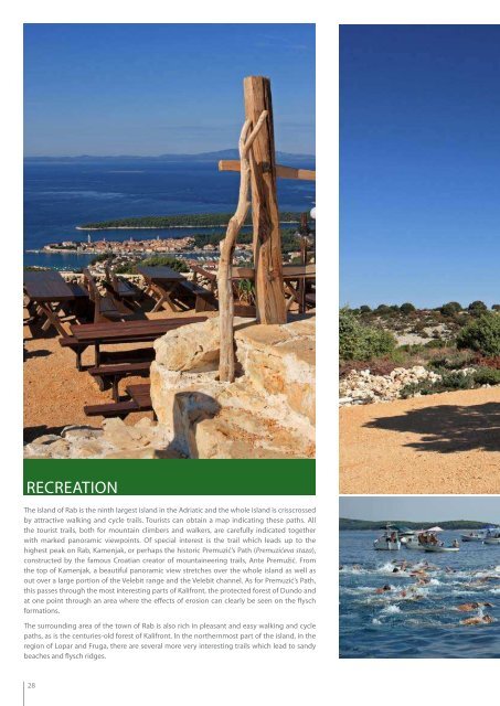
RECREATION<br />
The island of <strong>Rab</strong> is the ninth largest island in the Adriatic and the whole island is crisscrossed<br />
by attractive walking and cycle trails. Tourists can obtain a map indicating these paths. All<br />
the tourist trails, both for mountain climbers and walkers, are carefully indicated together<br />
with marked panoramic viewpoints. Of special interest is the trail which leads up to the<br />
highest peak on <strong>Rab</strong>, Kamenjak, or perhaps the historic Premuzić’s Path (Premuzićeva staza),<br />
constructed by the famous Croatian creator of mountaineering trails, Ante Premužić. From<br />
the top of Kamenjak, a beautiful panoramic view stretches over the whole island as well as<br />
out over a large portion of the Velebit range and the Velebit channel. As for Premuzić’s Path,<br />
this passes through the most interesting parts of Kalifront, the protected forest of Dundo and<br />
at one point through an area where the effects of erosion can clearly be seen on the flysch<br />
formations.<br />
The surrounding area of the town of <strong>Rab</strong> is also rich in pleasant and easy walking and cycle<br />
paths, as is the centuries-old forest of Kalifront. In the northernmost part of the island, in the<br />
region of Lopar and Fruga, there are several more very interesting trails which lead to sandy<br />
beaches and flysch ridges.<br />
28<br />
29