

Canal Heritage Footpath - Basingstoke and Deane Borough Council
Canal Heritage Footpath - Basingstoke and Deane Borough Council
Canal Heritage Footpath - Basingstoke and Deane Borough Council

Create successful ePaper yourself
Turn your PDF publications into a flip-book with our unique Google optimized e-Paper software.
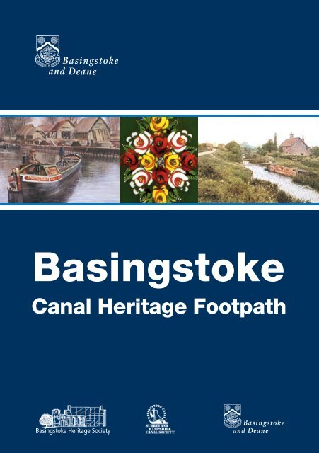
<strong>Basingstoke</strong><br />
<strong>Canal</strong> <strong>Heritage</strong> <strong>Footpath</strong><br />
<strong>Basingstoke</strong> <strong>Heritage</strong> Society
Introduction<br />
The <strong>Basingstoke</strong> <strong>Canal</strong> <strong>Heritage</strong> <strong>Footpath</strong> runs approximately 2 miles (3.2 km) from Festival Place,<br />
<strong>Basingstoke</strong> to Basing House, Old Basing. It closely follows the original route of the <strong>Basingstoke</strong><br />
<strong>Canal</strong>. At Old Basing the footpath connects to other public footpaths, including a route through<br />
Crabtree Plantation <strong>and</strong> Black Dam Nature Reserve. Alternatively you can return along the<br />
<strong>Heritage</strong> Path or, for the weary, there is a bus back to <strong>Basingstoke</strong>. (see information on the back<br />
of this leaflet)<br />
The footpath keeps to recognised rights of way but in places is currently inaccessible to prams,<br />
pushchairs <strong>and</strong> wheelchairs. Parts of the route may also be muddy at times. Please follow the<br />
Highway <strong>and</strong> Country Codes at all times http://www.countrysideaccess.gov.uk/:<br />
• Be safe, plan ahead <strong>and</strong> follow any signs<br />
• Leave gates <strong>and</strong> property as you find them<br />
• Protect plants <strong>and</strong> animals <strong>and</strong> take your litter home<br />
• Keep dogs under control<br />
• Consider other people<br />
<strong>Basingstoke</strong> <strong>Canal</strong><br />
The <strong>Basingstoke</strong> <strong>Canal</strong> was completed in 1794 <strong>and</strong> connected<br />
<strong>Basingstoke</strong> to London via the River Wey <strong>and</strong> the River Thames.<br />
The 37 mile route includes a 1,230 yard tunnel at Greywell.<br />
The canal was built to provide a more economical means of<br />
transporting agricultural goods from Hampshire to London, <strong>and</strong><br />
coal <strong>and</strong> fertilisers could be brought from London to <strong>Basingstoke</strong>.<br />
Mr A J Harmsworth’s last<br />
attempt to work a narrow<br />
boat through to <strong>Basingstoke</strong><br />
Entrance to <strong>Basingstoke</strong><br />
Wharf from Wote Street<br />
(E.C. White Timber Yard) –<br />
supplied by Arthur Atwood<br />
Though some canals were financed by individual industrialists,<br />
it was more usual to form a joint-stock company. In the 18th<br />
century, a joint-stock company had to be authorised by Act of<br />
Parliament. In the case of canals, an Act was also necessary<br />
to obtain powers to purchase l<strong>and</strong> <strong>and</strong> modify drainage. The<br />
Bill proceeded rapidly through Parliament <strong>and</strong> in 1778 the<br />
<strong>Basingstoke</strong> <strong>Canal</strong> Act was passed.<br />
It was ten years before work could begin, because the financial<br />
crisis during the American War of Independence delayed raising<br />
capital. William Jessop was appointed Surveyor <strong>and</strong> consultant<br />
engineer, <strong>and</strong> the contract was awarded to John Pinkerton,<br />
who let out the work to subcontractors. However the canal was<br />
not opened to <strong>Basingstoke</strong>, until 1794, because the company<br />
ran out of funds <strong>and</strong> had to obtain a second Act of Parliament<br />
to authorise raising more capital. The canal took six years to<br />
complete <strong>and</strong> cost £154,463.
Once opened, the canal was dogged by further financial<br />
problems <strong>and</strong> water shortages, particularly in the section from<br />
Greywell to <strong>Basingstoke</strong>. Improved roads <strong>and</strong> construction of the<br />
London <strong>and</strong> South Western Railway in the 1830s contributed to<br />
a further loss in trade. The last cargoes to <strong>and</strong> from <strong>Basingstoke</strong><br />
were carried in August 1900.<br />
The canal west of Greywell was threatened by complete<br />
ab<strong>and</strong>onment, so Mr A J Harmsworth carried a 10 ton load of<br />
s<strong>and</strong> as a token cargo to maintain the right of navigation in the<br />
winter of 1913-14. His narrow boat, ‘<strong>Basingstoke</strong>’ only managed<br />
to reach Basing Wharf after a three month journey because of<br />
the difficulty in raising a sufficient water level beyond the Greywell<br />
Tunnel. In 1932, a second collapse of the Greywell Tunnel<br />
resulted in the last five miles of the canal becoming inaccessible.<br />
The <strong>Basingstoke</strong> Wharf was finally sold off in 1936 <strong>and</strong> a bus<br />
station replaced the timber yard <strong>and</strong> cattle market.<br />
<strong>Basingstoke</strong> <strong>Canal</strong> Wharf<br />
Opened in 2002, Festival Place covers l<strong>and</strong> once occupied by the<br />
wharf of the <strong>Basingstoke</strong> <strong>Canal</strong>. The wharf <strong>and</strong> canal basin were<br />
the loading point for the agricultural produce of central Hampshire<br />
- grain, hops, timber, wool, woollen textiles <strong>and</strong> paper products.<br />
From Festival Place, walk towards the amphitheatre <strong>and</strong> under<br />
the road to Eastrop Link. On the wall of the underpass is artwork<br />
designed by Bettina Furnée, consisting of six painted steel panels.<br />
They are backlit <strong>and</strong> inscribed with a poem by the poet Neil Rollinson.<br />
In summer Eastrop Link is a pleasant spot to stop <strong>and</strong> watch<br />
the fountains <strong>and</strong> passers by, but more significantly, this is<br />
where the <strong>Basingstoke</strong> <strong>Canal</strong> <strong>Heritage</strong> <strong>Footpath</strong> starts, <strong>and</strong><br />
the canal is commemorated with a plaque on the wall of the<br />
southward emerging underpass. There are also representations<br />
of <strong>Basingstoke</strong> <strong>Canal</strong> Tokens.<br />
photo card of canal at Eastrop<br />
- supplied by Arthur Attwood<br />
Plan of canal basin 1894 –<br />
supplied by P Vine<br />
copyright P A L Vine<br />
The plaque <strong>and</strong> tokens at<br />
Eastrop Link<br />
THE BASINGSTOKE CANAL TOKEN<br />
Tokens were paid to navvies when coin was in short supply during the Napoleonic wars. The<br />
<strong>Basingstoke</strong> <strong>Canal</strong> Token is believed to have been designed by Wyon, engraver to the Mint. It shows<br />
a spade <strong>and</strong> mattock in a wheelbarrow on one side, <strong>and</strong> a man <strong>and</strong> a tree-trunk in a sailing barge on<br />
the reverse. It was chargeable at a number of public houses in the area, including the ‘George’ at<br />
Odiham. An unusual feature of this token is that it was worth one shilling. Most comparable tokens<br />
of the period were worth a halfpenny.
Eastrop Park<br />
The footpath route runs east through Eastrop Park marked<br />
by arrow disks. The park was laid out during the New Town<br />
Development in the late 1960s.<br />
The River Loddon runs through the park, providing a home for<br />
sticklebacks, newts, frogs <strong>and</strong> toads. The wet area at the eastern<br />
end of the park acts as a balancing pond, to regulate water flow<br />
in heavy downpours. It also provides a habitat for spring flowers,<br />
such as lady’s smock <strong>and</strong> cel<strong>and</strong>ine. Many birds can be seen in<br />
the park, including kingfishers <strong>and</strong> grey wagtails.<br />
photo card of canal at Eastrop<br />
- supplied by Arthur Attwood<br />
Look out for scented<br />
Meadowsweet <strong>and</strong> kingfishers<br />
on your walk<br />
The canal boundary hedge, mainly hawthorn, runs along the<br />
southern edge of the park, with crocus <strong>and</strong> daffodils naturalised<br />
beneath.<br />
Through the subway, at the east end of the park, walk a little<br />
way along the cycleway before turning right onto Basing Fen.<br />
This section of the footpath runs along the bed of the canal. The<br />
boundary hedges <strong>and</strong> banks can be seen on both sides.<br />
Basing Fen<br />
At this point the canal was built across Basing Fen (or Basing<br />
Water Meadows), which is a peat moor. The canal used to run<br />
in a large loop around the Fen until it ran parallel with Redbridge<br />
Lane. The canal hedges can still be seen, <strong>and</strong> now provide a<br />
home for many small birds, such as blue tits, great tits <strong>and</strong> long<br />
tailed tits.<br />
The footpath runs across the field, through the hedgerow<br />
<strong>and</strong> on across the water meadows. The meadows contain<br />
reed beds, <strong>and</strong> you may be fortunate to hear the song of reed<br />
<strong>and</strong> sedge warblers. Listen carefully for the songs of the wren<br />
<strong>and</strong> the willow warbler, <strong>and</strong> look out for fleabane <strong>and</strong> the scented<br />
meadow sweet. In winter you may see redwings <strong>and</strong> fieldfares.<br />
At the edge of the meadows you will cross over a chalk<br />
stream. The water is extremely clear as it rises from chalk springs<br />
on the western edge of the fen. Watercress beds used to be<br />
located further up stream. The stream runs into the River Loddon<br />
near Old Basing. Continue along the path to the Swing Bridge<br />
Cottages.
Swing Bridge Cottages<br />
Swing Bridge Cottages were built in the 1840s <strong>and</strong> are still<br />
inhabited. The swing bridge was replaced by a fixed wooden<br />
bridge around 1910, but this collapsed <strong>and</strong> the canal bed<br />
was filled in during the 1950s. The route of the old canal runs<br />
eastwards along Redbridge Lane to Red Bridge.<br />
The footpath route runs left along Redbridge Lane, then<br />
right into Basing Limepits car park, <strong>and</strong> immediately left<br />
onto <strong>Basingstoke</strong> Common. Once on the common, the path<br />
follows the perimeter fence <strong>and</strong> hedge line to Red Bridge,<br />
where you will find a <strong>Basingstoke</strong> <strong>Canal</strong> <strong>Heritage</strong> <strong>Footpath</strong><br />
interpretation board.<br />
The Limepits contain a large play area <strong>and</strong> informal space for<br />
picnics <strong>and</strong> relaxation.<br />
photo card of Swing Bridge<br />
Cottages circa 1912 -<br />
supplied by Arthur Attwood<br />
BasingSTOKE COmmon<br />
The common was provided to replace the original Common in<br />
London Road, which was incorporated into War Memorial Park as<br />
part of the new town development. In summer the l<strong>and</strong> is often<br />
grazed by cattle, therefore it is recommended that dogs be kept<br />
on leads.<br />
Look out for the layered thorn hedges, magpies <strong>and</strong> rabbits<br />
on the Common. From its highest point look back towards<br />
<strong>Basingstoke</strong> to appreciate the distinctive skyline of Festival Place,<br />
Basing View <strong>and</strong> the AA building.
RED BRIDGE<br />
Redbridge Lane crosses the canal here. The bridge is now the<br />
only canal structure still visible west of Basing House Bridge,<br />
which st<strong>and</strong>s at the entrance to Basing House. Local red<br />
brickwork was used <strong>and</strong> the design was typical of the 18th<br />
century, with stone capped piers, b<strong>and</strong>s, cambered arches <strong>and</strong><br />
parapets.<br />
Continue on the common <strong>and</strong> walk up the hill to the rear of<br />
Basing House. Follow the hedgerow on your left, exiting the<br />
common beside the British Legion on Crown Lane.<br />
Turn left towards Old Basing village <strong>and</strong> at The Crown.<br />
Continue along the street until you reach the main entrance<br />
of Basing House.<br />
The great wall of Basing House with two of its octagonal dovecotes built, c.1530.<br />
supplied by P. Vine<br />
copyright P A L Vine<br />
COVER PICTURE CREDITS<br />
Front Cover Images: (left to right) Picture of <strong>Basingstoke</strong> Warfe, Wote Street, painted by Terry Harrison<br />
for ‘London’s Lost Route to <strong>Basingstoke</strong> - the story of the <strong>Basingstoke</strong> <strong>Canal</strong>’ 1994 edition is published by<br />
Sutton Publishing <strong>and</strong> written by P A L Vine; <strong>Canal</strong> Art; photo card of Swing Bridge Cottages circa 1912 -<br />
supplied by Arthur Attwood<br />
Back Cover Images: (left to right) photo card of canal at Eastrop - supplied by Arthur Attwood;<br />
<strong>Canal</strong> Art; Bridge at Basing House 1912. Originally supplied by Arthur Atwood
BASING HOUSE<br />
Basing House was the largest private house in Engl<strong>and</strong>, before<br />
being razed to the ground by Oliver Cromwell in 1646. During<br />
construction a stash of gold guineas was found, believed to be<br />
part of the treasure worth £3million, buried by the defending<br />
cavaliers.<br />
The earthworks <strong>and</strong> ruins of Basing House are open to the public<br />
from April to September <strong>and</strong> admission fees will apply. Further<br />
information is available from<br />
www.hants.gov.uk/museum/basingho/<br />
Bridge at Basing House 1912.<br />
Originally supplied by<br />
Arthur Atwood<br />
We hope you have enjoyed your walk. If you have any comments about<br />
the footpath, or would like any further information, please contact the<br />
park rangers at:<br />
<strong>Basingstoke</strong> <strong>and</strong> <strong>Deane</strong> <strong>Borough</strong> <strong>Council</strong><br />
Civic Offices, London Road, <strong>Basingstoke</strong>, Hampshire, RG21 4AH<br />
www.basingstoke.gov.uk<br />
Tel. 01256 844844
Society Websites<br />
The <strong>Basingstoke</strong> <strong>Heritage</strong> Society www.bas-herit-soc.org/<br />
Surrey <strong>and</strong> Hampshire <strong>Canal</strong> Society www.basingstoke-canal.org.uk<br />
Travel Information<br />
Travel information is available from Stagecoach at:<br />
<strong>Basingstoke</strong> Bus Station, Festival Place<br />
http://www.stagecoachbus.com/south<br />
Tel. 0845 121 0180<br />
<strong>Basingstoke</strong> <strong>Heritage</strong> Society<br />
12303-07/07


