

Tunworth - Basingstoke and Deane Borough Council
Tunworth - Basingstoke and Deane Borough Council
Tunworth - Basingstoke and Deane Borough Council

You also want an ePaper? Increase the reach of your titles
YUMPU automatically turns print PDFs into web optimized ePapers that Google loves.
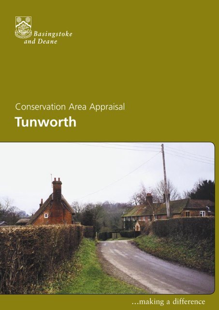
Conservation Area AppraisalConservation Area Appraisal<strong>Tunworth</strong>…making a difference <strong>Tunworth</strong>
Conservation Area AppraisalLocation <strong>and</strong> Population<strong>Tunworth</strong> is situated five miles south-east of <strong>Basingstoke</strong> in the rollingchalk l<strong>and</strong>scape of <strong>Tunworth</strong> Down. The hamlet nestles either side of aridge, with roads travelling to Upton Grey in the east <strong>and</strong> Mapledurwellin the north.The population of the hamlet in 1999 was approximately 32 (projectionbased on the Hampshire Country <strong>Council</strong> Planning Department SmallArea Population Forecasts 1995).Historic DevelopmentSettlement OriginsThe name ‘<strong>Tunworth</strong>’ originates from the Old English word‘Tunneanwyrd’, meaning ‘Tunna’s curtilage’. In the Anglo-Saxon period,the Manor of <strong>Tunworth</strong> was held by Alured from Queen Edith. It wasone of many estates in the possession of Hugh de Port at the time ofthe Domesday Survey in 1086. The property remained with the de Portfamily <strong>and</strong> their descendants until 1633, when Thomas Hall, twice Mayorof <strong>Basingstoke</strong>, succeeded to the manor. In 1760, the l<strong>and</strong> was soldto Samuel Prince. Three years later he sold it to Tristram HuddlestoneJervoise of Herriard, it remains in that family.Settlement DevelopmentThe hamlet of <strong>Tunworth</strong> has developed around two points. The church<strong>and</strong> adjacent manor form the first focus of settlement. They are locatedin the west of the hamlet, with the Old Rectory sited to the south-east.The houses in the second focus of settlement are located approximately400 metres to the east. They are physically separated from the church <strong>and</strong>manor area by a small ridge.Manor FarmhouseGranary at Manor FarmThe Tithe Map of 1841 shows extensive buildings comprising the ManorFarm complex. It is likely that agriculture was historically the predominantfunction of the community.<strong>Tunworth</strong> 3
Conservation Area AppraisalAn Appraisal of the Conservation AreaAn OverviewThe Appraisal plan identifies those buildings, views <strong>and</strong> key featuresconsidered essential to the special character or appearance of theConservation Area. In addition to listed buildings it also includes unlistedbuildings of particular individual or group value, which are indicated onthe Appraisal plan as notable. This is not to undermine the value of otherunmarked buildings or structures, which reflect the historic developmentof the hamlet without detracting from its special qualities.View of the Old School House <strong>and</strong>the BarracksIndividual hedgerows have not been included on the Appraisal plan.However, their contribution to the character of the Conservation Areashould not be underestimated <strong>and</strong> their significance is implicit in theAppraisal.The special architectural interest of <strong>Tunworth</strong> is derived from theshared vernacular form, scale <strong>and</strong> materials, characteristic of this partof Hampshire. However there is a subtle variety <strong>and</strong> intrinsic interest ofindividual buildings. The buildings are loosly clustered in two irregulargroup, which are given some cohesion by the road pattern.View northwards from the Old School HouseThe historic character is derived from the location of the hamlet, in anopen farml<strong>and</strong> setting of undulating l<strong>and</strong>scape character. The hillsidelocation of the hamlet contributes significantly to the visual interest <strong>and</strong>distinctive open qualities of the Conservation Area. The topography giveskey views through, into <strong>and</strong> out of, the Conservation Area, particularly inrelation to the buildings <strong>and</strong> spaces between them.4<strong>Tunworth</strong>
Conservation Area AppraisalBuilt FormThere are 12 buildings in the <strong>Tunworth</strong> Conservation Area that areincluded on the Statutory List of Buildings of Special Architectural orHistoric Interest. All are listed as being of local or regional special interest(Grade II), apart from the Church of All Saints, which is of nationalimportance (Grade II*).Key Individual BuildingsAll Saints Church dates from the 12th <strong>and</strong> 13th centuries, <strong>and</strong> isessentially a two cell plan form, constructed of flint with a tile roof. Ithas a timber-framed <strong>and</strong> clad bell turret at the western end, with a smallbroach spire, containing a single bell. The church was extensively restoredin 1854-55, when an oak porch <strong>and</strong> font were added. The woods ofHerriard Park provide a backdrop for the churchyard.Church of All SaintsThe Old Rectory is an imposing building <strong>and</strong> dates from the late18th century. It is set apart, <strong>and</strong> to the west of, the main focus ofdevelopment, around the Manor Farm <strong>and</strong> church. Constructed of redbrick in Flemish bond, with a dominant clay tile roof, it has a symmetricalwest elevation with large Victorian casement windows. The lower eastwing has a series of round-headed windows <strong>and</strong> a door of elaborateclassical form. The building is set in an extensive l<strong>and</strong>scaped garden withancillary outbuildings to the east.The Old RectoryBetween the two foci of settlement in the Conservation Area is RoseCottage (Grade II). Dating from the 18th <strong>and</strong> early 19th centuries, theoriginal timber-frame construction is mostly concealed by later red brickwalls of Monk bond. Some framing remains partly exposed on thegable-end walls. The roof is thatched, with eyebrows over the first floorcasements, which have diagonal leaded lights. Located on a bend, at thelowest point in the road, between the two settlements, it is a prominentbuilding <strong>and</strong> focal point in views along the road in both directions.On the western edge of the Conservation Area is <strong>Tunworth</strong> Lodge, asmall 19th century building, constructed of red brick with blue headers<strong>and</strong> a red clay tile roof. The lodge is partially concealed from the road byhedges <strong>and</strong> trees.<strong>Tunworth</strong> 5
Conservation Area AppraisalSignificant Groups of BuildingsManor Farmhouse <strong>and</strong> its associated complex of farm buildings form asignificant group of intrinsic architectural <strong>and</strong> historic value. These contributesignificantly to the character <strong>and</strong> appearance of this part of the ConservationArea. They are a key element in reinforcing the agricultural character <strong>and</strong>historic development of the settlementUnlisted farm buildings, Manor FarmThe farmhouse dates from the 16th <strong>and</strong> 17th centuries <strong>and</strong> is a long,two-storey timber-framed house with rear wings to each end, added at alater date. The exposed frame, with arch bracing, is filled with plain <strong>and</strong>herring-bone red brickwork, with signs of old blocked windows. The roofis of red clay tiles, hipped to the north-west, with a large central chimneystack, <strong>and</strong> a catslide to the rear. Although set back from the road, itforms a focus around which the farm complex is oriented.Adjacent to the farmhouse is a long eight-bay barn with weatherboardedexternal cladding. The 17th century timber-framed construction,on a brick <strong>and</strong> flint plinth, has a substantial roof that emphasises itslongitudinal form. The barn runs parallel to the road, <strong>and</strong> is a dominantfeature in this part of the Conservation Area.Grade II listed barn, Manor FarmOpposite the barn <strong>and</strong> farmhouse are three 19th century agriculturalbuildings. Situated on the rise <strong>and</strong> a curve in the road, they punctuateviews in both directions, <strong>and</strong> are visible in long range views from theother hamlet.The Granary (Grade II) is located to the north-west of the farmhouse <strong>and</strong>dates from the early 19th century. It is a timber-framed construction,with timber cladding, <strong>and</strong> a half-hipped tile roof. Indicative of its historicpurpose, the building rests above ground level on nine staddle-stones.South-west of the farmhouse is an ancillary building, again listed <strong>and</strong>dating from the early 19th century. This is a small, square building, withred brick walling in Monk bond <strong>and</strong> a hipped, red clay tile roof.6<strong>Tunworth</strong>
Conservation Area AppraisalThe second focus is formed by a varied group of buildings of irregularlinear plan form, following the rise of the road northwards. Old SchoolCottage is situated at the western-most end of the group, at the top ofthe steep incline of the lane. It dates from the late 18th century, <strong>and</strong> is atwo-storey building with a later extension on the east side. The cottage isconstructed of red brick, with blue header panels on the front elevationat ground floor level. The extension is built in red brick Flemish bondwith blue headers. The roof is thatched <strong>and</strong> half-hipped on the east side.Of particular value, in terms of the social <strong>and</strong> historic development ofthe village, is the single-storey schoolroom, attached to the south. Thewestern gable-end <strong>and</strong> lateral chimney stack are particularly prominent inviews down the lane, <strong>and</strong> against the farml<strong>and</strong> setting to the east.The Barracks, opposite, is an early 19th century terraced building of threedouble-fronted cottages. They are constructed of red brick walling inEnglish bond, with blue headers <strong>and</strong> a tiled roof. The casement windowsare leaded on the first floor <strong>and</strong> cast-metal on the ground floor withcambered openings. The terrace is similar to Trelawney <strong>and</strong> Manor FarmCottage in the north of the hamlet. It was originally two attached pairs,forming a short terrace. Similar features include leaded windows to thefirst floor, <strong>and</strong> cambered openings with cast casements to the groundfloor. These buildings were all Herriard Estate Cottages. Their commonstyle <strong>and</strong> use of materials is a distinctive historical <strong>and</strong> architecturalfeature of the Conservation Area.The BarracksMayflower CottageMayflower Cottage (formerly known as Fourways), Crossroads <strong>and</strong>Beechcroft, are situated near the road junction at the east end of thehamlet. These buildings date from the 17th century <strong>and</strong> are of timberframe<strong>and</strong> brick construction. They are substantial properties for theirvernacular origins. The longitudinal form is emphasised by the sweepingthatched roof slopes, punctuated by large central chimney stacks.Set in large individual plots, they are imposing buildings contributingsignificantly to the special character <strong>and</strong> appearance of this part of theConservation Area.The Old Post Office House dates from the 19th century <strong>and</strong> isconstructed of flint with brick dressings <strong>and</strong> a slate roof. The groundfloor casement windows have cambered openings. The simple vernacularform <strong>and</strong> orientation of this building to the lane complements thesurrounding group of listed buildings. It also reinforces the historiccharacter <strong>and</strong> development of the hamlet.<strong>Tunworth</strong> 7
Conservation Area AppraisalThe Character <strong>and</strong> Importance of Public<strong>and</strong> Private SpacesThe open spaces in this Conservation Area are fundamental in helpingdefine its character. Between the two foci of settlement is a large openarea, surrounding the crest of the ridge. This allows extensive views fromthe north-west to the north-east, over rolling agricultural l<strong>and</strong>. There isan area of open farml<strong>and</strong>, between the Old School House <strong>and</strong> ManorFarm Cottages to the north-east, which is particuarly important. It allowsviews between the two groups of buildings <strong>and</strong> reinforces the characterof the hamlet.Mayflower Cottage from the southBeechcroftThis verdant character is reinforced by the established <strong>and</strong> visuallydominant native hedgerows. These encompass both the buildings <strong>and</strong>the surrounding green spaces, uniting the two forms.The tree cover in <strong>Tunworth</strong> is predominantly broad-leaved, with a fewscattered conifers. Beech is the predominant species with ash, sycamore,oak <strong>and</strong> limes also represented. Amongst the conifer element, yew,monetary cypress, black pine, spruce <strong>and</strong> lawson cypress are present.Trees of note in the Conservation Area include two old walnuts at ManorFarm, a fine yew <strong>and</strong> several young silver pendant limes in The OldRectory, <strong>and</strong> a young wellingtonia in the garden of Rose Cottage.Other Features of Historic orArchitectural InterestThe cob walls to Manor Farm are notable features in the ConservationArea <strong>and</strong> demonstrate the use of local building materials in this part ofthe borough. These curtilage structures define the setting of the ManorFarm complex <strong>and</strong> are prominent in views towards the west of theConservation Area.Building MaterialsThe prevalent traditional building materials reflect vernacular buildingtraditions in this part of Hampshire. They include timber-frame (eitherinfilled or weather-boarded) red brick, red brick with blue headers <strong>and</strong>red brick with flint. Roofing materials include thatch, red clay tile <strong>and</strong>slate, to the slightly later buildings. Casement windows are prevalent <strong>and</strong>many buildings have large chimney stacks.Given the domestic scale <strong>and</strong> simple vernacular architecture of thebuildings in the Conservation Area, historic joinery (such as sash orcasement windows, doors <strong>and</strong> door hoods) are often the features thatdefine the appearance of properties. Although some buildings have beenmodernised, the use <strong>and</strong> overall effect of inappropriate replacementwindows <strong>and</strong> doors is limited.8<strong>Tunworth</strong>
Conservation Area AppraisalThe Setting of the Conservation Area<strong>Tunworth</strong>’s l<strong>and</strong>scape consists of chalk beds, covered with widespreaddeposits of clay with flints, particularly on hilltops creating an undulating orrolling l<strong>and</strong>form. There is a variation in l<strong>and</strong>cover, ranging from the denservegetation on the clay ridges (with many of the woodl<strong>and</strong>s of ancientsemi-natural origin), to the more open l<strong>and</strong>scape over the chalk in thevalleys. Scattered hamlets <strong>and</strong> villages are linked by a moderately densenetwork of winding lanes. This area of countryside displays the typicalrange of chalk <strong>and</strong> clay l<strong>and</strong>scape. It is defined to the north, east, <strong>and</strong>west, by more open l<strong>and</strong>scapes <strong>and</strong> to the south by the much flatter clayplateau. The l<strong>and</strong>scape setting affords significant long range views into,<strong>and</strong> out of, the area of settlement.The tall hedgerows <strong>and</strong> small to medium sized copses, which definemainly arable fields of varying size, provide the strong identity to thisdownl<strong>and</strong>. The steeply rolling l<strong>and</strong>form allows fine views over the dryvalley of Weston Patrick. A densely wooded backdrop of the plateauedge forms a foil to the fields <strong>and</strong> hedges in the valleys. The l<strong>and</strong>scapeis unspoiled by modern, visually intrusive, development <strong>and</strong> is especiallyrepresentative of its type.The nearby Hackwood Park, to the north-west, is a Grade I listed park<strong>and</strong> the site of a deer park dating back to 1280. The park has an earlyformal woodl<strong>and</strong> garden l<strong>and</strong>scape, dating from 1720. It may have beendesigned by James Gibbs in the style of Andre le Notre. Also in the vicinityof <strong>Tunworth</strong>, to the south, is Herriard Park, a Grade II listed park <strong>and</strong> aCountryside Heritage Site. It contains varied examples of ancient copses <strong>and</strong>pleasure grounds designed by Humphrey Repton in 1793, <strong>and</strong> earlier formalgardens designed by George London, in 1699. A Countryside Heritage Siteat nearby Great Park, represents a deer park laid out 1258. This retains largeparts of its boundary banks, along with 19 ancient, semi-natural woodl<strong>and</strong>s<strong>and</strong> eight replanted ancient woodl<strong>and</strong>s.<strong>Tunworth</strong> 9
Conservation Area AppraisalAreas of Archaeological SignificanceEvery settlement contains within it archaeological evidence of its origins<strong>and</strong> development, of the economy <strong>and</strong> industry of the community <strong>and</strong>for the lives <strong>and</strong> lifestyles of past inhabitants.It is in the Areas of High Archaeological Potential (AHAP) that it is mostlikely that such archaeological remains will be encountered.View of the Old School House<strong>and</strong> the BarracksWhere a development is proposed, the impact that it might have onthese remains is a material consideration within the planning process.This may occasionally result in the need for archaeological recording inthe case of some developments.An Area of High Archaeological Importance (AHAI) covers the areasurrounding the church <strong>and</strong> Manor Farm. This may have been a focus ofsettlement, which has since disappeared. On the north side of the road,opposite Manor Farm, is an Area of Archaeological Importance (AAI).This is another likely area of settlement near the church <strong>and</strong> Manor Farmcomplex.A second AAI covers the other area of settlement. The Tithe Map of1841 shows a barn, which has since disappeared. This suggests thatfurther outbuildings may have existed in the gaps between the houses.Other spaces between houses along the road may also be the result ofshrinkage <strong>and</strong>, potentially have evidence of building sites.10<strong>Tunworth</strong>
Conservation Area AppraisalConservation Area Planning ControlsThe following controls apply within the Conservation Area in addition tonormal planning controls:• Conservation Area Consent is normally required for thedemolition of buildings or structures over a certain size within aConservation Area.• The <strong>Council</strong> must be given six weeks notice of any intentionto undertake works to, cut down or uproot any trees over a certainsize in the Conservation Area.• Planning applications which, in the opinion of the <strong>Borough</strong><strong>Council</strong>, would affect the special character of the ConservationArea must be advertised <strong>and</strong> the opportunity given for publiccomment. This may include proposals outside the ConservationArea which nevertheless affect its setting.View westwards between Manor Farmbuildings <strong>and</strong> Rose CottageStatutory policies relating to Conservation Areas <strong>and</strong> listed buildingsare set out in the adopted <strong>Basingstoke</strong> <strong>and</strong> <strong>Deane</strong> <strong>Borough</strong> Local Plan.These policies reflect the statutory duty on the Local Planning Authorityto have regard to the preservation of historic buildings or their setting,<strong>and</strong> to the enhancement of areas designated as being of special interest.These policies seek to ensure that particular attention will be paid tothe scale, height, form, materials <strong>and</strong> detailing of proposals includingboundary treatments <strong>and</strong> other features of note. In order to consider theimplications of development <strong>and</strong> given the detail required, the <strong>Borough</strong><strong>Council</strong> will normally require proposals within the Conservation Areato be submitted in the form of a full, <strong>and</strong> not outline, application. The<strong>Borough</strong> <strong>Council</strong>’s conservation officers are available for advice <strong>and</strong>information on all matters relating to development proposals in theConservation Area.GrantsThe <strong>Borough</strong> <strong>Council</strong> provides grants for various types of work. Theseinclude Historic Buildings Grants, Environment <strong>and</strong> Regeneration Grants,<strong>and</strong> Village <strong>and</strong> Community Hall Grants. Leaflets are available explainingthe purpose <strong>and</strong> criteria for each grant <strong>and</strong> an approach to the <strong>Council</strong> isrecommended for further information on any grant.<strong>Tunworth</strong> 11
Conservation Area Appraisal - <strong>Tunworth</strong> Historical OS Map12<strong>Tunworth</strong>
Conservation Area Appraisal - <strong>Tunworth</strong> Tithe MapCourtesy of Hampshire County <strong>Council</strong><strong>Tunworth</strong> 13
Conservation Area Appraisal - <strong>Tunworth</strong> Archaeological MapCourtesy of Hampshire County <strong>Council</strong>14<strong>Tunworth</strong>
Conservation Area Appraisal<strong>Tunworth</strong>…making a difference<strong>Basingstoke</strong> <strong>and</strong> <strong>Deane</strong> <strong>Borough</strong> <strong>Council</strong>Civic Offices London Road <strong>Basingstoke</strong> Hants RG21 4AHTelephone 01256 844844 Fax 01256 845200www.basingstoke.gov.ukProduced by Graphics/Corporate Information Division April 20045164


