

Church Road, Tadley - Basingstoke and Deane Borough Council
Church Road, Tadley - Basingstoke and Deane Borough Council
Church Road, Tadley - Basingstoke and Deane Borough Council

Create successful ePaper yourself
Turn your PDF publications into a flip-book with our unique Google optimized e-Paper software.
Conservation Area AppraisalConservation Area Appraisal<strong>Church</strong> <strong>Road</strong>, <strong>Tadley</strong>…making <strong>Church</strong> a <strong>Road</strong>, difference <strong>Tadley</strong>
Conservation Area AppraisalIntroduction<strong>Basingstoke</strong> <strong>and</strong> <strong>Deane</strong> <strong>Borough</strong> <strong>Council</strong> designated the <strong>Church</strong> <strong>Road</strong>, <strong>Tadley</strong>Conservation Area in 1982 in recognition of the special architectural <strong>and</strong>historic interest of the village.Having designated the Conservation Area, the Local Authority has a statutoryduty to ensure that those elements that form its particular character orappearance should be preserved or enhanced, especially when consideringplanning applications.View to Hawley FarmhouseIt is therefore necessary to define <strong>and</strong> analyse those qualities or elements thatcontribute to, or detract from, the special interest of the area <strong>and</strong> to assesshow they combine to justify its designation as a Conservation Area. Suchfactors can include:• its historic development;• the contribution of individual or groups of buildings to the streetscene<strong>and</strong> the spaces that surround them; <strong>and</strong>• the relationship between the built environment <strong>and</strong> the l<strong>and</strong>scape.View into the villageThey can also include the less tangible senses <strong>and</strong> experiences, such as noises<strong>and</strong> smells, which can play a key part in forming the distinctive character ofan area.The Appraisal takes the form of a written text <strong>and</strong> an Appraisal plan. In bothrespects every effort has been made to include or analyse those elements thatare key to the special character of the area. Where buildings, structures orfeatures have not been specifically highlighted, this does not mean that theyare of no visual or historic value to the Conservation Area. The document isintended to be an overall framework <strong>and</strong> guide, within which decisions canbe made on a site-specific basis.This Appraisal of the <strong>Church</strong> <strong>Road</strong>, <strong>Tadley</strong> Conservation Area follows itsreview in 2003 <strong>and</strong> explains what its designation means for those who live<strong>and</strong> work in the area.This document was adopted as Supplementary Planning Guidance by the<strong>Borough</strong> of <strong>Basingstoke</strong> <strong>and</strong> <strong>Deane</strong> on 17 July 2003 <strong>and</strong> complements thepolicies of the <strong>Borough</strong> Local Plan (review).It has been subject to consultation with <strong>Council</strong>lors, the Town <strong>Council</strong> <strong>and</strong>local amenity groups. A full list of consultees, copies of their responses,<strong>and</strong> details of the <strong>Council</strong>’s consideration of the issues raised during theconsultation period are available for inspection, by appointment, at the CivicOffices, during normal office hours.2<strong>Church</strong> <strong>Road</strong>, <strong>Tadley</strong>
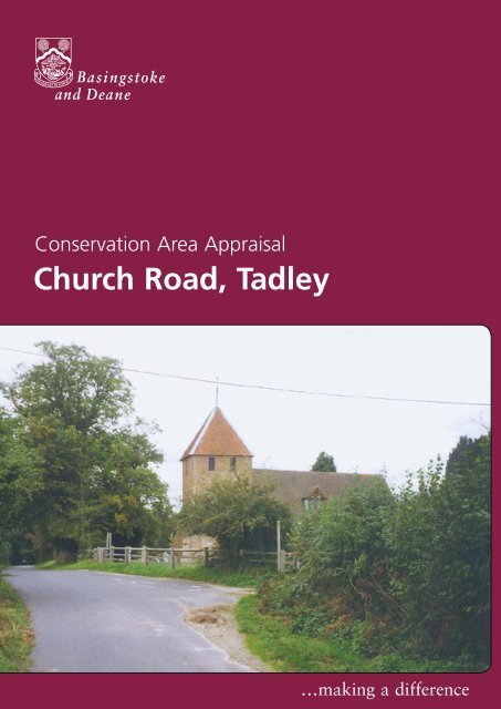
Conservation Area AppraisalLocation <strong>and</strong> PopulationThe main settlement of <strong>Tadley</strong> is located in the north of Hampshire,approximately six miles north-west of <strong>Basingstoke</strong>. The main A340 roadruns north/south through the settlement, <strong>and</strong> to the east is PamberForest. The <strong>Church</strong> <strong>Road</strong> Conservation Area is located approximatelyone third of a mile to the west of the main settlement. It extends fromthe medieval church of St Peter at its southern end, to New <strong>Road</strong>(approximately one mile to the north).The population of the Conservation Area in 1998 was approximately 36(projection based on the Hampshire County <strong>Council</strong> Planning DepartmentSmall Area Population Forecasts).Garden CottageHistoric DevelopmentSettlement OriginsThe name <strong>Tadley</strong> has possible origins from several old English words.‘Tad’ may have meant toads, or could be derived from a personal name.‘Ley’ is generally interpreted as meaning meadow or pasture.<strong>Tadley</strong> (Taddanleage) is first mentioned in a charter dated AD909,granting Bishops Wood to the Bishop of Winchester. <strong>Tadley</strong> did have anindependent manor of its own, initially called <strong>Tadley</strong>, <strong>and</strong> later named themanor of Withford or Wyeford. In 1166 the manor was the property ofWilliam Hotot. In 1305 it passed to the de la More family <strong>and</strong>, in 1496,the Ludlow family inherited the manor through marriage. Henry Ludlowwas the Lord of the Manor in 1625. He is said to have pulled down, ordestroyed, the original village of <strong>Tadley</strong> which may have been locatedin the vicinity of St Peter’s <strong>Church</strong>, forcing the villagers to move to thepresent site of ‘Old <strong>Tadley</strong>’.Another theory for the relocation of the village at this time was theresurgence of the Black Death in this area of country. The establishmentof The Old Meeting House, <strong>and</strong> the increasing support for the nonconformistreligions, drawing villagers away from the traditional area ofsettlement, may also have been responsible. After the death of HenryLudlow in 1639, the history of the manor is uncertain. By the end ofthe 17th century it had passed into the h<strong>and</strong>s of the Wither family, whoretained the property for some time.Settlement DevelopmentAlthough the north of <strong>Tadley</strong> was primarily healthl<strong>and</strong> <strong>and</strong> commonl<strong>and</strong>,the area of <strong>Church</strong> <strong>Road</strong>, <strong>and</strong> west <strong>and</strong> south of this, was <strong>and</strong> still isprimarily agricultural.Until World War II, <strong>Tadley</strong> comprised the area of settlement coveredby the <strong>Tadley</strong> Conservation Area. However, the development of theAldermaston Airfield, during the war, <strong>and</strong> the subsequent arrival of the<strong>Church</strong> <strong>Road</strong>, <strong>Tadley</strong> 3
Conservation Area AppraisalAtomic Weapons Research Establishment (AWRE) in 1950, encourageddevelopment northward, forming the present town.Historically, <strong>Tadley</strong> inhabitants were dependant on the woodl<strong>and</strong> craftsassociated with Pamber Forest. Villagers provided coppiced timber for usein the making of hurdles, barrels, baskets, kindling <strong>and</strong> the renownedbesom brooms. Bricks were also made on <strong>Tadley</strong> Common. The <strong>Church</strong><strong>Road</strong> area was largely dependent on agriculture, <strong>and</strong> this is still adominant influence on the appearance of the Conservation Area.St Peter’s <strong>Church</strong>An Appraisal of the Conservation AreaAn OverviewThe Appraisal plan identifies those buildings, views <strong>and</strong> key featuresconsidered essential to the special character or appearance of theConservation Area. In addition to listed buildings, it also includes unlistedbuildings of particular individual or group value, which are indicated onthe Appraisal plan as notable. This is not to undermine the value of otherunmarked buildings or structures that reflect the historic development ofthe village without detracting from its special qualities.Individual hedgerows have not been included in the Appraisal plan. However,their contribution to the character of the Conservation Area should not beunderestimated, <strong>and</strong> their significance is implicit in the Appraisal.Built FormThere are six buildings located within the Conservation Area included inthe Statutory List of Buildings of Special Architectural or Historic Interest. StPeter’s <strong>Church</strong> is Grade I listed, <strong>and</strong> is of outst<strong>and</strong>ing national importance.The remainder are listed as being of special local or regional importance(Grade II). Their large form <strong>and</strong> arrangement within large open plots is insharp contrast to the neighbouring town of <strong>Tadley</strong>.The listed buildings represent a variety of building types, mainly datingbetween the 16th <strong>and</strong> 19th centuries. Dispersed throughout theConservation Area, <strong>and</strong> often located at key visual points in the streetscene,they make a significant contribution to the special qualities of theConservation Area.There are several unlisted buildings that contribute positively to the specialcharacter of the Conservation Area. These buildings, dating mainly from the19th century, are scattered within the l<strong>and</strong>scape. Whilst some have intrinsicarchitectural or historic merit, most are highlighted for their group valuein reinforcing the character of the Conservation Area. Historic buildings ofparticular individual or group value are indicated as notable on the Appraisalplan. Other unmarked buildings or structures may also reflect the historicdevelopment of the area, without detracting from its special qualities.4<strong>Church</strong> <strong>Road</strong>, <strong>Tadley</strong>
Conservation Area AppraisalSignificant Groups of BuildingsHatch CottageSituated a short distance apart, in the middle of the Conservation Area,are Pound Farmhouse <strong>and</strong> Barn Close House. Pound Farmhouse datesfrom the late 18th century <strong>and</strong> is a two-storey building with a tiledroof. The walling is red brick in Flemish bond, <strong>and</strong> there is a massivechimneystack at the west end. The windows are all casements withleaded lights <strong>and</strong> cast iron frames. Barn Close House dates from the 18thcentury, with 1878 alterations by Reverend Saulez to become the earliestknown rectory. It is of two-storeys with a tiled roof <strong>and</strong> tapered endchimneystacks. The walling is roughcast with end pilasters <strong>and</strong> camberedwindow <strong>and</strong> door openings. The casements have pointed, coupled lightswith rectangular frames, <strong>and</strong> there is evidence of an earlier timberframedstructure.Building MaterialsThe buildings within the Conservation Area demonstrate the range ofvernacular materials prevalent throughout all periods of development.The retention of thatch as a roofing material is especially important inmaintaining the distinctive character of the area.View to Hawley FarmhouseGiven the domestic scale <strong>and</strong> simple provincial architecture of the buildingsin the Conservation Area, historic joinery (such as sash windows, doors<strong>and</strong> door hoods) often defines the appearance of properties. This is alsothe case for the more gr<strong>and</strong> or ordered elevations as at Hawley Farmhousewhere the arrangement of sash windows is key to the architectural design.Although some buildings have been modernised, the use <strong>and</strong> overall effectof inappropriate replacement windows <strong>and</strong> doors is limited.The Character <strong>and</strong> Importance of Public<strong>and</strong> Private SpacesThe open spaces in the Conservation Area are extremely important asthey create the pattern of settlement <strong>and</strong> reinforce its historic ruralcharacter <strong>and</strong> appearance. The open areas surrounding Hawley Farmallow it to remain in its traditional rural setting. There is an area ofcountryside between Barn Close House in the north, <strong>and</strong> Hatch Cottagein the south. This provide extensive views across the surroundingl<strong>and</strong>scape to the south-west <strong>and</strong> west. There are also restricted views tothe east <strong>and</strong> north.Smaller cultivated areas, such as gardens, also create important settingsto the many buildings set back from <strong>Church</strong> <strong>Road</strong>. The uncurved vergesalong parts of the road help define the residential character of theroad. Mature trees are planted around the Conservation Area, bothsingly <strong>and</strong> in avenues. They line the roadside along <strong>Church</strong> Brook, <strong>and</strong>6<strong>Church</strong> <strong>Road</strong>, <strong>Tadley</strong>
Conservation Area Appraisalare also in plantations to the west of the area. The verdant characterof the Conservation Area, together with the narrow lanes <strong>and</strong> hedges(particularly towards the church), restricts long views. Ash <strong>and</strong> oak arethe dominant species, with birch, willow, alder, walnut, beech, holly <strong>and</strong>robinia. Scots pine <strong>and</strong> yew trees are also present. Generally the treecover in the Conservation Area is broadleaved in character with onlya few conifers scattered around. The verges to the roads are generallyhedge-lined, with some hedgerow trees in evidence, creating a tunnellikeeffect.The Setting of the Conservation AreaThe Conservation Area has two very different neighbouring areas. Theyare the post- war development of <strong>Tadley</strong> to the east <strong>and</strong> north, <strong>and</strong> theopen countryside to the south <strong>and</strong> west. The area is therefore visible, if notdiscernable, as a distinctive place from the countryside <strong>and</strong> can be seen whenapproached from <strong>Tadley</strong>. Little of its surroundings can be viewed from insidethe Conservation Area. This is due to the combination of the tall <strong>and</strong> densewooded areas on the edges, <strong>and</strong> the lack of any topographical features ofnote.Areas of Archaeological SignificanceLow Bridge on <strong>Church</strong> <strong>Road</strong>View along <strong>Church</strong> BrookEvery settlement contains within it archaeological evidence of its origins <strong>and</strong>development, the economy <strong>and</strong> industry of the community <strong>and</strong> of the lives<strong>and</strong> lifestyles of past inhabitants. It is in the Areas of High ArchaeologicalImportance (AHAP) that it is most likely that such archaeological remainswill most likely be encountered. Where a development is proposed, theimpact that it might have on these remains is a material considerationwithin the planning process. This may occasionally result in the need forarchaeological recording in the case of some developments.The archaeological significance or potential of the Conservation Areahas yet to be identified. However, the possible historical development of<strong>Tadley</strong> suggests that an area in the vicinity of the church may have beenthe origin of the settlement.<strong>Church</strong> <strong>Road</strong>, <strong>Tadley</strong> 7
Conservation Area AppraisalConservation Area Planning ControlsThe following controls apply within the Conservation Area in addition tonormal planning controls:• Conservation Area Consent is normally required for thedemolition of buildings or structures over a certain size within aConservation AreaPound FarmhouseHawley Farmhouse• The <strong>Council</strong> must be given six weeks notice of any intention toundertake works to, cut down or uproot any trees over a certain sizein the Conservation Area• Planning applications which, in the opinion of the <strong>Borough</strong> <strong>Council</strong>,would affect the special character of the Conservation Area must beadvertised <strong>and</strong> the opportunity given for public comment. This mayinclude proposals outside the Conservation Area which neverthelessaffect its settingStatutory policies relating to Conservation Areas <strong>and</strong> listed buildingsare set out in the adopted <strong>Basingstoke</strong> <strong>and</strong> <strong>Deane</strong> <strong>Borough</strong> Local Plan.These policies reflect the statutory duty on the Local Planning Authorityto have regard to the preservation of historic buildings or their setting,<strong>and</strong> to the enhancement of areas designated as being of special interest.These policies seek to ensure that particular attention will be paid tothe scale, height, form, materials <strong>and</strong> detailing of proposals includingboundary treatments <strong>and</strong> other features of note. In order to consider theimplications of development, <strong>and</strong> given the detail required, the <strong>Borough</strong><strong>Council</strong> will normally require proposals within the Conservation Area to besubmitted in the form of a full, <strong>and</strong> not outline, application. The <strong>Borough</strong><strong>Council</strong>’s conservation officers are available for advice <strong>and</strong> information onall matters relating to development proposals in the Conservation Area.GrantsThe <strong>Borough</strong> <strong>Council</strong> provides grants for various types of work. Theseinclude Historic Buildings Grants, Environment <strong>and</strong> Regeneration Grants,<strong>and</strong> Village <strong>and</strong> Community Hall Grants. Leaflets are available explainingthe purpose <strong>and</strong> criteria for each grant <strong>and</strong> an approach to the <strong>Council</strong> isrecommended for further information on any grant.8<strong>Church</strong> <strong>Road</strong>, <strong>Tadley</strong>
Conservation Area Appraisal - <strong>Church</strong> <strong>Road</strong>, <strong>Tadley</strong> 1870 OS Map<strong>Church</strong> <strong>Road</strong>, <strong>Tadley</strong> 9
Conservation Area Appraisal - <strong>Church</strong> <strong>Road</strong>, <strong>Tadley</strong> Tithe MapCourtesy of Hampshire County <strong>Council</strong>10<strong>Church</strong> <strong>Road</strong>, <strong>Tadley</strong>
Conservation Area AppraisalIntroductionLorem ipsum dolor sit amet, consectetuer adipiscing elit, sed diam nonummy nibheuismod tincidunt ut laoreet dolore magna aliquam erat volutpat. Ut wisi enimad minim veniam, quis nostrud exerci tation ullamcorper suscipit lobortis nisl utaliquip ex ea commodo consequat. Duis autem vel eum iriure dolor in hendreritin vulputate velit esse molestie consequat, vel illum dolore eu feugiat nulla facilisisat vero eros et accumsan et iusto odio dignissim qui bl<strong>and</strong>it praesent luptatumzzril delenit augue duis dolore te feugait nulla facilisi neque porro quisquam est,qui dolorem ipsum, quia dolor sit, amet, consectetur, adipisci velit, sed quia nonnumquam eius modi tempora incidunt, ut labore et dolore magnam aliquamPicture Text quaerat voluptatem.Conservation Area Lorem ipsum Appraisaldolor sit amet, consectetuer adipiscing elit, sed diam nonummy nibheuismod tincidunt ut laoreet dolore magna aliquam erat volutpat. Ut wisi enim<strong>Church</strong> <strong>Road</strong>, minim veniam, quis<strong>Tadley</strong>nostrud exerci tation ullamcorper suscipit lobortis nisl utaliquip ex ea commodo consequat. Duis autem vel eum iriure dolor in hendrerit invulputate velit esse molestie consequat, vel illum dolore eu feugiat nulla facilisis atvero eros et accumsan et iusto odio dignissim qui bl<strong>and</strong>it praesent luptatum zzrildelenit augue duis dolore te feugait nulla facilisi.Picture TextPleff lorem monaq morel plaff lerom baple merol pliff ipsum ponaq mipsu ploffpimsu caple supim pluff sumip qonaq issum daple ussum ronaq ossom fap25abcde tonaq fghij gaple klmno vonaq pqrst haple uvwxy nonaq zzzz. Laple plefflorem monaq morel plaff sumip qonaq issum daple ussum ponaq gaple klm50lore.Picture Text1…making a difference<strong>Basingstoke</strong> <strong>and</strong> Picture <strong>Deane</strong> Text <strong>Borough</strong> <strong>Council</strong>Civic Offices London <strong>Road</strong> <strong>Basingstoke</strong> Hants RG21 4AHTelephone 01256 844844 Fax 01256 845200www.basingstoke.gov.ukProduced by Graphics/Corporate Information Division April 2004<strong>Church</strong> <strong>Road</strong>, <strong>Tadley</strong>5228


