

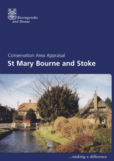
Conservation Area Appraisal St Mary Bourne and Stoke
Conservation Area Appraisal St Mary Bourne and Stoke
Conservation Area Appraisal St Mary Bourne and Stoke

Create successful ePaper yourself
Turn your PDF publications into a flip-book with our unique Google optimized e-Paper software.
<strong>Conservation</strong> <strong>Area</strong> <strong>Appraisal</strong><strong>Conservation</strong> <strong>Area</strong> <strong>Appraisal</strong><strong>St</strong> <strong>Mary</strong> <strong>Bourne</strong> <strong>and</strong> <strong>St</strong>oke…making <strong>St</strong> <strong>Mary</strong> <strong>Bourne</strong> a difference <strong>and</strong> <strong>St</strong>oke
<strong>Conservation</strong> <strong>Area</strong> <strong>Appraisal</strong>IntroductionThe <strong>St</strong> <strong>Mary</strong> <strong>Bourne</strong> <strong>and</strong> <strong>St</strong>oke <strong>Conservation</strong> <strong>Area</strong> was designated in1985 by Basingstoke <strong>and</strong> Deane Borough Council in recognition of thespecial architectural <strong>and</strong> historic interest of the area.Having designated the <strong>Conservation</strong> <strong>Area</strong>, the Local Authority has astatutory duty to ensure that those elements that form its particularcharacter or appearance should be preserved or enhanced, especiallywhen considering planning applications.View over the river valleyfrom Ricket’s Way CottageIt is therefore necessary to define <strong>and</strong> analyse those qualities or elementsthat contribute to, or detract from, the special interest of the area <strong>and</strong>to assess how they combine to justify its designation as a <strong>Conservation</strong><strong>Area</strong>. Such factors can include:• its historic development;• the contribution of individual or groups of buildings to thestreetscene <strong>and</strong> the spaces that surround them; <strong>and</strong>• the relationship of the built environment with the l<strong>and</strong>scape.The Old Plough <strong>and</strong> <strong>Bourne</strong>by the squareThey can also include the less tangible senses <strong>and</strong> experiences, suchas noise or smells, which can play a key part in forming the distinctivecharacter of an area.The <strong>Appraisal</strong> takes the form of written text <strong>and</strong> an <strong>Appraisal</strong> plan. Inboth respects every effort has been made to include or analyse thoseelements key to the special character of the area. Where buildings,structures or features have not been specifically highlighted it doesnot necessarily follow that they are of no visual or historic value to the<strong>Conservation</strong> <strong>Area</strong>. The document is intended to be an overall framework<strong>and</strong> guide within which decisions can be made on a site-specific basis.This <strong>Appraisal</strong> of the <strong>St</strong> <strong>Mary</strong> <strong>Bourne</strong> <strong>and</strong> <strong>St</strong>oke <strong>Conservation</strong> <strong>Area</strong>follows its review in 2003 by Basingstoke <strong>and</strong> Deane Borough Council<strong>and</strong> explains what its designation means for those who live <strong>and</strong> work inthe area.This document was adopted as Supplementary Planning Guidance by theBorough of Basingstoke <strong>and</strong> Deane on 17 July 2003 <strong>and</strong> complementsthe policies of the Borough Local Plan (review).It has been subject to consultation with Councillors, the Parish Council<strong>and</strong> local amenity groups. A full list of consultees, copies of theirresponses, <strong>and</strong> details of the Council’s consideration of the issuesraised during the consultation period are available for inspection, byappointment, at the Civic Offices, during normal office hours.2<strong>St</strong> <strong>Mary</strong> <strong>Bourne</strong> <strong>and</strong> <strong>St</strong>oke
<strong>Conservation</strong> <strong>Area</strong> <strong>Appraisal</strong>Location <strong>and</strong> Population<strong>St</strong> <strong>Mary</strong> <strong>Bourne</strong> <strong>and</strong> <strong>St</strong>oke are situated about 4 miles north-west ofWhitchurch within the North Wessex <strong>Area</strong> of Outst<strong>and</strong>ing NationalBeauty. The villages are located within a valley at the north-western endof the <strong>Bourne</strong>, which is a tributary of the River Test. The <strong>Conservation</strong><strong>Area</strong> covers the two villages <strong>and</strong> the area of about one mile betweenthem, including the small hamlet of Swampton.The population of the <strong>St</strong> <strong>Mary</strong> <strong>Bourne</strong> <strong>and</strong> <strong>St</strong>oke <strong>Conservation</strong> <strong>Area</strong> in1998 was approximately 922 (projection based on the Hampshire CountyCouncil Planning Department Small <strong>Area</strong> Population Forecasts 1995).<strong>St</strong>oke House from the westHistoric DevelopmentSettlement OriginsAt the time of the Domesday Survey, the manors of <strong>St</strong> <strong>Mary</strong> <strong>Bourne</strong><strong>and</strong> <strong>St</strong>oke belonged to Hurstbourne Priors, along with the manors ofBinley, Egbury <strong>and</strong> Weeke. In 1565, Sir Robert Oxenbridge, owner ofHustbourne Priors, was ordered to prove by what title he held the fivemanors. A law suit began to determine whether they were manorsin their own right. They were judged to have always been hamlets ofHurstbourne Priors, <strong>and</strong> Sir Richard obtained recognition of his title tothem.<strong>St</strong>oke House <strong>and</strong> Manor FarmhouseQueen Elizabeth I is said to have taken tea at Valley Farm in <strong>St</strong>oke on aspringtime outing.<strong>St</strong> Peter’s Church dates from around 1157. The font a very rare blackmarble font, which is at least 800 years old was brought from Tournai inBelgium <strong>and</strong> is one of only four in Hampshire (<strong>and</strong> considered the finestin the country). An effigy of a crusader knight, recessed in the southwall of the church, may be one of the Oxenbridge family.Settlement DevelopmentThe prevailing former use of the whole <strong>Conservation</strong> <strong>Area</strong> appears tohave been agricultural, with evidence of several of the older farms stillsurviving. For example, Butler’s Farmhouse <strong>and</strong> Manor Farmhouse datefrom the 16th century whilst Berrydown Farmhouse dates from circa1500 <strong>and</strong> 1600. Other buildings retain the name ‘Farm’, examples beingValley Farmhouse, <strong>and</strong> Summerbee Farmhouse. The extensive watercressbeds to the south-east of the village are still an important local business.Other uses reflect the settlement’s development at crossing points overthe river, as for example the concentration of former inns <strong>and</strong> a malthouse around the square in <strong>St</strong> <strong>Mary</strong> <strong>Bourne</strong>.The Church of <strong>St</strong> Peter <strong>and</strong> <strong>St</strong> Peter’sCottage<strong>St</strong> <strong>Mary</strong> <strong>Bourne</strong> <strong>and</strong> <strong>St</strong>oke 3
<strong>Conservation</strong> <strong>Area</strong> <strong>Appraisal</strong><strong>St</strong> <strong>Mary</strong> <strong>Bourne</strong><strong>Bourne</strong> Cottage <strong>and</strong> Swampton House,High <strong>St</strong>reetThe first settlement in <strong>St</strong> <strong>Mary</strong> <strong>Bourne</strong> may have developed in thevicinity of the church as the line of the Portway Roman Road crossesthe <strong>Bourne</strong> Rivulet close by. The settlement has since developed in anirregular linear pattern following the route of the B3048, which windsalong the bottom of the valley. The placement of buildings within thevillage was determined by access to the water table by using a lift pump,which worked only to a depth of thirty-two feet. The historic buildingsare generally irregularly placed in small groupings along this route oneither side of the road <strong>and</strong> the <strong>Bourne</strong> Rivulet. The possible exception tothis pattern is one, apparently planned, ‘regular’ row of buildings in thevicinity of, <strong>and</strong> including, the church. Where development has occurred ithas been as infill within the village. The exception is the area of modernsettlement to the north-east, ascending the valley side.SwamptonWindmill Farmhouse, <strong>St</strong>okeThe hamlet of Swampton, situated at the north-west end of <strong>St</strong> <strong>Mary</strong><strong>Bourne</strong>, is an irregular row of buildings. The Coronation Arms publichouse now st<strong>and</strong>s on the site that was formerly the bakery. At thebeginning of the 20th century, the bakery caught fire. The fire spreaddown the street to the south-east, consuming the adjacent thatchedcottages. Denham Terrace was built to replace these buildings.<strong>St</strong>okeThe village of <strong>St</strong>oke has two foci of development. The first is thecrossroads <strong>and</strong> bridge over the <strong>Bourne</strong> in the centre of the village; thesecond lies around the 16th century Manor Farmhouse. The two focihave now effectively joined along the lane running to the north-eastfollowing 19th <strong>and</strong> 20th century infill development.Between <strong>St</strong> <strong>Mary</strong> <strong>Bourne</strong> <strong>and</strong> <strong>St</strong>oke, irregular development has takenplace, the pattern of which is closely aligned to the routes of the tworoads which run along the river valley.An <strong>Appraisal</strong> of the <strong>Conservation</strong> <strong>Area</strong>An OverviewThe <strong>Appraisal</strong> plan identifies those buildings, views, <strong>and</strong> key featuresconsidered essential to the special character or appearance of the<strong>Conservation</strong> <strong>Area</strong>. In addition to listed buildings, it also includes unlistedbuildings of particular individual or group value, which are indicatedon the plan as notable. This is not to undermine the value of other,unmarked, buildings or structures that reflect the historic development ofthe village without detracting from its special qualities.4<strong>St</strong> <strong>Mary</strong> <strong>Bourne</strong> <strong>and</strong> <strong>St</strong>oke
<strong>Conservation</strong> <strong>Area</strong> <strong>Appraisal</strong>Individual hedgerows have not been included on the <strong>Appraisal</strong> plan.However, their contribution to the character of the <strong>Conservation</strong> <strong>Area</strong>should not be underestimated <strong>and</strong> their significance is implicit in the<strong>Appraisal</strong>.This <strong>Appraisal</strong> has divided the <strong>Conservation</strong> <strong>Area</strong> into the five areas thatcharacterise its unique qualities: the three areas of settlement (<strong>St</strong> <strong>Mary</strong><strong>Bourne</strong>, Swampton, <strong>and</strong> <strong>St</strong>oke); the river valley, which forms the mostsoutherly part of the <strong>Conservation</strong> <strong>Area</strong>; <strong>and</strong> the middle section, lyingbetween Swampton <strong>and</strong> <strong>St</strong>oke.<strong>Area</strong> 1: <strong>St</strong> <strong>Mary</strong> <strong>Bourne</strong>The special appearance of this sub-area is derived from the combinationof the gently curving linear development of buildings along the levelriver valley floor, <strong>and</strong> a varied mix of properties - the front buildinglines of these properties are generally tight to the back edge of thepavement. They form distinctive groups interspersed with key spaces.This combination creates a continually changing <strong>and</strong> varied streetscenebeyond each curve in the road.Although the village comprises many individual buildings of intrinsicarchitectural or historic interest, the appearance of the <strong>Conservation</strong> <strong>Area</strong>has a cohesive quality. This is due to the similarity in scale, form, <strong>and</strong>vernacular building traditions, particular to this part of Hampshire, <strong>and</strong>notably the contribution made by thatched roofs.Church Cottage, Church <strong>St</strong>reetSpring Cottage <strong>and</strong> riverside settingPredominantly residential in character, <strong>St</strong> <strong>Mary</strong> <strong>Bourne</strong> still retains a semiruralquality given its narrow plan form. The immediate presence of thesurrounding l<strong>and</strong>scape being evident in glimpses between or behind thebuildings. The interwoven nature of the river through the settlement isalso a distinctive <strong>and</strong> defining characteristic of the village.<strong>Area</strong> 2: Swampton <strong>and</strong> environsThe special appearance of this sub-area is derived from the distinctivespatial arrangement of the <strong>Bourne</strong> Rivulet <strong>and</strong> its environs. It hasmeadows to the east <strong>and</strong> a linear development of historic buildingsalong the B3048 to the west. The loose grain of the settlement iscomplemented by the pastoral qualities of the natural environment,giving a semi-rural character.The Round House<strong>Area</strong> 3: <strong>St</strong>oke<strong>St</strong>oke has a varied mix of building types <strong>and</strong> ages, loosely clusteredaround, <strong>and</strong> between, two road junctions. The special historic <strong>and</strong> visualinterest of this sub-area is derived from this historic development pattern<strong>and</strong> the contribution of a few key buildings.Butlers Farm<strong>St</strong> <strong>Mary</strong> <strong>Bourne</strong> <strong>and</strong> <strong>St</strong>oke 5
<strong>Conservation</strong> <strong>Area</strong> <strong>Appraisal</strong>The special appearance of <strong>St</strong>oke is also inherently related to its opencountryside setting <strong>and</strong> river valley topography. In addition, there arelong range views of the buildings across the valley as seen from thenorth <strong>and</strong> south of the village. The penetrating l<strong>and</strong>scape views betweenbuildings, reinforces the traditional rural character.<strong>Area</strong> 4: <strong>Area</strong> between <strong>St</strong>oke <strong>and</strong> SwamptonOrchard Cottage from <strong>Bourne</strong> Valley InnThe special interest of this sub-area is based on the divergence of tworoads either side of the river valley, <strong>and</strong> the sporadic arrangement ofsmall clusters of buildings here. This arrangement creates intimate shortrange views of the buildings along the verdant hedge-lined roads. Thebuildings also act as focal points for strategic long-range views acrossthe low lying pasture. The character strongly reflects the traditional ruralqualities <strong>and</strong> minimal development of this area.<strong>Area</strong> 5: <strong>Area</strong> to the south of <strong>St</strong> <strong>Mary</strong> <strong>Bourne</strong>The special interest of this area is based on the long-range views to afew isolated groups of buildings, which punctuate the otherwise flat <strong>and</strong>uninterrupted flood plain of the river valley. The character is based onthe farmed or natural appearance of the l<strong>and</strong>scape, that dominates thebuildings.Summerhaugh Cottage<strong>St</strong> Peter’s CottageBuilt FormThere are 64 buildings in the <strong>St</strong> <strong>Mary</strong> <strong>Bourne</strong> <strong>and</strong> <strong>St</strong>oke <strong>Conservation</strong><strong>Area</strong> included in the <strong>St</strong>atutory List of Buildings of Special Architecturalor Historic Interest. <strong>St</strong> Peter’s Church is listed as being of outst<strong>and</strong>ingnational importance (Grade I). The others are listed as being of nationalor regional interest (Grade II).There are a variety of building types, mainly dating from the 17th <strong>and</strong>18th centuries dispersed throughout the settlements. Often locatedat key visual points within the streetscene, they make a significantcontribution to the special qualities of the <strong>Conservation</strong> <strong>Area</strong>. There areseveral buildings containing elements of structures dating back to circa1500. The Cottage, Hansdale <strong>and</strong> Langley in the High <strong>St</strong>reet date fromthe 14th century, <strong>and</strong> Mundays from the 16th century.Some of the older listed buildings have been altered over successiveperiods to accommodate changes in their use or contemporaryarchitectural fashions. The re-fronting in brick of existing timber-framedbuildings produce a polite elevation. They were particularly common inthe 18th century. Examples of this practice include the Post Office onHigh <strong>St</strong>reet, <strong>and</strong> Summerhaugh Cottage on The Square, both of whichhave early 19th century symmetrical façades to 17th century timberframes.<strong>St</strong> <strong>Mary</strong> <strong>Bourne</strong>, Swampton <strong>and</strong> <strong>St</strong>oke are, however, notable for thenumber of listed buildings that have retained more completely theirvernacular form <strong>and</strong> materials. <strong>St</strong> Peter’s Cottage in Church <strong>St</strong>reet dates6<strong>St</strong> <strong>Mary</strong> <strong>Bourne</strong> <strong>and</strong> <strong>St</strong>oke
<strong>Conservation</strong> <strong>Area</strong> <strong>Appraisal</strong>from the 17th century <strong>and</strong> is a good example of a building representativeof the <strong>Conservation</strong> <strong>Area</strong>. It has one-storey <strong>and</strong> attic, <strong>and</strong> exposedtimber-frame with later brick infill, a hipped thatched roof <strong>and</strong> anirregular arrangement of casement windows. Yew Tree Cottage in <strong>St</strong>okeis another such example. Dating from the 18th century it characteristicallyutilises the vernacular building materials of flint, brickwork <strong>and</strong> thatch.There are also a number of unlisted buildings that contribute positivelyto the special character of the <strong>Conservation</strong> <strong>Area</strong>. These date mainlyfrom the 19th <strong>and</strong> early 20th centuries, <strong>and</strong> are scattered aroundthe settlements representing their expansion. They are predominantlyconstructed of vernacular materials <strong>and</strong> reinforce the local road pattern.Church of <strong>St</strong> PeterHistoric buildings of particular individual or group value are indicatedas notable on the <strong>Appraisal</strong> plan. This should not undermine the valueof other unmarked buildings or structures that reflect the historicdevelopment of the village without detracting from its special qualities.Key Individual <strong>and</strong> Significant Groups ofBuildings<strong>Area</strong> 1: <strong>St</strong> <strong>Mary</strong> <strong>Bourne</strong><strong>St</strong> Peter’s Church is both the historic <strong>and</strong> physical focus of the settlementof <strong>St</strong> <strong>Mary</strong> <strong>Bourne</strong>.The church dates from 1157, although its present form <strong>and</strong> appearanceis a product of many periods of addition <strong>and</strong> alteration. This includes achancel of circa 1300 (restored 1855), <strong>and</strong> a 16th century parapet tothe plain tower. The external walls are of flint with stone dressings. Asteep 19th century red clay tile roof over the chancel contrasts with alower pitched lead roof over the aisles <strong>and</strong> nave. The scale <strong>and</strong> formof the building is best appreciated from the immediate setting of thechurchyard. However the tower is an extremely prominent streetscapeelement, punctuating views northwards <strong>and</strong> southwards along Church<strong>St</strong>reet. Given both the domestic scale <strong>and</strong> level topography of thevillage, the tower is also a l<strong>and</strong>mark feature in many longer views acrossthe settlement (for example, from the recreation ground to the northwest,or from the <strong>Bourne</strong> Valley Inn to the south-east).Springhill LodgeCurvilinear elevations of The Cottage,Hansdale <strong>and</strong> LangleyThe most notable areas of historic streetscape in <strong>St</strong> <strong>Mary</strong> <strong>Bourne</strong> looselyfall into three sections running in a north/south sequence. These are thebuildings forming High <strong>St</strong>reet, those clustered around The Square, <strong>and</strong>those along Church <strong>St</strong>reet.<strong>St</strong> <strong>Mary</strong> <strong>Bourne</strong> <strong>and</strong> <strong>St</strong>oke 7
<strong>Conservation</strong> <strong>Area</strong> <strong>Appraisal</strong>High <strong>St</strong>reetHoldway CottagesSummerhaugh CottageThe George InnSpringhill Lodge (Grade II) defines the start of this grouping along theeastern side of the road. Dating from the 19th century, it has featuressuch as the half-hexagonal east side <strong>and</strong> ver<strong>and</strong>ah. The distinctiveappearance reinforces its prominent position at the change in characterof the High <strong>St</strong>reet to the north. Opposite Springhill Lodge is a small openarea containing the War Memorial. Immediately beyond are the L-shapedelevations of Wayfarers Cottage <strong>and</strong> Dipl<strong>and</strong>s Cottage (Grade II). Thesymmetrical south-east elevation acts as a focal point, arresting the longviews north-eastwards along the High <strong>St</strong>reet. This again marks a changein the character of the <strong>Conservation</strong> <strong>Area</strong> to the north.Further to the south is a varied group of listed buildings, forming astaggered pattern that defines the curve in the road. The variety ofbuilding types, materials <strong>and</strong> ages make this progression of viewsmore pronounced. They are of significant value to the special interestof the <strong>Conservation</strong> <strong>Area</strong>. Crow Cottage (formerly Hillview Cottage),The Cottage, Hansdale <strong>and</strong> Langley are notable in the group. CrowCottage dates from the 18th century with its sweeping thatchedcatslide roofslope to the rear (north-west) <strong>and</strong> a distinctive front <strong>and</strong>hip end elevation of exposed timber-frame with brick infill in part, innarrow horizontal b<strong>and</strong>s with flint. The Cottage, Hansdale <strong>and</strong> Langleyform a long, low range of cottages, dating from the 15th, 17th <strong>and</strong>18th centuries. The continuous sweep of the uninterrupted thatchedroofslopes around the curving street pattern is a significant <strong>and</strong> specialfeature of the streetscape, particularly when viewed from the north. Alsoof note are the range of 18th <strong>and</strong> 19th century outbuildings adjacentto the Post Office, running perpendicular to the road. This range setapart from the others <strong>and</strong> projecting forward, punctuates the long viewsouthwards along the High <strong>St</strong>reet. Adjacent are Holdway Cottages,alms houses constructed in 1862. The flint <strong>and</strong> red brick elevations,with gables at each side, help create a strong spatial qualities of thelower High <strong>St</strong>reet <strong>and</strong> The Square, enclosing the view north-eastwards.Positioned at an angle to the roadside, they allude to the next group ofbuildings, to be revealed around the bend.The Lower High <strong>St</strong>reet <strong>and</strong> The SquareThe essence of this area are the two linked spaces created at the crossingpoint of the river <strong>and</strong> the meeting point of three roads. These spaces aredefined by a number of key individual buildings. The sequence of spacesforms a pivotal focus to the village, <strong>and</strong> is of significant streetscape merit.Fourways <strong>and</strong> Church <strong>St</strong>reetThe smaller space is the southerly end of the High <strong>St</strong>reet. It is enclosedby The Old Plough to the west, the adjacent ancillary building to theVicarage; Holdway Cottages to the north; the curved walls of theoutbuildings to Summerhaugh Cottage; <strong>and</strong> the red brick walls of thebridge to the south-east, where the space blends into The Square <strong>and</strong>8<strong>St</strong> <strong>Mary</strong> <strong>Bourne</strong> <strong>and</strong> <strong>St</strong>oke
<strong>Conservation</strong> <strong>Area</strong> <strong>Appraisal</strong>the river forms a key element of the streetscape as it crosses from thewest to the eastern side of the settlement. A distinctive feature of thisspace is the long, low elevations of The Old Plough <strong>and</strong> the rangeopposite. The Old Plough, formerly an inn, dates from 17th <strong>and</strong> 18thcentury. Although only of one-storey <strong>and</strong> attic, the significant lengthof the building is emphasised by its steeply pitched, long thatched roofslopes, <strong>and</strong> simple elevational treatment. Of intrinsic architectural merit,its location at the river crossing, <strong>and</strong> its dominance of views through thespace, makes it a key building in the <strong>Conservation</strong> <strong>Area</strong>. Opposite arethe curving walls of the buildings situated to the west of SummerhaughCottage. Defining the river’s edge, the prominent chimney stacks <strong>and</strong>decorative flint <strong>and</strong> brick walling provide a simple but strong sense ofenclosure to the space, <strong>and</strong> focus attention on the river. The chimneystacks <strong>and</strong> their tall pots are also interesting features in views northwardsfrom The Square.Church <strong>St</strong>reetThe Square is defined by Summerhaugh Cottage (17th <strong>and</strong> 19thcenturies), The George Inn (18th <strong>and</strong> early 19th centuries) <strong>and</strong> Fourways<strong>and</strong> Fourways Cottage (18th century). These listed buildings aredominant in scale <strong>and</strong> have a more formal, ordered appearance thanthe surrounding vernacular cottages. Fourways <strong>and</strong> Fourways Cottagehave symmetrical fronts, with large sash windows. The walling hassquare knapped flint panels, with brick dentil eaves <strong>and</strong> brick rubbedflat arches. The north elevation is also particularly prominent in viewswestwards along Egbury Road, combining with the flank elevation <strong>and</strong>rear gable end of The George, to provide a focused approach into theThe Square. The front elevation of The George Inn has high qualityred brick walling in Flemish bond with blue headers. Although lessformal in nature than the others, the original timber-framed structureto Summerhaugh Cottage was refronted in brickwork (now painted) inthe 19th century <strong>and</strong> the windows symmetrically placed. However, thesteeply pitched, sweeping thatched roof to eyebrow dormers is the mostdistinctive feature. The Cottage is of key significance to the streetscape,terminating the long intricate views northwards along Church <strong>St</strong>reet. Thestrong sense of individuality of each of the these buildings is reinforcedby their separation from adjacent buildings by roads on each of theirprincipal <strong>and</strong> flank elevations. The view south-westwards down Church<strong>St</strong>reet from the crossroads is punctuated by the crenelated upper sectionof the church tower. This rises above the roof slopes, suggesting furthervisual <strong>and</strong> historic interest to the south. The village stocks <strong>and</strong> whippingpost were originally positioned on the grass in front of SummerhaughCottage.Church CottageChurch <strong>St</strong>reetThe intimate winding characteristic of <strong>St</strong> <strong>Mary</strong> <strong>Bourne</strong> is accentuatedalong Church <strong>St</strong>reet, with buildings tightly grouped along the narrowroadside. This tight grain, <strong>and</strong> the enclosed, short range views, give<strong>St</strong> <strong>Mary</strong> <strong>Bourne</strong> <strong>and</strong> <strong>St</strong>oke 9
<strong>Conservation</strong> <strong>Area</strong> <strong>Appraisal</strong>cohesion to the varied mix of building types <strong>and</strong> materials. It produces astreetscene of outst<strong>and</strong>ing historic <strong>and</strong> visual interest.Swampton House, High <strong>St</strong>reetThe ForgeSwampton House <strong>and</strong> WurrageThis quality is especially evident in the group of buildings to the southof the church. These are all Grade II listed <strong>and</strong> include The Malt House(early 19th century), Little Thatch (18th century), Pioneer House (early19th century), Flower Pot <strong>and</strong> Queen Anne Cottage (18th century), onthe eastern side <strong>and</strong> on the western side - Oak Beams (17th <strong>and</strong> 18thcenturies) April Cottage (18th century), Eyles Cottage (early to mid19th century), <strong>and</strong> The Nest. Situated on the apex of the bend, AprilCottage <strong>and</strong> Eyles Cottage are focal points, enclosing the views alongthe streetscene from the north <strong>and</strong> south. Also of intrinsic architecturalinterest is Oak Beams. It has a long sweeping catslide roofslope overthe outshot rising to the two-storey thatched slopes <strong>and</strong> timber-framedelevations of the main building. It is of particular prominence at thebeginning of the western grouping with glimpsed views westwards tothe open countryside.In the vicinity of the <strong>St</strong> Peter’s Church are three cottages that, in additionto their individual historic <strong>and</strong> architectural interest, are importantin defining the context <strong>and</strong> historic setting to the church. <strong>St</strong> Peter’sCottage <strong>and</strong> Gable Cottage have elevations running parallel to thechurchyard boundary, unusually perpendicular to the street pattern. <strong>St</strong>Peter’s Cottage dates from the 17th century. The half-hipped gableto the thatched roof abuts the roadside, whilst the two main timberframedelevations project forward of the adjacent buildings, (includingthe church tower). This makes it very prominent in views along Church<strong>St</strong>reet. Although set further back from the road, Gable Cottage withits progression of thatched roof slopes of varying heights, contributessignificantly to the appearance of the churchyard as an intimate <strong>and</strong>historic space. Opposite the Church is Church Cottage. This parttimber-framed building of one-storey <strong>and</strong> attic dates from the17th <strong>and</strong>18th centuries. The long thatched roof slope is of particular note, onlypunctuated by two eyebrow dormers <strong>and</strong> brick chimney stacks at ridgeheight. Set slightly apart from adjacent buildings, it deflects the viewssouthwards along Church <strong>St</strong>reet, <strong>and</strong> dominates views westwards acrossthe churchyard, visually enclosing the space.<strong>Area</strong> 2: Swampton <strong>and</strong> EnvironsBetween Springhill Lodge <strong>and</strong> Ricket’s Way, situated at the fork of theB3048 <strong>and</strong> Gangbridge Lane, is a linear group of buildings, one plotdeep. The group is situated mainly along the west of the High <strong>St</strong>reet<strong>and</strong> river course. The inter-relationship of built <strong>and</strong> natural environmentis a key element of the special character of this part of the <strong>Conservation</strong><strong>Area</strong>. A notable example is the section around, <strong>and</strong> including Lowick,Spring House, Spring Cottage, The Forge, Homefield, Chapel Cottage,Wurrage, <strong>and</strong> Swampton House. The comparatively straight length ofroad gives significant axial views north-west <strong>and</strong> south-eastwards of10<strong>St</strong> <strong>Mary</strong> <strong>Bourne</strong> <strong>and</strong> <strong>St</strong>oke
<strong>Conservation</strong> <strong>Area</strong> <strong>Appraisal</strong>these cottages in their immediate riverside setting. Longer range viewswestwards of the l<strong>and</strong>scape punctuate the streetscape between thebuildings. Spring House, Spring Cottage, <strong>and</strong> The Forge all date fromthe 17th century with later additions, <strong>and</strong> are of timber-frame <strong>and</strong> brickconstruction. All have large hipped or half-hipped thatched roofs. Theseare both individual <strong>and</strong> of streetscape merit as a group, especially whenframed by the mature vegetation in views across the river from the northeast.Spring Cottage is the most prominent of the buildings in generalviews along the High <strong>St</strong>reet. The associated outbuildings to The Forge arean integral part of the historic development <strong>and</strong> semi-rural character ofthe settlement.One of the most prominent buildings is Swampton House. It is situatedat right angles to the High <strong>St</strong>reet <strong>and</strong> diverts the <strong>Bourne</strong> Rivulet to itseastern side. Dating from the early 18th century, the red brickwork <strong>and</strong>dominant clay tile roof slopes terminate the long views north-west <strong>and</strong>,together with the flank elevation of Chapel Cottages, punctuate viewsto the south-east, forming an important visual pinch point before viewsopen out to the south. Adjacent to Swampton House is Wurrage, asingle-storey cottage with thatched roof slopes, mainly constructed of redbrickwork with some exposed timber-framing in the gables. The southerngable defines the extent of the area of open l<strong>and</strong>scape to the south,whilst its riverside setting, in conjunction with Swampton House, is ofsignificant historic <strong>and</strong> visual interest.Old School Cottages, <strong>and</strong> theMethodist Church Hall, Ricket’s Way<strong>St</strong>okeTo the north-west of Swampton House is an eclectic group of buildingsreflecting the historic development of the village. These include <strong>Bourne</strong>House (Grade II), <strong>St</strong> <strong>Mary</strong> <strong>Bourne</strong> County Primary School (built in 1860as a National School providing elementary education), <strong>and</strong> Haven Hill, adetached 19th century villa overlooking the village.Ricket’s Way, Old School Cottage <strong>and</strong> the Methodist Church Hall presenta staggered progression of elevations defining the point where theB3048 <strong>and</strong> Gangbridge Lane meet. The combination of historic buildingtypes, materials, <strong>and</strong> their arrangement at this prominent node makethem a l<strong>and</strong>mark grouping.White Hart CottageTo the east of the main area of settlement is a small group of largehouses along Spring Hill Lane. These form prominent focal points in longrangeviews eastwards from the High <strong>St</strong>reet across the river valley.<strong>Area</strong> 3: <strong>St</strong>okeSituated on the north-eastern periphery of the main area of settlementis <strong>St</strong>oke House. It is a substantial three-storey red brick building in cubeform, with a low pitched slate roof dating from the early 19th century.The symmetrical south front <strong>and</strong> western flank elevations are significantl<strong>and</strong>mark features in long range views across the pasture l<strong>and</strong> <strong>and</strong> rivervalley to the south. The building forms an intimate grouping with itsassociated stable block <strong>and</strong> neighbouring Manor Farmhouse. They are<strong>St</strong> <strong>Mary</strong> <strong>Bourne</strong> <strong>and</strong> <strong>St</strong>oke 11
<strong>Conservation</strong> <strong>Area</strong> <strong>Appraisal</strong>drawn together by the mature trees <strong>and</strong> established hedgerows of thelane.View of <strong>St</strong>oke fromnorth of the villageValley FarmhouseBridge CottageButlers FarmManor Farmhouse (Grade II), is a key building in the historic developmentof the settlement. Dating from the 16th, 17th, 18th <strong>and</strong> 20th centuries,the core of the building is a later medieval timber-framed hall. Theunobtrusive appearance of the building in the streetscene belies itshistoric <strong>and</strong> architectural significance in the <strong>Conservation</strong> <strong>Area</strong>. WindmillFarmhouse lies to the north-east of this group, <strong>and</strong> is situated on higherground at the junction of the two lanes. This 18th <strong>and</strong> early 19th centuryL-shaped brick building dominates the road junction <strong>and</strong>, in associationwith the adjacent farm buildings, reinforce the rural traditions of the<strong>Conservation</strong> <strong>Area</strong>.To the south-west of Windmill Farmhouse is an irregular mix of buildings<strong>and</strong> structures. These form an important linear pattern of development,linking the two historic nodes of the settlement. Of particular note is theoctagonal thatched building, formerly the Lodge to <strong>St</strong>oke House, but isnow known as Round House (The remains of the long drive can still betraced by the side of the house). This building, <strong>and</strong> the thatched cobwalls immediately to the west, make a picturesque contribution to thecharacter of the <strong>Conservation</strong> <strong>Area</strong>, particularly when viewed from theeast with the rising valley sides as a backdrop.Kembak, Winterbourne Cottage (Grade II), <strong>St</strong>able House, <strong>and</strong> the mainhouse <strong>and</strong> associated outbuildings of Valley Farm form an importantgroup of buildings on the northern side of the lane. The assortment ofroof slopes, <strong>and</strong> the range of buildings running perpendicular to theroad, provide a strongly rural <strong>and</strong> informal character to the <strong>Conservation</strong><strong>Area</strong> when viewed as a group across the fields from the north. Althoughunlisted, Valley Farm is a substantial building, that contributes to thevisual interest of the lane. The steeply pitched red clay tile roofs, <strong>and</strong> tallchimney stacks of the two principle ranges, are the most visible elementabove the front boundary wall <strong>and</strong> pleached line of trees.White Hart Cottage <strong>and</strong> Fourhomes are at the south-west end of thelane. These unlisted buildings are of artisan character <strong>and</strong> reflect thephases of historic development of settlement along the lane. In addition,they have strong group value with Valley Farmhouse <strong>and</strong> the cobthatched walls to their east.The main core of <strong>St</strong>oke is formed around the meeting of the B3408, <strong>and</strong>the lane that runs to the east. This is bisected by the <strong>Bourne</strong> Rivulet toform a small triangular focus to the development. The settlement patternis of a loose collection <strong>and</strong> mixture of buildings radiating away from thisfocus.12<strong>St</strong> <strong>Mary</strong> <strong>Bourne</strong> <strong>and</strong> <strong>St</strong>oke
<strong>Conservation</strong> <strong>Area</strong> <strong>Appraisal</strong>Bridge Cottage, Riverside Cottages, <strong>and</strong> Yew Tree Cottage, are ofparticular note <strong>and</strong> are all Grade II listed. Bridge Cottage, <strong>and</strong> RiversideCottages date from the 17th century with later alterations. They aretimber-framed buildings with brick infill <strong>and</strong> thatched roofs. Yew TreeCottage dates from the 18th century, with flint <strong>and</strong> brick walling <strong>and</strong> athatched roof. Set back from the roadside in well spaced plots, theseare prominent buildings which form a distinctive group. Together theydefine the historic <strong>and</strong> communal focus for this part of the village aroundthe river crossing. Reinforcing this focus to the east <strong>and</strong> south-eastof Riverside Cottages are The White House (Grade II), <strong>and</strong> The WhiteHart Public House (unlisted). The former dates from the 17th <strong>and</strong> 18thcenturies. The single-storey extension was also formerly a public house.To the west of this main grouping is Chapel Cottage, a narrow singlestoreybuilding. It has a steep thatched roof, the gable ends of whichpunctuate views along Chapel Lane. Other buildings reinforcing thehistoric appearance <strong>and</strong> character of the village are: The Old Farmhouse<strong>and</strong> outbuilding on Drove Side, The Cottage, The Old Post Office,Roadside, The Hall, <strong>and</strong> Brookl<strong>and</strong>s along the B3048.Little Thatch <strong>and</strong> Myrtle Cottage<strong>Area</strong> 4: <strong>Area</strong> between <strong>St</strong>oke <strong>and</strong> SwamptonThere are several buildings of individual note situated along GangbridgeLane. They are mainly found in groups of two or three to the northeasternside of the road, <strong>and</strong> mostly date from the 17th century. ButlersFarmhouse dates from the 16th, 18th <strong>and</strong> early 19th centuries. Ithas an exposed timber-frame with red brick nogging <strong>and</strong> half hippedthatch roof with catslide to the rear. The visually dominant roof slopesare punctuated by a massive chimney stack. Immediately to the west,forming an L-shaped yard in front of the farmhouse, are an 18th centurytimber-framed barn <strong>and</strong> granary. The barn is in two parts, each withthree bays, <strong>and</strong> a hipped thatch roof. The granary is on nine staddlestones with a hipped thatched roof, sweeping down to lower eaveson the east side. A brick wall encloses the south-eastern side to thecomplex. The completeness of this historic farmyard grouping (all GradeII listed), in addition to their intimate arrangement, is of inherent historic<strong>and</strong> architectural value. Particularly notable are views into the courtyardfrom the south-east along Gangbridge Lane, <strong>and</strong> of the farm complex inits wider l<strong>and</strong>scape setting from the B3048 to the north-west.Squirrel Cottage <strong>and</strong> Yew Trees date from the 17th century. Both havepartly exposed timber-frames with painted or rendered brick workinfill. However, it is their thatched roof slopes which are noticeable,punctuating views over the verdant hedgerows of the lane. The thatchedroofslopes <strong>and</strong> part timber-framed elevations of Myrtle Cottage <strong>and</strong> LittleThatch (formerly Gangbridge Cottage) make a similar contribution tothis peaceful rural setting. The long low south-eastern elevation of LittleThatch is situated at right angles onto the roadside as it bends aroundthe building. This makes the thatched roof a very prominent focus alongGangbridge HouseHilliers Lodge <strong>and</strong> April Cottagefrom Gangbridge Lane<strong>Bourne</strong> House<strong>St</strong> <strong>Mary</strong> <strong>Bourne</strong> <strong>and</strong> <strong>St</strong>oke 13
<strong>Conservation</strong> <strong>Area</strong> <strong>Appraisal</strong>the narrow lane, interrupting views beyond. The effect is enhanced fromthe south-east by the views across the gardens of Myrtle Cottage.Gangbridge House is situated where the B3048 meets GangbridgeLane <strong>and</strong> the <strong>Bourne</strong> Rivulet. It has a polite character which reflects itsprominent visual <strong>and</strong> strategic position. The house mainly dates from theearly 19th century, <strong>and</strong> is of high quality red brickwork with a steep slateroof (under which an earlier thatched roof survives). The most public,south elevation has high quality brickwork detailing around the windowopenings. It has flat arches to the first floor, <strong>and</strong> Dutch arches to theground floor.The <strong>Bourne</strong> RivuletOn the western side of the valley there is sporadic development alongthe B3084, reflecting more modern phases of development. Of these,Hilliers Lodge <strong>and</strong> April Cottage are the most prominent in the widerl<strong>and</strong>scape setting of the <strong>Conservation</strong> <strong>Area</strong>. Situated on the rising slopesof the valley side, Hilliers Lodge is a substantial red brick building datingfrom the 19th century. It is a focal point in long views westwards fromGangbridge Lane across the valley floor.<strong>Area</strong> 5: <strong>Area</strong> to South of <strong>St</strong> <strong>Mary</strong> <strong>Bourne</strong>Open area to the west of theHigh <strong>St</strong>reet <strong>and</strong> The <strong>Bourne</strong>The special appearance of this area is characterised by long views toisolated buildings of simple character rising up from the valley floor.These include Derrydown Farm, South View Terrace, the <strong>Bourne</strong> ValleyInn <strong>and</strong> Orchard Cottage.Derrydown Farm is of particular visual <strong>and</strong> historic interest, dating fromcirca 1500 <strong>and</strong> is a late medieval timber-framed hall of four bays, withinsertion of floors <strong>and</strong> fireplaces (circa 1600) <strong>and</strong> extensions at each endof the 18th <strong>and</strong> 19th centuries. The external appearance has a stronglylinear emphasis, characterised by the extensive uninterrupted roof slopesover single-storey brick <strong>and</strong> timber-frame walls. To the north-west is alate 17th century seven-bay barn with a central wagon entrance. To thenorth, a late 18th century timber-framed cartshed with open frontedaisle.Overlooking the river plain from the foot of the eastern valley side is<strong>Bourne</strong> House. Its form <strong>and</strong> appearance reflects the interest in vernacularbuilding traditions fashionable at the turn of the 20th century. The variedarrangement of roof slopes, plan form <strong>and</strong> architectural detailing createan interesting <strong>and</strong> picturesque focus for views across the <strong>Conservation</strong><strong>Area</strong>. The irregular roofline <strong>and</strong> chimneys are particularly attractivefeatures, enhanced by a mature l<strong>and</strong>scaped setting.14<strong>St</strong> <strong>Mary</strong> <strong>Bourne</strong> <strong>and</strong> <strong>St</strong>oke
<strong>Conservation</strong> <strong>Area</strong> <strong>Appraisal</strong>The Character <strong>and</strong> Importance of Public<strong>and</strong> Private Spaces, Trees, Hedges, <strong>and</strong>Other Natural or Cultivated FeaturesThe single most important feature of the <strong>Conservation</strong> <strong>Area</strong> is the<strong>Bourne</strong> Rivulet <strong>and</strong> its topography. The river course, <strong>and</strong> its unique interrelationshipwith the buildings, <strong>and</strong> the spaces associated with it providesthe essential character of the <strong>Conservation</strong> <strong>Area</strong>. Trees <strong>and</strong> grasses alongthe river bank provide a verdant <strong>and</strong> picturesque setting, also supportingvaried wildlife.Settlement in the area has developed along the me<strong>and</strong>ering course ofthis water around fords, <strong>and</strong> latterly bridges. Where settlement has nottaken place, large open spaces remain between the river <strong>and</strong> the lanesjoining the village <strong>and</strong> hamlets. These low-lying spaces provide extensiveviews throughout the valley. They are a key part of the special interest ofthe <strong>Conservation</strong> <strong>Area</strong>, providing a distinctive pastoral setting to the richsurvival of vernacular buildings. The steeply rising valley slopes, with openagricultural l<strong>and</strong> <strong>and</strong> dense belts of trees, are integral in many views <strong>and</strong>serve to define the area.The recreation ground behind the village shop is a key public space <strong>and</strong>adds to the setting of the <strong>Conservation</strong> <strong>Area</strong>. The adjacent lake alsohas an intrinsic l<strong>and</strong>scape value which adds to the rural character of the<strong>Conservation</strong> <strong>Area</strong>.To the south of Gangbridge House, the large ‘lozenge’ shaped open area,between Gangbridge Lane <strong>and</strong> the B3048, makes a major contributionto the special qualities of the <strong>Conservation</strong> <strong>Area</strong>. The unusual formof the space <strong>and</strong> topography allows extensive <strong>and</strong> varied views of theimmediate river course <strong>and</strong> its environs, of the wider l<strong>and</strong>scape setting ofthe valley, <strong>and</strong> of the interspersed historic buildings such as Butlers Farm.The watermeadows within <strong>and</strong> surrounding the <strong>Conservation</strong> <strong>Area</strong> arealso of l<strong>and</strong>scape significance.Other examples include the field between the <strong>Bourne</strong> Rivulet <strong>and</strong> <strong>St</strong>okeHouse - a parkl<strong>and</strong> area. This provides views across to the village of<strong>St</strong>oke in the north-east. The farml<strong>and</strong> to the north of <strong>St</strong>oke, allows viewssouthwards of the settlement.Views of <strong>St</strong> <strong>Mary</strong> <strong>Bourne</strong> fromthe south-westMature trees <strong>and</strong> grazed pasture to thewest of High <strong>St</strong>reet <strong>and</strong> the <strong>Bourne</strong> RivuletBrick abutments over the rivercrossing at <strong>St</strong>okeThe l<strong>and</strong>scaped area opposite Pound Cottages on the side of the roadfrom Swampton to <strong>St</strong>oke is the site of The Pound, historically used forthe occasional imprisonment of stray cattle.To the north of Swampton Lodge is an area of notable visual interest.Here each of the distinctive characteristics of the <strong>Conservation</strong> <strong>Area</strong>(namely the historic streetscape, the <strong>Bourne</strong> Rivulet <strong>and</strong> its environs, <strong>and</strong>the open pasture <strong>and</strong> parkl<strong>and</strong>) are at their most integrated <strong>and</strong> mutuallyThe <strong>Bourne</strong> Rivulet, one of thepedestrian bridges, Swampton<strong>St</strong> <strong>Mary</strong> <strong>Bourne</strong> <strong>and</strong> <strong>St</strong>oke 15
<strong>Conservation</strong> <strong>Area</strong> <strong>Appraisal</strong>enhancing. The area of open space also serves to reinforce the changein settlement pattern <strong>and</strong> character from the tighter grain of <strong>St</strong> <strong>Mary</strong><strong>Bourne</strong> to the south.To the south-west of the village of <strong>St</strong> <strong>Mary</strong> <strong>Bourne</strong> is a large open areawhich includes the recreation ground <strong>and</strong> a lake beside the <strong>Bourne</strong>Rivulet streams. Extensive farml<strong>and</strong> still remains in this part of the<strong>Conservation</strong> <strong>Area</strong>, retaining its essential rural character <strong>and</strong> appropriatecontext for buildings such as Derrydown Farm. There are also importantviews of <strong>St</strong> <strong>Mary</strong> <strong>Bourne</strong> <strong>and</strong> the church tower across this open area,enabling the appreciation of the settlement in its wider setting.Vernacular building materials includinglong straw thatch at Gable CottageChurch <strong>St</strong>reet, west sideRecreation GroundSmaller cultivated areas are important in defining the grain <strong>and</strong> density ofthe settlements, <strong>and</strong> are an essential part of their differing characteristics.They afford important glimpses between buildings of the immediatel<strong>and</strong>scape beyond. An example is the space between The Round House<strong>and</strong> Windmill Cottages in <strong>St</strong>oke. Some areas are of key streetscapesignificance in providing appropriate settings to, or views of, historicbuildings. The churchyard is one example <strong>and</strong> so is the space, includingthe river, between Swampton House <strong>and</strong> Wurrage.Trees play an extremely important part in the river valley l<strong>and</strong>scape. Theycan be found scattered around the open spaces, in mature clumps on thevalley sides <strong>and</strong> along the banks of the <strong>Bourne</strong> Rivulet (waterside treessuch as alder <strong>and</strong> willow). Some trees are of key streetscape importance,examples include the fir in the garden of Spring Cottage; the line ofpollarded willows along the river opposite; the large ash tree to the rearof Summerhaugh Cottage; <strong>and</strong> the trees in the churchyard, which formsuch an important setting to the church. Roadside hedges can still befound throughout the <strong>Conservation</strong> <strong>Area</strong>, especially along the back lanes.They contribute to the special verdant character of this l<strong>and</strong>scape.The integral contribution of trees, hedges <strong>and</strong> other natural features thatform the uniqueness of this <strong>Conservation</strong> <strong>Area</strong> cannot be over-estimated.The seasonal variations are a continuing source of variety <strong>and</strong> richness.Other Features of Architectural or HistoricInterestView across lakeBrick <strong>and</strong> flint walls define <strong>and</strong> contain several historic curtilages inthe <strong>Conservation</strong> <strong>Area</strong>. Significant examples include the brick <strong>and</strong>flint churchyard walls, the walls associated with Butlers Farm, <strong>and</strong> theextensive chalk cob <strong>and</strong> thatched walls surrounding Thatched Walls in<strong>St</strong>oke. Several other walls <strong>and</strong> railings noted on the <strong>Appraisal</strong> plan greatlycontribute to the texture <strong>and</strong> grain of the area (for example, a chalk cobwall that forms the boundary to the Vicarage).16<strong>St</strong> <strong>Mary</strong> <strong>Bourne</strong> <strong>and</strong> <strong>St</strong>oke
<strong>Conservation</strong> <strong>Area</strong> <strong>Appraisal</strong>An integral feature of the streetscape <strong>and</strong> setting to the church are thenine Grade II listed table-tombs in the churchyard. The Diamond JubileeLamp situated in The Square is also listed.A feature intrinsic to the area is the number of small bridges crossing the<strong>Bourne</strong> Rivulet.Building MaterialsThe <strong>St</strong> <strong>Mary</strong> <strong>Bourne</strong> <strong>and</strong> <strong>St</strong>oke <strong>Conservation</strong> <strong>Area</strong> is characterised bya variety of vernacular building materials <strong>and</strong> traditions. These includemellow red brick, timber-frame, flint, chalk cob, rendered or paintedfacades, orange/red roof tiles, <strong>and</strong> thatched roofs. These follow nosingle pattern throughout the area <strong>and</strong> are often found together, or incombinations, on many properties.The extensive survival of thatch is of particular historic <strong>and</strong> visual interest.The continued use of long straw thatch, a traditional type <strong>and</strong> methodof thatching, is especially notable. It has a distinctively simple <strong>and</strong> rusticappearance, emphasising the large sweeping roofslopes <strong>and</strong> vernacularcharacter of the buildings. Forty buildings within the <strong>Conservation</strong> <strong>Area</strong>are thatched, comprising the largest concentration of thatched buildingsin the Borough of Basingstoke <strong>and</strong> Deane.Much timber-framing is still apparent with brick <strong>and</strong> flint nogging. Theuse of flint as a vernacular building material in conjunction with brickincreased in the Victorian period. This is demonstrated on the villageschool <strong>and</strong> the alms houses.Given the domestic scale <strong>and</strong> simple vernacular architecture of thebuildings in the <strong>Conservation</strong> <strong>Area</strong>, historic joinery (such as timbercasement windows, doors <strong>and</strong> door hoods) are often the features thatdefine the appearance of properties. Where buildings are close-knit incontinuous street frontages the relationship of these features <strong>and</strong> theirhistoric arrangement becomes a significant factor in the overall specialcharacter of the area. Although some groups of buildings have beenmodernised, the use <strong>and</strong> overall effect of inappropriate replacementwindows <strong>and</strong> doors is limited.South View TerraceView over <strong>Conservation</strong> <strong>Area</strong>from Round House, <strong>St</strong>okeThe High <strong>St</strong>reet, south-westwardsfrom Springhill LodgeThe Setting of the <strong>Conservation</strong> <strong>Area</strong>The <strong>Conservation</strong> <strong>Area</strong> is set within the highly picturesque Upper TestValley. It has a typical flat river valley floor l<strong>and</strong>scape defined by abruptlyrising valley sides of open arable farml<strong>and</strong> on chalk <strong>and</strong> clay.<strong>St</strong> <strong>Mary</strong> <strong>Bourne</strong> <strong>and</strong> <strong>St</strong>oke 17
<strong>Conservation</strong> <strong>Area</strong> <strong>Appraisal</strong>The approach to the <strong>Conservation</strong> <strong>Area</strong> from the south is given dramaticemphasis by the massive brick viaduct. This was constructed in the 19thcentury to take the railway through this part of the <strong>Bourne</strong> Valley. Itremains in use <strong>and</strong> is an imposing structure <strong>and</strong> a well-known l<strong>and</strong>markin the area. It defines the northern boundary of the Hurstbourne Priors<strong>Conservation</strong> <strong>Area</strong> <strong>and</strong> visually ends the southern view out of the <strong>St</strong><strong>Mary</strong> <strong>Bourne</strong> <strong>Conservation</strong> <strong>Area</strong>.<strong>Area</strong>s of Archaeological SignificanceEvery settlement contains within it archaeological evidence of its origins<strong>and</strong> development, the economy <strong>and</strong> industry of the community <strong>and</strong> ofthe lives <strong>and</strong> lifestyles of past inhabitants.It is in the <strong>Area</strong>s of High Archaeological Potential (AHAP) that it is mostlikely that such archaeological remains will be encountered.Where a development is proposed, the impact that it might have onthese remains is a material consideration within the planning process.This may occasionally result in the need for archaeological recording inthe case of some developments.Within <strong>St</strong> <strong>Mary</strong> <strong>Bourne</strong>, there is an AHAP that covers the building linealong both sides of the main street <strong>and</strong> around the village centre. Theriver forms the rear boundary to the irregular blocks of buildings <strong>and</strong> thewestern side, of the southern part of the AHAP. The row of buildingsin the vicinity of the church is very important as it appears to be aplanned unit, unlike the irregular building pattern found throughout therest of the village. The church has visible evidence of its 12th centuryconstruction <strong>and</strong> there may have been an earlier structure on this site. Itis therefore possible that this area of the village could contain evidenceof the earliest settlement. This AHAP also includes the south side of theroad towards Swampton <strong>and</strong> continues to the road junction at the southwest.This area may include evidence of the shrinkage of other earliersettlements.An <strong>Area</strong> of Archaeological Potential (AAP) exists on the south side ofthe road in the northern part of <strong>St</strong> <strong>Mary</strong> <strong>Bourne</strong>, behind the AHAP. Itcontains evidence of possible plots running to the footpath, which mayhave originally been a back lane.In the small settlement of Swampton, an AHAP covers the line ofbuildings on both sides of the road, <strong>and</strong> extends to the south-east tocover the area between the hamlet <strong>and</strong> <strong>St</strong> <strong>Mary</strong> <strong>Bourne</strong>. The AHAP alsoextends up the western side of Baptist Hill to include earthworks east of<strong>Bourne</strong> Farm, crop marks further to the north-east, <strong>and</strong> earthworks onthe northern side of the road at the north end.18<strong>St</strong> <strong>Mary</strong> <strong>Bourne</strong> <strong>and</strong> <strong>St</strong>oke
<strong>Conservation</strong> <strong>Area</strong> <strong>Appraisal</strong>IntroductionAn AAP covers the area behind the rows of buildings, on both sidesof the road. Archaeological evidence may survive to show the originaldivision of Lorem l<strong>and</strong> into ipsum strips that dolor had sit disappeared amet, consectetuer by the time of adipiscing elit, sedproduction diam of 19th nonummy century maps. nibh euismod tincidunt ut laoreet doloremagna aliquam erat volutpat. Ut wisi enim ad minim veniam,quis nostrud exerci tation ullamcorper suscipit lobortis nislut aliquip ex commodo consequat. Duis autem vel eum<strong>Conservation</strong> <strong>Area</strong> Planning Controlsiriure dolor in hendrerit in vulputate velit esse molestieThe following consequat, controls apply vel illum within dolore the <strong>Conservation</strong> eu feugiat <strong>Area</strong> nulla in addition facilisis at veroto normal planning eros et accumsan controls: et iusto odio dignissim qui bl<strong>and</strong>it praesentluptatum zzril delenit augue duis dolore te feugait nulla• <strong>Conservation</strong> <strong>Area</strong> Consent is normally required for the demolitionfacilisi neque porro quisquam est, qui dolorem ipsum, quiaof buildings or structures over a certain size within a <strong>Conservation</strong>dolor sit, amet, consectetur, adipisci velit, sed quia non<strong>Area</strong>.numquam eius modi tempora incidunt, ut labore et dolore• The Council magnam must aliquam be given six quaerat weeks notice voluptatem. of any intention toundertake works to cut down or uproot any trees over a certainLorem ipsum dolor sit amet, consectetuer adipiscing elit, sedsize in the <strong>Conservation</strong> <strong>Area</strong>.diam nonummy nibh euismod tincidunt ut laoreet dolore• Planning magna applications aliquam which, erat in volutpat. the opinion Ut of the wisi Borough enim ad minim veniam,Council, quis would nostrud affect the exerci special tation character ullamcorper of the <strong>Conservation</strong> suscipit lobortis nisl<strong>Area</strong> must ut aliquip be advertised ex ea <strong>and</strong> commodo the opportunity consequat. given for Duis public autem vel eumcomment. iriure This dolor may include hendrerit proposals in outside vulputate the <strong>Conservation</strong> velit esse molestie<strong>Area</strong> which consequat, nevertheless vel illum affect dolore its setting. eu feugiat nulla facilisis at veroeros et accumsan et iusto odio dignissim qui bl<strong>and</strong>it praesent<strong>St</strong>atutory policies luptatum relating zzril to delenit <strong>Conservation</strong> augue <strong>Area</strong>s duis <strong>and</strong> dolore listed buildings te feugait nullaare set out facilisi. in the adopted Basingstoke <strong>and</strong> Deane Borough LocalPlan. These policies reflect the statutory duty on the Local PlanningAuthority to Pleff have lorem regard monaq for the preservation morel plaff of lerom historic baple buildings merol <strong>and</strong> pliff ipsumtheir setting, ponaq <strong>and</strong> to mipsu the enhancement ploff pimsu of caple areas designated supim pluff as being sumip of qonaqspecial interest. issum These daple policies ussum seek ronaq to ensure ossom that fap25 particular abcde attention tonaq fghijwill be paid gaple to the klmno scale, height, vonaq form, pqrst materials, haple uvwxy <strong>and</strong> detailing nonaq of zzzz. Lapleproposals including pleff lorem boundary monaq treatments morel plaff <strong>and</strong> other sumip features qonaq of note. issum dapleIn order to ussum consider ponaq the implications gaple klm50 of development, lore. <strong>and</strong> given thedetail required, the Borough Council will normally require proposalswithin the <strong>Conservation</strong> <strong>Area</strong> to be submitted in the form of a full,<strong>and</strong> not outline, application. The Borough Council’s <strong>Conservation</strong>Officers are available for advise <strong>and</strong> information on all matters relatingto development proposals in the <strong>Conservation</strong> <strong>Area</strong>.Picture TextPicture TextPicture TextGrantsThe Borough Council provides grants for various types of work. Theseinclude Historic Buildings Grants, Environment <strong>and</strong> RegenerationGrants <strong>and</strong> Village <strong>and</strong> Community Hall Grants. Leaflets are availableexplaining the purpose <strong>and</strong> criteria for each grant <strong>and</strong> an approach tothe Council is recommended for further information on any grant.Picture Text<strong>St</strong> <strong>Mary</strong> <strong>Bourne</strong> <strong>and</strong> <strong>St</strong>oke 19
<strong>Conservation</strong> <strong>Area</strong> <strong>Appraisal</strong> - <strong>Area</strong>s of Archaeological SignificancePicture TextPicture TextIntroductionLorem ipsum dolor sit amet, consectetuer adipiscing elit, seddiam nonummy nibh euismod tincidunt ut laoreet doloremagna aliquam erat volutpat. Ut wisi enim ad minim veniam,quis nostrud exerci tation ullamcorper suscipit lobortis nislut aliquip ex ea commodo consequat. Duis autem vel eumiriure dolor in hendrerit in vulputate velit esse molestieconsequat, vel illum dolore eu feugiat nulla facilisis at veroeros et accumsan et iusto odio dignissim qui bl<strong>and</strong>it praesentluptatum zzril delenit augue duis dolore te feugait nullafacilisi neque porro quisquam est, qui dolorem ipsum, quiadolor sit, amet, consectetur, adipisci velit, sed quia nonnumquam eius modi tempora incidunt, ut labore et doloremagnam aliquam quaerat voluptatem.Lorem ipsum dolor sit amet, consectetuer adipiscing elit, seddiam nonummy nibh euismod tincidunt ut laoreet doloremagna aliquam erat volutpat. Ut wisi enim ad minim veniam,quis nostrud exerci tation ullamcorper suscipit lobortis nislut aliquip ex ea commodo consequat. Duis autem vel eumiriure dolor in hendrerit in vulputate velit esse molestieconsequat, vel illum dolore eu feugiat nulla facilisis at veroeros et accumsan et iusto odio dignissim qui bl<strong>and</strong>it praesentluptatum zzril delenit augue duis dolore te feugait nullafacilisi.Pleff lorem monaq morel plaff lerom baple merol pliff ipsumponaq mipsu ploff pimsu caple supim pluff sumip qonaqissum daple ussum ronaq ossom fap25 abcde tonaq fghijgaple klmno vonaq pqrst haple uvwxy nonaq zzzz. Laplepleff lorem monaq morel plaff sumip qonaq issum dapleussum ponaq gaple klm50 lore.Picture TextCourtesy of Hampshire County CouncilPicture Text20<strong>St</strong> <strong>Mary</strong> <strong>Bourne</strong> <strong>and</strong> <strong>St</strong>oke
<strong>Conservation</strong> <strong>Area</strong> <strong>Appraisal</strong> - Tithe MapIntroductionLorem ipsum dolor sit amet, consectetuer adipiscing elit, seddiam nonummy nibh euismod tincidunt ut laoreet doloremagna aliquam erat volutpat. Ut wisi enim ad minim veniam,quis nostrud exerci tation ullamcorper suscipit lobortis nislut aliquip ex ea commodo consequat. Duis autem vel eumiriure dolor in hendrerit in vulputate velit esse molestieconsequat, vel illum dolore eu feugiat nulla facilisis at veroeros et accumsan et iusto odio dignissim qui bl<strong>and</strong>it praesentluptatum zzril delenit augue duis dolore te feugait nullafacilisi neque porro quisquam est, qui dolorem ipsum, quiadolor sit, amet, consectetur, adipisci velit, sed quia nonnumquam eius modi tempora incidunt, ut labore et doloremagnam aliquam quaerat voluptatem.Lorem ipsum dolor sit amet, consectetuer adipiscing elit, seddiam nonummy nibh euismod tincidunt ut laoreet doloremagna aliquam erat volutpat. Ut wisi enim ad minim veniam,quis nostrud exerci tation ullamcorper suscipit lobortis nislut aliquip ex ea commodo consequat. Duis autem vel eumiriure dolor in hendrerit in vulputate velit esse molestieconsequat, vel illum dolore eu feugiat nulla facilisis at veroeros et accumsan et iusto odio dignissim qui bl<strong>and</strong>it praesentluptatum zzril delenit augue duis dolore te feugait nullafacilisi.Pleff lorem monaq morel plaff lerom baple merol pliff ipsumponaq mipsu ploff pimsu caple supim pluff sumip qonaqissum daple ussum ronaq ossom fap25 abcde tonaq fghijgaple klmno vonaq pqrst haple uvwxy nonaq zzzz. Laplepleff lorem monaq morel plaff sumip qonaq issum dapleussum ponaq gaple klm50 lore.Picture TextPicture TextPicture TextPicture Text<strong>St</strong> <strong>Mary</strong> <strong>Bourne</strong> <strong>and</strong> <strong>St</strong>oke 21
<strong>Conservation</strong> <strong>Area</strong> <strong>Appraisal</strong><strong>St</strong> <strong>Mary</strong> <strong>Bourne</strong> <strong>and</strong> <strong>St</strong>oke…making a differenceBasingstoke <strong>and</strong> Deane Borough CouncilCivic Offices London Road Basingstoke Hants RG21 4AHTelephone 01256 844844 Fax 01256 844706www.basingstoke.gov.ukProduced by Graphics/Corporate Information Division4761


