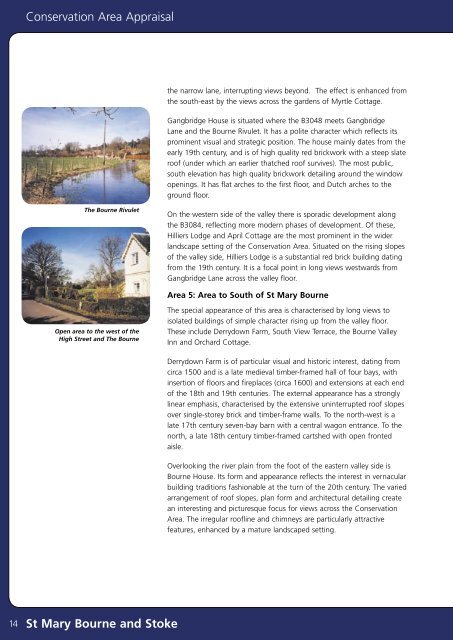
<strong>Conservation</strong> <strong>Area</strong> <strong>Appraisal</strong>the narrow lane, interrupting views beyond. The effect is enhanced fromthe south-east by the views across the gardens of Myrtle Cottage.Gangbridge House is situated where the B3048 meets GangbridgeLane <strong>and</strong> the <strong>Bourne</strong> Rivulet. It has a polite character which reflects itsprominent visual <strong>and</strong> strategic position. The house mainly dates from theearly 19th century, <strong>and</strong> is of high quality red brickwork with a steep slateroof (under which an earlier thatched roof survives). The most public,south elevation has high quality brickwork detailing around the windowopenings. It has flat arches to the first floor, <strong>and</strong> Dutch arches to theground floor.The <strong>Bourne</strong> RivuletOn the western side of the valley there is sporadic development alongthe B3084, reflecting more modern phases of development. Of these,Hilliers Lodge <strong>and</strong> April Cottage are the most prominent in the widerl<strong>and</strong>scape setting of the <strong>Conservation</strong> <strong>Area</strong>. Situated on the rising slopesof the valley side, Hilliers Lodge is a substantial red brick building datingfrom the 19th century. It is a focal point in long views westwards fromGangbridge Lane across the valley floor.<strong>Area</strong> 5: <strong>Area</strong> to South of <strong>St</strong> <strong>Mary</strong> <strong>Bourne</strong>Open area to the west of theHigh <strong>St</strong>reet <strong>and</strong> The <strong>Bourne</strong>The special appearance of this area is characterised by long views toisolated buildings of simple character rising up from the valley floor.These include Derrydown Farm, South View Terrace, the <strong>Bourne</strong> ValleyInn <strong>and</strong> Orchard Cottage.Derrydown Farm is of particular visual <strong>and</strong> historic interest, dating fromcirca 1500 <strong>and</strong> is a late medieval timber-framed hall of four bays, withinsertion of floors <strong>and</strong> fireplaces (circa 1600) <strong>and</strong> extensions at each endof the 18th <strong>and</strong> 19th centuries. The external appearance has a stronglylinear emphasis, characterised by the extensive uninterrupted roof slopesover single-storey brick <strong>and</strong> timber-frame walls. To the north-west is alate 17th century seven-bay barn with a central wagon entrance. To thenorth, a late 18th century timber-framed cartshed with open frontedaisle.Overlooking the river plain from the foot of the eastern valley side is<strong>Bourne</strong> House. Its form <strong>and</strong> appearance reflects the interest in vernacularbuilding traditions fashionable at the turn of the 20th century. The variedarrangement of roof slopes, plan form <strong>and</strong> architectural detailing createan interesting <strong>and</strong> picturesque focus for views across the <strong>Conservation</strong><strong>Area</strong>. The irregular roofline <strong>and</strong> chimneys are particularly attractivefeatures, enhanced by a mature l<strong>and</strong>scaped setting.14<strong>St</strong> <strong>Mary</strong> <strong>Bourne</strong> <strong>and</strong> <strong>St</strong>oke
<strong>Conservation</strong> <strong>Area</strong> <strong>Appraisal</strong>The Character <strong>and</strong> Importance of Public<strong>and</strong> Private Spaces, Trees, Hedges, <strong>and</strong>Other Natural or Cultivated FeaturesThe single most important feature of the <strong>Conservation</strong> <strong>Area</strong> is the<strong>Bourne</strong> Rivulet <strong>and</strong> its topography. The river course, <strong>and</strong> its unique interrelationshipwith the buildings, <strong>and</strong> the spaces associated with it providesthe essential character of the <strong>Conservation</strong> <strong>Area</strong>. Trees <strong>and</strong> grasses alongthe river bank provide a verdant <strong>and</strong> picturesque setting, also supportingvaried wildlife.Settlement in the area has developed along the me<strong>and</strong>ering course ofthis water around fords, <strong>and</strong> latterly bridges. Where settlement has nottaken place, large open spaces remain between the river <strong>and</strong> the lanesjoining the village <strong>and</strong> hamlets. These low-lying spaces provide extensiveviews throughout the valley. They are a key part of the special interest ofthe <strong>Conservation</strong> <strong>Area</strong>, providing a distinctive pastoral setting to the richsurvival of vernacular buildings. The steeply rising valley slopes, with openagricultural l<strong>and</strong> <strong>and</strong> dense belts of trees, are integral in many views <strong>and</strong>serve to define the area.The recreation ground behind the village shop is a key public space <strong>and</strong>adds to the setting of the <strong>Conservation</strong> <strong>Area</strong>. The adjacent lake alsohas an intrinsic l<strong>and</strong>scape value which adds to the rural character of the<strong>Conservation</strong> <strong>Area</strong>.To the south of Gangbridge House, the large ‘lozenge’ shaped open area,between Gangbridge Lane <strong>and</strong> the B3048, makes a major contributionto the special qualities of the <strong>Conservation</strong> <strong>Area</strong>. The unusual formof the space <strong>and</strong> topography allows extensive <strong>and</strong> varied views of theimmediate river course <strong>and</strong> its environs, of the wider l<strong>and</strong>scape setting ofthe valley, <strong>and</strong> of the interspersed historic buildings such as Butlers Farm.The watermeadows within <strong>and</strong> surrounding the <strong>Conservation</strong> <strong>Area</strong> arealso of l<strong>and</strong>scape significance.Other examples include the field between the <strong>Bourne</strong> Rivulet <strong>and</strong> <strong>St</strong>okeHouse - a parkl<strong>and</strong> area. This provides views across to the village of<strong>St</strong>oke in the north-east. The farml<strong>and</strong> to the north of <strong>St</strong>oke, allows viewssouthwards of the settlement.Views of <strong>St</strong> <strong>Mary</strong> <strong>Bourne</strong> fromthe south-westMature trees <strong>and</strong> grazed pasture to thewest of High <strong>St</strong>reet <strong>and</strong> the <strong>Bourne</strong> RivuletBrick abutments over the rivercrossing at <strong>St</strong>okeThe l<strong>and</strong>scaped area opposite Pound Cottages on the side of the roadfrom Swampton to <strong>St</strong>oke is the site of The Pound, historically used forthe occasional imprisonment of stray cattle.To the north of Swampton Lodge is an area of notable visual interest.Here each of the distinctive characteristics of the <strong>Conservation</strong> <strong>Area</strong>(namely the historic streetscape, the <strong>Bourne</strong> Rivulet <strong>and</strong> its environs, <strong>and</strong>the open pasture <strong>and</strong> parkl<strong>and</strong>) are at their most integrated <strong>and</strong> mutuallyThe <strong>Bourne</strong> Rivulet, one of thepedestrian bridges, Swampton<strong>St</strong> <strong>Mary</strong> <strong>Bourne</strong> <strong>and</strong> <strong>St</strong>oke 15