Byron Flora and Fauna Study 1999 - Byron Shire Council
Byron Flora and Fauna Study 1999 - Byron Shire Council
Byron Flora and Fauna Study 1999 - Byron Shire Council

Create successful ePaper yourself
Turn your PDF publications into a flip-book with our unique Google optimized e-Paper software.
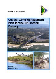
A GREENPRINT FOR A SUSTAINABLE FUTURE<br />
extent (Table 4.7). Hager <strong>and</strong> Benson (1994) provide an assessment of the conservation status of forest<br />
communities of north-eastern NSW <strong>and</strong> Griffith (1993) has identified coastal communities in northern<br />
New South Wales which are either unreserved or else not well reserved across their geographic range. Some<br />
communities were identified as being of limited extent in existing reserves.<br />
During the NSW CRA/RFA process, ecological modelling undertaken by NSW NPWS established<br />
relationships between forest ecosystems <strong>and</strong> their abiotic environments for areas where fine-scale mapping<br />
was available. Each forest ecosystem was modelled across unmapped areas to estimate its past extent in<br />
Upper North East (UNE) NSW (NSW NPWS <strong>1999</strong>). Not all forest ecosystems were modelled successfully.<br />
For instance, pre-1750 extent of rainforest has not been modelled as it is “generally not possible to derive<br />
robust models for types with such wide environmental characteristics” (NSW NPWS <strong>1999</strong>).<br />
All assessments are limited by incomplete underst<strong>and</strong>ing of former <strong>and</strong> present areal extent of individual<br />
plant communities. Assessments of reservation adequacy require updating to reflect recent l<strong>and</strong> tenure<br />
changes (Section 1.3). Vegetation mapping is sometimes not available for reserves. In addition, the associations,<br />
communities or other mapping units vary in their definitions <strong>and</strong> are frequently different from those adopted<br />
for this study. Vegetation classification schemes also differ between studies. In particular, Floyd’s (1990a)<br />
assessments of conservation status of rainforest suballiances, which are based on floristic association, cannot<br />
readily be applied to the rainforest mapping units used in this study (based on substrate). Rainforest<br />
communities are therefore dealt with separately. Floyd (1990a) assessed the overall conservation status of<br />
subtropical <strong>and</strong> warm temperate rainforest suballiances in NSW as ranging from excellent to adequate.<br />
However, most of the conserved areas of rainforest are found in the less accessible, mountainous areas of<br />
north east NSW.<br />
Rainforests on the immediate coastal strip are also considered to be well-conserved regionally, though only<br />
small areas are present locally (mostly reserved). Floyd (1990a) identifies three suballiances within coastal<br />
(littoral) rainforest. The conservation status of each has been assessed as follows:<br />
Suballiance 16 (Syzygium luehmannii-Acmena hemilampra) – adequate (Floyd 1990a, Hager & Benson 1994).<br />
Suballiance 17 (Cupaniopsis anacardioides) – excellent (Floyd 1990a), adequate (Hager & Benson 1994).<br />
Suballiance 18 (Lophostemon confertus) – adequate (Floyd 1990a, Hager & Benson 1994).<br />
Only small remnants of rainforest remain on the coastal ranges <strong>and</strong> plains of north east NSW <strong>and</strong> were<br />
examined in this study according to substrate. In the <strong>Byron</strong> <strong>Shire</strong>, only three Big Scrub remnants are<br />
reserved - Hayters Hill NR (lowl<strong>and</strong> krasnozem), Andrew Johnston Big Scrub NR (lowl<strong>and</strong> krasnozem <strong>and</strong><br />
alluvial) <strong>and</strong> Booyong <strong>Flora</strong> <strong>and</strong> <strong>Fauna</strong> Reserve (alluvial). Small areas of alluvial rainforest are reserved in<br />
Brunswick Heads NR <strong>and</strong> Andrew Johnston Big Scrub NR. Most of the remnant alluvial rainforest exists as<br />
unreserved riparian strips along the Brunswick River. Rainforest on rhyolitic soil (warm temperate rainforest)<br />
is reserved in Nightcap NP <strong>and</strong> Mt Jerusalem NP, but small very important areas remain unreserved on<br />
private l<strong>and</strong>s around Goonengerry <strong>and</strong> along Wilsons Creek in the Federal area. Rainforest on metasediments<br />
is reserved at Inner Pocket NR <strong>and</strong> as small areas in Billinudgel NR <strong>and</strong> Brunswick Heads NR. Important<br />
remnant areas remain unreserved on Mt Chincogan, at Tunnel Rd, Billinudgel <strong>and</strong> scattered throughout the<br />
<strong>Shire</strong>.<br />
The conservation status assessment summarised in Table 4.7 must be interpreted cautiously but indicates<br />
that many of the vegetation types found in <strong>Byron</strong> <strong>Shire</strong> are significantly reduced in area <strong>and</strong> are poorly<br />
conserved.<br />
4.9 PLOT-BASED VEGETATION SURVEYS<br />
Survey data from 175 sites throughout the <strong>Shire</strong> were entered into the field survey database.<br />
Location <strong>and</strong> basic site characteristics data are summarized for the sites in Appendix 4. The locations of the<br />
sites are shown on Map 3.<br />
56