NAUTILUS P01 OCTOBER 2010.qxd - Nautilus International
NAUTILUS P01 OCTOBER 2010.qxd - Nautilus International
NAUTILUS P01 OCTOBER 2010.qxd - Nautilus International

Create successful ePaper yourself
Turn your PDF publications into a flip-book with our unique Google optimized e-Paper software.
24 | telegraph | nautilusint.org | October 2010 October 2010 | nautilusint.org | telegraph | 25<br />
TECHNOLOGY<br />
TECHNOLOGY<br />
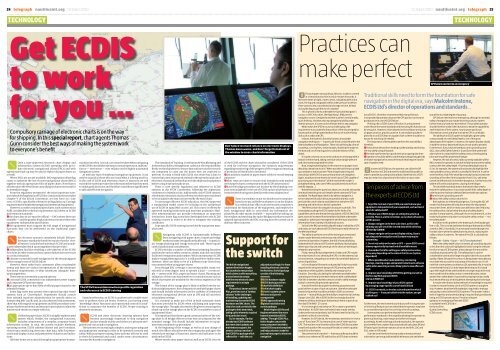
Get ECDIS<br />
to work<br />
for you …<br />
Compulsory carriage of electronic charts is on the way<br />
for shipping. In this special report, chart agents Thomas<br />
Gunn consider the best ways of making the system work<br />
to everyone’s benefit<br />
O<br />
Only a type-approved electronic chart display and<br />
information system (ECDIS) operating with up-todate<br />
electronic navigational charts (ENCs) and with<br />
appropriate back-up may be used to replace all paper charts on<br />
a vessel.<br />
Where ENCs are not yet available, IMO regulations allow flag<br />
states to authorise the use of raster navigational charts (RNCs)<br />
together with an appropriate folio of paper charts. Note that in<br />
all other cases the vessel must carry all paper charts necessary for<br />
its intended voyage.<br />
From the regulatory perspective, the most important statement<br />
about the legal status of ECDIS is contained in the amended<br />
Chapter V of the SOLAS Convention, set into force on 1 July<br />
2002. ECDIS is specifically referred to in Regulation 19 ‘Carriage<br />
requirements for shipborne navigational systems and equipment’.<br />
However, in order to replace paper charts, such systems must<br />
fulfil considerable technical requirements laid down in ECDIS<br />
performance standards:<br />
zthe chart data in use must be official — ENCs where these are<br />
available — and the graphic display on the screen must meet the<br />
equipment-independent specification<br />
zthe equipment must support the full range of navigational<br />
functions that can be performed on the traditional paper<br />
charts.<br />
O<br />
No electronic system is completely failsafe. IMO performance<br />
standards therefore require that the ‘overall<br />
system’ includes both a primary ECDIS and an adequate<br />
independent back-up arrangement that provides:<br />
zindependent facilities enabling a safe takeover of the ECDIS<br />
functions in order to ensure that a system failure does not result<br />
in a critical situation<br />
za means to provide for safe navigation for the remaining part<br />
of the voyage in case of ECDIS failure<br />
However, these rather basic statements allow considerable<br />
leeway and there are various interpretations of the minimum<br />
functional requirements, or what constitutes ‘adequate’ backup<br />
arrangements.<br />
There are two commonly accepted options:<br />
za second ECDIS, connected to an independent power supply<br />
and a separate GPS position input<br />
zan appropriate up-to-date folio of official paper charts for the<br />
intended voyage<br />
Some flag states may permit other options (eg radar-based<br />
systems such as ‘Chart-Radar’). Shipowners should consult<br />
their national maritime administration for specific advice in<br />
Interpreting MSC 232/82 and, in a documented risk assessment,<br />
show that with regards to equipment and SMS procedures compliance<br />
has been achieved, and measures are in place to allow the<br />
mariner and vessels to comply with this.<br />
O<br />
Unlike the paper chart, ECDIS is a highly sophisticated<br />
system which, besides the navigational functions,<br />
includes components of a complex, computer-based<br />
information system. In total, the system includes hardware,<br />
operating system, ECDIS software (kernel and user interface),<br />
sensor input interfacing, electronic chart data, rules for presentation<br />
and display, status and parameters of alarms and indications.<br />
All these items are accessed through an appropriate humanmachine<br />
interface. As such, care must be taken when navigating<br />
with ECDIS to avoid false operation, misinterpretation, malfunction<br />
or — even worse — over-reliance on this highly-automated<br />
navigation system<br />
As with any type of shipboard navigation equipment, it can<br />
only be as good as those who use it and what it is being used for.<br />
In the case of ECDIS and electronic charts, if mariners are well<br />
trained the system provides the information flow that they need<br />
to make good decisions and therefore contributes significantly<br />
to safe and efficient navigation.<br />
The STCW Convention now has specific regulation<br />
and references to ECDIS training<br />
Stated another way, an ECDIS is another tool to enable mariners<br />
to perform their job better. However, just having some<br />
‘knowledge’ about ‘functions’ and ‘operational controls’ is insufficient<br />
to maximise the benefits of ECDIS. Proper training is<br />
absolutely necessary.<br />
O<br />
ECDIS and other electronic charting systems have<br />
become increasingly important to ship navigation<br />
and are already widely used either as a primary navigation<br />
tool or as an aid to navigation.<br />
The systems are increasingly complex, and require adequate<br />
and appropriate training in order to be operated correctly and<br />
safely. Without proper training, these systems will not be used<br />
to their full potential and could, under some circumstances,<br />
increase the hazard to navigation.<br />
The Standards of Training, Certification & Watchkeeping and<br />
<strong>International</strong> Safety Management codes put the responsibility<br />
firmly on the shipowner to ensure that mariners on their vessels<br />
are competent to carry out the duties they are expected to<br />
perform. If a ship is fitted with ECDIS, the owner has a duty to<br />
ensure that users are properly trained in the operation and use of<br />
electronic charts and are familiar with the shipboard equipment<br />
before using it operationally at sea.<br />
There is now specific regulation and reference to ECDIS<br />
systems in the STCW Convention, following the diplomatic<br />
conference in Manila in July. Additionally, since ECDIS systems<br />
are related to electronic charts, references to them are considered<br />
to be included in the material covered by the word ‘chart’.<br />
To encourage effective ECDIS education, the IMO approved<br />
a standardised model course for training on the operational<br />
use of ECDIS in 1999 (IMO course 1.27). This course is offered by<br />
approved training institutions and maritime academies. Maritime<br />
administrations can provide information on approved<br />
institutions. Some flag states have developed their own ECDIS<br />
training courses in order to be able to recognise the training<br />
certificates.<br />
Type specific ECDIS training is provided by equipment manufacturers.<br />
O<br />
Navigating with ECDIS is fundamentally different<br />
from navigating with paper charts. Important bridge<br />
work processes are significantly affected — in particular,<br />
voyage planning and voyage execution task. These require<br />
careful analysis and consideration.<br />
ECDIS provides a number of additional planning functions<br />
and features such as safety contours, alarms, and click-and-drop<br />
facilities for waypoints and markers. Whilst in many ways ECDIS<br />
makes voyage planning easier, it is still possible to make errors.<br />
However, these are likely to be of a different type from those<br />
encountered when using paper charts.<br />
Even though ENC coverage is increasing rapidly, many vessels<br />
will, to some degree, have to operate a dual — or even triple<br />
— system with ENCs, paper and raster charts. Planning and<br />
validation of the route has therefore to consider issues such as<br />
which chart types are available for the various segments of the<br />
voyage.<br />
The format of the voyage plan is likely to differ from the traditional<br />
alphanumeric lists of waypoints used with paper charts<br />
and should include information on the usability of connected<br />
electronic navigational devices such as GPS and AIS and their<br />
actual alarm settings.<br />
It is essential to make use of the in-built automatic check<br />
functions provided by ECDIS when validating and approving<br />
the voyage plan. Thought also needs to be given to ensuring that<br />
a back-up to the voyage plan on the ECDIS is available in case of<br />
equipment failure.<br />
It is important that there is good communication of the voyage<br />
plan to all bridge officers so that they are prepared for the<br />
intended voyage. This should include information on equipment<br />
status and back-up procedures.<br />
At the beginning of the voyage, as well as at any change of<br />
watch, the officers should review the voyage plan and agree the<br />
selected pre-settings of functions, alarms and indicators to be<br />
used on the ECDIS.<br />
Where vessels carry paper charts as well as an ECDIS, the role<br />
Don’t place too much reliance on electronic displays,<br />
Thomas Gunn warns, and don’t forget to look out of<br />
the window to cross-check information<br />
of the ECDIS and the charts should be considered. If the ECDIS<br />
is used for real-time navigation, the statutory requirements<br />
regarding monitoring of the progress of the voyage and marking<br />
of positions will need to be considered:<br />
zare positions marked in paper charts solely for record-keeping<br />
purposes<br />
zwhat steps are taken to ensure that intended tracks marked<br />
on the paper charts correspond with the ECDIS information<br />
zhave the bridge procedures set in place by the shipping company<br />
been adapted for the use of ECDIS and are all persons concerned<br />
with the navigation familiar with these adaptations<br />
O<br />
There is a tendency to put too much trust in computerbased<br />
systems and believe whatever is on the display.<br />
It is essential that officers do not become complacent,<br />
understand the limitations of the equipment, and employ the<br />
basic navigational skills to cross-check the information displayed<br />
by all other means available — especially by looking out<br />
the window and watching the radar! Bridge procedures must be<br />
adapted appropriately and ENC training must be carried out to<br />
alleviate these concerns.<br />
Support for<br />
the switch<br />
The British navigational<br />
systems firm Kelvin Hughes<br />
has launched a new product<br />
which claims to offer everything<br />
a vessel needs to comply<br />
with the new electronic chart<br />
requirements in a single<br />
package.<br />
The product, known as ECDIS<br />
Plus, promises users a ‘turnkey<br />
solution’ to the challenges<br />
of installing, updating and<br />
maintaining licences for ECDIS<br />
hardware and ENC charts. The<br />
idea is for each user to tailor the<br />
package to their own needs,<br />
taking up the elements required<br />
for a particular vessel.<br />
So, for example, if a ship<br />
already has ECDIS hardware<br />
but needs chart updates and<br />
maintenance support, the<br />
owners can buy a version of<br />
the ECDIS Plus package which<br />
reflects this — with the cost<br />
adjusted accordingly. For those<br />
installing electronic charts for<br />
the first time, the full package<br />
consists of the following<br />
elements:<br />
zECDIS hardware supply<br />
zECDIS backup provision<br />
zchart folio definition<br />
zinitial chart supply<br />
zChartCo update system<br />
zlicence and permit<br />
management<br />
zIMO approved training<br />
zglobal installation and<br />
service packages<br />
Kelvin Hughes CEO Russell<br />
Hughes welcomed the move<br />
towards mandatory ECDIS,<br />
adding: ‘Through ECDIS Plus,<br />
Kelvin Hughes can provide<br />
every component needed to<br />
make ECDIS easy and compliant<br />
and help customers make the<br />
journey from paper to electronic<br />
navigation.’<br />
Practices can<br />
make perfect<br />
Things happen very quickly at 28 knots. A cable is covered<br />
cin 13 seconds and a mile in only 2 minutes 9 seconds. It<br />
feels even faster at night, close to shore, navigating with only a<br />
chart, the log and a stopwatch whilst under pressure to deliver<br />
three consorts into a coordinated anchorage on time. At least<br />
during the day you get the use of a sextant!<br />
This is what it is like to undertake the Specialist Navigator’s<br />
course, or SPEC N for short, the Royal Navy’s (RN) premier<br />
navigation course. Designed to test the student’s mental maths,<br />
quick thinking, initiative and raw navigational ability under<br />
intense pressure, it is seen as the ultimate test for any navigator.<br />
What makes the SPEC N course so challenging is the<br />
requirement to accurately fix the position of the ship and predict<br />
future position at high speed without the use of modern fixing<br />
aids such as radar and GPS.<br />
Instead, the student is forced to harness all available<br />
navigation techniques — in particular those contained within the<br />
Admiralty Manual of Navigation. These include fixing by a line of<br />
soundings, running fixes, sextant angles, doubling the angle on<br />
the bow and use of bearing pairs to calculate distance off an<br />
object.<br />
It is quite common on course to conduct an anchorage with a<br />
sextant in either hand, taking a vertical sextant angle with one<br />
and a horizontal angle with the other.<br />
Now, imagine plotting fixes in this manner on a paper chart.<br />
Would you know how to do it When was the last time you picked<br />
up a sextant or station pointer Now imagine planning and<br />
executing it with ECDIS as your primary means of navigation.<br />
Again, would you know how to do it and is your ECDIS capable of<br />
processing such information (At the moment the reader is<br />
probably thinking, who cares Who actually needs to do this in<br />
real life anyway...)<br />
Notwithstanding the questions above, you may be asking why<br />
one would need to go to such lengths when radar and GPS are<br />
available. The Royal Navy needs to be able to navigate in a<br />
sensor-deprived situation because operational areas could<br />
preclude the use of radar to avoid detection and where GPS<br />
jamming and other sensor denial is prevalent.<br />
The RN must train its navigators to acquire such skills. This<br />
necessitates pushing the ECDIS system to the limits of its<br />
capabilities and is why the warfare equivalent of ECDIS (WECDIS)<br />
gives access to increased functionality to facilitate underwater<br />
navigation, waterspace management and the input of position<br />
information from a variety of traditional sources.<br />
So that’s the RN, but realistically with today’s reliability of GPS<br />
and radar, are such advanced ECDIS techniques really relevant in<br />
the Merchant Navy<br />
The ability to perform some of the techniques mentioned<br />
above may be deemed unnecessary and old fashioned for<br />
commercial operation. However, the skill of manually fixing<br />
independent of radar and GPS and the ability to clearly display<br />
where your ship can and cannot go on the chart are techniques<br />
relevant to any mariner.<br />
Firstly, manual fixing independent of radar and GPS may be<br />
the only means of cross-checking the GPS or in the extreme, but<br />
not uncommon, navigating in an area of an unreliable datum or<br />
sensor input failure.<br />
Let’s not forget all the work conducted by Trinity House with<br />
regards to the very present danger of GPS jamming and the<br />
importance of being able to identify and manage such a<br />
situation. Secondly, calculating the safe water available when<br />
operating to minimal under keel clearance with a safety depth<br />
that falls in between charted contours is vital to safely manage<br />
today’s commercially pressured operations.<br />
It would therefore be prudent to develop procedures and<br />
practice them in case of such an outcome. I therefore advocate<br />
two techniques that should be utilised in ECDIS as common<br />
practice — manual fixing and the ability to implement a Limiting<br />
Danger Line (LDL). We at ECDIS Ltd feel so strongly about the<br />
relevance of these techniques that we teach them as part of our<br />
five-day STCW IMO 1.27 course.<br />
It is not enough to rely solely on GPS or radar to provide fix<br />
information. An ECDIS does not have to have a radar overlay<br />
under performance standards, but if it does have this facility, it is<br />
prudent to utilise it in its entirety.<br />
However, for GPS denial, the mindset you need to be in is not a<br />
case of ‘if you lose GPS’ but very much a case of ‘when you lose<br />
GPS’. The mariner must therefore utilise the ECDIS like any other<br />
navaid and question the accuracy of the data in order to quality<br />
control the information.<br />
The premise here is twofold — that manual fixing should be<br />
used to cross-reference GPS and that loss of GPS does not mean<br />
Traditional skills need to form the foundation for safe<br />
navigation in the digital era, says Malcolm Instone,<br />
ECDIS Ltd’s director of operations and standards…<br />
loss of ECDIS. I therefore recommend that manual fixing is<br />
incorporated by operators to prove the GPS position correct and<br />
good practice in case of ECDIS failure.<br />
Plotting a fix in ECDIS (Lines of Position) is a requirement<br />
under the performance standards and executing this function can<br />
be very quick. However, it does depend on the software and just as<br />
on paper, practice, practice, practice. It can easily be quicker to<br />
plot a fix on an ECDIS than on a paper chart so there should be no<br />
excuse for not doing it if needed.<br />
The importance of being able to perform this task swiftly is<br />
threefold:<br />
zit should not detract from looking out the window and driving<br />
the ship safely using all navaids<br />
zthe task is performed as a quick check at an appropriate time<br />
zoperators should be able to comfortably manage long periods<br />
of relative navigation for areas of the world that require it and in<br />
case of sudden need.<br />
In event of GPS failure, the operator can utilise the DR<br />
cfunction in ECDIS and revert to traditional fixing skills in<br />
order to provide accurate positional data. Note that loss of GPS<br />
may also mean loss of positional information on your radar.<br />
Ten pieces of advice from<br />
the experts at ECDIS Ltd<br />
1. To get the most out of your ECDIS you need to know your<br />
equipment. Ask questions of your equipment, such as Does it<br />
alarm for safety depth<br />
2. Effective use of ECDIS hinges on setting the system up<br />
correctly. There is a lot to remember, so use check-off cards to<br />
aid this process<br />
3. Always navigate on the best scale chart, as this is the<br />
only way you will see all the charted data whilst not being<br />
affected by SCAMIN<br />
4. Always navigate on the correct display setting. Base is<br />
not adequate for navigation and Standard may require<br />
customising<br />
5. Do not rely solely on the radar or GPS — prove ECDIS correct<br />
at every opportunity by visual and all available means<br />
6. Remember that after setting your safety contour value,<br />
it may vary depending on the scale of chart in use (system<br />
dependent)<br />
7. Where possible when route planning, use clearing<br />
bearings, clearing ranges and parallel index lines to enhance<br />
safety when executing a route. Many systems now offer such<br />
tools<br />
8. Improve your knowledge of ECDIS by getting yourself on<br />
the five-day MCA approved ECDIS<br />
course at ECDIS Ltd<br />
9. Improve your knowledge of your ECDIS system<br />
by arranging a type-specific course from ECDIS Ltd<br />
10. ECDIS is a navaid, so treat as such and question what it<br />
is telling you — if you put rubbish into the system, you get<br />
rubbish out!<br />
Furthermore, the environment you find yourself in may preclude<br />
or limit visual fixing to such an extent that the operator may have<br />
to use transferred position lines or fix by a line of soundings.<br />
Some systems can perform beyond the minimum<br />
performance standards in this regard by allowing the operator to<br />
plot visual bearings, radar ranges and other techniques<br />
accordingly. As well as being quick and easy to plot, the operator<br />
also benefits from a system that automatically calculates DR and<br />
EP based upon last known values such as set and drift, COG and<br />
SOG, when in ‘DR mode’.<br />
It can be seen therefore that manually entered positional<br />
information can very quickly establish where you are and where<br />
‘GPS failure need not be an emergency’<br />
you will be to a high degree of accuracy.<br />
GPS failure need not be an emergency, although to maintain<br />
safety of navigation you may be forced to push your system<br />
further than you have ever done before. The prudent operator<br />
should therefore make it their business to know the capabilities<br />
and limitations of their system, how to prove positional<br />
information correct and what to do when GPS is unreliable.<br />
The ability of an ECDIS system to highlight a given safety<br />
contour based on a set Safety Depth is one of the great<br />
advantages of the system. In essence, the system displays clearly<br />
in bold the contour beyond which you do not wish to proceed.<br />
Furthermore, if you have activated your anti-grounding cone<br />
(AGC, also called Safety Frame or Guard Zone) the system will<br />
alarm when in contact with the safety contour, thereby giving<br />
prior warning of the proximity of danger.<br />
However, the lack of contour data currently available within<br />
ENCs means the operator is not able to fully harmonise the safety<br />
contour with the safety depth. If I set my safety depth value to<br />
6.5m, for example, the system will automatically highlight the<br />
next available contour, which is normally the 10m line. It can be<br />
seen therefore, that if the vessel by necessity has to proceed over<br />
soundings of less than 10m but greater than 6.5m, safe areas<br />
cannot be defined and it is therefore dangerous. Furthermore, the<br />
system will continuously alarm, causing alarm fatigue.<br />
This shortfall essentially means that vessels that need to<br />
reduce the safety contour in accordance with their safety depth in<br />
order to get into harbour safely will be faced with two options:<br />
zturn the anti-grounding cone off<br />
zreduce the safety contour value to 5m<br />
Both options are inherently dangerous. Turning the AGC off<br />
means that the system will only alarm when the ship symbol<br />
encounters them, which in most cases will be too late. Reducing<br />
the safety contour value below the value of safety depth is<br />
possible in many systems, although I do not recommend it, as the<br />
majority of systems only alarm crossing the safety contour — not<br />
the safety depth!<br />
A solution to this problem is the drawing of a limiting danger<br />
line or LDL. This is a tried and tested technique that works on RNCs<br />
as well as ENCs. Essentially, it is a manually inserted danger line<br />
that will alarm when the safety frame touches it, replacing the<br />
safety contour in extremis. The value of the LDL is calculated as<br />
follows:<br />
Draught + Safety + Squat — HoT (Time dependent)<br />
When the safety depth value is inserted, all soundings equal to<br />
or less than this value are highlighted in bold. Using the relevant<br />
function on your ECDIS system, draw a danger line around the<br />
soundings to produce the LDL. The safety value is a prime<br />
consideration and must be large enough to take into account the<br />
quality of data. Because the contour is being drawn manually you<br />
must take into account the inaccuracy of the data in use. It is of<br />
note that some systems can draw an LDL automatically. It must be<br />
remembered that a LDL is time dependent because it is based<br />
upon the height of tide and that when no longer required it must<br />
be ensured that the safety contour is reverted back to a value<br />
greater than safety depth. It goes without saying that you really<br />
must know what you are doing before attempting this technique.<br />
It may be seen that an advanced level of knowledge is required<br />
in order to ensure the best use of an ECDIS system on any given<br />
ship. However, what level of knowledge is required to manage<br />
and quality control a fleet of ECDIS systems The answer is that a<br />
level of expertise and understanding is required that goes beyond<br />
being an ECDIS operator at sea. Provision of expert<br />
guidance on managing a fleet with ECDIS<br />
is available from ECDIS Ltd in<br />
the form of the<br />
Quality Controlling<br />
ECDIS course.