botchergate - Carlisle City Council
botchergate - Carlisle City Council
botchergate - Carlisle City Council

You also want an ePaper? Increase the reach of your titles
YUMPU automatically turns print PDFs into web optimized ePapers that Google loves.
BOTCHERGATE CONSERVATION AREA APPRAISAL<br />
development of Botchergate and its hinterland<br />
perhaps at the height of its urbanisation,<br />
with each side of the street densely lined with<br />
terraces interspersed with business and manufacturers.<br />
The narrow 'burgage' plots which<br />
characterised ownerships on the 1821 map<br />
have influenced the development of later<br />
stages. These patterns can be seen to have<br />
dictated the shapes of developments such as<br />
the Rickerby's agricultural works at the rear of<br />
Portland Place (now a surface car park), and<br />
also the numerous narrow lanes and courts<br />
that stretched back from the frontage, lined<br />
with dense housing and workshops of which<br />
there is now little trace.<br />
1.4.6 As the twentieth century progressed<br />
there has been a tendency for developments<br />
which have consolidated and obliterated<br />
these traces of early land ownerships, with<br />
large swathes of backland now coalesced into<br />
areas of car parking or large footprint buildings.<br />
The frontages have proved more robust,<br />
and while a number of buildings which span<br />
numerous original plot widths (e.g. Stanley<br />
Hall and Palace Arcade) the ground floor subdivisions<br />
broadly reflect the 4-5m footprints of<br />
earlier plots. Towards the southern part of the<br />
street unconsolidated smaller frontages are<br />
very much still in evidence.<br />
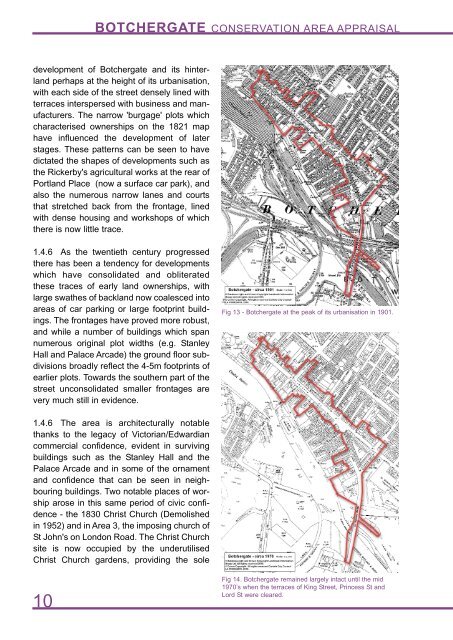
Fig 13 - Botchergate at the peak of its urbanisation in 1901.<br />
1.4.6 The area is architecturally notable<br />
thanks to the legacy of Victorian/Edwardian<br />
commercial confidence, evident in surviving<br />
buildings such as the Stanley Hall and the<br />
Palace Arcade and in some of the ornament<br />
and confidence that can be seen in neighbouring<br />
buildings. Two notable places of worship<br />
arose in this same period of civic confidence<br />
- the 1830 Christ Church (Demolished<br />
in 1952) and in Area 3, the imposing church of<br />
St John's on London Road. The Christ Church<br />
site is now occupied by the underutilised<br />
Christ Church gardens, providing the sole<br />
10<br />
Fig 14. Botchergate remained largely intact until the mid<br />
1970’s when the terraces of King Street, Princess St and<br />
Lord St were cleared.