

Conserving Freshwater and Coastal Resources in a Changing Climate
Conserving Freshwater and Coastal Resources in a Changing Climate
Conserving Freshwater and Coastal Resources in a Changing Climate

Create successful ePaper yourself
Turn your PDF publications into a flip-book with our unique Google optimized e-Paper software.
Courtesy of the U.S. Environmental Protection Agency<br />
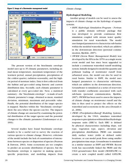
Figure 5. Image of a Stormwater management model<br />
The present version of the bioclimatic envelope<br />
model uses up to 35 climatic parameters, <strong>in</strong>clud<strong>in</strong>g annual<br />
mean temperature, maximum temperature of the<br />
warmest period, annual precipitation, precipitation of<br />
the coldest quarter, radiation seasonality, <strong>and</strong> the highest<br />
period of moisture <strong>in</strong>dex. Data is first collected from<br />
the habitat <strong>and</strong> geo-coded us<strong>in</strong>g historic <strong>and</strong> current<br />
distribution data. Secondly, each climatic parameter is<br />
calculated at every geo-coded site. Next, a statistical<br />
summary – the “bioclimatic envelope” – is made of each<br />
climatic parameter’s range, obta<strong>in</strong>ed as mean, st<strong>and</strong>ard<br />
deviation, m<strong>in</strong>imum, maximum <strong>and</strong> percentile value.<br />
F<strong>in</strong>ally, the potential distribution of the target species<br />
is mapped. Matches with<strong>in</strong> the “bioclimatic envelope”<br />
show the area where the species can live. The impacts<br />
of climate change are assessed by exam<strong>in</strong><strong>in</strong>g the potential<br />
distribution of the target species <strong>and</strong> the potential<br />
changes to the climatic parameter (L<strong>in</strong>denmayer et al.,<br />
1991).<br />
Several studies have found bioclimatic envelope<br />
models to be a useful tool to survey the reaction of<br />
various species to climate change. However, criticisms<br />
of the model <strong>in</strong>clude the lack of exam<strong>in</strong>ation of <strong>in</strong>teractions<br />
between species or dispersion of species (Pearson<br />
& Dawson, 2003). Some ecosystems are too complex<br />
to predict an accurate distribution of species, but the<br />
bioclimatic envelope is superior <strong>in</strong> mak<strong>in</strong>g speciesspecific<br />
projections, <strong>and</strong> model<strong>in</strong>g impacts from<br />
climate change.<br />
Hydrological Model<strong>in</strong>g<br />
Another group of models can be used to assess the<br />
impacts of climate change on the hydrology of aquatic<br />
systems.<br />
• HSPF, Hydrologic Simulation Program – Fortran<br />
is a public doma<strong>in</strong> software package that<br />
was developed to provide cont<strong>in</strong>uous flow<br />
simulation coupled with stream water quality<br />
simulation for rural watersheds. The model<br />
uses lumped parameters to characterize sub-bas<strong>in</strong>s<br />
with<strong>in</strong> the modeled watershed, which are additive<br />
<strong>in</strong> the downstream direction (personal communication,<br />
Bjerklie, 2007).<br />
• SWMM (Storm Water Management Model) was<br />
developed by the EPA <strong>in</strong> the 1970’s as a s<strong>in</strong>gle storm<br />
event model <strong>and</strong> has s<strong>in</strong>ce been upgraded to<br />
<strong>in</strong>clude a cont<strong>in</strong>uous watershed runoff model<strong>in</strong>g<br />
system. Initially designed to model the quantity <strong>and</strong><br />
pollutant load<strong>in</strong>g of stormwater runoff from<br />
urbanized areas, the model can also be used <strong>in</strong><br />
rural bas<strong>in</strong>s. Similar to HSPF, the model uses<br />
lumped parameters to characterize sub-bas<strong>in</strong>s,<br />
which are additive <strong>in</strong> the downstream direction.<br />
Groundwater is simulated as a series of reservoirs<br />
with transfer coefficients associated with each<br />
sub-bas<strong>in</strong> (personal communication, Bjerklie,<br />
2007). SWMM has been used to assess the impacts<br />
of climate change on stormwater runoff <strong>and</strong> the<br />
data is then used to project the effects on the<br />
watershed <strong>and</strong> ecosystems <strong>in</strong> the area (Denault et<br />
al., 2006).<br />
• PRMS (Precipitation-Runoff Model<strong>in</strong>g System),<br />
developed by the USGS, simulates watershed<br />
response to precipitation with<strong>in</strong> def<strong>in</strong>ed hydrologic<br />
response units (HRU’s). Each HRU is def<strong>in</strong>ed<br />
by physical characteristics <strong>in</strong>clud<strong>in</strong>g slope, soil<br />
type, vegetation type, aspect, elevation <strong>and</strong><br />
precipitation distribution. PRMS can simulate<br />
daily surface water yields at def<strong>in</strong>ed outlet<br />
locations, or can model peak flows us<strong>in</strong>g smaller<br />
precipitation time steps. Groundwater is simulated<br />
<strong>in</strong> a similar manner as HSPF <strong>and</strong> SWMM. Recent<br />
work has successfully l<strong>in</strong>ked the PRMS <strong>and</strong> the<br />
USGS ground-water flow model (MODFLOW) to<br />
create a new coupled model called GSFLOW,<br />
29<br />
<strong>Conserv<strong>in</strong>g</strong> <strong>Freshwater</strong> <strong>and</strong> <strong>Coastal</strong> <strong>Resources</strong> <strong>in</strong> a Chang<strong>in</strong>g <strong>Climate</strong>


