Geological Survey of Finland - Geologian tutkimuskeskus
Geological Survey of Finland - Geologian tutkimuskeskus
Geological Survey of Finland - Geologian tutkimuskeskus

Create successful ePaper yourself
Turn your PDF publications into a flip-book with our unique Google optimized e-Paper software.
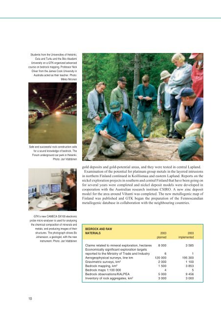
Students from the Universities <strong>of</strong> Helsinki,<br />
Oulu and Turku and the Åbo Akademi<br />
University on a GTK-organized advanced<br />
course on bedrock mapping. Pr<strong>of</strong>essor Nick<br />
Oliver from the James Cook University in<br />
Australia acted as their teacher. Photo:<br />
Mikko Nironen<br />
Safe and successful rock construction calls<br />
for a sound knowledge <strong>of</strong> bedrock. The<br />
Forum underground car park in Helsinki.<br />
Photo: Jari Väätäinen<br />
gold deposits and gold-potential areas, and they were tested in central Lapland.<br />
Examination <strong>of</strong> the potential for platinum group metals in the layered intrusions<br />
in northern <strong>Finland</strong> continued in Koillismaa and eastern Lapland. Reports on the<br />
nickel exploration projects in southern and central <strong>Finland</strong> that have been going on<br />
for several years were completed and nickel deposit models were developed in<br />
cooperation with the Australian research institute CSIRO. A new zinc deposit<br />
model for the area around Vihanti was completed. The new metallogenic map <strong>of</strong><br />
<strong>Finland</strong> was published and GTK began the preparation <strong>of</strong> the Fennoscandian<br />
metallogenic database in collaboration with the neighbouring countries.<br />
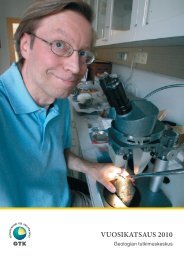
GTK’s new CAMECA SX100 electronic<br />
probe micro-analyser is used for analysing<br />
the chemical composition <strong>of</strong> minerals and<br />
metals, and producing images <strong>of</strong> their<br />
structures. The photograph shows Bo<br />
Johansson, a geologist, with the new<br />
instrument. Photo: Jari Väätäinen<br />
BEDROCK AND RAW<br />
MATERIALS 2003 2003<br />
planned implemented<br />
Claims related to mineral exploration, hectares 8 000 3 585<br />
Economically significant exploration targets<br />
reported to the Ministry <strong>of</strong> Trade and Industry 6 1<br />
Aerogeophysical surveys, line km 120 000 195 300<br />
Gravimetric surveys, km 2 2 000 1 100<br />
Bedrock mapping, km 2 1 500 3 853<br />
Bedrock maps 1:100 000 4 5<br />
Bedrock observations/KALPEA 5 000 9 456<br />
Inventory <strong>of</strong> rock aggregates, km 2 3 000 3 000<br />
10