Geological Survey of Finland - Geologian tutkimuskeskus
Geological Survey of Finland - Geologian tutkimuskeskus
Geological Survey of Finland - Geologian tutkimuskeskus

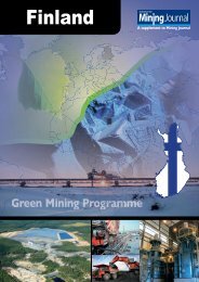
Create successful ePaper yourself
Turn your PDF publications into a flip-book with our unique Google optimized e-Paper software.
Geoservices<br />
The Geoservice Centre is the<br />
GTK national service unit that<br />
provides most <strong>of</strong> its laboratory,<br />
geophysical and field research<br />
services.<br />
During the year under review, on the basis <strong>of</strong> the preparatory work carried out by<br />
GTK and the Ministry <strong>of</strong> Trade and Industry, the Finnish government decided to<br />
incorporate VTT Mineral Processing into GTK. This internationally renowned<br />
cluster <strong>of</strong> expertise in process mineralogy, located in Outokumpu, eastern <strong>Finland</strong>,<br />
became part <strong>of</strong> GTK Geoservices at the start <strong>of</strong> 2004, which supplemented GTK’s<br />
already extensive range <strong>of</strong> services in the minerals sector. In addition to mineral<br />
processing, the equipment and expertise <strong>of</strong> the unit will also permit the development<br />
<strong>of</strong> more advanced environmental services in such areas as the investigation<br />
<strong>of</strong> contaminated areas and processing. The equipment includes a pilot-scale<br />
dressing plant.<br />
Geolaboratory<br />
The 5 th International Conference on the Analysis <strong>of</strong> <strong>Geological</strong> and Environmental<br />
Materials, an event in the conference series <strong>of</strong> the International Association <strong>of</strong><br />
Geoanalysts (IAG) was held in Rovaniemi in June. GTK’s Geolaboratory was<br />
responsible for organizing the event. The fact that <strong>Finland</strong> had been chosen as the<br />
venue for the meeting showed that we are trusted and that geoanalytical and<br />
geochemical research in <strong>Finland</strong> is held in high international esteem. A total <strong>of</strong> 110<br />
experts from 22 countries took part in the conference.<br />
The three-day scientific programme at the conference covered quality assurance<br />
in the taking and processing <strong>of</strong> samples and analysis, and new analysis techniques<br />
for geological and environmental samples. On a new topic concerning applied<br />
geoanalysis, the conference discussed matters related to global ecogeochemical<br />
mapping.<br />
The operations <strong>of</strong> the mining laboratory in Sodankylä established in 1997 were<br />
expanded as a result <strong>of</strong> the reopening <strong>of</strong> the Pahtavaara gold mine. Customerfunded<br />
laboratory activities provide jobs for about ten people in Sodankylä, which<br />
is significant from the point <strong>of</strong> view <strong>of</strong> employment in the region. This also has a<br />
major impact on know-how at the national level and the provision <strong>of</strong> services in the<br />
mining sector in <strong>Finland</strong>.<br />
In connection with its quality system and accreditation, the Geolaboratory takes<br />
part in number <strong>of</strong> international pr<strong>of</strong>iciency tests on a regular basis. During the year<br />
under review, it participated in four international test programmes which had a total<br />
<strong>of</strong> 11 analysis rounds. Most <strong>of</strong> the results were excellent and showed that the testing<br />
services provided by the Geolaboratory are <strong>of</strong> high quality by international<br />
standards.<br />
Geophysics and marine geology<br />
Most <strong>of</strong> GTK’s airborne geophysical surveys were carried out as part <strong>of</strong> its<br />
international projects. In addition to an unusually large project in Tanzania<br />
covering a total <strong>of</strong> about 150 000 line kilometres, GTK carried out an airborne<br />
survey project in Portugal and Spain that mainly served the needs <strong>of</strong> ore exploration.<br />
As a result <strong>of</strong> the extensive international airborne survey projects, the national<br />
mapping programme in <strong>Finland</strong> could not be carried out to the extent envisaged. A<br />
total <strong>of</strong> 18 000 line kilometres were covered in Hamina and Kumlinge in June, and<br />
for exploration <strong>of</strong> natural resources, measurements were also carried out using a<br />
denser line spacing in selected areas in eastern and northern <strong>Finland</strong>. In addition to<br />
traditional applications in bedrock mapping, airborne geophysics was also used for<br />
locating eskers covered by Quaternary deposits, which is very important for sectors<br />
20