here - Atomic Energy Regulatory Board
here - Atomic Energy Regulatory Board
here - Atomic Energy Regulatory Board

Create successful ePaper yourself
Turn your PDF publications into a flip-book with our unique Google optimized e-Paper software.
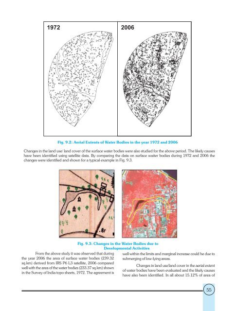
Fig. 9.2: Aerial Extents of Water Bodies in the year 1972 and 2006<br />
Changes in the land use/ land cover of the surface water bodies were also studied for the above period. The likely causes<br />
have been identified using satellite data. By comparing the data on surface waiter bodies during 1972 and 2006 the<br />
changes were identified and shown for a typical example in Fig. 9.3.<br />
From the above study it was observed that during<br />
the year 2006 the area of surface water bodies (239.32<br />
sq.km) derived from IRS P6 L3 satellite, 2006 compared<br />
well with the area of the water bodies (233.37 sq.km) shown<br />
in the Survey of India topo sheets, 1972. The agreement is<br />
Fig. 9.3: Changes in the Water Bodies due to<br />
Developmental Activities<br />
well within the limits and marginal increase could be due to<br />
submerging of low-lying areas.<br />
Changes in land use/land cover in the aerial extent<br />
of water bodies have been evaluated and the likely causes<br />
have also been identified. In all about 15.12% of area of<br />
55