PAWTUCKET DOWNTOWN DESIGN PLAN FINAL ... - VHB.com
PAWTUCKET DOWNTOWN DESIGN PLAN FINAL ... - VHB.com
PAWTUCKET DOWNTOWN DESIGN PLAN FINAL ... - VHB.com

You also want an ePaper? Increase the reach of your titles
YUMPU automatically turns print PDFs into web optimized ePapers that Google loves.
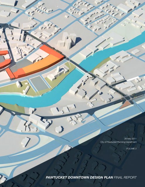
26 May 2011<br />
City of Pawtucket Planning Department<br />
VOLUME 2<br />
<strong>PAWTUCKET</strong> <strong>DOWNTOWN</strong> <strong>DESIGN</strong> <strong>PLAN</strong> <strong>FINAL</strong> REPORT
P<br />
P<br />
P<br />
P<br />
P<br />
P<br />
Thurlow Small Architecture<br />
L + A Landscape Architecture<br />
McMahon Associates<br />
Horsley Witten Group<br />
Highchair designhaus<br />
26 May 2011<br />
City of Pawtucket Planning Department<br />
<strong>PAWTUCKET</strong> <strong>DOWNTOWN</strong> <strong>DESIGN</strong> <strong>PLAN</strong> <strong>FINAL</strong> REPORT
TABLE OF CONTENTS<br />
INTRODUCTION<br />
VISION<br />
<strong>DESIGN</strong><br />
2<br />
004<br />
009<br />
021<br />
045<br />
052<br />
055<br />
060<br />
076<br />
079<br />
091<br />
Executive Summary<br />
Existing Conditions<br />
Study Area and PDDP Process<br />
Report Conclusions<br />
Challenges and Opportunities<br />
Concepts<br />
Concept 1 : Follow the Turnpike, all roads lead to Main Street<br />
Concept 2: Take the Exchange<br />
Concept 3: “P”arking<br />
Concept 4: Enjoy the Riverway<br />
Concept 5: Use Downtown Guidance<br />
Defining Scope<br />
Preferred Alternatives Scope Areas<br />
Overview<br />
Traffic & Street improvements<br />
Street Improvement Principles<br />
Traffic Analysis<br />
Preferred alternatives<br />
Exchange Street - Nathanson Bridge to Broadway<br />
Conceptual Plan<br />
Exchange Street & Broadway to 10%<br />
East Avenue Extension - George Street to Summer Street<br />
Long term Conceptual Plan<br />
George Street & East Avenue Extension to 10%<br />
Pleasant Street & East Avenue Extension to 10%<br />
Main Street & High Street to 10%<br />
Summer Street & High Street to 10%<br />
East Avenue Extension - George Street to Main Street<br />
Short term Conceptual Plan<br />
George Street & East Avenue Extension to 10%<br />
Main Street & High Street to 10%<br />
Main Street - Dexter Street, to Broad Street, to High Street<br />
Conceptual Plan<br />
Broad Street & Exchange Street to 10%<br />
Main Street & Broad Street to 10%<br />
Dexter Street & Main Street to 10%<br />
Cost Estimates<br />
Exchange Street - roadway & landscape improvements<br />
East Avenue Extension - Short-term options<br />
East Avenue Extension - Long-term<br />
Main Street - Roadway & landscape improvements<br />
Re<strong>com</strong>mendations<br />
Public Parking Management<br />
Parking programs<br />
Two-hour parking enforcement<br />
Main Street Garage renovation<br />
Two-wheeled vehicle parking<br />
Lighting replacement program<br />
Permeable paving replacement program<br />
Parking lot improvement projects<br />
Blue “P” signage<br />
Tree edges<br />
Re<strong>com</strong>mendations<br />
Transit systems<br />
Bicycle circulator<br />
Bicycle lanes, sharrows, cycle tracks and roadway signage<br />
Bicycle shelters, parking and map signage<br />
Transit systems<br />
<strong>PAWTUCKET</strong> <strong>DOWNTOWN</strong> <strong>DESIGN</strong> <strong>PLAN</strong>
Removal of RIPTA Roosevelt waiting zone<br />
Rerouting of bus lines & stops after two-way conversions<br />
Re<strong>com</strong>mendations<br />
STATUS & IMPLEMENTATION<br />
099<br />
119<br />
139<br />
146<br />
152<br />
154<br />
Streetscape & Pedestrian system<br />
Sidewalk Ribbon System<br />
Lighting<br />
Lighting revision project option<br />
Lighting replacement project option<br />
Lighting Quality inventory<br />
Street furnishings<br />
Bicycle parking for Main Street<br />
Furnishings<br />
Sponsor program<br />
Benches<br />
Waste receptacles<br />
Planters<br />
Signage<br />
Turnpike signage<br />
Wayfinding signage<br />
Main Street banners<br />
Re<strong>com</strong>mendations<br />
Landscape system<br />
Landscape Plan<br />
Gateways<br />
Tree Ordinance<br />
Urban Street Tree species list<br />
Park and Residential Tree species list<br />
Riverfront District species list<br />
Ecological Green Street Network<br />
Riverway Components<br />
Bridge Park East<br />
Park Place Re-alignment<br />
Re<strong>com</strong>mendations<br />
Regulatory Framework<br />
Mixed use and multi-tenant <strong>com</strong>mercial by right<br />
Parking requirements removal for CD District<br />
Reduce allowable maximum height in downtown<br />
Re<strong>com</strong>mendations<br />
Projects List<br />
List by concept<br />
List by timeline<br />
Cost Evaluation / Additional services<br />
Next Steps and Implementation Priorities<br />
Conclusions<br />
APPENDIX<br />
159<br />
187<br />
229<br />
237<br />
261<br />
A<br />
B<br />
C<br />
D<br />
E<br />
Proposed amendments to the Zoning Ordinance<br />
Proposed amendments to the Planning Commission Regulations<br />
Downtown Design Guidelines<br />
Recirculated 2010 Traffic Analysis<br />
Detailed cost estimates for Exchange Street, East Avenue Extension &<br />
Main street street improvement projects<br />
MAPS<br />
VOLUMES<br />
<strong>FINAL</strong> REPORT<br />
Comprehensive map of PDDP Projects - 3 Parts<br />
1 Existing Conditions Report<br />
2 Final Report<br />
3 FInal Report: Summary<br />
4 Addendum 1: Pleasant Avenue Intersection<br />
5 Addendum 2: Exchange Street<br />
3
P<br />
P<br />
P<br />
P<br />
P<br />
P<br />
EXECUTIVE SUMMARY<br />
Pawtucket, Rhode Island, is a city of roughly 73,000 situated just a few miles<br />
north of Providence on the Blackstone River. Like many small New England<br />
cities, Pawtucket’s fortunes have ebbed and flowed with history. It expanded<br />
with the industrial revolution in the 1800s, suffered an outflow of manufacturing<br />
in the 1930s, lost residents and density to suburbanization and urban renewal<br />
in the 1950s and ‘60s, and resurged with real estate growth in the early 2000s.<br />
Many of these eras introduced plans to redesign Pawtucket’s physical<br />
environment, and the city today reflects these layered efforts. Its unused train<br />
station deteriorates slowly above a closed rail stop. Interstate 95 coarsely<br />
cuts off the downtown from its neighborhoods. The core of the city, once a<br />
meeting point of historic routes, is now a confusing set of one-way streets and<br />
inescapable loops.<br />
MAP OF PDDP PROJECTS<br />
In the spring of 2010, the City of Pawtucket’s Planning Department and the<br />
Pawtucket Foundation initiated a project to fix the downtown. Called the<br />
Pawtucket Downtown Design Plan, the project’s goal is to improve the city’s<br />
infrastructure and, as a result, foster sustainable economic and residential<br />
development. The city selected the Thurlow Small Architecture to lead a team<br />
that includes: L+A Landscape Architecture; McMahon Associates, traffic<br />
engineering; Horsley Witten Group, regulatory consultant; and Highchair<br />
designhaus, graphic design and signage consultant, for the 10-month project<br />
to study traffic, public space, and zoning.<br />
Before solving Pawtucket’s problems, the PDDP team had to better<br />
understand their roots. In 1790 Pawtucket presented a vision of America as<br />
an urban industrial nation to a receptive Alexander Hamilton, then Secretary<br />
of Treasury, as he crossed the Main Street Bridge and visited Slater Mill. The<br />
city soon emerged as a dense urban hub connected to <strong>com</strong>mercial corridor<br />
spokes. That clear pattern, though still evident today, was later interrupted by<br />
major projects intended to benefit the city, like the interstate and the northeast<br />
rail corridor as well as a succession of planning decisions that altered the<br />
function of short segments of roadway and intersections.<br />
While presumably made with good intentions, these choices inevitably undid<br />
established connections. The design team found that linking existing routes,<br />
TWO-WAY MAIN STREET<br />
4<br />
<strong>PAWTUCKET</strong> <strong>DOWNTOWN</strong> <strong>DESIGN</strong> <strong>PLAN</strong>
EXCHANGE STREET<br />
instead of reconfiguring them, could allow people to use their natural instincts<br />
to get around. All we had to do in a town developed during the textile era was<br />
knit its original threads back together.<br />
The Pawtucket Downtown Design Plan proposes five concepts in response to<br />
specific problems that look backward to move forward — not through nostalgia<br />
but <strong>com</strong>mon sense.<br />
PROBLEM While Pawtucket is not congested, it is really hard to get to and<br />
move around downtown.<br />
CONCEPT The first concept reconnects the historic turnpike system, including<br />
the former Boston Post Road, so that travelers see clearly how to get to and<br />
from Main Street. This Turnpike System concept would first be implemented<br />
on Main Street and East Avenue Extension by opening them to two-way traffic,<br />
decreasing wide intersections, increasing on street parking, and enhancing<br />
both pedestrian and bicycle access. Supportive details of this system include<br />
wayfinding and street signage that work from prior downtown signage<br />
programs, environmentally and business-friendly street furnishing options for<br />
Main Street, and the re<strong>com</strong>mendation of a lighting replacement program.<br />
This project also encourages the use of newly available public space in key<br />
locations to be developed into special gateways to downtown.<br />
PROBLEM The rail, the river, the highway, public transit and an up<strong>com</strong>ing<br />
Blackstone Valley Bikeway all <strong>com</strong>e through but not together in downtown.<br />
CONCEPT The second concept identifies Exchange Street as a true place of<br />
“exchange” between the highway, the river, the <strong>com</strong>ing train station, and the<br />
delineated systems for bicycles, local car and bus traffic, and pedestrians. This<br />
concept would first be implemented on Exchange Street between Broadway<br />
and the Nathanson Bridge in the Armory District and near Tolman High School<br />
as part of an existing street improvement project currently underway. The<br />
Exchange concept employs the sidewalk ribbon concept that employs a<br />
buffer space between pedestrians and traffic where public amenities, utilities<br />
<strong>FINAL</strong> REPORT<br />
5
TURNPIKE SYSTEM COMPONENTS<br />
and trees can be located as well as cycle tracks for bicycle use in high traffic<br />
volume areas. The Exchange also proposes two new bicycle loops, or bike<br />
circulators, that would use striping, signage, and bicycle amenities to safely link<br />
the <strong>com</strong>ing bikeway and downtown to important historic sites, local schools<br />
and McCoy stadium. This concept also encourages the integration of new<br />
RIPTA rapid bus changes and future <strong>com</strong>muter rail pedestrian linkages into the<br />
downtown area as those projects move forward.<br />
PROBLEM Finding parking is downtown is perceived as a problem even though<br />
there is too much surface parking.<br />
“P”ARKING SYSTEM LOCATIONS<br />
CONCEPT The third concept is a “P”arking system that will discourage the<br />
creation of new surface parking and decrease the city’s environmental impact.<br />
Aspects of this concept include: encouraging future landscape systems that<br />
replace impervious parking surfaces with permeable options to decrease<br />
the heat island effect and improve water runoff issues; lighting replacement<br />
strategies to decrease energy use and light pollution; signage to improve<br />
wayfinding and enhance use; and the encouragement of specific areas of on<br />
street parking limit enforcement to allow the downtown system to work better<br />
as is. The concept also encourages the introduction of two-wheeled motor<br />
vehicle parking to support more environmentally-friendly transportation.<br />
P<br />
P<br />
P<br />
PROBLEM The river is a vital resource, but not very publicly accessible.<br />
6<br />
PDDP Vision<br />
P<br />
P<br />
P<br />
CONCEPT The fourth project develops a Riverway that supports public spaces<br />
along the mostly undeveloped river and connects them to local neighborhoods.<br />
This concept proposes that specific existing areas of public land be developed<br />
into public parks and viewpoints to frame the river for residents and visitors,<br />
connected to each other and the <strong>com</strong>ing Blackstone Valley Bikeway. Two<br />
parks have already been designated adjacent to the new Bridge 550 project,<br />
Bridge Park West and East; a design proposal for the latter is included in<br />
the PDDP. As well, this project encourages the incorporation of sustainable<br />
practices in downtown, including the adoption of a tree ordinance and a green<br />
street network initiative to increase the tree canopy.<br />
<strong>PAWTUCKET</strong> <strong>DOWNTOWN</strong> <strong>DESIGN</strong> <strong>PLAN</strong>
PROBLEM The current regulatory process relies on special use permits and<br />
variances.<br />
CONCEPT The final project, Downtown Guidance, cleans up zoning and land<br />
use issues to encourage the pedestrian-oriented, mixed-use development<br />
the city wants and discourage the car-dominated, low density it doesn’t. This<br />
concept assists the city in changing its current regulations to offer mixed use<br />
and multi-tenant <strong>com</strong>mercial by right, removing parking requirements for the<br />
Commercial Downtown District, reduces allowable maximum height restrictions<br />
in downtown and offers development guidelines to support appropriate and<br />
<strong>com</strong>patible urban design and architecture.<br />
The PDDP concepts are broad in ambition, but detailed and organized<br />
into a list of projects that address short, medium and long-term phase<br />
implementation. While each project can be <strong>com</strong>pleted individually, they<br />
also add up to a bigger more productive vision and will require coordination<br />
between local and state level agencies, continued political and <strong>com</strong>munity<br />
support, and funding from federal, state and local levels.<br />
LANDSCAPE <strong>PLAN</strong><br />
Inevitably, the Pawtucket Downtown Design Plan is not really a single “plan” so<br />
much as a set of ongoing projects. These efforts may not fix everything about<br />
downtown, but they will give the city a solid infrastructural base that provides<br />
healthy and clear ways to get around by allowing the city to leverage its many<br />
strengths. Pawtucket is what so many places are not — a small, walkable<br />
urban center filled with new and old buildings, neighborhoods of people from<br />
all over the world, hardy entrepreneurs, and accessible city government. At just<br />
one corner, Fountain and Exchange streets, you can find a world-class theater,<br />
a silkscreen <strong>com</strong>pany, a high school, a renovated mill full of design <strong>com</strong>panies,<br />
a historic armory, and, just across the adjacent river full of wildlife, you reach<br />
City Hall, a post office, a public library, and a historic site soon to be the center<br />
of a new National Park. In developing the downtown plan, the PDDP team<br />
found that the best design direction was simply to make a place evident to<br />
itself and others.<br />
BRIDGE PARK EAST<br />
<strong>FINAL</strong> REPORT<br />
PDDP final report<br />
7
INTRODUCTION<br />
EXISTING CONDITIONS<br />
The PDDP team began the Pawtucket Downtown Design Plan by studying the<br />
existing conditions of the City of Pawtucket’s downtown, urban boundaries,<br />
and region. We gathered existing information from previous reports, studies,<br />
traffic data and projects from a variety of sources including the City of<br />
Pawtucket’s Planning and Public Works departments, the Rhode Island<br />
Department of Transportation, the Rhode Island Public Transit Authority, the<br />
Pawtucket Foundation, local institutions and stakeholders. (A list of sources<br />
can be found on pages 4 and 5 of the Existing Conditions Report.) This<br />
material was also made public and available online on the PDDP website,<br />
www.downtownpawtucket.us, under the Pawtucket Planning Database. The<br />
PDDP team also <strong>com</strong>pleted a series of site observation and documentation<br />
visits.<br />
After reviewing and analyzing the information, the PDDP team developed a set<br />
of maps and observations about the current conditions of public space and<br />
street use in the plan’s area. This established the project team’s perspective on<br />
challenges and opportunities for the plan design.<br />
9
VISION Existing Conditions<br />
STUDY AREA & PDDP PROCESS<br />
The City of Pawtucket and the Pawtucket Foundation initiated the Pawtucket<br />
Downtown Design Plan (PDDP) in 2010. They obtained funding from Rhode<br />
Island State-wide Planning Challenge Grant, provided matching funds,<br />
and issued a Request for Proposals to hire a design consultant team in<br />
April 2010. After reviewing proposals and interviewing a set of finalists, the<br />
review <strong>com</strong>mittee selected a team lead by urban design firm Thurlow Small<br />
Architecture with the support of<br />
The city also assembled a Technical Advisory Committee (TAC) consisting<br />
of local and state public officials and stakeholders. The TAC included<br />
representatives from the Rhode Island Department of Transportation, the<br />
Rhode Island Public Transit Authority, Rhode Island Statewide Planning, the<br />
Rhode Island Housing Keepspace Project, the Pawtucket Foundation, and City<br />
Departments, including Planning and Public Works, as well as representatives<br />
from the Mayor’s Office and members of the city Council.<br />
The PDDP study topics include traffic, public space, streetscape, and its<br />
regulatory framework. The area of study was downtown Pawtucket bounded<br />
by a radius equivalent to a ten-minute walking distance from Main Street, as<br />
shown in the adjacent diagram. The core of the downtown fits within a five<br />
minute walking distance shown in the smaller circle.<br />
The PDDP included the following key public and technical advisory meetings:<br />
Jun 01 Task 1 Project Began<br />
Jun 22 Task 2 Community Meeting #1 - Introduction<br />
Jun 24 TAC #1 Technical Advisory Committee meeting<br />
Jul 09 Task 1 Existing Conditions Report <strong>com</strong>pleted<br />
Aug 03 TAC #2 Technical Advisory Committee meeting<br />
Sep 23 TAC #3 Technical Advisory Committee meeting<br />
Sep 27 Task 3 Top Options <strong>com</strong>pleted<br />
Sep 28 Task 4 Community Meeting #2 - Top Options & Vision<br />
Oct 21 TAC #4 Technical Advisory Committee meeting<br />
Dec 02 Task 5 Community Zoning Workshop<br />
Jan 27 TAC #5 Technical Advisory Committee meeting<br />
Feb 17 Task 5 Preferred Alternative <strong>com</strong>pleted<br />
Feb 17 Task 6 Community Meeting #2 - Projects<br />
Mar 08 TAC #6 Technical Advisory Committee meeting<br />
Apr 14 Task 7 Preferred alternative refinement draft<br />
Apr 14 Task 8 Final PDDP Report & Documents<br />
Along with the above described public meetings, members of the PDDP<br />
team held five informal open lunches at Cup’n’Saucer on Main Street<br />
during the first six months of the project and maintained a website at: www.<br />
downtownpawtucket.us that included the Pawtucket Planning database,<br />
project information and meeting dates, and areas for public <strong>com</strong>ment.<br />
10<br />
<strong>PAWTUCKET</strong> <strong>DOWNTOWN</strong> <strong>DESIGN</strong> <strong>PLAN</strong>
WEST<br />
AVE.<br />
PINE<br />
ST.<br />
ST.<br />
CT.<br />
ST.<br />
REET<br />
ICA<br />
10 minute<br />
walking<br />
distance<br />
CONGRESS ST.<br />
LILY<br />
ST.<br />
PINE ST.<br />
POND ST.<br />
5 minute<br />
walking<br />
distance<br />
HOPE<br />
DEXTER CT.<br />
DEXTER ST.<br />
AN ST.<br />
CHERRY ST.<br />
ST.<br />
OLIVE ST.<br />
BARTON ST.<br />
HANCOCK<br />
ST.<br />
NICKERSON ST.<br />
MASON ST<br />
BEATTY ST<br />
MASON ST.<br />
HICKS ST.<br />
BROAD ST.<br />
BARTON<br />
HUMES ST<br />
LONSDALE<br />
ST.<br />
MANCHESTER ST<br />
ST.<br />
MONTGOMERY<br />
JACKSON<br />
MILLER ST<br />
Exchange Street &<br />
GRANT ST<br />
AVE.<br />
THORNLEY<br />
ST.<br />
DARROW<br />
ST.<br />
BLACKSTONE AVE.<br />
St. MARY'S<br />
WEEDEN ST.<br />
WAY<br />
ST.<br />
ALICE ST.<br />
FENNER ST.<br />
EXCHANGE ST.<br />
CENTRAL AVENUE<br />
BLAKE ST.<br />
BLACKSTONE AVE.<br />
Exchange Street &<br />
Roosevelt Avenue<br />
BULLOCK<br />
FRONT ST.<br />
MIDDLE ST.<br />
LEMAN ST.<br />
CARNATION STREET<br />
ROUTE 95<br />
PLEASANT STREET<br />
VIEW WAY<br />
Study area for the PDDP<br />
CENTRE ST.<br />
FOUNTAIN ST.<br />
MAY ST<br />
SLATER<br />
BLAKE ST.<br />
CT.<br />
LAUREL STREET<br />
IRVING<br />
HOWARD AVE.<br />
LUPINE STREET<br />
LAWR<br />
ALLEN AVE.<br />
KOSSUTH ST.<br />
COTTAGE ST.<br />
BROADWAY U.S. ROUTE 1<br />
ENCE<br />
ST.<br />
DANIELS ST.<br />
MINERAL SPRING AVE.<br />
BAGLEY<br />
LYON<br />
GREENE ST.<br />
MARTIN<br />
STAR ST.<br />
ST.<br />
SAU<br />
MYRTLE ST.<br />
NDE<br />
SANFORD ST.<br />
ST.<br />
CT.<br />
ORCHARD ST.<br />
WOODBINE ST.<br />
ST.<br />
CARNATION S<br />
PRIMROSE ST<br />
RS<br />
PRINCE ST.<br />
CENTRAL AVE<br />
ANGLE ST.<br />
ST.<br />
T.<br />
ST.<br />
EN ST.<br />
T.<br />
FENNER ST.<br />
QUINCY<br />
BULLOCK<br />
ST.<br />
COLEMAN ST.<br />
CENTRE ST.<br />
SLATER<br />
IRVING<br />
CT.<br />
STAR ST.<br />
MINERAL SPRING AVE.<br />
BAGLEY<br />
ST.<br />
CONANT ST.<br />
CAPITAL ST.<br />
AVE.<br />
MARTIN<br />
CT.<br />
ST.<br />
CONANT ST.<br />
BARTON ST.<br />
MAINST.<br />
PEARL ST.<br />
BEECHST.<br />
Dexter Street &<br />
Goff Avenue<br />
MULBERRY ST.<br />
GARDEN<br />
PINE ST<br />
FOREST<br />
BAYLEY ST.<br />
East Avenue &<br />
George Street<br />
LAWN AVE.<br />
GOFF AVE.<br />
MAIN ST.<br />
CHURCH ST.<br />
CEDAR ST.<br />
HILL ST.<br />
COMMERCE ST.<br />
SOUTH UNION ST.<br />
HARRISON ST.<br />
GROTTO AVE.<br />
MARRIN ST.<br />
GRACE ST.<br />
HUMBOLT ST.<br />
GEORGE ST.<br />
PARK PLACE<br />
AVE.<br />
AVE.<br />
DIX<br />
MAIN ST.<br />
U.S. ROUTE 1<br />
PLEASANT ST.<br />
MAPLE ST.<br />
EAST AVE. EXT.<br />
NORTH<br />
SUMMER ST.<br />
JENKS WAY<br />
UNION ST<br />
AVE.<br />
HIGH ST.<br />
ROOSEVELT AVE.<br />
LEWIS<br />
ST.<br />
RIVER ST.<br />
LEATHER AVE<br />
SLATER AVE<br />
ROUTE<br />
DIVISION ST<br />
QUINCY<br />
WATER ST.<br />
WATER<br />
15<br />
SCHOOL ST.<br />
VERNON ST.<br />
BOWERS ST<br />
BROADWAY<br />
FRUIT ST.<br />
CARSON ST.<br />
MERRICK ST.<br />
ST.<br />
EXCHANGE CT.<br />
KIDS<br />
DIVISION ST.<br />
SOUTH ST.<br />
UNDERWOOD ST.<br />
LONGLEY CT.<br />
WALCOTT<br />
POTTER ST.<br />
SUMMIT ST.<br />
GROVE ST.<br />
ARLINGTON ST.<br />
ARMISTICE BLVD.<br />
MAYNARD<br />
HOMESTEAD<br />
ST.<br />
ST.<br />
JOHNSON<br />
BREWSTER ST.<br />
SPRING<br />
CAPITAL ST.<br />
ST.<br />
INTERSTATE<br />
Main Street &<br />
Roosevelt Avenue<br />
MELTON ST.<br />
TYLER ST.<br />
COMSTOCK ST.<br />
ST.<br />
WALNUT ST.<br />
ST.<br />
ST.<br />
ST.<br />
MEADOW ST.<br />
STUART ST.<br />
FRENCH ST.<br />
YOUNG ST.<br />
DENVER<br />
AVE.<br />
CLOVER<br />
WHITE ST.<br />
ST.<br />
ARCH ST.<br />
NORTH BEND<br />
ST.<br />
SOUTH BEND ST.<br />
ST.<br />
KEPLER ST.<br />
B<br />
BROWN<br />
CARSON ST.<br />
MELTON ST.<br />
COMSTOCK ST.<br />
ST.<br />
BROWN ST.<br />
BARNEY AVE.<br />
PINE ST.<br />
DELANEY<br />
ST.<br />
EAST AVE.<br />
JAMES ST.<br />
PLEASANT ST.<br />
TAFT ST<br />
DAVIS<br />
Pleasant Street &<br />
Division Street<br />
ST.<br />
WEBB ST.<br />
CT.<br />
SPRING<br />
POND<br />
NORTON ST.<br />
HILTON ST.<br />
ST.<br />
MULBERRY ST.<br />
WHITE ST.<br />
WASHINGTON ST.<br />
SCHOOL<br />
GARDEN ST.<br />
MERRICK ST.<br />
STUART ST.<br />
SPENCER<br />
WEST AVE.<br />
BUFFUM ST.<br />
WEBB ST.<br />
MAIN ST.<br />
STERRY ST.<br />
MAGILL<br />
SHERMAN<br />
SAYLES AVE.<br />
WARREN<br />
BELMONT<br />
ANTHONY<br />
RANDALL<br />
MARY ST.<br />
HILTON ST.<br />
SISSON ST.<br />
CT.<br />
MAGILL<br />
ST.<br />
ST.<br />
DUNNELL<br />
AVE.<br />
AVE.<br />
DORRANCE ST.<br />
<strong>FINAL</strong> REPORT<br />
AVE.<br />
WALKER<br />
KNOWLES<br />
ST.<br />
SAYLES AVE.<br />
AVE.<br />
AVE.<br />
ST.<br />
ST.<br />
BOUTWELL ST.<br />
WALTHAM ST.<br />
DUNNELL AVE.<br />
AUBURN ST.<br />
STERRY ST.<br />
KNOWLES ST.<br />
HARVARD ST.<br />
ST.<br />
JEFFERSON AVE.<br />
SISSON ST.<br />
AVE<br />
CLYDE<br />
KIMBALL AVE.<br />
CAMBRIA CT.<br />
VE.<br />
ST. CLYDE<br />
ST.<br />
BEDFORD RD.<br />
KENNILW<br />
WHIPPLE<br />
ST.<br />
GERALD ST.<br />
<strong>PAWTUCKET</strong> AVE.<br />
HIGHLAND ST.<br />
DORSET RD.<br />
ROUTE 1<br />
IBSON<br />
E.<br />
McCUSKER<br />
PATT ST.<br />
BARNES<br />
EAST AVE.<br />
NEWELL<br />
AVE.<br />
N AVE.<br />
HARVEY<br />
RHODES<br />
TOWER<br />
MANNING<br />
ST.<br />
LYMAN<br />
ST.<br />
CLEVELAND<br />
CLIFFORD<br />
WINTER<br />
SHERMAN ST<br />
ST.<br />
ST.<br />
TIDEWATER ST.<br />
ST.<br />
ST.<br />
ST.<br />
JEFFERS<br />
THURSTON ST.<br />
HARRIET<br />
ST.<br />
HAYWARD<br />
ST.<br />
ST.<br />
ST.<br />
SHOREHAM<br />
CT.<br />
SHEFFIELD AVE.<br />
MERRY<br />
ST.<br />
ROUTE 122<br />
BENSLEY<br />
AVE.<br />
ST.<br />
ST.<br />
THORNTON ST.<br />
TAFT ST.<br />
BOWLES CT.<br />
PLEASANT ST.<br />
ST.<br />
THORNTON<br />
MAIN ST.<br />
LEGEND<br />
STERRY ST.<br />
MAGILL<br />
SHERMAN<br />
WOODLAND ST.<br />
ST.<br />
ROSEWOOD ST.<br />
RANDALL<br />
CHESTNUT ST.<br />
Original study Intersections<br />
One Way Streets<br />
North<br />
MARY ST.<br />
PROSPECT ST.<br />
BEECHWOOD<br />
ENGLEWOOD<br />
SISSON ST.<br />
CT.<br />
LINWOOD<br />
MAGILL<br />
MOELLER<br />
EXETER<br />
11<br />
PL.<br />
AVE.<br />
FENWOOD AVE.<br />
ST.<br />
DUNNELL<br />
TALCOTT AVE.<br />
AVE.<br />
MELROSE AVE.<br />
AVE.<br />
DUNNELL<br />
PEARSON AVE.<br />
AVE.<br />
AVE.<br />
RIVERVIEW AVE.<br />
MARYLAND AVE.<br />
RRANCE ST.<br />
RHODE ISLAND AVE.<br />
RHODE ISL<br />
AVE.<br />
KN<br />
LA
VISION Existing Conditions<br />
REPORT CONCLUSIONS<br />
The following conditions were noted in the PDDP Existing Conditions Report<br />
<strong>com</strong>pleted in July 2010:<br />
CONTEXT<br />
Regional relationships<br />
Primary consumer destinations are outside of the city<br />
Primary employment locations are outside of downtown<br />
Downtown is a gateway to Blackstone river valley<br />
Downtown is a unique convergence of river, highway & rail line<br />
Urban development<br />
Main street is, and was always, the perceptual center<br />
River was spine of power, then decay, now development<br />
Highway detached neighborhoods on two sides of downtown<br />
Historic routes became disconnected<br />
Urban history<br />
Historic layers describe city instincts<br />
Urban design massing & density<br />
Scale of downtown buildings appropriate for city center<br />
Low density zones just outside of center<br />
Street edge continuity<br />
Area between main & summer streets has most continuous street edge<br />
Open lots on edge of downtown significantly undermine street edge<br />
Loss of public space clarity and protocol<br />
Discontinuities disrupt sense of downtown boundaries and density<br />
Good urban fabric variation<br />
URBAN <strong>DESIGN</strong><br />
Current & up<strong>com</strong>ing development<br />
Recent development in close proximity to main street<br />
Recent large developments are mostly housing<br />
Current development is primarily smaller scale <strong>com</strong>mercial<br />
Data indicates future unlikely to see large-scale housing development<br />
Districts and historic properties<br />
Significant individual historic buildings remain, but are a loose field<br />
PUBLIC SPACE / LANDSCAPE<br />
Public space & activity spots<br />
Public transportation initiates public activity<br />
People use public outdoor space<br />
Lunchtime is busy<br />
Streetscape<br />
Lighting mostly for cars, not pedestrians<br />
Sidewalks in mostly acceptable condition, need maintenance<br />
Striping in poor condition<br />
12<br />
Pedestrian & automobile conflicts<br />
There are dangerous pedestrian crossings between intersections<br />
Crossing areas are unique problems to solve<br />
<strong>PAWTUCKET</strong> <strong>DOWNTOWN</strong> <strong>DESIGN</strong> <strong>PLAN</strong>
Greenspace<br />
Sidewalks are the primary public space<br />
Slater mill is the primary big open event space<br />
The river is the primary green space<br />
Water flow & topography<br />
Significant impermeable paving exists in downtown pawtucket<br />
Flooding a potential threat to downtown<br />
Parking parking lots & on-street parking<br />
Surface parking dominates the downtown landscape<br />
On street parking limits are rarely enforced<br />
Parking pairings<br />
Signage is missing to identify the use of many lots<br />
Many private lots are under used<br />
PARKING<br />
RIPTA bus lines, stops & shelters<br />
There is a high density and diversity of bus lines<br />
Rapid bus will be a significant opportunity<br />
Bus locations generate significant pedestrian activity<br />
TRANSIT<br />
One way street patterns<br />
One way streets around downtown cut it off<br />
People inside and outside of pawtucket find one ways confusing<br />
TRAFFIC<br />
Downtown routes in & out<br />
Finding main street requires local knowledge<br />
Bicycle use & infrastructure<br />
Bicycles are <strong>com</strong>monly used as transportation<br />
There are no clear traffic protocols for bicycles<br />
There is limited bicycle parking in downtown<br />
Besides bicycles, people <strong>com</strong>monly use other personal vehicles<br />
The major intersections in downtown operate at good levels of service<br />
While the one-way streets reduce the number of conflict points at intersections,<br />
they necessitate additional miles traveled to reach destinations.<br />
ZONING<br />
<strong>FINAL</strong> REPORT<br />
13
VISION Existing Conditions<br />
CHALLENGES AND OPPORTUNITIES<br />
From the existing conditions, the PDDP team found a set of challenges and<br />
opportunities to address in developing projects to improve downtown Pawtucket:<br />
CHARACTER<br />
The downtown could better express its character as a gateway.<br />
The downtown Pawtucket area works like a set of <strong>com</strong>mercial corridors<br />
spokes into the centralized city hub, yet it is not only hard to make the<br />
connection to the core of Main Street, but not clear when one has entered<br />
into the downtown area in general. The downtown could likely get further<br />
<strong>com</strong>mercial support from recognition as a special area of density and growth.<br />
The downtown could make better exchange points between its three<br />
most important systems: the river, the rail and the highway.<br />
These three systems are the most vital physical and infrastructural resources<br />
in downtown Pawtucket and unique in the state. Pawtucket is the gateway to<br />
the entire region of the Blackstone Valley. The highway is a critical linkage to<br />
the eastern seaboard including airports. The rail line is the future of passenger<br />
and freight investment. In Pawtucket, these all <strong>com</strong>e together within less than<br />
a third of a mile; access points <strong>com</strong>e within two-thirds of a mile of each other,<br />
but finding those access point and links between them are not evident.<br />
Downtown Pawtucket’s historic buildings significantly contribute to the<br />
organic, cultural and aesthetic sense of downtown.<br />
When people first <strong>com</strong>e to Pawtucket, they often react positively to the<br />
remaining historic properties that are different in type, era, and style. The<br />
downtown area is a <strong>com</strong>mercial New England business district that was<br />
developed primarily between the 1880s and the 1930s. The buildings are<br />
substantial in mass, ornament and of strong institutional and public typology.<br />
While it matches a type found regionally, this character is special, unique, and<br />
important.<br />
DENSITY<br />
Downtown is disrupted by low density surrounding it and surface<br />
parking in it.<br />
The biggest interruption of the historic and retail character of downtown<br />
Pawtucket is the large areas of surface parking, much of which is under used<br />
and privately owned. There is a noticeable ring of low density around the center<br />
of downtown that negatively contributes to the connections beyond.<br />
Recent larger development has been housing; recent smaller<br />
development has been <strong>com</strong>mercial.<br />
The real estate boom of the early 2000s enhanced the residential population<br />
and tax base in the downtown area, particularly in renovated mill space.<br />
The boom did not, however, improve economic conditions for <strong>com</strong>mercial<br />
properties in a major way as the residential growth was not significant enough<br />
to establish a consumer base for local stores. Many of the people who moved<br />
to the new downtown units do not work or buy daily provisions in Pawtucket.<br />
TRAFFIC<br />
14<br />
Main Street’s one way configuration disrupts its use as a center.<br />
The core of Main Street, from Broad Street to High Street, is a visible center<br />
to the downtown area, but can not function or connect properly to help it<br />
be accessible easily from surrounding neighborhoods or cities because it is<br />
confusing to find.<br />
<strong>PAWTUCKET</strong> <strong>DOWNTOWN</strong> <strong>DESIGN</strong> <strong>PLAN</strong>
Downtown does not have a traffic amount problem.<br />
Traffic count data shows that intersections are rated at appropriate levels for<br />
a downtown urban area. The traffic problem is thus not one of amount, but<br />
rather of access.<br />
The one way streets are very confusing and cut off the downtown from<br />
its neighborhoods.<br />
Traffic patterns have been set over time by incremental changes to facilitate<br />
unique circumstances and the overall ease of moving to the center of the city<br />
has be<strong>com</strong>e more difficult. It is hard to get around when you can’t move back<br />
the same way you came. Local people rely on local knowledge of how to get<br />
around; visitors just get lost.<br />
Pawtucket is at the center of important historic routes.<br />
Many important historical events happened in downtown Pawtucket because<br />
it was well linked to New York and Boston. While these are not evident in the<br />
way the streets currently work, all of the key roadways exist except for one<br />
small section. The logics of how to move through the city could be re-formed<br />
and would help people use their natural cue and instincts to move to and from<br />
the downtown area instead of relying on signage or local knowledge.<br />
The downtown needs to be linked across the highway.<br />
Interstate 95 significantly cut off the downtown from Providence and the east<br />
side of Pawtucket when it was built. The city has not recovered from that<br />
decades old split and would benefit from projects that restitch both sides.<br />
TRANSIT / BICYCLES /<br />
PEDESTRIANS<br />
There are dangerous pedestrian crossings between intersections that<br />
need unique solutions.<br />
Several situations in downtown Pawtucket encourage pedestrians to do<br />
perilous crossings. The first is at Roosevelt Avenue and Main Street at the bus<br />
hub; the second is at Main Street mid way between Broad Street and High<br />
Street; and the third is on Goff Avenue mid way between Dexter Street and<br />
Broad Street. These conditions are unique and need to be addressed through<br />
specific street improvements or by working with property owners and state<br />
agencies.<br />
There are a lot of bicyclists in downtown, but not a clear protocol on<br />
where they should be.<br />
There are many bike riders in downtown Pawtucket and both they and<br />
automobile drivers would benefit from a clear and designated system for their<br />
space in the public way. With new ac<strong>com</strong>modation, bike ridership would also<br />
likely rise, decreasing the use of cars and future parking needs.<br />
Downtown has a high density of bus lines and great potential as a<br />
terminus of the future rapid bus.<br />
Downtown Pawtucket has a high density of bus lines, stops and activity in<br />
downtown but does not take advantage of the pedestrian activity nor help to<br />
organize the routes. The downtown hub has significant pedestrian traffic and<br />
generates most of the social activity. The one way streets contribute to bus<br />
route inefficiency.<br />
<strong>FINAL</strong> REPORT<br />
15
NATURAL RESOURCES<br />
The river is the most important resource for public space and private<br />
development.<br />
The river is a beautiful and re-energizing resource that significantly contributes<br />
to the character of downtown Pawtucket. Compared to a typical downtown<br />
urban area, the areas around the Blackstone River are surprisingly<br />
undeveloped. In downtown, they consist of forrest, cultivated grassy banks,<br />
and former mill properties. Outside of downtown, they are mostly open<br />
and uncultivated but impacted natural forest and riverbank. There is a lot of<br />
opportunity in considering its future for public use and increasing City tax base.<br />
Downtown has too much impervious paving.<br />
The large areas of impermeable paving in the downtown area almost eliminates<br />
the natural ecological flow of water through the Blackstone Valley to the river<br />
and harms not only the water quality and below surface recharge, but impacts<br />
flood-prone areas during high volume events. These large expanses of paving<br />
also increase the heat island effect.<br />
There is little organized programmed greenspace, but lots of wild<br />
natural space along the river.<br />
Because the river area, particularly outside of downtown, is undeveloped, there<br />
is a significant opportunity to consider how the open spaces can be preserved,<br />
made more accessible, and protected before larger development might<br />
occur so that the public can access the river for recreation and wildlife can<br />
maintain habitat. The city has an opportunity to both support the redeveloping<br />
ecological system and grow economically.<br />
PUBLIC SPACE<br />
People use public space during the daytime.<br />
While most people perceive downtown as being relatively empty of activity,<br />
increasingly there are more people on the street waiting for public transit and<br />
patronizing local restaurants, social organizations, or institutions. During the<br />
lunch hour, particularly in summer months, it is <strong>com</strong>mon to find many people<br />
seated on benches, walking around, or on bicycles.<br />
Except on and around Main Street, lighting is mostly for cars, not<br />
pedestrians<br />
Lighting in downtown Pawtucket consists mostly of industrial fixtures intended<br />
to illuminate the neighborhood generally. This creates a <strong>com</strong>bination of over<br />
lighting some areas, particularly at public parking areas, and under lighting<br />
others, particularly small streets for pedestrians. The existing pedestrian light<br />
fixture types contribute to light pollution and are not energy efficient.<br />
PARKING<br />
16<br />
Pawtucket has enough parking in downtown for current use and some<br />
moderate expansion.<br />
The number of spaces in the downtown area meets current needs for<br />
businesses. Assuming no sudden growth, there is also some available space<br />
for incremental needs over the <strong>com</strong>ing years. The perceived parking problem is<br />
not due to amount available, but to what is for public use.<br />
On-street spots are used as long-term parking. Private lots are under<br />
used.<br />
Because there is no parking limit enforcement in the downtown area, people<br />
who work in downtown often park their cars in on street spaces and leave their<br />
<strong>PAWTUCKET</strong> <strong>DOWNTOWN</strong> <strong>DESIGN</strong> <strong>PLAN</strong>
cars there all day. This disrupts the potential for people who are patronizing<br />
local shops from having direct access to close spaces and encourages the<br />
sense that there is a parking “problem.”<br />
Parking lots have poor signage.<br />
Another contributor to the sense of a parking problem is that the lots that<br />
are available are not signed clearly and drivers find it confusing to locate an<br />
available off street spot. Some lots also have a <strong>com</strong>bination of public and<br />
restricted uses. Signage would help.<br />
There are roadblocks to the most important uses downtown.<br />
Mixed use, including mixed <strong>com</strong>mercial and the <strong>com</strong>bination of residential with<br />
<strong>com</strong>mercial, currently requires a Special Use Permit within the Commercial<br />
Downtown (CD) District. This additional layer of permitting creates a<br />
perception of additional risk to applicants and a second layer of permitting<br />
that is not necessary for these most desirable uses. Also, dimensional<br />
requirements associated with multi-tenant <strong>com</strong>mercial use make it extremely<br />
difficult to re-occupy some of the buildings along Main Street.<br />
ZONING<br />
Parking regulations are ready for more flexibility.<br />
Pawtucket allows for a reduction in required parking downtown when<br />
<strong>com</strong>pared with other areas of the <strong>com</strong>munity, acknowledging that a vibrant<br />
mixed use district must have flexibility. However, there are still requirements<br />
in place today that make re-occupation of some structures very challenging.<br />
Changes in regulations will need to reflect an overall shift to viewing parking<br />
downtown as a “system” that operates beyond individual sites, on a<br />
neighborhood scale.<br />
Main Street is a cultural resource that would benefit from design<br />
guidelines.<br />
The Zoning Ordinance today incorporates many design principles that are<br />
intended to help shape development in a manner that is consistent with<br />
the historic fabric and economic goals of the <strong>com</strong>munity. These principles,<br />
however, are not presented in a way that is easily enforced and can be<br />
interpreted in many different ways.<br />
<strong>FINAL</strong> REPORT<br />
17
VISION
INTRODUCTION<br />
CONCEPTS<br />
Rather than develop open guidelines, the PDDP team developed a set of<br />
concepts that formed into specific projects that could convey <strong>com</strong>munity<br />
ambitions and methods for implementation. Downtowns are a set of <strong>com</strong>plex<br />
interactions between urban systems that involve physical infrastructure, such<br />
as roadway surfaces, utilities, sidewalks, and signaling equipment, but also<br />
programs, such as city administrative processes, such as parking enforcement,<br />
maintenance, and economic development. These projects intend to reframe<br />
the historic and existing efforts in the city with contemporary logics of<br />
economic and ecological stainability along with simple pragmatic observations<br />
to help systems work better together, to help pedestrians, bicycles and<br />
public transportation share priority on roadways, and offer ways in which the<br />
character of the city can express itself.<br />
These were presented in stages as they were developing: first to the Technical<br />
Advisory Committee on August 3, 2010, then to the Pawtucket Foundation’s<br />
board, one of the sponsoring organizations, on September 8, followed by a<br />
full <strong>com</strong>munity-wide meeting on September 28. The <strong>com</strong>munity meeting was<br />
approximately two hours in length and included many questions from the<br />
audience. The presentation was posted to the project website and people were<br />
asked to make <strong>com</strong>ments online as well as to join lunches once a month with<br />
the project team leader, Maia Small.<br />
The projects of the PDDP are:<br />
THE TURNPIKES<br />
THE EXCHANGE<br />
“P”ARKING<br />
RIVERWAY<br />
<strong>DOWNTOWN</strong> GUIDANCE<br />
21
VISION Concepts<br />
HOW DO I GET TO <strong>DOWNTOWN</strong> <strong>PAWTUCKET</strong><br />
CONCEPT 1 : FOLLOW THE TURNPIKE, ALL ROADS LEAD TO MAIN STREET<br />
Turnpike project goals<br />
Make finding Downtown easy<br />
Normalize Pawtucket’s streets and<br />
intersections<br />
Bring people to Main Street naturally<br />
Link people now to Pawtucket’s past<br />
Turnpike project <strong>com</strong>ponents<br />
Re-establishing Two-way traffic<br />
Adding On-Street parking<br />
Encouraging bicycles and<br />
pedestrians<br />
Adding historic route signage<br />
Creating special paving and striping<br />
Main Street improvements goals<br />
Make two-way traffic without<br />
changing utilities<br />
Make it active, functional, & beautiful<br />
Add traffic calming<br />
Main Street <strong>com</strong>ponents<br />
Two-way traffic<br />
On-street parking alternating<br />
on both sides<br />
Raised shared space surface<br />
Bike ac<strong>com</strong>modations<br />
Through our study of the origins of transportation and vehicle movement<br />
through the downtown area of Pawtucket we discovered that Main Street<br />
has been a significant route since the early 1700s. The first recorded path<br />
or roadway in the city was the Boston Post Road, an important linkage from<br />
Boston to New York City that began as a Native American trail and was more<br />
formalized after European settlement as the King’s Best Highway.<br />
The Boston Post Road was instrumental in the development of New England<br />
as it offered a known route for goods and people during settlement expansion<br />
and organization. It functioned as the origins of postal travel and was identified<br />
as a service route by postmaster general Benjamin Franklin prior to the<br />
Revolutionary War.<br />
In Pawtucket, the Boston Post Road route can still be identified along the<br />
existing streets of Pawtucket Avenue to Pleasant Street, to Main Street, across<br />
the Main Street bridge, up Broadway and onto what is now Washington Street<br />
(named after President George Washington’s inaugural ride to Boston). While<br />
this route currently exists (save one very short segment that has been given to<br />
private development), it has been disconnected from <strong>com</strong>mon use because of<br />
one way configurations and limited intersection options.<br />
Other roadways developed in Pawtucket’s early colonial years, specifically<br />
a privatized turnpike system that began in the early 1800s and was sold to<br />
municipalities in the 1830s. Four important turnpikes converged on Pawtucket:<br />
the Valley Falls Turnpike that connected Central Falls and Cumberland; the<br />
Norfolk Bristol Turnpike that connected South Attleboro and Boston; the<br />
Mineral Spring Turnpike that connected North Providence and Connecticut;<br />
the Providence East Turnpike that connected Hope Street and the east side<br />
of Providence; and the Providence Pawtucket Turnpike that connected North<br />
Main in Providence to Pawtucket. These routes all converged like spokes on<br />
the hub of a short segment of Pawtucket’s Main Street.<br />
The PDDP Turnpike proposal for downtown Pawtucket is to re-establish these<br />
key historic routes into downtown Pawtucket. These routes represent natural<br />
instincts for movement in the city and help establish existing landmarks for<br />
navigating to and through downtown.<br />
22<br />
PDDP VISION
Historic Turnpike Routes<br />
Valley Falls Turnpike<br />
Central Falls & Cumberland<br />
Norfolk Bristol Turnpike<br />
South Attleboro & Boston<br />
Mineral Spring Turnpike<br />
North Providence & Connecticut<br />
Providence East Turnpike<br />
Hope Street & east side of<br />
Providence<br />
Providence Pawtucket Turnpike<br />
North Main in Providence<br />
This diagram shows the turnpikes of Rhode Island in the 1800s.<br />
PDDP <strong>FINAL</strong> REPORT<br />
23
Re-established Turnpike Routes<br />
MAIN STREET<br />
SLATER MILL<br />
I-95<br />
This diagram shows the historic<br />
turnpike routes and their existing<br />
locations by color. All of the routes<br />
exist except the short segment of<br />
Pawtucket Avenue shown dashed.<br />
The segment of George Street and<br />
East Avenue Extension is the only<br />
route that deviates from the original<br />
historical path.<br />
Valley Falls Turnpike Central Falls & Cumberland<br />
Norfolk Bristol Turnpike South Attleboro & Boston<br />
Mineral Spring Turnpike North Providence & Connecticut<br />
Providence East Turnpike Hope Street & East side of Providence<br />
Providence Pawtucket Turnpike North Main in Providence<br />
Boston Post Road New York City to Boston<br />
24<br />
PDDP VISION
Segments of Turnpike Routes<br />
BROAD<br />
HIGH<br />
ROOSEVELT<br />
BROADWAY<br />
MAIN STREET<br />
MAIN<br />
EAST AVENUE EXT<br />
DIVISION<br />
GEORGE<br />
<strong>PAWTUCKET</strong> AVENUE<br />
PLEASANT<br />
This diagram shows the roadway segments that would need to be modified<br />
from one-way to two-way operation in order to make the Turnpike System<br />
functional. They are also shown in phases based on likelihood of funding and<br />
viability.<br />
Short-term<br />
Medium-term<br />
Long-term<br />
PDDP <strong>FINAL</strong> REPORT<br />
25
Views of existing and proposed Broad Street and Exchange Street intersection<br />
26<br />
PDDP VISION
Views of existing and proposed Main Street<br />
PDDP <strong>FINAL</strong> REPORT<br />
27
VISION Concepts<br />
HOW DO I MOVE AROUND <strong>DOWNTOWN</strong> <strong>PAWTUCKET</strong><br />
CONCEPT 2 : TAKE THE EXCHANGE<br />
Exchange goals<br />
Find alternative transportation easily<br />
Make it safe to ride a bike<br />
Help kids get to school<br />
Add trees and beauty to Downtown<br />
Exchange <strong>com</strong>ponents<br />
Intersection diets<br />
Bicycle lanes<br />
Sustainable plantings & trees<br />
RIPTA bus focus<br />
Specific RIPTA bus shelters<br />
Improved crossing at Tolman HS<br />
Normalize intersections<br />
Exchange Street has historically been a linkage between the river and the rail<br />
line and later to the interstate highway. The original train station was located at<br />
Montgomery and Exchange Streets before the rail line was moved farther west<br />
towards Goff with the station moving north towards Barton and Broad Streets.<br />
Exchange is one of the best linkages between the what is anticipated to be<br />
the new <strong>com</strong>muter rail stop station and the Blackstone River. It is a wide street<br />
with many trees that function now as a clear way to move around the center<br />
of downtown. It is one of the only two-way boulevards in Pawtucket and the<br />
only one near downtown (Park Place, while wide, does not allow clear two-way<br />
travel),<br />
The Exchange Project is intended to establish the importance of multiple forms<br />
of transit and make finding, accessing and crossing between them easy. With<br />
the introduction of the RIPTA rapid bus system that will efficiently connect<br />
downtown Pawtucket with downtown Providence, this is an opportunity for the<br />
city to capitalize on statewide investment. There are also numerous bus lines<br />
that currently move through downtown, many of which run along Exchange<br />
Street, Roosevelt Avenue and HIgh Street.<br />
The Exchange project looks to reinforce the “boulevard” and traffic calming<br />
nature of Exchange Street by reducing automobile travel lanes, increasing<br />
on street parking, adding bicycle lanes, increasing the number of trees and<br />
plantings, coordinating with new RIPTA bus shelters and generally making<br />
pedestrian travel safer by having short crosswalk distances at intersections and<br />
better coordinated signals. The bicycle paths also are designed to form two<br />
“circulator” loops around downtown playing on the legacy of Pawtucket’s much<br />
derided traffic circulator and connecting the two high schools, the Blackstone<br />
Academy and an elementary school along with McCoy Stadium, home of the<br />
PawSox, and three other neighborhood schools with downtown. Students<br />
often use the bus system after school as well, so this makes it safer and easier<br />
for students to access public transportation. Connecting the schools with the<br />
bicycle loops also encourages students to ride their bikes, decreasing early<br />
morning and afternoon pickup and drop off traffic on Exchange Street and East<br />
Avenue and increasing their physical fitness.<br />
Adding bicycle lanes in to an area that currently does not have them is a<br />
difficult investment since having designated bicycle riding space is mostly<br />
effective if it is part of a larger system. In this case, as loops bisected by the<br />
<strong>com</strong>ing Blackstone Valley Bikeway, they are self-contained system that can be<br />
expanded upon through future efforts.<br />
28<br />
PDDP VISION
PROJECT 2 : TAKE THE EXCHANGE<br />
PDDP <strong>FINAL</strong> REPORT<br />
29
MAIN<br />
Proposed Exchange Components<br />
HIGH<br />
ROOSEVELT<br />
BROAD<br />
EXCHANGE<br />
BROADWAY<br />
DIVISION<br />
GEORGE<br />
PLEASANT<br />
Street improvements from Dexter to Broadway;<br />
Bicycle circulators to local schools<br />
RIPTA bus stops<br />
30<br />
PDDP VISION
Exchange Segments<br />
BROAD<br />
HIGH<br />
ROOSEVELT<br />
BROADWAY<br />
EXCHANGE<br />
MAIN<br />
DIVISION<br />
GEORGE<br />
PLEASANT<br />
This diagram shows each part of the Exchange project in phases.<br />
Short-term<br />
Medium-term<br />
Long-term<br />
Affiliated<br />
PDDP <strong>FINAL</strong> REPORT<br />
31
Views of existing and proposed Roosevelt Avenue and Exchange Street intersection<br />
32<br />
PDDP VISION
Views of existing and proposed Exchange Street between High Street and Roosevelt Avenue<br />
PDDP <strong>FINAL</strong> REPORT<br />
33
VISION Concepts<br />
HOW DO I STOP IN <strong>DOWNTOWN</strong> <strong>PAWTUCKET</strong><br />
CONCEPT 3 : “P”ARKING<br />
“P”arking goals<br />
Make finding parking easy<br />
Encourage development<br />
Reduce water run-off<br />
“P”arking <strong>com</strong>ponents<br />
Enforce on-street parking<br />
Add on-street spaces<br />
Create “P” signage at parking lots<br />
Increase pervious surfaces<br />
Add trees<br />
Renovate City Garage<br />
Change parking requirements<br />
Historically, Pawtucket’s downtown street edges were lined with <strong>com</strong>mercial<br />
buildings as it was developed prior to the use of the automobile. Originally,<br />
pedestrian movement was the primary form of getting through the downtown;<br />
then carriages and streetcars became <strong>com</strong>mon. Eventually, the downtown<br />
streets were redesigned to ac<strong>com</strong>modate cars, a system that also included<br />
parking lots, wider streets, and larger sidewalk corner radii.<br />
Currently, 25% of all land area in downtown is surface parking. There are<br />
currently 1,730 parking spaces, 10% of which is on street parking, 90% of<br />
which is in parking lots. 70% of all parking spaces are found on private lots;<br />
30% of parking spaces are on public streets, lots or garages. The biggest<br />
users of parking in the core of downtown are City Hall, the Visitors Center<br />
building, the YMCA and the Public Library.<br />
After reviewing recent parking studies <strong>com</strong>pleted for the city, the PDDP found<br />
that parking is ample for the current and anticipated uses in the near future.<br />
The parking system, however, does not work efficiently because lots are<br />
not adequately signed and on street parking limits are not enforced. There<br />
is enough activity by businesses and offices in downtown that employees<br />
generally park in the on street parking locations during daytime hours,<br />
restricting those spots for <strong>com</strong>mercial customers and short-term parking.<br />
Having a system of moving spaces is important to keeping up the flow of<br />
traffic, density of <strong>com</strong>mercial activity and encouraging retail shopping.<br />
The “P”arking project addresses the above concerns by developing a set<br />
of program and physical infrastructure improvements: enforce the two-hour<br />
parking limit for on street parking spots, provide standard “P” signage for<br />
public lots that clarifies how it can be used, fund City garage renovations to<br />
make it safer and more appealing, increase on street parking spaces through<br />
the turnpike system and roadway diets, and, for the public surface parking that<br />
remains, use more pervious paving and tree edges on public lots to decrease<br />
the heat island effect, water run-off issues, and add density along the sidewalk.<br />
Additionally, the large amount of surface parking is a result of zoning laws that<br />
have required businesses to provide the maximum needed parking for the uses<br />
of their occupancy. As property values have decreased, this has encouraged<br />
the demolition of older buildings for the creation of surface parking to support<br />
the remaining businesses. As well, recent parking studies have re<strong>com</strong>mended<br />
more surface parking be added in anticipation of unrealistic downtown<br />
growth. In some cases, they have re<strong>com</strong>mended removing important historic<br />
structures. This project addresses the abundance of surface parking by<br />
changing the zoning regulations so that there is zero requirement for parking<br />
for <strong>com</strong>mercial uses and limited parking requirements for residential uses in the<br />
downtown area.<br />
34<br />
PDDP VISION
PROJECT 3 : “P”ARKING<br />
The above diagram shows all of the public and private surface parking areas in downtown Pawtucket. The bottom<br />
images show the type of building-lined streets typical of its early urban development, particularly in the late 1800s and<br />
into the 1930s. The picture on the lower right shows the more typical condition today-- gaps between buildings filled with<br />
surface parking. Also as is shown, surface parking is generally not filled to capacity.<br />
PDDP <strong>FINAL</strong> REPORT<br />
35
Trees canopy and paving types<br />
Surface parking lots in downtown Pawtucket are vast areas of asphalt with few trees. “P”parking suggests new types of<br />
permeable surfaces be used as lots are redone and trees added to both provide shade and create lot edges.<br />
36<br />
PDDP VISION
MAIN<br />
Public parking lots to be signed<br />
HIGH<br />
ROOSEVELT<br />
BROAD<br />
P<br />
P<br />
EXCHANGE<br />
BROADWAY<br />
P<br />
P<br />
P<br />
P<br />
DIVISION<br />
Public lots in and around downtown Pawtucket can receive blue “P” parking signs to indicate their available use and<br />
location. Strategic signs can be located nearby to direct traffic towards their entrances.<br />
PDDP <strong>FINAL</strong> REPORT<br />
37
VISION Concepts<br />
HOW DO I EXPERIENCE THE RIVER<br />
PROJECT 4 : ENJOY THE RIVERWAY<br />
Riverway goals<br />
Help people get to the river<br />
Offer a beautiful place to get exercise<br />
Protect the river’s natural resources<br />
Encourage appropriate development<br />
Riverway <strong>com</strong>ponents<br />
Links existing public green spaces<br />
Create view spots and corridors<br />
Adds to tree canopy<br />
Links City to planned BV Bikeway<br />
Defines BV Bikeway parking areas<br />
The Blackstone Valley River is the heart of downtown Pawtucket and its<br />
greatest natural resource for natural habitat, public space and private<br />
development. Always an important place, the Pawtucket Falls were an<br />
important Native American fishing and crossing point. For colonial Europeans,<br />
the water was first resource for living and then for power as industrialization<br />
harnessed the potential energy of the falls and Pawtucket became the<br />
birthplace of the American Industrial Revolution. The placement of Slater Mill,<br />
followed by mills of many types over the next hundred years, was key in the<br />
development of the city and the Blackstone Valley region.<br />
Eventually, industry changed, out grew its small-scale facilities, and abandoned<br />
the Pawtucket downtown area. Because there had been few or no industrial<br />
regulations, the river became the most polluted river in the United States,<br />
destroying fish, wildlife and plant ecosystems. Eventually, development along<br />
the river was abandoned as it was a dangerous flow of toxins and decay.<br />
In the mid 20th century, public efforts began to bring the river back to health.<br />
In the 1970s, the Zap the Blackstone initiative and Environmental Protection<br />
Agency regulations started programs to revitalize the water quality and natural<br />
health of the river region. Over the past few decades, the river has increasingly<br />
be<strong>com</strong>e safe and renewed and it is anticipated to hit key water quality<br />
milestones in the <strong>com</strong>ing decade increasing the potential of public access.<br />
In the future of downtown Pawtucket, the river will be a crucial place for<br />
recreation, healthy ecosystems, transportation, economic growth, and<br />
residential use. The existing surviving mill buildings have already be<strong>com</strong>e<br />
places for adaptive reuse and new neighborhood growth. These are<br />
sustainable housing types and help increase the city’s tax base.<br />
The next infrastructure investment will be the Blackstone Valley Bikeway<br />
which will be built through the downtown area. The PDDP team recognizes<br />
the potential to leverage this effort into a larger network of public spaces that<br />
link existing properties from downtown north to Central Falls and south along<br />
both sides of the river to the Festival Pier, Town Landing, East Providence and<br />
Providence.<br />
These linked spaces form the proposed Riverway-- it would include publicly<br />
owned land for recreation or development that includes public space.<br />
Currently the spaces along the river are either highly urban and built or leftover<br />
wild spaces that neither function as healthy ecological spaces nor as functional<br />
public recreation areas. If these spaces are tied together, the network could<br />
be<strong>com</strong>e an emerald necklace of natural beauty for healthy living.<br />
38<br />
PDDP VISION
PROJECT 4 : ENJOY THE RIVERWAY<br />
The Blackstone River was first a source of life, then power, then danger, now health and ecological and economic<br />
revitalization.<br />
PDDP <strong>FINAL</strong> REPORT<br />
39
Proposed Riverway system<br />
HIGH<br />
ROOSEVELT<br />
BROAD<br />
EXCHANGE<br />
TOLMAN<br />
HS<br />
BROADWAY<br />
MAIN<br />
SLATER<br />
MILL<br />
APEX<br />
PROPERTY<br />
DIVISION<br />
GEORGE<br />
TOWN<br />
LANDING<br />
PLEASANT<br />
NATIONAL GRID<br />
FESTIVAL PIER<br />
The riverway <strong>com</strong>ponents include existing public property locations such as the Town Landing, the Festival Pier, the new<br />
public right of way on the east side of the Blackstone River next to the Apex property, up to the Slater Mill property and<br />
to Tolman High School. The orange shows the areas for special elements that allow visual connection or pedestrians to<br />
the river including a potential pedestrian and bicycle bridge that connects the east and west sides of the river below the<br />
Division Street bridge.<br />
40<br />
Riverway connection paths<br />
Existing public sites for riverway<br />
Existing Tree Canopy in proposed riverway sites<br />
Riverway river view points<br />
Proposed RIDOT Blackstone Valley Bikeway<br />
Potential future or affiliated riverway sites<br />
New public landscape areas<br />
PDDP VISION
MAIN<br />
Proposed Riverway <strong>com</strong>ponents<br />
HIGH<br />
ROOSEVELT<br />
BROAD<br />
EXCHANGE<br />
BROADWAY<br />
DIVISION<br />
GEORGE<br />
PLEASANT<br />
The most immediate projects that could support this overall concept are the<br />
spaces adjacent to the new bridge 550 being built currently. In the long-term<br />
view, it is important to include linkages into the surrounding neighborhoods.<br />
Short-term<br />
Medium-term<br />
Long-term<br />
Affiliated<br />
PDDP <strong>FINAL</strong> REPORT<br />
41
VISION Concepts<br />
HOW DO I MOVE A BUSINESS OR DEVELOP PROPERTY<br />
CONCEPT 5 USE <strong>DOWNTOWN</strong> GUIDANCE<br />
Guidance goals<br />
Variance Free Environment<br />
Support other Downtown efforts<br />
Provide development information<br />
Guidance <strong>com</strong>ponents<br />
Fixing what is broken<br />
Strengthening good ideas<br />
Lay the foundation<br />
Encourage local efforts<br />
Development guidelines available<br />
While often not an overt element of physical infrastructure, a City’s regulatory<br />
framework sets a <strong>com</strong>munity’s goals into action through the process of private<br />
development. With the increase of residential and <strong>com</strong>mercial development<br />
in the early 2000s, Pawtucket’s existing regulatory system was tested by new<br />
types of development. Many of these projects did not fit in the original zoning<br />
goals and thus the process developed a history of special use permits and<br />
variances to ac<strong>com</strong>plish what are now standard practices in other successful<br />
<strong>com</strong>munities of the same size. This pattern of allowing special exceptions<br />
as a matter of course has left the regulatory bodies without a clear path and<br />
development with extra hurdles.<br />
Downtown Guidance is intended to do some regulatory housekeeping so that<br />
the city encourages the types of development it wants and discourages the<br />
types it doesn’t. It also hopes to foster supportive projects that benefit the<br />
city’s downtown and to leverage positive density and activity.<br />
Downtown Guidance includes:<br />
Fixing what is broken<br />
This work will take care of zoning and land-use regulatory housekeeping that<br />
will allow mixed-use and multi-tenant <strong>com</strong>mercial use projects by right, reduce<br />
special use permits, and change residential density limits.<br />
Strengthening Good ideas<br />
This initiative will shift parts of the Development Plan Review from the<br />
Ordinance to the Regulations, and employ the power of zero to eliminate<br />
parking requirements for <strong>com</strong>mercial development, setback requirements in<br />
the <strong>com</strong>mercial downtown and make adjustments that can bring variances to<br />
zero as well.<br />
Lay the Foundation<br />
This will help future regulatory projects by looking in a more sophisticated way<br />
at design in the design guidelines for development, take a look at form-based<br />
codes, and investigate incentive zoning logics that can involve the transfer of<br />
development rights, boost green development and look forward towards how<br />
downtown’s changes can affect the city as a whole.<br />
Encourage Local Efforts<br />
A set of local citizens that have organized into a neighborhood association that<br />
is the precursor to a downtown business improvement district are hoping to<br />
improve the quality of how Main Street looks. The PDDP encourages these<br />
local grown efforts to raise money and incrementally improve the streetscape.<br />
Make Development Guidelines available online<br />
When the new design guidelines and incentives are available, the PDDP wants<br />
to support the Pawtucket Foundation’s goals to market the downtown and<br />
make the information freely available. The PDDP website will be transformed<br />
into this public space for people, entrepreneurs and developers to find good<br />
information.<br />
42<br />
PDDP VISION
CG<br />
PROJECT 5 USE <strong>DOWNTOWN</strong> GUIDANCE<br />
CG<br />
RM<br />
CG<br />
RE<br />
RM<br />
RD3<br />
MO<br />
CL<br />
RE<br />
RD1<br />
CG<br />
CG<br />
MB<br />
MO<br />
CD<br />
RD1<br />
MB<br />
PC<br />
RS<br />
CG<br />
RD3<br />
RE<br />
CG<br />
RM<br />
CG<br />
PC<br />
RM<br />
RD1<br />
CG<br />
CG<br />
RT<br />
RD1<br />
CL<br />
RD3<br />
Commercial Downtown<br />
Commercial Local<br />
Commercial General<br />
Industrial Built-up<br />
Industrial Open<br />
Residential Elevator<br />
Residential Multifamily<br />
Riverfront Public Open<br />
Riverfront Mixed-Use<br />
Cemetery<br />
Overlay Districts<br />
PDDP <strong>FINAL</strong> REPORT<br />
43
INTRODUCTION<br />
DEFINING SCOPE<br />
The Vision process of the PDDP gave us a set of five concepts that responded<br />
to the challenges set forth by the scope of the PDDP and the existing<br />
downtown conditions. With this bigger picture of the influences and <strong>com</strong>munity<br />
ambitions, it was important for the team to narrow the specific areas of further<br />
study in order to fulfill the goals of the PDDP proposal. Originally, the proposal<br />
request called for four intersections to be designed to 30%; in discussion with<br />
city officials and the Technical Advisory Committee, it became clear that the<br />
project could have greater impact with more areas designed to less depth than<br />
fewer with more. This would help the city gain funding and have a greater longterm<br />
impact.<br />
In revising the scope after the second <strong>com</strong>munity meeting in September 2010,<br />
the team offered three options from which to select six intersections that could<br />
be designed to 10% with conceptual plans describing roadways in between.<br />
We presented three options with areas of focus: Main Street, a long-time focus<br />
of planning energy and the heart of downtown; Exchange Street, anticipated to<br />
have funds available for resurfacing due to the RIDOT Bridge 550 project; and<br />
the River, identified as an important resources and due to advance with the<br />
<strong>com</strong>ing Blackstone River Bikeway.<br />
45
VISION Defining Scope<br />
PREFERRED ALTERNATIVES<br />
PDDP PROCESS TO<br />
REFINE SCOPE<br />
In presenting the following three scope options, City officials and <strong>com</strong>munity<br />
members clearly prioritized Main Street, with the supportive hope that the<br />
other projects could follow. Additionally, because of fund already allocated for<br />
street improvements at Exchange Street between the Nathanson Bridge and<br />
Broadway, the team was also asked to study this street area and intersection.<br />
The final scope was based on the Main Street focus, with the addition of<br />
Pleasant Street and East Avenue Extension and Bayley and Dexter Street<br />
intersections. Exchange Street and Broad Street are not included in this report,<br />
but will follow in the projects described below.<br />
The city sought additional planning funds to study the Pleasant and Division<br />
Street intersection from Statewide Planning and Exchange Street from Dexter<br />
Street to Broadway from Rhode Island Housing through the Pawtucket Citizens<br />
Development Corporation Pawtucket and Central Falls Keepspace Project.<br />
Those two projects will begin after the PDDP and will be considered addenda<br />
to it.<br />
COMPARING PDDP OPTIONS<br />
Option 1<br />
MAIN STREET<br />
Option 2<br />
EXCHANGE<br />
Option 3<br />
RIVER AREA<br />
Change traffic circulation potential<br />
Reduce one-way circulator potential<br />
Improve connections to downtown<br />
Pedestrian Needs<br />
Bicycle Needs<br />
Traffic Needs<br />
Signal modifications<br />
Roadway widening / narrowing<br />
Median installation<br />
46<br />
highest<br />
middle<br />
lowest<br />
PDDP VISION
MAIN<br />
Main Street Scope Priority<br />
BROAD<br />
HIGH<br />
ROOSEVELT<br />
BROADWAY<br />
EXCHANGE<br />
DIVISION<br />
GEORGE<br />
PLEASANT<br />
Main Street scope included:<br />
Exchange Street and Broad Street intersection to 10%<br />
Main Street and North Union Intersection to 10%<br />
Main Street and High Street Intersection to 10%<br />
George Street and East Avenue Extension Intersection to 10%<br />
Summer Street and High Street Intersection to 10%<br />
Broadway and Exchange Street Intersection to 10%<br />
PDDP <strong>FINAL</strong> REPORT<br />
47
MAIN<br />
Exchange Street Scope Priority<br />
BROAD<br />
HIGH<br />
ROOSEVELT<br />
BROADWAY<br />
EXCHANGE<br />
DIVISION<br />
GEORGE<br />
PLEASANT<br />
Exchange Street scope included:<br />
Exchange Street and Broad Street intersection to 10%<br />
Exchange Street and Dexter Street Intersection to 10%<br />
Exchange Street and Roosevelt Avenue Intersection to 10%<br />
Main Street and High Street Intersection to 10%<br />
George Street and East Avenue Extension Intersection to 10%<br />
Broadway and Exchange Street Intersection to 10%<br />
48<br />
PDDP VISION
MAIN<br />
River Scope Priority<br />
BROAD<br />
HIGH<br />
ROOSEVELT<br />
BROADWAY<br />
EXCHANGE<br />
DIVISION<br />
GEORGE<br />
PLEASANT<br />
River focus scope included:<br />
Exchange Street and Broad Street intersection to 10%<br />
Exchange Street and Roosevelt Avenue Intersection to 10%<br />
Main Street and High Street Intersection to 10%<br />
Main Street and Roosevelt Avenue Intersection to 10%<br />
George Street and East Avenue Extension Intersection to 10%<br />
Pleasant Street and Division Street Intersection to 10%<br />
PDDP <strong>FINAL</strong> REPORT<br />
49
<strong>DESIGN</strong>
<strong>DESIGN</strong> Overview<br />
OVERVIEW<br />
THE EXCHANGE<br />
THE RIVERWAY<br />
TURNPIKES<br />
A diagram showing the PDDP projects over the downtown area.<br />
52<br />
PDDP <strong>DESIGN</strong>
MAIN<br />
Scope of the PDDP Projects<br />
BROAD<br />
HIGH<br />
ROOSEVELT<br />
BROADWAY<br />
P<br />
EXCHANGE<br />
P<br />
P<br />
P<br />
P<br />
P<br />
DIVISION<br />
PLEASANT<br />
GEORGE<br />
This diagram shows the five concepts over the downtown area.<br />
PDDP <strong>FINAL</strong> REPORT<br />
53
INTRODUCTION<br />
TRAFFIC & STREET IMPROVEMENTS<br />
The PDDP Traffic improvements include general principles that define the<br />
Turnpike and Exchange projects, traffic analysis that supports the conversion<br />
of one way to two ways, and conceptual plans of Exchange Street from the<br />
Nathanson Bridge to the Broadway, Main Street from Broad Street to High<br />
Street, and both short-term and long-term options for East Avenue Extension<br />
from George Street to Main Street. Up<strong>com</strong>ing addenda will include Exchange<br />
Street from Dexter to the Nathanson Bridge and the Pleasant Street and<br />
Division Street intersection.<br />
55
<strong>DESIGN</strong> Traffic & Street Improvements<br />
STREET IMPROVEMENTS PRINCIPLES<br />
The Turnpike System has a set of physical <strong>com</strong>ponents that help define the<br />
route, allow for multiple kinds of transportation to work together, and develop<br />
material goals that work as wayfinding. Also, as a system, the <strong>com</strong>ponents<br />
support one another in a cohesive way, but must also adapt to its specific<br />
location and conditions. Each layer of markings help to define the edges of<br />
one type of movement from the other. The sidewalks function like a continuous<br />
ribbon that connects pedestrians clearly to crosswalks. The spaces between<br />
the sidewalk and the street edge is a buffer area is where lighting, trees,<br />
newspaper racks, utilities and signage are located. The bicycle system is either<br />
located on the sidewalk as a cycle track to avoid putting cyclists between<br />
parked and moving cars, or are on the street where there is no parking. The<br />
<strong>com</strong>ponents also use a color coded system on signage, lighting and curb<br />
edges where appropriate, to define a wayfinding system.<br />
To follow a turnpike is easy-- just look for a colorful turnpike sign, point yourself<br />
towards downtown and you will end up on Main Street on a route that people<br />
have used for nearly two hundred years. The Turnpikes give residents and<br />
visitors something that, from day to day, is both useful and full of historic<br />
meaning. The follow design principles govern the development of the turnpike<br />
systems, see also Sidewalk Ribbon concept, page 100:<br />
Crosswalk<br />
Intersection distances are minimized to decrease pedestrian and car conflict<br />
areas.<br />
Wayfinding<br />
A color wayfinding system, including paving and signage, is added to make it<br />
easy to locate yourself and find Main Street.<br />
Signage<br />
Signs have two options: a full street sign in the color of the turnpike with each<br />
turnpike having a distinctive color and a “top hat” version that could be added<br />
to existing street signs if they have already been replaced.<br />
Lighting<br />
New energy efficient pedestrian-oriented lighting would be added to the<br />
turnpike routes that would consist of Dark Sky approved lamp-types and<br />
fixtures. Fixtures would reflect a historic character appropriate to the height of<br />
the <strong>com</strong>mercial era of downtown Pawtucket.<br />
Trees<br />
Low maintenance plantings and permeable paving are added wherever<br />
possible in the space between the sidewalk and the roadway.<br />
One Way Traffic Conversion<br />
One way street segments are reconfigured into two ways streets.<br />
On Street Parking Enhancement<br />
Any changes to the streets must be on street parking neutral and, wherever<br />
possible, positive. On street parking is encouraged.<br />
56<br />
PDDP <strong>DESIGN</strong>
Turnpike system attributes<br />
BRANDED SIGNAGE<br />
TREES<br />
BUFFER<br />
SPACE<br />
BIKE LANE<br />
COLOR CODING<br />
LIGHTING<br />
CYCLE TRACK<br />
AT ON STREET<br />
PARKING<br />
LOCATIONS<br />
SIDEWALK<br />
BIKE LANE<br />
TRAVEL LANE<br />
TRAVEL LANE<br />
PARKING<br />
CYCLE TRACK<br />
SIDEWALK<br />
Bicycle Rider Provisions<br />
Bicycles are an important form of travel along the turnpikes and are given special protection from motorized vehicles.<br />
Bicycle priority can be designated in the following ways:<br />
• if there is no on street parking and roadway width permits it, bike lanes are added.<br />
• If the roadway is too narrow, sharrows are a last resort<br />
• if there is on street parking or a bus stop, a cycle track is added at the level of the sidewalk with a 1.5 foot minimum<br />
buffer space between parked cars and the track edge.<br />
PDDP <strong>FINAL</strong> REPORT<br />
57
<strong>DESIGN</strong> Traffic & Street Improvements<br />
TRAFFIC ANALYSIS<br />
As the proposed projects were being developed, traffic analyses were<br />
conducted to ensure that the proposed changes could ac<strong>com</strong>modate the<br />
current traffic demands for the Downtown area. Projects 1 and 2 alter the<br />
traffic flow in downtown.<br />
Project 1, Take the Turnpike, re<strong>com</strong>mends the conversion from one-way to<br />
two-way traffic for the following roadway segments:<br />
Short-term:<br />
• East Avenue Extension –George Street to Main Street<br />
Medium- Term:<br />
• High Street from main Street to Summer Street<br />
• Main Street from High Street to Bayley Street<br />
• Broad Street from Main Street to Exchange Street<br />
• Main Street from Mineral Spring Avenue and Pine Street<br />
• Pawtucket Avenue from East Avenue to Pleasant Street<br />
Long-Term<br />
• Broadway from Underwood Street to Kossuth Street<br />
• Broadway from Main Street to School Street<br />
• Park Place East from Church Street to Main Street<br />
Traffic volumes for the PM peak hour condition were re-assigned to the<br />
proposed street network with two-way roadways and capacity analyses were<br />
conducted for the major intersections. Note that count data was not available<br />
to evaluate the conversion of Broadway, Pawtucket Avenue, Park Place East,<br />
and Main Street near Mineral Spring Avenue.<br />
Intersection capacity analyses were conducted for the six study area<br />
intersections to evaluate the 2010 projected PM peak-hour traffic conditions.<br />
The analyses were based upon actuated signalization with optimized timings<br />
and were conducted using Synchro capacity analysis software, based<br />
on procedures contained in the 2000 Highway Capacity Manual (HCM).<br />
Operating levels of service are reported on a scale of A to F with A representing<br />
the best conditions (with little or no delay) and F representing the worst<br />
operating conditions (long delays). Typically in an urbanized area, LOS D is<br />
considered adequate.<br />
The major intersections analyzed had overall intersection LOS of “C” or<br />
better under existing conditions. Traffic operations do not decline with the<br />
introduction of two-way streets. The major intersections are expected to<br />
operate at an overall LOS “C” or better with traffic reassigned to a two-way<br />
street system.<br />
The capacity analyses are summarized in the adjacent table.<br />
Project 2, Take the Exchange, implements traffic calming techniques along<br />
Exchange Street. Exchange Street currently carries approximately 500 vehicles<br />
in one direction during the peak hour and this volume can be serviced in one<br />
travel lane. Additional turn lanes can be provided at major intersections as<br />
needed.<br />
58<br />
PDDP <strong>DESIGN</strong>
PDDP <strong>FINAL</strong> REPORT<br />
59
<strong>DESIGN</strong> Traffic & Street Improvements<br />
EXCHANGE STREET - NATHANSON BRIDGE TO BROADWAY<br />
NATHANSON BRIDGE TO BROADWAY<br />
Proposed improvements at the intersection of Exchange Street and Broadway<br />
will focus on reducing the length of pedestrian crossings and traffic calming.<br />
The curb radii of the southeast and southwest corners will be decreased and a<br />
curb extension will be installed in the northeast corner of the intersection. The<br />
existing traffic islands within the intersection will be removed. Lane assignments<br />
on the westbound Exchange Street approach will be unchanged, with<br />
one through lane and one left-turn lane for vehicles turning southbound onto<br />
Broadway. The eastbound approach will have two lanes; an exclusive rightturn<br />
lane for vehicles accessing Broadway southbound and the center lane for<br />
eastbound traffic accessing I-95 southbound.<br />
Lane assignments on the Broadway southbound approach will be consolidated<br />
from a right-turn lane, two through lanes and a through-right lane to one<br />
through lane and one through-right lane. Curb extensions will be installed on<br />
either side of Broadway, approximately 40-feet north of the intersection. Existing<br />
on-street parking will be retained on Broadway north of the proposed curb<br />
extensions.<br />
A bike lane will be installed along the north side of Exchange Street, east of the<br />
intersection, and will continue through the intersection and onto the sidewalk<br />
on the north side of Exchange Street, west of the intersection. A bike lane will<br />
also be installed on the south side of Exchange Street, west of the intersection.<br />
Pedestrian crossings will be provided across all legs of the intersection.<br />
LOCATION MAP<br />
EXCHANGE STREET<br />
CITY HALL<br />
SLATER MILL<br />
60<br />
PDDP <strong>DESIGN</strong>
Exchange Street views: from Nathanson Bridge to Broadway & at Fountain Street<br />
PDDP <strong>FINAL</strong> REPORT<br />
61
PROPOSED<br />
LOCATION OF<br />
BLACKSTONE<br />
VALLEY BIKEWAY<br />
CYCLE<br />
TRACK<br />
NEW PLAZA<br />
NEW 3” RAISED<br />
CROSSWALK<br />
LOADING<br />
ZONE<br />
TOLMAN HIGH SCHOOL<br />
THE GAMM<br />
ARMORY<br />
EXCHANGE COURT<br />
<strong>DESIGN</strong> CENTER<br />
BIKE CROSS-<br />
ING<br />
62<br />
PDDP <strong>DESIGN</strong>
Exchange Street Concept Plan<br />
LOADING ZONE - NO<br />
PARKING ZONE<br />
REMOVED TRAFFIC<br />
ISLAND AND REVISED<br />
CROSSWALK<br />
NEW PEDESTRIAN<br />
SIGNALS AT<br />
INTERSECTION<br />
NEW BUMPOUTS ON<br />
BROADWAY<br />
FOUNTAIN STREET<br />
BROADWAY<br />
EXCHANGE STREET<br />
BROADWAY<br />
I-95<br />
BIKE PATHS<br />
NEW CROSSWALK<br />
GATEWAY SPACE<br />
REMOVED ISLAND AND<br />
REVISED CROSSWALK<br />
PDDP <strong>FINAL</strong> REPORT<br />
63
<strong>DESIGN</strong> Traffic & Street Improvements<br />
EAST AVENUE EXTENSION - LONG-TERM<br />
CONCEPTUAL <strong>PLAN</strong><br />
GEORGE STREET &<br />
EAST AVENUE EXTENSION TO 10%<br />
PLEASANT STREET &<br />
EAST AVENUE EXTENSION TO 10%<br />
MAIN STREET &<br />
HIGH STREET TO 10%<br />
SUMMER STREET &<br />
HIGH STREET TO 10%<br />
Long-term improvements to East Avenue Extension will include modifications<br />
to the intersection of East Avenue Extension at Pleasant Street. Currently<br />
Pleasant Street intersects East Avenue Extension as the minor approach of<br />
the T-intersection. The proposed alignment will be such that East Avenue<br />
Extension northbound will serve as the minor-street approach at the Pleasant<br />
Street intersection. Long-term improvements also include the conversion<br />
of High Street to ac<strong>com</strong>modate two-way travel north of the Main Street<br />
intersection during this phase of the project.<br />
George Street and Park Place West at East Avenue Extension<br />
Long-term improvements will focus on revising the curb line to decrease<br />
the pedestrian crossing distances at the intersection. The width of East<br />
Avenue Extension will be decreased from approximately 40-feet to 28-<br />
feet, ac<strong>com</strong>modating one travel lane in each direction. The curb radii of the<br />
northeast and southeast corners will be decreased to provide shorter distances<br />
for pedestrians crossing East Avenue Extension, George Street and Park Place<br />
West. The lane assignments on the George Street northbound approach will<br />
be revised from a through lane and a through-right lane to one through lane<br />
and one right-turn lane. The curb line on the east side of Park Place West<br />
will be revised to ac<strong>com</strong>modate one receiving lane for the George Street<br />
northbound through movement. Further modifications will be made to the<br />
existing traffic island within the intersection and a traffic island will be installed<br />
north of the intersection. Pedestrian crossings will be provided across all legs<br />
of the intersection.<br />
Pleasant Street and East Avenue Extension<br />
Long-term improvements at the intersection will focus on prioritizing traffic<br />
flow between East Avenue Extension to the north and Pleasant Street. This<br />
will be ac<strong>com</strong>plished by revising the alignment of East Avenue Extension<br />
LOCATION MAP<br />
CITY HALL<br />
SLATER MILL<br />
EAST AVE EXT<br />
64<br />
PDDP <strong>DESIGN</strong>
north of the intersection to be continuous with the Pleasant Street alignment<br />
and the East Avenue Extension northbound approach will be<strong>com</strong>e the minor<br />
leg at this T-intersection. The traffic island currently separating northbound<br />
and southbound vehicles on Pleasant Street will be removed. Sharrows (or<br />
bike lanes width permitting) will be added on the east side of Pleasant Street<br />
and carried through the intersection onto East Avenue Extension. Pedestrian<br />
crossings will be provided across all legs of the intersection.<br />
Main Street at High Street and East Avenue Extension<br />
The main focus of the proposed improvements at this intersection is to improve<br />
the flow of traffic by introducing two-way traffic flow on all approaches. Longterm<br />
improvements include geometric improvements to the intersection and<br />
the introduction of two-way travel on Main Street, west of the intersection.<br />
The exclusive westbound left-turn lane introduced in the short-term<br />
improvements will be converted to a through-left lane, allowing vehicles to<br />
continue westbound through the intersection on Main Street. The curb radii<br />
of the northwest and southwest corners will be increased to ac<strong>com</strong>modate<br />
buses turning westerly onto Main Street from High Street and East Street.<br />
The alignment of Main Street east of the intersection will be shifted slightly to<br />
the south and the northeast corner curb radius will be decreased in order to<br />
reduce the length of the pedestrian crossings, which will be provided across all<br />
legs of the intersection.<br />
Summer Street at High Street<br />
Two-way travel will be introduced on High Street south of the Summer Street<br />
intersection as part of the long-term East Avenue Extension improvements.<br />
The proposed improvements at this intersection focus on ac<strong>com</strong>modating the<br />
two-way travel patterns on High Street south of Summer Street. Under existing<br />
conditions, High Street ac<strong>com</strong>modates two-way travel north of the Summer<br />
Street intersection. The existing traffic island in the middle of the intersection<br />
will be removed to allow vehicles to continue southbound on High Street<br />
through the intersection. Existing on-street parking will be retained on Summer<br />
Street and High Street. A curb bump-out is proposed along the east side of<br />
High Street to calm traffic and reduce the length of pedestrian crossings. Also,<br />
the southwest corner curb radius will be significantly decreased to reduce the<br />
length of pedestrian crossings, which will be provided across all legs of the<br />
intersection.<br />
EXISTING GEORGE STREET AND EAST<br />
AVENUE EXTENSION INTERSECTION<br />
PDDP <strong>FINAL</strong> REPORT<br />
65
CONNECTION TO<br />
RE-ALIGNED PARK<br />
PLACE<br />
ENHANCED ON<br />
STREET PARKING<br />
NEW PUBLIC<br />
SPACE GATEWAY<br />
LOCATION<br />
GEORGE STREET<br />
EAST AVE EXT<br />
PLEASANT STREET<br />
NEW PRIORITY OF PLEASANT<br />
STREET OVER EAST AVENUE EXTEN-<br />
ADDED SHARROWS FOR<br />
BICYCLES<br />
66<br />
PDDP <strong>DESIGN</strong>
East Avenue Extension - Two Way Conversion Long-term Concept Plan<br />
REDUCED<br />
INTERSECTION<br />
NEW PUBLIC<br />
SPACE GATEWAY<br />
LOCATION<br />
MAIN STREET<br />
SUMMER STREET<br />
HIGH STREET<br />
PDDP <strong>FINAL</strong> REPORT<br />
67
<strong>DESIGN</strong> Traffic & Street Improvements<br />
EAST AVENUE EXTENSION - SHORT-TERM<br />
GEORGE STREET &<br />
EAST AVENUE EXTENSION TO 10%<br />
MAIN STREET &<br />
HIGH STREET TO 10%<br />
Short-term improvements on East Avenue Extension will focus on<br />
implementing two-way traffic flow from its intersection with Park Place West<br />
and George Street to the Main Street intersection. The existing width of East<br />
Avenue Extension will ac<strong>com</strong>modate one travel lane in each direction with no<br />
changes to the curb line of the roadway. On-street parking will be maintained<br />
on both sides of East Avenue Extension.<br />
George Street and Park Place West at East Avenue Extension<br />
Short-term improvements at the intersection of George Street and Park Place<br />
West with East Avenue Extension will focus on ac<strong>com</strong>modating vehicles<br />
entering the intersection from the East Avenue Extension approach. Removal<br />
of the traffic island on East Avenue Extension and modifications to the traffic<br />
island in the middle of the intersection, opposite East Avenue Extension, will be<br />
necessary to ac<strong>com</strong>modate vehicles turning southbound onto George Street<br />
from East Avenue Extension. New traffic signal equipment will be installed at<br />
the intersection to serve the revised lane assignments. Striping will be extended<br />
southerly from the traffic island north of the intersection to align vehicles turning<br />
left onto East Avenue Extension from Park Place West.<br />
Pleasant Street and East Avenue Extension<br />
Under short-term conditions, East Avenue Extension will be a two-way<br />
roadway at this intersection. No changes will be made to Pleasant Street itself<br />
or the alignment of East Avenue Extension under the short-term improvements.<br />
Under short-term improvements, left turns from East Avenue Extension<br />
southbound onto Pleasant Street will be permitted; left turns from Pleasant<br />
Street northbound onto East Avenue Extension will not be permitted.<br />
LOCATION MAP<br />
CITY HALL<br />
SLATER MILL<br />
EAST AVE EXT<br />
68<br />
PDDP <strong>DESIGN</strong>
Main Street at High Street and East Avenue Extension<br />
The main focus of the proposed improvements at this intersection is to improve<br />
the flow of traffic by introducing two-way traffic flow on all approaches. Shortterm<br />
improvements include striping both East Avenue Extension and High<br />
Street to ac<strong>com</strong>modate two-way travel. Main Street west of the intersection<br />
will remain one-way eastbound. The westbound Main Street approach will<br />
be striped to ac<strong>com</strong>modate two lanes: a left-turn only and a right-turn only.<br />
The traffic islands at the intersection will be removed and new traffic signal<br />
equipment will be installed at the intersection. Existing on-street parking will be<br />
retained on either side of East Avenue Extension, south of the intersection, and<br />
new street parking will be provided along the east side of High Street, north of<br />
the intersection.<br />
PDDP <strong>FINAL</strong> REPORT<br />
69
George Street and Park Place West at East Avenue Extension<br />
70<br />
PDDP <strong>DESIGN</strong>
East Avenue Extension - Two Way Conversion Short-term 10% Intersections<br />
Main Street at High Street and East Avenue Extension<br />
PDDP <strong>FINAL</strong> REPORT<br />
71
<strong>DESIGN</strong> Traffic & Street Improvements<br />
MAIN STREET<br />
CONCEPTUAL <strong>PLAN</strong><br />
MAIN STREET &<br />
BROAD STREET TO 10%<br />
DEXTER STREET &<br />
MAIN STREET TO 10%<br />
A long-term goal of the project is to improve traffic flow throughout the<br />
Downtown Pawtucket area by converting Main Street to two-way travel<br />
between Dexter Street/Park Place West and East Avenue Extension/High<br />
Street. While the existing width of the roadway will ac<strong>com</strong>modate one travel<br />
lane in each direction, modifications must be made to the curb line to provide<br />
on-street parking along the roadway.<br />
Main Street at Broad Street<br />
Long-term improvements include modifications to Main Street and Broad<br />
Street to ac<strong>com</strong>modate two-way travel on both roadways. The curb line<br />
between Main Street and North Union Street will be revised to reduce the<br />
length of pedestrian crossings. The alignment of the North Union Street<br />
terminus will be modified to create a T-intersection with Broad Street. Curb<br />
line modifications will be necessary to retain existing on-street parking along<br />
the west side of Broad Street and the north side of Main Street west of Broad<br />
Street. Pedestrian crossings will be provided across all legs at the intersections<br />
of Main Street/Broad Street and Broad Street/North Union Street.<br />
Main Street at Dexter Street, Park Place West and Bayley Street<br />
With the conversion of Main Street to two-way travel under long-term<br />
conditions; southbound left-turn, northbound right-turn and eastbound<br />
through movements will be introduced at the intersection of Main Street at<br />
Dexter Street, Park Place West and Bayley Street as part of the long-term<br />
improvements. The existing eastern through lane on Dexter Street will be used<br />
as a through-left lane and the existing eastern through lane on Park Place West<br />
will be used as a through-right lane. On-street parking will be provided on the<br />
north side of Main Street and the west side of Park Place West. Pedestrian<br />
crossings will be provided across all legs of the intersection.<br />
CITY HALL<br />
MAIN STREET<br />
SLATER MILL<br />
72<br />
PDDP <strong>DESIGN</strong>
Main Street views<br />
PDDP <strong>FINAL</strong> REPORT<br />
73
NEW TREES<br />
NEW PARKING<br />
3” RAISED<br />
CROSSING<br />
AREA<br />
DIFFERENT<br />
PAVING TO<br />
INDICATE<br />
INTERSECTION<br />
BROAD STREET<br />
MCDEVITT<br />
NORTH UNION<br />
CHINA<br />
INN<br />
MAIN STREET<br />
SCHOOL<br />
DEPARTMENT<br />
MAIN STREET<br />
NEW BICYCLE PATHS<br />
NEW TREES<br />
74<br />
PDDP <strong>DESIGN</strong>
Main Street Concept Plan<br />
3” RAISED<br />
CROSSING AREA<br />
NEW PARKING<br />
3” RAISED<br />
CROSSING WITH<br />
<strong>PLAN</strong>TING AREAS<br />
IMPROVED<br />
PARKING<br />
AREA FOR <strong>PLAN</strong>TINGS<br />
CUP’N’<br />
SAUCER<br />
MAPLE STREET<br />
HIGH STREET<br />
PLACES &<br />
SPACES REALTY<br />
SOVEREIGN BANK<br />
MAIN STREET<br />
CITY<br />
GARAGE<br />
THE GRANT<br />
PDDP <strong>FINAL</strong> REPORT<br />
75
<strong>DESIGN</strong> Traffic & Street Improvements<br />
COST ESTIMATE - EXCHANGE STREET, EAST AVE EXTENSION & MAIN STREET ESTIMATES<br />
Exchange Street Improvements<br />
Proposed improvements to Exchange Street focus on calming traffic and<br />
improving the roadway for pedestrians and bicyclists, as shown on pages<br />
62 and 63. Revisions to the curb line at the intersection of Broadway and<br />
Exchange Street will shorten the distance pedestrians must walk to cross the<br />
street, and raised crosswalks will provide pedestrian ac<strong>com</strong>modations while<br />
serving to calm traffic. The cost of construction for the proposed improvements<br />
along Exchange Street from west of Exchange Court to east of Broadway will<br />
be approximately $332,300. This estimate represents the cost of the curbto-curb<br />
improvements within the area described and does not include any<br />
features behind the curb line of the roadway. This estimate does not include<br />
utility work or the proposed bumpouts on Broadway. The landscape estimate<br />
for the public space from the curb line to private lots is $370,000. Itemized<br />
spreadsheets for the cost estimates are provided in Appendix E.<br />
East Avenue Extension Short-Term Improvements<br />
A construction cost estimate was prepared for the short-term improvements<br />
proposed on East Avenue Extension between the signalized intersections Park<br />
Place West/George Street and Main Street/High Street. The goal of the shortterm<br />
improvements is to convert East Avenue Extension to a two-way roadway<br />
between the intersections described above. Both intersection and traffic signal<br />
improvements will be necessary to ac<strong>com</strong>modate two-way travel; no curb<br />
work will be required along the edges of the roadway. Existing traffic islands<br />
within the intersections will need to be modified or removed, additional traffic<br />
signal equipment will need to be installed at both signalized intersections and<br />
pavement markings must be removed and reapplied along the roadway. The<br />
cost of construction for the short-term roadway improvements is summarized<br />
in the tables below. The lower estimate of $72,000, shown in Table XX,<br />
reflects the installation of wooden utility poles to support the new traffic signal<br />
equipment. The upper estimate of $88,000 shown in Table XX reflects the<br />
installation of new steel traffic signal poles to ac<strong>com</strong>modate the new traffic<br />
signal equipment. This estimate does not include utility work and assumes that<br />
the existing traffic signal controller can ac<strong>com</strong>modate the new traffic signal<br />
equipment and phasing. An itemized spreadsheet for the cost estimate is<br />
provided in Appendix E.<br />
East Avenue Extension Short-Term Improvements w/Wooden Signal Poles<br />
INTERSECTION<br />
STREET<br />
SIGNAL<br />
SUB-TOTALS<br />
IMPROVEMENTS IMPROVEMENTS<br />
PARK PLACE WEST/GEORGE STREET $21,000 $30,000 $51,000<br />
MAIN STREET/HIGH STREET $8,500 $10,000 $18,500<br />
EAST AVENUE EXT (ROADWAY) $2,500 N/A $2,500<br />
TOTAL $72,000<br />
East Avenue Extension Short-Term Improvements w/Steel Signal Poles<br />
INTERSECTION<br />
STREET<br />
SIGNAL<br />
SUB-TOTALS<br />
IMPROVEMENTS IMPROVEMENTS<br />
PARK PLACE WEST/GEORGE STREET $21,000 $45,000 $66,000<br />
MAIN STREET/HIGH STREET $8,500 $11,000 $19,500<br />
EAST AVENUE EXT (ROADWAY) $2,500 N/A $2,500<br />
TOTAL $88,000<br />
76<br />
PDDP <strong>DESIGN</strong>
East Avenue Extension Long-Term Improvements<br />
Long-term improvements along East Avenue Extension are proposed from<br />
Park Place West/George Street to the intersection of High Street and Summer<br />
Street. The long-term improvements along East Avenue Extension are focused<br />
on converting the roadway to two-way travel while improving the geometry<br />
of the roadway and its intersections, as shown on pages 66 and 67. The<br />
intersections of High Street/Summer Street, East Avenue Extension/Main<br />
Street/High Street and East Avenue Extension/Park Place West/George Street<br />
will experience changes to the curb lines and revisions to the existing traffic<br />
islands within the intersections as well as the necessary signal improvements<br />
at the signalized intersections to ac<strong>com</strong>modate two-way traffic flow. The<br />
intersection of East Avenue Extension and Pleasant Street will experience a<br />
major change, with the alignment of East Avenue Extension being revised to<br />
serve as the minor-street approach in a T-intersection with Pleasant Street.<br />
Pavement markings will be revised at all intersections and along the roadway.<br />
The cost of construction for the long-term improvements is summarized in the<br />
table below. The cost of construction for all long-term improvements proposed<br />
along East Avenue Extension and High Street from Park Place West/George<br />
Street to Summer Street will be approximately $384,000. This estimate does<br />
not include utility work and assumes the existing traffic signal controller can<br />
ac<strong>com</strong>modate the new traffic signal equipment and phasing. The landscape<br />
estimate for the public space from the curb line to private lots is $422,000.<br />
Itemized spreadsheets for the cost estimates are provided in Appendix E.<br />
East Avenue Extension Long-Term Improvements<br />
INTERSECTION<br />
STREET<br />
IMPROVEMENTS<br />
SIGNAL<br />
IMPROVEMENTS<br />
SUB-<br />
TOTALS<br />
PARK PLACE WEST/GEORGE STREET $89,500 $45,000 $134,500<br />
PLEASANT STREET $82,000 N/A $82,000<br />
MAIN STREET/HIGH STREET $74,000 $30,000 $104,000<br />
HIGH STREET/SUMMER STREET $59,000 N/A $59,000<br />
EAST AVENUE EXTENSION (ROADWAY) $4,500 N/A $4,500<br />
TOTAL= $384,000<br />
Cost Estimates Main Street<br />
As part of this project Main Street and Broad Street will be converted to<br />
two-way roadways in order to improve traffic flow throughout Downtown<br />
Pawtucket. The most substantial change needed to facilitate this conversion<br />
is the installation of on-street parking ac<strong>com</strong>modations within the existing<br />
sidewalk area, as shown on pages 74 - 75. This will allow enough space for a<br />
travel lane in each direction along Main Street and Broad Street. North Union<br />
Street will remain a one-way roadway but improvements will be made to its<br />
intersection with Broad Street to create a T-intersection. Signal improvements<br />
will be required at the intersections of Broad Street/Goff Avenue and Main<br />
Street/Park Place West as part of the two-way conversion. The cost of<br />
proposed improvements to Main Street and Broad Street will be approximately<br />
$230,000. This estimate does not include utility work. The landscape and<br />
streetscape estimate for the public space from the curb line to private lots<br />
is $945,000. Itemized spreadsheets for the cost estimates are provided in<br />
Appendix E.<br />
PDDP <strong>FINAL</strong> REPORT<br />
77
TRAFFIC & STREET IMPROVEMENTS<br />
CONCLUSION<br />
The Turnpike System is a network to be built over a series of street<br />
improvement projects. The most important idea from the Turnpikes is<br />
that routes, not just sites, are important to the legacy of the city-- that the<br />
downtown’s natural connections to other places are valuable and vital. The<br />
disconnection of the internal roadway network due to one way conversions,<br />
and the interruptions of the highway, the river and the rail line, are significant<br />
hurdles to Pawtucket’s future economic and social development. The turnpikes<br />
seek to restore these connections.<br />
While not all areas of the Turnpikes could fit into the scope of the PDDP, there<br />
is one simple segment of one way to two way conversation that could have a<br />
significant impact on travel from other parts of Rhode Island and Pawtucket<br />
into downtown: Main Street between Church and Mineral Spring Avenue. This<br />
segment would be a simple adjustment of signalling on either end and restriping<br />
and could be ac<strong>com</strong>plished with minimal expense and little roadway work.<br />
Broadway’s one way segments from the Main Street Bridge to I-95 presents<br />
an unfortunate disconnection between downtown and the north east side of<br />
Pawtucket that will be the most difficult area to reconnect. This also works with<br />
a larger network of roadways between Exchange Street and Underwood that<br />
make pedestrian and bicycle crossings dangerous. Because this is a RIDOT<br />
roadway that connects a set of interstate on and off ramps, we anticipate this<br />
to be a long-term, but important, one way to two way conversion and hope<br />
that RIDOT sees the local benefit to better linkages and calmed traffic.<br />
The PDDP team re<strong>com</strong>mends that the values of the Turnpike System be<br />
established in each future project in downtown. Each segment <strong>com</strong>pleted will<br />
add significant functionality to the project; eventually, the system will not work<br />
unless there is a critical mass of ac<strong>com</strong>plishment. The network needs to be<br />
linked to create an impact.<br />
78
INTRODUCTION<br />
PUBLIC PARKING MANAGEMENT<br />
The PDDP team reviewed existing parking surveys and reports, specifically: the<br />
Parking Supply Demand Study (2005), the Downtown Parking Study (2000)<br />
and Parking in Downtown Pawtucket (1987). The conditions of downtown<br />
parking have changed little in the past decades as the population and business<br />
development of the city has remained steady. Residential development has<br />
improved in the last ten years, but all new built development required ample<br />
deeded spaces, so this did not impact the larger <strong>com</strong>mercial picture.<br />
The current downtown parking condition has been shaped by a typical pattern<br />
of automobile priority in a historic <strong>com</strong>mercial core: streets have been widened,<br />
zoning required businesses to offer parking spaces on private property which<br />
resulted in older buildings to be removed for surface lots, and little public<br />
investment in a parking system was required. The high visibility and surface<br />
area of the current public and private lot arrangement leaves the downtown<br />
visually scarred and ambiguous lines between pedestrian and automobile<br />
space. The high number of open lots allows the automobile to intrude even<br />
into the interior of the block by crossing and lining sidewalks further eroding the<br />
clear protocol of pedestrian prioritized space.<br />
The PDDP Parking Project “P’arking, is uses a set of infrastructural and<br />
program systems to help better define the parking conditions.<br />
79
<strong>DESIGN</strong> Public Parking Management<br />
PARKING PROGRAMS<br />
GOAL<br />
PROPOSAL<br />
Parking programs that can help downtown’s public parking facilities are a set<br />
of physical improvements and services that can help parking be<strong>com</strong>e available<br />
to those that need it to enhance economic development in downtown.<br />
Other factors that drive the parking systems downtown include local Zoning<br />
Ordinance requirements. The PDDP team examined these in detail and<br />
proposed several amendments that are discussed in Regulatory Framework,<br />
page 139.<br />
On street parking is for short-term (two hours or less)<br />
Off-street parking is for long-term (more than two hours)<br />
Enforce Two hour limits on public street on street parking.<br />
Currently, many of the spaces along downtown streets are used by employees<br />
who can park directly outside of their offices or businesses. These spaces are<br />
then filled all day blocking the possibility of customers using the spaces for<br />
day to day activity. By enforcing the on street limits, currently the city does not<br />
have an enforcement system, more spaces, particularly on Main Street, will<br />
be available for people who want to patronize local shops, restaurants and<br />
vendors.<br />
This ease of stopping in and moving on, helps activate customer access,<br />
improve traffic calming (as cars have to slow down to ac<strong>com</strong>modate parking<br />
cars), and encourage people to think of downtown as accessible. The people<br />
who stay longer than two hours are generally residents and employees.<br />
Employees will need to find private or public lot or garage spaces for parking<br />
all day. This encourages lots that are more full and will eventually increase<br />
pressure towards repairing the existing garage and potentially investing and<br />
building a future garage that could open space on existing lots for <strong>com</strong>mercial<br />
development.<br />
The PDDP team re<strong>com</strong>mends that Main Street be the top priority for this<br />
enforcement with Roosevelt Avenue next and then all of the <strong>com</strong>mercial<br />
downtown zone. The individual PDDP street improvement projects will add on<br />
street spaces which will help offer new places for people to find spaces.<br />
GOAL<br />
PROPOSAL<br />
80<br />
Improve existing parking<br />
Renovate the Main Street Garage<br />
The existing garage at Main Street is in disrepair in a number of architectural<br />
ways: the lighting is poor; it has poor visibility from the inside to the outside<br />
(partially determined by its siting within a slope) making it feel unsafe; the exterior<br />
and interior materials have deteriorated; the pedestrian linkages are not clearly<br />
signed or made evident and its general appearance and signage are not of a<br />
high architectural quality. The location and size of the garage is appropriately<br />
scaled and within close distance to Main Street, but until it is more appealing<br />
and perceived as safe, it will not get the proper use to relieve Main Street of its<br />
‘all day’ parkers. Some recent improvements in signage have increased its use,<br />
but it is not used nearly to capacity. Renovating the garage would also be a big<br />
sign to residents of the city investing in its downtown’s development.<br />
PDDP <strong>DESIGN</strong>
Encourage the use of two-wheeled motorized vehicles<br />
Add two-wheeled motorize vehicle spaces to on street and lot parking<br />
GOAL<br />
PROPOSAL<br />
On way to highlight the diversity of transit and movement of people in<br />
downtown and decrease the priority of he automobile is to encourage the use<br />
of smaller vehicles, including motorcycles and mopeds. They are more energy<br />
efficient, take up less space to park, and are more interactive with their public<br />
environment. To encourage their use, it is important to offer spaces for them to<br />
park. In many cases, small spaces left over in parking planning can offer ample<br />
room for these vehicles and the PDDP team encourages this system in future<br />
street improvement planning. The PDDP includes spaces directly adjacent to<br />
Main Street on Maple and High Streets.<br />
Reduce light pollution and energy use<br />
Develop lighting project to replace current parking lighting with energy<br />
efficient, pedestrian-oriented, automatic timing system<br />
GOAL<br />
PROPOSAL<br />
Current lighting in City parking lots use a typical “shoebox” parking lighting<br />
fixture which is Dark Sky friendly, but does not use energy efficient bulbs. The<br />
lighting in the city parking garage has very poor and industrial light quality. The<br />
PDDP team re<strong>com</strong>mends that the garage lighting be replaced in the short-term<br />
as part of a larger garage renovation project with more pedestrian-oriented<br />
LED fixtures and that the parking lots fixtures and lamps be replaced with LED<br />
and Dark Sky <strong>com</strong>pliant fixtures and lamps when the current fixtures expire.<br />
See ‘Lighting’ under STREETSCAPE AND PEDESTRIAN SYSTEMS for more<br />
information about the Dark Sky International Association and Department of<br />
Energy lighting grants, pages 102 and 103.<br />
Reduce precipitation run off, recharge ground water and reduce heat<br />
island effect<br />
Replace current solid asphalt parking surfaces with permeable paving<br />
GOAL<br />
PROPOSAL<br />
Water run off is a significant problem in improving the water quality in the<br />
Blackstone River and reducing instances of flooding. Downtown Pawtucket<br />
has suffered flooding during two recent periods of high river levels, in 2010 and<br />
2005 and anticipate future floods at increased frequency and, while it can not<br />
control the water flowing from up river, it can decrease its own impact on the<br />
natural watershed area.<br />
As well, the significant asphalt paving in the downtown area increases heat<br />
absorption which can cause higher temperature levels in the downtown area<br />
increasing cooling loads for downtown buildings and generally making it more<br />
un<strong>com</strong>fortable for pedestrians.<br />
For future public parking lots and replacement projects, the city should work<br />
towards reducing heat island effects and water run off rates for any remaining<br />
public surface parking areas that are not transitioned into a higher use<br />
PDDP <strong>FINAL</strong> REPORT<br />
81
<strong>DESIGN</strong> Public Parking Management<br />
development.<br />
A goal of 50% pervious paving is re<strong>com</strong>mended by LEED Neighborhood<br />
Standards to reduce the heat island effect. This can be ac<strong>com</strong>plished by using<br />
a variety of paving types that both offer an attractive surface for pedestrians<br />
and a durable surface for cars.<br />
Design: adding trees and vegetation<br />
With good landscape architecture practices, it is easy to increase areas of<br />
sustainable, low maintenance plantings and decrease areas of parking. This<br />
can be done through the addition of islands, mini-parks, “bump-ins” where<br />
the public sidewalk pushes plantings into parking areas as a buffer between<br />
moving cars on the public streets and parked cars in a public lot. It not only<br />
adds green to reduce the heat island effect and help water management, but<br />
makes the lot more amenable to and safer for pedestrians and encourages the<br />
reprogramming of the space for other purposes.<br />
Effectiveness Good for heat island reduction because it includes trees for<br />
shade and vegetative areas, but parking areas have to be larger<br />
to ac<strong>com</strong>modate the same number of cars; Not ideal for water<br />
run-off since the non-vegetative areas are impervious.<br />
Applications High traffic areas<br />
Durability High<br />
Maintenance Increased from standard lot<br />
Aesthetics Looks like a parking lot with some landscape decoration<br />
Eco-paving: assembled units with large openings<br />
A variety of products are available that allow grass to grow through unit<br />
<strong>com</strong>ponents so that a surface can be a <strong>com</strong>bination of vegetation and ground<br />
stabilization. Some of these units are made of traditional masonry materials<br />
and other are made from recycled plastic <strong>com</strong>ponents. The plastic cellular<br />
units, often called “turf blocks” or “grass pavers,” distribute the weight of<br />
traffic and prevent <strong>com</strong>pression of the underlying soil and stabilize what<br />
looks like a continuous field of grass. Masonry units can be more easily seen<br />
and add to the overall aesthetic. Both exist as well proven systems that can<br />
handle large forces, such as fire engines, and offer a smooth surface in winter.<br />
Example products of this material type include: Grass-crete, Terrafirm Eco-grid,<br />
BodPave Porous Grass Paving Grids, and EZ Roll Grass Pavers.<br />
Effectiveness Best option for water-run off, Best option for heat reduction<br />
Applications Low traffic areas<br />
Durability Structure, high; plantings; medium<br />
Maintenance Increased from a standard lot<br />
Aesthetics High, Looks like a park<br />
82<br />
Porous surfaces: surfaces with small openings<br />
Traditional masonry units can be used with permeable joints for water to seep<br />
through. Because it is masonry, it has little effect on heat absorption rates,<br />
however, joints can be vegetated over time which has a minor effect. The<br />
benefit for masonry is that is a more appealing material which encourages<br />
the re-use of surface parking areas for other programs, such as cultural<br />
events, farmer’s markets, and vending. Examples of this material type include:<br />
Advanced Pavement Technology Aqua-Bric, Eco-Tek, Eurocobble, and Uni<br />
PDDP <strong>DESIGN</strong>
Eco-Stone.<br />
The most <strong>com</strong>mon materials for parking lots, concrete and asphalt can be<br />
done with new techniques and types so that they are porous. This does not<br />
affect heat island reduction, but it does help significantly with water run off.<br />
More information can be found at the websites of the National Ready Mixed<br />
Concrete Association and the National Asphalt Pavement Association.<br />
Effectiveness Good option for water-run off, permeability can decrease over<br />
time with sand infiltration; does not help heat reduction<br />
Applications High traffic areas<br />
Durability High<br />
Maintenance Same as a standard lot<br />
Aesthetics<br />
Masonry: high aesthetic value;<br />
Porous concrete or asphalt: looks like a regular parking lot<br />
ANNUAL RAINFALL<br />
55% EVAPO-TRANSPIRATION<br />
SOIL<br />
INFILTRATION<br />
17% RUNOFF<br />
UNDISTURBED CYCLE<br />
28% BASE FLOW<br />
ANNUAL RAINFALL<br />
5% EVAPORATIVE LOSS<br />
REDUCED<br />
INFILTRATION<br />
THROUGH<br />
COMPACTED<br />
SOILS<br />
DISTURBED CYCLE<br />
PDDP <strong>FINAL</strong> REPORT<br />
95% RUNOFF<br />
0% INFILTRATION<br />
83
<strong>DESIGN</strong> Public Parking Management<br />
PARKING LOT IMPROVEMENT PROJECTS<br />
GOAL<br />
PROPOSAL<br />
Sign all public lots.<br />
Use the standard blue “P” signs.<br />
Existing lots are not clearly signed for drivers as they look for a place to park.<br />
While there are numerous public spaces that are free, it is unclear where they<br />
are and how they work. The standard blue P signs give a strong visual cue<br />
to find parking and the signs can be augmented with basic information like<br />
“2 HOUR” or “FREE” to help drivers understand the rules. This is a standard<br />
found in the US and abroad.<br />
The locations chosen to be signed are all of the public lots in downtown<br />
Pawtucket, this includes:<br />
• Lot at Broad Street and Humes Street<br />
• Lot at Dexter Street and Ferland Way<br />
• Lot at Broadway and Exchange Street<br />
• Lot on Summer Street next to the library<br />
• Lot at Roosevelt Avenue and Exchange Street<br />
• Main Street Garage<br />
See the following pages as well as the large downtown plan for sign locations<br />
and orientations on the lots listed above.<br />
GOAL<br />
PROPOSAL<br />
Reduce heat island effect and better define lot edges<br />
Add trees to edges of parking lots<br />
Surface parking lots reduce the sense of density in downtown and add vast<br />
areas of absorptive surfaces that increase the urban heat island effect. The city<br />
should add trees to the edges of lots and internally in lots during replacement<br />
projects to add to the overall downtown tree canopy and help define lots<br />
edges to increase a sense of density. Deciduous trees will increase shading<br />
during summer months cooling people and remaining pavement and offer<br />
sunlight during cold winter months to do the opposite. See the following pages<br />
as well as the large downtown plan for tree locations, organization and spacing<br />
on the lots listed above.<br />
See Landscape Re<strong>com</strong>mendation (page*).<br />
84<br />
PDDP <strong>DESIGN</strong>
MAIN<br />
“P”arking System Locations<br />
HIGH<br />
2<br />
P<br />
EXCHANGE<br />
1 P<br />
5<br />
P<br />
6<br />
4<br />
P<br />
P<br />
3<br />
P<br />
DIVISION<br />
GEORGE<br />
PLEASANT<br />
1<br />
2<br />
3<br />
4<br />
5<br />
Lot at Dexter Street and Ferland Way<br />
Lot at Broad Street and Humes Street<br />
Main Street Garage<br />
Lot on Summer Street next to the library<br />
Lot at Roosevelt Avenue and Exchange Street<br />
6<br />
Lot at Broadway and Exchange Street<br />
PDDP <strong>FINAL</strong> REPORT<br />
85
Roosevelt Avenue Parking Lot<br />
RECOMMENDED<br />
TREE LOCATION<br />
FACE OF SIGN<br />
86<br />
PDDP <strong>DESIGN</strong>
Broadway and Exchange Street Parking Lot<br />
PDDP <strong>FINAL</strong> REPORT<br />
87
Broad Street and Humes Street Parking Lot / Main Street Parking Garage<br />
RECOMMENDED<br />
TREE LOCATION<br />
FACE OF SIGN<br />
88<br />
PDDP <strong>DESIGN</strong>
Dexter Street and Ferland Way Parking Lot / Summer Street Parking Lot<br />
PDDP <strong>FINAL</strong> REPORT<br />
89
PUBLIC PARKING MANAGEMENT<br />
CONCLUSION<br />
The PDDP is primarily re<strong>com</strong>mends adjustments to the existing parking system<br />
as its system size is adequate, but not very functional. Improved signage and<br />
encouraging all day parkers to move out of on street spaces should alleviate<br />
the parking perception problem and allow the current system to work more<br />
effectively. Changing current methods of designing and constructing lots, both<br />
in landscape and lighting, should also help make existing surface parking<br />
more energy efficient, safer, and better for the natural environment. Perhaps<br />
the largest change to parking in the PDDP is to the management of private<br />
lots requirements in the zoning modification, as that will decrease the need for<br />
making more parking in the <strong>com</strong>ing years.<br />
Eventually, when the density of <strong>com</strong>mercial development increases significantly,<br />
the city as a whole, including public agencies, private business and institutional<br />
stakeholders, will need to look a larger parking strategy. When this occurs,<br />
the city will presumably have more options with a larger tax base to raise<br />
funding. When this occurs, we re<strong>com</strong>mend that the city look for ways not to<br />
increase parking areas, but rather parking density through the development<br />
of parking garages and also consider investments that encourage the use of<br />
public transportation, bicycle use, and pedestrian access to decrease parking<br />
pressures. Shared parking strategies are also very useful; for example, the<br />
future <strong>com</strong>muter rail stop parking could also be made available for weekend<br />
shoppers. Private employers should also seek incentive programs with local<br />
transit agencies, such as RIPTA, to encourage their employees to ride public<br />
transit to work.<br />
Generally, we hope that the city puts parking less in front of the overall growth<br />
needs of the city infrastructure, as it has been for the past few decades,<br />
because this incentivized the destruction of important historic buildings and<br />
construction of more suburban models of site design. Future development<br />
needs are hard to predict, but a parking “problem” can be alleviated in many<br />
more ways as the city evolves than simply by adding more.<br />
90
INTRODUCTION<br />
TRANSIT SYSTEMS<br />
While public streets have been primarily used for passenger automobile traffic,<br />
the PDDP re<strong>com</strong>mends balancing this with increased priority of public transit,<br />
both bus and rail, and bicycle travel.<br />
Bicycle use in the downtown area is perilous, but there are a surprising number<br />
of riders. Because there is no clear system or designated space for cyclists<br />
and Rhode Island drivers are not attuned to them sharing the road, bicyclists<br />
currently play it safe by riding on the sidewalk, braving it in the same lanes with<br />
cars or even walking their bikes. The goal of the PDDP is to establish how a<br />
hub and spoke logic can spark a new bicycle lane system that can eventually<br />
permeate Pawtucket as a whole and link regionally. Bicycle use is ideal for the<br />
city that is small enough to traverse and flat enough to be <strong>com</strong>fortable. With<br />
the increase of gasoline prices, this small transit population is likely to rise.<br />
Bicycling improves physical condition and decreases the use of motorized<br />
vehicles improving air quality for everyone. With the number of students in local<br />
schools, safer routes will open up new opportunities for many people who<br />
would choose to ride if it was encouraged.<br />
While RIPTA has a terminus in downtown Pawtucket, ridership levels could be<br />
improved and the bus waiting area at Roosevelt Avenue, while very active, is<br />
not perceived as positive. The area at the stop is congested and dangerous as<br />
riders cross between waiting and moving buses to get to the other side of the<br />
street. Simple changes in parking areas can decrease this congestion, but this<br />
area will be in flux as the new Rapid Bus and Blackstone Valley Bikeway arrive.<br />
91
<strong>DESIGN</strong> Bicycle & Transit Systems<br />
BICYCLE CIRCULATOR<br />
The bicycle network proposed in the PDDP consist of two parts that form a<br />
hub and spoke system. The spoke <strong>com</strong>ponent is the turnpike system that<br />
establishes a network of lanes that link from Main Street out towards other<br />
neighborhoods and cities via the historic turnpike routes. They not only link to<br />
each other on Main Street, but the regional Blackstone Valley Bikeway that will<br />
eventually <strong>com</strong>e through the center of the city along the river.<br />
The hub <strong>com</strong>ponent are the two bike circulators as loops that bring people<br />
from the center of town to two adjacent areas where there are a set of local<br />
schools and landmarks and back again. Playing on the historic “circulator”<br />
terminology that described a one-way traffic circle around downtown built in<br />
the 60s, these loops offer two routes to two types of riders. The first is to local<br />
elementary, junior high and high school students as both loops connect to a<br />
pocket of public and charter schools near the downtown area. These loops<br />
offer students a safe route to and from school encouraging their physical<br />
activity and easy and independent travel to and from home, to afterschool<br />
programs or sports, or to downtown bus routes. The second are to visitors<br />
who might arrive on the future Blackstone Valley Bikeway and would have the<br />
option to detour through Pawtucket’s national and local historic districts and<br />
landmarks including downtown mills, churches and stately homes in the Quality<br />
HIll District and McCoy Stadium for minor league baseball games ad events.<br />
The bicycle loops offer four <strong>com</strong>ponents for development: bicycle sheltered<br />
parking, open parking, on street markings, and signage.<br />
GOAL<br />
PROPOSAL<br />
Make riding bicycles easier and safer<br />
Add bicycle lanes, sharrows, and cycle tracks & signage<br />
The PDDP re<strong>com</strong>mends offering bicycles the most advanced designation<br />
possible in the development of bicycle space on roadways. Whenever space<br />
allows, full bicycle lanes with <strong>com</strong>plete markings should be used as shown<br />
in the Manual on Uniform Traffic Control Devices developed by the Federal<br />
Highway Administration. Sharrows are acceptable in narrow widths, but should<br />
only be used when lanes are not possible. Cycle tracks are a great alternative<br />
to on road bicycle lanes, particularly in low speed or congested areas where<br />
bicyclists would be at risk of moving between parked and moving cars and will<br />
be riding slowly and can more easily negotiate pedestrian movement.<br />
If lanes and tracks are well marked, signage can be used more as a supportive<br />
methods for bicyclists to locate a specific route. For the bike circulators, small<br />
signs along the route can help identify it to visitors and larger signs at the bike<br />
parking hubs at schools or key landmarks can include maps or local area<br />
information.<br />
GOAL<br />
PROPOSAL<br />
92<br />
Develop support system for bicyclists<br />
Add bicycle shelters, parking, and map signage<br />
The PDDP re<strong>com</strong>mends that each school be fitted with bicycle parking that<br />
is easily identified as being an amenity on the circulator route. Additionally,<br />
parking should be provided near the new gateway spaces (see*) and adjacent<br />
to key historic properties. See map for specific locations.<br />
PDDP <strong>DESIGN</strong>
Bicycle Circulator Plan<br />
HIGH<br />
ROOSEVELT<br />
TOLMAN HIGH SCHOOL<br />
BROAD<br />
EXCHANGE<br />
MAIN<br />
BROADWAY<br />
ST. RAPHAEL ACADEMY<br />
LITTLE ELEMENTARY<br />
JENKS JR HIGH SCHOOL<br />
DIVISION<br />
GEORGE<br />
MCCOY<br />
STADIUM<br />
PLEASANT<br />
BLACKSTONE ACADEMY<br />
SHEA HIGH<br />
SCHOOL<br />
VARIEUR ELEMENTARY<br />
OAK HILL PARK<br />
Bicycle Circulator map showing two routes: Tolman Circulator<br />
and Shea Circulator<br />
Bicycle shelter location with bicycle parking, signage, and map. Tolman circulator: Tolman High School, New<br />
Park at Broad and Exchange Streets, St. Paul’s Episcopal Church & Park Place, McCoy Stadium. Shea<br />
circulator: Shea High School, Blackstone Valley Visitor’s Center & Slater Mill<br />
Bicycle parking location: all public and private schools<br />
Bicycle parking and historical marker. Tolman Circulator: Old Colony & Main Street, Apex & First Congregational<br />
Church, To Kalon Club & the Grand Manor, Quality Hill Historic District, the Armory<br />
PDDP <strong>FINAL</strong> REPORT<br />
Existing RIPTA bus stops<br />
93
Bicycle parking types<br />
At each of the key locations indicated on the map on the previous page, sheltered bicycle parking and signage would<br />
be available for riders and visitors like the type shown above. While the shelter might be designed uniquely to exhibit<br />
local character or artistry, the PDDP re<strong>com</strong>mends using standard parking racks like the type shown here-- simple u-<br />
shaped bars that can each offer parking space for two bikes and easy lock access to both ends of the bike. Shelters or<br />
bicycle parking can also ac<strong>com</strong>modate benches or other public amenities or be coordinated with bus shelters.<br />
94<br />
PDDP <strong>DESIGN</strong>
Bike circulator signage<br />
Signs can help support the bike circulators by indicating routes to pedestrians, bicyclists, and drivers. Other signs can<br />
indicate parking for bicycles, forward information on the roues, rules of the road, and historical markers. These signs<br />
would be color-coded to indicate which loop is which and help the wayfinding logic.<br />
PDDP <strong>FINAL</strong> REPORT<br />
95
<strong>DESIGN</strong> Bicycle & Transit Systems<br />
TRANSIT SYSTEMS<br />
As RIPTA is going through significant changes and new goals, it will be<br />
important for the city to have a strong connection and collaboration to best<br />
integrate the city’s priorities and RIPTA investment in the <strong>com</strong>ing years. Two<br />
re<strong>com</strong>mendations can help in the short term, prior to the RIPTA Rapid Bus line:<br />
GOAL<br />
PROPOSAL<br />
Protect transit riders as pedestrians<br />
Change RIPTA bus waiting zone on Roosevelt Avenue to on street two<br />
hour parking<br />
One of the most dangerous areas in downtown Pawtucket is on Roosevelt<br />
Avenue at Main Street where RIPTA buses pull in on both sides to pick up<br />
passengers. While a current street improvement project will improve the<br />
crosswalk between Slater Mill and the Blackstone Valley Visitor’s Center<br />
and help with traffic calming, that area still needs refinement to improve<br />
safety. When the Blackstone Valley Bikeway is added in this area, significant<br />
modifications will happen to the east edge of Roosevelt and new bus shelters<br />
and sidewalk areas hopefully can improve. Currently, one reason there is<br />
increased congestion is that there is a long area on the West side of Roosevelt<br />
Avenue where buses currently wait-- contrary to RIPTA operations-- before<br />
beginning their next route. This is only possible because the buses are<br />
given this zone for their use. By changing the parking regulations from the<br />
Blackstone Valley Visitors Center to City Hall parking to two hour parking, it will<br />
increase parking spaces for the public calming traffic further and decreasing<br />
the habit of bus waiting and large-scale vehicle congestion. This is an easy<br />
low-hanging fruit adjustment that the city can implement easily.<br />
GOAL<br />
PROPOSAL<br />
Increase the use of buses and visibility of access<br />
Work with RIPTA to develop Pawtucket specific bus stops & reroute<br />
bus lines as one way conversions open up shorter routes<br />
With the addition of the RIPTA Rapid Bus line #99 that will speed passengers<br />
to and from downtown Providence to downtown Pawtucket and the<br />
implementation of the re<strong>com</strong>mendations from the Metro Transit Enhancement<br />
Study, there will be new opportunities to do Pawtucket-specific bus shelters<br />
that can help make RIPTA easily identifiable and offer street furniture that<br />
reflects local character and design.<br />
Additionally, as the turnpike segments and one way to two way conversions<br />
happen over time, there will be new opportunities to more efficiently reroute<br />
RIPTA bus lines saving fuel, time, and confusion in stop and line locations.<br />
Ideally, the turnpikes will match with RIPTA routes which will help people move<br />
to Main Street by methods other than driving.<br />
96<br />
PDDP <strong>DESIGN</strong>
RIPTA zone to be changed to two hour parking<br />
ROOSEVELT AVENUE<br />
This image shows the location , in orange, that is currently a no parking zone that could be modified for two hour public<br />
parking by simply adding striping and new signs. This would add parked and parking cars to this section of the street<br />
adding calming, offering more parking in a congested area and decreasing the perception of the width of the street.<br />
new tree<br />
PDDP <strong>FINAL</strong> REPORT<br />
97
TRANSIT SYSTEMS<br />
CONCLUSION<br />
Enhancing transit use supports the PDDP goals to improve public spaces<br />
and streets in Downtown Pawtucket, better connect to its neighborhoods<br />
and neighboring <strong>com</strong>munities, and provide alternatives to automobile use to<br />
uphold the quality of life in historic downtown Pawtucket. Using public transit<br />
and bicycles reduces energy use, improves air quality, increases public health,<br />
reduces the need for surface parking, and encourages social interaction. While<br />
it seems like a simple choice, people change many behaviors when they ride<br />
buses or bikes and it generally enhances local retail shopping, participation in<br />
events, and connectivity to local issues.<br />
There is currently no bicycle ac<strong>com</strong>modation in the City of Pawtucket other than<br />
bike parking at the public library and Blackstone Valley Visitor Center; bicyclists<br />
must share the same lane as vehicular traffic. The first improvement currently in<br />
development is temporary bicycle striping that will connect the terminus of the<br />
Blackstone Valley Bikeway in Cumberland to Providence’s Blackstone Valley<br />
Boulevard. The PDDP supports further projects to encourage bicycle use.<br />
RIPTA’s investment in the #99 route Rapid Bus line, the first in its system,<br />
will be an exciting addition to the downtown bus transit hub and is a great<br />
opportunity for the city to better link with Providence. The current development<br />
of a RIPTA linkage to the South Attleboro MBTA stop is an important regional<br />
linkage for people in Pawtucket to link to Boston. Eventually, a future <strong>com</strong>muter<br />
rail stop will arrive in Pawtucket replacing the need for this bus route.<br />
Downtown Pawtucket has a tremendous opportunity to organize the area<br />
around the new stop for transit-oriented development, however, the stop<br />
must make sure to establish existing neighborhood priorities in this process.<br />
Pawtucket will be the recipient of significant investment in infrastructure and<br />
has the <strong>com</strong>munity ambition to leverage them into a set of local improvements.<br />
98
INTRODUCTION<br />
STREETSCAPE AND PEDESTRIAN SYSTEMS<br />
Streetscape can mean a variety of types of changes to the street: sidewalk<br />
improvements, street furniture, signage, lighting and landscape elements. The<br />
PDDP has focused on more infrastructural projects that require more major<br />
construction to establish a solid foundation for downtown improvements, than<br />
surface treatments of furnishings. This is partially due to the implementation<br />
strategy goals of the city, but also because Pawtucket’s downtown has had<br />
a history of more surface apparent streetscape changes, particularly on Main<br />
Street, that have mostly been perceived as “failures” in that they did not spark<br />
<strong>com</strong>mercial and retail growth. The high expectations of these projects limited<br />
the sense of their success.<br />
The PDDP team has been concerned about suggesting projects that are<br />
focused on “beautification” or designing elements that simply dress up the<br />
downtown. Because the downtown area is growing slowly and organically,<br />
it seems appropriate that the layers of street furniture or more decorative<br />
elements be added by local business owners, residents and institutions.<br />
Businesses that invest in improvements are also more likely to monitor, maintain<br />
and develop them. The PDDP thus includes areas for temporary plantings,<br />
street trees, furnishing types, and previous signage and banner work <strong>com</strong>pleted<br />
by Highchair designhaus for implementation to support an existing downtown<br />
neighborhood organization that is pursuing smaller-scale improvements.<br />
One of the best opportunities for landscape and streetscape improvements are<br />
the new gateway spaces created by intersection diets, specifically at Pleasant<br />
Street and East Avenue Extension; Broadway and Exchange Street; George<br />
Street and East Avenue Extension; and anticipated to be at Broad Street and<br />
Exchange Street. These new pieces of public land can express the unique<br />
characteristics of their locations.<br />
99
<strong>DESIGN</strong> Streetscape and Pedestrian Systems<br />
SIDEWALK RIBBON SYSTEM<br />
The sidewalk ribbon system would apply at all future street improvement<br />
projects except on Main Street which has a special character and unique<br />
design. The basic streetscape system works as follows:<br />
RECOMMENDATIONS<br />
SYSTEM<br />
Help make finding the pedestrian path easy, especially across<br />
roadways<br />
Design the sidewalk like a continuous ribbon<br />
To help prioritize the pedestrian, the sidewalk be<strong>com</strong>es the dominant right of<br />
way in all public spaces between the automobile travel lanes and private lots.<br />
The primary <strong>com</strong>ponent of the ribbon is the concrete sidewalk itself that is<br />
positioned towards the center of the available space. Between the sidewalk<br />
and the roadway is a small buffer space that stays constant and provides<br />
space for trees, plantings, and permeable paving along with any public<br />
amenities such as benches, trash receptacles, newspaper vending, utility<br />
poles, lighting, signage and fire hydrants. This organizes the public walking<br />
space into a clear zone and also offers an easy way to create a tree trench<br />
rather than set holes that allow for healthier urban trees and better drainage.<br />
Special paving distinguishes areas that are not part of the ribbon and helps to<br />
reduce the amount of impervious surfaces. On the other side of the sidewalk<br />
are either private lots, buildings without setbacks or pedestrian-oriented<br />
programmed spaces like gardens, walkways, seating, or plazas.<br />
The ribbon system can be modified for the specific condition or types of edges<br />
available. When the ribbon arrives at the corner, it is aligned with curb cut<br />
ramps and crosswalks, so that the egress path is clear and delineated. The<br />
ramp then directly enters in protected crosswalk space and directs pedestrians<br />
to the ramp on the other side which is then connected to the sidewalk beyond.<br />
Facilitating pedestrian travel encourages it.<br />
The PDDP also considered the need to integrate the sidewalk into new<br />
development and redevelopment opportunities with revisions to local<br />
regulations. Orientation of buildings, sidewalk materials, entrance way design,<br />
and windows are all addressed as part of the proposed Design Guidelines,<br />
which are specifically geared toward enhancing the pedestrian experience.<br />
These guidelines are presented in greater detail in Appendix page (tbd).<br />
100<br />
PDDP <strong>DESIGN</strong>
Sidewalk ribbon system and examples<br />
CORNER<br />
BUILDING<br />
SETBACK<br />
DRIVEWAY<br />
NEW CORNER /<br />
GATEWAY SPACE<br />
PDDP <strong>FINAL</strong> REPORT<br />
101
<strong>DESIGN</strong> Streetscape and Pedestrian Systems<br />
LIGHTING<br />
GOAL<br />
PROPOSAL<br />
Reduce light pollution and energy use and improve pedestrian lighting<br />
During street improvement projects, replace and enhance current<br />
public space lighting with energy efficient, pedestrian-oriented system<br />
Light pollution is a significant problem that can harm birds and insect habitat<br />
and cause resident sleep dis<strong>com</strong>fort. Additionally, over-lighting urban areas<br />
uses energy ineffectively or unnecessarily.<br />
Most of the lighting in downtown Pawtucket is oriented for cars, not<br />
pedestrians. Main Street is fairly well lit and uses pedestrian scaled lighting.<br />
Some areas, like Roosevelt Avenue are over lit due to the large expanse of<br />
parking, while others, like North Union and Summer Streets are under lit.<br />
Current lighting fixture types in downtown Pawtucket consist of primarily two<br />
types: acorn luminaires on cast iron posts that use 150 high pressure sodium<br />
bulbs and cobra roadway lamp heads. The cast iron historic styled light posts<br />
also are used for banner attachments and street signs. The cobra heads are<br />
on their own posts on Broadway, Exchange Street and Goff Avenue and, in the<br />
core of downtown, attached to utility poles.<br />
The PDDP team re<strong>com</strong>mends transitioning from the existing lamp and fixture<br />
types to energy efficient and light pollution reducing models and practices. The<br />
city can ac<strong>com</strong>plish this in one of two ways:<br />
Lighting Revision Project Option<br />
• Keep existing poles and swap out luminaires to top shielded acorn globes<br />
or add interior reflector shields to existing globes and LED bulbs to <strong>com</strong>ply<br />
with Dark Sky principles and improve energy efficiency.<br />
• Add poles with in low lit areas with new dark sky <strong>com</strong>pliant acorn globes,<br />
LED bulbs, and posts that match the dominant cast iron type.<br />
• Add new energy efficient and Dark Sky friendly lighting fixtures in special<br />
areas when specific project funding allows, such along the turnpikes and<br />
Exchange Street, that support the branding and wayfinding goals of those<br />
projects.<br />
102<br />
PDDP <strong>DESIGN</strong>
Current downtown lighting fixtures<br />
Lighting Replacement Project Option<br />
A second option is for the city to begin a more significant lighting replacement<br />
project that would eliminate the existing miss match of fixtures types and<br />
styles. To do this, the PDDP team re<strong>com</strong>mends that the city participate in an<br />
up<strong>com</strong>ing demonstration and workshop given by the Department of Energy<br />
to best select appropriate fixture and lamp types and hire a lighting consultant<br />
to assist in a detailed plan. This project could include public parking lots and<br />
facilities as well as public sidewalks, streets, and parks. Additionally, DOE<br />
workshop participation will prepare the city to be able to write a grant to obtain<br />
funding from the Department of Energy Municipal Solid-State Street Lighting<br />
Consortium.<br />
There are three resources that can help further this effort:<br />
• The International Dark Sky Association (http://www.darksky.org ) and the<br />
Illuminating Engineering Society of North America is developing standards<br />
for reducing light pollution, including a Model Lighting Ordinance.<br />
• The recently established LEED Neighborhood development Program has<br />
established a Light Pollution Reduction Credit which also establishes best<br />
practice standards (see addendum*).<br />
• The US Department of Energy has recently established the Municipal<br />
Solid-State Street Lighting Consortium that helps identify LED products<br />
and can help facilitate grant awards.<br />
Lighting Quality Inventory<br />
Main Street<br />
Pedestrian-oriented lighting; adequate visibility; poor quality fixture<br />
North Union<br />
North segment - Auto-oriented lighting; inadequate visibility; poor quality fixture<br />
South segment - Pedestrian-oriented lighting; adequate visibility; poor quality<br />
fixture<br />
High Street<br />
Auto-oriented lighting; inadequate visibility; poor quality fixture<br />
Summer Street<br />
Pedestrian-oriented lighting; mostly adequate visibility; poor quality fixture<br />
Roosevelt Avenue<br />
Auto-oriented lighting; over lit due to adjacent parking; poor quality fixture<br />
Exchange Street<br />
MIxture of pedestrian and Auto-oriented lighting; mostly adequate visibility;<br />
poor quality fixture<br />
East Avenue Extension<br />
Auto-oriented lighting; mostly inadequate visibility; poor quality fixture<br />
PDDP <strong>FINAL</strong> REPORT<br />
103
Existing lighting conditions<br />
EXCHANGE STREET<br />
BROAD STREET<br />
SUMMER STREET<br />
ROOSEVELT AVENUE<br />
MAIN STREET<br />
Diagram showing existing lighting conditions.<br />
Auto-oriented lighting; over lit level<br />
Auto-oriented lighting; acceptable lighting level<br />
Pedestrian-oriented lighting; acceptable lighting level<br />
Not adequate lighting level<br />
104<br />
PDDP <strong>DESIGN</strong>
Proposed lighting areas<br />
DUE TO LARGE ADJACENT PUBLIC LOT,<br />
SIDEWALK LIGHT MUST BE CALIBRATED TO<br />
AVOID OVER LIGHTING<br />
EXCHANGE STREET<br />
BROAD STREET<br />
SUMMER STREET<br />
MAIN STREET<br />
ROOSEVELT AVENUE<br />
Diagram showing zone types for lighting improvement project.<br />
Turnpike Lighting fixture types - historic character post with wayfinding color band<br />
Exchange lighting fixture types - historic character post with special distinctive luminaire<br />
General lighting fixture type - historic character post with shielded acorn luminaire<br />
PDDP <strong>FINAL</strong> REPORT<br />
Widths indicate two lighting levels - low pedestrian use & high pedestrian use<br />
105
<strong>DESIGN</strong> Streetscape and Pedestrian Systems<br />
STREET FURNISHINGS<br />
GOAL<br />
PROPOSAL<br />
Encourage bicycle use near retail<br />
Provide safe bicycle parking on Main Street<br />
Bike racks provide on-street parking for bicycles and should be constructed to<br />
allow strong security from bicycle theft as well as provide consistency with the<br />
street furnishing design for each area.<br />
Site Specifications<br />
• Clear path: With few exceptions, bike racks must allow a minimum clear<br />
path of 8 feet in width<br />
• Clearance from the curb: All bike racks must be a minimum of 18 inches<br />
from the curb<br />
• Clearance from large objects: 15 feet from fire hydrants, bus stops, taxi<br />
stand or hotel loading zones, and franchise structures<br />
• Clearance from openings: 10 feet from corner quadrants, driveways, and<br />
building entrances<br />
• Clearance from other objects: 5 feet from standpipes and above-ground<br />
structures such as signs, meters, lights, mailboxes, planters, etc.<br />
• Clearance from surface changes: 3 feet from tree pit edges, grates, and<br />
utility covers<br />
GOAL<br />
PROPOSAL<br />
Encourage pedestrian activity near retail<br />
Provide furnishings on Main Street<br />
Furnishings on Main Street prior to street improvements should reflect the<br />
organic and growing nature of the downtown <strong>com</strong>munity. Over-planning or<br />
large investments in furnishings prior to more substantial growth in economic<br />
or retail development may only offer nice amenities that sit empty and highlight<br />
the lack of activity. These products are best used when monitored by the<br />
local <strong>com</strong>munity on a day to day basis as well as removed seasonally as<br />
appropriate. Thus the PDDP re<strong>com</strong>mends that the city not provide these types<br />
of furnishings in an overall program, but rather empower, support, and help<br />
to fund local non-profits or future downtown business improvement district<br />
organization who can implement this work responsibly and incrementally as<br />
conditions change. generally, the PDDP re<strong>com</strong>mends that furnishing selections<br />
are made that encourages the use of recycled materials, materials either<br />
fabricated locally or designed by local craftspeople. A few source options are:<br />
hiring the Steelyard in Providence, Loll Designs, and Orange22 Botanist.<br />
Sponsor–a–Basket / Planter / Bench Program<br />
Sponsoring organizations may purchase and place custom waste receptacles<br />
with the approval of the Department of Public Works. The waste receptacle<br />
design must meet Pawtucket specifications. Sponsored waste receptacles<br />
may bear the name or logo of the sponsoring organization, but cannot include<br />
advertising of any kind. Locations must be submitted for approval along with<br />
the Sponsor-a-Basket Letter of Intent.<br />
106<br />
PDDP <strong>DESIGN</strong>
Street furnishing types<br />
The following are some guidelines for furnishing programs:<br />
Benches<br />
Benches are best situated in areas with heavy pedestrian traffic, especially<br />
retail shopping corridors, transit stops, plazas, or near cultural institutions<br />
Currently there is no RIDOT standard design for benches in the right–of–way.<br />
The Department of Parks and Recreation utilizes several styles of benches<br />
in parks. These may be used in plazas and on streets. However a revocable<br />
consent or a maintenance agreement is generally required.<br />
• Benches may be installed on the street subject to a revocable consent or<br />
maintenance agreement from RIDOT along streets under RIDOT purview.<br />
• No bench shall be shorter than 5 feet in length<br />
• Benches adjacent and parallel to the building shall be installed no more<br />
than 6 inches from the building face.<br />
Waste receptacles<br />
Waste receptacles are concentrated in <strong>com</strong>mercial areas, They may also be<br />
placed in predominantly residential zones and serviced on residential refuse<br />
routes, along with household trash.<br />
The PDDP re<strong>com</strong>mends that furnishings are not bought en masse, but<br />
incrementally by local business owners or in small sets. This will enhance<br />
the organic nature of he urban are that fits with its current economic and<br />
development status. It is important that each bench be secured against theft<br />
and monitors by local residents or business employees so that vandalism<br />
is kept to a minimum. Since Main Street is not fully inhabited, it is also<br />
re<strong>com</strong>mended to only provide appropriate low numbers to avoid having them<br />
look empty.<br />
Planters & Plantings<br />
Planters are also re<strong>com</strong>mended only if they are well cared for and monitored<br />
by local participants, otherwise they are open to vandalism, trash, and theft.<br />
These should be planted with seasonal, native species and size-appropriate<br />
plantings.<br />
The PDDP also re<strong>com</strong>mends that trees should only be planted in the ground<br />
as part of the projects or programs listed in the PDDP where there is ample<br />
physical volumetric space for their roots and overhead open canopy space to<br />
promote their growth and health and reduce the chance of sidewalk damage.<br />
Planting types should highlight the use of evergreen shrubs as year-round<br />
structure with flowering shrubs. Perennials are not re<strong>com</strong>mended and annuals<br />
can be used as seasonal underplanting. Some re<strong>com</strong>mended species are:<br />
Evergreen: buxus sempervirens, ilex crenata, and meserve holly<br />
Flowering shrubs: azalea, hydrangeas, philadelphus<br />
PDDP <strong>FINAL</strong> REPORT<br />
107
<strong>DESIGN</strong> Streetscape and Pedestrian Systems<br />
SIGNAGE<br />
GOAL<br />
PROPOSAL<br />
Help people find Main Street<br />
Turnpike signage<br />
The turnpike system includes a simple wayfinding logic for how to get to and<br />
from downtown Pawtucket by using color, signage, and materials.<br />
Signage is an inexpensive way to reinforce natural routes to Main Street. The<br />
PDDP team has developed a signage logic that includes both a full street<br />
replacement sign and a top hat that can be added to existing signs that<br />
have recently been replaced. The city began a signage replacement program<br />
recently that uses clear black signs with strong white letters. This is a nicely<br />
<strong>com</strong>patible graphic logic that can works well with the turnpike goals. Color<br />
is the key logic for wayfinding through signage-- each turnpike has a specific<br />
color and it helps visitors and residents to know that if they find a color-filled<br />
sign, they are on a route either to or from the core of Main Street.<br />
As one-way segments are transitioned to two-way through street improvement<br />
projects, street signs would be replaced with color-coded versions shown<br />
on the adjacent page. The full replacement signs would be used at key<br />
intersections of major routes. The top-hat type turnpike signage would be used<br />
on existing signs that have already been converted to the new sign types and<br />
in more general locations that signify that a cross street is <strong>com</strong>ing to a turnpike<br />
route.<br />
EXISTING <strong>DOWNTOWN</strong><br />
DISTRICT SIGNAGE<br />
108<br />
PDDP <strong>DESIGN</strong>
Turnpike street name signage examples<br />
Proposed signage in existing turnpike segments prior to street improvements. Shown are the full sign types.<br />
PDDP <strong>FINAL</strong> REPORT<br />
109
Full replacement signs would be used at key intersections between significant routes.<br />
110<br />
PDDP <strong>DESIGN</strong>
Top-hat versions would be used where signs have already been converted or as more general intersections.<br />
PDDP <strong>FINAL</strong> REPORT<br />
111
<strong>DESIGN</strong> Streetscape and Pedestrian Systems<br />
WAYFINDING SIGNAGE<br />
GOAL<br />
PROPOSAL<br />
Help people find special places<br />
Special location wayfinding signage<br />
Highchair designhaus <strong>com</strong>pleted a study of signage wayfinding in downtown<br />
Pawtucket in 2009. While the long-term hope is that the one way conversation<br />
will make finding one’s way around through the turnpikes much more instinctive<br />
and clear, having key signs at highway off-ramps will always help people find<br />
the key downtown institutions. The PDDP team re<strong>com</strong>mends the following<br />
signs be made to help visitors find Downtown, City Hall, Slater Mill, the Armory,<br />
the YMCA, and the Public Library, and key <strong>com</strong>mercial streets, such as<br />
Exchange Street, Dexter Street, and Broad Street.<br />
112<br />
PDDP <strong>DESIGN</strong>
Signage location map<br />
6<br />
4<br />
7<br />
8<br />
3<br />
1<br />
2<br />
5<br />
1<br />
2<br />
3<br />
4<br />
5<br />
I-95 Exit 27N - sign directing towards downtown (at exit ramp shown off map at George and Marrin Streets)<br />
I-95 Exit 27S - sign directing towards downtown<br />
George Street & East Avenue Extension - sign directing towards downtown<br />
Roosevelt Avenue and Exchange Street - sign directing towards Main Street<br />
I-95 Exit 28N - sign directing towards downtown<br />
PDDP <strong>FINAL</strong> REPORT<br />
See following page for<br />
6 7 8<br />
113
Proposed sign type<br />
From the Highchair report ”Signs should be constructed of D.O.T.-grade aluminum, with reflective coating. Teal and blues<br />
are color-fast (more than reds and yellows), yet we suggest that an ink-on-aluminum process be used instead of applied<br />
vinyl, as this process tends to fade, crack and/or peel over time.”<br />
114<br />
PDDP <strong>DESIGN</strong>
Proposed signs and locations<br />
6<br />
7<br />
8<br />
6<br />
7<br />
8<br />
Two signs at I-95 Exit 29 at Fountain Street that direct drivers to the Armory, Slater Mill, City Hall, & Downtown and<br />
Fountain Street, North on ramp to I-95, RI Antiques, & Massachusetts.<br />
Two signs located on Broadway at Exchange Street that help visitors to find Downtown, City Hall, the Visitor’s<br />
Center, & Slater Mill, and the Armory, Dexter, Broad & Exchange Streets.<br />
Two signs at Main and High Street that help people find the Visitor Center, Slater Mill, City Hall, & I-95, and the<br />
Library, the YMCA & Exchange Street.<br />
PDDP <strong>FINAL</strong> REPORT<br />
115
<strong>DESIGN</strong> Streetscape and Pedestrian Systems<br />
MAIN STREET BANNERS<br />
GOAL<br />
PROPOSAL<br />
Update current downtown graphics<br />
Replace existing banners with new versions<br />
The City of Pawtucket has a variety of banners that fit into existing light posts.<br />
The PDDP team re<strong>com</strong>mends replacing these with the graphics shown on<br />
the right, a local design that reflects the authentic and organic Main Street<br />
storefront quality that currently exists and has historically existed at the core<br />
of the downtown area. These banners can be swapped out for special events<br />
and replaced over time.<br />
General principles:<br />
• Horizontal banners are not permitted.<br />
• Vertical banners shall be not more than 3 feet wide and not more than 8<br />
feet in length.<br />
• All banners larger than five square feet must have six air slits<br />
• Banners shall contain no advertisements<br />
• The trade name or logo of the sponsor of the event (if applicable) shall<br />
occupy no more than 10% of the lower portion of the banner<br />
EXISTING AND PROPOSED<br />
BANNER <strong>DESIGN</strong>S<br />
116<br />
PDDP <strong>DESIGN</strong>
Proposed Main Street banner designs<br />
Re<strong>com</strong>mended banners for Main Street to replace existing banners.<br />
PDDP <strong>FINAL</strong> REPORT<br />
117
STREETSCAPE AND PEDESTRIAN SYSTEMS<br />
CONCLUSION<br />
One of the goals of the PDDP is to improve the quality of space and access for<br />
pedestrians in downtown because foot traffic offers opportunities for private<br />
retail and <strong>com</strong>mercial space investment. Increased pedestrian activity also<br />
reduces the need for car parking, reduces pollution, and generally encourages<br />
a healthier <strong>com</strong>munity. The PDDP has focused primarily on street improvement<br />
projects that change the physical infrastructure of public street spaces because<br />
these are the most difficult in terms of duration and expense, however, many<br />
of the short-term options to improve public space can be taken on by local<br />
non-profits, businesses and residents with funding, approval and installation<br />
assistance from the city. The PDDP encourages local initiatives for the following<br />
reasons:<br />
Encourages authentic expression Small investments by locals leads to a<br />
more organic and less “designed” street environment which will better express<br />
the authentic sense of place and culture. Pawtucket is full of cultural, artistic,<br />
and entrepreneurial energy and this is better expressed by layers of small<br />
investments by the <strong>com</strong>munity.<br />
Avoids over promising Large acquisitions of furnishings prior to economic<br />
development often offers a visual false promise that activity is there before it is.<br />
This can demoralize a local <strong>com</strong>munity and empty furnishings simply adds to<br />
a local perception that “Pawtucket is dead.” It is important not to over promise<br />
through design improvements.<br />
Offers neighborhood watch If people who are there every day participated<br />
in the design, creation, funding or installation of streetscape improvements,<br />
they are more likely to care and watch over them. Local initiatives have a better<br />
chance of being protected from vandalism, theft and neglect.<br />
118
INTRODUCTION<br />
LANDSCAPE<br />
While Pawtucket’s downtown appears a built area of urban landscape, it<br />
significantly contributes to a larger regional ecosystem and environment.<br />
This contribution currently is fairly poor-- with large amounts of impermeable<br />
surfaces, asphalt, and automobile transportation, the natural systems are either<br />
limited or overwhelmed with precipitation, wildlife, pollutants and all aspects of<br />
biological life.<br />
The Landscape planning in the PDDP intends to help improve the management<br />
of these systems so that the downtown’s contributions are positive to the<br />
water, air, soil and habitat systems. The PDDP team also recognizes the critical<br />
importance of the Blackstone River and its relationship to downtown and<br />
intends to enhance access while enhancing its renewal.<br />
The landscape projects included in the PDDP include ways to link existing<br />
public spaces, add publicly accessible parks, increase permeable surfaces<br />
and vegetation, add trees, and encourage principles that tie greenspace and<br />
people together. These proposals include developing:<br />
<strong>DOWNTOWN</strong> GATEWAYS<br />
A TREE ORDINANCE<br />
A GREEN STREET NETWORK<br />
<strong>DESIGN</strong> ELEMENTS THAT FRAME THE RIVER<br />
THE BRIDGE PARK EAST AND<br />
THE RE-ALIGNMENT OF PARK PLACE<br />
119
<strong>DESIGN</strong> Landscape<br />
LANDSCAPE <strong>PLAN</strong><br />
GOAL<br />
PROPOSAL<br />
Make downtown Pawtucket greener<br />
Highlight the river and support health in its watershed<br />
Pawtucket, like many cities in the Northeast United States, has a rich industrial<br />
heritage based on energy and <strong>com</strong>merce derived from it’s river. In 1790,<br />
Samuel Slater built the second American cotton mill in Pawtucket, RI and this<br />
mill is the central reference point of the early rise of the Industrial Revolution<br />
in America today. Post-industrial cities turned their backs to the river but with<br />
current efforts being made to clean the rivers, we can again turn our urban<br />
design attention back to the water as a natural and cultural resource.<br />
River edges<br />
The Pawtucket River is the portion of the Blackstone River which lies in the City<br />
of Pawtucket. The Blackstone River runs from Worcester, MA to Pawtucket<br />
Falls, just south of the Slater Mill at the Main Street bridge. At this point the<br />
river turns tidal and is named the Seekonk River. The original native American<br />
name for the river was the “Kittacuck”, which meant “the great tidal river”.<br />
During the industrial revolution, and due to the proliferation of mills along its<br />
shores, it was dubbed “America’s hardest working river.”<br />
The edges or banks of the Pawtucket River are currently a <strong>com</strong>bination<br />
of exposed geologic strata and WPA (Works Progress Administration)-era<br />
concrete bulkheads. Native and invasive plants have found refuge in silt<br />
deposits along the banks of the river.<br />
Pollution and contamination<br />
Much of the pollution from the Industrial Revolution lies trapped in the river<br />
sediment, especially at the dams. In recent years, pollution can be traced<br />
to the wastewater treatment plant in Worchester, Massachusetts, which<br />
discharges into the Blackstone. In 1990, the United States Environmental<br />
Protection Agency (EPA) called it “the most polluted river in the country with<br />
respect to toxic sediments” and in 1998 it was made “An American Heritage<br />
River” in an effort to protect and clean it. River cleanup is still underway. Today,<br />
the Blackstone is considered a Class C River, suitable only for “secondary<br />
contact” activities like boating, for much of its length.<br />
Pawtucket’s three bridges<br />
The Pawtucket River and it’s <strong>com</strong>bination of bridges and falls is unique.<br />
Pawtucket’s three bridges - the Main Street Bridge, designed by Luther<br />
Kingsley in 1858 to replace earlier bridges; the Division Street Bridge, designed<br />
by Horace Foster in 1876; and the Exchange Street Bridge, designer unknown<br />
in 1928 - connect each side of the city and provide visual access to the deeply<br />
incised river. Events such as the Dragon Boat and Columbian Festivals make<br />
the river a destination for locals and tourists.<br />
120<br />
PDDP <strong>DESIGN</strong>
MAIN<br />
Proposed landscape plan<br />
HIGH<br />
ROOSEVELT<br />
BLACKSTONE RIVER<br />
BROADWAY<br />
BROAD<br />
EXCHANGE<br />
Park Place<br />
Re-alignment<br />
Bridge Park East<br />
DIVISION<br />
GEORGE<br />
Bridge Park West<br />
PLEASANT<br />
LEGEND<br />
River<br />
Buildings<br />
Public Parking lots<br />
Private parking lots - selected<br />
Existing parks<br />
Pedestrian connections<br />
Existing Temporary Bike Strip<br />
Future BV Bikeway<br />
New Gateway space<br />
Potential green space<br />
Riverway spaces<br />
Program parking lots for<br />
alternate uses<br />
PDDP <strong>FINAL</strong> REPORT<br />
121
<strong>DESIGN</strong> Streetscape and Pedestrian Systems<br />
GATEWAYS<br />
GOAL<br />
PROPOSAL<br />
Make gateways into downtown Pawtucket<br />
Use the new areas of public land from the street improvement projects<br />
for special markers<br />
In the process of developing roadway diets that shrink lanes widths, turning<br />
radii and crosswalk lengths, new areas of public space can be transformed<br />
from the domain of the automobile into a set of public uses. Many of the<br />
very wide areas that the PDDP addresses are at the edge of downtown, as<br />
they were designed either as part of the car dominant “circulator” or were<br />
extensions form the highway system into downtown. This width can now<br />
be used to the city’s advantage by reallocating to new purposes such as<br />
recreation, relaxation, events and the specific character of the location.<br />
East Avenue Extension Plan<br />
George Street and East Avenue Extension<br />
This proposal offers new space at the northeast corner of this intersection and<br />
sets up a new alignment for Park Place to be reconnected to local historic<br />
properties. This new land be<strong>com</strong>es an extension of the park, a gateway for<br />
pedestrians to walk to Main Street.<br />
Pleasant Street and East Avenue Extension<br />
In the two-way conversion of East Avenue Extension, Pleasant Street be<strong>com</strong>es<br />
prioritized, as it was a historic route, and East Avenue Extension is reduced, as<br />
it came later in Pawtucket modern development. With this re-alignment, a new<br />
area of land is available that forms a potential gateway into the Main and High<br />
Street intersection, a perfect introduction for travelers from Hope Street and<br />
East Avenue to find their way to downtown by tracing the river.<br />
Summer Street and High Street<br />
With Main Street be<strong>com</strong>ing the dominant route in its proposed two-way<br />
configuration, Summer Street is no longer a major thoroughfare and can<br />
be<strong>com</strong>e a civic center, a place for people and institutions to have local traffic<br />
and safer public space for events. In this return to the local activity, a special<br />
corner emerges at High and Summer Street that faces the historic library<br />
building that easily lends itself as a place to admire the building and introduce a<br />
slower and calmer Summer Street area.<br />
Exchange Street Plan<br />
Broadway and Exchange Street<br />
One of the first ways people are introduced to Pawtucket is by getting off the<br />
north bound interstate 95 at exit 29, turning left onto Broadway, and then right<br />
onto Exchange Street, dropping down the hill past the Armory to the river. At<br />
this corner, a new public space emerges offering a great place for sculpture<br />
or markers that signifies the local artistic character of the neighborhood that<br />
is <strong>com</strong>plete with an important regional theater, historic buildings, including<br />
the armory, a high school, as well as numerous creative offices and light<br />
manufacturing.<br />
Exchange Project - to be addressed in addendum project<br />
The new space formed at this intersection as it is reduced from its large size<br />
can offer a small public park that would include shade, seating and a place for<br />
local restaurants to extend to the public realm.<br />
122<br />
PDDP <strong>DESIGN</strong>
Gateway locations<br />
3<br />
2<br />
1<br />
GATEWAY SPACE<br />
1<br />
2<br />
East Avenue Extension Plan<br />
George Street and East Avenue Extension - Gateway to Park Place Re-alignment<br />
Pleasant Street and East Avenue Extension - Gateway to downtown from East Avenue<br />
Summer Street and High Street - Gateway to Summer Street institutions<br />
Exchange Street Plan<br />
Broadway and Exchange Street - Gateway to Armory District and downtown from I-95 and East side<br />
3<br />
Exchange Project - to be addressed in addendum project<br />
Broad Street and Exchange Street - Gateway to downtown from Central Falls<br />
PDDP <strong>FINAL</strong> REPORT<br />
123
<strong>DESIGN</strong> Landscape<br />
TREE ORDINANCE<br />
GOAL<br />
Improve air and water quality and reduce storm water run-off<br />
Trees boost air and water quality, moderate temperatures, and improve public<br />
health. Trees reduce storm water runoff by intercepting rain in their canopies<br />
and allowing it to evaporate.<br />
Pawtucket currently has approximately 9% of tree coverage! It is the goal<br />
of this plan to establish 30%- 40% tree canopy coverage in downtown<br />
Pawtucket. This effort will leverage the planting of trees collectively by<br />
homeowners, land-owning institutions, and city-sponsored tree planting. A<br />
healthy tree in your yard contributes to the urban tree canopy, which benefits<br />
the environment and all city residents.<br />
Trees live longer when planted together as groves or in trenches with modified<br />
soils. Modified soils allow for greater water and air infiltration which provides a<br />
healthy growing medium for street trees.<br />
PROPOSAL<br />
Establish a Tree Ordinance<br />
• Establish 30% - 40% tree canopy cover ordinance similar to Providence,<br />
RI.<br />
• Protect historic or large trees over 30” diameter by requiring public notice<br />
and city approval prior to removal<br />
• Encourage planting GROVES rather than individual trees<br />
• Establish minimum soil volume of 200 cubic feet (e.g.) 20’ long x 5’ wide x<br />
2’ deep) for urban tree planting<br />
• Require tree TRENCHES rather than PITS (see #4 directly above) with<br />
pervious cobblestone, de<strong>com</strong>posed granite, or other surface<br />
• Establish municipal tree list of preferred species (with dominant native<br />
selections)<br />
<strong>PAWTUCKET</strong>’S CURRENT<br />
APPROVED TREE LIST<br />
Pyrus calleryana “Chanticleer”<br />
Tillia cordata<br />
Syringa reticulata<br />
Ulmus parvifolia ‘Drake’‘<br />
Zelkova serrata<br />
Chanticleer Pear<br />
Corzam<br />
Corinthian Linden<br />
Tree Lilac<br />
Drake’ Chinese Elm<br />
“Green Vase”<br />
Japanese Zelkova<br />
124<br />
PDDP <strong>DESIGN</strong>
City Center Re<strong>com</strong>mended Tree Canopy<br />
LEGEND<br />
PDDP <strong>FINAL</strong> REPORT<br />
river<br />
buildings<br />
existing pervious understory<br />
existing trees<br />
90% tree coverage re<strong>com</strong>mended<br />
40% tree coverage re<strong>com</strong>mended<br />
125
PROPOSED TREE LIST (PARTIAL)<br />
OUTSIDE OF RIVER AREA<br />
30-40% COVERAGE<br />
200’ RIPARIAN BUFFER<br />
90% TREE CANOPY<br />
RIVER EDGE<br />
URBAN STREET TREE SPECIES LIST<br />
126<br />
Acer campestre<br />
Acer rubrum<br />
Carpinus betulus ‘Fastgiata’<br />
Cladrastis kentuckea<br />
Crataegus viridis<br />
Fraxinus pennsylvanica<br />
Ginkgo biloba<br />
Gleditsia triacanthos<br />
Koelreuteria paniculata<br />
Ostrya virginiana<br />
Platnus x acerfolia<br />
Platanus occidentalis<br />
Quercus palustris<br />
Quercus rubra<br />
Robinia psuedoacacia<br />
Sophora japonica<br />
Hedge Maple<br />
‘Queen Elizabeth’<br />
red maple<br />
European hornbeam<br />
yellowwood<br />
green Hawthorn<br />
‘WinterKing’<br />
green ash<br />
‘Marshall’s’<br />
‘Seedless’<br />
‘Summit’<br />
Ginkgo Tree<br />
‘Autumn gold’<br />
‘Princeton Sentry’<br />
honeylocust<br />
‘Shademaster’<br />
Golden Rain Tree<br />
Eastern Hop Hornbeam<br />
London Planetree<br />
‘Bloodgood’<br />
‘Columbia’<br />
‘Liberty’<br />
‘Yarwood’<br />
London plane tree<br />
Pin Oak<br />
‘Crownright’<br />
‘Sovereign’<br />
scarlet oak<br />
black locust<br />
Japanese Scholar Tree<br />
PDDP <strong>DESIGN</strong>
Proposed tree lists<br />
Tilia cordata<br />
Ulmus Americana<br />
Ulmus parvifolia<br />
Ulmus sp<br />
Zelkova serrata<br />
Littleleaf Linden<br />
‘Corinthian’<br />
‘Glenleven’<br />
‘Greenspire’<br />
American elm<br />
Chinese Elm<br />
‘Drake’<br />
Elm Hybids<br />
‘Frontier’<br />
‘Homestead’<br />
Japanese zelkova<br />
‘Green Vase’<br />
Acer ginnala<br />
Cornus alternifolia<br />
Cornus florida<br />
Cotinus coggygria<br />
Cotinus obovatus<br />
Fagus grandiflora<br />
Fagus sylvatica<br />
Gymnocladus dioica<br />
Helesia tetraptera<br />
Ilex opaca<br />
Juniperus virginiana<br />
Liriodendron tulipifera<br />
Magnolia x loebneri<br />
Magnolia x soulangiana<br />
Magnolia x stellata<br />
Malus sp.<br />
Paulownia tomentosa<br />
Pinus strobus<br />
Pinus rigida<br />
Syringa reticulate<br />
Amur Maple<br />
pagoda dogwood<br />
flowering dogwood<br />
Common Smoke Tree<br />
American Smoke Tree<br />
‘Cardinal’<br />
‘Snowdrift’<br />
American beech<br />
European beech<br />
Kentucky Coffee Tree<br />
Carolina silverbell<br />
American holly<br />
eastern red cedar<br />
tulip tree<br />
Loebner Magnolia<br />
Saucer Magnolia<br />
Star Magnolia<br />
Crabapple<br />
‘Wyman’<br />
Royal paulownia<br />
white pine<br />
pitch pine<br />
Japanese Tree Lilac<br />
‘Ivory Silk’<br />
‘Regent’<br />
‘Summer Snow’<br />
PARK AND RESIDENTIAL TREE<br />
SPECIES LIST<br />
Acer rubrum<br />
Acer saccarum<br />
Amelanchier arborea<br />
Betula allegheniensis<br />
Betula lenta<br />
Betula papyrifera<br />
Larix laricina<br />
Liquidambar stolinifera<br />
Nyssa sylvatica<br />
Populus tremuloides<br />
Salix alba ‘Tristis’<br />
PDDP <strong>FINAL</strong> REPORT<br />
red maple<br />
sugar maple<br />
tall shadbush<br />
yellow birch<br />
black birch<br />
white birch,<br />
paper birch<br />
American larch<br />
sweetgum<br />
tupelo<br />
quaking Aspen<br />
weeping willow<br />
RIVERFRONT DISTRICT TREE SPECIES<br />
LIST<br />
127
<strong>DESIGN</strong> Landscape<br />
ECOLOGICAL GREEN STREETS NETWORK<br />
GOAL<br />
Manage storm water run off<br />
Green Streets use vegetated landscape systems to manage storm water<br />
runoff at its source. A Green Street is a sustainable rainwater strategy that<br />
meets regulatory <strong>com</strong>pliance and resource protection goals by using a natural<br />
systems approach to manage water, reduce flow rates, improve water quality,<br />
and enhance watershed health. www.portlandonline.<strong>com</strong><br />
Pawtucket has a valuable natural resource, the Pawtucket River. It is vital to<br />
employ Green Street strategies at strategic streets to enhance the health of the<br />
river and the city - especially within the River Zone. All surface parking lots and<br />
all streets running perpendicular to the river with a downhill slope should be<br />
considered.<br />
PROPOSAL<br />
When <strong>com</strong>pleting street improvement projects, include green street<br />
principles.<br />
• Reduce imperviousness and renovate streets to be no wider than<br />
necessary to move traffic effectively.<br />
• Construct driveways and parking with pervious systems, revamp local<br />
street specifications to allow context-sensitive street design with narrower<br />
travel lanes without curb and gutter systems.<br />
• Green infrastructure retrofit standards for streets need to be adopted<br />
as public policies that require green infrastructure practices as standard<br />
roadway construction and retrofits.<br />
• Green infrastructure practices should be credited towards required<br />
controls for rainwater runoff. Legalize all types of green infrastructure,<br />
particularly for the use of water harvesting devices and downspout<br />
disconnection, including allowing clean roof drainage to enter the river<br />
directly. Where not possible, establish a payment-in-lieu fee for off-site<br />
stormwater management facilities.<br />
• A network of green streets, open spaces such as the Slater Mill <strong>com</strong>plex,<br />
the river valley bluffs and riparian buffer, and a higher percentage of tree<br />
canopy cover will provide the green infrastructure to restore the hydrologic<br />
cycle and greatly reduce CSO outflows.<br />
Photo credit: portlandonline.<strong>com</strong><br />
128<br />
PDDP <strong>DESIGN</strong>
Ecological green street network<br />
LEGEND<br />
river<br />
parking lots<br />
200’ riparian buffer<br />
steep slopes<br />
green streets<br />
PDDP <strong>FINAL</strong> REPORT<br />
129
<strong>DESIGN</strong> Landscape<br />
RIVERWAY COMPONENTS<br />
GOAL<br />
PROPOSAL<br />
Highlight the river, a critical resource in downtown Pawtucket<br />
Frame the River<br />
The PDDP re<strong>com</strong>mends improving view corridors through selective removal<br />
of riverside vegetation, highlighting the bridges and falls with innovative and<br />
creative lighting or design solutions, and establishing material thresholds at the<br />
bridges to distinguish them from the adjacent streets.<br />
• Create a River Zone from roughly the ridge of the sloping hills that<br />
surround the river.<br />
• Create pedestrian access to the river.<br />
• Connect the future segment of the Blackstone Bikeway to the river.<br />
• Mitigate point and non-point source pollution through the implementation<br />
of Green Streets program, tree planting programs, and the addition of<br />
permeable pavement to the River Zone.<br />
• Implement strategies for highlighting Pawtucket’s three bridges at night<br />
with innovative lighting and with paving materials and other design<br />
solutions to amplify the presence of the river below.<br />
• Improve view corridors to the river through selective removal of riverside<br />
vegetation.<br />
• Encourage river activities and events.<br />
GOFF STREET NORTH UNION HIGH STREET ROOSEVELT AVENUE BROADWAY I-95<br />
130<br />
PDDP <strong>DESIGN</strong>
Riverway framing locations & River watershed<br />
LEGEND<br />
River<br />
RIVER<br />
Cat. 4 storm surge zone<br />
CATEGORY 4 STORM SURGE ZONE<br />
River zone<br />
RIVER ZONE<br />
200’ Riverbank wetland<br />
200’ RIVERBANK WETLAND<br />
River zone section<br />
RIVER ZONE SECTION<br />
PDDP <strong>FINAL</strong> REPORT<br />
131
<strong>DESIGN</strong> Landscape<br />
BRIDGE PARK EAST<br />
GOAL<br />
PROPOSAL<br />
Create more public access to the river<br />
Develop the Bridge Park East<br />
The PDDP team identified an opportunity to create a public park in the location<br />
that was to be a storm water retention and management basin adjacent to the<br />
future bridge 550 along the east side of the Blackstone River at Division Street.<br />
Our design for the project offers a low flow channel and grass basin that could<br />
be open to the public and accessible via Division Street. The park design<br />
includes a simple bridge over the basin area that leads pedestrians towards<br />
the new bridge, highlighting its design. Trees enclose the space spatially and<br />
are located in gabion walls that buffer the basin areas. The tree and planting<br />
selections for the park suggest types that would change color over the year,<br />
offering people different experiences of the foliage. All of the plantings would<br />
be native species and would benefit from low maintenance and enhance the<br />
natural ecosystem of the river.<br />
In the conclusion of this PDDP, the team and City also discovered the need<br />
for another retention area on the west side of the Blackstone River. The PDDP<br />
team encourages RIDOT to help the city develop a Bridge Park West.<br />
<strong>PAWTUCKET</strong><br />
RIVER<br />
apex<br />
I-95<br />
DIVISION STREET<br />
DEVELOPMENT SITE<br />
school street<br />
town landing<br />
132<br />
PDDP <strong>DESIGN</strong>
Views of Bridge Park East<br />
PDDP <strong>FINAL</strong> REPORT<br />
133
B<br />
Bridge Park East plan and section A<br />
A<br />
BRIDGE RUN-<br />
OFF DRAIN<br />
FOREBAY /<br />
SEDIMENT<br />
REMOVAL<br />
TREE ROW<br />
VIEWPOINT<br />
CHANNEL OUTPUT<br />
PEDESTRIAN BRIDGE<br />
LOW FLOW CHANNEL WITH RAIN GARDEN VEGETATION<br />
CONSTRUCTED WETLAND RETENTION BASIN<br />
ROADWAY<br />
The Bridge Park plan consists of a low flow channel that would be a spine for both water and vegetation growth, two<br />
rows of trees set in gabion walls that help filter larger water flow, and a pedestrian bridge that would be open to the<br />
public and frames a view of he new bridge 550. Additionally, the park would contain a forebay for sediment removal connected<br />
to the interstate bridge run-off drain to ac<strong>com</strong>modate the east side of the bridge’s precipitation run-off.<br />
134<br />
PDDP <strong>DESIGN</strong>
Bridge Park East plantings and section B<br />
CANOPY<br />
SHRUBS<br />
HERBACEOUS<br />
EMERGENT<br />
TREE ROW<br />
GABION WALL<br />
VIEWPOINT<br />
PEDESTRIAN BRIDGE<br />
MEANDERING LOW FLOW CHANNEL, TYP. WITH<br />
RAIN GARDEN VEGETATION<br />
CONSTRUCTED WETLAND RETENTION BASIN<br />
The plantings for the park project support native species that are adapted to wet and dry habitats. Vegetation would<br />
include four layers: canopy, shrub, herbaceous, and emergent that form a sustainable ecosystem that can also function<br />
as local habitat. Several re<strong>com</strong>mended tree and shrub types, such as winterberry and black gum, turn red in the fall<br />
to add seasonal variety to the experience of the park. Other selected plantings would be evergreen, so that the park<br />
would be further <strong>com</strong>pelling in winter.<br />
PDDP <strong>FINAL</strong> REPORT<br />
135
<strong>DESIGN</strong> Landscape<br />
PARK PLACE RE-ALIGNMENT / <strong>PAWTUCKET</strong> COMMON<br />
GOAL<br />
PROPOSAL<br />
Re-align George Street and Dexter Streets<br />
Re-align Park Place to connect cars to Dexter and pedestrians to Main<br />
Street<br />
On the adjacent page is a project highlighted in the Vision Plan that did<br />
not clearly fit under the five indicated projects, but we wanted to highlight<br />
due to the <strong>com</strong>munity and City interest. The Park Place alignment project<br />
support both the Riverway and Turnpike systems as a way to better link the<br />
neighborhoods and primary routes through the city to Main Street and the<br />
River. It also enhances the pedestrian traffic to Main Street and improves<br />
access to the historic Wilkinson Park by elevating the east side of Park Place<br />
into a shared space route. This work, along with the two way conversion of<br />
East Avenue Extension would normalize the intersections and add new public<br />
space that could be seen as a western side gateway into the downtown area.<br />
This project would seek to elevate the roadway surface of the segment on<br />
the east side of Park Place. This would connect the historic church and active<br />
neighborhood to the park better enhancing the beauty and usefulness of the<br />
park as a Pawtucket Common and divert traffic onto the segment between<br />
dexter Street and George Street making the traffic flow smoother, clearer, and<br />
more effective. This helps connect Main Street traffic to Dexter/George Street<br />
traffic-- two important routes in the city.<br />
136<br />
PDDP <strong>DESIGN</strong>
Park Place Re-alignment Concept Plan<br />
MAIN STREET<br />
<strong>PAWTUCKET</strong><br />
FOUNDATION &<br />
PRESERVATION<br />
SOCIETY<br />
WILKINSON PARK<br />
PARK PLACE<br />
BV COMMUNITY HEALTH<br />
ST PAUL’S<br />
CHURCH<br />
Diagram of the Park Place re-alignment and creation of the Pawtucket Common. By shifting north-bound traffic to Park<br />
Place West, George and Dexter Streets would function as a continuous route.<br />
PDDP <strong>FINAL</strong> REPORT<br />
137
LANDSCAPE<br />
CONCLUSION<br />
The PDDP team re<strong>com</strong>mends two types of landscape projects within the<br />
downtown area:<br />
Greening the downtown<br />
This initiative includes a tree ordinance, re<strong>com</strong>mendations for greening parking<br />
lots, gateway spaces, the development of downtown gateways and the Park<br />
Place Re-alignment project. Some of these are stand-alone projects, but most<br />
would be implemented as part of street improvement projects. This work<br />
should be coordinated with the Riverfront District’s guidelines. The Riverfront<br />
District is a designated area in the city’s zoning overseen by the Riverfront<br />
Commission, an advisory board to the Planning Commission.<br />
The Riverway<br />
This specific project links and encourages public access to public property<br />
immediately adjacent to the Blackstone River including special areas that<br />
frame the river itself. To begin this project, the PDDP team re<strong>com</strong>mends that<br />
a planning and design project be undertaken to detail the available properties<br />
and develop the types connections that could be made as this was beyond the<br />
scope of the PDDP. Once at a more advanced design stage, this plan could<br />
be used to gain funding, promote riverfront development of the private areas<br />
currently being proposed for redevelopment, and as a vehicle to encourage<br />
land owners to create publicly beneficial projects that work together.<br />
138
INTRODUCTION<br />
REGULATORY FRAMEWORK<br />
An important <strong>com</strong>ponent to any downtown revitalization effort is understanding<br />
the degree to which the existing regulatory framework serves to inhibit or<br />
enable positive change. More than most elements in the redevelopment<br />
equation, local Zoning Ordinance provisions send a signal to potential<br />
developers as to whether a given <strong>com</strong>munity will provide an opportunity for<br />
positive investment. From a developer’s perspective, the clarity of permitting<br />
processes and the degree to which standards “fit” within the context of existing<br />
development may increase the risk already associated with development or<br />
may add incentives to the process. Typical barriers that are quickly identified<br />
by the development <strong>com</strong>munity include the need for multiple permits, the need<br />
for permits that could easily be denied, and the need to <strong>com</strong>ply with standards<br />
that are not well articulated.<br />
The PDDP team began the process of examining the regulatory framework in<br />
Pawtucket on a very broad level. This approach included an audit of all of the<br />
Zoning Ordinance provisions and the Planning Commission’s regulations that<br />
apply to the study area. Observations concerning the Riverfront Commission,<br />
the Historic Commission, the downtown, Broad Street and Dexter Street,<br />
and the industrial districts north of downtown are all included in the initial<br />
Regulatory Audit performed as part of the Existing Conditions Report. From<br />
that point, in conjunction with the ongoing circulation work, the PDDP team<br />
discussed the full breadth of changes that could occur within the local<br />
regulations and what should be prioritized. Members agreed that focusing<br />
on the standards and processes associated with the CD District (Commercial<br />
Downtown) represented the best starting point for developing actual<br />
amendments to local legislation.<br />
139
<strong>DESIGN</strong> Regulatory Framework<br />
The PDDP team developed a series of proposed regulatory amendments for<br />
the city’s consideration. The text below summarizes these amendments and<br />
the full text of the proposed Zoning Ordinance and Planning Commission<br />
Regulations can be found in Appendix X. It is important to note that the<br />
material provided in the appendix represents re<strong>com</strong>mendations prior to<br />
public <strong>com</strong>ment and the required public hearing process with the Planning<br />
Commission and City Council. Small modifications to the language provided<br />
in the appendix are likely to occur as the city continues through the adoption<br />
process.<br />
GOAL<br />
PROPOSAL<br />
Remove obvious impediments to reoccupation and redevelopment<br />
Allow mixed use and multi-tenant <strong>com</strong>mercial by-right<br />
Zoning provisions in the CD District require an applicant for mixed use<br />
development or multi-tenant <strong>com</strong>mercial development to obtain Special Use<br />
Permit approval from the Zoning Board of Review. This permit creates an<br />
unnecessary barrier to what is probably the most important land use within the<br />
district because of the additional time required for review and the uncertainty<br />
of approval. Although a Special Use Permit does not necessarily preclude<br />
these uses, it does raise the possibility that an application may be denied.<br />
This situation represents a significant level of uncertainty to a developer when<br />
<strong>com</strong>pared with those uses that are allowed “by-right”. In these by-right cases,<br />
the developer is virtually guaranteed a permit as long as he or she meets the<br />
zoning standards associated with that district. With a Special Use Permit,<br />
the applicant must meet the zoning standards, but must also satisfy several<br />
other criteria which are more discretionary and subject to interpretation.<br />
This uncertainty increases the risk of investment and can serve as a serious<br />
disincentive to redevelopment.<br />
It is also important to note that the requirements for a Special Use Permit<br />
triggers additional site development standards that would not be applicable<br />
to these uses if allowed by-right. These requirements are found in Section<br />
410-60 of the Zoning Ordinance and include limitations on residential density<br />
(one unit per 2,000 square feet of land area) and additional setbacks and use<br />
restrictions. Although these additional standards may be useful in other areas<br />
of the city, they are inconsistent with the goals of the CD District. Furthermore,<br />
from a practical standpoint, buildings in the CD District may not be able to<br />
meet these standards as they already provide higher levels of density and<br />
smaller setbacks with their existing configuration. As a result, applying the<br />
Special Use Permit process to these buildings may set them up for a variance<br />
application—another unnecessary layer of permitting and uncertainty.<br />
The PDDP team identified these land uses as critical to the success of the CD<br />
District and re<strong>com</strong>mended that they be allowed by-right.<br />
140<br />
PDDP <strong>DESIGN</strong>
Improve upon existing provisions designed to encourage<br />
redevelopment.<br />
Remove parking requirements for the CD District<br />
GOAL<br />
PROPOSAL<br />
In our review of existing zoning standards, the PDDP team recognized that<br />
there are parking standards that acknowledge the need for a more innovative<br />
approach to downtown, one that recognizes that parking operates more<br />
as a district-wide system rather than an isolated site-by-site approach.<br />
For example, the standard parking requirements are reduced by 50% in<br />
the downtown for each use, restaurants are fully exempt from parking<br />
requirements, and off-site parking can be allowed through a Special Use<br />
Permit. These standards represent a “step in the right direction”, but should be<br />
strengthened to truly answer to the unique conditions within the CD District.<br />
As with other standards examined in our study, it is important to note that<br />
many sites in the downtown area could not <strong>com</strong>ply with the existing parking<br />
requirements, even with the 50% reduction. With that in mind, and based<br />
on existing practice in other cities, the PDDP re<strong>com</strong>mends eliminating<br />
parking requirements for all non-residential use in the CD District. Further,<br />
the allowances for off-site and shared parking would not require a Special<br />
Use Permit, but would be reviewed through the Development Plan Review<br />
process as mechanisms allowed by-right. This approach not only removes<br />
encumbrances to some existing significant buildings, but provides the business<br />
<strong>com</strong>munity the flexibility they need to provide parking efficiently for any<br />
proposed use.<br />
Move the administration of Development Plan Review to the Planning<br />
Commission Regulations<br />
Many Rhode Island <strong>com</strong>munities use Development Plan Review as a review<br />
process for by-right uses. Pawtucket uses this procedure throughout<br />
the city to review projects either through the Department of Planning and<br />
Redevelopment or through the Planning Commission depending on the<br />
scale of the proposal. This process provides a forum for the city to review<br />
site plans and other information associated with proposed development and<br />
to discuss them with the applicant. Unlike a Special Use Permit, however,<br />
the Development Plan Review cannot be used to deny an application based<br />
on discretionary criteria. The applicant is still assured approval as long as<br />
the information provided to the city shows <strong>com</strong>pliance with all applicable<br />
standards.<br />
One of the differences in Development Plan Review that arises from one<br />
municipality to another is whether the process is administered through the<br />
Zoning Ordinance or through the Planning Commission Regulations. In order<br />
to clarify the procedures associated with Development Plan Review, the PDDP<br />
team provided revisions that would place many of the procedural elements for<br />
Development Plan Review in the Planning Commission Regulations, allowing<br />
for greater flexibility in the process.<br />
PDDP <strong>FINAL</strong> REPORT<br />
141
Enhance design requirements<br />
The review of the existing Zoning Ordinance performed by the PDDP team<br />
showed that there are dozens of design guidelines or principles within the<br />
ordinance that speak to issues of site design, circulation, building form, etc.<br />
Notable among almost all of these standards was a pattern of language that<br />
is somewhat subjective and open to interpretation. As such, these design<br />
principles, however well-conceived, are difficult to enforce and present<br />
uncertainty to both developers and City officials.<br />
To remedy this situation, the PDDP team developed design standards for the<br />
CD District that deal specifically with different aspects of site development.<br />
Issues of pedestrian circulation, uses within setbacks, building orientation, and<br />
architectural elements are clearly articulated and, in many cases, illustrated to<br />
show visual representations of desirable practices.<br />
GOAL<br />
PROPOSAL<br />
Anticipate future initiatives and opportunities<br />
Reduce the allowable maximum height in the downtown<br />
One of the more interesting observations from the audit of CD District<br />
standards is the maximum allowable building height of 100 feet. This number<br />
is striking for several reasons including the absence of buildings <strong>com</strong>ing close<br />
to that threshold, the lack of historic precedence for that height, and the idea<br />
that such a building would <strong>com</strong>fortably ac<strong>com</strong>modate eight stories and feel<br />
very imposing among the smaller structures in the district. Surveying existing<br />
buildings today and reviewing historic photographs, five to six story structures<br />
are the largest buildings with any significant character and provide a strong<br />
baseline for the largest height and massing that is consistent with the district’s<br />
character.<br />
Another important consideration is that many municipalities do consider<br />
density or height bonuses as part of incentive programs within their Zoning<br />
Ordinance. Examples of these programs include those for green buildings,<br />
the provision of workforce housing, or the acceptance of development rights<br />
through a Transfer of Development Rights (TDR) program. Each of these<br />
initiatives either already exists in the State of Rhode Island or is under active<br />
study. As a result, it is important for Pawtucket to look forward and consider<br />
that there may be a time to offer these incentives in the downtown. If the<br />
allowable height is already 100 feet, then there really would be no practical<br />
opportunity to offer any height “bonus”.<br />
The PDDP team re<strong>com</strong>mends reducing the allowable maximum building<br />
height within the CD District to 65 feet. This would allow a spacious five-story<br />
structure, or a more tightly design six-story structure to be developed by-right.<br />
This allowance would not pose any threat to revitalization of the downtown and<br />
may anticipate the opportunity to offer incentives in the future.<br />
142<br />
PDDP <strong>DESIGN</strong>
REGULATORY FRAMEWORK<br />
Like many historic New England downtown districts, Pawtucket’s CD District<br />
was built long before zoning laws were conceived and development patterns<br />
emerged from a <strong>com</strong>mon sense approach to creating tightly woven social<br />
networks and <strong>com</strong>merce opportunities. The architectural styles <strong>com</strong>mon to<br />
the late 19th and early 20th centuries were used to frame attractive, dense<br />
“main streets” that gathered crowds of people along public ways designed<br />
to move people, horses, carts and cars. These neighborhoods continuously<br />
evolved over time in an effort to maintain safety without sacrificing the vibrancy<br />
that was central to the main street experience. Despite all of the different<br />
scales and designs found throughout New England, whether small villages<br />
or major urban downtowns, many basic principles are constant in the most<br />
successful examples. These include attractive buildings, a clear connection<br />
between storefronts and the sidewalk, and the ability to mix uses in a way that<br />
blends business with visitors and permanent residents.<br />
CONCLUSION<br />
As zoning standards continued to develop through the 20th century, primarily<br />
in response to suburban expansion, planners struggled with how to adapt<br />
these standards and procedures to their main streets. Standards designed<br />
to apply “lot by lot” across cookie-cutter developments were ill-suited to<br />
deal with environments that operate more as an integrated system. Rigid<br />
parking requirements, dimensional standards, and the perceived need to<br />
segregate residential and non-residential uses continue to erode the vibrancy<br />
of downtown areas across New England. Further, for developers with the<br />
vision and expertise to enhance our downtown areas, these rigid regulatory<br />
frameworks deter future investment.<br />
Districts like Pawtucket’s downtown embody the notion that a neighborhood<br />
is greater than the sum of its parts. Equally important as the architecture and<br />
the uses associated with an individual site, is the manner in which that site<br />
connects to the street and to its neighbors. The challenge, of course, is how<br />
to capture these essential elements and facilitate these relationships within<br />
a local Zoning Ordinance. The PDDP team focused on both process and<br />
standards in our re<strong>com</strong>mendations for the CD District. Re<strong>com</strong>mendations<br />
were grouped into three basic categories: 1) Remove obvious impediments<br />
to redevelopment; 2) Improve upon some of the existing tools within the<br />
ordinance today; and 3) Anticipate future opportunities for incentives.<br />
PDDP <strong>FINAL</strong> REPORT<br />
143
STATUS AND IMPLEMENTATION
STATUS AND IMPLEMENTATION Projects<br />
PROJECTS LIST - BY CONCEPT<br />
Following is a list of all of the projects that emerged from the PDDP Vision. This list in intended to assist in their<br />
development and implementation. The first list shows them by concept so they can be understood as a group and the<br />
second list shows them by timeline so that they can be implemented within the same cycles.<br />
Project Location specifics Timeline Phase<br />
Turnpike System<br />
East Avenue Extension George to Main Short-term Intersections 10%<br />
Turnpike Signage All segments Short-term Signs designed<br />
East Avenue Extension Main to Summer Medium-term Conceptual plan<br />
Main Street Broad to High Medium-term Conceptual plan<br />
Pawtucket Avenue East Ave to Division Street Medium-term Planning funding<br />
Main Street Mineral Spring to Church Medium-term Vision level<br />
Broadway One ways Long-term Vision level<br />
Turnpike improvements Existing two-way Segments Long-term Vision level<br />
The Exchange<br />
Exchange Street Improvements Nathanson Bridge to Broadway Short-term Conceptual plan<br />
Exchange Street Dexter to Tolman HS Medium-term Planning funding<br />
Bicycle circulators & shelters To Tolman & Shea HS Medium-term Vision level<br />
RIPTA rapid bus planning & stops Exchange Street & Roosevelt Ave Medium-term RIPTA planning<br />
“P”arking<br />
P new signage public lots Short-term Graphic design <strong>com</strong>plete<br />
Bus zone to two-hour parking Roosevelt Avenue Short-term Re<strong>com</strong>mendation<br />
Zoning requirement changes downtown area Short-term Language written<br />
Lighting audit & improvements downtown area Short-term Re<strong>com</strong>mendation<br />
Tree edges at lots public lots Short-term Re<strong>com</strong>mendation<br />
Enforcement of two-hour limits downtown area Short-term Re<strong>com</strong>mendation<br />
On street & two-wheeled vehicle parking downtown area Medium-term Vision level<br />
City Garage renovation Main Street Medium-term Re<strong>com</strong>mendation<br />
Permeable paving public lots Attrition Re<strong>com</strong>mendation<br />
Riverway<br />
Riverway Master Plan East bank of Blackstone River Short-term Re<strong>com</strong>mendation<br />
Bridge Park East East side of Bridge 550 Short-term Conceptual plan<br />
Bridge Park West West side of Bridge 550 Short-term Re<strong>com</strong>mendation<br />
Tree Ordinance downtown Medium-term Re<strong>com</strong>mendation<br />
Green Street network downtown Medium-term Re<strong>com</strong>mendation<br />
Park Place Re-alignment Park Place Long-term Vision level<br />
Riverway linkages and framing Slater Mill to Festival Pier Long-term Vision level<br />
Riverway linkages and framing River to School street neighborhoods Long-term Vision level<br />
Riverway linkages and framing ped/bike bridge Long-term Vision level<br />
Downtown Guidance<br />
Zoning changes downtown area Short-term Language written<br />
Design guidelines downtown area Short-term Language written<br />
Website transition downtownpawtucket.us Short-term Site<br />
Wayfinding signage I-95 Exits & downtown spots Short-term Graphic design <strong>com</strong>plete<br />
Banners Main Street Short-term Graphic design <strong>com</strong>plete<br />
Landscape & street furniture Main Street Short-term Plan locations<br />
Commuter rail station connections Dexter & Barton Streets Medium-term Re<strong>com</strong>mendation<br />
Expanding downtown provisions Pawtucket boundary Long-term Re<strong>com</strong>mendation<br />
146<br />
PDDP STATUS & IMPLEMENTATION
Responsible Agency Partner Agency Funding Sources Next Steps<br />
City of Pawtucket RIDOT RIDOT / Bridge 550 Cost Est & RIDOT / City agreement<br />
City of Pawtucket City of Pawtucket Coordinate with DPW<br />
City of Pawtucket RIDOT TIP TIP process<br />
City of Pawtucket RIDOT TIP TIP process<br />
City of Pawtucket RIDOT TIP / Bridge 550 PDDP team design<br />
City of Pawtucket RIDOT TIP / Statewide Planning Challenge Grant Application<br />
RIDOT RIDOT TIP / Statewide Planning Challenge Grant Application<br />
City of Pawtucket RIDOT TIP Long-term planning<br />
RIDOT <strong>VHB</strong> Engineering Secured City monitoring<br />
City of Pawtucket RIDOT TIP / Bridge 550 PDDP team design<br />
City of Pawtucket Statewide Planning Statewide Planning Challenge Grant Application<br />
RIPTA City of Pawtucket RIPTA Meeting RIPTA & City of Pawtucket<br />
City of Pawtucket - City of Pawtucket DPW detailing & fabrication<br />
City of Pawtucket RIPTA not required DPW coordination<br />
City of Pawtucket - not required Planning Commission & City Council approval<br />
City of Pawtucket Dept of Energy Dept of Energy Workshop participation & grant application<br />
City of Pawtucket Paw Foundation Paw Foundation DPW coordination<br />
City of Pawtucket - City of Pawtucket System design<br />
City of Pawtucket - TIP Develop TIP projects<br />
City of Pawtucket - City of Pawtucket Source funding<br />
City of Pawtucket - City of Pawtucket Wait for necessary improvement project<br />
City of Pawtucket RI DEM / CRMC / BVNHC Statewide Planning Challenge Grant Application<br />
RIDOT CRMC / BVNHC Bridge 550 CRMC & Commonwealth coordination<br />
RIDOT CRMC / BVNHC Bridge 550 RIDOT coordination<br />
City of Pawtucket RI DEM not required<br />
City of Pawtucket RI DEM City of Pawtucket<br />
City of Pawtucket RIDOT TIP 10% Plan<br />
City of Pawtucket RI DEM / CRMC / BVNHC RIDOT Master Plan<br />
City of Pawtucket RI DEM / CRMC / BVNHC RIDOT Master Plan<br />
City of Pawtucket RI DEM / CRMC / BVNHC RIDOT Master Plan<br />
City of Pawtucket not required Planning Commission & City Council approval<br />
City of Pawtucket not required Planning Department review<br />
Pawtucket Foundation City of Pawtucket private funds PDDP team coordination with PF team<br />
City of Pawtucket City of Pawtucket Sign drafting<br />
Paw Foundation PADS City of Pawtucket CDBG Project management & Implementation<br />
Paw Foundation PADS City of Pawtucket CDBG Project management & Implementation<br />
RIDOT City of Pawtucket FTA RIDOT meeting<br />
City of Pawtucket Statewide Planning Challenge Grant Application<br />
PDDP <strong>FINAL</strong> REPORT<br />
147
PROJECTS LIST - BY TIMELINE<br />
Project Location specifics Timeline Phase<br />
Short-term<br />
East Avenue Extension George to Main Short-term Intersections 10%<br />
Exchange Street Improvements Nathanson Bridge to Broadway Short-term Conceptual plan<br />
Bus zone to two-hour parking Roosevelt Avenue Short-term Re<strong>com</strong>mendation<br />
P new signage public lots Short-term Graphic design <strong>com</strong>plete<br />
Zoning requirement changes downtown area Short-term Language written<br />
Lighting audit & improvements downtown area Short-term Re<strong>com</strong>mendation<br />
Tree edges at public parking lots public lots Short-term Re<strong>com</strong>mendation<br />
Enforcement of two-hour limits downtown area Short-term Re<strong>com</strong>mendation<br />
Riverway Master Plan East bank of Blackstone River Short-term Re<strong>com</strong>mendation<br />
Bridge Park East East side of Bridge 550 Short-term Conceptual plan<br />
Bridge Park West West side of Bridge 550 Short-term Re<strong>com</strong>mendation<br />
Zoning changes downtown area Short-term Language written<br />
Design guidelines downtown area Short-term Language written<br />
Website transition downtownpawtucket.us Short-term Site<br />
Wayfinding signage I-95 Exits & downtown spots Short-term Graphic design <strong>com</strong>plete<br />
Banners Main Street Short-term Graphic design <strong>com</strong>plete<br />
Landscape & street furniture Main Street Short-term Plan locations<br />
Medium-term<br />
East Avenue Extension Main to Summer Medium-term Conceptual plan<br />
Main Street Broad to High Medium-term Conceptual plan<br />
Pawtucket Avenue East Ave to Division Street Medium-term Planning funding<br />
Main Street Mineral Spring to Church Medium-term Vision level<br />
Exchange Street Dexter to Tolman HS Medium-term Planning funding<br />
Bicycle circulators & shelters To Tolman & Shea HS Medium-term Vision level<br />
RIPTA rapid bus planning & stops Exchange Street & Roosevelt Ave Medium-term RIPTA planning<br />
On street & two-wheeled vehicle parking downtown area Medium-term Vision level<br />
City Garage renovation Main Street Medium-term Re<strong>com</strong>mendation<br />
Tree Ordinance downtown Medium-term Re<strong>com</strong>mendation<br />
Green Street network downtown Medium-term Re<strong>com</strong>mendation<br />
Commuter rail station connections Dexter & Barton Streets Medium-term Re<strong>com</strong>mendation<br />
Long-term<br />
Broadway One ways Long-term Vision level<br />
Park Place Re-alignment Park Place Long-term Vision level<br />
Riverway linkages and framing Slater Mill to Festival Pier Long-term Vision level<br />
Riverway linkages and framing River to School street neighborhoods Long-term Vision level<br />
Riverway linkages and framing ped/bike bridge Long-term Vision level<br />
Expanding downtown provisions Pawtucket boundary Long-term Re<strong>com</strong>mendation<br />
Permeable paving public lots Attrition Re<strong>com</strong>mendation<br />
148<br />
PDDP STATUS & IMPLEMENTATION
Responsible Agency Partner Agency Funding Sources Next Steps<br />
City of Pawtucket RIDOT RIDOT / Bridge 550 Cost Est & RIDOT / City agreement<br />
RIDOT <strong>VHB</strong> Engineering Secured City monitoring<br />
City of Pawtucket Dept of Public Works Self-sustaining City coordination<br />
City of Pawtucket - City of Pawtucket DPW detailing & fabrication<br />
City of Pawtucket - not required Planning Commission & City Council approval<br />
City of Pawtucket Dept of Energy Dept of Energy Workshop participation & grant application<br />
City of Pawtucket Paw Foundation Paw Foundation DPW coordination<br />
City of Pawtucket - City of Pawtucket System design<br />
City of Pawtucket RI DEM / CRMC / BVNHC Statewide Planning Challenge Grant Application<br />
RIDOT CRMC / BVNHC Bridge 550 CRMC & Commonwealth coordination<br />
RIDOT CRMC / BVNHC Bridge 550 RIDOT coordination<br />
City of Pawtucket not required Planning Commission & City Council approval<br />
City of Pawtucket not required Planning Department review<br />
Pawtucket Foundation City of Pawtucket private funds PDDP team coordination with PF team<br />
City of Pawtucket City of Pawtucket Sign drafting<br />
Paw Foundation PADS City of Pawtucket CDBG Project management & Implementation<br />
Paw Foundation PADS City of Pawtucket CDBG Project management & Implementation<br />
City of Pawtucket RIDOT TIP TIP process<br />
City of Pawtucket RIDOT TIP TIP process<br />
City of Pawtucket RIDOT TIP / Bridge 550 PDDP team design<br />
City of Pawtucket RIDOT TIP / Statewide Planning Challenge Grant Application<br />
City of Pawtucket RIDOT TIP / Bridge 550 PDDP team design<br />
City of Pawtucket Statewide Planning Statewide Planning Challenge Grant Application<br />
RIPTA City of Pawtucket RIPTA Meeting RIPTA & City of Pawtucket<br />
City of Pawtucket - TIP Develop TIP projects<br />
City of Pawtucket - City of Pawtucket Source funding<br />
City of Pawtucket RI DEM* not required<br />
City of Pawtucket RI DEM* City of Pawtucket<br />
RIDOT City of Pawtucket FTA RIDOT meeting<br />
RIDOT RIDOT TIP / Statewide Planning Challenge Grant Application<br />
City of Pawtucket RIDOT TIP 10% Plan<br />
City of Pawtucket RI DEM / CRMC / BVNHC RIDOT Master Plan<br />
City of Pawtucket RI DEM / CRMC / BVNHC RIDOT Master Plan<br />
City of Pawtucket RI DEM / CRMC / BVNHC RIDOT Master Plan<br />
City of Pawtucket Statewide Planning Challenge Grant Application<br />
City of Pawtucket - City of Pawtucket Wait for necessary improvement project<br />
PDDP <strong>FINAL</strong> REPORT<br />
149
STATUS AND IMPLEMENTATION Projects<br />
COST EVALUATIONS<br />
The figures shown in light gray are<br />
not included in the final total as they<br />
include funding outside of the city.<br />
Establishing an overall cost for the PDDP can only be considered in round<br />
figures as the scope of many of its projects are yet undefined. This list is simply<br />
to get a range of potential costs for general discussion.<br />
COST RANGE<br />
PROJECT<br />
ASSUMPTIONS<br />
$ 384,000<br />
422,000<br />
60,000 - 200,00<br />
200,000 - 500,000<br />
230,000<br />
945,000<br />
300,000 - 800,000<br />
500,000 - 2,000,000<br />
Turnpike System<br />
East Ave Ext - long-term curb to curb See estimate<br />
East Ave Ext - long-term landscape See estimate<br />
Main Street - Church & Min Spring Two intersection signals, island removal<br />
Pawtucket Avenue<br />
Two-intersection revisions<br />
Main Street curb to curb<br />
See estimate<br />
Main Street landscape<br />
See estimate<br />
Broadway<br />
Signal work, bumpouts, and restriping<br />
Two-way segment improvements Bike striping, lights, signage<br />
332,300<br />
370,000<br />
1,000,000 - 2,000,000<br />
80,000 - 150,000<br />
150,000<br />
The Exchange<br />
Exchange Street - curb to curb<br />
Exchange Street - landscape<br />
Exchange Street<br />
Bicycle circulators & shelters<br />
RIPTA rapid bus planning & stops<br />
See estimate<br />
See estimate<br />
Intersection diets & cycle tracks<br />
Striping, signage, racks & shelters<br />
Costs supported by RIPTA<br />
3,000<br />
200<br />
0<br />
10,000 - 100,000<br />
15,000 - 50,000<br />
0<br />
0<br />
200,000 - 1,000,000<br />
0<br />
50,000<br />
900,000<br />
1,000,000<br />
0<br />
0<br />
1,000,000 - 1,200,000<br />
5,000,000 - 8,000,000<br />
0<br />
0<br />
5,000 - 30,000<br />
8,000<br />
2,000<br />
50,000 - 100,000<br />
200,000 - 500,000<br />
30,000<br />
“P”arking<br />
P new signage<br />
City provided signage and labor<br />
Bus zone to two-hour parking Two signs<br />
Zoning requirement changes --<br />
Lighting audit & improvements Lamp and/or fixture replacements<br />
Tree edges at lots<br />
As shown in the plans<br />
Enforcement of two-hour limits Program should be self-sustaining<br />
On street & two-wheeled veh parking Part of street improvements<br />
City Garage renovation<br />
$50 / s.f.<br />
Permeable paving<br />
Part of future replacement projects<br />
Riverway<br />
Riverway Master Plan<br />
Design services<br />
Bridge Park East<br />
RIDOT existing Bridge funding<br />
Bridge Park West<br />
RIDOT existing Bridge funding<br />
Tree Canopy & ordinance --<br />
Green Street network --<br />
Park Place Re-alignment<br />
Raised roadway, signal modifications<br />
Riverway linkages<br />
Wide range of scope<br />
Downtown Guidance<br />
Zoning changes --<br />
Design guidelines --<br />
Website transition<br />
Funded privately<br />
Wayfinding signage<br />
City installed, Indicated locations<br />
Banners<br />
10 banners<br />
Landscape & street furniture Existing / future CDBG funding<br />
Commuter rail station connections Funding through future project<br />
Expanding downtown provisions Consultant funding<br />
150<br />
$ 11 - 18 M<br />
TOTAL PDDP COST RANGE<br />
PDDP STATUS & IMPLEMENTATION
ADDITIONAL SERVICES<br />
The PDDP team will continue to develop two additional planning projects that<br />
stem from the PDDP concepts after the conclusion of this report.<br />
The Exchange<br />
Rhode Island Housing has agreed to fund additional planning services for<br />
the PDDP team to develop a plan for Exchange Street from Dexter Street to<br />
Roosevelt Avenue. This is part of their Keepspace Communities initiative and<br />
made possible by it’s local project host, the Pawtucket Citizens Development<br />
Corporation, who is included on the PDDP Technical Advisory Committee.<br />
This extension of the Exchange project will look into developing a boulevard<br />
concept that safely offers multi-transit possibilities for downtown Pawtucket<br />
in anticipation of a future <strong>com</strong>muter rail stop and the RIPTA Rapid Buss #99.<br />
This work will plan access for pedestrians and bicyclists from downtown to the<br />
river, for RIPTA buses through downtown Pawtucket, and for automobiles to<br />
the interstate highway. It will also enhance greenspace and environmentallysustainable<br />
landscape.<br />
Pawtucket Avenue, Pleasant Street and Division Street Intersection<br />
As part of the Bridge 550 project, the intersection of Pawtucket Avenue,<br />
Pleasant Street, and Division Street has bene modified. The modification has<br />
occurred at a location that is key to the functionality of the Turnpike System.<br />
Rhode Island State-wide Planning will provide funding for the PDDP team to<br />
analyze and design an alternative plan for this intersection that reconnects<br />
Pawtucket Avenue to Pleasant Street and encourages improved traffic patterns<br />
based on the historic logic of the streets.<br />
When this work is <strong>com</strong>plete, this report will be reissued with this work in<br />
addendum.<br />
PDDP <strong>FINAL</strong> REPORT<br />
151
STATUS AND IMPLEMENTATION Projects<br />
NEXT STEPS AND IMPLEMENTATION PRIORITIES<br />
The next steps can be read more directly in the project lists on the previous<br />
pages, but the following are more general directions for immediate projects that<br />
can begin.<br />
STREET IMPROVEMENTS<br />
East Avenue Extension is the low-hanging fruit with the biggest impact of the<br />
three proposed street improvement projects. The portion of Exchange Street<br />
will also be ac<strong>com</strong>plished shortly as it is currently funded. Of the mediumterm<br />
projects, Main Street is the biggest priority for moving in downtown and<br />
Pleasant Street connecting to Pawtucket and East Avenues has the biggest<br />
potential for impacting how people get to downtown. These are both critical<br />
conversions. Main Street between Church and Mineral Spring Avenue is a short<br />
and simple segment that could be ac<strong>com</strong>plished easily as well. Broadway will<br />
be the most difficult as it is a state maintained segment. The most important<br />
goal of all of the turnpike segments is opening one way to two way traffic.<br />
Any segments that can be modified will have am important impact on the<br />
functionality and thus the perception of downtown Pawtucket.<br />
PARKING<br />
The low-hanging fruit for the “P”arking project are the signage and tree<br />
planting strategies, as these are inexpensive, can be organized by the city,<br />
and incremental. Making the parking zone change on Roosevelt Avenue is<br />
also simple and does not require funding along with the proposed regulatory<br />
change of decreasing parking requirements for <strong>com</strong>mercial use development.<br />
The parking enforcement will take greater city coordination, but could be<br />
begun in small designated areas, specifically on Main Street and near Tolman<br />
High School and can later be expanded with greater infrastructure. The<br />
permeable paving replacement will happen more slowly and through attrition.<br />
TRANSIT<br />
The most immediate project that can help begin the bicycle network was<br />
developed prior to the PDDP-- the temporary bike striping between the end<br />
of the Blackstone Valley Bikeway and the Blackstone Boulevard bike network.<br />
The bicycle lanes included as part of the Exchange Street improvement<br />
will add to this network and can be further extended by striping the bike<br />
circulators. The city may be able to find supportive private partners show can<br />
help fund these amenities, such as local child or sport-oriented businesses.<br />
THe next steps will involve coordinating with RIPTA and RIDOT n the up<strong>com</strong>ing<br />
transit initiative so the MBTA stop and Rapid Bus line. Their integration will be<br />
key to the longer-term success of the downtown systems.<br />
STREETSCAPE AND PEDESTRIAN<br />
SYSTEMS<br />
The current streetscaping project organized by PADS and the Pawtucket<br />
Foundation can have an immediate visual impact on Main Street by replacing<br />
banners and providing planters with plantings and a few of benches. The larger<br />
pedestrians systems will <strong>com</strong>e through the up<strong>com</strong>ing street improvement<br />
projects, Exchange Street in the Armory District and East Avenue Extension<br />
being the first two in the pipeline.<br />
LANDSCAPE<br />
152<br />
The most immediate potential for the landscape plan for the PDDP is the<br />
opening of public space in the Bridge Park East, as it already has funding,<br />
PDDP STATUS & IMPLEMENTATION
along with the potential of an East Park West presumably to be at the Town<br />
Landing. Another short-term project is developing a tree ordinance for<br />
downtown which can have lasting effects on the development of the tree<br />
canopy even if it will take a set of initiatives to increase it dramatically. While<br />
aspects of the Riverway will take long-term planning, developing a detailed<br />
plan can put this project in the pipeline along with the <strong>com</strong>pleting of the<br />
Blackstone Valley Bikeway and help as private development grows near the<br />
river.<br />
The regulatory work involved should be well on its way through the process by<br />
the <strong>com</strong>pletion of the PDDP report. The three categories: 1) Remove obvious<br />
impediments to redevelopment; 2) Improve upon some of the existing tools<br />
within the ordinance today; and 3) Anticipate future opportunities for incentives.<br />
As all of the regulatory initiates do not require funding and already have<br />
obtained key local political support, these should be fulfilled in the short-term.<br />
ZONING<br />
PDDP <strong>FINAL</strong> REPORT<br />
153
STATUS AND IMPLEMENTATION Projects<br />
CONCLUSIONS<br />
The goals for this phase of Pawtucket’s downtown development is to establish<br />
the priorities, quality of design, and level of ambition with the support of the<br />
<strong>com</strong>munity and stakeholders so that the city can get funding and implement<br />
each project that, added together, be<strong>com</strong>es the Pawtucket Downtown Design<br />
Plan. The PDDP team hopes that the city will use this report as a manual<br />
for initiating projects and fulfilling goals. In the short-term, the projects build<br />
on current work underway in the city, including the effects of the 550 bridge<br />
construction. In the longer-term, the city will need to work with the existing<br />
and evolving funding strategies of the Rhode Island and Federal Departments<br />
of Transportation. The PDDP was developed with current best practices<br />
to support the types of projects that these agencies encourage, including<br />
coordinating with public transportation and bicycle transportation.<br />
Coordination<br />
The first key step for all of the projects is to establish who within the city is<br />
responsible for directing and managing the work in the Pawtucket Downtown<br />
Design Plan. While this may not rest with one position and projects may<br />
be delegated to different people within the Planning and Public Works<br />
departments, it is still important that there be a clear centralized point or<br />
person to oversee the <strong>com</strong>ponents to encourage coordination between<br />
departments and state agencies and keep the city’s leadership involved.<br />
Funding<br />
The second key step for all of the projects is to source the available grants,<br />
federal and state funding, and funding partners. Each project has been<br />
designed with specific sources of funding in mind so that they can fit their<br />
descriptions and goals. This is the fundamental step in the future process and<br />
takes significant expertise and effort.<br />
Political Leadership<br />
While specific public officials will be organizing the implementation efforts, they<br />
will need strong support by elected city officials to establish this work at a<br />
state level as a priority as Pawtucket will be <strong>com</strong>peting for resources with other<br />
municipalities. The city is well-poised for this effort, as has been shown during<br />
the PDDP process. The PDDP team was encouraged by the strong support<br />
for the plan by both the current and former Mayors and their staffs, all of the<br />
involved members of the City Council, and additional appointed <strong>com</strong>mission<br />
members. This support is vital to the plan’s success both in drafting and<br />
passing local legislation and lobbying state leaders.<br />
154<br />
Community Leadership<br />
While the PDDP addresses public streets and property, unelected <strong>com</strong>munity<br />
leadership have and will continue to significantly help to encourage the PDDP<br />
process locally by acting as stakeholders and encouraging local property<br />
owners to participate to get the most impact between public works and<br />
private development, and statewide to encourage state leaders to facilitate<br />
funding. Three important groups of this <strong>com</strong>munity include: the Pawtucket<br />
Foundation and local business leaders; the non-profit <strong>com</strong>munity linked to local<br />
neighborhoods, including specifically the Pawtucket Citizens Development<br />
Corporation, the Pawtucket YMCA and the public library; and the cultural<br />
arts <strong>com</strong>munity, including the Armory Arts District board, who have also been<br />
<strong>com</strong>mitted partners with the city. The PDDP team hopes that this process can<br />
continue to be strong, inclusive, and open to new partners.<br />
PDDP STATUS & IMPLEMENTATION
Opportunities<br />
The City of Pawtucket has expressed a powerful renewed effort to reshape its<br />
downtown through the support of this plan. With four important investments<br />
in progress: the Blackstone Valley Bikeway, the MBTA Commuter Rail stop,<br />
the Interstate 95 Bridge 550 project and the RIPTA Rapid Bus 99, this plan<br />
will help to knit and leverage current efforts underway to support the existing<br />
businesses, cultural institutions, residents, and public efforts to revitalize the<br />
parts of downtown than have not yet re-emerged.<br />
Once a vital and dense area full of retail, cable car and pedestrian activity,<br />
downtown Pawtucket may have declined, but it still retains <strong>com</strong>mitted citizens,<br />
public servants, and state level partners who are already working together<br />
to foster cultural regrowth and sustainable economic development along its<br />
ecologically-renewed river. This plan is not a single movement that will recreate<br />
what is already here, but will grow incrementally and help the downtown<br />
infrastructure evolve to function in both standard and intuitive ways. As it builds<br />
on strengths already in progress or rooted in Pawtucket’s history, the PDDP<br />
team’s evaluation of the downtown plan would best be determined in 100<br />
years, in that none of its residents would perceive that it had ever been any<br />
differently. We hope that the Pawtucket Downtown Design Plan of 2010 - 2011<br />
bridges a continuity between the original foundation of the vibrant city’s past,<br />
through the efforts of its current inhabitants, and to its active and engaging<br />
urban future.<br />
PDDP <strong>FINAL</strong> REPORT<br />
155
APPENDIX
158
APPENDIX A<br />
PROPOSED AMENDMENTS TO THE ZONING ORDINANCE<br />
159
160<br />
<strong>PAWTUCKET</strong> <strong>DOWNTOWN</strong> <strong>DESIGN</strong> <strong>PLAN</strong>
<strong>FINAL</strong> REPORT - APPENDIX<br />
161
162<br />
<strong>PAWTUCKET</strong> <strong>DOWNTOWN</strong> <strong>DESIGN</strong> <strong>PLAN</strong>
<strong>FINAL</strong> REPORT - APPENDIX<br />
163
164<br />
<strong>PAWTUCKET</strong> <strong>DOWNTOWN</strong> <strong>DESIGN</strong> <strong>PLAN</strong>
<strong>FINAL</strong> REPORT - APPENDIX<br />
165
166<br />
<strong>PAWTUCKET</strong> <strong>DOWNTOWN</strong> <strong>DESIGN</strong> <strong>PLAN</strong>
<strong>FINAL</strong> REPORT - APPENDIX<br />
167
168<br />
<strong>PAWTUCKET</strong> <strong>DOWNTOWN</strong> <strong>DESIGN</strong> <strong>PLAN</strong>
<strong>FINAL</strong> REPORT - APPENDIX<br />
169
170<br />
<strong>PAWTUCKET</strong> <strong>DOWNTOWN</strong> <strong>DESIGN</strong> <strong>PLAN</strong>
<strong>FINAL</strong> REPORT - APPENDIX<br />
171
172<br />
<strong>PAWTUCKET</strong> <strong>DOWNTOWN</strong> <strong>DESIGN</strong> <strong>PLAN</strong>
<strong>FINAL</strong> REPORT - APPENDIX<br />
173
174<br />
<strong>PAWTUCKET</strong> <strong>DOWNTOWN</strong> <strong>DESIGN</strong> <strong>PLAN</strong>
<strong>FINAL</strong> REPORT - APPENDIX<br />
175
176<br />
<strong>PAWTUCKET</strong> <strong>DOWNTOWN</strong> <strong>DESIGN</strong> <strong>PLAN</strong>
<strong>FINAL</strong> REPORT - APPENDIX<br />
177
178<br />
<strong>PAWTUCKET</strong> <strong>DOWNTOWN</strong> <strong>DESIGN</strong> <strong>PLAN</strong>
<strong>FINAL</strong> REPORT - APPENDIX<br />
179
180<br />
<strong>PAWTUCKET</strong> <strong>DOWNTOWN</strong> <strong>DESIGN</strong> <strong>PLAN</strong>
<strong>FINAL</strong> REPORT - APPENDIX<br />
181
182<br />
<strong>PAWTUCKET</strong> <strong>DOWNTOWN</strong> <strong>DESIGN</strong> <strong>PLAN</strong>
<strong>FINAL</strong> REPORT - APPENDIX<br />
183
184<br />
<strong>PAWTUCKET</strong> <strong>DOWNTOWN</strong> <strong>DESIGN</strong> <strong>PLAN</strong>
<strong>FINAL</strong> REPORT - APPENDIX<br />
185
186
APPENDIX B<br />
PROPOSED AMENDMENTS TO<br />
THE <strong>PLAN</strong>NING COMMISSION REGULATIONS<br />
187
188<br />
<strong>PAWTUCKET</strong> <strong>DOWNTOWN</strong> <strong>DESIGN</strong> <strong>PLAN</strong>
<strong>FINAL</strong> REPORT - APPENDIX<br />
189
190<br />
<strong>PAWTUCKET</strong> <strong>DOWNTOWN</strong> <strong>DESIGN</strong> <strong>PLAN</strong>
<strong>FINAL</strong> REPORT - APPENDIX<br />
191
192<br />
<strong>PAWTUCKET</strong> <strong>DOWNTOWN</strong> <strong>DESIGN</strong> <strong>PLAN</strong>
<strong>FINAL</strong> REPORT - APPENDIX<br />
193
194<br />
<strong>PAWTUCKET</strong> <strong>DOWNTOWN</strong> <strong>DESIGN</strong> <strong>PLAN</strong>
<strong>FINAL</strong> REPORT - APPENDIX<br />
195
196<br />
<strong>PAWTUCKET</strong> <strong>DOWNTOWN</strong> <strong>DESIGN</strong> <strong>PLAN</strong>
<strong>FINAL</strong> REPORT - APPENDIX<br />
197
198<br />
<strong>PAWTUCKET</strong> <strong>DOWNTOWN</strong> <strong>DESIGN</strong> <strong>PLAN</strong>
<strong>FINAL</strong> REPORT - APPENDIX<br />
199
200<br />
<strong>PAWTUCKET</strong> <strong>DOWNTOWN</strong> <strong>DESIGN</strong> <strong>PLAN</strong>
<strong>FINAL</strong> REPORT - APPENDIX<br />
201
202<br />
<strong>PAWTUCKET</strong> <strong>DOWNTOWN</strong> <strong>DESIGN</strong> <strong>PLAN</strong>
<strong>FINAL</strong> REPORT - APPENDIX<br />
203
204<br />
<strong>PAWTUCKET</strong> <strong>DOWNTOWN</strong> <strong>DESIGN</strong> <strong>PLAN</strong>
<strong>FINAL</strong> REPORT - APPENDIX<br />
205
206<br />
<strong>PAWTUCKET</strong> <strong>DOWNTOWN</strong> <strong>DESIGN</strong> <strong>PLAN</strong>
<strong>FINAL</strong> REPORT - APPENDIX<br />
207
208<br />
<strong>PAWTUCKET</strong> <strong>DOWNTOWN</strong> <strong>DESIGN</strong> <strong>PLAN</strong>
<strong>FINAL</strong> REPORT - APPENDIX<br />
209
210<br />
<strong>PAWTUCKET</strong> <strong>DOWNTOWN</strong> <strong>DESIGN</strong> <strong>PLAN</strong>
<strong>FINAL</strong> REPORT - APPENDIX<br />
211
212<br />
<strong>PAWTUCKET</strong> <strong>DOWNTOWN</strong> <strong>DESIGN</strong> <strong>PLAN</strong>
<strong>FINAL</strong> REPORT - APPENDIX<br />
213
214<br />
<strong>PAWTUCKET</strong> <strong>DOWNTOWN</strong> <strong>DESIGN</strong> <strong>PLAN</strong>
<strong>FINAL</strong> REPORT - APPENDIX<br />
215
216<br />
<strong>PAWTUCKET</strong> <strong>DOWNTOWN</strong> <strong>DESIGN</strong> <strong>PLAN</strong>
<strong>FINAL</strong> REPORT - APPENDIX<br />
217
218<br />
<strong>PAWTUCKET</strong> <strong>DOWNTOWN</strong> <strong>DESIGN</strong> <strong>PLAN</strong>
<strong>FINAL</strong> REPORT - APPENDIX<br />
219
220<br />
<strong>PAWTUCKET</strong> <strong>DOWNTOWN</strong> <strong>DESIGN</strong> <strong>PLAN</strong>
<strong>FINAL</strong> REPORT - APPENDIX<br />
221
222<br />
<strong>PAWTUCKET</strong> <strong>DOWNTOWN</strong> <strong>DESIGN</strong> <strong>PLAN</strong>
<strong>FINAL</strong> REPORT - APPENDIX<br />
223
224<br />
<strong>PAWTUCKET</strong> <strong>DOWNTOWN</strong> <strong>DESIGN</strong> <strong>PLAN</strong>
<strong>FINAL</strong> REPORT - APPENDIX<br />
225
226<br />
<strong>PAWTUCKET</strong> <strong>DOWNTOWN</strong> <strong>DESIGN</strong> <strong>PLAN</strong>
<strong>FINAL</strong> REPORT - APPENDIX<br />
227
228
APPENDIX C<br />
<strong>DOWNTOWN</strong> <strong>DESIGN</strong> GUIDELINES ASSOCIATED<br />
WITH THE <strong>PLAN</strong>NING COMMISSION REGULATIONS<br />
229
PARKING<br />
BUILDING<br />
STREET<br />
SECONDARY<br />
ENTRANCE<br />
PRIMARY<br />
ENTRANCE<br />
STREET<br />
FIGURE 1: This image shows how parking is located in the inner part of the block to allow buildings to create a<br />
continuous sidewalk and street edge. Primary entrances are on the public sidewalk with alternative entrances adjacent to<br />
the parking.<br />
230<br />
<strong>PAWTUCKET</strong> <strong>DOWNTOWN</strong> <strong>DESIGN</strong> <strong>PLAN</strong>
PARKING<br />
MINIMUM SETBACK<br />
BUILDING<br />
SMALL SETBACK<br />
BUILDING<br />
STREET<br />
STREET<br />
LOADING<br />
ADJACENT<br />
LOT<br />
BUILDING<br />
ADJACENT<br />
BUILDING<br />
MAXIMUM<br />
SETBACK<br />
STREET<br />
FIGURE 2: This image shows how three different setbacks can work between a minimum of zero to a maximum of<br />
40 feet. Minimum setbacks support a continuous street edge along the public sidewalk. A small setback can offer<br />
pedestrian amenities including benches, trees, tables and seating. The maximum setback can be used to create plaza<br />
space defined by adjacent structures for activities, seating or outdoor program.<br />
<strong>FINAL</strong> REPORT - APPENDIX<br />
231
ARTICULATE CHANGES IN FLOORS OR OTHER SPATIAL FEATURES<br />
ROOF TOP SHOULD SHIELD VIEW OF MECHANICAL SYSTEMS<br />
NATURAL MATERIALS SHOULD BE USED OVER INDUSTRIAL<br />
60% MIN REQUIRED CLEAR GLASS ON STREET LEVEL<br />
WINDOWS SHOULD BE ACCESSIBLE TO SIDEWALK TRAFFIC<br />
UNBROKEN FACADES BEYOND 50 FEET ARE NOT ALLOWED<br />
MAIN ENTRY SHOULD BE PRONOUNCED<br />
FIGURE 3: This image shows how different types of architectural languages can articulate the same goals. The overall<br />
goal is to avoid large unbroken facades or street level facades that disconnect pedestrian visual access into buildings.<br />
232<br />
<strong>PAWTUCKET</strong> <strong>DOWNTOWN</strong> <strong>DESIGN</strong> <strong>PLAN</strong>
BUILDABLE LOT WITHOUT<br />
A SIDE SETBACK<br />
STREET<br />
PUBLICLY<br />
ACCESSIBLE SPACE<br />
STREET<br />
FIGURE 4: This image shows how building side walls should be treated depending on lot conditions. Buildings that<br />
have side walls that are adjacent to publicly accessible space should add detail, glazing or entrances to the side wall<br />
to avoid large blank surfaces. Buildings that are adjacent to buildable lots with no side setback may have blank walls in<br />
anticipation of future site development.<br />
<strong>FINAL</strong> REPORT - APPENDIX<br />
233
These windows illustrate potential styles that meet the dimensional, material and functional re<strong>com</strong>mendations.<br />
Mullions or muntins should divide large areas of glass, especially for windows above the ground floor.<br />
DESIRABLE<br />
UNDESIRABLE<br />
These images illustrate how windows faces should be sized appropriately to the face of dormers.<br />
FIGURE 5: These images illustrate how traditional windows should use details to provide attractive features.<br />
234<br />
<strong>PAWTUCKET</strong> <strong>DOWNTOWN</strong> <strong>DESIGN</strong> <strong>PLAN</strong>
UNDESIRABLE<br />
DESIRABLE<br />
FIGURE 6: These images illustrate how human-scale decorative lighting creates a more inviting environment for<br />
pedestrians.<br />
<strong>FINAL</strong> REPORT - APPENDIX<br />
235
SIGN<br />
SIGN<br />
UNDESIRABLE<br />
The poor placement of signs in this illustration shows how signage can detract from the architectural appeal of well designed buildings.<br />
SIGN<br />
DESIRABLE<br />
The same buildings shown above are provided here with better signage scale and placement.<br />
FIGURE 7: These images show more desirable signage locations and scales.<br />
236<br />
<strong>PAWTUCKET</strong> <strong>DOWNTOWN</strong> <strong>DESIGN</strong> <strong>PLAN</strong>
APPENDIX D<br />
RECIRCULATED 2010 TRAFFIC ANALYSIS<br />
237
238<br />
<strong>PAWTUCKET</strong> <strong>DOWNTOWN</strong> <strong>DESIGN</strong> <strong>PLAN</strong>
<strong>FINAL</strong> REPORT - APPENDIX<br />
239
240<br />
<strong>PAWTUCKET</strong> <strong>DOWNTOWN</strong> <strong>DESIGN</strong> <strong>PLAN</strong>
<strong>FINAL</strong> REPORT - APPENDIX<br />
241
242<br />
<strong>PAWTUCKET</strong> <strong>DOWNTOWN</strong> <strong>DESIGN</strong> <strong>PLAN</strong>
<strong>FINAL</strong> REPORT - APPENDIX<br />
243
244<br />
<strong>PAWTUCKET</strong> <strong>DOWNTOWN</strong> <strong>DESIGN</strong> <strong>PLAN</strong>
<strong>FINAL</strong> REPORT - APPENDIX<br />
245
246<br />
<strong>PAWTUCKET</strong> <strong>DOWNTOWN</strong> <strong>DESIGN</strong> <strong>PLAN</strong>
<strong>FINAL</strong> REPORT - APPENDIX<br />
247
248<br />
<strong>PAWTUCKET</strong> <strong>DOWNTOWN</strong> <strong>DESIGN</strong> <strong>PLAN</strong>
<strong>FINAL</strong> REPORT - APPENDIX<br />
249
250<br />
<strong>PAWTUCKET</strong> <strong>DOWNTOWN</strong> <strong>DESIGN</strong> <strong>PLAN</strong>
<strong>FINAL</strong> REPORT - APPENDIX<br />
251
252<br />
<strong>PAWTUCKET</strong> <strong>DOWNTOWN</strong> <strong>DESIGN</strong> <strong>PLAN</strong>
<strong>FINAL</strong> REPORT - APPENDIX<br />
253
254<br />
<strong>PAWTUCKET</strong> <strong>DOWNTOWN</strong> <strong>DESIGN</strong> <strong>PLAN</strong>
<strong>FINAL</strong> REPORT - APPENDIX<br />
255
256<br />
<strong>PAWTUCKET</strong> <strong>DOWNTOWN</strong> <strong>DESIGN</strong> <strong>PLAN</strong>
<strong>FINAL</strong> REPORT - APPENDIX<br />
257
258<br />
<strong>PAWTUCKET</strong> <strong>DOWNTOWN</strong> <strong>DESIGN</strong> <strong>PLAN</strong>
<strong>FINAL</strong> REPORT - APPENDIX<br />
259
260
APPENDIX E<br />
DETAILED COST ESTIMATES FOR<br />
EXCHANGE STREET, EAST AVENUE EXTENSION & MAIN STREET<br />
STREET IMPROVEMENT PROJECTS<br />
261
MAIN STREET ESTIMATE<br />
COMBINED ESTIMATE:<br />
Curb-to-curb $ 230,000<br />
Landscape $ 945,000<br />
TOTAL Construction Estimate $ 1,175,000<br />
SCOPE<br />
262<br />
<strong>PAWTUCKET</strong> <strong>DOWNTOWN</strong> <strong>DESIGN</strong> <strong>PLAN</strong>
CURB TO CURB<br />
LANDSCAPE<br />
Description Unit-of-Measure Unit Cost Quantity Cost<br />
R&D sidewalks sy 5 25000 125,000<br />
concrete sidewalks sf 10 20000 200,000<br />
granite transition bands lf 40 2000 80,000<br />
unit pavers sf 20 9000 180,000<br />
assume cobbles from city stockpile<br />
trees and struct. soil each 1,000 60 60,000<br />
furnishings allow 1 30000 30,000<br />
planters, trash cans, bike racks<br />
benches allow 1 20000 20,000<br />
lighting each 10,000 25 250,000<br />
TOTAL $ 945,000<br />
<strong>FINAL</strong> REPORT - APPENDIX<br />
263
EXCHANGE STREET ESTIMATE<br />
COMBINED ESTIMATE:<br />
Curb-to-curb $ 332,300<br />
Landscape $ 370,000<br />
TOTAL Construction Estimate $ 702,300<br />
SCOPE<br />
264<br />
<strong>PAWTUCKET</strong> <strong>DOWNTOWN</strong> <strong>DESIGN</strong> <strong>PLAN</strong>
CURB TO CURB<br />
LANDSCAPE<br />
Description Unit-of-Measure Unit Cost Quantity Cost<br />
NORTH SIDE ITEMS<br />
R&D sidewalks sy 5 3000 $ 15,000<br />
concrete sidewalks sf 10 0 0<br />
asphalt bike lanes sf 10 2600 26,000<br />
granite transition bands lf 40 600 24,000<br />
unit pavers sf 25 3000 75,000<br />
trees and struct. soil each 1,000 5 5,000<br />
Tolman Square allow 80,000 1 80,000<br />
SOUTH SIDE ITEMS<br />
$ 225,000<br />
R&D sidewalks sy 10 3000 30,000<br />
concrete sidewalks sf 10 0 0<br />
asphalt bike lanes sf 0 0 0<br />
granite transition bands lf 30 600 18,000<br />
unit pavers sf 25 3000 75,000<br />
trees and struct. soil each 1,000 22 22,000<br />
$ 145,000<br />
Notes:<br />
1. Assume sidewalk ribbon to remain.<br />
2. Bike lane estimate for on walk only.<br />
<strong>FINAL</strong> REPORT - APPENDIX<br />
TOTAL $ 370,000<br />
265
EAST AVENUE EXTENSION - LONG-TERM<br />
COMBINED ESTIMATE:<br />
Curb-to-curb $ 384,000<br />
Landscape $ 422,000<br />
TOTAL Construction Estimate $ 806,000<br />
SCOPE<br />
266<br />
<strong>PAWTUCKET</strong> <strong>DOWNTOWN</strong> <strong>DESIGN</strong> <strong>PLAN</strong>
CURB TO CURB<br />
<strong>FINAL</strong> REPORT - APPENDIX<br />
267
CURB TO CURB<br />
268<br />
<strong>PAWTUCKET</strong> <strong>DOWNTOWN</strong> <strong>DESIGN</strong> <strong>PLAN</strong>
CURB TO CURB<br />
LANDSCAPE<br />
Description Unit-of-Measure Unit Cost Quantity Cost<br />
R&D sidewalks sy 5 8000 40,000<br />
concrete sidewalks sf 10 16000 160,000<br />
granite transition bands lf 40 800 32,000<br />
unit pavers sf 20 8000 160,000<br />
assume cobbles from city stockpile or new brick pavers<br />
trees and struct. soil each 1,000 0 0<br />
furnishings allow 1 0 30,000<br />
planters, trash cans, bike racks<br />
benches allow 1 0 0<br />
lighting each 10,000 0 0<br />
downtown gateway each 120,000 1 120,000<br />
public art not included<br />
park place gateway each 80,000 1 80,000<br />
public art not included<br />
TOTAL $ 422,000<br />
<strong>FINAL</strong> REPORT - APPENDIX<br />
269
EAST AVENUE EXTENSION - SHORT-TERM<br />
ESTIMATE OPTIONS:<br />
TOTAL Wooden signal poles Curb-to-curb $ 72,000<br />
TOTAL Steel signal poles Curb-to-curb $ 88,000<br />
SCOPE<br />
270<br />
<strong>PAWTUCKET</strong> <strong>DOWNTOWN</strong> <strong>DESIGN</strong> <strong>PLAN</strong>
CURB TO CURB ONLY<br />
<strong>FINAL</strong> REPORT - APPENDIX<br />
271
CURB TO CURB ONLY<br />
272<br />
<strong>PAWTUCKET</strong> <strong>DOWNTOWN</strong> <strong>DESIGN</strong> <strong>PLAN</strong>
Thurlow Small Architecture<br />
L + A Landscape Architecture<br />
McMahon Associates<br />
Horsley Witten Group<br />
Highchair designhaus