

Final Report - VHB.com
Final Report - VHB.com
Final Report - VHB.com

You also want an ePaper? Increase the reach of your titles
YUMPU automatically turns print PDFs into web optimized ePapers that Google loves.
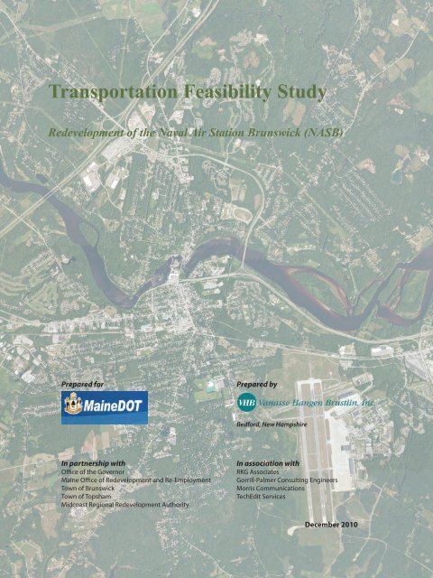
Transportation Feasibility Study<br />
Redevelopment of the Naval Air Station Brunswick (NASB)<br />
Prepared for<br />
Prepared by<br />
Bedford, New Hampshire<br />
In partnership with<br />
Office of the Governor<br />
Maine Office of Redevelopment and Re-Employment<br />
Town of Brunswick<br />
Town of Topsham<br />
Midcoast Regional Redevelopment Authority<br />
In association with<br />
RKG Associates<br />
Gorrill-Palmer Consulting Engineers<br />
Morris Communications<br />
TechEdit Services<br />
December 2010
Transportation Feasibility Study<br />
Redevelopment of the<br />
Naval Air Station Brunswick (NASB)<br />
Prepared for<br />
The Maine Department of Transportation<br />
In partnership with<br />
Office of the Governor<br />
Maine Office of Redevelopment and Re-Employment<br />
Town of Brunswick<br />
Town of Topsham<br />
Midcoast Regional Redevelopment Authority<br />
Prepared by<br />
Vanasse Hangen Brustlin, Inc.<br />
Bedford, New Hampshire<br />
In association with<br />
RKG Associates<br />
Gorrill-Palmer Consulting Engineers<br />
Morris Communications<br />
TechEdit Services<br />
December 2010
Table of Contents<br />
Executive Summary ............................................................................................................... 1<br />
Introduction/Background ............................................................................................................ 1<br />
Study Needs .............................................................................................................................. 1<br />
Public Input ................................................................................................................................ 2<br />
Options ...................................................................................................................................... 3<br />
Transportation Demand Management ....................................................................... 3<br />
Roadway Options ....................................................................................................... 4<br />
Strategy 1 - Provide Direct Access to US Route 1 from the NASB ............ 4<br />
Strategy 2A - Improve Mobility along the Coastal Connector and<br />
Route 201 ................................................................................................... 5<br />
Strategy 2B - Improve Mobility along Pleasant Street ................................ 6<br />
Strategy 2C - Improve Mobility along Mill Street ........................................ 7<br />
Strategy 3 - Extend the Existing Rail Spur to the NASB ............................ 7<br />
Evaluation/Next Steps ............................................................................................................... 8<br />
1.0 Introduction ................................................................................................................... 11<br />
1.1 Project Background .......................................................................................................... 11<br />
1.2 Study Area, Defined Strategies, and Options ................................................................... 12<br />
1.3 Purpose and Need ............................................................................................................ 13<br />
1.4 Public Participation Process ............................................................................................. 14<br />
1.4.1 Public Informational Meetings ..................................................................... 15<br />
1.4.2 Public Workshops ....................................................................................... 15<br />
1.4.3 Study Advisory Committee ........................................................................... 16<br />
1.4.4 Project Website and Other Media ............................................................... 17<br />
2.0 Existing Conditions ....................................................................................................... 20<br />
2.1 Introduction ....................................................................................................................... 20<br />
2.2 Transportation ................................................................................................................... 20<br />
2.2.1 Existing Facilities ........................................................................................... 20<br />
2.2.2 Traffic Operations .......................................................................................... 27<br />
2.2.3 Crash Evaluation ............................................................................................ 35<br />
2.3 Environmental Resources ................................................................................................. 41<br />
2.3.1 Wetlands ........................................................................................................ 41<br />
2.3.2 Surface Waters .............................................................................................. 46<br />
2.3.3 Groundwater Resources ................................................................................ 48<br />
2.3.4 Floodplains ..................................................................................................... 48<br />
2.3.5 Farmland ........................................................................................................ 49<br />
2.3.6 Rare, Threatened, and Endangered Species ................................................ 50<br />
Table of Contents<br />
i
2.3.7 Wildlife Habitat ............................................................................................... 51<br />
2.3.8 Hazardous Materials ...................................................................................... 51<br />
2.4 Socioeconomic Resources ............................................................................................... 57<br />
2.4.1 Economy and Demographics ......................................................................... 61<br />
2.4.2 Cultural Resources ........................................................................................ 70<br />
2.4.3 Parklands and Recreation .............................................................................. 74<br />
3.0 Future Conditions ......................................................................................................... 74<br />
3.1 Introduction ....................................................................................................................... 74<br />
3.2 2035 DHV Forecasting ..................................................................................................... 74<br />
3.3 NASB and Topsham Annex Trip Estimates ...................................................................... 75<br />
3.3.1 NASB Reuse Future Traffic ........................................................................... 76<br />
3.3.2 Topsham Annex Reuse Trip Generation ....................................................... 81<br />
4.0 Summary of Options .................................................................................................... 82<br />
4.1 Introduction ....................................................................................................................... 82<br />
4.2 No Action Option ............................................................................................................... 83<br />
4.3 Transportation Demand Management .............................................................................. 83<br />
4.4 Bicyclist and Pedestrian Improvements ............................................................................ 84<br />
4.5 Passenger Rail and Bus Rapid Transit ............................................................................. 86<br />
4.6 Strategy 1 – Direct Access to US Route 1 ........................................................................ 86<br />
4.6.1 Option 1 ......................................................................................................... 87<br />
4.6.2 Option 2 ......................................................................................................... 88<br />
4.6.3 Option 3 ......................................................................................................... 89<br />
4.7 Strategy 2A – Improve Mobility along State Route 196 and US Route 201 ..................... 95<br />
4.7.1 Option 1 ......................................................................................................... 96<br />
4.7.2 Option 2 ......................................................................................................... 97<br />
4.7.3 Option 2A ....................................................................................................... 97<br />
4.7.4 Option 3 ......................................................................................................... 98<br />
4.7.5 Option 3A ..................................................................................................... 100<br />
4.7.6 Option 4 ....................................................................................................... 101<br />
4.7.7 Option 5 ....................................................................................................... 101<br />
4.8 Strategy 2B – Improve Mobility along Pleasant Street ................................................... 110<br />
4.8.1 Common Features ....................................................................................... 110<br />
4.8.2 Option 1 ....................................................................................................... 113<br />
4.8.3 Option 1A ..................................................................................................... 113<br />
4.8.4 Option 2 ....................................................................................................... 114<br />
4.8.5 Option 2A ..................................................................................................... 114<br />
4.8.6 Option 3 ....................................................................................................... 115<br />
4.9 Strategy 2C – Improve Mobility along Mill Street ............................................................ 123<br />
4.9.1 Option 1 ....................................................................................................... 123<br />
4.9.2 Option 2 ....................................................................................................... 124<br />
4.10 Strategy 3 – Rail Spur to the NASB .............................................................................. 127<br />
4.10.1 Options 1 and 1A ....................................................................................... 127<br />
4.10.2 Options 2 and 2A ....................................................................................... 128<br />
4.11 Other Roadway Modification Ideas ............................................................................... 133<br />
Table of Contents<br />
ii
4.11.1 Maine Street/US Route 1 Interchange ....................................................... 133<br />
4.11.2 New Interchange on I-295 at River Road ................................................... 133<br />
4.11.3 Depressed Mill Street ................................................................................. 134<br />
4.11.4 Convert Pleasant Street to Two-Way ......................................................... 134<br />
5.0 Evaluation of Options ................................................................................................ 137<br />
5.1 Evaluation Criteria .......................................................................................................... 137<br />
5.1.1 Addressing Purpose and Need .................................................................... 137<br />
5.1.2 Traffic Operations ........................................................................................ 138<br />
5.1.3 Transportation Demand Management ......................................................... 138<br />
5.1.4 Cost Estimates ............................................................................................. 139<br />
5.1.5 Environmental Evaluation – Resources and Methods ................................. 142<br />
5.2 Options Evaluation .......................................................................................................... 143<br />
5.2.1 No Action ..................................................................................................... 143<br />
5.2.2 Travel Demand Management ...................................................................... 144<br />
5.2.3 Build Options ................................................................................................ 147<br />
6.0 Conclusions .................................................................................................................. 161<br />
Appendix A.<br />
Resolutions Endorsing Certain Improvements<br />
Appendix B.<br />
Public Input<br />
Table of Contents<br />
iii
List of Tables<br />
Table No. Description Page No.<br />
1.4-1 Public Informational Meetings .................................................................................. 15<br />
1.4-2 Interactive Public Workshops .................................................................................. 16<br />
1.4-3 Study Advisory Committee Meetings ....................................................................... 16<br />
2.2-1 Existing Traffic-Volume Summary ............................................................................ 30<br />
2.2-2 Signalized Intersection Capacity Analysis Summary ............................................... 32<br />
2.2-3 Unsignalized Intersection Capacity Analysis Summary ........................................... 34<br />
2.2-4 2006–2008 Intersection Crash Data ........................................................................ 38<br />
2.2-5 2006–2008 Roadway Segment Crash Data ............................................................ 39<br />
2.4-1 Properties Listed in the National Register of Historic Places ................................... 64<br />
2.4-2 Previously Inventoried Historic Properties ............................................................... 65<br />
3.3-1 Trip-Generation Land-Use Summary ....................................................................... 77<br />
3.3-2 Trip-Generation Summary ....................................................................................... 77<br />
3.3-3 Trip-Distribution Summary ....................................................................................... 80<br />
5.1-1 Environmental Evaluation Metrics .......................................................................... 143<br />
5.1-2 Evaluation Matrix (Build Options Only) ................................................................. 146<br />
Table of Contents<br />
iv
List of Figures<br />
Figure No.<br />
Description<br />
1-1 Base Map<br />
2-1 Roadway Functional Classification<br />
2-2 Bicycle/Pedestrian Facilities<br />
2-3 2009 Design Hour Volumes<br />
2-4 Operationally Deficient Locations<br />
2-5 High Crash Locations<br />
2-6 Wetlands<br />
2-7 Groundwater Resources<br />
2-8 Floodplains<br />
2-9 Farmland Soils<br />
2-10 Rare, Threatened, and Endangered Species<br />
2-11 Wildlife Habitat<br />
2-12 Hazardous Materials<br />
2-13 Cultural Resources<br />
2-14 Parklands and Recreational Areas<br />
3-1 2035 Design Hour Volumes No Build<br />
3-2 2035 Design Hour Volumes with Direct Access to US Route 1<br />
4-1 Strategy 1, Option 1: Trumpet/Loop Interchange<br />
4-2 Strategy 1, Option 2: Flyover Interchange<br />
4-3 Strategy 1, Option 3: Frontage Road Interchange<br />
4-4 Strategy 2A, Option 1: I-295 Exit 31 Southbound On-Ramp Signal<br />
4-5 Strategy 2A, Option 2: Route 196/US Route 201 Roundabout with Widening of<br />
Coastal Connector<br />
4-6 Strategy 2A, Option 2A: Route 196/US Route 201 Roundabout<br />
4-7 Strategy 2A, Option 3: Route 196/US Route 201 Grade-Separation with Signals<br />
4-8 Strategy 2A, Option 3A:- Route 196/US Route 201 Grade Separation with<br />
Roundabouts<br />
4-9 Strategy 2A, Option 4: Coastal Connector Widened to Four Lanes<br />
4-10 Strategy 2A, Option 5: Topsham Annex Intersection<br />
Table of Contents<br />
v
Figure No. Description<br />
4-11 Strategy 2B, Option 1: Traffic-Calming Boulevard (2 Sheets)<br />
4-12 Strategy 2B, Option 1A/2A: Relocated River Road<br />
4-13 Strategy 2B, Option 2: Urban Boulevard (2 Sheets)<br />
4-14 Strategy 2B, Option 3: Five-Lane with TWLTL (2 Sheets)<br />
4-15 Strategy 2C, Option 1: Mill Street Three Lanes with Median<br />
4-16 Strategy 2C, Option 2: Mill Street Four Lanes with Median<br />
4-17 Strategy 3, Option 1: Western Connection Grade-Separated<br />
4-18 Strategy 3, Option 1A: Western Connection At-Grade<br />
4-19 Strategy 3, Option 2: Eastern Connection Grade-Separated<br />
4-20 Strategy 3, Option 2A: Eastern Connection At-Grade<br />
5-1 2035 Design Hour Volume Level of Service Summary<br />
Table of Contents<br />
vi
Executive Summary<br />
Introduction/Background<br />
This Transportation Feasibility Study for the Redevelopment of the Naval Air Station<br />
Brunswick (NASB) was prepared for the Maine Department of Transportation<br />
(MaineDOT) in partnership with the Office of the Governor, the Maine Office of<br />
Redevelopment and Re-Employment, the Towns of Brunswick and Topsham, and<br />
the Midcoast Regional Redevelopment Authority (MRRA). The purpose of this<br />
Feasibility Study is to determine the nature and extent of transportation<br />
enhancements aimed at improving mobility and access in support of the<br />
redevelopment of the NASB.<br />
The closure of the NASB - at one time Maine’s second largest employer - is expected<br />
to have a significant adverse impact on the economy of the Midcoast Region.<br />
However, the base closure also presents an opportunity for redevelopment that could<br />
substantially mitigate this economic loss if some of the issues identified in the 2007<br />
NASB Reuse Master Plan are addressed.<br />
A critical issue identified in the Reuse Master Plan is that access to the NASB must be<br />
improved for the redevelopment to reach full potential. Improving access to the<br />
NASB must consider a wide range of multimodal transportation factors, including<br />
the adequacy and safety of the existing roadway system, feasibility of additional<br />
public transportation options, freight and passenger rail access, and adequate<br />
ac<strong>com</strong>modations for pedestrians and bicyclists.<br />
Study Needs<br />
For this Feasibility Study, five specific needs or strategies were previously identified<br />
for evaluation. These needs were provided to the MaineDOT by the Governor’s<br />
Advisory Council and formulated through the previous NASB Reuse Master Plan<br />
study efforts conducted by the MRRA. The five needs are as follows:<br />
Provide direct access to US Route 1 from the NASB.<br />
Improve mobility along State Route 196 (Coastal Connector) from Interstate-295<br />
(I-295) (Exit 31) to US Route 1, including the State Route 196/US Route 201<br />
intersection and US Route 201 north to Old Augusta Road.<br />
Executive Summary 1
Improve mobility between I-295 (Exit 28) along Pleasant Street and Maine Street<br />
in Brunswick to State Route 123.<br />
Improve mobility along Mill Street in Brunswick from Pleasant Street to State<br />
Route 196.<br />
Extend the existing rail spur into the NASB.<br />
To be successful, the proposed transportation solutions also must dovetail with the<br />
near- and long-term goals of the <strong>com</strong>munities of Brunswick and Topsham, which<br />
include minimizing NASB-related trips through downtown Brunswick and<br />
residential districts and maintaining and enhancing livable <strong>com</strong>munities.<br />
Public Input<br />
To ensure that the Feasibility Study considered the needs and desires of both<br />
<strong>com</strong>munities, it was driven by an open and active public-participation process. The<br />
public was given several opportunities to share <strong>com</strong>ments and ideas at public<br />
informational meetings and informal workshops, as well as through a Study website,<br />
which provided a feature that allowed the public to ask questions and submit<br />
<strong>com</strong>ments online. Additionally, a Study Advisory Committee consisting of public<br />
officials, business leaders, and residents of Brunswick and Topsham met on a regular<br />
basis (approximately monthly) to review Study progress. The Committee provided<br />
invaluable insight about the needs and desires of the two <strong>com</strong>munities and also<br />
served as a sounding board in the development of alternative-transportation<br />
solutions.<br />
Throughout the Study, the public identified the need to address existing traffic<br />
congestion and safety deficiencies, and many people expressed a strong desire to<br />
look at multimodal transportation solutions rather than solely relying on new or<br />
wider roadways to ac<strong>com</strong>modate future growth. In particular, there was a strong<br />
desire to provide ac<strong>com</strong>modations for safe bicyclist and pedestrian mobility and to<br />
develop and encourage the use of public transportation.<br />
With regard to the roadway system, although there is recognition of the need to<br />
increase capacity on some roadways, the focus is on improving the safe and efficient<br />
movement of motor vehicles, pedestrians, and bicyclists through access management,<br />
introduction of traffic calming, preservation of the existing character of the<br />
downtown areas, and - most important - bringing the various elements together into<br />
a well-connected multimodal transportation system.<br />
Recognizing that the continued construction of new and wider roadways is neither<br />
desired nor without substantial cost, the <strong>com</strong>munities must <strong>com</strong>mit to the long-term<br />
implementation of Transportation Demand Management (TDM) actions. An<br />
aggressive TDM program can reduce, delay, and sometimes eliminate the need to<br />
increase roadway capacity. This <strong>com</strong>mitment to TDM needs to be real and long term,<br />
and it involves both the private and public sectors. Additionally, convincing<br />
<strong>com</strong>munities to establish or expand public-transportation systems, single-occupant<br />
Executive Summary 2
motorists to get out of their vehicle and use public transportation or carpools, and<br />
employers to implement flexible work hours requires a certain level of traffic<br />
congestion on the roadway system. The MaineDOT, the Towns of Brunswick and<br />
Topsham, and the users of the area’s transportation system must understand and<br />
accept this premise.<br />
Options<br />
After providing the five specific needs and engaging in an open public-participation<br />
process that enabled the Study Team to understand the needs and desires of the<br />
<strong>com</strong>munities of Brunswick and Topsham, the next step was to develop a series of<br />
options to be evaluated.<br />
The range of multimodal transportation options considered in this Feasibility Study<br />
includes highway, rail, bicycle, and pedestrian options in Brunswick and Topsham.<br />
In addition, the Study examines the potential effect of travel demand on Study Area<br />
roadways associated with the implementation of various levels of TDM measures.<br />
Given the expressed <strong>com</strong>mitment of the local <strong>com</strong>munities to a multimodal approach<br />
to addressing transportation needs in favor of solely relying on the continued<br />
construction of new and wider roadways, TDM actions are presented in this Study<br />
not as an either/or alternative but rather as actions that should be implemented as<br />
aggressively as possible – regardless of the implementation of other physical<br />
modifications to the roadway system.<br />
The No Action Option is essentially the continuation and perpetuation of the existing<br />
conditions and the short<strong>com</strong>ings inherent in the current Study Area roadways,<br />
interchanges, intersections, and transportation system. The No Action Option serves<br />
as a baseline condition for <strong>com</strong>parison to other options.<br />
Transportation Demand Management<br />
TDM en<strong>com</strong>passes a wide range of strategies that are designed to change personal<br />
travel behavior, resulting in the reduction of demand for automobile use and the<br />
need to construct additional roadway capacity. This is ac<strong>com</strong>plished through<br />
measures that (1) reduce the number or length of drive-alone trips, and (2) move<br />
trips out of peak times of roadway congestion. TDM measures provide incentives (or<br />
disincentives) to those who drive alone by encouraging them to change their travel<br />
behavior and use ride-share programs or other modes of travel.<br />
To be successful, TDM needs to be a collaborative partnership among the MaineDOT,<br />
the Towns of Brunswick and Topsham, and the local business <strong>com</strong>munity. The<br />
public sector can (1) provide supportive multimodal infrastructure such as bicycle<br />
lanes, sidewalks, pedestrian crosswalks and pedestrian-actuated traffic signals, bus<br />
Executive Summary 3
pullouts, and bus-stop shelters; (2) sponsor TDM programs such as GOMAINE,<br />
which provides carpool, vanpool, park ’n’ ride, and ridesharing services; and (3)<br />
continue to support local bus service and regional passenger rail. At the same time,<br />
the business <strong>com</strong>munity can promote tele<strong>com</strong>muting and implement<br />
staggered/flexible work hours and <strong>com</strong>pressed work weeks and support amenities<br />
such as bicycle storage and shower facilities.<br />
Roadway Options<br />
In response to the strong desire of the two <strong>com</strong>munities for multimodal<br />
transportation solutions, the various roadway options that were evaluated<br />
incorporated bicyclist and pedestrian ac<strong>com</strong>modations, introduced access<br />
management and traffic-calming elements, and - most important - were designed to<br />
provide only the minimal additional capacity needed to meet future projected travel<br />
demands. That is, the roadway options were designed to operate close to capacity<br />
during the future 2035 design hour in an effort to support the TDM actions. The<br />
roadway options that were developed and evaluated in each of the five previously<br />
described needs are discussed in the following sections.<br />
Strategy 1 - Provide Direct Access to US Route 1 from the<br />
NASB<br />
The successful redevelopment of the NASB property has the potential to<br />
substantially mitigate the expected economic loss to the region that will result from<br />
the closure of the NASB. Good access to US Route 1 will be needed if the<br />
redevelopment is to reach its full potential. For this reason, three direct-access-to-US<br />
Route 1 interchange options were considered. The options include a “trumpet”<br />
interchange, a “flyover” interchange, and a “split-diamond” interchange.<br />
The trumpet and flyover interchange options each provide a direct connection to US<br />
Route 1 with the construction of a connector roadway that passes beneath Bath Road<br />
and the Rockland Branch Railroad and then over US Route 1. The difference between<br />
the two options is that the trumpet option provides a loop-ramp configuration to<br />
ac<strong>com</strong>modate the US Route 1 southbound movements. The flyover interchange<br />
ac<strong>com</strong>modates the US Route 1 southbound movements with a multi-tier ramp<br />
system in which the southbound off-ramp passes over both US Route 1 and the<br />
southbound on-ramp. Both options enhance bicyclist and pedestrian mobility by<br />
providing a multiuse path that connects the NASB and the existing Androscoggin<br />
River Bicycle and Pedestrian Path.<br />
A third option, the split-diamond interchange, is configured such that the US Route 1<br />
northbound and southbound ramps are split and connect to the existing Cooks<br />
Corner cross roadway and a new NASB access roadway. The two cross roadways are<br />
linked by one-way frontage roadways that run parallel to US Route 1 and terminate<br />
opposite the new ramp intersections, creating two four-way signalized intersections<br />
Executive Summary 4
along each of the cross roadways. Unlike the alignment of the trumpet and flyover<br />
options, which are located west of Merrymeeting Plaza, the new connector roadway<br />
for the split-diamond option is located east of the shopping center. The connector<br />
roadway passes over US Route 1 but, unlike the other two options, the connector<br />
bridges over Bath Road and the rail line. Like the trumpet and the flyover<br />
interchanges, the split-diamond configuration enhances bicyclist and pedestrian<br />
mobility by providing a multiuse path that connects the NASB to the existing<br />
Androscoggin River Bicycle and Pedestrian Path.<br />
Strategy 2A - Improve Mobility along the Coastal Connector and Route 201<br />
The options to increase the throughput capacity of the Coastal Connector; address<br />
congestion problems at the State Route 196/US Route 201 intersection; and provide<br />
good pedestrian, bicyclist, and local vehicular connectivity ranged from:<br />
widening the Coastal Connector to four lanes<br />
installing a roundabout at the State Route 196/Route 201 intersection<br />
installing a traffic signal on State Route 196 at the Exit 31 southbound on-ramp<br />
and extending the left-turn storage length<br />
realigning Canam Drive and Old Augusta Road to form a single four-way<br />
signalized intersection on US Route 201 that serves as the primary access to the<br />
redeveloped Topsham Annex (the Topsham Annex intersection also provides<br />
access to properties with redevelopment potential located on the west side of<br />
State Route 201)<br />
In addition, to improve the efficient movement of vehicular traffic on the Coastal<br />
Connector while enhancing the local street function and “feel” of US Route 201, a<br />
grade-separated option was evaluated. This option consisted of grade-separating the<br />
Coastal Connector/Route 201 intersection with the Coastal Connector bridging over<br />
US Route 201. Whereas the Coastal Connector provides four lanes (i.e., two lanes in<br />
each direction) with a raised-center median, US Route 201 is limited to a single<br />
through lane in each direction as well as turn lanes with the potential for wider<br />
sidewalks, bicycle lanes, and landscaped medians, which present a more pedestrianfriendly<br />
character.<br />
Access through the local secondary connector roadways west of Route 201, such as<br />
Union Park and Monument Place, is maintained. However, the grade-separated<br />
option includes construction of additional connector roadways on the northeast and<br />
southeast quadrants of the intersection. The new connector roadways intersect the<br />
Coastal Connector east of Route 201 with traffic movements limited to right-turn<br />
in/right-turn out. The new roadway on the southeast quadrant intersects Route 201<br />
opposite Monument Place, whereas the new connector roadway on the northwest<br />
quadrant intersects Route 201 at a newly realigned Eagles Way. This grade-separated<br />
option provides two suboptions: single-lane roundabouts at the two newly formed<br />
Executive Summary 5
connector-roadway intersections with Route 201 or traffic-signal control at these<br />
intersections.<br />
Strategy 2B - Improve Mobility along Pleasant Street<br />
Based on public input, it is important to improve the safe and efficient movement of<br />
motor vehicles, pedestrians, and bicyclists and to address existing deficiencies while<br />
respecting the access needs of numerous businesses located along the Pleasant Street<br />
corridor. Additionally, there is a desire to decrease automobile dominance<br />
throughout the corridor. To ac<strong>com</strong>plish these goals, the options were developed with<br />
the application of access-management and traffic-calming techniques. The three basic<br />
options include a traffic-calming boulevard, an urban boulevard, and a five-lane<br />
cross section. All three options include secondary connector roadways (i.e., access<br />
management) that parallel Pleasant Street and provide connections between abutting<br />
roadside properties and the major intersections along the corridor, thereby allowing<br />
left-turn movements at these controlled locations. The locations of the secondary<br />
connector roadways are conceptual only, and it is envisioned that these connections<br />
would occur over time, if and when property owners consider redevelopment<br />
opportunities. The placement and implementation of these secondary connections<br />
will require the involvement and cooperation of the property owners.<br />
An important traffic-calming action is the proposed installation of a roundabout at<br />
the Exit 28 Connector/US Route 1 intersection. The primary purpose of this<br />
roundabout is to serve as a gateway that provides a transition from the high-speed I-<br />
295 Exit 28 to a more built-up, soon-to-be pedestrian-friendly Pleasant Street.<br />
The traffic-calming boulevard also includes two-lane roundabouts at the Church<br />
Road and River Road intersections with a raised-center median so that all driveways<br />
located away from these major intersections ac<strong>com</strong>modate right-turn-in/right-turnout<br />
movements. Left turns either use the parallel connectors or reverse direction at<br />
the roundabouts. This option does not provide for a roundabout at the Stanwood<br />
Street/Mill Street intersection because it was determined to have an unacceptable<br />
operation. The option at this location provides traffic-signal control at a realigned<br />
intersection where US Route 1 (i.e., Pleasant Street and Mill Street) is aligned as the<br />
through movement.<br />
The urban-boulevard option is similar to the traffic-calming option – the only<br />
difference being that the Church Road and River Road intersections would be trafficsignal<br />
controlled with exclusive left-turn lanes provided. The five-lane option is<br />
similar to the urban-boulevard option in that it provides the same traffic-signal<br />
control. The difference is that a two-way center left-turn lane is provided along the<br />
length of Pleasant Street as opposed to a raised-center median.<br />
An additional option considers relocating the River Road intersection to the west<br />
side of the Hyundai dealership to form a new four-way intersection with the fourth<br />
Executive Summary 6
leg of the intersection, which provides access to property on the south side of<br />
Pleasant Street that could present a redevelopment opportunity. This relocated<br />
intersection would be a roundabout or a signalized intersection.<br />
Strategy 2C - Improve Mobility along Mill Street<br />
Based on public input, there is little agreement about which actions should be taken<br />
to improve safety and mobility along Mill Street. Some people contend that as a<br />
principal arterial, Mill Street (i.e., US Route 1) should be widened to four lanes (i.e.,<br />
two lanes in each direction); others, stressing the proximity of the nearby residential<br />
neighborhood on the south side and the Androscoggin Brunswick-Topsham<br />
Riverwalk (with its recent restoration of the historic John A. Roebling Swinging<br />
Bridge) on the north side, believe that Mill Street should remain a two-lane roadway.<br />
In addition to the No Action Option, which maintains the existing two-lane cross<br />
section, three- and four-lane options were evaluated. The three-lane option consists<br />
of two northbound and one southbound travel lanes separated by a raised-center<br />
median. The basis for the three-lane section is that maintaining the single<br />
southbound lane (and the resulting delay) may encourage through traffic destined to<br />
I-295 to use the Coastal Connector. This perspective is consistent with the trafficcalming<br />
actions that are targeted for the Pleasant Street corridor. The four-lane<br />
option consists of two northbound and two southbound travel lanes separated by a<br />
raised-center median.<br />
To enhance pedestrian safety and provide the desired bicyclists and pedestrian<br />
connectivity, both the three- and four-lane options include sidewalks along Mill<br />
Street and construction of a pedestrian bridge in the vicinity of the existing railroad<br />
bridge. The pedestrian bridge essentially extends the Androscoggin Brunswick-<br />
Topsham Riverwalk to the residential neighborhood located on the opposite side of<br />
Mill Street.<br />
Strategy 3 - Extend the Existing Rail Spur to the NASB<br />
In keeping with the desire to consider opportunities for nonautomobile-oriented<br />
modes of access to the NASB, options were developed for extending the Rockland<br />
Branch Railroad spur - which currently runs along the north side of Bath Road - into<br />
the NASB. Two route options were developed for the spur, each of which provides<br />
rail access to the NASB near Hangar No. 6. The two route options consider crossing<br />
Bath Road either at grade or by way of grade separation where the rail spur crosses<br />
beneath Bath Road, resulting in four rail-spur options. The primary difference<br />
between the two route options is the origin of the spur on the Rockland Branch<br />
Railroad and the route to Hangar No. 6 on the NASB. The western alignment<br />
intersects Bath Road just east of Jordan Avenue; the eastern alignment intersects Bath<br />
Road just west of the Merrymeeting Plaza Shopping Center.<br />
Executive Summary 7
Evaluation/Next Steps<br />
Based on results of the evaluation and extensive public input, the following<br />
overarching plan elements were identified:<br />
Improve the safe and efficient movement of vehicular traffic through access<br />
management.<br />
Reduce the dominance of vehicular traffic by introducing traffic calming.<br />
Encourage multimodal mobility through enhanced pedestrian and bicyclist<br />
ac<strong>com</strong>modations and through the support of public transportation.<br />
Limit the need to continually increase roadway capacity by the implementation<br />
of aggressive TDM strategies and by the willingness to accept some level of<br />
traffic congestion on the roadway system.<br />
With regard to the interchange options that were evaluated to provide a direct<br />
connection between the NASB and US Route 1, the results - at a planning level -<br />
suggest that although each option does have impacts, the concept of constructing a<br />
new direct-connection interchange is feasible. However, the pursuit of this strategy<br />
would likely require the preparation of an Environmental Impact Statement or an<br />
Environmental Assessment as a provision of the National Environmental Policy Act<br />
(NEPA) of 1969. The NEPA study would examine the project options and impacts in<br />
greater detail and also entail additional in-depth public involvement. Given that this<br />
improved access is critical to the redevelopment of the NASB reaching its full<br />
potential, the general public support of this strategy voiced during the Feasibility<br />
Study, and the time needed to conduct such an in-depth study, the MaineDOT<br />
should consider pursuing this strategy as an early-action item. Project funding<br />
should be programmed prior to the initiation of the NEPA study.<br />
With regard to the strategies to improve mobility along the Coastal Connector,<br />
Pleasant Street, and Mill Street, consensus still must be reached on a fundamental<br />
question: whether the functional characteristics of these three principal arterials<br />
should be changed so as to encourage through traffic to use the Coastal Connector.<br />
This sentiment was voiced by many throughout the Feasibility Study’s publicparticipation<br />
process. If the decision is to encourage regional through traffic to use<br />
the Coastal Connector and as a result reclassify (i.e., downgrade) Pleasant Street and<br />
Mill Street, then options such as the widening of the Coastal Connector to a uniform<br />
four lanes and grade-separating the Route 196/Route 201 intersection should be<br />
pursued early, followed by the traffic-calming options considered for Pleasant Street.<br />
These options also may require NEPA action.<br />
.<br />
Because the secondary connector roadways, which <strong>com</strong>prise an important<br />
<strong>com</strong>ponent of the Pleasant Street access-management plan, are likely to be<br />
implemented over time as properties along the corridor redevelop, the full<br />
implementation of the Pleasant Street modifications may be phased and take many<br />
years. However, installation of the gateway roundabout at the Exit 28 Connector/US<br />
Executive Summary 8
Route 1 intersection could be considered. This action would serve to begin the<br />
transition of the Pleasant Street corridor from its current automobile-dominant<br />
character to a corridor that ac<strong>com</strong>modates multiple modes of travel, including the<br />
movement of pedestrians.<br />
Other physical roadway modifications that could be considered for early<br />
implementation include the following:<br />
installation of the traffic signal and the lengthening of the left-turn lane at the<br />
intersection of Route 196 and the I-295 Exit 31 southbound on-ramp<br />
construction of the pedestrian overpass of Mill Street<br />
depending on timing of the redevelopment of the Topsham Annex, realignment<br />
of Canam Drive and Old Augusta Road to form a single four-way signalized<br />
intersection on State Route 201<br />
Ultimately the decision as to which of the alternatives will be advanced for<br />
additional study or for implementation will involve further discussion between the<br />
MaineDOT and the Towns of Brunswick and Topsham.<br />
Executive Summary 9
Executive Summary 10
1<br />
Introduction<br />
1.1 Project Background<br />
The Maine Department of Transportation (MaineDOT), in partnership with the<br />
Office of the Governor, the Maine Office of Redevelopment and Re-Employment, the<br />
Towns of Brunswick and Topsham, and the Midcoast Regional Redevelopment<br />
Authority (MRRA), initiated this Transportation Feasibility Study to promote<br />
development of immediate and long-range transportation improvement strategies<br />
that support the phased redevelopment of the Naval Air Station Brunswick (NASB).<br />
The 2005 Base Realignment and Closure Commission decided to close the Naval Air<br />
Station Brunswick, Maine, including the Topsham Annex (NASB), 1 and to relocate its<br />
aircraft with dedicated personnel, equipment, and support to Naval Air Station<br />
Jacksonville (Florida). As Maine's second largest employer, the NASB once employed<br />
more than 4,800 military and civilian personnel. In 2007, it provided more than $187<br />
million to the local economy, including $115 million in salaries, $38 million in<br />
contracts and material purchases, and $34 million in medical purchases. 2 The loss of<br />
this economic driver could have a substantial impact on the economy of the Midcoast<br />
Region.<br />
However, redevelopment of the Air Station and Annex represents an opportunity for<br />
economic growth if several issues identified in the December 2007 NASB Reuse Master<br />
Plan are properly addressed. The Reuse Master Plan envisions the development of<br />
1,690 acres of the Air Station and Annex, or roughly half of their <strong>com</strong>bined area (i.e.,<br />
3,274 acres); the other half would be reserved for open space. The developed area<br />
would en<strong>com</strong>pass a mix of land uses, including a civilian airport, professional office<br />
space, residential space, <strong>com</strong>mercial and retail space, recreational and park, and<br />
educational uses. The Reuse Master Plan predicts that the redevelopment has the<br />
<br />
1 For the purposes of this document and unless stated otherwise, all references to NASB include both the Cooks<br />
Corner and Topsham Annex facilities.<br />
2 Brunswick Naval Air Station Reuse Master Plan, December 2007, prepared for the Brunswick Local Redevelopment<br />
Authority by Matrix Design Group.<br />
Introduction 11
potential to eventually replace the lost jobs and economic activity associated with the<br />
NASB.<br />
A critical issue identified in the Reuse Master Plan is that access to the NASB must be<br />
improved for the redevelopment to reach its full potential. A strategy to improve<br />
access should consider a wide range of transportation factors, including the<br />
adequacy and safety of the existing roadway network, feasibility of additional public<br />
transportation options, freight and passenger rail access, and adequate<br />
ac<strong>com</strong>modations for pedestrians and bicyclists.<br />
It is estimated that ultimately under a maximum build-out scenario, the traffic<br />
generated by the redeveloped NASB facility could increase to at least twice the<br />
preclosure levels. This scenario has the potential to exacerbate congestion delays and<br />
safety issues along the roadways (e.g., Pleasant Street) and at intersections (e.g.,<br />
Cooks Corner) that are currently experiencing lower levels of service (LOSs).<br />
Although some of the impacts may be mitigated through the creation of additional<br />
points of access to the adjacent street system at the NASB, the 2007 Reuse Master Plan<br />
identified certain off-site improvements as necessary to ac<strong>com</strong>modate the increased<br />
traffic volumes.<br />
This Transportation Feasibility Study is based on recent and concurrent planning<br />
efforts associated with the NASB and the Midcoast Region, including the Brunswick<br />
Naval Air Station and Topsham Annex Reuse Master Plans, December 2007; the US Route<br />
1 Corridor Study, Brunswick, 2007; the Gateway 1 Corridor Action Plan, June 2009; and<br />
the ongoing US Navy Base Closure Environmental Impact Statement. These studies<br />
clearly indicate that current access to the redeveloped NASB is inadequate and<br />
would seriously constrain the successful implementation of the Reuse Master Plan and<br />
the economic vitality that is so important to the Midcoast Region.<br />
This Feasibility Study considers and <strong>com</strong>pares, at the macro level, the transportation<br />
efficiency, cost, right-of-way (ROW), constructability, environmental, and<br />
<strong>com</strong>munity impacts of specific strategies and options, which range from relatively<br />
low cost easy to implement improvements to major reconstruction or expansion of<br />
the existing infrastructure. The Study considers multimodal options including the<br />
existing and future movement of people and goods by rail, transit, truck, and<br />
automobile, as well as the needs of pedestrians and bicyclists.<br />
1.2 Study Area, Defined Strategies, and<br />
Options<br />
The Study Area for this Feasibility Study is generally bounded by Interstate 295 (I-<br />
295) to the west between Exits 28 and 31, by State Route 196 to the north, and by US<br />
Route 1 and Bath Road to the east and south. However, as discussed herein, specific<br />
areas within this more general area were defined further in order to focus the Study.<br />
Introduction 12
Throughout this Feasibility Study, the terms strategy and option are used to describe<br />
different alternatives for achieving the improved access to the redeveloped NASB.<br />
The term strategy refers to larger transportation and land-use needs used<br />
individually or in <strong>com</strong>bination to achieve better access to the NASB. Different ways<br />
of achieving those strategies are considered options. Potential options for a defined<br />
strategy may include actions such as the widening of an existing roadway, addition<br />
of turn lanes, improved traffic-signal timing, and implementation of Transportation<br />
Demand Management (TDM) actions.<br />
For this Study, five specific strategies were identified for evaluation. These five<br />
strategies were provided to the MaineDOT by the Governor’s Advisory Council and<br />
formulated through the previous NASB Reuse Master Plan study efforts conducted by<br />
the MRRA. Focusing the evaluation effort on these five strategies ensures that the<br />
evaluation is conducted at a sufficient level of detail in order for decision makers to<br />
advance some of the preferred options to the permitting, design, and implementation<br />
phases. The five strategies or needs are as follows:<br />
Provide direct access to US Route 1 from the NASB.<br />
Improve mobility along State Route 196 (Coastal Connector) from I-295 (Exit 31)<br />
to US Route 1, including the State Route 196/US Route 201 intersection and US<br />
Route 201 north to Old Augusta Road.<br />
Improve mobility between I-295 (Exit 28) along Pleasant Street and Maine Street<br />
in Brunswick to State Route 123.<br />
Improve mobility along Mill Street from Pleasant Street in Brunswick to State<br />
Route 196.<br />
Extend the existing rail spur to the NASB.<br />
Whereas many transportation studies speak in terms of a single “Preferred Option,”<br />
this Feasibility Study seeks to identify a Preferred Option - perhaps more than one -<br />
for each strategy. It is important to understand that one strategy may be forwarded<br />
to construction independently of the others. The Preferred Options are prioritized for<br />
advancement based on the need to ac<strong>com</strong>modate base redevelopment.<br />
Each of the five strategies has a defined Study Area, which are shown in Figure 1-1.<br />
1.3 Purpose and Need<br />
The intent of the purpose and need outlined in this section is to describe and support<br />
the Feasibility Study. The purpose and need of a project establish a basis for the<br />
development of a range of reasonable options and assist with the identification,<br />
analysis, and eventual selection of a Preferred Option(s). The Purpose and Need<br />
Statement is used for <strong>com</strong>paring the effectiveness and impacts of the various Study<br />
options to the No Action Option.<br />
Introduction 13
The Purpose and Need Statement is fundamental to the analysis of a Feasibility<br />
Study under the National Environmental Policy Act (NEPA), the Clean Water Act<br />
(Section 404), and other environmental regulations.<br />
Project Purpose and Need<br />
The purpose of this Feasibility Study is to guide future infrastructure investments to<br />
enhance mobility and access for redevelopment of the NASB, including the Topsham<br />
Annex, by:<br />
identifying measures to improve safety at problem locations in the Study Area<br />
ac<strong>com</strong>modating future traffic demands related to <strong>com</strong>muter trips and the<br />
shipment of goods and services to and from the redeveloped NASB<br />
considering multimodal options (e.g., public transit and vehicular, rail, bicycle,<br />
and pedestrian modes) that improve access efficiency at the redeveloped NASB<br />
from I-295, US Route 1, and State Route 196<br />
evaluating the engineering and environmental feasibility of creating a rail<br />
connection to the NASB<br />
As described in the previous section, five needs were identified for evaluation. In<br />
meeting these needs, the proposed transportation solutions must dovetail with the<br />
goals of the <strong>com</strong>munities of Topsham and Brunswick, which include minimizing<br />
NASB-related trips through downtown Brunswick and residential districts and<br />
maintaining and enhancing livable <strong>com</strong>munities.<br />
Options to be considered include the No Action Option; TDM strategies to reduce<br />
vehicle trips (e.g., ride sharing/carpooling and public transit); enhanced rail service;<br />
and adding capacity to existing roadways by widening and improving intersections<br />
and interchanges.<br />
1.4 Public Participation Process<br />
An open and consensus-driven public participation process that engages all<br />
stakeholders is key to the development and refinement of thoughtful transportation<br />
solutions. Good planning practice involves a mutual learning process among<br />
practitioners, elected officials, residents, business groups, citizen groups, and other<br />
affected parties. The thoughts, concerns, and ideas of the general public on Study<br />
Area transportation needs, problems, and solutions are critical to crafting and<br />
refining solutions that are practical, permittable, affordable, and context-sensitive in<br />
meeting the transportation needs.<br />
Various methods were provided to simplify the process as much as possible for the<br />
public to learn about and provide input on the Feasibility Study.<br />
Introduction 14
1.4.1 Public Informational Meetings<br />
Public informational meetings were held at three key points during the Feasibility<br />
Study so that the MaineDOT and the Study Team could provide important<br />
information to the public and solicit its input. Attendee sign-in sheets and <strong>com</strong>ment<br />
forms were provided at all public meetings. Meeting reports, as well as presentations<br />
and handouts, were posted on the website following each meeting so that those not<br />
in attendance could follow the progress of the Study. The topics and timing for the<br />
public informational meetings are listed in Table 1.4-1. All meetings were held at the<br />
Brunswick Junior High School except the final meeting on August 12, 2010, which<br />
was held at the Mount Ararat Middle School in Topsham.<br />
Table 1.4-1. Public Informational Meetings<br />
Meeting Date Topics<br />
1 August 6, 2009 Review of the Feasibility Study objectives; definition of the five strategies; Study schedule;<br />
environmental process; and public involvement plan<br />
2 March 30, 2010 Review of Feasibility Study purpose and need; remainder of the Study schedule; future<br />
conditions; summary of public input received at workshops conducted in September 2009 and<br />
January 2010; and description of options to be evaluated<br />
3 June 2, 2010 Review of Feasibility Study purpose and need; discussion of public feedback including bicycle<br />
and pedestrian access; public transportation opportunities; functional characteristics of<br />
roadways; and detailed plans of options for each of the five strategies<br />
4 August 12, 2010 Presentation and discussion of study findings<br />
1.4.2 Public Workshops<br />
Two interactive public workshops were conducted at key points in the Feasibility<br />
Study (Table 1.4-2). These meetings differed from the public informational meetings<br />
in that there were no formal presentations by the MaineDOT, the Study Team, or<br />
other stakeholders. Rather, these meetings focused on review of the Study base maps<br />
and conceptual designs. The public was invited to view these plans with the staff<br />
responsible for developing them. Various stations were set up in the meeting room,<br />
with each station focused on one of the five strategies or issues (e.g., Strategy 1,<br />
environmental resources, socioeconomic issues, and multimodal connections). In this<br />
way, the public was able to interact one-on-one with the technical experts working<br />
on the project to ensure that public feedback was clearly understood.<br />
Introduction 15
Table 1.4-2. Interactive Public Workshops<br />
Meeting Date Topics<br />
1 September 2, 2009 Review of Feasibility Study base plan, including environmental constraints and roadway<br />
layouts; electronic polling of attendees regarding several areas of interest; feedback sought on<br />
options within each strategy (except Strategy 1); environmental-resource maps presented<br />
2 January 13, 2010 Review of Feasibility Study schedule; natural- and cultural-resource mapping; traffic volumes,<br />
high crash locations (HCLs), and operationally deficient locations; review of Strategy 1 with<br />
information station; review of expanded Strategy 2A<br />
1.4.3 Study Advisory Committee<br />
A Study Advisory Committee <strong>com</strong>posed of public officials, business leaders, and<br />
residents of Brunswick and Topsham met on a regular basis (approximately<br />
monthly) to review Feasibility Study progress. The Committee provided invaluable<br />
insight to the needs and desires of the <strong>com</strong>munities and also served as a “sounding<br />
board” in the development of the transportation solutions. The Study Advisory<br />
Committee members are as follows:<br />
Anna Breinich Lee Karker Benet Pols Rich Roedner<br />
Dave Markovchick Ted Crooker James Howard Victor Langelo<br />
Leighton Cooney Jeff Jordon John Gerard Louise Rosen<br />
Bill Torrey Tony Armstrong John Shattuck Denise Clavette<br />
Ten Study Advisory Committee meetings were held, as summarized in Table 1.4-3.<br />
Table 1.4-3. Study Advisory Committee Meetings<br />
Meeting Date Topics<br />
1 July 29, 2009 Study area and study purpose, study schedule, and study process.<br />
2 September 15, 2009 Purpose and need; review public input from September 2, 2009, workshop; discussion on expanding<br />
study area along Route 201 to Old Augusta Road in Topsham<br />
3 November 18, 2009 Confirmation of expanded study area; clarification of the five defined strategies to be studied;<br />
discussion of the NASB reuse build-out projections; discussion of possible additional study efforts,<br />
including rail intermodal study and Route 196 west of I-295 traffic study<br />
4 January 6, 2010 Discussion on the NASB reuse build-out projections and need to retain independent review of<br />
economic projections, discussion of draft Purpose and Need Statement<br />
5 February 17, 2010 Presentation of findings of independent review of the NASB build-out projections, discussion of<br />
modifications to draft Purpose and Need Statement, review of public input from January 13, 2010,<br />
workshop<br />
Introduction 16
Table 1.4-3. Study Advisory Committee Meetings (continued)<br />
6 March 17, 2010 Presentation of results of the future-year traffic projections and operational analyses; discussion of<br />
the preliminary screening of options to be evaluated under each strategy<br />
7 April 19, 2010 Presentation and discussion of the ongoing options evaluation<br />
8 May 19, 2010 Presentation and discussion of the option conceptual plans to be presented at the June 2, 2010,<br />
public meeting<br />
9 June 9, 2010 Review of public input received from June 2, 2010, public meeting, discussion of TDM actions, and<br />
review of updated evaluation matrix<br />
10 July 1, 2010 Review of additional public input received via the study website, discussion of potential project<br />
phasing and priorities, discussion of schedule to <strong>com</strong>plete the study<br />
11 August 19, 2010 Review of public input received from August 12, 2010 public meeting, discussion of project priorities,<br />
and distribution of draft report to Committee members<br />
1.4.4 Project Website and Other Media<br />
Website<br />
To broadcast information about the project, a project-specific Internet website was<br />
created. At www.nasb-transportation-study.<strong>com</strong>, the public can view the documents<br />
involved in the Feasibility Study, find out when meetings are scheduled, review<br />
meeting reports, and read regular updates on the progress of the Study. The website<br />
also contains a feature that allows the public to ask questions or submit <strong>com</strong>ments<br />
online.<br />
Email Updates<br />
Members of the public who want to hear Feasibility Study news regularly can elect to<br />
be on the email list for automatic updates. An email listing of Study Advisory<br />
Committee members and other interested citizens was provided for updates of all<br />
public meetings and workshops, with a request to forward the meeting notice to<br />
other interested individuals.<br />
Media<br />
The news media received regular press releases on meeting dates and on the<br />
progress of the Feasibility Study. A concerted effort was made to generate coverage<br />
at public meetings and workshops. Several news articles about the Study and<br />
meeting notices were published in the Times Record (Brunswick) and The Forecaster<br />
(Falmouth). An eight-page newspaper insert, which described the options being<br />
considered, was published in the July 30, 2010, Times Record. The June 2, 2010, public<br />
Introduction 17
informational meeting was covered by television station WCSH (Portland), which<br />
aired a report during its evening newscast.<br />
Introduction 18
F<br />
CATHANCE RIVER<br />
MEADOW RD<br />
W HITEHOUSE CROOSING RD<br />
JESSE RD<br />
AUGUSTA RD<br />
CATHANCE RD<br />
MUDDY RIVER<br />
§¨¦295<br />
Exit 28<br />
DURHAM RD<br />
HILLSIDE DR<br />
PLEASANT HILL RD<br />
CASCO RD<br />
RI VER RD<br />
EXIT-28<br />
CONNECTOR<br />
RIVER RD<br />
OLD PORTLAND RD<br />
GREENWOOD RD<br />
RAYMON D R D<br />
BIBBER P K W Y<br />
RIVER RD<br />
RANGE RD<br />
FAIRWAY<br />
DR<br />
INDUSTRIAL PKWY<br />
CHURCH RD<br />
LEWISTON LOWER BRANCH RAILINE<br />
§¨¦295<br />
WOODSIDE RD<br />
LAMB<br />
FARM RD<br />
FOX RUN DR<br />
PAT RI C<br />
IA RD<br />
NANCY DR<br />
RIVERVIEW DR<br />
PLEASANT ST<br />
EMILY ST<br />
RIVER RD<br />
RIVER RD<br />
MARRINER RD<br />
MCINTOSH<br />
ST<br />
BAILEY LN<br />
CHURCH RD<br />
ROCKY AV<br />
PLEASANT HILL R D<br />
LEW ISTON RD<br />
Exit 31<br />
RAYMOND RD<br />
FAYE ST<br />
GREENLEAF<br />
ST<br />
RIVER RD<br />
PAUL ST<br />
WESTMINSTER AV<br />
BOUCH ARD DR<br />
TOPSHAM FAIR MALL RD<br />
HENNESSEY AVE<br />
W INTE R ST<br />
MIDDLE ST<br />
PLEASANT ST<br />
TURNER ST<br />
BARIBEAU DR<br />
PARK DR<br />
FRONT ST<br />
LEWISTON RD<br />
SOKOKIS<br />
CIR<br />
MALLETT DR<br />
HIGH ST<br />
STANWOOD ST<br />
MILL ST<br />
ABENAKI DR<br />
MALLETT DR<br />
OAK ST<br />
ANTHON Y AV<br />
BRIDGE ST<br />
MORSE CT<br />
BRIDGE ST<br />
FOR E S T DR<br />
PATRICIA DR<br />
MAPLE ST<br />
MILL ST<br />
MCKEEN ST MCKEEN ST<br />
MAQUOIT RD<br />
§¨¦295<br />
A ST<br />
BODWELL ST<br />
COLUMBIA AVE<br />
PEARY DR<br />
PRO SPECT ST<br />
WOOD AV<br />
BICKFORD DR<br />
CAROLYN ST<br />
WALNUT ST<br />
BARBARA ST<br />
HIGH ST<br />
BARROW S DR<br />
LOLA ST<br />
CUMBERLAND ST<br />
SPRING ST<br />
MILL RD<br />
BELMONT ST<br />
THOMPSON ST<br />
MAIN ST<br />
HANSON DR<br />
WINTER ST<br />
CEDAR ST<br />
WILLIAMS DR<br />
GARDEN DR<br />
GILMAN AV<br />
WESTERN AV<br />
MAIN ST<br />
HIGHLAND<br />
ST<br />
SUMMER ST<br />
PLEASANT ST<br />
WEYMOUTH ST<br />
PAGE ST<br />
LINCOLN ST<br />
BOODY ST<br />
MAINE ST<br />
WILSON ST<br />
ELM ST<br />
BANK ST<br />
NOBLE ST<br />
MAINE ST<br />
POTTER ST<br />
MAIN ST<br />
MAINE ST<br />
CENTER<br />
ST<br />
WH ITTIER ST<br />
BOWD OIN ST<br />
HEMLOCK RD<br />
PLEASANT ST<br />
GREEN ST<br />
PERKI N S ST<br />
FRANKLIN ST<br />
SCHOOL ST<br />
FEDERAL ST<br />
CO LLEG E ST<br />
SOUTH ST<br />
LON GFELLOW AVE<br />
LAUR E L R D<br />
JUNIPER R D<br />
MELDEN DR<br />
INDUSTRY<br />
RD<br />
WATER ST<br />
MAPLE ST<br />
COASTAL CONNECTOR<br />
JORDAN AV<br />
BEEC H DR<br />
ELM ST<br />
VILLAGE DR<br />
FAIR<br />
CIR<br />
KATHERINE<br />
ST<br />
PINE ST<br />
COASTAL CONNECTOR<br />
MINAT AV<br />
BATH RD<br />
BOWKER ST<br />
HARPSWELL RD<br />
MCLELLAN ST<br />
CHAMBERLAIN AVE<br />
GARRISON ST<br />
BAXTER LN<br />
AU DO B O N WAY<br />
£¤ 1 ") 196<br />
OLD AUGUSTA RD<br />
£¤ 1 £¤ 1<br />
Strategy 1<br />
LOWER ROAD RAILLINE<br />
£¤ 1 BOWDOIN<br />
COLLEGE<br />
") 196<br />
MOUNTA<br />
IN RD<br />
D AVIS ST<br />
BICKFORD RD<br />
HILLCREST<br />
LN<br />
GARDEN LN<br />
RIVERVIEW DR<br />
JORDAN AV<br />
WHEELER<br />
PARK<br />
HAWTHORNE ST<br />
POLLARD AVE<br />
WILSON AVE<br />
HARPSWELL RD<br />
MIDDLESEX RD<br />
ELAINE<br />
DR<br />
KING RD<br />
TOPSHAM CRSG<br />
O LD<br />
PI N E W O O D D R<br />
LORI<br />
DR<br />
TEDFORD DR<br />
FARM<br />
RD<br />
WHITE ST<br />
JORDAN AV<br />
ARBOR AV<br />
THOMAS AV<br />
FORESIDE RD<br />
LOWER ROAD RAILLINE<br />
MERRYMEETING DR<br />
ROCKLAND BRANCH RAILINE<br />
PERIMETER RD<br />
BATH RD<br />
ORIO N ST<br />
SEAHAWK AV<br />
LOVERS LN<br />
PEGASUS ST<br />
MIDDLESEX RD<br />
FORESIDE RD<br />
A ST<br />
FITCH ST<br />
MU RDER R D<br />
BATH RD<br />
PURINTON RD<br />
FORRESTAL DR<br />
INTREPID ST<br />
A<br />
R<br />
GURNET RD<br />
STORER RD<br />
LEY RD<br />
CORAL<br />
SEA ST<br />
PER RYMAN DR<br />
GUADALCANAL ST<br />
THOMA S POINT R D<br />
INDEPENDENCE DR<br />
COOM BS RD<br />
WILD WOOD DR<br />
GROVER LN<br />
BATH RD<br />
MERRICONEAG RD<br />
ORDINANCE RD NO. 5<br />
COOMBS RD<br />
") 196 £¤ 201 £¤ 201 ") 123<br />
SIMPSON<br />
MOODY RD<br />
RIVER RD<br />
BROOK<br />
BUNGANUC<br />
TOWN OF TOPSHAM, SAGADAHOC CO<br />
TOWN OF BRUNSWICK, CUMBERLAND CO<br />
AND RO S C O G G<br />
IN R<br />
IVER<br />
IVAN H OE DR<br />
BLUEBERRY LN<br />
Strategy 2B<br />
MAINE VOCATIONAL<br />
REG ION 10<br />
BRUNSWICK<br />
HIGH SCHOOL<br />
BNAS MCKEEN<br />
ST HOUSING<br />
COMPLEX<br />
BRUNSWICK JR<br />
HIGH SCHOOL<br />
COFFIN<br />
SCHOOL<br />
MACMILLAN DR<br />
WOODSIDE<br />
MERE POINT RD<br />
ELEM SCHOOL<br />
MT ARARAT<br />
MIDDLE SCHOOL<br />
CANAM DR<br />
REPUBLIC AV<br />
MEADOWBROOK RD<br />
PARKVIEW<br />
MEMORIAL<br />
HOSPITAL<br />
MT ARARAT<br />
HIGH SCHOOL<br />
TOPSHAM<br />
ANNEX<br />
Strategy 2A<br />
Strategy 2C<br />
BLUEBERRY LN<br />
GR OVE ST<br />
JORDAN<br />
ACRES SCHOOL<br />
ANDROSCOGGIN RIVER<br />
COW ISLAND<br />
Strategy 3<br />
BAY PARK DR<br />
BRUNSWICK NAVAL<br />
AIR STATION<br />
OLD TAVERN R D<br />
DRISCOLL<br />
ISLAND<br />
TOWN OF TOPSHAM, SAGADAHOC<br />
") 123 ") 24 ") 24<br />
CO<br />
TOWN OF BRUNSWICK, CUMBERLAND CO<br />
Legend<br />
Major Roads<br />
Study Area<br />
BNAS Building Footprints<br />
BNAS Airfield<br />
Interstate 295<br />
Other Principal Arterial<br />
State Roads<br />
Railroad<br />
Parcel Boundary<br />
Stream<br />
Surface Water<br />
Existing Conservation Land<br />
Town Boundary<br />
l<br />
0 3,000 6,000 Feet<br />
Transportation Feasibility Study<br />
Redevelopment of Naval Air<br />
Station Brunswick<br />
Figure 1-1<br />
STREAM<br />
MIDDLE BAY RD<br />
MARE BROOK<br />
Base Map<br />
Brunswick & Topsham Maine<br />
Sources: Town of Brunswick Public Works Department, Town of Topsham<br />
Planning Department, MaineDOT Bureau of Transportation Systems Planning, Maine GIS<br />
ROSSMORE RD<br />
HIGHLAND RD<br />
WOODSIDE RD<br />
MARE BROOK<br />
PINEFIELDS LN<br />
BUNGANUC<br />
PENNEYVILLE R D<br />
GURNET RD<br />
STREAM<br />
B UNGANUC RD<br />
ERE POINT RD
2<br />
Existing Conditions<br />
2.1 Introduction<br />
This chapter describes the existing or baseline conditions in the Study Area. Current<br />
transportation infrastructure and traffic-operating conditions, as well as<br />
environmental and socioeconomic resources, are described. Information on the<br />
natural and cultural resources contained in the transportation strategies were<br />
obtained from file reviews, agency consultations, geographic information system<br />
(GIS) database retrieval, and a windshield-level field-reconnaissance effort. It is this<br />
affected environment that the impacts of the various Feasibility Study options are<br />
evaluated against in Chapter 5.<br />
2.2 Transportation<br />
This section summarizes the existing transportation infrastructure and trafficoperating<br />
conditions in the Study Area, which is generally bound by I-295 on the<br />
west between Exits 28 and 31, by State Route 196 to the north, and by US Route 1 and<br />
Bath Road to the east and south. Figure 2-1 shows the primary Feasibility Study<br />
roadways and associated functional classification. Subsection 2.2.1 describes the<br />
existing transportation facilities including roadways, public transportation, rail, and<br />
bicyclist and pedestrian facilities. Subsection 2.2.2 summarizes existing 2009 traffic<br />
volumes, the development of appropriate existing design hour volumes (DHVs), and<br />
results of the existing traffic-operations evaluation. Subsection 2.2.3 summarizes the<br />
existing roadway and intersection deficiencies identified through crash research and<br />
crash analysis, physical inventories of the geometric conditions, and operational and<br />
capacity analyses.<br />
2.2.1 Existing Facilities<br />
Roadways<br />
State Route 196 is the major transportation link between the Lewiston–Auburn area<br />
and Midcoast Maine. The segment of State Route 196 in the Study Area is classified<br />
Existing Conditions 20
as a principal arterial and extends from the I-295 interchange at Exit 31<br />
approximately 2.5 miles east and south to its interchange with US Route 1. The<br />
segment of State Route 196 east of US Route 201 (known as the Coastal Connector) is<br />
primarily a two-lane undivided roadway with additional turn lanes provided at<br />
major intersections. State Route 196 serves as a gateway to Topsham’s <strong>com</strong>mercial<br />
and industrial businesses located on or adjacent to State Route 196 between I-295 and<br />
US Route 201. This portion of State Route 196 has experienced increased<br />
development and associated growth in traffic volumes, resulting in a deteriorating<br />
quality of travel since the Coastal Connector opened in November 1997. Five<br />
signalized intersections providing access to businesses and local roadways are<br />
closely situated (i.e., within 0.6 mile) between the I-295 interchange and US Route<br />
201.<br />
US Route 1 in Brunswick between the Exit 28 connector and Mill Street is known as<br />
Pleasant Street and it provides two travel lanes in each direction. Extending northerly<br />
from the Pleasant Street/Stanwood Street intersection, US Route 1 transitions from<br />
the four-lane urban principal arterial along Pleasant Street to a two-lane principal<br />
arterial known as Mill Street. Mill Street extends northerly through a gradeseparated<br />
intersection with US Route 201 (Maine Street) before transitioning to a<br />
four-lane divided highway. Access to Maine Street from Mill Street is limited; left<br />
turns from Mill Street/US Route 1 northbound and southbound to Maine Street<br />
westbound and eastbound, respectively, are prohibited, creating driver confusion,<br />
delays, and undesirable reverse-direction maneuvers.<br />
State Route 24 serves primarily as a minor arterial roadway between State Route 196<br />
and Cooks Corner and also provides connectivity to I-295, State Route 196, and US<br />
Route 1 for Brunswick and Topsham. State Route 24 also serves a number of<br />
destinations including Bowdoin College, the NASB (primary access), and a number<br />
of <strong>com</strong>mercial/retail developments. The Maine Street segment of State Route 24<br />
between State Route 123 and US Route 1/Mill Street in the downtown Brunswick<br />
area varies from a two-lane roadway (one lane in each direction) to a four-lane<br />
roadway (two lanes in each direction) and is often congested during peak travel<br />
periods. The Bath Road segment of State Route 24 extends from Maine Street easterly<br />
to Cooks Corner as a two-lane minor arterial. At the Cooks Corner intersection, State<br />
Route 24 be<strong>com</strong>es Gurnet Road and turns sharply to the south to Harpswell; Bath<br />
Road continues easterly toward Bath as a major collector roadway.<br />
Public Transportation<br />
Public transit is currently provided in the Study Area by Coastal Trans, Inc. (CTI);<br />
Concord Coach Lines; Greyhound Bus Lines; and Maine Eastern Railroad. The<br />
following discussion describes each of the services currently provided.<br />
CTI is a nonprofit subsidiary of Methodist Conference Home, Inc., and is a State of<br />
Maine designated Regional Transportation Provider. CTI operates a fleet of<br />
Americans with Disabilities Act accessible buses, sedans, and vans that provides<br />
nonemergency medical transportation for residents of Knox, Lincoln, and Sagadahoc<br />
Existing Conditions 21
Counties and the Towns of Brunswick and Harpswell. CTI operates demandresponsive<br />
services, as well as a Midcoast Shuttle that provides roundtrip morning<br />
and afternoon services from Brunswick to Edge<strong>com</strong>b.<br />
Until September 2010, CTI did not have a fixed-route service. The Brunswick<br />
Explorer program provides bus service throughout Brunswick with buses running<br />
on an hourly Monday through Friday schedule from 7:30 AM to 5:30 PM. Fares for<br />
the Brunswick Explorer are set at $1 for a one-way trip, $2 for a day pass (unlimited<br />
rides), $10 for a 12-ride ticket, and $25 for a monthly pass. Scheduled route stops<br />
include Thornton Oaks Retirement Community, Parkview Adventist Medical Center,<br />
Bowdoin College, Maine Street Station, Hannaford Supermarket, Gilman Avenue,<br />
Woodlawn Tower, Pejescot Terrace, Merrymeeting Plaza, Wal-Mart, Mid Coast<br />
Hospital, and Sweetser.<br />
Concord Coach Lines currently provides service to and from Brunswick and points<br />
south including Portland, Maine, and South Station and Logan Airport in Boston,<br />
Massachusetts. Stops in Brunswick include the Mobil Mart/Puffin Stop (101 Bath<br />
Road) and Bowdoin College (Druckenmiller Hall on Stills Drive). Daily southbound<br />
routes depart the Brunswick area at approximately 10:20 AM and 2:20 PM, arriving<br />
at the Boston destinations at approximately 1:25 PM and 5:25 PM, respectively.<br />
Additional southbound routes include a Friday run that leaves Brunswick at<br />
approximately 1:35 PM and arrives in Boston at approximately 4:30 PM and a<br />
Sunday run that departs at approximately 5:05 PM and arrives in Boston at<br />
approximately 8:00 PM. Northbound daily routes depart the Boston stops at<br />
approximately 11:20 AM and 4:25 PM, arriving in the Brunswick area at<br />
approximately 2:40 PM and 7:50 PM, respectively.<br />
Greyhound Bus Lines provides transportation throughout the United States, as well<br />
as parts of Canada and Mexico. Greyhound operates a stop in Brunswick at the new<br />
Maine Street Station.<br />
Maine Eastern Railroad currently provides seasonal scenic passenger excursions<br />
between Brunswick and Rockland with stops in Bath and Wiscasset. Additionally,<br />
the MaineDOT and the Northern New England Passenger Rail Authority (NNEPRA)<br />
are currently upgrading the rail line from Portland to Brunswick, which will provide<br />
for the extension of the Amtrak Downeaster passenger rail services to Brunswick.<br />
Railroad facilities are discussed in more detail in the next subsection.<br />
In addition to these public-transportation services, Bowdoin College provides several<br />
transportation options for their students and employees, including the following:<br />
ZipCars. This program offers the use of two energy-efficient vehicles to students,<br />
faculty, staff, and members of the <strong>com</strong>munity who be<strong>com</strong>e ZipCar members.<br />
Membership requires an acceptable driving record, an application fee of $25<br />
(which is waived for Bowdoin students and employees), and an annual<br />
Existing Conditions 22
membership fee of $35. ZipCar members can reserve a vehicle for a fee of $7 per<br />
hour or $60 per day with gasoline, maintenance, and insurance included.<br />
The Bowdoin Shuttle. This shuttle service provides transportation to students<br />
when classes are in session. The shuttle operates within an approximate 1-mile<br />
radius of the campus center including downtown Brunswick, the Concord Coach<br />
Lines bus stop on Bath Road, and many off-campus apartments. The Bowdoin<br />
Shuttle also offers services on Friday and Saturday during the academic year for<br />
trips to Freeport and Portland at a cost of $3.<br />
Purpool. This pilot carpooling-network program is available only to Bowdoin<br />
students, faculty, and staff. The program provides carpool-matching services and<br />
assists with scheduling and <strong>com</strong>munication within the carpool. The program also<br />
calculates and tracks the amount of gasoline saved and miles not driven as a<br />
result of the carpool.<br />
Bowdoin Yellow Bike Club. This club grants its members access to any of the<br />
Yellow Bikes provided throughout the campus for nonmotorized transportation.<br />
Railroad Facilities<br />
In recent years, the State of Maine has made investment in passenger and freight rail<br />
a priority. To this end, the MaineDOT has made substantial investments along the<br />
existing rail corridors in the area.<br />
.<br />
The Amtrak Downeaster corridor is a 114-mile rail corridor between Boston,<br />
Massachusetts, and Portland, Maine. In 2000, the portion of the line from Portland to<br />
Boston was rehabilitated to Federal Railroad Administration (FRA) Class 3 and 4<br />
standards to support passenger service. In 2010, the MaineDOT and the NNEPRA<br />
received funding to extend passenger rail service north of Portland to Brunswick as a<br />
continuation of the passenger rail service between Boston and Portland. The<br />
extension includes track work, drainage engineering, surveying, and station design.<br />
This $35 million project will rehabilitate 30 miles of existing rail to FRA Class 3<br />
standards to extend the Amtrak Downeaster passenger rail service from Portland<br />
north to Brunswick, with a station in Freeport.<br />
Additionally, the State of Maine is investing in the upgrade of the 56-mile Rockland<br />
Branch Railroad, which runs along Maine’s scenic coast, linking Brunswick and<br />
Rockland. Freight service is provided along the Rockland Branch Railroad by the<br />
Maine Eastern Railroad. The proposed upgrades are expected to improve freight-rail<br />
operations as well as provide opportunities for the expansion of passenger rail<br />
service beyond the current seasonal tourist service.<br />
Bicyclist and Pedestrian Facilities<br />
The Towns of Brunswick and Topsham currently have off-road bicyclist and<br />
pedestrian paths and trails. Both towns also have plans to continue to expand the<br />
Existing Conditions 23
OUSE CROOSING RD<br />
JESSE RD<br />
RD<br />
AUGUSTA<br />
CATHANCE RD<br />
MUDDY RIVER<br />
LEWISTON LOWER BRANCH RAILINE<br />
RD<br />
IVAN HOE DR<br />
MIDDLESEX RD<br />
DAHOC CO<br />
ERLAND CO<br />
8<br />
OR<br />
RIVER RD<br />
RTLAND RD<br />
NWOOD RD<br />
AND RO S C O G G<br />
BIBBER P K W Y<br />
RIVER RD<br />
IN R<br />
RANGE RD<br />
FAIRWAY<br />
DR<br />
INDUSTRIAL PKWY<br />
CHURCH RD<br />
§¨¦295<br />
IVER<br />
WOODSIDE RD<br />
LAMB<br />
FARM RD<br />
FOX RUN DR<br />
PAT RICIA RD<br />
NANCY DR<br />
RIVERVIEW DR<br />
PLEASANT ST<br />
") £¤ 196 201 MT ARARAT<br />
MIDDLE SCHOOL<br />
TOPSHAM<br />
ANNEX<br />
§¨¦295<br />
MT ARARAT<br />
HIGH SCHOOL<br />
Exit 31<br />
") 196<br />
KING RD<br />
£¤ 201 HILLCREST<br />
LN<br />
DRISCOLL<br />
ISLAND<br />
BOWDOIN<br />
") 24 COLLEGE<br />
BRUNSWICK NAVAL<br />
AIR STATION<br />
PARKVIEW<br />
MEMORIAL<br />
") ") 123 24<br />
HOSPITAL<br />
EMILY ST<br />
RIVER RD<br />
RIVER RD<br />
MARRINER RD<br />
MCINTOSH<br />
ST<br />
BAILEY LN<br />
CHURCH RD<br />
ROCKY AV<br />
LEWISTON RD<br />
RAYMOND RD<br />
FAYE ST<br />
GREENLEAF<br />
ST<br />
RIVER RD<br />
PAUL ST<br />
WESTMINSTER AV<br />
BOUCHARD DR<br />
TOPSHAM FAIR MALL RD<br />
HENNESSEY AVE<br />
WINTER ST<br />
MIDDLE ST<br />
PLEASANT ST<br />
TURNER ST<br />
BARIBEAU DR<br />
PARK DR<br />
FRONT ST<br />
LEWISTON RD<br />
SOKOKIS<br />
CIR<br />
MALLETT DR<br />
HIGH ST<br />
A ST<br />
BODWELL ST<br />
MILL ST<br />
STANWOOD ST<br />
ABENAKI DR<br />
MALLETT DR<br />
OAK ST<br />
ANTHON Y AV<br />
BRIDGE ST<br />
MORSE CT<br />
BRIDGE ST<br />
FOR EST DR<br />
PATRICIA DR<br />
BICKFORD DR<br />
MAPLE ST<br />
MILL ST<br />
MCKEEN ST MCKEEN ST<br />
COLUMBIA AVE<br />
PEARY DR<br />
PROSPECT ST<br />
WOOD AV<br />
CAROLYN ST<br />
WALNUT ST<br />
BARBARA ST<br />
HIGH ST<br />
BARROWS DR<br />
LOLA ST<br />
CUMBERLAND ST<br />
SPRING ST<br />
MILL RD<br />
BELMONT ST<br />
THOMPSON ST<br />
OLD AUGUSTA RD<br />
MAIN ST<br />
HANSON DR<br />
WINTER ST<br />
CEDAR ST<br />
WILLIAMS DR<br />
GARDEN DR<br />
GILMAN AV<br />
WESTERN AV<br />
MAIN ST<br />
HIGHLAND<br />
ST<br />
SUMMER ST<br />
LINCOLN ST<br />
PLEASANT ST<br />
WEYMOUTH ST<br />
PAGE ST<br />
BOODY ST<br />
MAINE ST<br />
WILSON ST<br />
ELM ST<br />
MAIN ST<br />
MAINE ST<br />
BANK ST<br />
NOBLE ST<br />
CENTER<br />
ST<br />
MAINE ST<br />
POTTER ST<br />
WHITTIER ST<br />
BOWDOIN ST<br />
PLEASANT ST<br />
GREEN ST<br />
PERKI NS ST<br />
FRANKLIN ST<br />
SCHOOL ST<br />
FEDERAL ST<br />
COLLEGE ST<br />
SOUTH ST<br />
LONGFELLOW AVE<br />
INDUSTRY<br />
RD<br />
WATER ST<br />
MAPLE ST<br />
COASTAL CONNECTOR<br />
JORDAN AV<br />
ELM ST<br />
MOUNTAIN RD<br />
VILLAGE DR<br />
FAIR<br />
CIR<br />
KATHERINE<br />
ST<br />
PINE ST<br />
COASTAL CONNECTOR<br />
MINAT AV<br />
BATH RD<br />
BOWKER ST<br />
HARPSWELL RD<br />
MCLELLAN ST<br />
CHAMBERLAIN AVE<br />
GARRISON ST<br />
AUDO B ON WAY<br />
£¤ 1 ") 196<br />
MAINE VOCATIONAL<br />
REGION 10<br />
BLUEBERRY LN<br />
BNAS MCKEEN<br />
ST HOUSING<br />
COMPLEX<br />
BRUNSWICK JR<br />
HIGH SCHOOL<br />
COFFIN<br />
SCHOOL<br />
MACMILLAN DR<br />
WOODSIDE<br />
ELEM SCHOOL<br />
CANAM DR<br />
REPUBLIC AV<br />
MEADOWBROOK RD<br />
DAVIS ST<br />
BICKFORD RD<br />
GARDEN LN<br />
RIVERVIEW DR<br />
JORDAN AV<br />
WHEELER<br />
PARK<br />
HAWTHORNE ST<br />
POLLARD AVE<br />
WILSON AVE<br />
MIDDLESEX RD<br />
ELAINE<br />
DR<br />
TOPSHAM CRSG<br />
PIN E W O O D D R<br />
LORI<br />
DR<br />
TEDFORD DR<br />
O LD<br />
FARM<br />
RD<br />
WHITE ST<br />
JORDAN AV<br />
ARBOR AV<br />
THOMAS AV<br />
FORESIDE RD<br />
LOWER ROAD RAILLINE<br />
MERRYMEETING DR<br />
£¤ 1 £¤ 1<br />
BLUEBERRY LN<br />
GROVE ST<br />
JORDAN<br />
ACRES SCHOOL<br />
ANDROSCOGGIN RIVER<br />
ROCKLAND BRANCH RAILINE<br />
PERIMETER RD<br />
COW ISLAND<br />
BAY PARK DR<br />
OLD TAVERN RD<br />
BATH RD<br />
SEAHAWK AV<br />
LOVERS LN<br />
PEGASUS ST<br />
FORESIDE RD<br />
A ST<br />
FITCH ST<br />
MURDER RD<br />
BATH RD<br />
FORRESTAL DR<br />
INTREPID ST<br />
F A<br />
R<br />
GURNET RD<br />
STORER RD<br />
LEY RD<br />
CORAL<br />
SEA ST<br />
PERRYMAN DR<br />
GUADALCANAL ST<br />
TOWN OF TOPSHAM, SAGADAHOC<br />
THOMAS POINT R D<br />
INDEPENDENCE DR<br />
WILDWOOD DR<br />
GROVER LN<br />
BATH RD<br />
CO<br />
TOWN OF BRUNSWICK, CUMBERLAND CO<br />
Legend<br />
Study Area<br />
BNAS Building Footprints<br />
BNAS Airfield<br />
Functioncal Classification<br />
Principal Arterial<br />
Principal Arterial - Other<br />
Principal Arterial - Other Freeways or Expressways<br />
Minor Arterial<br />
Major/Urban Collector<br />
Minor Collector<br />
Local<br />
Railroad<br />
Parcel Boundary<br />
Stream<br />
Surface Water<br />
Existing Conservation Land<br />
Town Boundary<br />
l<br />
0 2,000 4,000 Feet<br />
Transportation Feasibility Study<br />
Redevelopment of Naval Air<br />
Station Brunswick<br />
Figure 2-1<br />
Roadway Functional Classification<br />
Brunswick & Topsham Maine<br />
Sources: Town of Brunswick Public Works Department, Town of Topsham<br />
Planning Department, MaineDOT Bureau of Transportation Systems Planning, Maine GIS
network, with the goal of providing good bicyclist and pedestrian connectivity<br />
throughout the area. In addition to the off-road trails, some of the existing primary<br />
roadways throughout the area provide designated bicycle lanes, as well as sidewalks<br />
and crosswalks.<br />
The Androscoggin River Bicycle and<br />
Pedestrian Path is a 2.6-mile paved<br />
multiuse path along the Androscoggin<br />
River. The path, which serves walkers,<br />
joggers, bicyclists, and rollerbladers, offers<br />
scenic views of the river and provides a<br />
connection between downtown Brunswick<br />
and the Cooks Corner area. The path also<br />
can be accessed from Topsham by way of<br />
the pedestrian/bicycle lane over the Coastal Connector bridge. Access points to the<br />
path and parking are provided at Water Street and Grover Lane.<br />
The Androscoggin Brunswick-<br />
Topsham Riverwalk is 1.25-mile<br />
pedestrian/bicyclist in-town loop<br />
trail that allows users of the trail to<br />
enjoy the natural beauty of the river<br />
and to be well connected to the<br />
downtown and nearby residential<br />
neighborhoods. The Riverwalk<br />
connects the John A. Roebling<br />
Swinging Bridge Park to the<br />
Topsham Heights neighborhood and<br />
then runs along the riverbank to the Summer Street sidewalk to and over the Frank J.<br />
Wood Bridge to Fort Andross in Brunswick.<br />
The Town of Topsham has developed a shared-use trails master plan that builds on<br />
the paths and on-road bicyclist facilities that already exist in the town. The plan<br />
considers origins and destinations such as Mount Ararat High School, Municipal<br />
Offices, Topsham Fairgrounds, and residential neighborhoods. It also considers<br />
future developments and connections to other trails such as the Androscoggin River<br />
Bicycle and Pedestrian Path and the future Merrymeeting Trail. The phased<br />
implementation plan one day will result in an extensive alternative transportation<br />
and recreation network that will provide important nonmotorized connections<br />
throughout the municipality.<br />
The Maine Council of Governments, working with the Towns of Topsham,<br />
Bowdoinham, Richmond, and Gardiner, <strong>com</strong>missioned a study to assess the<br />
feasibility of constructing a 26-mile multiuse rail-with-trail facility along the Maine<br />
Eastern Railroad corridor. The trail would connect to the Kennebec River Trail in<br />
Gardiner and the Topsham trails, thereby including the Androscoggin River Bicycle<br />
Existing Conditions 25
and Pedestrian Path in Brunswick. The trail<br />
would provide local nonmotorized<br />
transportation alternatives as well as regional<br />
recreational opportunities.<br />
Figure 2-2 shows the existing established<br />
bicyclist and pedestrian facilities located in the<br />
Study Area. The following subsections<br />
describe existing on-road bicyclist and<br />
pedestrian ac<strong>com</strong>modations.<br />
Pleasant Street<br />
Bituminous sidewalks exist along both sides of Pleasant Street in Brunswick;<br />
however, they are not continuous for the entire length from US Route 1 to Mill Street.<br />
Sidewalk continuity is broken frequently by <strong>com</strong>mercial drives or uncurbed paved<br />
parking lots that can create long gaps in the sidewalks. There are more sidewalks<br />
along the south side of Pleasant Street than along the north side. The south side also<br />
has a number of utility poles located in the sidewalk area. The only pedestrian<br />
crosswalk across Pleasant Street within the section from US Route 1 to Mill Street is<br />
located at the signalized intersection with Old Lewiston Road.<br />
Pleasant Street does not provide designated bicycle lanes or off-road bicycle paths.<br />
Paved shoulders are narrow or nonexistent, and traffic volumes are relatively high.<br />
The <strong>com</strong>mercial character of the corridor includes frequent driveway openings that<br />
increase the potential for vehicle/bicycle conflicts. All of these factors suggest that<br />
Pleasant Street is currently not conducive to bicycle mobility.<br />
Mill Street<br />
Mill Street in Brunswick has curbed sidewalks on both sides heading northeast from<br />
Pleasant Street. The westside sidewalk ends at Cumberland Street and begins again<br />
at the waterfront park where the Swinging Bridge crosses the river into Topsham.<br />
The sidewalk then extends to Bow Street and the Maine Street interchange. The<br />
eastside sidewalk is continuous from Pleasant Street to Maine Street. Painted<br />
crosswalks exist at major intersections. Similar to Pleasant Street, Mill Street is not<br />
conducive to pedestrian and bicycle mobility due to high traffic volumes and<br />
minimal roadway shoulders.<br />
State Route 196<br />
In Topsham, State Route 196 (Lewiston Road/Coastal Connector) provides a<br />
sidewalk only on the south side, beginning at Topsham Fair Mall Road and<br />
extending to its terminus at US Route 201 (Main Street).<br />
State Route 196 bicycle lanes begin at the I-295 interchange on both sides of the road<br />
and extend past US Route 201, where they blend into the wide State Route 196<br />
shoulders. The southbound side retains a bicycle lane/shoulder to and over the<br />
Androscoggin River Bridge to where it diverges off the road to connect with the<br />
Existing Conditions 26
Androscoggin River Bicycle and Pedestrian Path. On the northbound side of the<br />
Androscoggin River Bridge, there is a shared-use path that connects the<br />
Androscoggin River Bicycle and Pedestrian Path in Brunswick to State Route 24 in<br />
Topsham. The bridge also has a northbound shoulder that allows on-road cyclists to<br />
continue on State Route 196 to the bicycle lanes in Topsham.<br />
US Route 201<br />
US Route 201 (Main Street in Topsham) has a paved sidewalk on the east side that<br />
begins at State Route 24 and extends northward, through the State Route 196<br />
intersection, to where it terminates by turning onto Canam Drive and Mount Ararat<br />
Middle School.<br />
US Route 201 provides designated striped bicycle lanes only in the vicinity of the<br />
State Route 196 intersection. North and south of the intersection, the roadway<br />
provides paved shoulders on both sides of the road that can ac<strong>com</strong>modate bicycle<br />
travel.<br />
Bath Road<br />
Bath Road (State Route 24 in Brunswick) in the vicinity of the NASB entrance has no<br />
sidewalks or shared-use paths. The roadway does provide paved shoulders of<br />
varying widths.<br />
2.2.2 Traffic Operations<br />
Existing Traffic Volumes<br />
To determine the existing traffic-volume demands and flow patterns in the Study<br />
Area, a traffic-volume-count program was conducted between the months of June<br />
and November in 2009. The 2009 count data were supplemented by 2004–2008<br />
available count data from the MaineDOT and other sources. Weekday-evening peakperiod<br />
manual-turning movement counts were conducted at the major Study Area<br />
intersections and multiday automatic traffic-recorder counts were conducted along<br />
key Study Area roadways.<br />
Review of the hourly traffic-volume variations for a typical weekday at three<br />
locations in the Study Area (i.e., Pleasant Street west of Church Road, State Route 196<br />
east of I-295, and US Route 201 north of Eagles Way), as depicted in Exhibits 2.2-1,<br />
2.2-2, and 2.2-3, exhibits typical <strong>com</strong>muter-route characteristics. The graphs show<br />
distinct weekday morning and evening peak-<strong>com</strong>muter-hour activity, and show that<br />
the highest recorded traffic volumes occur during the evening peak period.<br />
Existing Conditions 27
Existing Conditions 28
2009 Design Hour Volume<br />
The unit of measure used to evaluate and design roadway facilities is an hourly<br />
traffic volume measured in vehicles per hour (vph). However, because hourly traffic<br />
volumes can vary during the course of a day and throughout the year, it is necessary<br />
to select an appropriate design hour volume (DHV) condition. The hourly traffic<br />
volume used for the purpose of design should not be exceeded very often or by very<br />
much. However, it should not be so high that the traffic volume would rarely be high<br />
enough to make full use of the facility. It is wasteful to design a facility based on the<br />
maximum peak-hour traffic of the design year, yet the use of the average hourly<br />
traffic may result in an inadequate design. Therefore, the procedure typically used to<br />
evaluate traffic-volume demands on a roadway system, as described in A Policy on<br />
Geometric Design of Highways and Streets, 3 is to establish a 30th-highest hour volume,<br />
or DHV, as the future design condition. Given the economic considerations involved<br />
in the planning and design of roadway facilities, this DHV design criterion is selected<br />
because the 30th-highest hour volume generally reflects a “point of diminishing<br />
return” in that a substantial increase in capacity would only ac<strong>com</strong>modate few<br />
periods of higher traffic volumes.<br />
The MaineDOT generally applies seasonal-adjustment factors to the raw traffic data<br />
to establish the DHV utilizing highway classifications of Groups I, II, and III for state<br />
and local roadways. Group I roadways are defined as urban roadways that<br />
experience little seasonal variation throughout the year because they primarily serve<br />
<strong>com</strong>muter traffic. Group II roadways are defined as arterial roadways that<br />
<br />
3 American Association of State Highway and Transportation Officials, A Policy on Geometric Design of Highways and<br />
Streets, Washington, DC, 2001.<br />
Existing Conditions 29
experience moderate seasonal variation because they serve a <strong>com</strong>bination of<br />
<strong>com</strong>muter and recreational traffic. Group III roadways are defined as recreational<br />
roadways and experience significant seasonal variation. Most of the Study Area<br />
roadways (i.e., State Route 196, US Route 201, State Route 24, and Gurnet Road) are<br />
considered Group I roadways. Pleasant Street (i.e., US Route 1) is considered a<br />
Group II roadway and Harpswell Road (i.e., State Route 123) is considered a<br />
<strong>com</strong>bination of Group I and Group II roadways.<br />
Weekday-evening peak-hour traffic volumes collected for this Feasibility Study were<br />
adjusted to reflect the DHV (i.e., 30th-highest hour volume) using “Weekly Group<br />
Mean Factors” provided by the MaineDOT. The 30th-highest hour approximates the<br />
6th-highest week identified in the MaineDOT’s “Weekly Group Mean Factors,”<br />
which generally corresponds to a summer condition. Some of the raw-count data<br />
<strong>com</strong>piled for this Feasibility Study were collected during Summer 2010 conditions<br />
and therefore did not require an adjustment to represent a DHV condition. Data<br />
collected in other months were adjusted by as little as 2 percent and as much as 25<br />
percent to represent the DHV condition.<br />
Table 2.2-1 summarizes the automatic traffic-recorder-count data <strong>com</strong>piled for the<br />
Study as well as the established 2009 DHV. Figure 2-3 shows the 2009 existing DHV<br />
intersection traffic volumes.<br />
Table 2.2-1. Existing Traffic-Volume Summary<br />
Topsham Year AADT* 2009 DHV+<br />
State Route 196 west of I-295 2007 17,700 1,600<br />
State Route 196 east of I-295 2008 20,100 2,500<br />
State Route 196 east of Topsham Fair Mall Road 2007 29,100 2,200<br />
State Route 196 east of Main Street (US Route 201) 2008 18,200 1,900<br />
Main Street (US Route 201) north of Eagles Way 2008 9,900 1,100<br />
Main Street (US Route 201) south of State Route 196 2008 10,000 1,100<br />
Main Street (US Route 201) north of Elm Street 2007 13,200 1,200<br />
Brunswick Year AADT 2009 DHV<br />
Main Street (State Route 24/US Route 201) at Topsham Town Line 2007 20,000 2,100<br />
Pleasant Street (US Route 1) west of Church Street 2006 25,500 2,500<br />
US Route 1 Eastbound east of I-295 2009 11,500 NA<br />
US Route 1 Westbound east of I-295 2009 10,800 NA<br />
Pleasant Street west of Maine Street (State Route 24) 2009 6,500 900<br />
US Route 1 Eastbound east of State Route 196 2007 22,900 2,020<br />
US Route 1 Westbound east of State Route 196 2007 21,700 2,715<br />
Bath Road (State Route 24) east of Maine Street 2009 16,600 1,300<br />
Existing Conditions 30
Table 2.2-1. Existing Traffic-Volume Summary (continued)<br />
Mill Street (US Route 1) east of Cushing Street 2006 25,500 NA<br />
Gurnet Road (State Route 24) north of Forrestal Drive 2007 11,000 1,200<br />
Stills Drive (State Route 123) south of Bath Road (State Route 24) 2007 10,900 1,100<br />
*AADT: average annual daily traffic<br />
+DHV: design hour volume<br />
Existing Traffic Operations<br />
Measuring the volume of traffic in the Study Area indicates the importance of these<br />
roadways and intersections to the regional transportation system but does not<br />
necessarily indicate the quality of traffic flow. To assess the quality of traffic flow<br />
along the corridor, capacity analyses were conducted to determine how well the<br />
roadway facilities serve the traffic demands placed on them. The traffic-performance<br />
measures and the evaluation criteria used in the operational analyses are based on<br />
the methodology presented in the 2000 Highway Capacity Manual. 4<br />
A primary result of capacity analysis is the assignment of LOS, which is a qualitative<br />
measure describing operational conditions. LOS generally describes these conditions<br />
in terms of such factors as speed and travel time, density or freedom to maneuver,<br />
traffic interruptions, <strong>com</strong>fort, and convenience, thereby providing an index to quality<br />
of traffic flow. Six LOSs are defined that range in letter designation from LOS A to<br />
LOS F, with LOS A representing the best operating condition and LOS F representing<br />
the worst. LOS C describes a stable flow condition and is considered desirable for<br />
design hour traffic flow. LOS D is generally considered acceptable when the cost and<br />
impacts of making improvements to provide LOS C are deemed unjustifiable. LOS E<br />
reflects a capacity condition.<br />
Results of the 2009 DHV existing-conditions operational analyses, which were<br />
conducted for the key signalized and unsignalized intersections that control traffic<br />
operations in the Study Area, are summarized in Tables 2.2-2 and 2.2-3. Figure 2-4<br />
depicts the operationally deficient locations.<br />
As shown in Table 2.2-2, results of the 2009 DHV existing-conditions operational<br />
analyses at the signalized intersections show that the intersection of Pleasant Street at<br />
Mill Street and Stanwood Street in Brunswick currently operates over capacity at a<br />
LOS F with long delays. The intersection of Pleasant Street at Church Street in<br />
Brunswick currently operates at LOS D. However, the intersection is operating near<br />
capacity with a volume-to-capacity ratio (v/c) of 0.96 (96 percent of capacity). The<br />
intersections of State Route 196 at US Route 201, Bath Road at Federal Street and<br />
<br />
4 2000 Highway Capacity Manual, Special <strong>Report</strong> 209, Transportation Research Board, Washington, DC.<br />
Existing Conditions 31
Stills Drive, and Bath Road at the US Route 1 ramps and Gurnet Road all operate at a<br />
LOS D. The other signalized Study Area intersections operate at LOS C or better.<br />
Table 2.2-2. Signalized Intersection Capacity Analysis Summary<br />
(Results reflect overall intersection operations)<br />
2009 Existing DHV<br />
Location v/c* Delay+ LOS^<br />
State Route 196 & I-295 Northbound Ramps 0.48 16 B<br />
State Route 196 & Topsham Fair Mall Road 0.56 25 C<br />
State Route 196 & Mallet Drive 0.51 7 A<br />
State Route 196 & Hamilton Court 0.50 11 B<br />
State Route 196 & US Route 201 0.82 52 D<br />
State Route 196 & Village Drive/Community Way 1.02 30 C<br />
State Route 196 & State Route 24 Connection 0.66 19 B<br />
US Route 201 & Elm Street 0.89 22 C<br />
Maine Street & Pleasant Street 0.58 16 B<br />
Pleasant Street & Church Street 0.96 35 D<br />
Pleasant Street & River Road/Webster Street 0.85 24 C<br />
Pleasant Street & Mill Street/Stanwood Street 1.07 > 100 F<br />
Bath Road & Federal Street/Sills Drive 0.87 46 D<br />
Bath Road & Merrymeeting Plaza 0.52 10 B<br />
Bath Road & Fitch Avenue 0.49 12 B<br />
Bath Road & US Route 1 Ramps/Gurnet Road 0.65 49 D<br />
*Volume-to-capacity ratio<br />
+Delay expressed in seconds per vehicle<br />
^Level of service<br />
Results of the 2009 DHV existing-conditions analyses at the unsignalized<br />
intersections (Table 2.2-3) reveal that many side-street movements along the primary<br />
Feasibility Study corridors operate at poor levels of service (i.e., LOSs E and F). Most<br />
notably, vehicles exiting from side streets onto US Route 201 and Maine Street<br />
experience excessive delays during peak-hour conditions.<br />
Existing Conditions 32
USE CROOSING RD<br />
JESSE RD<br />
D<br />
AUGUST<br />
CATHANCE RD<br />
MUDDY RIVER<br />
LEWISTON LOWER BRANCH RAILINE<br />
IVER RD<br />
IVAN HOE DR<br />
MIDDLESEX RD<br />
AGADAHOC CO<br />
UMBERLAND CO<br />
IT-28<br />
ECTOR<br />
RIVER RD<br />
PORTLAND RD<br />
GREENWOOD RD<br />
AND ROS C O GG<br />
BIBBER PK W Y<br />
RIVER RD<br />
IN R<br />
RANGE RD<br />
FAIRWAY<br />
DR<br />
INDUSTRIAL PKWY<br />
CHURCH RD<br />
§¨¦295<br />
IVER<br />
WOODSIDE RD<br />
LAMB<br />
FARM RD<br />
FOX RUN DR<br />
PAT RI CIA RD<br />
NANCY DR<br />
RIVERVIEW DR<br />
PLEASANT ST<br />
") £¤ 196 201 MT ARARAT<br />
MIDDLE SCHOOL<br />
TOPSHAM<br />
ANNEX<br />
§¨¦295<br />
MT ARARAT<br />
HIGH SCHOOL<br />
Exit 31<br />
Topsham Master Plan<br />
Proposed Trail Network<br />
") 196<br />
KING RD<br />
£¤ 201<br />
Androscoggin<br />
Brunswick-Topsham<br />
HILLCREST<br />
Riverwalk<br />
LN<br />
Androscoggin River<br />
Bicycle & Pedestrian Path<br />
DRISCOLL<br />
ISLAND<br />
BOWDOIN<br />
") 24 COLLEGE<br />
BRUNSWICK NAVAL<br />
AIR STATION<br />
PARKVIEW<br />
MEMORIAL<br />
") ") 123 24<br />
HOSPITAL<br />
EMILY ST<br />
RIVER RD<br />
RIVER RD<br />
MARRINER RD<br />
MCINTOSH<br />
ST<br />
BAILEY LN<br />
CHURCH RD<br />
ROCKY AV<br />
LEWISTON RD<br />
RAYMOND RD<br />
FAYE ST<br />
GREENLEAF<br />
ST<br />
RIVER RD<br />
PAUL ST<br />
WESTMINSTER AV<br />
BOUCHARD DR<br />
TOPSHAM FAIR MALL RD<br />
HENNESSEY AVE<br />
WINTER ST<br />
MIDDLE ST<br />
PLEASANT ST<br />
TURNER ST<br />
BARIBEAU DR<br />
PARK DR<br />
FRONT ST<br />
LEWISTON RD<br />
SOKOKIS<br />
CIR<br />
MALLETT DR<br />
HIGH ST<br />
A ST<br />
BODWELL ST<br />
MILL ST<br />
STANWOOD ST<br />
ABENAKI DR<br />
MALLETT DR<br />
OAK ST<br />
PROSPECT ST<br />
ANTHON Y AV<br />
BRIDGE ST<br />
MORSE CT<br />
BRIDGE ST<br />
FOREST DR<br />
PATRICIA DR<br />
BICKFORD DR<br />
MAPLE ST<br />
MILL ST<br />
MCKEEN ST MCKEEN ST<br />
COLUMBIA AVE<br />
PEARY DR<br />
WOOD AV<br />
CAROLYN ST<br />
WALNUT ST<br />
MILL RD<br />
BARBARA ST<br />
HIGH ST<br />
BARROWS DR<br />
LOLA ST<br />
CUMBERLAND ST<br />
SPRING ST<br />
BELMONT ST<br />
THOMPSON ST<br />
OLD AUGUSTA RD<br />
MAIN ST<br />
HANSON DR<br />
WINTER ST<br />
CEDAR ST<br />
WILLIAMS DR<br />
GARDEN DR<br />
GILMAN AV<br />
WESTERN AV<br />
MAIN ST<br />
HIGHLAND<br />
ST<br />
SUMMER ST<br />
LINCOLN ST<br />
PLEASANT ST<br />
WEYMOUTH ST<br />
PAGE ST<br />
BOODY ST<br />
MAINE ST<br />
WILSON ST<br />
ELM ST<br />
MAIN ST<br />
MAINE ST<br />
BANK ST<br />
NOBLE ST<br />
CENTER<br />
ST<br />
MAINE ST<br />
POTTER ST<br />
WHITTIER ST<br />
BOWDOIN ST<br />
PLEASANT ST<br />
GREEN ST<br />
PERKINS ST<br />
FRANKLIN ST<br />
SCHOOL ST<br />
FEDERAL ST<br />
COLLEGE ST<br />
SOUTH ST<br />
LONGFELLOW AVE<br />
R D<br />
INDUSTRY<br />
RD<br />
WATER ST<br />
JORDAN AV<br />
MAPLE ST<br />
COASTAL CONNECTOR<br />
ELM ST<br />
MOUNTAIN RD<br />
VILLAGE DR<br />
FAIR<br />
CIR<br />
KATHERINE<br />
ST<br />
PINE ST<br />
COASTAL CONNECTOR<br />
MINAT AV<br />
BATH RD<br />
BOWKER ST<br />
HARPSWELL RD<br />
MCLELLAN ST<br />
CHAMBERLAIN AVE<br />
GARRISON ST<br />
AUDO BON WAY<br />
£¤ 1 ") 196<br />
MAINE VOCATIONAL<br />
REGION 10<br />
BLUEBERRY LN<br />
BNAS MCKEEN<br />
ST HOUSING<br />
COMPLEX<br />
BRUNSWICK JR<br />
HIGH SCHOOL<br />
COFFIN<br />
SCHOOL<br />
MACMILLAN DR<br />
WOODSIDE<br />
ELEM SCHOOL<br />
CANAM DR<br />
REPUBLIC AV<br />
MEADOWBROOK RD<br />
DAVIS ST<br />
BICKFORD RD<br />
GARDEN LN<br />
RIVERVIEW DR<br />
JORDAN AV<br />
WHEELER<br />
PARK<br />
HAWTHORNE ST<br />
POLLARD AVE<br />
WILSON AVE<br />
MIDDLESEX RD<br />
ELAINE<br />
DR<br />
TOPSHAM CRSG<br />
P IN E W O OD DR<br />
LORI<br />
DR<br />
TEDFORD DR<br />
O LD<br />
FARM<br />
RD<br />
WHITE ST<br />
JORDAN AV<br />
ARBOR AV<br />
THOMAS AV<br />
FORESIDE RD<br />
LOWER ROAD RAILLINE<br />
MERRYMEETING DR<br />
£¤ 1 £¤ 1<br />
BLUEBERRY LN<br />
GROVE ST<br />
JORDAN<br />
ACRES SCHOOL<br />
ANDROSCOGGIN RIVER<br />
ROCKLAND BRANCH RAILINE<br />
PERIMETER RD<br />
COW ISLAND<br />
BAY PARK DR<br />
OLD TAVERN RD<br />
BATH RD<br />
SEAHAWK AV<br />
LOVERS LN<br />
PEGASUS ST<br />
FORESIDE RD<br />
A ST<br />
FITCH ST<br />
MURDER RD<br />
BATH RD<br />
FORRESTAL DR<br />
INTREPID ST<br />
F<br />
A<br />
R<br />
GURNET RD<br />
STORER RD<br />
LEY RD<br />
CORAL<br />
SEA ST<br />
PERRYMAN DR<br />
GUADALCANAL ST<br />
TOWN OF TOPSHAM, SAGADAHOC<br />
THOMAS POINT R D<br />
INDEPENDENCE DR<br />
WILDWOOD DR<br />
GROVER LN<br />
BATH RD<br />
CO<br />
TOWN OF BRUNSWICK, CUMBERLAND CO<br />
Legend<br />
Major Roads<br />
Study Area<br />
BNAS Building Footprints<br />
BNAS Airfield<br />
Interstate 295<br />
Other Principal Arterial<br />
State Roads<br />
Railroad<br />
Parcel Boundary<br />
Stream<br />
Surface Water<br />
Existing Conservation Land<br />
Town Boundary<br />
Existing Multi-Use Path/Trail<br />
Potential/Future Trail<br />
l<br />
0 2,000 4,000 Feet<br />
Transportation Feasibility Study<br />
Redevelopment of Naval Air<br />
Station Brunswick<br />
Figure 2-2<br />
Bicycle/Pedestrian Facilities<br />
Brunswick & Topsham Maine<br />
Sources: Town of Brunswick Public Works Department, Town of Topsham<br />
Planning Department, MaineDOT Bureau of Transportation Systems Planning, Maine GIS
Table 2.2-3. Unsignalized Intersection Capacity Analysis Summary<br />
(Results reflect specified movement operations)<br />
2009 Existing DHV<br />
Location/Movement Demand* Delay+ LOS^<br />
State Route 196 & I-295 Southbound On-Ramp<br />
Northbound left turns from State Route 196 295 12 B<br />
State Route 196 & I-295 Southbound Off-Ramps<br />
Eastbound right turns from I-295 Off-Ramp 220 13 B<br />
Westbound right turns from I-295 Off-Ramp 45 11 B<br />
US Route 201 & Old Augusta Road<br />
Westbound movements from Old Augusta Road 25 18 C<br />
Southbound movements from US Route 201 275 1 A<br />
US Route 201 & Canam Drive<br />
Westbound movements from Canam Drive 205 41 E<br />
Southbound left turns from US Route 201 10 9 A<br />
US Route 201 & Eagles Way<br />
Westbound movements from Eagles Way 110 > 100 F<br />
Southbound movements from US Route 201 430 2 A<br />
Maine Street & US Route 1 Southbound Off-Ramp<br />
Westbound movements from Off-Ramp 150 67 F<br />
Maine Street & US Route 1 Southbound On-Ramp<br />
Northbound left turns from Maine Street 210 12 B<br />
Maine Street & US Route 1 Northbound Off-Ramp<br />
Eastbound right turns from Off-Ramp 100 11 B<br />
Maine Street & Mason Street<br />
Westbound left turns from Mason Street 15 > 100 F<br />
Westbound right turns from Mason Street 285 41 E<br />
Southbound left turns from Maine Street 320 22 C<br />
Maine Street & Bath Road<br />
Southbound left turns from Maine Street 565 14 B<br />
Gurnet Road & Forrestal Drive/Lee's Tire<br />
Eastbound movements from Forrestal Drive 40 65 F<br />
Westbound movements from Lee's Tire 40 23 C<br />
Northbound left turns from Gurnet Road 5 9 A<br />
Southbound left turns from Gurnet Road 25 9 A<br />
Existing Conditions 34
Table 2.2-3. Unsignalized Intersection Capacity Analysis Summary (continued)<br />
2009 Existing DHV<br />
Location/Movement Demand* Delay+ LOS^<br />
Gurnet Road & Coombs Road (north)/Board Road<br />
Eastbound movements from Coombs Road 10 21 C<br />
Westbound movements from Board Road 0 0 A<br />
Northbound movements from Gurnet Road 390 1 A<br />
Gurnet Road & Coombs Road (south)<br />
Eastbound movements from Coombs Road 10 15 B<br />
Northbound movements from Gurnet Road 390 1 A<br />
Harpswell Road & Baxter Lane/Jonathan Street<br />
Eastbound movements from Baxter Lane 5 14 B<br />
Westbound movements from Jonathan Street 10 12 B<br />
Northbound movements from Harpswell Road 200 1 A<br />
Southbound movements from Harpswell Road 275 1 A<br />
Harpswell Road & Middle Bay Road<br />
Eastbound movements from Middle Bay Road 120 13 B<br />
Westbound movements from Golf Course 65 16 C<br />
Northbound movements from Harpswell Road 205 2 A<br />
Southbound movements from Harpswell Road 250 1 A<br />
* Demand in vehicles per hour<br />
+ Delay expressed in seconds per vehicle<br />
^ Level of service<br />
2.2.3 Crash Evaluation<br />
A review of high crash locations (HCLs) in the Study Area was <strong>com</strong>pleted for the<br />
most recent three-year period of crash data available (i.e., 2006–2008). To evaluate<br />
whether a location is problematic, the MaineDOT utilizes two criteria to define what<br />
is called an HCL. Both of the following criteria must be met to be classified as an<br />
HCL:<br />
A Critical Rate Factor (CRF) of 1.00 or more for a three-year period. A CRF<br />
<strong>com</strong>pares the actual crash rate at a specific location to the rate for similar<br />
intersections in the state. A CRF of less than 1.00 indicates a below-average crash<br />
rate.<br />
A minimum of eight crashes during the latest three-year period.<br />
Based on a review of the 2006–2008 crash records, the locations that met both criteria<br />
were identified. In addition, the locations that met one of the two criteria and were<br />
close to meeting the other were included in a more detailed review. For example, if an<br />
intersection had eight crashes and a CRF of 0.95 or seven crashes and a CRF of 1.00,<br />
that location also was included for further examination. When the locations of interest<br />
Existing Conditions 35
USE CROOSING RD<br />
JESSE RD<br />
D<br />
AUGUST<br />
CATHANCE RD<br />
MUDDY RIVER<br />
RIVER RD<br />
LEWISTON LOWER BRANCH RAILINE<br />
RIVER RD<br />
EMILY ST<br />
RIVERVIEW DR<br />
RIVER RD<br />
ROCKY AV<br />
LEWISTON RD<br />
Exit 31<br />
RAYMOND RD<br />
FAYE ST<br />
TOPSHAM FAIR MALL RD<br />
") 196 £¤ 201 £¤ 201 ") 123 ") 24 ") 24<br />
IVER RD<br />
IVAN HOE DR<br />
MIDDLESEX RD<br />
SAGADAHOC CO<br />
UMBERLAND CO<br />
AND ROS C O G G<br />
IN R<br />
IVER<br />
BLUEBERRY LN<br />
!H<br />
PARK DR<br />
§¨¦295<br />
!H !H!H<br />
LEWISTON RD<br />
MALLETT DR<br />
MALLETT DR<br />
ANTHON Y AV<br />
FORE ST DR<br />
PATRICIA DR<br />
WOODSIDE<br />
ELEM SCHOOL<br />
WOOD AV<br />
CAROLYN ST<br />
OLD AUGUSTA RD<br />
!H<br />
BARBARA ST<br />
BARROWS DR<br />
MAIN ST<br />
WILLIAMS DR<br />
MT ARARAT<br />
MIDDLE SCHOOL<br />
CANAM DR<br />
!H<br />
!H<br />
HANSON DR<br />
WESTERN AV<br />
MAIN ST<br />
REPUBLIC AV<br />
MT ARARAT<br />
HIGH SCHOOL<br />
") 196<br />
PLEASANT ST<br />
TOPSHAM<br />
ANNEX<br />
MOUNTAIN RD<br />
VILLAGE DR<br />
!H<br />
COASTAL CONNECTOR<br />
AUDO B ON WAY<br />
KING RD<br />
TOPSHAM CRSG<br />
TEDFORD DR<br />
LOWER ROAD RAILLINE<br />
XIT-28<br />
ECTOR<br />
D PORTLAND RD<br />
GREENWOOD RD<br />
BIBBER P K W Y<br />
RANGE RD<br />
FAIRWAY<br />
DR<br />
INDUSTRIAL PKWY<br />
CHURCH RD<br />
§¨¦295<br />
WOODSIDE RD<br />
LAMB<br />
FARM RD<br />
FOX RUN DR<br />
PAT RI CIA RD<br />
NANCY DR<br />
PLEASANT ST<br />
RIVER RD<br />
MARRINER RD<br />
MCINTOSH<br />
ST<br />
BAILEY LN<br />
CHURCH RD<br />
GREENLEAF<br />
ST<br />
RIVER RD<br />
PAUL ST<br />
WESTMINSTER AV<br />
BOUCHARD DR<br />
HENNESSEY AVE<br />
WINTER ST<br />
MIDDLE ST<br />
PLEASANT ST<br />
TURNER ST<br />
BARIBEAU DR<br />
FRONT ST<br />
SOKOKIS<br />
CIR<br />
HIGH ST<br />
A ST<br />
BODWELL ST<br />
MILL ST<br />
STANWOOD ST<br />
ABENAKI DR<br />
OAK ST<br />
PROSPECT ST<br />
BRIDGE ST<br />
MORSE CT<br />
BRIDGE ST<br />
BICKFORD DR<br />
WALNUT ST<br />
MAPLE ST<br />
MILL ST<br />
MCKEEN ST MCKEEN ST<br />
COLUMBIA AVE<br />
PEARY DR<br />
MILL RD<br />
HIGH ST<br />
LOLA ST<br />
CUMBERLAND ST<br />
SPRING ST<br />
BELMONT ST<br />
THOMPSON ST<br />
WINTER ST<br />
GARDEN DR<br />
CEDAR ST<br />
GILMAN AV<br />
HIGHLAND<br />
ST<br />
SUMMER ST<br />
LINCOLN ST<br />
PLEASANT ST<br />
WEYMOUTH ST<br />
PAGE ST<br />
BOODY ST<br />
MAINE ST<br />
WILSON ST<br />
ELM ST<br />
MAIN ST<br />
MAINE ST<br />
BANK ST<br />
NOBLE ST<br />
CENTER<br />
ST<br />
MAINE ST<br />
POTTER ST<br />
WHITTIER ST<br />
BOWDOIN ST<br />
GREEN ST<br />
PERKINS ST<br />
FRANKLIN ST<br />
SCHOOL ST<br />
FEDERAL ST<br />
COLLEGE ST<br />
SOUTH ST<br />
LONGFELLOW AVE<br />
R D<br />
INDUSTRY<br />
RD<br />
WATER ST<br />
MAPLE ST<br />
JORDAN AV<br />
ELM ST<br />
FAIR<br />
CIR<br />
KATHERINE<br />
ST<br />
PINE ST<br />
COASTAL CONNECTOR<br />
MINAT AV<br />
BATH RD<br />
BOWKER ST<br />
HARPSWELL RD<br />
MCLELLAN ST<br />
CHAMBERLAIN AVE<br />
GARRISON ST<br />
DAVIS ST<br />
BICKFORD RD<br />
HILLCREST<br />
LN<br />
GARDEN LN<br />
RIVERVIEW DR<br />
JORDAN AV<br />
WHEELER<br />
PARK<br />
HAWTHORNE ST<br />
POLLARD AVE<br />
WILSON AVE<br />
MIDDLESEX RD<br />
ELAINE<br />
DR<br />
P IN E W O O D D R<br />
LORI<br />
DR<br />
O LD<br />
FARM<br />
RD<br />
WHITE ST<br />
JORDAN AV<br />
ARBOR AV<br />
THOMAS AV<br />
FORESIDE RD<br />
MERRYMEETING DR<br />
BAY PARK DR<br />
OLD TAVERN RD<br />
LOVERS LN<br />
MURDER RD<br />
Legend<br />
Major Roads<br />
Study Area<br />
BNAS Building Footprints<br />
BNAS Airfield<br />
Interstate 295<br />
Other Principal Arterial<br />
State Roads<br />
Railroad<br />
Parcel Boundary<br />
Stream<br />
Surface Water<br />
Existing Conservation Land<br />
Town Boundary<br />
!H Operationally Deficient Intersections<br />
") 196<br />
!H £¤<br />
!H<br />
1 DRISCOLL<br />
ISLAND<br />
£¤ !H<br />
£¤ 1<br />
1<br />
MAINE VOCATIONAL<br />
REGION 10<br />
!H !H<br />
BNAS MCKEEN<br />
ST HOUSING<br />
COMPLEX<br />
BRUNSWICK JR<br />
HIGH SCHOOL<br />
COFFIN<br />
SCHOOL<br />
MACMILLAN DR<br />
MEADOWBROOK RD<br />
PARKVIEW<br />
MEMORIAL<br />
HOSPITAL<br />
BOWDOIN<br />
COLLEGE<br />
!H<br />
BLUEBERRY LN<br />
GROVE ST<br />
JORDAN<br />
ACRES SCHOOL<br />
ANDROSCOGGIN RIVER<br />
ROCKLAND BRANCH RAILINE<br />
PERIMETER RD<br />
COW ISLAND<br />
BRUNSWICK NAVAL<br />
AIR STATION<br />
BATH RD<br />
SEAHAWK AV<br />
PEGASUS ST<br />
FORESIDE RD<br />
A ST<br />
FITCH ST<br />
BATH RD<br />
!H<br />
FORRESTAL DR<br />
INTREPID ST<br />
F<br />
A<br />
R<br />
GURNET RD<br />
STORER RD<br />
LEY RD<br />
!H<br />
CORAL<br />
SEA ST<br />
PERRYMAN DR<br />
GUADALCANAL ST<br />
TOWN OF TOPSHAM, SAGADAHOC<br />
THOMAS POINT RD<br />
INDEPENDENCE DR<br />
WILDWOOD DR<br />
GROVER LN<br />
BATH RD<br />
CO<br />
TOWN OF BRUNSWICK, CUMBERLAND CO<br />
l<br />
0 2,000 4,000 Feet<br />
Transportation Feasibility Study<br />
Redevelopment of Naval Air<br />
Station Brunswick<br />
Figure 2-4<br />
Operationally Deficient Locations<br />
Brunswick & Topsham Maine<br />
Sources: Town of Brunswick Public Works Department, Town of Topsham<br />
Planning Department, MaineDOT Bureau of Transportation Systems Planning, Maine GIS
were identified, individual police reports for those locations were requested from the<br />
MaineDOT and collision diagrams were prepared. The collision diagrams were then<br />
examined to identify whether there are patterns that can be corrected.<br />
Figure 2-5 and Tables 2.2-4 and 2.2-5 summarize the HCLs for the Study Area<br />
intersections and roadway segments as established using the MaineDOT criteria.<br />
When a node is identified with the prefix “P”, it means that it was in proximity to an<br />
adjacent node and, for the purposes of crash reporting, the MaineDOT considers the<br />
two nodes as a single node. The tables also identify how many police reports were<br />
actually provided by the MaineDOT for that location. Occasionally, there are<br />
discrepancies between what is originally reported in the summary sheets and the<br />
actual number of police reports. This occurs because as the police reports are pulled,<br />
miscodings made on the originals are identified and adjusted as needed. The most<br />
substantial change for this Study Area is Node 13637, which is identified in the<br />
summary sheets as having eight crashes and a CRF of 1.06, thus making it a HCL.<br />
According to the MaineDOT, there were numerous miscodings for this node and the<br />
actual number of police reports is three. Because there were only three reports, Node<br />
13637 was not listed in the summary tables.<br />
Table 2.2-4. 2006–2008 Intersection Crash Data<br />
Node<br />
Intersection<br />
Number of<br />
Collisions<br />
Crash<br />
Rate CRF* HCL+<br />
Police<br />
<strong>Report</strong>s<br />
44511 (T) State Route 196/Route 24 Connector 11 0.41 1.27 Yes 11<br />
60685 (T)<br />
State Route 196/Village Drive/<br />
0.45<br />
10<br />
Community Way<br />
1.32 Yes 10<br />
P44020 (T) State Route 196/US Route 201 36 0.95 0.96 No 36<br />
44585 (T) State Route 196/Hamilton Court 12 0.42 1.31 Yes 12<br />
44588 (T)<br />
State Route 196/I-295 Southbound Off-<br />
1.60<br />
15<br />
Ramp<br />
4.22 Yes 16<br />
44593 (T)<br />
State Route 196/I-295 Northbound Off-<br />
0.79<br />
11<br />
Ramp<br />
2.31 Yes 10<br />
17218 (B)<br />
Maine Street/US Route 1 Southbound<br />
1.52<br />
15<br />
Off-Ramp<br />
4.30 Yes 15<br />
17212 (B)<br />
Bath Road/US Route 1 On-Off-<br />
0.96<br />
42<br />
Ramps/Gurnet Road<br />
1.00 Yes 42<br />
15865 (B) Bath Road/Merrymeeting Plaza 10 0.47 1.31 Yes 10<br />
15879 (B) Maine Street/Elm Street 9 0.37 1.07 Yes 9<br />
15874 (B) Maine Street/Noble Street 12 0.76 1.96 Yes 14<br />
15873 (B) Maine Street/Bath Road 8 0.59 1.47 Yes 6<br />
13700 (B)<br />
Maine Street/Columbia Avenue/<br />
0.50<br />
7<br />
Longfellow Avenue<br />
1.39 No 7<br />
13839 (B) Pleasant Street/Cushing Street 8 1.03 2.45 Yes 7<br />
14928 (B) Pleasant Street/Union Street 19 1.50 1.24 Yes 18<br />
18641 (B) US Route 1/Old Portland Road 7 0.54 1.87 No 7<br />
17190 (B) Pleasant Street/Church Road 30 0.99 0.97 No 29<br />
Existing Conditions 38
Table 2.2-4. 2006–2008 Intersection Crash Data (continued)<br />
Number of<br />
Node Intersection<br />
Collisions<br />
Crash<br />
Rate CRF* HCL+ Police <strong>Report</strong>s<br />
17200 (B) Mill Street/Cushing Street 15 0.42 1.40 Yes 15<br />
61022 (B) Mill Street (Westbound)/Ramp “A” 7 0.39 1.29 No 7<br />
18539 (B) US Route 1 Off-Ramp/Cooks Corner 15 1.07 2.81 Yes 17<br />
10343 (B) Bath Road/Tibbetts Drive 19 0.84 2.61 Yes 22<br />
(T) = Topsham<br />
(B) = Brunswick<br />
*Critical Rate Factor<br />
+High crash location<br />
Table 2.2-5. 2006–2008 Roadway Segment Crash Data<br />
Segment Roadway From To<br />
Number of<br />
Collisions<br />
Crash<br />
Rate CRF* HCL+<br />
61017-44168 (B) Maine Street Ramp “C” Town Line 14 669.44 1.70 Yes 14<br />
17212-19591 (B) Gurnet Road Cooks Corner Mall Cooks Corner 12 1,171.72 2.79 Yes 12<br />
10087-17212 (B) Bath Road Mall Entrance Gurnet Road 11 378.77 1.03 Yes 10<br />
15878-15879 (B) Maine Street Elm Street Fitch Place 8 432.35 1.35 Yes 8<br />
15879-15880 (B) Maine Street Everett Street Elm Street 9 428.69 1.48 Yes 9<br />
15882-15884 (B) Maine Street Center Street Town Hall Place 17 1,754.25 3.71 Yes 17<br />
15887-15888 (B) Maine Street Gilman Avenue Dunlap Street 7 1,043.38 2.01 No 7<br />
13766-17196 (B) Pleasant Street Stanwood Street Spring Street 8 594.99 1.52 Yes 8<br />
13839-14928 (B) Pleasant Street Cushing Street Union Street 7 479.87 1.25 No 7<br />
13840-14928 (B) Pleasant Street Union Street Middle Street 8 995.14 2.23 Yes 9<br />
17189-17190 (B) Pleasant Street Robinson Avenue Church Road 20 572.63 1.62 Yes 19<br />
17190-17191 (B) Pleasant Street Church Road LaVallee Avenue 31 1,426.19 3.62 Yes 34<br />
17191-17192 (B) Pleasant Street LaVallee Avenue Westminster Avenue 21 968.00 2.46 Yes 21<br />
17192-17193 (B) Pleasant Street Westminster Avenue River Road 21 431.06 1.31 Yes 20<br />
13822-17194 (B) Pleasant Street Webster Street Lombard Street 20 1,157.78 2.78 Yes 20<br />
17194-17195 (B) Pleasant Street Lombard Street Summer Street 36 1,695.86 4.28 Yes 36<br />
17195-61001 (B) Pleasant Street Summer Street Stanwood Street 10 652.22 1.52 Yes 10<br />
61000-17197 (B) Mill Street Pleasant Street Sage Hill 7 682.65 1.44 No 7<br />
9615-17220 (B) US Route 1 Maine Street Ramp State Route 196 7 227.93 1.24 No 7<br />
10343-13637 (B) Bath Road Thomas Point Road Tibbetts Drive 21 397.65 1.41 Yes 22<br />
(T) = Topsham<br />
(B) = Brunswick<br />
*Critical Rate Factor<br />
Police<br />
<strong>Report</strong>s<br />
+ High Crash Location<br />
In general, the crash evaluation revealed that 16 roadway segments were identified<br />
as HCLs with an additional four segments approaching the HCL criteria. Similarly,<br />
16 intersections in the Study Area were reported as HCLs with an additional five<br />
intersections approaching the HCL criteria. Although no segments of State Route 196<br />
were determined to be HCLs, five intersections (i.e., Bypass Drive, Village Drive,<br />
Hamilton Court, I-295 southbound off-ramp, and I-295 northbound off-ramp) were<br />
Existing Conditions 39
determined to be HCLs. A sixth intersection at US Route 201 almost qualified as a<br />
HCL with 36 crashes but had a CRF of 0.96. Of the 96 reported crashes at these six<br />
intersections along State Route 196, 78 (or just over 80 percent) were reported as rearend<br />
collisions. Approximately 74 percent of those reported crashes (i.e., 71 of 96)<br />
were caused by driver inattention or distraction. No fatalities were reported along<br />
State Route 196 at these six intersections during the latest three-year period (i.e.,<br />
2006–2008).<br />
Along Pleasant Street, nine roadway segments were determined to be HCL segments<br />
(with a tenth approaching). Additionally, two intersections along Pleasant Street (i.e.,<br />
Cushing Street and Union Street) were determined to be HCLs with two other<br />
intersections (i.e., Old Portland Road and Church Street) approaching the HCL<br />
criterion. In total, 245 crashes were reported at these ten segments and four<br />
intersections. More crashes were reported as rear-end collisions (i.e., 91 crashes, or<br />
approximately 37 percent) than any other type of crash. A substantial number of<br />
crashes were associated with turning movements and lane changes. Specifically, of<br />
the 245 crashes, 83 (i.e., 34 percent) were reported as turning movements, 41 (i.e., 17<br />
percent) were reported as lane changes, and 15 (i.e., 6 percent) were reported as<br />
angular collisions. The most <strong>com</strong>mon contributing human factors for crashes along<br />
Pleasant Street were driver inattention or distraction, improper or unsafe lane<br />
changes, improper turns, and failure to yield the ROW. No fatalities were reported<br />
along Pleasant Street at these ten segments and four intersections during the latest<br />
three-year period (i.e., 2006–2008).<br />
Although no segments of Mill Street were determined to be HCLs, the intersection of<br />
Cushing Street was determined to be a HCL, with the intersection of the westbound<br />
ramp from Maine Street approaching the HCL criterion along Mill Street. Four<br />
roadway segments along Maine Street were identified as HCLs, with another two<br />
approaching the criterion. Additionally, four intersections (i.e., US Route 1<br />
southbound off-ramp, Elm Street, Noble Street, and Bath Road) were determined to<br />
be HCLs, with a fifth intersection (i.e., Columbia Avenue) approaching the HCL<br />
criterion along Maine Street. Between Mill Street and Maine Street, 135 crashes were<br />
reported during the latest three-year period (i.e., 2006–2008). Rear-end collisions<br />
were predominant at the ramp locations of Mill Street and Maine Street, whereas<br />
angular, turning, and lane-changing crashes were more <strong>com</strong>mon at all other<br />
intersections and segments along Mill Street and Maine Street. No fatalities were<br />
reported along Mill Street or Maine Street at these six segments and seven<br />
intersections during the latest three-year period (i.e., 2006–2008).<br />
Along State Route 24 (i.e., Bath Road and Gurnet Road), three roadway segments<br />
were determined to be HCL segments. Additionally, three intersections along State<br />
Route 24 (i.e., Merrymeeting Plaza, US Route 1 on- and off-ramps, and Tibbetts<br />
Drive) were determined to be HCLs. In total, 135 crashes were reported at these three<br />
segments and three intersections. The predominant contributing human factor was<br />
driver inattention or distraction (i.e., 74 of the 135 crashes, or approximately 55<br />
percent). No fatalities were reported along State Route 24 (i.e., Bath Road and Gurnet<br />
Existing Conditions 40
Road) at these three segments and three intersections during the latest three-year<br />
period (i.e., 2006–2008).<br />
Of the locations identified in Tables 2.2-4 and 2.2-5, two are currently under review<br />
by the MaineDOT, as follows:<br />
Cleaveland Street/Maine Street/Noble Street (Node 15874): This general area is<br />
currently being reviewed by the MaineDOT. A new design is expected to change<br />
the traffic patterns in a manner that addresses the issues related to the crash rate.<br />
Bath Road East/Maine Street/Upper Park Row (Node 15873): Similar to Node<br />
15874, this general area is currently being reviewed by the MaineDOT. A new<br />
design is expected to change the traffic patterns that address issues related to the<br />
crash rate.<br />
In addition, there is an ongoing town-initiated corridor redesign for Bath Road from<br />
approximately Cooks Corner to Old Bath Road/Lowe’s driveway. This redesign also<br />
includes a review and potential retiming of the traffic signals at Tibbetts Drive (i.e.,<br />
Wal-Mart) and at Old Bath Road/Lowe’s driveway. The redesign includes the<br />
following HCLs:<br />
Node 10343: Bath Road at Tibbetts Drive (i.e., Wal-Mart)<br />
Segment 10343–13637: Bath Road from Tibbetts Drive to Thomas Point Road<br />
2.3 Environmental Resources<br />
This section describes the environmental resources in the Study Area. The existingconditions<br />
inventory was <strong>com</strong>piled using various sources, as discussed herein.<br />
Environmental resources inventoried include wetlands; surface water; groundwater;<br />
floodplains; farmlands; rare, threatened, and endangered species; wildlife habitat;<br />
and potential soil and groundwater contaminated sites.<br />
2.3.1 Wetlands<br />
The National Wetlands Inventory (NWI) mapping, National Resources Conservation<br />
Service (NRCS) hydric-soils mapping, and aerial-photography–interpreted wetlands<br />
provided by the Towns of Brunswick and Topsham were reviewed to determine the<br />
potential location of wetlands in each transportation-strategy Study Area.<br />
Environmental scientists verified potential wetlands by <strong>com</strong>pleting a windshieldlevel<br />
field-reconnaissance effort on September 2 and 3, 2009. Due to minor changes in<br />
the Study Area footprint, additional fieldwork was <strong>com</strong>pleted on May 21 and 22,<br />
Existing Conditions 41
HOUSE CROOSING RD<br />
JESSE RD<br />
RD<br />
AUGUSTA R<br />
CATHANCE RD<br />
MUDDY RIVER<br />
LEWISTON LOWER BRANCH RAILINE<br />
IVER RD<br />
IVAN HOE DR<br />
MIDDLESEX RD<br />
SAGADAHOC CO<br />
UMBERLAND CO<br />
XIT-28<br />
ECTOR<br />
RIVER RD<br />
D PORTLAND RD<br />
GREENWOOD RD<br />
AND ROS C O G G<br />
BIBBER P K W Y<br />
RIVER RD<br />
IN R<br />
RANGE RD<br />
IVER<br />
FAIRWAY<br />
DR<br />
INDUSTRIAL PKWY<br />
CHURCH RD<br />
§¨¦295<br />
WOODSIDE RD<br />
LAMB<br />
FARM RD<br />
FOX RUN DR<br />
PAT RI CIA RD<br />
NANCY DR<br />
RIVERVIEW DR<br />
PLEASANT ST<br />
") £¤ 196 201 MT ARARAT<br />
MIDDLE SCHOOL<br />
TOPSHAM<br />
ANNEX<br />
§¨¦295<br />
!.<br />
MT ARARAT<br />
HIGH SCHOOL<br />
!.<br />
Exit 31<br />
!. ") 196<br />
!.<br />
KING RD<br />
£¤ 201 !.<br />
HILLCREST<br />
LN<br />
!. £¤ 1<br />
!.<br />
DRISCOLL<br />
ISLAND<br />
!. !.<br />
!.<br />
£¤ 1<br />
!.!.<br />
BOWDOIN<br />
!.<br />
COLLEGE ") !.<br />
24<br />
!. !.<br />
BRUNSWICK NAVAL<br />
AIR STATION<br />
PARKVIEW<br />
MEMORIAL<br />
123<br />
") 24<br />
EMILY ST<br />
RIVER RD<br />
RIVER RD<br />
MARRINER RD<br />
MAINE VOCATIONAL<br />
REGION 10<br />
BLUEBERRY LN<br />
MCINTOSH<br />
ST<br />
BAILEY LN<br />
CHURCH RD<br />
ROCKY AV<br />
LEWISTON RD<br />
RAYMOND RD<br />
FAYE ST<br />
GREENLEAF<br />
ST<br />
RIVER RD<br />
PAUL ST<br />
WESTMINSTER AV<br />
BOUCHARD DR<br />
BNAS MCKEEN<br />
ST HOUSING<br />
COMPLEX<br />
TOPSHAM FAIR MALL RD<br />
HENNESSEY AVE<br />
WINTER ST<br />
MIDDLE ST<br />
PLEASANT ST<br />
TURNER ST<br />
BARIBEAU DR<br />
PARK DR<br />
FRONT ST<br />
LEWISTON RD<br />
SOKOKIS<br />
CIR<br />
MALLETT DR<br />
HIGH ST<br />
A ST<br />
BODWELL ST<br />
MILL ST<br />
STANWOOD ST<br />
ABENAKI DR<br />
OAK ST<br />
BRUNSWICK JR<br />
HIGH SCHOOL<br />
ANTHON Y AV<br />
BRIDGE ST<br />
MORSE CT<br />
COFFIN<br />
SCHOOL<br />
WOODSIDE<br />
ELEM SCHOOL<br />
FORE ST DR<br />
PATRICIA DR<br />
MAPLE ST<br />
MILL ST<br />
MCKEEN ST MCKEEN ST<br />
COLUMBIA AVE<br />
PEARY DR<br />
MALLETT DR<br />
PROSPECT ST<br />
BRIDGE ST<br />
BICKFORD DR<br />
WOOD AV<br />
CAROLYN ST<br />
WALNUT ST<br />
BARBARA ST<br />
HIGH ST<br />
BARROWS DR<br />
LOLA ST<br />
CUMBERLAND ST<br />
SPRING ST<br />
MILL RD<br />
BELMONT ST<br />
THOMPSON ST<br />
OLD AUGUSTA RD<br />
MAIN ST<br />
HANSON DR<br />
WINTER ST<br />
CEDAR ST<br />
WILLIAMS DR<br />
GARDEN DR<br />
GILMAN AV<br />
WESTERN AV<br />
MAIN ST<br />
HIGHLAND<br />
ST<br />
SUMMER ST<br />
PLEASANT ST<br />
WEYMOUTH ST<br />
PAGE ST<br />
LINCOLN ST<br />
BOODY ST<br />
MAINE ST<br />
WILSON ST<br />
ELM ST<br />
MAIN ST<br />
MAINE ST<br />
BANK ST<br />
NOBLE ST<br />
CENTER<br />
ST<br />
MAINE ST<br />
POTTER ST<br />
WHITTIER ST<br />
BOWDOIN ST<br />
PLEASANT ST<br />
GREEN ST<br />
PERKINS ST<br />
FRANKLIN ST<br />
SCHOOL ST<br />
FEDERAL ST<br />
COLLEGE ST<br />
SOUTH ST<br />
LONGFELLOW AVE<br />
INDUSTRY<br />
RD<br />
WATER ST<br />
MAPLE ST<br />
COASTAL CONNECTOR<br />
JORDAN AV<br />
ELM ST<br />
MOUNTAIN RD<br />
VILLAGE DR<br />
FAIR<br />
CIR<br />
JORDAN<br />
ACRES SCHOOL<br />
KATHERINE<br />
ST<br />
PINE ST<br />
COASTAL CONNECTOR<br />
MINAT AV<br />
BATH RD<br />
BOWKER ST<br />
HARPSWELL RD<br />
MCLELLAN ST<br />
CHAMBERLAIN AVE<br />
GARRISON ST<br />
AUDO B ON WAY<br />
£¤ 1 ") 196<br />
MACMILLAN DR<br />
CANAM DR<br />
REPUBLIC AV<br />
MEADOWBROOK RD<br />
BLUEBERRY LN<br />
GROVE ST<br />
DAVIS ST<br />
BICKFORD RD<br />
GARDEN LN<br />
RIVERVIEW DR<br />
JORDAN AV<br />
WHEELER<br />
PARK<br />
HAWTHORNE ST<br />
POLLARD AVE<br />
WILSON AVE<br />
MIDDLESEX RD<br />
ELAINE<br />
DR<br />
TOPSHAM CRSG<br />
P IN E W O O D D R<br />
LORI<br />
DR<br />
TEDFORD DR<br />
O LD<br />
FARM<br />
RD<br />
WHITE ST<br />
ANDROSCOGGIN RIVER<br />
JORDAN AV<br />
ARBOR AV<br />
THOMAS AV<br />
FORESIDE RD<br />
LOWER ROAD RAILLINE<br />
MERRYMEETING DR<br />
COW ISLAND<br />
ROCKLAND BRANCH RAILINE<br />
PERIMETER RD<br />
BAY PARK DR<br />
OLD TAVERN RD<br />
BATH RD<br />
SEAHAWK AV<br />
LOVERS LN<br />
PEGASUS ST<br />
FORESIDE RD<br />
A ST<br />
FITCH ST<br />
MURDER RD<br />
BATH RD<br />
FORRESTAL DR<br />
INTREPID ST<br />
F<br />
A<br />
R<br />
GURNET RD<br />
STORER RD<br />
LEY RD<br />
CORAL<br />
SEA ST<br />
GUADALCANAL ST<br />
TOWN OF TOPSHAM, SAGADAHOC<br />
INDEPENDENCE DR<br />
CO<br />
TOWN OF BRUNSWICK, CUMBERLAND CO<br />
THOMAS POINT RD<br />
PERRYMAN DR<br />
WILDWOOD DR<br />
GROVER LN<br />
BATH RD<br />
Legend<br />
Major Roads<br />
Study Area<br />
BNAS Building Footprints<br />
BNAS Airfield<br />
Interstate 295<br />
Other Principal Arterial<br />
State Roads<br />
Railroad<br />
Parcel Boundary<br />
Stream<br />
Surface Water<br />
Existing Conservation Land<br />
Town Boundary<br />
!. High Crash Location (HCL) Intersection<br />
High Crash Location (HCL) Segment<br />
l<br />
0 2,000 4,000 Feet<br />
Transportation Feasibility Study<br />
Redevelopment of Naval Air<br />
Station Brunswick<br />
Figure 2-5<br />
High Crash Locations<br />
Brunswick & Topsham Maine<br />
Sources: Town of Brunswick Public Works Department, Town of Topsham<br />
Planning Department, MaineDOT Bureau of Transportation Systems Planning, Maine GIS
2010. Trimble ProXT Global Positioning System (GPS) units with an accuracy of<br />
submeter or better were used to verify and update existing wetland mapping and to<br />
collect previously unidentified wetland boundaries. GPS points were collected at the<br />
corners of wetlands to map their general extent in the Study Area. Formal<br />
delineations were not performed. Figure 2-6 shows the extent of wetlands in the<br />
Study Area.<br />
Strategy 1<br />
According to NRCS digital GIS soil data, patches of hydric-soil units consisting of<br />
Scarboro sandy loam, Au Gres loamy sand, and Limerick-Saco silt loams are found in<br />
the Strategy 1 Study Area.<br />
Together, the photo–interpreted wetlands data provided by the Town of Brunswick<br />
and NWI mapping indicated 10 wetlands systems located in the Study Area. The<br />
windshield-level survey did not add any other wetland systems, but the previously<br />
mapped boundaries were adjusted to reflect current conditions. On the north side of<br />
US Route 1, west of Cooks Corner, two palustrine forested wetland systems (wetland<br />
1-1 and 1-2) with perennial stream flow are located. The streams are culverted by 18-<br />
to 24-inch pipes located under US Route 1 and drain to the Androscoggin River.<br />
A large palustrine emergent wetland (wetland 1-3) is located in the center of the<br />
Study Area. The wetland receives flow from a perennial stream via a culvert that<br />
channelizes the stream from the south side of US Route 1. Historically, this wetland<br />
was part of a larger system that extended south to Bath Road, but it apparently was<br />
filled to allow for the construction of US Route 1. In the Study Area, a utility-line<br />
corridor divides the wetland where a dam has been constructed, impounding a small<br />
amount of surface water. The wetland can be viewed from the Merrymeeting Park<br />
wayside historical area located along the Androscoggin River Bicycle and Pedestrian<br />
Path.<br />
An additional forested wetland (wetland 1-4) is partially located on the eastern side<br />
of the Androscoggin River Scenic Area and extends east to an existing private<br />
driveway on the north side of US Route 1. This relatively small wetland along the<br />
Androscoggin River provides floodplain storage and protection for US Route 1.<br />
Three wetlands are located on the south side of US Route 1 The first, a scrub-shrub<br />
wetland (wetland 1-5), is located immediately west of Cooks Corner in an existing<br />
utility corridor. The western edge of the wetland extends into a mobile home park;<br />
the eastern edge extends into a privately owned, unoccupied parcel. The wetland<br />
outlets at a culvert that drains to a larger forested wetland on the north side of US<br />
Route 1.<br />
A recently constructed bioretention pond (wetland 1-6) associated with Shaw’s<br />
Supermarket is located on the rear of the property between US Route 1 and the<br />
Existing Conditions 43
grocery store. The size of the pond is approximately 0.3 acre and outlets to a large<br />
scrub-shrub/forested wetlands.<br />
A large scrub-shrub/forested wetland (wetland 1-7) is located in a valley between<br />
two large <strong>com</strong>mercially developed parcels. Beaver flowage is found in central areas<br />
of the wetland, which receives flow from a perennial stream that originates on the<br />
NASB. The perennial stream meanders through the wetland, which outlets to a<br />
culvert under US Route 1. Prior to construction of US Route 1, this wetland was part<br />
of a larger wetland system located on the north side of US Route 1.<br />
Located on the western end of the Study Area is a large floodplain forest (wetland 1-<br />
8) that receives flow from multiple perennial streams. Most of the area consists of<br />
forested wetland habitat, with a strip of emergent wetland extending west along US<br />
Route 1. The wetland outlets via a culvert into a small emergent wetland on the north<br />
side of US Route 1.<br />
Two additional wetlands (wetland 1-9 and 1-10), located on the NASB, were not<br />
visited in the field due to their location on the base, but they are clearly visible in<br />
aerial photographs. Both wetlands are relatively small systems (i.e., less than 2 acres)<br />
and consist primarily of open-water habitat. The wetlands are connected by a<br />
perennial stream that originates on the southernmost wetlands and outlets under<br />
Bath Road via a culvert. The stream provides flow to previously described wetlands<br />
located on both the southern and northern sides of US Route 1.<br />
Strategy 2A<br />
NWI mapping indicated four small wetlands systems (wetland 2A-1and 2A-6) in the<br />
Strategy 2A Study Area. The windshield-level survey located six small wetlands on<br />
Lewiston Road, west of Exit 31. These wetlands consist of emergent, forested, and<br />
open-water wetlands. The largest wetland (i.e., wetland 2A-4) occurs in an island of<br />
forested wetlands area between the I-295 southbound on- and off-ramps. Two<br />
perennial streams also are located in this area, both along the I-295 on- and off-ramps<br />
at Exit 31.<br />
The portion of the Study Area east of Exit 31 and Main Street (US Route 201) in<br />
Topsham has experienced substantial development and contains relatively few<br />
wetland resources. NWI mapping did not identify any wetland systems in this area;<br />
however, the windshield-level survey identified two small emergent wetland<br />
systems: (1) along the I-295 northbound on-ramp (wetland 2A-7); and (2) on the<br />
south side of Lewiston Road at the outlet of a culverted perennial stream (wetland<br />
2A-8).<br />
On US Route 201 (Main Street) north of State Route 196, several wetlands (wetland<br />
2A-9) were located in a utility-line corridor adjacent to the entrance of Mount Ararat<br />
High School. These scrub-shrub/emergent wetland systems consist of areas of<br />
goldenrod, raspberry, jewel weed, and various sedges, with patchy areas of alder<br />
Existing Conditions 44
scrub-shrub habitat. The largest of the wetlands (wetland 2A-10) is located on the<br />
east side of US Route 201, behind Pine State Safety Lines, Inc. A perennial stream<br />
associated with this wetland originates on the Mount Ararat High School property<br />
and flows south through the wetland.<br />
Farther to the north on US Route 201, two small wetlands are located in the vicinity<br />
of Old Augusta Road. The first (wetland 2A-11) consists of an emergent roadside<br />
ditch adjacent to US Route 201. The second (wetland 2A-12) is located behind a<br />
mobile-home retailer, adjacent to a large open field. Habitat associated with this<br />
wetland is dominated by forested habitat with a small area of open-water habitat.<br />
The northern edge of the wetland consists of a small area of emergent habitat<br />
adjacent to the field.<br />
The eastern portion of this Study Area (i.e., east of the US Route 201/State Route 196<br />
intersection) contains several perennial-stream crossings bordered by narrow bands<br />
of emergent and forested wetland habitat. The largest wetland (2A-13) in this area is<br />
located west of Village Drive and is divided by State Route 196. A perennial-stream<br />
channel, originating on the south side of State Route 196, connects the two wetlands.<br />
The stream flows from southwest to northeast and is a tributary to the Cathance<br />
River.<br />
In addition to the wetlands previously described, several roadside ditches are located<br />
along this corridor, especially between US Route 201 and Village Drive – where a<br />
ditch runs on the north side of the road.<br />
Strategy 2B<br />
Wetland resources in the Strategy 2B Study Area are limited by residential and<br />
<strong>com</strong>mercial development. US Route 1 (Pleasant Street) in Brunswick is almost<br />
entirely built-out on both sides of the road. However, several wetlands systems were<br />
identified in the aerial-photography–interpreted mapping provided by the Town of<br />
Brunswick. The largest system is a forested wetland (wetland 2B-1) located on the<br />
south side of the Exit 28 connector road. The wetland originates along the southern<br />
slope of the Connector Road and extends south to Old Portland Road, where it<br />
outlets to a perennial stream that eventually crosses Pleasant Street and flows into an<br />
emergent wetland.<br />
On the north side of the Connector Road are several small wetlands consisting of<br />
emergent and forested-wetlands habitat that eventually drain to a perennial-stream<br />
channel (wetland 2B-2) . The stream originates as a ditch in the vicinity of a utilityline<br />
corridor that crosses the Exit 28 Connector Road, just west of Pleasant Street. An<br />
emergent wetland (wetland 2B-3) surrounds the stream channel between Pleasant<br />
Street and Range Road. The emergent wetland be<strong>com</strong>es widespread and parallels the<br />
north side of Pleasant Street. The wetland extends out of the Study Area, where it is<br />
associated with the floodplain of the Androscoggin River.<br />
Existing Conditions 45
The Strategy 2B Study Area east of River Road is primarily developed, with one<br />
wetland system (wetland 2B-4) located east of Riverside Cemetery. The forested<br />
wetland borders the Androscoggin River and receives flow from a perennial stream<br />
that crosses Pleasant Street from the south. East of Mill Street is an isolated wetland<br />
(wetland 2B-5) located in the vicinity of the old railroad depot.<br />
Strategy 2C<br />
The north side of Mill Street, from Pleasant Street to the Brunswick Mill area, is<br />
bordered by the Androscoggin River. The south side of the road is predominantly<br />
residential development with no wetlands. East of Maine Street, several small<br />
wetlands (wetland 2C-1 through 2C-7) were identified by the photo–interpreted<br />
wetlands data and confirmed in the field. Most of these wetlands occur on either side<br />
of the railroad bed in the vicinity of the Androscoggin River Bicycle and Pedestrian<br />
Path.<br />
Strategy 3<br />
No wetland resources were located on the existing Rockland Branch Railroad<br />
between Jordan Avenue in Brunswick and the proposed connection across State<br />
Route 24 (Bath Road).<br />
However, two wetlands were identified on the NASB, which overlap with Strategy 1.<br />
These wetlands are described in the Strategy 1 discussion.<br />
2.3.2 Surface Waters<br />
The Androscoggin River is a main feature of the Study Area. The river is 178 miles<br />
long and its watershed <strong>com</strong>prises portions of Maine and New Hampshire. The<br />
Androscoggin River begins at the outlet of Umbagog Lake in Errol, New Hampshire.<br />
The river flows south through Berlin, New Hampshire, before crossing over the state<br />
line in Gilead, Maine. Beyond Gilead, the river turns east, flowing through the towns<br />
of Bethel, Newry, Hanover, Rumford, and Canton. In Livermore Falls, the river takes<br />
a more southerly course, traveling into Auburn and Lewiston. In Lewiston, the river<br />
flows southeasterly through Durham, Lisbon Falls, Topsham, and Brunswick. In<br />
Brunswick, the river transitions to tidal water at Merrymeeting Bay, which is an<br />
approximately 10-mile-long tidal estuary located at the confluence of the<br />
Androscoggin and Kennebec Rivers. From the confluence, it is approximately 20<br />
miles to the Atlantic Ocean, where the Kennebec River empties into the Gulf of<br />
Maine.<br />
The watershed for the Androscoggin River at Merrymeeting Bay is approximately<br />
350 square miles. The Androscoggin River is defined as a “Great River” and is<br />
therefore protected by the Mandatory Shoreland Protection Act (Title 38, MRSA<br />
Existing Conditions 46
OUSE CROOSING RD<br />
JESSE RD<br />
RD<br />
AUGUSTA<br />
CATHANCE RD<br />
MUDDY RIVER<br />
RIVER RD<br />
LEWISTON LOWER BRANCH RAILINE<br />
RIVER RD<br />
EMILY ST<br />
RIVERVIEW DR<br />
RIVER RD<br />
ROCKY AV<br />
LEWISTON RD<br />
Exit 31<br />
RAYMOND RD<br />
FAYE ST<br />
TOPSHAM FAIR MALL RD<br />
") 196 £¤ 201 £¤ 201 ") 123 ") 24 ") 24<br />
IVER RD<br />
IVAN H OE DR<br />
MIDDLESEX RD<br />
AGADAHOC CO<br />
UMBERLAND CO<br />
AND ROS C O GG<br />
IN R<br />
IVER<br />
BLUEBERRY LN<br />
2A-1<br />
2A-2<br />
2A-3<br />
2A-4<br />
2A-6<br />
2A-5<br />
PARK DR<br />
§¨¦295<br />
LEWISTON RD<br />
2A-8<br />
2A-7<br />
MALLETT DR<br />
MALLETT DR<br />
ANTHON Y AV<br />
FOREST DR<br />
PATRICIA DR<br />
WOODSIDE<br />
ELEM SCHOOL<br />
2A-11<br />
WOOD AV<br />
CAROLYN ST<br />
OLD AUGUSTA RD<br />
2A-12<br />
BARBARA ST<br />
BARROWS DR<br />
MAIN ST<br />
WILLIAMS DR<br />
MT ARARAT<br />
MIDDLE SCHOOL<br />
CANAM DR<br />
2A-9 2A-10<br />
HANSON DR<br />
WESTERN AV<br />
MAIN ST<br />
REPUBLIC AV<br />
MT ARARAT<br />
HIGH SCHOOL<br />
PLEASANT ST<br />
TOPSHAM<br />
ANNEX<br />
MOUNTAIN RD<br />
VILLAGE DR<br />
COASTAL CONNECTOR<br />
AUDO B ON WAY<br />
STRATEGY 2A<br />
2A-13<br />
KING RD<br />
TOPSHAM CRSG<br />
TEDFORD DR<br />
LOWER ROAD RAILLINE<br />
XIT-28<br />
ECTOR<br />
PORTLAND RD<br />
GREENWOOD RD<br />
BIBBER PK W Y<br />
RANGE RD<br />
FAIRWAY<br />
DR<br />
INDUSTRIAL PKWY<br />
CHURCH RD<br />
§¨¦295<br />
WOODSIDE RD<br />
LAMB<br />
FARM RD<br />
FOX RUN DR<br />
PAT RI CIA RD<br />
NANCY DR<br />
PLEASANT ST<br />
RIVER RD<br />
MARRINER RD<br />
MCINTOSH<br />
ST<br />
BAILEY LN<br />
CHURCH RD<br />
GREENLEAF<br />
ST<br />
RIVER RD<br />
PAUL ST<br />
WESTMINSTER AV<br />
BOUCHARD DR<br />
HENNESSEY AVE<br />
WINTER ST<br />
MIDDLE ST<br />
PLEASANT ST<br />
TURNER ST<br />
BARIBEAU DR<br />
FRONT ST<br />
SOKOKIS<br />
CIR<br />
HIGH ST<br />
A ST<br />
BODWELL ST<br />
MILL ST<br />
STANWOOD ST<br />
ABENAKI DR<br />
OAK ST<br />
PROSPECT ST<br />
BRIDGE ST<br />
MORSE CT<br />
BRIDGE ST<br />
BICKFORD DR<br />
WALNUT ST<br />
MAPLE ST<br />
MILL ST<br />
MCKEEN ST MCKEEN ST<br />
COLUMBIA AVE<br />
PEARY DR<br />
MILL RD<br />
HIGH ST<br />
LOLA ST<br />
CUMBERLAND ST<br />
SPRING ST<br />
BELMONT ST<br />
THOMPSON ST<br />
WINTER ST<br />
GARDEN DR<br />
CEDAR ST<br />
GILMAN AV<br />
HIGHLAND<br />
ST<br />
SUMMER ST<br />
LINCOLN ST<br />
PLEASANT ST<br />
WEYMOUTH ST<br />
PAGE ST<br />
BOODY ST<br />
MAINE ST<br />
WILSON ST<br />
ELM ST<br />
MAIN ST<br />
MAINE ST<br />
BANK ST<br />
NOBLE ST<br />
CENTER<br />
ST<br />
MAINE ST<br />
POTTER ST<br />
WHITTIER ST<br />
BOWDOIN ST<br />
GREEN ST<br />
PERKINS ST<br />
FRANKLIN ST<br />
SCHOOL ST<br />
FEDERAL ST<br />
COLLEGE ST<br />
SOUTH ST<br />
LONGFELLOW AVE<br />
D<br />
INDUSTRY<br />
RD<br />
WATER ST<br />
JORDAN AV<br />
MAPLE ST<br />
ELM ST<br />
FAIR<br />
CIR<br />
KATHERINE<br />
ST<br />
PINE ST<br />
COASTAL CONNECTOR<br />
MINAT AV<br />
BATH RD<br />
BOWKER ST<br />
HARPSWELL RD<br />
MCLELLAN ST<br />
CHAMBERLAIN AVE<br />
GARRISON ST<br />
DAVIS ST<br />
BICKFORD RD<br />
HILLCREST<br />
LN<br />
GARDEN LN<br />
RIVERVIEW DR<br />
JORDAN AV<br />
WHEELER<br />
PARK<br />
HAWTHORNE ST<br />
POLLARD AVE<br />
WILSON AVE<br />
MIDDLESEX RD<br />
ELAINE<br />
DR<br />
P IN E W O OD DR<br />
LORI<br />
DR<br />
O LD<br />
FARM<br />
RD<br />
WHITE ST<br />
JORDAN AV<br />
ARBOR AV<br />
THOMAS AV<br />
FORESIDE RD<br />
MERRYMEETING DR<br />
BAY PARK DR<br />
OLD TAVERN R D<br />
LOVERS LN<br />
MURDER RD<br />
Legend<br />
Transportation Strategy Corridor<br />
Study Area<br />
BNAS Building Footprints<br />
BNAS Airfield<br />
Major Roads<br />
Interstate 295<br />
Other Principal Arterial<br />
State Roads<br />
Railroad<br />
Parcel Boundary<br />
Stream<br />
Surface Water<br />
Town Boundary<br />
Study Area Wetlands (Labeled with ID #)<br />
Hydric Soils (NRCS)<br />
Study Area Streams<br />
2B-2<br />
2B-1<br />
£¤<br />
£¤ 1<br />
2B-4<br />
Scenic Area<br />
Former Site of<br />
Merrymeeting Park<br />
2B-3<br />
2B-5<br />
") 196<br />
2C-3<br />
2C-2<br />
2C-1<br />
2C-5<br />
£¤ 1 2C-7<br />
2C-4<br />
2C-6<br />
DRISCOLL<br />
ISLAND<br />
Androscoggin River<br />
MAINE VOCATIONAL<br />
REGION 10<br />
STRATEGY 2B<br />
BNAS MCKEEN<br />
ST HOUSING<br />
COMPLEX<br />
BRUNSWICK JR<br />
HIGH SCHOOL<br />
COFFIN<br />
SCHOOL<br />
MACMILLAN DR<br />
MEADOWBROOK RD<br />
PARKVIEW<br />
MEMORIAL<br />
HOSPITAL<br />
STRATEGY 2C<br />
BOWDOIN<br />
COLLEGE<br />
BLUEBERRY LN<br />
GROVE ST<br />
JORDAN<br />
ACRES SCHOOL<br />
ANDROSCOGGIN RIVER<br />
ROCKLAND BRANCH RAILINE<br />
PERIMETER RD<br />
COW ISLAND<br />
1-8<br />
STRATEGY 3<br />
BRUNSWICK NAVAL<br />
AIR STATION<br />
BATH RD<br />
1-4<br />
SEAHAWK AV<br />
1-7<br />
1-9<br />
1-10<br />
PEGASUS ST<br />
1-3<br />
1-6<br />
1-2<br />
FORESIDE RD<br />
A ST<br />
FITCH ST<br />
1-5<br />
BATH RD<br />
1-1<br />
FORRESTAL DR<br />
INTREPID ST<br />
F<br />
A<br />
R<br />
GURNET RD<br />
STORER RD<br />
LEY RD<br />
STRATEGY 1<br />
CORAL<br />
SEA ST<br />
THOMAS POINT RD<br />
PERRYMAN DR<br />
GUADALCANAL ST<br />
TOWN OF TOPSHAM, SAGADAHOC<br />
INDEPENDENCE DR<br />
WILDWOOD DR<br />
GROVER LN<br />
BATH RD<br />
CO<br />
TOWN OF BRUNSWICK, CUMBERLAND CO<br />
l<br />
0 2,000 4,000 Feet<br />
Transportation Feasibility Study<br />
Redevelopment of Naval Air<br />
Station Brunswick<br />
Figure 2-6<br />
Wetlands<br />
Brunswick & Topsham Maine<br />
Sources: Town of Brunswick Public Works Department, MaineDOT Bureau of<br />
Transportation Systems Planning, Maine GIS
Sections 435-449). However, the river is not classified as a “Significant River” or<br />
“Wild & Scenic River” under additional state and federal regulations.<br />
2.3.3 Groundwater Resources<br />
Information on groundwater resources in the form of substantial aquifers mapped by<br />
the Maine Department of Conservation, Maine Geological Survey, was retrieved<br />
from the MEGIS database. Substantial aquifers are defined as bodies of coarsegrained<br />
glacial material with the potential to yield 10 or more gallons per minute<br />
(gpm) to a properly constructed well. This analysis indicates that the Study Area is<br />
underlain by substantial aquifers yielding 10 to 50 gpm (see Figure 2-7). Specifically,<br />
substantial aquifers are located on both ends of transportation Strategy 1; the<br />
southern portion of Strategy 2A from Village Drive to the Androscoggin River; the<br />
portions of Strategy 2B from Church Road to Turner Street and Pleasant Street east of<br />
Mill Street; the eastern end of Strategy 2C; and almost the entire rail Strategy 3.<br />
GIS data from the Maine Department of Human Services, Drinking Water Program,<br />
were reviewed to determine whether the Study Area is located within a designated<br />
Well Head Protection Area or Source Water Protection Area, or if there are any<br />
mapped public or private wells in the vicinity. The review identified a single<br />
nontransient public water-supply system well and its associated Well Head<br />
Protection Area. The well is located approximately 0.25 mile west of I-295 in<br />
Topsham, within the northwest tip of Strategy 2A. A second well (i.e., <strong>com</strong>munity<br />
public water-supply system), is located on Jordan Avenue in Brunswick,<br />
approximately 500 feet southwest of Strategy 1. A Source Water Protection Area<br />
associated with this well extends into the eastern portion of Strategy 2B and the<br />
western portions of Strategies 1 and 3.<br />
2.3.4 Floodplains<br />
Information on floodplains and floodways for the transportation strategies was<br />
obtained by reviewing Federal Emergency Management Agency (FEMA) Q3 Flood<br />
Data files for Cumberland County 1996, Sagadahoc County 1997, which were<br />
derived from FEMA Flood Insurance Rate Maps (FIRM) (i.e., Community Panels<br />
2300420010B, 2300420015B, 2301220012B, 2301220016B, and 2301220017B). The Q3<br />
flood dataset provides users with automated flood-risk data that can be used to<br />
locate Special Flood Hazard Areas (SFHA); the risk zones are depicted on hardcopy<br />
FIRM. According to the Q3 mapping, portions of the Study Area are partially located<br />
in a SFHA zone (Figure 2-8).<br />
SFHA Zone A<br />
Zone A is the 1-percent-annual-chance floodplains that are determined in the Flood<br />
Insurance Study by approximate methodologies. No hydraulic analyses or Base<br />
Flood Elevations have been determined for this zone. A small area of Zone A<br />
Existing Conditions 48
floodplains is located in the northeast segment of Strategy 2A. Both the I-295<br />
northbound on-ramp and southbound off-ramp at Exit 31, as well as land currently<br />
being used as a pavement plant, are located in this zone.<br />
SFHA Zone AE<br />
Zone AE is the 1-percent-annual-chance floodplains that are determined in the Flood<br />
Insurance Study by detailed methods of hydraulic analysis. The Zone AE floodplains<br />
associated with several tributaries to the Androscoggin River are located in the Study<br />
Area. The northeast portion of transportation Strategy 1 is impacted by the<br />
floodplains of three perennial streams. On the western portion of Strategy 1, both<br />
sides of US Route 1 are located in a floodplain. A floodplain forest associated with a<br />
perennial stream is located on the southern side and on the north is the<br />
Androscoggin River. Strategy 2A is limited to a perennial stream running along State<br />
Route 196 and Hillcrest Lane. Strategy 2B is associated with two perennial streams,<br />
both of which are located on the north side of Pleasant Street. In several places along<br />
Mill Street, the bank of the Androscoggin River abuts the north side of the road in<br />
Strategy 2C.<br />
2.3.5 Farmland<br />
Information on Important Farmland Soils as defined by the Farmland Protection<br />
Policy Act (FFPA) was retrieved from the NRCS Soil Data Mart for Cumberland and<br />
Sagadahoc Counties. The Soil Data Mart contains current digital mapping and soilunit<br />
attribute information on Prime Farmland and Statewide Important Farmland<br />
soils for the Towns of Brunswick and Topsham. In addition to the data provided by<br />
the NRCS, aerial photography was used to determine the presence or absence of<br />
active farmlands in the Study Area (Figure 2-9).<br />
Prime Farmlands<br />
The NRCS database identifies several areas of prime farmland within the<br />
transportation Strategy 2A Study Area. The largest area occurs in an undeveloped<br />
area northeast of the Topsham Fairgrounds adjacent to State Route 196. Smaller<br />
pockets of prime farmland are located in Topsham along sections of Main Street<br />
north of Mount Ararat High School and along Lewiston Road east and west of I-295.<br />
Farmland of Statewide Importance<br />
Farmland of Statewide Importance is <strong>com</strong>mon among all of the transportationstrategy<br />
study areas. According to the NRCS, all strategy study areas except for the<br />
rail corridor (i.e., Strategy 3) have more than 50 percent of total area in Farmland of<br />
Statewide Importance.<br />
Existing Conditions 49
Areas mapped by the NRCS as Prime Farmland or Farmland of Statewide<br />
Importance in the Study Area consist primarily of industrial, retail, residential<br />
development, forested upland, and wetland habitats. Some areas designated by the<br />
NRCS as farmland based on soil type include waterway and vegetated wetlands and<br />
do not necessarily reflect those areas conducive to agricultural production. However,<br />
a Farmland Conversion Impact Rating may need to be prepared for review by the<br />
NRCS for <strong>com</strong>pliance with the FFPA. This is not expected to be a substantial issue for<br />
the advancement of transportation solutions in the future.<br />
2.3.6 Rare, Threatened, and Endangered Species<br />
A request was sent to the Maine Natural Areas Program (MNAP) to document<br />
whether there are any records of rare species, plants, and/or rare or exemplary<br />
natural <strong>com</strong>munities or ecosystems in the Study Area. A response from the MNAP<br />
and a GIS dataset were received on May 14, 2009. The MNAP concluded that there<br />
were 13 known occurrences (i.e., 3 animals and 10 plants and exemplary<br />
<strong>com</strong>munities) listed in its database, which are categorized in this section and shown<br />
in Figure 2-10.<br />
S1 Rank (Two Hits in the Study Area): Critically imperiled in Maine because of<br />
extreme rarity (i.e., five or fewer occurrences or very few remaining individuals or<br />
acres) or because some aspect of its biology makes it especially vulnerable to<br />
extirpation from the State of Maine. The following rare plants and exemplary natural<br />
<strong>com</strong>munities are known to occur in the Study Area:<br />
sandplain grassland (Little Bluestem)<br />
clothed sedge (Carex vestita)<br />
S2 Rank (Five Hits in the Study Area): Imperiled in Maine because of rarity (i.e., 6 to<br />
20 occurrences or few remaining individuals or acres) or because of other factors<br />
making them vulnerable to further decline. The following rare plants are known to<br />
occur in the Study Area:<br />
Easton’s bur-marigold (Bidens eatonii)<br />
estuary monkey flower (Mimulus ringens var. colpophilus)<br />
dry land sedge (Care siccata) (occurs in two locations)<br />
narrow-leaf arrowhead (Sagittaria filiformis)<br />
S3 Rank (Five Hits in the Study Area): Rare in Maine (i.e., 20 to 100 occurrences).<br />
The following rare plants are known to occur in the Study Area:<br />
spongy arrowhead (Sagittaria calycina var. spongiosa)<br />
Parker’s pipewort (Eriocaulon parkeri)<br />
estuary bur-marigold (Bidens hyperborean)<br />
upland sandpiper (Bartramia longicauda)<br />
Existing Conditions 50
grasshopper sparrow (Ammodramus savannarum)<br />
S4 Rank (One Hit in the Study Area): Apparently secure in Maine:<br />
bald eagle (Haliaeetus leucocephalus)<br />
2.3.7 Wildlife Habitat<br />
Requests were made to Beginning with Habitat (BwH) and the Gulf of Maine Coastal<br />
Program to document areas of significant habitat in the Study Area. A response with<br />
a series of GIS data was received on April 28, 2009. The BwH program maintains<br />
sufficient habitat information to support all native plant and animal species currently<br />
breeding in Maine. The request resulted in the identification of several important<br />
habitat systems: Essential Fish Habitat (i.e., Atlantic salmon), Inland Waterfowl &<br />
Wading Bird Habitat, Upland Sandpiper and Grasshopper Sparrow Habitat, and a<br />
Focus Area of Ecological Significance (i.e., Kennebec Estuary). Transportation<br />
Strategies 1, 2A, and 2C and Rail Strategy 3 occur in these habitat areas, which are<br />
shown in Figure 2-11.<br />
2.3.8 Hazardous Materials<br />
Available databases of known environmental-hazard sites supplied by the Maine<br />
Department of Environmental Protection were reviewed. The review identified<br />
several known locations of remediation sites, hazardous-oil spill sites, registered<br />
petroleum tanks, threats to groundwater and environmental monitoring, and<br />
wastewater outfalls in the Study Area. Threats to groundwater and environmental<br />
monitoring locations include the following:<br />
industrial <strong>com</strong>plexes<br />
Resource Conservation and Recovery Act (RCRA) small- and medium-quantity<br />
generators<br />
underground injection sites<br />
registered petroleum tanks including underground storage tanks for No. 2 fuel<br />
oil, gasoline, and diesel<br />
hazardous-oil spill sites including gasoline, waste oil, motor oil, and diesel<br />
This review revealed numerous potential hazardous-material sites, reflecting the<br />
long history of <strong>com</strong>mercial and industrial sites in the area. In total, the Study Area<br />
was found to contain the following (Figure 2-12):<br />
9 remediation sites<br />
38 hazardous-oil spill sites<br />
30 registered petroleum tanks<br />
37 threats to groundwater and environmental monitoring<br />
Existing Conditions 51
OUSE CROOSING RD<br />
JESSE RD<br />
RD<br />
AUGUSTA<br />
CATHANCE RD<br />
MUDDY RIVER<br />
&/<br />
IVAN HOE DR<br />
IVER RD<br />
&/<br />
MIDDLESEX RD<br />
LEWISTON LOWER BRANCH RAILINE<br />
SAGADAHOC CO<br />
CUMBERLAND CO<br />
XIT-28<br />
NECTOR<br />
RIVER RD<br />
D PORTLAND RD<br />
GREENWOOD RD<br />
&/<br />
AND RO S C O G G<br />
BIBBER PK W Y<br />
&/<br />
RIVER RD<br />
IN R<br />
RANGE RD<br />
FAIRWAY<br />
DR<br />
INDUSTRIAL PKWY<br />
CHURCH RD<br />
§¨¦295<br />
IVER<br />
WOODSIDE RD<br />
LAMB<br />
FARM RD<br />
FOX RUN DR<br />
PAT RI CIA RD<br />
NANCY DR<br />
RIVERVIEW DR<br />
PLEASANT ST<br />
EMILY ST<br />
") 196 £¤ 201 £¤ 201 ") 123 ") 24 ") 24<br />
RIVER RD<br />
RIVER RD<br />
MARRINER RD<br />
BLUEBERRY LN<br />
MCINTOSH<br />
ST<br />
BAILEY LN<br />
CHURCH RD<br />
&/<br />
ROCKY AV<br />
LEWISTON RD<br />
Exit 31<br />
RAYMOND RD<br />
FAYE ST<br />
GREENLEAF<br />
ST<br />
RIVER RD<br />
STRATEGY 2B<br />
PAUL ST<br />
WESTMINSTER AV<br />
BOUCHARD DR<br />
TOPSHAM FAIR MALL RD<br />
HENNESSEY AVE<br />
WINTER ST<br />
MIDDLE ST<br />
PLEASANT ST<br />
TURNER ST<br />
BARIBEAU DR<br />
PARK DR<br />
FRONT ST<br />
§¨¦295<br />
LEWISTON RD<br />
SOKOKIS<br />
CIR<br />
MALLETT DR<br />
HIGH ST<br />
A ST<br />
BODWELL ST<br />
MILL ST<br />
STANWOOD ST<br />
ABENAKI DR<br />
MALLETT DR<br />
OAK ST<br />
PROSPECT ST<br />
ANTHON Y AV<br />
BRIDGE ST<br />
MORSE CT<br />
BRIDGE ST<br />
FORE ST DR<br />
PATRICIA DR<br />
BICKFORD DR<br />
MAPLE ST<br />
MILL ST<br />
MCKEEN ST MCKEEN ST<br />
COLUMBIA AVE<br />
PEARY DR<br />
WOOD AV<br />
CAROLYN ST<br />
WALNUT ST<br />
MILL RD<br />
BARBARA ST<br />
HIGH ST<br />
BARROWS DR<br />
LOLA ST<br />
CUMBERLAND ST<br />
SPRING ST<br />
BELMONT ST<br />
THOMPSON ST<br />
OLD AUGUSTA RD<br />
MAIN ST<br />
HANSON DR<br />
WINTER ST<br />
CEDAR ST<br />
WILLIAMS DR<br />
GARDEN DR<br />
GILMAN AV<br />
WESTERN AV<br />
MAIN ST<br />
HIGHLAND<br />
ST<br />
SUMMER ST<br />
LINCOLN ST<br />
PLEASANT ST<br />
WEYMOUTH ST<br />
PAGE ST<br />
BOODY ST<br />
MAINE ST<br />
WILSON ST<br />
ELM ST<br />
MAIN ST<br />
MAINE ST<br />
BANK ST<br />
NOBLE ST<br />
CENTER<br />
ST<br />
MAINE ST<br />
POTTER ST<br />
WHITTIER ST<br />
BOWDOIN ST<br />
PLEASANT ST<br />
GREEN ST<br />
PERKINS ST<br />
FRANKLIN ST<br />
SCHOOL ST<br />
FEDERAL ST<br />
COLLEGE ST<br />
SOUTH ST<br />
LONGFELLOW AVE<br />
INDUSTRY<br />
RD<br />
WATER ST<br />
MAPLE ST<br />
COASTAL CONNECTOR<br />
JORDAN AV<br />
ELM ST<br />
MOUNTAIN RD<br />
VILLAGE DR<br />
FAIR<br />
CIR<br />
KATHERINE<br />
ST<br />
PINE ST<br />
COASTAL CONNECTOR<br />
MINAT AV<br />
BATH RD<br />
BOWKER ST<br />
HARPSWELL RD<br />
MCLELLAN ST<br />
CHAMBERLAIN AVE<br />
GARRISON ST<br />
AUDO B ON WAY<br />
£¤ 1 ") 196<br />
MAINE VOCATIONAL<br />
REGION 10<br />
&/<br />
BNAS MCKEEN<br />
ST HOUSING<br />
COMPLEX<br />
BRUNSWICK JR<br />
HIGH SCHOOL<br />
COFFIN<br />
SCHOOL<br />
MACMILLAN DR<br />
WOODSIDE<br />
ELEM SCHOOL<br />
CANAM DR<br />
MEADOWBROOK RD<br />
PARKVIEW<br />
MEMORIAL<br />
HOSPITAL<br />
MT ARARAT<br />
MIDDLE SCHOOL<br />
REPUBLIC AV<br />
MT ARARAT<br />
HIGH SCHOOL<br />
") 196<br />
TOPSHAM<br />
ANNEX<br />
STRATEGY 2A<br />
DAVIS ST<br />
BICKFORD RD<br />
HILLCREST<br />
LN<br />
GARDEN LN<br />
RIVERVIEW DR<br />
JORDAN AV<br />
WHEELER<br />
PARK<br />
HAWTHORNE ST<br />
POLLARD AVE<br />
WILSON AVE<br />
MIDDLESEX RD<br />
ELAINE<br />
DR<br />
KING RD<br />
TOPSHAM CRSG<br />
P IN E W O O D D R<br />
LORI<br />
DR<br />
TEDFORD DR<br />
O LD<br />
FARM<br />
RD<br />
WHITE ST<br />
JORDAN AV<br />
ARBOR AV<br />
THOMAS AV<br />
FORESIDE RD<br />
LOWER ROAD RAILLINE<br />
MERRYMEETING DR<br />
£¤ 1 DRISCOLL<br />
ISLAND<br />
&/<br />
£¤ 1<br />
STRATEGY 2C<br />
BOWDOIN<br />
COLLEGE<br />
BLUEBERRY LN<br />
GROVE ST<br />
JORDAN<br />
ACRES SCHOOL<br />
ANDROSCOGGIN RIVER<br />
&/<br />
ROCKLAND BRANCH RAILINE<br />
PERIMETER RD<br />
COW ISLAND<br />
BAY PARK DR<br />
STRATEGY 3<br />
OLD TAVERN RD<br />
BRUNSWICK NAVAL<br />
AIR STATION<br />
BATH RD<br />
SEAHAWK AV<br />
LOVERS LN<br />
PEGASUS ST<br />
FORESIDE RD<br />
A ST<br />
FITCH ST<br />
MURDER RD<br />
STRATEGY 1<br />
BATH RD<br />
FORRESTAL DR<br />
INTREPID ST<br />
F<br />
A<br />
R<br />
GURNET RD<br />
STORER RD<br />
LEY RD<br />
CORAL<br />
SEA ST<br />
PERRYMAN DR<br />
GUADALCANAL ST<br />
TOWN OF TOPSHAM, SAGADAHOC<br />
THOMAS POINT R D<br />
INDEPENDENCE DR<br />
WILDWOOD DR<br />
GROVER LN<br />
BATH RD<br />
CO<br />
TOWN OF BRUNSWICK, CUMBERLAND CO<br />
Legend<br />
Transportation Strategy Corridor<br />
Study Area<br />
Major Roads<br />
&/<br />
BNAS Building Footprints<br />
BNAS Airfield<br />
Interstate 295<br />
Other Principal Arterial<br />
State Roads<br />
Railroad<br />
Parcel Boundary<br />
Stream<br />
Surface Water<br />
Town Boundary<br />
Public Water Supply Well<br />
Source Water Protection Areas<br />
Community Public Water System<br />
Non-transient Public Water System<br />
Modeled Source Water Protection Area by Type<br />
Sand and Gravel Aquifer Area with 200 Day Travel<br />
Time To Selected Community Water Supply Well<br />
Sand and Gravel Aquifer Area with 2500 Day Travel<br />
Time To Selected Community Water Supply Well<br />
Sand & Gravel Aquifers<br />
Expected yield 10-50 gallons/minute<br />
Expected yield > 50 gallons/minute<br />
l<br />
0 2,000 4,000 Feet<br />
Transportation Feasibility Study<br />
Redevelopment of Naval Air<br />
Station Brunswick<br />
Figure 2-7<br />
Groundwater Resources<br />
Brunswick & Topsham Maine<br />
Sources: Town of Brunswick Public Works Department, MaineDOT Bureau of<br />
Transportation Systems Planning, Maine GIS, Maine Department of Environmental Protection
HOUSE CROOSING RD<br />
JESSE RD<br />
RD<br />
AUGUSTA R<br />
Zone AE<br />
CATHANCE RD<br />
MUDDY RIVER<br />
RIVER RD<br />
LEWISTON LOWER BRANCH RAILINE<br />
RIVER RD<br />
EMILY ST<br />
RIVERVIEW DR<br />
RIVER RD<br />
ROCKY AV<br />
LEWISTON RD<br />
Exit 31<br />
RAYMOND RD<br />
FAYE ST<br />
TOPSHAM FAIR MALL RD<br />
") 196 £¤ 201 £¤ 201 123<br />
RD<br />
IVAN HOE DR<br />
MIDDLESEX RD<br />
DAHOC CO<br />
ERLAND CO<br />
Zone AE<br />
AND RO S C O GG<br />
IN R<br />
Zone AE<br />
IVER<br />
BLUEBERRY LN<br />
PARK DR<br />
§¨¦295<br />
Zone A<br />
LEWISTON RD<br />
MALLETT DR<br />
MALLETT DR<br />
ANTHON Y AV<br />
FOR ES T DR<br />
PATRICIA DR<br />
WOODSIDE<br />
ELEM SCHOOL<br />
WOOD AV<br />
CAROLYN ST<br />
OLD AUGUSTA RD<br />
BARBARA ST<br />
BARROWS DR<br />
MAIN ST<br />
WILLIAMS DR<br />
MT ARARAT<br />
MIDDLE SCHOOL<br />
CANAM DR<br />
HANSON DR<br />
WESTERN AV<br />
MAIN ST<br />
REPUBLIC AV<br />
MT ARARAT<br />
HIGH SCHOOL<br />
") 196<br />
PLEASANT ST<br />
TOPSHAM<br />
ANNEX<br />
MOUNTAIN RD<br />
STRATEGY 2A<br />
VILLAGE DR<br />
COASTAL CONNECTOR<br />
AUDO BO N WAY<br />
KING RD<br />
TOPSHAM CRSG<br />
TEDFORD DR<br />
LOWER ROAD RAILLINE<br />
8<br />
OR<br />
RTLAND RD<br />
NWOOD RD<br />
BIBBER P KW Y<br />
RANGE RD<br />
FAIRWAY<br />
DR<br />
INDUSTRIAL PKWY<br />
CHURCH RD<br />
§¨¦295<br />
Zone AE<br />
WOODSIDE RD<br />
LAMB<br />
FARM RD<br />
FOX RUN DR<br />
PAT RICIA RD<br />
NANCY DR<br />
PLEASANT ST<br />
RIVER RD<br />
MARRINER RD<br />
MCINTOSH<br />
ST<br />
BAILEY LN<br />
CHURCH RD<br />
GREENLEAF<br />
ST<br />
RIVER RD<br />
PAUL ST<br />
WESTMINSTER AV<br />
BOUCHARD DR<br />
HENNESSEY AVE<br />
WINTER ST<br />
MIDDLE ST<br />
PLEASANT ST<br />
TURNER ST<br />
BARIBEAU DR<br />
FRONT ST<br />
SOKOKIS<br />
CIR<br />
HIGH ST<br />
A ST<br />
BODWELL ST<br />
MILL ST<br />
STANWOOD ST<br />
ABENAKI DR<br />
OAK ST<br />
PROSPECT ST<br />
BRIDGE ST<br />
MORSE CT<br />
BRIDGE ST<br />
BICKFORD DR<br />
WALNUT ST<br />
MAPLE ST<br />
MILL ST<br />
MCKEEN ST MCKEEN ST<br />
COLUMBIA AVE<br />
PEARY DR<br />
MILL RD<br />
HIGH ST<br />
LOLA ST<br />
CUMBERLAND ST<br />
SPRING ST<br />
BELMONT ST<br />
THOMPSON ST<br />
WINTER ST<br />
GARDEN DR<br />
CEDAR ST<br />
GILMAN AV<br />
HIGHLAND<br />
ST<br />
SUMMER ST<br />
LINCOLN ST<br />
PLEASANT ST<br />
WEYMOUTH ST<br />
PAGE ST<br />
BOODY ST<br />
MAINE ST<br />
WILSON ST<br />
ELM ST<br />
MAIN ST<br />
MAINE ST<br />
BANK ST<br />
NOBLE ST<br />
CENTER<br />
ST<br />
MAINE ST<br />
POTTER ST<br />
WHITTIER ST<br />
BOWDOIN ST<br />
GREEN ST<br />
PERKINS ST<br />
FRANKLIN ST<br />
SCHOOL ST<br />
FEDERAL ST<br />
COLLEGE ST<br />
SOUTH ST<br />
LONGFELLOW AVE<br />
INDUSTRY<br />
RD<br />
WATER ST<br />
JORDAN AV<br />
MAPLE ST<br />
ELM ST<br />
FAIR<br />
CIR<br />
KATHERINE<br />
ST<br />
PINE ST<br />
COASTAL CONNECTOR<br />
MINAT AV<br />
BATH RD<br />
BOWKER ST<br />
HARPSWELL RD<br />
MCLELLAN ST<br />
CHAMBERLAIN AVE<br />
GARRISON ST<br />
DAVIS ST<br />
BICKFORD RD<br />
HILLCREST<br />
LN<br />
GARDEN LN<br />
RIVERVIEW DR<br />
JORDAN AV<br />
WHEELER<br />
PARK<br />
HAWTHORNE ST<br />
POLLARD AVE<br />
WILSON AVE<br />
MIDDLESEX RD<br />
ELAINE<br />
DR<br />
P IN E W O OD DR<br />
LORI<br />
DR<br />
O LD<br />
FARM<br />
RD<br />
WHITE ST<br />
JORDAN AV<br />
ARBOR AV<br />
THOMAS AV<br />
FORESIDE RD<br />
MERRYMEETING DR<br />
BAY PARK DR<br />
OLD TAVERN RD<br />
LOVERS LN<br />
MURDER RD<br />
Zone A<br />
Legend<br />
Transportation Strategy Corridor<br />
Study Area<br />
BNAS Building Footprints<br />
BNAS Airfield<br />
Major Roads<br />
Interstate 295<br />
Other Principal Arterial<br />
State Roads<br />
Railroad<br />
Parcel Boundary<br />
Stream<br />
Surface Water<br />
Town Boundary<br />
FEMA Q3 Flood Data<br />
Floodway<br />
100-Year Floodplain<br />
") 196<br />
Zone AE<br />
£¤ 1<br />
MAINE VOCATIONAL<br />
REGION 10<br />
STRATEGY 2B<br />
BNAS MCKEEN<br />
ST HOUSING<br />
COMPLEX<br />
BRUNSWICK JR<br />
HIGH SCHOOL<br />
COFFIN<br />
SCHOOL<br />
MACMILLAN DR<br />
MEADOWBROOK RD<br />
PARKVIEW<br />
MEMORIAL<br />
BOWDOIN<br />
COLLEGE<br />
£¤ 1 Zone AE<br />
Zone AE<br />
Zone AE<br />
DRISCOLL<br />
ISLAND<br />
£¤ 1<br />
STRATEGY 2C<br />
BLUEBERRY LN<br />
GROVE ST<br />
Zone A<br />
JORDAN<br />
ACRES SCHOOL<br />
ANDROSCOGGIN RIVER<br />
ROCKLAND BRANCH RAILINE<br />
PERIMETER RD<br />
COW ISLAND<br />
Zone AE<br />
Zone AE<br />
BATH RD<br />
SEAHAWK AV<br />
PEGASUS ST<br />
FORESIDE RD<br />
") 24 BRUNSWICK NAVAL<br />
AIR STATION<br />
") 24<br />
STRATEGY 3<br />
STRATEGY 1<br />
A ST<br />
FITCH ST<br />
BATH RD<br />
FORRESTAL DR<br />
INTREPID ST<br />
F<br />
A<br />
R<br />
GURNET RD<br />
STORER RD<br />
LEY RD<br />
CORAL<br />
SEA ST<br />
PERRYMAN DR<br />
GUADALCANAL ST<br />
TOWN OF TOPSHAM, SAGADAHOC<br />
THOMAS POINT R D<br />
INDEPENDENCE DR<br />
WILDWOOD DR<br />
Zone AE<br />
GROVER LN<br />
BATH RD<br />
CO<br />
TOWN OF BRUNSWICK, CUMBERLAND CO<br />
l<br />
0 2,000 4,000 Feet<br />
Transportation Feasibility Study<br />
Redevelopment of Naval Air<br />
Station Brunswick<br />
Figure 2-8<br />
Floodplains<br />
Brunswick & Topsham Maine<br />
Sources: Town of Brunswick Public Works Department, MaineDOT Bureau of<br />
Transportation Systems Planning, Maine GIS
OUSE CROOSING RD<br />
JESSE RD<br />
RD<br />
AUGUSTA<br />
CATHANCE RD<br />
MUDDY RIVER<br />
RIVER RD<br />
LEWISTON LOWER BRANCH RAILINE<br />
RIVER RD<br />
EMILY ST<br />
RIVERVIEW DR<br />
RIVER RD<br />
ROCKY AV<br />
LEWISTON RD<br />
Exit 31<br />
RAYMOND RD<br />
FAYE ST<br />
TOPSHAM FAIR MALL RD<br />
") 196 £¤ 201 £¤ 201 ") 123 ") 24 ") 24<br />
RD<br />
IVAN HOE DR<br />
MIDDLESEX RD<br />
ADAHOC CO<br />
BERLAND CO<br />
AND ROS C O G G<br />
IN R<br />
IVER<br />
BLUEBERRY LN<br />
PARK DR<br />
§¨¦295<br />
LEWISTON RD<br />
MALLETT DR<br />
MALLETT DR<br />
ANTHON Y AV<br />
FOREST DR<br />
PATRICIA DR<br />
WOODSIDE<br />
ELEM SCHOOL<br />
WOOD AV<br />
CAROLYN ST<br />
OLD AUGUSTA RD<br />
BARBARA ST<br />
BARROWS DR<br />
MAIN ST<br />
WILLIAMS DR<br />
MT ARARAT<br />
MIDDLE SCHOOL<br />
CANAM DR<br />
HANSON DR<br />
WESTERN AV<br />
MAIN ST<br />
REPUBLIC AV<br />
MT ARARAT<br />
HIGH SCHOOL<br />
") 196<br />
PLEASANT ST<br />
TOPSHAM<br />
ANNEX<br />
MOUNTAIN RD<br />
STRATEGY 2A<br />
VILLAGE DR<br />
COASTAL CONNECTOR<br />
AUDO B ON WAY<br />
KING RD<br />
TOPSHAM CRSG<br />
TEDFORD DR<br />
LOWER ROAD RAILLINE<br />
28<br />
TOR<br />
RTLAND RD<br />
ENWOOD RD<br />
BIBBER PK W Y<br />
RANGE RD<br />
FAIRWAY<br />
DR<br />
INDUSTRIAL PKWY<br />
CHURCH RD<br />
§¨¦295<br />
WOODSIDE RD<br />
LAMB<br />
FARM RD<br />
FOX RUN DR<br />
PATR I CIA RD<br />
NANCY DR<br />
PLEASANT ST<br />
RIVER RD<br />
MARRINER RD<br />
MCINTOSH<br />
ST<br />
BAILEY LN<br />
CHURCH RD<br />
GREENLEAF<br />
ST<br />
RIVER RD<br />
PAUL ST<br />
WESTMINSTER AV<br />
BOUCHARD DR<br />
HENNESSEY AVE<br />
WINTER ST<br />
MIDDLE ST<br />
PLEASANT ST<br />
TURNER ST<br />
BARIBEAU DR<br />
FRONT ST<br />
SOKOKIS<br />
CIR<br />
HIGH ST<br />
A ST<br />
BODWELL ST<br />
MILL ST<br />
STANWOOD ST<br />
ABENAKI DR<br />
OAK ST<br />
PROSPECT ST<br />
BRIDGE ST<br />
MORSE CT<br />
BRIDGE ST<br />
BICKFORD DR<br />
WALNUT ST<br />
MAPLE ST<br />
MILL ST<br />
MCKEEN ST MCKEEN ST<br />
COLUMBIA AVE<br />
PEARY DR<br />
MILL RD<br />
HIGH ST<br />
LOLA ST<br />
CUMBERLAND ST<br />
SPRING ST<br />
BELMONT ST<br />
THOMPSON ST<br />
WINTER ST<br />
GARDEN DR<br />
CEDAR ST<br />
GILMAN AV<br />
HIGHLAND<br />
ST<br />
SUMMER ST<br />
LINCOLN ST<br />
PLEASANT ST<br />
WEYMOUTH ST<br />
PAGE ST<br />
BOODY ST<br />
MAINE ST<br />
WILSON ST<br />
ELM ST<br />
MAIN ST<br />
MAINE ST<br />
BANK ST<br />
NOBLE ST<br />
CENTER<br />
ST<br />
MAINE ST<br />
POTTER ST<br />
WHITTIER ST<br />
BOWDOIN ST<br />
GREEN ST<br />
PERKIN S ST<br />
FRANKLIN ST<br />
SCHOOL ST<br />
FEDERAL ST<br />
COLLEGE ST<br />
SOUTH ST<br />
LONGFELLOW AVE<br />
D<br />
INDUSTRY<br />
RD<br />
WATER ST<br />
MAPLE ST<br />
JORDAN AV<br />
ELM ST<br />
FAIR<br />
CIR<br />
KATHERINE<br />
ST<br />
PINE ST<br />
COASTAL CONNECTOR<br />
MINAT AV<br />
BATH RD<br />
BOWKER ST<br />
HARPSWELL RD<br />
MCLELLAN ST<br />
CHAMBERLAIN AVE<br />
GARRISON ST<br />
DAVIS ST<br />
BICKFORD RD<br />
HILLCREST<br />
LN<br />
GARDEN LN<br />
RIVERVIEW DR<br />
JORDAN AV<br />
WHEELER<br />
PARK<br />
HAWTHORNE ST<br />
POLLARD AVE<br />
WILSON AVE<br />
MIDDLESEX RD<br />
ELAINE<br />
DR<br />
P IN E W O O D D R<br />
LORI<br />
DR<br />
O LD<br />
FARM<br />
RD<br />
WHITE ST<br />
JORDAN AV<br />
ARBOR AV<br />
THOMAS AV<br />
FORESIDE RD<br />
MERRYMEETING DR<br />
BAY PARK DR<br />
OLD TAVERN R D<br />
LOVERS LN<br />
MURDER RD<br />
Legend<br />
Transportation Strategy Corridor<br />
Study Area<br />
BNAS Building Footprints<br />
BNAS Airfield<br />
Major Roads<br />
Insterstate 295<br />
Other Principal Arterial<br />
State Roads<br />
Railroad<br />
Parcel Boundary<br />
Stream<br />
Surface Water<br />
Town Boundary<br />
NRCS Farmland Soils<br />
All areas are prime farmland<br />
Farmland of statewide importance<br />
STRATEGY 2B<br />
£¤ 1 ") 196<br />
MAINE VOCATIONAL<br />
REGION 10<br />
BNAS MCKEEN<br />
ST HOUSING<br />
COMPLEX<br />
BRUNSWICK JR<br />
HIGH SCHOOL<br />
COFFIN<br />
SCHOOL<br />
MACMILLAN DR<br />
MEADOWBROOK RD<br />
PARKVIEW<br />
MEMORIAL<br />
HOSPITAL<br />
BOWDOIN<br />
COLLEGE<br />
£¤ 1 DRISCOLL<br />
ISLAND<br />
£¤ 1<br />
STRATEGY 2C<br />
BLUEBERRY LN<br />
GROVE ST<br />
JORDAN<br />
ACRES SCHOOL<br />
ANDROSCOGGIN RIVER<br />
ROCKLAND BRANCH RAILINE<br />
PERIMETER RD<br />
COW ISLAND<br />
STRATEGY 3<br />
BRUNSWICK NAVAL<br />
AIR STATION<br />
BATH RD<br />
SEAHAWK AV<br />
PEGASUS ST<br />
FORESIDE RD<br />
STRATEGY 1<br />
A ST<br />
FITCH ST<br />
BATH RD<br />
FORRESTAL DR<br />
INTREPID ST<br />
F<br />
A<br />
R<br />
GURNET RD<br />
STORER RD<br />
LEY RD<br />
CORAL<br />
SEA ST<br />
PERRYMAN DR<br />
GUADALCANAL ST<br />
TOWN OF TOPSHAM, SAGADAHOC<br />
THOMAS POINT RD<br />
INDEPENDENCE DR<br />
WILDWOOD DR<br />
GROVER LN<br />
BATH RD<br />
CO<br />
TOWN OF BRUNSWICK, CUMBERLAND CO<br />
l<br />
0 2,000 4,000 Feet<br />
Transportation Feasibility Study<br />
Redevelopment of Naval Air<br />
Station Brunswick<br />
Figure 2-9<br />
Farmland Soils<br />
Brunswick & Topsham Maine<br />
Sources: Town of Brunswick Public Works Department, MaineDOT Bureau of<br />
Transportation Systems Planning, Maine GIS
OUSE CROOSING RD<br />
JESSE RD<br />
RD<br />
AUGUSTA<br />
CATHANCE RD<br />
MUDDY RIVER<br />
LEWISTON LOWER BRANCH RAILINE<br />
IVER RD<br />
IVAN HOE DR<br />
MIDDLESEX RD<br />
SAGADAHOC CO<br />
CUMBERLAND CO<br />
XIT-28<br />
NECTOR<br />
RIVER RD<br />
D PORTLAND RD<br />
GREENWOOD RD<br />
AND ROS C O G G<br />
BIBBER PK W Y<br />
RIVER RD<br />
IN R<br />
RANGE RD<br />
FAIRWAY<br />
DR<br />
INDUSTRIAL PKWY<br />
CHURCH RD<br />
§¨¦295<br />
IVER<br />
WOODSIDE RD<br />
LAMB<br />
FARM RD<br />
FOX RUN DR<br />
PAT RI CIA RD<br />
NANCY DR<br />
RIVERVIEW DR<br />
PLEASANT ST<br />
") £¤ 196 201 MT ARARAT<br />
MIDDLE SCHOOL<br />
TOPSHAM<br />
ANNEX<br />
§¨¦295<br />
MT ARARAT<br />
HIGH SCHOOL<br />
Exit 31<br />
STRATEGY 2A<br />
") 196<br />
KING RD<br />
£¤ 201 HILLCREST<br />
LN<br />
DRISCOLL<br />
ISLAND<br />
BOWDOIN<br />
") 24 COLLEGE<br />
BRUNSWICK NAVAL<br />
AIR STATION<br />
PARKVIEW<br />
MEMORIAL<br />
") ") 123 24<br />
HOSPITAL<br />
EMILY ST<br />
RIVER RD<br />
RIVER RD<br />
MCINTOSH<br />
ST<br />
ROCKY AV<br />
BAILEY LN<br />
LEWISTON RD<br />
RAYMOND RD<br />
FAYE ST<br />
GREENLEAF<br />
ST<br />
RIVER RD<br />
STRATEGY 2B<br />
MARRINER RD<br />
CHURCH RD<br />
PAUL ST<br />
WESTMINSTER AV<br />
BOUCHARD DR<br />
TOPSHAM FAIR MALL RD<br />
HENNESSEY AVE<br />
WINTER ST<br />
MIDDLE ST<br />
PLEASANT ST<br />
TURNER ST<br />
BARIBEAU DR<br />
PARK DR<br />
FRONT ST<br />
LEWISTON RD<br />
SOKOKIS<br />
CIR<br />
MALLETT DR<br />
HIGH ST<br />
A ST<br />
BODWELL ST<br />
MILL ST<br />
STANWOOD ST<br />
ABENAKI DR<br />
MALLETT DR<br />
OAK ST<br />
ANTHON Y AV<br />
BRIDGE ST<br />
MORSE CT<br />
BRIDGE ST<br />
FORE ST DR<br />
PATRICIA DR<br />
BICKFORD DR<br />
MAPLE ST<br />
MILL ST<br />
MCKEEN ST MCKEEN ST<br />
COLUMBIA AVE<br />
PEARY DR<br />
PROSPECT ST<br />
WOOD AV<br />
CAROLYN ST<br />
WALNUT ST<br />
MILL RD<br />
BARBARA ST<br />
HIGH ST<br />
BARROWS DR<br />
LOLA ST<br />
CUMBERLAND ST<br />
SPRING ST<br />
BELMONT ST<br />
THOMPSON ST<br />
OLD AUGUSTA RD<br />
MAIN ST<br />
HANSON DR<br />
WINTER ST<br />
CEDAR ST<br />
WILLIAMS DR<br />
GARDEN DR<br />
GILMAN AV<br />
WESTERN AV<br />
MAIN ST<br />
HIGHLAND<br />
ST<br />
SUMMER ST<br />
LINCOLN ST<br />
PLEASANT ST<br />
WEYMOUTH ST<br />
PAGE ST<br />
BOODY ST<br />
MAINE ST<br />
WILSON ST<br />
ELM ST<br />
MAIN ST<br />
MAINE ST<br />
BANK ST<br />
NOBLE ST<br />
CENTER<br />
ST<br />
MAINE ST<br />
POTTER ST<br />
WHITTIER ST<br />
BOWDOIN ST<br />
PLEASANT ST<br />
GREEN ST<br />
PERKINS ST<br />
FRANKLIN ST<br />
SCHOOL ST<br />
FEDERAL ST<br />
COLLEGE ST<br />
SOUTH ST<br />
LONGFELLOW AVE<br />
D<br />
INDUSTRY<br />
RD<br />
WATER ST<br />
MAPLE ST<br />
COASTAL CONNECTOR<br />
JORDAN AV<br />
ELM ST<br />
MOUNTAIN RD<br />
VILLAGE DR<br />
FAIR<br />
CIR<br />
KATHERINE<br />
ST<br />
PINE ST<br />
COASTAL CONNECTOR<br />
MINAT AV<br />
BATH RD<br />
BOWKER ST<br />
HARPSWELL RD<br />
MCLELLAN ST<br />
CHAMBERLAIN AVE<br />
GARRISON ST<br />
AUDO B ON WAY<br />
£¤ 1 ") 196<br />
MAINE VOCATIONAL<br />
REGION 10<br />
BLUEBERRY LN<br />
BNAS MCKEEN<br />
ST HOUSING<br />
COMPLEX<br />
BRUNSWICK JR<br />
HIGH SCHOOL<br />
COFFIN<br />
SCHOOL<br />
MACMILLAN DR<br />
WOODSIDE<br />
ELEM SCHOOL<br />
CANAM DR<br />
REPUBLIC AV<br />
MEADOWBROOK RD<br />
DAVIS ST<br />
BICKFORD RD<br />
GARDEN LN<br />
RIVERVIEW DR<br />
JORDAN AV<br />
WHEELER<br />
PARK<br />
HAWTHORNE ST<br />
POLLARD AVE<br />
WILSON AVE<br />
MIDDLESEX RD<br />
ELAINE<br />
DR<br />
TOPSHAM CRSG<br />
P IN E W O O D D R<br />
LORI<br />
DR<br />
TEDFORD DR<br />
O LD<br />
FARM<br />
RD<br />
WHITE ST<br />
JORDAN AV<br />
ARBOR AV<br />
THOMAS AV<br />
FORESIDE RD<br />
LOWER ROAD RAILLINE<br />
MERRYMEETING DR<br />
£¤ 1 £¤ 1<br />
STRATEGY 2C<br />
BLUEBERRY LN<br />
GROVE ST<br />
JORDAN<br />
ACRES SCHOOL<br />
ANDROSCOGGIN RIVER<br />
ROCKLAND BRANCH RAILINE<br />
PERIMETER RD<br />
COW ISLAND<br />
BAY PARK DR<br />
STRATEGY 3<br />
OLD TAVERN RD<br />
BATH RD<br />
SEAHAWK AV<br />
LOVERS LN<br />
PEGASUS ST<br />
FORESIDE RD<br />
A ST<br />
FITCH ST<br />
MURDER RD<br />
STRATEGY 1<br />
BATH RD<br />
FORRESTAL DR<br />
INTREPID ST<br />
F<br />
A<br />
R<br />
GURNET RD<br />
STORER RD<br />
LEY RD<br />
CORAL<br />
SEA ST<br />
PERRYMAN DR<br />
GUADALCANAL ST<br />
TOWN OF TOPSHAM, SAGADAHOC<br />
THOMAS POINT RD<br />
INDEPENDENCE DR<br />
WILDWOOD DR<br />
GROVER LN<br />
BATH RD<br />
CO<br />
TOWN OF BRUNSWICK, CUMBERLAND CO<br />
Legend<br />
Major Roads<br />
Transportation Strategy Corridor<br />
Study Area<br />
BNAS Building Footprints<br />
BNAS Airfield<br />
Interstate 295<br />
Other Principal Arterial<br />
State Roads<br />
Railroad<br />
Parcel Boundary<br />
Stream<br />
Surface Water<br />
Town Boundary<br />
Rare, Threatened, and Endangered Species<br />
Grasshopper Sparrow & Upland Sandpiper<br />
Bald Eagle Nest Sites<br />
Rare Plants/Exemplary Natural Communities<br />
Clothed Sedge<br />
Dry Land Sedge<br />
Narrow-leaf Arrowhead<br />
Sandplain Grassland<br />
Silver Maple Floodplain Forest<br />
Tidal Spikerush<br />
Eaton's Bur-marigold, Estuary Bur-marigold, Estuary<br />
Monkeyflower, Parker's Pipewort, Spongy Arrow-head<br />
l<br />
0 2,000 4,000 Feet<br />
Transportation Feasibility Study<br />
Redevelopment of Naval Air<br />
Station Brunswick<br />
Figure 2-10<br />
Rare, Threatened and Endangered<br />
Species<br />
Brunswick & Topsham Maine<br />
Sources: Town of Brunswick Public Works Department, MaineDOT Bureau of<br />
Transportation Systems Planning, Maine GIS, Maine Natural Areas Program
OUSE CROOSING RD<br />
JESSE RD<br />
RD<br />
AUGUSTA<br />
CATHANCE RD<br />
MUDDY RIVER<br />
LEWISTON LOWER BRANCH RAILINE<br />
IVER RD<br />
IVAN H OE DR<br />
MIDDLESEX RD<br />
AGADAHOC CO<br />
UMBERLAND CO<br />
XIT-28<br />
ECTOR<br />
RIVER RD<br />
PORTLAND RD<br />
GREENWOOD RD<br />
AND ROS C O GG<br />
BIBBER PK W Y<br />
RIVER RD<br />
IN R<br />
RANGE RD<br />
FAIRWAY<br />
DR<br />
INDUSTRIAL PKWY<br />
CHURCH RD<br />
§¨¦295<br />
IVER<br />
WOODSIDE RD<br />
LAMB<br />
FARM RD<br />
FOX RUN DR<br />
PAT RI CIA RD<br />
NANCY DR<br />
RIVERVIEW DR<br />
PLEASANT ST<br />
") £¤ 196 201 MT ARARAT<br />
MIDDLE SCHOOL<br />
TOPSHAM<br />
ANNEX<br />
§¨¦295<br />
MT ARARAT<br />
HIGH SCHOOL<br />
Exit 31<br />
STRATEGY 2A<br />
") 196<br />
KING RD<br />
£¤ 201 HILLCREST<br />
LN<br />
DRISCOLL<br />
ISLAND<br />
BOWDOIN<br />
") 24 COLLEGE<br />
BRUNSWICK NAVAL<br />
AIR STATION<br />
PARKVIEW<br />
MEMORIAL<br />
") ") 123 24<br />
HOSPITAL<br />
EMILY ST<br />
RIVER RD<br />
RIVER RD<br />
MCINTOSH<br />
ST<br />
ROCKY AV<br />
BAILEY LN<br />
LEWISTON RD<br />
RAYMOND RD<br />
FAYE ST<br />
GREENLEAF<br />
ST<br />
RIVER RD<br />
STRATEGY 2B<br />
MARRINER RD<br />
CHURCH RD<br />
PAUL ST<br />
WESTMINSTER AV<br />
BOUCHARD DR<br />
TOPSHAM FAIR MALL RD<br />
HENNESSEY AVE<br />
WINTER ST<br />
MIDDLE ST<br />
PLEASANT ST<br />
TURNER ST<br />
BARIBEAU DR<br />
PARK DR<br />
FRONT ST<br />
LEWISTON RD<br />
SOKOKIS<br />
CIR<br />
MALLETT DR<br />
HIGH ST<br />
A ST<br />
BODWELL ST<br />
MILL ST<br />
STANWOOD ST<br />
ABENAKI DR<br />
MALLETT DR<br />
OAK ST<br />
ANTHON Y AV<br />
BRIDGE ST<br />
MORSE CT<br />
BRIDGE ST<br />
FOREST DR<br />
PATRICIA DR<br />
BICKFORD DR<br />
MAPLE ST<br />
MILL ST<br />
MCKEEN ST MCKEEN ST<br />
COLUMBIA AVE<br />
PEARY DR<br />
PROSPECT ST<br />
WOOD AV<br />
CAROLYN ST<br />
WALNUT ST<br />
BARBARA ST<br />
HIGH ST<br />
BARROWS DR<br />
LOLA ST<br />
CUMBERLAND ST<br />
SPRING ST<br />
MILL RD<br />
BELMONT ST<br />
THOMPSON ST<br />
OLD AUGUSTA RD<br />
MAIN ST<br />
HANSON DR<br />
WINTER ST<br />
CEDAR ST<br />
WILLIAMS DR<br />
GARDEN DR<br />
GILMAN AV<br />
WESTERN AV<br />
MAIN ST<br />
HIGHLAND<br />
ST<br />
SUMMER ST<br />
LINCOLN ST<br />
PLEASANT ST<br />
WEYMOUTH ST<br />
PAGE ST<br />
BOODY ST<br />
MAINE ST<br />
WILSON ST<br />
ELM ST<br />
MAIN ST<br />
MAINE ST<br />
BANK ST<br />
NOBLE ST<br />
CENTER<br />
ST<br />
MAINE ST<br />
POTTER ST<br />
WHITTIER ST<br />
BOWDOIN ST<br />
PLEASANT ST<br />
GREEN ST<br />
PERKINS ST<br />
FRANKLIN ST<br />
SCHOOL ST<br />
FEDERAL ST<br />
COLLEGE ST<br />
SOUTH ST<br />
LONGFELLOW AVE<br />
D<br />
INDUSTRY<br />
RD<br />
WATER ST<br />
JORDAN AV<br />
MAPLE ST<br />
COASTAL CONNECTOR<br />
ELM ST<br />
MOUNTAIN RD<br />
VILLAGE DR<br />
FAIR<br />
CIR<br />
KATHERINE<br />
ST<br />
PINE ST<br />
COASTAL CONNECTOR<br />
MINAT AV<br />
BATH RD<br />
BOWKER ST<br />
HARPSWELL RD<br />
MCLELLAN ST<br />
CHAMBERLAIN AVE<br />
GARRISON ST<br />
AUDO B ON WAY<br />
£¤ 1 ") 196<br />
MAINE VOCATIONAL<br />
REGION 10<br />
BLUEBERRY LN<br />
BNAS MCKEEN<br />
ST HOUSING<br />
COMPLEX<br />
BRUNSWICK JR<br />
HIGH SCHOOL<br />
COFFIN<br />
SCHOOL<br />
MACMILLAN DR<br />
WOODSIDE<br />
ELEM SCHOOL<br />
CANAM DR<br />
REPUBLIC AV<br />
MEADOWBROOK RD<br />
DAVIS ST<br />
BICKFORD RD<br />
GARDEN LN<br />
RIVERVIEW DR<br />
JORDAN AV<br />
WHEELER<br />
PARK<br />
HAWTHORNE ST<br />
POLLARD AVE<br />
WILSON AVE<br />
MIDDLESEX RD<br />
ELAINE<br />
DR<br />
TOPSHAM CRSG<br />
P IN E W O OD DR<br />
LORI<br />
DR<br />
TEDFORD DR<br />
O LD<br />
FARM<br />
RD<br />
WHITE ST<br />
JORDAN AV<br />
ARBOR AV<br />
THOMAS AV<br />
FORESIDE RD<br />
LOWER ROAD RAILLINE<br />
MERRYMEETING DR<br />
£¤ 1 £¤ 1<br />
STRATEGY 2C<br />
BLUEBERRY LN<br />
GROVE ST<br />
JORDAN<br />
ACRES SCHOOL<br />
ANDROSCOGGIN RIVER<br />
ROCKLAND BRANCH RAILINE<br />
PERIMETER RD<br />
COW ISLAND<br />
BAY PARK DR<br />
STRATEGY 3<br />
OLD TAVERN R D<br />
BATH RD<br />
SEAHAWK AV<br />
LOVERS LN<br />
PEGASUS ST<br />
FORESIDE RD<br />
A ST<br />
FITCH ST<br />
MURDER RD<br />
BATH RD<br />
FORRESTAL DR<br />
INTREPID ST<br />
F<br />
A<br />
R<br />
GURNET RD<br />
STORER RD<br />
STRATEGY 1<br />
LEY RD<br />
CORAL<br />
SEA ST<br />
THOMAS POINT RD<br />
PERRYMAN DR<br />
GUADALCANAL ST<br />
TOWN OF TOPSHAM, SAGADAHOC<br />
INDEPENDENCE DR<br />
WILDWOOD DR<br />
GROVER LN<br />
BATH RD<br />
CO<br />
TOWN OF BRUNSWICK, CUMBERLAND CO<br />
Legend<br />
Transportation Strategy Corridor<br />
Study Area<br />
Major Roads<br />
BNAS Building Footprints<br />
BNAS Airfield<br />
Interstate 295<br />
Other Principal Arterial<br />
State Roads<br />
Railroad<br />
Parcel Boundary<br />
Stream<br />
Surface Water<br />
Town Boundary<br />
Wildlife Habitat<br />
Deer Wintering Areas<br />
Shorebird Feeding/Roosting Habitat<br />
Inland Wading Bird/Waterfowl Habitat<br />
Tidal Wading Bird/Waterfowl Habitat<br />
Significant Vernal Pool<br />
Essential Fish Habitat (Atlantic Salmon)<br />
l<br />
0 2,000 4,000 Feet<br />
Transportation Feasibility Study<br />
Redevelopment of Naval Air<br />
Station Brunswick<br />
Figure 2-11<br />
Wildlife Habitat<br />
Brunswick & Topsham Maine<br />
Sources: Town of Brunswick Public Works Department, MaineDOT Bureau of<br />
Transportation Systems Planning, Maine GIS, Maine Natural Areas Program
The known remediation sites include the following:<br />
Crooker and Sons, Inc., on State Route 196<br />
Maine Recycling, an uncontrolled site on State Route 196<br />
Topsham Municipal Offices at 100 Main Street<br />
Pine State Safety Lines, Inc., at 115 Main Street<br />
BDP Range at Water Street (Androscoggin River Bicycle and Pedestrian Path)<br />
People Plus at 6 Noble Street (Brown Fields Program)<br />
Christy’s #332 at 152 Maine Street<br />
Cressey Motors at 148 Pleasant Street<br />
Former Irving Service Station at 156 Pleasant Street<br />
Most of these sites are likely contained or were previously remediated and do not<br />
pose a threat to the BNAS redevelopment project. However, it is expected that issues<br />
related to hazardous sites will be considered in more detail when acquiring ROW for<br />
any option advanced to the design and construction phases.<br />
2.4 Socioeconomic Resources<br />
This section describes the existing conditions of the socioeconomic resources in the<br />
Study Area. The socioeconomic resources inventoried for this Feasibility Study<br />
include economy and demographics; cultural resources; parklands and recreation;<br />
conservation land; properties that have been acquired or improved under Section 6(f)<br />
of the Land and Water Conservation Fund (LWCF) Act; and properties that may<br />
qualify as a public park or recreation area under Section 4(f) of the National<br />
Department of Transportation Act of 1966.<br />
2.4.1 Economy and Demographics<br />
This subsection discusses employment and demographic data for the Towns of<br />
Topsham and Brunswick and the Brunswick Labor Market Area (LMA). The sources<br />
of data used in preparing this report are as follows, and the information obtained<br />
from these sources is considered reliable:<br />
Understanding the Impact, Closing Naval Air Station Brunswick, prepared in January<br />
2007 by the Maine State Planning Office, includes a Regional Economic Models,<br />
Inc., economic model that forecasts population and employment changes in the<br />
Brunswick LMA as a result of the base closing between 2006 and 2015. 5<br />
Brunswick Naval Air Station, Housing Disposition and Redevelopment Plan, prepared<br />
in August 2009 by Development Synergies LLC and other associated firms for<br />
<br />
5 Regional Economic Models, Inc., produces a dynamic model of the Maine economy at the county level and is used to<br />
forecast the impact of different economic and market changes.<br />
Existing Conditions 57
the MRRA. This report presents information regarding demographic and<br />
housing conditions and trends, including population and household forecasts to<br />
2015 and 2020 as they relate to the disposition of the vacated military housing as<br />
a result of the base closing and the ensuing redevelopment strategy.<br />
New England Economic Partnership prepares a semiannual forecast for<br />
economic conditions for the State of Maine and New England.<br />
Brunswick Naval Air Station Reuse Master Plan, prepared for the Brunswick Local<br />
Redevelopment Authority by the Matrix Design Group in December 2007. The<br />
preliminary business plan and corresponding economic model that forecasted<br />
the redevelopment of the NASB and corresponding employment growth also<br />
were used, which was part of an Economic Development Conveyance<br />
application.<br />
Labor force and employment statistics were obtained from the Maine<br />
Department of Labor. Demographics NOW, a private vendor of demographic<br />
data, provided 2009 population and household estimates and characteristics that<br />
were used in conjunction with decennial census data. Building-permit data and<br />
2006–2008 estimates from the American Community Survey (ACS) were<br />
obtained from the U.S. Census website.<br />
Real-estate sales data were obtained from the assessor’s offices in Brunswick and<br />
Topsham. Listing information was obtained from various Internet sites including<br />
loopnet.<strong>com</strong> and realtor.<strong>com</strong>.<br />
Anecdotal information was obtained from discussions with municipal and<br />
economic-development personnel, as well as real estate brokers and other<br />
professionals.<br />
2.4.1.1 Population Size and Trends<br />
The Town of Brunswick had an estimated population of 21,930 in 2009, representing<br />
a 3.6 percent increase since 2000, which was greater than the 1.3 percent gain<br />
experienced during the 1990s. The Town of Topsham had an estimated population of<br />
9,599 in 2009, which was a 5.5 percent increase since 2000 and also a lower<br />
percentage gain than during the 1990s (i.e., 5.7 percent). The population in the<br />
Brunswick LMA was 69,830 in 2009, which was 3.3 percent greater than in 2000. The<br />
2009 population estimates appear consistent with prior three-year estimates prepared<br />
by the ACS for 2006–2008 and the potential margin of error associated with those<br />
estimates, which are also shown in the table. ACS data for Topsham were not<br />
available.<br />
Existing Conditions 58
2.4.1.2 Household Size and In<strong>com</strong>e<br />
The Town of Brunswick had 8,212 households in 2009 with an average size of 2.4<br />
persons per household. Topsham had 3,825 households in 2009 with an average<br />
household size of 2.46 persons. The region had 28,647 households in 2009 with an<br />
average household size of 2.34 persons per household.<br />
The increase in households since 2000 was nominal (i.e., 0.8 percent) in the Town of<br />
Brunswick, <strong>com</strong>pared to an 11.7 percent increase in Topsham and a 6 percent<br />
increase in the Midcoast Region. However, the average household size in Brunswick<br />
increased by 2.6 percent, whereas a 2.9 percent decline was evident in the region and<br />
a 6.1 percent decline in Topsham. The ACS estimates indicate a smaller average<br />
household size (i.e., 2.19 persons) for Brunswick and a higher number of households<br />
than Demographic NOW’s 2009 estimates; however, the population in households<br />
from both sources is almost identical. 6 Households in the Town of Brunswick<br />
accounted for 28.7 percent of the Brunswick LMA base in 2009, and households in<br />
Topsham accounted for 13.4 percent of the regional base in 2009.<br />
The median household in<strong>com</strong>e in the Town of Brunswick was $50,799 in 2009, an<br />
increase of 26 percent since 2000. In the Midcoast Region, the median household<br />
in<strong>com</strong>e was $51,250 in 2009, approximately 2.7 percent higher than indicated for the<br />
Town of Brunswick. The ACS estimate for 2006–2008 was approximately $3,500 less<br />
than the 2009 median household in<strong>com</strong>e for the Town of Brunswick; the ACS<br />
estimate for the Brunswick LMA was slightly higher. In Topsham, the median<br />
household in<strong>com</strong>e in 2009 was $58,756, reflecting a 22.9 percent increase since 2000.<br />
The distribution of households in 2009 by in<strong>com</strong>e levels in the Town of Brunswick<br />
was fairly similar to that in the Midcoast Region in all in<strong>com</strong>e groups. However,<br />
Brunswick experienced a higher percentage loss in those households in the three<br />
groups earning less than $50,000 and a lower percentage increase in those<br />
households in the two in<strong>com</strong>e groups earning $75,000 or more.<br />
2.4.1.3 Real Estate Market Characteristics<br />
This subsection reviews trends and pricing indicators of residential and <strong>com</strong>mercial<br />
properties (i.e., land and buildings) in the Towns of Brunswick and Topsham. The<br />
analysis is based on available sales data from each town assessors’ office, as well as<br />
available listings of residential and <strong>com</strong>mercial properties for sale and lease.<br />
Annual sales activity of land in the Town of Brunswick ranged between 33 sales in<br />
2008 and 104 sales in 2004. Annual sales activity of land in the Town of Topsham<br />
<br />
6 Increasing the ACS population in households by the margin-of-error figure (i.e., 20,523) and decreasing the<br />
household count by its margin of error (i.e., 8,660 households) results in a larger average household size of 2.7, and<br />
the difference between the two estimates would not be as great. Therefore, the Demographics Now estimates for<br />
2009 appear reasonable.<br />
Existing Conditions 59
anged between 14 sales in 2008 and 41 sales in 2003; transfers of <strong>com</strong>mercial land<br />
ranged between zero sales in 2007 and seven sales in 2005.<br />
Residential Land Activity and<br />
Pricing<br />
Brunswick – Residential Lot Sales<br />
A select sample of residential sales was categorized in 10 different zoning districts in<br />
the Town of Brunswick. Lot pricing from this sample ranged from $25,000 to<br />
$565,000, with the high end influenced by a waterfront setting. The range in median<br />
sale price between the different zoning districts was from $50,000 to $166,000; the<br />
overall median was $85,000. The average value per acre ranged from less than<br />
$20,000 to $138,420, depending on the zoning district; the overall average value per<br />
acre was $58,540.<br />
Topsham – Residential Lot Sales<br />
The selected sample of residential land sales was categorized in four different zoning<br />
districts in the Town of Topsham. Residential lot pricing ranged from $20,000 to<br />
$110,000. The range in median sale prices was from $46,750 to $58,500; the overall<br />
median was $51,750. The average value per acre ranged from $26,450 to $175,890; the<br />
overall average value per acre was $35,730.<br />
Commercial Land Activity and<br />
Pricing<br />
Brunswick – Commercial Land Sales<br />
According to the town’s data, the number of <strong>com</strong>mercial lot sales ranged between<br />
three (2005 and 2009) and eight sales (2004 and 2008). Most of the <strong>com</strong>mercial land<br />
sales were located in the Cooks Corner Commercial District (CCCD), the Portland<br />
Road Area (MU 5), the Church Road Industrial Park (I-2), or the Exit 22 district (I-4);<br />
only a few were in the Outer Pleasant Street (HC1) district.<br />
Fifteen of thirty-four <strong>com</strong>mercial land transactions were between 1 and 2.9 acres, six<br />
were less than 1 acre, and four were between 3 and 4.9 acres. The other nine sales<br />
were in two size categories with 5 acres or more and <strong>com</strong>prised more than 154 acres.<br />
The average sale value was $35,820 per acre; the highest average value was $597,825<br />
per acre. The latter was a representative sale of a 0.46-acre site on Pleasant Street in<br />
2007. The average value of small lots (i.e., less than 1 acre) was $322,570 per acre, and<br />
lots in the CCCD averaged $233,445 per acre, with a high value of $360,000 per acre.<br />
Topsham – Commercial Land Sales<br />
The number of per-year <strong>com</strong>mercial-lot sales in the Town of Topsham ranged<br />
between 12 sales in 2009 and 41 sales in 2003 and 2008, according to the town’s data.<br />
Most of the <strong>com</strong>mercial land sales were located in the Commercial Corridor (CC),<br />
Existing Conditions 60
Lower Village (LV), Mixed Use Commercial (MUC), and Rural Commercial Use<br />
(RCU) zoning districts.<br />
The average lot price of the <strong>com</strong>mercial sales ranged from $5,500 (R3) to $2.3 million<br />
(MUC); the overall average was $666,800. The average price for lots with less than 1<br />
acre ranged from $5,500 to $125,830; the average lot price was $80,070. For lots in the<br />
1- to 2.9-acre group, the average lot price was $451,820 and ranged from $229,000 to<br />
$780,330.<br />
In terms of average value per acre, lot sales in the LV district had the highest overall<br />
average value and highest value per acre of <strong>com</strong>mercial land sales in Topsham (i.e.,<br />
$357,580 per acre and $1.58 million per acre, respectively). The average sale price per<br />
acre of land sales in the Industrial district (i.e., $8,750 per acre), the R-3 district (i.e.,<br />
$12,910 per acre), and the Mixed Use Limited (MUL) district (i.e., $22,300 per acre)<br />
was the lowest price per acre of <strong>com</strong>mercial land sales in Topsham.<br />
2.4.2 Cultural Resources<br />
Cultural resources include both archeological resources and historic aboveground<br />
(i.e., standing structures) resources. Both types of resources are discussed in this<br />
subsection.<br />
Historic properties and archeological resources that are listed in or are eligible for<br />
listing in the NRHP are afforded protection by Section 106 of the National Historic<br />
Preservation Act (NHPA) and Section 4(f) of the National Department of<br />
Transportation Act of 1966.<br />
2.4.2.1 Historic Structures<br />
Study Team members visited the Maine Historic Preservation Commission (MHPC)<br />
office to identify and obtain forms for previously inventoried or NRHP-listed<br />
properties in the Study Area. 7 The Towns of Brunswick and Topsham have not been<br />
<strong>com</strong>prehensively or systematically inventoried, which results in coverage that is<br />
dispersed and in<strong>com</strong>plete. Limited inventory has been conducted in Brunswick; the<br />
most recent survey forms are related to specific review and <strong>com</strong>pliance projects. The<br />
most <strong>com</strong>prehensive inventory was undertaken in the 1980s. The information,<br />
however, was not recorded on the official MHPC inventory forms and is almost<br />
30 years old; therefore, it is not considered officially inventoried by the MHPC. 8 The<br />
most <strong>com</strong>prehensive survey of Topsham was conducted in 1991 but does not appear<br />
<br />
7<br />
Inventory information is arranged by town at the MHPC but is not mapped in a <strong>com</strong>prehensive GIS layer or series of<br />
maps. Thus, although every effort was made to identify every previously inventoried property in the Study Area, some<br />
gaps in the information may exist.<br />
8<br />
Christi Mitchell, MHPC, personal <strong>com</strong>munication, December 7, 2009. These forms were excluded due to their age and<br />
documentation level because buildings have been altered or demolished since that date and because the requirements<br />
for information have been expanded since the 1980s.<br />
Existing Conditions 61
to have covered the entire town. No project-specific inventory was conducted for the<br />
State Route 196 connector. 9<br />
Buildings and structures in the NASB and its satellite facilities in Brunswick and<br />
Topsham were surveyed in 1995–1996 by Louis Berger Associates. 10 A Phase IA<br />
archeological-resource study also was conducted, which is discussed in Subsection<br />
2.4.2.2. The report concluded that only three pre-1946 resources (i.e., three earthcovered<br />
steel magazines from 1943) met the NRHC Criterion C for eligibility. The<br />
remaining pre-1946 resources were not re<strong>com</strong>mended as eligible due to a<br />
demonstrable lack of significance and integrity. A series of buildings and structures<br />
that were not yet 50 years old was re<strong>com</strong>mended as potentially eligible once they<br />
reached the age of 50 years. The facility was subjected to additional historic<br />
architectural and archaeological investigations in the past year. The historic<br />
architectural investigation, which was <strong>com</strong>pleted in May 2010, concluded that only a<br />
series of ammunition magazines were additionally determined eligible for the<br />
National Register of Historic Places. 11 The Phase I archaeological investigations were<br />
<strong>com</strong>pleted in 2009 and 2010; MHPC does not have a final report on that work yet, but<br />
another 15 sites or so were found. The total for both 2009 and 2010 Phase I<br />
investigations was 35 sites, about evenly split between prehistoric and historic. The<br />
earliest prehistoric site is Paleoindian. Most of the historic sites are mid-19 th century.<br />
Of those 35 sites, 27 are potentially NR eligible, and will need Phase II archaeological<br />
work, an NR determination, and maybe other work in advance of construction. All of<br />
the site protection and future work will be incorporated into a Programmatic<br />
Agreement, and a “covenant” that will bind future owners and run with the<br />
property. 12<br />
Mapping of previously inventoried and listed properties was <strong>com</strong>pleted in GIS and<br />
is shown in Figure 2-13. The boundaries of existing NRHP historic districts and<br />
individual properties shown in the figure were based on maps provided in the<br />
respective NRHP nominations. The dates of NRHP listings came from the National<br />
Register Information System of the National Park Service. The location of<br />
individually inventoried properties shown in the same figure was based on U.S.<br />
Geological Survey quadrangles included with the inventory form or through<br />
identification of an approximate location using the address provided on the form.<br />
Table 2.4-1 identifies properties in both Brunswick and Topsham that are listed in the<br />
NRHP. Table 2.4-2 identifies properties that were previously inventoried but not<br />
necessarily evaluated for their NRHP eligibility.<br />
<br />
9<br />
Christi Mitchell, MHPC, personal <strong>com</strong>munication, December 7, 2009.<br />
10 The satellite facilities are the East Brunswick Remote Transmitter Site and the McKeen Housing Complex, Brunswick;<br />
the Topsham Annex, Topsham; and the Survival, Evasion, Resistance, and Escape School in Redington.<br />
11 Kirk Mohney, Deputy State Historic Preservation Officer, MHPC/<strong>com</strong>munication to Rita Walsh, <strong>VHB</strong>, 9-23-2010.<br />
12 Dr. Arthur Spiess, Senior Archaeologist, MHPC/<strong>com</strong>munication to Rita Walsh, <strong>VHB</strong>, 9-23-2010.<br />
Existing Conditions 62
IVER RD<br />
AGADAHOC CO<br />
UMBERLAND CO<br />
XIT-28<br />
ECTOR<br />
RIVER RD<br />
!<br />
PORTLAND RD<br />
GREENWOOD RD<br />
!<br />
") £¤ 196 201 !<br />
!<br />
!<br />
!<br />
!<br />
!<br />
MT ARARAT<br />
MIDDLE SCHOOL !<br />
!<br />
TOPSHAM<br />
!<br />
ANNEX<br />
!<br />
!<br />
§¨¦295<br />
!<br />
!<br />
!<br />
!<br />
!<br />
!<br />
MT ARARAT !<br />
HIGH SCHOOL<br />
!<br />
Exit 31<br />
!<br />
!<br />
!<br />
!<br />
!<br />
STRATEGY 2A<br />
! !<br />
!<br />
!<br />
!<br />
!<br />
") 196<br />
!<br />
! !<br />
KING RD<br />
!<br />
!<br />
!<br />
!<br />
!<br />
!<br />
!!<br />
!<br />
! !<br />
!<br />
! !<br />
!<br />
£¤ 201<br />
§¨¦295<br />
") 196<br />
!<br />
!<br />
!<br />
!<br />
! !<br />
!<br />
DRISCOLL<br />
!<br />
!<br />
!<br />
!<br />
!<br />
ISLAND<br />
!<br />
!<br />
!<br />
!<br />
!<br />
!<br />
!<br />
!<br />
!<br />
!<br />
!<br />
!<br />
! !<br />
!<br />
!<br />
!<br />
!<br />
!<br />
! ! !<br />
!<br />
! ! !<br />
! !<br />
!<br />
! !!!<br />
!<br />
!! !<br />
!<br />
£¤<br />
£¤ 1<br />
!<br />
! !<br />
!<br />
!<br />
!<br />
!<br />
!<br />
!<br />
!<br />
!<br />
!<br />
!<br />
!<br />
!<br />
! !<br />
!<br />
!<br />
!<br />
!<br />
!<br />
!<br />
!<br />
!<br />
!<br />
!<br />
!<br />
!<br />
!<br />
!<br />
!<br />
!<br />
!<br />
! !<br />
!<br />
!<br />
!<br />
BOWDOIN<br />
!<br />
!<br />
!<br />
") 24 COLLEGE<br />
!<br />
!<br />
!<br />
!<br />
!<br />
!<br />
! !<br />
!<br />
!<br />
!<br />
!<br />
!<br />
!<br />
!<br />
!<br />
!<br />
!<br />
HILLCREST<br />
!<br />
! LN<br />
! !<br />
!<br />
!<br />
!<br />
!<br />
!<br />
!<br />
! !! !<br />
! !<br />
!<br />
!<br />
!<br />
£¤ 1<br />
!<br />
!<br />
!<br />
!<br />
!<br />
!<br />
BRUNSWICK NAVAL<br />
!<br />
!<br />
AIR STATION<br />
!<br />
! !<br />
!<br />
!<br />
!<br />
!<br />
!<br />
!<br />
!<br />
! !<br />
! !<br />
!<br />
!<br />
! !<br />
!<br />
!<br />
!<br />
!<br />
!<br />
!<br />
!<br />
!<br />
PARKVIEW !<br />
!<br />
MEMORIAL<br />
!<br />
!<br />
!!<br />
!<br />
!<br />
") 123 HOSPITAL<br />
") 24<br />
AND ROS C O GG<br />
BIBBER PK W Y<br />
RIVER RD<br />
RANGE RD<br />
FAIRWAY<br />
DR<br />
INDUSTRIAL PKWY<br />
CHURCH RD<br />
OUSE CROOSING RD<br />
LEWISTON LOWER BRANCH RAILINE<br />
IN R<br />
IVER<br />
WOODSIDE RD<br />
IVAN H OE DR<br />
LAMB<br />
FARM RD<br />
FOX RUN DR<br />
PAT RI CIA RD<br />
NANCY DR<br />
RIVERVIEW DR<br />
PLEASANT ST<br />
EMILY ST<br />
RIVER RD<br />
RIVER RD<br />
MCINTOSH<br />
ST<br />
ROCKY AV<br />
BAILEY LN<br />
LEWISTON RD<br />
RAYMOND RD<br />
FAYE ST<br />
GREENLEAF<br />
ST<br />
RIVER RD<br />
STRATEGY 2B<br />
MARRINER RD<br />
MAINE VOCATIONAL<br />
REGION 10<br />
BLUEBERRY LN<br />
CHURCH RD<br />
PAUL ST<br />
WESTMINSTER AV<br />
BOUCHARD DR<br />
TOPSHAM FAIR MALL RD<br />
WINTER ST<br />
MIDDLE ST<br />
PLEASANT ST<br />
TURNER ST<br />
PARK DR<br />
FRONT ST<br />
LEWISTON RD<br />
SOKOKIS<br />
CIR<br />
MALLETT DR<br />
HIGH ST<br />
MILL ST<br />
STANWOOD ST<br />
ABENAKI DR<br />
MALLETT DR<br />
OAK ST<br />
ANTHON Y AV<br />
BRIDGE ST<br />
MORSE CT<br />
BRIDGE ST<br />
FOREST DR<br />
PATRICIA DR<br />
BICKFORD DR<br />
MAPLE ST<br />
MILL ST<br />
MCKEEN ST MCKEEN ST<br />
BNAS MCKEEN<br />
ST HOUSING<br />
COMPLEX<br />
HENNESSEY AVE<br />
BARIBEAU DR<br />
JESSE RD<br />
A ST<br />
BODWELL ST<br />
COLUMBIA AVE<br />
BRUNSWICK JR<br />
HIGH SCHOOL<br />
PEARY DR<br />
PROSPECT ST<br />
COFFIN<br />
SCHOOL<br />
MACMILLAN DR<br />
RD<br />
WOODSIDE<br />
ELEM SCHOOL<br />
WOOD AV<br />
CAROLYN ST<br />
WALNUT ST<br />
MILL RD<br />
BARBARA ST<br />
HIGH ST<br />
BARROWS DR<br />
LOLA ST<br />
CUMBERLAND ST<br />
SPRING ST<br />
AUGUSTA<br />
BELMONT ST<br />
THOMPSON ST<br />
OLD AUGUSTA RD<br />
MAIN ST<br />
HANSON DR<br />
WINTER ST<br />
CEDAR ST<br />
WILLIAMS DR<br />
GARDEN DR<br />
GILMAN AV<br />
WESTERN AV<br />
MAIN ST<br />
HIGHLAND<br />
ST<br />
SUMMER ST<br />
LINCOLN ST<br />
PLEASANT ST<br />
WEYMOUTH ST<br />
PAGE ST<br />
MAINE ST<br />
CANAM DR<br />
BOODY ST<br />
WILSON ST<br />
ELM ST<br />
MAIN ST<br />
MAINE ST<br />
BANK ST<br />
NOBLE ST<br />
CENTER<br />
ST<br />
POTTER ST<br />
WHITTIER ST<br />
BOWDOIN ST<br />
REPUBLIC AV<br />
MAINE ST<br />
MEADOWBROOK RD<br />
PLEASANT ST<br />
GREEN ST<br />
PERKINS ST<br />
FRANKLIN ST<br />
SCHOOL ST<br />
FEDERAL ST<br />
COLLEGE ST<br />
SOUTH ST<br />
LONGFELLOW AVE<br />
D<br />
INDUSTRY<br />
RD<br />
WATER ST<br />
JORDAN AV<br />
MAPLE ST<br />
COASTAL CONNECTOR<br />
ELM ST<br />
MOUNTAIN RD<br />
VILLAGE DR<br />
FAIR<br />
CIR<br />
KATHERINE<br />
ST<br />
PINE ST<br />
COASTAL CONNECTOR<br />
STRATEGY 2C<br />
BLUEBERRY LN<br />
GROVE ST<br />
JORDAN<br />
ACRES SCHOOL<br />
MINAT AV<br />
BATH RD<br />
BOWKER ST<br />
HARPSWELL RD<br />
MCLELLAN ST<br />
CHAMBERLAIN AVE<br />
GARRISON ST<br />
AUDO B ON WAY<br />
DAVIS ST<br />
BICKFORD RD<br />
GARDEN LN<br />
RIVERVIEW DR<br />
JORDAN AV<br />
WHEELER<br />
PARK<br />
HAWTHORNE ST<br />
POLLARD AVE<br />
WILSON AVE<br />
MIDDLESEX RD<br />
ELAINE<br />
DR<br />
TOPSHAM CRSG<br />
P IN E W O OD DR<br />
LORI<br />
DR<br />
TEDFORD DR<br />
O LD<br />
FARM<br />
RD<br />
WHITE ST<br />
JORDAN AV<br />
ARBOR AV<br />
THOMAS AV<br />
FORESIDE RD<br />
ANDROSCOGGIN RIVER<br />
LOWER ROAD RAILLINE<br />
MERRYMEETING DR<br />
ROCKLAND BRANCH RAILINE<br />
PERIMETER RD<br />
COW ISLAND<br />
BAY PARK DR<br />
STRATEGY 3<br />
OLD TAVERN R D<br />
BATH RD<br />
CATHANCE RD<br />
SEAHAWK AV<br />
LOVERS LN<br />
PEGASUS ST<br />
!<br />
MIDDLESEX RD<br />
FORESIDE RD<br />
A ST<br />
FITCH ST<br />
MURDER RD<br />
STRATEGY 1<br />
BATH RD<br />
FORRESTAL DR<br />
INTREPID ST<br />
F<br />
A<br />
R<br />
GURNET RD<br />
STORER RD<br />
LEY RD<br />
CORAL<br />
SEA ST<br />
THOMAS POINT RD<br />
PERRYMAN DR<br />
GUADALCANAL ST<br />
INDEPENDENCE DR<br />
WILDWOOD DR<br />
MUDDY RIVER<br />
TOWN OF TOPSHAM, SAGADAHOC<br />
GROVER LN<br />
BATH RD<br />
CO<br />
TOWN OF BRUNSWICK, CUMBERLAND CO<br />
Legend<br />
!<br />
!<br />
Transportation Strategy Corridor<br />
Study Area<br />
Major Roads<br />
BNAS Building Footprints<br />
BNAS Airfield<br />
Interstate 295<br />
Other Principal Arterial<br />
State Roads<br />
Railroad<br />
Parcel Boundary<br />
Stream<br />
Surface Water<br />
Town Boundary<br />
Hazardous Materials<br />
!<br />
!<br />
! Hazardous Oil Spill Sites<br />
! Waste Water Outfall<br />
!<br />
!<br />
!<br />
Threats to Groundwater and<br />
Environmental Monitoring<br />
! Registered Petroleum Tanks<br />
! Remediation Sites<br />
!<br />
!<br />
!<br />
l<br />
0 2,000 4,000 Feet<br />
Transportation Feasibility Study<br />
Redevelopment of Naval Air<br />
Station Brunswick<br />
Figure 2-12<br />
Hazardous Materials<br />
Brunswick & Topsham Maine<br />
Sources: Town of Brunswick Public Works Department, MaineDOT Bureau of<br />
Transportation Systems Planning, Maine GIS, Maine Department of Environmental Protection
Table 2.4-1. Properties Listed in the National Register of Historic Places<br />
Town/Address /Location Name Brief Description Designation (Date)<br />
Topsham and Brunswick,<br />
spanning the Androscoggin<br />
River<br />
Androscoggin Swinging<br />
Bridge<br />
1892 wood and steel<br />
pedestrian bridge on<br />
concrete abutments;<br />
partially rebuilt at various<br />
dates in the 20th century<br />
Individually listed in the<br />
NRHP (2004)<br />
Author/Date of<br />
Documentation<br />
Christi Mitchell, MHPC<br />
(2003)<br />
Topsham, roughly bounded by<br />
Main Street, Elm Street, and<br />
Lower Road Rail Line<br />
Topsham Historic District<br />
Mainly early 19th-century<br />
residential area<br />
Historic District listed in the<br />
NRHP (1978)<br />
Steven R. Kaplan and<br />
Frank Beard, MHPC<br />
(1977)<br />
Topsham, Brunswick Falls on<br />
the Androscoggin River<br />
Pejepscot Paper<br />
Company/Topsham Paper<br />
Company<br />
Industrial <strong>com</strong>plex built in<br />
1868<br />
Individually listed in the<br />
NRHP (1974)<br />
Earle G. Shettleworth, Jr.,<br />
MHPC (1973)<br />
Topsham, Topsham County<br />
Fairgrounds, north side of Elm<br />
Street<br />
Topsham Fairgrounds<br />
Grandstand<br />
Ca. 1863 wood<br />
grandstand that has been<br />
enlarged twice<br />
Individually listed in the<br />
NRHP (1992)<br />
Kirk Mohney, MHPC<br />
(1991)<br />
Topsham, 65 Elm Street Purinton Family Farm Four buildings in the early<br />
19th-century farm<br />
<strong>com</strong>plex, which consists<br />
of a house, carriage<br />
house and shop, barn,<br />
and a crib<br />
Brunswick, 4 Oak Street John Dunlap House 1798–1800 Federal-style<br />
house owned by a<br />
prominent Brunswick<br />
citizen<br />
Individually listed in the<br />
NRHP (1989)<br />
Individually listed in the<br />
NRHP (1979)<br />
Sally W. Rand/Kirk<br />
Mohney, MHPC (1989)<br />
with amendments by Dr.<br />
Arthur Spiess,<br />
Archeologist, and Kirk<br />
Mohney, MHPC (1990)<br />
Frank Beard and Robert<br />
Bradley, MHPC (1979)<br />
Brunswick, both sides of Lincoln<br />
Street between Maine and<br />
Union Streets<br />
Lincoln Street Historic<br />
District<br />
Mid-19th-century<br />
residential area<br />
Historic District listed in the<br />
NRHP (1976)<br />
Frank Beard and Steven<br />
Kaplan, MHPC (1975)<br />
Brunswick, 11 Lincoln Street Richardson House 1857 transitional Greek<br />
Revival/Italianate house<br />
built for a successful<br />
master mariner<br />
Individually listed in the<br />
NRHP (1974), also part of<br />
the Lincoln Street Historic<br />
District<br />
William D. Shipman,<br />
Pejepscot Historical<br />
Society (1974)<br />
Brunswick, 27 Pleasant Street<br />
St. Paul’s Episcopal<br />
Church<br />
1845 Gothic Revival<br />
church building designed<br />
by Richard Upjohn<br />
Individually listed in the<br />
NRHP (1978)<br />
Frank Beard and Robert<br />
Bradley, MHPC (1977)<br />
Brunswick, 207 Maine Street First Parish Church 1845 Gothic Revival<br />
church building designed<br />
by Richard Upjohn<br />
Individually listed in the<br />
NRHP (1969)<br />
John Briggs, State Park<br />
and Recreation<br />
Commission (1969)<br />
Brunswick, mainly along<br />
Federal Street and the side<br />
streets between Mason Street<br />
and Bath Road and the<br />
Bowdoin College campus<br />
Federal Street Historic<br />
District<br />
Largely residential area,<br />
except for campus area<br />
on south, with buildings<br />
dating to the late-18th<br />
and 19th and 20th<br />
centuries<br />
Historic District listed in the<br />
NRHP (1976)<br />
Earle G. Shettleworth, Jr.<br />
and Frank Beard, MHPC<br />
(1975)<br />
Existing Conditions 64
Town/Address /Location Name Brief Description Designation (Date)<br />
Brunswick, 63 Federal Street<br />
Harriet Beecher Stowe<br />
House<br />
c. 1807 house in which<br />
Harriet Beecher Stowe<br />
resided from 1850 to<br />
1852 and wrote Uncle<br />
Tom’s Cabin<br />
National Historic Landmark<br />
(1966); also part of Federal<br />
Street Historic District<br />
Author/Date of<br />
Documentation<br />
Polly Rettig, Landmark<br />
Review Project (1976),<br />
and J. Walter Coleman<br />
(1961)<br />
Brunswick, 75 Federal Street Parker Cleaveland House 1805–1806 Federal-style<br />
house owned by Bowdoin<br />
College professor who is<br />
nationally significant in<br />
contributions to study of<br />
mineralogy<br />
Brunswick, 256 Maine Street Henry Boody House 1849 three-story woodframe<br />
Gothic Revival<br />
cottage<br />
National Historic Landmark<br />
(2000); also part of Federal<br />
Street Historic District<br />
Individually listed in the<br />
NRHP (1975); also part of<br />
the Federal Street Historic<br />
District<br />
Dr. Joanne Kleussendorf,<br />
University of Illinois, and<br />
Kirk Mohney, MHPC<br />
(2000)<br />
Earle G. Shettleworth, Jr.,<br />
MHPC (1974)<br />
Brunswick, south side of Bath<br />
Road<br />
Massachusetts Hall<br />
c. 1802 three-story brick<br />
structure that has been<br />
extensively altered on the<br />
interior but is relatively<br />
intact on the exterior<br />
Individually listed in the<br />
NRHP (1971); also part of<br />
Federal Street Historic<br />
District<br />
John Briggs, Maine State<br />
Parks and Recreation<br />
Commission (1970)<br />
Table 2.4-2. Previously Inventoried Historic Properties<br />
Town/Address /Location Name Brief Description Designation (Date)<br />
Topsham and Brunswick Route<br />
201 spanning the Androscoggin<br />
River<br />
Frank J. Wood Bridge<br />
(Bridge #2016)<br />
1932 Warren metal truss<br />
bridge<br />
Topsham, 15 Summer Street No name provided Federal house with<br />
Queen Anne and<br />
Italianate elements; new<br />
section underneath<br />
Topsham, 17 Summer Street No name provided Small wood Federal cape<br />
with central chimney and<br />
entrance<br />
Topsham, 19 Summer Street No name provided 2½-story side-gable<br />
Federal house with<br />
Italianate elements<br />
Topsham, 19 Summer Street<br />
(rear)<br />
No name provided<br />
Front-gable wood barn<br />
converted to housing;<br />
full-width two-story porch<br />
on front<br />
NRHP-eligible as a<br />
contributing structure to an<br />
eligible industrial district in<br />
the area (district extent not<br />
identified)<br />
Inventoried on MHPC<br />
Historic Building/Structure<br />
Survey Form; NRHP<br />
eligibility marked “not<br />
determined”<br />
Inventoried on MHPC<br />
Historic Building/Structure<br />
Survey Form; NRHP<br />
eligibility marked “not<br />
determined”<br />
Inventoried on MHPC<br />
Historic Building/Structure<br />
Survey Form; NRHP<br />
eligibility marked “not<br />
determined”<br />
Inventoried on MHPC<br />
Historic Building/Structure<br />
Survey Form; NRHP<br />
eligibility marked “not<br />
determined”<br />
Author/Date of<br />
Documentation<br />
A.G. Lichtenstein and<br />
Associates (1999)<br />
Redlon & Roberts (1991)<br />
Redlon & Roberts (1991)<br />
Redlon & Roberts (1991)<br />
Redlon & Roberts (1991)<br />
Existing Conditions 65
Town/Address /Location Name Brief Description Designation (Date)<br />
Topsham, 21 Summer Street No name provided Elaborate wood Queen<br />
Anne house with equally<br />
embellished barn;<br />
Samuel Dunning noted<br />
as architect<br />
Topsham, 23 Summer Street No name provided Small wood Federal cape<br />
with central chimney and<br />
entrance; side-gable ell;<br />
almost identical to 25<br />
Summer Street<br />
Topsham, 25 Summer Street No name provided Small wood Federal cape<br />
with central chimney and<br />
entrance; side-gable ell;<br />
almost identical to 23<br />
Summer Street<br />
Topsham, 27 Summer Street No name provided Front-gable wood house<br />
with center entrance and<br />
wood deck<br />
Topsham, 29 Summer Street No name provided Side-gable wood barn<br />
converted to house;<br />
entrance and small porch<br />
on long side<br />
Inventoried on MHPC<br />
Historic Building/Structure<br />
Survey Form; NRHP<br />
eligibility marked “not<br />
determined”<br />
Inventoried on MHPC<br />
Historic Building/Structure<br />
Survey Form; NRHP<br />
eligibility marked “not<br />
determined”<br />
Inventoried on MHPC<br />
Historic Building/Structure<br />
Survey Form; NRHP<br />
eligibility marked “not<br />
determined”<br />
Inventoried on MHPC<br />
Historic Building/Structure<br />
Survey Form; NRHP<br />
eligibility marked “not<br />
determined”<br />
Inventoried on MHPC<br />
Historic Building/Structure<br />
Survey Form; NRHP<br />
eligibility marked “not<br />
determined”<br />
Author/Date of<br />
Documentation<br />
Redlon & Roberts (1991)<br />
Redlon & Roberts (1991)<br />
Redlon & Roberts (1991)<br />
Redlon & Roberts (1991)<br />
Redlon & Roberts (1991)<br />
Brunswick, 46 Pleasant Street Thomas H. Riley House 1881 wood Queen Anne<br />
house with elaborate<br />
front porch; Fossett &<br />
Stevens noted as<br />
architects<br />
Inventoried on MHPC<br />
Historic Building/Structure<br />
Survey Form; NRHP<br />
eligibility marked “not<br />
determined”<br />
Redlon & Roberts (1991)<br />
Brunswick, 60 Farley Road<br />
Anderson/Henderson,<br />
current owner<br />
ca. 1920 wood bungalow<br />
with large shed dormer in<br />
front roof slope and<br />
handicapped ramp in<br />
front<br />
Inventoried on MHPC<br />
Historic Building/Structure<br />
Survey Form; NRHP<br />
eligibility marked “not<br />
determined”<br />
Erik Carson (2004)<br />
Brunswick, 61 Farley Road McDonald, current owner Small mid-20th-century<br />
Cape Cod house with<br />
vinyl siding and side<br />
deck<br />
Brunswick, 68 Farley Road No name provided Small mid-20th-century<br />
Cape Cod house with<br />
masonite siding<br />
Brunswick, 71 Farley Road Laplante, current owner Small one-story camp<br />
building with shingle<br />
siding<br />
Brunswick, 72 Farley Road No name provided Small mid-20th-century<br />
side-gable house with<br />
recent siding and carport<br />
Inventoried on MHPC<br />
Historic Building/Structure<br />
Survey Form; NRHP<br />
eligibility marked “not<br />
determined”<br />
Inventoried on MHPC<br />
Historic Building/Structure<br />
Survey Form; NRHP<br />
eligibility marked “not<br />
determined”<br />
Inventoried on MHPC<br />
Historic Building/Structure<br />
Survey Form; NRHP<br />
eligibility marked “not<br />
determined”<br />
Inventoried on MHPC<br />
Historic Building/Structure<br />
Survey Form; NRHP<br />
Erik Carson (2004)<br />
Erik Carson (2004)<br />
Erik Carson (2004)<br />
Erik Carson (2004)<br />
Existing Conditions 66
Town/Address /Location Name Brief Description Designation (Date)<br />
on side<br />
eligibility marked “not<br />
determined”<br />
Brunswick, 80 Farley Road No name provided Small mid-20th-century<br />
side-gable house with<br />
ornamental concrete<br />
block foundation<br />
Brunswick, 81 Farley Road No name provided Early 20th-century<br />
Foursquare house with<br />
full-width front porch and<br />
shingle siding<br />
Brunswick, 82 Farley Road No name provided Small mid-20th-century<br />
Cape Cod with gambrelroof<br />
garage<br />
Brunswick, 100 Farley Road No name provided Late-19th-century frontgable<br />
house with center<br />
entrance and gable<br />
returns<br />
Inventoried on MHPC<br />
Historic Building/Structure<br />
Survey Form; NRHP<br />
eligibility marked “not<br />
determined”<br />
Inventoried on MHPC<br />
Historic Building/Structure<br />
Survey Form; NRHP<br />
eligibility marked “not<br />
determined”<br />
Inventoried on MHPC<br />
Historic Building/Structure<br />
Survey Form; NRHP<br />
eligibility marked “not<br />
determined”<br />
Inventoried on MHPC<br />
Historic Building/Structure<br />
Survey Form; NRHP<br />
eligibility marked “not<br />
determined”<br />
Author/Date of<br />
Documentation<br />
Erik Carson (2004)<br />
Erik Carson (2004)<br />
Erik Carson (2004)<br />
Erik Carson (2004)<br />
Designated Districts and<br />
Individual Properties<br />
There are three NRHP districts (i.e., Topsham Historic District in Topsham and Federal<br />
Street and Lincoln Street Historic Districts in Brunswick), five local historic districts in<br />
Topsham, and one Village Review Zone in Brunswick. There are two National Historic<br />
Landmarks in the Federal Street Historic District in Brunswick (i.e., the Parker<br />
Cleaveland House and the Harriet Beecher Stowe House).<br />
Within or adjacent to the strategy study areas are four individually listed properties<br />
in Topsham, none of which are in NRHP districts, and six individually listed<br />
properties in Brunswick, three of which are in NRHP historic districts.<br />
Inventoried Properties<br />
Of the 20 properties documented on inventory forms, only one has been determined<br />
eligible. The Frank J. Wood Bridge was determined eligible as a contributing<br />
<strong>com</strong>ponent of an adjacent industrial district. No information was provided in the<br />
eligibility determination regarding the identity or number of buildings that might be<br />
included in this eligible district, but the NRHP-listed Topsham/Pejepscot Paper<br />
Company on the north side in Topsham and the Cabot Mill (not inventoried or<br />
NRHP-listed) on the south side in Brunswick are assumed to be included. It is<br />
Existing Conditions 67
unclear whether any other additional buildings also may be in the re<strong>com</strong>mendedeligible<br />
industrial district.<br />
The remaining properties were marked “undetermined” for their NRHP status,<br />
which means that they have either not been officially reviewed or more information<br />
is needed to make a final determination.<br />
Local Historic Districts<br />
Both towns have local laws or ordinances that established the local historic districts –<br />
or areas similar in purpose but called by another name – that are in the Study Area.<br />
The boundaries of these areas – a single large area known as the Village Review Zone<br />
in Brunswick and the five separate local historic districts in Topsham – are shown in<br />
Figure 2-13. 13 In Brunswick, the Village Review Zone was created by provisions of<br />
the Zoning Ordinance. This large district includes six separate neighborhoods, some<br />
of which are in NRHP-listed historic districts. 14 The ordinance requires that<br />
development proposals in this downtown section of Brunswick be reviewed and<br />
approved by the Village Review Board or staff. All development proposals are<br />
required to provide information on identified historic features and known<br />
archeological sites on the project site and to mitigate the impact of development on<br />
these features. An application for a Certificate of Appropriateness must be submitted<br />
for any changes to the exterior appearance of the properties in this district, including<br />
new construction, additions, demolition, and any landscape structure such as<br />
sidewalks and retaining walls.<br />
Chapter 225-18 of the Topsham Code establishes a review process for any proposed<br />
exterior alterations, new construction, or demolition of buildings in the five local<br />
historic districts. The review process requires property owners to file an application<br />
to ultimately gain a Certificate of Appropriateness for their proposed work from the<br />
Topsham Historic District Commission. No building or other type of permit can be<br />
issued until the Historic District Commission has reviewed and approved the<br />
Certificate of Appropriateness application. 15<br />
Additional Properties Subject to<br />
Future Inventory<br />
Reconnaissance surveys were conducted in December 2009 and May 2010 to help<br />
identify buildings and areas in the Study Area (specifically focused on the five<br />
subareas) that were older than 45 years. The purpose of this identification effort was<br />
to inform project planners about areas and buildings not yet inventoried or<br />
<br />
13<br />
The five local historic districts in Topsham are the Topsham Historic District, which follows the same boundaries as<br />
the National Register Historic District by the same name; South Elm Street Historic District; Great Mill Island Historic<br />
District; Lower Main Street Historic District; and Lower Winter Street Historic District.<br />
14<br />
The six neighborhoods included in the Village Review District are Franklin/Maple Street, Federal Street, Maine Street,<br />
Mill Street, Northwest Neighborhood, and Pleasant Street. The Village Review District does not include any part of the<br />
Bowdoin College campus.<br />
15<br />
Barba Architecture and Preservation, Design Review Manual: Historic Districts of Topsham, Maine, 2000, p. 8.<br />
Existing Conditions 68
designated that may require documentation on MHPC inventory forms and NRHP<br />
evaluation in the event that some aspects of the project may affect them. These<br />
observations are discussed by strategy study area (i.e., Strategies 1, 2A, 2B, 2C, and 3)<br />
in Chapter 5.<br />
2.4.2.2 Archeological Resources<br />
Under an agreement between the MaineDOT and the MHPC, archeological<br />
assessments and determination of archeological sensitivity are <strong>com</strong>pleted by the<br />
MHPC. The Study Team coordinated with the MHPC to review available<br />
archeological-site records and reports pertinent to the Feasibility Study strategies and<br />
options. The archeological reviews provided herein are based on the data provided<br />
by the MHPC and the results of limited field reviews conducted in 2009 and 2010.<br />
The locations of inventoried prehistoric and historic archeological sites are shown in<br />
Figure 2-13. Generally speaking, these mapped sites are concentrated in the<br />
southeastern portion of the Study Area, near and within the areas potentially affected<br />
by Strategies 1 and 3. A discussion of preliminary findings of archeologically<br />
sensitive areas is presented by strategy.<br />
Strategy 1<br />
In general, previously disturbed lands in this area retain minimal archeological<br />
sensitivity. One exception is the former Merrymeeting Park, a 135-acre site of a<br />
former amusement park, zoo, amphitheater, restaurant, and dance hall that was in<br />
use from 1898 to 1909. No archeological studies concerning investigations at the park<br />
were provided by the MHPC. Further research into previous studies related to the<br />
park should be <strong>com</strong>pleted to determine if archeological features are likely to occur.<br />
Areas not previously disturbed outside of the Merrymeeting Park vicinity also may<br />
contain archeological sensitivity. A 1996 study by Louis Berger Associates indicates<br />
that small upland sites are likely to occur landward of the Androscoggin River in<br />
locations near headwater streams or on wetlands margins.<br />
Strategy 2A<br />
The areas within the existing ROW of State Route 196 and US Route 201 are<br />
considered to have low archeological sensitivity. However, upland settings between<br />
headwater streams within and outside of the existing ROW are considered<br />
archeologically sensitive because of their proximity to potable water and because<br />
they lie within an ecotone <strong>com</strong>posed of both upland and lowland resources in close<br />
association.<br />
Existing Conditions 69
Strategy 2B<br />
Based on field observations, locations of possible archeological sensitivity are<br />
between Westminster Avenue and Pleasant Street and between Paul Street and<br />
Turner Street on back lots. 16 If the proposed work is confined to the existing ROW, no<br />
other archeologically sensitive areas were identified.<br />
Strategy 2C<br />
Areas within existing ROWs are considered to have low archeological sensitivity.<br />
However, archeologically sensitive areas are associated with full-acquisition parcels<br />
or in locations that were not previously disturbed by construction. On fullacquisition<br />
parcels, it is likely that cultural remains may be present because the<br />
location is on the first high terrace adjacent to a major river. Furthermore, if<br />
residential buildings were present historically, the lots may have privies,<br />
foundations, or other structural remnants.<br />
Strategy 3<br />
In general, previously disturbed areas in this Study Area retain minimal<br />
archeological sensitivity. However, a 1996 study by Louis Berger Associates indicates<br />
that several historic and prehistoric archeological sites are present within and<br />
adjacent to the Study Area under consideration for construction of the rail connection<br />
to the redeveloped NASB.<br />
2.4.3 Parklands and Recreation<br />
Parklands and recreational areas are protected by various federal statutes that may<br />
apply to the Feasibility Study if funding is provided by the Federal Highway<br />
Administration (Figure 2-14).<br />
2.4.3.1 Conservation Land<br />
Based on a review of the most recent MEGIS Maine Conservation database (i.e.,<br />
November 10, 2009), published by the Bureau of Parks and Land, a single occurrence<br />
of existing conservation land is found in the Study Area. Specifically, the<br />
Androscoggin River Scenic Area is located in the Strategy 1 Study Area.<br />
<br />
16 Fieldwork was conducted by <strong>VHB</strong> on May 21, 2010.<br />
Existing Conditions 70
2.4.3.2 Section 6(f) LWCF<br />
Properties that have been acquired or improved with LWCF funding are protected<br />
under Section 6(f) of the Land and Water Conservation Fund Act. Two Section 6(f)<br />
properties are located in the Study Area: ID #23-00567 in the Strategy 2C Study Area,<br />
and ID# 23-00365 in the Strategy 2B Study Area. Five additional properties are<br />
located in proximity of a strategy Study Area, as follows:<br />
ID# 23-00567: Androscoggin River Canoe Portage, Mill Street, Brunswick<br />
ID# 23-00365: Recreation Park on Dunning Road, owned by the Town of<br />
Brunswick (Map U15, Lot 65)<br />
ID# 23-00292: Ball field located on 10 Pine Tree Road, owned by the Brunswick<br />
Sewer District (Map 4, Lot 7)<br />
ID# 23-00201: Tennis courts located off McKeen Street, owned by the Town of<br />
Brunswick<br />
ID# 23-00610: Longfellow Playground located at 21 Longfellow Avenue, owned<br />
by the Town of Brunswick<br />
ID# 23-0489AA: Coffin Pond Improvements, River Road, owned by the Town of<br />
Brunswick (Map 16, Lot 4B)<br />
ID# 23-00332: Recreation Area on Foreside Road in Topsham<br />
2.4.3.3 Section 4(f) Recreational Resources<br />
Based on a preliminary field review, at least one recreational resource in the Study<br />
Area may qualify as a parkland or recreational area under Section 4(f) of the National<br />
Department of Transportation Act of 1966. The Androscoggin River Bicycle and<br />
Pedestrian Path is a 2.6-mile paved bicycle and walking path along the Brunswick<br />
side of the Androscoggin River. 17 The trail begins at the end of Water Street and<br />
terminates at a parking lot at the end of Grover Lane.<br />
<br />
17 Androscoggin River access in Brunswick is owned by the MaineDOT (Parcel *U15-123).<br />
Existing Conditions 71
P<br />
USE CROOSING RD<br />
JESSE RD<br />
D<br />
AUGUSTA<br />
CATHANCE RD<br />
MUDDY RIVER<br />
LEWISTON LOWER BRANCH RAILINE<br />
RIVER RD<br />
IVAN H OE DR<br />
MIDDLESEX RD<br />
, SAGADAHOC CO<br />
CUMBERLAND CO<br />
EXIT-28<br />
NECTOR<br />
RIVER RD<br />
LD PORTLAND RD<br />
GREENWOOD RD<br />
AND RO S C O GG<br />
BIBBER P K W Y<br />
RIVER RD<br />
IN R<br />
RANGE RD<br />
FAIRWAY<br />
DR<br />
INDUSTRIAL PKWY<br />
CHURCH RD<br />
§¨¦295<br />
IVER<br />
WOODSIDE RD<br />
LAMB<br />
FARM RD<br />
FOX RUN DR<br />
PAT RICIA RD<br />
NANCY DR<br />
PLEASANT ST<br />
EMILY ST<br />
RIVERVIEW DR<br />
") £¤ 196 201 MT ARARAT<br />
MIDDLE SCHOOL<br />
TOPSHAM<br />
ANNEX<br />
§¨¦295<br />
MT ARARAT<br />
HIGH SCHOOL<br />
Exit 31<br />
STRATEGY 2A<br />
") 196<br />
KING RD<br />
£¤ 201 Topsham<br />
Fairgrounds<br />
Grandstand<br />
HILLCREST<br />
LN<br />
Pejepscot<br />
Purinton<br />
Paper<br />
Family<br />
Frank J. Wood Bridge<br />
Company<br />
Farm<br />
Androscoggin<br />
River Swinging<br />
Bridge<br />
Richardson<br />
House<br />
DRISCOLL<br />
ISLAND<br />
John Dunlap House<br />
Former Site of<br />
Harriet Beecher<br />
Merrymeeting Park<br />
Stowe House<br />
First<br />
Parish<br />
St. Paul's Church<br />
Parker<br />
Episcopal<br />
Cleaveland<br />
Church<br />
House<br />
Massachusetts<br />
Hall<br />
BOWDOIN<br />
Henry<br />
") 24 COLLEGE<br />
Boody<br />
House<br />
BRUNSWICK NAVAL<br />
AIR STATION<br />
PARKVIEW<br />
MEMORIAL<br />
") ") 123 24<br />
HOSPITAL<br />
RIVER RD<br />
RIVER RD<br />
MARRINER RD<br />
BLUEBERRY LN<br />
MCINTOSH<br />
ST<br />
ROCKY AV<br />
BAILEY LN<br />
STRATEGY 2B<br />
CHURCH RD<br />
LEWISTON RD<br />
RAYMOND RD<br />
FAYE ST<br />
GREENLEAF<br />
ST<br />
RIVER RD<br />
PAUL ST<br />
WESTMINSTER AV<br />
BOUCHARD DR<br />
TOPSHAM FAIR MALL RD<br />
HENNESSEY AVE<br />
WINTER ST<br />
MIDDLE ST<br />
PLEASANT ST<br />
TURNER ST<br />
BARIBEAU DR<br />
PARK DR<br />
FRONT ST<br />
LEWISTON RD<br />
SOKOKIS<br />
CIR<br />
MALLETT DR<br />
HIGH ST<br />
A ST<br />
BODWELL ST<br />
MILL ST<br />
STANWOOD ST<br />
ABENAKI DR<br />
MALLETT DR<br />
OAK ST<br />
PROSPECT ST<br />
ANTHON Y AV<br />
BRIDGE ST<br />
MORSE CT<br />
BRIDGE ST<br />
FOR E ST DR<br />
PATRICIA DR<br />
MAPLE ST<br />
MILL ST<br />
MCKEEN ST MCKEEN ST<br />
COLUMBIA AVE<br />
PEARY DR<br />
WOOD AV<br />
BICKFORD DR<br />
CAROLYN ST<br />
WALNUT ST<br />
MILL RD<br />
BARBARA ST<br />
HIGH ST<br />
BARROWS DR<br />
LOLA ST<br />
CUMBERLAND ST<br />
SPRING ST<br />
BELMONT ST<br />
THOMPSON ST<br />
OLD AUGUSTA RD<br />
MAIN ST<br />
HANSON DR<br />
WINTER ST<br />
CEDAR ST<br />
WILLIAMS DR<br />
GARDEN DR<br />
GILMAN AV<br />
WESTERN AV<br />
MAIN ST<br />
HIGHLAND<br />
ST<br />
SUMMER ST<br />
LINCOLN ST<br />
PLEASANT ST<br />
WEYMOUTH ST<br />
PAGE ST<br />
BOODY ST<br />
MAINE ST<br />
WILSON ST<br />
ELM ST<br />
MAIN ST<br />
MAINE ST<br />
BANK ST<br />
NOBLE ST<br />
CENTER<br />
ST<br />
MAINE ST<br />
POTTER ST<br />
WHITTIER ST<br />
BOWDOIN ST<br />
PLEASANT ST<br />
GREEN ST<br />
PERKI N S ST<br />
FRANKLIN ST<br />
SCHOOL ST<br />
FEDERAL ST<br />
COLLEGE ST<br />
SOUTH ST<br />
LONGFELLOW AVE<br />
D<br />
INDUSTRY<br />
RD<br />
WATER ST<br />
MAPLE ST<br />
COASTAL CONNECTOR<br />
JORDAN AV<br />
ELM ST<br />
MOUNTAIN RD<br />
VILLAGE DR<br />
FAIR<br />
CIR<br />
KATHERINE<br />
ST<br />
PINE ST<br />
COASTAL CONNECTOR<br />
MINAT AV<br />
BATH RD<br />
BOWKER ST<br />
HARPSWELL RD<br />
MCLELLAN ST<br />
CHAMBE RLAIN AVE<br />
GARRISON ST<br />
AUDO B ON WAY<br />
£¤ 1 ") 196<br />
MAINE VOCATIONAL<br />
REGION 10<br />
BNAS MCKEEN<br />
ST HOUSING<br />
COMPLEX<br />
BRUNSWICK JR<br />
HIGH SCHOOL<br />
COFFIN<br />
SCHOOL<br />
MACMILLAN DR<br />
WOODSIDE<br />
ELEM SCHOOL<br />
CANAM DR<br />
REPUBLIC AV<br />
MEADOWBROOK RD<br />
DAVIS ST<br />
BICKFORD RD<br />
GARDEN LN<br />
RIVERVIEW DR<br />
JORDAN AV<br />
WHEELER<br />
PARK<br />
HAWTHORNE ST<br />
POLLARD AVE<br />
WILSON AVE<br />
MIDDLESEX RD<br />
ELAINE<br />
DR<br />
TOPSHAM CRSG<br />
IN E W O O D D R<br />
LORI<br />
DR<br />
O LD<br />
TEDFORD DR<br />
FARM<br />
RD<br />
WHITE ST<br />
JORDAN AV<br />
ARBOR AV<br />
THOMAS AV<br />
FORESIDE RD<br />
LOWER ROAD RAILLINE<br />
MERRYMEETING DR<br />
£¤ 1 £¤ 1<br />
STRATEGY 2C<br />
BLUEBERRY LN<br />
GROVE ST<br />
JORDAN<br />
ACRES SCHOOL<br />
ANDROSCOGGIN RIVER<br />
ROCKLAND BRANCH RAILINE<br />
PERIMETER RD<br />
COW ISLAND<br />
STRATEGY 3<br />
BAY PARK DR<br />
OLD TAVERN RD<br />
BATH RD<br />
SEAHAWK AV<br />
LOVERS LN<br />
PEGASUS ST<br />
FORESIDE RD<br />
A ST<br />
FITCH ST<br />
MURDER R D<br />
STRATEGY 1<br />
BATH RD<br />
FORRESTAL DR<br />
INTREPID ST<br />
F<br />
A<br />
R<br />
GURNET RD<br />
STORER RD<br />
LEY RD<br />
CORAL<br />
SEA ST<br />
THOMA S POINT R D<br />
PERRYMAN DR<br />
GUADALCANAL ST<br />
TOWN OF TOPSHAM, SAGADAHOC<br />
INDEPENDENCE DR<br />
WILDWOOD DR<br />
GROVER LN<br />
BATH RD<br />
CO<br />
TOWN OF BRUNSWICK, CUMBERLAND CO<br />
Legend<br />
Major Roads<br />
Transportation Strategy Corridor<br />
Study Area<br />
BNAS Building Footprints<br />
BNAS Airfield<br />
Interstate 295<br />
Other Principal Arterial<br />
State Roads<br />
Railroad<br />
Parcel Boundary<br />
Stream<br />
Surface Water<br />
Town Boundary<br />
Existing Archaeologocal Resources<br />
Known Historic Archaeological Sites<br />
(Half Kilometer Squares)<br />
Known Prehistoric Archaeological Sites<br />
(Half Kilometer Squares)<br />
BNAS Sensitive Prehistoric<br />
Archaeological Sites<br />
BNAS Sensitive Historic Archaeology Sites<br />
Previously Surveyed Prehistoric Archaeological Sites<br />
Inventoried Historical Resources<br />
National Historic Landmark<br />
Individual NR-Listed<br />
Previously Inventoried<br />
Existing National Register Historic District<br />
Local Historic District<br />
Local Review District<br />
l<br />
0 2,000 4,000 Feet<br />
Transportation Feasibility Study<br />
Redevelopment of Naval Air<br />
Station Brunswick<br />
Figure 2-13<br />
Cultural Resources<br />
Brunswick & Topsham Maine<br />
Sources: Town of Brunswick Public Works Department, MaineDOT Bureau of<br />
Transportation Systems Planning, Maine GIS
OUSE CROOSIN G RD<br />
JESSE RD<br />
RD<br />
AUGUSTA<br />
CATHANCE RD<br />
MUDDY RIVER<br />
RIVER RD<br />
LEWISTON LOWER BRANCH RAILINE<br />
RIVER RD<br />
EMILY ST<br />
RIVERVIEW DR<br />
RIVER RD<br />
ROCKY AV<br />
LEWISTON RD<br />
Exit 31<br />
RAYMOND RD<br />
FAYE ST<br />
TOPSHAM FAIR MALL RD<br />
") 196 £¤ 201 £¤ 201 ") 123 ") 24 ") 24<br />
IVER RD<br />
IVAN HOE DR<br />
MIDDLESEX RD<br />
SAGADAHOC CO<br />
UMBERLAND CO<br />
AND ROS C O GG<br />
IN R<br />
IVER<br />
BLUEBERRY LN<br />
PARK DR<br />
§¨¦295<br />
LEWISTON RD<br />
MALLETT DR<br />
MALLETT DR<br />
ANTHON Y AV<br />
FORES T DR<br />
PATRICIA DR<br />
WOODSIDE<br />
ELEM SCHOOL<br />
WOOD AV<br />
CAROLYN ST<br />
OLD AUGUSTA RD<br />
BARBARA ST<br />
BARROWS DR<br />
MAIN ST<br />
WILLIAMS DR<br />
MT ARARAT<br />
MIDDLE SCHOOL<br />
CANAM DR<br />
HANSON DR<br />
WESTERN AV<br />
MAIN ST<br />
REPUBLIC AV<br />
MT ARARAT<br />
HIGH SCHOOL<br />
") 196<br />
PLEASANT ST<br />
TOPSHAM<br />
ANNEX<br />
MOUNTAIN RD<br />
VILLAGE DR<br />
COASTAL CONNECTOR<br />
STRATEGY 2A<br />
AUDO B ON WAY<br />
KING RD<br />
TOPSHAM CRSG<br />
TEDFORD DR<br />
LOWER ROAD RAILLINE<br />
XIT-28<br />
ECTOR<br />
PORTLAND RD<br />
GREENWOOD RD<br />
BIBBER P K W Y<br />
RANGE RD<br />
FAIRWAY<br />
DR<br />
INDUSTRIAL PKWY<br />
CHURCH RD<br />
§¨¦295<br />
WOODSIDE RD<br />
LAMB<br />
FARM RD<br />
FOX RUN DR<br />
PAT RIC<br />
IA RD<br />
NANCY DR<br />
PLEASANT ST<br />
RIVER RD<br />
MARRINER RD<br />
MCINTOSH<br />
ST<br />
BAILEY LN<br />
CHURCH RD<br />
GREENLEAF<br />
ST<br />
RIVER RD<br />
PAUL ST<br />
WESTMINSTER AV<br />
BOUCHARD DR<br />
HENNESSEY AVE<br />
WINTE R ST<br />
MIDDLE ST<br />
PLEASANT ST<br />
TURNER ST<br />
BARIBEAU DR<br />
FRONT ST<br />
SOKOKIS<br />
CIR<br />
HIGH ST<br />
A ST<br />
BODWELL ST<br />
MILL ST<br />
STANWOOD ST<br />
ABENAKI DR<br />
OAK ST<br />
PROSPECT ST<br />
BRIDGE ST<br />
MORSE CT<br />
BRIDGE ST<br />
BICKFORD DR<br />
WALNUT ST<br />
MAPLE ST<br />
MILL ST<br />
MCKEEN ST MCKEEN ST<br />
COLUMBIA AVE<br />
PEARY DR<br />
MILL RD<br />
HIGH ST<br />
LOLA ST<br />
CUMBERLAND ST<br />
SPRING ST<br />
BELMONT ST<br />
THOMPSON ST<br />
WINTER ST<br />
GARDEN DR<br />
CEDAR ST<br />
GILMAN AV<br />
HIGHLAND<br />
ST<br />
SUMMER ST<br />
LINCOLN ST<br />
PLEASANT ST<br />
WEYMOUTH ST<br />
PAGE ST<br />
BOODY ST<br />
MAINE ST<br />
WILSON ST<br />
ELM ST<br />
MAIN ST<br />
MAINE ST<br />
BANK ST<br />
NOBLE ST<br />
CENTER<br />
ST<br />
MAINE ST<br />
POTTER ST<br />
WHITTIER ST<br />
BOWDOIN ST<br />
GREEN ST<br />
PERKI NS ST<br />
FRANKLIN ST<br />
SCHOOL ST<br />
FEDERAL ST<br />
COLLEGE ST<br />
SOUTH ST<br />
LONGFELLOW AVE<br />
D<br />
INDUSTRY<br />
RD<br />
WATER ST<br />
MAPLE ST<br />
JORDAN AV<br />
ELM ST<br />
FAIR<br />
CIR<br />
KATHERINE<br />
ST<br />
PINE ST<br />
COASTAL CONNECTOR<br />
MINAT AV<br />
BATH RD<br />
BOWKER ST<br />
HARPSWELL RD<br />
MCLELLAN ST<br />
CHAMBERLAIN AVE<br />
GARRISON ST<br />
DAVIS ST<br />
BICKFORD RD<br />
HILLCREST<br />
LN<br />
GARDEN LN<br />
RIVERVIEW DR<br />
JORDAN AV<br />
WHEELER<br />
PARK<br />
HAWTHORNE ST<br />
POLLARD AVE<br />
WILSON AVE<br />
MIDDLESEX RD<br />
ELAINE<br />
DR<br />
PI NE W O O D D R<br />
LORI<br />
DR<br />
O LD<br />
FARM<br />
RD<br />
WHITE ST<br />
JORDAN AV<br />
ARBOR AV<br />
THOMAS AV<br />
FORESIDE RD<br />
MERRYMEETING DR<br />
BAY PARK DR<br />
OLD TAVERN RD<br />
LOVERS LN<br />
MURDER RD<br />
Legend<br />
Transportation Strategy Corridor<br />
Study Area<br />
BNAS Building Footprints<br />
BNAS Airfield<br />
Major Roads<br />
Interstate 295<br />
Other Principal Arterial<br />
State Roads<br />
Railroad<br />
Parcel Boundary<br />
Stream<br />
Surface Water<br />
Town Boundary<br />
Park Lands (Ball Fields & Recreation Areas)<br />
STRATEGY 2B<br />
£¤ 1 ") 196<br />
MAINE VOCATIONAL<br />
REGION 10<br />
BNAS MCKEEN<br />
ST HOUSING<br />
COMPLEX<br />
BRUNSWICK JR<br />
HIGH SCHOOL<br />
COFFIN<br />
SCHOOL<br />
MACMILLAN DR<br />
STRATEGY 2C<br />
MEADOWBROOK RD<br />
PARKVIEW<br />
MEMORIAL<br />
HOSPITAL<br />
BOWDOIN<br />
COLLEGE<br />
£¤ 1 DRISCOLL<br />
ISLAND<br />
Former Site of<br />
Merrymeeting Park<br />
£¤ 1<br />
BLUEBERRY LN<br />
GROVE ST<br />
JORDAN<br />
ACRES SCHOOL<br />
ANDROSCOGGIN RIVER<br />
ROCKLAND BRANCH RAILINE<br />
PERIMETER RD<br />
COW ISLAND<br />
STRATEGY 3<br />
BRUNSWICK NAVAL<br />
AIR STATION<br />
BATH RD<br />
SEAHAWK AV<br />
PEGASUS ST<br />
FORESIDE RD<br />
STRATEGY 1<br />
A ST<br />
FITCH ST<br />
BATH RD<br />
FORRESTAL DR<br />
INTREPID ST<br />
F<br />
A<br />
R<br />
GURNET RD<br />
STORER RD<br />
LEY RD<br />
CORAL<br />
SEA ST<br />
PERRYMAN DR<br />
GUADALCANAL ST<br />
TOWN OF TOPSHAM, SAGADAHOC<br />
THOMAS POINT R D<br />
INDEPENDENCE DR<br />
WILDWOOD DR<br />
GROVER LN<br />
BATH RD<br />
CO<br />
TOWN OF BRUNSWICK, CUMBERLAND CO<br />
l<br />
0 2,000 4,000 Feet<br />
Transportation Feasibility Study<br />
Redevelopment of Naval Air<br />
Station Brunswick<br />
Figure 2-14<br />
Park Lands & Recreational Areas<br />
Brunswick & Topsham Maine<br />
Sources: Town of Brunswick Public Works Department, MaineDOT Bureau of<br />
Transportation Systems Planning, Maine GIS
3<br />
Future Conditions<br />
3.1 Introduction<br />
This chapter describes the methodologies and procedures used to extend the forecast<br />
of the existing 2009 DHV to the Feasibility Study forecast year 2035 DHV. Trafficvolume<br />
projections for the Study account for both normal background traffic and<br />
redevelopment of the NASB and the Topsham Annex. The forecasting for this Study<br />
is based on historical MaineDOT traffic-volume data, land-use information provided<br />
in the December 2007 Brunswick Naval Air Station Reuse Master Plan and December<br />
2007 Topsham Annex Reuse Master Plan, and employment projections provided in the<br />
January 2010 Review of Employment Estimates for the Redevelopment of Naval Air Station<br />
Brunswick. The following subsections describe the traffic-volume forecasting<br />
procedures used to develop the 2035 DHV networks. Figure 3-1 shows the projected<br />
2035 DHV for Study Area intersections under the No Build Option.<br />
3.2 2035 DHV Forecasting<br />
Traffic growth is a function of the expected land development in the region. To<br />
predict a rate at which traffic can be expected to grow by 2035, the historical trafficgrowth<br />
trends, planned area developments, and future changes to transportationsystem<br />
infrastructure were examined.<br />
Historical traffic-count data published by the MaineDOT suggest that little to no<br />
growth has occurred in the Study Area in the past 10 to 15 years. However, to<br />
account for growth throughout the Midcoast Region that could influence the amount<br />
of pass-through traffic on Study Area roadways, this Feasibility Study assumes a<br />
nominal 0.5 percent annual background growth rate from 2009 to 2030 and a 1.0<br />
percent average annual background growth rate from 2030 to 2035. These annual<br />
growth rates represent a modest overall background growth rate of 17.3 percent for<br />
the 26-year forecast period of 2009–2035.<br />
Future Conditions 74
In addition to background growth, other specific <strong>com</strong>ponents considered in the 2035<br />
DHV forecasting include removal of the existing NASB traffic from the 2009 DHV<br />
network, new traffic generated by planned area developments, and traffic diversion<br />
associated with future roadway-improvement projects. Subsection 3.3.3 describes the<br />
trip-generation evaluation conducted for the reuse of the NASB and the Topsham<br />
Annex. In addition to these reuse plans, forecasting included development of the<br />
Maine Street Station project, which is a 317,000±-square-foot mixed-use development<br />
including residential, office, <strong>com</strong>mercial/retail, hotel, and cinema <strong>com</strong>ponents. The<br />
site is located on the southern edge of downtown Brunswick on Maine Street<br />
between Noble Street and the rail line. Trip-assignment networks for the Maine<br />
Street Station project were obtained from NASB Reuse Master Plan documentation.<br />
The final <strong>com</strong>ponent considered in the forecasting process is the construction of new<br />
local roadway connections that may influence the flow of traffic in the Study Area.<br />
The only roadway improvement in project development is associated with the<br />
Highland Green project in Topsham. The approval of this development requires new<br />
roadway construction. Specifically, Mountain Road will open to through traffic with<br />
the removal of the existing gate that connects Canam Drive and Village Drive. In<br />
addition, Audubon Way will be upgraded from a construction road used only by<br />
service vehicles to a throughway that connects Village Drive and Tedford Road.<br />
The 2035 DHV condition (Figures 3-1 and 3-2) was developed using the following<br />
steps:<br />
Adjust the raw turning-movement counts to reflect the 2009 DHV (30th-highest<br />
hour).<br />
Apply the overall background growth rate of 17.3 percent.<br />
Remove the traffic generated by the existing NASB.<br />
Add the site-generated traffic from the Maine Street Station project.<br />
Add the site-generated traffic from redevelopment of the Topsham Annex.<br />
Add the site-generated traffic from redevelopment of the NASB.<br />
Apply the traffic diversions associated with construction of the Highland Green<br />
roadway improvements.<br />
Future Conditions 75
3.3 NASB and Topsham Annex Trip Estimates<br />
This subsection describes the trip-generation estimates prepared for the reuse of the<br />
NASB and the Topsham Annex and used in development of the 2035 DHV.<br />
3.3.1 NASB Reuse Future Traffic<br />
Trip Generation<br />
The trip-generation estimate for the redevelopment of the NASB was determined<br />
using trip-generation rates published by the Institute of Transportation Engineers<br />
(ITE) in Trip Generation, 18 in conjunction with employment projections provided in<br />
A Review of Employment Estimates for the Redevelopment of Naval Air Station Brunswick<br />
and land-use information provided in the NASB Reuse Master Plan and Topsham<br />
Annex Master Plan. The employment report reviewed historical recovery trends and<br />
rates for other bases in the United States for what are classified as bases in “smaller<br />
regions” and in the “Northeast/US Average.” The report indicates that after<br />
reviewing base-closure recovery rates, as well as employment and population<br />
growth projections for Cumberland County (Maine), potential employment<br />
recovery in the region could range from 2,000 to 6,000 jobs. The report concludes<br />
that for transportation capacity-planning purposes, an estimate of 3,000 jobs is<br />
reasonable for the future year 2030. For Feasibility Study purposes, the 2035<br />
forecast year assumes that 3,000 jobs will be recovered for the NASB.<br />
Table 2 of the employment report provides an anticipated breakdown in jobs by<br />
various market sectors including office, industry, retail, transport, public, and<br />
hotel. Using the same percentage breakdown as shown in the table, the 3,000 jobs<br />
anticipated for the base recovery were proportionately distributed as 1,496 office,<br />
463 industry, 116 retail, 296 transport, 467 public, and 163 hotel jobs and were used<br />
to estimate trip generation. More detailed land-use information identified in the<br />
NASB Reuse Master Plan was used to select ITE Land Use Codes (LUCs) and<br />
associated trip rates. Table 3.3-1 summarizes the ITE LUCs and independent<br />
variables used in the trip-generation estimate for the NASB reuse.<br />
Table 3.3-2 summarizes the projected weekday-evening, peak-hour trip generation<br />
for the redevelopment of the NASB based on the land uses listed in Table 3.3-1.<br />
Because the projection of 3,000 jobs is on the lower end of the projected range for<br />
jobs at the NASB, the raw trip-generation estimate was increased by 25 percent to<br />
provide a slightly more conservative analysis condition. The adjusted tripgeneration<br />
estimate was used in development of the 2035 DHV networks.<br />
<br />
18 Trip Generation, Eighth Edition, ITE, Washington, DC, 2008.<br />
Future Conditions 76
Table 3.3-1. Trip-Generation Land-Use Summary<br />
Employment<br />
ITE LUC<br />
Projections Land Use 1 Independent Variable<br />
General Office (710) Office 1,496 Employees<br />
Light Industrial (110) Industry 117 Employees<br />
Industrial Park (130) Industry 346 Employees<br />
Shopping Center (820) Retail 57,766± Square Feet*<br />
General Aviation (022) Transport 296 Employees<br />
Community Recreation Center (495) Public 32 Employees<br />
High School (530) Public 130 Employees<br />
University/College (550) Public 200 Employees<br />
Library (590) Public 19 Employees<br />
General Office (710) Public 86 Employees<br />
Hotel (310) Hotel 163 Employees<br />
1Source: Review of Employment Estimates for the Redevelopment of Naval Air Station Brunswick, January 2010.<br />
*Shopping Center (retail) estimated by assuming two employees per 1,000 square feet.<br />
Table 3.3-2. Trip-Generation Summary<br />
NASB Redevelopment Site-Generated Trips<br />
(Weekday-Evening Peak-Hour)<br />
Raw Estimate* New Pass By Diverted Link Total<br />
Enter 669 28 23 720<br />
Exit 1,322 28 23 1,373<br />
Total 1,991 56 46 2,093<br />
Adjusted Estimate^ New Pass By Diverted Link Total<br />
Enter 836 35 29 900<br />
Exit 1,653 35 29 1,717<br />
Total 2,489 70 58 2,617<br />
*Raw trip-generation estimate is based on ITE rates and projected land uses.<br />
^Adjusted trip-generation estimate represents the raw estimate increased by 25 percent.<br />
Redevelopment of the NASB is expected to generate a total of 2,617 trips (i.e., 900<br />
entering and 1,717 exiting) during the weekday-evening peak-hour. This projected<br />
trip generation includes effects of three specific trip types: new trips, pass-by trips,<br />
and diverted-link trips. New trips are defined as those whose primary origin or<br />
destination is the redeveloped NASB. New trips are added directly to the roadway<br />
network. Pass-by trips are vehicles that are already on the street system adjacent to<br />
the base area (i.e., Bath Road/Route 24, Harpswell Road/Route 123, and Gurnet<br />
Road/Route 24) and are drawn to the NASB as a result of one of the uses. Pass-by<br />
trips are associated only with <strong>com</strong>mercial and retail land uses. Diverted-link trips are<br />
trips on Study Area roadways (other than those directly adjacent to the NASB) that<br />
require a diversion from one roadway to another to gain access to the redeveloped<br />
base. In addition to these trip types, mixed-use developments generate shared trips<br />
Future Conditions 77
(also known as internal capture). A shared trip is defined as one that goes to more than<br />
one land use on the site.<br />
The number of pass-by, diverted-link, and shared trips was determined based on<br />
information published in ITE’s Trip Generation Handbook. 19 A pass-by rate of 32<br />
percent and a diverted-link rate of 26 percent were applied to the retail-generated<br />
traffic. All other land uses at the redeveloped base area are not expected to generate<br />
pass-by or diverted-link trips. The overall internal-capture rate for the<br />
redevelopment of the NASB is expected to be approximately 6 percent. This<br />
reduction for shared trips is reflected in Table 3.3-2.<br />
Distribution<br />
The directional distribution of the new trips generated by the NASB redevelopment<br />
was based on output from the Gateway I Corridor Travel Demand Model, a review<br />
of the residents-to-workplace flows of surrounding <strong>com</strong>munities, 20 and existing<br />
travel patterns. Table 3.3-3 summarizes the distribution used to assign new trips to<br />
the Study Area roadway network. The distribution of pass-by trips was based on<br />
existing travel demands on the adjacent roadways (i.e., Bath Road/State Route 24,<br />
Harpswell Road/State Route 123, and Gurnet Road/State Route 24). The distribution<br />
of diverted-link trips was based on existing travel demands on US Route 1.<br />
Table 3.3-3. Trip-Distribution Summary<br />
Direction To/From Travel Route Percentage of Trips<br />
North I-295 8.0<br />
Route 24 6.0<br />
Route 201 3.8<br />
River Road 3.0<br />
Old Augusta Road 0.2<br />
South I-295 14.0<br />
Main Street (Topsham) 5.0<br />
Route 24 3.0<br />
Route 123 2.0<br />
East US Route 1 20.0<br />
Bath Road 4.0<br />
West Route 196 9.0<br />
US Route 1 8.0<br />
Other Locations* Local 14.0<br />
Total 100.0<br />
*Origin and destination locations in the Study Area that are not official Study Area roadways.<br />
<br />
19 Trip Generation Handbook, published by the ITE, Washington, DC, March 2001.<br />
20 Source: BNAS Transportation Study Socioeconomic & Real Estate Market Baseline Conditions Brunswick and<br />
Topsham, Maine, prepared by RKG Associates, Inc., December 2009 (draft).<br />
Future Conditions 80
3.3.2 Topsham Annex Reuse Trip Generation<br />
The Town of Topsham officially adopted the Topsham Annex Reuse Master Plan, dated<br />
December 2007, for future planning purposes. The 74-acre property, located along<br />
Canam Drive off Main Street, is anticipated to include a mix of office, <strong>com</strong>mercial,<br />
and light industrial uses. The Business and Community portion of the plan will total<br />
approximately 60,000 to 100,000 square feet of development, of which as much as<br />
70,000 square feet will be the redevelopment of existing buildings on site. The Parks<br />
and Recreation portion of the plan will consist of athletic fields; however, no indoor<br />
facilities or courts are planned. The two residential zones are anticipated to total 245<br />
residential units under a maximum build-out scenario. The 31-acre parcel is planned<br />
to be developed at a density of four residential units per acre; the 15-acre parcel is<br />
planned for eight residential units per acre.<br />
The Topsham Annex Redevelopment Study provided weekday-evening trip-generation<br />
estimates and traffic-volume network assignments for the anticipated redevelopment<br />
program. The redevelopment study indicated that the proposed Topsham Annex<br />
redevelopment will generate approximately 273 trips during the weekday-evening<br />
peak hour (i.e., 99 trips entering and 273 trips exiting). As stated in Section 3.2, these<br />
trips were included in the development of the 2035 DHV networks.<br />
Future Conditions 81
4<br />
Summary of Options<br />
4.1 Introduction<br />
Chapter 4 summarizes the various options identified as potentially achieving the<br />
stated purpose and need of the Transportation Feasibility Study. The evaluation<br />
process includes the No Action Option, which is used as the basis for <strong>com</strong>parison to<br />
each option. The range of multimodal transportation options considered in this<br />
Study includes highway, rail, bicycle, and pedestrian options in Brunswick and<br />
Topsham. In addition, the Study examines the potential effect of travel demand on<br />
Study Area roadways associated with the implementation of various levels of TDM<br />
measures.<br />
The options developed for the Study and described in Sections 4.6 through 4.10 were<br />
conceived based on the five strategies that were provided to the MaineDOT by the<br />
Governor’s Advisory Council and formulated through the previous NASB Reuse<br />
Master Plan study efforts conducted by the MRRA. The five strategies are as follows:<br />
Strategy 1: Provide direct access to US Route 1 from the NASB.<br />
Strategy 2A: Improve mobility along State Route 196 (Coastal Connector) from I-<br />
295 (Exit 31) to US Route 1, including the State Route 196/US Route 201<br />
intersection and US Route 201 north to Old Augusta Road.<br />
Strategy 2B: Improve mobility between I-295 (Exit 28) along Pleasant Street and<br />
Maine Street in Brunswick to State Route 123.<br />
Strategy 2C: Improve mobility along Mill Street from Pleasant Street in<br />
Brunswick to State Route 196.<br />
Strategy 3: Extend the existing rail spur to the NASB.<br />
Sections 4.2 and 4.6 through 4.11 provide general descriptions for each option<br />
considered in this Feasibility Study.<br />
Summary of Options 82
4.2 No Action Option<br />
The No Action Option is essentially the continuation and perpetuation of the existing<br />
conditions and the short<strong>com</strong>ings inherent in the current Study Area roadways,<br />
interchanges, intersections, and transportation system. The No Action Option serves<br />
as a baseline condition for <strong>com</strong>parison to other options.<br />
4.3 Transportation Demand Management<br />
TDM en<strong>com</strong>passes a wide range of strategies designed to change personal travel<br />
behavior, resulting in the reduction of demand for automobile use and the need to<br />
construct additional roadway capacity. This is ac<strong>com</strong>plished through measures that<br />
reduce the number or length of drive-alone trips or that move trips out of peak<br />
roadway-congestion times. TDM measures focus on incentives (or disincentives) to<br />
drivers who drive alone that will encourage them to change their travel behavior to<br />
ride-sharing or the use of other modes of travel.<br />
Given the expressed <strong>com</strong>mitment of the local <strong>com</strong>munities, as well as the<br />
MaineDOT, to a multimodal approach to meeting the area’s transportation needs in<br />
favor of solely relying on the continued construction of new and wider roadways,<br />
TDM actions are presented in this Feasibility Study as not an either /or alternative<br />
but rather actions that should be implemented as aggressively as possible regardless<br />
of other physical modifications to the transportation system that could be<br />
implemented. Following are some examples of TDM measures:<br />
Alternative Work Schedules: This measure allows employees to utilize flex time,<br />
<strong>com</strong>pressed work weeks, staggered work hours, and tele<strong>com</strong>muting. Flex time<br />
and staggered work hours have the effect of shifting some trips outside of peak<br />
congestion periods; <strong>com</strong>pressed work weeks and tele<strong>com</strong>muting have the effect<br />
of eliminating some work trips.<br />
Carpool /Vanpool Programs: In this type of program, a transportation<br />
coordinator works with employees to create carpools and vanpools. Employers<br />
can provide preferential parking for carpool vehicles.<br />
Secure Bicycle Facilities and Associated Amenities: The provision for secure<br />
bicycle-parking facilities and on-site showers and lockers promotes cycling to<br />
work.<br />
Financial Incentives and Parking Costs: These types of measures may call for<br />
higher parking fees for single-occupancy vehicles, reduced parking fees for<br />
carpools and vanpools, transit subsidies (e.g., free or employer-subsidized<br />
monthly passes), and other financial incentives.<br />
Summary of Options 83
Site Walk Access Improvements: This measure examines the difference in<br />
walking time associated with travel to and from the workplace as a result of<br />
work-site access changes. Walking time includes the time to walk from a parking<br />
lot or bus stop to an employee’s actual work site. Walk access time can be<br />
affected by policies such as preferential parking for carpools and vanpools or<br />
through improvements to the work site or area that renders access to public<br />
transit easier.<br />
GOMAINE is an existing <strong>com</strong>muter-connections program and website that is<br />
administered by the Greater Portland Council of Governments and is sponsored by<br />
the MaineDOT and the Maine Turnpike Authority. The website provides access to<br />
healthy, economical, and eco-friendly alternatives to <strong>com</strong>muting in a single-occupant<br />
automobile. The site provides a wealth of information on carpooling, vanpooling,<br />
park ‘n’ rides, trip planning, and ridesharing services. It also provides educational<br />
programs such as the Bicycle Commuter Education Program, which is a program<br />
assisting businesses that want to promote cycling in their organization and assist<br />
cyclists who want to <strong>com</strong>mute by bicycle.<br />
In addition to these existing TDM programs that are currently available to area<br />
<strong>com</strong>muters through GOMAINE, the Towns of Brunswick and Topsham can provide<br />
incentives to encourage employer-based programs through local land-use ordinances<br />
and regulations. For example, the towns could implement a traffic-impact fee system<br />
that would allow each municipality to assess private development projects an impact<br />
fee based on the number of vehicle trips that would be generated by the<br />
development. The incentive <strong>com</strong>es from applying credits to the fee for the<br />
developer’s <strong>com</strong>mitment to various levels of TDM actions.<br />
Aside from impact fees, municipal site plan regulations should encourage pedestrian<br />
and bicyclist mobility through site design (i.e., sidewalks, multiuse paths and trails,<br />
and limiting convenient parking) and by providing amenities such as bicycle storage,<br />
locker rooms, and shower facilities in buildings. Property owners and employers also<br />
should be encouraged to promote ridesharing and the use of public transportation<br />
through postings of maps and other information on internal employee bulletin<br />
boards and <strong>com</strong>pany websites. Employers could also provide employees with<br />
subsidized public-transportation passes.<br />
The criteria used to evaluate TDM measures and a summary of the TDM analysis<br />
results are presented in Chapter 5.<br />
4.4 Bicyclist and Pedestrian Improvements<br />
Bicyclist and pedestrian ac<strong>com</strong>modations are important <strong>com</strong>ponents of the proposed<br />
Build Options. Input from the public process strongly suggests that existing bicyclist<br />
and pedestrian facilities and connections should be improved wherever possible as<br />
Summary of Options 84
part of the Build Options. As a result, all of the Build Options include bicyclist and<br />
pedestrian improvements.<br />
In some instances, the bicyclist and pedestrian improvements are already planned by<br />
the municipalities. The Topsham Bike Path Master Plan includes a number of shareduse<br />
paths that one day will <strong>com</strong>plete a network of paths within the town. Those<br />
future Topsham paths are shown primarily on the Strategy 2A conceptual plans,<br />
which include US Route 201 and State Route 196. The future path locations shown in<br />
the Master Plan were adjusted as appropriate to dovetail with each of the proposed<br />
strategies presented in this Feasibility Study. The bicyclist and pedestrian<br />
improvements shown on the Master Plan figures include the following:<br />
Shared-Use Paths (also known as multimodal paths): These facilities are<br />
envisioned as consisting of 10- to 12-foot-wide paved paths that typically are<br />
separated from the roadways by grass or landscaped areas, or by curb and<br />
railings where space is extremely restricted. The paths typically ac<strong>com</strong>modate<br />
two-way bicyclist and pedestrian use as well as motorized users, such as electric<br />
wheelchairs and emergency and maintenance vehicles; other motorized vehicles<br />
are prohibited. The Androscoggin River Bicycle and Pedestrian Path is an<br />
example of a shared-use path. Proposed shared-use paths are also designated as<br />
“trails.”<br />
Bicycle Lanes: Bicycle lanes typically consist of 4- to 8-foot-wide paved<br />
shoulders adjacent to roadway travel lanes. Bicycle lanes typically are designated<br />
by signs as well as painted bicycle symbols within the roadway shoulders.<br />
Bicycle lanes are not proposed on all roadways. They are suggested where (1)<br />
adequate roadway shoulders support on-road cycling; (2) dedicated shared-use<br />
paths are not proposed; (3) motorist speeds, volumes, and potential conflicts are<br />
conducive to on-road cycling; and (4) they can be installed continuously to link<br />
origins and destinations, including other bicycle routes and paths.<br />
<br />
Sidewalks: Sidewalks are proposed adjacent to the roadway in areas where they<br />
currently exist and/or where land use, traveler origins, and destinations warrant<br />
adding them. Sidewalks are typically at least 5 feet wide and separated from the<br />
roadway by curbing and a grass strip where space is available. Formalizing or<br />
eliminating <strong>com</strong>mercial driveways through access management and enforcement<br />
of driveway-design standards improves pedestrian conditions where sidewalks<br />
pass through <strong>com</strong>mercial zones (e.g., the Pleasant Street corridor in Brunswick).<br />
Crosswalks: Crosswalks are included where appropriate to designate<br />
pedestrian-crossing locations. An effort was made to introduce more crosswalks<br />
at signalized intersections and roundabouts because crosswalks currently are<br />
generally lacking.<br />
Summary of Options 85
4.5 Passenger Rail and Bus Rapid Transit<br />
As traffic congestion and fuel prices increase, the demand for public transportation<br />
will also increase. To meet this demand and to reduce the need to construct new or<br />
wider roadways, the MaineDOT is evaluating options to expand public<br />
transportation opportunities for <strong>com</strong>munities along the I-295 corridor, including the<br />
Brunswick and Topsham. Specifically, the MaineDOT is currently conducting the<br />
Portland North Alternative Modes Transportation Study. The purpose of the study is<br />
to evaluate passenger rail and Bus Rapid Transit (BRT) between Portland and<br />
destinations north of Portland. BRT is a relatively new type of transit mode that<br />
incorporates the flexibility of rubber-tire buses with the speed, capacity, and<br />
operating elements of rail service. BRT vehicles can run in either their own dedicated<br />
rights-of-way or on roadways mixed with other traffic.<br />
It had been hoped that the Portland North Alternative Modes Transportation Study<br />
would have been <strong>com</strong>pleted and the findings presented in time for inclusion in this<br />
Feasibility Study. The current schedule calls for the findings to be presented by the<br />
end of 2010, but not in time for inclusion in this study. Nevertheless, whether the<br />
findings point to the expansion of passenger rail or BRT or some <strong>com</strong>bination, the<br />
MaineDOT is <strong>com</strong>mitted to the implementation of multimodal options aimed at<br />
reducing the need to construct new or wider roadways.<br />
4.6 Strategy 1 – Direct Access to US Route 1<br />
Strategy 1 involves evaluating the need and potential locations for improved access<br />
from US Route 1 into the NASB. The Strategy 1 Study Area for connecting US Route<br />
1 to the NASB begins approximately 1.0 mile south of the US Route 1/Cooks Corner<br />
interchange, which connects US Route 1 to State Route 24/Gurnet Road in Brunswick<br />
and extends northerly along US Route 1 for approximately 1.4 miles.<br />
Based on input from the Study Advisory Committee and feedback from the public<br />
workshops and public informational meetings, three Strategy 1 options were<br />
developed to provide a direct connection from US Route 1 to the NASB. Each option<br />
was developed to operate as efficiently as practicable while maintaining safety and<br />
mobility by including adequate ramp geometry and appropriate access controls<br />
along the roadways that connect to the NASB. In addition, <strong>com</strong>ments received at the<br />
public meetings highly favored the inclusion of a new pathway connecting the NASB<br />
to the Androscoggin River Bicycle and Pedestrian Path. Efforts to avoid or minimize<br />
impacts to environmental resources also were considered.<br />
Summary of Options 86
4.6.1 Option 1<br />
Option 1 is a three-leg, T-type interchange with a single structure over US Route 1 to<br />
manage southbound traffic (Figure 4-1). It is typically referred to as a “trumpet”<br />
interchange and is <strong>com</strong>parable<br />
to the existing trumpet<br />
interchange that connects US<br />
Route 1 to the Cooks Corner<br />
exit. The trumpet configuration<br />
favors the heavier<br />
northeast/southwest traffic<br />
movements associated with<br />
entering and exiting the NASB.<br />
Option 1 is located<br />
approximately 0.6 mile south<br />
of the Cooks Corner<br />
interchange and connects directly to the NASB via a two-lane median-divided access<br />
road. The proposed NASB access road extends southerly from US Route 1 for a total<br />
of 0.6 mile. It passes over US Route 1 and under the proposed rail and highway<br />
bridges that would carry the Rockland Branch Railroad and State Route 24 (Bath<br />
Road) over the access road before entering the base. Reconstruction of a 0.1-mile<br />
segment of State Route 24 and the Rockland Branch Railroad (located approximately<br />
0.65 mile southwest of Cooks Corner) is necessary to ac<strong>com</strong>modate construction of<br />
these new bridges. Access to and from US Route 1 and the access road is via freeflow,<br />
single-lane freeway ramps with acceleration and deceleration lanes to allow<br />
safe access to and egress from US Route 1. Due to the proximity of the existing Cooks<br />
Corner interchange and the proposed Option 1 interchange, auxiliary lanes between<br />
these interchanges that connect the respective northbound and southbound on- and<br />
off-ramps are also included to allow for improved traffic operations and safe<br />
weaving of vehicles as they enter or exit US Route 1 between the two interchanges. In<br />
addition, the existing at-grade driveway intersections connecting the now or<br />
formerly (N/F) Ormsby and Town of Brunswick properties with the southbound<br />
lane of US Route 1 are impacted by the Option 1 interchange configuration, requiring<br />
both driveways to be closed to traffic for safety reasons.<br />
Option 1 also requires reconstruction and relocation of portions of the existing<br />
Androscoggin River Bicycle and Pedestrian Path located adjacent to the southbound<br />
lane of US Route 1. As shown in Figure 4-1, the pathway is relocated to the north,<br />
away from US Route 1, and adjacent to the outside of the trumpet interchange<br />
southbound on-ramp to maintain the north–south continuity of the existing bicycle<br />
and pedestrian path. Comments received at the public meetings highly favored the<br />
inclusion of a new pathway connecting NASB to the Androscoggin River Bicycle and<br />
Pedestrian Path. In Option 1, the proposed path extends from NASB, adjacent to the<br />
south side of the access road; overpasses the northbound off-ramp on a new bridge;<br />
Summary of Options 87
and then overpasses US Route 1 adjacent to the new access-road bridge and loop to<br />
join the Androscoggin River Bicycle and Pedestrian Path.<br />
Option 1 includes construction of 0.6 mile of NASB access road; 0.6 mile of<br />
interchange ramps; 0.1 mile of State Route 24 (Bath Road) reconstruction; 0.6 miles of<br />
auxiliary lanes along US Route 1; three bridges (i.e., over US Route 1, the Rockland<br />
Branch Railroad over the access road, and Bath Road over the access road); 0.4 mile<br />
of retaining walls; and 1.2 miles of multiuse path.<br />
4.6.2 Option 2<br />
Option 2 also is a three-leg interchange, configured such that the southbound leftturn<br />
ramp traffic and the US Route 1 through traffic meet at a <strong>com</strong>mon position<br />
where two structures create three<br />
levels of roadway. This interchange,<br />
shown in Figure 4-2, is often<br />
referred to as a simple “flyover”<br />
type interchange. It is <strong>com</strong>parable to<br />
the existing flyover interchange that<br />
connects US Route 1 to the Coastal<br />
Connector/State Route 196. In<br />
general, this configuration allows<br />
for more improved directional<br />
traffic-flow characteristics than<br />
Option 1. The <strong>com</strong>bination of long curved bridges and retaining walls for the<br />
southbound traffic movements allows the interchange footprint to be more<br />
<strong>com</strong>pressed and to reduce impacts to resources and properties along the southbound<br />
lane. Option 2 is located approximately 0.6 mile south of the Cooks Corner<br />
interchange and connects directly to the NASB via a four-lane, median-divided<br />
access road. Access to and from US Route 1 and the access road is via free-flow,<br />
single-lane freeway ramps with acceleration and deceleration lanes to allow safe<br />
access to and egress from US Route 1.<br />
The development of a four-lane access road ac<strong>com</strong>modates the free-flow<br />
characteristics of each interchange ramp. For this option, the proposed NASB access<br />
road begins approximately 0.1 mile south of Bath Road and extends northerly for 0.3<br />
mile under the proposed rail and highway bridges that would carry the Rockland<br />
Branch Railroad and Bath Road over the access road before entering the base<br />
property. Reconstruction of 0.1-mile segments of Bath Road and the Rockland Branch<br />
Railroad approximately 0.65 mile southwest of Cooks Corner is necessary to<br />
ac<strong>com</strong>modate construction of these new bridges. Due to the proximity of the existing<br />
Cooks Corner interchange and the proposed Option 1 interchange, auxiliary lanes<br />
between these interchanges that connect the respective northbound and southbound<br />
on- and off-ramps also are included to allow for improved traffic operations and safe<br />
weaving of vehicles as they enter or exit US Route 1 between the two interchanges. In<br />
Summary of Options 88
addition, the existing at-grade driveway intersections connecting the N/F Ormsby<br />
and Town of Brunswick properties to the southbound lane of US Route 1 are<br />
impacted by the Option 2 interchange configuration, requiring both driveways to be<br />
closed to traffic for safety reasons.<br />
Option 2 also requires reconstruction and relocation of portions of the existing<br />
Androscoggin River Bicycle and Pedestrian Path located adjacent to the southbound<br />
lane of US Route 1. As shown in Figure 4-2, the path is relocated to the north, away<br />
from US Route 1, and adjacent to the outside of the southbound interchange ramps to<br />
maintain the north–south continuity of the existing bicyclist and pedestrian path. For<br />
Option 2, the proposed path extends from the NASB, adjacent to the west side of the<br />
access road; overpasses the northbound off-ramp on a new bridge; and then<br />
overpasses US Route 1 adjacent to the new southbound off-ramp bridge over US<br />
Route 1, joining the reconstructed section of the Androscoggin River Bicycle and<br />
Pedestrian Path.<br />
Option 2 includes construction of 0.3 mile of NASB access road; 0.5 mile of<br />
interchange ramps; 0.1 mile of Bath Road reconstruction; 0.3 miles of auxiliary lanes<br />
along US Route 1; four new bridges (i.e., two over US Route 1, the Rockland Branch<br />
Railroad over the access road, and Bath Road over the access road); 0.3 mile of<br />
retaining walls; and 0.9 mile of multiuse path.<br />
4.6.3 Option 3<br />
Option 3 <strong>com</strong>bines a reconfigured Cooks Corner interchange with a new halfdiamond<br />
interchange that connects directly to the NASB. This type of interchange<br />
(Figure 4-3) is generally referred to as a “split-diamond” interchange. The more<br />
familiar “diamond” interchanges – similar to the I-295 Exit 20 interchange in Freeport<br />
to the south or the I-295 Exit 37 interchange in Bowdoinham to the north – are<br />
created when four one-way ramps join a major highway with free-flow ramp<br />
connections, terminating at two four-way intersections with a singular crossroad.<br />
The Option 3 split-diamond/frontageroad<br />
interchange is essentially an<br />
elongated version of the standard<br />
diamond interchange, with one<br />
additional crossroad bridge and two<br />
frontage roads.<br />
In Option 3, the split-diamond<br />
interchange is configured such that the<br />
proposed northbound and southbound<br />
ramps are split apart and connect to the<br />
existing Cooks Corner crossroad to the east and the new NASB access road to the<br />
west, respectively. The Cooks Corner crossroad and the NASB access road are linked<br />
by one-way frontage roads, approximately 0.20 to 0.25 mile in length and that run<br />
Summary of Options 89
parallel to US Route 1. They terminate opposite the new ramp intersections, creating<br />
two four-way, signalized intersections along the Cooks Corner crossroad and two<br />
four-way, signalized intersections along the proposed NASB access road. At the<br />
easterly Cooks Corner section of the split-diamond interchange, portions of the<br />
existing interchange are rearranged to form an easterly half-diamond interchange<br />
that eliminates the existing southbound on-ramp and requires construction of a new<br />
southbound off-ramp. In Option 3, north of US Route 1, the northbound off-ramp is<br />
eliminated and the northbound on-ramp is retained and reconstructed. The existing<br />
bridge over US Route 1 also is retained and widened to the west to ac<strong>com</strong>modate<br />
two northbound lanes and a single southbound lane. The current design for the<br />
Rockland Branch Railroad grade-crossing and the roadway approach to the Cooks<br />
Corner intersection at State Route 24 is retained and upgraded. By utilizing the<br />
existing Cooks Corner interchange ROW and portions of the existing infrastructure,<br />
the overall construction costs – as well as resource and property impacts – are<br />
reduced for this section of Option 3.<br />
In Option 3, at the westerly end of the proposed split-diamond interchange, the<br />
second crossroad provides direct access to the NASB from US Route 1. The new<br />
NASB access road is located just east of the Merrymeeting Plaza and includes a threelane,<br />
median-divided connector road with one southbound and two northbound<br />
lanes entering and exiting the base, respectively. The access road begins at US Route<br />
1 and extends southerly for a total of 0.4 mile, overpassing the Rockland Branch<br />
Railroad and Bath Road (State Route 24) and aligns parallel to and west of the<br />
existing base access road (i.e., Fitch Road). Both the northbound and southbound<br />
ramps have two lanes with appropriate acceleration and deceleration lanes to<br />
manage the design-year traffic volumes entering and exiting the base.<br />
To manage turning vehicles, the frontage roads connecting the NASB access road<br />
and the Cooks Corner crossroad are two-lane, one-way roadways that are widened at<br />
the southerly and northerly termini of the southbound and northbound frontage<br />
roads, respectively.<br />
The existing at-grade driveway intersections connecting the N/F Ormsby and Town<br />
of Brunswick properties with the southbound lane of US Route 1 are impacted by the<br />
Option 3 interchange configuration, thereby requiring both driveways to be closed to<br />
traffic for safety reasons.<br />
Option 3 also requires reconstruction and relocation of portions of the existing<br />
Androscoggin River Bicycle and Pedestrian Path located adjacent to the southbound<br />
lane of US Route 1. As shown in Figure 4-3, the pathway is relocated to the north,<br />
away from US Route 1, and adjacent to the outside of the split-diamond interchange<br />
ramps and frontage road to maintain the north–south continuity of the existing<br />
bicycle and pedestrian path. In Option 3, the proposed path extends from the NASB,<br />
adjacent to the west side of the NASB access road. Those using the path utilize the<br />
pedestrian phases included in each signal to safely cross the northbound off-ramp<br />
Summary of Options 90
and the southbound on-ramp and then join the reconstructed section of the<br />
Androscoggin River Bicycle and Pedestrian Path.<br />
Option 3 includes construction of 0.4 mile of NASB access road; 1.3 miles of<br />
interchange ramps; 0.5 mile of interchange frontage roads; four new bridges and one<br />
bridge widening (i.e., two over US Route 1, over the Rockland Branch Railroad and<br />
over Bath Road [State Route 24], and over the unnamed brook); 0.4 mile of retaining<br />
walls; and 1.3 miles of multiuse path.<br />
Summary of Options 91
MAP-41<br />
LOT-14E<br />
MAP-41<br />
LOT-14D<br />
MAP-41<br />
LOT-14C<br />
MAP-41 LOT-14<br />
Legend<br />
MAP-40 LOT-7A<br />
Town of Topsham, Maine<br />
MAP-41 LOT-14A<br />
MAP-41<br />
LOT-15A<br />
Railroad<br />
Existing Conservation Land<br />
Parcel Boundary<br />
Strategy 1 - Direct Access to Base (Option 1)<br />
MAP-U04<br />
LOT-9<br />
MAP-U04 LOT-8<br />
MAP-U04 LOT-14<br />
MAP-U04 LOT-3<br />
Jordan Av<br />
MAP-40 LOT-6<br />
MAP-40 LOT-4<br />
MAP-40 LOT-1<br />
MAP-40 LOT-8<br />
1<br />
£¤ Androscoggin River<br />
MAP-40<br />
LOT-1A<br />
MAP-40<br />
LOT-2<br />
BATH RD<br />
MAP-40 LOT-5<br />
Town of Brunswick, Maine<br />
ROCKLAND BRANCH RAILINE<br />
MAP-41<br />
LOT-5A<br />
MAP-41<br />
LOT-6A<br />
MAP-41<br />
LOT-6B<br />
MAP-41 LOT-6C<br />
Merrymeeting Plaza<br />
Former Site of<br />
Merrymeeting Park<br />
UV 24 £¤ 1<br />
MAP-40 LOT-3<br />
MAP-41 LOT-1<br />
MAP-41<br />
LOT-2B<br />
MAP-41<br />
LOT-5B<br />
MAP-41<br />
LOT-3A MAP-41 LOT-3<br />
MAP-41 LOT-2A<br />
MAP-41<br />
LOT-2 MAP-41 LOT-4<br />
MAP-41 LOT-6<br />
MAP-41 LOT-5<br />
MAP-41 LOT-9<br />
MAP-41 LOT-8A<br />
ROCKLAND BRANCH RAILINE<br />
MAP-41 LOT-8<br />
MAP-41 LOT-11<br />
UV24<br />
MAP-41 LOT-9A<br />
MAP-41 LOT-13D<br />
MAP-CC1 LOT-2<br />
MAP-41 LOT-10<br />
MAP-41<br />
LOT-12<br />
MAP-41<br />
LOT-12A<br />
MAP-CC1<br />
LOT-3<br />
MAP-CC1<br />
LOT-33<br />
MAP-CC1<br />
LOT-34<br />
MAP-41 LOT-13<br />
MAP-41<br />
LOT-13A<br />
MAP-CC1 LOT-6<br />
MAP-41<br />
LOT-15<br />
MAP-CC1<br />
LOT-11<br />
Proposed Travel Way<br />
Proposed Bridge<br />
Proposed Path<br />
Proposed Raised Island<br />
Proposed Paved Shoulder<br />
Proposed Grass<br />
Proposed ROW<br />
Existing Androscoggin River Multi-Use Path<br />
Lane Lines, Crosswalks<br />
Proposed Retaining Wall<br />
UV 24GURNET RD<br />
BATH RD<br />
Cooks Corner<br />
Shopping Center<br />
MAP-CC1<br />
LOT-31B<br />
l<br />
MAP-CC1<br />
LOT-31<br />
PERIMETER ROAD<br />
0 500 1,000 Feet<br />
MAP- LOT-<br />
NAVAL AIR STATION<br />
BRUNSWICK<br />
Transportation Feasibility Study<br />
Redevelopment of Naval Air<br />
Station Brunswick<br />
Figure 4-1<br />
Strategy 1, Option 1<br />
Trumpet/Loop Interchange<br />
Brunswick & Topsham Maine<br />
Sources: Town of Brunswick Public Works Department, Town of Topsham<br />
Planning Department, MaineDOT Bureau of Transportation Systems Planning, Maine GIS<br />
THESE PLANS DEPICT CONCEPTUAL IDEAS AND ARE SUBJECT TO CHANGE. NO<br />
DECISIONS HAVE BEEN MADE WITH REGARD TO POTENTIAL PROPERTY<br />
ACQUISITION.<br />
Hanger #6
MAP-41<br />
LOT-14E<br />
MAP-41<br />
LOT-14D<br />
MAP-41<br />
LOT-14C<br />
MAP-41 LOT-14<br />
Legend<br />
MAP-40 LOT-7A<br />
Town of Topsham, Maine<br />
MAP-41 LOT-14A<br />
MAP-41<br />
LOT-15A<br />
Railroad<br />
Existing Conservation Land<br />
Parcel Boundary<br />
Strategy 1 - Direct Access to Base (Option 2)<br />
MAP-U04<br />
LOT-9<br />
MAP-40 LOT-6<br />
Town of Brunswick, Maine<br />
1<br />
£¤ Androscoggin River<br />
MAP-41<br />
LOT-5A<br />
MAP-41<br />
LOT-6A<br />
MAP-41<br />
LOT-6B<br />
MAP-41 LOT-6C<br />
Former Site of<br />
Merrymeeting Park<br />
MAP-41 LOT-9A<br />
MAP-41<br />
LOT-12A<br />
MAP-41 LOT-13<br />
MAP-41<br />
LOT-15<br />
£¤ 1<br />
Proposed Travel Way<br />
Proposed Bridge<br />
Proposed Sidewalk<br />
Proposed Path<br />
Proposed Raised Island<br />
Proposed Paved Shoulder<br />
Proposed Grass<br />
MAP-U04 LOT-8<br />
MAP-U04 LOT-14<br />
MAP-U04 LOT-3<br />
Jordan Av<br />
MAP-40 LOT-4<br />
MAP-40 LOT-1<br />
MAP-40 LOT-8<br />
MAP-40<br />
LOT-1A<br />
UV24<br />
MAP-40<br />
LOT-2<br />
BATH RD<br />
MAP-40 LOT-5<br />
MAP-40 LOT-3<br />
ROCKLAND BRANCH RAILINE<br />
MAP-41 LOT-1<br />
MAP-41<br />
LOT-2B<br />
MAP-41<br />
LOT-5B<br />
MAP-41<br />
LOT-3A MAP-41 LOT-3<br />
MAP-41 LOT-2A<br />
MAP-41<br />
LOT-2 MAP-41 LOT-4<br />
MAP-41 LOT-6<br />
MAP-41 LOT-5<br />
MAP-41 LOT-9<br />
Merrymeeting Plaza<br />
MAP-41 LOT-8A<br />
ROCKLAND BRANCH RAILINE<br />
MAP-41 LOT-8<br />
MAP-41 LOT-11<br />
UV24<br />
MAP-41 LOT-13D<br />
MAP-CC1 LOT-2<br />
MAP-41 LOT-10<br />
MAP-41<br />
LOT-12<br />
MAP-CC1<br />
LOT-3<br />
MAP-CC1<br />
LOT-33<br />
MAP-41<br />
LOT-13A<br />
MAP-CC1 LOT-6<br />
MAP-CC1<br />
LOT-34<br />
MAP-CC1<br />
LOT-11<br />
Paint Stripe<br />
Proposed ROW<br />
Lane Lines, Crosswalk<br />
Proposed Retaining Wall<br />
Existing Androscoggin River Multi-Use Path<br />
UV24GURNET RD<br />
BATH RD<br />
Cooks Corner<br />
Shopping Center<br />
MAP-CC1<br />
LOT-31B<br />
l<br />
MAP-CC1<br />
LOT-31<br />
PERIMETER ROAD<br />
0 500 1,000 Feet<br />
MAP- LOT-<br />
NAVAL AIR STATION<br />
BRUNSWICK<br />
Transportation Feasibility Study<br />
Redevelopment of Naval Air<br />
Station Brunswick<br />
Figure 4-2<br />
Strategy 1, Option 2<br />
Flyover Interchange<br />
Brunswick & Topsham Maine<br />
Sources: Town of Brunswick Public Works Department, Town of Topsham<br />
Planning Department, MaineDOT Bureau of Transportation Systems Planning, Maine GIS<br />
THESE PLANS DEPICT CONCEPTUAL IDEAS AND ARE SUBJECT TO CHANGE. NO<br />
DECISIONS HAVE BEEN MADE WITH REGARD TO POTENTIAL PROPERTY<br />
ACQUISITION.<br />
Hanger #6
MAP-41<br />
LOT-17B<br />
MAP-44<br />
LOT-1<br />
MAP-44<br />
LOT-4E<br />
MAP-41<br />
LOT-14<br />
MAP-41<br />
LOT-20<br />
MAP-41<br />
LOT-16A<br />
MAP-44<br />
LOT-4D<br />
MAP-41<br />
LOT-17C<br />
MAP-44 LOT-4<br />
MAP-41 LOT-14A<br />
MAP-41<br />
LOT-16<br />
MAP-41<br />
LOT-17<br />
MAP-41 LOT-23A<br />
Town of Topsham, Maine<br />
MAP-41<br />
LOT-15A<br />
MAP-41<br />
LOT-19<br />
Town of Brunswick, Maine<br />
1<br />
£¤ Androscoggin River<br />
MAP-40 LOT-6<br />
MAP-41<br />
LOT-5A<br />
MAP-41<br />
LOT-6A<br />
MAP-41<br />
LOT-6B<br />
MAP-41 LOT-6C<br />
MAP-41 LOT-9A<br />
S<br />
MAP-41<br />
LOT-12A<br />
MAP-41 LOT-13<br />
MAP-41 LOT-15<br />
S<br />
£¤ 1<br />
MAP-41 LOT-18<br />
MAP-40 LOT-4<br />
MAP-40<br />
LOT-1A<br />
UV24<br />
MAP-40<br />
LOT-2<br />
BATH RD<br />
MAP-40 LOT-5<br />
MAP-40 LOT-8<br />
MAP-40 LOT-3<br />
ROCKLAND BRANCH RAILINE<br />
MAP-41 LOT-1<br />
MAP-41<br />
LOT-2B<br />
MAP-41<br />
LOT-5B<br />
MAP-41<br />
LOT-3A MAP-41 LOT-3<br />
MAP-41 LOT-2A<br />
MAP-41<br />
LOT-2 MAP-41 LOT-4<br />
MAP-41 LOT-6<br />
MAP-41 LOT-5<br />
BATH RD<br />
MAP-41 LOT-9<br />
MAP-41 LOT-8A<br />
ROCKLAND BRANCH RAILINE<br />
MAP-41 LOT-8<br />
MAP-41 LOT-11<br />
UV24<br />
MAP-41 LOT-13D<br />
S<br />
MAP-CC1 LOT-2<br />
MAP-41 LOT-10<br />
MAP-41<br />
LOT-12<br />
MAP-CC1<br />
LOT-3<br />
MAP-CC1<br />
LOT-33<br />
MAP-41<br />
LOT-13A<br />
MAP-CC1 LOT-6<br />
MAP-CC1<br />
LOT-34<br />
S<br />
MAP-CC1<br />
LOT-31B<br />
UV24GURNET RD<br />
MAP-CC1<br />
LOT-28<br />
MAP-CC1<br />
LOT-29A<br />
BATH RD<br />
FARLEY RD<br />
THOMAS POINT RD<br />
MAP-CC1<br />
LOT-27<br />
MAP-CC1<br />
LOT-42<br />
MAP-CC1<br />
LOT-26<br />
MAP-CC2<br />
LOT-51<br />
MAP-CC2 LOT-36<br />
MAP-CC2 LOT-37<br />
MAP-CC2<br />
LOT-38<br />
MAP-CC2 LOT-40<br />
MAP-CC2<br />
LOT-47<br />
MAP-CC2 LOT-41<br />
MAP-CC2<br />
LOT-16<br />
MAP-CC2<br />
LOT-20<br />
PERIMETER ROAD<br />
MAP-CC1<br />
LOT-31A<br />
MAP-CC1<br />
LOT-31<br />
MAP-41<br />
LOT-21<br />
Legend<br />
Railroad<br />
Existing Conservation Land<br />
Parcel Boundary<br />
MAP-CC2 LOT-50<br />
MAP-CC2<br />
LOT-48<br />
Strategy 1 - Direct Access to Base (Option 3)<br />
Proposed Travel Way<br />
Proposed Bridge<br />
Proposed Path<br />
Proposed Raised Island<br />
Proposed Paved Shoulder<br />
Proposed Grass<br />
MAP-CC1<br />
LOT-11<br />
MAP-CC2<br />
LOT-1A<br />
MAP-CC2<br />
LOT-1<br />
MAP-CC1<br />
LOT-21<br />
MAP-CC1<br />
LOT-38<br />
MAP-CC2<br />
LOT-3<br />
MAP-CC2<br />
LOT-2<br />
MAP-CC2<br />
LOT-4<br />
MAP-CC2<br />
LOT-8<br />
MAP-CC2 LOT-9<br />
MAP-CC2<br />
LOT-7<br />
MAP-CC1<br />
LOT-25<br />
MAP-CC2<br />
LOT-7A<br />
MAP-CC2<br />
LOT-27<br />
MAP-CC2<br />
LOT-46<br />
MAP-CC2 LOT-11<br />
MAP-CC2<br />
LOT-23<br />
MAP-CC2<br />
LOT-22<br />
MAP-CC2<br />
LOT-42<br />
MAP-42 LOT-2<br />
MAP-42<br />
LOT-5A<br />
S<br />
Proposed ROW<br />
Lane Lines, Crosswalk<br />
Proposed Retaining Wall<br />
Existing Androscoggin River Multi-Use Path<br />
Potential Future Redevelopment Alignment<br />
Pavement Removal Lines<br />
Traffic Signal<br />
MAP-CC1<br />
LOT-39<br />
MAP-CC1<br />
LOT-15<br />
MAP-42<br />
LOT-6<br />
l<br />
MAP-CC1 LOT-30<br />
MAP-CC1<br />
LOT-37<br />
0 500 1,000 Feet<br />
NAVAL AIR STATION<br />
BRUNSWICK<br />
MAP- LOT-<br />
MAP-CC1<br />
LOT-41<br />
MAP-42<br />
LOT-32<br />
MAP-CC1<br />
LOT-43<br />
MAP-42 LOT-31<br />
Transportation Feasibility Study<br />
Redevelopment of Naval Air<br />
Station Brunswick<br />
Figure 4-3<br />
Strategy 1, Option 3<br />
Frontage Road Interchange<br />
MAP-42<br />
LOT-21<br />
Brunswick & Topsham Maine<br />
Sources: Town of Brunswick Public Works Department, Town of Topsham<br />
Planning Department, MaineDOT Bureau of Transportation Systems Planning, Maine GIS<br />
THESE PLANS DEPICT CONCEPTUAL IDEAS AND ARE SUBJECT TO CHANGE. NO<br />
DECISIONS HAVE BEEN MADE WITH REGARD TO POTENTIAL PROPERTY<br />
ACQUISITION.<br />
MAP-42<br />
LOT-30
4.7 Strategy 2A – Improve Mobility along State<br />
Route 196 and US Route 201<br />
Strategy 2A involves the evaluation of measures to (1) improve vehicular, bicycle,<br />
and pedestrian mobility along State Route 196 (the Coastal Connector) from the I-295<br />
Exit 31 in Topsham to US Route 1 in Brunswick; and (2) reduce congestion at the US<br />
Route 201/State Route 196 intersection. Strategy 2A also includes mobility<br />
enhancement along a section of US Route 201 in the vicinity of the Topsham Annex<br />
and connectivity of US Route 201 to the Coastal Connector, ultimately improving the<br />
linkage to the I-295 interchange at Exit 31.<br />
The Study Area for Strategy 2A en<strong>com</strong>passes the State Route 196 corridor, also<br />
known as the Coastal Connector, east of US Route 201 (Main Street in Topsham) and<br />
Lewiston Road west of Main Street. State Route 196 is classified as a principle-arterial<br />
roadway. The Study Area begins 0.2 mile west of the I-295/State Route 196–Exit 31,<br />
Lewiston Road, interchange in Topsham. It extends easterly for approximately 1.8<br />
miles, crossing the Androscoggin River and ending at the US Route 1 interchange in<br />
Brunswick. The Lewiston Road section of the Study Area is primarily a<br />
<strong>com</strong>mercial/retail zone; the Coastal Connecter section consists of a <strong>com</strong>bination of<br />
both undeveloped land and residential properties. The Study Area also includes a<br />
0.6-mile section of Main Street beginning approximately 0.2 mile south of the I-295<br />
overpass near the Old Augusta Road intersection, extending southerly through the<br />
intersection with the Coastal Connector, and ending approximately 0.1 mile south of<br />
the Main Street/Pleasant Street intersection. Main Street north of State Route 196 is<br />
classified as a major urban-collector roadway; to the south, it is classified as a minor<br />
arterial roadway. In the Study Area, land use along Main Street is a <strong>com</strong>bination of<br />
<strong>com</strong>mercial, retail, and residential properties and includes Mount Ararat High<br />
School. Based on input from the Study Advisory Committee and feedback from the<br />
public workshops and public informational meetings, a total of seven Feasibility<br />
Study options – including two variations each for Options 2 and 3 – were developed,<br />
as follows:<br />
Option 1 evaluates measures to improve traffic operations at the Exit 31<br />
southbound on-ramp at the State Route 196/I-295 interchange.<br />
Options 2A and 2B, 3A and 3B, and 4 consider measures to reduce congestion<br />
and improve mobility at the Main Street/Coastal Connector intersection.<br />
o<br />
Options 2A and 2B evaluate the use of a roundabout at the Main<br />
Street/Coastal Connector intersection. Option 2A also extends the<br />
existing four travel lanes along the Coastal Connector from the Main<br />
Street intersection easterly to match the existing four-lane section at the<br />
signalized intersection of the Coastal Connector and the existing<br />
connector road to State Route 24 (Middlesex Road). Option 2B includes a<br />
roundabout design without widening the Coastal Connector to the east.<br />
Summary of Options 95
o<br />
o<br />
Options 3A and 3B assess the possibility of grade-separating the Main<br />
Street/Coastal Connector intersection by constructing a bridge and an<br />
interchange separating Main Street and Coastal Connector traffic. These<br />
options extend the existing median-divided four-travel lanes along the<br />
Coastal Connector easterly to the existing four lanes at the Connector to<br />
State Route 24 (Middlesex Road) intersection. Options 3A and 3B are<br />
similar in design except for the treatment of the interchange ramp<br />
intersections at Main Street: Option 3A incorporates new signals,<br />
whereas Option 3B integrates single-lane roundabouts.<br />
Option 4 upgrades the existing signalized Main Street/Coastal<br />
Connector intersection and extends the existing four median-divided<br />
lanes along the Coastal Connector easterly to match the existing fourlane<br />
section at the signalized intersection of the Coastal Connector and<br />
connector road to State Route 24/Middlesex Road).<br />
Option 5 evaluates the<br />
enhancement of mobility<br />
along a section of Main<br />
Street in the vicinity of<br />
the Old Augusta<br />
Road/Canam Drive<br />
intersection and the<br />
improved connectivity to<br />
the Topsham Annex.<br />
Option 5 also considers<br />
the longer-term planning<br />
issues involved in<br />
connecting Main Street to Lewiston Road.<br />
4.7.1 Option 1<br />
Option 1 (Figure 4-4) involves the improvement of traffic operations, safety, and<br />
capacity at the intersection of State Route 196 and the Exit 31 southbound on-ramp to<br />
I-295. The improvements include lengthening the existing westbound left-turn lane<br />
on Lewiston Road from approximately 150 to 400 feet and constructing a new signal<br />
at the ramp intersection. The signal has an exclusive left-turn phase to provide<br />
westbound-to-southbound left-turning vehicles a controlled ROW onto I-295 across<br />
the Lewiston Road westbound traffic stream.<br />
Summary of Options 96
4.7.2 Option 2<br />
Option 2 (Figure 4-5) replaces the<br />
existing signal at the Main<br />
Street/Coastal Connector<br />
intersection with a modern two-lane<br />
roundabout. Option 2 also extends<br />
the existing four-lane, mediandivided<br />
Coastal Connector from the<br />
new roundabout easterly 1.0 mile<br />
through the Community<br />
Way/Village Drive intersection to<br />
the existing four-lane, mediandivided<br />
section of the Coastal<br />
Connector at the signalized intersection with the connector to State Route 24 (i.e.,<br />
Middlesex Road).<br />
In Option 2, the existing bicycle–roadway shoulder lanes also are extended along<br />
both sides of the Coastal Connector. Eastbound and westbound right-turn bypass<br />
lanes are added from the Coastal Connector to Main Street, which allow rightturning<br />
traffic to bypass the roundabout and travel southerly and northerly on Main<br />
Street, respectively. North of the roundabout, Main Street is widened to four lanes to<br />
ac<strong>com</strong>modate vehicles exiting and entering the new two-lane roundabout before<br />
transitioning to three lanes; this includes a northbound–southbound lane and a<br />
center two-way left-turn lane. The proposed three-lane section transitions to the<br />
existing two lanes or connects to the Option 5 improvements (described herein) to<br />
the north. Sidewalks are provided along both sides of Main Street, around the<br />
circumference of the roundabout, and along the south side of Lewiston Road to<br />
Horton Place.<br />
Option 2 includes construction of 0.4 mile of roadway along Main Street; 1.0 mile of<br />
the Coastal Connector; a two-lane roundabout; 0.8 mile of sidewalk and 2.0 miles of<br />
bicycle–roadway shoulder; and extension of the existing Coastal Connector bridge<br />
over the Lower Road Rail Line.<br />
4.7.2 Option 2A<br />
Option 2A (Figure 4-6) is essentially the same as Option 2 without extending the<br />
existing four lanes from the Main Street/Coastal Connector intersection easterly to<br />
the connector to State Route 24 (Middlesex Road) intersection. Option 2A replaces<br />
the existing signals at the Main Street/Coastal Connector intersection with a modern<br />
two-lane roundabout. As in Option 2, development of the roundabout design at this<br />
location involves a balance between vehicular use and pedestrian safety, as well as<br />
operational performance and ac<strong>com</strong>modation of oversized vehicles. The four travel<br />
lanes and bicycle–roadway shoulders extend through the roundabout easterly for a<br />
Summary of Options 97
short distance (i.e., 0.1 mile) before transitioning back to the existing two-lane section<br />
along the Coastal Connector. Eastbound and westbound right-turn bypass lanes are<br />
added to the Coastal Connector, allowing right-turning traffic to bypass the<br />
roundabout and travel south and north on Main Street, respectively.<br />
In Option 2A, Main Street south of the roundabout is reconstructed and widened for<br />
approximately 0.1 mile to ac<strong>com</strong>modate the new roundabout before transitioning<br />
back to the existing Main Street cross section at Monument Place. North of the<br />
roundabout, Main Street is widened to four lanes to ac<strong>com</strong>modate vehicles exiting<br />
and entering the new two-lane roundabout before transitioning to three lanes, which<br />
include a northbound–southbound lane and a center two-way left-turn lane. In<br />
Option 2A, the proposed three-lane section transitions to the existing two lanes or<br />
connects to the Option 5 improvements to the north. Sidewalks are provided along<br />
both sides of Main Street, around the circumference of the roundabout, and along the<br />
south side of Lewiston Road to Horton Place.<br />
Option 2A includes construction of 0.4 mile of roadway section along Main Street; 0.2<br />
mile of the Coastal Connector; a two-lane roundabout; and 0.8 mile of sidewalk and<br />
0.2 mile of bicycle–roadway shoulder.<br />
4.7.4 Option 3<br />
Option 3 (Figure 4-7) replaces the existing signalized Main Street/Coastal Connector<br />
intersection with a grade-separated interchange. The proposed design raises the<br />
grade and widens Lewiston Road/Coastal Connector to four lanes, including<br />
bicycle–roadway shoulder lanes<br />
that overpass a widened and<br />
reconstructed Main Street. The<br />
proposed four-lane roadway and<br />
bicycle–roadway shoulder lanewidening<br />
extends easterly<br />
through the reconstructed atgrade<br />
signalized intersection<br />
with Community Way/Village<br />
Drive to the existing four-lane<br />
section at the signalized<br />
connector road/State Route 24 (<br />
Middlesex Road) intersection. New interchange ramps provide free-flow access from<br />
the Coastal Connector to new signalized intersections at Main Street north and south<br />
of the proposed bridge overpass. The grade raise along Lewiston Road and the<br />
Coastal Connector is approximately 0.5 mile in length beginning at the Union<br />
Park/Horton Place intersection with Lewiston Road and ending 0.2 mile west of the<br />
existing Community Way/Village Drive intersection and the Coastal Connector. The<br />
Union Park/Horton Place intersection is reconfigured by extending the existing<br />
raised median westerly and allowing only right turns onto and off of Lewiston Road.<br />
Summary of Options 98
The new interchange with Main Street is configured as an urban half-cloverleaf-type<br />
interchange in which both the eastbound and westbound ramps are located east of<br />
Main Street.<br />
This proposed interchange configuration takes advantage of the topography, existing<br />
cultural resources, and existing roadway infrastructure including Monument Place<br />
and access to Mount Ararat High School. The ramps provide free-flow access to and<br />
from the Coastal Connector before transitioning to a three-lane roadway section,<br />
which includes two travel lanes and a center left-turn lane that allows controlled<br />
access to abutting properties before intersecting with Main Street. In Option 3, Main<br />
Street is widened and reconstructed for approximately 0.6 mile beginning at<br />
approximately 0.1 mile north of Pleasant Street and ending in the vicinity of Forrest<br />
Drive to the north. The widening includes one travel lane in each direction and a<br />
raised-median island that transitions to a left-turn lane (if required) at intersections.<br />
Sidewalks are constructed on both sides of Main Street and along the north side of<br />
the westbound ramps into the Mount Ararat High School <strong>com</strong>plex. The eastbound<br />
ramps intersect Main Street at a new signalized intersection opposite Monument<br />
Place. The westbound ramps intersect Main Street at a new signalized intersection at<br />
the existing entrance to Mount Ararat High School. The high school access shifts to<br />
the east and connects to the westbound ramps. A new connector roadway intersects<br />
opposite the high school, creating the fourth leg of the signalized intersection. The<br />
roadway extends from Main Street westerly and southerly for approximately 0.3<br />
mile, connecting opposite Mallet Drive at its current signalized intersection with<br />
Lewiston Road. In Figure 4-6, a future multiuse trail is shown adjacent to the Coastal<br />
Connector. The proposed interchange ramps provide continuity along the Coastal<br />
Connector corridor and connectivity to adjacent connecting roadways.<br />
Option 3 includes reconstruction of 0.6 mile of Main Street; 1.2 miles of Lewiston<br />
Road/Coastal Connector; 0.5 mile<br />
of ramps and connector roadway;<br />
two signals on Main Street; 1.3<br />
miles of sidewalk and 3.0 miles of<br />
bicycle–roadway shoulder; 0.4<br />
mile of retaining walls; one<br />
bridge over Main Street; two box<br />
culverts crossing unnamed<br />
brooks; and extension of the<br />
Coastal Connector bridge over<br />
the Lower Road Rail Line.<br />
Summary of Options 99
4.7.5 Option 3A<br />
Option 3A (Figure 4-8) is similar to Option 3 except for the treatment of the<br />
interchange-ramp intersections with Main Street. Option 3 incorporates new signals<br />
at each ramp intersection, whereas Option 3A integrates roundabouts at both<br />
intersections. Option 3A replaces the existing signalized Main Street/Coastal<br />
Connector intersection with a grade-separated interchange. The proposed design<br />
raises the grade and widens the Coastal Connector to four lanes, including bicycle–<br />
roadway-shoulder lanes that overpass a widened and reconstructed Main Street. The<br />
four lanes and bicycle–roadway shoulder lane-widening extends easterly through the<br />
reconstructed at-grade signalized intersection with Community Way/Village Drive<br />
to the existing four-lane section at the signalized connector road to the State Route 24<br />
(Middlesex Road) intersection. New interchange ramps provide free-flow access<br />
from the Coastal Connector to single-lane roundabout intersections with Main Street<br />
north and south of the proposed overpass bridge. The grade raise along the Coastal<br />
Connector is approximately 0.5 mile in length. It begins at the intersection of Union<br />
Park and Horton Place with the Coastal Connector and ends 0.2 mile west of the<br />
existing Community Way/Village Drive intersection. The Union Park/Horton Place<br />
intersection is reconfigured by extending the existing raised median westerly and<br />
allowing only right turns onto and off of Lewiston Road.<br />
The new Main Street interchange is configured as an urban half-cloverleaf-type with<br />
both the eastbound and westbound ramps located east of Main Street. This proposed<br />
interchange configuration takes advantage of the topography, existing cultural<br />
resources, and existing roadway infrastructure, including Monument Place and<br />
access to Mount Ararat High School. The ramps provide free-flow access to and from<br />
the Coastal Connector before transitioning to a three-lane roadway section that<br />
includes two travel lanes and a center left-turn lane to control access to abutting<br />
properties before intersecting with new roundabouts at Main Street.<br />
In Option 3A, Main Street is widened and reconstructed for approximately 0.6 mile<br />
beginning at approximately 0.1 mile north of Pleasant Street and ending in the<br />
vicinity of Forest Drive to the north. The widening includes one travel lane in each<br />
direction and a raised-median island that transitions to a left-turn lane (if required) at<br />
intersections. Sidewalks are constructed on both sides of Main Street and along the<br />
north side of the westbound ramps into the Mount Ararat High School <strong>com</strong>plex. The<br />
eastbound ramps intersect Main Street at a new roundabout opposite Monument<br />
Place. The westbound ramps intersect Main Street at a roundabout at the existing<br />
entrance to Mount Ararat High School. The high school access shifts to the east and<br />
connects to the westbound ramps. A new connector roadway intersects the new<br />
roundabout opposite the westbound ramps. The connector extends from Main Street<br />
westerly and southerly approximately 0.3 mile, connecting opposite Mallet Drive at<br />
the current signalized intersection with Lewiston Road. In Figure 4-8, a future<br />
multiuse trail is shown adjacent to the Coastal Connector and the proposed<br />
interchange ramps to provide continuity along the Coastal Connector corridor and<br />
connectivity to adjacent connecting roadways.<br />
Summary of Options 100
Option 3A includes reconstruction of 0.6 mile of Main Street; 1.2 miles of the Coastal<br />
Connector; 0.5 mile of ramps and connector roadway; two single-lane roundabouts<br />
on Main Street; 1.3 miles of sidewalk and 3.0 miles of bicycle–roadway shoulder; 0.4<br />
mile of retaining walls; one bridge over Main Street; two box culverts crossing<br />
unnamed brooks; and extension of the Coastal Connector bridge over the Lower<br />
Road Rail Line.<br />
4.7.6 Option 4<br />
Option 4 (Figure 4-9) extends the<br />
four lanes and bicycle–roadway<br />
shoulder lane that currently exists<br />
along Lewiston Road/Coastal<br />
Connector easterly for<br />
approximately 1.0 mile through the<br />
reconstructed intersection with<br />
Community Way/Village Drive to<br />
the existing four-lane section at the<br />
signalized State Route 24 (Middlesex<br />
Road) intersection.<br />
In Option 4, the existing signalized intersections at Community Way/Village Drive<br />
and the connector road to State Route 24 are upgraded. The south end of the existing<br />
railroad-bridge underpass is lengthened to ac<strong>com</strong>modate the widening of the Coastal<br />
Connector to four lanes.<br />
Option 4 includes construction of 1.0 mile of the Coastal Connector; 2.0 miles of<br />
bicycle–roadway shoulder; two signal upgrades; and extension of the existing<br />
Coastal Connector bridge over the Lower Road Rail Line.<br />
4.7.7 Option 5<br />
Option 5 (Figure 4-10) evaluates the enhancement of mobility along a section of Main<br />
Street in the vicinity of Old Augusta<br />
Road and Canam Drive, as well as<br />
improved connectivity to the Topsham<br />
Annex. Option 5 also considers the<br />
longer-term planning issues in providing<br />
a connection from Main Street to<br />
Lewiston Road. Option 5 can be<br />
constructed as a standalone improvement<br />
or connected to the Options 2, 2A, 3, 3A,<br />
and 4 improvements proposed along<br />
Main Street.<br />
Summary of Options 101
Option 5 widens and reconstructs a 0.5-mile section of Main Street beginning 300 feet<br />
south of the I-295 overpass and ending in the vicinity of Forest Drive. A 0.25-mile<br />
portion of Canam Drive is reconstructed and realigned, and its intersection with<br />
Main Street is relocated approximately 0.2 mile to the north. The Old Augusta Road<br />
intersection with Main Street is terminated and a 0.2-mile segment of Old Augusta<br />
Road is realigned and connected to the relocated Canam Drive. The proposed Main<br />
Street widening includes one travel lane and adjacent shoulders in each direction and<br />
a painted two-way, left-turn lane that transitions to a median-divided, left-turn lane<br />
at the new signalized intersection of Canam Drive. The remaining 0.1-mile segment<br />
of the existing Canam Drive is retained and connected to Main Street at the current<br />
location.<br />
As discussed previously, Option 5 also considers the longer-term planning issues of<br />
providing a connection from Main Street to Lewiston Road opposite Topsham Fair<br />
Mall Drive. The actual layout of the connection between Main Street and Lewiston<br />
Road has not been determined; however, as shown in the dashed line in Figure 4-9,<br />
the future configuration connects to and be<strong>com</strong>es the fourth leg of the new signalized<br />
intersection at Main Street and Canam Drive. It extends southerly generally along the<br />
easterly property of N/F Maine Gravel Service, Inc., and intersecting Lewiston Road<br />
opposite Topsham Fair Mall Drive.<br />
Option 5 includes construction of 0.5 mile of Main Street, 0.25 mile of Canam Drive,<br />
0.2 mile of Old Augusta Road, and a new signal.<br />
Summary of Options 102
Map R05<br />
Lot 41-<br />
UV 196 UV 196<br />
Map R05<br />
Lot 38-<br />
Map R05<br />
Lot 34-<br />
Legend<br />
Railroad<br />
Existing Conservation Land<br />
Parcel Boundary<br />
Proposed Travel Way<br />
Proposed Raised Island<br />
Proposed Paved Shoulder<br />
Map R05<br />
Lot 35-<br />
Map R05<br />
Lot 37-<br />
S<br />
Traffic Signal<br />
S<br />
Map R05<br />
Lot 35-<br />
Map R05<br />
Lot 37-<br />
THESE PLANS DEPICT CONCEPTUAL IDEAS AND ARE SUBJECT TO CHANGE. NO<br />
DECISIONS HAVE BEEN MADE WITH REGARD TO POTENTIAL PROPERTY<br />
ACQUISITION.<br />
Map Lot 0-<br />
§¨¦ 295 §¨¦ 295<br />
l<br />
0 100 200 Feet<br />
Transportation Feasibility Study<br />
Redevelopment of Naval Air<br />
Station Brunswick<br />
Figure 4-4<br />
Strategy 2A, Option 1<br />
I-295 Exit 31 SB On-Ramp<br />
Signal<br />
Brunswick & Topsham Maine<br />
Sources: Town of Brunswick Public Works Department, Town of Topsham<br />
Planning Department, MaineDOT Bureau of Transportation Systems Planning, Maine GIS
HORTON PL<br />
REST DR<br />
UV196<br />
ANTHONYAV<br />
201 Map R04<br />
Map R04<br />
Map R04<br />
Lot 27-<br />
Map R04<br />
Map R04<br />
Lot 28-<br />
Lot 17-<br />
£¤<br />
Map<br />
R05A<br />
Lot 5-<br />
Map R05A Lot 3-<br />
Map Map R04<br />
R04 Lot Lot 30-<br />
32-<br />
Map<br />
R04 Lot<br />
Map R05A Lot 2-<br />
31-<br />
Map R04 Lot 45-<br />
Map R05A Lot 1-<br />
Map R04 Lot 18-<br />
Map R05<br />
Lot 92-<br />
COASTAL CONNECTOR<br />
Map U05<br />
Lot 47-<br />
Map U05<br />
Lot 46-<br />
L E W I S T O N R D<br />
Map U22<br />
Lot 3-<br />
Map U22<br />
Lot 4-<br />
Map U22<br />
Lot 8-<br />
Map U22<br />
Lot 28-<br />
Map<br />
U22 Lot<br />
12-<br />
Map<br />
U02A<br />
Lot 72-<br />
Map Map<br />
R05 Lot U02A<br />
16-4<br />
Lot 73-<br />
Map<br />
U02A<br />
Lot 74-<br />
Map<br />
Map<br />
U02A<br />
U22<br />
Lot 75-<br />
Lot 30-<br />
Map<br />
U22<br />
Lot 27-<br />
Map<br />
U22<br />
Lot 2-<br />
Map R05 Lot 11-<br />
CHAD DR<br />
Map U22<br />
Lot 5-<br />
Map U22<br />
Lot 6-<br />
Map U22<br />
Lot 7-<br />
Map<br />
U22 Lot<br />
10-<br />
Map<br />
U22 Lot<br />
11-<br />
UNION PARK RD<br />
PATRICIA DR<br />
Map R04 Lot 34-<br />
Map<br />
R05A<br />
Lot 3-<br />
Map U05<br />
Lot 48-<br />
Map<br />
R04 Lot<br />
33-<br />
Map U05<br />
Lot 42-<br />
CAROLYN ST<br />
Map<br />
U05 Lot<br />
43-<br />
FIFTH ST<br />
FOURTH ST<br />
MONUMENT PL<br />
BARBARA ST<br />
SECOND ST<br />
FIRST ST<br />
Map U05<br />
Lot 4-<br />
Map U02A<br />
Lot 21-<br />
BARROWS DR<br />
Map U02A<br />
Lot 102-<br />
Map<br />
U02A<br />
Lot 103-<br />
Map<br />
U02A Lot<br />
104-<br />
Map<br />
U02A Lot<br />
105-<br />
Map<br />
U02A Lot<br />
106-<br />
Map R04<br />
Lot 21-<br />
Map<br />
U02A<br />
Lot 20-<br />
Map<br />
U02A<br />
Lot 107-<br />
Map<br />
U02A Lot<br />
108-<br />
Map<br />
U02A<br />
Lot 19-<br />
Map<br />
U02A<br />
Lot 15-<br />
Map U02A<br />
Lot 14-<br />
Map U02A<br />
Lot 13-<br />
Map U02A<br />
Lot 12-<br />
Map U02A<br />
Lot 11-<br />
Map U02A<br />
Lot 10-<br />
Map U02A<br />
Lot 9-<br />
EAGLES' WAY<br />
WILLIAMS DR<br />
Map U02A<br />
Lot 8-<br />
Map U05<br />
Lot 44-<br />
Map R04<br />
Lot 25-<br />
Map U05 Lot 44-<br />
Map U02A<br />
Lot 7-<br />
Map U03<br />
Lot 53-<br />
Map U03<br />
Lot 52-<br />
HANSON DR<br />
Map U05<br />
Lot 45-<br />
Map U04<br />
Lot 32-<br />
Map U02A<br />
Lot 139-<br />
THESE PLANS DEPICT CONCEPTUAL IDEAS AND ARE SUBJECT TO CHANGE. NO<br />
DECISIONS Map U02A<br />
Map HAVE U02A BEEN MADE WITH REGARD TO POTENTIAL PROPERTY<br />
Lot 152-<br />
Map U03 Lot 23-<br />
ACQUISITION. Lot 153-<br />
Map<br />
U02A Lot 154-<br />
Map<br />
U02A<br />
Lot 77-<br />
Map<br />
U02A<br />
Lot 78-<br />
Map<br />
U02A<br />
Lot 71-<br />
Map<br />
U02A<br />
Lot 80-<br />
Map<br />
U02A<br />
Lot 81-<br />
Map R05<br />
Lot 11-<br />
Map<br />
U02A<br />
Lot 70-<br />
Map<br />
U02A<br />
Lot 69-<br />
Map<br />
U02A<br />
Lot 53-<br />
Map<br />
U02A<br />
Lot 57-<br />
Map<br />
U02A<br />
Lot 68-<br />
Map<br />
U02A<br />
Lot 67-<br />
Map U05<br />
Lot 49-<br />
Map R05<br />
Lot 11-<br />
Map<br />
U02A<br />
Lot 66-<br />
Map U02A<br />
Lot 82-<br />
Map<br />
U02A<br />
Lot 52-<br />
Map<br />
U02A<br />
Lot 59-<br />
Map<br />
U02A<br />
Lot 60-<br />
Map<br />
U02A<br />
Lot 65-<br />
Map<br />
U02A<br />
Lot 61-<br />
Map<br />
U05 Lot<br />
41-<br />
Map<br />
U02A<br />
Lot 62-<br />
Map<br />
U02A<br />
Lot 63-<br />
Map<br />
U02A<br />
Lot 84-<br />
Map U05<br />
Lot 19-<br />
Map U05<br />
Lot 12-<br />
Map<br />
U02A<br />
Lot 51-<br />
Map U02A<br />
Lot 50-<br />
Map<br />
U02A<br />
Lot 49-<br />
Map<br />
U02A<br />
Lot 48-<br />
Map<br />
U02A<br />
Lot 38-<br />
Map<br />
U02A<br />
Lot 39-<br />
Map<br />
U02A<br />
Lot 46-<br />
Map<br />
U02A<br />
Lot 45-<br />
Map U05<br />
Lot 41-<br />
Map<br />
U05 Lot 34-<br />
Map<br />
U02A<br />
Lot 85-<br />
Map<br />
U02A<br />
Lot 40-<br />
Map<br />
U02A<br />
Lot 44-<br />
Map U02A<br />
Lot 152-<br />
Map<br />
U02A<br />
Lot 36-<br />
Map U05<br />
Lot 20-<br />
Map<br />
U02A<br />
Lot 42-<br />
Map U02A<br />
Lot 34-<br />
Map<br />
U02A<br />
Lot 43-<br />
Map U05<br />
Lot 33-<br />
Map U05<br />
Lot 8-<br />
Map<br />
U02A<br />
Lot 35-<br />
Map<br />
U02A<br />
Lot 33-<br />
Map<br />
U02A<br />
Lot 31-<br />
Map U05<br />
Lot 9-<br />
Map<br />
U02A<br />
Lot 90-<br />
Map U05<br />
Lot 2-<br />
Map<br />
U02A<br />
Lot 22-<br />
Map<br />
U02A Lot<br />
23-<br />
Map<br />
U02A<br />
Lot 30-<br />
Map<br />
U02A<br />
Lot 29-<br />
Map U05<br />
Lot 22-<br />
Map<br />
U02A Lot<br />
24-<br />
Map<br />
U02A Lot<br />
25-<br />
Map<br />
U02A Lot<br />
26-<br />
Map U02A<br />
Lot 88-<br />
Map<br />
U02A<br />
Lot 89-<br />
Map U02A<br />
Lot 93-<br />
Map U02A<br />
Lot 96-<br />
Map<br />
U05<br />
Lot 18-<br />
Map U02A<br />
Lot 97-<br />
Map U02A<br />
Lot 98-<br />
Map<br />
U02A Lot<br />
99-<br />
Map<br />
U02A<br />
Lot 129-<br />
Map U03<br />
Lot<br />
65-<br />
Map<br />
U02A<br />
Lot 100-<br />
Map<br />
U02A<br />
Lot 125-<br />
Map U05 Lot 1-<br />
Map<br />
U03<br />
Lot 63-<br />
Map<br />
U03<br />
Lot 62-<br />
Map<br />
U03<br />
Lot 67-<br />
Map U03<br />
Lot 61-<br />
Map U03<br />
Lot 60-<br />
Map U03<br />
Lot 59-<br />
Map U03<br />
Lot 58-<br />
Map U02A<br />
Lot 6-<br />
Map<br />
U03<br />
Lot 68-<br />
Map<br />
U03 Lot<br />
67-<br />
Map U02A<br />
Lot 5-<br />
Map U03<br />
Lot 56-<br />
Map U02A<br />
Lot 4-<br />
Map<br />
U02A<br />
Map<br />
U03<br />
Lot 69-<br />
Lot 3-<br />
Map<br />
U02A<br />
Lot 2-<br />
Map<br />
U04<br />
Lot 47-<br />
Map U03<br />
Lot 50-<br />
Map<br />
U02A<br />
Lot 1-<br />
Map<br />
U02A<br />
Lot 133-<br />
Map U03<br />
Lot 23-<br />
Map<br />
U02A Lot<br />
134-<br />
Map<br />
U02A Lot<br />
137-<br />
Map<br />
U02A<br />
Lot 140-<br />
Map U04<br />
Lot 33-<br />
Map<br />
U04<br />
Lot 43-<br />
Map<br />
U03<br />
Lot 49-<br />
Map<br />
U03 Lot<br />
48-<br />
Map U02A<br />
Lot 142-<br />
Map<br />
U04<br />
Lot 39-<br />
Map<br />
U03 Lot<br />
90-<br />
Map<br />
U04 Lot 33-<br />
Map<br />
U03<br />
Lot 82-<br />
Map<br />
U03<br />
Lot 83-<br />
Map U03<br />
Lot 47-<br />
Map U04<br />
Lot 34-<br />
Map U04<br />
Lot 59-<br />
Map U03<br />
Lot 46-<br />
Map U02 Lot 127-<br />
Map<br />
U02 Lot<br />
125-<br />
Map U03<br />
Lot 91-<br />
Map<br />
U03<br />
Lot 93-<br />
Map U04<br />
Lot 31-<br />
MAIN ST<br />
Map U04<br />
Lot 35-<br />
Map<br />
U03<br />
Lot 29-<br />
Map<br />
U03<br />
Lot 29-<br />
Map U03<br />
Lot<br />
97-<br />
£¤ 201<br />
Map<br />
Map U04 Lot 58- U04<br />
Lot 38-<br />
Map U03<br />
Lot 30-<br />
Map<br />
U03 Lot<br />
26-<br />
Map R04 Lot 26-<br />
Map U04<br />
Lot 31-<br />
Map U04<br />
Lot 36-<br />
Map U04<br />
Lot 38-<br />
Map<br />
U03<br />
Lot 30-<br />
Map U04<br />
Lot 38-<br />
Map<br />
U03<br />
Lot 31-<br />
Map<br />
U03<br />
Lot 22-<br />
Map U04<br />
Lot 30-<br />
Map U03<br />
Lot 42-<br />
Map<br />
U04 Lot<br />
29-<br />
Map U03<br />
Lot 45-<br />
Map<br />
U03<br />
Lot 21-<br />
Map U02<br />
Lot 128-<br />
Map U04<br />
Lot 15-<br />
Map<br />
U03<br />
Lot 17-<br />
Map<br />
U03<br />
Lot 16-<br />
Map U04<br />
Lot 32-<br />
Map<br />
U04<br />
Lot 14-<br />
Map U04<br />
Lot 25-<br />
Map U03<br />
Lot 38-<br />
Map U03<br />
Lot 37-<br />
Map<br />
U03<br />
Lot 36-<br />
Map U03<br />
Lot 35-<br />
Map U03<br />
Lot 5-<br />
Map U03 Lot 11-<br />
Map U03<br />
Lot 13- Map<br />
U03 Lot 12-<br />
Map U02<br />
Lot 129-<br />
Map U04<br />
Lot 16-<br />
Map U04<br />
Lot 23-<br />
PLEASANT ST<br />
Map<br />
U04 Lot 18-<br />
Map U04 Lot<br />
19-<br />
Map U02 Lot 130-<br />
Map U04<br />
Lot 13-<br />
Map U04<br />
Lot 9-<br />
Map U04<br />
Lot 21-<br />
Map<br />
U04 Lot<br />
22-<br />
Map U04<br />
Lot 22-<br />
Map U04<br />
Lot 22-<br />
Map<br />
U06 Lot 56-<br />
Map U03<br />
Lot 1-<br />
Map U04<br />
Lot 6-<br />
Map<br />
U04 Lot<br />
22-<br />
Map U06<br />
Lot 62-<br />
Map U06<br />
Lot 58-<br />
Map U06<br />
Lot 61-<br />
Map<br />
U06 Lot<br />
60-<br />
Map U06<br />
Lot 59-<br />
Map<br />
U03<br />
Lot 4-<br />
Map U02<br />
Lot 132-<br />
Map U04<br />
Lot 11-<br />
Map U04<br />
Lot 8-<br />
Map<br />
U04<br />
Lot 6-<br />
Map U04<br />
Lot 4-<br />
Map U04<br />
Lot 2-<br />
Map U06<br />
Lot 68-<br />
Map U06<br />
Lot 69-<br />
Map U06<br />
Lot 48-<br />
Map U03<br />
Lot 1-<br />
Map U06<br />
Lot 70-<br />
Map U06<br />
Lot 46-<br />
Map U06<br />
Lot 49-<br />
Map R04 Lot 47-2<br />
GOVERNORS WAY<br />
Map U04 Lot 1-<br />
Map<br />
U06<br />
Lot 75-<br />
Map<br />
U06 Lot<br />
Map 72-<br />
U06<br />
Lot 71-<br />
Map U06<br />
Lot 63-<br />
Map U06<br />
Lot 55-<br />
Map U06<br />
Lot<br />
50-<br />
Map U06<br />
Lot 65-<br />
Map<br />
U06 Lot<br />
66-<br />
Map R04<br />
Lot 17-<br />
Map<br />
U06<br />
Lot 76-<br />
VILLAGE DR<br />
S<br />
SEWALL LN<br />
Map R04<br />
Lot 47-<br />
Map<br />
U06 Lot<br />
77-<br />
Map<br />
U06 Lot<br />
67-<br />
Map<br />
Map U06 Lot<br />
U06 Lot 29-<br />
37-<br />
Map<br />
U06 Lot<br />
77-<br />
Map U06<br />
Lot 17-<br />
Map R04<br />
Lot 17-<br />
Map R04 Lot 47-<br />
Map U06<br />
Lot 15-<br />
Map U06<br />
Lot 80-<br />
Map U06<br />
Lot 79-<br />
Map U06<br />
Lot 78-<br />
Map R04<br />
Lot 18-<br />
Map R04 Lot 47-3<br />
Map<br />
U06 Lot<br />
14-<br />
Map U06 Lot 19-<br />
Community Way<br />
Map<br />
U06 Lot<br />
18-<br />
Map<br />
U07<br />
Lot 1-<br />
Map U06<br />
Lot<br />
12-<br />
Map R04 Lot 17-<br />
Map R04 Lot 17-<br />
Map U07 Lot 4-<br />
Map U07 Lot 4-<br />
Map R04<br />
Lot 49-<br />
Map U07<br />
Lot 4-<br />
Map U07 Lot 4-<br />
Map U07<br />
Lot 3-<br />
Map U06<br />
Lot 11-<br />
Map R04 Lot 16-<br />
COASTAL CONNECTOR<br />
Future Pedestrian<br />
Bridge<br />
Map U07<br />
Lot 4-<br />
Map U06 Lot 11-<br />
Map R04 Lot 17-<br />
Map R04<br />
Lot 45-<br />
Map Lot 0-<br />
Map U07<br />
Lot 5-<br />
Map<br />
U07<br />
Lot 6-<br />
Map U06 Lot 11-<br />
Map U23 Lot 72-<br />
Map<br />
U07<br />
Lot 7-<br />
Map<br />
U07<br />
Lot 8-<br />
Map R04 Lot 6-<br />
Map R04 Lot 6-<br />
Map<br />
U06<br />
Lot 7-<br />
Map U07<br />
Lot 16-<br />
Map U07<br />
Lot 10-<br />
Map<br />
U07<br />
Lot 9-<br />
Map<br />
U06<br />
Lot 6-<br />
Map R04<br />
Lot 48-<br />
Map<br />
U07<br />
Lot 11-<br />
Map R04<br />
Lot 6-<br />
Map<br />
U07<br />
Lot 12-<br />
Map U23<br />
Lot 56-<br />
Map<br />
U23 Lot<br />
55-<br />
Map U06<br />
Lot 4-<br />
SHADY LN<br />
Map U07<br />
Lot 14-<br />
Map<br />
U07 Lot<br />
14-<br />
Map<br />
U07<br />
Lot 13-<br />
Map U07<br />
Lot 14-<br />
Map<br />
U06<br />
Lot 2-<br />
Map U23<br />
Lot 58-<br />
Map U06<br />
Lot 1-<br />
HAWTHORNE LN<br />
CRABTREE DR<br />
HEMLOCK DR<br />
Future Pedestrian<br />
Bridge<br />
Map<br />
U07 Lot<br />
14-<br />
Map<br />
U07<br />
Lot 14-<br />
Map R04 Lot 45-<br />
Map U07<br />
Lot 14-<br />
Map Lot 0-<br />
Map U23 Lot 75-<br />
Map<br />
U23 Lot<br />
67-<br />
Map U08<br />
Lot 30-<br />
Map U07<br />
Lot 15-<br />
Map<br />
U23<br />
Lot 71-<br />
Map R04<br />
Lot 1-<br />
Map<br />
U23<br />
Lot 32-<br />
Map U08 Lot 29-<br />
Map U08<br />
Lot 28-<br />
Map<br />
U23<br />
Lot 33-<br />
Map U07<br />
Lot 17-<br />
Map U08<br />
Lot 31-<br />
Map U23 Lot 74-<br />
Map R04 Lot 45-<br />
Map<br />
U23<br />
Lot 70-<br />
Map<br />
U23<br />
Lot 17-<br />
Map<br />
U23 Lot<br />
42-<br />
TOPHSAM CROSSING<br />
Map U23<br />
Lot 43-<br />
Map<br />
U08<br />
Lot 1-<br />
UV 196<br />
Map<br />
U23 Lot 5-<br />
Map U23<br />
Lot 69-<br />
Future Merrymeeting<br />
Rail with Trail<br />
Map U23<br />
Lot 44-<br />
COASTAL CONNECTOR<br />
Map U23<br />
Lot 1-<br />
Map<br />
U23 Lot 2-<br />
Map<br />
U23 Lot 3-<br />
Map<br />
U23 Lot 4-<br />
Map U23<br />
Lot 6-<br />
Map R04<br />
Lot 45-<br />
LOWER ROAD RAILINE<br />
Map U10<br />
Lot 10-<br />
Map U10<br />
Lot 10-<br />
Map U10<br />
Lot 10-<br />
DUSTIN LN<br />
Map<br />
U11<br />
Lot 3-<br />
Map U11<br />
Lot 2-<br />
Map U11<br />
Lot 2-<br />
Map U11<br />
Lot 2-<br />
Map U11<br />
Lot 2-<br />
Map U11<br />
Lot 4-<br />
UV24<br />
Map U11<br />
Lot 5-<br />
Map U11 Lot 1-<br />
Map U10<br />
Lot 10-<br />
Map U10<br />
Lot 10-<br />
Map U08<br />
Lot 3-<br />
Map<br />
U08<br />
Lot 7-<br />
Connect to Existing<br />
Multi-Use Path<br />
Map U08<br />
Lot 26-<br />
Map U08<br />
Lot 4-<br />
Map<br />
U08 Lot<br />
25-<br />
Map U08<br />
Lot 27-<br />
Map U08<br />
Lot 5-<br />
Map<br />
U08<br />
Lot 22-<br />
Map U08<br />
Lot 24-<br />
Map U10<br />
Lot 10-<br />
Map U10<br />
Lot 10-<br />
Map U10<br />
Lot 10-<br />
Map U10<br />
Lot 10-<br />
Map U10<br />
Lot 10-<br />
Map U10<br />
Lot 10-<br />
TEDFORDDR<br />
MIDDLESEX RD<br />
Map<br />
U08<br />
Lot 16-<br />
Map U08<br />
Lot 21-<br />
Map U08<br />
Lot 23-<br />
Legend<br />
Railroad<br />
Existing Conservation Land<br />
Parcel Boundary<br />
Proposed Travel Way<br />
Proposed Bridge<br />
Proposed Sidewalks<br />
Proposed Bike Lanes<br />
Proposed Paved Driveways<br />
Proposed Raised Island<br />
Proposed Paved Shoulder<br />
Proposed Grass Slopes<br />
Proposed ROW<br />
Lane Line, Crosswalk<br />
Town of Topsham Bike Path Master Plan<br />
S<br />
Existing Trail<br />
Potential/Future Trail<br />
Traffic Signal<br />
l<br />
0 500 1,000 Feet<br />
Transportation Feasibility Study<br />
Redevelopment of Naval Air<br />
Station Brunswick<br />
Figure 4-5<br />
Strategy 2A, Option 2<br />
Route 196/ US Route 201 Roundabout<br />
with Widening of Coastal Connector<br />
Brunswick & Topsham Maine<br />
Sources: Town of Brunswick Public Works Department, Town of Topsham<br />
Planning Department, MaineDOT Bureau of Transportation Systems Planning, Maine GIS
Map R05A<br />
Lot 36-<br />
Map R04 Lot<br />
39-<br />
Map R04<br />
Lot 37-<br />
Map R05A<br />
Lot 35-<br />
Map<br />
Lot 0-<br />
Map<br />
R05A<br />
Lot 28-<br />
Map R05A<br />
Lot 34-<br />
Map R05A<br />
Lot 33-<br />
Map R04<br />
Lot 34-<br />
Map R04 Lot 22-<br />
Map R05A<br />
Lot 48-<br />
Map R05A<br />
Lot 47-<br />
Map R05A<br />
Lot 29-<br />
Map R05A<br />
Lot 30-<br />
Map Lot 0-<br />
FOREST DR<br />
Map R05A<br />
Lot 31-<br />
Map R05A Lot 6-<br />
Map R05A<br />
Lot 32-<br />
Map R05A Lot 5-<br />
Map R05A Lot 4-<br />
Map R05A Lot 3-<br />
Map R04<br />
Lot 33-<br />
Map R04<br />
Lot 32-<br />
Map R04 Lot 31-<br />
Map R04 Lot 30-<br />
Map Lot 0-<br />
EAGLE'S WAY<br />
Map R04<br />
Lot 45-<br />
Map R04<br />
Lot 25-<br />
Legend<br />
Railroad<br />
Existing Conservation Land<br />
Parcel Boundary<br />
Proposed Travel Way<br />
Proposed Bridge<br />
Map R05A Lot 7-<br />
Map R05A Lot 3-<br />
Proposed Sidewalks<br />
Map R05A Lot 8-<br />
Map R05A Lot 1-<br />
Proposed Bike Lanes<br />
Map Lot 0-<br />
Proposed Paved Driveways<br />
MUNROE LN<br />
Map R05A Lot 2-<br />
Map U05 Lot 43-<br />
Map R04 Lot 21-<br />
Map R04<br />
Lot 26-<br />
Proposed Raised Island<br />
Proposed Paved Shoulder<br />
Proposed Grass Slopes<br />
Proposed ROW<br />
Lane Line, Crosswalk<br />
Map R05<br />
Lot 92-<br />
Map U05 Lot 42-<br />
Town of Topsham Bike Path Master Plan<br />
Map U05 Lot 48-<br />
5TH ST<br />
Map U05<br />
Lot 41-<br />
Map U05 Lot 41-<br />
Map U05<br />
Lot 40-<br />
Map U05<br />
Lot 39-<br />
4TH ST<br />
Map U05<br />
Lot 33-<br />
Map U05 Lot 44-<br />
Existing Trail<br />
Potential/Future Trail<br />
Map U05 Lot 47-<br />
Map U05<br />
Lot 37-<br />
Map U05<br />
Lot 36-<br />
Map U05<br />
Lot 34-<br />
Map U05 Lot 44-<br />
Map U05<br />
Lot 49-<br />
Map U05<br />
Lot 22-<br />
Map U05 Lot 45-<br />
Map R05<br />
Lot 17-<br />
Map U05 Lot 46-<br />
UNION PARK<br />
Map U05 Lot 19-<br />
Map U05 Lot 20-<br />
Map U05<br />
Lot 20-<br />
Map<br />
U05 Lot<br />
15-<br />
Map U05<br />
Lot 17-<br />
Map U05 Lot 18-<br />
Map U04<br />
Lot 32-<br />
l<br />
MONUMENT PL<br />
Map U04 Lot 32-<br />
0 200 400 Feet<br />
Map R05 Lot 16-1<br />
Map R05 Lot 16-6<br />
Map R05<br />
Lot 11-<br />
HORTON PL<br />
Map R05 Lot 11-<br />
Map R05 Lot 11-<br />
Map U05 Lot 12-<br />
Map U05<br />
Lot 11-<br />
Map U05<br />
Lot 10-<br />
Map U05<br />
Lot 9-<br />
Map U05 Lot 8-<br />
Map U05<br />
Lot 2-<br />
Map U05<br />
Lot 4-<br />
Map U05 Lot 1-<br />
MAIN ST<br />
Map U04 Lot 33-<br />
£¤ 201<br />
Map U04<br />
Lot 31-<br />
Transportation Feasibility Study<br />
Redevelopment of Naval Air<br />
Station Brunswick<br />
Figure 4-6<br />
Strategy 2A, Option 2A<br />
Route 196/US Route 201 Roundabout<br />
Brunswick & Topsham Maine<br />
HAMILTON CT<br />
ET DR<br />
Map U21<br />
THESE PLANS Lot 63- DEPICT CONCEPTUAL Map IDEAS R05 Lot AND 16-2 ARE SUBJECT TO CHANGE. NO<br />
DECISIONS HAVE BEEN MADE WITH REGARD TO POTENTIAL PROPERTY<br />
ACQUISITION.<br />
Map R05 Lot 16-3<br />
Map R05 Lot 16-5<br />
Map R05 Lot 16-4<br />
Map U02A<br />
Lot 72-<br />
Map U02A Lot 73-<br />
Map U02A<br />
Lot 55-<br />
Map U02A<br />
Lot 54-<br />
Map U02A<br />
Lot 53-<br />
Map U02A<br />
Lot 52-<br />
Map U02A<br />
Lot 51-<br />
BARROWS DR<br />
Map U02A<br />
Lot 36-<br />
Map U02A<br />
Lot 35-<br />
Map U02A<br />
Lot 21-<br />
Map U02A<br />
Lot 20-<br />
Map U03<br />
Lot 65-<br />
Map U03<br />
Lot 66-<br />
Map U03<br />
Lot 67-<br />
Map U04<br />
Lot 49-<br />
Map<br />
U04 Lot 48-<br />
Map U04<br />
Lot 33-<br />
Map U04 Lot 51-<br />
Sources: Town of Brunswick Public Works Department, Town of Topsham<br />
Planning Department, MaineDOT Bureau of Transportation Systems Planning, Maine GIS
AV<br />
Map R05A<br />
Lot 30-<br />
Map R05A<br />
Lot 31-<br />
Map R05A<br />
Lot 32-<br />
FOREST DR<br />
Map R05A<br />
Lot 7-<br />
Map Lot 0-<br />
Map R05A<br />
Lot 6-<br />
Map R05A Lot 2-<br />
Map R05A<br />
Lot 5-<br />
Map R05A Lot 4-<br />
Map R05A Lot 3-<br />
Map R05A Lot 3-<br />
Map R05A Lot 1-<br />
Map R04 Lot 34-<br />
Map R04<br />
Lot 33-<br />
Map R04<br />
Lot 32-<br />
Map R04<br />
Lot 31-<br />
Map R04<br />
Lot 30-<br />
Map<br />
Lot 0-<br />
EAGLES' WAY<br />
Map Lot 0-<br />
Map R04<br />
Lot 22-<br />
Map R04 Lot 45-<br />
Map R04<br />
Lot 24-<br />
Map R04<br />
Lot 27-<br />
Map R04<br />
Lot 28-<br />
Map R04 Lot 18-<br />
Map R04 Lot 17-<br />
Legend<br />
Railroad<br />
Existing Conservation Land<br />
Parcel Boundary<br />
Proposed Travel Way<br />
Proposed Bridge<br />
Map R05 Lot 92-<br />
Proposed Sidewalk/Crosswalk<br />
Map R05<br />
Lot 17-<br />
£¤ 201 COASTAL CONNECTOR<br />
Map R04<br />
Map U05<br />
Lot 25-<br />
Lot 43-<br />
Map Lot 0-<br />
Map U05<br />
Lot 48-<br />
Map U05<br />
Lot 42-<br />
Map U05 Lot 47-<br />
Map U05<br />
Lot 41-<br />
Map R04 Lot 21-<br />
Map<br />
U05 Lot 40-<br />
Map U05<br />
Map R04 Lot 47-<br />
Lot 41-<br />
Map<br />
U05<br />
Lot 37-<br />
Map U05<br />
Map U05<br />
Lot 33-<br />
Lot 36-<br />
Map U05<br />
Lot 49- Map U05 Lot 34-<br />
Map U05 Lot 46-<br />
Map R04<br />
Lot 26-<br />
Map U05 Lot 44-<br />
Map U05<br />
Lot 22-<br />
UV 196 Map<br />
U05 Lot<br />
20-<br />
Map R05 Lot 16-5<br />
L E W I S T O N R D<br />
Map R05 Lot 16-6 Map R05 Lot 11-<br />
Map R05 Lot 16-4<br />
Map U22<br />
Lot 30-<br />
Map U02A<br />
Lot 72-<br />
Map U02A<br />
Lot 73-<br />
Map U02A<br />
Lot 74-<br />
Map U02A<br />
Lot 75-<br />
Map U02A<br />
Lot 77-<br />
Map U02A<br />
Lot 55-<br />
UNION PARK RD<br />
Map U02A<br />
Lot 71-<br />
HORTON PL<br />
Map U02A<br />
Lot 70-<br />
Map R05 Lot 11-<br />
Map U02A<br />
Lot 54-<br />
Map U02A<br />
Lot 69-<br />
Map R05<br />
Lot 11-<br />
Map U02A<br />
Lot 56-<br />
Map U02A<br />
Lot 53-<br />
Map U02A<br />
Lot 57-<br />
Map U02A<br />
Lot 58-<br />
Map U02A<br />
Lot 60-<br />
Map U02A<br />
Lot 52-<br />
Map U02A<br />
Lot 49-<br />
Map U05<br />
Lot 12-<br />
Map U02A<br />
Lot 51-<br />
Map U02A<br />
Lot 50-<br />
Map U05<br />
Lot 19-<br />
S<br />
FIFTH ST<br />
Map U02A<br />
Lot 38-<br />
Map U22 Lot 27-<br />
Map U02A<br />
Lot 68-<br />
Map U02A<br />
THESE PLANS DEPICT CONCEPTUAL IDEAS AND ARE SUBJECT Map U02A TO CHANGE. NO<br />
Map U02A Lot 39-<br />
DECISIONS HAVE BEEN MADE WITH REGARD TO POTENTIAL Lot 59- PROPERTY<br />
Lot 48-<br />
ACQUISITION.<br />
Map U02A<br />
Map U02A<br />
Lot 78-<br />
Lot 67-<br />
Map U02A<br />
Lot 47-<br />
Map U02A<br />
Lot 40-<br />
FOURTH ST<br />
MONUMENT PL<br />
Map U05<br />
Lot 11-<br />
Map U02A<br />
Lot 36-<br />
Map U05<br />
Lot 20-<br />
Map U05<br />
Lot 10-<br />
Map U05<br />
Lot 8-<br />
Map U02A<br />
Lot 35-<br />
Map U02A<br />
Lot 34-<br />
Map U02A<br />
Lot 33-<br />
Map U02A<br />
Lot 32-<br />
SECOND ST<br />
Map U05<br />
Lot 9-<br />
Map U02A<br />
Lot 22-<br />
Map U05<br />
Lot 15-<br />
FIRST ST<br />
Map U02A<br />
Lot 23-<br />
Map U05<br />
Lot 2-<br />
Map U05<br />
Lot 4-<br />
Map U02A<br />
Lot 21-<br />
BARROWS DR<br />
Map U02A<br />
Lot 24-<br />
Map U05<br />
Lot 17-<br />
Map U02A<br />
Lot 20-<br />
Map U05<br />
Lot 18-<br />
Map U02A<br />
Lot 19-<br />
Map U03 Lot 65-<br />
Map U03<br />
Lot 65-<br />
S<br />
Map U05<br />
Lot 1-<br />
Map U03<br />
Lot 66-<br />
Map U05 Lot 44-<br />
Map U03<br />
Lot 67-<br />
Map U03<br />
Lot 67-<br />
Map U04<br />
Lot 49-<br />
Map U04<br />
Lot 48-<br />
Map U04<br />
Lot 47-<br />
Map U04 Lot 33-<br />
Map U04<br />
Lot 51-<br />
Map U05 Lot 45-<br />
Map U04 Lot 32-<br />
Map U04<br />
Lot 33-<br />
MAIN ST<br />
Map U04 Lot 31-<br />
Map U04 Lot 31-<br />
Map U04<br />
Lot 32-<br />
Map U04 Lot 13-<br />
Map R04 Lot 47-2<br />
Map R04<br />
Lot 47-<br />
Map R04<br />
Lot 17-<br />
Map U04<br />
Lot 1-<br />
Proposed Bike Lanes<br />
Proposed Paved Driveways<br />
Proposed Raised Island<br />
Proposed Paved Shoulder<br />
Proposed Grass Slopes<br />
Proposed Retaining Wall<br />
Lane Lines, Sidewalk<br />
Proposed ROW<br />
Town of Topsham Bike Path Master Plan<br />
S<br />
Existing Trail<br />
Potential/Future Trail<br />
Traffic Signal<br />
GOVERNORS WAY<br />
l<br />
S<br />
SEWALL LN<br />
0 250 500 Feet<br />
Transportation Feasibility Study<br />
Redevelopment of Naval Air<br />
Station Brunswick<br />
Figure 4-7<br />
Strategy 2A, Option 3<br />
Route 196/ US Route 201<br />
Grade-Separation with Signals<br />
Brunswick & Topsham Maine<br />
Commun<br />
Sources: Town of Brunswick Public Works Department, Town of Topsham<br />
Planning Department, MaineDOT Bureau of Transportation Systems Planning, Maine GIS<br />
PATRICIA DR<br />
BARBAR<br />
CAROLY
V<br />
Map R05A<br />
Lot 30-<br />
Map R05A<br />
Lot 31-<br />
Map R05A<br />
Lot 32-<br />
FOREST DR<br />
Map R05A<br />
Lot 7-<br />
Map Lot 0-<br />
Map R05A<br />
Lot 6-<br />
Map R05A<br />
Lot 5-<br />
Map R05A Lot 2-<br />
Map R05A Lot 4-<br />
Map R05A Lot 3-<br />
Map R05A Lot 3-<br />
Map R05A Lot 1-<br />
Map R04 Lot 34-<br />
Map R04<br />
Lot 33-<br />
Map R04<br />
Lot 32-<br />
Map R04<br />
Lot 31-<br />
Map R04<br />
Lot 30-<br />
Map<br />
Lot 0-<br />
EAGLES' WAY<br />
Map Lot 0-<br />
Map R04 Lot 22-<br />
Map R04 Lot 45-<br />
Map R04 Lot 24-<br />
Map R04<br />
Lot 27-<br />
Map R04 Lot 28-<br />
Map R04 Lot 17-<br />
Legend<br />
Railroad<br />
Existing Conservation Land<br />
Parcel Boundary<br />
Proposed Travel Way<br />
Map R05<br />
Lot 92-<br />
Map R04 Lot 18-<br />
Proposed Bridge<br />
Proposed Sidewalk/Crosswalk<br />
Map R05<br />
Lot 17-<br />
£¤ 201 COASTAL CONNECTOR<br />
Map R04<br />
Map U05<br />
Lot 25-<br />
Lot 43-<br />
Map U05<br />
Lot 48-<br />
Map U05<br />
Lot 42-<br />
Map U05 Lot 47-<br />
Map U05<br />
Lot 41-<br />
Map R04 Lot 21-<br />
Map<br />
U05 Lot 40-<br />
Map U05<br />
Lot 41-<br />
Map<br />
U05<br />
Lot 37-<br />
Map U05<br />
Map U05<br />
Lot 33-<br />
Lot 36-<br />
Map U05<br />
Lot 49- Map U05 Lot 34-<br />
Map U05 Lot 46-<br />
Map R04<br />
Map U05 Lot 44-<br />
Lot 26-<br />
Map U05<br />
Lot 22-<br />
UV 196 Map<br />
U05 Lot<br />
20-<br />
Map R05 Lot 16-5<br />
L E W I S T O N R D<br />
Map R05 Lot 16-6 Map R05 Lot 11-<br />
Map U22 Lot 27-<br />
Map R05 Lot 16-4<br />
Map U22<br />
Lot 30-<br />
Map U02A<br />
Lot 72-<br />
Map U02A<br />
Lot 73-<br />
Map U02A<br />
Lot 74-<br />
Map U02A<br />
Lot 75-<br />
Map U02A<br />
Lot 77-<br />
Map U02A<br />
Lot 55-<br />
UNION PARK RD<br />
Map U02A<br />
Lot 71-<br />
HORTON PL<br />
Map U02A<br />
Lot 70-<br />
Map R05 Lot 11-<br />
Map U02A<br />
Lot 54-<br />
Map U02A<br />
Lot 69-<br />
Map U02A<br />
Lot 68-<br />
Map R05<br />
Lot 11-<br />
Map U02A<br />
Lot 56-<br />
Map U02A<br />
Lot 53-<br />
Map U02A<br />
Lot 57-<br />
Map U02A<br />
Lot 58-<br />
Map U02A<br />
Lot 60-<br />
Map U02A<br />
Lot 52-<br />
Map U02A<br />
Lot 49-<br />
Map U05<br />
Lot 12-<br />
Map U02A<br />
Lot 51-<br />
Map U02A<br />
Lot 50-<br />
Map U05<br />
Lot 19-<br />
FIFTH ST<br />
Map U02A<br />
Lot 38-<br />
Map U02A<br />
Map U02A<br />
THESE PLANS DEPICT CONCEPTUAL IDEAS AND ARE SUBJECT TO CHANGE. Map U02A NOLot 39-<br />
Lot 59-<br />
Lot 48-<br />
DECISIONS HAVE BEEN MADE WITH REGARD TO POTENTIAL PROPERTY<br />
ACQUISITION.<br />
Map U02A<br />
Lot 78-<br />
Map U02A<br />
Lot 67-<br />
Map U02A<br />
Lot 47-<br />
Map U02A<br />
Lot 40-<br />
FOURTH ST<br />
MONUMENT PL<br />
Map U05<br />
Lot 11-<br />
Map U02A<br />
Lot 36-<br />
Map U05<br />
Lot 20-<br />
Map U05<br />
Lot 10-<br />
Map U05<br />
Lot 8-<br />
Map U02A<br />
Lot 35-<br />
Map U02A<br />
Lot 34-<br />
Map U02A<br />
Lot 33-<br />
Map U02A<br />
Lot 32-<br />
SECOND ST<br />
Map U05<br />
Lot 9-<br />
Map<br />
U02A Lot 31-<br />
Map U02A<br />
Lot 22-<br />
Map U05<br />
Lot 15-<br />
FIRST ST<br />
Map U02A<br />
Lot 23-<br />
Map U05<br />
Lot 2-<br />
Map U05<br />
Lot 4-<br />
Map U02A<br />
Lot 21-<br />
BARROWS DR<br />
Map U02A<br />
Lot 24-<br />
Map U05<br />
Lot 17-<br />
Map U02A<br />
Lot 20-<br />
Map U05<br />
Lot 18-<br />
Map U02A<br />
Lot 19-<br />
Map U03 Lot 65-<br />
Map U03<br />
Lot 65-<br />
Map U05<br />
Lot 1-<br />
Map U03<br />
Lot 66-<br />
Map U05 Lot 44-<br />
Map U03<br />
Lot 67-<br />
Map U03<br />
Lot 67-<br />
Map U04<br />
Lot 49-<br />
Map U04<br />
Lot 48-<br />
Map U04<br />
Lot 47-<br />
Map U05 Lot 45-<br />
Map U04 Lot 33-<br />
Map U04<br />
Lot 51-<br />
Map U04 Lot 32-<br />
Map U04<br />
Lot 33-<br />
MAIN ST<br />
Map U04 Lot 31-<br />
Map U04 Lot 31-<br />
Map U04<br />
Lot 32-<br />
Map U04 Lot 13-<br />
Map R04 Lot 47-2<br />
Map R04 Lot 47-<br />
Map R04<br />
Lot 47-<br />
Map R04<br />
Lot 17-<br />
Map U04<br />
Lot 1-<br />
Proposed Bike Lanes<br />
Proposed Paved Driveways<br />
Proposed Raised Island<br />
Proposed Paved Shoulder<br />
Proposed Grass Slopes<br />
Lane Lines, Sidewalk<br />
Proposed Retaining Wall<br />
Proposed ROW<br />
Town of Topsham Bike Path Master Plan<br />
S<br />
Existing Trail<br />
Potential/Future Trail<br />
Traffic Signal<br />
GOVERNORS WAY<br />
l<br />
S<br />
SEWALL LN<br />
Communi<br />
0 250 500 Feet<br />
Transportation Feasibility Study<br />
Redevelopment of Naval Air<br />
Station Brunswick<br />
Figure 4-8<br />
Strategy 2A, Option 3A<br />
Route 196/US Route 201<br />
Grade-Separation with Roundabouts<br />
Brunswick & Topsham Maine<br />
Sources: Town of Brunswick Public Works Department, Town of Topsham<br />
Planning Department, MaineDOT Bureau of Transportation Systems Planning, Maine GIS<br />
PATRICIA DR<br />
BARBARA<br />
CAROLY
Map R04<br />
Lot 18-<br />
Map R04 Lot 47-2<br />
LLAGE DR<br />
Map<br />
Lot 0-<br />
S<br />
Map R04 Lot 18-<br />
Map R04 Lot 47-3<br />
Community Way<br />
Map R04<br />
Lot 49-<br />
Map R04 Lot 16-<br />
COASTAL CONNECTOR<br />
Future Pedestrian<br />
Bridge<br />
Map U23 Lot 72-<br />
Map R04<br />
Lot 48-<br />
Map Lot 0-<br />
E LN<br />
Map<br />
U23 Lot<br />
67-<br />
CRABTREE DR<br />
OCK DR<br />
Map<br />
U23<br />
Lot 70-<br />
Map<br />
U23 Lot<br />
42-<br />
TOPHSAM CROSSING<br />
Map U23<br />
Lot 69-<br />
Future Merrymeeting<br />
Rail with Trail<br />
Map U23<br />
Lot 5-<br />
Map<br />
U23 Lot 6-<br />
Map U23<br />
Lot 7-<br />
Map U23<br />
Lot 8-<br />
LOWER ROAD RAILINE<br />
Legend<br />
Railroad<br />
Existing Conservation Land<br />
Parcel Boundary<br />
Proposed Travel Way<br />
Proposed Bridge<br />
Proposed Bike Lanes<br />
Proposed Raised Island<br />
Map R04 Lot 47-<br />
SEWALL LN<br />
Map<br />
U10<br />
Lot 10-<br />
Proposed Paved Shoulder<br />
Proposed Grass Slopes<br />
Lane Lines, Crosswalk, Sidewalk<br />
Proposed ROW<br />
Town of Topsham Bike Path Master Plan<br />
Existing Trail<br />
Map R04 Lot 47-<br />
Map U10<br />
Lot 10-<br />
S<br />
Potential/Future Trail<br />
Traffic Signal<br />
GOVERNORS WAY<br />
Map U10<br />
Lot 10-<br />
Map U07<br />
Lot 16-<br />
Map R04<br />
Lot 1-<br />
DUSTIN LN<br />
l<br />
Map R04<br />
Lot 26-<br />
Map R04 Lot 17-<br />
0 500<br />
Map U04<br />
Lot 1-<br />
Map U07 Lot 4-<br />
Map<br />
U07<br />
Lot 4-<br />
THESE PLANS DEPICT CONCEPTUAL IDEAS AND ARE SUBJECT TO CHANGE. NO<br />
DECISIONS HAVE BEEN MADE WITH REGARD TO POTENTIAL PROPERTY<br />
ACQUISITION.<br />
Map U07 Lot 4-<br />
Map<br />
U08<br />
Lot 1-<br />
COASTAL CONNECTOR<br />
Transportation Feasibility Study<br />
Redevelopment of Naval Air<br />
Station Brunswick<br />
Figure 4-9<br />
Strategy 2A, Option 4<br />
Coastal Connector<br />
Widen to 4 Lanes<br />
Brunswick & Topsham Maine<br />
Sources: Town of Brunswick Public Works Department, Town of Topsham<br />
Planning Department, MaineDOT Bureau of Transportation Systems Planning, Maine GIS<br />
LESEX RD
Map R05 Lot 75-<br />
Map R05 Lot 75-<br />
Map R05 Lot 75-<br />
Map R05<br />
Lot 75-<br />
§¨¦295<br />
Map R05 Lot 87-<br />
Map R04<br />
Lot 17-<br />
Map<br />
R04 Lot<br />
40-<br />
£¤ 201<br />
RHOADES LN<br />
Map R05 Lot 86-<br />
Map R04 Lot 40-<br />
Legend<br />
Map R05<br />
Lot 73-<br />
Map R04 Lot 40-<br />
Map R04 Lot 40-<br />
Railroad<br />
Existing Conservation Land<br />
Map R05 Lot 75-<br />
Parcel Boundary<br />
Proposed Travel Way<br />
Map R05 Lot 75-<br />
Map R05<br />
Lot 72-<br />
Map R05<br />
Lot 72-<br />
Map R04 Lot 42-<br />
Map R04<br />
Lot 44-<br />
Map R04<br />
Lot 40-<br />
Proposed Raised Island<br />
Proposed Paved Shoulder<br />
Proposed Grass Slopes<br />
Lane Lines, Crosswalk<br />
OLD AUGUSTA RD<br />
Proposed ROW<br />
Potential Future Roadway Connection<br />
Map R05 Lot 92-<br />
Town of Topsham Bike Path Master Plan<br />
DOMINION AVE<br />
Map R05<br />
Lot 34-<br />
Map R05 Lot 76-<br />
Map R05<br />
Lot 23-<br />
Map R05<br />
Lot 23-<br />
Map R05<br />
Lot 92-<br />
s<br />
Map R05<br />
Lot 70-<br />
Map R05<br />
Lot 69-<br />
Map<br />
R05A<br />
Lot 13-<br />
Map<br />
R05A<br />
Lot 21-<br />
Map<br />
R05A Lot<br />
43-<br />
Map<br />
R05A<br />
Lot 25-<br />
Map<br />
R05A<br />
Lot 38-<br />
Map<br />
R05A Lot<br />
26-<br />
WOOD AV<br />
Map<br />
R05A<br />
Lot 49- Map<br />
Map<br />
R05A<br />
Lot 46-<br />
R05A Lot<br />
48-<br />
Map Lot 0-<br />
Map R05A Lot 2-<br />
Map R04<br />
Lot 41-<br />
Map R05A<br />
Lot 8-<br />
Map<br />
R05A Lot<br />
36-<br />
CANAM DR<br />
FOREST DR<br />
Map<br />
R05A<br />
Lot 7-<br />
Map<br />
R05A<br />
Lot 6-<br />
Map R04 Lot 40-<br />
Map<br />
R04 Lot<br />
37-<br />
Map<br />
R05A Lot 33-<br />
Map<br />
R05A<br />
Lot 31-<br />
Map<br />
R05A<br />
Lot 5-<br />
Map R04<br />
Lot 39-<br />
Map R05A Lot 3-<br />
Map R04<br />
Lot 39-<br />
Map R04 Lot 34-<br />
Map<br />
R05A<br />
Lot 3-<br />
Map<br />
R04 Lot<br />
33- Map<br />
R04 Lot<br />
32-<br />
Map R04<br />
Lot 31-<br />
Map R04<br />
Lot 30-<br />
Map R04<br />
Lot 22-<br />
EAGLES' WAY<br />
Map R04<br />
Lot 24-<br />
S<br />
Existing Trail<br />
Potential/Future Trail<br />
Pavement Removal Lines<br />
Traffic Signal<br />
l<br />
0 400 800 Feet<br />
Map Lot 0-<br />
§¨¦295<br />
UV 196<br />
THESE PLANS DEPICT CONCEPTUAL IDEAS AND ARE SUBJECT TO CHANGE. Map R05BNO<br />
DECISIONS HAVE BEEN MADE WITH REGARD TO POTENTIAL PROPERTY Lot 11-<br />
ACQUISITION.<br />
Map R05B Lot 9-<br />
Map R05B Lot 12-<br />
Map Lot 0-<br />
Map R05B Lot 10-<br />
Map R05 Lot 23-<br />
Map R05B<br />
Lot 1-<br />
Map R05B<br />
Lot 2-<br />
Map R05<br />
Lot 19-<br />
Map R05<br />
Lot 21-<br />
Map R05<br />
Lot 17-<br />
COASTAL CONNECTOR<br />
Map R04 Lot 25-<br />
Figure 4-10<br />
Map U05<br />
Lot 48-<br />
Map U05<br />
Lot 42-<br />
Map U05<br />
Lot 47-<br />
Map U05<br />
Map R04<br />
Lot 41-<br />
Lot 21-<br />
Map<br />
U05 Lot<br />
Brunswick & Topsham Maine<br />
41-<br />
Map R04 Lot 26-<br />
Map U05<br />
Lot 49-<br />
Map U05 Lot 46-<br />
Map U05 Lot 44-<br />
Map<br />
U05 Lot 22-<br />
L E W I S T O N R D<br />
Map R05A Lot 1-<br />
UNION PARK RD<br />
Map<br />
U05 Lot<br />
43-<br />
FIFTH ST<br />
FOURTH ST<br />
Map<br />
U05 Lot<br />
34-<br />
Map U05<br />
Lot 33-<br />
ST<br />
Map R04 Lot 45-<br />
Transportation Feasibility Study<br />
Redevelopment of Naval Air<br />
Station Brunswick<br />
Strategy 2A, Option 5<br />
Topsham Annex Intersection<br />
Sources: Town of Brunswick Public Works Department, Town of Topsham<br />
Planning Department, MaineDOT Bureau of Transportation Systems Planning, Maine GIS
4.8 Strategy 2B – Improve Mobility along Pleasant Street<br />
Strategy 2B involves the evaluation of measures to improve vehicular, bicycle, and<br />
pedestrian safety and mobility along Pleasant Street between the I-295 Exit 28<br />
interchange and Mill Street in the Town of Brunswick. Strategy 2B is intended to<br />
reduce congestion and vehicle conflicts by implementing access-management<br />
techniques and by providing new off-corridor connector roadways that provide<br />
alternative access to businesses and other secondary roadways.<br />
The Study Area for Strategy 2B en<strong>com</strong>passes the Pleasant Street (US Route 1)<br />
corridor, beginning 0.6 mile east of the I-295 Exit 28 interchange ramps and<br />
extending easterly approximately 1.5 miles through a primarily <strong>com</strong>mercial zone to<br />
where it ends at the intersection of Mill Street (the easterly continuation of US Route<br />
1) and Stanwood Street. The Study Area also is bounded by the Lower Road Rail<br />
Line to the south and the Androscoggin River to the north. The Study Area is located<br />
entirely within the Town of Brunswick. Based on input from the Study Advisory<br />
Committee and feedback from the public workshops and public informational<br />
meetings, three primary options with variations of Options 1 and 2 were developed,<br />
for a total of five Feasibility Study options.<br />
4.8.1 Common Features<br />
The five Feasibility Study options are similar to one another in several ways. The<br />
following proposed features are <strong>com</strong>mon to most of the options, as described in<br />
detail in this section.<br />
Gateway Roundabout: All five Feasibility Study options consider a roundabout<br />
design at the Pleasant Street/Old Portland Road intersection. The envisioned highcapacity<br />
roundabout<br />
is considered a<br />
western “gateway”<br />
because it introduces<br />
a speed and character<br />
transition between the<br />
I-295 interchange<br />
ramps and the busy<br />
<strong>com</strong>mercial district<br />
along Pleasant Street.<br />
The roundabout is<br />
large enough to easily ac<strong>com</strong>modate trucks and high traffic volumes but small<br />
enough to have a measurable traffic-calming effect. All five Study options evaluate<br />
the access and mobility effects of the roundabout for Old Portland Road (US Route<br />
1), Pleasant Street, and the I-295 ramps. Among the expected benefits is the<br />
elimination of the high-speed weaves that currently occur because of the reversedirection<br />
ramps in the Pleasant Street median in the vicinity of Old Portland Road.<br />
Summary of Options 110
Raised-Median Islands: Options 1, 1A, 2, and 2A consider reducing congestion<br />
and left-turning vehicle conflicts along Pleasant Street by introducing raisedmedian<br />
islands through the<br />
entire length of the<br />
Feasibility Study corridor. By<br />
introducing median islands,<br />
vehicles in the left through<br />
lanes, for the most part, are<br />
unimpeded. Exclusive leftturn<br />
lanes also are added at<br />
the signalized intersections<br />
to further facilitate free flow<br />
of the through lanes.<br />
Vehicles entering the<br />
Pleasant Street traffic flow from adjoining driveways and minor side streets will<br />
likely experience less delay than under current conditions because left turns from<br />
those locations are prohibited by the medians. It is expected that side- and rearimpact<br />
crash rates will be reduced because the raised medians effectively<br />
eliminate uncontrolled left turns across traffic. The medians force vehicles to<br />
reverse direction at signalized intersections, through roundabouts, or by utilizing<br />
the proposed local connector roadways.<br />
Connector Roadways: All five Feasibility Study options include off-corridor<br />
local connector roadways that provide alternative access to businesses and other<br />
existing secondary roadways. These connector roadways also provide partial<br />
alternative routes for bicyclists who do not wish to ride along Pleasant Street.<br />
The connector roadways, as envisioned, require acquisition of private property<br />
but also benefit the adjoining businesses and the Study Area as a whole.<br />
Specifically, the connector roadways in the Study Area consist of the following:<br />
o<br />
o<br />
Connector A: This three-legged, two-lane road on the south side of<br />
Pleasant Street forms a fourth leg at the Range Road/Pleasant Street<br />
intersection. It extends 500 feet to the south along the property line<br />
between two businesses to form a T intersection with the other two legs<br />
that extend east–west along the edge of the Lower Road Rail Line ROW.<br />
From the T intersection, Connector A extends 400 feet to the east to<br />
connect to Owen Street and 1,150 feet to the west and north to connect to<br />
Pleasant Street. The intersection with Pleasant Street is right-in/right-out<br />
due to a median that prevents left turns. Connector A is not proposed in<br />
Option 3 because that option does not have a median to limit access at<br />
the west end of the connector.<br />
Connector B: This is an approximate 600-foot-long roadway that<br />
connects Westminster Avenue to Pleasant Street to form a four-way<br />
intersection opposite Church Road. This connector is evaluated in all<br />
Summary of Options 111
four options, and the maximum benefit is derived when Connector C<br />
also is constructed.<br />
o<br />
o<br />
o<br />
o<br />
Connector C: This is an approximate 300-foot-long roadway that crosses<br />
private property to connect the east end of Westminster Avenue to River<br />
Road. Connectors B and C <strong>com</strong>bined with Westminster Avenue and<br />
River Road form a new off-corridor alternate route as well as enhanced<br />
access to local businesses. In Options 1A and 2A, Connector C is shorter<br />
but provides similar connectivity to River Road.<br />
Connector D: This is an approximate 900-foot-long east–west roadway<br />
that connects Paul Street end-to-end to Turner Street.<br />
Connector E: This is an approximate 350-foot-long east–west roadway<br />
that connects Turner Street to Summer Street.<br />
Connector F: This is an approximate 100-foot-long roadway that forms a<br />
fourth leg of the Pleasant Street/Mill Street/Stanwood Street<br />
intersection. It provides alternative access through a signalized<br />
intersection for <strong>com</strong>mercial development along Pleasant Street.<br />
Constructing all three south-side Connectors A, D, and E results in an alternative<br />
route that runs parallel to Pleasant Street for approximately 0.8 mile. This route is<br />
connected to Pleasant Street by eight existing or proposed public roads, and it<br />
adjoins approximately fifty parcels of land along the way. The expected benefits<br />
include reduced congestion on Pleasant Street, alternative access to businesses,<br />
and enhanced alternative bicycle connectivity.<br />
Pedestrian Ac<strong>com</strong>modations: All five Feasibility Study options include<br />
improved sidewalks along Pleasant Street. Primarily, this entails adding<br />
sidewalks in areas where none currently exist. An example is the sidewalk<br />
proposed in all of the options between Pleasant Street and Old Portland Road.<br />
The sidewalk currently ends at the Comfort Inn driveway and does not connect<br />
to Old Portland Road. Sidewalk improvements also are expected as part of the<br />
access-management improvements discussed herein because reducing driveway<br />
openings will result in a proportional increase in sidewalks.<br />
Pedestrian crosswalks also are added at roundabouts and signalized<br />
intersections to improve pedestrian access and mobility across Pleasant Street.<br />
The only existing marked crosswalk across Pleasant Street is at the River Road<br />
signalized intersection. The roundabouts proposed in Options 1 and 1A have<br />
two-lane entries and exits. The 2010 draft U.S. Department of Transportation<br />
(USDOT) Public Right-of-Way Accessibility Guidelines document contains<br />
provisions for signalizing two-lane roundabout pedestrian crossings; however,<br />
this Study assumes unsignalized roundabout pedestrian crossings.<br />
Summary of Options 112
Access Management: All five Feasibility Study options include access<br />
improvements with the intention of minimizing motorist conflicts and the<br />
associated safety concerns and congestion. Approximately 60 <strong>com</strong>mercial<br />
driveways are located along Pleasant Street, and the envisioned improvements<br />
include formalizing and standardizing driveway entrances wherever possible.<br />
Access management also includes minimizing, <strong>com</strong>bining, and/or eliminating<br />
driveways wherever appropriate and wherever cross access between businesses<br />
can be arranged. The connector roads described herein are considered a<br />
<strong>com</strong>ponent of access management because they provide alternative off-corridor<br />
access to businesses and side streets.<br />
The following subsections describe the unique features of the five Strategy 2B options<br />
that were not previously discussed in Section 4.8.1.<br />
4.8.2 Option 1<br />
Option 1 (Figure 4-11) involves maintaining the existing four travel lanes and<br />
shoulders on Pleasant Street<br />
throughout the Study Area. The<br />
typical roadway section includes<br />
a raised median and sidewalks,<br />
as described previously.<br />
A distinguishing feature of<br />
Option 1 is that it includes twolane<br />
roundabouts at the Pleasant<br />
Street/Church Road and<br />
Pleasant Street/River Road<br />
intersections. Option 1 also includes signalized intersections at the Pleasant<br />
Street/Range Road and the Pleasant Street/Mill Street intersections. Exclusive leftturn<br />
lanes are provided on Pleasant Street at the signalized intersections.<br />
4.8.3 Option 1A<br />
Option 1A (Figure 4-12) differs from<br />
Option 1 only in that the existing Pleasant<br />
Street/River Road intersection is relocated<br />
approximately 450 feet to the west. This is<br />
ac<strong>com</strong>plished by constructing a new<br />
connector from River Road to the new<br />
intersection, which is controlled by a twolane<br />
roundabout. This option is primarily<br />
contingent on the inclusion of Connector<br />
Road D because it is a feeder road to the<br />
Summary of Options 113
oundabout from the south. This option also provides more balanced spacing of the<br />
River Road intersection between the Church Road and Mill Street intersections.<br />
4.8.4 Option 2<br />
Option 2 (Figure 4-13) is similar to<br />
Option 1 in that it involves<br />
maintaining the existing four travel<br />
lanes and shoulders on Pleasant<br />
Street. The typical roadway section<br />
includes a raised median and<br />
sidewalks, as described previously.<br />
The primary distinguishing feature is<br />
that Option 2 has a series of four<br />
signalized intersections, and the only<br />
roundabout is the two-lane gateway<br />
roundabout at Old Portland Road.<br />
The signalized Pleasant Street intersections are at Range Road, Church Road, River<br />
Road, and Mill Street. Each intersection includes exclusive left-turn lanes on Pleasant<br />
Street and crosswalks for pedestrians to cross Pleasant Street and the side roads.<br />
4.8.5 Option 2A<br />
Option 2A (Figure 4-12) differs from<br />
Option 2 only in that the existing<br />
Pleasant Street/River Road<br />
intersection is relocated<br />
approximately 450 feet to the west.<br />
This is ac<strong>com</strong>plished by constructing<br />
connectors from both River Road and<br />
Connector Road D to the new<br />
signalized intersection. As in Option<br />
1A, this option provides more<br />
balanced spacing of the River Road<br />
intersection between the Church<br />
Road and Mill Street intersections.<br />
Summary of Options 114
4.8.6 Option 3<br />
Option 3 (Figure 4-14) improves mobility along the corridor by creating a continuous<br />
five-lane cross section without raised medians. The center lane consists of exclusive<br />
left-turn lanes at the signalized intersections and a two-way center turn lane<br />
(TWCTL) for the remainder of the corridor. The TWCTL lane helps remove leftturning<br />
vehicles from the through lanes, thereby reducing congestion and rear-end<br />
crashes. Construction of the center lane requires minor roadway widening because<br />
shoulders and sidewalks are still provided on both sides of the road. The<br />
intersections are controlled by traffic signals, similar to Option 2.<br />
Summary of Options 115
MAP-U25<br />
LOT-20<br />
Bailey Ln<br />
Ln<br />
B ailey<br />
MAP-16 LOT-20<br />
MAP-U25<br />
LOT-19<br />
Legend<br />
MAP-16<br />
LOT-29<br />
Railroad<br />
MAP-16 LOT-1<br />
Existing Conservation Land<br />
Parcel Boundary<br />
MAP-16 LOT-30<br />
Proposed Travel Way<br />
MAP-16 LOT-2<br />
Proposed Connector Road<br />
MAP-U34 LOT-23<br />
MAP-U33<br />
LOT-26<br />
MAP-U33<br />
LOT-27<br />
MAP-U33<br />
LOT-28<br />
MAP-U33<br />
LOT-26C<br />
MAP-U33<br />
LOT-26B<br />
MAP-U33<br />
LOT-26A<br />
MAP-U33<br />
LOT-25<br />
Range Rd<br />
MAP-U25 LOT-1<br />
Proposed Sidewalk<br />
Proposed Paved Driveway<br />
Proposed Raised Island<br />
Proposed Paved Shoulder<br />
MAP-U34<br />
LOT-15<br />
MAP-U34<br />
LOT-14<br />
MAP-U34<br />
LOT-13<br />
MAP-U33<br />
LOT-24<br />
MAP-U33<br />
LOT-23<br />
MAP-U33 LOT-20<br />
MAP-U33<br />
LOT-19<br />
MAP-U33<br />
LOT-18<br />
MAP-U33<br />
LOT-16<br />
MAP-U33<br />
LOT-14<br />
MAP-U33<br />
LOT-15<br />
MAP-U33<br />
LOT-13<br />
MAP-U33<br />
LOT-12<br />
Pleasant St<br />
MAP-U33 LOT-5<br />
MAP-U33<br />
LOT-1<br />
MAP-U26 LOT-37<br />
S<br />
MAP-U26<br />
LOT-39<br />
MAP-U26<br />
LOT-42<br />
MAP-U26<br />
LOT-41<br />
MAP-U26<br />
LOT-25<br />
S<br />
Proposed Grass Slopes<br />
Lane Lines, Crosswalk<br />
Proposed Retaining Wall<br />
New Building (Since time of photo)<br />
Demolished Building<br />
Parcel Connector<br />
Striped Median<br />
Pavement Removal Lines<br />
Traffic Signal<br />
MAP-U34 LOT-7<br />
MAP-U34<br />
LOT-6B<br />
£¤ 1<br />
Old Portland Rd<br />
MAP-U34 LOT-4<br />
MAP-U34<br />
LOT-2<br />
MAP-U34<br />
LOT-1<br />
MAP-U34 LOT-3<br />
MAP-U33<br />
LOT-437<br />
MAP-U33 LOT-436<br />
MAP-U33<br />
LOT-435B<br />
MAP-U33<br />
LOT-435<br />
MAP-U33 LOT-434<br />
MAP-U33<br />
LOT-433<br />
MAP-U33 LOT-430<br />
Connector A<br />
MAP-U26<br />
LOT-35<br />
MAP-U26<br />
LOT-33<br />
MAP-U26 LOT-34<br />
MAP-U26<br />
LOT-30<br />
Robinson Ave<br />
MAP-U26<br />
LOT-30A<br />
MAP-U26<br />
LOT-29B<br />
MAP-U26<br />
LOT-29C<br />
MAP-U26<br />
LOT-25A<br />
MAP-U26<br />
LOT-26<br />
MAP-U26<br />
LOT-29A<br />
l<br />
MAP-17 LOT-6<br />
Lower Road Rail Line<br />
Marriner Rd<br />
0 300 600 Feet<br />
MAP-17 LOT-59<br />
MAP-17 LOT-58<br />
MAP-17<br />
LOT-57<br />
MAP-17<br />
LOT-50<br />
MAP-17<br />
LOT-25<br />
MAP-U31<br />
LOT-36A<br />
Transportation Feasibility Study<br />
Redevelopment of Naval Air<br />
Station Brunswick<br />
Figure 4-11 (Sheet 1 of 2)<br />
Strategy 2B, Option 1<br />
Traffic Calming Boulevard<br />
Bibber Pkwy<br />
MAP-17 LOT-56<br />
MAP-17<br />
LOT-52<br />
MAP-17 LOT-19<br />
THESE PLANS DEPICT CONCEPTUAL IDEAS AND ARE SUBJECT TO CHANGE. NO<br />
DECISIONS HAVE BEEN MADE WITH REGARD TO POTENTIAL PROPERTY<br />
ACQUISITION.<br />
MAP-17 LOT-53<br />
MAP-17 LOT-44<br />
Industrial Pkwy<br />
MAP-17 LOT-43<br />
MAP-17<br />
LOT-42<br />
MAP-17<br />
LOT-48<br />
MAP-17<br />
LOT-24<br />
MAP-17<br />
LOT-71<br />
MAP-U31<br />
LOT-35<br />
MAP-U31 LOT-5<br />
MAP-U31 LOT-4<br />
MAP-U31<br />
LOT-3<br />
MAP-U31<br />
LOT-209<br />
Brunswick & Topsham Maine<br />
Sources: Town of Brunswick Public Works Department, Town of Topsham<br />
Planning Department, MaineDOT Bureau of Transportation Systems Planning, Maine GIS
MAP-U25<br />
LOT-20<br />
MAP-16 LOT-1<br />
Bailey<br />
Ln<br />
B ailey<br />
MAP-U25<br />
LOT-19<br />
MAP-U25<br />
LOT-21<br />
Ln<br />
MAP-U25<br />
LOT-18<br />
MAP-U25<br />
LOT-22<br />
MAP-U25<br />
LOT-17<br />
MAP-U25<br />
LOT-16<br />
Bailey Ln<br />
MAP-U25<br />
LOT-15<br />
MAP-U25<br />
LOT-14<br />
MAP-U25<br />
LOT-13<br />
MAP-U25<br />
LOT-1B<br />
MAP-U24<br />
LOT-44<br />
MAP-U24 LOT-6<br />
MAP-U24<br />
LOT-6A<br />
MAP-U24 LOT-5<br />
MAP-U24<br />
LOT-2A<br />
MAP-U26<br />
LOT-39<br />
MAP-U26<br />
LOT-34<br />
Marriner Rd<br />
MAP-U31<br />
LOT-5<br />
MAP-U26<br />
LOT-30<br />
Robinson Ave<br />
MAP-U26<br />
LOT-30A<br />
MAP-U31<br />
LOT-36A<br />
MAP-U26<br />
LOT-29B<br />
MAP-U26<br />
LOT-29C<br />
MAP-U26<br />
LOT-41<br />
MAP-U26<br />
LOT-25<br />
MAP-U26<br />
LOT-25A<br />
MAP-U26<br />
LOT-29A<br />
MAP-17 LOT-25<br />
MAP-U26<br />
LOT-26<br />
MAP-U26<br />
LOT-28<br />
MAP-17 LOT-6<br />
MAP-U31<br />
LOT-3<br />
MAP-U26<br />
LOT-42<br />
MAP-U26<br />
LOT-24<br />
MAP-U26 LOT-27<br />
MAP-U31<br />
LOT-207<br />
MAP-U26<br />
LOT-28A<br />
Owen St<br />
MAP-U26<br />
LOT-16<br />
MAP-U31 LOT-2<br />
MAP-U31<br />
LOT-206<br />
MAP-U26<br />
LOT-22<br />
Church Rd<br />
MAP-U26 LOT-14<br />
MAP-U31<br />
LOT-225<br />
MAP-U26<br />
LOT-46<br />
MAP-U26<br />
LOT-13B<br />
MAP-U26<br />
LOT-12<br />
MAP-U31<br />
LOT-105<br />
MAP-U31<br />
MAP-U31<br />
LOT-239<br />
LOT-224<br />
THESE PLANS DEPICT CONCEPTUAL MAP-U31 IDEAS AND ARE SUBJECT TO CHANGE. NO<br />
MAP-U31 LOT-4<br />
LOT-238<br />
MAP-U31<br />
MAP-U31<br />
DECISIONS HAVE BEEN MADE WITH<br />
MAP-U31<br />
MAP-U31 REGARD TO POTENTIAL PROPERTY<br />
LOT-226<br />
LOT-113<br />
ACQUISITION. LOT-208<br />
LOT-240<br />
MAP-U31<br />
LOT-237<br />
MAP-U25 LOT-1<br />
MAP-U31<br />
LOT-205<br />
MAP-U26<br />
LOT-43<br />
MAP-U31<br />
LOT-241<br />
MAP-U31<br />
LOT-204<br />
MAP-U31 LOT-1<br />
MAP-U31<br />
LOT-203<br />
MAP-U26<br />
LOT-44<br />
MAP-U26<br />
LOT-20<br />
MAP-U26<br />
LOT-13<br />
MAP-U31<br />
LOT-202<br />
MAP-U31<br />
LOT-227<br />
MAP-U26<br />
LOT-6<br />
MAP-U31<br />
LOT-201<br />
MAP-U31<br />
LOT-223<br />
MAP-U24 LOT-7<br />
MAP-U26<br />
LOT-5<br />
MAP-U26<br />
LOT-47<br />
Connector B<br />
Paul St<br />
MAP-U26 LOT-10<br />
MAP-U31<br />
LOT-12<br />
MAP-U31<br />
LOT-104<br />
MAP-U31<br />
LOT-106<br />
MAP-U24<br />
LOT-14<br />
MAP-U26 LOT-49<br />
MAP-U26 LOT-3<br />
MAP-U26<br />
LOT-15<br />
MAP-U31<br />
LOT-103<br />
MAP-U31<br />
LOT-107<br />
MAP-U31<br />
LOT-112<br />
MAP-U24 LOT-4<br />
Lavalley Ave<br />
MAP-U26 LOT-18<br />
MAP-U28<br />
LOT-107<br />
MAP-U31<br />
LOT-108<br />
MAP-U26<br />
LOT-50<br />
MAP-U31<br />
LOT-111<br />
MAP-U26<br />
LOT-9<br />
River Rd<br />
Westminster Ave<br />
MAP-U23<br />
LOT-71<br />
MAP-U28<br />
LOT-106<br />
MAP-U31<br />
LOT-116<br />
MAP-U23<br />
LOT-65<br />
MAP-U28<br />
LOT-104<br />
MAP-U23<br />
LOT-58<br />
MAP-U28<br />
LOT-88<br />
MAP-U28<br />
LOT-89<br />
MAP-U23<br />
LOT-66<br />
MAP-U23<br />
LOT-57<br />
MAP-U26<br />
LOT-7<br />
MAP-U28<br />
LOT-1A<br />
MAP-U28<br />
LOT-105<br />
MAP-U28<br />
LOT-102<br />
MAP-U28<br />
LOT-87<br />
MAP-U23<br />
LOT-62<br />
MAP-U23<br />
LOT-57A<br />
MAP-U28<br />
LOT-103<br />
MAP-U28<br />
LOT-86<br />
MAP-U24 LOT-3<br />
MAP-U23<br />
LOT-67<br />
Westminster<br />
MAP-U23<br />
LOT-56<br />
MAP-U28<br />
LOT-101<br />
MAP-U24<br />
LOT-2B<br />
MAP-U24 LOT-1<br />
MAP-U28<br />
LOT-100<br />
MAP-U23<br />
LOT-68<br />
MAP-U28<br />
LOT-84<br />
MAP-U23 LOT-55A<br />
MAP-U24<br />
LOT-2C<br />
Connector C<br />
Connector D<br />
Lower Road Rail Line<br />
MAP-U28<br />
LOT-85<br />
MAP-U23<br />
LOT-69<br />
MAP-U28<br />
LOT-99<br />
MAP-U28<br />
LOT-98<br />
MAP-U28<br />
LOT-82<br />
MAP-U28<br />
LOT-83<br />
MAP-U28<br />
LOT-97<br />
MAP-U28<br />
LOT-96<br />
MAP-U28<br />
LOT-117<br />
MAP-U23<br />
LOT-78<br />
MAP-U28<br />
LOT-80<br />
MAP-U23 LOT-50<br />
MAP-U28<br />
LOT-95<br />
MAP-U28<br />
LOT-81<br />
MAP-U23 LOT-87<br />
MAP-U28<br />
LOT-94<br />
MAP-U28<br />
LOT-118<br />
MAP-U28<br />
LOT-78<br />
MAP-U23<br />
LOT-79<br />
MAP-U23<br />
LOT-48<br />
MAP-U28<br />
LOT-93<br />
MAP-U28<br />
LOT-79<br />
MAP-U28<br />
LOT-92<br />
MAP-U28<br />
LOT-119<br />
MAP-U28<br />
LOT-91<br />
MAP-U28<br />
LOT-76<br />
MAP-U28<br />
LOT-120<br />
MAP-U23<br />
LOT-47<br />
MAP-U28<br />
LOT-3<br />
Bouchard Dr<br />
MAP-U28<br />
LOT-90<br />
MAP-U28<br />
LOT-77<br />
MAP-U28<br />
LOT-74<br />
MAP-U23 LOT-83<br />
MAP-U28<br />
LOT-75<br />
MAP-U28<br />
LOT-121<br />
MAP-U28<br />
LOT-25<br />
MAP-U23<br />
LOT-46<br />
MAP-U23<br />
LOT-93<br />
MAP-U23 LOT-92<br />
MAP-U28 LOT-7<br />
MAP-U28<br />
LOT-4<br />
MAP-U28<br />
LOT-26<br />
MAP-U28<br />
LOT-48<br />
MAP-U28<br />
LOT-24<br />
MAP-U28<br />
LOT-27<br />
MAP-U28<br />
LOT-49<br />
MAP-U28<br />
LOT-47<br />
MAP-U28<br />
LOT-50<br />
MAP-U23<br />
LOT-28<br />
MAP-U23<br />
LOT-18<br />
MAP-U28<br />
LOT-6<br />
MAP-U28<br />
LOT-22<br />
MAP-U23<br />
LOT-94<br />
MAP-U23<br />
LOT-31<br />
MAP-U28<br />
LOT-29<br />
MAP-U23<br />
LOT-30<br />
Webster St<br />
MAP-U23<br />
LOT-29<br />
MAP-U28<br />
LOT-45<br />
MAP-U23<br />
LOT-41<br />
MAP-U23<br />
LOT-32<br />
MAP-U23<br />
LOT-33<br />
Turner St<br />
MAP-U23<br />
LOT-17<br />
MAP-U28<br />
LOT-21<br />
MAP-U28<br />
LOT-8<br />
MAP-U23<br />
LOT-89<br />
MAP-U23<br />
LOT-16<br />
MAP-U28<br />
LOT-9<br />
MAP-U28<br />
LOT-31<br />
MAP-U28<br />
LOT-30<br />
MAP-U28<br />
LOT-52<br />
MAP-U28<br />
LOT-53<br />
MAP-U28<br />
LOT-167<br />
MAP-U23<br />
LOT-34<br />
MAP-U23<br />
LOT-34A<br />
MAP-U28 MAP-U28<br />
LOT-20 LOT-19<br />
MAP-U28<br />
LOT-44<br />
MAP-U28<br />
LOT-43<br />
MAP-U28<br />
LOT-32<br />
MAP-U28<br />
LOT-54<br />
MAP-U23<br />
LOT-40<br />
MAP-U28<br />
LOT-42<br />
MAP-U23<br />
LOT-37<br />
MAP-U23<br />
LOT-36<br />
MAP-U28<br />
LOT-55<br />
MAP-U23<br />
LOT-90<br />
Lombard St<br />
MAP-U23<br />
LOT-35<br />
MAP-U23<br />
LOT-15<br />
MAP-U28 LOT-14<br />
MAP-U28<br />
LOT-33<br />
MAP-U23 LOT-8<br />
MAP-U23<br />
LOT-9<br />
MAP-U23<br />
LOT-10<br />
MAP-U28<br />
LOT-35<br />
MAP-U28<br />
LOT-34<br />
MAP-U28<br />
LOT-41<br />
MAP-U23<br />
LOT-11<br />
MAP-U15<br />
LOT-117<br />
MAP-U23<br />
LOT-5<br />
Town of Topsham<br />
Androscoggin River<br />
MAP-U23<br />
LOT-3<br />
Town of Brunswick<br />
Summer St<br />
Connector E<br />
MAP-U23 LOT-14<br />
MAP-U28<br />
LOT-36<br />
MAP-U28<br />
LOT-40<br />
MAP-U28<br />
LOT-69<br />
MAP-U28<br />
LOT-39<br />
MAP-U28<br />
LOT-37<br />
MAP-U23<br />
LOT-4<br />
MAP-U28<br />
LOT-38<br />
MAP-U28<br />
LOT-73<br />
Connector F<br />
MAP-U15<br />
LOT-118<br />
MAP-U15<br />
LOT-102<br />
MAP-U15<br />
LOT-104<br />
MAP-U15 LOT-108<br />
MAP-U22<br />
LOT-101<br />
MAP-U15<br />
LOT-107B<br />
MAP-U22<br />
LOT-102<br />
MAP-U22<br />
LOT-86<br />
MAP-U15<br />
LOT-107<br />
MAP-U15 LOT-123<br />
MAP-U15<br />
LOT-119<br />
MAP-U15<br />
LOT-105<br />
MAP-U15 LOT-106<br />
MAP-U22<br />
LOT-107<br />
MAP-U22<br />
LOT-108<br />
MAP-U22<br />
LOT-104<br />
MAP-U22<br />
LOT-96<br />
MAP-U22<br />
LOT-88<br />
MAP-U22<br />
LOT-62<br />
MAP-U22<br />
MAP-U22<br />
LOT-66<br />
LOT-65<br />
MAP-U15<br />
LOT-120<br />
MAP-U15<br />
LOT-99<br />
MAP-U15<br />
LOT-116<br />
MAP-U15<br />
LOT-115A<br />
MAP-U15<br />
LOT-113A<br />
MAP-U15<br />
LOT-110<br />
MAP-U15<br />
LOT-115<br />
MAP-U15<br />
LOT-114<br />
MAP-U15<br />
LOT-113<br />
S<br />
MAP-U15<br />
LOT-112<br />
MAP-U15<br />
LOT-111<br />
MAP-U22<br />
LOT-94<br />
MAP-U22<br />
LOT-89<br />
MAP-U22<br />
LOT-68<br />
Stanwood St<br />
MAP-U22<br />
LOT-106<br />
MAP-U22<br />
LOT-59<br />
MAP-U22<br />
LOT-60<br />
MAP-U22<br />
LOT-93<br />
MAP-U15<br />
LOT-76<br />
MAP-U22<br />
LOT-92<br />
MAP-U22<br />
LOT-91<br />
MAP-U15<br />
LOT-77<br />
MAP-U15<br />
LOT-124<br />
MAP-U15 LOT-79<br />
MAP-U22<br />
LOT-58<br />
MAP-U15 LOT-81<br />
MAP-U22<br />
LOT-10<br />
MAP-U15<br />
LOT-47<br />
MAP-U15 LOT-80<br />
MAP-U22<br />
LOT-56<br />
MAP-U15<br />
LOT-78<br />
MAP-U15<br />
LOT-82<br />
MAP-U22<br />
LOT-1<br />
MAP-U22<br />
LOT-54<br />
MAP-U15<br />
LOT-53<br />
MAP-U15<br />
LOT-54<br />
MAP-U15<br />
LOT-75<br />
MAP-U15<br />
LOT-83<br />
MAP-U22<br />
LOT-19<br />
MAP-U22<br />
LOT-2<br />
MAP-U22<br />
LOT-20<br />
MAP-U22<br />
LOT-47<br />
Legend<br />
Sage Hill<br />
S<br />
Railroad<br />
Existing Conservation Land<br />
Parcel Boundary<br />
Proposed Travel Way<br />
Proposed Connector Road<br />
Proposed Sidewalk<br />
Proposed Paved Driveway<br />
Proposed Raised Island<br />
Proposed Paved Shoulder<br />
Proposed Grass Slopes<br />
Lane Lines, Crosswalk<br />
Proposed Retaining Wall<br />
New Building (Since time of photo)<br />
Demolished Building<br />
Parcel Connector<br />
Striped Median<br />
Pavement Removal Lines<br />
Traffic Signal<br />
l<br />
0 300 600 Feet<br />
Transportation Feasibility Study<br />
Redevelopment of Naval Air<br />
Station Brunswick<br />
Figure 4-11 (Sheet 2 of 2)<br />
Strategy 2B, Option 1<br />
Traffic Calming Boulevard<br />
Brunswick & Topsham Maine<br />
Sources: Town of Brunswick Public Works Department, Town of Topsham<br />
Planning Department, MaineDOT Bureau of Transportation Systems Planning, Maine GIS
MAP-U24 LOT-2A<br />
River Rd<br />
MAP-U24 LOT-2B<br />
Traffic Calming Boulevard<br />
MAP-U24 LOT-2A<br />
River Rd<br />
MAP-U24 LOT-2B<br />
Urban Boulevard<br />
MAP-U24 LOT-3<br />
MAP-U24 LOT-3<br />
Legend<br />
MAP-U24 LOT-2C<br />
MAP-U24 LOT-2C<br />
Railroad<br />
Existing Conservation Land<br />
Parcel Boundary<br />
Proposed Travel Way<br />
MAP-U24 LOT-1<br />
MAP-U23<br />
LOT-94<br />
MAP-U24 LOT-1<br />
MAP-U23<br />
LOT-94<br />
Proposed Connector Road<br />
Proposed Sidewalk<br />
Proposed Paved Driveway<br />
Proposed Raised Island<br />
MAP-U23<br />
LOT-67<br />
inster Ave<br />
MAP-U23<br />
LOT-62<br />
MAP-U23<br />
LOT-68<br />
MAP-U23<br />
LOT-74<br />
MAP-U23<br />
LOT-73<br />
MAP-U23<br />
LOT-69<br />
MAP-U23<br />
LOT-72<br />
MAP-U23<br />
LOT-70<br />
MAP-U23 LOT-87<br />
Connector C<br />
MAP-U23 LOT-78<br />
MAP-U23 LOT-83<br />
MAP-U23<br />
LOT-89<br />
MAP-U23<br />
LOT-67<br />
Westminster Ave<br />
MAP-U23<br />
LOT-62<br />
MAP-U23<br />
LOT-68<br />
MAP-U23<br />
LOT-74<br />
MAP-U23<br />
LOT-73<br />
MAP-U23<br />
LOT-69<br />
MAP-U23<br />
LOT-72<br />
MAP-U23<br />
LOT-70<br />
MAP-U23 LOT-87<br />
Connector C<br />
MAP-U23 LOT-78<br />
MAP-U23 LOT-83<br />
MAP-U23<br />
LOT-89<br />
Proposed Paved Shoulder<br />
Proposed Grass Slopes<br />
Lane Lines<br />
Proposed Retaining Wall<br />
New Building (Since time of photo)<br />
Demolished Building<br />
Westminster<br />
Westminster<br />
MAP-U23<br />
LOT-60<br />
MAP-U23<br />
LOT-75<br />
MAP-U23<br />
LOT-76<br />
MAP-U23<br />
LOT-77<br />
MAP-U23<br />
LOT-79<br />
MAP-U23<br />
LOT-43<br />
MAP-U23<br />
LOT-42<br />
MAP-U23<br />
LOT-41<br />
MAP-U23<br />
LOT-60<br />
MAP-U23<br />
LOT-75<br />
MAP-U23<br />
LOT-76<br />
MAP-U23<br />
LOT-77<br />
MAP-U23<br />
LOT-79<br />
S<br />
MAP-U23<br />
LOT-43<br />
MAP-U23<br />
LOT-42<br />
MAP-U23<br />
LOT-41<br />
S<br />
Parcel Connector<br />
Striped Median<br />
Pavement Removal Lines<br />
Traffic Signal<br />
MAP-U23<br />
LOT-57<br />
MAP-U23<br />
LOT-57A<br />
MAP-U23<br />
LOT-56<br />
MAP-U23<br />
LOT-55<br />
MAP-U23 LOT-55A<br />
MAP-U23<br />
LOT-54<br />
MAP-U23<br />
LOT-50<br />
MAP-U23<br />
LOT-48<br />
Lower Road Rail Line<br />
MAP-U28 LOT-1A<br />
MAP-U28<br />
LOT-93<br />
MAP-U28<br />
LOT-91<br />
MAP-U23<br />
LOT-47<br />
Connector D<br />
MAP-U23<br />
LOT-93<br />
MAP-U23 LOT-92<br />
MAP-U28 LOT-3<br />
MAP-U23<br />
LOT-46<br />
MAP-U23<br />
LOT-25<br />
MAP-U23<br />
LOT-20<br />
MAP-U23<br />
LOT-26<br />
MAP-U23<br />
LOT-19<br />
MAP-U23<br />
LOT-45<br />
MAP-U23<br />
LOT-44<br />
MAP-U23<br />
LOT-18<br />
MAP-U23<br />
LOT-28<br />
MAP-U28 LOT-6<br />
MAP-U23<br />
LOT-31<br />
MAP-U28 LOT-7<br />
MAP-U23<br />
LOT-30<br />
Webster St<br />
MAP-U23<br />
LOT-29<br />
MAP-U23<br />
LOT-32<br />
MAP-U23<br />
LOT-33<br />
Turner St<br />
MAP-U23<br />
LOT-17<br />
MAP-U28<br />
LOT-8<br />
MAP-U23<br />
LOT-34<br />
MAP-U23<br />
LOT-34A<br />
MAP-U28<br />
LOT-9<br />
MAP-U23<br />
LOT-57<br />
MAP-U23<br />
LOT-57A<br />
MAP-U23<br />
LOT-56<br />
MAP-U23<br />
LOT-55<br />
MAP-U23 LOT-55A<br />
MAP-U23<br />
LOT-54<br />
Lower Road Rail Line<br />
MAP-U28 LOT-1A<br />
MAP-U23<br />
LOT-50<br />
MAP-U23<br />
LOT-48<br />
MAP-U28<br />
LOT-93<br />
MAP-U28<br />
LOT-91<br />
MAP-U23<br />
LOT-47<br />
Connector D<br />
MAP-U23<br />
LOT-93<br />
MAP-U23 LOT-92<br />
MAP-U28 LOT-3<br />
MAP-U23<br />
LOT-46<br />
MAP-U23<br />
LOT-25<br />
MAP-U23<br />
LOT-20<br />
MAP-U23<br />
LOT-26<br />
MAP-U23<br />
LOT-19<br />
MAP-U23<br />
LOT-45<br />
MAP-U23<br />
LOT-44<br />
MAP-U23<br />
LOT-18<br />
MAP-U23<br />
LOT-28<br />
MAP-U28 LOT-6<br />
MAP-U23<br />
LOT-31<br />
MAP-U28 LOT-7<br />
MAP-U23<br />
LOT-30<br />
Webster St<br />
MAP-U23<br />
LOT-29<br />
MAP-U23<br />
LOT-32<br />
MAP-U23<br />
LOT-33<br />
Turner St<br />
MAP-U23<br />
LOT-17<br />
MAP-U28<br />
LOT-8<br />
MAP-U23<br />
LOT-34<br />
MAP-U23<br />
LOT-34A<br />
MAP-U28<br />
LOT-9<br />
l<br />
0 200 400 Feet<br />
Transportation Feasibility Study<br />
Redevelopment of Naval Air<br />
Station Brunswick<br />
Figure 4-12<br />
Strategy 2B Option 1A/2A<br />
Relocated River Rd<br />
Brunswick & Topsham Maine<br />
Sources: Town of Brunswick Public Works Department, Town of Topsham<br />
Planning Department, MaineDOT Bureau of Transportation Systems Planning, Maine GIS<br />
MAP-U28 LOT-4<br />
MAP-U28 LOT-4<br />
MAP-U28<br />
LOT-97<br />
MAP-U28<br />
LOT-95<br />
MAP-U28 LOT-20<br />
MAP-U28<br />
LOT-97<br />
MAP-U28<br />
LOT-95<br />
MAP-U28 LOT-20
MAP-U25<br />
LOT-20<br />
Bailey Ln<br />
Ln<br />
B ailey<br />
MAP-16 LOT-20<br />
MAP-U25<br />
LOT-19<br />
Legend<br />
MAP-16<br />
LOT-29<br />
Railroad<br />
MAP-16 LOT-1<br />
Existing Conservation Land<br />
Parcel Boundary<br />
MAP-16 LOT-30<br />
Proposed Travel Way<br />
MAP-16 LOT-2<br />
Proposed Connector Road<br />
MAP-U34 LOT-23<br />
MAP-U33<br />
LOT-26<br />
MAP-U33<br />
LOT-27<br />
MAP-U33<br />
LOT-28<br />
MAP-U33<br />
LOT-26C<br />
MAP-U33<br />
LOT-26B<br />
MAP-U33<br />
LOT-26A<br />
MAP-U33<br />
LOT-25<br />
Range Rd<br />
MAP-U25 LOT-1<br />
Proposed Sidewalk<br />
Proposed Paved Driveway<br />
Proposed Raised Island<br />
Proposed Paved Shoulder<br />
MAP-U34<br />
LOT-15<br />
MAP-U34<br />
LOT-14<br />
MAP-U34<br />
LOT-13<br />
MAP-U33<br />
LOT-24<br />
MAP-U33<br />
LOT-23<br />
MAP-U33 LOT-20<br />
MAP-U33<br />
LOT-19<br />
MAP-U33<br />
LOT-18<br />
MAP-U33<br />
LOT-16<br />
MAP-U33<br />
LOT-14<br />
MAP-U33<br />
LOT-15<br />
MAP-U33<br />
LOT-13<br />
MAP-U33<br />
LOT-12<br />
Pleasant St<br />
MAP-U33 LOT-5<br />
MAP-U33<br />
LOT-1<br />
MAP-U26 LOT-37<br />
S<br />
MAP-U26<br />
LOT-39<br />
MAP-U26<br />
LOT-42<br />
MAP-U26<br />
LOT-41<br />
MAP-U26<br />
LOT-25<br />
S<br />
Proposed Grass Slopes<br />
Lane Lines, Crosswalks, Etc<br />
Proposed Retaining Wall<br />
New Building (Since time of photo)<br />
Demolished Building<br />
Parcel Connector<br />
Striped Median<br />
Pavement Removal Lines<br />
Traffic Signal<br />
MAP-U34 LOT-7<br />
MAP-U34<br />
LOT-6B<br />
£¤ 1<br />
Old Portland Rd<br />
MAP-U34 LOT-4<br />
MAP-U34<br />
LOT-2<br />
MAP-U34<br />
LOT-1<br />
MAP-U34 LOT-3<br />
MAP-U33<br />
LOT-437<br />
MAP-U33 LOT-436<br />
MAP-U33<br />
LOT-435B<br />
MAP-U33<br />
LOT-435<br />
MAP-U33 LOT-434<br />
MAP-U33<br />
LOT-433<br />
MAP-U33 LOT-430<br />
Connector A<br />
MAP-U26<br />
LOT-35<br />
MAP-U26<br />
LOT-33<br />
MAP-U26 LOT-34<br />
MAP-U26<br />
LOT-30<br />
Robinson Ave<br />
MAP-U26<br />
LOT-30A<br />
MAP-U26<br />
LOT-29B<br />
MAP-U26<br />
LOT-29C<br />
MAP-U26<br />
LOT-25A<br />
MAP-U26<br />
LOT-26<br />
MAP-U26<br />
LOT-29A<br />
l<br />
MAP-17 LOT-6<br />
Lower Road Rail Line<br />
Marriner Rd<br />
0 300 600 Feet<br />
MAP-17 LOT-59<br />
MAP-17 LOT-58<br />
MAP-17<br />
LOT-57<br />
MAP-17<br />
LOT-50<br />
MAP-17<br />
LOT-25<br />
MAP-U31<br />
LOT-36A<br />
Transportation Feasibility Study<br />
Redevelopment of Naval Air<br />
Station Brunswick<br />
Figure 4-13 (Sheet 1 of 2)<br />
Strategy 2B, Option 2<br />
Urban Boulevard<br />
Bibber Pkwy<br />
MAP-17 LOT-56<br />
MAP-17<br />
LOT-52<br />
MAP-17 LOT-19<br />
THESE PLANS DEPICT CONCEPTUAL IDEAS AND ARE SUBJECT TO CHANGE. NO<br />
DECISIONS HAVE BEEN MADE WITH REGARD TO POTENTIAL PROPERTY<br />
ACQUISITION.<br />
MAP-17 LOT-53<br />
MAP-17 LOT-44<br />
Industrial Pkwy<br />
MAP-17 LOT-43<br />
MAP-17<br />
LOT-42<br />
MAP-17<br />
LOT-48<br />
MAP-17<br />
LOT-24<br />
MAP-17<br />
LOT-71<br />
MAP-U31<br />
LOT-35<br />
MAP-U31 LOT-5<br />
MAP-U31 LOT-4<br />
MAP-U31<br />
LOT-3<br />
MAP-U31<br />
LOT-209<br />
Brunswick & Topsham Maine<br />
Sources: Town of Brunswick Public Works Department, Town of Topsham<br />
Planning Department, MaineDOT Bureau of Transportation Systems Planning, Maine GIS
MAP-U25<br />
LOT-20<br />
MAP-16 LOT-1<br />
Bailey<br />
Ln<br />
B ailey<br />
MAP-U25<br />
LOT-19<br />
MAP-U25<br />
LOT-21<br />
Ln<br />
MAP-U25<br />
LOT-18<br />
MAP-U25<br />
LOT-22<br />
MAP-U25<br />
LOT-17<br />
MAP-U25<br />
LOT-16<br />
Bailey Ln<br />
MAP-U25<br />
LOT-15<br />
MAP-U25<br />
LOT-14<br />
MAP-U25<br />
LOT-13<br />
MAP-U25<br />
LOT-1B<br />
MAP-U24<br />
LOT-44<br />
MAP-U24 LOT-6<br />
MAP-U24<br />
LOT-6A<br />
MAP-U24 LOT-5<br />
MAP-U24<br />
LOT-2A<br />
MAP-U26<br />
LOT-39<br />
MAP-U26<br />
LOT-34<br />
Marriner Rd<br />
MAP-U31<br />
LOT-5<br />
MAP-U26<br />
LOT-30<br />
Robinson Ave<br />
MAP-U26<br />
LOT-30A<br />
MAP-U31<br />
LOT-36A<br />
MAP-U26<br />
LOT-29B<br />
MAP-U26<br />
LOT-29C<br />
MAP-U26<br />
LOT-41<br />
MAP-U26<br />
LOT-25<br />
MAP-U26<br />
LOT-25A<br />
MAP-U26<br />
LOT-29A<br />
MAP-17 LOT-25<br />
MAP-U26<br />
LOT-26<br />
MAP-U26<br />
LOT-28<br />
MAP-17 LOT-6<br />
MAP-U31<br />
LOT-3<br />
MAP-U26<br />
LOT-42<br />
MAP-U26<br />
LOT-24<br />
MAP-U26 LOT-27<br />
MAP-U31<br />
LOT-207<br />
MAP-U26<br />
LOT-28A<br />
Owen St<br />
MAP-U26<br />
LOT-16<br />
MAP-U31 LOT-2<br />
MAP-U31<br />
LOT-206<br />
MAP-U26<br />
LOT-22<br />
Church Rd<br />
MAP-U26 LOT-14<br />
MAP-U31<br />
LOT-225<br />
MAP-U26<br />
LOT-46<br />
S<br />
MAP-U26<br />
LOT-13B<br />
MAP-U26<br />
LOT-12<br />
MAP-U31<br />
LOT-105<br />
MAP-U31<br />
MAP-U31<br />
LOT-239<br />
LOT-224<br />
THESE PLANS DEPICT CONCEPTUAL MAP-U31 IDEAS AND ARE SUBJECT TO CHANGE. NO<br />
MAP-U31 LOT-4<br />
LOT-238<br />
MAP-U31<br />
MAP-U31<br />
DECISIONS HAVE BEEN MADE WITH<br />
MAP-U31<br />
MAP-U31 REGARD TO POTENTIAL PROPERTY<br />
LOT-226<br />
LOT-113<br />
ACQUISITION. LOT-208<br />
LOT-240<br />
MAP-U31<br />
LOT-237<br />
MAP-U25 LOT-1<br />
MAP-U31<br />
LOT-205<br />
MAP-U26<br />
LOT-43<br />
MAP-U31<br />
LOT-241<br />
MAP-U31<br />
LOT-204<br />
MAP-U31 LOT-1<br />
MAP-U31<br />
LOT-203<br />
MAP-U26<br />
LOT-44<br />
MAP-U26<br />
LOT-20<br />
MAP-U26<br />
LOT-13<br />
MAP-U31<br />
LOT-202<br />
MAP-U31<br />
LOT-227<br />
MAP-U26<br />
LOT-6<br />
MAP-U31<br />
LOT-201<br />
MAP-U31<br />
LOT-223<br />
MAP-U24 LOT-7<br />
MAP-U26<br />
LOT-5<br />
MAP-U26<br />
LOT-47<br />
Connector B<br />
Paul St<br />
MAP-U26 LOT-10<br />
MAP-U31<br />
LOT-12<br />
MAP-U31<br />
LOT-104<br />
MAP-U31<br />
LOT-106<br />
MAP-U24<br />
LOT-14<br />
MAP-U26 LOT-49<br />
MAP-U26 LOT-3<br />
MAP-U26<br />
LOT-15<br />
MAP-U31<br />
LOT-103<br />
MAP-U31<br />
LOT-107<br />
MAP-U31<br />
LOT-112<br />
MAP-U24 LOT-4<br />
Lavalley Ave<br />
MAP-U26 LOT-18<br />
MAP-U28<br />
LOT-107<br />
MAP-U31<br />
LOT-108<br />
MAP-U26<br />
LOT-50<br />
MAP-U31<br />
LOT-111<br />
MAP-U26<br />
LOT-9<br />
River Rd<br />
Westminster Ave<br />
MAP-U23<br />
LOT-71<br />
MAP-U28<br />
LOT-106<br />
MAP-U31<br />
LOT-116<br />
MAP-U23<br />
LOT-65<br />
MAP-U28<br />
LOT-104<br />
MAP-U23<br />
LOT-58<br />
MAP-U28<br />
LOT-88<br />
MAP-U28<br />
LOT-89<br />
MAP-U23<br />
LOT-66<br />
MAP-U23<br />
LOT-57<br />
MAP-U26<br />
LOT-7<br />
MAP-U28<br />
LOT-1A<br />
MAP-U28<br />
LOT-105<br />
MAP-U28<br />
LOT-102<br />
MAP-U28<br />
LOT-87<br />
MAP-U23<br />
LOT-62<br />
MAP-U23<br />
LOT-57A<br />
MAP-U28<br />
LOT-103<br />
MAP-U28<br />
LOT-86<br />
MAP-U24 LOT-3<br />
MAP-U23<br />
LOT-67<br />
Westminster<br />
MAP-U23<br />
LOT-56<br />
MAP-U28<br />
LOT-101<br />
MAP-U24<br />
LOT-2B<br />
MAP-U24 LOT-1<br />
MAP-U28<br />
LOT-100<br />
MAP-U23<br />
LOT-68<br />
MAP-U28<br />
LOT-84<br />
MAP-U23 LOT-55A<br />
MAP-U24<br />
LOT-2C<br />
Connector C<br />
Connector D<br />
Lower Road Rail Line<br />
MAP-U28<br />
LOT-85<br />
MAP-U23<br />
LOT-69<br />
MAP-U28<br />
LOT-99<br />
MAP-U28<br />
LOT-98<br />
MAP-U28<br />
LOT-82<br />
MAP-U28<br />
LOT-83<br />
MAP-U28<br />
LOT-97<br />
MAP-U28<br />
LOT-96<br />
MAP-U28<br />
LOT-117<br />
MAP-U23<br />
LOT-78<br />
MAP-U28<br />
LOT-80<br />
MAP-U23 LOT-50<br />
MAP-U28<br />
LOT-95<br />
MAP-U28<br />
LOT-81<br />
MAP-U23 LOT-87<br />
MAP-U28<br />
LOT-94<br />
MAP-U28<br />
LOT-118<br />
MAP-U28<br />
LOT-78<br />
MAP-U23<br />
LOT-79<br />
MAP-U23<br />
LOT-48<br />
MAP-U28<br />
LOT-93<br />
MAP-U28<br />
LOT-79<br />
MAP-U28<br />
LOT-92<br />
MAP-U28<br />
LOT-119<br />
MAP-U28<br />
LOT-91<br />
MAP-U28<br />
LOT-76<br />
MAP-U28<br />
LOT-120<br />
MAP-U23<br />
LOT-47<br />
MAP-U28<br />
LOT-3<br />
Bouchard Dr<br />
MAP-U28<br />
LOT-90<br />
MAP-U28<br />
LOT-77<br />
MAP-U28<br />
LOT-74<br />
MAP-U23 LOT-83<br />
MAP-U28<br />
LOT-75<br />
MAP-U28<br />
LOT-121<br />
MAP-U28<br />
LOT-25<br />
MAP-U23<br />
LOT-46<br />
MAP-U23<br />
LOT-93<br />
MAP-U23 LOT-92<br />
MAP-U28 LOT-7<br />
MAP-U28<br />
LOT-4<br />
MAP-U28<br />
LOT-26<br />
MAP-U28<br />
LOT-48<br />
MAP-U28<br />
LOT-24<br />
MAP-U28<br />
LOT-27<br />
MAP-U28<br />
LOT-49<br />
MAP-U28<br />
LOT-47<br />
MAP-U28<br />
LOT-50<br />
MAP-U23<br />
LOT-28<br />
MAP-U23<br />
LOT-18<br />
MAP-U28<br />
LOT-6<br />
MAP-U28<br />
LOT-22<br />
MAP-U23<br />
LOT-94<br />
S<br />
MAP-U23<br />
LOT-31<br />
MAP-U28<br />
LOT-29<br />
MAP-U23<br />
LOT-30<br />
Webster St<br />
MAP-U23<br />
LOT-29<br />
MAP-U28<br />
LOT-45<br />
MAP-U23<br />
LOT-41<br />
MAP-U23<br />
LOT-32<br />
MAP-U23<br />
LOT-33<br />
Turner St<br />
MAP-U23<br />
LOT-17<br />
MAP-U28<br />
LOT-21<br />
MAP-U28<br />
LOT-8<br />
MAP-U23<br />
LOT-89<br />
MAP-U23<br />
LOT-16<br />
MAP-U28<br />
LOT-9<br />
MAP-U28<br />
LOT-31<br />
MAP-U28<br />
LOT-30<br />
MAP-U28<br />
LOT-52<br />
MAP-U28<br />
LOT-53<br />
MAP-U28<br />
LOT-167<br />
MAP-U23<br />
LOT-34<br />
MAP-U23<br />
LOT-34A<br />
MAP-U28 MAP-U28<br />
LOT-20 LOT-19<br />
MAP-U28<br />
LOT-44<br />
MAP-U28<br />
LOT-43<br />
MAP-U28<br />
LOT-32<br />
MAP-U28<br />
LOT-54<br />
MAP-U23<br />
LOT-40<br />
MAP-U28<br />
LOT-42<br />
MAP-U23<br />
LOT-37<br />
MAP-U23<br />
LOT-36<br />
MAP-U28<br />
LOT-55<br />
MAP-U23<br />
LOT-90<br />
Lombard St<br />
MAP-U23<br />
LOT-35<br />
MAP-U23<br />
LOT-15<br />
MAP-U28 LOT-14<br />
MAP-U28<br />
LOT-33<br />
MAP-U23 LOT-8<br />
MAP-U23<br />
LOT-9<br />
MAP-U23<br />
LOT-10<br />
MAP-U28<br />
LOT-35<br />
MAP-U28<br />
LOT-34<br />
MAP-U28<br />
LOT-41<br />
MAP-U23<br />
LOT-11<br />
MAP-U15<br />
LOT-117<br />
MAP-U23<br />
LOT-5<br />
Town of Topsham<br />
Androscoggin River<br />
MAP-U23<br />
LOT-3<br />
Town of Brunswick<br />
Summer St<br />
Connector E<br />
MAP-U23 LOT-14<br />
MAP-U28<br />
LOT-36<br />
MAP-U28<br />
LOT-40<br />
MAP-U28<br />
LOT-69<br />
MAP-U28<br />
LOT-39<br />
MAP-U28<br />
LOT-37<br />
MAP-U23<br />
LOT-4<br />
MAP-U28<br />
LOT-38<br />
MAP-U28<br />
LOT-73<br />
Connector F<br />
MAP-U15<br />
LOT-118<br />
MAP-U15<br />
LOT-102<br />
MAP-U15<br />
LOT-104<br />
MAP-U15 LOT-108<br />
MAP-U22<br />
LOT-101<br />
MAP-U15<br />
LOT-107B<br />
MAP-U22<br />
LOT-102<br />
MAP-U22<br />
LOT-86<br />
MAP-U15<br />
LOT-107<br />
MAP-U15 LOT-123<br />
MAP-U15<br />
LOT-119<br />
MAP-U15<br />
LOT-105<br />
MAP-U15 LOT-106<br />
MAP-U22<br />
LOT-107<br />
MAP-U22<br />
LOT-108<br />
MAP-U22<br />
LOT-104<br />
MAP-U22<br />
LOT-96<br />
MAP-U22<br />
LOT-88<br />
MAP-U22<br />
LOT-62<br />
MAP-U22<br />
MAP-U22<br />
LOT-66<br />
LOT-65<br />
MAP-U15<br />
LOT-120<br />
MAP-U15<br />
LOT-99<br />
MAP-U15<br />
LOT-116<br />
MAP-U15<br />
LOT-115A<br />
MAP-U15<br />
LOT-113A<br />
MAP-U15<br />
LOT-110<br />
MAP-U15<br />
LOT-115<br />
MAP-U15<br />
LOT-114<br />
MAP-U15<br />
LOT-113<br />
S<br />
MAP-U15<br />
LOT-112<br />
MAP-U15<br />
LOT-111<br />
MAP-U22<br />
LOT-94<br />
MAP-U22<br />
LOT-89<br />
MAP-U22<br />
LOT-68<br />
Stanwood St<br />
MAP-U22<br />
LOT-106<br />
MAP-U22<br />
LOT-59<br />
MAP-U22<br />
LOT-60<br />
MAP-U22<br />
LOT-93<br />
MAP-U15<br />
LOT-76<br />
MAP-U22<br />
LOT-92<br />
MAP-U22<br />
LOT-91<br />
MAP-U15<br />
LOT-77<br />
MAP-U15<br />
LOT-124<br />
MAP-U15 LOT-79<br />
MAP-U22<br />
LOT-58<br />
MAP-U15 LOT-81<br />
MAP-U22<br />
LOT-10<br />
MAP-U15<br />
LOT-47<br />
MAP-U15 LOT-80<br />
MAP-U22<br />
LOT-56<br />
MAP-U15<br />
LOT-78<br />
MAP-U15<br />
LOT-82<br />
MAP-U22<br />
LOT-1<br />
MAP-U22<br />
LOT-54<br />
MAP-U15<br />
LOT-53<br />
MAP-U15<br />
LOT-54<br />
MAP-U15<br />
LOT-75<br />
MAP-U15<br />
LOT-83<br />
MAP-U22<br />
LOT-19<br />
MAP-U22<br />
LOT-2<br />
MAP-U22<br />
LOT-20<br />
MAP-U22<br />
LOT-47<br />
Legend<br />
Sage Hill<br />
S<br />
Railroad<br />
Existing Conservation Land<br />
Parcel Boundary<br />
Proposed Travel Way<br />
Proposed Connector Road<br />
Proposed Sidewalk<br />
Proposed Paved Driveway<br />
Proposed Raised Island<br />
Proposed Paved Shoulder<br />
Proposed Grass Slopes<br />
Lane Lines, Crosswalks, Etc<br />
Proposed Retaining Wall<br />
New Building (Since time of photo)<br />
Demolished Building<br />
Parcel Connector<br />
Striped Median<br />
Pavement Removal Lines<br />
Traffic Signal<br />
l<br />
0 300 600 Feet<br />
Transportation Feasibility Study<br />
Redevelopment of Naval Air<br />
Station Brunswick<br />
Figure 4-13 (Sheet 2 of 2)<br />
Strategy 2B, Option 2<br />
Urban Boulevard<br />
Brunswick & Topsham Maine<br />
Sources: Town of Brunswick Public Works Department, Town of Topsham<br />
Planning Department, MaineDOT Bureau of Transportation Systems Planning, Maine GIS
MAP-U25<br />
LOT-20<br />
Bailey Ln<br />
Ln<br />
B ailey<br />
MAP-16 LOT-20<br />
MAP-U25<br />
LOT-19<br />
Legend<br />
MAP-16<br />
LOT-29<br />
Railroad<br />
MAP-16 LOT-1<br />
Existing Conservation Land<br />
Parcel Boundary<br />
MAP-16 LOT-30<br />
Proposed Travel Way<br />
MAP-16 LOT-2<br />
Proposed Connector Road<br />
MAP-U34 LOT-23<br />
MAP-U33<br />
LOT-26<br />
MAP-U33<br />
LOT-27<br />
MAP-U33<br />
LOT-28<br />
MAP-U33<br />
LOT-26C<br />
MAP-U33<br />
LOT-26B<br />
MAP-U33<br />
LOT-26A<br />
MAP-U33<br />
LOT-25<br />
Range Rd<br />
MAP-U25 LOT-1<br />
Proposed Sidewalk<br />
Proposed Paved Driveway<br />
Proposed Raised Island<br />
Proposed Paved Shoulder<br />
MAP-U34<br />
LOT-15<br />
MAP-U34<br />
LOT-14<br />
MAP-U34<br />
LOT-13<br />
MAP-U33<br />
LOT-24<br />
MAP-U33<br />
LOT-23<br />
MAP-U33 LOT-20<br />
MAP-U33<br />
LOT-19<br />
MAP-U33<br />
LOT-18<br />
MAP-U33<br />
LOT-16<br />
MAP-U33<br />
LOT-14<br />
MAP-U33<br />
LOT-15<br />
MAP-U33<br />
LOT-13<br />
MAP-U33<br />
LOT-12<br />
Pleasant St<br />
MAP-U33 LOT-5<br />
MAP-U33<br />
LOT-1<br />
MAP-U26 LOT-37<br />
S<br />
MAP-U26<br />
LOT-39<br />
MAP-U26<br />
LOT-42<br />
MAP-U26<br />
LOT-41<br />
MAP-U26<br />
LOT-25<br />
S<br />
Proposed Grass Slopes<br />
Lane Lines, Crosswalks<br />
Retaining Wall<br />
New Building (Since time of photo)<br />
Demolished Building<br />
Parcel Connector<br />
Striped Median<br />
Pavement Removal Lines<br />
Traffic Signal<br />
MAP-U34 LOT-7<br />
MAP-U34<br />
LOT-6B<br />
£¤ 1<br />
Old Portland Rd<br />
MAP-U34 LOT-4<br />
MAP-U34<br />
LOT-2<br />
MAP-U34<br />
LOT-1<br />
MAP-U34 LOT-3<br />
MAP-U33<br />
LOT-437<br />
MAP-U33 LOT-436<br />
MAP-U33<br />
LOT-435B<br />
MAP-U33<br />
LOT-435<br />
MAP-U33 LOT-434<br />
MAP-U33<br />
LOT-433<br />
MAP-U33 LOT-430<br />
MAP-U26<br />
LOT-35<br />
MAP-U26<br />
LOT-33<br />
MAP-U26 LOT-34<br />
MAP-U26<br />
LOT-30<br />
Robinson Ave<br />
MAP-U26<br />
LOT-30A<br />
MAP-U26<br />
LOT-29B<br />
MAP-U26<br />
LOT-29C<br />
MAP-U26<br />
LOT-25A<br />
MAP-U26<br />
LOT-26<br />
l<br />
MAP-U26<br />
LOT-29A<br />
MAP-17 LOT-6<br />
Lower Road Rail Line<br />
Marriner Rd<br />
0 300 600 Feet<br />
MAP-17 LOT-59<br />
MAP-17 LOT-58<br />
MAP-17<br />
LOT-57<br />
MAP-17<br />
LOT-50<br />
MAP-17<br />
LOT-25<br />
MAP-U31<br />
LOT-36A<br />
Transportation Feasibility Study<br />
Redevelopment of Naval Air<br />
Station Brunswick<br />
Figure 4-14 (Sheet 1 of 2)<br />
Strategy 2B, Option 3<br />
5-Lane w/TWLTL<br />
Bibber Pkwy<br />
MAP-17 LOT-56<br />
MAP-17<br />
LOT-52<br />
MAP-17 LOT-19<br />
THESE PLANS DEPICT CONCEPTUAL IDEAS AND ARE SUBJECT TO CHANGE. NO<br />
DECISIONS HAVE BEEN MADE WITH REGARD TO POTENTIAL PROPERTY<br />
ACQUISITION.<br />
MAP-17 LOT-53<br />
MAP-17 LOT-44<br />
Industrial Pkwy<br />
MAP-17 LOT-43<br />
MAP-17<br />
LOT-42<br />
MAP-17<br />
LOT-48<br />
MAP-17<br />
LOT-24<br />
MAP-17<br />
LOT-71<br />
MAP-U31<br />
LOT-35<br />
MAP-U31 LOT-5<br />
MAP-U31 LOT-4<br />
MAP-U31<br />
LOT-3<br />
MAP-U31<br />
LOT-209<br />
Brunswick & Topsham Maine<br />
Sources: Town of Brunswick Public Works Department, Town of Topsham<br />
Planning Department, MaineDOT Bureau of Transportation Systems Planning, Maine GIS
MAP-U25<br />
LOT-20<br />
MAP-16 LOT-1<br />
Bailey Ln<br />
Ln<br />
B ailey<br />
MAP-U25<br />
LOT-19<br />
MAP-U25<br />
LOT-21<br />
MAP-U25<br />
LOT-18<br />
MAP-U25<br />
LOT-22<br />
MAP-U25<br />
LOT-17<br />
MAP-U25<br />
LOT-16<br />
Bailey Ln<br />
MAP-U25<br />
LOT-15<br />
MAP-U25<br />
LOT-14<br />
MAP-U25<br />
LOT-13<br />
MAP-U25<br />
LOT-1B<br />
MAP-U24<br />
LOT-44<br />
MAP-U24 LOT-6<br />
MAP-U24<br />
LOT-6A<br />
MAP-U24 LOT-5<br />
MAP-U24<br />
LOT-2A<br />
MAP-U26<br />
LOT-39<br />
MAP-U26<br />
LOT-34<br />
Marriner Rd<br />
MAP-U31<br />
LOT-5<br />
MAP-U26<br />
LOT-30<br />
Robinson Ave<br />
MAP-U26<br />
LOT-30A<br />
MAP-U31<br />
LOT-36A<br />
MAP-U26<br />
LOT-29B<br />
MAP-U26<br />
LOT-29C<br />
MAP-U26<br />
LOT-41<br />
MAP-U26<br />
LOT-25<br />
MAP-U26<br />
LOT-25A<br />
MAP-U26<br />
LOT-29A<br />
MAP-17 LOT-25<br />
MAP-U26<br />
LOT-26<br />
MAP-U26<br />
LOT-28<br />
MAP-17 LOT-6<br />
MAP-U31<br />
LOT-3<br />
MAP-U26<br />
LOT-42<br />
MAP-U26<br />
LOT-24<br />
MAP-U26 LOT-27<br />
MAP-U31<br />
LOT-207<br />
MAP-U26<br />
LOT-28A<br />
Owen St<br />
MAP-U26<br />
LOT-16<br />
MAP-U31 LOT-2<br />
MAP-U31<br />
LOT-206<br />
MAP-U26<br />
LOT-22<br />
Church Rd<br />
MAP-U26 LOT-14<br />
MAP-U31<br />
LOT-225<br />
MAP-U26<br />
LOT-46<br />
S<br />
MAP-U26<br />
LOT-13B<br />
MAP-U26<br />
LOT-12<br />
MAP-U31<br />
LOT-105<br />
MAP-U31<br />
MAP-U31<br />
LOT-239<br />
LOT-224<br />
THESE PLANS DEPICT CONCEPTUAL MAP-U31 IDEAS AND ARE SUBJECT TO CHANGE. NO<br />
MAP-U31 LOT-4<br />
LOT-238<br />
MAP-U31<br />
MAP-U31<br />
DECISIONS HAVE BEEN MADE WITH<br />
MAP-U31<br />
MAP-U31 REGARD TO POTENTIAL PROPERTY<br />
LOT-226<br />
LOT-113<br />
ACQUISITION. LOT-208<br />
LOT-240<br />
MAP-U31<br />
LOT-237<br />
MAP-U25 LOT-1<br />
MAP-U31<br />
LOT-205<br />
MAP-U26<br />
LOT-43<br />
MAP-U31<br />
LOT-241<br />
MAP-U31<br />
LOT-204<br />
MAP-U31 LOT-1<br />
MAP-U31<br />
LOT-203<br />
MAP-U26<br />
LOT-44<br />
MAP-U26<br />
LOT-20<br />
MAP-U26<br />
LOT-13<br />
MAP-U31<br />
LOT-202<br />
MAP-U31<br />
LOT-227<br />
MAP-U26<br />
LOT-6<br />
MAP-U31<br />
LOT-201<br />
MAP-U31<br />
LOT-223<br />
MAP-U24 LOT-7<br />
MAP-U26<br />
LOT-5<br />
MAP-U26<br />
LOT-47<br />
Connector B<br />
Paul St<br />
MAP-U26 LOT-10<br />
MAP-U31<br />
LOT-12<br />
MAP-U31<br />
LOT-104<br />
MAP-U31<br />
LOT-106<br />
MAP-U24<br />
LOT-14<br />
MAP-U26 LOT-49<br />
MAP-U26 LOT-3<br />
MAP-U26<br />
LOT-15<br />
MAP-U31<br />
LOT-103<br />
MAP-U31<br />
LOT-107<br />
MAP-U31<br />
LOT-112<br />
MAP-U24 LOT-4<br />
Lavalley Ave<br />
MAP-U26 LOT-18<br />
MAP-U28<br />
LOT-107<br />
MAP-U31<br />
LOT-108<br />
MAP-U26<br />
LOT-50<br />
MAP-U26<br />
LOT-9<br />
MAP-U31<br />
LOT-111<br />
River Rd<br />
Westminster Ave<br />
MAP-U23<br />
LOT-71<br />
MAP-U28<br />
LOT-106<br />
MAP-U31<br />
LOT-116<br />
MAP-U23<br />
LOT-65<br />
MAP-U23<br />
LOT-58<br />
MAP-U28<br />
LOT-104<br />
MAP-U28<br />
LOT-88<br />
MAP-U28<br />
LOT-89<br />
MAP-U23<br />
LOT-66<br />
MAP-U23<br />
LOT-57<br />
MAP-U26<br />
LOT-7<br />
MAP-U28<br />
LOT-1A<br />
MAP-U28<br />
LOT-105<br />
MAP-U28<br />
LOT-102<br />
MAP-U28<br />
LOT-87<br />
MAP-U23<br />
LOT-62<br />
MAP-U23<br />
LOT-57A<br />
MAP-U28<br />
LOT-103<br />
MAP-U28<br />
LOT-86<br />
MAP-U24 LOT-3<br />
MAP-U23<br />
LOT-67<br />
Westminster<br />
MAP-U23<br />
LOT-56<br />
MAP-U28<br />
LOT-101<br />
MAP-U24<br />
LOT-2B<br />
MAP-U24 LOT-1<br />
MAP-U28<br />
LOT-100<br />
MAP-U23<br />
LOT-68<br />
MAP-U28<br />
LOT-84<br />
MAP-U23 LOT-55A<br />
MAP-U24<br />
LOT-2C<br />
Connector C<br />
Connector D<br />
Lower Road Rail Line<br />
MAP-U28<br />
LOT-85<br />
MAP-U23<br />
LOT-69<br />
MAP-U28<br />
LOT-99<br />
MAP-U28<br />
LOT-98<br />
MAP-U28<br />
LOT-82<br />
MAP-U28<br />
LOT-83<br />
MAP-U28<br />
LOT-97<br />
MAP-U28<br />
LOT-96<br />
MAP-U28<br />
LOT-117<br />
MAP-U23<br />
LOT-78<br />
MAP-U28<br />
LOT-80<br />
MAP-U23<br />
LOT-50<br />
MAP-U28<br />
LOT-95<br />
MAP-U28<br />
LOT-81<br />
MAP-U23 LOT-87<br />
MAP-U28<br />
LOT-94<br />
MAP-U28<br />
LOT-118<br />
MAP-U28<br />
LOT-78<br />
MAP-U23<br />
LOT-79<br />
MAP-U23<br />
LOT-48<br />
MAP-U28<br />
LOT-93<br />
MAP-U28<br />
LOT-79<br />
MAP-U28<br />
LOT-92<br />
MAP-U28<br />
LOT-119<br />
MAP-U28<br />
LOT-91<br />
MAP-U28<br />
LOT-76<br />
MAP-U28<br />
LOT-120<br />
MAP-U23<br />
LOT-47<br />
MAP-U28<br />
LOT-3<br />
Bouchard Dr<br />
MAP-U28<br />
LOT-90<br />
MAP-U28<br />
LOT-77<br />
MAP-U28<br />
LOT-74<br />
MAP-U23 LOT-83<br />
MAP-U28<br />
LOT-75<br />
MAP-U28<br />
LOT-121<br />
MAP-U28<br />
LOT-25<br />
MAP-U23<br />
LOT-46<br />
MAP-U23<br />
LOT-93<br />
MAP-U23 LOT-92<br />
MAP-U28 LOT-7<br />
MAP-U28<br />
LOT-4<br />
MAP-U28<br />
LOT-26<br />
MAP-U28<br />
LOT-48<br />
MAP-U28<br />
LOT-24<br />
MAP-U28<br />
LOT-27<br />
MAP-U28<br />
LOT-49<br />
MAP-U28<br />
LOT-47<br />
MAP-U28<br />
LOT-50<br />
MAP-U23<br />
LOT-28<br />
MAP-U23<br />
LOT-18<br />
MAP-U28<br />
LOT-6<br />
MAP-U28<br />
LOT-22<br />
MAP-U23<br />
LOT-94<br />
MAP-U28<br />
LOT-29<br />
S<br />
MAP-U23<br />
LOT-31<br />
MAP-U23<br />
LOT-30<br />
Webster St<br />
MAP-U23<br />
LOT-29<br />
MAP-U28<br />
LOT-45<br />
MAP-U23<br />
LOT-41<br />
MAP-U23<br />
LOT-32<br />
MAP-U23<br />
LOT-33<br />
Turner St<br />
MAP-U23<br />
LOT-17<br />
MAP-U28<br />
LOT-21<br />
MAP-U28<br />
LOT-8<br />
MAP-U23<br />
LOT-89<br />
MAP-U23<br />
LOT-16<br />
MAP-U28<br />
LOT-9<br />
MAP-U28<br />
LOT-31<br />
MAP-U28<br />
LOT-30<br />
MAP-U28<br />
LOT-52<br />
MAP-U28<br />
LOT-53<br />
MAP-U28<br />
LOT-167<br />
MAP-U23<br />
LOT-34<br />
MAP-U23<br />
LOT-34A<br />
MAP-U28 MAP-U28<br />
LOT-20 LOT-19<br />
MAP-U28<br />
LOT-44<br />
MAP-U28<br />
LOT-43<br />
MAP-U28<br />
LOT-32<br />
MAP-U28<br />
LOT-54<br />
MAP-U23<br />
LOT-40<br />
MAP-U28<br />
LOT-42<br />
MAP-U23<br />
LOT-37<br />
MAP-U23<br />
LOT-36<br />
MAP-U28<br />
LOT-55<br />
MAP-U23<br />
LOT-90<br />
Lombard St<br />
MAP-U23<br />
LOT-35<br />
MAP-U23<br />
LOT-15<br />
MAP-U28 LOT-14<br />
MAP-U28<br />
LOT-33<br />
MAP-U23 LOT-8<br />
MAP-U23<br />
LOT-9<br />
MAP-U28<br />
LOT-35<br />
MAP-U28<br />
LOT-34<br />
MAP-U28<br />
LOT-41<br />
MAP-U23<br />
LOT-10<br />
MAP-U23<br />
LOT-11<br />
MAP-U15<br />
LOT-117<br />
MAP-U23<br />
LOT-5<br />
Town of Topsham<br />
Androscoggin River<br />
MAP-U23<br />
LOT-3<br />
Town of Brunswick<br />
Summer St<br />
Connector E<br />
MAP-U28<br />
LOT-40<br />
MAP-U28<br />
LOT-69<br />
MAP-U23 LOT-14<br />
MAP-U28<br />
LOT-36<br />
MAP-U28<br />
LOT-39<br />
MAP-U28<br />
LOT-37<br />
MAP-U23<br />
LOT-4<br />
MAP-U28<br />
LOT-38<br />
MAP-U28<br />
LOT-73<br />
MAP-U15<br />
LOT-118<br />
MAP-U15 LOT-108<br />
MAP-U22<br />
LOT-101<br />
Connector F<br />
MAP-U15<br />
LOT-102<br />
MAP-U15<br />
LOT-104<br />
MAP-U15<br />
LOT-107B<br />
MAP-U22<br />
LOT-102<br />
MAP-U22<br />
LOT-86<br />
MAP-U15<br />
LOT-107<br />
MAP-U15 LOT-123<br />
MAP-U15<br />
LOT-119<br />
MAP-U15<br />
LOT-105<br />
MAP-U15 LOT-106<br />
MAP-U22<br />
LOT-107<br />
MAP-U22<br />
LOT-108<br />
MAP-U22<br />
LOT-104<br />
MAP-U22<br />
LOT-88<br />
MAP-U22<br />
LOT-62<br />
MAP-U22<br />
LOT-65<br />
MAP-U22<br />
LOT-96<br />
MAP-U22<br />
LOT-66<br />
MAP-U15<br />
LOT-120<br />
MAP-U15<br />
LOT-99<br />
MAP-U15<br />
LOT-116<br />
MAP-U15<br />
LOT-115A<br />
MAP-U15<br />
LOT-113A<br />
MAP-U15<br />
LOT-110<br />
MAP-U15<br />
LOT-115<br />
MAP-U15<br />
LOT-114<br />
MAP-U15<br />
LOT-113<br />
MAP-U15<br />
LOT-112<br />
MAP-U15<br />
LOT-111<br />
MAP-U22<br />
LOT-94<br />
MAP-U22<br />
LOT-89<br />
S<br />
MAP-U22<br />
LOT-68<br />
Stanwood St<br />
MAP-U22<br />
LOT-106<br />
MAP-U22<br />
LOT-59<br />
MAP-U22<br />
LOT-60<br />
MAP-U22<br />
LOT-93<br />
MAP-U15<br />
LOT-76<br />
MAP-U22<br />
LOT-92<br />
MAP-U22<br />
LOT-91<br />
MAP-U15<br />
LOT-77<br />
MAP-U15<br />
LOT-124<br />
MAP-U15 LOT-79<br />
MAP-U22<br />
LOT-58<br />
MAP-U15 LOT-81<br />
MAP-U22<br />
LOT-10<br />
MAP-U15<br />
LOT-47<br />
MAP-U15 LOT-80<br />
MAP-U22<br />
LOT-56<br />
MAP-U15<br />
LOT-78<br />
MAP-U15<br />
LOT-82<br />
MAP-U22<br />
LOT-1<br />
MAP-U22<br />
LOT-54<br />
MAP-U15<br />
LOT-53<br />
MAP-U15<br />
LOT-54<br />
MAP-U15<br />
LOT-75<br />
MAP-U15<br />
LOT-83<br />
MAP-U22<br />
LOT-19<br />
MAP-U22<br />
LOT-2<br />
MAP-U22<br />
LOT-20<br />
MAP-U22<br />
LOT-47<br />
Legend<br />
Sage Hill<br />
S<br />
Railroad<br />
Existing Conservation Land<br />
Parcel Boundary<br />
Proposed Travel Way<br />
Proposed Connector Road<br />
Proposed Sidewalk<br />
Proposed Paved Driveway<br />
Proposed Raised Island<br />
Proposed Paved Shoulder<br />
Proposed Grass Slopes<br />
Lane Lines, Crosswalks<br />
Retaining Wall<br />
New Building (Since time of photo)<br />
Demolished Building<br />
Parcel Connector<br />
Striped Median<br />
Pavement Removal Lines<br />
Traffic Signal<br />
l<br />
0 300 600 Feet<br />
Transportation Feasibility Study<br />
Redevelopment of Naval Air<br />
Station Brunswick<br />
Figure 4-14 (Sheet 2 of 2)<br />
Strategy 2B, Option 3<br />
5-Lane w/TWLTL<br />
Brunswick & Topsham Maine<br />
Sources: Town of Brunswick Public Works Department, Town of Topsham<br />
Planning Department, MaineDOT Bureau of Transportation Systems Planning, Maine GIS
4.9 Strategy 2C – Improve Mobility along Mill Street<br />
Strategy 2C involves the evaluation of measures to improve vehicular, bicycle, and<br />
pedestrian mobility along Mill Street between the Pleasant Street/Stanwood Street<br />
intersection and the Maine Street/Mill Street interchange. Strategy 2C is primarily<br />
intended to reduce congestion and vehicle conflicts by increasing the number of<br />
travel lanes and by installing a raised median.<br />
The Study Area for Strategy 2C en<strong>com</strong>passes the Mill Street (US Route 1) corridor,<br />
beginning at Pleasant Street and extending easterly for approximately 0.45 mile to<br />
the Mill Street/Maine Street interchange ramps. The Study Area is also bounded by<br />
the Androscoggin River to the north and a residential neighborhood to the south.<br />
The Study Area is located entirely within the Town of Brunswick. Based on input<br />
from the Study Advisory Committee and feedback from the public workshops and<br />
public informational meetings, two study options were developed. The following<br />
subsections describe the features of the two Strategy 2C options.<br />
4.9.1 Option 1<br />
Option 1 (Figure 4-15) entails adding a continuous eastbound travel lane that results<br />
in two eastbound and one westbound travel lanes. This lane configuration matches<br />
the two existing eastbound and one westbound through lanes located in the<br />
depressed Mill Street section under Maine Street. The typical roadway section<br />
includes a continuous<br />
raised median,<br />
shoulders, and<br />
sidewalks through the<br />
Study Area. The raised<br />
median does not have<br />
breaks in it; therefore,<br />
left turns into and out of<br />
the side streets are<br />
prohibited in Option 1.<br />
Widening Mill Street to<br />
ac<strong>com</strong>modate the<br />
additional eastbound lane results in minor slope impacts. The Mill Street widening in<br />
the vicinity of Sage Hill worsens the already steep approach grade; therefore, the<br />
Study investigates the closing of the steep approach and instead connecting Sage Hill<br />
to Cumberland Street by a 400-foot-long connector road. Therefore, the Cumberland<br />
Street, Swett Street, and Cushing Street intersections with Mill Street be<strong>com</strong>e rightin/right-out.<br />
Summary of Options 123
Option 1 includes continuous sidewalks and/or a shared-use path that connects to<br />
the Pleasant Street and Maine Street sidewalks and the Androscoggin Brunswick-<br />
Topsham Riverwalk. The Riverwalk crosses the river on the historic Swinging Bridge<br />
pedestrian bridge.<br />
Option 1 removes the at-grade pedestrian crosswalk that crosses Mill Street at the<br />
Cushing Street intersection.<br />
Pedestrians and bicyclists<br />
instead cross the road via a<br />
proposed pedestrian<br />
overpass adjacent to the east<br />
side of the railroad bridge.<br />
A 500-foot-long shared-use<br />
path is constructed<br />
southeast of the Mill Street<br />
pedestrian overpass to<br />
connect the residential<br />
neighborhood streets to the trail and sidewalk network. The pedestrian bridge<br />
requires a 400-foot-long bicyclist and pedestrian ramp along the Androscoggin River<br />
to provide access to the bridge from street level.<br />
Option 1 also includes replacement of the existing railroad bridge over Mill Street<br />
with a longer bridge to ac<strong>com</strong>modate the wider Mill Street roadway section<br />
underneath.<br />
4.9.2 Option 2<br />
Option 2 (Figure 4-16) differs from Option 1 primarily in that Mill Street is expanded<br />
to include two through<br />
lanes in each direction.<br />
This provides lane<br />
continuity to the proposed<br />
four-lane Pleasant Street<br />
cross-section included in<br />
Strategy 2B. The Option 2<br />
four-lane design results in<br />
only a modest increase in<br />
slope impacts <strong>com</strong>pared<br />
to Option 1 because the<br />
Option 1 westbound lane<br />
width needs to be wider than one standard lane. The raised median in <strong>com</strong>bination<br />
with a single lane necessitates the wider section so that motorists have the ability to<br />
pass a disabled vehicle.<br />
Summary of Options 124
Map U01 Lot<br />
63-<br />
Map U01<br />
Lot 57-<br />
Map U01<br />
Lot 43-<br />
MAP-U23 LOT-94<br />
MAP-U15<br />
LOT-122<br />
Map U01<br />
Lot 58-<br />
Map U01<br />
Lot 62-<br />
Map U01<br />
Lot 42-<br />
Map U01<br />
Lot 59-<br />
MAP-U15<br />
LOT-117<br />
Map U01<br />
Lot 40-<br />
Map U01<br />
Lot 59-<br />
Map U01<br />
Lot 60-<br />
Map U01<br />
Lot 61-<br />
Map U01<br />
Lot 39-<br />
Map U01<br />
Lot 53-<br />
Map U01<br />
Lot 64-<br />
Map U01<br />
Lot 33-<br />
Mill St Canoe<br />
Portage<br />
MAP-U15 LOT-123<br />
MAP-U15 MAP-U15<br />
LOT-118<br />
LOT-119<br />
£¤ 1<br />
MAP-U15 LOT-102<br />
Map U01<br />
Lot 38-<br />
Map Lot 0-<br />
Map U01<br />
Lot 65-<br />
Map U01<br />
Lot 38-<br />
Map U01<br />
Lot 32-<br />
Map U01<br />
Lot 69-<br />
Map U01<br />
Lot 68-<br />
MAP-U15 MAP-U15<br />
LOT-101 LOT-100<br />
Map U01<br />
Lot 66-<br />
Map U01<br />
Lot 37-<br />
MAP-U15 LOT-120<br />
MAP-U15<br />
LOT-99<br />
Map U01<br />
Lot 74-<br />
Map U01<br />
Lot 67-<br />
Map U01<br />
Lot 36-<br />
Map U01<br />
Lot 71-<br />
Map U01<br />
Lot 70-<br />
Map U01<br />
Lot 80-<br />
Map U01<br />
Lot 72-<br />
Map U01<br />
Lot 81-<br />
MAP-U15<br />
LOT-76<br />
Map U01<br />
Lot 79-<br />
Map U01 Lot 35-<br />
Map U01<br />
Lot 77-<br />
Map U01<br />
Lot 78-<br />
Map U01<br />
Lot 76-<br />
Map U01<br />
Lot 82-<br />
Proposed Pedestrian<br />
Bridge<br />
MAP-U15<br />
LOT-124<br />
MAP-U15<br />
LOT-53<br />
MAP-U15<br />
LOT-54<br />
Map U01 Lot 83-<br />
MAP-U15<br />
LOT-47<br />
MAP-U15<br />
LOT-75<br />
Map U01<br />
Lot 85-<br />
Map U01<br />
Lot 84-<br />
MAP-U15<br />
LOT-126<br />
Sage Hill<br />
MAP-U15<br />
LOT-52<br />
MAP-U15<br />
LOT-55<br />
Map U01<br />
Lot 86-<br />
Map U01 Lot 95-<br />
MAP-U15<br />
LOT-51<br />
MAP-U15<br />
LOT-48<br />
MAP-U15<br />
LOT-56<br />
MAP-U15<br />
LOT-74<br />
MAP-U15<br />
LOT-38<br />
MAP-U15 LOT-46<br />
MAP-U15<br />
LOT-72<br />
Map U01<br />
Lot 22-<br />
MAP-U15<br />
LOT-50<br />
MAP-U15<br />
LOT-57<br />
Map U01<br />
Lot 23-<br />
MAP-U15<br />
LOT-36<br />
Map U01<br />
Lot 8-<br />
MAP-U15<br />
LOT-71<br />
MAP-U15<br />
LOT-35<br />
MAP-U15<br />
LOT-39<br />
MAP-U15<br />
LOT-49<br />
Map U01<br />
Lot 24-<br />
MAP-U15<br />
LOT-45<br />
MAP-U15<br />
LOT-58<br />
Map U01<br />
Lot 24-<br />
Androscoggin River<br />
Swinging Bridge<br />
MAP-U15<br />
LOT-40<br />
MAP-U15<br />
LOT-70<br />
MAP-U15<br />
LOT-43<br />
MAP-U15<br />
LOT-59<br />
MAP-U15<br />
LOT-28<br />
MAP-U15 LOT-26<br />
MAP-U15<br />
LOT-69<br />
MAP-U15<br />
LOT-34<br />
MAP-U15<br />
LOT-41<br />
Cumberland St<br />
MAP-U15<br />
LOT-37<br />
MAP-U15<br />
LOT-30<br />
MAP-U15<br />
LOT-29<br />
MAP-U15<br />
LOT-27<br />
MAP-U15<br />
LOT-25<br />
MAP-U15<br />
LOT-65<br />
MAP-U15<br />
MAP-U15<br />
LOT-61<br />
LOT-60<br />
Pleasant St<br />
MAP-U15<br />
LOT-68<br />
Map U01<br />
Lot 8-<br />
Swett St<br />
MAP-U15 LOT-42<br />
MAP-U15<br />
LOT-67<br />
MAP-U15 LOT-3<br />
MAP-U15 LOT-4<br />
MAP-U15 LOT-5<br />
MAP-U15 LOT-6<br />
MAP-U15 LOT-7<br />
MAP-U15 LOT-8<br />
MAP-U15<br />
LOT-24<br />
MAP-U15<br />
LOT-62<br />
MAP-U15<br />
LOT-19<br />
MAP-U15<br />
LOT-66<br />
MAP-U15<br />
LOT-98<br />
MAP-U15 LOT-97<br />
MAP-U15<br />
LOT-128<br />
MAP-U15<br />
LOT-23<br />
MAP-U15<br />
LOT-17<br />
MAP-U15<br />
LOT-15<br />
MAP-U15<br />
LOT-14<br />
MAP-U15<br />
LOT-20<br />
MAP-U15<br />
MAP-U15 LOT-64<br />
LOT-63<br />
Spring St<br />
MAP-U15<br />
LOT-22<br />
MAP-U15<br />
LOT-20A<br />
MAP-U16<br />
LOT-54<br />
MAP-U14<br />
LOT-170<br />
MAP-U15<br />
LOT-2<br />
MAP-U15<br />
LOT-16<br />
MAP-U15<br />
LOT-12<br />
MAP-U15<br />
LOT-9<br />
MAP-U15<br />
LOT-21<br />
MAP-U15<br />
LOT-33<br />
MAP-U15<br />
LOT-10<br />
MAP-U15<br />
LOT-18<br />
MAP-U16<br />
LOT-55<br />
Cushing St<br />
MAP-U15<br />
LOT-18A<br />
MAP-U16<br />
LOT-53<br />
MAP-U16<br />
LOT-56<br />
Androscoggin<br />
Brunswick-Topsham<br />
Riverwalk<br />
MAP-U14<br />
LOT-96<br />
MAP-U14<br />
LOT-95<br />
MAP-U14<br />
LOT-74<br />
MAP-U14<br />
LOT-75<br />
MAP-U14<br />
LOT-54<br />
MAP-U14<br />
LOT-55<br />
MAP-U14<br />
LOT-56<br />
MAP-U14<br />
LOT-73<br />
MAP-U14<br />
LOT-31<br />
MAP-U14 LOT-32<br />
MAP-U14<br />
LOT-34<br />
MAP-U14<br />
LOT-11<br />
MAP-U16<br />
LOT-52<br />
MAP-U14<br />
LOT-93<br />
MAP-U14<br />
LOT-33<br />
MAP-U14<br />
LOT-97<br />
MAP-U14<br />
LOT-76<br />
MAP-U14<br />
LOT-53<br />
MAP-U14<br />
LOT-57<br />
MAP-U14<br />
LOT-35<br />
MAP-U14<br />
LOT-30<br />
MAP-U14<br />
LOT-13<br />
MAP-U16<br />
LOT-51<br />
MAP-U14<br />
LOT-98<br />
MAP-U14<br />
LOT-72<br />
MAP-U14<br />
LOT-36<br />
MAP-U14<br />
LOT-88<br />
MAP-U14<br />
MAP-U14 LOT-69<br />
MAP-U14 LOT-70<br />
LOT-71<br />
MAP-U14<br />
LOT-77<br />
MAP-U14<br />
LOT-52<br />
MAP-U14<br />
LOT-58<br />
MAP-U14<br />
LOT-89<br />
MAP-U14<br />
LOT-99<br />
MAP-U14<br />
LOT-29<br />
MAP-U14<br />
LOT-51<br />
MAP-U14<br />
LOT-28<br />
MAP-U14<br />
LOT-15<br />
MAP-U14<br />
LOT-100<br />
MAP-U14<br />
LOT-78<br />
High St<br />
MAP-U14<br />
LOT-59<br />
MAP-U14<br />
LOT-37<br />
MAP-U14<br />
LOT-8<br />
MAP-U14<br />
LOT-27<br />
MAP-U14<br />
LOT-16<br />
State Highway Mill St<br />
MAP-U14<br />
LOT-50<br />
MAP-U16<br />
LOT-49<br />
MAP-U14<br />
LOT-87<br />
MAP-U14<br />
LOT-101<br />
Oak St<br />
MAP-U14<br />
LOT-60<br />
MAP-U14<br />
LOT-68<br />
MAP-U14<br />
LOT-79<br />
MAP-U14<br />
LOT-26<br />
MAP-U14<br />
LOT-38<br />
MAP-U14<br />
LOT-6<br />
MAP-U14<br />
LOT-49<br />
MAP-U14<br />
LOT-17<br />
MAP-U14<br />
LOT-86<br />
MAP-U14<br />
LOT-67<br />
MAP-U14<br />
LOT-80A<br />
MAP-U14<br />
LOT-61<br />
Cumberland St<br />
MAP-U14<br />
LOT-39<br />
Dunning St<br />
MAP-U14<br />
LOT-102<br />
MAP-U14<br />
LOT-25<br />
MAP-U14<br />
LOT-5<br />
MAP-U14<br />
LOT-18<br />
MAP-U16<br />
LOT-48<br />
MAP-U14<br />
LOT-66<br />
MAP-U14<br />
LOT-47<br />
MAP-U14<br />
LOT-85<br />
MAP-U14<br />
LOT-103<br />
MAP-U14<br />
LOT-80B<br />
MAP-U14<br />
LOT-62<br />
MAP-U14<br />
LOT-40<br />
MAP-U14<br />
LOT-46<br />
MAP-U14<br />
LOT-172<br />
MAP-U14<br />
LOT-63A<br />
MAP-U14<br />
LOT-23<br />
MAP-U14<br />
LOT-24<br />
MAP-U14<br />
LOT-19<br />
Mill St<br />
MAP-U14<br />
LOT-81<br />
MAP-U14<br />
LOT-41<br />
MAP-U14<br />
LOT-1B<br />
MAP-U14<br />
LOT-132<br />
MAP-U14<br />
LOT-104<br />
MAP-U14<br />
LOT-65A<br />
MAP-U14<br />
LOT-45<br />
MAP-U14<br />
LOT-83<br />
MAP-U14<br />
LOT-82<br />
MAP-U14<br />
LOT-63<br />
MAP-U14<br />
LOT-22<br />
MAP-U14<br />
LOT-83A<br />
MAP-U14<br />
LOT-21<br />
MAP-U14<br />
LOT-105<br />
MAP-U14<br />
LOT-64<br />
MAP-U14<br />
LOT-44<br />
MAP-U14<br />
LOT-43<br />
MAP-U14<br />
LOT-65B<br />
MAP-U14 LOT-2<br />
MAP-U14 LOT-1A<br />
Bow St<br />
MAP-U14 LOT-20<br />
MAP-U16 LOT-47<br />
MAP-U14<br />
LOT-133<br />
MAP-U13<br />
LOT-46<br />
THESE PLANS DEPICT CONCEPTUAL IDEAS AND ARE SUBJECT TO CHANGE. NO<br />
MAP-U16 DECISIONS LOT-50 HAVE BEEN MADE WITH REGARD TO POTENTIAL PROPERTY MAP-U16<br />
ACQUISITION.<br />
LOT-45<br />
Union St<br />
MAP-U14<br />
LOT-122<br />
MAP-U14<br />
LOT-123<br />
MAP-U14<br />
LOT-107<br />
MAP-U13<br />
LOT-5<br />
MAP-U13<br />
LOT-8<br />
MAP-U13<br />
LOT-30<br />
MAP-U13<br />
LOT-30A<br />
MAP-U13<br />
LOT-31<br />
MAP-U13<br />
LOT-47<br />
MAP-U13<br />
LOT-48<br />
MAP-U13<br />
LOT-49<br />
MAP-U13<br />
LOT-50<br />
Legend<br />
Railroad<br />
Existing Conservation Land<br />
Parcel Boundary<br />
Proposed Travel Way<br />
Proposed Bridge<br />
Proposed Bike Path<br />
Proposed Connector Road<br />
Proposed Sidewalk<br />
Proposed Paved Driveway<br />
Proposed Raised Island<br />
Proposed Paved Shoulder<br />
Proposed Grass Slopes<br />
Lane Lines<br />
Proposed ROW<br />
New Building (Since time of photo)<br />
Demolished Building<br />
Existing Path<br />
l<br />
0 200 400 Feet<br />
Transportation Feasibility Study<br />
Redevelopment of Naval Air<br />
Station Brunswick<br />
Figure 4-15<br />
Strategy 2C, Option 1<br />
Mill St 3 Lanes with Median<br />
Brunswick & Topsham Maine<br />
Sources: Town of Brunswick Public Works Department, Town of Topsham<br />
Planning Department, MaineDOT Bureau of Transportation Systems Planning, Maine GIS
MAP-U23 LOT-94<br />
MAP-U23<br />
LOT-90<br />
Map U01<br />
Lot 57-<br />
Map U01<br />
Lot 43-<br />
Map U01<br />
Lot 63-<br />
MAP-U15<br />
LOT-122<br />
Map U01<br />
Lot 58-<br />
Map U01<br />
Lot 62-<br />
Map U01<br />
Lot 42-<br />
Map U01<br />
Lot 59-<br />
MAP-U15<br />
LOT-117<br />
Map U01<br />
Lot 40-<br />
Map U01<br />
Lot 59-<br />
Map U01<br />
Lot 60-<br />
Map U01<br />
Lot 61-<br />
Map U01<br />
Lot 39-<br />
Map U01<br />
Lot 53-<br />
Map U01<br />
Lot 64-<br />
Map U01<br />
Lot 33-<br />
Map U01<br />
Lot 38-<br />
Map Lot 0-<br />
Map U01<br />
Lot 65-<br />
Map U01<br />
Lot 38-<br />
Map U01<br />
Lot 75-<br />
Map U01<br />
Lot 69-<br />
Map U01<br />
Lot 68-<br />
Map U01<br />
Lot 32-<br />
Mill St Canoe<br />
Portage<br />
MAP-U15 LOT-123<br />
MAP-U15 MAP-U15<br />
LOT-118 LOT-119<br />
£¤ 1<br />
Map U01<br />
Lot 66-<br />
Map U01<br />
Lot 37-<br />
Map U01<br />
Lot 74-<br />
Map U01<br />
Lot 70-<br />
Map U01<br />
Lot 67-<br />
Map U01<br />
Lot 36-<br />
MAP-U15 LOT-120<br />
Map U01<br />
Lot 71-<br />
Map U01<br />
Lot 80-<br />
Map U01<br />
Lot 72-<br />
Map U01<br />
Lot 81-<br />
MAP-U15<br />
LOT-76<br />
Map U01<br />
Lot 79-<br />
Map U01 Lot 35-<br />
Map U01<br />
Lot 77-<br />
Map U01<br />
Lot 78-<br />
Map U01<br />
Lot 76-<br />
Map U01<br />
Lot 82-<br />
Proposed Pedestrian<br />
Bridge<br />
MAP-U15<br />
LOT-124<br />
MAP-U15<br />
LOT-53<br />
MAP-U15<br />
LOT-54<br />
Map U01<br />
Lot 93-<br />
Map U01 Lot 83-<br />
MAP-U15<br />
LOT-47<br />
MAP-U15<br />
LOT-75<br />
Map U01<br />
Lot 85-<br />
Map U01<br />
Lot 84-<br />
MAP-U15<br />
LOT-126<br />
Sage Hill<br />
MAP-U15<br />
LOT-52<br />
MAP-U15<br />
LOT-55<br />
Map U01 Lot 95-<br />
Map U01<br />
Lot 86-<br />
MAP-U15<br />
LOT-51<br />
MAP-U15<br />
LOT-48<br />
MAP-U15<br />
LOT-56<br />
MAP-U15<br />
LOT-74<br />
MAP-U15<br />
LOT-38<br />
MAP-U15 LOT-46<br />
MAP-U15<br />
LOT-72<br />
Map U01<br />
Lot 22-<br />
MAP-U15<br />
LOT-50<br />
MAP-U15<br />
LOT-57<br />
Map U01<br />
Lot 23-<br />
MAP-U15<br />
LOT-36<br />
Map U01<br />
Lot 8-<br />
MAP-U15<br />
LOT-71<br />
MAP-U15<br />
LOT-35<br />
MAP-U15<br />
LOT-39<br />
MAP-U15<br />
LOT-49<br />
Map U01<br />
Lot 24-<br />
MAP-U15<br />
LOT-45<br />
MAP-U15<br />
LOT-58<br />
Map U01 Lot 9-<br />
Map U01<br />
Lot 24-<br />
Androscoggin River<br />
Swinging Bridge<br />
MAP-U15<br />
LOT-40<br />
MAP-U15<br />
LOT-70<br />
MAP-U15<br />
LOT-43<br />
MAP-U15<br />
LOT-59<br />
MAP-U15<br />
LOT-28<br />
MAP-U15 LOT-26<br />
MAP-U15<br />
LOT-69<br />
MAP-U15<br />
LOT-34<br />
MAP-U15<br />
LOT-41<br />
Cumberland St<br />
MAP-U15<br />
LOT-37<br />
MAP-U15<br />
LOT-30<br />
MAP-U15<br />
LOT-29<br />
MAP-U15<br />
LOT-25<br />
MAP-U15<br />
LOT-65<br />
MAP-U15<br />
LOT-27<br />
MAP-U15<br />
MAP-U15<br />
LOT-61<br />
LOT-60<br />
MAP-U15<br />
LOT-68<br />
Map U01<br />
Lot 8-<br />
Pleasant St<br />
Swett St<br />
MAP-U15<br />
LOT-24<br />
MAP-U15 LOT-42<br />
MAP-U15<br />
LOT-67<br />
MAP-U15 LOT-3<br />
MAP-U15 LOT-4<br />
MAP-U15 LOT-5<br />
MAP-U15 LOT-6<br />
MAP-U15 LOT-7<br />
MAP-U15<br />
LOT-62<br />
MAP-U15 LOT-8<br />
MAP-U15<br />
LOT-19<br />
MAP-U15<br />
LOT-66<br />
MAP-U15<br />
LOT-98<br />
MAP-U15 LOT-97<br />
MAP-U15<br />
LOT-128<br />
MAP-U15<br />
LOT-23<br />
MAP-U15<br />
LOT-17<br />
MAP-U15<br />
LOT-15<br />
MAP-U15<br />
LOT-14<br />
MAP-U15<br />
LOT-20<br />
MAP-U15<br />
MAP-U15 LOT-64<br />
LOT-63<br />
Spring St<br />
MAP-U15<br />
LOT-22<br />
MAP-U15<br />
LOT-20A<br />
MAP-U16<br />
LOT-54<br />
MAP-U14<br />
LOT-170<br />
MAP-U15<br />
LOT-2<br />
MAP-U15<br />
LOT-16<br />
MAP-U15<br />
LOT-12<br />
MAP-U15<br />
LOT-9<br />
MAP-U15<br />
LOT-21<br />
MAP-U15<br />
LOT-18<br />
MAP-U15<br />
LOT-33<br />
MAP-U15<br />
LOT-10<br />
MAP-U16<br />
LOT-55<br />
Cushing St<br />
MAP-U15<br />
LOT-18A<br />
MAP-U16<br />
LOT-53<br />
MAP-U14<br />
LOT-95<br />
MAP-U14<br />
LOT-74<br />
Androscoggin<br />
Brunswick-Topsham<br />
Riverwalk<br />
MAP-U14<br />
LOT-96<br />
MAP-U14<br />
LOT-75<br />
MAP-U14<br />
LOT-54<br />
MAP-U14<br />
LOT-55<br />
MAP-U14<br />
LOT-56<br />
MAP-U16<br />
LOT-52<br />
MAP-U14<br />
LOT-73<br />
MAP-U14<br />
LOT-31<br />
MAP-U14<br />
LOT-34<br />
MAP-U14<br />
LOT-93<br />
MAP-U14 LOT-32<br />
MAP-U14<br />
LOT-33<br />
MAP-U14<br />
LOT-11<br />
MAP-U14<br />
LOT-97<br />
MAP-U14<br />
LOT-76<br />
MAP-U14<br />
LOT-53<br />
MAP-U14<br />
LOT-57<br />
MAP-U14<br />
LOT-35<br />
MAP-U14<br />
LOT-30<br />
MAP-U14<br />
LOT-13<br />
MAP-U16<br />
LOT-51<br />
MAP-U14<br />
LOT-98<br />
MAP-U14<br />
LOT-72<br />
MAP-U14<br />
LOT-52<br />
MAP-U14<br />
LOT-88<br />
MAP-U14<br />
MAP-U14 LOT-69<br />
MAP-U14 LOT-70<br />
LOT-71<br />
MAP-U14<br />
LOT-77<br />
MAP-U14<br />
LOT-58<br />
MAP-U14<br />
LOT-36<br />
MAP-U14<br />
LOT-89<br />
MAP-U14<br />
LOT-99<br />
MAP-U14<br />
LOT-29<br />
MAP-U14<br />
LOT-51<br />
MAP-U14<br />
LOT-28<br />
MAP-U14<br />
LOT-15<br />
MAP-U16<br />
MAP-U14<br />
LOT-100<br />
MAP-U14<br />
LOT-78<br />
High St<br />
MAP-U14<br />
LOT-59<br />
MAP-U14<br />
LOT-37<br />
MAP-U14<br />
LOT-8<br />
MAP-U14<br />
LOT-50<br />
MAP-U14<br />
LOT-27<br />
MAP-U14<br />
LOT-16<br />
MAP-U16<br />
LOT-49<br />
State Highway Mill St<br />
MAP-U14<br />
LOT-87<br />
MAP-U14<br />
LOT-101<br />
Oak St<br />
MAP-U14<br />
LOT-60<br />
MAP-U14<br />
LOT-68<br />
MAP-U14<br />
LOT-79<br />
MAP-U14<br />
LOT-49<br />
MAP-U14<br />
LOT-26<br />
MAP-U14<br />
LOT-38<br />
MAP-U14<br />
LOT-6<br />
MAP-U14<br />
LOT-17<br />
MAP-U14<br />
LOT-86<br />
MAP-U14<br />
LOT-67<br />
MAP-U14<br />
LOT-80A<br />
MAP-U14<br />
LOT-61<br />
Cumberland St<br />
MAP-U14<br />
LOT-39<br />
Dunning St<br />
MAP-U14<br />
LOT-102<br />
MAP-U14<br />
LOT-25<br />
MAP-U14<br />
LOT-5<br />
MAP-U14<br />
LOT-18<br />
MAP-U16<br />
LOT-48<br />
MAP-U14<br />
LOT-66<br />
MAP-U14<br />
LOT-47<br />
MAP-U14<br />
LOT-80B<br />
MAP-U14<br />
LOT-62<br />
MAP-U14<br />
LOT-40<br />
MAP-U14<br />
LOT-85<br />
MAP-U14<br />
LOT-103<br />
MAP-U14<br />
LOT-46<br />
MAP-U14<br />
LOT-172<br />
MAP-U14<br />
LOT-63A<br />
MAP-U14<br />
LOT-23<br />
MAP-U14<br />
LOT-24<br />
MAP-U14<br />
LOT-19<br />
Mill St<br />
MAP-U14<br />
LOT-81<br />
MAP-U14<br />
LOT-41<br />
MAP-U14<br />
LOT-1B<br />
MAP-U14<br />
LOT-132<br />
MAP-U14<br />
LOT-104<br />
MAP-U14<br />
LOT-65A<br />
MAP-U14<br />
LOT-45<br />
MAP-U14<br />
LOT-83<br />
MAP-U14<br />
LOT-82<br />
MAP-U14<br />
LOT-63<br />
MAP-U14<br />
LOT-22<br />
MAP-U14<br />
LOT-83A<br />
MAP-U14<br />
LOT-21<br />
MAP-U14<br />
LOT-64<br />
MAP-U14<br />
LOT-44<br />
MAP-U14<br />
LOT-43<br />
MAP-U14 LOT-2<br />
MAP-U14 LOT-1A<br />
Bow St<br />
MAP-U14 LOT-20<br />
MAP-U16 LOT-47<br />
MAP-U14<br />
LOT-105<br />
MAP-U14<br />
LOT-65B<br />
MAP-U14<br />
LOT-133<br />
MAP-U13<br />
LOT-5<br />
MAP-U13<br />
LOT-8<br />
MAP-U13<br />
LOT-30<br />
MAP-U13<br />
LOT-30A<br />
MAP-U13<br />
LOT-31<br />
MAP-U13<br />
LOT-46<br />
MAP-U13<br />
LOT-47<br />
MAP-U13<br />
LOT-48<br />
MAP-U13<br />
LOT-49<br />
LOT-50 THESE PLANS DEPICT CONCEPTUAL IDEAS AND ARE SUBJECT TO CHANGE. NO<br />
DECISIONS HAVE BEEN MADE WITH REGARD TO POTENTIAL PROPERTY<br />
ACQUISITION.<br />
MAP-U16<br />
LOT-45<br />
Union St<br />
Legend<br />
Railroad<br />
Existing Conservation Land<br />
Parcel Boundary<br />
Proposed Travel Way<br />
Proposed Bridge<br />
Proposed Bike Path<br />
Proposed Connector Road<br />
Proposed Sidewalk<br />
Proposed Paved Driveway<br />
Proposed Raised Island<br />
Proposed Paved Shoulder<br />
Proposed Grass Slopes<br />
Lane Lines<br />
Proposed ROW<br />
New Building (Since time of photo)<br />
Demolished Building<br />
Existing Path<br />
l<br />
0 200 400 Feet<br />
Transportation Feasibility Study<br />
Redevelopment of Naval Air<br />
Station Brunswick<br />
Figure 4-16<br />
Strategy 2C, Option 2<br />
Mill St 4 Lanes with Median<br />
Brunswick & Topsham Maine<br />
Sources: Town of Brunswick Public Works Department, Town of Topsham<br />
Planning Department, MaineDOT Bureau of Transportation Systems Planning, Maine GIS
4.10 Strategy 3 – Rail Spur to the NASB<br />
Strategy 3 considers the feasibility of providing a rail spur from the MaineDOT<br />
Rockland Branch Railroad into the NASB. The intent of the spur is to provide direct<br />
freight railroad access to the redeveloped NASB. The primary focus of this<br />
evaluation is to determine the most logical means and layout for connecting a rail<br />
spur to the NASB. South of Bath Road, numerous possible track layouts can be<br />
ac<strong>com</strong>modated, pending Strategy 1 roadway layouts and final redevelopment plans<br />
for NASB facilities. Strategy 1 en<strong>com</strong>passes proposed roadways into the NASB<br />
property, which likely have implications for both layout and vertical placement of<br />
proposed tracks south of Bath Road. The existing elevation of the Rockland Branch<br />
Railroad is approximately 10 feet lower than the surface of the adjacent Bath Road. In<br />
both options, this renders grade separation – with the tracks passing beneath a<br />
proposed Bath Road overpass – more feasible than when Bath Road passes beneath<br />
the tracks.<br />
Two route options were developed for the spur, and each provides rail access to the<br />
NASB in proximity to Hangar No. 6. The two route options consider crossing Bath<br />
Road either at grade or via a grade separation where the rail spur crosses beneath<br />
Bath Road, resulting in a total of four rail-spur options. The primary difference<br />
between the two route options is the origination of the spur on the Rockland Branch<br />
Railroad and the route to Hangar No. 6 on the NASB. Conceptual cost estimates were<br />
developed to identify the capital infrastructure investment necessary to build each<br />
route option in either an at-grade or grade-separated condition beneath Bath Road.<br />
4.10.1 Options 1 and 1A<br />
Options 1 and 1A begin<br />
approximately 200 feet east of the<br />
existing at-grade crossing of the<br />
Rockland Branch Railroad and<br />
Jordan Avenue (Figures 4-17 and<br />
4-18). From the junction with the<br />
Rockland Branch Railroad, the rail<br />
spur proceeds east and then<br />
southeast, crossing Bath Road via<br />
either a grade-separated (Option 1)<br />
or at-grade (Option 1A) crossing. The rail spur continues in a southerly direction,<br />
terminating behind existing Hangar No. 6.<br />
The primary advantage of this route option is the direct access to the NASB core area,<br />
which minimizes the need for heavy site-clearing prior to construction. Option 1<br />
offers ample length to reach the existing surface elevations on NASB property if the<br />
rail spur travels beneath Bath Road, as it would for a grade-separated crossing.<br />
Summary of Options 127
The primary challenge with Option 1 is the proximity of where it crosses Bath Road<br />
relative to a proposed T-intersection that is currently part of the Strategy 1 proposals.<br />
In Option 1, with a grade-separated crossing for the intersection of the rail spur and<br />
Bath Road, the rail spur crosses beneath Bath Road roughly halfway between Jordan<br />
Avenue and the proposed T-intersection, both of which are at-grade intersections.<br />
There appears to be limited distance along Bath Road to ramp up and down for the<br />
overpass before meeting grade for Jordan Avenue and the proposed T-intersection<br />
at-grade intersections on either end. Therefore, a grade-separated crossing for the<br />
intersection of the rail spur with Bath Road may be difficult to ac<strong>com</strong>modate.<br />
Additional challenges for Options 1 and 1A include sharp-curvature geometry and a<br />
conflict with an existing airport taxiway on NASB property. An at-grade crossing of<br />
an airport taxiway is not practical; therefore, this issue must be resolved with further<br />
study by adjusting the track alignment and/or reconfiguring existing taxiways to<br />
avoid the spur. The cost estimate does not include any costs associated with<br />
reconfiguring the taxiways.<br />
4.10.2 Options 2 and 2A<br />
The route for Options 2 and 2A begins approximately 1,300 feet east of the existing<br />
at-grade industry crossing leading to Dragon Cement (Figures 4-19 and 2-20). From<br />
its junction with the Rockland Branch Railroad, the rail spur proceeds east and then<br />
southeast, crossing Bath Road via either a grade-separated (Option 2) or at-grade<br />
(Option 2A) crossing. The rail<br />
spur continues in a<br />
southwesterly direction,<br />
paralleling the existing tree<br />
line adjacent to the NASB jetfuel<br />
tank-storage site and<br />
terminating behind existing<br />
Hangar No. 6.<br />
The primary advantage of<br />
Option 2 is the distance along<br />
Bath Road that is provided<br />
between the grade-separated crossing with the rail spur and the at-grade intersection<br />
of the roadway entrance to the existing Merrymeeting Plaza Shopping Center. This<br />
distance is ample and renders a grade-separated crossing between the rail spur and<br />
Bath Road more feasible than in Option 1.<br />
The primary challenge associated with Options 2 and 2A is the circuitous route that<br />
the proposed rail spur needs to access the NASB. Additional <strong>com</strong>plications also may<br />
result from constructing the rail spur through undeveloped forest.<br />
Summary of Options 128
Town of Brunswick, Maine<br />
MAP-U04<br />
LOT-9A<br />
MAP-U04<br />
LOT-9B<br />
MAP-U04 LOT-9<br />
1<br />
£¤ Androscoggin River<br />
MAP-40 LOT-6<br />
MAP-41<br />
LOT-5A<br />
MAP-41<br />
LOT-6A<br />
MAP-41<br />
LOT-6B<br />
MAP-41<br />
LOT-6C<br />
Former Site of<br />
Merrymeeting Park<br />
Legend<br />
MAP-U04 LOT-8<br />
MAP-41<br />
LOT-5B<br />
Railroad<br />
Existing Conservation Land<br />
Parcel Boundary<br />
MAP-40 LOT-4<br />
Dragon Cement<br />
MAP-41<br />
LOT-13D<br />
MAP-41<br />
LOT-11<br />
Proposed Travel Way<br />
Proposed Bridge<br />
Jordan Av<br />
MAP-U04 LOT-14<br />
MAP-U04 LOT-3<br />
MAP-40 LOT-5<br />
MAP-41<br />
LOT-2B<br />
MAP-41 LOT-2A<br />
MAP-41 LOT-6<br />
Merrymeeting Plaza<br />
Proposed At-Grade Crossing<br />
Proposed Raised Island<br />
Proposed Paved Shoulder<br />
MAP-40 LOT-1<br />
MAP-40 LOT-8<br />
Proposed Paved Driveway<br />
MAP-40<br />
LOT-1A<br />
UV24<br />
MAP-40<br />
LOT-2<br />
BATH RD<br />
MAP-40 LOT-3<br />
ROCKLAND BRANCH RAILINE<br />
MAP-41 LOT-1<br />
MAP-41 MAP-41<br />
LOT-2 LOT-3A MAP-41 LOT-3<br />
MAP-41 LOT-4<br />
MAP-41 LOT-9<br />
BATH RD<br />
MAP-41 LOT-5<br />
ROCKLAND BRANCH RAILINE<br />
MAP-41 LOT-8A<br />
MAP-41 LOT-8<br />
UV 24<br />
Proposed Grass Slope<br />
Proposed Railroad Spur Centerline<br />
Proposed ROW<br />
Existing Androscoggin River Multi-Use Path<br />
PERIMETER ROAD<br />
MAP- LOT-<br />
NAVAL AIR STATION<br />
BRUNSWICK<br />
l<br />
0 400 800 Feet<br />
THESE PLANS DEPICT CONCEPTUAL IDEAS AND ARE SUBJECT TO CHANGE. NO<br />
DECISIONS HAVE BEEN MADE WITH REGARD TO POTENTIAL PROPERTY<br />
ACQUISITION.<br />
Hanger #6<br />
Transportation Feasibility Study<br />
Redevelopment of Naval Air<br />
Station Brunswick<br />
Figure 4-17<br />
Strategy 3, Option 1<br />
Western Connection<br />
Grade-Separated<br />
Brunswick & Topsham Maine<br />
Sources: Town of Brunswick Public Works Department, Town of Topsham<br />
Planning Department, MaineDOT Bureau of Transportation Systems Planning, Maine GIS
Town of Brunswick, Maine<br />
MAP-U04<br />
LOT-9A<br />
MAP-U04<br />
LOT-9B<br />
MAP-U04 LOT-9<br />
1<br />
£¤ Androscoggin River<br />
MAP-40 LOT-6<br />
MAP-41<br />
LOT-5A<br />
MAP-41<br />
LOT-6A<br />
MAP-41<br />
LOT-6B<br />
MAP-41<br />
LOT-6C<br />
Former Site of<br />
Merrymeeting Park<br />
Legend<br />
MAP-U04 LOT-8<br />
MAP-41<br />
LOT-5B<br />
Railroad<br />
Existing Conservation Land<br />
Parcel Boundary<br />
MAP-40 LOT-4<br />
MAP-41<br />
LOT-11<br />
Proposed Travel Way<br />
MAP-U04 LOT-14<br />
MAP-U04 LOT-3<br />
Jordan Av<br />
Dragon Cement<br />
MAP-40 LOT-5<br />
MAP-41<br />
LOT-2B<br />
MAP-41 LOT-2A<br />
MAP-41 LOT-6<br />
Merrymeeting Plaza<br />
MAP-41<br />
LOT-13D<br />
Proposed Bridge<br />
Proposed At-Grade Crossing<br />
Proposed Raised Island<br />
Proposed Paved Shoulder<br />
MAP-40 LOT-1<br />
MAP-40 LOT-8<br />
Proposed Paved Driveway<br />
MAP-40<br />
LOT-1A<br />
UV24<br />
MAP-40<br />
LOT-2<br />
BATH RD<br />
MAP-40 LOT-3<br />
ROCKLAND BRANCH RAILINE<br />
MAP-41 LOT-1<br />
MAP-41 MAP-41<br />
LOT-2 LOT-3A MAP-41 LOT-3<br />
MAP-41 LOT-4<br />
MAP-41 LOT-9<br />
MAP-41 LOT-5<br />
ROCKLAND BRANCH RAILINE<br />
MAP-41 LOT-8A<br />
MAP-41 LOT-8<br />
UV 24<br />
Proposed Grass Slope<br />
Proposed Railroad Spur Centerline<br />
Proposed ROW<br />
Existing Androscoggin River Multi-Use Path<br />
BATH RD<br />
PERIMETER ROAD<br />
MAP- LOT-<br />
NAVAL AIR STATION<br />
BRUNSWICK<br />
l<br />
0 400 800 Feet<br />
THESE PLANS DEPICT CONCEPTUAL IDEAS AND ARE SUBJECT TO CHANGE. NO<br />
DECISIONS HAVE BEEN MADE WITH REGARD TO POTENTIAL PROPERTY<br />
ACQUISITION.<br />
Hanger #6<br />
Transportation Feasibility Study<br />
Redevelopment of Naval Air<br />
Station Brunswick<br />
Figure 4-18<br />
Strategy 3, Option 1A<br />
Western Connection<br />
At-Grade<br />
Brunswick & Topsham Maine<br />
Sources: Town of Brunswick Public Works Department, Town of Topsham<br />
Planning Department, MaineDOT Bureau of Transportation Systems Planning, Maine GIS
Town of Brunswick, Maine<br />
1<br />
£¤ Androscoggin River<br />
MAP-41<br />
LOT-6A<br />
MAP-41 LOT-6C<br />
MAP-40 LOT-6<br />
MAP-41<br />
LOT-5A<br />
MAP-41<br />
LOT-6B<br />
Former Site of<br />
Merrymeeting Park<br />
MAP-41 LOT-9A<br />
Legend<br />
MAP-U04 LOT-8<br />
MAP-40 LOT-4<br />
MAP-41<br />
LOT-5B<br />
MAP-41 LOT-11<br />
Railroad<br />
Existing Conservation Land<br />
Parcel Boundary<br />
Proposed Travel Way<br />
Dragon Cement<br />
Proposed Bridge<br />
Jordan Av<br />
MAP-U04<br />
LOT-14<br />
MAP-U04 LOT-3<br />
MAP-40 LOT-1<br />
MAP-40 LOT-8<br />
MAP-40 LOT-5<br />
MAP-41<br />
LOT-2B<br />
MAP-41 LOT-2A<br />
MAP-41 LOT-6<br />
Merrymeeting Plaza<br />
MAP-41 LOT-13D<br />
MAP-41<br />
LOT-10<br />
Proposed Raised Island<br />
Proposed Paved Shoulder<br />
Proposed Grass Slopes<br />
Proposed Track<br />
MAP-40<br />
LOT-1A<br />
UV24<br />
MAP-40<br />
LOT-2<br />
BATH RD<br />
MAP-40 LOT-3<br />
ROCKLAND BRANCH RAILINE<br />
MAP-41 LOT-1<br />
MAP-41<br />
MAP-41<br />
LOT-3A<br />
LOT-2 MAP-41 LOT-4<br />
MAP-41 LOT-3<br />
ROCKLAND BRANCH RAILINE<br />
MAP-41 LOT-8A<br />
MAP-41 LOT-8<br />
UV 24<br />
Proposed ROW<br />
Existing Androscoggin River Multi-Use Path<br />
BATH RD<br />
MAP-41 LOT-5<br />
PERIMETER ROAD<br />
MAP- LOT-<br />
NAVAL AIR STATION<br />
BRUNSWICK<br />
l<br />
0 400 800 Feet<br />
THESE PLANS DEPICT CONCEPTUAL IDEAS AND ARE SUBJECT TO CHANGE. NO<br />
DECISIONS HAVE BEEN MADE WITH REGARD TO POTENTIAL PROPERTY<br />
ACQUISITION.<br />
Hanger #6<br />
Transportation Feasibility Study<br />
Redevelopment of Naval Air<br />
Station Brunswick<br />
Figure 4-19<br />
Strategy 3, Option 2<br />
Eastern Connection<br />
Grade-Separated<br />
Brunswick & Topsham Maine<br />
Sources: Town of Brunswick Public Works Department, Town of Topsham<br />
Planning Department, MaineDOT Bureau of Transportation Systems Planning, Maine GIS
Town of Brunswick, Maine<br />
1<br />
£¤ Androscoggin River<br />
MAP-40 LOT-6<br />
MAP-41<br />
LOT-5A<br />
MAP-41<br />
LOT-6A<br />
MAP-41<br />
LOT-6B<br />
MAP-41 LOT-6C<br />
Former Site of<br />
Merrymeeting Park<br />
MAP-41 LOT-9A<br />
Legend<br />
Railroad<br />
MAP-U04 LOT-8<br />
MAP-40 LOT-4<br />
MAP-41<br />
LOT-5B<br />
MAP-41 LOT-11<br />
Existing Conservation Land<br />
Parcel Boundary<br />
Proposed Travel Way<br />
Proposed Bridge<br />
MAP-U04<br />
LOT-14<br />
Jordan Av<br />
MAP-U04 LOT-3<br />
MAP-40 LOT-1<br />
MAP-40 LOT-8<br />
Dragon Cement<br />
MAP-40 LOT-5<br />
MAP-41<br />
LOT-2B<br />
MAP-41 LOT-2A<br />
MAP-41 LOT-6<br />
Merrymeeting Plaza<br />
MAP-41 LOT-13D<br />
MAP-41<br />
LOT-10<br />
Proposed At-Grade Crossing<br />
Proposed Raised Island<br />
Proposed Paved Shoulder<br />
Proposed Grass Slopes<br />
Proposed Railroad Spur Centerline<br />
MAP-40<br />
LOT-1A<br />
UV24<br />
MAP-40<br />
LOT-2<br />
BATH RD<br />
MAP-40 LOT-3<br />
ROCKLAND BRANCH RAILINE<br />
MAP-41 LOT-1<br />
MAP-41<br />
MAP-41<br />
LOT-3A<br />
LOT-2 MAP-41 LOT-4<br />
MAP-41 LOT-3<br />
ROCKLAND BRANCH RAILINE<br />
MAP-41 LOT-8A<br />
MAP-41 LOT-8<br />
UV 24<br />
Proposed ROW<br />
Existing Androscoggin River Multi-Use Path<br />
BATH RD<br />
MAP-41 LOT-5<br />
PERIMETER ROAD<br />
MAP- LOT-<br />
NAVAL AIR STATION<br />
BRUNSWICK<br />
l<br />
0 500 1,000<br />
THESE PLANS DEPICT CONCEPTUAL IDEAS AND ARE SUBJECT TO CHANGE. NO<br />
DECISIONS HAVE BEEN MADE WITH REGARD TO POTENTIAL PROPERTY<br />
ACQUISITION.<br />
Hanger #6<br />
Transportation Feasibility Study<br />
Redevelopment of Naval Air<br />
Station Brunswick<br />
Figure 4-20<br />
Strategy 3, Option 2A<br />
Eastern Connection<br />
At-Grade<br />
Brunswick & Topsham Maine<br />
Sources: Town of Brunswick Public Works Department, Town of Topsham<br />
Planning Department, MaineDOT Bureau of Transportation Systems Planning, Maine GIS
4.11 Other Roadway Modification Ideas<br />
As the Feasibility Study progressed, various ideas for modifying the roadway system<br />
were suggested. These suggestions were voiced at public informational meetings,<br />
public workshops, or through the feedback link on the Study website. Each<br />
suggestion was considered in the initial screening process. However, for various<br />
reasons (e.g., failing to meet the purpose and need, falling outside the initially<br />
defined strategies, project cost, and project impact), these ideas were not advanced to<br />
the detailed-evaluation phase. Nevertheless, these ideas could be given further<br />
consideration in the future. Four of the ideas are described in this section.<br />
4.11.1 Maine Street/US Route 1 Interchange<br />
Left-turn movements from US Route 1 northbound and southbound onto Maine<br />
Street in Brunswick are currently prohibited. This left-turn prohibition is not only<br />
confusing to motorists; the prohibition is also problematic as southbound-destined<br />
motorists who are unable to turn onto Maine Street turn left onto Cushing Street,<br />
thereby impacting the residential neighborhood. Additionally, motorists destined for<br />
Topsham who are prohibited from turning onto Maine Street northbound travel<br />
through downtown Brunswick by way of Pleasant Street.<br />
As part of a separate study effort, the MaineDOT is evaluating options to address<br />
this left-turn problem. As an immediate action, the MaineDOT is proceeding with a<br />
project to reconfigure the US Route 1 southbound off-ramp at the intersection with<br />
Maine Street so as to allow left-turn movements. The planned modifications, which<br />
include the installation of traffic-signal control, are expected to be in place by 2011.<br />
In addition to this immediate action, this separate study considered potential longterm<br />
solutions such as a roundabout at the southbound ramp and a single-pointurban<br />
interchange (SPUI). The SPUI would ac<strong>com</strong>modate both southbound and<br />
northbound left-turn movements. Construction of the SPUI requires the relocation of<br />
the US Route 1 northbound on-ramp from its current location off of Mason Street to a<br />
location immediately adjacent to US Route 1 and tight to the interchange.<br />
4.11.2 New Interchange on I-295 at River Road<br />
In an effort to reduce the level of traffic congestion on Pleasant Street, it was<br />
suggested that the construction of a new interchange on I-295 at River Road be<br />
considered. The thinking was that motorists traveling between I-295 and River Road<br />
west of I-295 unnecessarily travel along Pleasant Street. Construction of a new<br />
interchange at this location would provide motorists traveling to and from the west a<br />
direct connection to I-295, thereby reducing the traffic volume on Pleasant Street.<br />
Summary of Options 133
Results of the preliminary screening suggest that less than 4 percent of the traffic<br />
traveling along Pleasant Street, west of River Road, travels to and from River Road;<br />
therefore, any reduction in traffic on Pleasant Street associated with River Road trips<br />
would be minimal. Additionally, River Road is currently classified as a collector<br />
street and would need to be upgraded to an arterial roadway to be provided direct<br />
connection to I-295. Given that land use along River Road is mostly residential,<br />
whereas Pleasant Street is mostly <strong>com</strong>mercial, any diversion of traffic from Pleasant<br />
Street to River Road could adversely impact businesses on Pleasant Street by<br />
diverting customers away and residents on River Road by increasing regional<br />
through traffic. For this reason, this idea was not advanced to the detailed-evaluation<br />
phase.<br />
4.11.3 Depressed Mill Street<br />
In an effort to better connect the riverfront area along Mill Street to the residential<br />
neighborhoods and downtown Brunswick, it was suggested that Mill Street be<br />
lowered - essentially converting Mill Street to a tunnel section. As a tunnel, Mill<br />
Street and its associated high-volume and high-speed traffic would pass through the<br />
area along its existing alignment – the only difference being that the roadway would<br />
be below grade. With the highway and the traffic below grade, the land above the<br />
tunnel could be recaptured for civic and <strong>com</strong>munity activities such as a riverfront<br />
park or other uses. The important feature of this idea is that the traffic would be<br />
removed (i.e., it would be underground) and the land above the tunnel would<br />
reconnect the riverfront with the local neighborhood and the downtown. This idea<br />
has the support of residents in the area because a petition with more than 100<br />
signatures was submitted.<br />
Results of the preliminary screening suggested that although the benefit of<br />
connecting the riverfront to the downtown and the local neighborhood would be<br />
tremendous, the cost to construct such a project is extremely high – well in excess of<br />
$100 million. For this reason, the idea was not advanced to the detailed-evaluation<br />
phase.<br />
4.11.4 Convert Pleasant Street to Two-Way<br />
The section of Pleasant Street between Mill Street and Maine Street in Brunswick is<br />
currently restricted to one-way traffic in the eastbound direction. This one-way<br />
operation ac<strong>com</strong>modates motorists entering the downtown but not those exiting. The<br />
current one-way operation also makes it difficult for residents of the area to travel<br />
westbound toward I-295. To address this problem, it was suggested that this section<br />
of Pleasant Street be converted to a two-way operation.<br />
Results of the preliminary screening suggested that with the existing and projected<br />
future traffic volume demand along Pleasant Street, the conversion to a two-way<br />
operation would cause substantial delays and congestion at the Pleasant Street/Mill<br />
Summary of Options 134
Street intersection. However, if the functional classification of the Pleasant<br />
Street/Mill Street corridor is downgraded in <strong>com</strong>bination with increasing the<br />
throughput capacity of the Coastal Connector and sufficient regional through traffic<br />
can be diverted to the Coastal Connector, it may be possible in the future to<br />
reconsider this idea.<br />
Summary of Options 135
Summary of Options 136
5<br />
Evaluation of Options<br />
5.1 Evaluation Criteria<br />
When considered in the context of the existing transportation system and<br />
environmental resources described in Chapters 2 and 3, review of the conceptual<br />
engineering plans described in Chapter 4 allows <strong>com</strong>parison of the relative benefits<br />
and impacts of each strategy and option. The methodologies and criteria used in<br />
conducting such an evaluation are described in this chapter, along with results of the<br />
analysis.<br />
5.1.1 Addressing Purpose and Need<br />
As discussed in Chapter 1, the Purpose and Need Statement defines which possible<br />
options are reasonable, prudent, and practicable. Thus, an evaluation of whether a<br />
particular strategy or option meets the Study purpose and need is an important<br />
element of the Feasibility Study. Table 5.1-2 provides guidance on how well each<br />
Study strategy and option satisfies the objectives of the Purpose and Need Statement.<br />
Following are the five questions asked in the matrix to assist in determining whether<br />
the Study objectives are met:<br />
How well does the option…<br />
Improve mobility<br />
Enhance safety<br />
Encourage multimodal mobility<br />
Ac<strong>com</strong>modate NASB travel demands<br />
Dovetail with <strong>com</strong>munity goals<br />
These questions were asked of each Study strategy and option on review of the<br />
existing crash trends in the Study Area, the 2035 DHV No Action and Build trafficoperational<br />
analysis results, and local planning initiatives and long-term plans. The<br />
questions were answered using a color-coding system that establishes green as<br />
substantially meeting the objective, yellow as moderately meeting the objective, and<br />
red as minimally or failing to meet the objective.<br />
Conclusions 137
5.1.2 Traffic Operations<br />
As previously discussed in Subsection 2.2.2, traffic operations usually are defined<br />
through LOS, which also is generally described in that subsection. Typically,<br />
feasibility and planning<br />
studies prepared for transportation infrastructure improvement projects strive to<br />
achieve LOS C or LOS D traffic operations under Build conditions. However,<br />
whereas the Towns of Brunswick and Topsham and the MaineDOT seek to<br />
encourage multimodal transportation use and reduce single-occupancy vehicles in<br />
the Study Area, this Feasibility Study and its improvement options attempt to<br />
balance the need for adequate roadway capacity by promoting TDM. Therefore, it<br />
was determined that the traffic-operations criteria for this Study could consider LOS<br />
E or LOS F operations as acceptable under Build conditions if the LOS under the<br />
specific option strongly promotes TDM for travel in the Study Area.<br />
5.1.3 Transportation Demand Management<br />
An evaluation was conducted to determine the percentage of trip reduction that<br />
could be achieved in the Study Area by implementing various levels of TDM<br />
programs. The TDM evaluation in this Feasibility Study was not conducted as a<br />
standalone Build option; it is doubtful that TDM measures alone can reduce vehicle<br />
trips to the extent that they address existing levels of congestion currently<br />
experienced in the Study Area corridors and anticipated future demands on the<br />
roadways with redevelopment of the NASB. More important, given the expressed<br />
<strong>com</strong>mitment of the local <strong>com</strong>munities to a multimodal approach of addressing<br />
transportation needs as opposed to relying solely on the continued construction of<br />
new and wider roadways, TDM actions are not considered as an either/or alternative<br />
but rather as actions that should be implemented as aggressively as possible –<br />
regardless of the implementation of other physical modifications to the<br />
transportation system.<br />
For this reason, a series of sensitivity analyses was conducted assuming various<br />
model inputs. The results were used to conduct a supplemental traffic-operational<br />
analysis of the Feasibility Study strategies and options to understand the level of<br />
operational improvement that could be achieved by implementing an aggressive<br />
areawide TDM program.<br />
The Environmental Protection Agency (EPA) COMMUTER Model Version 2 [1] was<br />
used to approximate the effect of TDM on the Study Area. Sensitivity analyses were<br />
performed for the following three separate employment populations:<br />
<br />
[1] COMMUTER Version 2.0 release from U.S. Environmental Protection Agency.<br />
Conclusions 138
the employment population for the redeveloped NASB as a site-specific analysis<br />
the 2009 employment population for the Towns of Brunswick and Topsham as<br />
both site-specific and areawide analyses<br />
the 2009 employment population for the Brunswick LMA as an areawide<br />
analysis<br />
The TDM measures outlined in Chapter 4 were included under all analysis scenarios;<br />
however, two model inputs were adjusted under the various employment scenarios<br />
to understand the range of TDM reduction that could be achieved. The first model<br />
input tested is the “Employer-Support Programs” level, which the first COMMUTER<br />
model defined as follows:<br />
Level 0: No program<br />
Level 1: Provision of information activities plus a quarter-time transportation<br />
coordinator<br />
Level 2: Level 1 plus in-house matching services for carpool and vanpool, workhours<br />
flexibility, or bicycle parking and shower activities<br />
Level 3: Level 2 plus a half-time transportation coordinator plus preferential<br />
parking for carpool and vanpool, on-site transit pass sales, or secure bicycle<br />
parking and local infrastructure improvements for bicycle travel<br />
Level 4: Level 3 plus a full-time transportation coordinator plus additional<br />
financial and technical support for carpool and vanpool, guaranteed ride home,<br />
or workplace promotional activities<br />
The three population groups considered in the TDM evaluation considered<br />
Employer-Support Program Levels 2 and 4. GOMAINE serves as the transportation<br />
coordinator for the Brunswick/Topsham area; therefore, regardless of whether<br />
individual employers have their own transportation coordinator, the application of<br />
the Level 4 Employer-Support Program is appropriate for the evaluation.<br />
The second COMMUTER model input adjusted for analysis purposes is parking<br />
costs that contemplate higher parking rates charged for single-occupancy vehicles<br />
than for carpool or vanpool vehicles. The two scenarios evaluated to test the<br />
sensitivity of higher parking costs for single-occupancy vehicles included increases of<br />
$1 and $2 per day.<br />
Section 5.2 discusses results of the TDM evaluation for each strategy and option<br />
evaluated.<br />
Conclusions 139
5.1.4 Cost Estimates<br />
Planning-level cost estimates (FY 2010 dollars) were generated for each option and<br />
presented in the evaluation matrix (see Table 5.1-1). The cost elements include<br />
construction, right-of-way acquisition, and construction engineering. The derived<br />
cost estimates are shown as a range to account for the potential costs of unknown<br />
elements.<br />
Construction Cost Estimates<br />
Identifying an order-of-magnitude construction cost estimate for the five strategies<br />
first entailed the <strong>com</strong>pletion of planning-level study concepts that denote the design<br />
elements based on stakeholder input and that meet the overall project purpose and<br />
need. The Feasibility Study concepts were <strong>com</strong>pleted using 2006 true-color, highresolution<br />
aerial-photography base information provided by the Towns of Brunswick<br />
and Topsham. Additional aerial mapping was derived from 2009 color aerial<br />
photography provided by the National Agricultural Imagery Program.<br />
Topographical data, collected in November 2006 as 2-foot interval contour lines,<br />
were provided by the MaineGIS. The Study concepts were <strong>com</strong>pleted by using the<br />
available imagery and mapping and then supplementing this information with field<br />
reconnaissance and a <strong>com</strong>pilation of previous construction plans and documents<br />
from the MaineDOT and the <strong>com</strong>munities of Brunswick and Topsham.<br />
The Study concepts reflect a level of design that includes development of planninglevel<br />
plans, profiles (when necessary), typical roadway cross sections, and critical<br />
cross sections that establish a footprint for each strategy and option, which then<br />
serves as the basis for preparing a planning-level construction cost estimate.<br />
Preparation of the order-of-magnitude construction cost estimate for each strategy<br />
and option included the following process:<br />
Prepare a list of assumptions regarding how the estimate would be developed.<br />
Define appropriate unit prices to develop an opinion of construction costs.<br />
Prepare roadway typical standards, as necessary, to identify a cost-per-mile<br />
estimate for each roadway type.<br />
Complete preliminary <strong>com</strong>puter-model runs, as necessary, to develop order-ofmagnitude<br />
earthwork quantities<br />
Complete order-of-magnitude roadway quantity takeoffs for significant<br />
construction items (e.g., clearing, grubbing, loam, guard rail, and overhead<br />
signs).<br />
Identify anticipated retaining wall locations; estimate length and height.<br />
Identify bridge costs on per-square-foot cost basis; estimate bridge span length<br />
and width.<br />
Identify signal locations and associated system costs.<br />
Conclusions 140
The estimate worksheet 21 identifies key cost items, including the following:<br />
roadway length and typical section used to develop cost<br />
bicycle path length and typical section used to develop cost<br />
guard rail<br />
retaining walls and bridges<br />
clearing and grubbing<br />
loam and seed<br />
earthwork (i.e., excavation and embankment volumes)<br />
drainage and miscellaneous item percentages<br />
maintenance of traffic and uniform officers percentages<br />
general interchange and intersection lighting<br />
signal costs<br />
water-quality and pollution-control items<br />
number of detention basins<br />
mobilization<br />
overhead sign structures<br />
construction engineering and contingencies<br />
Right-of-Way Cost Estimates<br />
Establishing order-of-magnitude cost estimates for ROW acquisition needs for the<br />
five strategies first involved establishing the existing property and ROW<br />
boundaries. Information pertaining to ROW and property in the Study Area was<br />
obtained from 2008 and 2009 GIS parcel mapping, including assessment records<br />
provided by the Towns of Brunswick and Topsham, respectively. Using the<br />
construction impact footprint developed for each strategy and option where<br />
additional ROW acquisitions would be necessary, new ROW boundaries were<br />
developed to establish the potential property acquisitions needed to construct and<br />
maintain the proposed improvement. By <strong>com</strong>paring the proposed ROW needs for<br />
each option with the existing ROW boundaries, the areas of land and building<br />
acquisitions were established.<br />
The estimated costs of the takings and acquisitions impacts for each option were<br />
based on the values of real property contained in the assessment database for the two<br />
<strong>com</strong>munities. Assessed value does not necessarily reflect the actual purchase price<br />
that might be achieved through a negotiated transaction for each potentially<br />
<br />
Conclusions 141
impacted property. However, using this data provides for a consistent valuation<br />
across all properties being considered. Therefore, it offers a reasonable surrogate to a<br />
more detailed property-appraisal process that would be conducted in a future project<br />
phase.<br />
The potential property acquisitions were divided into two primary categories: partial<br />
and full. The land values for partial takings were based on an average value per acre<br />
of land for all properties expected to be impacted by the option being evaluated. For<br />
full takings, which involve the <strong>com</strong>plete acquisition of land and/or buildings, the<br />
total assessed property value contained in the assessment database was used to<br />
estimate the impact. The assessment ratio of properties in Topsham reportedly was<br />
close to 100 percent at the time of this analysis; therefore, the estimated cost impacts<br />
of Topsham properties may reflect more closely potential purchase prices. However,<br />
according to the Town of Brunswick assessor, the assessment ratio of real property<br />
was estimated at only 60 percent of market value, which means that potential<br />
acquisition costs for project options in Brunswick could be significantly higher than<br />
the estimates provided.<br />
5.1.5 Environmental Evaluation – Resources and Methods<br />
Understanding the potential impacts on environmental and social resources is<br />
another important element of the Feasibility Study. To review these issues, an<br />
impact analysis of each option was conducted.<br />
As described in Chapter 2, available GIS data for the Study Area were obtained<br />
from various state agencies, MaineGIS, and the local level. In addition, existing<br />
environmental information was verified and updated in the field based on a<br />
reconnaissance-level effort. Information pertaining to ROW and property in the<br />
Study Area was obtained by 2008 and 2009 GIS parcel mapping, including<br />
assessment records, provided by the Towns of Brunswick and Topsham,<br />
respectively.<br />
Potential impacts then were calculated using a GIS overlay analysis, in which the<br />
footprint of each roadway option was overlaid onto the various environmental<br />
resources. Table 5.1-2 summarizes the metrics used to evaluate these resources.<br />
Impacts presented in this Feasibility Study must be interpreted cautiously. First,<br />
only direct impacts were considered. However, certain resources (i.e., historic<br />
buildings and historic districts) can be affected indirectly. Second, all identified<br />
impacts are preliminary estimates because they are based on preliminary rough<br />
grading without site-specific survey contours or detailed engineering. Third,<br />
resource mapping relies primarily on landscape-level environmental data rather<br />
than detailed site-specific studies that would be required during a formal NEPA<br />
or permit evaluation. The impacts, however, are still useful and appropriate for<br />
<strong>com</strong>paring the relative impacts of options within a strategy.<br />
Conclusions 142
Table 5.1-1. Environmental Evaluation Metrics<br />
Resource/Impact<br />
Wetlands<br />
Water Quality<br />
Floodplains<br />
Aquifer<br />
Farmland<br />
Rare, Threatened, Endangered Species/Habitat<br />
Parkland & Recreation<br />
ROW Displacement<br />
Historic/Archeological Resources<br />
Hazardous Waste<br />
Construction Cost<br />
ROW Cost<br />
Estimated Annual Tax Loss<br />
Metric<br />
Acres of Dredge/Fill<br />
Number of Stream Crossings<br />
Acres of New Pavement<br />
Acres of New Pavement<br />
Acres of Disturbance<br />
Acres of Disturbance<br />
Acres of Disturbance<br />
Within the Proposed Project Footprint<br />
Acres of Full Acquisition<br />
Acres of Partial Acquisition<br />
Number of Known Archeological Sites<br />
Number of Standing Potential Structures<br />
Within the Proposed Project Footprint<br />
2010 Dollars<br />
2010 Dollars<br />
2010 Dollars<br />
5.2 Options Evaluation<br />
This section summarizes evaluation results for each strategy and option considered<br />
in this Feasibility Study, as well as evaluation results for the No Action Option.<br />
Figure 5-1 shows the 2035 DHV LOS for each option. Table 5.1-2 tabulates impacts<br />
and costs of each option and provides a green, yellow, or red rating to demonstrate<br />
how well each option meets the objectives of the Study.<br />
Section 5.2.2 describes the potential effect of the various TDM measures on peak<br />
traffic demands (i.e., DHV) in the Study Area. As discussed in Chapter 4,<br />
supplemental analyses were performed for each Build Option considering the<br />
implementation of an aggressive TDM program in the Study Area and region. The<br />
level of improvement in traffic operations associated with the TDM reduction in<br />
DHV is described for each applicable Build Option.<br />
5.2.1 No Action<br />
The No Action Option is the continuation and perpetuation of the existing<br />
transportation infrastructure in the Study Area. Therefore, the No Action analysis<br />
scenario does not consider any physical roadway or intersection improvements in the<br />
Study Area (except those previously discussed in Chapter 3). However, it assumes<br />
that traffic volumes will continue to grow to the design year 2035, including<br />
redevelopment of the NASB and Topsham Annex. As shown in Figure 5-1, the No<br />
Action Option results in the substantial degradation of traffic operations at eight of<br />
the Study Area signalized intersections along State Route 196, Pleasant Street, and<br />
Conclusions 143
Bath Road. The following signalized intersections are all expected to experience 2035<br />
DHV demands that exceed existing capacity:<br />
State Route 196 and US Route 201<br />
State Route 196 and Village Drive/Community Way<br />
Pleasant Street and Church Street<br />
Pleasant Street and River Road/Webster Street<br />
Pleasant Street and Mill Street/Stanwood Street<br />
Bath Road and Federal Street/Sills Drive<br />
Bath Road and Merrymeeting Plaza<br />
Bath Road and US Route 1 Ramps/Gurnet Road<br />
Of these eight intersections, four are projected to operate at LOS F and three at LOS E<br />
under the 2035 DHV condition.<br />
In addition to the signalized intersections, several of the unsignalized Study Area<br />
intersections are projected to substantially deteriorate under the No Action Option.<br />
Poor traffic operations under 2009 existing conditions will continue to degrade at the<br />
unsignalized intersections of US Route 201 and Canam Drive, US Route 201 and<br />
Eagles Way, Maine Street and the US Route 1 southbound off-ramp, and Maine<br />
Street and Mason Street. In addition, at the intersection of State Route 196 and the US<br />
Route 1 southbound on-ramp, unsignalized left turns from State Route 196 to the onramp<br />
are projected to degrade from LOS B under 2009 existing conditions to LOS E<br />
under 2035 DHV conditions.<br />
5.2.2 Travel Demand Management<br />
The TDM sensitivity analysis suggests that the implementation of moderate<br />
measures (i.e., Employer-Support Program Level 2 and $1/day increase in parking<br />
costs for single-occupancy vehicles) could result in a 1 to 4 percent reduction in peakhour<br />
traffic volume demands in the Study Area for all three employment populations<br />
considered. However, with the implementation of the more aggressive program (i.e.,<br />
Employer-Support Program Level 4 and $2/day increase in parking costs for singleoccupancy<br />
vehicles), the percent reduction could range from 13 to 16 percent.<br />
Noting the strong local- and state-level <strong>com</strong>mitment for promoting TDM in the Study<br />
Area and the region, the supplemental analyses conducted for each of the applicable<br />
Build Options applied a reduction factor of 10 percent to all local traffic, which is<br />
defined for the purpose of this evaluation as all 2035 DHVs except regional through<br />
traffic on US Route 1 and State Route 196. Adjusting for the split of regional through<br />
traffic versus local traffic on these two corridors results in an effective reduction<br />
factor ranging from 6 to 8 percent for the US Route 1 and State Route 196 corridors.<br />
Again, all other movements were reduced by 10 percent.<br />
Conclusions 144
TABLE 5.1-2 Evaluation Matrix (Build Options Only)<br />
Conclusions 146
5.2.3 Build Options<br />
A traffic-operations analysis, similar to the analysis of existing conditions, was<br />
conducted for the future 2035 DHVs. The analyses were conducted for each Build<br />
option considered for each Strategy.<br />
5.2.3.1 Strategy 1 – Direct Access to US Route 1<br />
Transportation Operations<br />
As described in Chapter 4, Strategy 1 considers three interchange options to improve<br />
direct access to and from US Route 1 and the NASB: Option 1 is the trumpet/loop<br />
interchange; Option 2 is the flyover interchange; and Option 3 is the split-diamond<br />
interchange.<br />
The results of the operational analyses show that each ramp movement at US Route 1<br />
(i.e., merge, diverge, and weave movements) for Options 1 and 2 operate at LOS D or<br />
better. The southbound on-ramp merge movement for both options shows an LOS D<br />
operation with all other ramp movements operating at LOS C or better.<br />
All ramp movements for Option 3 operate at LOS C or better. Additionally, the four<br />
signalized intersections located on the two connector roadways for Option 3 operate<br />
at LOS B<br />
or better. The aggressive TDM program results in modest improvement for all<br />
movements with all three options. However, for most intersections and ramp<br />
movements, the LOS is unchanged.<br />
It is important that the US Route 1 southbound off-ramp to the Coastal Connector<br />
interchange is projected to operate at LOS F by 2035. With implementation of an<br />
aggressive TDM program, the operation improves to LOS E. Nevertheless,<br />
consideration should be given – perhaps in a future planning study – to<br />
reconfiguring the interchange so that the Coastal Connector and the segment of US<br />
Route 1 north of the Connector are aligned as the highway mainline and the segment<br />
of US Route 1 southwest of the Connector being subordinate. Incidentally, this type<br />
of reconfiguration is consistent with the idea of encouraging regional through traffic<br />
to use the Coastal Connector in Topsham rather than Pleasant Street in Brunswick.<br />
The idea of directing regional through traffic to the Coastal Connector was suggested<br />
by many people throughout the public input process.<br />
All three options result in reduced traffic volume demands along Bath Road and<br />
Gurnet Road, which improves traffic operations. The intersection at Bath Road and<br />
Merrymeeting Plaza is projected to improve from LOS E under the No Action<br />
condition to LOS C for each of the three options - with and without the<br />
implementation of TDM. Similarly, the intersection at Bath Road and US Route<br />
Conclusions 147
1/Gurnet Road is projected to improve from LOS F to LOS C and the intersection of<br />
Gurnet Road and Forrestal Drive/Lee’s Tire is projected to improve from LOS C to<br />
LOS B.<br />
In general, each of the three options either moderately or substantially meets the five<br />
study objectives. As for the objectives of “improving mobility” and “ac<strong>com</strong>modating<br />
NASB travel demands,” Option 3 is rated as moderately meeting the objectives as<br />
<strong>com</strong>pared to Options 1 and 2, which are rated as substantially meeting them. Options<br />
1 and 2 provide direct free-flow ramps as <strong>com</strong>pared to Option 3, which includes a<br />
series of traffic-signal–controlled intersections.<br />
Environmental Impacts<br />
The locations of the proposed interchanges providing direct access from US Route 1<br />
into the NASB for Options 1 and 2 occupy the same general area. Therefore, these<br />
two options affect similar environmental resources but differ slightly due to different<br />
footprints associated with each. However, Option 3 is located closer to Cooks Corner<br />
(i.e., to the east relative to Options 1 or 2); therefore, it affects a different set of<br />
environmental resources, which are discussed in the following subsections.<br />
Environmental Resources<br />
Option 1 and 2 would both impact a large scrub-shrub/forested wetlands, located<br />
just west of the Merrymeeting Plaza on State Route 24 (i.e., Bath Road). Additionally,<br />
the “trumpet/loop” portion of Option 1 would be located on the north side of<br />
US Route 1, impacting a second emergent wetlands system. Potential impacts to<br />
wetlands for Strategy 1 range from 1.2 acres (Option 3) to 4.0 acres (Option 1).<br />
Stream-crossing impacts range from one stream crossing associated with Option 1 to<br />
three stream crossings associated with Option 3.<br />
The primary measure for water quality used in this Feasibility Study is the number of<br />
new impervious surfaces associated with the construction of each option (i.e.,<br />
measured as the number of acres of new pavement). Option 1 has the largest project<br />
footprint of the three options evaluated and therefore would have a slightly larger<br />
impact on water quality than Option 2 or 3. However, potential water-quality<br />
impacts can be managed through the use of appropriate water quality best<br />
management practices (BMPs) including stormwater detention and treatment<br />
structures. Such measures would be designed if any of the options is selected for<br />
advancement to preliminary design.<br />
All options for Strategy 1 would impact the floodplains with Option 1 having the<br />
greater impact on these resources than Options 2 and 3. The “trumpet/loop”<br />
footprint of Option 1 would be located primarily within the Zone AE floodplain<br />
associated with the Androscoggin River. This is one of the more notable impacts<br />
associated with any of the proposed options and would require discussion with<br />
resource agencies such as the Maine DEP and the U.S. Army Corps of Engineers<br />
Conclusions 148
(USACE) if it is selected for advancement to preliminary design. The conceptual<br />
engineering <strong>com</strong>pleted as part of this Study allows for neither calculation of the<br />
volume of floodplain fill nor a hydraulic analysis of potential effects on the river.<br />
Nevertheless, the proposed footprint of the project within the 100-year floodplain is<br />
relatively substantial for Option 1 (3.8 acres) <strong>com</strong>pared to Option 2 (1.9 acres) and<br />
Option 3 (1.5 acres).<br />
All of the options in Strategy 1 would impact portions of the aquifer associated with<br />
the Androscoggin River, ranging from about 4.4 to 6.2 acres depending on the<br />
option.<br />
Options 1 and 2 would impact identified habitat of several rare, threatened, or<br />
endangered species located at the northern terminus of the NASB runways.<br />
Options 1 and 2 both impact approximately 1.6 acres of upland sandpiper (Bartramia<br />
longicauda, a state-threatened bird) and grasshopper sparrow (Ammodramus<br />
savannarum, a state-endangered bird) habitat. These two species depend on the<br />
presence of open grasslands for their continued existence. Additionally, Option 1<br />
would impact 2.9 acres of Inland Wading Bird and Waterfowl Habitat located on the<br />
north side of US Route 1. Option 3 avoids these impacts.<br />
Right-of-Way Impacts<br />
Option 1 would affect the largest amount of privately owned land (33.0 acres),<br />
consisting of the full acquisition of two properties totaling 11.6 acres and an<br />
additional partial acquisition of 10 properties on 21.4 acres. Option 2 would require<br />
the full acquisitions needed for Option 1 but fewer partial acquisitions, totaling 14.6<br />
acres.<br />
One of the impacts associated with the acquisition of ROW is the removal of land<br />
from taxable status. This effect is similar for all three options in Strategy 1: impacts to<br />
the Town of Brunswick range from an estimated $15,200 annual tax loss for Option 2<br />
to about $21,400 for Option 3.<br />
Cultural Resources<br />
In general, previously disturbed areas in this area retain minimal archeological<br />
sensitivity except for the former Merrymeeting Park, which would be impacted by<br />
Options 1 and 2. No archeological studies concerning investigations at the Park were<br />
provided by MHPC. Further research into previous studies connected with the Park<br />
should be <strong>com</strong>pleted to determine if archeological features are likely to occur within<br />
the interchange option. Areas not previously disturbed outside of the Park vicinity<br />
also may contain archeological sensitivity. A 1996 study by Louis Berger Associates<br />
indicates that small upland sites are likely to occur landward of the Androscoggin<br />
River in locations near headwater streams or on wetlands margins. Such locations<br />
appear to occur in all three options, as follows: Options 1 and 2, south of US Route 1<br />
and north of the Rockland Branch Railroad; Option 3, south of Bath Road on the east<br />
side of the NASB.<br />
Conclusions 149
In terms of standing structures, the area does not contain any buildings or structures<br />
that are more than 45 years old, except for what appears to be a fragment of a wood<br />
bridge railing within the site of the former Merrymeeting Park north of US Route 1.<br />
The area is characterized by more recently constructed <strong>com</strong>mercial developments<br />
and trailer parks. \<br />
5.2.3.2 Strategy 2A - Improved Mobility along State<br />
Route 196 and US Route 201<br />
Transportation Operations<br />
Strategy Area 2A involves roadway improvements to three distinct areas and<br />
evaluates five improvement scenarios, as follows:<br />
I-295 southbound on-ramp (Option 1)<br />
State Route 196/US Route 201 intersection and widening improvements (Options<br />
2, 2A, 3, and 3A)<br />
US Route 201 intersection and roadway improvements at the Topsham Annex<br />
(Options 4 and 5)<br />
Option 1 consists of installing a traffic signal on State Route 196 at the I-295<br />
southbound ramp. The option also involves extending the length of the existing State<br />
Route 196 westbound left-turn lane. The purpose of this option is to safely and<br />
efficiently ac<strong>com</strong>modate motorists turning left onto the I-295 southbound ramp. With<br />
this option in place, operations are projected to improve from LOS E under the No<br />
Action unsignalized condition to LOS A. The option substantially meets each<br />
Feasibility Study objectives except encouraging multimodal mobility.<br />
Option 2 consists of the construction of a two-lane roundabout at the State Route<br />
196/US Route 201 intersection. The concept of the roundabout was developed and<br />
evaluated at this intersection because it was believed – as a suggested at the public<br />
workshop – that it would efficiently process the heavy east-west Coastal Connector<br />
traffic flow while simultaneously introducing a traffic-calming effect that would<br />
reduce travel speeds and, as a result, enhance the safe and efficient movement of<br />
pedestrians and bicyclists. However, results of the operational analyses show the<br />
westbound approach (i.e., motorists entering the roundabout from the Coastal<br />
Connector) operating at LOS F. Additionally, the aggressive TDM program would<br />
reduce the volume of traffic at the roundabout, but the westbound approach would<br />
still operate at LOS F.<br />
Options 3 and 3A consist of grade-separating the Coastal Connector/US Route 201<br />
intersection by having the Coastal Connector bridge over US Route 201. Access to US<br />
Route 201 from the Coastal Connector would be provided by way of connector<br />
Conclusions 150
oadways located on the northeast and southeast quadrants of the intersection. The<br />
connector roadway on the northeast quadrant intersects US Route 201 opposite 5th<br />
Street, whereas the southeast quadrant connector roadway intersects US Route 201 at<br />
Monument Place.<br />
Results of the operational analyses show that the two signalized intersections<br />
(Option 3) operate at LOS C. The connector roadway intersection opposite 5th Street<br />
would improve to LOS B, whereas the intersection opposite Monument Place would<br />
remain at LOS C with the aggressive TDM program. The two roundabout<br />
intersections (Option 3A) operate at LOS E. However, with the aggressive TDM<br />
program, both roundabout intersections improve to LOS C. Options 3 and 3A each<br />
substantially meet the objectives of improving mobility, enhancing safety,<br />
ac<strong>com</strong>modating NASB travel demands, and dovetailing with <strong>com</strong>munity goals, but<br />
only moderately meet the objective of encouraging multimodal mobility.<br />
Option 4 calls for widening the Coastal Connector to four lanes. As a result, traffic<br />
operations at the signalized intersection of the Coastal Connector and Village<br />
Drive/Community Way are projected to improve from LOS F under the No Action<br />
condition to LOS B with and without the aggressive TDM. Option 4 substantially<br />
meets the objectives of improving mobility, enhancing safety, ac<strong>com</strong>modating NASB<br />
travel demands, and dovetailing with <strong>com</strong>munity goals but only moderately meet<br />
the objective of encouraging multimodal mobility.<br />
Option 5 involves the realignment of Canam Drive and Old Augusta Road to form a<br />
single four-way signalized intersection with US Route 201 that serves as the primary<br />
access to the redeveloped Topsham Annex. This new intersection would provide<br />
access to properties with redevelopment potential that are located on the west side of<br />
US Route 201; it also would provide a connection to Route 196 – potentially at the<br />
Topsham Fair Mall intersection. Under this option, the new signalized intersection is<br />
projected to operate at LOS C with and without aggressive TDM as <strong>com</strong>pared to the<br />
LOS F operation for motorists exiting an unsignalized Canam Drive under the No<br />
Action scenario. Similar to Options 3, 3A, and 4, Option 5 substantially meets the<br />
objectives of improving mobility, enhancing safety, ac<strong>com</strong>modating NASB travel<br />
demands, and dovetailing with <strong>com</strong>munity goals but only moderately meets the<br />
objective of encouraging multimodal mobility.<br />
Environmental Impacts<br />
Options 2 and 2A have a relatively smaller footprint than Options 3 and 3A due to<br />
the proposed connector roads on new alignment associated with Options 3 and 3A.<br />
Thus, Options 3 and 3A would have greater impact on natural and socioeconomic<br />
resources. The project footprint for these two options is similar in size, with an<br />
additional 15.5 and 14.2 acres of new pavement required for Options 3 and 3A,<br />
respectively. Option 4 also involves additional roadway width, although this<br />
additional footprint would be located along the existing State Route 196 (Coastal<br />
Connector).<br />
Conclusions 151
Limited environmental resources are located adjacent to US Route 201. Thus, the<br />
roadway improvements associated with Option 5 would have a minor impact on<br />
them, primarily associated with the proposed realignment of the US Route 201/Old<br />
Augusta Road intersection and a new connector road linking US Route 201 and<br />
Canam Drive. The relative impacts of these options are discussed in the following<br />
subsections.<br />
Environmental Resources<br />
Intersection and roadway improvements for Option 1 are limited to the existing<br />
ROW of State Route 196 (Lewiston Road) and therefore would have negligible<br />
impacts to environmental resources.<br />
Wetlands impacts associated with Options 2 and 2A would be relatively minor, with<br />
Option 2 requiring about 1.3 acres of wetlands impact (including four stream<br />
crossings) and Option 2A totaling less than 0.1 acre (only one stream crossing).<br />
Construction of the connector roads for Options 3 and 3A would require additional<br />
wetlands filling associated with a perennial stream that receives flow from a<br />
stormwater ditch originating at Mt. Ararat High School. (Additional wetlands<br />
impacts would result from the widening of the State Route 196 Coastal Connector to<br />
four lanes [i.e., Option 4]). The area of wetlands impact for the two options would be<br />
almost identical, with Options 3 and 3A resulting in 2.5 and 2.6 acres of impact,<br />
respectively. Additionally, both options would require as many as 13 stream<br />
crossings impacting a total of as much as quarter-mile of stream channel. Option 4<br />
would impact approximately 1.3 acres, or approximately 50 percent fewer wetlands<br />
than Options 3 and 3A.<br />
Approximately 0.2 acre of forested wetlands and emergent ditch would be impacted<br />
by the realignment of intersection with US Route 201 and Old Augusta Road (Option<br />
5). Only the northern edge of the wetlands would be impacted by construction;<br />
minimal impact is expected because most of the wetlands is located to the south.<br />
Impacts to streams are not anticipated.<br />
There are no floodplains located in the Strategy 2A Study Area. The eastern portion<br />
of the Strategy 2A Study Area is underlain by a sand and gravel aquifer. The<br />
widening associated with State Route 196 (Option 4) would impact approximately 4.8<br />
acres of this aquifer.<br />
Options 3 and 3A would both impact 4.1 acres of prime farmland soils, as designated<br />
by the NRCS, and approximately 10.5 acres of farmland soil of statewide importance.<br />
Of the 4.1 acres of impact to prime farmland soils, 3.6 acres would be associated with<br />
the widening of State Route 196. Impacts to prime farmland soils would be<br />
minimized by Option 2, whereas only 1.6 acres of farmland soil of statewide<br />
importance would be impacted. A large mowed field located east of the existing<br />
Conclusions 152
intersection of US Route 201 and Old Augusta Road would be impacted by Option 5,<br />
resulting in approximately 3.5 acres of farmland soil of statewide importance<br />
impacted.<br />
Clothed sedge and dry land sedge are known to occur on both sides of the utility<br />
corridor located south of Eagle’s Way. Less than 0.1 acre would be impacted by<br />
Options 2, 2A, 3, and 3A. Options 1, 4, and 5 do not impact this resource.<br />
Right-of-Way Impacts<br />
None of the options require full acquisition of any parcels in this Strategy. However,<br />
the connector road associated with Options 3 and 3A would require several acres of<br />
partial acquisitions, in addition to the ROW needed for the two new intersections on<br />
US Route 201. A total of approximately 9.1 acres of partial acquisition on 33<br />
properties is required for Option 3. Option 3A would require slightly more<br />
acquisition, 9.2 acres, on 31 privately owned parcels. Property acquisitions are<br />
relatively smaller in Options 2 and 2A, in which approximately 2.5 and 1.5 acres of<br />
partial acquisitions are required, respectively.<br />
The location of the northern connector road for both Option 3 and Option 3A<br />
requires a small acquisition of the Mount Ararat Baseball Fields, which represents an<br />
impact that would require further review pursuant to Section 4(f) of the USDOT Act.<br />
No other impacts to public parks or recreational facilities would result from any of<br />
the other options.<br />
Cultural Resources<br />
A limited number of detailed archeological studies have been undertaken in this<br />
strategy Study Area. The <strong>com</strong>pleted studies were conducted primarily on the<br />
Topsham Fairgrounds and along the Androscoggin River. It is anticipated that at<br />
least two potential sensitivity areas for archeological resources exist for new<br />
construction in Options 2, 2A, 3, and 3A.<br />
A small number of standing structures 45 years or older are located in the vicinity of<br />
Strategy 2A and may be impacted by one or more option. Although none of the<br />
buildings appear to be National Register–eligible, none has been previously<br />
inventoried on MHPC forms. The structures are mainly single-family residential and<br />
date from c. 1870 to c. 1925.<br />
Located south of the intersection of Main Street and Lewiston Road are a small ca.<br />
1880 front-gable house on Second Street and a one-story brick and concrete post<br />
office building at 101 Main Street, which dates to 1962 and would be impacted by<br />
Options 2, 2A, 3, and 3A. The post office displays a typical design of those from the<br />
early 1960s with a one-story, flat-roofed rectangular form, cutaway corner with<br />
recessed entry, and multipane rectangular windows.<br />
Conclusions 153
Neither building appears to be National Register–eligible; however, each property<br />
would be inventoried on MHPC inventory forms for National Register evaluation if<br />
they are affected by future projects pursued as a result of this Feasibility Study.<br />
Option 5 requires the acquisition of approximately 4.8 acres of ROW to realign the<br />
intersection and the connector road. The majority of the ROW acquisition would<br />
affect a farm <strong>com</strong>plex at the intersection of US Route 201 and Old Augusta Road,<br />
which en<strong>com</strong>passes a ca. 1870 Italianate house and several outbuildings, including<br />
an English barn surrounded by open rolling land. The house has been altered by the<br />
application of vinyl siding and large dormers and the barn is partially sheathed with<br />
asphalt shingles, which diminishes the possibility of the <strong>com</strong>plex being eligible for<br />
the National Register. Nevertheless, this property is potentially historic and may<br />
require additional study. Although no preexisting archeology surveys have been<br />
<strong>com</strong>pleted in the area affected by Option 5, at least two areas sensitive for<br />
archeological resources would be impacted.<br />
5.2.3.3 Strategy 2B – Improve Mobility along Pleasant<br />
Street<br />
Transportation Operations<br />
The focus of Strategy 2B is to improve the efficient movement of traffic, provide<br />
access to businesses, and decrease automobile dominance along the Pleasant Street<br />
corridor. The three basic options include a traffic-calming boulevard (Option 1), an<br />
urban boulevard (Option 2), and a five-lane cross-section (Option 3). All three<br />
options include secondary connector roadways (i.e., access management) that<br />
provide a connection to one of the major intersections along the corridor, thereby<br />
allowing left-turn movements at these controlled locations. Additionally, a variation<br />
of Options 1 and 2 (i.e., Options 1A and 2A) considers relocating the River Road<br />
intersection to the west side of the Hyundai dealership, forming a four-way<br />
intersection with the fourth leg providing access to property on the south side of<br />
Pleasant Street. Option 3 evaluates a five-lane cross section that includes two<br />
through-travel lanes in each direction and a center two-way left-turn lane.<br />
All three options call for a roundabout at the intersection of US Route 1 and the Exit<br />
28 Connector, which is projected to operate at LOS C and improving to LOS B with<br />
the aggressive TDM program. All three options also call for the installation of a<br />
signal at the intersection of Pleasant Street and Range Road, which is projected to<br />
operate at LOS A. Last, all three options include a signalized intersection at Pleasant<br />
Street and Mill Street/Stanwood Street; this intersection is projected to operate at<br />
LOS C <strong>com</strong>pared to LOS F under the No Action condition.<br />
At the intersection of Pleasant Street and Church Street, Option 1 calls for the<br />
implementation of a roundabout, which is projected to operate at LOS F but<br />
improving to LOS D with the aggressive TDM program. Options 2 and 3 call for<br />
Conclusions 154
etaining a signalized intersection at this location, which is projected to operate at<br />
LOS D or better <strong>com</strong>pared to LOS F under No Action.<br />
Similar to the Church Street intersection, Option 1 calls for a new roundabout at the<br />
intersection of Pleasant Street and River Road/Webster Street, whereas Options 2<br />
and 3 call for retaining traffic-signal control. The roundabout is projected to operate<br />
at LOS E but improve to LOS D with the aggressive TDM program. The signalized<br />
intersection is projected to operate at LOS C for both Options 2 and 3 with and<br />
without TDM.<br />
Options 1 and 1A substantially meet the objectives of improving mobility, enhancing<br />
safety, ac<strong>com</strong>modating NASB travel demands, and dovetailing with <strong>com</strong>munity<br />
goals but only moderately meet the objective of encouraging multimodal mobility.<br />
Options 2 and 2A meet the objectives at a similar level except for dovetailing with<br />
<strong>com</strong>munity goals, which was rated as moderately meeting that objective. Option 3,<br />
the five-lane cross-section, substantially improves mobility and substantially<br />
ac<strong>com</strong>modates NASB travel demand, moderately enhances safety, but only<br />
minimally encourages multimodal mobility and dovetails with <strong>com</strong>munity goals.<br />
Environmental Impacts<br />
Strategy 2B, which is defined by the Pleasant Street (US Route 1) corridor from Exit<br />
31 to Mill Street, currently exists as an urbanized landscape with limited natural<br />
resources present in the strategy area. The footprints associated with Options 1 and 2<br />
are identical along Pleasant Street, except at the intersections of Church Road and<br />
River Road, where Option 1 calls for roundabouts and Option 2 calls for traffic<br />
signals. Option 3 requires the least amount of new pavement (i.e., 7.8 acres) and<br />
causes the least environmental impact.<br />
Environmental Resources<br />
As previously mentioned, limited natural resources exist in the strategy area, and<br />
those present are located along the margins of the Study Area. For example, based on<br />
current concept plans and current mapping, wetlands and stream impacts are<br />
expected to be negligible.<br />
The potential water-quality impacts are similar among all options because each<br />
requires a similar amount of new pavement, ranging from 7.8 acres (Option 3) to 9.2<br />
acres (Option 2A). All of the options would similarly impact two areas of Zone AE<br />
floodplains associated with two unnamed perennial streams, totaling 0.2 acre.<br />
Furthermore, each option would impact a similar amount of the sand and gravel<br />
aquifer, ranging from 3.9 acres (Option 3) to 5.7 acres (Options 1A and 2A).<br />
More important, there are a substantial number of potential hazardous-material sites<br />
present within the corridor that would need to be considered as part of the<br />
construction for any option. Each option could impact at least 10 known hazardousmaterial<br />
sites, many of them underground petroleum tanks. Although each site<br />
Conclusions 155
would warrant further investigation during final design to minimize health and<br />
safety risks, it is expected that the research would determine that most of them pose<br />
no substantial risk.<br />
Right-of-Way Impacts<br />
The urbanized landscape associated with Pleasant Street means that construction<br />
within this corridor would result in greater ROW acquisition costs and affect a larger<br />
population than any of the other strategies. All of the options require full acquisition<br />
of approximately 5.5 acres of private property. Additional partial ROW acquisition is<br />
needed, ranging from 1.5 acres (Option 1) to 1.7 acres (Option 3). Options 1A and 2A,<br />
both of which involve the relocation of River Road, have the greatest <strong>com</strong>bined<br />
impact on ROW acquisition. The corresponding loss of tax base is estimated to range<br />
from $32,000 to $81,000.<br />
Cultural Resources<br />
No known archeology sites exist within the corridor, and it is not anticipated that<br />
any sensitive archeology areas would be affected by any of the options. However,<br />
Strategy Area 2B contains approximately 10 potentially historic structures, primarily<br />
located along the south side of Pleasant Street. Option 1 takes two former houses at<br />
113 and 115 Pleasant Street, which now serve as offices. The building located at 113<br />
Pleasant Street is a ca. 1915 four-square house; 115 Pleasant Street is a side-gable,<br />
four-bay house with a central chimney that may date to the early 19th century or<br />
even earlier, but the windows and front entrance appear to have been altered. The<br />
Paul Street/Turner Street connector road south of Pleasant Street in all four options<br />
runs through the rear of three parcels containing older buildings (i.e., 133 Pleasant<br />
Street, a more recent motel structure with two ca. 1870 houses in the rear; 139<br />
Pleasant Street, a ca. 1940s single-family house; and 141 Pleasant Street, a ca. 1890<br />
front-gable house with a rear shed). The small ca. 1920 bungalow at 6 Robinson<br />
Avenue would be acquired for the Owen Street connector between Church Road and<br />
Pleasant Street in all options except Option 3.<br />
The area in which the Westminster Avenue connector will be built (proposed in all<br />
four options) to connect River Road and Pleasant Street contains smaller residences<br />
that date from the 1870s through the 1920s, along with more recently constructed<br />
houses. No potentially historic buildings would be acquired for the connector road.<br />
The Lombard Street connector, Pleasant Street, and Stanwood Street on the west side<br />
of this portion of the Study Area would be located adjacent to 15 Lombard Street, a<br />
single-family residence that appears to date to the 1950s. Lombard Street north of this<br />
house contains early 20th-century bungalows as well as mid-20 th -century singlefamily<br />
houses.<br />
An inventory of all buildings older than 45 years would be required to fully<br />
understand potential impacts to historic structures, although it is not anticipated that<br />
any of these properties are NRHP–eligible.<br />
Conclusions 156
5.2.3.4 Strategy 2C – Improve Mobility along Mill Street<br />
Transportation Operations<br />
Options 1 and 2 for Strategy 2C examine a three- and a four-lane median divided<br />
cross section for Mill Street, respectively. The three-lane option consists of two<br />
northbound travel lanes and one southbound travel lane separated by a raised-center<br />
median. The four-lane option provides two northbound and two southbound travel<br />
lanes. From a traffic-operational perspective, the four-lane section (Option 2) is<br />
needed to process the projected DHVs. Anything other than the four-lane section will<br />
result in substantial delay. However, throughout the public-input process,<br />
considerable <strong>com</strong>ments suggested that regional through traffic should be encouraged<br />
to use the Coastal Connector. The thinking is that to encourage the redistribution of<br />
traffic to the Coastal Connector will necessitate motorists experiencing substantial<br />
delay.<br />
Option 1 substantially meets the objective of enhancing safety but only moderately<br />
meets the objectives of improving mobility, encouraging multimodal mobility,<br />
ac<strong>com</strong>modating NASB travel demands, and dovetailing with <strong>com</strong>munity goals.<br />
Option 2 substantially meets the objectives of improving mobility, enhancing safety,<br />
and ac<strong>com</strong>modating NASB travel demands but only moderately meets the objectives<br />
of encouraging multimodal mobility and dovetailing with <strong>com</strong>munity goals.<br />
Environmental Impacts<br />
Strategy 2C, located along the Mill Street urban corridor, is bounded by high-density<br />
residential development to the south and east and the Androscoggin River to the<br />
north. The primary natural resource located in this strategy area is the Androscoggin<br />
River and its associated floodplains. Socioeconomic resources include an adjacent<br />
residential neighborhood, potential historical resources, recreational facilities, and<br />
private property. The two options developed for this strategy are similar in terms of<br />
alignment and overall footprint.<br />
Environmental Resources<br />
Both options avoid wetlands and stream crossings and neither would impact<br />
aquifers, farmland soils, or threatened or endangered species. The two options add<br />
approximately 1.5 acres of new impervious surface, and both would impact about 0.2<br />
acre of the Zone AE floodplains by widening the overall cross section of Mill Street.<br />
No other impacts to natural resources are anticipated.<br />
Right-of-Way<br />
The Mill Street canoe portage, a property located at the corner of Mill Street and<br />
Pleasant Street, would be impacted by the slope limits of each option but would<br />
remain functional. This impact is anticipated to be less than 0.1 acre, occurring<br />
Conclusions 157
immediately adjacent to the north side of Mill Street. The proposed ROW for both<br />
options is identical, requiring the acquisition of about 0.9 acre of new ROW. The tax<br />
implications are relatively minor and are estimated at $4,500 for both options.<br />
Cultural Resources<br />
From an archeological perspective, it is anticipated that the entire area may be<br />
sensitive for archeological resources due to the proximity of the Androscoggin River.<br />
A series of smaller older houses, dating mainly from the mid-19th to the early 20th<br />
century, line the south side of Mill Street west of Union Street to Cumberland Street.<br />
These houses were neither previously inventoried or listed in the NRHP nor are they<br />
within the Village Review District. It is anticipated that three of the structures may be<br />
impacted by the widening associated with Options 1 and 2.<br />
Along Mill Street, west of Cushing Street in the Village Review District, the<br />
demolition and construction of any landscape structure (e.g., sidewalks, retaining<br />
walls, and intersection improvements) are subject to MHPC review.<br />
The Androscoggin River Railroad Bridge, a through truss bridge located on the<br />
Lewiston Lower Branch Rail Line, needs to be inventoried because the bridge is<br />
likely to be eligible for the NRHP. Proposed modifications to the entry to the bridge<br />
from US Route 1 also need to be reviewed by the MHPC. In addition, the building at<br />
U15, Lot 3 (i.e., 73 Mill Street, which is a full acquisition) needs to be inventoried, but<br />
it is not likely to be NRHP-eligible.<br />
5.2.3.5 Strategy 3 – Rail Spur to NASB<br />
Strategy 3 entails construction of a new rail connection from the existing Rockland<br />
Branch Railroad to the NASB. Portions of the Study Area for this strategy overlap<br />
with Strategy 1, and the two strategies affect some of the same resources. Two<br />
locations for the possible future rail connection were investigated: a western and an<br />
eastern alignment. Additionally, at-grade and grade-separated options were<br />
considered for each alignment.<br />
Options 1 and 2, which call for grade-separated crossings, substantially meet the<br />
objectives of improving mobility, encouraging multimodal mobility, ac<strong>com</strong>modating<br />
NASB travel demands, and dovetailing with <strong>com</strong>munity goals but only moderately<br />
meet the objective of enhancing safety. Options 1A and 2A, which call for at-grade<br />
intersections, substantially meet the objectives of encouraging multimodal mobility,<br />
ac<strong>com</strong>modating NASB travel demands, and dovetailing with <strong>com</strong>munity goals but<br />
only moderately meet the objective of improving mobility and minimally meet the<br />
objective of enhancing safety.<br />
Conclusions 158
Environmental Impacts<br />
Environmental Resources<br />
Both alignments avoid impacts to wetlands, streams, and rivers, and no hazardousmaterial<br />
sites were found in the footprint of the proposed rail alignments. Neither<br />
alignment requires a substantial amount of new pavement, which would limit the<br />
potential for future stormwater impacts. However, the open fields at the northern<br />
end of the NASB runways contain habitat for two protected bird species that depend<br />
on open grasslands: the state-threatened upland sandpiper and state-endangered<br />
grasshopper sparrow. Understanding the potential impacts to these species is an<br />
important issue if Strategy 3 is selected for advancement. Because the western<br />
options affect more of this grassland habitat, it is expected that Options 1 and 1A<br />
would have a greater effect on these species. Additionally, the western options<br />
would have more potential impact to the sand and gravel aquifer found in this area.<br />
Right-of-Way<br />
The western options (Options 1 and 1A) require slightly more ROW acquisition than<br />
the eastern options (Options 2 and 2A), estimated at approximately 7 acres or about 6<br />
acres, respectively. Most of this ROW impact would occur to land currently within<br />
the NASB, with some minor strip takings along Bath Road (i.e., State Route 24). For<br />
this reason, the tax-loss implications of this strategy are quite limited because NASB<br />
property has not previously been on the tax rolls. No park or recreation areas would<br />
be affected.<br />
Cultural Resources<br />
No standing structures would be directly affected by either rail-connection option;<br />
therefore, the potential for impacts to historic buildings is very low. However, as<br />
discussed for Strategy 1, previous archeological studies established a number of<br />
historic and prehistoric archeological sites in this area. Additional field surveys of the<br />
area of potential impact would need to be conducted to adequately understand<br />
potential effects to archeological resources that may result from the construction of<br />
the rail connection.<br />
Airspace Obstruction Analysis<br />
Strategy 3 Options 1, 1A, 2, and 2A, which provide direct freight rail-spur access to<br />
the NASB, were examined to determine if they had any impact to the NASB airspace<br />
for Runways 19R and 19L. Options 1 (grade-separated) and 1A (at-grade) are located<br />
approximately 700 feet east of Runway 19 and fall within the controlling airspace<br />
obstruction departure surface. Options 2 (grade-separated) and 2a (at-grade) are<br />
located approximately 0.5 mile farther east of Runway 19L and out of the direct<br />
influence of the NASB runway obstruction departure surface and not subjected to<br />
any further evaluation. Options 1 and 1A were evaluated to identify potential<br />
conflicts in the form of obstructions, hazards to air navigation, and air-service<br />
limitations that may arise from bringing rail service into the airport. Option 1, as<br />
Conclusions 159
proposed, raises the elevation of Route 24, thereby creating a higher roadway and<br />
subsequent vehicle profile with the railroad passing under Route 24. Option 1A<br />
crosses Route 24 at-grade with a higher rail-vehicle profile, bringing both options<br />
closer to the NASB airspace for Runway 19L.<br />
Federal Aviation Regulations (FAR) Part 77, Obstructions Affecting Navigable Airspace,<br />
requires notice to be filed to the FAA for proposed structures meeting certain criteria.<br />
If obstruction standards are not exceeded, the FAA issues a Determination of Does<br />
Not Exceed (DNE) or a Determination of No Hazard (DNH). If obstruction standards<br />
are exceeded, the FAA issues a Notice of Presumed Hazard (NPH), which notifies<br />
the sponsor that the structure would exceed obstruction standards, lists the height to<br />
which the structure should be lowered so as not to exceed obstruction standards, and<br />
finally advises that if the sponsor wishes to pursue the originally requested height,<br />
further aeronautical study by the FAA is necessary to determine hazard status.<br />
A preliminary evaluation was <strong>com</strong>pleted to determine if the development of an<br />
Option 1 or Option 1A rail spur into the NASB would exceed obstruction standards<br />
and, if so, whether it would constitute a hazard to air navigation. The preliminary<br />
evaluation reviewed the geometric configuration of the imaginary surfaces for<br />
Runway 19L as defined in FAR §77.25, generally referred to as Part 77 imaginary<br />
surfaces. These surfaces were obtained from a draft copy of the 19L Inner Approach<br />
Surfaces plan dated October 2, 2009, and provided by the MaineDOT. Utilizing the<br />
Runway 19L existing runway configuration and based on available contour<br />
elevations, both Option 1 and Option 1A top-of-obstruction elevation heights did not<br />
penetrate the Part 77 horizontal surface height (i.e., 40:1 departure surface). For<br />
Option 1, the obstruction elevation is approximately 94 feet whereas the<br />
corresponding Part 77 surface elevation is approximately 109 feet (-15 feet). For<br />
Option 1A, the rail-vehicle obstruction elevation is approximately 90 feet, falling<br />
below the Part 77 surface elevation of approximately 101 feet (-11 feet). However, the<br />
analysis is preliminary and does not consider the arrangement of rail within the<br />
NASB or how the future redevelopment of the NASB will be classified as<br />
obstructions to air navigation by the FAA. It would be subject to further aeronautical<br />
study to determine potential hazards to air navigation.<br />
Conclusions 160
6<br />
Conclusions<br />
The purpose of this Feasibility Study is to determine the nature and extent of<br />
transportation enhancements aimed at improving mobility and access in support of<br />
the redevelopment of the NASB. Five specific needs or strategies were previously<br />
identified for evaluation. These needs were provided to the MaineDOT by the<br />
Governor’s Advisory Council and formulated through the previous NASB Reuse<br />
Master Plan study efforts conducted by the MRRA. The five needs are as follows:<br />
‣ Provide direct access to US Route 1 from the NASB.<br />
‣ Improve mobility along State Route 196 (Coastal Connector) from Interstate-<br />
295 (I-295) (Exit 31) to US Route 1, including the State Route 196/US Route<br />
201 intersection and US Route 201 north to Old Augusta Road.<br />
‣ Improve mobility between I-295 (Exit 28) along Pleasant Street and Maine<br />
Street in Brunswick to State Route 123.<br />
‣ Improve mobility along Mill Street in Brunswick from Pleasant Street to State<br />
Route 196.<br />
‣ Extend the existing rail spur into the NASB.<br />
To be successful, the proposed transportation solutions also must dovetail with the<br />
near- and long-term goals of the <strong>com</strong>munities of Brunswick and Topsham, which<br />
include minimizing NASB-related trips through downtown Brunswick and<br />
residential districts and maintaining and enhancing livable <strong>com</strong>munities. To achieve<br />
this objective, the study applied a context sensitive planning approach, which<br />
consisted of:<br />
‣ Balancing safety, mobility, <strong>com</strong>munity, and environmental goals.<br />
‣ Applying flexibility in the application of standards.<br />
‣ Maintaining a multimodal mindset.<br />
‣ Incorporating aesthetics into the decision process.<br />
‣ Involving the public early and continuously.<br />
Based on results of the evaluation and extensive public input, the following<br />
overarching plan elements were identified:<br />
‣ Improve the safe and efficient movement of vehicular traffic through access<br />
management.<br />
‣ Reduce the dominance of vehicular traffic by introducing traffic calming.<br />
Conclusions 161
‣ Encourage multimodal mobility through enhanced pedestrian and bicyclist<br />
ac<strong>com</strong>modations and through the support of public transportation.<br />
‣ Limit the need to continually increase roadway capacity by the<br />
implementation of aggressive TDM strategies and by the willingness to<br />
accept some level of traffic congestion on the roadway system.<br />
The range of multimodal transportation options considered in this Feasibility Study<br />
includes highway, rail, bicycle, and pedestrian options in Brunswick and Topsham.<br />
In addition, the Study examines the potential effect of travel demand on Study Area<br />
roadways associated with the implementation of various levels of Transportation<br />
Demand Management (TDM) measures.<br />
Given the expressed <strong>com</strong>mitment of the local <strong>com</strong>munities to a multimodal approach<br />
to addressing transportation needs in favor of solely relying on the continued<br />
construction of new and wider roadways, TDM actions are presented in this Study<br />
not as an either/or alternative but rather as actions that should be implemented as<br />
aggressively as possible – regardless of the implementation of other physical<br />
modifications to the roadway system.<br />
With regard to the interchange options that were evaluated to provide a direct<br />
connection between the NASB and US Route 1, the results - at a planning level -<br />
suggest that although each option does have impacts, the concept of constructing a<br />
new direct-connection interchange is feasible. However, the pursuit of this strategy<br />
would likely require the preparation of an Environmental Impact Statement or an<br />
Environmental Assessment as a provision of the National Environmental Policy Act<br />
(NEPA) of 1969. The NEPA study would examine the project options and impacts in<br />
greater detail and also entail additional in-depth public involvement. Given that this<br />
improved access is critical to the redevelopment of the NASB reaching its full<br />
potential, the general public support of this strategy voiced during the Feasibility<br />
Study, and the time needed to conduct such an in-depth study, the MaineDOT<br />
should consider pursuing this strategy as an early-action item. Project funding<br />
should be programmed prior to the initiation of the NEPA study.<br />
With regard to the strategies to improve mobility along the Coastal Connector,<br />
Pleasant Street, and Mill Street, consensus still must be reached on a fundamental<br />
question: whether the functional characteristics of these three principal arterials<br />
should be changed so as to encourage through traffic to use the Coastal Connector.<br />
This sentiment was voiced by many throughout the Feasibility Study’s publicparticipation<br />
process. If the decision is to encourage regional through traffic to use<br />
the Coastal Connector and as a result reclassify (i.e., downgrade) Pleasant Street and<br />
Mill Street, then options such as the widening of the Coastal Connector to a uniform<br />
four lanes and grade-separating the Route 196/Route 201 intersection should be<br />
pursued early, followed by the traffic-calming options considered for Pleasant Street.<br />
These options also may require NEPA action.<br />
.<br />
Conclusions 162
Because the secondary connector roadways, which <strong>com</strong>prise an important<br />
<strong>com</strong>ponent of the Pleasant Street access-management plan, are likely to be<br />
implemented over time as properties along the corridor redevelop, the full<br />
implementation of the Pleasant Street modifications may be phased and take many<br />
years. However, installation of the gateway roundabout at the Exit 28 Connector/US<br />
Route 1 intersection could be considered early on. This action would serve to begin<br />
the transition of the Pleasant Street corridor from its current automobile-dominant<br />
character to a corridor that ac<strong>com</strong>modates multiple modes of travel, including the<br />
movement of pedestrians.<br />
Other physical roadway modifications that could be considered for early<br />
implementation include the following:<br />
‣ Installation of the traffic signal and the lengthening of the left-turn lane at the<br />
intersection of Route 196 and the I-295 Exit 31 southbound on-ramp.<br />
‣ Construction of the pedestrian overpass of Mill Street.<br />
‣ Depending on timing of the redevelopment of the Topsham Annex,<br />
realignment of Canam Drive and Old Augusta Road to form a single fourway<br />
signalized intersection on State Route 201.<br />
Ultimately the decision as to which of the alternatives will be advanced for<br />
additional study or for implementation will involve further discussion between the<br />
MaineDOT and the Towns of Brunswick and Topsham. Nevertheless, the Study<br />
Advisory Committee, in its final Advisory Committee meeting, discussed project<br />
priorities and suggested the following as high priority actions.<br />
‣ Advance the Strategy 1 interchange alternatives for providing direct<br />
connection between the NASB and US Route 1 for additional study as a<br />
provision of the National Environmental Policy Act (NEPA). The NEPA<br />
study would examine the alternatives and impacts in greater detail. The<br />
study would also include additional in-depth public involvement.<br />
‣ Conduct a temporary test program to evaluate modifications to highway<br />
directional signage along I-295. The purpose of this “pilot” program would<br />
be to test the effectiveness of signage directing regional through traffic to the<br />
Coastal Connector (Exit 31) while encouraging the use of Exit 28 by motorists<br />
destined to businesses in Brunswick. It will be important to involve and gain<br />
the support of the Pleasant Street business <strong>com</strong>munity prior to initiating the<br />
“pilot” program.<br />
‣ Advance the widening of the Coastal Connector, recognizing that additional<br />
consideration as to the preferred solution for the Route 196/Route 201<br />
intersection will still need to take place.<br />
Conclusions 163
Appendix A<br />
Upon review of the study findings, the Brunswick Town Council, the Topsham Board of<br />
Selectmen, and the Midcoast Regional Redevelopment Authority each adopted a<br />
resolution endorsing certain transportation improvements, related to the<br />
redevelopment of the Naval Air Station Brunswick, in Topsham and Brunswick, ME.<br />
Copies of each of the adopted resolutions is provided in this Appendix A<br />
Appendix A
Appendix B<br />
Throughout the study, the public has been asked to submit their thoughts and<br />
<strong>com</strong>ments through the project website, by mail, or by submitting <strong>com</strong>ment forms at<br />
project public meetings.<br />
The submitted public <strong>com</strong>ments are provided in this Appendix B<br />
Appendix B
From: wwilkoff@gwi.net<br />
Sent: Saturday, August 29, 2009 8:47 PM<br />
To: Kennedy, Marty; <strong>VHB</strong>_Webmaster<br />
Subject: Brunswick Naval Air Station website form submittal<br />
I am a member of the Bicycle and Pedestrian Advisory Committee to the Brunswick Town Council. I attended the<br />
first public meeting and plan to attend the others and work shops. I have several concerns. The first is that the Route<br />
1 interchange should include a high quality bicycle and pedestrian bike access to the existing Androscoggin<br />
Bike/Pedestrian path. By high quality I mean one that is safe and accessible for the cyclist of average ability and<br />
experience. The bicycle access to the Rte 196 bypass at the other end of the bike path is not of high quality. It forces<br />
one into fast traffic on a turn. Most cyclists familiar with the area will choose to ride on the pedestrian sidewalk<br />
which is much safe, but this obviously causes conflict with pedestrians. My second concern is that study should look<br />
closely and consider bicycle and pedestrian access (again high quality) at all of the proposed access points to the<br />
Base that were spelled out in the original master plan. Again thanks for listening. Will Wilkoff, Brunswick<br />
Email sent by <strong>VHB</strong> QuickMail.NET<br />
From: mrb@smemaine.<strong>com</strong><br />
Sent: Monday, August 31, 2009 1:32 PM<br />
To: Kennedy, Marty; <strong>VHB</strong>_Webmaster<br />
Subject: Brunswick Naval Air Station website form submittal<br />
Please add me to your mailing list. Mark Bergeron<br />
Email sent by <strong>VHB</strong> QuickMail.NET<br />
From: chrisbak52@yahoo.<strong>com</strong> [mailto:chrisbak52@yahoo.<strong>com</strong>]<br />
Sent: Thursday, September 03, 2009 11:26 PM<br />
To: Kennedy, Marty; <strong>VHB</strong>_Webmaster<br />
Subject: Brunswick Naval Air Station website form submittal<br />
One issue your study might look at why has been a lot of demand for industrial and <strong>com</strong>mercial zoned land in west<br />
Brunswick, but relatively little interest in east Brunswick - including at the base property. People are being paid a lot<br />
of money to create “pipe dreams” about all the jobs that will be located at the base, but so far that hasn’t turned out<br />
to be the reality. I have wondered if possibly the traffic delays on Route 1 through Brunswick may be a contributing<br />
factor to employers preference for west Brunswick. Also I don’t see any need for this new base entrance. There used<br />
to be thousands of people working on the base and that was a problem at rush hour on Route 24, but now there don't<br />
seem to be any problems surrounding traffic access to the base. Instead of some base entrance what we really need is<br />
improvements to Route 1 through Brunswick, including making it a limited access highway. Chris Baker<br />
Email sent by <strong>VHB</strong> QuickMail.NET<br />
From: nwheel@sus<strong>com</strong>-maine.net [mailto:nwheel@sus<strong>com</strong>-maine.net]<br />
Sent: Saturday, September 05, 2009 5:50 PM<br />
To: Kennedy, Marty; <strong>VHB</strong>_Webmaster<br />
Subject: Brunswick Naval Air Station website form submittal<br />
I certainly hope that any road improvements will include bicycle paths in as many parts of Brunswick as possible.<br />
We have noticed a big increase in interest in cycling as a mode of transportation along our road (the Durham Road),<br />
yet it is very dangerous with no paved path for bicycles. Including bike paths along our major arteries would be key<br />
to making this a bike-friendly town. Think big and think future! Thank you. Genie Wheelwright<br />
Do NOT add to mailing list.<br />
Email sent by <strong>VHB</strong> QuickMail.NET<br />
1
From: missysdad@hotmail.<strong>com</strong> [mailto:missysdad@hotmail.<strong>com</strong>]<br />
Sent: Friday, September 11, 2009 7:16 PM<br />
To: cmorris@morris<strong>com</strong>m.net; Kennedy, Marty; <strong>VHB</strong>_Webmaster<br />
Subject: Brunswick Naval Air Station website form submittal<br />
Have you ever thought of making the coastal connector into a loop Instead of it ending at route 1, extend it as far as<br />
bath road with an exit for both directions of bath road and a new exit to access the base property. The loop could go<br />
back around to route 1 and perhaps include an exit to main street or federal street as well. This means that the base<br />
would now be very accesesible from I295 while eliviating some of the traffic from pleasant street if people took the<br />
196 exit on I295 and got to town using the coastal connector. 90% of all your pleasant street traffic <strong>com</strong>es from the<br />
I295 exit so why not give people an easy option. Michael Laverdiere<br />
Email sent by <strong>VHB</strong> QuickMail.NET<br />
From: Rex Harrison<br />
To: Beth Brogan ; Jim McCarthy<br />
Cc: Marty Kennedy ; Anna Breinich ; Gary Brown<br />
Sent: Monday, September 14, 2009 3:22 PM<br />
Subject: Re: BNAS reuse transportation study<br />
Hello again,<br />
Thank you Beth for responding to my request to forward my message concerning the reuse of the BNAS property.<br />
I don't mind my message being included in the Opinion Page of The Times Record, but I would request Jim<br />
McCarthy that you leave out my personal health information. I don't mind having my piece edited to shorten the<br />
content but please please don't change my sense of cooperation and the inclusion of many different ideas, no matter<br />
their thought.<br />
To Marty Kennedy, Anna Breinich and Gary Brown, you see my full message (slightly revised from my original<br />
version sent to Beth.) I hope my thoughts can/will be included with all the others to make a sound decision for the<br />
benefit of the entire region.<br />
Again, my thoughts and prayers go out to everyone involved and I wish you much success.<br />
V/R<br />
Rex J. Harrison<br />
----- Original Message -----<br />
From: "Beth Brogan" <br />
To: "Rex Harrison" ; "Jim McCarthy" <br />
Sent: Monday, September 14, 2009 11:16 AM<br />
Subject: Re: BNAS reuse transportation study<br />
> Hi Rex,<br />
> Thanks for sharing your thoughts. I will certainly keep your e-mail for<br />
> background material as I cover this in the future.<br />
> I've also forwarded it to Jim McCarthy, our Opinion Page editor, for<br />
> consideration as a Commentary on our Opinion Page.<br />
> <strong>Final</strong>ly, I'll give you the e-mail address of the lead consultant working<br />
> on the transportation study. His name is Marty Kennedy at Vanasse Hangen<br />
> Brustlin: mkennedy@<strong>VHB</strong>.<strong>com</strong>.<br />
2
You might also forward your thoughts to Director of Planning Anna<br />
> Breinich (abreinich@brunswickme.org) and/or Town Manager Gary Brown<br />
> (gbrown@brunswickme.org) both of whom are on the advisory board to the<br />
> study.<br />
><br />
> Thanks again,<br />
> Beth Brogan<br />
><br />
> Rex Harrison wrote:<br />
>> Hello Beth,<br />
>><br />
>> My name is Rex J. Harrison and I live in Bath. I am writing<br />
>> in reference to your article, "BNAS reuse transportation study calls<br />
>> for public input," in /The Times Record/ newspaper, Friday, August 28,<br />
>> 2009 (it was very well written.)<br />
>><br />
>> My reason for writing you is that hopefully you can/will<br />
>> forward this message to the Maine Department of Transportation,<br />
>> Midcoast Regional Redevelopment Authority (MRRA) and other involved<br />
>> agencies.<br />
>><br />
>> I am rated as 100% disabled by the VA and recently learned<br />
>> that I now have Parkinson's Disease as well. I do not do well in<br />
>> public, thus my writing you this message. I create a distraction<br />
>> detrimental to public meetings. So I ask that you please do what you<br />
>> can to forward these ideas. Also, please forgive me in advance for<br />
>> being so long winded with my descriptions. One of my many drawbacks<br />
>> in life.<br />
>><br />
>> I do not expect all of these ideas to be used 100% as stated,<br />
>> or not even at all. I do hope though, that if these ideas are not<br />
>> used as written that they might jog someone else's gray matter to use<br />
>> them to <strong>com</strong>e up with a better idea. The more ideas the better.<br />
>><br />
>> I also read the Thursday, September 4, 2009 article and am encouraged by<br />
>> what I read. Again, my ideas are offered freely and hopefully someone<br />
>> else can build upon them. I just hope I'm not too late.<br />
>><br />
>> Over the last couple of years, I've read that several traffic issues<br />
>> (among other things) include:<br />
>><br />
>> 1. Growing traffic pressure on the Cooks Corner intersection.<br />
>> 2. Growing traffic pressure on Brunswick's Pleasant Street.<br />
>> 3. The need for a new entrance to the BNAS property that also<br />
>> connects to Rt 1 and I-295.<br />
>> 4. The need for rail service to be extended in/onto the BNAS property.<br />
>> 5. An alternate route from Main Street in Topsham and Rt 1 to Rt 196.<br />
>> 6. How to entice businesses to move onto the BNAS property.<br />
>><br />
>> I'd like to say these are not the only traffic issues the<br />
>> state of Maine has with this geographic area. I think I can offer a<br />
>> solution that could offer a viable solution to all these issues, and more.<br />
>><br />
>> First, I think we have a safety issue that is bigger than any<br />
>> of these other problems. I love Parkview Hospital and the way it's<br />
>> laid out. It has a separate entrances for emergency vehicles and<br />
3
everyday traffic for doctor visits and hospital visitors. I also love<br />
>> Mid-Coast Hospital but I think the engineers who designed the traffic<br />
>> flow must have been smoking something funny! The hospital has but one<br />
>> main entrance and a smaller entrance that goes through a residential<br />
>> area. The majority of the traffic has to enter at the main entrance<br />
>> on the Old Bath Road and follow a winding road that leads to the<br />
>> medical office building(s.) The Emergency Room is located on the far<br />
>> side of the parking lot. I understand the winding road will enable<br />
>> more medical-type building lots to be sold and developed. But I'd<br />
>> hate to be the person in an ambulance who's had a stroke or heart<br />
>> attach and needs "every available second" in the Emergency Room.<br />
>> Not only is the hospital grounds a negative factor, but any emergency<br />
>> vehicle heading to Mid-Coast has to travel on the Old Bath Road from<br />
>> Bath, and deal with the traffic congestion at Cooks Corner whether<br />
>> they <strong>com</strong>e from the West, off Rt 1 or from Harpswell. Oh yeah, they<br />
>> could also be <strong>com</strong>ing from the Old Brunswick Road. All of these<br />
>> vehicles also get caught up in the traffic at the two stop lights in<br />
>> front of WalMart and Lowes.<br />
>><br />
>> My first point though, is to say that the entire region that<br />
>> depends on Mid-Coast Hospital (as opposed to Parkview) has a potential<br />
>> calamity on their hands. If someone should die on the way to the<br />
>> hospital because they got caught up in heavy traffic, that would be<br />
>> horrible. But what would happen if there was a huge accident, such as<br />
>> a train derailment or business emergency like a fire or chemical<br />
>> explosion What would those traffic jams around Cooks Corner mean to<br />
>> you then. And who wants to be the person who is in the<br />
>> emergency vehicle in heavy traffic Emergencies don't just happen to<br />
>> the guy next door, they could happen to any and everyone - from<br />
>> Wiscasset to Lisbon, from Bailey's Island to Bowdoinham. They could be<br />
>> a visiting dignitary, a tourist or anyone of the town counselors or<br />
>> selectmen from Bath, Brunswick or Topsham - or they could be just an<br />
>> ordinary citizen.<br />
>><br />
>> My second point is that creating a new connection to Rt 1 onto<br />
>> the BNAS property is a little short-sighted. All you will be doing by<br />
>> adding a new connection is add to the already congested problems of<br />
>> Rt 1 North into Brunswick (Pleasant Street) and the Topsham Bypass.<br />
>><br />
>> My third point is that there is more money available now than<br />
>> there ever has been or likely will be for decades to <strong>com</strong>e. The State<br />
>> of Maine needs to take advantage of the fact that we had road projects<br />
>> ready for construction the day the stimulus money was released. The<br />
>> state <strong>com</strong>pleted those projects to the delight of the relevant<br />
>> authorities. There's money available, but only if we get our act<br />
>> together with proposals for more road work. Planners and Developers,<br />
>> please don't drag your feet and loose out on the unique monetary<br />
>> incentive. Study hard but quickly, make your call, then make it<br />
>> work. You won't be able to please everyone, but delaying things and<br />
>> loosing out on federal funding is ludicrous.<br />
>><br />
>> My proposal for a viable solution will help solve these three<br />
>> points I've made. In reverse order, there is plenty of money<br />
>> available to do everything I will mention. An added plus to the<br />
>> State's argument is that not only do we have new projects ready to go,<br />
>> but we are also dealing with the redevelopment of the BNAS property,<br />
4
and the things it could pay for.<br />
>><br />
>> Next (in reverse order) my suggestion would give the entire<br />
>> region an extra means to get on/off I-295, greatly reduce the traffic<br />
>> flow on Pleasant Street, give yet another entrance/exit to the BNAS<br />
>> property, and take even more pressure off the Cooks Corner<br />
>> intersection. Bonuses would be a quicker traffic pattern to points<br />
>> North on Rt 1 - and - more development possibilities down the road.<br />
>> This might also help by extending and developing the other side to Rt 196.<br />
>><br />
>> /<strong>Final</strong>ly, my proposals;/<br />
>><br />
>> (A.) On Rt 1, where the old Bath Lumber property is located<br />
>> on the Old Bath Road, just past of golf driving range in East<br />
>> Brunswick, there is part of the old lumber business that's never been<br />
>> sold or developed since that business closed - how long ago now I'm<br />
>> sure John Morse would love to get rid of it, even if by eminent<br />
>> domain. Across the Old Bath Road, There is a small patch of woods and<br />
>> a Jeep dealership that closed (not the VW part, just the Jeep<br />
>> portion.) On the other side (West side) of Rt 1 is part of a mobile<br />
>> home park. I've never been allowed to look at the topo maps South of<br />
>> Rt 1, but I'd think the state could build a new overpass on Rt 1, into<br />
>> the old Bath Lumber property, past the car dealership and past the<br />
>> Northeast side of Mid-Coast Hospital, directly next to the Emergency<br />
>> Room (again, for EVERYBODY'S benefit). That new road could connect<br />
>> to an improved Harding Rd.<br />
>><br />
>> (B.) On I-295, at mile 24, improve the on/off ramp heading<br />
>> North to include on/ff ramps heading South. Connect that road to (an<br />
>> improved) Pleasant Hill Road. Following the Pleasant Hill Road East<br />
>> towards Brunswick, just past the Woodside Road, build a new road that<br />
>> connects the Pleasant Hill Road to Maquoit Road, and (the new road)<br />
>> continues on to Mere Point Road, where it would merge with Middle Bay<br />
>> Road. This road would continue on to Rt 123 and the existing entrance<br />
>> of the BNAS property in the Southwest corner corner of said property.<br />
>> This road should continue East, over to Rt 24, (it could also connect to<br />
>> existing roads leading into the BNAS property) where it would connect<br />
>> to a new road that connects Rt 24 (just North of Ward Circle) to a new<br />
>> four way (vice the existing three-way) intersection of Meadows Road,<br />
>> Thomas Point Road and Adams Road. This proposed road extends to I-295<br />
>> and Rt 1 to the West and connects to Rt 24 on the East. It could also<br />
>> have intersections with the majors roads just South of Brunswick.<br />
>> Adams Road would be improved to connect to the new road that passes<br />
>> the East side of Midcoast Hospital and the new intersection on the Old<br />
>> Bath Road that connects to the new overpass (as mentioned in "A" above.)<br />
>><br />
>> (C.) Theoretically, a driver heading to Bath with no intention of stopping<br />
>> for anything in Brunswick (<strong>com</strong>muters and delivery trucks) and<br />
>> beyond, could exit I-295 on this new bypass, drive past the Southern<br />
>> End of the BNAS property, cross Rt 24 and connect with Rt 1 North just<br />
>> past the hospital on it's Northeast side. I know a lot of fishermen<br />
>> would love a route like this. They're just traveling from points<br />
>> along the mid-coast to Portland, and back. You can also add the<br />
>> <strong>com</strong>muters from the North who are heading to Portland and back. I<br />
>> don't know but that a quick study or survey of <strong>com</strong>muters would be<br />
>> beneficial. You might want to ask if the <strong>com</strong>muters drive separately,<br />
5
carpool, mass transit, or other. Where they start their journey, make<br />
>> connections (such as meeting a car pool) and get off for work. Also<br />
>> the general time frame. Do they ever stop along the way What are<br />
>> your shopping habits before and after work In what general part of<br />
>> which town do you stop to shop or run errands Same goes for filling<br />
>> up the vehicle.<br />
>> Some means need to be made available if the options to these questions<br />
>> don't fit a person's situation. Create an "other" option and a short<br />
>> space for written information.<br />
>><br />
>> Another survey could be taken among all businesses in the<br />
>> mid-coast region, large and small. They could identify the areas they<br />
>> service and the most traveled routes their patrons take (note the side<br />
>> streets, as well as the main arteries they follow.) Time-frames would<br />
>> also be useful.<br />
>><br />
>> The idea is to create a time-lapse view that goes<br />
>> along with a surveyed-view of traffic patterns and bottle-necks. If<br />
>> there is a bottleneck and traffic <strong>com</strong>es to a stop, what is it that<br />
>> clears the bottleneck.<br />
>><br />
>> This survey could be quickly put together, posted on the<br />
>> internet and advertized to the general population. No names need be given,<br />
>> so more people should be willing to<br />
>> take the survey. The results could be <strong>com</strong>piled automatically. Looking<br />
>> at a map gives a good perspective of a situation, but adding the human<br />
>> elements/patterns helps the engineers in their planning process.<br />
>><br />
>> (D.) A new on/off ramp on Rt 1, one that is closer to<br />
>> Brunswick, could also be developed, but I'd build it far enough East<br />
>> as to bypass the airstrip. Otherwise the new road would have to be<br />
>> looped all the way around the airstrip. As for a railroad spur, there<br />
>> was one (and could be re-engineered to make it functional again) just West<br />
>> of the existing main gate into the BNAS property. Older maps will<br />
>> confirm the existence of this old railroad spur. If enough r/r<br />
>> traffic <strong>com</strong>es to pass, then look into an overpass so the r/r spur<br />
>> doesn't interfere with Old Bath Rd traffic.<br />
>><br />
>> (E.) Actually, if the railroad was hauling strictly freight<br />
>> to and from the North, a railroad spur could be built along the new<br />
>> I-295 bypass road at mile 24, that feeds off the existing railroad line from<br />
>> Freeport, before it reaches Brunswick (proper,) and let it run into<br />
>> the BNAS property, then connect to the railroad line on the Old Bath<br />
>> Road again. I would not, however, ever delete the railroad line that<br />
>> runs through Brunswick. Heck, why not have a new spur as I just<br />
>> explained, and refurbish the older spur as I described in Item D, above.<br />
>><br />
>> (F.) I fully agree with the idea of using the Rt 201<br />
>> overpass to create a new on/off ramp to I-295 (the Southbound on-ramp<br />
>> is already built,) and shortly after build a new road from Rt 201 to<br />
>> Rt 196. I would suggest improving the Meadow and Ward roads, maybe<br />
>> even running the new portion all the way into Lisbon Falls, and then<br />
>> let the new road connect to Rt 196 there, maybe at the RT 9 intersection.<br />
>><br />
>> (G.) To entice businesses to move onto the BNAS property, how<br />
>> about taking a novel approach. Since this property is being given<br />
6
FREE to the region, how about doing the region's veterans a BIG<br />
>> favor. First, a little background. If a person were to visit each<br />
>> neighboring town, they would find a different mix of buildings for<br />
>> military and other fraternal organizations. One town may have a VFW<br />
>> hall, another might have an American Legion hall. Others might be<br />
>> fortunate to have each and sometimes more than one. The point is,<br />
>> none of the towns within this affected region has the same mix of<br />
>> meeting halls for veterans. In fact, some groups have to rent space<br />
>> from another organization.<br />
>><br />
>> Why not GIVE a piece of property (possibly with an existing building)<br />
>> to the region's veterans, to allow them to <strong>com</strong>e together to use and maintain<br />
>> this facility for all of their uses. The Disabled American Vets (DAV,)<br />
>> American Veterans (AMVETS,) VFW and Legion (etc.) could all form a<br />
>> <strong>com</strong>mittee to determine how the facility will be run (maybe a different group<br />
>> get to use the facility on a given night each month, etc.) It gives all regional<br />
>> members a place to meet with their prospective groups, if their groups don't<br />
>> already have a meeting hall. This facility could also be used by<br />
>> training guardsmen and reserves if necessary.<br />
>><br />
>> I would also suggest this meeting hall be placed in close<br />
>> proximity to a new Commissary */AND/* Exchange (Navy Exchange - Post<br />
>> Exchange - whatever.) There will be plenty of training guardsmen and<br />
>> reserves, along with retired military personnel who would use these<br />
>> facilities if located close to each other.<br />
>><br />
>> What is the tradeoff for the region "If you build it, they<br />
>> will <strong>com</strong>e." If these military types described earlier have a reason<br />
>> to <strong>com</strong>e on the BNAS property, they will undoubtedly pass by any new<br />
>> businesses. Any developer is looking for traffic to flow past a new<br />
>> business. These military types, especially the retired military type,<br />
>> have a ready source of in<strong>com</strong>e to shop. What a great way to start<br />
>> drawing potential customers. Word of mouth, and<br />
>> within a month you'll have all sorts of people shopping there. That's<br />
>> the draw factor the will entice other businesses to move.<br />
>> Businesses of all kinds, not just industrial or shopping centers.<br />
>><br />
>> One last request to the engineers. If you improve an existing<br />
>> road or build a new road, (re)engineer the base of the roads to take<br />
>> heavier loads. These roads need to last a long time and they would<br />
>> surely take on a very heavy work-load. These trucks and heavy<br />
>> equipment surely tear up our roads - but I don't blame them. We need<br />
>> these heavier types of vehicles and what they bring to us. The trick is<br />
>> to engineer a road in the beginning to take these heavy loads, even to<br />
>> higher standards than what is currently called for by existing federal<br />
>> weight limit standards. Also, look to the future when you build these<br />
>> new roads. Undoubtedly there will <strong>com</strong>e new development along any new<br />
>> stretch of road. Build enough lanes (the first time) to ac<strong>com</strong>modate<br />
>> turning traffic, etc. (Do it right the first time!)<br />
>><br />
>> In conclusion, I would say that the affected roads, streets,<br />
>> intersections, r/r crossings, highway overpasses already in existance<br />
>> - they all have been used hard and need attention. If new or<br />
>> alternate routes are created, still, go back and make necessary<br />
>> upgrades to the previous routes (Pleasant Street, etc.) One last<br />
>> piece of advice - no matter which plan is adopted for each issue, the<br />
7
decision makers are going to faced with the "not in my back yard"<br />
>> people. I'm including some valuable properties and sensitive issues<br />
>> with what goes on at the BNAS property. These affected people have<br />
>> legitimate arguments, but negotiate with them and make things happen.<br />
>> Once you have one or two property owners <strong>com</strong>e around to your way of<br />
>> thinking, the others will fall in line quickly. If court dates are<br />
>> necessary, push them through with all of the influence you can muster.<br />
>><br />
>> One final thought - if the region could indeed tap the Federal<br />
>> government for enough funds to make these proposals - (LOOK HOW<br />
>> MANY JOBS WOULD BE INVOLVED - AND - HOW MUCH NEW<br />
>> SPACE WOULD BE OPENED UP FOR FUTURE DEVELOPMENT,<br />
>> possibly for a new industrial park! Please expidite your decision making<br />
>> process so you can apply for federal monies before it is all taken!<br />
>><br />
>> Thank you for giving the public a voice in these matters.<br />
>> Again, I'm sorry for the long-windedness but it's hard to describe<br />
>> these things in one or two paragraphs. This Parkinson's makes typing<br />
>> this a very hard and tiring effort - please try to understand and not<br />
>> cut off my suggestions because they are so late, please Good luck<br />
>> and God bless you in your efforts. I pray for all of you.<br />
>><br />
>> Thank you as well, Beth. Please keep up your good work with<br />
>> The Times Record.<br />
>><br />
>> Rex J. Harrison<br />
>> 8 Aspen Lane<br />
>> Bath, ME 04530-2200<br />
>><br />
>> 207-443-3749<br />
>><br />
>> rjharr@gwi.net <br />
From: stibbettspe@sus<strong>com</strong>-maine.net [mailto:stibbettspe@sus<strong>com</strong>-maine.net]<br />
Sent: Thursday, November 05, 2009 1:40 PM<br />
To: cmorris@morris<strong>com</strong>m.net; Kennedy, Marty; <strong>VHB</strong>_Webmaster<br />
Subject: Brunswick Naval Air Station website form submittal<br />
I am currently on the Brunswick Downtown Master Plan Update Committee. One of the key focus point in our<br />
current work is pedestrian and bicycle safety along Maine Street. The safety of the downtown for pedestrians is<br />
extremely important if we are going to make it a viable, walkable <strong>com</strong>mercial downtown. I would appreciate it if a<br />
member of your study team would visit with our <strong>com</strong>mittee to discuss our concerns and how they might impact the<br />
Base study. Stephen W. Tibbetts, PE<br />
Email sent by <strong>VHB</strong> QuickMail.NET<br />
From: cglewis@me.<strong>com</strong><br />
Sent: Thursday, January 14, 2010 10:37 PM<br />
To: cmorris@morris<strong>com</strong>m.net; Kennedy, Marty; <strong>VHB</strong>_Webmaster<br />
Subject: Brunswick Naval Air Station website form submittal<br />
Hi – the study process document speaks to aviation reuse and non-aviation reuse. Wondering if you can confirm that<br />
at least some portion of NAS is most likely to be converted to civilian aviation as of this point in time Thanks,<br />
Courtland Lewis<br />
Email sent by <strong>VHB</strong> QuickMail.NET<br />
8
From: emartz@gwi.net [mailto:emartz@gwi.net]<br />
Sent: Saturday, January 16, 2010 10:00 AM<br />
To: cmorris@morris<strong>com</strong>m.net; Kennedy, Marty; <strong>VHB</strong>_Webmaster<br />
Subject: Brunswick Naval Air Station website form submittal<br />
Reopen Coombs Road from route 24 to route 123 so that Harpswell residents can drive to Brunswick without going<br />
through Cook's Corner. Opening this road was in the original plan for nasb but has not been mentioned since. The<br />
road goes to or through the nasb golf course. Opening it for traffic will be simple and inexpensive act. Please reopen<br />
the road as soon as possible and please include it in your next report. please respond. Thanks. ELSA MARTZ<br />
Do NOT add to mailing list.<br />
Email sent by <strong>VHB</strong> QuickMail.NET<br />
On Jan 25, 2010, at 1:07 PM, dflaherty@flahertyrealty.<strong>com</strong> wrote:<br />
Chris Mann the email link for you on the website isn't functioning. I own property at 113-115 Pleasant and have<br />
been attending the meetings. I support the use of Turner, Paul and other streets as option to reduce congestion. Two<br />
other thoughts for consideration.1.) No left turn onto River Road. Instead with signage direct traffic to turn right<br />
onto Lombard, right onto Turner, right onto Webster thus bringing cars back to the existing light. 2.)Brunswick<br />
Planning spent a lot of time on the new Tim Horton and Dunkin Donuts with much discussion on no left turns. They<br />
prohibited no lefts but what got built allows cars to circumvent the intent. David Flaherty<br />
Email sent by <strong>VHB</strong> QuickMail.NET<br />
From: fred.horch@gmail.<strong>com</strong><br />
Sent: Wednesday, February 17, 2010 12:17 AM<br />
To: cmorris@morris<strong>com</strong>m.net; Kennedy, Marty; <strong>VHB</strong>_Webmaster<br />
Subject: Brunswick Naval Air Station website form submittal<br />
Please add me to your mailing list. Thanks! -Fred Fred Horch<br />
Email sent by <strong>VHB</strong> QuickMail.NET<br />
From: hasshen@myfairpoint.net<br />
Sent: Tuesday, March 30, 2010 10:35 PM<br />
To: cmorris@morris<strong>com</strong>m.net; Kennedy, Marty; <strong>VHB</strong>_Webmaster<br />
Subject: Brunswick Naval Air Station website form submittal<br />
I attended the 3/30/10 meeting and have a couple of <strong>com</strong>ments. If you do consider a traffic circle at the north end of<br />
the Mill St./Maine intersection, has thought been given to the additional amount of traffic that will have to make the<br />
left turn onto Mill from Pleasant I do not know what the traffic counts are that are now using Pleasant & Maine to<br />
get to Topsham but would think it would be quite high. Also I would re<strong>com</strong>mend prohibiting left turns from Mill<br />
onto the "Black Bridge" and left turns onto Mill From the "Black Bridge". I still feel that Mill St. needs to be<br />
widened to 4 lanes in ant event and the intersection be modified to allow two lanes of traffic to turn left onto Mill<br />
from Pleasant. Why do you show the possible rail connection to the nasb right in line with the end on the runways I<br />
like your concept of roundabouts along Pleasant St. How do this work with trailor trucks Your presentation tonight<br />
was excellent. Harold B. Hutchinson Former Town Engineer and Public Works Director of Brunswick. Harold B.<br />
Hutchinson<br />
Email sent by <strong>VHB</strong> QuickMail.NET<br />
9
From: cwiercinski@sitelinespa.<strong>com</strong><br />
Sent: Tuesday, April 1, 2010 11:40 AM<br />
To: cmorris@morris<strong>com</strong>m.net; Kennedy, Marty; <strong>VHB</strong>_Webmaster<br />
Subject: Brunswick Naval Air Station website form submittal<br />
Good Morning Marty.... I enjoyed your presentation on Tuesday night and offer the following <strong>com</strong>ments for your<br />
consideration. As a local Civil design consultant over the last 20 years, we have be<strong>com</strong>e particularly familiar with<br />
the traffic conditions on Pleasant Street. We have been involved in many of the newer projects and obtained<br />
approvals at the Planning Board with particular concern on the impact and safety of left hand turns. I see three key<br />
areas to be addressed and recognize, as you pointed out, that these areas and others impact each other and need to be<br />
considered together. The intersection of Stanwood, Pleasant and Mill. The adjacent properties are underutilized and<br />
would be converted to better use in a better economy. This is anticipated. I don't think a round-about would work<br />
there but I may be wrong. I would suggest that Stanwood be widened to 2 lanes outbound to improve the left turn<br />
capacity. Mill Street Southbound should be improved to be free flowing. I would investigate the practicality of<br />
returning Pleasant Street to 2-way eastward to St John's Church. I think this would remove many left turns that now<br />
pass through the NW neighborhood to get to their desired destination. As part of this intersection upgrade, the<br />
concept of the Turner/Paul bypass is obvious. It can be built in stages as property owners support. In addition to<br />
providing access to the area, it will facilitate increased property values and development in a mixed use zone<br />
bounded by the railroad tracks. Maine, Mill and Mason Intersection. I liked the idea of the round-about on the Maine<br />
Street bridge but assume that the property impact will render this idea too expensive. I do believe that the left hand<br />
turns to Maine Street be reinstituted if at all possible. Church Road/Pleasant Street intersection and outer Pleasant<br />
Street... I have no expertise in the capacity of a round-about but support the idea at Church to facilitate the left<br />
turning traffic for local businesses. I also liked your idea of a transition round-about westerly to calm traffic and<br />
reduce highway speeds. I would expect that this would be larger in size and perhaps address the S-curve switchback<br />
to old Route 1/Freeport Road. Good luck in your analysis and I will look forward to your progress. Charles<br />
Wiercinski<br />
Email sent by <strong>VHB</strong> QuickMail.NET<br />
From: willvan@sus<strong>com</strong>-maine.net<br />
Sent: Monday, April 26, 2010 5:42 PM<br />
To: cmorris@morris<strong>com</strong>m.net; Kennedy, Marty; <strong>VHB</strong>_Webmaster<br />
Subject: Brunswick Naval Air Station website form submittal<br />
Attended March 30 Public meeting and have these thoughts at this time: 1) dealing with disfunctional/unsafe<br />
problems locations and ac<strong>com</strong>odating future demand is a huge undertaking in a region characterized by difficult<br />
topography and marginally functional existing infrastructure 2) the plan will work only if all the several strategies<br />
work, since by themselves each stragety will do little to ac<strong>com</strong>plish goals. Accordingly, the success of<br />
implementation will be gauged by the lowest level of success of any single strategy. 3) the idea of limiting/removing<br />
access to Rt. 196/Coastal Connector is fabulous and gives us the opportunity to un-do all the wrongs there in the<br />
number of controlled intersections. 3) Even if all the strategies are implemented successfully, the overall solution<br />
may not work well unless other modes are major players, especially rail and mass transit (bus and rail) as well as<br />
bicycle and pedestrian. 4) Even if all the above are successful, a major new infrastructure project may be necessary<br />
so as to lower vehicles-per-day usage over existing routes. 5) Providing greater mobility over existing routes while<br />
maintaining a pleasant, pedestrian-friendly, quiet ambience will be challenging and will require all the latest design<br />
tricks and tools. I have great concern about having my <strong>com</strong>munity turned into a transportation hub with all the<br />
attendant blight, noise and reduced quality of life. Thank you. Keep up the good work. -Will William Van Twisk<br />
Email sent by <strong>VHB</strong> QuickMail.NET<br />
From: Tina <br />
Sent: Wednesday, May 26, 2010 9:11 PM<br />
To: cmorris@morris<strong>com</strong>m.net; Kennedy, Marty; <strong>VHB</strong>_Webmaster<br />
Subject: Brunswick Naval Air Station website form submittal<br />
10
Hello Marty,<br />
You can reach me after 5:15pm either Thursday or Friday, or Tuesday, 6/1 after 4:30. You can reach me at 207-729-<br />
5535. I look forward to hearing from you.<br />
If you are not available at those times I was wondering if you could provide me with an arial photo that doesn't cut<br />
off Stanwood St. The one that was published in the Times Record on 5/25, stops just shy of my street. If that is not<br />
possible, a more detailed description of the proposal.<br />
The last time this idea of a side street was proposed there were two scenarios. The first was to run a road parallel the<br />
the railroad tracks that would connect up to Turner St. I'm not exactly sure as I'm still looking for the paper I had<br />
saved. The second scenario, and much more alarming to me, was one that would be either thru my property or my<br />
next door neighbors at 14 Stanwood St. or close by. I would like to know which scenario is being proposed now or if<br />
a newer one has been proposed that I'm unaware of.<br />
Any help you can give me before the June 2nd meeting would be much appreciated.<br />
Thank you!<br />
Edith Baldwin<br />
16 Stanwood St.<br />
Brunswick, ME 04011<br />
207-729-5535<br />
----- Original Message -----<br />
From: Kennedy, Marty<br />
To: bookchick@gwi.net<br />
Cc: carol morris<br />
Sent: Tuesday, May 25, 2010 9:09 PM<br />
Subject: RE: Brunswick Naval Air Station website form submittal<br />
Ms. Baldwin,<br />
If you provide me you phone number and a time when it would be good for me to call, I would be happy to call you<br />
to answer any questions that you might have.<br />
Marty<br />
Martin F. Kennedy, P.E.<br />
Regional Manager- Northern New England<br />
603.644.0888 x2502<br />
www.vhb.<strong>com</strong><br />
From: bookchick@gwi.net [mailto:bookchick@gwi.net]<br />
Sent: Tuesday, May 25, 2010 6:05 PM<br />
To: cmorris@morris<strong>com</strong>m.net; Kennedy, Marty; <strong>VHB</strong>_Webmaster<br />
Subject: Brunswick Naval Air Station website form submittal<br />
I live on Stanwood St. From the photos that I've seen, I cannot see where the proposed road that you are indicating<br />
would be on Stanwood st. Is it by the railroad tracks or further up the street I live on 16 Stanwood and received<br />
something a few years ago about possibly having the road very close to my house. Please send me what information<br />
you can so that I will be more informed when I attend the meeting on June 2nd. Thank you. Edith Baldwin<br />
Email sent by <strong>VHB</strong> QuickMail.NET<br />
11
From: mar-e_trebilcock@msad51.org [mailto:mar-e_trebilcock@msad51.org]<br />
Sent: Saturday, May 29, 2010 4:51 PM<br />
To: cmorris@morris<strong>com</strong>m.net; Kennedy, Marty; <strong>VHB</strong>_Webmaster<br />
Subject: Brunswick Naval Air Station website form submittal<br />
As a resident of Topsham Crossing on Crabtree Drive, which abuts the coastal connector (rte 196) I am very<br />
concerned with how you will further develop this bypass. This is a residential area, and I believe it is important to<br />
consider this fact as you proceed with plans for traffic flow through the area. Central to my concerns are safety for<br />
my children and noise from the traffic on the road. I think any plan should consider how these concerns will be<br />
addressed for residents of our neighborhood. Mar-E Trebilcock<br />
Do NOT add to mailing list.<br />
Email sent by <strong>VHB</strong> QuickMail.NET<br />
From: Steve Weems [slweems@gmail.<strong>com</strong>]<br />
Sent: Sunday, May 30, 2010 1:07 PM<br />
To: cmorris@morris<strong>com</strong>m.net; Kennedy, Marty; <strong>VHB</strong>_Webmaster<br />
Subject: Brunswick Naval Air Station website form submittal<br />
Martin --<br />
Thanks for the courtesy of a personal reply. I kind of figured it was intentional, and I appreciate your <strong>com</strong>ments<br />
about the number of meetings. I'll definitely be there, and hope the challenge of being in two places at once can be<br />
mastered! As a trustee of MRRA, I have a burning interest in both events.<br />
Steve Weems<br />
POLARIS ASSOCIATES<br />
(207) 725-7282 (Brunswick office)<br />
(207) 772-5356, ext 118 (Portland office)<br />
(207) 751-9437 (Cell)<br />
slweems@gmail.<strong>com</strong> (Email)<br />
On Sun, May 30, 2010 at 12:03 PM, Kennedy, Marty wrote:<br />
Mr. Weems,<br />
The meeting was scheduled that way on purpose. The thinking behind it was that because there have been so many<br />
public meetings on different studies in town, it’s just not fair to continually ask the public to give up their valuable<br />
time to attend these types of meetings. Also, because both these studies are related to the redevelopment of the<br />
NASB, having them on the same night would provide the public the opportunity to talk with both study teams and to<br />
feel some level of <strong>com</strong>fort that both study teams are receiving the same <strong>com</strong>munity input.<br />
I hope you can attend and thank you for taking the time to share your thoughts.<br />
Martin F. Kennedy, P.E.<br />
Regional Manager- Northern New England<br />
From: slweems@gmail.<strong>com</strong> [mailto:slweems@gmail.<strong>com</strong>]<br />
Sent: Sunday, May 30, 2010 11:34 AM<br />
To: cmorris@morris<strong>com</strong>m.net; Kennedy, Marty; <strong>VHB</strong>_Webmaster<br />
Subject: Brunswick Naval Air Station website form submittal<br />
12
Was the scheduling of the June 2 meeting, to overlap the meeting on the Einvironmental Impact Statement (EIS)<br />
intentional or inadvertent I think it is unfrotunate, and hope you will schedule another informational meeting prior<br />
to the final meeting(s). Steve Weems<br />
Email sent by <strong>VHB</strong> QuickMail.NET<br />
From: galenv@sus<strong>com</strong>-maine.net [mailto:galenv@sus<strong>com</strong>-maine.net]<br />
Sent: Thursday, June 03, 2010 2:18 PM<br />
To: cmorris@morris<strong>com</strong>m.net; Kennedy, Marty; <strong>VHB</strong>_Webmaster<br />
Subject: Brunswick Naval Air Station website form submittal<br />
Thank you Mr. Kennedy for the presentation you put on at the Brunswick J.H. last evening. Most of the proposed<br />
solutions to Brunswick's traffic patterns made a lot of sense to me. My only <strong>com</strong>ment is on the Pleasant St. and Mill<br />
St. suggestions. I agree with the 3 main intersection and service roads on Pleasant St. I suggest installing 4 lanes on<br />
Mill St. Barriers could be placed to isolate the adjoining neighborhoods. I've seen barriers in other states that are<br />
decorated with images or etchings that make them aesthetically pleasing. I am also in favor of the bike paths and<br />
sidewalks but cars are not going away and the business folks along this way, of which I am not, want and need the<br />
traffic. Please make this corridor a priority. Galen Violette, 161 McKeen St., Brunswick Galen Violette<br />
Email sent by <strong>VHB</strong> QuickMail.NET<br />
From: johnandlinda@sus<strong>com</strong>-maine.net [mailto:johnandlinda@sus<strong>com</strong>-maine.net]<br />
Sent: Thursday, June 03, 2010 5:10 PM<br />
To: cmorris@morris<strong>com</strong>m.net; Kennedy, Marty; <strong>VHB</strong>_Webmaster<br />
Subject: Brunswick Naval Air Station website form submittal<br />
We attended the June 2 meeting and found the study to be both informative and thorough. Despite not having cost<br />
and timeframe data, the alternatives were clearly delineated. Thanks. Our greatest concern is that planning for<br />
Pleasant/Mill Streets seems dependent on those roads being a conduit for ongoing traffic heading north/south inside<br />
Maine and beyond the state. As a result, the plan is way too <strong>com</strong>plex and probably going to be a BIG drain on those<br />
who pay for the changes (ultimately the taxpayers of Brunswick, ME and the feds (in short, us!) After the Topsham<br />
Coastal Connector was built, we had thought nonlocal traffic would be routed that way from 295 to Northern<br />
locations such as Bath or Bar Harbor. And, with your grade separation alternative plan for Route 196 (and maybe<br />
some work on the exit/entrance into Topsham Mall) plus the widening of 196 to 2 lanes in each direction, it seems<br />
even more like the way to move nonlocal traffic. IWe favor having the "Coastal Connector" signage on 295 changed<br />
to indicate Exit 31 ONLY (not also including Brunswick signage as a coastal connector route N/S) we believe there<br />
will be far less traffic. Therefore, we support far fewer upgrades to Pleasant Street, and keeping Mill Street 2<br />
lanes...perhaps with pedestrian upgrades to help pedestrians cross Mill to access the river. In order to ac<strong>com</strong>modate<br />
concerns of merchants on Pleasant, we favor designating Exit 28 as "Business Route - Brunswick" to encourage<br />
travelers who aren't racing to destinations N/S to swing onto Pleasant and then on to downtown. Currently, we<br />
suspect very few Pleasant Street drivers from out of the area actually go into town! Damariscotta has used this<br />
"business route" designation to great effect! We regularly decide whether to stop in town or zoom on past. With<br />
regard to loosing shoppers, even as the Brunswick roads are now configured, we can't imagine many travelers on<br />
5/7/9 hour trips to Maine are going to stop to poke around shops en route just because they are barreling through<br />
town. We'd also favor adding a turn lane in the middle of Pleasant Street to improve access to businesses and,<br />
simultaneously, stop annoying everyone who gets stuck as a northbound car tries to turn into Dunkin or Mulberry<br />
Cottage. We do not favor rotaries as a means to control traffic, and would not like to see 5 or so signals/rotaries used<br />
in such a short stretch of road. Get rid of some of the through traffic, and we don't think these "improvements" are<br />
really necessary. <strong>Final</strong>ly, we would like to see greater alternative transportation such as biking around town, but feel<br />
there are already many Brunswick routes that work (McKeen, Pleasant Hill, etc.) without trying to convert Route 1<br />
for that purpose. We look forward to watching the progress as NASB/area property evolves. Thanks again for<br />
keeping us current on your plans. John and Linda O'Connell<br />
Email sent by <strong>VHB</strong> QuickMail.NET<br />
13
From: Chris Baker, Harpswell [chrisbak5u@myfairpoint.net]<br />
Sent: Friday, June 04, 2010 1:58 AM<br />
To: cmorris@morris<strong>com</strong>m.net; Kennedy, Marty; <strong>VHB</strong>_Webmaster<br />
Subject: Brunswick Naval Air Station website form submittal<br />
Please ignore my first email. I would like to see Exit 28 on I-295 reconfigured and a 4-lane limited access solution<br />
proposed from there to Mill St. Such a solution would make the base property much more attractive to employers<br />
because it would be readily available to <strong>com</strong>muters from I-295. Also over the decades, economic growth in both<br />
Bath and Woolich has be<strong>com</strong>e stunted because of the lack of a limited access road through Brunswick to I-295.<br />
However wasting more funds on Pleasant St., as your firm has proposed, makes no sense because the parochial<br />
Brunswick Town Council keeps permitting more businesses there. Also the Times Record reported that an owner of<br />
a business along Route 1 (Pleasant St.) <strong>com</strong>plained about a potential “loss of business” from your firm’s proposals<br />
for Pleasant St. In fact, DOT has a long history with such <strong>com</strong>plaints and they shouldn’t preclude any of your firm’s<br />
proposals.<br />
Thank you,<br />
Chris Baker, Harpswell<br />
Email sent by <strong>VHB</strong> QuickMail.NET<br />
From: brunswickautorecycling@yahoo.<strong>com</strong> [mailto:brunswickautorecycling@yahoo.<strong>com</strong>]<br />
Sent: Friday, June 04, 2010 3:18 PM<br />
To: cmorris@morris<strong>com</strong>m.net; Kennedy, Marty; <strong>VHB</strong>_Webmaster<br />
Subject: Brunswick Naval Air Station website form submittal<br />
In my opinion putting an off ramp thur 2 businesses that brings in business is a bad idea and should not be done.<br />
Here @ brunswick auto recycling we do alot of good for the city.The ramp needs to be put further down to make it<br />
easyer to get to the hospital and fire department.So they don't have to go through cooks corner. We also save<br />
brunswick money because we allow the fire department to do there training here at no cost.We also help the low<br />
in<strong>com</strong>e familys that can't afford new parts. We also accept use oil, batterys, and tires. There has been a junkyard<br />
here since the 50's it would be devastating to the <strong>com</strong>munity and to our family that has fought to get this junkyard.<br />
My future and my childrens relly on this business. My husband has been here since 1995 when he was 18 years old<br />
this is the only thing he knows. So I would suggest other options that would be beneficial to city. Please consider<br />
other opions. Thank you Paula Letourneau PAULA LETOURNEAU<br />
Email sent by <strong>VHB</strong> QuickMail.NET<br />
From: sweber@bowdoin.edu [mailto:sweber@bowdoin.edu]<br />
Sent: Saturday, June 05, 2010 11:26 PM<br />
To: cmorris@morris<strong>com</strong>m.net; Kennedy, Marty; <strong>VHB</strong>_Webmaster<br />
Subject: Brunswick Naval Air Station website form submittal<br />
I like the pleasant street improvements since I don't foresee this area being a pedestrian, bicycle destination anyway.<br />
But overall, I thought your presentation was too automobile focused and I question the models as to whether a direct<br />
link from US-1 to the base will be even necessary. I also re<strong>com</strong>mend removing the State Highway 24 designation on<br />
Bath Rd. and Maine St. and instead rerouting route 24 along the bypass from where it <strong>com</strong>es in on Middlesex Rd.<br />
and along US. 1 from where the bypass <strong>com</strong>es in to the Cooks Corner exit. This would ease the unnecessary<br />
congestion on Bath Rd. and down Maine St., which shoud instead be narrower and allow safer and more convenient<br />
access to pedestrians and cyclists. Scott Weber<br />
Email sent by <strong>VHB</strong> QuickMail.NET<br />
-----Original Message-----<br />
From: Scott F. Weber [mailto:sweber@bowdoin.edu]<br />
14
Sent: Sunday, June 06, 2010 4:14 PM<br />
To: Kennedy, Marty<br />
Cc: cmorris@morris<strong>com</strong>m.net; Mann, Chris A<br />
Subject: RE: Brunswick Naval Air Station website form submittal<br />
Hi Mr. Kennedy,<br />
I thank you very much for the informative presentation Wednesday evening. I personally believe adding direct<br />
connectivity to the base from Route-1 and visa versa would be a plus given the congestion (and I find the trumpet<br />
interchange most appealing), but I think more <strong>com</strong>munity input is needed before a decision be made, plus cost<br />
projections.<br />
Best Regards,<br />
Scott Weber<br />
________________________________________<br />
From: Kennedy, Marty [mkennedy@<strong>VHB</strong>.<strong>com</strong>]<br />
Sent: Sunday, June 06, 2010 7:15 AM<br />
To: Scott F. Weber<br />
Cc: cmorris@morris<strong>com</strong>m.net; Mann, Chris A<br />
Subject: RE: Brunswick Naval Air Station website form submittal<br />
Mr. Weber,<br />
Thank you for attending last week’s meeting and for your thoughtful <strong>com</strong>ments. Please clarify one point for me. In a<br />
previous <strong>com</strong>ment, you stated that you liked the trumpet interchange connecting Route 1 to the Base. However, in<br />
this <strong>com</strong>ment, you question whether the direct connection to the Route 1 is even necessary. Am I misinterpreting<br />
your statements<br />
Thanks again,<br />
Marty<br />
Martin F. Kennedy, P.E.<br />
Regional Manager- Northern New England<br />
603.644.0888 x2502<br />
www.vhb.<strong>com</strong><br />
From: sweber@bowdoin.edu [mailto:sweber@bowdoin.edu]<br />
Sent: Saturday, June 05, 2010 11:26 PM<br />
To: cmorris@morris<strong>com</strong>m.net; Kennedy, Marty; <strong>VHB</strong>_Webmaster<br />
Subject: Brunswick Naval Air Station website form submittal<br />
I like the pleasant street improvements since I don't foresee this area being a pedestrian, bicycle destination anyway.<br />
But overall, I thought your presentation was too automobile focused and I question the models as to whether a direct<br />
link from US-1 to the base will be even necessary. I also re<strong>com</strong>mend removing the State Highway 24 designation on<br />
Bath Rd. and Maine St. and instead rerouting route 24 along the bypass from where it <strong>com</strong>es in on Middlesex Rd.<br />
and along US. 1 from where the bypass <strong>com</strong>es in to the Cooks Corner exit. This would ease the unnecessary<br />
congestion on Bath Rd. and down Maine St., which shoud instead be narrower and allow safer and more convenient<br />
access to pedestrians and cyclists. Scott Weber<br />
Email sent by <strong>VHB</strong> QuickMail.NET<br />
From: pbgalvin@yahoo.<strong>com</strong> [mailto:pbgalvin@yahoo.<strong>com</strong>]<br />
Sent: Sunday, June 06, 2010 6:09 PM<br />
To: cmorris@morris<strong>com</strong>m.net; Kennedy, Marty; <strong>VHB</strong>_Webmaster<br />
Subject: Brunswick Naval Air Station website form submittal<br />
15
I thought that the Topsham Coastal Connector, formerly known as the Bath/Brunswick By-Pass, was supposed to<br />
alleviate the traffic situation on Rte 1 (Pleasant and Mill Streets) in Brunswick. What happened DOT or the Town<br />
allowed too many curb cuts and the by-pass became a local road! As a temporary measure the signs on 295 have to<br />
be changed to reflect the fact that Rte I through Brunswick is NOT THE ONLY GATEWAY TO THE COAST OR<br />
RTE 1. Depending upon where one is headed Boothbay or Rockand or Bar harbor, etc. other exits from 295 can be<br />
used to head North.( For example through the Topsham exit or the Augusta Exit to name two exits.) Signs to this<br />
effect should be placed before the Brunswick exit. The Brunswick sign should read simply Bath/Brunswick and<br />
Route 1. Nothing about the coast Route. The overhead sign should read Topsham, Rockland and points North via<br />
Coastal Route I. Please review the signage in Brunswick and stop listening to the business on Pleasant street who<br />
scream that they will go out business if any car is diverted from Pleasant Street. Pamela Galvin<br />
Email sent by <strong>VHB</strong> QuickMail.NET<br />
From: brunswickautorecycling@yahoo.<strong>com</strong> [mailto:brunswickautorecycling@yahoo.<strong>com</strong>]<br />
Sent: Monday, June 07, 2010 1:02 PM<br />
To: cmorris@morris<strong>com</strong>m.net; Kennedy, Marty; <strong>VHB</strong>_Webmaster<br />
Subject: Brunswick Naval Air Station website form submittal<br />
I OWN BRUNSWICK AUTO RECYCLING AT 117 BATH RD.BRUNSWICK ME.AND DONT WANT TO SEE<br />
A RAMP THROUGH MY YARD FROM RT1 TO THE BASE. I DONT FEEL THIS WOULD BE FOR THE<br />
PEOPLE OF BRUNSWICK AS MUCH AS IT WOULD BE FOR FEDX.THIS HAS BEEN A SALVAGE YARD<br />
HELPING THE PEOPLE OF BRUNSWICK AND SUROUNDING TOWNS FOR ABOUT AS LONG AS THE<br />
BASE HAS BEEN THERE IF NOT EVEN LONGER.NOW THE BASE IS CLOSING AND FEDX IS COMMING<br />
IN THEY FEEL THE NEED OF A RAMP THROUGH MY SALVAGE YARD.MYSELF AND HUNDREDS OF<br />
OTHER PEOPLE THINK THIS YARD IS MORE HELPFUL TO THE PEOPLE OF BRUNSWICK AND<br />
SUROUNDING TOWNS THAN A RAMP FOR FEDX. WHAT REALY GETS MYSELF AND OTHER PEOPLE<br />
UP SET IS THAT THE RAMP COULD GO DOWN THE ROAD A FEW HUNDRED YARDS AND NOT<br />
AFFECT ANYONE.DISCOUNT TIRE AND AUTOMETRICS WHO ARE OUT FRONT OF US WOULD ALSO<br />
BE AFECTED BY THIS RAMP FOR FEDX UNLESS IT WAS DOWN THE ROAD CLOSER TO<br />
MERRYMEETING PLAZA OR IT COULD GO TO THE OTHER SIDE OF COOKS CORNER WHERE IT<br />
WOULD BE BETTER FOR THE HOSPITAL AND THE FIRE DEPARTMENT SO THEY WOULD NOT HAVE<br />
TO GO THROUGH COOKS CORNER WITH EMERGENCY VEHICALS. WE ALL KNOW TIME CAN SAVE<br />
A LIFE. WE DO ALOT FOR THE COMUNITY FROM TAKING USED OILS TO BATTERIES TO TIRES TO<br />
SCRAP CARS/TRUCKS AND OTHER SCRAP OFF THE STREETS AND DISPOSING OF PROPERLY. WE<br />
ALSO DONATE ALOT TO THE TOWN FROM CASH FOR FIRE/RESCUE TO POLICE TO STATE POLICE.<br />
WE ALSO DONATE CARS TO FIRE/RESCUE TO TRAIN WITH JAWS OF LIFE TO PUTTING OUT FIRES<br />
RIGHT HERE ON THE PROPERTY FOR FREE AS MANY AS THEY HAVE ASKED FOR.WE ALSO<br />
DONATE TO VOC.SCHOOLS.WE ALSO DONATE CRASHED CARS TO GO ON DISPLAY TO HELP MAKE<br />
PEOPLE UNDERSTAND NOT TO DRINK AND DRIVE.WE DO ALOT FOR THE COMUNITY HERE AND<br />
WE WANT TO STAY! THE PEOPLE I TALK TO WANT US HERE AS WELL! I THINK THE RAMP<br />
SHOULD GO SOME PLACE ELS! SHAWN LETOURNEAU<br />
Email sent by <strong>VHB</strong> QuickMail.NET<br />
From: DeWitt Kimball [mailto:dewitt.kimball@gmail.<strong>com</strong>]<br />
Sent: Tuesday, June 08, 2010 11:04 AM<br />
To: sbenjamin@mainecollaborativeplanning.<strong>com</strong> forwarded to Marty Kennedy<br />
Subject: RE: Brunswick Naval Air Station website form submittal<br />
Hello Mr. Benjamin,<br />
I want to thank you for the June 2nd road change presentation. It really helped to see the plans and listen to the<br />
audience’s input. There is a lot at stake with the potential modifications. With such a significant project,<br />
16
neighborhoods will be impacted, green space lost, and there is the potential increase in traffic associated problems,<br />
including smog and noise.<br />
For me to form an opinion based on information, rather than my own knee jerk bias, I need more data. You<br />
mentioned that 26,000 cars per day go down Pleasant Street during the peak travel times of the year. It would be<br />
very helpful if you could supply information on how many of those cars continue to Maine Street and how many bypass<br />
Brunswick and head north via Mill Street. I was told by a DOT employee that 24,000 cars go down Mill Street<br />
each day during the peak travel times. If that is the case, it seems that the vast majority of the traffic on Mill Street<br />
may by-pass traffic which could be handled better with the improved Coastal Connector in Topsham.<br />
More specific information will help me see if the proposed Mill Street upgrades are just providing a better conduit<br />
for people to go north, or for people to visit Brunswick.<br />
Best Wishes,<br />
DeWitt Kimball<br />
Complete Home Evaluation Services LLC<br />
www.CompleteHomeEvaluations.<strong>com</strong><br />
Email: dewitt@CompleteHomeEvaluations.<strong>com</strong><br />
Office: 207.729.8400<br />
Cell: 207.831.5634<br />
From: Pamela Galvin [mailto:pbgalvin@yahoo.<strong>com</strong>]<br />
Sent: Tuesday, June 08, 2010 8:18 PM<br />
To: Kennedy, Marty<br />
Subject: RE: Brunswick Naval Air Station website form submittal<br />
Marty,<br />
I just drove up from Portland and paid careful attention to the signs. There are five signs that have the Route 1<br />
logo and Coastal Route next to it.<br />
On all but one of the four signs which read Brunswick Bath are the words Coastal Route not listed.<br />
No wonder Pleasant Street and Mill Streets are clogged with traffic particularly in the summer months. Tourists<br />
must think this is the only way to drive up the coast.<br />
The Freeport exit sign reads Freeport and the Route 1 logo. Why doesn't this sign state Coastal Route<br />
Please just stop thinking about changing the signage and DO IT, if only on a temporary basis to see if something<br />
this simple could relieve the congestion on Brunswick's Route 1.<br />
Thank you for listening,<br />
Pam Galvin<br />
From: lolly@theamconveyors.<strong>com</strong> [mailto:lolly@theamconveyors.<strong>com</strong>]<br />
Sent: Thursday, June 10, 2010 4:45 PM<br />
To: cmorris@morris<strong>com</strong>m.net; Kennedy, Marty; <strong>VHB</strong>_Webmaster<br />
Subject: Brunswick Naval Air Station website form submittal<br />
I read the article following June 2nd meeting and want to emphasis as did others that you are not opening up the idea<br />
of "mobility" to non-car options. When you have such an opportunity, be forward thinking. Don't keep cutting off<br />
alternative modes of transport (walking, biking etc), build them into the model. You will be famously applauded<br />
years down the road and the whole <strong>com</strong>munity will be enhanced- their spirits, their health and their property values.<br />
Make Brunswick more "livable" , more fun. Have you seen how many people are trying to make a switch from oil<br />
dependency transport or to healthy habits. Not talking side walks and bike lanes but an independent path that links<br />
the town and is widely accessible from home and work. Don't wait until someone gets hit by a car- put it in the plan<br />
now. need help- think Swedish model watching with great interest and hope and in memory of Willie Neal LLG<br />
lolly garrec<br />
Email sent by <strong>VHB</strong> QuickMail.NET<br />
17
From: charris@tidewater.net<br />
Sent: Friday, June 11, 2010 8:28 AM<br />
To: cmorris@morris<strong>com</strong>m.net; Kennedy, Marty; <strong>VHB</strong>_Webmaster<br />
Cc: Margo Knight; Benet Pols; Nancy Randolph; Vicky Marr; Suzan Wilson<br />
Subject: Brunswick Naval Air Station website form submittal<br />
A million dollars for the study as presented in the 6/4 Forecaster There must be more than what is presented there,<br />
or on the website. Roundabouts on Pleasant Street leave me skeptical, but open given more information. Four lanes<br />
on Mill Street is a no brainer. It would require the acquisition of just a couple of properties. There was a <strong>com</strong>ment<br />
made that this improvement would "...sell our souls...". The improvement would be relatively simple and<br />
inexpensive <strong>com</strong>pared to cloverleaf and trumpet interchanges. My soul will be untainted. What is the big problem<br />
with 201/196 We are never going to build our way out of minor delays. Keeping in mind huge Federal and State<br />
budget shortfalls, we need to put up with minor delays at peak hours. A direct connection to NASB from Route 1 is<br />
in order, but given the potential cost, and "soul selling" property takes that will be required, it may be better to just<br />
realign the current main entrance. Eliminating the current entrance. and providing a major signal controlled<br />
intersection with attendant turn lanes across from Merrymeeting Plaza (Shaw's) would provide simplified access,<br />
and separate the distance between signals. Perhaps a more <strong>com</strong>plex scheme could take some <strong>com</strong>mercial properties<br />
along the railroad tracks in order to add additional lane capacity from the Cooks Corner intersection.<br />
Jonathan Harris<br />
Email sent by <strong>VHB</strong> QuickMail.NET<br />
From: gorbs@sus<strong>com</strong>-maine.net<br />
Sent: Tuesday, June 22, 2010 4:41 PM<br />
To: cmorris@morris<strong>com</strong>m.net; Kennedy, Marty; <strong>VHB</strong>_Webmaster<br />
Cc: Margo Knight; Benet Pols; Nancy Randolph; Vicky Marr; Suzan Wilson<br />
Subject: Brunswick Naval Air Station website form submittal<br />
just back from vacation and wham with plan for our house on westminster ave. it seems all of the plans will affect us<br />
at 2 westminster.if plan goes thru how wide must the street be would like to be kept informed of any developments.<br />
ken gorby (plan 2B0<br />
Email sent by <strong>VHB</strong> QuickMail.NET<br />
From: alison@harbart.net [mailto:alison@harbart.net]<br />
Sent: Monday, June 28, 2010 8:45 PM<br />
To: cmorris@morris<strong>com</strong>m.net; Kennedy, Marty; <strong>VHB</strong>_Webmaster<br />
Subject: Brunswick Naval Air Station website form submittal<br />
RE: Transportation Feasibility Study Related to the Redevelopment of NASB Thank your for the opportunity to<br />
<strong>com</strong>ment on this study. I am excited about the potential for the redevelopment of NASB to generate much-needed<br />
jobs and be<strong>com</strong>e a vital force in Mid Coast Maine economic recovery. At the same time, it is important to retain the<br />
unique historic character of Brunswick and avoid the suburban sprawl dominated by automobiles that I have<br />
witnessed in Central New Jersey and Fairfield County, Connecticut. It is wrong-headed to inflict automobile<br />
speedways on the citizens of Brunswick and Topsham 24/7 to ac<strong>com</strong>modate traffic only two hours a day, five days a<br />
week. If keeping streets safe for pedestrians and cyclists adds a bit of time to daily vehicular <strong>com</strong>mutes, so be it.<br />
Some drivers to Bath Iron Works or Cooks Corner from points South of Brunswick may prefer to add a few miles<br />
and speed along on the 196 Coastal Connector and avoid the slowdowns through Brunswick, which would be just<br />
fine. As a resident of the NorthWest Brunswick neighborhood who takes advantage of living within walking and<br />
bicycling distance of Brunswicks downtown, my interest is primarily in Strategies 2A, 2B and 2C. 1. It is critical<br />
that mobility plans safely ac<strong>com</strong>modate bicycles and pedestrians on all roads other than major highways. 1.1. The<br />
intersection of Route 201 and Route 196 is near many facilities that draw pedestrians and bicyclists, or would, if<br />
18
there were safe access. They include: Mt. Ararat Middle School, Mt. Ararat High School, the Merrymeeting Adult<br />
School, the Orion Arts Center (at the Middle School), the Topsham Municipal Complex, the Post Office, the<br />
Topsham Fair Mall, as well as businesses that will emerge at the redeveloped NASB Topsham Annex. 1.2. Outer<br />
Pleasant Street from I-295 to Mill Street serves not only many local businesses that generate a lot of left-turn traffic<br />
from the roadway and from parking lots onto the roadway, but also neighborhoods of short side and parallel streets<br />
that now must use Pleasant Street. Some businesses, such as the Salvation Army, serve a population that may not<br />
even own cars. 1.3. Mill Street provides or impedes access to the Androscoggin River and popular pedestrian<br />
destinations such as the canoe portage park, the Swinging Bridge, and the Androscoggin Riverwalk. 2. Through<br />
traffic between points south on I-295 and Cooks Corner, Bath and Coastal Route One should be directed to use the<br />
Route 196 Coastal Connector. Local traffic between those areas should be encouraged to use the Coastal Connector<br />
even though it is longer. They should be discouraged from using Pleasant Street and Mill Street by making them<br />
slower streets, appropriate to urban <strong>com</strong>munities with pedestrians and cyclists. 2.1. South of Exit 28 on I-295 install<br />
signs that 2.1.1. Direct traffic for Cooks Corner, NASB (a/k/a Brunswick Landing), Harpswell via Route 24, Bath<br />
and Coastal Route One to Exit 31 and the Coastal Connector 2.1.2. Stress that Exit 28 is for Downtown Brunswick,<br />
Bowdoin & Harpswell via Route 123, only 2.2. On Route One South in Cooks Corner, install signs to direct traffic<br />
to I-295 South via the Route 196 Coastal Connector. 2.3. On Outer Pleasant Street, slow traffic and provide safe<br />
routes for pedestrians and cyclists. 2.3.1. Given my past life in New Jersey where they are eliminating traffic circles,<br />
I was leery of roundabouts but am now persuaded that they might safely and effectively slow traffic if installed on<br />
Pleasant Street at the intersections with the I-295 off ramp, River Road, and Mill/Stanwood Street. 2.3.2. Reduce the<br />
width of outer Pleasant Street to three lanes with a center left-turn lane. 2.3.3. Widen and improve sidewalks (trees,<br />
attractive lighting, etc.) to safely ac<strong>com</strong>modate strollers and wheelchairs. 2.3.4. Create clearly marked bicycle lanes.<br />
2.3.5. At traffic lights, clearly mark pedestrian crosswalks and provide safety medians in the middle of the street.<br />
2.3.6. Reduce the number of curb cuts along Pleasant Street by 2.3.6.1. Working with the Town of Brunswick to<br />
encourage existing businesses to share parking lots and curb cuts, and insisting the new businesses do the same.<br />
2.3.6.2. Creating a network of parallel streets to move local traffic away from Pleasant Street. 2.4. On Mill Street,<br />
slow traffic and provide safe routes for pedestrians and cyclists. 2.4.1. Reduce the width of Mill Street to three lanes<br />
with a center left-turn lane. 2.4.2. Implement the Androscoggin Riverwalk plan to create a path for pedestrians and<br />
cyclists from Bow Street to the Swinging Bridge that is close to the river and separated from traffic by a guardrail<br />
2.4.3. Widen and improve (trees, attractive lighting, etc.) the sidewalk of the South side of Mill Street (across Mill<br />
Street from the River) to ac<strong>com</strong>modate strollers and wheelchairs 2.4.4. Create clearly marked bicycle lanes from the<br />
Swinging Bridge to Pleasant Street and from Pleasant Street to Maine Street. 2.4.5. Ensure safe pedestrian crossings<br />
at the Mill Street Canoe Portage, Cumberland Street to the business across Mill Street, and from Cushing Street to<br />
the Swinging Bridge. Possibilities include: 2.4.5.1. Traffic lights controlled by pedestrians 2.4.5.2. Flashing<br />
crosswalks, with warning signs for drivers when a pedestrian activates the flashers 2.4.5.3. Speed bumps on either<br />
side of crosswalks 2.5. On Route 196 in Topsham, reduce the number of traffic signals between the Coastal<br />
Connector and I-295. They deter drivers from using the Coastal Connector to bypass Pleasant and Mill Street. 3. My<br />
preference at the intersection of Route 196 and Route 201 is to as much as possible retain the character of Route<br />
201 as Topshams Main Street, leading from the river and the lower village to the Post Office and the Municipal<br />
Complex and then on to the Mt. Ararat school campus and the redeveloped NASB Topsham Annex. 3.1. Depress<br />
Route 196 below Route 201. 3.2. Maintain sidewalks and bicycle lanes on both sides of Route 201. 3.3. Ensure safe<br />
pedestrian crossings at side streets and strategic locations such as the Post Office, Municipal Complex, and Mt.<br />
Ararat schools. 4. On areas outside the scope of this study, my suggestions include: 4.1. Create direct access from<br />
Route One South to Maine Street in Brunswick in both directions: over the Frank J. Wood Bridge to Topsham (as<br />
now) and to downtown Brunswick and Fort Andross. Perhaps a roundabout could achieve that. 4.2. Until that is<br />
achieved, install clear signage along the length of Cushing Street to direct traffic going from Route One South to<br />
Maine Street to travel all the way to Pleasant Street, rather than turning on the residential side streets. This will have<br />
the dual benefit of protecting NorthWest Brunswick neighborhood from through traffic and exposing Pleasant Street<br />
businesses to passing vehicles. 4.3. Explore making Pleasant Street from Maine Street to Mill/Stanwood Street twoway<br />
with three lanes, including one left-turn lane. Add clearly designated bicycle lanes. The current traffic pattern of<br />
one-way streets and streets that abruptly change from two-way to one-way is confusing to visitors. Reducing the<br />
travel lanes will make Pleasant Street safer for pedestrian crossings. 4.4. Revisit adding a River Road exit to I-295<br />
between Exit 28 and Exit 31 to draw traffic off of Pleasant Street. Again, thank you for you opportunity to <strong>com</strong>ment<br />
on the study. It is important that planning for mobility considers pedestrian and cyclist mobility as well as vehicular<br />
mobility. Even more importantly, we must not sacrifice the character of our historic <strong>com</strong>munity just to<br />
ac<strong>com</strong>modate traffic for two hours, five days a week, especially when we have a perfectly serviceable Route 196<br />
Coastal Connector for through traffic both <strong>com</strong>muters and visitors. Alison Harris 38 Cumberland Street<br />
19
Brunswick, ME 04011 207-729-0787 Alison Harris<br />
Email sent by <strong>VHB</strong> QuickMail.NET<br />
From: brunswickautorecycling@yahoo.<strong>com</strong> [mailto:brunswickautorecycling@yahoo.<strong>com</strong>]<br />
Sent: Tuesday, June 29, 2010 1:46 PM<br />
To: cmorris@morris<strong>com</strong>m.net; Kennedy, Marty; <strong>VHB</strong>_Webmaster<br />
Subject: Brunswick Naval Air Station website form submittal<br />
WHEN WILL THE TOWN MEETING TAKE PLACE IN JULY PAULA LETOURNEAU<br />
Email sent by <strong>VHB</strong> QuickMail.NET<br />
From: midcoasteve@gmail.<strong>com</strong> [mailto:midcoasteve@gmail.<strong>com</strong>]<br />
Sent: Sunday, August 01, 2010 8:51 AM<br />
To: cmorris@morris<strong>com</strong>m.net; Kennedy, Marty<br />
Subject: Brunswick Naval Air Station website form submittal<br />
RE: Strategy 2A: Coastal connector Options 2A and 3 are are the only options that would increase thetraffic flow<br />
rate because either would eliminate the signalized intersection at Rt 201. Option 4, widening Rt 196, will reduce buy<br />
half the length of the line of traffic that has to stop at the signalized Highlands/Rt196 intersection. To increase flow<br />
efficiency, the sigal a Highlans/Rt 196 must be elimnated. Consider building a single lane signalized bridge over<br />
Rt196 to connect the 2 properties. It could easily handle the extremely low trafic volume that requires cross lane<br />
access to Rt196. Lets' attempt make the "Connector" a true connector. Stephen Goller<br />
Email sent by <strong>VHB</strong> QuickMail.NET<br />
From: flanagan1@sus<strong>com</strong>-maine.net [mailto:flanagan1@sus<strong>com</strong>-maine.net]<br />
Sent: Sunday, August 01, 2010 8:55 AM<br />
To: cmorris@morris<strong>com</strong>m.net; Kennedy, Marty<br />
Subject: Brunswick Naval Air Station website form submittal<br />
Whatever you decide, do not add roundabouts to the plans. They are very dangerous. marilyn flanagan<br />
Do NOT add to mailing list.<br />
Email sent by <strong>VHB</strong> QuickMail.NET<br />
From: flanagan1@sus<strong>com</strong>-maine.net [mailto:flanagan1@sus<strong>com</strong>-maine.net]<br />
Sent: Monday, August 02, 2010 12:49 AM<br />
To: cmorris@morris<strong>com</strong>m.net; Kennedy, Marty<br />
Subject: Brunswick Naval Air Station website form submittal<br />
Dear Sir or Madam, One <strong>com</strong>ment I do have is that in my opinion the plans for "roundabouts" are badly mistaken.<br />
These constructions are confusing, dangerous, counter-productive, and wasteful in every sense of the word. James<br />
M. Flanagan<br />
Do NOT add to mailing list.<br />
Email sent by <strong>VHB</strong> QuickMail.NET<br />
From: jimbyrnept@sus<strong>com</strong>-maine.net<br />
Sent: Monday, August 02, 2010 9:28 PM<br />
To: cmorris@morris<strong>com</strong>m.net; Kennedy, Marty<br />
Subject: Brunswick Naval Air Station website form submittal<br />
20
To Whom it may Concern: I would offer the following feedback and input to the redevelopment process of the<br />
NASB. -concerning the coastal connector in Topsham I am in favor of options two (the rotary) and option 4<br />
widening the connector into 4 lanes. I feel that option 4 would allow the <strong>com</strong>munity the option to continue to work<br />
on the bike and pedestrian path, hopefully someday progressing to a pedestrian bridge. One favorable point on these<br />
options is that they seem to allow bike and pedestrian access to the schools and areas North of 196. The rotary<br />
would assist traffic movement and efficiency if done right. I am strongly in favor of rotaries as they improve traffic<br />
flow, save gas and actually decrease accident frequency and serious injuries. (an article in a recent economist<br />
magazine discussed worldwide <strong>com</strong>ebacks of rotaries) Not too many drivers are T-boned at a rotary. I feel that<br />
options 3 and 3A although intriguing would slice through some significant unfragmented forests as well as greatly<br />
effect the character of the somewhat small town feel of Topsham. I can live with the rotary at the 196 and 201<br />
interchange because that volume of traffic needs to be moved through but the alternate rotaries, even one lane, don't<br />
seem to fit the character of the town in their location and spirit. The pedestrian bridge option seems expensive and<br />
may not produce the result of bike and pedestrian friendly areas that the <strong>com</strong>munity seeks but I say this with not a<br />
true understanding of the proposal so this is a qualified non re<strong>com</strong>mendation. Regarding the Brunswick Maine Street<br />
and Pleasant street intersection. I agree that this area is extremely problematic and very inefficient. The best solution<br />
I believe is a rotary at this intersection to improve traffic flow and allow motorists some turns that they cannot do<br />
now as noted in the Feasibility study form. To add that I am forced to use residential roads frequently and Cushing<br />
Street is probably the main cut through that I use. Thank you for your continued efforts and hard work Sincerely,<br />
Jim Byrne 11 Jeanne Drive Topsham, ME 04086 207 729-3901 Jim Byrne<br />
Email sent by <strong>VHB</strong> QuickMail.NET<br />
From: fmoore@sc.rr.<strong>com</strong> [mailto:fmoore@sc.rr.<strong>com</strong>]<br />
Sent: Tuesday, August 10, 2010 7:00 PM<br />
To: cmorris@morris<strong>com</strong>m.net; Kennedy, Marty<br />
Subject: Brunswick Naval Air Station website form submittal<br />
August 10, 2010 As plans are established for the redevelopment of the Naval Air Station Brunswick (NASB) the<br />
Midcoast Regional Redevelopment Authoritys (MRDA) number one objective is to increase access to BNAS from<br />
Route 1. Given the numerous entrances known as gates when BNAS was an actively operating facility, isnt<br />
there enough access already Why must more land and money be spent for yet another entrance Since 1950 various<br />
entrances have been used daily and or on an as-needed basis, to allow the thousands of military and civilian workers<br />
access to their place of work. When the flying Blue Angels bring their spectacular air shows to our area, crowds of<br />
over 100,000 people are able to enjoy the talents of these special pilots, and our roadways always have been able to<br />
handle the increased traffic adequately. Will the increase in traffic headed for NASB be any greater than those<br />
numbers Must all the people enter from one primary location at a cost of $30 to $40 million dollars for this single<br />
option If there is to be an estimated 30 to 40 million dollars allocated in Strategy 1: Increased Base Access, will a<br />
variety of environmental, geological, and historical studies be <strong>com</strong>pleted and cautiously scrutinized Assuming the<br />
answer to this question is Yes then please consider the following: Option 1: Trumpet loop from Route 1 directly<br />
onto NASB requires the most land to ac<strong>com</strong>plish the same goal as Option 2 (Flyover lanes) and Option 3<br />
(Signalized Frontage Road). When a study of the history of the land is done for Option 1, it will be learned that the<br />
property has tremendous historical importance about which much has been researched and written. The proposed<br />
loop entirely en<strong>com</strong>passes what remains of the former Merrymeeting Park. Local historian Mr. Chris Gutcher has<br />
done valuable research and writing on the history of the park. It should be taken into consideration when information<br />
about this land is studied. Unfortunately nearly sixteen acres of the park was destroyed when Route 1 was<br />
constructed in the early 1960s. In addition to Merrymeeting Park, Mr. Gutcher has recently <strong>com</strong>pleted research on<br />
the Humphreys shipyard and steam mill that were located within the scope of the proposed Trumpet loop. Further,<br />
the Trumpet loop will destroy what has been described by Dr. Bruce Bourque, State of Maine State Museum Chief<br />
Archeologist and Curator of Ethnography, as one of the most unique Native American cultural sites in North<br />
America. The Red Paint Indians lived on this land nearly 8,000 years ago, and there is much more to be learned<br />
about them and other Native American cultures that made this specific piece of land their home after the demise of<br />
the Red Paint. Should the Trumpet loop be constructed all of the above along with the deer, turkeys, fox, beaver,<br />
eagles and other wildlife will be gone forever. Two special residences on the property will be destroyed as well. I<br />
and members of my family have these questions for the <strong>com</strong>mittee: 1. Why is the Trumpet loop considered as<br />
Option 1 (It can’t be that it has the least amount of impact on the land. As is seen in the <strong>com</strong>mittee’s pictorial<br />
21
proposals it requires the most land.) 2. If each of the three options costs from $30 to $40 million, doesnt it make<br />
sense to choose the option with the least historical and environmental impact 3. Which option will require using the<br />
most taxable land 4.Which option is the greenest meaning will have the smallest impact on the environment and<br />
habitat of flora and fauna 5a. Shouldn’t the option that is chosen use land that already is not part of the tax base in<br />
Brunswick instead of removing more property from the tax rolls (For example, back in the 1940s the Federal<br />
government wanted the road frontage land that runs from the cemetery across from VIP on the Old Bath Road all the<br />
way to the area across from Foshay’s Tire. My family owned that land and the government took it from them.) 5b.<br />
Can you imagine the taxes the Town of Brunswick could collect if that property, along with that taken in the last 20<br />
years (along Jordan Avenue and the Old Bath Road to expand the landing zone for the air base) were still<br />
<strong>com</strong>mercially available (In 1959 sixteen acres were taken to makeup part of the current Route 1. There are now<br />
only thirty-one acres left from a purchase of 140 acres my grandfather made in 1929.) 6. Will any consideration be<br />
given to what our family has endured in the past when it <strong>com</strong>es to losing more land Some final questions I would<br />
like answered: 7. How will the various strategies (1, 2A, 2B, 2C, and 3) be implemented over time Is there any<br />
guarantee that each of these will be ac<strong>com</strong>plished, or is it probable that Strategy 1 is the top priority and the others<br />
may not <strong>com</strong>e to fruition in this century Because I live and work in South Carolina and summer on the<br />
Merrymeeting Park property during June and July (and plan to retire there in 2012), I will not be able to attend the<br />
August 12 meeting. On behalf of the elder members of my family, I respectfully request that the questions and<br />
information included herein be seriously considered and responded to so we will know we have been included in the<br />
process being followed by the MDOT and the MRDA. Thank you. Sincerely, Frank Moore, Grandson of Original<br />
Merrymeeting Park Property Owner (Earl L. Ormsby, Sr.) for Gilbert Ormsby, current Merrymeeting Park Property<br />
Owner Florence Ormsby, current Merrymeeting Park Property Owner Barbara Ormsby, current Merrymeeting Park<br />
Property Owner Frank Moore<br />
Email sent by <strong>VHB</strong> QuickMail.NET<br />
From: mekousa@gmail.<strong>com</strong> [mailto:mekousa@gmail.<strong>com</strong>]<br />
Sent: Monday, August 16, 2010 8:22 PM<br />
To: cmorris@morris<strong>com</strong>m.net; Kennedy, Marty<br />
Subject: Brunswick Naval Air Station website form submittal<br />
Hi. Thanks for the opportunity to submit <strong>com</strong>ments. I have lived in Topsham for 13 years and Bath for 34 years<br />
before that. As a person who travels the Topsham bypass (Rt 196) several times a day, here are my observations on<br />
traffic flow. The bypass worked well at first. Now it has turned into stop light after stop light. It literally takes 5-10<br />
minutes to get through during most of the day. I often hit 4 or 5 red lights each trip. A couple of years ago, they built<br />
an access road. Why not pull almost all the stop lights off the bypass and close it to left turning traffic. The only<br />
exceptions should be Rt 201, Rt 95, and the Topsham Fair Mall. This would be a great improvement because<br />
through traffic will keep moving instead of stopping over and over. All local traffic would access businesses from<br />
the access road. I've seen this work very well in many other states that I have visited. Thanks for listening. Kevin<br />
Olson<br />
Email sent by <strong>VHB</strong> QuickMail.NET<br />
From: alank@donfoshays.<strong>com</strong> [mailto:alank@donfoshays.<strong>com</strong>]<br />
Sent: Tuesday, August 17, 2010 8:18 AM<br />
To: cmorris@morris<strong>com</strong>m.net; Kennedy, Marty<br />
Subject: Brunswick Naval Air Station website form submittal<br />
Hello, I manage Don Foshay's Discount Tire on Bath rd in Brunswick and am writing concerning the possible<br />
changes in traffic routes in Brunswick. To keep it short, I will be direct and to the point. Although I do feel there are<br />
areas of Brunswick which could use some help, I feel most of the propsed changes should be held till further review.<br />
We just shipped out close to 4000 people from the area, why do we need drastic traffic control now The only area I<br />
feel that could use some eleviation is Mill St to Pleasant. The 201/196 in Topsham is absolutely fine. I don't<br />
understand the thought that people cannot wait 1 minute for a light to change. Widening the overpass will not do<br />
anything as it is only as good as the off ramps on the Brunswick side. The Pleasant St revamp needs to be looked at<br />
as the proposed change would make it impossible for any business to work in that area. As far as my area goes, I feel<br />
22
you have already made up your mind as to where the bypass will go through...which is right through my store.<br />
Please take a look 300 ft down and you will find an area in a gully where a stepped down road would work<br />
perfectly. You now have my e-mail, please keep me informed. Thank You Alan Kapocius<br />
Email sent by <strong>VHB</strong> QuickMail.NET<br />
From: brunswickautorecycling@yahoo.<strong>com</strong> [mailto:brunswickautorecycling@yahoo.<strong>com</strong>]<br />
Sent: Friday, August 27, 2010 4:40 PM<br />
To: cmorris@morris<strong>com</strong>m.net; Kennedy, Marty<br />
Subject: Brunswick Naval Air Station website form submittal<br />
I THINK THE OFF RAMP TO THE BASE IS NOT WORTH THE MONEY UNTIL THE DEMAND IS<br />
THERE.AS FAR AS THE NEED EVEN WHEN THE BASE WAS FULL COOK'S CORNER HANDLE THE<br />
TRAFFIC. AS FAR AS THE STUDY DID THEY DO THAT WHEN THE BASE WAS FULL AND THERE WAS<br />
CONSTRUCTION I TRAVEL THRU COOK'S CORNER EVERY DAY THE ONLY THING I HAVE TO STOP<br />
FOR IS THE RED LIGHTS. NEVER BECAUSE THERE IS TO MUCH TRAFFIC EXCEPT FOR<br />
CONSTRUCTION. WHERE THEY WANT TO PUT IT THERE IS NO REASON THEY CAN'T PUT IT OVER<br />
IN THE GULLY SO IT WOULDN'T EFFECT 2 BUSINESS.IF ANY ONE WAS A NEED TO DO IT WOULD<br />
BE PLESANT ST THAT IS ALWAYS A MESS. PAULA LETOURNEAU<br />
Email sent by <strong>VHB</strong> QuickMail.NET<br />
From: "brunswick auto recycling"@yahoo.<strong>com</strong> [mailto:"brunswick auto recycling"@yahoo.<strong>com</strong>]<br />
Sent: Friday, August 27, 2010 5:41 PM<br />
To: cmorris@morris<strong>com</strong>m.net; Kennedy, Marty<br />
Subject: Brunswick Naval Air Station website form submittal<br />
HAVE YOU BEEN TO COOKS CORNER LATELY NOT MUCH TRAFIC AT ALL, ANY TIME OF<br />
DAY!!!IS THERE I DO NOT SEE A NEED FOR A RAMP THROUGH THE ONLY SALVAGE YARD IN THE<br />
AREA AND NEITHER DO MY CUSTOMERS. WE SAY WAIT TILL THERE IS THE NEED TO IMPROVE<br />
TRAFIC FLOW. $30,000,000 IS ALOT OF MONEY TO WAIST. SPEND IT WHERE IT IS NEEDED NOT<br />
WHERE YOU THINK IT MIGHT BE NEEDED. PEOPLE WILL BUILD THERE IF THEY WANT TO NO<br />
MATTER HOW THEY GET IN THERE.THERE IS GOING TO BE 10 OTHER WAYS IN TO THE BASE DO<br />
YOU THINK RT1 IS THE ONLY WAY PEOPLE WILL GO IN I DONT!!! THEY WILL USE THE CLOSEST<br />
ENTERENCE TO WHERE THEY NEED TO GO. THERE WILL BE ANOTHER ONE RIGHT ON BATH ROAD<br />
ANYWAYS!!! YOU TALK ABOUT OVER BUILDING AT YOUR MEETINGS ,HOW YOU DONT WANT TO<br />
DO THAT BECAUSE PEOPLE WONT USE PUBLIC TRANSPORTATION AND HOW YOU CAN WAIT ON<br />
THE RAIL SPUR BECAUSE THE DEMAND IS NOT THERE THAT MAKES SENCE BUT THEN YOU GO<br />
AND SAY YOU NEED TO BUILD THIS EVEN THOU THE TRAFIC IS NOT THERE. THAT MAKES NO<br />
SENCE,SOUND LIKE A OXY MORON OR SOMETHING YOU ALSO SAY OPTION 1,2,3 ALL COST THE<br />
SAME NOW THAT MISS LEADING. TELL THE TRUTH WILL 1,2 COST MORE THAN 3 YES IT WILL.<br />
YOU SAY 20 - 30 MILLION NOW WE ALL KNOW 1,2 WOULD BE 30-40 MILLION AND 3 WOULD BE 10-<br />
20 MILLION. BIG DIFFERENCE THERE, AT LEAST TO US LITTLE PEOPLE!!! SO TAKE A RIDE DOWN<br />
PLESANT ST AND RT197 IN TOPSHAM THEN DRIVE THROUGH COOKS CORNER AND THEN ASK<br />
YOUR SELF IF COOKS CORNER IS A PROBLEM. WE SAY FIX THE PROBLEMS FIRST AND THEN<br />
COOKS CORNER WHEN THE DAMAND IS THERE. MAYBE DIRECT ACCESS FORM I95 TO THE BASE<br />
WOULD BE THE WAY TO GO BUT THEN I DONT MAKE 6 FIGURES A YEAR WHAT DO I KNOW I<br />
REALY THINK A RAMP FIRST IS NOT THE WAY TO GO IT COULD BE A GOST RAMP! AND I REALY<br />
DONT THINK YOU WANT THAT. THERE IS TALK ABOUT CREATING JOBS WHAT ABOUT THE ONE<br />
YOU WILL KILL. AGAIN I STRONGLY SUGEST NOT BUILDING THROUGH THE BISSNESSES ON BATH<br />
ROAD BRUNSWICK AUTO RECYCLING,DISCOUNT TIRE,AUTOMERTCS. THERE ARE OTHER<br />
OPTIONS! SHAWN LETOURNEAU<br />
Email sent by <strong>VHB</strong> QuickMail.NET<br />
23
From: cp348@aol.<strong>com</strong> [mailto:cp348@aol.<strong>com</strong>]<br />
Sent: Friday, August 27, 2010 7:15 PM<br />
To: cmorris@morris<strong>com</strong>m.net; Kennedy, Marty<br />
Subject: Brunswick Naval Air Station website form submittal<br />
Why don't you make an interchange I295 just north of Freeport.Go east just south of base then north east, just east of<br />
mid coast hospital to route 1 then north west across river to I95 north of Topsham. then you could continue southeast<br />
over 201 south 196 over river to river road back to 295. That way anyone <strong>com</strong>ing north can get off to go to base or<br />
continue to Bath or east by pass. Coming From Lewiston, Lisbon can bypass Topsham to route 1 to base. River road<br />
can do the same as Lisbon. or go south and get on 295.That way they won't go on pleasant st - traffic circles don't<br />
work like people think they will. Look at the map instead of at downtown map Virgil Faith<br />
Email sent by <strong>VHB</strong> QuickMail.NET<br />
From: duckcove@roadrunner.<strong>com</strong> [mailto:duckcove@roadrunner.<strong>com</strong>]<br />
Sent: Friday, August 27, 2010 8:22 PM<br />
To: cmorris@morris<strong>com</strong>m.net; Kennedy, Marty<br />
Subject: Brunswick Naval Air Station website form submittal<br />
I have just a question as to whether there will be any access to the Old Gatchell Cemetery in he woods on the<br />
BNAS. We have been to it several times but was always taken by a lady that worked at the Base. The last time we<br />
were there the fence around it was not in very good shape. Just was wondering about this. Sandra Hickey Sandra<br />
Hickey<br />
Do NOT add to mailing list.<br />
Email sent by <strong>VHB</strong> QuickMail.NET<br />
From: mharrison04252@gmail.<strong>com</strong> [mailto:mharrison04252@gmail.<strong>com</strong>]<br />
Sent: Monday, August 30, 2010 12:29 PM<br />
To: cmorris@morris<strong>com</strong>m.net; Kennedy, Marty<br />
Subject: Brunswick Naval Air Station website form submittal<br />
I have a re<strong>com</strong>mendation that I did not see in the report. Thank you for your consideration of my input. Add a green<br />
light turning arrow for US Route 1 southbound traffic at the intersection of Mill Street and Pleasant Street in<br />
Brunswick. The green arrow would be lighted whenever the northbound traffic had a green light. I believe this<br />
would greatly increase the speed of traffic southbound through this intersection and improve the present condition<br />
that results in lengthy backups. Southbound motorists appear confused and frequently stop to yield when in fact if<br />
traffic is flowing northbound there is no reason for them to stop or yield. Matthew Harrison<br />
Do NOT add to mailing list.<br />
Email sent by <strong>VHB</strong> QuickMail.NET<br />
From: pmconusa@netscape.net [mailto:pmconusa@netscape.net]<br />
Sent: Monday, August 30, 2010 1:43 PM<br />
To: cmorris@morris<strong>com</strong>m.net; Kennedy, Marty<br />
Subject: Brunswick Naval Air Station website form submittal<br />
There is no reasonable expectation that the Brunswick Naval Air station will have anywhere near the roughly 6000<br />
people who occupied the facility in its hay-day. There will certainly not be the 300 or more school age children who<br />
need to be transported to local schools every day. The conclusion a prudent person could make is that the traffic in<br />
and around the old air station will be nowhere near what it was. Any spending on access and egress should be<br />
constrained to maintaining the system of roads as they exist today. Any additional widening would be a waste of<br />
taxpayer funds. It is already too late, but I think an over 100 page study to <strong>com</strong>e to these conclusions was a colossal<br />
waste as well. Fred Blanchard<br />
Email sent by <strong>VHB</strong> QuickMail.NET<br />
24
From: Ken Gorby [mailto:gorbs123@<strong>com</strong>cast.net]<br />
Sent: Tuesday, September 07, 2010 8:26 AM<br />
To: Mann, Chris A<br />
Cc: aken<br />
Subject: NASB TRANSPORTATION STUDY<br />
KEN GORBY<br />
2 Westminster AVE<br />
BRUNSWICK ME 04011<br />
I will be affected by 2b and I am not pleased as you can imagine. all variations affect me and my home. Reason I<br />
bought home on dead end was to avoid traffic, congestion etc.<br />
Feel that your study tries to solve all problems but only on paper. How traffic etc changes with one plan will not<br />
necessarily get better by having more plans in place.<br />
Also feel roundabout at exit 28 connector/rte 1 intersection and removing all signs directing traffic onto pleasant st<br />
would improve traffic flow, reduce cars on pleasant. then if not working as desired try another plan.<br />
ken gorby<br />
Email sent by <strong>VHB</strong> QuickMail.NET<br />
From: olivermarlene@yahoo.<strong>com</strong> [mailto:olivermarlene@yahoo.<strong>com</strong>]<br />
Sent: Wednesday, September 08, 2010 6:19 PM<br />
To: cmorris@morris<strong>com</strong>m.net; Kennedy, Marty<br />
Subject: Brunswick Naval Air Station website form submittal<br />
Thank you for asking for public <strong>com</strong>ment. I have not read the draft report summary and am basing my opinions on<br />
today's Times Record Editorial. 1) I am wary of hiring consulting firms, especially from out of state. I will guess<br />
that their employees don't live in this area and don't use the roads on a regular basis whether by car, bicycle or by<br />
foot. If consulting firms did not <strong>com</strong>e up with major and expensive re<strong>com</strong>mendations their fees might not get paid.<br />
2) Roundabouts cause crashes, namely for bicyclists and pedestrians with visual impairments, and tourists<br />
unfamiliar with the area. 3) Raised medians also cause crashes. Two places that <strong>com</strong>e to mind are on the Coastal<br />
Connector and Rte. 1 near the Swinging Bridge. I feel they are more nuisances than helpful, especially in the winter<br />
and at night, and can force cars to enter the path of bicyclists. 4) As far as widening the Coastal Connector I am for<br />
any widening that will benefit bicyclists and pedestrians. I live in Topsham and have two children attending Mt.<br />
Ararat High School. Although the Connector is a direct route from my house to the school I will not allow them to<br />
walk or bicycle to school by way of the Connector. It is simply too dangerous. 5) Please don't put another traffic<br />
light on Route 201. Thanks for reading this. I lived in Boston and California; by <strong>com</strong>parison driving through<br />
Brunswick and Topsham is a piece of cake!! Marlene R. Oliver<br />
Do NOT add to mailing list.<br />
Email sent by <strong>VHB</strong> QuickMail.NET<br />
From: gil.peterson@hotmail.<strong>com</strong> [mailto:gil.peterson@hotmail.<strong>com</strong>]<br />
Sent: Thursday, September 09, 2010 11:58 AM<br />
To: cmorris@morris<strong>com</strong>m.net; Kennedy, Marty<br />
Subject: Brunswick Naval Air Station website form submittal<br />
The proposed roundabouts, or traffic circles, on Pleasant Street would enhance the flow of traffic and should be<br />
considered a viable alternative to the current situation. However, the current mess at the intersection of Stanwood,<br />
Pleasant, and Mill Streets needs serious redesign as its current status causes serious backups on Mill Street. Cars<br />
turning left from Stanwood onto Pleasant Street do not turn into the left lane, causing cars on Route 1 to stop. Mill<br />
Street, the direct access to the Route 1 by-pass, should be four lanes to maintain the flow of traffic, and the Coastal<br />
Connector should also be four lanes for the same reason. The intersection of Routes 201 and 196 works well and<br />
should be maintained as it is. Gil Peterson<br />
25
Do NOT add to mailing list.<br />
Email sent by <strong>VHB</strong> QuickMail.NET<br />
From: peterd@midcoastimaging.<strong>com</strong> [mailto:peterd@midcoastimaging.<strong>com</strong>]<br />
Sent: Thursday, September 09, 2010 8:34 AM<br />
To: cmorris@morris<strong>com</strong>m.net; Kennedy, Marty<br />
Subject: Brunswick Naval Air Station website form submittal<br />
I have lived in Brunswick for over 23 years, part of that time on Route 123 next to the Navy base, and the rest of that<br />
time here in East Brunswick to the East of the base. I've looked over your Transportation Feasibility Study carefully,<br />
and there seems to be one glaring issue that is not being addressed. Put as simply as possible, the traffic <strong>com</strong>ing up<br />
from Harpswell on Route 24 heading for the downtown Brunswick area & points West should not have to travel on<br />
Bath Road, with its high traffic volume & "high crash locations". Similarly, the traffic <strong>com</strong>ing up Route 123 heading<br />
for Cooks Corner and points East should not have to travel through this congested and accident-ridden Bath Road<br />
artery either. If you made provisions for traffic to flow South of the runway across from Route 123 to Route 24<br />
(Golf Course intersection and Coombs Rd intersections, respectively,) you would significantly cut down on the<br />
traffic volumes and accident rate on Bath Road and the Cooks Corner and Sills Drive intersections. This would give<br />
you a much higher chance of success with any of your traffic access strategies to the new Brunswick Landing<br />
facilities. Peter Dessereau<br />
Email sent by <strong>VHB</strong> QuickMail.NET<br />
From: eswan@pineisland.org [mailto:eswan@pineisland.org]<br />
Sent: Friday, September 10, 2010 7:46 AM<br />
To: cmorris@morris<strong>com</strong>m.net; Kennedy, Marty<br />
Subject: Brunswick Naval Air Station website form submittal<br />
I prefer the "traffic-calming boulevard" model for outer Pleasant Street. Roundabouts at intersections will move<br />
traffic smoothly and will be more visually appealing than traffic lights and lots of lanes. Until power lines are buried<br />
on outer Pleasant, it will be hard to make it look much less ugly than in looks now, but eliminating one of the<br />
existing travel lanes will free up space for much-needed aesthetic improvements. I strongly oppose widening Mill<br />
Street to 4 lanes. Every effort should be made to divert traffic onto the Coastal Connector, a road that is much more<br />
suited to being widened than a downtown street abutting a residential neighborhood like Mill Street. In summary,<br />
please don't propose any solutions that widen existing roads with the exception of the Coastal Connector, whose sole<br />
purpose is moving traffic and is therefore more suited to that role. Emily Swan<br />
Do NOT add to mailing list.<br />
Email sent by <strong>VHB</strong> QuickMail.NET<br />
From: cfolsom@localnet.<strong>com</strong> [mailto:cfolsom@localnet.<strong>com</strong>]<br />
Sent: Friday, September 10, 2010 6:21 AM<br />
To: cmorris@morris<strong>com</strong>m.net; Kennedy, Marty<br />
Subject: Brunswick Naval Air Station website form submittal<br />
Re: Strategy 2C Improving mobility on Mill Street I live in the Topsham Heights neighborhood and work in<br />
downtown Brunswick. I go home for lunch and travel across the black bridge and along Mill Street 4 times each<br />
day. A middle turn lane on Mill Street would be helpful for left turning traffic <strong>com</strong>ing out of Cushing Street to have<br />
a place to go to while waiting to merge into southbound traffic. Presently, an opening is needed in both northbound<br />
and southbound lanes in order to turn left. Also, the yield at the end of Mill turning onto Pleasant seems to be the<br />
major contributor to the back up of traffic along Mill in the summer time. Drivers who are unfamiliar <strong>com</strong>e to a<br />
<strong>com</strong>plete stop and wait. It would make more sense to restrict traffic turning left off Stanwood to the inner lane and<br />
allowing Mill to flow into the outer lane. Lastly, the end of Cumberland where it meets Mill is wide enough for a<br />
right turn and left turn lane designation. Drivers often pull to the far right and sit with their blinkers on for a left<br />
hand turn; impeding all those who could turn right. (My other option for getting home would be a left hand turn onto<br />
26
Maine Street from Lincoln! Which is why I continue to navigate through Mill Street every day.) Cindy Folsom<br />
Do NOT add to mailing list.<br />
Email sent by <strong>VHB</strong> QuickMail.NET<br />
From: Claudia & Ed Knox [mailto:eknox@sus<strong>com</strong>-maine.net]<br />
Sent: Friday, September 10, 2010 1:39 PM<br />
To: Mann, Chris A<br />
Cc: Margo Knight; Benet Pols; Nancy Randolph; Vicky Marr; Suzan Wilson<br />
Subject: NASB Study Comments<br />
Dear Chris,<br />
Below please find some appreciation for study 'concepts' that I believe are positive, and then (a longer) critique if<br />
study 'concepts' that I believe would endanger the economic and social well being of the town I live in, Brunswick.<br />
I. Appreciations<br />
Proposed Pleasant Street roundabouts at the end of the route 295 ramp, at Church Street, and at River Road, are<br />
worth really exploring. These locations are the right ones for signaling gradual transitions in land uses as Pleasant<br />
morphs from highway <strong>com</strong>mercial in tone to a more urban and pedestrian <strong>com</strong>mercial/residential mix. The<br />
roundabouts also help to calm traffic while facilitating steady traffic flow and offering opportunities to reverse<br />
direction. These traffic management tools can support Pleasant Street businesses.<br />
Widening of the Coastal Connector is <strong>com</strong>pletely logical and economical - it was designed for this destiny. The<br />
overpass re<strong>com</strong>mendation makes sense to me and I hope that it does to Topsham.<br />
Changes in the signage on 295 directing through traffic, should encourage use of the Coastal Connector and<br />
discourage use of Pleasant Street for this segment of the driving public. As roundabouts are built on Pleasant Street,<br />
and as the Coastal Connector is widened and an overpass is added, more local drivers will select the Topsham route<br />
because they will perceive it as faster. Reduction in traffic volumes on Pleasant Street will encourage local shoppers<br />
to patronize Pleasant Street businesses.<br />
II. Critiques<br />
NASB addresses needs to move traffic to Brunswick Landing to the exclusion of addressing the needs of the<br />
Brunswick <strong>com</strong>munity to reconnect with its primary <strong>com</strong>mercial roadway, Pleasant Street, and with its<br />
Androscoggin riverfront. Some of the NASB 'concepts' exacerbate the alienation of Brunswick from Pleasant Street<br />
and from the River. Furthermore, the 'concepts' are based upon traffic modeling for limited high use periods, not<br />
upon normal (e.g. peak travel on a weekday in October or May) traffic flow. This approach engineers roadways for<br />
atypical situations, and gives precedence not to local users but to vacationers. This is both expensive to the State<br />
and damaging to healthy local development.<br />
The massive intersection proposed for Pleasant/Mill Street, exactly where the riverfront and Brunswick's historic<br />
neighborhoods begin, is a huge mistake - an insult even. This idea <strong>com</strong>pounds earlier errors in traffic engineering<br />
and will further erode downtown residential and <strong>com</strong>mercial property values.<br />
Mill Street should be kept to two lanes, with dedicated left turns as needed. Traffic should be calmed to a relatively<br />
low speed. Pedestrian access to the swinging bridge and the future riverwalk should have priority. The proposed<br />
elevated pedestrian walkway is laughable - poorly positioned and fundamentally useless. There should be no<br />
median barrier on Mill Street that inhibits pedestrian crossing at Cushing Street.<br />
Any new design for the Pleasant/Mill Street intersection should not preclude the future return of two-way traffic<br />
between Stanwood and Union Streets on Pleasant Street, or, potentially, between Stanwood and Maine Streets on<br />
Pleasant Street. This is Pleasant Street's historic function, to conduct Brunswick drivers to businesses on Pleasant<br />
Street and to allow them to easily travel between the North and South sides of Brunswick's downtown. A one-way<br />
27
'inner' Pleasant Street is a barrier to normal <strong>com</strong>mercial and social interaction. A one-way 'inner' Pleasant<br />
Street distorts logical driver choice, sending vehicles onto Maine Street, Mill Street, Union Street, Stanwood Street,<br />
and numerous smaller side streets, all in a convoluted effort to get out of town. This excess burden of traffic is<br />
deleterious to a vibrant downtown and to residential neighborhoods. The location of Brunswick's new police station<br />
at Stanwood and Pleasant opens opportunities for better management at this key intersection and the restoration of<br />
two-way traffic.<br />
Proposed median barriers on 'outer' Pleasant Street seem counterproductive to me - I don't think they are a necessary<br />
adjunct to the roundabouts. I think better design standards for the roadway can reduce the number of potential left<br />
turns by reducing the number of curb cuts. Can some dedicated left turn stacking lanes be worked in Parallel roads<br />
may be a good addition to driver choices particularly if they are carefully coordinated with the interests of some<br />
residential enclaves.<br />
Lastly, Sage Hill Road now functions as a dead end and is problematic because its only inlet/outlet is via Mill<br />
Street. Its connection to Pleasant Street should be established.<br />
Sincerely,<br />
Claudia Knox<br />
Brunswick<br />
From: McInnes, Richard D. [mailto:mcinnes@mitre.org]<br />
Sent: Friday, September 10, 2010 10:43 AM<br />
To: Mann, Chris A<br />
Cc: McInnes, Richard D.<br />
Subject: Traffic Circles<br />
Sir,<br />
I am concerned that Traffic Circles are being considered. Other states are spending a lot of money removing traffic<br />
circles. One particular example is the traffic circle in Concord Massachusetts. It is my understanding that they are<br />
getting ready to spend $ Millions to implement a new solution.<br />
Bath just built a traffic circle when a simple traffic light would have worked. I understand that they built it because<br />
they received funding from some government agency but I think we all need to be good stewards of our tax dollars<br />
as they are in short supply.<br />
Best Regards,<br />
Richard McInnes<br />
Brunswick<br />
From: Scott Taylor [mailto:scott@brunswicktelegraph.<strong>com</strong>]<br />
Sent: Friday, September 10, 2010 11:03 PM<br />
To: Kennedy, Marty<br />
Cc: Cooney, Leighton; Louise<br />
Subject: NASB Study - NWBNA <strong>com</strong>ments<br />
Marty Kennedy<br />
<strong>VHB</strong> Consulting<br />
Re: NASB Transportation Study<br />
Dear Marty:<br />
10 September 2010<br />
28
On behalf of the board of the NorthWest Brunswick Neighborhood Association, I am writing to provide some of our<br />
<strong>com</strong>ments and concerns which we hope will be included in the final <strong>VHB</strong> report. We are naturally concerned with<br />
the aspects of the report’s re<strong>com</strong>mendations that directly impact our neighborhood. Of specific concern is the idea of<br />
widening Mill Street.<br />
The historic NorthWest neighborhood is bordered by Pleasant, Mill and Maine Streets. This area is one of the most<br />
historically significant parts of Brunswick. It includes 2 of the 3 Brunswick homes designed by famed architect John<br />
Calvin Stevens. There are several, well-preserved examples of the original apartment buildings that housed mill<br />
workers in the late 1800s – (the rest were destroyed when the Rt. 1 overpass was constructed). It is home to the<br />
recently restored John Roebling Swinging Bridge, as well as Davis Park – the only accessible in-town green space<br />
besides the mall that is not dedicated to athletic use.<br />
The character of the neighborhood is shaped with an eclectic <strong>com</strong>munity of families, students, retirees, artists, and<br />
professionals from a wide range of economic and cultural backgrounds all of whom are interested in the positive<br />
development and revitalization of their neighborhood. The homes that line our streets, many of which are being<br />
lovingly restored, are a direct link to the original development of Brunswick’s downtown. This <strong>com</strong>bination of<br />
active, friendly, and diverse neighbors, historic architecture, and the walkable proximity to the economic and<br />
cultural vibrancy of Topsham, Maine Street Brunswick, and Bowdoin College, provides a rich quality of life and<br />
makes the Northwest Brunswick Neighborhood an ideal location in which to live.<br />
While you have said repeatedly that the report is not a re<strong>com</strong>mendation to do anything without the <strong>com</strong>munity’s<br />
blessing, it’s not hard to see how some people are viewing it precisely as a blueprint or foregone conclusion for the<br />
future “necessary” or “inevitable” development of Brunswick.<br />
We believe that the report gives vision to several projects which could be very good for Brunswick’s future. We<br />
are confident that many of the Traffic Demand Management strategies that came to the forefront during the Study, if<br />
implemented, will mitigate any need for or interest in expanding Mill. We support:<br />
- New signage on 295 that appropriately routes traffic to the Coastal Connector<br />
- Expanding the Coastal Connector to a consistent width and grade separating the intersection at Rt. 201<br />
- Better management of Rt. 1 southbound traffic as it passes through Brunswick, including the MDOT<br />
study of the intersection of the Rt. 1 off ramp, allowing a left turn onto Maine St.<br />
- Managing Pleasant Street traffic – including the improvement of the intersection at Pleasant, Mill and<br />
Stanwood Streets<br />
- Creating direct access to the base for rail and cars if further research shows it’s needed and costeffective.<br />
There were a lot of good ideas in the report, but we’d like to say in no uncertain terms that the expansion of Mill<br />
Street would unquestionably threaten the quality of life in this increasingly vital neighborhood, and would<br />
irreversibly sever the downtown from our waterfront. The bank of the Androscoggin River in this neighborhood<br />
offers Brunswick’s only possibility for multi-use, in-town waterfront development. With ongoing upstream<br />
improvements in water quality, wildlife restoration and protection, the river that was the sad inspiration for Senator<br />
Muskie’s Clean Water Act, can be a proud example of the potential for waterfront revival. To widen Mill Street,<br />
thereby increasing traffic, pollution and noise. It would be a travesty if such a precious resource for the whole town<br />
was sacrificed to a four lane highway built to ac<strong>com</strong>modate those whose goal is to leave Brunswick and get<br />
somewhere else as fast as possible.<br />
During the Transportation Study process, you were publicly presented with a petition with 100 signatures<br />
requesting that the feasibility of decking-over Mill Street be considered. No formal response to that petition has been<br />
received. Given that those 100 signatures were easily collected online in a short time frame, we know that thousands<br />
of signatures can be collected with a minimum of effort. An intelligent approach to the long term goal of decking<br />
over Mill Street is a concept that could change the future of Brunswick and the region and the perception of Maine<br />
overall. It deserves to be incorporated into the considerations of the current Study and both short and long term<br />
plans for this area.<br />
It seems that the State now owns, or will soon own, property parcels along much or all of Mill Street. This property<br />
should be protected and landscaped to provide sound and visual barriers between the neighborhood and Mill Street.<br />
The homes on Sage Hill, the end of Cumberland and all along Oak Street are particularly vulnerable.<br />
29
We are requesting that as part of the overall Transportation Study re<strong>com</strong>mendation to improve facilities for cyclists<br />
and pedestrians and the hoped-for expansion of Brunswick’s bus service, this neighborhood will see the following:<br />
- At least three pedestrian bridges providing access to the river bank – one at the Canoe Portage, one<br />
opposite the Swinging Bridge and another opposite Union Street<br />
- The inclusion of the Riverwalk plans in the overall transportation plans<br />
- Reorganization of the traffic patterns to protect the neighborhood from being used as an access route to<br />
Maine Street<br />
And finally, we recognize the considerable work that you have put into this study and the many different options<br />
presented. There are a lot of good ideas in there, but we hope that as the powers that be move forward on any and<br />
all “improvements” that they will be carefully considered in terms of short term and long term benefits and losses to<br />
all the residents of our fair town.<br />
We look forward to working together with you and the town and the folks in Augusta for the betterment of<br />
Brunswick, and our many neighbors, friends and guests.<br />
Best,<br />
Scott Taylor<br />
President<br />
NWBNA<br />
From: kiran1@earthlink.net<br />
Sent: Tuesday, November 9, 2010 11.10 AM<br />
To: cmorris@morris<strong>com</strong>m.net; Kennedy, Marty<br />
Subject: Brunswick Naval Air Station website form submittal<br />
Wanted to know what the status of the draft is in terms of implementations of this study. I am the owner of<br />
Travelers Inn and Knights Inn on pleasant street. Would like to know more about the plans on pleasant street and<br />
route 1. Thank You Kiran Patel<br />
Email sent by <strong>VHB</strong> QuickMail.NET<br />
From: gtelectricalservices@yahoo.<strong>com</strong> [mailto:gtelectricalservices@yahoo.<strong>com</strong>]<br />
Sent: Tuesday, November 09, 2010 8:33 PM<br />
To: cmorris@morris<strong>com</strong>m.net; Kennedy, Marty<br />
Subject: Brunswick Naval Air Station website form submittal<br />
I wonder if it would be possible to get a paper copy of the entire study report. Thank you George Thompson<br />
Email sent by <strong>VHB</strong> QuickMail.NET<br />
30


