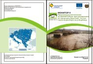
risk management - monitor ii
risk management - monitor ii
risk management - monitor ii

Create successful ePaper yourself
Turn your PDF publications into a flip-book with our unique Google optimized e-Paper software.
28 Monitor II Scenarios<br />
Monitor II Scenarios 29<br />
In Austria, the federal states and the<br />
municipalities are responsible for flood warning.<br />
Measurements are performed by the<br />
hydrographic service, which are associated<br />
with the Provincial Warning and Alarm Centers<br />
(LWZ). For each <strong>monitor</strong>ing station three gauge<br />
levels are defined. In case of an imminent<br />
flood event the Provincial Warning and Alarm<br />
Centre (LWZ) is informed auto matically by<br />
the <strong>monitor</strong>ing systems. After checking the<br />
correctness of the values, the LWZ initiates the<br />
necessary steps and informs the population<br />
through the warning and alarm system.<br />
Connecting<br />
the tools:<br />
scenarios<br />
The missing link:<br />
scenarios<br />
Basis questions about hazard Processes<br />
WHAT CAN HAPPEN<br />
WHERE CAN IT HAPPEN<br />
HOW OFTEN CAN IT HAPPEN<br />
HOW FAST WILL IT HAPPEN<br />
HOW SUDDENLY WILL IT HAPPEN<br />
ARE PROTECTION MEASURES INSTALLED<br />
AND ARE KEY THEY FUNCTIONALITY<br />
Information required<br />
Standardized process description including<br />
simplified scenario models.<br />
Standardized description of source, transport<br />
and impact area of the process.<br />
Description of the expected frequency<br />
(recurrence interval) of an event<br />
Standardized description of process<br />
development in time scale<br />
Standardized description of process initiation<br />
in time scale<br />
Standardized description of protection measures<br />
and functionality including information on<br />
protection, failure conditions and residual <strong>risk</strong>.<br />
In Slovenia the <strong>monitor</strong>ing and flood forecasting<br />
is provided by the Environmental<br />
Agency of the Republic of Slovenia (ACRSPDR).<br />
The forecasting system was established for<br />
main rivers of Slovenia, with the thresholds for<br />
one day forecast. On the basis of the r ealtime<br />
<strong>monitor</strong>ing results (discharges, levels)<br />
and forecast the ACRSPDR activates the civil<br />
protection forces on the designated areas.<br />
Information on water levels, river flow and<br />
water temperature is sent to the notification<br />
centre every 30 minutes. Plan contains intervention<br />
values with five levels of flood hazard<br />
for cross-sections of watercourses.<br />
Hazard maps indicate for defined return<br />
periods of the considered design events<br />
(e.g. 100-years flooding event), the spatial<br />
distribution of areas which are possibly inflicted<br />
by natural hazard processes of a certain<br />
intensity. Based on the assessment of possible<br />
damages and given standard assumptions<br />
on the vulnerability of elements at <strong>risk</strong>, a <strong>risk</strong><br />
zonation is done. During hazard assessment<br />
a very detailed standard procedure based on<br />
technical codes and regulations is followed up<br />
by the hazard mapping experts, leading to the<br />
definition of probable scenarios for the design<br />
events and to the delineation of related hazard<br />
zones. Although high quality information is<br />
available during hazard assessment procedure<br />
itself, this information on hazard processes,<br />
process development and possible event<br />
scenarios is generally summarized in reports<br />
hardly readable by contingency planners and<br />
“condensed” in more or less simple hazard<br />
maps. During this process of this somehow<br />
necessary “simplification” of complex processes<br />
and process interactions, key information,<br />
required by contingency planners might end up<br />
being hidden or lost.<br />
EXPECTED IMPACT OF HAZARD EVENT<br />
AND AREA AFFECTED<br />
IS IT POSSIBLE TO FORECAST EVENT’S INITIATION<br />
AND EVOLUTION<br />
IS IT POSSIBLE TO OBSERVE OR MONITOR<br />
EVENT’S INITIATION AND EVOLUTION<br />
IS IT POSSIBLE TO OBSERVE/ MONITOR KEY<br />
PROTECTION STRUCTURES AND OBSTACLES<br />
POSSIBLE<br />
IS IT POSSIBLE TO UNDERTAKE ANY<br />
INTERVENTION BEFORE AND/OR DURING FULL<br />
PROCESS DEVELOPMENT<br />
Description of key impact parameters like flow<br />
velocity or impact energy, and of area affected.<br />
Standardized description of possible triggers and<br />
process activation. Definition of warning stages.<br />
Definition of observation points and<br />
of standard operation procedure.<br />
Description of key protection structures,<br />
their function and of failure conditions.<br />
Description of obstacles. Standard operation<br />
procedures for observation.<br />
Definition of intervention points and<br />
appropriate measures to be defined in standard<br />
operation procedures.<br />
Figure 28: Basic information about hazard processes required by contingency planners<br />
A more “process oriented approach” of<br />
contingency planning requires as input from<br />
advanced hazard mapping, answers to very<br />
basic questions about the development of<br />
hazard processes and about required actions<br />
and measures to be taken (see Tab. 1).<br />
In order to fulfill these requirements, reference<br />
scenarios must be defined and included in<br />
the hazard maps and in tools like a “hazard<br />
manager” in Continuous Situation Awareness<br />
(CSA) systems to act as a link between hazard<br />
mapping and contingency planning procedure.<br />
Reference scenarios should be structured<br />
according to simplified scenario models<br />
i.e. as a standardized description of a course<br />
of future hazard events and of their impacts,<br />
based on a consistent and plausible set of<br />
assumptions about future conditions. Within<br />
contingency planning, scenario models can be<br />
used to describe reference scenarios both in<br />
preparedness phase and response phase.<br />
Reference Event Scenarios refer exclusively<br />
to the evolution in space and time of the<br />
hazardous process. Reference Risk Scenarios<br />
(divided into Damage Scenarios and Loss Scenarios)<br />
refer to the evolution in space and time<br />
of the reference event and of its effects, also<br />
considering eventual mitigation or response<br />
actions.<br />
Figure 29: Simplified scenario models as a link between hazard<br />
mapping and contingency planning (I. SCHNETZER).