

Tai Po Development - HKU Libraries
Tai Po Development - HKU Libraries
Tai Po Development - HKU Libraries

Create successful ePaper yourself
Turn your PDF publications into a flip-book with our unique Google optimized e-Paper software.
Kwangtung Province<br />
:ography by Lands & Survey Department PWD<br />
© Hong Kong Government 1978<br />
Market<br />
Towns
UNIVERSITY OF HONG KONG<br />
LIBRARY<br />
Hong Kong Collection<br />
gift from<br />
N.T. <strong>Development</strong> Dept.<br />
Hong Kong
ACC. NO.<br />
DATE OF ACC.<br />
CLASS NO.<br />
AUTHOR NO. ;-' - J<br />
Contents<br />
Introduction<br />
<strong>Tai</strong> <strong>Po</strong><br />
Fanling-Sheung Shui-Shek Wu Hui<br />
Yuen Long<br />
Introduction<br />
REBOUND<br />
In 1972, Hong Kong's Executive Council gave its approval<br />
to the adoption of a "Ten Year Housing Target<br />
Programme", which included proposals for the expansion<br />
of the three Market Towns— <strong>Tai</strong> <strong>Po</strong>, Fanling/Sheung Shui/<br />
. 15 Shek Wu Hui and Yuen Long. Plans have now been<br />
drawn up for the expansion of these Market Towns in the<br />
25 New Territories so that ultimately they accommodate<br />
nearly half a million people .<br />
Urban development in the New Territories is in fact taking<br />
place on three distinct levels. The New Towns of Sha Tin,<br />
Tuen Mun and Tsuen Wan are the first ranking urban<br />
centres. They are followed by the Market Towns, and then<br />
the smaller rural townships such as Cheung Chau, Mui O,<br />
Sai Kung and others.<br />
The three Market Towns are being expanded and<br />
developed as balanced townships, as self-contained as<br />
possible, with all modern basic amenities.<br />
At <strong>Tai</strong> <strong>Po</strong> and Yuen Long, the first two industrial estates<br />
in Hong Kong are also being developed.<br />
Although historically the Market Towns have always played<br />
a significant role in the life of the New Territories, growth<br />
in recent years has been overshadowed by the rapid buildup<br />
in population within the three New Towns. However,<br />
with the drawing up of the latest plans, the scope of<br />
development in the Market Towns has been increased<br />
greatly and they are likely to emerge once again as<br />
important centres in their own right.<br />
The present population of the three Market Towns is about<br />
100,000 and the transition to fully balanced townships<br />
housing almost 500,000 people is the responsibility of the<br />
New Territories <strong>Development</strong> Department (N.T.D.D.).<br />
Established within the Public Works Department in 1973 to<br />
plan and develop New Towns an
, long<br />
N<br />
Metres<br />
1 000 1500 2000<br />
<strong>Tai</strong> <strong>Po</strong> <strong>Development</strong><br />
general land use proposal<br />
Cartography by Lands & Survey Department, PWD (<br />
© Hong Kong Government, 1978 I
TAIPO<br />
The old town of <strong>Tai</strong> <strong>Po</strong> lies at the head of the northwestern<br />
arm of Tolo Harbour, at the point where the road from<br />
Kowloon to Fanling crosses the Lower Lam Tsuen River.<br />
On the north-eastern side of the river adjacent to the Ting<br />
Kok Road is <strong>Tai</strong> <strong>Po</strong> Old Market. Between 1960 and 1970<br />
the town expanded rapidly as the area southeast of the<br />
old town on both sides of Kwong Fuk Road was developed.<br />
This most recent part of the town is known as <strong>Tai</strong> <strong>Po</strong><br />
Central Area.<br />
At present, <strong>Tai</strong> <strong>Po</strong> has a population of about 30,000.<br />
Many more people live in its peripheral areas, around the<br />
shores of Tolo Harbour and in the valleys leading up into<br />
the surrounding hills and mountains. There is a strong<br />
feeling of identity with the mountains and the sea which<br />
form an attractive backdrop to <strong>Tai</strong> <strong>Po</strong>. The local fishing<br />
fleet can still be seen anchored off <strong>Tai</strong> <strong>Po</strong> Kau where the<br />
ferry pier and other marine facilities are situated.<br />
Agriculture still plays an important part in the local<br />
economy and much of the produce from the villages of the<br />
area is sold from the market and hawker stalls in <strong>Tai</strong> <strong>Po</strong>.<br />
The continuing pace of urban development inevitably<br />
means that agricultural land close to the town will be lost,<br />
but with such a large hinterland as <strong>Tai</strong>po enjoys the<br />
traditional function of the town as a market centre will<br />
remain important in the future.<br />
The <strong>Development</strong> Plan<br />
The principal objective of the plan to expand <strong>Tai</strong> <strong>Po</strong> is to<br />
develop a community within a more satisfactory urban<br />
environment having an adequate range of commercial,<br />
industrial and community facilities. Much of the new land<br />
available for development will be reclaimed from the sea,<br />
but the existing areas of the town will also be further<br />
developed and improved.<br />
In carrying out reclamation, borrow areas will be brought<br />
into operation to provide the necessary filling material<br />
and the proper reinstatement and after-use of these borrow<br />
areas is an important element in the overall plan.<br />
The major land uses will be centred around the<br />
reclamation to the north and east of the existing town.<br />
Primarily for residential use — both public and private -<br />
the area will also include commercial development,<br />
principal community buildings such as the cultural complex,<br />
open space and some industrial land. North-east of the<br />
town adjacent to Ting Kok Road, will be the <strong>Tai</strong> <strong>Po</strong><br />
Industrial Estate — already in the course of development.<br />
Peripheral areas will contain additional lower-density<br />
residential areas, further light industrial land, village areas<br />
and open space zones.<br />
The ultimate population of the <strong>Tai</strong> <strong>Po</strong> area is expected to<br />
be about 220,000 people, of whom some 170,000 would<br />
be living in the <strong>Tai</strong> <strong>Po</strong> township itself.<br />
Transport<br />
<strong>Tai</strong> <strong>Po</strong> will be linked to Sha Tin New Town and Kowloon<br />
by a new coastal trunk road, which will eventually be<br />
extended to Yuen Long. The existing road connecting<br />
<strong>Tai</strong> <strong>Po</strong> with Fanling will also be improved.<br />
Rapid communications with Sha Tin, Kowloon and Fanling<br />
will also be provided by the Kowloon-Canton Railway. The<br />
initial stages of an extensive modernisation programme are<br />
already under way with the double tracking of the<br />
main line between Hung Horn and Sha Tin and by the early<br />
1980's it is expected that this will have been extended to<br />
<strong>Tai</strong> <strong>Po</strong>. Considerable improvements are also planned for<br />
the rolling stock which will be in use on the railway. The<br />
expanded town will continue to be served by the stations at<br />
<strong>Tai</strong> <strong>Po</strong> Market and <strong>Tai</strong> <strong>Po</strong> Kau which will themselves<br />
be modernised.<br />
Within the town, a network of roads is planned to serve<br />
each of the individual planning areas. This network will be<br />
linked to the trunk road by two interchanges. Another<br />
important link in the network will be the major road<br />
planned along the edge of the future reclamation to serve<br />
the industrial estate and the land uses within the<br />
reclaimed area.
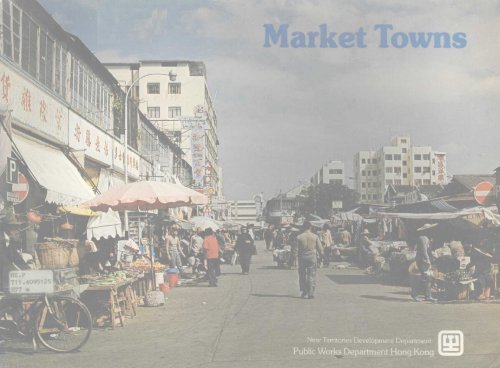
1. <strong>Tai</strong> <strong>Po</strong> is a traditional market centre.<br />
2. Island House — the residence of the Secretary for the New Territories.<br />
3. The <strong>Tai</strong> <strong>Po</strong> District Office.
1. <strong>Tai</strong><strong>Po</strong> Tau Village.<br />
2. A typical Hakka woman and her children<br />
relax in the shade.<br />
3. The Yuen Chau Tsai squatter area which is<br />
being cleared and re-developed.
1. The <strong>Tai</strong> <strong>Po</strong> Market railway station.<br />
2. Sailing is a popular recreation around <strong>Tai</strong> <strong>Po</strong>.<br />
3 &4. Transport and communications will be improved in <strong>Tai</strong> <strong>Po</strong>.<br />
At present, some of the remote villages are served by private \<br />
transport. * tfc A<br />
TAI PO MARKI
Three main bus terminals are to be provided — one next to<br />
<strong>Tai</strong> <strong>Po</strong> Market Railway Station and an other on reclaimed<br />
land. The third terminal will be incorporated within the<br />
industrial estate, and certain housing estates may be<br />
provided with sub-terminals to cater for local feeder<br />
services.<br />
An extensive network of cycle tracks and pedestrian ways,<br />
separated from the major roads, will also be developed.<br />
Housing<br />
Three public housing estates are planned for <strong>Tai</strong> <strong>Po</strong>, to<br />
accommodate about 83,000 people.<br />
Construction work on the first estate, for 30,000 people,<br />
has started and it should be occupied by the end of 1980.<br />
Land formation work for the estate is already in progress<br />
adjacent to Ting Kok Road. The second estate to provide<br />
homes for 30,000 people, will be located north of Kwong<br />
Fuk Road between Island House and the <strong>Po</strong>lice Bungalow.<br />
The last estate will be to the south of <strong>Tai</strong> <strong>Po</strong> Central Area<br />
and will accommodate about 23,000 people.<br />
Private residential development areas provided for in the<br />
plan are expected to house another 55,000 people. The<br />
existing residential areas have an estimated maximum<br />
population capacity of 29,000. <strong>Development</strong>s in the<br />
peripheral areas, including low-density residential use in<br />
some of the borrow areas, are expected to accommodate<br />
the balance of future population growth.<br />
Recreation<br />
As nearly 30 per cent of the population of the expanded<br />
town will be under the age of 15, emphasis will be placed<br />
on the provision of an adequate range of recreational<br />
facilities linked together by the cycle track and footpath<br />
systems.<br />
The types of open space to be provided will range from<br />
active areas for organised games to landscaped picnic and<br />
viewing areas in the surrounding foothills.<br />
A stadium and a swimming pool complex will be provided<br />
as well as riverside walks and waterfront open space.<br />
Weekend ferry trips to the Sai Kung Peninsula area are<br />
expected to continue to increase in popularity, with the<br />
improved ferry facilities at the <strong>Tai</strong> <strong>Po</strong> Kau being used more<br />
intensively.<br />
Special emphasis has been placed on this aspect of the<br />
development and a comprehensive study on landscaping<br />
and recreational facilities is being undertaken to<br />
recommend and co-ordinate action that will enhance the<br />
environment of the new development.<br />
One of the aims of the landscaping plan is to retain the<br />
present harmony between the town and the surrounding<br />
countryside and harbour.<br />
Industry and Employment<br />
Several areas have been set aside in the plan for the<br />
development of light industries, including service trades.<br />
The <strong>Tai</strong> <strong>Po</strong> Industrial Estate now under development is<br />
expected to provide better prospects for skilled workers<br />
within the community. Some workshop sites for smallscale<br />
service trades will be provided at appropriate locations<br />
within the high density residential areas. Commercial<br />
establishments within the town will also provide<br />
employment opportunities.
1 & 2. Agriculture ar^fishing p/ay ar<br />
in the life of the market town.<br />
importer) ^f»€i rt<br />
m^H**"'<br />
e of arip/oyment.
1. Large areas are being reclaimed from the sea<br />
to provide land for industrial and housing development.<br />
2. The <strong>Tai</strong> <strong>Po</strong> police station.<br />
3. School children buy snacks from a street vendor.
Education<br />
There are at present six secondary schools and seven<br />
primary schools in <strong>Tai</strong> <strong>Po</strong>. A new secondary school and<br />
two new primary schools will be provided within the public<br />
housing estate in the first stage of <strong>Tai</strong> <strong>Po</strong> development,<br />
now in progress. Additional primary and secondary schools<br />
will be built in accordance with the Education Department's<br />
programme. All planning areas will include site reservations<br />
for schools to ensure that every child receives a primary<br />
school education. From September 1978 every child<br />
entering secondary school will be assured of three years of<br />
secondary education.<br />
Community Facilities<br />
Two private clinics are now in operation at <strong>Tai</strong> <strong>Po</strong> and a site<br />
for a third government facility has been reserved adjacent<br />
to the central area. A site for a district hospital to meet longterm<br />
needs has also been reserved outside the main highdensity<br />
1. Mountains and green pastures provide an attractive backdrop to <strong>Tai</strong> <strong>Po</strong>.<br />
2. Recreational cycling along the Ting Kok Road.<br />
3. A new secondary school and two primary schools will be among the many<br />
facilities to be provided in the first stage of <strong>Tai</strong> <strong>Po</strong> development.
Sheung Shui-Shek Wu Hui-Fanling <strong>Development</strong><br />
general land use proposal<br />
250 500 750<br />
i.identiai<br />
1<br />
Public Housing<br />
Village Type Housing<br />
1 Light Industrial<br />
Govt, Institution & Community<br />
Public Open Space<br />
Lowland Rural Area<br />
Cartography by Lands & Survey Department PWD (<br />
© Hong Kong Government 1978 I
FANLING/SHEUNG SHUI/SHEK WU HUI<br />
Fanling, Sheung Shui and Shek Wu Hui are some 8 km<br />
north of <strong>Tai</strong> <strong>Po</strong>. Fanling is situated at the junction of the<br />
road from <strong>Tai</strong> <strong>Po</strong> with that to Sha Tau Kok. Existing<br />
development consists primarily of the old villages on either<br />
side of Jockey Club Road, of which the largest groups are<br />
Fan Leng <strong>Tai</strong> Wai, Fan Leng Nam Wai and Fanling Pak<br />
Wai, plus the more modern development of Luen Wo Hui,<br />
a market centre alongside the Sha Tau Kok Road. Nearby<br />
is the industrial area of On Lok Tsuen.<br />
Just to the north lies Sheung Shui, with its old walled<br />
village side-by-side with other recent extensions. Some<br />
5,000 people now live there. The improvement of this<br />
village forms an important aspect of the development.<br />
Close by is Shek Wu Hui, which today is a fairly modern<br />
development built after a wide-spread fire which swept the<br />
area in the 1950s. The streets are quite narrow however<br />
as'they still follow the old pattern and many of them are<br />
crowded, particularly near the market, as Shek Wu Hui is<br />
also one of the traditional centres for the surrounding area.<br />
The <strong>Development</strong> Plan<br />
Comprehensive plans have been prepared to cover all the<br />
three areas but each will retain its own individual<br />
identity. Much of the land to be developed is in private<br />
ownership and will have to be resumed and the people<br />
now living there will have to be rehoused before work can<br />
begin. The existing population is about 43,000,<br />
but when fully developed it will be the home of nearly<br />
170,000 people.<br />
The bulk of the additional population, particularly in the<br />
initial stages of the programme, will be accommodated in<br />
Sheung Shui where most of the public housing will be<br />
constructed. Sheung Shui Village and the Shek Wu Hui<br />
development will be retained.<br />
Three public housing estates have been planned, two at<br />
Sheung Shui and one at Fanling. Sites have also been<br />
provided for private residential development and there will<br />
be land for an estate under the Housing Authority's<br />
"Home Ownership" scheme, village housing and light<br />
industries.<br />
Extension areas for Sheung Shui village have been<br />
identified, and a light industrial area is likely to be developed<br />
between the village area and the railway line.<br />
The existing Sheung Shui railway station will be at the heart<br />
of the development, and additional transport facilities will<br />
be provided in adjoining areas beginning with the<br />
construction of a bus terminal. A community centre is also<br />
planned nearby.<br />
A large open space will act as a landscaped buffer zone<br />
separating the development at Sheung Shui from that<br />
of Fanling.<br />
This open space, in front of the Ling Hill and temple and<br />
adjacent to the Fan Leng group of villages, will include the<br />
important "fung shui" area facing the hill.<br />
"Fung shui" is a type of Far-Eastern geomancy, with the<br />
literal meaning of "wind and water". This practice has been<br />
used for thousands of years to determine the best site for a<br />
Chinese home or workplace in relation to natural features<br />
of the landscape such as waterways, land form and<br />
vegetation.<br />
<strong>Development</strong> at Fanling will be centred on the area<br />
adjoining the railway station. There will be a public housing<br />
estate for about 20,000 people, and private<br />
commercial/residential development for another 4,000.<br />
Sites have been reserved for community facilities and a<br />
cultural complex.<br />
15
1. Fan/ing, Sheung Shui and Shek Wu Hui are some 8 km north of <strong>Tai</strong> <strong>Po</strong>.<br />
2. "The Better Ole"restaurant near Fanling railway station.<br />
3. The <strong>Tai</strong> <strong>Po</strong> and Sheung Shui railway stations will be modernised. There, are<br />
also plans for the double-tracking of the main line.
I<br />
The Luen Wo Market area, as well as the existing On Lok<br />
Tsuen industrial area, will be improved.<br />
The improvement of the On Lok Tsuen area will be by<br />
provision of adequate roads and drains, and the retraining<br />
of the adjacent river channel. At Luen Wo Hui, a traffic<br />
plan will be imposed to see that the existing narrow roads<br />
are not overloaded and efficiently serve the abutting<br />
properties. Private development in the area is expected to<br />
continue and provision has been made for the expansion<br />
and further development of existing villages.<br />
The entire development area is low-lying and the general<br />
level has to be brought up to avoid possible flooding.<br />
Suitable material from surrounding hills has to be obtained<br />
and brought in for this purpose. Close contact with local<br />
people will be maintained in order that their cherished<br />
landmarks, some of which have local fung shui significance,<br />
are not unnecessarily affected. Special attention is also<br />
being paid to plan and budget for reinstatement work so<br />
that land created from borrow areas is put to worthwhile<br />
subsequent use compatible with the rural character of the<br />
countryside.<br />
Transport<br />
The existing road between Fanling and <strong>Tai</strong> <strong>Po</strong> will be<br />
upgraded to dual carriageway standard with a connection<br />
to the trunk road at Lam Kam, just north of <strong>Tai</strong> <strong>Po</strong>. Within<br />
the development area, through traffic will be carried on the<br />
Fanling Bypass. The Bypass will be aligned parallel to the<br />
existing railway on the south-west side of the tracks and<br />
then turn onto the line of the existing <strong>Tai</strong> <strong>Po</strong> Road passing<br />
through the area formerly occupied by tanneries.<br />
Three connections will be provided to the internal road<br />
network which will be based primarily on the improvement<br />
to dual carriageway standard of Jockey Club Road and<br />
Sha Tau Kok Road. In addition, a new internal<br />
route between Fanling and Sheung Shui will be provided<br />
alongside the railway, and San Fung Avenue will be<br />
replaced by a new road between the Jockey Club Road/<br />
San Fung Avenue junction and the existing roundabout at<br />
the junction of <strong>Tai</strong> <strong>Po</strong> Road/San Fung Avenue.<br />
An internal by-pass road to the Luen Wo Market area<br />
is also allowed for in the plan.<br />
Each of the planning areas will be served by a system of<br />
local roads.<br />
The railway stations at Fanling and Sheung Shui are to be<br />
retained and modernised. There are also plans for the<br />
double tracking of the main line.<br />
The main bus terminal for the area will be at Sheung Shui.<br />
As the population in the area builds up, the terminal is<br />
expected to be expanded, with ancillary facilities including a<br />
public light bus terminal, taxi ranks and car parking areas.<br />
Other smaller bus terminals will be provided at Luen Wo<br />
Market and Fanling railway station and some may also be<br />
provided within the public housing estates.<br />
The development area will be served by a network of<br />
footpaths and cycle tracks which will be separated from the<br />
major roads. This system will be linked to <strong>Tai</strong> <strong>Po</strong> by cycle<br />
tracks which will be provided as part of the improvements<br />
to the road between Fanling and <strong>Tai</strong> <strong>Po</strong>.<br />
Housing<br />
Of the three public housing estates planned — two at<br />
Sheung Shui and one at Fanling — the first estate will be<br />
in the former tanneries area between <strong>Tai</strong> <strong>Po</strong> Road and<br />
the railway. When complete it will have a population of<br />
30,000. Another estate under the Housing Authority<br />
Home Ownership scheme is also planned for this area.<br />
The second housing estate at Sheung Shui will<br />
accommodate some 23,000 people and will be located on<br />
the north-east side of Jockey Club Road. The Fanling<br />
estate will be on a site adjacent to the railway station<br />
and will house about 20,000 people.<br />
The Shek Mu Hui extension area, the planned Luen Wo<br />
Market development, and a site next to the Fanling housing<br />
estate will provide for private development to accommodate<br />
some 37,000 persons. It is estimated that the existing areas<br />
will have an eventual population capacity of 21,000.
A temple near the Fanling railway station is popular<br />
mth both local children and tourists.
1. The sewage treatment plant at Shek Wu Hui.<br />
2. An old market at Fan Leng Lau Village.<br />
3. A new swimming pool under construction near the Fanling railway station.
<strong>Development</strong> around the main high density areas will<br />
include low density, high class residential sites, village<br />
housing areas and some new village schemes.<br />
Industry and Employment<br />
Three areas have been allocated for the development of<br />
light industry to provide adequate employment opportunity<br />
for the people living in the area.<br />
The biggest of these is at On Lok Tsuen, an area which<br />
already contains a high proportion of industrial sites. The<br />
other two sites will be developed near Sheung Shui village<br />
and in the former tanneries area.<br />
Small scale service trades will be provided for by the<br />
development of workshop areas in suitable locations within<br />
the high density residential areas. Commercial development<br />
in other areas will also present employment opportunities.<br />
Recreation<br />
To meet the needs of young people who are likely to make<br />
up a considerable proportion of the expanded town<br />
population, adequate recreational facilities will be available.<br />
Work has begun on the construction of a swimming pool<br />
complex on land adjoining Fanling Playground and a site<br />
has been reserved nearby for a stadium. A further area of<br />
land has been set aside at Sheung Shui for a second<br />
swimming pool and stadium complex.<br />
It is envisaged that the facilities so provided will not only<br />
cater for the requirements of local residents but also those<br />
of villagers in the north-eastern sector of the New Territories.<br />
A large open space area will be developed between Fanling<br />
and Sheung Shui and the individual planning areas will<br />
provide for local open space and amenity areas. The type<br />
of open space will vary from active areas for volleyball,<br />
etc., to landscaped sitting out areas.<br />
The proposed cycle track and footpath system will link the<br />
main areas and facilities.<br />
Education<br />
At present there are eleven primary schools and three<br />
secondary schools in Fanling and Sheung Shui. Additional<br />
schools will be provided in the development area set out in<br />
the Education Department programme and appropriate<br />
reservations will be made in each of the planning areas.<br />
Medical, <strong>Po</strong>lice and Fire Services<br />
Sheung Shui has a private clinic and Fanling a small<br />
district hospital. This hospital is expected to be expanded to<br />
meet the needs of the growing population.<br />
There is a small police station in Sheung Shui village and<br />
the Frontier <strong>Po</strong>lice H.Q. is now under construction on a site<br />
adjacent to the Fanling roundabout.<br />
Both Sheung Shui and Fanling have fire stations, and<br />
provision has been made for the Fanling Station to be<br />
expanded.<br />
Community halls or estate welfare buildings will be<br />
provided for within the public housing estates and a social<br />
centre is to be built in Sheung Shui. A cultural complex is<br />
also planned at Fanling.<br />
Estimated Cost<br />
During the 10-year period of development, total<br />
expenditure in the public sector for the expansion of Fanling<br />
and Sheung Shui will be about $1,300 million at 1977<br />
price levels. Private enterprise is expected to invest a<br />
similar sum in development during this period.<br />
The first stage of work at Fanling (Package 3) will begin<br />
in 1978/1979 and will cost about $65 million.<br />
The first sites to become available for disposal to the private<br />
sector will be at Shek Wu Hui and it is envisaged they will<br />
be ready in 1979/1980.<br />
21
1. Fan Leng Lau Village.<br />
2. The divisional fire station at Fanling.<br />
3 & 4. Additional schools will be provided in the Fanling/Sheung Shui/Shek Wu Hui<br />
area as set out in the Government programme.
N<br />
Metres<br />
100 200 300 400 500<br />
Yuen Long Town <strong>Development</strong><br />
general land use proposal<br />
Cartography by Lands & Survey Department PWD (<br />
* Hong Kong Government 1978 \
YUENLONG<br />
Yuen Long occupies a strategic location in the middle of the<br />
largest flood plain in the north-western part of the New<br />
Territories, and is the traditional market centre for the<br />
agricultural produce of the surrounding villages, farmlands<br />
and fish ponds. Part of the old town may still be seen<br />
to-day in the Kau Hui (Old Market) area.<br />
It is 40 km by road from the existing urban areas of<br />
Kowloon, 22 km from the Tsuen Wan New Town, 6.5 km<br />
from Tuen Mun New Town, 16 km from Sheung Shui<br />
(via San Tin) and <strong>Tai</strong> <strong>Po</strong> (via Lam Tsuen).<br />
The planned development at Yuen Long will cover an area<br />
of approximately 160 hectares.<br />
Rapid development including the provision of infrastructure<br />
during the past decade has resulted in an increase of the<br />
town population to about 37,000 persons, mainly due to<br />
influx from the surrounding countryside.<br />
With further development of the town and its light industrial<br />
area, a higher rate of population growth is envisaged. Its<br />
present population is expected to grow to an ultimate<br />
figure of 95,000 in the next 10 to 15 years when all the<br />
building land presently reserved for residential,<br />
commercial/residential uses and for public housing is<br />
developed and occupied.<br />
Some 15 to 20 per cent of the future population is<br />
expected to seek jobs in the labour-intensive light industrial/<br />
manufacturing sector. The proposed industrial estate at<br />
Wang Chau, little more than a kilometre north of Yuen<br />
Long town, will provide sites for special land-intensive type<br />
industries similar to those in the <strong>Tai</strong> <strong>Po</strong> Industrial estate.<br />
The <strong>Development</strong> Plan<br />
With the territory-wide population increase, the demand<br />
for more building land for various urban uses, the<br />
improvement of the New Territories Circular Road, the<br />
completion of the bulk of flood control schemes and other<br />
major public works projects, more systematic development<br />
of the town took place in accordance with planning<br />
layouts in the mid '60s.<br />
These planning layouts form the basis of the present<br />
development plan of the market town. The principal<br />
objective of the plan is to foster the growth of balanced<br />
communities with adequate commercial, industrial<br />
and community services in the further development and<br />
redevelopment of the area.<br />
Over the years, the town has been providing the main<br />
employment opportunities for its hinterland population with<br />
its private-run wholesale marketing facilities and service<br />
industries.<br />
The influence of industrialisation has however spread to this<br />
relatively remote area and demand for proper industrial<br />
premises has increased in recent years. This trend is<br />
expected to continue in particular following the establishment<br />
of labour-intensive light industrial/manufacturing sector.<br />
25
1. Yuen Long is in the middle of the largest flood<br />
plain in the north-western part of the New Territories.<br />
It is surrounded by /arm/and and fish ponds.<br />
2. Part of an old area in Yuen Long.<br />
3. A private market.<br />
nnnnn<br />
.
The main objectives of the development plan are:<br />
• to provide a site for a new public housing estate for<br />
approximately 11,000 persons;<br />
• to provide more sites for private commercial/residential<br />
development;<br />
• to allow in-filling development to take place within the<br />
town boundaries;<br />
• to make adequate reservations for essential Government,<br />
Institution and Community uses as well as local open<br />
space development; and<br />
• to reserve sufficient sites for light industrial<br />
development and service industries.<br />
To achieve these aims, a development strategy has been<br />
formulated and a network of packages of engineering<br />
works programmed which include the formation of sites<br />
within the development area and the provision of roads<br />
and drainage connections to building sites.<br />
Since most of the hills nearby are either mainly well-wooded<br />
or carefully kept clear of squatter or burial activities, the<br />
development plans do not propose to affect them. Instead,<br />
borrow areas have been identified at <strong>Tai</strong> Tong, 4 km to the<br />
south of the town, where suitable fill material will be<br />
obtained and taken in to bring the building sites up to<br />
formation level. In order that no ugly scars are left<br />
unheeded in the countryside, funds have been set aside<br />
and plans have been drawn up for landscaping work to be<br />
carried out afterwards.<br />
Transport<br />
As the town develops, a system of roads will be<br />
constructed. A network of footpaths, cycle tracks, subways<br />
and footbridges has been planned to provide safe<br />
connections between the various areas of development.<br />
As well as maintaining the existing system of internal<br />
roads, a number of pedestrian precincts will be developed<br />
to ensure that shopping streets are reasonably<br />
segregated from unnecessary vehicular traffic.<br />
Sites have also been reserved for off-street car parks which<br />
may be converted to multi-storey development, should the<br />
need arise.<br />
Housing<br />
A public housing estate to accommodate 11,000 people is<br />
planned near Shui Pin Wai at the north-western part of the<br />
town. This is in addition to another site in the eastern part of<br />
the town which has already been developed and occupied.<br />
Most of the high density residential/commercial areas of<br />
the town have already been developed. It is estimated that<br />
the total area of building land for private residential use,<br />
will eventually accommodate 60,000 persons.<br />
To allow for some mixture of residential properties, about<br />
11 hectares of building land for medium and low density<br />
residential development are also provided at the southwestern<br />
part of the town to attract the higher income group.<br />
Industry<br />
At present there is about one hectare of industrial land at<br />
the north-eastern corner of the town, adjacent to the<br />
existing public housing estate. A few multi-storey flatted<br />
factories have been erected here, andThese presently<br />
provide jobs for the local people.<br />
Further north of this is an area of flat land totalling<br />
about 23 hectares which is mainly used for fish ponds.<br />
This area is zoned for industrial uses.<br />
A block of government-constructed flatted factories is<br />
located at the eastern edge of the existing built-up area of<br />
the town.<br />
27
<strong>Po</strong>nd fish farming and the timber industry have been two of the<br />
traditional sources of employment around Yuen Long.
Education<br />
There are already eight primary and three secondary<br />
schools within the town boundaries, providing a total of<br />
148 classrooms. Provision for more sites has been made<br />
to meet further educational requirements when the<br />
population increases.<br />
Community Facilities<br />
There are already a number of existing facilities including a<br />
a government office building, a post office, clinic, firestation,<br />
ambulance depot, police station, blind people's<br />
home, Family Planning Association office, rural committee<br />
buildings, a government stadium, and a town hall area<br />
housing a public library, a bus terminus, two retail markets<br />
and two privately run wholesale markets.<br />
In addition to these existing facilities, a number of new or<br />
additional facilities are proposed — including a small<br />
district general hospital, an extension to the stadium, a<br />
magistracy, a civic centre, a swimming pool complex, an<br />
additional retail market, clinic, post office, ambulance depot,<br />
fire station and bus terminus and hawker bazaars and<br />
cooked food stall centres.<br />
The clubhouse of the Yuen Long Sports Association has<br />
now been completed.<br />
Two sites are already developed and managed as rest<br />
gardens and playgrounds.<br />
A small town park and more recreation and open space<br />
facilities will be provided in the new development to cater<br />
for the growing population.<br />
A study into the landscaping requirements is being<br />
undertaken in order that the provision of recreational and<br />
sporting facilities as well as amenity planting are properly<br />
integrated and programmed to enhance the environmental<br />
quality of the "urban development.<br />
It will be seen that many of the facilities already existing or<br />
to be provided are at district level. They will cater not only<br />
for the requirements of the townspeople but also those of<br />
the villagers in the various clusters of communities,<br />
scattered in the large plain in the north-western part of the<br />
New Territories. The availability of such amenities<br />
will go a long way to recapture the eminence of<br />
the town as a focal point for recreational, cultural and sports<br />
activities for the district.<br />
Estimated Cost<br />
During the 10-year period of development, total<br />
expenditure in the public sector for development of Yuen<br />
Long town will be about $474 million at 1977 price levels.<br />
The packaged engineering works began in July 1977.<br />
Much of the land in Yuen Long, except for a few small<br />
areas, is expected to be fully formed and ready for<br />
development within six to seven years.<br />
All sums of money mentioned in the text<br />
are in Hong Kong dollars<br />
29
1. The main street at Yuen Long.<br />
2 &3. The Yuen Long Stadium and Town Hall
A lovely tree- lined river-front promenade along the Nam Sang Wai near Yuen Long.
180<br />
160<br />
140<br />
<strong>Tai</strong><strong>Po</strong><br />
XD17flSlbl<br />
Sheung Shui<br />
ShekWuHui<br />
Fanling<br />
<strong>Po</strong>pulation<br />
in<br />
Market Towns<br />
1977-1987<br />
Persons<br />
in thousands<br />
220<br />
180<br />
120<br />
100<br />
Yuen Long<br />
80<br />
60<br />
40<br />
after<br />
1987<br />
86-87<br />
85-86<br />
84-85<br />
83-84<br />
82-83<br />
81-82<br />
80-81<br />
79-80<br />
78-79<br />
77-78<br />
Mar. 77<br />
Cartography by Lands & Survey Department PWD I<br />
© Hong Kong Government 1978 I
Land Use Distribution<br />
\Lowland<br />
al Area<br />
Area & percentage<br />
jGovt., Institution<br />
& Community Area<br />
1793.4<br />
hectares<br />
\Govt., Institution<br />
\& Community Area<br />
Govt., Institution & Community Area<br />
^94,5<br />
\Lowland<br />
\Rural Area<br />
ustrial Area<br />
Industrial Area<br />
45.5<br />
Indetermined/Other uses<br />
ndetermined/ Other uses<br />
.1<br />
\Undetermined /Other uses<br />
Commercial Area<br />
0.7<br />
esentia<br />
Area<br />
_5BMkM<br />
Residentia*! Area<br />
210.5<br />
hectares<br />
Residential Area<br />
^37.9<br />
hectares<br />
Residential zoning<br />
Height of block is an indication of eventual<br />
population density in each residential category.<br />
<strong>Tai</strong><strong>Po</strong><br />
Sheung Shui-Shek Wu Hui-Fanling<br />
private housing<br />
Yuen Long<br />
public<br />
housing<br />
O'to£/aphy by Lands & Survey Department PWD I<br />
© Hong Kong Government 1978 I<br />
R.I— 4=Restdential Zones !—4 VTH==V!l}age Type Housing C/R = Commercial/Restdential RS^Speciai Residenttj
711.4095125 1281351<br />
Hong Kong. New Territories <strong>Development</strong><br />
Dept.<br />
Market towns. 1979.<br />
Date<br />
Due<br />
Date Due<br />
& *Yf<br />
Borrower's<br />
No. I<br />
Date<br />
Due<br />
I<br />
Borrower's<br />
No.<br />
1281351<br />
[HKP] 711.4095125 H77 m<br />
XD17fiSlbl


