lungau summer in the hills brochure - Blasiwirt
lungau summer in the hills brochure - Blasiwirt
lungau summer in the hills brochure - Blasiwirt

Create successful ePaper yourself
Turn your PDF publications into a flip-book with our unique Google optimized e-Paper software.
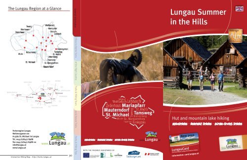
The Lungau Region at a Glance<br />
General Information Fabulous Hikes to Alp<strong>in</strong>e Tarns Flavor of <strong>the</strong> High Country Hik<strong>in</strong>g Trails & Hik<strong>in</strong>g Tours<br />
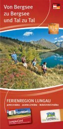
Lungau Summer<br />
<strong>in</strong> <strong>the</strong> Hills<br />
Theme & Nature Trails<br />
Hut and mounta<strong>in</strong> lake hik<strong>in</strong>g<br />
Atmosphere Heavenly Sphere Alp<strong>in</strong>e-Sports Sphere<br />
Ferienregion Lungau<br />
Rotkreuzgasse 100<br />
A-5582 St. Michael im Lungau<br />
Tel. 0043 (0)6477 8988<br />
Fax 0043 (0)6477 8988-20<br />
<strong>in</strong>fo@<strong>lungau</strong>.at<br />
www.<strong>lungau</strong>.at<br />
Interactive Hik<strong>in</strong>g Map – http://karte.<strong>lungau</strong>.at<br />
90<br />
Nature Parks & Hik<strong>in</strong>g Tips<br />
Atmosphere Heavenly Sphere Alp<strong>in</strong>e-Sports Sphere<br />
WITH THE FRIENDLY ASSISTANCE OF<br />
New 2012<br />
LungauCard<br />
Die Ferienregion Lungau All-<strong>in</strong>clusive erleben<br />
Information: card.<strong>lungau</strong>.at
Nature Parks & Hik<strong>in</strong>g Tips Theme & Nature Trails Hik<strong>in</strong>g Trails & Hik<strong>in</strong>g ToursFlavor of <strong>the</strong> High Country<br />
Fabulous Hikes to Alp<strong>in</strong>e Tarns General Information<br />
Table of Contents<br />
General Information Page 3<br />
Fabulous Hikes to Alp<strong>in</strong>e Tarns Page 9<br />
Flavor of <strong>the</strong> High Country Page 31<br />
Hik<strong>in</strong>g Trails & Hik<strong>in</strong>g Tours Page 79<br />
Theme & Nature Trails Page 82<br />
Nature Parks & Hik<strong>in</strong>g Tips Page 89<br />
Publisher:<br />
Ferienregion Lungau<br />
Rotkreuzgasse 100, A-5582 St. Michael im Lungau<br />
Tel. 0043 (0)6477 8988, Fax 0043 (0)6477 8988-20<br />
<strong>in</strong>fo@<strong>lungau</strong>.at, www.<strong>lungau</strong>.at<br />
Edition 2012<br />
Editorial Texts: Ferienregion Lungau, Dr. Gertraud Ste<strong>in</strong>er,<br />
kulturpublizistik@aon.at<br />
Title Photos: Ferienregion Lungau<br />
Photo Credits: Ferienregion Lungau (pp. 4, 5, 7, 20, 27, 58, 59, 60, 62,<br />
64, 70, 72, 73, 77, 78, 82, 84, 87, 88), H. Modl (pp. 9, 13, 14, 17, 18,<br />
22, 23, 26, 28), Zederhaus Touris Office (pp. 10, 11, 12, 31, 32, 39, 40),<br />
P. Mache<strong>in</strong>er (p. 15), Lungau Lift Co. (p. 16), Oberkofler Family (p. 19),<br />
P. Kröll (pp. 24, 25), Muhr Tourist Office (p. 29), www.oberkaernten.<strong>in</strong>fo<br />
(p. 30), Gruber Family (p. 33), Batlogg Family (p. 34), Gruber Familiy<br />
(p. 35), Gruber/Jäger Family (p. 36), Schiefer Family (p. 37), Dorfer<br />
Family (p. 38), Bergmann Family (p. 41), Mache<strong>in</strong>er Family (p. 42),<br />
Wirnsperger Family (p. 43), S. Perner (p. 44), Sagmeister Family (p. 45),<br />
Kocher Family (p. 46), Fuchsberger Family (p. 47), Kendlbacher Family<br />
Lungauer (p. 48), Bergseen Lerchner Family (p. 49), Kösslbacher Family (p. 50), Bliem Family<br />
16 Landschitzseen / S. 25<br />
01 Boarnlacke (p. 51), A. / S. Neuschitzer 9<br />
09 (p. Giglachsee 52), Sampl / S. 17 Family (p. 17 53), Zwerfenbergsee D. Buck (pp. & Angersee 55, 61, / S. 26<br />
02 Esser 65, See 67, / 74, S. 1076)<br />
10 Oberer Schönalmsee / S. 18 18 Prebersee / S. 27<br />
03 Ilgsee & Zaunersee / S. 11 11 Oberhüttensee / S. 19 19 Rosan<strong>in</strong>see / S. 28<br />
04 Ro<strong>the</strong>nwändersee Design: Die Medienwerkstatt / S. 12 12 Wirpitschsee GmbH, & www.diemedienwerkstatt.<strong>in</strong>fo<br />
20 Rotgüldensee / S. 29<br />
05 Schlierersee / S. 13<br />
Tiefenbachsee / S. 20 & 21 21 Anderleseen / S. 30<br />
Pr<strong>in</strong>t: SAMSON Druck GmbH, www.samsondruck.at<br />
06 Blauseen / S. 14<br />
13 Lignitzsee / S. 22<br />
07 Twenger Summer Almsee panorama: / S. 15 He<strong>in</strong>z 14 Landawirseen Vielk<strong>in</strong>d, / S. Panoramastudio<br />
23<br />
08 Trogalmseen Interactive / S. hik<strong>in</strong>g 16 map 15 Gralatisee (http://karte.<strong>lungau</strong>.at):<br />
/ S. 24<br />
Intermaps Software GmbH<br />
Bewirtschaftete Hütten<br />
Not liable for errors or <strong>in</strong>accuracies. Information may be subject to<br />
change. Any reproduction, <strong>in</strong> whatever format, <strong>in</strong> whole or <strong>in</strong> part, is<br />
allowed only with <strong>the</strong> express written permission of <strong>the</strong> publisher.<br />
2<br />
Credits<br />
Interactive Hik<strong>in</strong>g Map – http://karte.<strong>lungau</strong>.at<br />
Huts <strong>in</strong> <strong>the</strong> Lungau<br />
26 Sauschneideralm / p. 73<br />
27 Tonimörtl Hut / p. 42<br />
28 Ke<strong>in</strong>precht Hut / p. 67<br />
29 Ignaz Mattis Hut / p. 68<br />
30 Giglachsee Hut / p. 68<br />
31 Ober Hut / p. 69<br />
32 Jausenstation Dicktler Hut / p. 73<br />
33 Grangler Hut / p. 41<br />
34 Jausenstation Wielandhof / p. 74<br />
35 Hansal Hut / p. 43<br />
36 Landawirsee Hut / p. 63<br />
37 Laßhoferalm / p. 44<br />
38 Lenznalm / p. 45<br />
39 Wildbach Hut / p. 46<br />
40 Preber-Halter Hut / p. 59<br />
41 Grazer Hut / p. 70<br />
42 Ludlalm / p. 74<br />
43 Dorfer Hut / p. 47<br />
44 Platschalm / p. 48<br />
45 Niggei Hut / p. 59<br />
47 Twenger-Alm / p. 57<br />
48 Dr. Josef Mehrl Hut / p. 64<br />
49 Hoislalm / p. 32<br />
50 Branntwe<strong>in</strong>er Hut / p. 49<br />
51 Kößlbacheralm / p. 50<br />
52 Bonner Hut / p. 70<br />
53 Schlögelberger Alp<strong>in</strong>e Inn &<br />
Wildlife Park / p. 75<br />
54 Adlerhorst Summit Restaurant / p. 75<br />
55 Speiereck-Halterhut / p. 51<br />
56 Jausenstation Neuhauserstubn / p. 76<br />
58 Pritz Hut / p. 52<br />
59 Hanslbaueralm / p. 60<br />
60 Gasthof Bacher / p. 76<br />
61 Gamskogel Hut / p. 77<br />
62 Stöcklalm / p. 53<br />
63 Hiasleralm / p. 60<br />
64 Rotgüldensee Hut / p. 64<br />
65 Stickler Hut / p. 65<br />
66 Alpengasthof Jedl / p. 78<br />
67 Goll<strong>in</strong>g Hut / p. 69<br />
68 Altwirtsalm / p. 61<br />
69 Adamalm / p. 61<br />
70 Kößlerhiasalm / p. 55<br />
71 Wasteialm / p. 56
Welcome to Summer <strong>in</strong> <strong>the</strong> Hills<br />
<strong>in</strong> <strong>the</strong> Lungau<br />
Await<strong>in</strong>g you here <strong>in</strong> <strong>the</strong> Lungau region, nestled between <strong>the</strong> peaks of<br />
<strong>the</strong> Niedere Tauern and Nockberge, is a superlative hik<strong>in</strong>g paradise. The<br />
fragrant air of <strong>the</strong> Alps, <strong>the</strong> countryside filled with alp<strong>in</strong>e pastures and<br />
a colorful carpet of plants and wild herbs spread out before you, along<br />
with <strong>the</strong> tranquil beauty of nature, turn every hike <strong>in</strong>to a memorable<br />
experience and give you <strong>the</strong> pure enjoyment and relaxation you have<br />
been look<strong>in</strong>g for.<br />
Some sixty mounta<strong>in</strong> lakes, crystal-clear and iridescent, shimmer<strong>in</strong>g<br />
emerald greens and silvers, lie scattered amidst green pastures and<br />
silent combes, or beneath rocky crags and alp<strong>in</strong>e summits.<br />
Is it possible to become addicted to such blissful moments as <strong>the</strong>se?<br />
Oh, yes <strong>in</strong>deed!<br />
Natural jewels have someth<strong>in</strong>g about <strong>the</strong>m. The joy of a newly<br />
discovered mounta<strong>in</strong> lake creates a long<strong>in</strong>g and curiosity for <strong>the</strong> next<br />
one. A wide-rang<strong>in</strong>g, clearly marked network of trails provide a constant<br />
source of enthusiasm for walkers and experienced mounta<strong>in</strong>eers, but<br />
also for those who want to take an extended stroll <strong>in</strong> <strong>the</strong> country, flee <strong>the</strong><br />
stresses of daily life, embark on a nature pilgrimage or just experience<br />
a few moments of complete bliss. These trails promise tours that are<br />
guaranteed to appeal no matter how <strong>the</strong> day happens to shape up, be<br />
that bright sunsh<strong>in</strong>e or <strong>the</strong> quiet romance of overcast skies.<br />
None of <strong>the</strong> hikes presented here offer extreme challenges, but ra<strong>the</strong>r<br />
are <strong>in</strong> keep<strong>in</strong>g with <strong>the</strong> tone of. This <strong>in</strong>cludes landscapes and scenery<br />
seem<strong>in</strong>gly plucked from <strong>the</strong> pages of a picture book, as well as <strong>the</strong><br />
joy of discover<strong>in</strong>g those quiet hidden spots of glorious natural beauty,<br />
experienc<strong>in</strong>g first-hand <strong>the</strong> botany, geology and ancient traditions of<br />
<strong>the</strong> region. All of this is accompanied by an outstand<strong>in</strong>g <strong>in</strong>frastructure,<br />
<strong>in</strong>clud<strong>in</strong>g a valley bus and self-guided <strong>the</strong>me trails, plus genu<strong>in</strong>ely<br />
hospitable hosts at alp<strong>in</strong>e huts and hikers’ refuges, mounta<strong>in</strong> <strong>in</strong>ns,<br />
country cafés and summit restaurants. A Lungau also captivates guests<br />
with its service, scores high marks with countless cul<strong>in</strong>ary specialties<br />
and embraces you with a warmth not soon to be forgotten.<br />
Interactive Hik<strong>in</strong>g Map – http://karte.<strong>lungau</strong>.at<br />
3<br />
General Information Fabulous Hikes to Alp<strong>in</strong>e Tarns Flavor of <strong>the</strong> High Country Hik<strong>in</strong>g Trails & Hik<strong>in</strong>g Tours Theme & Nature Trails<br />
Nature Parks & Hik<strong>in</strong>g Tips
Nature Parks & Hik<strong>in</strong>g Tips Theme & Nature Trails Hik<strong>in</strong>g Trails & Hik<strong>in</strong>g ToursFlavor of <strong>the</strong> High Country<br />
Fabulous Hikes to Alp<strong>in</strong>e Tarns General Information<br />
Each of <strong>the</strong> huts we present has its own little “secret.” This might<br />
be some cultural treasure passed down through <strong>the</strong> generations of <strong>the</strong><br />
same family, a unique craft, or a service, such as perhaps a Kneipp spa<br />
dedicated to your good health. Nutritious, delicious country fare and<br />
<strong>the</strong> best of farmhouse cook<strong>in</strong>g is always at <strong>the</strong> top of <strong>the</strong> list. Traditional<br />
Lungau dishes <strong>in</strong>clude homemade doughnuts, dumpl<strong>in</strong>gs, (unsweetened<br />
pastry), bacon, and cheese. Of <strong>the</strong> various thirst-quenchers,<br />
buttermilk with native , <strong>the</strong> name for l<strong>in</strong>gonberries here <strong>in</strong> <strong>the</strong> Lungau,<br />
has become particularly popular. The cul<strong>in</strong>ary highlight of any hike<br />
<strong>in</strong> <strong>the</strong> Lungau is undoubtedly, referred to by <strong>the</strong> experts as “Lungau<br />
marzipan.” We are more than happy to share <strong>the</strong> recipe, but be forewarned,<br />
only up at an alp<strong>in</strong>e hut does it ever taste quite so heavenly. Let<br />
us simply say, if <strong>the</strong>re were ever an excuse for ignor<strong>in</strong>g your daily calorie<br />
count, is def<strong>in</strong>itely it.<br />
Lungauer Rahmkoch –<br />
“Lungau Marzipan”<br />
Ingredients: ½ kg butter, ½ kg of granular flour, ¼ l cream, 180 g sugar,<br />
c<strong>in</strong>namon, anise, rais<strong>in</strong>s, rum<br />
Directions: Melt <strong>the</strong> butter. Mix <strong>the</strong> sweetened cream <strong>in</strong>to <strong>the</strong> flour<br />
and <strong>the</strong>n stir <strong>the</strong> mixture <strong>in</strong>to <strong>the</strong> melted butter. (Important: don’t let<br />
<strong>the</strong> butter get too hot!) Allow <strong>the</strong> mixture to simmer for 30 m<strong>in</strong>utes,<br />
stirr<strong>in</strong>g cont<strong>in</strong>uously, until this so-called “Koch” falls from <strong>the</strong> spoon.<br />
Add sugar, c<strong>in</strong>namon, anise, rais<strong>in</strong>s and rum to taste. Pour <strong>the</strong> mixture<br />
<strong>in</strong>to an oblong mold and keep <strong>in</strong> a cold place for about 12 hours.<br />
The tours described here do assume that you enjoy extended walks<br />
and that you are essentially <strong>in</strong> good physical condition with average<br />
stam<strong>in</strong>a. The trails’ descriptions are <strong>in</strong>tended to give you an accurate<br />
sense of <strong>the</strong>ir physical demands. Recklessness is someth<strong>in</strong>g we advise<br />
strongly aga<strong>in</strong>st, s<strong>in</strong>ce <strong>the</strong> mounta<strong>in</strong> world doesn’t tolerate foolishness<br />
lightly. Our <strong>in</strong>formation section also gives you some important tips and<br />
lists essential telephone numbers.<br />
In conclusion, <strong>the</strong> Lungau Holiday Region wishes to thank<br />
• Dr. Gertraud Ste<strong>in</strong>er for author<strong>in</strong>g <strong>the</strong> editorial texts,<br />
• Mr. Peter Bayr for his descriptions of <strong>the</strong> alp<strong>in</strong>e hut and lake routes,<br />
as well as for compil<strong>in</strong>g cartographical materials,<br />
• Mr. Hannes Modl for his descriptions of <strong>the</strong> alp<strong>in</strong>e hut and lake<br />
routes, as well as for his wealth of ideas dur<strong>in</strong>g <strong>the</strong> creative and<br />
realization process, and also<br />
• all of <strong>the</strong> owners, managers and staff of our region’s alp<strong>in</strong>e huts.<br />
Without <strong>the</strong>ir support and dedication, it would not have been possible<br />
to produce this <strong>brochure</strong>.<br />
Additional Read<strong>in</strong>g on this Topic:<br />
• Dr. Gertraud Ste<strong>in</strong>er: W<strong>in</strong>kelwelt. Sagen aus dem Lungau.<br />
Wolfgang Pfeifenberger Verlag 1999<br />
• Dr. Gertraud Ste<strong>in</strong>er: Sagen und My<strong>the</strong>n entdecken auf Salzburger<br />
Almen. Tyrolia Verlag 2005<br />
Interactiv Hik<strong>in</strong>g Map:<br />
4 5<br />
Interactive Hik<strong>in</strong>g Map – http://karte.<strong>lungau</strong>.at<br />
Interactive Hik<strong>in</strong>g Map – http://karte.<strong>lungau</strong>.at<br />
General Information<br />
Fabulous Hikes to Alp<strong>in</strong>e Tarns Flavor of <strong>the</strong> High Country Hik<strong>in</strong>g Trails & Hik<strong>in</strong>g Tours Theme & Nature Trails<br />
Nature Parks & Hik<strong>in</strong>g Tips
General Information<br />
Valley Bus, Lungau Shuttle &<br />
Mounta<strong>in</strong> Lifts<br />
The valley buses and Lungau shuttle br<strong>in</strong>g you comfortably and <strong>in</strong><br />
environmentally-friendly fashion to and from <strong>the</strong> trailheads, mak<strong>in</strong>g it<br />
possible to beg<strong>in</strong> your hike over <strong>in</strong> one valley and return from <strong>the</strong> next.<br />
Difficulty Rat<strong>in</strong>g for Hik<strong>in</strong>g Paths <strong>in</strong><br />
<strong>the</strong> Alp<strong>in</strong>e Region<br />
General Information<br />
Nature Parks & Hik<strong>in</strong>g Tips Theme & Nature Trails Hik<strong>in</strong>g Trails & Hik<strong>in</strong>g ToursFlavor of <strong>the</strong> High Country<br />
Fabulous Hikes to Alp<strong>in</strong>e Tarns<br />
Detailed timetables and rates are conta<strong>in</strong>ed <strong>in</strong> <strong>the</strong> official bus and<br />
shuttle <strong>brochure</strong>s, available at all local tourist offices; <strong>the</strong> Lungau<br />
regional tourist office, Tel. 0043 (0)6477 8988; <strong>the</strong> Tamsweg Post<br />
Bus Offices, Tel. 0043 (0)6474 2213; or onl<strong>in</strong>e at www.taelerbus.at,<br />
www.svv-<strong>in</strong>fo.at, or www.postbus.at.<br />
Please also note that toll charges apply <strong>in</strong> some valleys if you opt to<br />
drive your own car.<br />
Take a deep breath, relax and enjoy <strong>the</strong> wonderful views that<br />
accompany your rides on <strong>the</strong> region’s mounta<strong>in</strong> lifts (cable cars on <strong>the</strong><br />
Grosseck/Speiereck from Mauterndorf and St. Michael, as well as <strong>the</strong><br />
A<strong>in</strong>eckbahn lift on <strong>the</strong> Katschberg). Reach<strong>in</strong>g <strong>the</strong> mounta<strong>in</strong>tops has never<br />
been faster or easier. Details regard<strong>in</strong>g times and fares are available from<br />
<strong>the</strong> Lungau regional tourist office, Tel. 0043 (0)6477 8988 or onl<strong>in</strong>e at<br />
www.bergbahnen-<strong>lungau</strong>.at, www.katschi.at.<br />
There is noth<strong>in</strong>g left to do now but allow yourself to be delightfully<br />
surprised, impressed and enchanted, walk<strong>in</strong>g <strong>the</strong> <strong>in</strong>trigu<strong>in</strong>g <strong>the</strong>me trails<br />
or out on magically beautiful hikes to legendary mounta<strong>in</strong> lakes and<br />
fasc<strong>in</strong>at<strong>in</strong>g alp<strong>in</strong>e huts.<br />
Let’s head for <strong>the</strong> <strong>hills</strong> – Lungau-style!<br />
The follow<strong>in</strong>g descriptions assume dry, <strong>summer</strong>like wea<strong>the</strong>r conditions.<br />
• easy<br />
Simple hik<strong>in</strong>g paths <strong>in</strong> permanently populated areas and adjacent<br />
forested areas, proceed<strong>in</strong>g through flat terra<strong>in</strong> with few significant<br />
uphill stretches.<br />
Special Requirements: None, regular runn<strong>in</strong>g shoes or street shoes are<br />
sufficient. No special equipment necessary. Navigable without use of a<br />
hik<strong>in</strong>g map.<br />
• <strong>in</strong>termediate/medium<br />
Mounta<strong>in</strong> trails that require a certa<strong>in</strong> degree of sure-footedness.<br />
Steep stages, water courses, narrow trails at po<strong>in</strong>ts, wash-out dirt and<br />
vegetation may be encountered along <strong>the</strong>se trails.<br />
Special Requirements: Basic map-read<strong>in</strong>g skills are required. Hik<strong>in</strong>g/<br />
trekk<strong>in</strong>g/mounta<strong>in</strong>eer<strong>in</strong>g boots with a good tread and extend<strong>in</strong>g above<br />
<strong>the</strong> ankle are recommended, as is a topographical hik<strong>in</strong>g map of <strong>the</strong><br />
area <strong>in</strong> question.<br />
• difficult<br />
Difficult alp<strong>in</strong>e and mounta<strong>in</strong>eer<strong>in</strong>g trails, secured at exposed<br />
po<strong>in</strong>ts by cables, manmade stairways, ladders, cha<strong>in</strong>s etc. You may<br />
often need to use your hands to ma<strong>in</strong>ta<strong>in</strong> balance and move along <strong>the</strong><br />
trail. The precise trail is not always readily recognizable. Occasionally<br />
very exposed areas present a real danger of fall<strong>in</strong>g, loose rock, and<br />
steep grassy or rocky slopes. Summer hikers may well still encounter<br />
unthawed snowpack from <strong>the</strong> previous w<strong>in</strong>ter.<br />
Special Requirements: Hikers must have appropriate hik<strong>in</strong>g and<br />
mounta<strong>in</strong>eer<strong>in</strong>g experience, as well as be<strong>in</strong>g able to navigate with a<br />
detailed topographical hik<strong>in</strong>g map. Hik<strong>in</strong>g/trekk<strong>in</strong>g/mounta<strong>in</strong>eer<strong>in</strong>g<br />
boots with a good tread and extend<strong>in</strong>g above <strong>the</strong> ankle are <strong>in</strong>dispensible.<br />
Hikers should have no physical impairments prevent<strong>in</strong>g <strong>the</strong>m from<br />
tackl<strong>in</strong>g fixed-cable stages, steep stairways or similar obstacles where<br />
hik<strong>in</strong>g poles are occasional more of a handicap than a help.<br />
In <strong>the</strong> Lungau region you will often f<strong>in</strong>d additional red-white-red<br />
mark<strong>in</strong>gs (some of which have trail numbers) next to <strong>the</strong> yellow trail<br />
signs, direct<strong>in</strong>g you from one sign location to <strong>the</strong> next.<br />
6 7<br />
Interactive Hik<strong>in</strong>g Map – http://karte.<strong>lungau</strong>.at<br />
Interactive Hik<strong>in</strong>g Map – http://karte.<strong>lungau</strong>.at<br />
Fabulous Hikes to Alp<strong>in</strong>e Tarns Flavor of <strong>the</strong> High Country Hik<strong>in</strong>g Trails & Hik<strong>in</strong>g Tours Theme & Nature Trails<br />
Nature Parks & Hik<strong>in</strong>g Tips
Nature Parks & Hik<strong>in</strong>g Tips Theme & Nature Trails Hik<strong>in</strong>g Trails & Hik<strong>in</strong>g ToursFlavor of <strong>the</strong> High Country<br />
Fabulous Hikes to Alp<strong>in</strong>e Tarns General Information<br />
8<br />
Correct Trail Behavior<br />
1. Prior to every tour, verify <strong>the</strong> mounta<strong>in</strong>eer<strong>in</strong>g experience and<br />
physical capabilities of all participants, <strong>in</strong>clud<strong>in</strong>g children. Hikes <strong>in</strong><br />
<strong>the</strong> mounta<strong>in</strong>s often demand a high degree of sure-footedness and<br />
an absence of any vertigo problems.<br />
2. Plan your hike carefully us<strong>in</strong>g tour descriptions and maps.<br />
Information provided by regional alp<strong>in</strong>e associations and <strong>the</strong> staff of<br />
alp<strong>in</strong>e huts can be of critical assistance.<br />
3. Make sure you have cloth<strong>in</strong>g and equipment appropriate to your<br />
expedition and wea<strong>the</strong>r conditions. High-ankle boots with a good<br />
tread and cloth<strong>in</strong>g provid<strong>in</strong>g adequate protection aga<strong>in</strong>st ra<strong>in</strong> and<br />
cold are very important.<br />
4. Prior to sett<strong>in</strong>g out, notify staff at <strong>the</strong> alp<strong>in</strong>e hut or hotel, or family<br />
and friends of your planned route and dest<strong>in</strong>ation, as well as <strong>the</strong><br />
estimated time of your return.<br />
5. Match your tempo to that of your weakest team member. A slow pace<br />
is especially important at <strong>the</strong> start of a hike. Always pay attention<br />
to <strong>the</strong> o<strong>the</strong>r members of your group to catch any early signs of<br />
exhaustion.<br />
6. Never leave marked trails. Use extreme caution <strong>in</strong> cross<strong>in</strong>g steep<br />
grassy slopes, especially when wet (to avoid slipp<strong>in</strong>g). Travers<strong>in</strong>g<br />
steep snow fields and glaciers is particularly hazardous.<br />
7. Never kick rocks off <strong>the</strong> trail, s<strong>in</strong>ce you may <strong>in</strong>jure o<strong>the</strong>r hikers. Do<br />
not stop <strong>in</strong> areas threatened by fall<strong>in</strong>g rock; leave such areas as<br />
quickly as possible.<br />
8. If <strong>the</strong> wea<strong>the</strong>r turns, fog moves <strong>in</strong>, <strong>the</strong> trail becomes too difficult or<br />
is <strong>in</strong> poor condition, turn back. Ra<strong>the</strong>r than be<strong>in</strong>g someth<strong>in</strong>g to be<br />
ashamed of, it shows you are us<strong>in</strong>g your common sense!<br />
9. If <strong>the</strong>re is an accident, rema<strong>in</strong> calm. If you are unable to take care of<br />
<strong>the</strong> problem yourself, use your mobile phone, shout, signal with a<br />
light or wave large items of cloth<strong>in</strong>g <strong>in</strong> order to summon assistance.<br />
In general, accident victims should not be moved or left alone.<br />
10. Be k<strong>in</strong>d to local animal and plant life. Carry your trash back to <strong>the</strong><br />
valley.<br />
11. Interaction with animals: Do not tease calves, sheep, horses, or<br />
o<strong>the</strong>r animals. Instead behave “normally” and show no fear. Never<br />
leave pathways across alp<strong>in</strong>e pastures, and keep a wide distance<br />
between you and <strong>the</strong> animals.<br />
12. Always keep your dog on a leash. Never allow your dog to charge<br />
after graz<strong>in</strong>g animals. Mo<strong>the</strong>r cows, <strong>in</strong> particular, can suffer stress if<br />
<strong>the</strong>ir calves appear threatened.<br />
Alp<strong>in</strong>e Emergency Number: 140<br />
International Emergency Number: 112<br />
(Source: UIAA/VAVÖ)<br />
Interactive Hik<strong>in</strong>g Map – http://karte.<strong>lungau</strong>.at<br />
Boarnlacke (elev. 2,214 m)<br />
Legendary People of Immense Strength<br />
Ried<strong>in</strong>gtal Nature Park, Zederhaus<br />
It is said that <strong>the</strong> simple,<br />
good farmhouse cook<strong>in</strong>g,<br />
<strong>summer</strong>s spent on <strong>the</strong> high<br />
pastures, and <strong>the</strong> exercise that<br />
comes with hav<strong>in</strong>g to walk<br />
long distances contributed<br />
to mak<strong>in</strong>g <strong>the</strong> people of<br />
Zederhaus <strong>in</strong>credibly strong.<br />
Legends grew of people with<br />
almost supernatural strength.<br />
In this regard, Ignaz Kürs<strong>in</strong>ger<br />
tells <strong>the</strong> tale of one particular son who was told by his fa<strong>the</strong>r, a farmer<br />
<strong>in</strong> Zederhaus, to take a deer he had recently shot and register it with<br />
<strong>the</strong> authorities <strong>in</strong> Moosham. But <strong>in</strong>stead of load<strong>in</strong>g it onto <strong>the</strong> back of<br />
<strong>the</strong> wagon, he carried <strong>the</strong> creature on his shoulders, not dropp<strong>in</strong>g it<br />
until he stood <strong>in</strong> front of <strong>the</strong> game official <strong>in</strong> Moosham. The latter was<br />
astonished and asked where <strong>the</strong> lad’s wagon was. His matter-of-fact<br />
response: “For a deuced animal like this, it wasn’t worth <strong>the</strong> effort of<br />
harness<strong>in</strong>g up a horse. They were all out graz<strong>in</strong>g anyway.”<br />
Along <strong>the</strong> toll road (€ 8 fee, <strong>in</strong>cl. valley bus dur<strong>in</strong>g <strong>the</strong> ma<strong>in</strong> vacation<br />
season) by bus or car to <strong>the</strong> Schliereralm (1,495 m) <strong>in</strong> Ried<strong>in</strong>gtal nature<br />
park and <strong>the</strong>n take <strong>the</strong> valley bus to <strong>the</strong> Königalm (1,667 m). From <strong>the</strong><br />
Königalm, we cont<strong>in</strong>ue on <strong>the</strong> alp<strong>in</strong>e path to <strong>the</strong> Zauneralm. Directly<br />
beh<strong>in</strong>d <strong>the</strong> Zauneralm we reach path no. 711 which leads us to <strong>the</strong><br />
beautifully located Boarnlacke (2,214 m), a small lake. If you cont<strong>in</strong>ue<br />
hik<strong>in</strong>g, you will reach Ried<strong>in</strong>gscharte gap (2,275 m). Ca. 100 m below,<br />
you can see <strong>the</strong> Ried<strong>in</strong>gsee. For <strong>the</strong> hike down, you will backtrack along<br />
<strong>the</strong> same route.<br />
Elevation Change:<br />
Difficulty:<br />
Time on Trail:<br />
Bus Service:<br />
Park<strong>in</strong>g:<br />
Refreshments:<br />
ca. 600 m<br />
• <strong>in</strong>termediate<br />
approximately 2.5 hours to <strong>the</strong> Ried<strong>in</strong>gscharte<br />
No. 770 to Zederhaus – Schliereralm – Königalm<br />
Park<strong>in</strong>g lot <strong>in</strong> <strong>the</strong> Schlierersee area<br />
Schliereralm, Königalm, Zauner Hut<br />
Interactive Hik<strong>in</strong>g Map – http://karte.<strong>lungau</strong>.at<br />
9<br />
General Information Fabulous Hikes to Alp<strong>in</strong>e Tarns<br />
Flavor of <strong>the</strong> High Country Hik<strong>in</strong>g Trails & Hik<strong>in</strong>g Tours Theme & Nature Trails<br />
Nature Parks & Hik<strong>in</strong>g Tips
Hik<strong>in</strong>g Trails & Hik<strong>in</strong>g Tours<br />
Flavor of <strong>the</strong> High Country Fabulous Hikes to Alp<strong>in</strong>e Tarns<br />
General Information<br />
Theme & Nature Trails<br />
Nature Parks & Hik<strong>in</strong>g Tips<br />
Esser See (elev. 2,088 m)<br />
The Court Butcher and Zederhaus Bread<br />
Ried<strong>in</strong>gtal Nature Park, Zederhaus<br />
Cattle traders from Salzburg<br />
used to trek across <strong>the</strong><br />
Tappenkar and Taferlnock to<br />
sell <strong>the</strong>ir oxen and calves <strong>in</strong><br />
Zederhaus. The court butcher,<br />
Perner, never shied away from<br />
mak<strong>in</strong>g <strong>the</strong> long trip ei<strong>the</strong>r,<br />
ever striv<strong>in</strong>g to supply <strong>the</strong><br />
table of <strong>the</strong> Pr<strong>in</strong>ce Archbishops<br />
with <strong>the</strong> best meat available.<br />
On one such occasion, he had<br />
just come to an agreement with a hill farmer and sealed <strong>the</strong> deal with a<br />
handshake. The farmer’s wife served up a hearty snack which <strong>in</strong>cluded<br />
bread and butter. The f<strong>in</strong>e gentleman ate <strong>the</strong> butter, and slid <strong>the</strong> bread<br />
<strong>in</strong>to his pocket, say<strong>in</strong>g, “I’ll take that with me to Salzburg so that my<br />
lords see what terrible bread you have.” On <strong>the</strong> Tappenkar, however, he<br />
was surprised by bad wea<strong>the</strong>r. Exhausted and hungry, he rummaged<br />
about and pulled out <strong>the</strong> bread. Nibbl<strong>in</strong>g away, he gradually rega<strong>in</strong>ed<br />
his strength, later claim<strong>in</strong>g that he had never tasted better bread.<br />
From <strong>the</strong> “Jakoberalm” park<strong>in</strong>g lot <strong>in</strong> <strong>the</strong> Ried<strong>in</strong>gtal nature park <strong>in</strong><br />
Zederhaus - ca. 0.5 km before <strong>the</strong> Schliereralm (toll road/€ 8 fee, <strong>in</strong>cl.<br />
valley bus dur<strong>in</strong>g <strong>the</strong> ma<strong>in</strong> vacation season), a supply road branch<strong>in</strong>g off<br />
to <strong>the</strong> right leads to <strong>the</strong> Jakoberalm at an elevation of 1,839 m (time on<br />
trail ca. 1.0 hr.). Westward on path no. 702, you will reach <strong>the</strong> Esser See<br />
at an elevation of 2,088 m. From <strong>the</strong>re, you will go uphill to <strong>the</strong> Franz-<br />
Fischer-Hütte (2,020 m), where <strong>the</strong> Zaunersee is also located. Downhill<br />
via <strong>the</strong> Hüttenweg path (no. 711), you will aga<strong>in</strong> reach <strong>the</strong> Ried<strong>in</strong>gtal<br />
road.<br />
Elevation Change:<br />
Difficulty:<br />
Time on Trail:<br />
Bus Service:<br />
Park<strong>in</strong>g:<br />
Refreshments:<br />
ca. 600 m<br />
• <strong>in</strong>termediate to • difficult<br />
approximately 4.5 hours for <strong>the</strong> entire hike<br />
No. 770 to Zederhaus – Schliereralm<br />
At <strong>the</strong> base of <strong>the</strong> trail up to <strong>the</strong> Jakoberalm<br />
Jakoberalm, Gruberalm, Schliereralm<br />
Ilgsee (elev. 2,099 m) – Zaunersee (elev. 2,020 m, via <strong>the</strong> Haselloch)<br />
Death of <strong>the</strong> Königbauer Farmer below <strong>the</strong> Haselloch<br />
Ried<strong>in</strong>gtal Nature Park, Zederhaus<br />
The beautiful Zederhaus<br />
Valley was once particularly<br />
remote and daunt<strong>in</strong>g, be<strong>in</strong>g<br />
about a six- to seven-hour<br />
hike from <strong>the</strong> market town of<br />
St. Michael. Not much longer<br />
and far more beautiful is<br />
<strong>the</strong> trail over <strong>the</strong> Tappenkar<br />
(elev. 2,135 m) to Kle<strong>in</strong>arl or<br />
a cross<strong>in</strong>g of <strong>the</strong> Taferlnock<br />
(elev. 2,236 m) <strong>in</strong>to <strong>the</strong> Flachau<br />
region. Messengers, woodcutters, peddlers, pig castrators and cattle<br />
dealers all hiked along <strong>the</strong>se trails and “<strong>in</strong>to <strong>the</strong> wide outside world.”<br />
At <strong>the</strong> best times of year, even <strong>the</strong> most locally savvy and hardy<br />
wanderers had to be watchful of drastic changes <strong>in</strong> <strong>the</strong> wea<strong>the</strong>r. On<br />
October 8, 1844, Blasius Dorfer, who lived on <strong>the</strong> Königbauer farm<br />
<strong>in</strong> Zederhaus, came to an untimely end. Toge<strong>the</strong>r with his sister, a<br />
dairymaid at <strong>the</strong>ir parents’ hill farm, he was on his way from <strong>the</strong> cattle<br />
market <strong>in</strong> St. Johann when <strong>the</strong>y were overcome by driv<strong>in</strong>g snows. Ignaz<br />
Kürs<strong>in</strong>ger wrote down <strong>the</strong> story of <strong>the</strong> two unfortunate sibl<strong>in</strong>gs, as it was<br />
retold to him by Maria Dorfer: I tapped my way slowly forward <strong>in</strong> <strong>the</strong> dark,<br />
gloomy night – <strong>in</strong> <strong>the</strong> snow and fog – but without know<strong>in</strong>g where I was<br />
head<strong>in</strong>g. Overcome by enormous fatigue, I called back to my bro<strong>the</strong>r to<br />
tell him to follow me. Full of fear, I shouted “Come, we’re go<strong>in</strong>g home!”<br />
But her bro<strong>the</strong>r’s voice was lost <strong>in</strong> <strong>the</strong> dark, snowy night. Maria Dorfer<br />
eventually fell down a snow-covered slope on <strong>the</strong> Wurmfeldspitze and<br />
lost consciousness, though she was able to save herself on <strong>the</strong> follow<strong>in</strong>g<br />
day, f<strong>in</strong>d<strong>in</strong>g her way back to her mounta<strong>in</strong> hut, where <strong>the</strong> shocked<br />
herdsman <strong>the</strong>re gave <strong>the</strong> half-frozen woman some hot soup and sent for<br />
farmhands <strong>in</strong> <strong>the</strong> valley to help assist <strong>in</strong> <strong>the</strong> recovery of her unfortunate<br />
bro<strong>the</strong>r.<br />
Along <strong>the</strong> toll road (€ 8 fee, <strong>in</strong>cl. valley bus dur<strong>in</strong>g <strong>the</strong> ma<strong>in</strong> vacation<br />
season) by bus or car to <strong>the</strong> Schliereralm (1,495 m) <strong>in</strong> Ried<strong>in</strong>gtal nature<br />
park and <strong>the</strong>n by valley bus to <strong>the</strong> Königalm (1,667 m). The uphill trail<br />
leads from <strong>the</strong> Königalm (1,667 m) to <strong>the</strong> Haselloch (2,136 m). From <strong>the</strong>re,<br />
we take marked path no. 702, which is uphill at first and <strong>the</strong>n cont<strong>in</strong>ues<br />
down <strong>in</strong>to <strong>the</strong> valley, to <strong>the</strong> Ilgsee. The Zaunersee is located right by <strong>the</strong><br />
Franz-Fischer-Hütte (2,020 m). The downhill trail <strong>in</strong>to Ried<strong>in</strong>gtal is via<br />
Hüttenweg path (no. 711).<br />
Elevation Change: ca. 470 m<br />
Difficulty:<br />
• <strong>in</strong>termediate<br />
Time on Trail: ca. 5 hours for <strong>the</strong> entire hike<br />
Bus Service: No. 770 to Zederhaus – Schliereralm – Königalm<br />
Park<strong>in</strong>g:<br />
Park<strong>in</strong>g lot <strong>in</strong> <strong>the</strong> Schlierersee area<br />
Refreshments: Königalm, Hoislalm, Gruberalm, Schliereralm<br />
10 11<br />
Interactive Hik<strong>in</strong>g Map – http://karte.<strong>lungau</strong>.at<br />
Interactive Hik<strong>in</strong>g Map – http://karte.<strong>lungau</strong>.at<br />
General Information Fabulous Hikes to Alp<strong>in</strong>e Tarns<br />
Flavor of <strong>the</strong> High Country Hik<strong>in</strong>g Trails & Hik<strong>in</strong>g Tours Theme & Nature Trails<br />
Nature Parks & Hik<strong>in</strong>g Tips
Hik<strong>in</strong>g Trails & Hik<strong>in</strong>g Tours<br />
Flavor of <strong>the</strong> High Country Fabulous Hikes to Alp<strong>in</strong>e Tarns<br />
General Information<br />
Theme & Nature Trails<br />
Nature Parks & Hik<strong>in</strong>g Tips<br />
Ro<strong>the</strong>nwändersee (elev. 2,010 m)<br />
Jovial, high-spirited people of Zederhaus<br />
Ried<strong>in</strong>gtal Nature Park, Zederhaus<br />
The Zederhaus Prangstangen<br />
are quite famous. These<br />
large, 8-meter-high, wooden<br />
poles, beautifully garlanded<br />
<strong>in</strong> flowers, are ceremoniously<br />
paraded to church on <strong>the</strong><br />
24th of June. Of course, this<br />
process requires some strong<br />
young lads. Many tales have<br />
been told over <strong>the</strong> years<br />
about <strong>the</strong>se jovial, crafty and<br />
thoroughly muscular citizens of Zederhaus. Even <strong>the</strong> term Hanswurst –<br />
<strong>the</strong> German name given to a village buffoon – is said to have its orig<strong>in</strong>s<br />
with a native of this valley. The village church is actually consecrated to<br />
two sa<strong>in</strong>ts, John <strong>the</strong> Baptist and John <strong>the</strong> Evangelist, which is why so<br />
many local boys were christened Johannes (mean<strong>in</strong>g John, commonly<br />
shortened to Hans or Hannes). Historian Ignaz Kürs<strong>in</strong>ger, who was <strong>the</strong><br />
super<strong>in</strong>tendent of Lungau schools dur<strong>in</strong>g <strong>the</strong> 1840’s, once commented<br />
that <strong>the</strong> valley’s children often bore <strong>the</strong> strangest Christian names.<br />
There I read Petronilla and Angela, Isabella and Hemma, Polikarpus and<br />
Athanasius, etc. (733). The orig<strong>in</strong>ator of <strong>the</strong>se odd names turned out to<br />
be Vicar Joseph Königsdorfer, who summarily gave newborns whatever<br />
name happened to appear on <strong>the</strong> church calendar on <strong>the</strong> day of <strong>the</strong>ir<br />
christen<strong>in</strong>g.<br />
From <strong>the</strong> “Jakoberalm” park<strong>in</strong>g lot <strong>in</strong> Ried<strong>in</strong>gtal nature park <strong>in</strong><br />
Zederhaus - ca. 0.5 km before <strong>the</strong> Schliereralm (toll road/€ 8 fee, <strong>in</strong>cl.<br />
valley bus dur<strong>in</strong>g <strong>the</strong> ma<strong>in</strong> vacation season), a supply road branch<strong>in</strong>g<br />
off to <strong>the</strong> right leads to <strong>the</strong> Jakoberalm at an elevation of 1,839 m (time<br />
on trail ca. 1.0 hr.). From <strong>the</strong>re, we hike along <strong>the</strong> “Tauernhöhenweg” no.<br />
702 up to <strong>the</strong> Ro<strong>the</strong>nwändersee (2,010 m) and cont<strong>in</strong>ue to <strong>the</strong> junction<br />
for <strong>the</strong> Grosskesselalmen. Path no. 741 <strong>the</strong>n leads downhill <strong>in</strong>to <strong>the</strong><br />
valley to <strong>the</strong> Ried<strong>in</strong>gstraße and from <strong>the</strong>re back to <strong>the</strong> start<strong>in</strong>g po<strong>in</strong>t.<br />
Elevation Change: ca. 530 m<br />
Difficulty:<br />
• <strong>in</strong>termediate<br />
Time on Trail: ca. 5 hours for <strong>the</strong> entire hike<br />
Bus Service: No. 770 to Zederhaus – Schliereralm<br />
Park<strong>in</strong>g:<br />
At <strong>the</strong> start of <strong>the</strong> trail up to <strong>the</strong> Jakoberalm<br />
Refreshments: Jakoberalm, Kößlerhiasalm, Muhreralm,<br />
Schwarzenbichlhütte<br />
Schlierersee (elev. 1,495 m)<br />
Of <strong>the</strong> Weisseck Dog<br />
Ried<strong>in</strong>gtal Nature Park, Zederhaus<br />
Above <strong>the</strong> Ried<strong>in</strong>gsee (elev.<br />
2,169 m), where <strong>the</strong> hiker<br />
can look out over <strong>the</strong> flowercovered<br />
Upper Ried<strong>in</strong>g Valley,<br />
towers <strong>the</strong> mighty Weisseck<br />
(elev. 2,711 m), home to quartz<br />
and rare m<strong>in</strong>erals, and to<br />
<strong>the</strong> legends <strong>in</strong>to which <strong>the</strong>y<br />
are woven. Where today’s<br />
Schliereralmsee now lies,<br />
<strong>the</strong>re was once a broad area of<br />
high moors, <strong>the</strong> so-called Ei´g´hagtes Moos. The pathway <strong>the</strong>re from<br />
Zederhaus was known as <strong>the</strong> W<strong>in</strong>ter Way, because sleighs loaded with<br />
hay or wood once traveled along this route.<br />
The last farm <strong>in</strong> <strong>the</strong> valley was <strong>the</strong> old Schwarzenbichler property. This<br />
meant, of course, that its residents also had <strong>the</strong> longest walk to church.<br />
One stormy, pitch-black night, a strange visitor knocked on <strong>the</strong> front<br />
door. It was an icy grey mounta<strong>in</strong> dwarf with a knee-length beard and a<br />
storm lantern, who immediately ordered <strong>the</strong> farmer’s wife to follow him.<br />
Their path, accord<strong>in</strong>g to <strong>the</strong> tale, took <strong>the</strong>m steeply uphill to <strong>the</strong> rocky<br />
cliffs of <strong>the</strong> Weisseck. Once at <strong>the</strong> top, <strong>the</strong> dwarf now expla<strong>in</strong>ed, <strong>the</strong>y<br />
would encounter <strong>the</strong> Weisseck Dog which, at this very midnight hour,<br />
would appear before <strong>the</strong> mounta<strong>in</strong> with a wooden key <strong>in</strong> its mouth.<br />
With this key, <strong>the</strong> farmer’s wife would be able to unlock all <strong>the</strong> treasures<br />
hidden with<strong>in</strong> <strong>the</strong> mounta<strong>in</strong>. Sadly, faced with <strong>the</strong> prospect of meet<strong>in</strong>g<br />
this scary creature, <strong>the</strong> woman did not have <strong>the</strong> courage to carry on. The<br />
treasure rema<strong>in</strong>ed where it was. But it is said that if <strong>the</strong> p<strong>in</strong>e tree <strong>in</strong> front<br />
of <strong>the</strong> house is ever felled <strong>in</strong> order to build a cradle, <strong>the</strong> child who lies <strong>in</strong><br />
it will aga<strong>in</strong> be called upon to w<strong>in</strong> those mysterious treasures.<br />
A Lake used for Hydroelectric Power<br />
This expedition beg<strong>in</strong>s on <strong>the</strong> enchant<strong>in</strong>g hik<strong>in</strong>g path that leaves<br />
from <strong>the</strong> car park located near <strong>the</strong> sou<strong>the</strong>rn entrance to <strong>the</strong> Tauern<br />
Tunnel (elev. 1,345 m). The hike to <strong>the</strong> Schlierersee takes about 1 hour.<br />
As you follow this trail, you will pass several alp<strong>in</strong>e huts on <strong>the</strong> way<br />
to <strong>the</strong> Örgenhiasalm (elev. 1,710 m) <strong>in</strong> <strong>the</strong> Upper Ried<strong>in</strong>g Valley. This<br />
portion of <strong>the</strong> hike takes around 2 hours. A valley bus runs between <strong>the</strong><br />
Schliereralm and Königalm mounta<strong>in</strong> <strong>in</strong>ns.<br />
Elevation Change: ca. 370 m<br />
Difficulty:<br />
• easy<br />
Time on Trail: ca. 1 to 3 hours (depend<strong>in</strong>g on tour variant)<br />
Bus Service: No. 770 to Zederhaus – Wald – Schliereralm<br />
Park<strong>in</strong>g:<br />
near <strong>the</strong> Tauern Tunnel (south entrance), Schliereralm<br />
Refreshments: Schliereralm, Gruberalm, Hoislalm, Ilgalm, Königalm,<br />
Zauner Hut, Örgenhiasalm<br />
12 13<br />
Interactive Hik<strong>in</strong>g Map – http://karte.<strong>lungau</strong>.at<br />
Interactive Hik<strong>in</strong>g Map – http://karte.<strong>lungau</strong>.at<br />
General Information Fabulous Hikes to Alp<strong>in</strong>e Tarns<br />
Flavor of <strong>the</strong> High Country Hik<strong>in</strong>g Trails & Hik<strong>in</strong>g Tours Theme & Nature Trails<br />
Nature Parks & Hik<strong>in</strong>g Tips
Hik<strong>in</strong>g Trails & Hik<strong>in</strong>g Tours<br />
Flavor of <strong>the</strong> High Country Fabulous Hikes to Alp<strong>in</strong>e Tarns<br />
General Information<br />
Theme & Nature Trails<br />
Nature Parks & Hik<strong>in</strong>g Tips<br />
Blauseen (elev. 2,013 m)<br />
Of <strong>the</strong> Lantschfeld Witches<br />
Twenger Lantschfeld<br />
Ly<strong>in</strong>g <strong>in</strong> an isolated combe<br />
beneath <strong>the</strong> Grosser (elev.<br />
2,501 m) and Kle<strong>in</strong>er (elev.<br />
2,418 m) Pleissl<strong>in</strong>gkeil – <strong>the</strong><br />
two highest peaks of <strong>the</strong><br />
Radstädter Tauern – are <strong>the</strong><br />
two Blauseen lakes. From this<br />
beautiful lookout po<strong>in</strong>t, hikers<br />
are able to enjoy fantastic<br />
views of <strong>the</strong> Tauern mounta<strong>in</strong>s<br />
and out across <strong>the</strong> alp<strong>in</strong>e<br />
pastures of <strong>the</strong> Lantschfeld. The valley head was once <strong>the</strong> site of one of<br />
<strong>the</strong> Lungau region’s biggest hut villages, <strong>in</strong>clud<strong>in</strong>g a small chapel which,<br />
after undergo<strong>in</strong>g complete restoration, still stands to this day. Though<br />
an avalanche <strong>in</strong> <strong>the</strong> 1930’s destroyed most of <strong>the</strong> huts, <strong>the</strong>se pastures<br />
cont<strong>in</strong>ue to be used for <strong>summer</strong> graz<strong>in</strong>g. The dairymaids who once ran<br />
<strong>the</strong>se huts must have been quite resolute and hardwork<strong>in</strong>g people who<br />
demanded a degree of fear and respect, o<strong>the</strong>rwise <strong>the</strong>y would not have<br />
acquired <strong>the</strong>ir nickname as <strong>the</strong> La´schfödhexen (= Lantschfeld Witches).<br />
At <strong>the</strong> beg<strong>in</strong>n<strong>in</strong>g of June, <strong>the</strong> time of year when cattle were returned to<br />
<strong>the</strong> high pastures, <strong>the</strong> ra<strong>in</strong> so vital for <strong>the</strong> growth of seeds and <strong>the</strong> fields<br />
frequently did not arrive. But through years of experience, <strong>the</strong> older<br />
residents of <strong>the</strong> Lungau developed <strong>the</strong> superstition that, whenever <strong>the</strong><br />
Lantschfeld Witches returned to <strong>the</strong>ir alp<strong>in</strong>e huts, <strong>the</strong> event would always<br />
be accompanied by beneficial ra<strong>in</strong>s.<br />
You can drive your car through <strong>the</strong> magical Lantschfeld Valley – as far as<br />
<strong>the</strong> Almtor. From <strong>the</strong>re, hike along trail No. 744, which will br<strong>in</strong>g you to <strong>the</strong><br />
hut village and a chapel (elev. 1,649 m). From here, <strong>the</strong> path leads up to<br />
<strong>the</strong> W<strong>in</strong>dsfeld (elev. 1,950 m). At <strong>the</strong> fork, branch off to <strong>the</strong> right towards<br />
<strong>the</strong> Blauseen lakes. At <strong>the</strong> entrance to <strong>the</strong> Lantschfeld Valley, just past <strong>the</strong><br />
large lumber yard, you will see a gate. For a fee of € 6,--, you can obta<strong>in</strong><br />
<strong>the</strong> key to this gate from <strong>the</strong> village hall <strong>in</strong> Tweng, open Monday through<br />
Thursday from 8am – 3:30pm and Friday from 8am – 11:30am. Outside of<br />
<strong>the</strong>se times, <strong>the</strong> key can also be obta<strong>in</strong>ed from <strong>the</strong> Muik Family at Gasthof<br />
Twengerhof, right across from <strong>the</strong> village hall.<br />
Elevation Change: ca. 880 m<br />
Difficulty:<br />
• <strong>in</strong>termediate<br />
Time on Trail: approximately 3.5 hours from <strong>the</strong> Almtor<br />
to Blauseen Lakes<br />
Park<strong>in</strong>g:<br />
close to <strong>the</strong> lumber yard<br />
Refreshments: Genossenschaftshütte Tweng, Müllnerbauer Hut<br />
Twenger Almsee (elev. 2,120 m)<br />
Subterranean L<strong>in</strong>k<br />
Obertauern Lantschfeld<br />
From <strong>the</strong> Twenger Almsee,<br />
you can look out across <strong>the</strong><br />
broad Tweng Valley, which<br />
<strong>in</strong> its turn rises towards <strong>the</strong><br />
Radstädter Tauern Pass. The<br />
ancient Romans once passed<br />
through here, ma<strong>in</strong>ta<strong>in</strong><strong>in</strong>g a<br />
refuge – known as a mansio<br />
– on <strong>the</strong> pass heights, at <strong>the</strong><br />
site where today’s visitors<br />
can visit <strong>the</strong> “Cemetery of <strong>the</strong><br />
Unknowns.” In <strong>the</strong> Early Middle Ages, <strong>the</strong> trail over <strong>the</strong> Oberhüttensattel<br />
grew more important s<strong>in</strong>ce it held fewer perils <strong>in</strong> store for travelers. The<br />
range that lies between, with its countless lakes and high pastures,<br />
rewards you with magical views <strong>in</strong> both directions. Above <strong>the</strong> combe,<br />
at <strong>the</strong> po<strong>in</strong>t where you cross over to <strong>the</strong> Schönalmsee, you can enjoy<br />
one-of-a-k<strong>in</strong>d vistas <strong>in</strong>clud<strong>in</strong>g <strong>the</strong> sight of three different lakes. This was<br />
also a source of excitement for Michael Dengg, a collector of Lungau<br />
legends, who heard from an old hill farmer that, accord<strong>in</strong>g to legend,<br />
Twenger Almsee and <strong>the</strong> Schönalmsee are connected with one ano<strong>the</strong>r<br />
below ground. (173)<br />
The hike beg<strong>in</strong>s at <strong>the</strong> Schaidberg youth hostel <strong>in</strong> Obertauern and<br />
takes you along trail No. 8 to <strong>the</strong> Ernsthütte (elev. 1,869 m, closed to<br />
<strong>the</strong> public). The trail now becomes quite flat, tak<strong>in</strong>g you to <strong>the</strong> “Twenger<br />
Alm” and branch<strong>in</strong>g off to <strong>the</strong> left just before a barn. You will now cross<br />
delightful alp<strong>in</strong>e meadows and tackle somewhat steep climbs until you<br />
reach <strong>the</strong> beautiful Twenger Almsee at 2,120 meters above sea level.<br />
You can now return to <strong>the</strong> Schaidberg or descend <strong>in</strong>to <strong>the</strong> Weisspriach<br />
Valley, mak<strong>in</strong>g your way via <strong>the</strong> Schönalmsee and Wirpitschsee to <strong>the</strong><br />
Grangler Hut (mounta<strong>in</strong> traverse).<br />
Elevation Change: ca. 500 m<br />
Difficulty:<br />
• <strong>in</strong>termediate<br />
Time on Trail: approximately 2 hours from <strong>the</strong> youth hostel to<br />
<strong>the</strong> Twenger Almsee<br />
Bus Service: No. 780 to Mauterndorf – Obertauern Schaidberg or<br />
No. 710 to Mariapfarr – Weisspriach – Znach turn-off –<br />
Grangler Hut – Uln Hut<br />
Park<strong>in</strong>g:<br />
close to <strong>the</strong> Schaidberg youth hostel, Znachtal turn-off<br />
<strong>in</strong> <strong>the</strong> Weisspriach Valley (co<strong>in</strong>-operated toll booth/fee:<br />
€ 4,--)<br />
Refreshments: Toni Mörtl Hut, Grangler Hut, Dicktler Hut, Twenger-Alm Hut<br />
14 15<br />
Interactive Hik<strong>in</strong>g Map – http://karte.<strong>lungau</strong>.at<br />
Interactive Hik<strong>in</strong>g Map – http://karte.<strong>lungau</strong>.at<br />
General Information Fabulous Hikes to Alp<strong>in</strong>e Tarns<br />
Flavor of <strong>the</strong> High Country Hik<strong>in</strong>g Trails & Hik<strong>in</strong>g Tours Theme & Nature Trails<br />
Nature Parks & Hik<strong>in</strong>g Tips
Hik<strong>in</strong>g Trails & Hik<strong>in</strong>g Tours<br />
Flavor of <strong>the</strong> High Country Fabulous Hikes to Alp<strong>in</strong>e Tarns<br />
General Information<br />
Theme & Nature Trails<br />
Nature Parks & Hik<strong>in</strong>g Tips<br />
Trogalmseen (elev. 1,808 m)<br />
Witches’ Dance on <strong>the</strong> Speiereck<br />
Grosseck Mauterndorf<br />
The Speiereck (elev.<br />
2,411 m) has a reputation as<br />
<strong>the</strong> Lungau region’s witch<br />
mounta<strong>in</strong>, with numerous<br />
dark tales swirl<strong>in</strong>g around<br />
it. How did that happen?<br />
Well, <strong>the</strong> sun rises beh<strong>in</strong>d<br />
<strong>the</strong> Preber, but s<strong>in</strong>ks beh<strong>in</strong>d<br />
<strong>the</strong> Speiereck <strong>in</strong>to a world<br />
of shadow. The light of day<br />
was ext<strong>in</strong>guished beh<strong>in</strong>d this<br />
mounta<strong>in</strong>. The night beg<strong>in</strong>s its dom<strong>in</strong>ion, accompanied by its fiendish<br />
companions - witches and sorcerers - who dance <strong>in</strong> a s<strong>in</strong>ister tempest of<br />
lightn<strong>in</strong>g and thunder around <strong>the</strong> summit. Ignaz Kürs<strong>in</strong>ger also became<br />
aware of this superstition and reports that, accord<strong>in</strong>g to local lore,<br />
<strong>the</strong> soul of Schörgentoni also gets up to no good atop <strong>the</strong> Speiereck,<br />
where he conjures up storms, tosses stones and rocks down on cattle<br />
graz<strong>in</strong>g below and, upon <strong>the</strong> stroke of midnight, is visited by witches<br />
and sorcerers. It f<strong>in</strong>ally got to <strong>the</strong> po<strong>in</strong>t that a Capuch<strong>in</strong> priest was<br />
sent up <strong>the</strong> mounta<strong>in</strong> to exorcise this evil spirit. But today’s hiker has<br />
no cause for fear, and is able to enjoy <strong>the</strong> enchant<strong>in</strong>g landscapes and<br />
glorious views that surround <strong>the</strong> Trogalmsee. In <strong>the</strong> most beautiful way<br />
imag<strong>in</strong>able, virtually <strong>the</strong> entire Lungau bas<strong>in</strong> lies right here at your feet<br />
– without ever hav<strong>in</strong>g to resort to magic of any k<strong>in</strong>d!<br />
The Trogalm Lakes are actually manmade, supply<strong>in</strong>g <strong>the</strong> water to run<br />
snowmak<strong>in</strong>g equipment <strong>in</strong> w<strong>in</strong>ter. They were built with great sensitivity<br />
for <strong>the</strong> surround<strong>in</strong>g countryside and are a highly popular hik<strong>in</strong>g<br />
dest<strong>in</strong>ation <strong>in</strong> <strong>summer</strong>. The start<strong>in</strong>g po<strong>in</strong>t for this hike <strong>in</strong> Mauterndorf<br />
can be <strong>the</strong> old lift path, <strong>the</strong> old Trogweg, or <strong>the</strong> forest path from <strong>the</strong> ski<br />
center. The hike takes about 2.5 hours. Late-risers can ride <strong>the</strong> cab<strong>in</strong> lift,<br />
hike from <strong>the</strong> summit term<strong>in</strong>al down to <strong>the</strong> Trogalmsee-Trogalm (elev.<br />
1,808 m) or up to <strong>the</strong> Speiereck Hut (elev. 2,072 m). Our start<strong>in</strong>g po<strong>in</strong>t<br />
<strong>in</strong> St. Michael is across from Hotel Post. Along Schulstrasse as far as<br />
St. Mart<strong>in</strong>-Berg, <strong>the</strong>n make a left at <strong>the</strong> panorama <strong>in</strong>fo board towards<br />
Sonndörfl (Trail No. 93). From <strong>the</strong>re, make a right at <strong>the</strong> Bacherhof<br />
towards <strong>the</strong> Grubental, <strong>the</strong>n somewhat more steeply uphill to <strong>the</strong><br />
Trogalm and Trogalm lakes at 1,808 m above sea level. Time on trail is<br />
about 2.5 hours.<br />
Elevation Change: ca. 750 m<br />
Difficulty:<br />
• <strong>in</strong>termediate<br />
Time on Trail: ca. 2.5 hours<br />
Bus Service: No. 780 to Mauterndorf – Grosseck valley term<strong>in</strong>al or<br />
Nos. 760 / 770 to St. Michael – Weissenste<strong>in</strong><br />
Park<strong>in</strong>g:<br />
Grosseck valley term<strong>in</strong>al, St. Michael town center<br />
Refreshments: Restaurant Panorama Alm, Trogalm, Speiereck Hut<br />
Giglachsee (elev. 1,921 m)<br />
Of <strong>the</strong> Schatzbühel and <strong>the</strong> Venediger <strong>in</strong> <strong>the</strong> Granierkar<br />
Weisspriach Valley<br />
Schatzbühel is <strong>the</strong> name<br />
of <strong>the</strong> last slope preced<strong>in</strong>g<br />
<strong>the</strong> f<strong>in</strong>al climb up to <strong>the</strong><br />
Znachsattel. The m<strong>in</strong><strong>in</strong>g<br />
tradition, which was of such<br />
significance for this region,<br />
once aga<strong>in</strong> resonates <strong>in</strong><br />
this name. A total of eleven<br />
separate m<strong>in</strong>eral operations<br />
were active here, m<strong>in</strong><strong>in</strong>g for<br />
copper, iron, z<strong>in</strong>c, and cobalt.<br />
M<strong>in</strong><strong>in</strong>g was conducted <strong>in</strong> <strong>the</strong> Knappenstubengraben south-east of <strong>the</strong><br />
Granglergut, both at <strong>the</strong> entrance to and also with<strong>in</strong> <strong>the</strong> Upper Znachtal<br />
Valley, primarily on <strong>the</strong> Z<strong>in</strong>kwand, once <strong>the</strong> focal po<strong>in</strong>t of Lungau<br />
m<strong>in</strong><strong>in</strong>g. It is said that <strong>the</strong> legendary Venediger dwarf used to cross <strong>the</strong><br />
Schatzbühel. Year after year, <strong>the</strong> Venediger would come to <strong>the</strong> Gronia<br />
Alm, armed with a div<strong>in</strong><strong>in</strong>g rod and mirror, and a pickaxe, with which<br />
he would tear up <strong>the</strong> precious alp<strong>in</strong>e turf. That is to say, until this all<br />
became too much for a cowherd who gave <strong>the</strong> dwarf a thorough beat<strong>in</strong>g.<br />
Years later, this same cowherd had become a more respectable person,<br />
travell<strong>in</strong>g <strong>the</strong> countryside as a pig castrator. One day, he entered a<br />
ra<strong>the</strong>r em<strong>in</strong>ent abode whose owner struck him as oddly familiar. The<br />
owner immediately addressed him by name and, it turned out, he was<br />
<strong>in</strong>deed <strong>the</strong> same miscreant <strong>the</strong> former cowherd had driven away from<br />
<strong>the</strong> hill farm long ago. Our Lungau friend became ra<strong>the</strong>r sheepish, but<br />
<strong>the</strong> owner rema<strong>in</strong>ed quite friendly and even <strong>in</strong>vited him up to <strong>the</strong> top<br />
floor of his home, where laid out before <strong>the</strong>m was a beautiful collection<br />
of crystals and rocks gleam<strong>in</strong>g with gold. “These made me rich,” stated<br />
<strong>the</strong> Venediger, “and back <strong>in</strong> those days, you threw many a rock at a cow<br />
that was worth far more than <strong>the</strong> cow itself.”<br />
This hike beg<strong>in</strong>s at <strong>the</strong> car park by <strong>the</strong> turn-off for <strong>the</strong> Znachtal, located<br />
<strong>in</strong> <strong>the</strong> Upper Weisspriach Valley, which is easy to reach ei<strong>the</strong>r by car or<br />
on <strong>the</strong> valley bus (co<strong>in</strong>-operated toll booth/fee: € 4,--). You will branch<br />
off to <strong>the</strong> right on trail No. 771, tak<strong>in</strong>g you through <strong>the</strong> Znachtal to <strong>the</strong><br />
“Obere Gre<strong>in</strong>meisteralm” (elev. 1,620 m) and <strong>the</strong>n on to <strong>the</strong> Znachsattel<br />
(elev. 2,059 m). The lake lies at 1,921 m and <strong>the</strong> Giglachsee Hut at 1,955<br />
meters above sea level.<br />
Elevation Change: ca. 780 m<br />
Difficulty:<br />
• <strong>in</strong>termediate<br />
Time on Trail: approximately 3 hours from <strong>the</strong> car park to <strong>the</strong> Giglachsee<br />
Bus Service: No. 710 to Mariapfarr – Weisspriach – Znach turn-off<br />
Park<strong>in</strong>g:<br />
Znachtal turn-off<br />
Refreshments: Giglachsee Hut, Ignaz Mattis Hut<br />
16 17<br />
Interactive Hik<strong>in</strong>g Map – http://karte.<strong>lungau</strong>.at<br />
Interactive Hik<strong>in</strong>g Map – http://karte.<strong>lungau</strong>.at<br />
General Information Fabulous Hikes to Alp<strong>in</strong>e Tarns<br />
Flavor of <strong>the</strong> High Country Hik<strong>in</strong>g Trails & Hik<strong>in</strong>g Tours Theme & Nature Trails<br />
Nature Parks & Hik<strong>in</strong>g Tips
Hik<strong>in</strong>g Trails & Hik<strong>in</strong>g Tours<br />
Flavor of <strong>the</strong> High Country Fabulous Hikes to Alp<strong>in</strong>e Tarns<br />
General Information<br />
Theme & Nature Trails<br />
Nature Parks & Hik<strong>in</strong>g Tips<br />
Oberer Schönalmsee (elev. 2,115 m)<br />
A Dangerous Dancer<br />
Weisspriach Valley<br />
The extended mounta<strong>in</strong> ridge<br />
that stretches from <strong>the</strong> Tauern to<br />
<strong>the</strong> summits of <strong>the</strong> Tauernhöhe<br />
(elev. 2,328 m), Gollitschspitz<br />
(elev. 2,247 m), Gurpitschek<br />
(elev. 2,526 m), Karnereck (elev.<br />
2,380 m) and Fann<strong>in</strong>ghöhe,<br />
divides <strong>the</strong> Tweng Valley<br />
from <strong>the</strong> Weisspriach Valley.<br />
Magnificent mounta<strong>in</strong> scenery<br />
is spr<strong>in</strong>kled with beautiful<br />
lakes amidst delightful alp<strong>in</strong>e pastures, one of <strong>the</strong> biggest of which is <strong>the</strong><br />
Schönalm. Dairymaids and cowherds would tend <strong>the</strong> cattle, sheep, pigs,<br />
and goats, fill<strong>in</strong>g <strong>the</strong> butter churns and cheese kettles week after week.<br />
On a warm <strong>summer</strong>’s night, musicians would strike up <strong>the</strong>ir dance music<br />
and couples would whirl through <strong>the</strong> moonlit night. The mysterious wild<br />
women would come out of <strong>the</strong>ir caves and mix with <strong>the</strong> dancers. Their<br />
robes were bright and delicate, <strong>the</strong>ir hair light and long, a fragrance like<br />
that of elder blossoms waft<strong>in</strong>g <strong>in</strong> <strong>the</strong> even<strong>in</strong>g breezes. The danc<strong>in</strong>g was<br />
punctuated every now and <strong>the</strong>n by <strong>the</strong> joyous Juschgaza yells of <strong>the</strong> young<br />
men, echo<strong>in</strong>g off <strong>the</strong> surround<strong>in</strong>g mounta<strong>in</strong>s. But an unwelcome guest<br />
might sneak <strong>in</strong>to this picture as well- a truly fiendish, unfamiliar character,<br />
perhaps, dressed <strong>in</strong> <strong>the</strong> costume of a hunter, splitt<strong>in</strong>g up many a couple<br />
and seduc<strong>in</strong>g <strong>the</strong> local beauties. It is said that many of <strong>the</strong>se dancers now<br />
repent <strong>the</strong>ir wicked recklessness <strong>in</strong>side Satan’s Wall above Tweng. But not<br />
everyone is scared away by tales such as <strong>the</strong>se for, as <strong>the</strong> local say<strong>in</strong>g goes:<br />
In <strong>the</strong> hill country, <strong>the</strong>re is no such th<strong>in</strong>g as s<strong>in</strong>!<br />
The start<strong>in</strong>g po<strong>in</strong>t for this hike is <strong>the</strong> car park at <strong>the</strong> turn-off for <strong>the</strong><br />
Znachtal <strong>in</strong> <strong>the</strong> Upper Weisspriach Valley, which is easy to reach by car or<br />
on <strong>the</strong> valley bus (co<strong>in</strong>-operated toll booth/fee: € 4,--). The hike takes you<br />
along gravel path No. 770, past <strong>the</strong> Grangler Hut (elev. 1,320 m) to <strong>the</strong> trail<br />
fork at <strong>the</strong> “Uln Hut” (stop for <strong>the</strong> valley bus). Make a left beh<strong>in</strong>d <strong>the</strong> hut,<br />
cont<strong>in</strong>ue past <strong>the</strong> roar<strong>in</strong>g waterfall and cross <strong>the</strong> Longa. After about 200 m,<br />
a marked hik<strong>in</strong>g trail breaks off to <strong>the</strong> left and takes you to <strong>the</strong> Toni Mörtl<br />
Hut, where refreshments are available. Hav<strong>in</strong>g reached <strong>the</strong> hut, you will first<br />
keep straight and <strong>the</strong>n make a left, hik<strong>in</strong>g past <strong>the</strong> Wirpitschsee (elev. 1,699<br />
m) to <strong>the</strong> Lower Schönalmsee (elev. 1,893 m). From here, <strong>the</strong> trail cont<strong>in</strong>ues<br />
to climb toward your dest<strong>in</strong>ation, <strong>the</strong> Upper Schönalmsee (elev. 2,115 m).<br />
• <strong>in</strong>termediate to • difficult<br />
Elevation Change: ca. 840 m<br />
Difficulty:<br />
Time on Trail: approximately 3.5 hours to <strong>the</strong> Upper Schönalmsee<br />
Bus Service: No. 710 to Mariapfarr – Weisspriach – Znach turn-off –<br />
Grangler Hut – Uln Hut<br />
Park<strong>in</strong>g:<br />
Znachtal turn-off<br />
Refreshments: Grangler Hut, Toni Mörtl Hut<br />
Oberhüttensee (elev. 1,866 m)<br />
A Deadly Pilgrimage to <strong>the</strong> Filzmooser K<strong>in</strong>dl<br />
Weisspriach Valley<br />
Before <strong>the</strong> ascent to <strong>the</strong><br />
Oberhüttensattel and just<br />
beyond <strong>the</strong> last mounta<strong>in</strong> hut,<br />
<strong>the</strong>re stands a lonely wayside<br />
altar to commemorate a fatal<br />
accident that occurred on<br />
October 12, 1817. For a long<br />
time, <strong>the</strong> <strong>in</strong>cident was only<br />
known <strong>in</strong> <strong>the</strong> form of <strong>the</strong><br />
legend of The Two Denggen<br />
Women. Pastor Josef Schitter<br />
exam<strong>in</strong>ed <strong>the</strong> rott<strong>in</strong>g board more closely and was able to decipher<br />
names and a date. The follow<strong>in</strong>g entry had also been made <strong>in</strong> <strong>the</strong> death<br />
registry <strong>in</strong> Mariapfarr: The 19-year-old daughter of <strong>the</strong> Denggen farm,<br />
Maria, and Kathar<strong>in</strong>a Moser, 28 years of age, daughter of a tenant<br />
farmer <strong>in</strong> Ste<strong>in</strong>dorf, <strong>in</strong> service as a maid at <strong>the</strong> Denggen farm, embarked<br />
on a pilgrimage to Filzmoos on October 11, 1917. In order to do so, <strong>the</strong>y<br />
used <strong>the</strong> commonly traveled and quite beautiful cross<strong>in</strong>g over <strong>the</strong><br />
Oberhüttensattel. Such expeditions on foot were not only regarded<br />
as spiritual exercises, <strong>the</strong>y were also healthy and enjoyable, taught<br />
participants about <strong>the</strong> outside world, and, last but not least, would<br />
provide return<strong>in</strong>g travelers with Styrian apples to fill <strong>the</strong>ir rucksacks.<br />
But <strong>in</strong> this particular case, th<strong>in</strong>gs took a bad turn. On <strong>the</strong>ir return<br />
journey, <strong>the</strong> two young women were surprised by fog and driv<strong>in</strong>g snow.<br />
Already worn out by <strong>the</strong> strenuous walk through <strong>the</strong> Forstau Valley, <strong>the</strong>y<br />
succumbed to <strong>the</strong>ir exhaustion just below <strong>the</strong> Oberhüttensattel. When<br />
<strong>the</strong>y were f<strong>in</strong>ally discovered a few days later, it is said that tears frozen<br />
to ice still stood upon <strong>the</strong>ir cheeks.<br />
The start<strong>in</strong>g po<strong>in</strong>t for this hike is <strong>the</strong> car park at <strong>the</strong> turn-off for <strong>the</strong><br />
Znachtal <strong>in</strong> <strong>the</strong> Upper Weisspriach Valley, which is easy to reach by car or<br />
on <strong>the</strong> valley bus (co<strong>in</strong>-operated toll booth/fee: € 4,--). The hike takes<br />
you along gravel path No. 770, past <strong>the</strong> Grangler Hut (elev. 1,320 m)<br />
to <strong>the</strong> trail fork at <strong>the</strong> “Uln Hut” (stop for <strong>the</strong> valley bus). You will now<br />
make a right after <strong>the</strong> marked path, later tak<strong>in</strong>g trail No. 770. Once atop<br />
<strong>the</strong> Oberhüttensattel, you will discover <strong>the</strong> lake (elev. 1,866 m) and <strong>the</strong><br />
Oberhütte (elev. 1,869 m), where refreshments are available. Take <strong>the</strong><br />
same route back to <strong>the</strong> car park.<br />
Elevation Change: ca. 590 m<br />
Difficulty:<br />
• <strong>in</strong>termediate<br />
Time on Trail: approximately 3 hours to <strong>the</strong> Oberhüttensee<br />
Bus Service: No. 710 to Mariapfarr – Weisspriach – Znach turn-off –<br />
Grangler Hut – Uln Hut<br />
Park<strong>in</strong>g:<br />
Znachtal turn-off<br />
Refreshments: Grangler Hut, Ober Hut<br />
18 19<br />
Interactive Hik<strong>in</strong>g Map – http://karte.<strong>lungau</strong>.at<br />
Interactive Hik<strong>in</strong>g Map – http://karte.<strong>lungau</strong>.at<br />
General Information Fabulous Hikes to Alp<strong>in</strong>e Tarns<br />
Flavor of <strong>the</strong> High Country Hik<strong>in</strong>g Trails & Hik<strong>in</strong>g Tours Theme & Nature Trails<br />
Nature Parks & Hik<strong>in</strong>g Tips
Hik<strong>in</strong>g Trails & Hik<strong>in</strong>g Tours<br />
Flavor of <strong>the</strong> High Country Fabulous Hikes to Alp<strong>in</strong>e Tarns<br />
General Information<br />
Theme & Nature Trails<br />
Nature Parks & Hik<strong>in</strong>g Tips<br />
Wirpitschsee, Tiefenbachsee (elev. 1,699 m, 1,846 m)<br />
The Frimlgeist<br />
Weisspriach Valley<br />
At <strong>the</strong> foot of <strong>the</strong><br />
Teufelskirche, <strong>the</strong> Upper<br />
Weisspriach Valley divides<br />
<strong>in</strong>to two arms. Take a right<br />
and you will come to <strong>the</strong><br />
Znachtal, while a left will<br />
br<strong>in</strong>g you to <strong>the</strong> Oberhütte<br />
and <strong>the</strong> Wirpitschsee. Before<br />
you reach this fork, <strong>the</strong> path<br />
takes you up narrow, steep<br />
stage known as <strong>the</strong> Lahntörl.<br />
In earlier times, this area was often threatened by avalanches and<br />
rockslides, a place many people found to be very creepy and unsettl<strong>in</strong>g.<br />
Not far from here is <strong>the</strong> lower Frimlalm. On <strong>the</strong> way <strong>the</strong>re is a rock on<br />
which, with a little imag<strong>in</strong>ation, you will have no problem mak<strong>in</strong>g out <strong>the</strong><br />
shape of claws and a face.<br />
The follow<strong>in</strong>g event is said to have occurred here: It was Christmas<br />
Eve and a farmhand from <strong>the</strong> Frimlbauer Farm was mak<strong>in</strong>g a long trek<br />
out to an alp<strong>in</strong>e hut, <strong>in</strong> order to fetch back <strong>the</strong> lid of a butter churn that<br />
had been forgotten <strong>the</strong>re. In <strong>the</strong> local dialect, <strong>the</strong> object is known as<br />
a Riakiwebai. In midw<strong>in</strong>ter, especially, a solitary traveler must always<br />
expect strange encounters, for <strong>the</strong>se nights are, after all, <strong>the</strong> doma<strong>in</strong><br />
of demons and spirits. The lad believed none of this. However, he did<br />
beg<strong>in</strong> to get a few butterflies <strong>in</strong> his stomach as he heard a strange call<br />
com<strong>in</strong>g from a rocky mounta<strong>in</strong>side: Attack, attack, don’t you see <strong>the</strong> redhaired<br />
man? Equally as uncanny came <strong>the</strong> response: I can’t get to him,<br />
he is led by that four-legged biter! Now <strong>the</strong> lad did <strong>in</strong>deed have his brave<br />
dog, Vieräugl, at his side. When he tied him to <strong>the</strong> fence of <strong>the</strong> hut <strong>in</strong><br />
order to retrieve <strong>the</strong> Riakiwebai from with<strong>in</strong>, <strong>the</strong> poor animal began to<br />
whimper quite pitifully. When he returned from <strong>the</strong> hut, he couldn’t have<br />
been more taken aback, for stand<strong>in</strong>g <strong>the</strong>re before him were two te<strong>the</strong>red<br />
dogs, identical <strong>in</strong> every way. One of <strong>the</strong> animals seemed like a k<strong>in</strong>d<br />
creature to him, with its tail wagg<strong>in</strong>g back and forth, so <strong>the</strong> farmhand<br />
went ahead and released him. But that was <strong>the</strong> wrong decision. Next<br />
to a boulder appeared a black dwarf, who placed his cold, clawed hand<br />
on <strong>the</strong> lad’s shoulder and whispered: Whatsoever this day delivers to<br />
me, shall belong to me evermore! Thus began a fray for life and death,<br />
and <strong>the</strong> boy would certa<strong>in</strong>ly have been lost if it were not for <strong>the</strong> fact that<br />
his brave companion, Vieräugl, had torn himself loose <strong>in</strong> order to aid<br />
his master. Suddenly, <strong>the</strong> black dwarf disappeared like a ghost <strong>in</strong> <strong>the</strong><br />
night. But how thoroughly did this night change <strong>the</strong> young man! The<br />
next morn<strong>in</strong>g, when he stepped <strong>in</strong>to <strong>the</strong> farmhouse at <strong>the</strong> Frimlbauer<br />
Farm, <strong>the</strong> young farmhand had been transformed <strong>in</strong>to an old man with<br />
grey hair.<br />
Larch Trees Ablaze <strong>in</strong> <strong>the</strong> Autumn Sunlight<br />
Autumn tours of <strong>the</strong> mounta<strong>in</strong>s promise a brilliant display of color:<br />
golden sunsh<strong>in</strong>e, blue skies and larch trees resplendent <strong>in</strong> oranges,<br />
yellows and greens. Unforgettable moments are guaranteed. The<br />
sparkl<strong>in</strong>g blue waters of <strong>the</strong> Wirpitsch and Tiefenbach lakes below <strong>the</strong><br />
Tauernhöhe, larches and defiant p<strong>in</strong>e trees, along with <strong>the</strong> crumbl<strong>in</strong>g<br />
walls of abandoned mounta<strong>in</strong> huts, take <strong>the</strong> romance of this mounta<strong>in</strong><br />
sett<strong>in</strong>g to even greater heights and turn it <strong>in</strong>to a picture book landscape<br />
filled with last<strong>in</strong>g memories.<br />
The start<strong>in</strong>g po<strong>in</strong>t for this hike is <strong>the</strong> car park at <strong>the</strong> turn-off for <strong>the</strong><br />
Znachtal <strong>in</strong> <strong>the</strong> Upper Weisspriach Valley, which is easy to reach by car<br />
or on <strong>the</strong> valley bus (co<strong>in</strong>-operated toll booth/fee: € 4,--). The hike<br />
takes you along gravel path No. 770, past <strong>the</strong> Grangler Hut (elev. 1,320<br />
m) to <strong>the</strong> trail fork at <strong>the</strong> “Uln Hut” (stop for <strong>the</strong> valley bus). Make a<br />
left beh<strong>in</strong>d <strong>the</strong> hut, cont<strong>in</strong>ue past <strong>the</strong> roar<strong>in</strong>g waterfall and cross <strong>the</strong><br />
Longa. After about 200 m, a marked hik<strong>in</strong>g trail breaks off to <strong>the</strong> left<br />
and takes you to <strong>the</strong> Toni Mörtl Hut, where refreshments are available.<br />
After hav<strong>in</strong>g reached <strong>the</strong> hut, first cont<strong>in</strong>ue straight, <strong>the</strong>n turn right<br />
just before reach<strong>in</strong>g <strong>the</strong> Wirpitschsee (elev. 1,699 m). After about 150<br />
vertical meters along an unmarked, but well-trodden pathway, you will<br />
come to <strong>the</strong> Tiefenbachsee at 1,846 meters above sea level.<br />
Elevation Change: ca. 570 m<br />
Difficulty:<br />
• <strong>in</strong>termediate<br />
Time on Trail: approximately 2 hours to <strong>the</strong> Tiefenbachsee<br />
Bus Service: No. 710 to Mariapfarr – Weisspriach – Znach turn-off –<br />
Grangler Hut – Uln Hut<br />
Park<strong>in</strong>g:<br />
Znachtal turn-off<br />
Refreshments: Grangler Hut, Toni Mörtl Hut<br />
20 21<br />
Interactive Hik<strong>in</strong>g Map – http://karte.<strong>lungau</strong>.at<br />
Interactive Hik<strong>in</strong>g Map – http://karte.<strong>lungau</strong>.at<br />
General Information Fabulous Hikes to Alp<strong>in</strong>e Tarns<br />
Flavor of <strong>the</strong> High Country Hik<strong>in</strong>g Trails & Hik<strong>in</strong>g Tours Theme & Nature Trails<br />
Nature Parks & Hik<strong>in</strong>g Tips
Theme & Nature Trails Hik<strong>in</strong>g Trails & Hik<strong>in</strong>g Tours<br />
Flavor of <strong>the</strong> High Country Fabulous Hikes to Alp<strong>in</strong>e Tarns<br />
General Information<br />
Lignitzsee (elev. 1,965 m)<br />
Mariapfarr Lignitz<br />
Spellbound Fishes and <strong>the</strong> Mounta<strong>in</strong> Dwarves of <strong>the</strong> Hundste<strong>in</strong><br />
Meat was a relatively<br />
rare treat <strong>in</strong> <strong>the</strong> olden days.<br />
But older farmers still recall<br />
how, <strong>in</strong> <strong>the</strong> days when <strong>the</strong>y<br />
were still young shepherds<br />
and cowherds, <strong>the</strong>y were<br />
able to catch char, trout and<br />
schwareiter, all of which <strong>the</strong>y<br />
refer to as “small fish.” Up<br />
at <strong>the</strong> hill farms, especially,<br />
where <strong>the</strong>re was only butter,<br />
cheese soup and cheese for days on end, a fish <strong>in</strong> <strong>the</strong> fry<strong>in</strong>g pan was a<br />
welcome change of pace. The fish <strong>in</strong> <strong>the</strong> tranquil waters of <strong>the</strong> Lignitzsee<br />
were also highly desired. But word had it that <strong>the</strong> dwarves who <strong>in</strong>habited<br />
<strong>the</strong> Hundste<strong>in</strong> guarded <strong>the</strong> stock of fish <strong>in</strong> this lake. These were said<br />
to be no ord<strong>in</strong>ary fish, but ra<strong>the</strong>r spellbound spirits that <strong>the</strong> dwarves<br />
had under <strong>the</strong>ir control. As if conjured up from <strong>the</strong> depths of <strong>the</strong> earth<br />
itself, an iron-grey dwarf would suddenly be seen stand<strong>in</strong>g on <strong>the</strong> shore,<br />
tightly wrapped up <strong>in</strong> his hooded cloak and never utter<strong>in</strong>g a sound. This<br />
supernatural creature and his k<strong>in</strong>d have never spoken a s<strong>in</strong>gle word to<br />
man.<br />
Water from <strong>the</strong> Lignitzsee dra<strong>in</strong>s off <strong>in</strong> mysterious fashion as well.<br />
The Lignitzbach flows down to <strong>the</strong> valley below <strong>in</strong> three stages, though<br />
<strong>in</strong> do<strong>in</strong>g so, it only reveals itself twice and very briefly above ground.<br />
Sett<strong>in</strong>g out from <strong>the</strong> Kocherbauer Farm (run by <strong>the</strong> Daum Family)<br />
<strong>in</strong> <strong>the</strong> Lignitz Valley, you will come to a car park and a gate after 1,500<br />
meters. Hike along this flat gravel road to <strong>the</strong> upper huts, <strong>the</strong>n across<br />
beautiful alp<strong>in</strong>e pastures (trail No. 774) up to <strong>the</strong> lake (elev. 1,965 m).<br />
Elevation Change: ca. 630 m<br />
Difficulty:<br />
• <strong>in</strong>termediate<br />
Time on Trail: approximately 2.5 hours to <strong>the</strong> Lignitzsee<br />
Park<strong>in</strong>g:<br />
close to Kocherbauer farm<br />
Refreshments: Wielandhof<br />
Landawirseen (elev. 1,977 m, 2,047 m)<br />
Kaswurm Snake and Kasastoa<br />
Göriach Valley<br />
The dairymaids of Göriach<br />
were always proud of <strong>the</strong>ir<br />
good cheese. But one day,<br />
<strong>the</strong> cheese worms (Kaswurm)<br />
bored <strong>in</strong>to <strong>the</strong> white and<br />
golden yellow rounds of<br />
cheese, caus<strong>in</strong>g <strong>the</strong>m to<br />
become ongla grausig, as<br />
<strong>the</strong> people of <strong>the</strong> Lungau<br />
say whenever <strong>the</strong>y feel that<br />
someth<strong>in</strong>g tastes dreadful.<br />
The legend goes on to say that a hunter f<strong>in</strong>ally found a long, white<br />
snake at <strong>the</strong> base of a rock on <strong>the</strong> trail’s edge not far from <strong>the</strong> hut village.<br />
He waited patiently until he was f<strong>in</strong>ally able to fire a deadly shot. The<br />
monster immediately fell apart <strong>in</strong>to a pile of t<strong>in</strong>y worms which, as quick<br />
as a flash, disappeared <strong>in</strong>to <strong>the</strong> cracks and fissures of <strong>the</strong> ground. S<strong>in</strong>ce<br />
that time, <strong>the</strong> dairymaids at this hut village have been spared from <strong>the</strong>se<br />
vexatious cheese worms, with <strong>the</strong>ir savory cheeses appeal<strong>in</strong>g even to<br />
<strong>the</strong> most gourmet of palates. The cheese stone (Kasastoa) stands <strong>the</strong>re<br />
to this day – clearly visible on <strong>the</strong> edge of <strong>the</strong> trail where, as hikers make<br />
<strong>the</strong>ir way <strong>in</strong>to <strong>the</strong> valley, <strong>the</strong> picturesque hut village comes <strong>in</strong>to view. It<br />
was also here that <strong>the</strong> new cowherds were officially welcomed <strong>in</strong>to <strong>the</strong><br />
community.<br />
From <strong>the</strong> car park located just outside <strong>the</strong> hut village <strong>in</strong> <strong>the</strong> Upper<br />
Göriach Valley, you will take trail No. 775 to <strong>the</strong> Landawirsee Hut<br />
(elev. 1,985 m). Cont<strong>in</strong>u<strong>in</strong>g past <strong>the</strong> hut, you will come to <strong>the</strong> Lower<br />
Landawirsee (elev. 1,977 m) and <strong>the</strong> smaller Upper Landawirsee (elev.<br />
2,047 m). The hike from <strong>the</strong> car park to <strong>the</strong> Landawirseen takes about<br />
2.5 hours.<br />
Elevation Change: ca. 610 m<br />
Difficulty:<br />
• <strong>in</strong>termediate<br />
Time on Trail: about 2.5 hours to <strong>the</strong> Landawirseen<br />
Bus Service: No. 720 to Mariapfarr – Göriach –<br />
Göriach Hut Village car park<br />
Park<strong>in</strong>g:<br />
just before <strong>the</strong> Göriach Hut Village<br />
Refreshments: Hansal Hut, Landawirsee Hut<br />
General Information Fabulous Hikes to Alp<strong>in</strong>e Tarns<br />
Flavor of <strong>the</strong> High Country Hik<strong>in</strong>g Trails & Hik<strong>in</strong>g Tours Theme & Nature Trails<br />
Nature Parks & Hik<strong>in</strong>g Tips<br />
22 23<br />
Interactive Hik<strong>in</strong>g Map – http://karte.<strong>lungau</strong>.at<br />
Interactive Hik<strong>in</strong>g Map – http://karte.<strong>lungau</strong>.at<br />
Nature Parks & Hik<strong>in</strong>g Tips
Theme & Nature Trails Hik<strong>in</strong>g Trails & Hik<strong>in</strong>g Tours<br />
Flavor of <strong>the</strong> High Country Fabulous Hikes to Alp<strong>in</strong>e Tarns<br />
General Information<br />
Gralatisee (elev. 1,816 m)<br />
The Golden Hen<br />
In <strong>the</strong> secluded Gralatikar –<br />
at <strong>the</strong> foot of <strong>the</strong> Hochgoll<strong>in</strong>g<br />
– lies a small mounta<strong>in</strong> tarn,<br />
one of many that adorn <strong>the</strong><br />
cross<strong>in</strong>g from <strong>the</strong> Lessachtal<br />
to <strong>the</strong> Schladm<strong>in</strong>ger Tauern.<br />
For many an hour dur<strong>in</strong>g <strong>the</strong><br />
day, <strong>the</strong> tall rocky crags of <strong>the</strong><br />
Hochgoll<strong>in</strong>g are reflected <strong>in</strong> its<br />
dark green waters, giv<strong>in</strong>g <strong>the</strong><br />
abandoned alp<strong>in</strong>e hut <strong>the</strong>re<br />
an almost fairytale appearance.<br />
Upper Lessach Valley<br />
It has been a long time s<strong>in</strong>ce <strong>the</strong> gold m<strong>in</strong>ers of <strong>the</strong> Lessachtal dug<br />
for silver, copper, and sulfur, with <strong>the</strong>ir greatest bounty discovered on<br />
<strong>the</strong> steep slopes of <strong>the</strong> Hochgoll<strong>in</strong>g itself. At dizzy<strong>in</strong>g elevations, <strong>the</strong>y<br />
drove <strong>the</strong>ir m<strong>in</strong>e galleries deep <strong>in</strong>to <strong>the</strong> mounta<strong>in</strong>side. Many entrances<br />
and steps hewn out of <strong>the</strong> rock are visible to this day. With <strong>the</strong> arrival<br />
of w<strong>in</strong>ter, <strong>the</strong> m<strong>in</strong>ers would abandon <strong>the</strong> m<strong>in</strong>es and return aga<strong>in</strong> <strong>in</strong><br />
<strong>the</strong> spr<strong>in</strong>gtime. One area of snow, located above <strong>the</strong> Gralatikar, would<br />
always rema<strong>in</strong>, tak<strong>in</strong>g on <strong>the</strong> silhouette of a hen, a sign to <strong>the</strong> m<strong>in</strong>ers<br />
that <strong>the</strong> ore m<strong>in</strong>es were once aga<strong>in</strong> free of ice and snow. The ore of <strong>the</strong><br />
Hochgoll<strong>in</strong>g petered out many, many years ago and m<strong>in</strong><strong>in</strong>g ceased, but<br />
<strong>the</strong> Golden Hen above <strong>the</strong> Gralatisee is still <strong>the</strong>re for everyone to see.<br />
Leav<strong>in</strong>g from <strong>the</strong> Lasshoferalm (elev. 1,270 m) <strong>in</strong> <strong>the</strong> Upper Lessach<br />
Valley (toll road/fee: € 4,50), you will <strong>in</strong>itially hike out <strong>in</strong> a nor<strong>the</strong>rly<br />
direction to <strong>the</strong> po<strong>in</strong>t where <strong>the</strong> valley forks. Hike to <strong>the</strong> left (west) along<br />
trail RW 8, which will take you on a steady climb directly to <strong>the</strong> eastern<br />
slopes of <strong>the</strong> Hochgoll<strong>in</strong>g and <strong>the</strong> Goll<strong>in</strong>ganger. From <strong>the</strong>re you will<br />
cont<strong>in</strong>ue southwards to <strong>the</strong> Gralatisee (elev. 1,816 m).<br />
• <strong>in</strong>termediate to • difficult<br />
Elevation Change: ca. 550 m<br />
Difficulty:<br />
Time on Trail: about 2.5 hours to <strong>the</strong> Gralatisee<br />
Park<strong>in</strong>g:<br />
Lasshoferalm<br />
Refreshments: Lenznalm, Lasshoferalm<br />
Landschitzseen (elev. 1,778 m, 1.937 m)<br />
Of <strong>the</strong> mysterious Kasmandl<br />
Upper Lessachtal<br />
The dwarf-like, half-savage<br />
Kasmandl is an alp<strong>in</strong>e spirit<br />
who, <strong>in</strong> <strong>the</strong> <strong>summer</strong> months,<br />
<strong>in</strong>habits <strong>the</strong> highest peaks,<br />
darkest forests and most<br />
<strong>in</strong>accessible areas, feed<strong>in</strong>g<br />
upon roots and wild herbs. At<br />
Mart<strong>in</strong>mas, <strong>in</strong> late autumn,<br />
<strong>the</strong> little rascal leaves his<br />
hid<strong>in</strong>g place and sneaks <strong>in</strong>to<br />
<strong>the</strong> abandoned alp<strong>in</strong>e huts,<br />
where he spends his time snack<strong>in</strong>g on remnants of butter and cheese,<br />
left <strong>the</strong>re by <strong>the</strong> hill farmers as a friendly gesture toward him. But <strong>in</strong><br />
late spr<strong>in</strong>g, when up <strong>in</strong> <strong>the</strong> mounta<strong>in</strong>s <strong>the</strong> very first grasses and herbs<br />
are beg<strong>in</strong>n<strong>in</strong>g to peek out of <strong>the</strong> ground, <strong>the</strong> Kasmandl must leave <strong>the</strong><br />
huts and head back up toward <strong>the</strong> high, lonely mounta<strong>in</strong>tops. Just<br />
before <strong>the</strong> cattle are driven up to <strong>the</strong> alp<strong>in</strong>e pastures for <strong>summer</strong> graz<strong>in</strong>g<br />
and <strong>the</strong> dairymaids and cowherds settle <strong>in</strong> for <strong>the</strong> <strong>summer</strong>, <strong>the</strong> farmer<br />
would generally hike up to his hut alone and check that everyth<strong>in</strong>g was<br />
as it should be. Upon his return home, he would <strong>the</strong>n tell his eagerly<br />
attentive children how he had, once aga<strong>in</strong>, driven away <strong>the</strong> Kasmandl.<br />
The lowest of <strong>the</strong> three Landschitzseen (elev. 1,778 m) can be reached<br />
from <strong>the</strong> Lasshoferalm (elev. 1,270 m) <strong>in</strong> <strong>the</strong> Upper Lessachtal (toll road/<br />
fee: € 4,50) via a marked trail (No. 784). The hike takes about 2 hours.<br />
We would recommend cont<strong>in</strong>u<strong>in</strong>g your hike to <strong>the</strong> middle and <strong>the</strong>n <strong>the</strong><br />
upper Landschitzsee (elev. 1,937 m). The hike from one lake to <strong>the</strong> next<br />
takes about 45 m<strong>in</strong>utes.<br />
Elevation Change: ca. 510 to 810 m (depend<strong>in</strong>g on tour variant)<br />
Difficulty:<br />
• <strong>in</strong>termediate<br />
Time on Trail: approximately 3.5 hours to <strong>the</strong> upper Landschitzsee<br />
Park<strong>in</strong>g:<br />
Lasshoferalm<br />
Refreshments: Lenznalm, Lasshoferalm<br />
General Information Fabulous Hikes to Alp<strong>in</strong>e Tarns<br />
Flavor of <strong>the</strong> High Country Hik<strong>in</strong>g Trails & Hik<strong>in</strong>g Tours Theme & Nature Trails<br />
Nature Parks & Hik<strong>in</strong>g Tips<br />
24 25<br />
Interactive Hik<strong>in</strong>g Map – http://karte.<strong>lungau</strong>.at<br />
Interactive Hik<strong>in</strong>g Map – http://karte.<strong>lungau</strong>.at<br />
Nature Parks & Hik<strong>in</strong>g Tips
Hik<strong>in</strong>g Trails & Hik<strong>in</strong>g Tours<br />
Flavor of <strong>the</strong> High Country Fabulous Hikes to Alp<strong>in</strong>e Tarns<br />
General Information<br />
Theme & Nature Trails<br />
Nature Parks & Hik<strong>in</strong>g Tips<br />
Zwerfenbergsee, Angersee (elev. 2,024 m, 2,100 m)<br />
Chance Encounters with <strong>the</strong> Kasmandl<br />
Upper Lessachtal<br />
The Kasmandl shies away<br />
from people, mak<strong>in</strong>g any<br />
chance encounter so very rare,<br />
wondrous, and mysterious,<br />
that a legend would be woven<br />
around any such occurrence.<br />
Two such stories come to us<br />
from <strong>the</strong> Lessachtal. Once<br />
upon a time <strong>the</strong>re was a<br />
hunter who, hav<strong>in</strong>g just killed<br />
a chamois, decided to cook up<br />
some fresh liver at an unoccupied mounta<strong>in</strong> hut. As he stepped <strong>in</strong> <strong>the</strong><br />
door, he saw no o<strong>the</strong>r than <strong>the</strong> Kasmandl, who was already cook<strong>in</strong>g up<br />
his own meal, a charred frog on a wooden skewer sizzl<strong>in</strong>g over <strong>the</strong> open<br />
fire.<br />
Yet ano<strong>the</strong>r tale reveals that <strong>the</strong> Kasmandl is also a lover of music.<br />
A farmhand from Lessach, who also happened to be a wonderful fiddle<br />
player, made a deal with <strong>the</strong> farmer that if he were able to entice <strong>the</strong><br />
Kasmandl down from <strong>the</strong> hill country with his music, he would receive a<br />
spotted milk cow as his reward. On Mart<strong>in</strong>mas Eve, <strong>the</strong> time for <strong>the</strong> trial<br />
had f<strong>in</strong>ally arrived. The Kasmandl, accompanied by a black cow, strode<br />
by <strong>the</strong> fiddle player and <strong>the</strong> astonished farmers, before disappear<strong>in</strong>g<br />
<strong>in</strong>to <strong>the</strong> murky night.<br />
From <strong>the</strong> car park at <strong>the</strong> Lasshoferalm (elev. 1,270 m) <strong>in</strong> <strong>the</strong> Upper<br />
Lessachtal (toll road/fee: € 4,50), we beg<strong>in</strong> a somewhat challeng<strong>in</strong>g<br />
hike. At <strong>the</strong> trail fork, you will take trail No. 777 to <strong>the</strong> biggest lake <strong>in</strong> <strong>the</strong><br />
Lungau region, <strong>the</strong> Zwerfenbergsee, elev. 2,024 m. The hike takes about<br />
3.5 hours. A detour to <strong>the</strong> somewhat higher Angersee (elev. 2,100 m),<br />
which takes about 30 m<strong>in</strong>utes, is highly recommended.<br />
• <strong>in</strong>termediate to • difficult<br />
Elevation Change: ca. 850 m<br />
Difficulty:<br />
Time on Trail: about 3.5 hours to <strong>the</strong> Zwerfenbergsee<br />
Park<strong>in</strong>g:<br />
Lasshoferalm<br />
Refreshments: Lenznalm, Lasshoferalm<br />
Prebersee (elev. 1,514 m)<br />
The Golden Harrow<br />
Tamsweg Preber Area<br />
Nestled with<strong>in</strong> a delightful,<br />
sunny stretch of land is <strong>the</strong><br />
mysterious Prebersee (elev.<br />
1,514 m). Suspended matter<br />
<strong>in</strong> <strong>the</strong> water of <strong>the</strong> moors<br />
gives <strong>the</strong> water surface its<br />
dark color. Along <strong>the</strong> flanks<br />
of <strong>the</strong> Preber (elev. 2,740 m),<br />
with its impos<strong>in</strong>g ridgel<strong>in</strong>e,<br />
<strong>the</strong>re extends a broad region<br />
of alp<strong>in</strong>e pastures boast<strong>in</strong>g a<br />
number of reward<strong>in</strong>g hik<strong>in</strong>g dest<strong>in</strong>ations. But ra<strong>the</strong>r than <strong>the</strong> sooth<strong>in</strong>g<br />
mounta<strong>in</strong> sun, it was <strong>the</strong> call of gold that enticed treasure hunters to <strong>the</strong><br />
area throughout <strong>the</strong> centuries. The old Venediger Books chronicle <strong>the</strong><br />
existence of <strong>the</strong> so-called Bishop’s Hole below <strong>the</strong> Trogleiteneck on <strong>the</strong><br />
way to <strong>the</strong> Preberspitze, <strong>the</strong> site of a gold m<strong>in</strong>e from which high-quality<br />
gold ore was extracted over a protracted period of time. Inscriptions<br />
on <strong>the</strong> rocks at <strong>the</strong> entrance to this protected cave rem<strong>in</strong>d us of those<br />
days long past. Legend, <strong>in</strong>cidentally, has now transferred <strong>the</strong> legendary<br />
Preber Gold to <strong>the</strong> lake itself. Accord<strong>in</strong>g to this legend, at some po<strong>in</strong>t <strong>in</strong><br />
<strong>the</strong> distant future, <strong>the</strong> lake’s tranquil waters will rise over its shores and<br />
flood <strong>the</strong> entire area of <strong>the</strong> Murboden. F<strong>in</strong>ally, a harrow made of pure<br />
gold will be washed up from <strong>the</strong> lakebed, one so valuable that it will be<br />
possible to rebuild everyth<strong>in</strong>g anew, <strong>in</strong>clud<strong>in</strong>g St. Leonhard’s Church.<br />
What fears <strong>the</strong> people of those times must have lived with! Nowadays,<br />
we probably have a better perspective on th<strong>in</strong>gs, see<strong>in</strong>g those flecks of<br />
gold that sparkle atop <strong>the</strong> lake’s dark moorland waters as perhaps <strong>the</strong><br />
one gra<strong>in</strong> of truth to this particular legend.<br />
Reachable by car or valley bus from Tamsweg. An alp<strong>in</strong>e moorland<br />
lake is located at 1,514 m above sea level is circled by <strong>the</strong> Self-guided<br />
Moors Trail around <strong>the</strong> lake. This trail is accessible both to prams<br />
and wheelchairs. Leav<strong>in</strong>g from <strong>the</strong> car parks, <strong>the</strong> walk takes about<br />
45 m<strong>in</strong>utes.<br />
Time on Trail:<br />
Difficulty:<br />
Bus Service:<br />
Park<strong>in</strong>g:<br />
Refreshments:<br />
45-m<strong>in</strong>ute loop<br />
• easy<br />
No. 740 from Tamsweg – Prebersee<br />
Car park next to Lake Prebersee<br />
Ludlalm<br />
26 27<br />
Interactive Hik<strong>in</strong>g Map – http://karte.<strong>lungau</strong>.at<br />
Interactive Hik<strong>in</strong>g Map – http://karte.<strong>lungau</strong>.at<br />
General Information Fabulous Hikes to Alp<strong>in</strong>e Tarns<br />
Flavor of <strong>the</strong> High Country Hik<strong>in</strong>g Trails & Hik<strong>in</strong>g Tours Theme & Nature Trails<br />
Nature Parks & Hik<strong>in</strong>g Tips
Hik<strong>in</strong>g Trails & Hik<strong>in</strong>g Tours<br />
Flavor of <strong>the</strong> High Country Fabulous Hikes to Alp<strong>in</strong>e Tarns<br />
General Information<br />
Theme & Nature Trails<br />
Nature Parks & Hik<strong>in</strong>g Tips<br />
Rosan<strong>in</strong>see (elev. 2,080 m)<br />
The Spirit <strong>in</strong> <strong>the</strong> Freimannsloch<br />
The alp<strong>in</strong>e meadows of<br />
<strong>the</strong> Nockberge mounta<strong>in</strong>s,<br />
fragrant with smell of <strong>the</strong> herb<br />
muskroot, were first worn<br />
beautifully smooth by ice-age<br />
glaciers and subsequently<br />
deforested by ore m<strong>in</strong>ers.<br />
Bundschuh Nature Sanctuary<br />
Hikers here roam through<br />
a very peaceful world. M<strong>in</strong><strong>in</strong>g<br />
ceased about 100 years ago,<br />
which meant that a fire has not burned <strong>in</strong> <strong>the</strong> Bundschuh smelter for about<br />
<strong>the</strong> same period of time. But legend has it that <strong>the</strong>re are still treasures<br />
out <strong>the</strong>re, hidden amid <strong>the</strong> fissured crags above <strong>the</strong> Rosan<strong>in</strong>see. One<br />
now legendary spot became known as <strong>the</strong> Freimannsloch. Year after<br />
year, a treasure hunter would come here and extract his rewards from a<br />
mysterious cave between Stangalm and Rosan<strong>in</strong>. “If people only knew<br />
what wealth lay below <strong>the</strong>ir feet, <strong>the</strong>y would have far fewer concerns,”<br />
he once revealed to a poor shepherd. The latter, of course, had no<br />
grasp that wealth might also come <strong>in</strong> <strong>the</strong> form of prist<strong>in</strong>e beautiful<br />
countryside. He secretly searched for <strong>the</strong> hidden cave and did <strong>in</strong>deed<br />
f<strong>in</strong>d gold and silver. The local magistrate found his newly acquired<br />
fortune suspicious and, s<strong>in</strong>ce he refused to reveal <strong>the</strong> truth, he was cast<br />
<strong>in</strong>to a dungeon. Only <strong>in</strong> <strong>the</strong> night before his scheduled execution did he<br />
confide <strong>the</strong> details to <strong>the</strong> executioner, <strong>in</strong> exchange for a promise that<br />
he would ga<strong>in</strong> his freedom. The executioner was a scoundrel, kept <strong>the</strong><br />
secret to himself, and put <strong>the</strong> man to <strong>the</strong> sword <strong>the</strong> next morn<strong>in</strong>g. But<br />
he, too, did not escape punishment, for it is his spirit which now haunts<br />
<strong>the</strong> Freimannsloch, where he stands guard with a bloody axe, scar<strong>in</strong>g<br />
away potential <strong>in</strong>truders.<br />
Sett<strong>in</strong>g out from <strong>the</strong> car park across from Almhotel Schönfeld or from<br />
<strong>the</strong> Dr. Josef Mehrl Hut (elev. 1,730 m), you will cross <strong>the</strong> bridge and <strong>the</strong>n<br />
make a left, hik<strong>in</strong>g steadily uphill along trail No. 126 to <strong>the</strong> Rosan<strong>in</strong>see<br />
(elev. 2,080 m). Once <strong>the</strong>re, we would highly recommend a hike up to<br />
<strong>the</strong> Grosser Königstuhl (elev. 2,340 m). The hike to <strong>the</strong> Rosan<strong>in</strong>see takes<br />
about 1.5 hours, <strong>the</strong> hike from <strong>the</strong> Rosan<strong>in</strong>see to <strong>the</strong> Grosser Königstuhl<br />
approximately 1 hour.<br />
Elevation Change: ca. 350 to 610 m (depend<strong>in</strong>g on tour variant)<br />
Difficulty:<br />
• <strong>in</strong>termediate<br />
Time on Trail: approximately 1.5 hours to <strong>the</strong> Rosan<strong>in</strong>see<br />
Bus Service: St. Michael – St. Margare<strong>the</strong>n – Schönfeld<br />
Dr. Josef Mehrl Hut<br />
Park<strong>in</strong>g:<br />
across from Almhotel Schönfeld, Dr. Josef Mehrl Hut<br />
Refreshments: Dr. Josef Mehrl Hut<br />
Rotgüldensee (elev. 1,735 m)<br />
The Golden Treasure <strong>in</strong> <strong>the</strong> Lake<br />
Muhr, <strong>the</strong> Nature Park Village<br />
As even<strong>in</strong>g commences,<br />
<strong>the</strong> lake becomes a sea of<br />
reddish gold, warm rays of<br />
sunsh<strong>in</strong>e stream<strong>in</strong>g across <strong>the</strong><br />
glisten<strong>in</strong>g waters. Rotgülden is<br />
a place that still resonates with<br />
<strong>the</strong> long, eventful history of<br />
those m<strong>in</strong>es, m<strong>in</strong>ers, and gold<br />
prospectors that were once so<br />
much a part of this region.<br />
There was once a rich<br />
m<strong>in</strong>e owner, or so <strong>the</strong> tale would have it, who oversaw gold m<strong>in</strong><strong>in</strong>g <strong>in</strong><br />
Muhrw<strong>in</strong>kel. He was a proud, hard on his m<strong>in</strong>ers, but his love for his only<br />
daughter surpassed all else. Then <strong>the</strong> daughter fell <strong>in</strong> love with a poor<br />
m<strong>in</strong>e worker. Overcome with jealousy, <strong>the</strong> fa<strong>the</strong>r forbade her any future<br />
contact. Overcome by grief, <strong>the</strong> girl became mortally ill and, <strong>in</strong> a matter<br />
of days, was borne out to <strong>the</strong> cemetery. The fa<strong>the</strong>r was <strong>in</strong> utter despair<br />
and, from this day on, hated gold as much as death itself. So filled with<br />
sorrow was he, that he sank his entire fortune <strong>in</strong>to <strong>the</strong> dark waters of<br />
this lake, which has been known as <strong>the</strong> Rotgüldensee (red-gold lake)<br />
ever s<strong>in</strong>ce.<br />
Leav<strong>in</strong>g from <strong>the</strong> car park at <strong>the</strong> Arsenhaus (elev. 1,341 m, <strong>the</strong> hut<br />
is not open to <strong>the</strong> public), you will take <strong>the</strong> self-guided nature trail to<br />
<strong>the</strong> Rotgüldensee Hut and on to <strong>the</strong> lower Rotgüldensee (elev. 1,735 m).<br />
Option to take way-marked shortcuts (ra<strong>the</strong>r steep) lead<strong>in</strong>g through<br />
different k<strong>in</strong>ds of vegetation (e.g. columb<strong>in</strong>e, larkspur, wild oregano<br />
and marjoram, a variety of orchids etc.). From <strong>the</strong> hut, a beautiful trail<br />
leads out above <strong>the</strong> lake shore to <strong>the</strong> far shorel<strong>in</strong>e, tak<strong>in</strong>g us through tall<br />
vegetation and rare plants. A unique experience for anyone who loves<br />
flowers. The hike takes about 1.5 hours.<br />
Elevation Change: ca. 400 m<br />
Difficulty:<br />
• easy<br />
Time on Trail: approximately 1.5 hours to <strong>the</strong> lower Rotgüldensee<br />
Bus Service: No. 760 to Muhr – Muhr Rotgülden<br />
Park<strong>in</strong>g:<br />
Arsenhaus car park (Muhr Rotgülden bus stop)<br />
Refreshments: Rotgüldensee Hut<br />
28 29<br />
Interactive Hik<strong>in</strong>g Map – http://karte.<strong>lungau</strong>.at<br />
Interactive Hik<strong>in</strong>g Map – http://karte.<strong>lungau</strong>.at<br />
General Information Fabulous Hikes to Alp<strong>in</strong>e Tarns<br />
Flavor of <strong>the</strong> High Country Hik<strong>in</strong>g Trails & Hik<strong>in</strong>g Tours Theme & Nature Trails<br />
Nature Parks & Hik<strong>in</strong>g Tips
Nature Parks & Hik<strong>in</strong>g Tips Theme & Nature Trails Hik<strong>in</strong>g Trails & Hik<strong>in</strong>g ToursFlavor of <strong>the</strong> High Country Fabulous Hikes to Alp<strong>in</strong>e Tarns<br />
General Information<br />
30<br />
Anderleseen (2.080 m)<br />
The legend of <strong>the</strong> bloody meadow<br />
A lot of speculation among history experts<br />
Bundschuh nature preserve<br />
The smooth landscape of<br />
<strong>the</strong> Nockberge <strong>in</strong> <strong>the</strong> most<br />
sou<strong>the</strong>rn corner of Lungau<br />
was deforested by iron m<strong>in</strong><strong>in</strong>g.<br />
There are now green<br />
alp<strong>in</strong>e meadows as far as <strong>the</strong><br />
eye can see. Tumultuousness<br />
and stress are quickly forgotten<br />
here.<br />
How could <strong>the</strong> legend of <strong>the</strong><br />
bloody meadow unfold <strong>in</strong> such peaceful countryside? Yet, this story, a<br />
popular oral history <strong>in</strong> <strong>the</strong>se parts, is said to be ra<strong>the</strong>r true. This area has<br />
actually been attacked by warr<strong>in</strong>g factions three different times. The sett<strong>in</strong>g<br />
of this legend is a type of embankment, which surrounds an alp<strong>in</strong>e<br />
pla<strong>in</strong> on three sides. It is divided to <strong>the</strong> south by <strong>the</strong> Kremsbach and <strong>in</strong><br />
<strong>the</strong> east by <strong>the</strong> Bundschuhbach. The events of <strong>the</strong> war, however, can not<br />
be conf<strong>in</strong>ed to such a small space. But one th<strong>in</strong>g at a time:<br />
In <strong>the</strong> 7th century, <strong>the</strong> Slavs advanced from <strong>the</strong> south <strong>in</strong>to <strong>the</strong> Niedere<br />
and Hohe Tauern <strong>in</strong> search of more land to settle, and <strong>the</strong>re arose a<br />
fierce struggle for power with <strong>the</strong> Bajuwarii who were push<strong>in</strong>g from<br />
Bohemia towards <strong>the</strong> south. To <strong>the</strong> old settlements of <strong>the</strong> Alp<strong>in</strong>e Slavs<br />
such as Stranach (“side”), Göriach (“amongst <strong>the</strong> mounta<strong>in</strong> dwellers”),<br />
or Begöriach, <strong>the</strong>re were now added <strong>the</strong> names of Bavarian ones such<br />
as Oberbayrdorf, Mörtelsdorf, Seitl<strong>in</strong>g, etc. Under <strong>the</strong> Slavic k<strong>in</strong>g Samo,<br />
who died <strong>in</strong> 658, <strong>the</strong>se battles were said to have flared up especially<br />
<strong>in</strong>tensely. The Bajuwarii duke Diet along with his wife Gleistrada, accord<strong>in</strong>g<br />
to legend, died <strong>the</strong>re on this bloody meadow <strong>in</strong> Bundschuh,<br />
and <strong>the</strong>ir gravesite can be found at St. Michael’s parish church. So much<br />
blood shed <strong>in</strong> this beautiful alp<strong>in</strong>e world surround<strong>in</strong>g <strong>the</strong> Anderleseen.<br />
Today, <strong>the</strong> area is a bless<strong>in</strong>g for all those who consider <strong>the</strong> peace and<br />
quiet of nature a true gift.<br />
By bus or car you will take <strong>the</strong> ma<strong>in</strong> Bundschuh road (L 267) to<br />
<strong>the</strong> lift park<strong>in</strong>g lot <strong>in</strong> Schönfeld at an elevation of 1,740 m, <strong>the</strong> start<strong>in</strong>g<br />
po<strong>in</strong>t for this hike. Keep<strong>in</strong>g to <strong>the</strong> right, you will hike over <strong>the</strong><br />
Matehanshöhe, along <strong>the</strong> ridge, and over <strong>the</strong> Zechnerhöhe, Gaipahöhe<br />
and Kameritzhöhe to <strong>the</strong> Anderleseen lakes at an elevation of 2,080 m.<br />
Elevation change:<br />
Difficulty:<br />
Time on trail:<br />
Bus service:<br />
Park<strong>in</strong>g:<br />
Refreshments:<br />
340 m<br />
• <strong>in</strong>termediate<br />
ca. 3.0 hours<br />
no. 751 from St. Michael to Schönfeld<br />
Schönfeld lift park<strong>in</strong>g lot<br />
Dr. Josef Mehrlhütte<br />
Interactive Hik<strong>in</strong>g Map – http://karte.<strong>lungau</strong>.at<br />
Gruberalm (elev. 1,514m)<br />
Hut Highlights – “Wooden Tools & Toys”<br />
Ried<strong>in</strong>gtal Nature Park, Zederhaus<br />
An old pitchfork tells of <strong>the</strong><br />
former days of hay-mak<strong>in</strong>g<br />
here <strong>in</strong> <strong>the</strong> hill country. Every<br />
bushel of hay was valuable,<br />
essential to gett<strong>in</strong>g <strong>the</strong> dairy<br />
cows through <strong>the</strong> w<strong>in</strong>ter, while<br />
<strong>the</strong> wooden tools <strong>the</strong> farmers<br />
needed were manufactured<br />
right <strong>the</strong>re on <strong>the</strong> farm.<br />
Machln is what <strong>the</strong>y call it<br />
<strong>in</strong> <strong>the</strong> Lungau dialect, while<br />
<strong>the</strong> workshop is known as a Zeferhittn. Great maple, birch and spruce<br />
trees produce a lightweight wood and were <strong>the</strong>refore used to make<br />
rakes, pitchforks and o<strong>the</strong>r tools. If a more durable wood was needed,<br />
farmers turned to ash or barberry. Gischgalatznhoiz is what <strong>the</strong> Lungau<br />
locals called <strong>the</strong> latter. From its red berries, <strong>in</strong>cidentally, you can make<br />
a delicious and healthy juice. At <strong>the</strong> Gruberalm, your hosts still nurture<br />
ages-old <strong>in</strong>sights <strong>in</strong>to f<strong>in</strong>d<strong>in</strong>g <strong>the</strong> right wood for <strong>the</strong> right job. And your<br />
children can look forward to play<strong>in</strong>g with homemade wooden toys!<br />
Alp<strong>in</strong>e Flavor – Gruberalm<br />
Homemade <strong>in</strong>gredients from an organic farm <strong>in</strong> our meals and snacks.<br />
Home-baked bread with bacon and Tyrolean gray cheese to <strong>in</strong>vigorate<br />
hikers. If you have an appetite for a warm meal, order ahead for some<br />
tasty “Hasenöhrl” (unsweetened pastry) with sauerkraut.<br />
Open to <strong>the</strong> Public: June to October<br />
Overnight Accommodations: no<br />
Contact:<br />
Gottfried Gruber Family, Gruberbauer farm<br />
Telephone: 0043 (0)6478 390<br />
How to reach us<br />
As a start<strong>in</strong>g po<strong>in</strong>t for our hike, we would recommend <strong>the</strong> car park<br />
located near <strong>the</strong> south entrance to <strong>the</strong> Tauern Tunnel (elev. 1,345 m).<br />
The hik<strong>in</strong>g path will take us on a walk last<strong>in</strong>g about 1.5 hours to <strong>the</strong><br />
Gruberalm (elev. 1,514 m). For an alternative, take a ride on <strong>the</strong> valley<br />
bus or drive your own car (toll road/€ 8 fee, <strong>in</strong>cl. valley bus dur<strong>in</strong>g <strong>the</strong><br />
ma<strong>in</strong> vacation season) to <strong>the</strong> Schliereralm (elev. 1,495 m). From <strong>the</strong>re<br />
cont<strong>in</strong>ue on foot along <strong>the</strong> shores of <strong>the</strong> Schlierersee and <strong>the</strong> banks of<br />
a stream, or ride <strong>the</strong> valley bus to <strong>the</strong> Gruberalm. The walk from <strong>the</strong><br />
Schliereralm to <strong>the</strong> Gruberalm takes about 30 m<strong>in</strong>utes.<br />
Elevation Change:<br />
Difficulty:<br />
Time on Trail:<br />
Bus Service:<br />
Park<strong>in</strong>g:<br />
ca. 170 m<br />
• easy<br />
ca. 0.5 to 1.5 hours (depend<strong>in</strong>g on tour variant)<br />
No. 770 to Zederhaus – Wald – Schliereralm – Gruberalm<br />
near <strong>the</strong> Tauern Tunnel (south entrance), Schliereralm<br />
Interactive Hik<strong>in</strong>g Map – http://karte.<strong>lungau</strong>.at<br />
31<br />
General Information Fabulous Hikes to Alp<strong>in</strong>e Tarns Flavor of <strong>the</strong> High Country<br />
Hik<strong>in</strong>g Trails & Hik<strong>in</strong>g Tours Theme & Nature Trails Nature Parks & Hik<strong>in</strong>g Tips
Hik<strong>in</strong>g Trails & Hik<strong>in</strong>g Tours Flavor of <strong>the</strong> High Country<br />
Fabulous Hikes to Alp<strong>in</strong>e Tarns General Information<br />
Hoislalm (elev. 1,556 m)<br />
Hut Highlights - “Hill farm<strong>in</strong>g past and present”<br />
Ried<strong>in</strong>gtal Nature Park, Zederhaus<br />
At <strong>the</strong> newly renovated<br />
Hoislalm you can experience<br />
and discover life on <strong>the</strong> farm.<br />
Old and young visitors alike<br />
are given <strong>in</strong>terest<strong>in</strong>g <strong>in</strong>sights<br />
<strong>in</strong>to hill farm<strong>in</strong>g of <strong>the</strong> past<br />
and present. With advance<br />
reservation, <strong>the</strong> farmers<br />
will even take some time to<br />
personally <strong>in</strong>troduce you to<br />
<strong>the</strong> farm. Just as “Hoisl Peter”<br />
once milked cows at <strong>the</strong> Hoislalm with his own hands, you can also try<br />
your “hand” at milk<strong>in</strong>g at <strong>the</strong> “nature park cow”. Enjoy <strong>the</strong> refresh<strong>in</strong>g<br />
mounta<strong>in</strong> air, watch <strong>the</strong> pigs be<strong>in</strong>g <strong>the</strong>ir usual lazy selves and <strong>the</strong> cows<br />
graz<strong>in</strong>g, or simply take delight <strong>in</strong> listen<strong>in</strong>g to <strong>the</strong> rush of <strong>the</strong> mounta<strong>in</strong><br />
stream… If you are <strong>in</strong> <strong>the</strong> mood for some healthy Kneipp <strong>the</strong>rapy, step<br />
<strong>in</strong>to <strong>the</strong> fresh mounta<strong>in</strong> waters of <strong>the</strong> Ried<strong>in</strong>gbach right next to <strong>the</strong> hut.<br />
Alp<strong>in</strong>e Flavor – Hoislalm<br />
A particular specialty of <strong>the</strong> Hoislalm are meat pockets right out<br />
of <strong>the</strong> hot pan. All <strong>in</strong>gredients used <strong>in</strong> our delectable alp<strong>in</strong>e snacks<br />
are produced here at <strong>the</strong> Hoislalm. The hill farmers <strong>in</strong>vite you for<br />
refreshments, to refuel with farm-fresh products, enjoy <strong>the</strong> beautiful<br />
view, or simply to take a break and rest.<br />
Open to <strong>the</strong> Public: June until end of September<br />
Overnight Accommodations: yes<br />
Contact:<br />
Schlick Family, Hoislbauer farm<br />
Telephone: 0043 (0)650 3411931<br />
E-Mail:<br />
hoislbauer@cablel<strong>in</strong>k.at<br />
Jakoberalm (elev. 1,839 m)<br />
Ried<strong>in</strong>gtal Nature Park, Zederhaus<br />
Hut Highlights – “Kneipp Therapy <strong>in</strong> a Mounta<strong>in</strong> Tarn”<br />
The Jakoberalm sits<br />
beneath <strong>the</strong> Mosermandl<br />
amid glorious alp<strong>in</strong>e pastures,<br />
where countless hikes vary<strong>in</strong>g<br />
both <strong>in</strong> length and difficulty<br />
await you. You are also certa<strong>in</strong><br />
to be tempted to enjoy <strong>the</strong><br />
<strong>in</strong>vigorat<strong>in</strong>g stimulation of <strong>the</strong><br />
fresh mounta<strong>in</strong> stream – a true<br />
joy for your toes, soles, heels,<br />
calves, knees and arms.<br />
The Jakoberalm has managed to preserve many of its traditional<br />
household items. Ever heard of someth<strong>in</strong>g called a Bittrach? The name<br />
of this rounded wooden vessel is Slavic <strong>in</strong> orig<strong>in</strong>. Used <strong>in</strong> <strong>summer</strong>, <strong>the</strong><br />
Bittrach was filled with fresh spr<strong>in</strong>g water. Then a farmhand would carry<br />
it out to <strong>the</strong> dairymaids and cowherds work<strong>in</strong>g <strong>in</strong> <strong>the</strong> fields.<br />
Alp<strong>in</strong>e Flavor – Jakoberalm<br />
Cheese dumpl<strong>in</strong>gs and cheese-dumpl<strong>in</strong>g soup have a permanent<br />
place <strong>in</strong> <strong>the</strong> country-style cook<strong>in</strong>g of <strong>the</strong> Lungau. Certa<strong>in</strong> to satisfy <strong>the</strong><br />
most ravenous hunger pangs, <strong>the</strong>se dishes at <strong>the</strong> Jakoberalm are still<br />
made from old family recipes. Want to know <strong>the</strong> <strong>in</strong>gredients? Just ask.<br />
Your hosts at <strong>the</strong> Jakoberalm will be glad to share!<br />
Open to <strong>the</strong> Public: June until late September<br />
Overnight Accommodations: yes<br />
Contact:<br />
Johann Gruber Family, Jakoberbauer farm<br />
Telephone: 0043 (0)6478 504<br />
E-Mail:<br />
jakoberbauer.zederhaus@sbg.at<br />
General Information<br />
Fabulous Hikes to Alp<strong>in</strong>e Tarns Flavor of <strong>the</strong> High Country<br />
Hik<strong>in</strong>g Trails & Hik<strong>in</strong>g Tours<br />
Theme & Nature Trails<br />
Nature Parks & Hik<strong>in</strong>g Tips<br />
How to reach us<br />
As a start<strong>in</strong>g po<strong>in</strong>t, we recommend <strong>the</strong> park<strong>in</strong>g area at <strong>the</strong> south<br />
entrance to <strong>the</strong> Tauern tunnel (elev. 1,345 m) – from <strong>the</strong>re it takes about<br />
2.5 h to reach <strong>the</strong> Hoislalm. It’s also possible to travel by car to <strong>the</strong><br />
park<strong>in</strong>g area for <strong>the</strong> Nature Park Info Center (toll road/€ 8 fee, <strong>in</strong>cl.<br />
valley bus dur<strong>in</strong>g <strong>the</strong> ma<strong>in</strong> vacation season) – also <strong>the</strong> start<strong>in</strong>g po<strong>in</strong>t<br />
of <strong>the</strong> Almenwanderweg trail. By tak<strong>in</strong>g this idyllic trail you will reach<br />
<strong>the</strong> Hoislalm <strong>in</strong> an hour. Hikes dur<strong>in</strong>g <strong>the</strong> ma<strong>in</strong> holiday season can also<br />
<strong>in</strong>corporate a ride on <strong>the</strong> valley bus.<br />
Elevation Change:<br />
Difficulty:<br />
Time on Trail:<br />
Bus Service:<br />
Park<strong>in</strong>g:<br />
ca. 210 m<br />
• easy<br />
ca. 1 to 2.5 hours (depend<strong>in</strong>g on <strong>the</strong> tour variant)<br />
L<strong>in</strong>e 770 to Zederhaus - Wald – Nature Park Center at <strong>the</strong><br />
Schliereralm - with <strong>the</strong> valley bus to <strong>the</strong> Hoislalm<br />
Tauern tunnel south entrance, near <strong>the</strong> Nature Park Center<br />
How to reach us<br />
From Zederhaus take <strong>the</strong> toll road (€ 8 fee, <strong>in</strong>cl. valley bus dur<strong>in</strong>g<br />
<strong>the</strong> ma<strong>in</strong> vacation season) towards Ried<strong>in</strong>gtal (about 9 km) until you<br />
get to <strong>the</strong> „Jakoberalm“ car park (ca. 0.5 km prior to <strong>the</strong> Schliereralm).<br />
From this po<strong>in</strong>t, a supply road and a marked hik<strong>in</strong>g path lead to <strong>the</strong><br />
Jakoberalm (elev. 1,839 m). We highly recommend hik<strong>in</strong>g to <strong>the</strong> Esser<br />
See (see page 10) or <strong>the</strong> Ro<strong>the</strong>nwändersee (see page 12).<br />
Elevation Change:<br />
Difficulty:<br />
Time on Trail:<br />
Bus Service:<br />
Park<strong>in</strong>g:<br />
ca. 350 m<br />
• <strong>in</strong>termediate<br />
ca. 1 hour<br />
No. 770 to Zederhaus – Schliereralm<br />
next to <strong>the</strong> trail to <strong>the</strong> Jakoberalm<br />
32 33<br />
Interactive Hik<strong>in</strong>g Map – http://karte.<strong>lungau</strong>.at<br />
Interactive Hik<strong>in</strong>g Map – http://karte.<strong>lungau</strong>.at<br />
Theme & Nature Trails<br />
Nature Parks & Hik<strong>in</strong>g Tips
General Information<br />
Hik<strong>in</strong>g Trails & Hik<strong>in</strong>g Tours Flavor of <strong>the</strong> High Country<br />
Fabulous Hikes to Alp<strong>in</strong>e Tarns<br />
Theme & Nature Trails<br />
Nature Parks & Hik<strong>in</strong>g Tips<br />
Königalm (elev. 1.667 m)<br />
Hut Highlights – “Zwergerlteich and Waterwheel”<br />
Ried<strong>in</strong>gtal Nature Park, Zederhaus<br />
We are only a leisurely onehour<br />
hike from <strong>the</strong> Nature<br />
Park House or a short ride<br />
on <strong>the</strong> Valley Bus from <strong>the</strong><br />
Königalm. Anyone who makes<br />
a refreshment stop here is<br />
certa<strong>in</strong> to enjoy <strong>the</strong> sett<strong>in</strong>g<br />
with every fiber of <strong>the</strong>ir be<strong>in</strong>g<br />
– <strong>the</strong> tranquility, <strong>the</strong> prist<strong>in</strong>e<br />
scenery, and, of course,<br />
<strong>the</strong> mouthwater<strong>in</strong>g country<br />
cook<strong>in</strong>g.<br />
Ducks waddle and splash about <strong>in</strong> <strong>the</strong> Zwergerlteich next to <strong>the</strong><br />
terrace, while sheep and lambs graze nearby – an alp<strong>in</strong>e paradise for<br />
children of all ages. After all, here <strong>the</strong>y can play to <strong>the</strong>ir hearts’ content,<br />
gaze at <strong>the</strong> waterwheel and pet <strong>the</strong> lambs.<br />
Alp<strong>in</strong>e Flavor – Königalm<br />
At <strong>the</strong> Königalm, <strong>the</strong> owner cooks for you personally throughout<br />
<strong>the</strong> day. Hikers can count on hot meals served from open<strong>in</strong>g to clos<strong>in</strong>g<br />
time. The Königalm serves hearty dishes based on regional recipes,<br />
specialties of <strong>the</strong> hill country and homemade <strong>in</strong>gredients, <strong>in</strong>clud<strong>in</strong>g<br />
bacon and cheese. Their wholegra<strong>in</strong> cheese noodles with a l<strong>in</strong>gonberry<br />
foam are delicious and a well-known specialty of <strong>the</strong> Königalm. Mmmhh,<br />
<strong>the</strong>y taste heavenly!<br />
Open to <strong>the</strong> Public: beg<strong>in</strong>n<strong>in</strong>g of June until October<br />
Overnight Accommodations: yes<br />
Contact:<br />
Robert Batlogg Family<br />
Telephone: 0043 (0)664 2523297<br />
E-Mail:<br />
koenigalm@sbg.at<br />
How to reach us<br />
As a start<strong>in</strong>g po<strong>in</strong>t for a hike, we would recommend <strong>the</strong> car park<br />
located near <strong>the</strong> south entrance to <strong>the</strong> Tauern Tunnel (elev. 1,345 m).<br />
Follow<strong>in</strong>g <strong>the</strong> hik<strong>in</strong>g path we will reach <strong>the</strong> Königalm after about a<br />
2.5-hour walk. For an alternative, take a ride on <strong>the</strong> valley bus or<br />
drive your own car (toll road/€ 8 fee, <strong>in</strong>cl. valley bus dur<strong>in</strong>g <strong>the</strong> ma<strong>in</strong><br />
vacation season) to <strong>the</strong> Schliereralm. From <strong>the</strong>re cont<strong>in</strong>ue on foot via<br />
<strong>the</strong> Almenwanderweg path, or ride <strong>the</strong> valley bus to <strong>the</strong> Königalm. The<br />
walk from <strong>the</strong> Schliereralm to <strong>the</strong> Königalm takes about 1 ¼ hours. We<br />
also recommend tak<strong>in</strong>g a walk to <strong>the</strong> Boarnlacke (see page 9) or <strong>the</strong><br />
Ilgsee – Zaunersee (see page 11).<br />
Elevation Change:<br />
Difficulty:<br />
Time on Trail:<br />
Bus Service:<br />
Park<strong>in</strong>g:<br />
ca. 350 m<br />
• easy<br />
ca. 1 ¼ to 2 ½ hours (depend<strong>in</strong>g on tour variant)<br />
No. 770 to Zederhaus – Wald – Schliereralm – Königalm<br />
near <strong>the</strong> Tauern Tunnel (south entrance), Schliereralm<br />
Liasalm (elev. 1.812 m)<br />
Hut Highlights – “With scy<strong>the</strong> and whetstone”<br />
Karthäusen - Zederhaus<br />
Have a sharp edge – a local<br />
phrase that applies to a person<br />
who demonstrates courage,<br />
skill and strength. To be a<br />
good hay-reaper, you needed<br />
good physical skills and a<br />
scy<strong>the</strong> you could count on,<br />
which meant you needed to<br />
be able to sharpen your blade<br />
correctly with <strong>the</strong> whetstone<br />
you carried <strong>in</strong> a lea<strong>the</strong>r pouch<br />
on your belt. At <strong>the</strong> Liasalm,<br />
<strong>the</strong> correct techniques of<br />
hand-scyth<strong>in</strong>g have been passed down through <strong>the</strong> generations. The<br />
joy of learn<strong>in</strong>g to practice this skill <strong>the</strong> right way is someth<strong>in</strong>g your<br />
hosts are also glad to share with you. “The scy<strong>the</strong> cont<strong>in</strong>ues to be<br />
absolutely <strong>in</strong>dispensible to hill farmers, especially when cutt<strong>in</strong>g hay <strong>in</strong><br />
more <strong>in</strong>accessible areas.” TIP: A feast for <strong>the</strong> eyes for all visitors – <strong>the</strong><br />
wonderful floral decorations at <strong>the</strong> hut.<br />
Alp<strong>in</strong>e Flavor – Liasalm<br />
Cutt<strong>in</strong>g hay always works up an appetite. Specialties of <strong>the</strong> Liasalm<br />
<strong>in</strong>clude “Topfenmuas” (dish with curd cheese) and cheese. Out <strong>in</strong> <strong>the</strong><br />
glorious alp<strong>in</strong>e meadow, <strong>the</strong> farmer’s wife <strong>in</strong>troduces visitors to a variety<br />
of medic<strong>in</strong>al herbs and <strong>the</strong>ir uses.<br />
Open to <strong>the</strong> Public: mid June until mid September<br />
Overnight Accommodations: no<br />
Contact:<br />
Erich Gruber Family, Liasnbauer farm<br />
Telephone: 0043 (0)664 2719830 or 0043 (0)6478 243<br />
E-Mail:<br />
fam.gruber@liasnhof.at<br />
Internet:<br />
www.liasnhof.at<br />
How to reach us<br />
The start<strong>in</strong>g po<strong>in</strong>t of <strong>the</strong> hike is directly across from a small saw<br />
mill <strong>in</strong> <strong>the</strong> town center of Zederhaus – from <strong>the</strong> church go about 200<br />
meters towards <strong>the</strong> mouth of <strong>the</strong> valley. Follow <strong>the</strong> signposts via <strong>the</strong><br />
avalanche gallery for <strong>the</strong> autobahn, <strong>the</strong>n make a left onto <strong>the</strong> supply<br />
road as far as <strong>the</strong> cross<strong>in</strong>g for <strong>the</strong> Karthäusenalmen. Cont<strong>in</strong>ue on <strong>the</strong><br />
old path, through <strong>the</strong> high forest along <strong>the</strong> Karthäusengraben to <strong>the</strong><br />
Liasalm at an elevation of 1,812 m. As an alternative <strong>the</strong>re is also a<br />
variant with Gasthof Jägerwirt as a start<strong>in</strong>g po<strong>in</strong>t. Follow <strong>the</strong> road and<br />
ca. 50 m past <strong>the</strong> Jägerwirtbrücke bridge, make a left <strong>in</strong> <strong>the</strong> direction of<br />
<strong>the</strong> Karthäuser-Almen. Follow <strong>the</strong> gravel path as far as a gate, where you<br />
will f<strong>in</strong>d <strong>the</strong> trail lead<strong>in</strong>g up to <strong>the</strong> Liasalm. From <strong>the</strong>re a supply road and<br />
a marked hik<strong>in</strong>g path lead you on a 2.5 hr. walk to <strong>the</strong> Liasalm.<br />
Elevation Change:<br />
Difficulty:<br />
Time on Trail:<br />
Bus Service:<br />
Park<strong>in</strong>g:<br />
ca. 620 m<br />
• <strong>in</strong>termediate<br />
ca. 1,5 to 2,5 hours (depend<strong>in</strong>g on tour variant)<br />
No. 770 to Zederhaus - center<br />
center of Zederhaus – near <strong>the</strong> shop “Kaufhaus Bliem”<br />
34 35<br />
Interactive Hik<strong>in</strong>g Map – http://karte.<strong>lungau</strong>.at<br />
Interactive Hik<strong>in</strong>g Map – http://karte.<strong>lungau</strong>.at<br />
General Information<br />
Fabulous Hikes to Alp<strong>in</strong>e Tarns Flavor of <strong>the</strong> High Country<br />
Hik<strong>in</strong>g Trails & Hik<strong>in</strong>g Tours Theme & Nature Trails Nature Parks & Hik<strong>in</strong>g Tips
General Information<br />
Hik<strong>in</strong>g Trails & Hik<strong>in</strong>g Tours Flavor of <strong>the</strong> High Country<br />
Fabulous Hikes to Alp<strong>in</strong>e Tarns<br />
Theme & Nature Trails<br />
Nature Parks & Hik<strong>in</strong>g Tips<br />
Muhreralm (elev. 1.659 m)<br />
Hut Highlights – “Müchbitschn”<br />
Grosskessel – Zederhaus<br />
Farmers used to transport<br />
milk <strong>in</strong> wooden buckets,<br />
barrels or Bitschn from <strong>the</strong> hill<br />
farm down to <strong>the</strong> valley below.<br />
But most of <strong>the</strong> milk stayed<br />
right where it was produced,<br />
where <strong>the</strong> dairymaid turned it<br />
<strong>in</strong>to a variety of cheeses and<br />
butter. Mechanization and <strong>the</strong><br />
construction of access roads<br />
made it possible to transport<br />
<strong>the</strong> fresh milk and cream <strong>in</strong> wooden or alum<strong>in</strong>um conta<strong>in</strong>ers to <strong>the</strong> farms<br />
and <strong>the</strong>n on to local dairies. Thus it became possible to supply local<br />
communities with fresh, high-quality dairy products. At <strong>the</strong> Muhreralm,<br />
visitors can still view some of <strong>the</strong>se orig<strong>in</strong>al Müchbitschn, while <strong>the</strong><br />
youngsters can also look forward to play<strong>in</strong>g with a homemade toy car.<br />
Alp<strong>in</strong>e Flavor – Muhreralm<br />
Everyth<strong>in</strong>g is home-produced – butter, freshly baked bread, cottage<br />
cheese seasoned with herbs and cheese noodles.<br />
Open to <strong>the</strong> Public: mid June until <strong>the</strong> end of September<br />
Overnight Accommodations: no<br />
Contact:<br />
Gruber/Jäger Family, Muhrerbauer farm<br />
Telephone: 0043 (0)6477 8369<br />
E-Mail:<br />
muhrerbauer@aon.at<br />
Internet:<br />
www.member.aon.at/muhrerbauer<br />
How to reach us<br />
Prior to <strong>the</strong> toll station for Ried<strong>in</strong>gtal Nature Park <strong>in</strong> Zederhaus, <strong>the</strong><br />
forestry road branches off towards Grosskessel, where marked path<br />
No. 741 beg<strong>in</strong>s. This path now takes us to <strong>the</strong> Muhreralm (elev. 1,659 m)<br />
<strong>in</strong> about a 1-hour’s walk. We also recommend tak<strong>in</strong>g a hike to <strong>the</strong><br />
Ro<strong>the</strong>nwändersee (see page 12).<br />
Elevation Change:<br />
Difficulty:<br />
Time on Trail:<br />
Bus Service:<br />
Park<strong>in</strong>g:<br />
ca. 250 m<br />
• <strong>in</strong>termediate<br />
ca. 1 hour<br />
No. 770 to Zederhaus – Zederhaus toll station<br />
<strong>in</strong> Ried<strong>in</strong>gtal<br />
Ried<strong>in</strong>gtal toll station<br />
Örgenhiasalm (elev. 1.710 m)<br />
Ried<strong>in</strong>gtal Nature Park, Zederhaus<br />
Hut Highlights – “The cheese ripens <strong>in</strong> <strong>the</strong> Katschka”<br />
Alpsfahrnis is <strong>the</strong> name<br />
found <strong>in</strong> old documents <strong>in</strong><br />
reference to <strong>the</strong> wooden<br />
equipment that was brought<br />
up for use at alp<strong>in</strong>e huts.<br />
These tools <strong>in</strong>cluded <strong>the</strong> Stotz<br />
and Katschka for process<strong>in</strong>g<br />
milk. The former was used to<br />
skim <strong>the</strong> milk <strong>in</strong> <strong>the</strong> days when<br />
<strong>the</strong>re were no centrifuges.<br />
It was a large wooden dish,<br />
from which it was easy to ladle off <strong>the</strong> cream. The Katschka looks like a<br />
wooden flowerpot, bound by two wooden r<strong>in</strong>gs. The milk curd is allowed<br />
to mature overnight <strong>in</strong> this conta<strong>in</strong>er, becom<strong>in</strong>g <strong>the</strong> Lungau’s famous<br />
Hill Cheese. Small round holes <strong>in</strong> <strong>the</strong> base of <strong>the</strong> conta<strong>in</strong>er allow excess<br />
liquid to dra<strong>in</strong> off. Up at <strong>the</strong> Örgenhiasalm, <strong>the</strong> Stotz and Katschka are<br />
far from be<strong>in</strong>g museum pieces. They still play an important role <strong>in</strong> daily<br />
life.<br />
Alp<strong>in</strong>e Flavor – Örgenhiasalm<br />
Visitors can look forward to doughnuts straight out of <strong>the</strong> pan and hill<br />
cheese that is rich and flavorful. Yet ano<strong>the</strong>r of <strong>the</strong> specialties here is<br />
home-cured bacon, made from <strong>the</strong> pigs raised right on <strong>the</strong> farm.<br />
Open to <strong>the</strong> Public: June to September<br />
Overnight Accommodations: yes<br />
Contact:<br />
Karl Schiefer Family, Örgenhiasbauer farm<br />
Telephone: 0043 (0)6477 7294 or 0043 (0)664 5940250<br />
How to reach us<br />
As a start<strong>in</strong>g po<strong>in</strong>t for a hike, we would recommend <strong>the</strong> car park<br />
located near <strong>the</strong> south entrance to <strong>the</strong> Tauern Tunnel (elev. 1,345 m).<br />
Follow<strong>in</strong>g <strong>the</strong> hik<strong>in</strong>g path we will reach <strong>the</strong> Örgenhiasalm (elev. 1,710 m)<br />
after about a 3-hour walk. For an alternative, take a ride on <strong>the</strong> valley<br />
bus or drive your own car (toll road/€ 8 fee, <strong>in</strong>cl. valley bus dur<strong>in</strong>g <strong>the</strong><br />
ma<strong>in</strong> vacation season) to <strong>the</strong> Schliereralm (elev. 1,495 m). From <strong>the</strong>re<br />
cont<strong>in</strong>ue on foot via <strong>the</strong> Almenwanderweg path, or ride <strong>the</strong> valley bus to<br />
<strong>the</strong> Königalm, after which you will make your way up to <strong>the</strong> Örgenhiasalm<br />
(about a 30-m<strong>in</strong>ute walk). Time on trail from <strong>the</strong> Schliereralm to <strong>the</strong><br />
Örgenhiasalm is about 2 hours.<br />
Elevation Change:<br />
Difficulty:<br />
Time on Trail:<br />
Bus Service:<br />
Park<strong>in</strong>g:<br />
ca. 370 m<br />
• easy<br />
ca. 0.5 to 3 hours (depend<strong>in</strong>g on tour variant)<br />
No. 770 to Zederhaus – Wald – Schliereralm – Königalm<br />
near <strong>the</strong> Tauern Tunnel (south entrance), Schliereralm<br />
36 37<br />
Interactive Hik<strong>in</strong>g Map – http://karte.<strong>lungau</strong>.at<br />
Interactive Hik<strong>in</strong>g Map – http://karte.<strong>lungau</strong>.at<br />
General Information<br />
Fabulous Hikes to Alp<strong>in</strong>e Tarns Flavor of <strong>the</strong> High Country<br />
Hik<strong>in</strong>g Trails & Hik<strong>in</strong>g Tours Theme & Nature Trails Nature Parks & Hik<strong>in</strong>g Tips
General Information<br />
Hik<strong>in</strong>g Trails & Hik<strong>in</strong>g Tours Flavor of <strong>the</strong> High Country<br />
Fabulous Hikes to Alp<strong>in</strong>e Tarns<br />
Theme & Nature Trails<br />
Nature Parks & Hik<strong>in</strong>g Tips<br />
Schliereralm (elev. 1.495 m)<br />
Ried<strong>in</strong>gtal Nature Park, Zederhaus<br />
Hut Highlights – “Butter- & Cheese-Mak<strong>in</strong>g and a Pett<strong>in</strong>g Zoo”<br />
The Schliereralm, which<br />
sits at <strong>the</strong> entrance to <strong>the</strong><br />
Ried<strong>in</strong>gtal Nature Park, is a<br />
wonderful getaway dur<strong>in</strong>g<br />
any holiday <strong>in</strong> <strong>the</strong> Alps. The<br />
views of <strong>the</strong> landscapes are<br />
beautiful and accompanied by<br />
mouth-water<strong>in</strong>g treats from <strong>the</strong><br />
kitchen. The hut which stands<br />
next-door, whose dark wood<br />
has absorbed <strong>the</strong> power of <strong>the</strong><br />
sun for <strong>the</strong> last three centuries, is still used for butter- and cheese-mak<strong>in</strong>g.<br />
Visitors are encouraged to watch and even to lend a hand. These products<br />
are also available for purchase. Await<strong>in</strong>g children on <strong>the</strong> green shorel<strong>in</strong>e<br />
of <strong>the</strong> Schlierersee is a pett<strong>in</strong>g zoo, along with play equipment and trees<br />
to climb <strong>in</strong>. Bleat<strong>in</strong>g pygmy goats and cackl<strong>in</strong>g bantam chickens roam <strong>the</strong><br />
area <strong>in</strong> search of <strong>the</strong> best snacks. NEW: As of <strong>summer</strong> 2012, <strong>the</strong>re will now<br />
be a public, handicapped-accessible WC right at <strong>the</strong> Schliereralm.<br />
Alp<strong>in</strong>e Flavor – Schliereralm<br />
Native trout teem <strong>in</strong> <strong>the</strong> clear mounta<strong>in</strong> stream <strong>in</strong> front of <strong>the</strong><br />
Schliereralm. Once caught, fried up fresh and flavored with homemade<br />
butter, <strong>the</strong>y are served with Lungau potatoes to make an exceptional<br />
meal. O<strong>the</strong>r specialties <strong>in</strong>clude Lungau cheese-dumpl<strong>in</strong>g soup, wiener<br />
schnitzel fried <strong>in</strong> home-churned butter and, of course, an utterly delicious<br />
Kaiserschmarren dessert. Order ahead and you will even be able to look<br />
forward to “Hasenöhrl” (unsweetened pastry) with sauerkraut.<br />
Open to <strong>the</strong> Public: mid May until October<br />
Overnight Accommodations: yes<br />
Contact:<br />
Johann Dorfer family, Schliererbauer farm<br />
Telephone: 0043 (0)6478 484 or 0043 (0)6478 453<br />
E-Mail:<br />
<strong>in</strong>fo@schliereralm.at<br />
Internet:<br />
www.schliereralm.at<br />
How to reach us<br />
As a start<strong>in</strong>g po<strong>in</strong>t for a hike, we would recommend <strong>the</strong> car park<br />
located near <strong>the</strong> south entrance to <strong>the</strong> Tauern Tunnel (elev. 1,345 m).<br />
Follow<strong>in</strong>g <strong>the</strong> hik<strong>in</strong>g path we will reach <strong>the</strong> Schliereralm (elev. 1,495 m)<br />
after about a 1-hour walk. For an alternative, take a ride on <strong>the</strong> valley<br />
bus or drive your own car (toll road/€ 8 fee, <strong>in</strong>cl. valley bus dur<strong>in</strong>g<br />
<strong>the</strong> ma<strong>in</strong> vacation season) to <strong>the</strong> Schliereralm (elev. 1,495 m). We<br />
recommend tak<strong>in</strong>g a hike to <strong>the</strong> Upper Ried<strong>in</strong>gtal or circumnavigat<strong>in</strong>g<br />
<strong>the</strong> Schlierersee (see page 13).<br />
Elevation Change:<br />
Difficulty:<br />
Time on Trail:<br />
Bus Service:<br />
Park<strong>in</strong>g:<br />
ca. 150 m<br />
• easy<br />
ca. 1 hour<br />
No. 770 to Zederhaus – Wald – Schliereralm<br />
near <strong>the</strong> Tauern Tunnel (south entrance), Schliereralm<br />
Schwarzenbichl Hut (elev. 1.375 m)<br />
Hut Highlights – “Butter- & Cheese-Mak<strong>in</strong>g”<br />
Ried<strong>in</strong>gtal Nature Park, Zederhaus<br />
Riakiwei is <strong>the</strong> name given<br />
<strong>in</strong> <strong>the</strong> Lungau to a conta<strong>in</strong>er<br />
used to churn cream, with <strong>the</strong><br />
aid of a crank and wooden<br />
handles, <strong>in</strong>to butter and<br />
buttermilk. Children were<br />
often assigned to this ra<strong>the</strong>r<br />
tedious and tir<strong>in</strong>g task,<br />
but <strong>the</strong>ir efforts were well<br />
rewarded when it was time for<br />
a tasty sandwich accompanied<br />
by a cup of fresh buttermilk. Many hill farms occasionally took advantage<br />
of nearby streams, us<strong>in</strong>g <strong>the</strong> force of <strong>the</strong> water to drive <strong>the</strong> Riakiwei. At<br />
<strong>the</strong> Schwarzenbichlhütte, <strong>the</strong>re is so much “churn<strong>in</strong>g” every day – <strong>in</strong><br />
<strong>the</strong> cheese vat or <strong>in</strong> <strong>the</strong> butter tub. All of <strong>the</strong> milk is processed every<br />
morn<strong>in</strong>g <strong>in</strong>to various types of cheeses, yogurt, cottage cheese, or even<br />
butter. You can observe this daily work of <strong>the</strong> hill farmers at <strong>the</strong> cheese<br />
dairy - where delicious, genu<strong>in</strong>e, and natural hill farm products are made<br />
(advance notice required).<br />
Alp<strong>in</strong>e Flavor – Schwarzenbichl Hut<br />
The whey dr<strong>in</strong>ks and homemade fruit juices produced by <strong>the</strong> family<br />
of Andreas Pritz and Gabi Löcker couldn’t be any healthier and <strong>the</strong>y are<br />
def<strong>in</strong>itely <strong>the</strong> best thirst-quenchers imag<strong>in</strong>able. We also recommend<br />
sampl<strong>in</strong>g <strong>the</strong> various homemade cheeses, along with hill-country butter<br />
and hearty, freshly baked bread. We promise, you have never tasted<br />
anyth<strong>in</strong>g more delicious <strong>in</strong> your life!<br />
Open to <strong>the</strong> Public: mid June until mid September<br />
Overnight Accommodations: yes<br />
Contact:<br />
Pritz/Löcker Family<br />
Telephone:<br />
0043 (0)650 2499223 or<br />
0043 (0)650 5585054 (Hut)<br />
E-Mail:<br />
trimm<strong>in</strong>gerhof@salzburg.at<br />
Internet:<br />
www.tiscover.at/schwarzenbichlalm<br />
How to reach us<br />
The Schwarzenbichl Hut (elev. 1,375 m) is about 4.5 km from<br />
Zederhaus as you make your way <strong>in</strong>to <strong>the</strong> valley and towards Ried<strong>in</strong>gtal<br />
Nature Park (ca. 300 m prior to <strong>the</strong> Ried<strong>in</strong>gtal toll station). Park<strong>in</strong>g is<br />
available right next to <strong>the</strong> hut, as well as on <strong>the</strong> car park near <strong>the</strong> south<br />
entrance of <strong>the</strong> Tauern Tunnel (elev. 1,345 m), about a 5 to 10-m<strong>in</strong>ute<br />
walk from <strong>the</strong> hut.<br />
Elevation Change:<br />
Difficulty:<br />
Time on Trail:<br />
Bus Service:<br />
Park<strong>in</strong>g:<br />
ca. 30 m<br />
• easy<br />
ca. 5 to 10 m<strong>in</strong>utes<br />
No. 770 to Zederhaus – Schwarzenbichl Hut<br />
near <strong>the</strong> Tauern Tunnel (south entrance),<br />
Schwarzenbichl Hut<br />
38 39<br />
Interactive Hik<strong>in</strong>g Map – http://karte.<strong>lungau</strong>.at<br />
Interactive Hik<strong>in</strong>g Map – http://karte.<strong>lungau</strong>.at<br />
General Information<br />
Fabulous Hikes to Alp<strong>in</strong>e Tarns Flavor of <strong>the</strong> High Country<br />
Hik<strong>in</strong>g Trails & Hik<strong>in</strong>g Tours Theme & Nature Trails Nature Parks & Hik<strong>in</strong>g Tips
General Information<br />
Hik<strong>in</strong>g Trails & Hik<strong>in</strong>g Tours Flavor of <strong>the</strong> High Country<br />
Fabulous Hikes to Alp<strong>in</strong>e Tarns<br />
Theme & Nature Trails<br />
Nature Parks & Hik<strong>in</strong>g Tips<br />
Zauner Hut (elev. 1.700 m)<br />
Ried<strong>in</strong>gtal Nature Park, Zederhaus<br />
Hut Highlights – “Copper Kettle over <strong>the</strong> Farmhouse Fire”<br />
Copper cook<strong>in</strong>g utensils<br />
give foods a more ref<strong>in</strong>ed<br />
flavor than do iron and steel.<br />
A large copper pot is thus <strong>the</strong><br />
pride of every dairymaid. At<br />
<strong>the</strong> Zauner Hut, it hangs above<br />
a brick fireplace. It is filled<br />
with skimmed milk, s<strong>in</strong>ce <strong>the</strong><br />
cream is dest<strong>in</strong>ed to be turned<br />
<strong>in</strong>to butter, which <strong>the</strong>n quietly<br />
simmers away over a low heat.<br />
The milk baht … <strong>the</strong> dialect term describ<strong>in</strong>g <strong>the</strong> clott<strong>in</strong>g process of milk<br />
as it turns <strong>in</strong>to a curd cheese. The Zauneralm cont<strong>in</strong>ues to make use of<br />
generations-old herbal recipes to make <strong>the</strong>ir cheese.<br />
Alp<strong>in</strong>e Flavor – Zauner Hut<br />
Henasteign, essentially a hot, deep-fried cake, is a Lungau specialty,<br />
traditionally enjoyed as a delicious, meatless <strong>summer</strong>time treat. It is<br />
accompanied, of course, by any one of a number of mixed milk dr<strong>in</strong>ks<br />
from <strong>the</strong> “Milk Bar” or simply pure, fresh milk from <strong>the</strong> farm’s very own<br />
cows. For tired, downtrodden feet, whey footbaths are sooth<strong>in</strong>g, and<br />
use <strong>the</strong> homemade herbal o<strong>in</strong>tment for your cuts, bumps and bruises.<br />
Open to <strong>the</strong> Public: June to September<br />
Overnight Accommodations: yes<br />
Contact:<br />
Kremser Family, Zaunerbauer farm<br />
Telephone: 0043 (0)650 3870063 or 0043 (0)6478 378<br />
E-Mail:<br />
zauneralm@aon.at<br />
Internet:<br />
www.zauneralm.at.tf<br />
How to reach us<br />
As a start<strong>in</strong>g po<strong>in</strong>t for a hike, we would recommend <strong>the</strong> car park<br />
located near <strong>the</strong> south entrance to <strong>the</strong> Tauern Tunnel (elev. 1,345 m).<br />
Follow<strong>in</strong>g <strong>the</strong> hik<strong>in</strong>g path we will reach <strong>the</strong> Zauner Hut (elev. 1,700 m)<br />
after about a 2 ¾ hour walk. For an alternative, take a ride on <strong>the</strong> valley<br />
bus or drive your own car (toll road/€ 8 fee, <strong>in</strong>cl. valley bus dur<strong>in</strong>g <strong>the</strong><br />
ma<strong>in</strong> vacation season) to <strong>the</strong> Schliereralm (elev. 1,495 m). From <strong>the</strong>re<br />
cont<strong>in</strong>ue on foot via <strong>the</strong> Almenwanderweg path, or ride <strong>the</strong> valley bus<br />
to <strong>the</strong> Königalm, after which you will make your way up to <strong>the</strong> Zauner<br />
Hut (about a 15-m<strong>in</strong>ute walk). Time on trail from <strong>the</strong> Schliereralm to<br />
<strong>the</strong> Zauner Hut is about 1 ¾ hours. We also recommend hik<strong>in</strong>g to <strong>the</strong><br />
Boarnlacke (see page 9).<br />
Elevation Change:<br />
Difficulty:<br />
Time on Trail:<br />
Bus Service:<br />
Park<strong>in</strong>g:<br />
ca. 390 m<br />
• easy<br />
ca. ¼ to 2 ¾ hours (depend<strong>in</strong>g on tour variant)<br />
No. 770 to Zederhaus – Wald – Schliereralm – Königalm<br />
near <strong>the</strong> Tauern Tunnel (south entrance), Schliereralm<br />
Grangler Hut (elev. 1.320 m)<br />
Hut Highlights – “Herb Garden <strong>in</strong> a Cot”<br />
Weisspriach Valley<br />
It took a lot of effort and<br />
not a little sweat to turn<br />
<strong>the</strong> former Palffy Alm <strong>in</strong>to<br />
<strong>the</strong> Grangler Hut we know<br />
today. But <strong>the</strong> Bergmann<br />
Family never gave up, f<strong>in</strong>ally<br />
creat<strong>in</strong>g <strong>the</strong>ir own little piece<br />
of paradise amid <strong>the</strong>se lush<br />
alp<strong>in</strong>e pastures. The Longa<br />
flows languidly by, nestled<br />
amid <strong>the</strong> glorious natural<br />
sett<strong>in</strong>g of <strong>the</strong> Weisspriach Valley. Their humorous emblem: an antique,<br />
70-year-old wooden child’s bed, stand<strong>in</strong>g at <strong>the</strong> entrance to <strong>the</strong> hut. The<br />
children who once slept <strong>in</strong> it have long s<strong>in</strong>ce grown up, so now <strong>the</strong> bed<br />
frame serves as a garden spot for fresh herbs used <strong>in</strong> <strong>the</strong> kitchen. Of<br />
course, <strong>the</strong>y cont<strong>in</strong>ue to <strong>in</strong>vest an abundance of love <strong>in</strong> <strong>the</strong> place, say<br />
<strong>the</strong> owners. Even a playground for kids can be found at <strong>the</strong> Grangler Hut.<br />
Alp<strong>in</strong>e Flavor – Grangler Hut<br />
Hik<strong>in</strong>g always results <strong>in</strong> a hearty appetite, as we well know. At <strong>the</strong><br />
Grangler Hut, you will be greeted by hearty, healthy traditional dishes.<br />
The specialty is <strong>the</strong>ir Blood-Sausage Griddle featur<strong>in</strong>g homemade blood<br />
sausage, caramelized onions and Lungau potatoes. Your taste buds are<br />
<strong>in</strong> for a delicious regional treat if you try <strong>the</strong> Farmhouse Stew, which<br />
<strong>in</strong>cludes roasted potatoes, bacon, vegetables and eggs.<br />
Open to <strong>the</strong> Public: mid May until <strong>the</strong> end of October<br />
Overnight Accommodations: yes<br />
Contact:<br />
Bergmann Family<br />
Telephone: 0043 (0)664 6353715 or 0043 (0)6473 7310<br />
E-Mail:<br />
<strong>in</strong>fo@hausbergmann.at<br />
Internet:<br />
www.hausbergmann.at<br />
How to reach us<br />
The start<strong>in</strong>g po<strong>in</strong>t for a hike to <strong>the</strong> Grangler Hut (elev. 1,320 m)<br />
and <strong>the</strong> surround<strong>in</strong>g mounta<strong>in</strong> tarns, <strong>in</strong>cl. <strong>the</strong> Oberer Schönalmsee,<br />
Oberhüttensee, Wirpitsch- and Tiefenbachsee (see pages 18, 19 and 20),<br />
is <strong>the</strong> car park at <strong>the</strong> Znachtal turn-off <strong>in</strong> <strong>the</strong> Upper Weisspriachtal (co<strong>in</strong>operated<br />
toll booth/fee: € 4,--), which is easy to reach us<strong>in</strong>g <strong>the</strong> valley<br />
bus or your own car. Now follow<strong>in</strong>g gravel path No. 770 (also suitable<br />
for prams), we will take a walk last<strong>in</strong>g about 30 m<strong>in</strong>utes to <strong>the</strong> Grangler<br />
Hut. The Grangler Hut can also be reached directly us<strong>in</strong>g <strong>the</strong> valley bus.<br />
Elevation Change: ca. 50 m<br />
Difficulty:<br />
• easy<br />
Time on Trail: ca. 0.5 hours<br />
Bus Service: No. 710 to Mariapfarr – Weisspriach – Znach turn-off –<br />
Grangler Hut<br />
Park<strong>in</strong>g:<br />
Znachtal turn-off<br />
40 41<br />
Interactive Hik<strong>in</strong>g Map – http://karte.<strong>lungau</strong>.at<br />
Interactive Hik<strong>in</strong>g Map – http://karte.<strong>lungau</strong>.at<br />
General Information<br />
Fabulous Hikes to Alp<strong>in</strong>e Tarns Flavor of <strong>the</strong> High Country<br />
Hik<strong>in</strong>g Trails & Hik<strong>in</strong>g Tours Theme & Nature Trails Nature Parks & Hik<strong>in</strong>g Tips
General Information<br />
Hik<strong>in</strong>g Trails & Hik<strong>in</strong>g Tours Flavor of <strong>the</strong> High Country<br />
Fabulous Hikes to Alp<strong>in</strong>e Tarns<br />
Theme & Nature Trails<br />
Nature Parks & Hik<strong>in</strong>g Tips<br />
Toni Mörtl Hut (elev. 1.700 m)<br />
Hut Highlights – “Butter from a decorative mold”<br />
Weisspriach Valley<br />
True to Alp<strong>in</strong>e tradition,<br />
flavorful butter is pressed <strong>in</strong>to<br />
a decorative wooden mold<br />
known as a Buttermodel.<br />
Carved <strong>in</strong>to <strong>the</strong>se molds are<br />
an array of plant motifs and<br />
symbols of bless<strong>in</strong>g, which<br />
are <strong>the</strong>n transferred to <strong>the</strong><br />
butter itself. In <strong>the</strong> old days,<br />
<strong>the</strong> dairymaids would ga<strong>the</strong>r<br />
to compare and admire <strong>the</strong><br />
beautifully decorated slabs of butter. Nowadays, <strong>the</strong>se molds enjoy<br />
a place of honor <strong>in</strong> every hut. At <strong>the</strong> Toni Mörtl Hut, for <strong>in</strong>stance, your<br />
hosts have managed to preserve a number of exceptionally beautiful<br />
examples. They are always quite happy to share details of <strong>the</strong> orig<strong>in</strong>s of<br />
<strong>the</strong>molds and how <strong>the</strong>y are used.<br />
Alp<strong>in</strong>e Flavor – Toni Mörtl Hut<br />
L<strong>in</strong>gonberries <strong>in</strong> <strong>the</strong> Lungau ripen <strong>in</strong> September and are transformed<br />
<strong>in</strong>to delicious jams, compote and juice. With your Kaiserschmarrn at <strong>the</strong><br />
Toni Mörtl Hut, you will be served l<strong>in</strong>gonberries preserved on site. Yet<br />
ano<strong>the</strong>r delicious specialty is <strong>the</strong> cheese strudel.<br />
Open to <strong>the</strong> Public: mid June until mid September<br />
Overnight Accommodations: no<br />
Contact:<br />
Mache<strong>in</strong>er Family<br />
Telephone: 0043 (0)664 9260975 or 0043 (0)6473 8583<br />
E-Mail:<br />
office@tonimoertlhof.at<br />
Internet:<br />
www.tonimoertlhof.at<br />
How to reach us<br />
The start<strong>in</strong>g po<strong>in</strong>t for a hike to <strong>the</strong> Toni Mörtl Hut (elev. 1,700 m) is<br />
<strong>the</strong> car park at <strong>the</strong> Znachtal turn-off <strong>in</strong> <strong>the</strong> Upper Weisspriachtal (co<strong>in</strong>operated<br />
toll booth/fee: € 4,--), which is easy to reach us<strong>in</strong>g <strong>the</strong> valley<br />
bus or your own car. The hike takes us along gravel path No. 770, past <strong>the</strong><br />
Grangler Hut to <strong>the</strong> trail fork at <strong>the</strong> „Uln Hut“ (a stop for <strong>the</strong> valley bus).<br />
We now cont<strong>in</strong>ue on beh<strong>in</strong>d <strong>the</strong> hut to <strong>the</strong> left, pass<strong>in</strong>g a thunderous<br />
waterfall and cross<strong>in</strong>g <strong>the</strong> Longa. After ca. 200 m, a marked hik<strong>in</strong>g trail<br />
leads off to <strong>the</strong> left to <strong>the</strong> Toni Mörtl Hut (serv<strong>in</strong>g refreshments), located<br />
very close to <strong>the</strong> Wirpitschsee (see page 20). We recommend tak<strong>in</strong>g a<br />
hike to <strong>the</strong> Upper Schönalmsee (see page 18).<br />
Elevation Change: ca. 420 m<br />
Difficulty:<br />
• <strong>in</strong>termediate<br />
Time on Trail: ca. 1.5 to 2 hours<br />
Bus Service: No. 710 to Mariapfarr – Weisspriach – Znach turn-off –<br />
Grangler Hut – Uln Hut<br />
Park<strong>in</strong>g:<br />
Znachtal turn-off<br />
Hansal Hut (elev. 1.420 m)<br />
Göriach Valley<br />
Hut Highlights – “Alp<strong>in</strong>e world plucked from <strong>the</strong> pages of a picture book”<br />
The Göriach Hut Village,<br />
which is set aga<strong>in</strong>st <strong>the</strong><br />
picturesque mounta<strong>in</strong> backdrop<br />
of <strong>the</strong> Schladm<strong>in</strong>ger<br />
Tauern, is truly a vision from a<br />
fairytale. The rustic huts <strong>in</strong> this<br />
little village are close toge<strong>the</strong>r<br />
- like plucked from <strong>the</strong> pages<br />
of a picture book. Hill-farm<strong>in</strong>g<br />
has always played a valuable<br />
role here, with many of <strong>the</strong><br />
old tools (butter churn, butter molds, etc.) and techniques preserved to<br />
this day.<br />
Alp<strong>in</strong>e Flavor – Hansal Hut<br />
Of course, <strong>the</strong>re are plenty of tasty th<strong>in</strong>gs to eat at <strong>the</strong> Hansal hut,<br />
<strong>in</strong>clud<strong>in</strong>g <strong>the</strong>ir specialty “Kaiserschmarrn”, fluffy sugared pancakes<br />
with rais<strong>in</strong>s made to mo<strong>the</strong>r’s recipe. They have never tasted as good<br />
as <strong>the</strong>y do right here – and best of all: <strong>the</strong> <strong>in</strong>gredients come from our<br />
own organic farm!<br />
Open to <strong>the</strong> Public: mid May until mid October<br />
(dur<strong>in</strong>g october depend<strong>in</strong>g on<br />
wea<strong>the</strong>r conditions!)<br />
Overnight Accommodations: no<br />
Contact:<br />
Wirnsperger Family<br />
Telephone: 0043 (0)664 1130080<br />
E-Mail:<br />
hansalgut@aon.at<br />
Internet:<br />
www.hansalgut.com<br />
How to reach us<br />
Tak<strong>in</strong>g ei<strong>the</strong>r <strong>the</strong> bus or our own car, we travel from H<strong>in</strong>tergöriach and<br />
<strong>in</strong>to <strong>the</strong> valley for about 6.5 km, until we come to <strong>the</strong> car park outside<br />
<strong>the</strong> Göriach Hut Village. This is a unique alp<strong>in</strong>e village (9 huts <strong>in</strong> total,<br />
1 of which serves refreshments), also easy for seniors and parents<br />
push<strong>in</strong>g a pram to reach. From <strong>the</strong> last car park, it is only a few m<strong>in</strong>utes’<br />
walk to <strong>the</strong> Hansal Hut (elev. 1,420 m), which is, <strong>in</strong> turn, a great start<strong>in</strong>g<br />
po<strong>in</strong>t for a hike to <strong>the</strong> Landawirseen lakes (see page 23).<br />
Difficulty:<br />
• easy<br />
Bus Service: No. 720 to Mariapfarr – Göriach – Göriach Hut Village<br />
Park<strong>in</strong>g:<br />
prior to <strong>the</strong> Göriach Hut Village<br />
42 43<br />
Interactive Hik<strong>in</strong>g Map – http://karte.<strong>lungau</strong>.at<br />
Interactive Hik<strong>in</strong>g Map – http://karte.<strong>lungau</strong>.at<br />
General Information<br />
Fabulous Hikes to Alp<strong>in</strong>e Tarns Flavor of <strong>the</strong> High Country<br />
Hik<strong>in</strong>g Trails & Hik<strong>in</strong>g Tours Theme & Nature Trails Nature Parks & Hik<strong>in</strong>g Tips
Hik<strong>in</strong>g Trails & Hik<strong>in</strong>g Tours Flavor of <strong>the</strong> High Country<br />
Fabulous Hikes to Alp<strong>in</strong>e Tarns General Information<br />
Lasshoferalm (elev. 1,270 m)<br />
Hut Highlights – “Gett<strong>in</strong>g a strike on an outdoor bowl<strong>in</strong>g lane”<br />
Lessach Valley<br />
Bowl<strong>in</strong>g is <strong>the</strong> name for this<br />
form of recreation when it is<br />
played on computerized lanes.<br />
But a game of Kegelscheiben,<br />
<strong>the</strong> way it has always been<br />
played <strong>in</strong> <strong>the</strong> Lungau, is far<br />
more fun. In <strong>the</strong> open air, on<br />
a wooden lane where, with a<br />
little bit of practice, you, too,<br />
will be able to send all n<strong>in</strong>e<br />
p<strong>in</strong>s crash<strong>in</strong>g to <strong>the</strong> ground! At<br />
<strong>the</strong> Lasshoferalm <strong>in</strong> <strong>the</strong> Lessach Valley, <strong>the</strong> high-spirited enjoyment of<br />
outdoor bowl<strong>in</strong>g has experienced a resurgence. If you are new to <strong>the</strong><br />
sport, your hosts will be more than happy to teach you <strong>the</strong> basic rules.<br />
And whenever you get hungry or thirsty, <strong>the</strong> kitchen is certa<strong>in</strong> to have<br />
just what you are look<strong>in</strong>g for.<br />
Alp<strong>in</strong>e Flavor – Lasshoferalm<br />
The Lungau is famous for soil <strong>in</strong> which mushrooms thrive. The<br />
porc<strong>in</strong>i and chanterelle mushrooms that go <strong>in</strong>to <strong>the</strong> soup pot at <strong>the</strong><br />
Lasshoferalm, of course, are all picked locally. Bratwurst (sausage)<br />
awaits anyone with a more hearty appetite, while a shot of homedistilled<br />
rowanberry schnapps serves as <strong>the</strong> perfect after-meal digestif.<br />
Open to <strong>the</strong> Public: end of June until <strong>the</strong> end of September and<br />
on weekends <strong>in</strong> October<br />
(depend<strong>in</strong>g on wea<strong>the</strong>r!)<br />
Overnight Accommodations: no<br />
Contact:<br />
Mrs. Siegl<strong>in</strong>de Perner<br />
Telephone: 0043 (0)676 9352906 or 0043 (0)6484 267<br />
Lenznalm (elev. 1,253 m)<br />
Hut Highlights – “Pett<strong>in</strong>g zoo and play<strong>in</strong>g <strong>in</strong> open nature”<br />
Lessach Valley<br />
Families especially enjoy <strong>the</strong><br />
pure nature on <strong>the</strong> Lenznalm<br />
<strong>in</strong> <strong>the</strong> “H<strong>in</strong>teres Lessachtal”<br />
nature preserve. Children have<br />
an endless amount of room to<br />
run around and play here. For<br />
example, <strong>the</strong>re is an adventure<br />
playground made of natural<br />
materials and a pett<strong>in</strong>g zoo<br />
with many different animals to<br />
discover. The nature path – on<br />
<strong>the</strong> tracks of <strong>the</strong> forest dwellers – <strong>in</strong> <strong>the</strong> last stage of <strong>the</strong> hik<strong>in</strong>g path and <strong>the</strong><br />
area around <strong>the</strong> hut will make <strong>the</strong> children’s eyes sparkle, and adults can<br />
experience pure nature! An extra bonus for bikers: <strong>the</strong>re is also a charg<strong>in</strong>g<br />
station for e-bikes.<br />
Alp<strong>in</strong>e Flavor – Lenznalm<br />
In a rustic, romantic atmosphere, enjoy special delicacies from our<br />
own ORGANIC farm such as farmhouse bread, butter, bacon, cheese,<br />
buttermilk, and homemade sausage. Home-cooked specialties such as<br />
cheese dumpl<strong>in</strong>gs, blueberry pancakes, farmhouse donuts, and <strong>the</strong> famous<br />
Lungau Rahmkoch dessert <strong>in</strong>vite you to l<strong>in</strong>ger and relax. We are also happy<br />
to cook fresh, seasonal dishes.<br />
Open to <strong>the</strong> Public: mid May until beg<strong>in</strong>n<strong>in</strong>g of October,<br />
<strong>the</strong>n depend<strong>in</strong>g on wea<strong>the</strong>r<br />
Overnight Accommodations: no<br />
Contact:<br />
Mr. Franz Sagmeister<br />
Telephone: 0043 (0)664 1335487 or 0043 (0)6484 356<br />
E-Mail:<br />
f.sagmeister@aon.at<br />
General Information<br />
Fabulous Hikes to Alp<strong>in</strong>e Tarns Flavor of <strong>the</strong> High Country<br />
Hik<strong>in</strong>g Trails & Hik<strong>in</strong>g Tours<br />
Theme & Nature Trails<br />
Nature Parks & Hik<strong>in</strong>g Tips<br />
How to reach us<br />
Drive from Tamsweg <strong>in</strong> <strong>the</strong> direction of <strong>the</strong> Upper Lessachtal. After<br />
you have paid <strong>the</strong> toll charges (€ 4,50), it will be possible for you to<br />
drive all <strong>the</strong> way to <strong>the</strong> Lasshoferalm (elev. 1,270 m). The start<strong>in</strong>g po<strong>in</strong>t<br />
for a hike is <strong>the</strong> car park just prior to <strong>the</strong> toll station, from which it is<br />
about a 2-hour walk along a forestry road, past <strong>the</strong> Lenznalm (elev. 1,253<br />
m) to <strong>the</strong> Lasshoferalm. The Lasshoferalm is an ideal start<strong>in</strong>g po<strong>in</strong>t for<br />
a hike to <strong>the</strong> Gralatisee, <strong>the</strong> Landschitzseen lakes and <strong>the</strong> Zwerfenbergand<br />
Angersee lakes (see pages 24, 25 and 26).<br />
Elevation Change:<br />
Difficulty:<br />
Time on Trail:<br />
Park<strong>in</strong>g:<br />
ca. 100 m<br />
• easy<br />
ca. 2 hours<br />
just before <strong>the</strong> toll station <strong>in</strong> <strong>the</strong> Upper Lessachtal<br />
How to reach us<br />
From Tamsweg, head <strong>in</strong> <strong>the</strong> direction of H<strong>in</strong>teres Lessachtal nature<br />
preserve by car. After pay<strong>in</strong>g <strong>the</strong> toll (€ 4.50), you can <strong>the</strong>n drive right to<br />
<strong>the</strong> Lenznalm (1,253 m). The start<strong>in</strong>g po<strong>in</strong>t for a hike to <strong>the</strong> Lenznalm is<br />
<strong>the</strong> park<strong>in</strong>g lot <strong>in</strong> front of <strong>the</strong> toll booth. From <strong>the</strong>re, you will go along <strong>the</strong><br />
hik<strong>in</strong>g path for ca. 1.5 hrs. to <strong>the</strong> Lenznalm. This is also a start<strong>in</strong>g po<strong>in</strong>t<br />
for numerous hikes: Landschitzseen, Zwerfenbergsee, Angersee (see<br />
pages 25 and 26), L<strong>in</strong>dlsee, Klaffersee, as well as many o<strong>the</strong>r mounta<strong>in</strong><br />
tours <strong>in</strong> <strong>the</strong> upper Lessachtal valley.<br />
Elevation Change:<br />
Difficulty:<br />
Time on Trail:<br />
Park<strong>in</strong>g:<br />
ca. 50 m<br />
• easy<br />
ca. 1.5 hours<br />
before <strong>the</strong> toll road <strong>in</strong> upper Lessachtal<br />
44 45<br />
Interactive Hik<strong>in</strong>g Map – http://karte.<strong>lungau</strong>.at<br />
Interactive Hik<strong>in</strong>g Map – http://karte.<strong>lungau</strong>.at<br />
Theme & Nature Trails<br />
Nature Parks & Hik<strong>in</strong>g Tips
General Information<br />
Hik<strong>in</strong>g Trails & Hik<strong>in</strong>g Tours Flavor of <strong>the</strong> High Country<br />
Fabulous Hikes to Alp<strong>in</strong>e Tarns<br />
Theme & Nature Trails<br />
Nature Parks & Hik<strong>in</strong>g Tips<br />
Wildbach Hut (elev. 1,806 m)<br />
Hut Highlights – “A hike for <strong>the</strong> senses”<br />
Lessach Valley<br />
A hike to <strong>the</strong> Wildbachhütte<br />
is excit<strong>in</strong>g for kids and adults.<br />
Fasc<strong>in</strong>at<strong>in</strong>g forest trails lead<br />
to this beautiful lookout po<strong>in</strong>t<br />
and <strong>the</strong> children can look<br />
forward to a pett<strong>in</strong>g zoo with<br />
goats and sheep. In addition<br />
<strong>the</strong>re is great wooden play<br />
equipment on <strong>the</strong> playground.<br />
Earlier <strong>the</strong> alp<strong>in</strong>e meadows<br />
were mowed far up <strong>in</strong>to <strong>the</strong><br />
mounta<strong>in</strong>s. The wooden wagon at <strong>the</strong> entrance to <strong>the</strong> hut rem<strong>in</strong>ds<br />
of us this, with its floral decorations now a true feast for <strong>the</strong> eyes. A<br />
description of this family hike can be found under “<strong>the</strong>me paths and<br />
self-guided trails”.<br />
Alp<strong>in</strong>e Flavor – Wildbach Hut<br />
The homemade sausage served at <strong>the</strong> Wildbach Hut is <strong>the</strong> crown<strong>in</strong>g<br />
element of <strong>the</strong>ir country platters. You only get a hearty taste like that<br />
when you make it yourself! Their cured beef is also quite a treat <strong>in</strong> its<br />
own right. So, our advice? Try <strong>the</strong>m both!<br />
Open to <strong>the</strong> Public: end of June until mid October<br />
Overnight Accommodations: yes<br />
Contact:<br />
Kocher Family<br />
Telephone: 0043 (0)664 4107513<br />
E-Mail:<br />
kochjako@yahoo.de<br />
Internet:<br />
www.wildbachhuette.com<br />
How to reach us<br />
From Tamsweg we drive by car <strong>in</strong> <strong>the</strong> direction of Lessach. About 400<br />
meters prior to <strong>the</strong> parish church on <strong>the</strong> left (sign for <strong>the</strong> Wildbach Hut),<br />
<strong>the</strong> road takes us uphill to <strong>the</strong> right to <strong>the</strong> „Wildbach Hut“ car park at <strong>the</strong><br />
Purggergut, <strong>the</strong> highest farm <strong>in</strong> <strong>the</strong> Lungau region at 1,400 m above sea<br />
level. From <strong>the</strong>re we enjoy a relax<strong>in</strong>g 1 ½ hour hike along <strong>the</strong> Family Path<br />
out to <strong>the</strong> Wildbach Hut (elev. 1,806 m).<br />
Elevation Change:<br />
Difficulty:<br />
Time on Trail:<br />
Bus Service:<br />
Park<strong>in</strong>g:<br />
ca. 400 m<br />
• easy<br />
ca. 1 ½ hours<br />
No. 730 to Lessach – Lessach Sagmeister<br />
Base of <strong>the</strong> trail to <strong>the</strong> „Wildbach Hut“ at <strong>the</strong> Purggergut<br />
Dorfer Hut (elev. 1,655 m)<br />
Hut Highlights – “The Forest has Wood of all K<strong>in</strong>ds”<br />
Seetal – Tamsweg<br />
The Lungau is a region<br />
rich <strong>in</strong> forests. From roof<br />
sh<strong>in</strong>gles to cook<strong>in</strong>g spoons,<br />
from fences to k<strong>in</strong>dl<strong>in</strong>g and<br />
dr<strong>in</strong>k<strong>in</strong>g troughs, orig<strong>in</strong>ally<br />
everyth<strong>in</strong>g was made of<br />
wood. Know<strong>in</strong>g precisely<br />
which wood was best for a<br />
given purpose required a lot<br />
of experience and expertise.<br />
Spruce wood, for example, is<br />
good for construction and burn<strong>in</strong>g. When cur<strong>in</strong>g meats, spruce wood is<br />
mixed with juniper. Larch withstands moisture, mak<strong>in</strong>g it ideal for roofs,<br />
fences and dr<strong>in</strong>k<strong>in</strong>g troughs. Birch, willow and barberry are tough and<br />
flexible woods, lend<strong>in</strong>g <strong>the</strong>mselves well to be<strong>in</strong>g shaped <strong>in</strong>to tools. At<br />
<strong>the</strong> Dorfer Hut <strong>in</strong> Seetal, visitors can see, learn, touch and try out <strong>the</strong><br />
tools. The Fuchsberger family is always glad to share <strong>the</strong>ir knowledge<br />
with anyone who is <strong>in</strong>terested.<br />
Alp<strong>in</strong>e Flavor – Dorfer Hut<br />
The Dorfer Hut, which is located <strong>in</strong> <strong>the</strong> idyllic Seetal Valley, offers<br />
mouth-water<strong>in</strong>g homemade hams. Guests are welcome to try both<br />
cooked and raw hams. Served with fresh farmhouse bread, <strong>the</strong> food<br />
couldn’t taste any more delicious. Of course, <strong>the</strong>re is also fresh alp<strong>in</strong>e<br />
milk, buttermilk, butter, and cheese at <strong>the</strong> Dorfer Hut.<br />
Open to <strong>the</strong> Public: mid June until mid September<br />
Overnight Accommodations: no<br />
Contact:<br />
Fuchsberger Family<br />
Telephone: 0043 (0)6474 8035<br />
E-Mail:<br />
e.a.fuchsberger@aon.at<br />
How to reach us<br />
From Tamsweg we take ei<strong>the</strong>r <strong>the</strong> bus or a car <strong>in</strong> <strong>the</strong> direction of Seetal.<br />
The hike takes us from <strong>the</strong> „In der Stadt“ section of Seetal (elementary<br />
school) along a marked cart path to a road, go<strong>in</strong>g through a series of<br />
bends on <strong>the</strong> way up to <strong>the</strong> Seetal Huts, where we also discover <strong>the</strong><br />
Dorfer Hut at 1,655 m above sea level. As an alternative we recommend a<br />
hike from Gasthof Klausnerwirt. We head <strong>in</strong> <strong>the</strong> direction of <strong>the</strong> Gstoder,<br />
along a path with blue mark<strong>in</strong>gs tak<strong>in</strong>g us to Klausegg ru<strong>in</strong>s, followed by<br />
a forested downhill stretch to <strong>the</strong> Seetal Huts.<br />
Elevation Change: ca. 420 m<br />
Difficulty:<br />
• easy<br />
Time on Trail: ca. 1.5 to 2 hours (depend<strong>in</strong>g on tour variant)<br />
Bus Service: No. 896 from Tamsweg – Seetal Stadtkreuz –<br />
Seetal Zur Klause<br />
Park<strong>in</strong>g:<br />
Seetal elementary school, Gasthof Klausnerwirt<br />
46 47<br />
Interactive Hik<strong>in</strong>g Map – http://karte.<strong>lungau</strong>.at<br />
Interactive Hik<strong>in</strong>g Map – http://karte.<strong>lungau</strong>.at<br />
General Information<br />
Fabulous Hikes to Alp<strong>in</strong>e Tarns Flavor of <strong>the</strong> High Country<br />
Hik<strong>in</strong>g Trails & Hik<strong>in</strong>g Tours Theme & Nature Trails Nature Parks & Hik<strong>in</strong>g Tips
General Information<br />
Hik<strong>in</strong>g Trails & Hik<strong>in</strong>g Tours Flavor of <strong>the</strong> High Country<br />
Fabulous Hikes to Alp<strong>in</strong>e Tarns<br />
Theme & Nature Trails<br />
Nature Parks & Hik<strong>in</strong>g Tips<br />
Platschalm (elev. 1,890 m)<br />
Hut Highlights – “At home with <strong>the</strong> wood cutters”<br />
Karneralm – Ram<strong>in</strong>gste<strong>in</strong><br />
To be a wood cutter means<br />
hard work and a simple life <strong>in</strong><br />
<strong>the</strong> open nature of <strong>the</strong> forest.<br />
Free from such home comforts<br />
as a bed, a kitchen, a bathtub.<br />
A roof of bark over your head<br />
and walls weaved toge<strong>the</strong>r<br />
of bark and moss. This used<br />
to be known <strong>in</strong> <strong>the</strong>se parts<br />
as “wood cutter’s junk”. But<br />
<strong>the</strong>re are also advantages.<br />
Campfires, wood cutter’s gruel, and songs on <strong>the</strong> harmonica. At <strong>the</strong><br />
Platschalm, <strong>the</strong> Kendlbacher family takes time for <strong>the</strong>ir visitors. They<br />
expla<strong>in</strong> how life once was for <strong>the</strong> wood cutters, and you can f<strong>in</strong>d out<br />
what strange sound<strong>in</strong>g terms such as Putzen, Schepsen, Sch<strong>in</strong>den,<br />
Hacken, Schneiden, Kliam, and Sagln have to do with it. You can also<br />
admire <strong>the</strong> breathtak<strong>in</strong>g panorama, <strong>the</strong> alp<strong>in</strong>e plant world and, if you’re<br />
lucky, animals such as chamois and marmots. For <strong>the</strong> children, <strong>the</strong>re are<br />
ponies, a pond, and a flume with a water wheel. Nowadays, you do get<br />
to enjoy a few extra comforts – <strong>in</strong> <strong>the</strong> relax<strong>in</strong>g Schaffelbad hot tub…<br />
Alp<strong>in</strong>e Flavor – Platschalm<br />
The wood cutter’s made Brennmuas gruel for breakfast. There had<br />
to be plenty of fat <strong>in</strong> it – for <strong>the</strong> muscles. For lunch and d<strong>in</strong>ner, <strong>the</strong>re<br />
was wood cutter’s dumpl<strong>in</strong>gs. A properly set table with plates was not <strong>in</strong><br />
<strong>the</strong> picture back <strong>the</strong>n. Instead, pure food for strength, quickly cooked,<br />
and eaten hungrily right out of <strong>the</strong> pan. The cook<strong>in</strong>g is now handled<br />
with much love by Maria, who along with meat, sausage, and bacon<br />
from our own farm as well as delicious desserts also serves up more<br />
traditional wood cutter’s dishes. You can also enjoy <strong>the</strong> rustic comfort<br />
and hospitality of your hut hosts.<br />
Open to <strong>the</strong> Public: mid June until <strong>the</strong> end of September<br />
Overnight Accommodations: yes<br />
Contact:<br />
Kendlbacher Family<br />
Telephone: 0043 (0)664 1379371 or 0043 (0)6475 344<br />
How to reach us<br />
We reach <strong>the</strong> start of this hike by travel<strong>in</strong>g from Ram<strong>in</strong>gste<strong>in</strong> <strong>in</strong> <strong>the</strong><br />
direction of <strong>the</strong> Karneralm. After about 6 km, at <strong>the</strong> “Birgeckbrücke“<br />
bridge, our route branches off to <strong>the</strong> right and takes us to <strong>the</strong> Platschalm<br />
(elev. 1,890 m). From this po<strong>in</strong>t, small wooden men at every turn-off<br />
show us <strong>the</strong> way to <strong>the</strong> hut, which we will reach after a walk last<strong>in</strong>g<br />
about 1 hour.<br />
Elevation Change:<br />
Difficulty:<br />
Time on Trail:<br />
Park<strong>in</strong>g:<br />
ca. 360 m<br />
• easy<br />
about 1 hour<br />
“Birgeckbrücke”<br />
Branntwe<strong>in</strong>er Hut (elev. 1,778 m)<br />
Hut Highlights – “A Table made from a Tree Trunk”<br />
A<strong>in</strong>eck – St. Margare<strong>the</strong>n<br />
With <strong>the</strong> exception of<br />
Ram<strong>in</strong>gste<strong>in</strong>, all communities<br />
<strong>in</strong> <strong>the</strong> Lungau region lie<br />
above <strong>the</strong> 1,000-meter mark.<br />
Th<strong>in</strong>gs grow here a little<br />
less abundantly, vegetation<br />
is marked by its hard<strong>in</strong>ess<br />
and tenacity. Slow-growth<br />
woods, which are typical of<br />
mounta<strong>in</strong> forests on shadier<br />
slopes, enjoy <strong>the</strong> advantage<br />
of be<strong>in</strong>g more durable and resilient. Unique species of p<strong>in</strong>e, larch and<br />
alp<strong>in</strong>e maple are able to reach great ages <strong>in</strong> <strong>the</strong> Lungau and thus grow<br />
<strong>in</strong>to impos<strong>in</strong>g giant trees. The big table at <strong>the</strong> Branntwe<strong>in</strong>er Hut on <strong>the</strong><br />
A<strong>in</strong>eck, which was carved from a s<strong>in</strong>gle tree trunk, would def<strong>in</strong>itely have<br />
some tales to tell. The Lerchner family estimates <strong>the</strong> tree from which <strong>the</strong><br />
table was made was at least 150 years old.<br />
Alp<strong>in</strong>e Flavor – Branntwe<strong>in</strong>er Hut<br />
Mmmhhh – doughnuts are so delicious and always <strong>in</strong> season!<br />
Especially at <strong>the</strong> Branntwe<strong>in</strong>er Hut, where <strong>the</strong>y have a very special<br />
variant of <strong>the</strong>ir own – “Drunken Doughnuts” <strong>the</strong> way grandpa used to<br />
make <strong>the</strong>m! Not quite appropriate for children, this doughnut is made<br />
from a somewhat firmer dough than usual, and fried <strong>in</strong> clarified butter.<br />
Bon appétit – and cheers!<br />
Open to <strong>the</strong> Public: June 1 until October 15<br />
Overnight Accommodations: yes<br />
Contact:<br />
Lerchner Family<br />
Telephone: 0043 (0)664 5333155 or 0043 (0)6476 496<br />
E-Mail:<br />
sab<strong>in</strong>e.lerchner@aon.at<br />
How to reach us<br />
The Branntwe<strong>in</strong>er Hut (elev. 1,778 m) can be reached ei<strong>the</strong>r from St.<br />
Margare<strong>the</strong>n or from <strong>the</strong> Katschberghöhe. From St. Margare<strong>the</strong>n, we<br />
can take ei<strong>the</strong>r <strong>the</strong> Leisnitz Water Path or a road (2 km) to Alpengasthof<br />
Schlögelberger (about a 1 hour walk). From <strong>the</strong>re we will reach <strong>the</strong><br />
Branntwe<strong>in</strong>er Hut via marked path „C“ after about a 1 ½ hour walk.<br />
The Branntwe<strong>in</strong>er Hut can also be reached from <strong>the</strong> Katschberghöhe by<br />
walk<strong>in</strong>g along path No. 98, which takes about 2 hours (ca. 140 vertical<br />
meters).<br />
Elevation Change:<br />
Difficulty:<br />
Time on Trail:<br />
Bus Service:<br />
ca. 140 - 490 m (depend<strong>in</strong>g on tour variant)<br />
• <strong>in</strong>termediate<br />
ca. 2.0 - 3.0 hours (depend<strong>in</strong>g on tour variant)<br />
No. 760 to St. Margare<strong>the</strong>n – town center<br />
No. 5132 from St. Michael – Katschberghöhe<br />
St. Margare<strong>the</strong>n town center, Katschberghöhe<br />
48 49<br />
Interactive Hik<strong>in</strong>g Map – http://karte.<strong>lungau</strong>.at<br />
Park<strong>in</strong>g:<br />
Interactive Hik<strong>in</strong>g Map – http://karte.<strong>lungau</strong>.at<br />
General Information<br />
Fabulous Hikes to Alp<strong>in</strong>e Tarns Flavor of <strong>the</strong> High Country<br />
Hik<strong>in</strong>g Trails & Hik<strong>in</strong>g Tours Theme & Nature Trails Nature Parks & Hik<strong>in</strong>g Tips
General Information<br />
Hik<strong>in</strong>g Trails & Hik<strong>in</strong>g Tours Flavor of <strong>the</strong> High Country<br />
Fabulous Hikes to Alp<strong>in</strong>e Tarns<br />
Theme & Nature Trails<br />
Nature Parks & Hik<strong>in</strong>g Tips<br />
Kösslbacheralm (elev. 1,780 m)<br />
Hut Highlights – “Ziachschlitten and Radlbock”<br />
A<strong>in</strong>eck – St. Margare<strong>the</strong>n<br />
In <strong>the</strong> car-less days of <strong>the</strong><br />
past, travel was a long and<br />
tedious affair. It required<br />
skilled craftsmen and<br />
resourceful carpenters to<br />
design, carve and build an<br />
array of vehicles appropriate<br />
to <strong>the</strong> season and terra<strong>in</strong>.<br />
Sleighs were used to haul<br />
wood, hay and straw to <strong>the</strong><br />
farms for <strong>the</strong> w<strong>in</strong>ter. Small<br />
wooden wagons, known as a Radlbock, transported supplies along cart<br />
paths up to alp<strong>in</strong>e huts <strong>in</strong> <strong>summer</strong>. Sleighs and <strong>the</strong> occasional Radlbock<br />
can still be discovered every now and <strong>the</strong>n even today, though generally<br />
hav<strong>in</strong>g been re-purposed as a picturesque stand for colorful floral<br />
decorations.<br />
Alp<strong>in</strong>e Flavor – Kösslbacheralm<br />
The A<strong>in</strong>eck is a popular area for berry pickers. Buttermilk with<br />
cowberries, as <strong>the</strong> residents of Lungau call <strong>the</strong> l<strong>in</strong>gonberries, is a<br />
delicious specialty dr<strong>in</strong>k at <strong>the</strong> Kösslbacheralm. The freshly baked,<br />
warm plum French toast, a farmhouse donut, or “rabbit ears” with<br />
sauerkraut are also very tasty.<br />
Open to <strong>the</strong> Public: July 1 to September 15 daily, <strong>the</strong>n accord<strong>in</strong>g<br />
to operat<strong>in</strong>g times of <strong>the</strong> A<strong>in</strong>eckbahn<br />
Overnight Accommodations: no<br />
Contact:<br />
Kösslbacher Family<br />
Telephone: 0043 (0)664 2113711 or 0043 (0)664 2436499<br />
E-Mail:<br />
andreas-koessl@sbg.at<br />
Internet:<br />
www.koesslbacheralm.at<br />
How to reach us<br />
The Kösslbacheralm (elev. 1,780 m) can be reached ei<strong>the</strong>r from St.<br />
Margare<strong>the</strong>n or from <strong>the</strong> Katschberghöhe. From St. Margare<strong>the</strong>n, we<br />
can take ei<strong>the</strong>r <strong>the</strong> Leisnitz Water Path or a road (2 km) to Alpengasthof<br />
Schlögelberger (about a 1.0 hour walk). From <strong>the</strong>re we will reach <strong>the</strong><br />
Kösslbacheralm via marked path “C” after about a 1.5 hour walk. The<br />
Kösslbacheralm can also be reached from <strong>the</strong> Katschberghöhe by<br />
walk<strong>in</strong>g along path No. 98, which takes about 2 hours (ca. 140 vertical<br />
meters). Ano<strong>the</strong>r tour variant: take <strong>the</strong> A<strong>in</strong>eckbahn lift up <strong>the</strong> A<strong>in</strong>eck,<br />
over <strong>the</strong> Teuerlnock to <strong>the</strong> Kösslbacheralm, <strong>the</strong>n via <strong>the</strong> high path back<br />
to <strong>the</strong> Katschberg Passhöhe (time on trail ca. 3 hrs.).<br />
Elevation Change:<br />
Difficulty:<br />
Time on Trail:<br />
Bus Service:<br />
Park<strong>in</strong>g:<br />
ca. 140 - 490 m (depend<strong>in</strong>g on tour variant)<br />
• <strong>in</strong>termediate<br />
ca. 2.0 – 3.0 hours (depend<strong>in</strong>g on tour variant)<br />
No. 760 to St. Margare<strong>the</strong>n – town center<br />
No. 5132 from St. Michael – Katschberghöhe<br />
St. Margare<strong>the</strong>n town center, Katschberghöhe<br />
Speiereck-Halterhut (elev. 1,933 m)<br />
Hut Highlights – “Homemade Honey Schnapps”<br />
The rustic Speiereck-<br />
Halterhut <strong>in</strong>vites hikers to<br />
stop <strong>in</strong>, relax and soak up<br />
some sunsh<strong>in</strong>e. As you take<br />
<strong>in</strong> <strong>the</strong> magnificent views,<br />
enjoy regional products from<br />
<strong>the</strong>ir own farm. The hut’s<br />
specialty, and a real treat after<br />
a hearty country meal, is <strong>the</strong>ir<br />
homemade honey schnapps.<br />
Your hosts would be delighted<br />
to show you precisely how it’s made.<br />
Speiereck – St. Michael<br />
Alp<strong>in</strong>e Flavor – Speiereck-Halterhut<br />
Hikers who plan on tak<strong>in</strong>g a break at <strong>the</strong> Speiereck-Halterhut can<br />
look forward to <strong>the</strong>ir famous country platter featur<strong>in</strong>g bacon, sausage,<br />
cheese and bread. If you have an appetite for a hot meal, you might<br />
want to sample some of <strong>the</strong>ir cheese-dumpl<strong>in</strong>g soup. It’s guaranteed to<br />
reenergize you for <strong>the</strong> rest of your hike.<br />
Open to <strong>the</strong> Public: mid June until <strong>the</strong> end of September<br />
Overnight Accommodations: no<br />
Contact:<br />
Mr. Alfred Bliem<br />
Telephone: 0043 (0)6477 8563<br />
How to reach us<br />
The hike to <strong>the</strong> Speiereck-Halterhut (elev. 1,933 m) beg<strong>in</strong>s <strong>in</strong> <strong>the</strong> town<br />
center of St. Michael, between <strong>the</strong> pharmacy and <strong>the</strong> Raiffeisenbank.<br />
Follow<strong>in</strong>g marked hik<strong>in</strong>g path No. 94, we make our way up via <strong>the</strong><br />
Leitnergasse to <strong>the</strong> lower Piendl Alm (ru<strong>in</strong>s, elev. 1,322 m) and cont<strong>in</strong>ue<br />
on to <strong>the</strong> Speiereck-Halterhut.<br />
Elevation Change:<br />
Difficulty:<br />
Time on Trail:<br />
Bus Service:<br />
Park<strong>in</strong>g:<br />
ca. 860 m<br />
• <strong>in</strong>termediate<br />
ca. 2.5 hours<br />
Nos. 760 / 770 to St. Michael – St. Michael Weissenste<strong>in</strong><br />
St. Michael town center<br />
50 51<br />
Interactive Hik<strong>in</strong>g Map – http://karte.<strong>lungau</strong>.at<br />
Interactive Hik<strong>in</strong>g Map – http://karte.<strong>lungau</strong>.at<br />
General Information<br />
Fabulous Hikes to Alp<strong>in</strong>e Tarns Flavor of <strong>the</strong> High Country<br />
Hik<strong>in</strong>g Trails & Hik<strong>in</strong>g Tours Theme & Nature Trails Nature Parks & Hik<strong>in</strong>g Tips
General Information<br />
Hik<strong>in</strong>g Trails & Hik<strong>in</strong>g Tours Flavor of <strong>the</strong> High Country<br />
Fabulous Hikes to Alp<strong>in</strong>e Tarns<br />
Theme & Nature Trails<br />
Nature Parks & Hik<strong>in</strong>g Tips<br />
Pritz Hut (elev. 1,800 m)<br />
Hut Highlights – “Pony Express to <strong>the</strong> Ponyalm””<br />
Gontal am Katschberg – Muhr<br />
Here <strong>in</strong> <strong>the</strong> midst of <strong>the</strong><br />
enchant<strong>in</strong>g landscapes of<br />
<strong>the</strong> Gontal Valley, a small<br />
mounta<strong>in</strong> streams babbles<br />
quietly along just across<br />
<strong>the</strong> way from <strong>the</strong> Pritz Hut.<br />
Ris<strong>in</strong>g from <strong>the</strong> flower-filled<br />
meadows are <strong>the</strong> healthful<br />
aromas of countless alp<strong>in</strong>e<br />
herbs. A pool filled with cold<br />
fresh water <strong>in</strong>vites you to treat<br />
your legs to traditional Kneipp<br />
<strong>the</strong>rapy. Stepp<strong>in</strong>g barefoot <strong>in</strong>to <strong>the</strong> clear mounta<strong>in</strong> stream, and <strong>the</strong>n<br />
allow<strong>in</strong>g your feet to dry off <strong>in</strong> <strong>the</strong> sunsh<strong>in</strong>e, is probably <strong>the</strong> ultimate<br />
form of relaxation. It t<strong>in</strong>gles, gets <strong>the</strong> blood flow<strong>in</strong>g and <strong>in</strong>vigorates! The<br />
wellness method pioneered by Pastor Sebastian Kneipp (1821 – 1897)<br />
has proven itself a reliable means to toughen up <strong>the</strong> body, as well as to<br />
prevent, alleviate and even cure a variety of ailments. Kneippen is a true<br />
gift for body and soul. “Horse Taxis” carry visitors from <strong>the</strong> Katschberg<br />
<strong>in</strong>to <strong>the</strong> Gontal Valley. The Pritz Hut also serves as <strong>the</strong> trailhead for an<br />
easy walk over <strong>the</strong> Gontalscharte or even a hike to <strong>the</strong> top of <strong>the</strong> Kareck.<br />
At an elevation of 2,481 m, this path to <strong>the</strong> summit does require good<br />
physical condition and stam<strong>in</strong>a.<br />
NEW - <strong>the</strong> “Ponyalm”: Around <strong>the</strong> Pritz hut are various breeds of<br />
ponies and small animals. Pet <strong>the</strong>m, make friends with <strong>the</strong>m, enjoy<br />
<strong>the</strong>m. A panoramic trail leads through this wonderful world of ponies,<br />
sure to get <strong>the</strong> youngsters’ pulses rac<strong>in</strong>g with excitement.<br />
Alp<strong>in</strong>e Flavor – Pritz Hut<br />
After your Kneipp session and an <strong>in</strong>vigorat<strong>in</strong>g hike, you will def<strong>in</strong>itely<br />
be ready to take a little rest and put someth<strong>in</strong>g healthy <strong>in</strong> your stomach.<br />
The specialties of <strong>the</strong> Pritz Hut <strong>in</strong>clude pasta dishes with ei<strong>the</strong>r cheese<br />
or meat.<br />
Open to <strong>the</strong> Public: mid May to mid October<br />
Overnight Accommodations: no<br />
Contact:<br />
Mr. Andreas Neuschitzer<br />
Telephone: 0043 (0)664 2844583<br />
E-Mail:<br />
<strong>in</strong>fo@pferdezentrum-katschberg.at<br />
Internet:<br />
www.pritzhuette.com<br />
How to reach us<br />
Perched at 1,800 meters above sea level, <strong>the</strong> Pritz Hut is reachable <strong>in</strong><br />
about a 1 ¼ hour walk via a flat cart path which comes from <strong>the</strong> car park<br />
beh<strong>in</strong>d Gasthof Bacher (on <strong>the</strong> Katschberg).<br />
Elevation Change:<br />
Difficulty:<br />
Time on Trail:<br />
Bus Service:<br />
Park<strong>in</strong>g:<br />
ca. 100 m<br />
• easy<br />
ca. 1 ¼ hours<br />
No. 5132 from St. Michael – Katschberghöhe<br />
beh<strong>in</strong>d Gasthof Bacher<br />
Stöcklalm (elev. 1,755 m)<br />
Hut Highlights – “Splitt<strong>in</strong>g Wood”<br />
Gontal – Muhr<br />
The farmer’s do<strong>in</strong>g well if<br />
he has enough wood <strong>in</strong> front<br />
of his hut. – That was once a<br />
popular say<strong>in</strong>g here <strong>in</strong> <strong>the</strong><br />
Lungau. Wood stacked <strong>in</strong> front<br />
of <strong>the</strong> hut, seasoned under<br />
<strong>the</strong> sun, promises a good life<br />
and <strong>the</strong> coz<strong>in</strong>ess of a crackl<strong>in</strong>g<br />
fire <strong>in</strong> <strong>the</strong> hearth. Visitors<br />
to <strong>the</strong> Stöcklalm can learn<br />
how to split wood with an ax,<br />
as well as <strong>the</strong> f<strong>in</strong>e art of stack<strong>in</strong>g wood <strong>the</strong> correct way. And you are<br />
always welcome to lend a hand! Your hosts will tell you what else can<br />
be done with <strong>the</strong> wood, and what aspects of <strong>the</strong>ir daily lives are actually<br />
dependent on that wood.<br />
Alp<strong>in</strong>e Flavor – Stöcklalm<br />
Carefully selected and precisely counted, <strong>the</strong> wood is also used to fire<br />
<strong>the</strong> oven for bread-bak<strong>in</strong>g. The folks at <strong>the</strong> Stöcklalm are very precise<br />
<strong>in</strong> <strong>the</strong>ir methods, s<strong>in</strong>ce a hearty, delicious home-baked bread requires<br />
wood that has been carefully selected and cut just <strong>the</strong> right way. Their<br />
home-baked bread, served with a variety of cheeses, is a specialty of<br />
<strong>the</strong> Stöcklalm.<br />
Open to <strong>the</strong> Public: mid of June until mid September<br />
Overnight Accommodations: no<br />
Contact:<br />
Sampl Family<br />
Telephone:<br />
0043 (0)664 1128544 or<br />
0043 (0)664 4868173<br />
How to reach us<br />
The hike to <strong>the</strong> Stöcklalm (elev. 1,755 m) beg<strong>in</strong>s from <strong>the</strong> car park<br />
beh<strong>in</strong>d Gasthof Bacher (on <strong>the</strong> Katschberg). We first take a flat cart path<br />
to <strong>the</strong> Pritz Hut, <strong>the</strong>n cont<strong>in</strong>ue as far as „Haus Almfried“. Now we <strong>in</strong>itially<br />
make our way uphill, before dropp<strong>in</strong>g to <strong>the</strong> „Doktoralm“ and cont<strong>in</strong>u<strong>in</strong>g<br />
to <strong>the</strong> „Wengeralm“. From this po<strong>in</strong>t on, <strong>the</strong> hik<strong>in</strong>g trail becomes a little<br />
rocky. The walk out to <strong>the</strong> Stöcklalm takes about 2.5 hours.<br />
Elevation Change:<br />
Difficulty:<br />
Time on Trail:<br />
Bus Service:<br />
Park<strong>in</strong>g:<br />
ca. 150 m<br />
• <strong>in</strong>termediate<br />
ca. 2.5 hours<br />
No. 5132 from St. Michael – Katschberghöhe<br />
beh<strong>in</strong>d Gasthof Bacher<br />
52 53<br />
Interactive Hik<strong>in</strong>g Map – http://karte.<strong>lungau</strong>.at<br />
Interactive Hik<strong>in</strong>g Map – http://karte.<strong>lungau</strong>.at<br />
General Information<br />
Fabulous Hikes to Alp<strong>in</strong>e Tarns Flavor of <strong>the</strong> High Country<br />
Hik<strong>in</strong>g Trails & Hik<strong>in</strong>g Tours Theme & Nature Trails Nature Parks & Hik<strong>in</strong>g Tips
Hik<strong>in</strong>g Trails & Hik<strong>in</strong>g Tours Flavor of <strong>the</strong> High Country<br />
Fabulous Hikes to Alp<strong>in</strong>e Tarns General Information<br />
O<strong>the</strong>r Alp<strong>in</strong>e Huts<br />
<strong>in</strong> <strong>the</strong> Lungau Region<br />
Bartlalm (elev.1,666 m)<br />
Nahendfeld – Zederhaus<br />
Open to <strong>the</strong> Public: June until <strong>the</strong> end of September<br />
Overnight Accommodations: no<br />
Contact:<br />
Bliem Family, Bartlbauer farm<br />
Telephone: 0043 (0)664 3000836<br />
E-Mail:<br />
e.bliem@sbg.at<br />
How to reach us<br />
The start<strong>in</strong>g po<strong>in</strong>t of <strong>the</strong> hike is <strong>in</strong> Zederhaus at Nahendfeldbrücke<br />
bridge/Mitterhuber (bus stop and park<strong>in</strong>g). From <strong>the</strong>re, <strong>the</strong> marked<br />
country path leads to <strong>the</strong> Bartlalm (1,666 m). Time on trail is 1.5 hrs.<br />
Loop path: beh<strong>in</strong>d <strong>the</strong> “Denkmalhof”, head right follow<strong>in</strong>g signs for <strong>the</strong><br />
Bartlalm, <strong>the</strong>n downhill back to <strong>the</strong> Nahendfeldbrücke/Mitterhuber.<br />
Elevation Change:<br />
Difficulty:<br />
Time on Trail:<br />
Bus Service:<br />
Park<strong>in</strong>g:<br />
Ilgalm (elev. 1,590 m)<br />
ca. 350 m<br />
• <strong>in</strong>termediate<br />
ca. 1.5 hours<br />
No. 770 to Zederhaus – Zederhaus Nahendfeldbrücke<br />
Nahendfeldbrücke bridge<br />
Ried<strong>in</strong>gtal Nature Park, Zederhaus<br />
Open to <strong>the</strong> Public:<br />
beg<strong>in</strong>n<strong>in</strong>g of June until mid of September<br />
Overnight Accommodations: no<br />
Contact:<br />
Pfeifenberger Family, Ilgbauer farm<br />
Telephone: 0043 (0)6478 295<br />
Schieferalm (elev. 1,718 m)<br />
Zederhaustal<br />
Open to <strong>the</strong> Public:<br />
mid June until September<br />
Overnight Accommodations: no<br />
Contact:<br />
Pfeifenberger Family, Schieferbauer farm<br />
Telephone: 0043 (0)664 1787065<br />
E-Mail:<br />
pfeifenberger.schieferbauer@gmail.com<br />
Internet:<br />
www.schieferbauer.at<br />
How to reach us<br />
The start<strong>in</strong>g po<strong>in</strong>t for this leisurely hike to <strong>the</strong> Schieferalm (elev. 1,718<br />
m) is <strong>the</strong> car park <strong>in</strong> Zederhaus at <strong>the</strong> start of <strong>the</strong> road up to <strong>the</strong> Tauernmotorway.<br />
From here a well ma<strong>in</strong>ta<strong>in</strong>ed supply road heads off to <strong>the</strong><br />
right, tak<strong>in</strong>g us on a walk to <strong>the</strong> Schieferalm last<strong>in</strong>g about 1 ½ hours.<br />
Elevation Change:<br />
Difficulty:<br />
Time on Trail:<br />
Bus Service:<br />
Park<strong>in</strong>g:<br />
ca. 520 m<br />
• <strong>in</strong>termediate<br />
ca. 1.5 hours<br />
No. 770 to Zederhaus – Zederhaus Königbauernweg<br />
close to <strong>the</strong> road lead<strong>in</strong>g up to <strong>the</strong> Tauern-motorway<br />
Kößlerhiasalm (1.797 m)<br />
Open to <strong>the</strong> Public:<br />
June to <strong>the</strong> end of September<br />
Overnight Accommodations: Yes<br />
Contact:<br />
Ms. Kathar<strong>in</strong>a Stranner<br />
Telephone: 0043 (0)664 8973684<br />
Großkessel - Zederhaus<br />
How to reach us<br />
At <strong>the</strong> Ried<strong>in</strong>gtal toll booth, <strong>the</strong> alp<strong>in</strong>e path turns right towards <strong>the</strong><br />
Grosskessel. On path no. 741, you will reach <strong>the</strong> Grosskesselalmen <strong>in</strong> ca.<br />
1 hour. From <strong>the</strong> alp<strong>in</strong>e plateau, cont<strong>in</strong>ue on <strong>the</strong> path for ca. 20 m<strong>in</strong>utes<br />
to <strong>the</strong> Kösslerhiasalm.<br />
General Information<br />
Fabulous Hikes to Alp<strong>in</strong>e Tarns Flavor of <strong>the</strong> High Country<br />
Hik<strong>in</strong>g Trails & Hik<strong>in</strong>g Tours<br />
Theme & Nature Trails<br />
Nature Parks & Hik<strong>in</strong>g Tips<br />
How to reach us<br />
We recommend beg<strong>in</strong>n<strong>in</strong>g this hike from <strong>the</strong> car park near <strong>the</strong> Tauern<br />
Tunnel (south entrance, elev. 1,345 m). Follow<strong>in</strong>g <strong>the</strong> hik<strong>in</strong>g path we will<br />
reach <strong>the</strong> Ilgalm (elev. 1,590 m) after a walk last<strong>in</strong>g about 2 hours. For<br />
an alternative, take a ride on <strong>the</strong> valley bus or drive your own car (toll<br />
road/€ 8 fee, <strong>in</strong>cl. valley bus dur<strong>in</strong>g <strong>the</strong> ma<strong>in</strong> vacation season) to <strong>the</strong><br />
Schliereralm. From <strong>the</strong>re cont<strong>in</strong>ue on foot via <strong>the</strong> Almenwanderweg path<br />
to <strong>the</strong> Ilgalm (about a 1-hour walk). In <strong>the</strong> <strong>summer</strong> months <strong>the</strong> valley bus<br />
also runs from <strong>the</strong> Schliereralm to and from Königalm (ca. 1 km beyond<br />
<strong>the</strong> Ilgalm).<br />
Elevation Change:<br />
Difficulty:<br />
Time on Trail:<br />
Bus Service:<br />
Park<strong>in</strong>g:<br />
ca. 250 m<br />
• easy<br />
ca. 1 to 2 hours (depend<strong>in</strong>g on tour variant)<br />
No. 770 to Zederhaus – Wald – Schliereralm – Königalm<br />
near <strong>the</strong> Tauern Tunnel (south entrance), Schliereralm<br />
Elevation Change:<br />
Difficulty:<br />
Time on Trail:<br />
Bus Service:<br />
ca. 400 m<br />
• easy<br />
ca. 1.5 hours<br />
no. 770 to Zederhaus<br />
Ried<strong>in</strong>gtal toll booth<br />
Ried<strong>in</strong>gtal toll booth<br />
54 55<br />
Interactive Hik<strong>in</strong>g Map – http://karte.<strong>lungau</strong>.at<br />
Park<strong>in</strong>g:<br />
Interactive Hik<strong>in</strong>g Map – http://karte.<strong>lungau</strong>.at<br />
Theme & Nature Trails<br />
Nature Parks & Hik<strong>in</strong>g Tips
General Information<br />
Hik<strong>in</strong>g Trails & Hik<strong>in</strong>g Tours Flavor of <strong>the</strong> High Country<br />
Fabulous Hikes to Alp<strong>in</strong>e Tarns<br />
Theme & Nature Trails<br />
Nature Parks & Hik<strong>in</strong>g Tips<br />
Wasteialm (1.934 m)<br />
Karthäuse - Zederhaus<br />
Open to <strong>the</strong> Public:<br />
beg<strong>in</strong>n<strong>in</strong>g of july to mid September<br />
Overnight Accommodations: No<br />
Contact:<br />
Mr. Johann Gruber<br />
Telephone: 0043 (0)6478 274<br />
E-mail:<br />
martha.gruber@sbg.at<br />
How to reach us<br />
The start<strong>in</strong>g po<strong>in</strong>t of <strong>the</strong> hike is right across from a small sawmill <strong>in</strong><br />
<strong>the</strong> town center of Zederhaus - ca. 200 m from <strong>the</strong> church towards <strong>the</strong><br />
mouth of <strong>the</strong> valley. Follow <strong>the</strong> signposts over <strong>the</strong> avalanche gallery of<br />
<strong>the</strong> autobahn, <strong>the</strong>n go left along a supply road to <strong>the</strong> Karthäusenalmen<br />
turn-off. Cont<strong>in</strong>ue on <strong>the</strong> old farm path through <strong>the</strong> high forest along <strong>the</strong><br />
Karthäusen graben to <strong>the</strong> Wasteialm at an elevation of 1,934 m. As an<br />
alternative <strong>the</strong>re is also a variant from Gasthof Jägerwirt. On <strong>the</strong> road<br />
ca. 50 m past <strong>the</strong> Jägerwirt bridge, turn left <strong>in</strong> <strong>the</strong> direction of <strong>the</strong> Karthäuseralmen.<br />
Follow<strong>in</strong>g <strong>the</strong> gravel path to a gate, you will reach <strong>the</strong><br />
trail lead<strong>in</strong>g up to <strong>the</strong> Wasteialm. From <strong>the</strong>re, a supply road and marked<br />
hik<strong>in</strong>g path take you <strong>in</strong> ca. 2.5 hours to <strong>the</strong> Wasteialm.<br />
Elevation Change:<br />
Difficulty:<br />
Time on Trail:<br />
Bus Service:<br />
Park<strong>in</strong>g:<br />
750 m<br />
• easy<br />
ca. 2.0 to 3.0 hours (depend<strong>in</strong>g on <strong>the</strong> tour)<br />
no. 770 to <strong>the</strong> town center of Zederhaus<br />
Zederhaus town center – near Kaufhaus Bliem<br />
Müllnerbauer Hut (elev. 1,660 m)<br />
Twenger Lantschfeld<br />
Open to <strong>the</strong> Public:<br />
mid June until <strong>the</strong> end of September<br />
Overnight Accommodations: no<br />
Contact:<br />
Mr. Michael Fann<strong>in</strong>ger<br />
Telephone: 0043 (0)6476 358<br />
How to reach us<br />
At <strong>the</strong> sign at <strong>the</strong> entrance of Tweng (Tauern side of town), <strong>the</strong> road<br />
branches off to Twenger Lantschfeld, where a lumber yard (gate/fee for<br />
<strong>the</strong> key: € 6,-) is <strong>the</strong> start<strong>in</strong>g po<strong>in</strong>t for our hike. Follow<strong>in</strong>g marked path<br />
No. 744, we will pass <strong>the</strong> Postalm (not open to <strong>the</strong> public) and come<br />
to a large wildlife feed<strong>in</strong>g station. From here we are able to reach <strong>the</strong><br />
Genossenschaftshütte (serv<strong>in</strong>g refreshments) and <strong>the</strong> Müllnerbauer<br />
Hut at 1,660 m above sea level. You can take your car quite a way <strong>in</strong>to<br />
Lantschfeld and also hike out to <strong>the</strong> Blauseen lakes (see page 14).<br />
Elevation Change:<br />
Difficulty:<br />
Time on Trail:<br />
Bus Service:<br />
Park<strong>in</strong>g:<br />
ca. 420 m<br />
• <strong>in</strong>termediate<br />
ca. 3 hours<br />
No. 780 to Mauterndorf – Tweng town center<br />
close to <strong>the</strong> lumber yard<br />
Genossenschaftshut Tweng (elev. 1,630 m)<br />
Twenger Lantschfeld<br />
Open to <strong>the</strong> Public:<br />
mid June until <strong>the</strong> end of September<br />
Overnight Accommodations: no<br />
Contact:<br />
Mr. Michael Fann<strong>in</strong>ger<br />
Telephone: 0043 (0)6476 358<br />
How to reach us<br />
At <strong>the</strong> sign at <strong>the</strong> entrance of Tweng (Tauern side of town), <strong>the</strong> road<br />
branches off to Twenger Lantschfeld, where a lumber yard (gate/fee for<br />
<strong>the</strong> key: € 6,-) is <strong>the</strong> start<strong>in</strong>g po<strong>in</strong>t for our hike. Follow<strong>in</strong>g marked path<br />
No. 744, we will pass <strong>the</strong> Postalm (not open to <strong>the</strong> public) and come to<br />
a large wildlife feed<strong>in</strong>g station. From here we are <strong>the</strong>n able to reach <strong>the</strong><br />
Genossenschaftshut (serv<strong>in</strong>g refreshments, elev. 1,630 m). You can take<br />
your car quite a way <strong>in</strong>to Lantschfeld and also hike out to <strong>the</strong> Blauseen<br />
lakes (see page 14).<br />
Elevation Change:<br />
Difficulty:<br />
Time on Trail:<br />
Bus Service:<br />
Park<strong>in</strong>g:<br />
ca. 370 m<br />
• <strong>in</strong>termediate<br />
ca. 2 ¾ hours<br />
No. 780 to Mauterndorf – Tweng town center<br />
close to <strong>the</strong> lumber yard<br />
Twenger-Alm (elev. 1.900 m)<br />
Tweng - Obertauern<br />
Open to <strong>the</strong> Public:<br />
mid June to <strong>the</strong> end of September<br />
Overnight Accommodations: no<br />
Contact:<br />
Kocher family / Rigele<br />
Telephone: 0043 (0)664 3696696<br />
E-mail:<br />
wolfgang.kocher@lfs-tamsweg.at<br />
Internet:<br />
www.rigele-kocher.at<br />
How to reach us<br />
The easiest way to reach us from Obertauern is <strong>the</strong> country path that<br />
starts on <strong>the</strong> B99 (Katschberg Bundesstrasse) at <strong>the</strong> Schaidberg youth<br />
hostel. Follow this <strong>in</strong> <strong>the</strong> direction of <strong>the</strong> Twenger Almsee 2,120 m and<br />
Gurpitscheck 2,526 m. From <strong>the</strong>re, you can reach <strong>the</strong> hut <strong>in</strong> ca. 50 m<strong>in</strong>.<br />
More challeng<strong>in</strong>g paths to <strong>the</strong> hut lead directly from Tweng (start<strong>in</strong>g<br />
po<strong>in</strong>t is <strong>the</strong> park<strong>in</strong>g lot of <strong>the</strong> Tweng elementary school – time on trail ca.<br />
3.5 hrs.) and from Weisspriachtal to <strong>the</strong> Twenger-Alm.<br />
Elevation Change:<br />
Difficulty:<br />
Time on Trail:<br />
Bus Service:<br />
ca. 250 m (from Obertauern)<br />
• <strong>in</strong>termediate<br />
ca. 50 m<strong>in</strong><br />
No. 780 to Mauterndorf – Obertauern Schaidberg or<br />
No. 710 to Mariapfarr – Weisspriach – Znach turn-off –<br />
Grangler Hut – Uln Hut<br />
Next to <strong>the</strong> Katschberg-Bundesstrasse B99<br />
near <strong>the</strong> Schaidberg youth hostel<br />
56 57<br />
Interactive Hik<strong>in</strong>g Map – http://karte.<strong>lungau</strong>.at<br />
Park<strong>in</strong>g:<br />
Interactive Hik<strong>in</strong>g Map – http://karte.<strong>lungau</strong>.at<br />
General Information<br />
Fabulous Hikes to Alp<strong>in</strong>e Tarns Flavor of <strong>the</strong> High Country<br />
Hik<strong>in</strong>g Trails & Hik<strong>in</strong>g Tours Theme & Nature Trails Nature Parks & Hik<strong>in</strong>g Tips
General Information<br />
Hik<strong>in</strong>g Trails & Hik<strong>in</strong>g Tours Flavor of <strong>the</strong> High Country<br />
Fabulous Hikes to Alp<strong>in</strong>e Tarns<br />
Theme & Nature Trails<br />
Nature Parks & Hik<strong>in</strong>g Tips<br />
Genossenschaftshut Trogalm (elev. 1,808 m)<br />
Grosseck – Mauterndorf<br />
Open to <strong>the</strong> Public:<br />
mid June until <strong>the</strong> end of September<br />
Overnight Accommodations: no<br />
Contact:<br />
Mr. Mauser Hubert<br />
Telephone: 0043 (0)6472 7312<br />
How to reach us<br />
Our start<strong>in</strong>g po<strong>in</strong>t <strong>in</strong> Mauterndorf is <strong>the</strong> old lift road, <strong>the</strong> Alter Trogweg<br />
or <strong>the</strong> forestry path from <strong>the</strong> ski center. The walk to <strong>the</strong> Trogalm (elev.<br />
1,808 m) takes about 2 ½ hours. Late-risers might wish to ride <strong>the</strong><br />
cable lift, <strong>the</strong>n hike from <strong>the</strong> summit term<strong>in</strong>al down to <strong>the</strong> Trogalm and<br />
Trogalmseen lakes (see page 16). The start<strong>in</strong>g po<strong>in</strong>t <strong>in</strong> St. Michael is<br />
opposite Hotel Post. Via Schulstrasse to St. Mart<strong>in</strong>-Berg, <strong>the</strong>n we make<br />
a left at <strong>the</strong> panorama <strong>in</strong>fo board to Sonndörfl (path No. 93). Once <strong>the</strong>re,<br />
we turn right at <strong>the</strong> Bacherhof towards Grubental, mak<strong>in</strong>g a ra<strong>the</strong>r steep<br />
climb up to <strong>the</strong> Trogalm (elev. 1,808 m).<br />
Elevation Change:<br />
Difficulty:<br />
Time on Trail:<br />
Bus Service:<br />
Park<strong>in</strong>g:<br />
ca. 750 m<br />
• <strong>in</strong>termediate<br />
ca. 2 ½ hours<br />
No. 780 to Mauterndorf – Grosseck valley term<strong>in</strong>al or<br />
Nos. 760 / 770 to St. Michael – St. Michael Weissenste<strong>in</strong><br />
Grosseck valley term<strong>in</strong>al, St. Michael town center<br />
Almstüberl Fan<strong>in</strong>gberg (elev. 1,850 m)<br />
Moserkopf – Mauterndorf<br />
Open to <strong>the</strong> Public:<br />
June to October<br />
Overnight Accommodations: no<br />
Contact:<br />
Sturm Family<br />
Telephone: 0043 (0)650 7611101<br />
E-Mail:<br />
almstueberl@gmail.com<br />
Internet:<br />
www.almstueberl.com<br />
How to reach us<br />
From Mauterndorf Castle a path leads us off to <strong>the</strong> right to <strong>the</strong><br />
Stampfl section of Mauterndorf. Here we take path No. 46 to Almstüberl<br />
Fan<strong>in</strong>gberg (elev. 1,850 m). This walk takes about 2 ½ hours.<br />
Elevation Change:<br />
Difficulty:<br />
Time on Trail:<br />
Bus Service:<br />
Park<strong>in</strong>g:<br />
ca. 720 m<br />
• <strong>in</strong>termediate<br />
ca. 2.5 hours<br />
No. 770 to Mauterndorf – Mauterndorf Stampfl<br />
Mauterndorf Castle<br />
Preber-Halter Hut (elev. 1,862 m)<br />
Preber area – Tamsweg<br />
Open to <strong>the</strong> Public:<br />
End of June until beg<strong>in</strong>n<strong>in</strong>g of September<br />
Overnight Accommodations: no<br />
Contact:<br />
Mr. Leonhard Jessner<br />
Telephone: 0043 (0)664 6495793<br />
How to reach us<br />
We will take <strong>the</strong> bus or car from Tamsweg to Lake Prebersee<br />
(ca. 9 km), where we take a ca. 1-hour walk up a mounta<strong>in</strong> lane to <strong>the</strong><br />
Preber-Halter Hut. And from here: we can cross over to <strong>the</strong> Grazer Hut<br />
(elev. 1,897 m), where <strong>the</strong>re is aga<strong>in</strong> an opportunity to drop down to <strong>the</strong><br />
lake. The whole hike takes about 3 ½ hours.<br />
Elevation Change:<br />
Difficulty:<br />
Time on Trail:<br />
Bus Service:<br />
Park<strong>in</strong>g:<br />
ca. 350 - 470 m (depend<strong>in</strong>g on tour variant)<br />
• <strong>in</strong>termediate<br />
ca. 1 – 3 ½ hours (depend<strong>in</strong>g on tour variant)<br />
No. 740 from Tamsweg – Tamsweg Ludlalm<br />
Prebersee<br />
Niggei Hut (elev. 1,812 m)<br />
Hochalm – Ram<strong>in</strong>gste<strong>in</strong><br />
Open to <strong>the</strong> Public:<br />
mid June until mid September<br />
Overnight Accommodations: no<br />
Contact:<br />
Esl-Pagitsch Family, Niggei farm<br />
Telephone: 0043 (0)6475 340<br />
How to reach us<br />
Our drive to <strong>the</strong> start of this hike takes us from Ram<strong>in</strong>gste<strong>in</strong> <strong>in</strong> <strong>the</strong><br />
direction of <strong>the</strong> Karneralm. At <strong>the</strong> Mislitzbach turn-off (ca. 5.5 km), a<br />
forestry path leads off to <strong>the</strong> left towards <strong>the</strong> Hochalmen, where we f<strong>in</strong>d<br />
<strong>the</strong> Niggei Hut at 1,812 m above sea level. The walk takes about 2 hours.<br />
Elevation Change:<br />
Difficulty:<br />
Time on Trail:<br />
Park<strong>in</strong>g:<br />
ca. 620 m<br />
• <strong>in</strong>termediate<br />
ca. 2 hours<br />
Mislitzbach turn-off<br />
58 59<br />
Interactive Hik<strong>in</strong>g Map – http://karte.<strong>lungau</strong>.at<br />
Interactive Hik<strong>in</strong>g Map – http://karte.<strong>lungau</strong>.at<br />
General Information<br />
Fabulous Hikes to Alp<strong>in</strong>e Tarns Flavor of <strong>the</strong> High Country<br />
Hik<strong>in</strong>g Trails & Hik<strong>in</strong>g Tours Theme & Nature Trails Nature Parks & Hik<strong>in</strong>g Tips
General Information<br />
Hik<strong>in</strong>g Trails & Hik<strong>in</strong>g Tours Flavor of <strong>the</strong> High Country<br />
Fabulous Hikes to Alp<strong>in</strong>e Tarns<br />
Theme & Nature Trails<br />
Nature Parks & Hik<strong>in</strong>g Tips<br />
Hanslbaueralm (elev. 1,815 m)<br />
Open to <strong>the</strong> Public:<br />
mid June until mid October<br />
Overnight Accommodations: no<br />
Contact:<br />
Gruber Family<br />
Telephone: 0043 (0)6477 7374<br />
Gontal – Katschberg<br />
How to reach us<br />
The Hanslbaueralm (elev. 1,815 m) is about a 1-hour walk from <strong>the</strong><br />
car park beh<strong>in</strong>d Gasthof Bacher (on <strong>the</strong> Katschberg). The hike takes us<br />
along <strong>the</strong> cart path until we come to a trail mark<strong>in</strong>g, where we take <strong>the</strong><br />
left-hand path to <strong>the</strong> hut.<br />
Elevation Change: ca. 170 m<br />
Difficulty:<br />
• easy<br />
Time on Trail: ca. 1 hour<br />
Bus Service: No. 5132 from St. Michael – Katschberghöhe<br />
Park<strong>in</strong>g:<br />
beh<strong>in</strong>d Gasthof Bacher<br />
Hiasleralm (elev. 1,820 m)<br />
Open to <strong>the</strong> Public:<br />
beg<strong>in</strong>n<strong>in</strong>g of June until <strong>the</strong> end of<br />
September<br />
Overnight Accommodations: yes<br />
Contact:<br />
Mr. Michael Mayr<br />
Telephone: 0043 (0)664 3932176<br />
Muhr<br />
How to reach us<br />
After <strong>the</strong> sign which <strong>in</strong>dicates you are leav<strong>in</strong>g Muhr, an old cart path<br />
branches off to <strong>the</strong> left of <strong>the</strong> road. This takes us uphill towards <strong>the</strong><br />
Hiasleralm (elev. 1,820 m). About a 2-hour walk.<br />
Elevation Change:<br />
Difficulty:<br />
Time on Trail:<br />
Bus Service:<br />
Park<strong>in</strong>g:<br />
ca. 700 m<br />
• <strong>in</strong>termediate<br />
ca. 2 hours<br />
No. 760 to Muhr – Muhr town center<br />
close to <strong>the</strong> start of <strong>the</strong> hike<br />
Altwirtsalm (1.700 m)<br />
Open to <strong>the</strong> Public:<br />
End of June to mid September<br />
Overnight Accommodations: No<br />
Contact:<br />
Lanschützer family<br />
Telephone: 0043 (0)676 4020293<br />
E-Mail:<br />
office@altwirt.net<br />
60 61<br />
Interactive Hik<strong>in</strong>g Map – http://karte.<strong>lungau</strong>.at<br />
Muhr<br />
How to reach us<br />
After <strong>the</strong> road sign for Muhr, a forest road turns left, and here you will<br />
f<strong>in</strong>d <strong>the</strong> signpost for <strong>the</strong> Altwirtsalm at an elevation of 1,700 m. The time<br />
on trail is ca. 1.5 hrs.<br />
Elevation Change: ca. 600 m<br />
Difficulty:<br />
• easy<br />
Time on Trail: ca. 1.5 hours<br />
Bus Service: no. 760 to Muhr<br />
Park<strong>in</strong>g:<br />
right by <strong>the</strong> trail<br />
Adamalm (1.800 m)<br />
Muhr<br />
Open to <strong>the</strong> Public:<br />
ca. beg<strong>in</strong>n<strong>in</strong>g of June to beg<strong>in</strong>n<strong>in</strong>g of<br />
September, <strong>the</strong>n on weekends until ca.<br />
mid September<br />
Overnight Accommodations: No<br />
Contact:<br />
Ms. König Brigitte<br />
Telephone:<br />
0043 (0)676 6253076 (hut) or<br />
0043 (0)664 4145680 (valley)<br />
E-Mail:<br />
muhr11@hotmail.at<br />
How to reach us<br />
Variant 1: from <strong>the</strong> Adambauernhof farm (town center), a ra<strong>the</strong>r steep<br />
trail ris<strong>in</strong>g 700 vertical meters and tak<strong>in</strong>g ca. 2 hrs. leads right to <strong>the</strong><br />
Adamalm at an elevation of 1,800 m. Variant 2: 100 m outside <strong>the</strong> town limits<br />
of Muhr, an old alp<strong>in</strong>e path/forest road leads left to <strong>the</strong> staffed hut.<br />
Elevation Change:<br />
Difficulty:<br />
Time on Trail:<br />
Bus Service:<br />
Park<strong>in</strong>g:<br />
ca. 700 m<br />
• <strong>in</strong>termediate to •<br />
easy (depend<strong>in</strong>g on <strong>the</strong> tour)<br />
ca. 2.0 hours<br />
no. 760 to Muhr<br />
for variant 1 right at <strong>the</strong> farm<br />
for variant 2 right at <strong>the</strong> start of <strong>the</strong> path or<br />
<strong>the</strong> Raika park<strong>in</strong>g lot <strong>in</strong> <strong>the</strong> town center<br />
Interactive Hik<strong>in</strong>g Map – http://karte.<strong>lungau</strong>.at<br />
General Information<br />
Fabulous Hikes to Alp<strong>in</strong>e Tarns Flavor of <strong>the</strong> High Country<br />
Hik<strong>in</strong>g Trails & Hik<strong>in</strong>g Tours Theme & Nature Trails Nature Parks & Hik<strong>in</strong>g Tips
General Information<br />
Hik<strong>in</strong>g Trails & Hik<strong>in</strong>g Tours Flavor of <strong>the</strong> High Country<br />
Fabulous Hikes to Alp<strong>in</strong>e Tarns<br />
Theme & Nature Trails<br />
Nature Parks & Hik<strong>in</strong>g Tips<br />
Hikers’ Refuge Huts<br />
<strong>in</strong> <strong>the</strong> Lungau Region<br />
Franz Fischer Hut (elev. 2,020 m)<br />
Ried<strong>in</strong>gtal Nature Park, Zederhaus<br />
Open to <strong>the</strong> Public: Expected to be closed <strong>in</strong> <strong>summer</strong> 2012<br />
due to remodel<strong>in</strong>g!<br />
How to reach us<br />
Along <strong>the</strong> toll road (€ 8 fee, <strong>in</strong>cl. valley bus dur<strong>in</strong>g <strong>the</strong> ma<strong>in</strong> vacation<br />
season) by bus or car to <strong>the</strong> Schliereralm (1,495 m) <strong>in</strong> <strong>the</strong> Ried<strong>in</strong>gtal<br />
nature park and <strong>the</strong>n by valley bus to <strong>the</strong> trail lead<strong>in</strong>g up to <strong>the</strong> “Franz-<br />
Fischer-Hütte”. Once you’ve reached <strong>the</strong> top, path no. 711 tales you to<br />
<strong>the</strong> right and <strong>in</strong> ca. 1.5 hrs. to <strong>the</strong> Franz-Fischer-Hütte (2,020 m). As an<br />
alternative, you can hike to <strong>the</strong> Jakoberalm and <strong>the</strong>n take alp<strong>in</strong>e path no.<br />
702 past <strong>the</strong> Esser See (see page 10) to <strong>the</strong> Franz-Fischer-Hütte.<br />
Elevation Change: ca. 500 m<br />
Difficulty:<br />
• <strong>in</strong>termediate<br />
Time on Trail: ca. 1.5 hours<br />
Bus Service: No. 770 to Zederhaus – Schliereralm –<br />
path to <strong>the</strong> Franz Fischer Hut<br />
Park<strong>in</strong>g:<br />
Schliereralm, Jakoberalm path<br />
Speiereck Hut (elev. 2,072 m)<br />
Radstädter Tauern (Salzburg)<br />
Open to <strong>the</strong> Public:<br />
June until <strong>the</strong> end of September<br />
Overnight Accommodations: yes<br />
Contact:<br />
Mr. Hruska Peter<br />
Telephone: 0043 (0)680 1287645<br />
Internet:<br />
speiereckhuette@gmail.com<br />
How to reach us<br />
Our start<strong>in</strong>g po<strong>in</strong>t <strong>in</strong> Mauterndorf is <strong>the</strong> old lift road, <strong>the</strong> Alter Trogweg<br />
or <strong>the</strong> forestry path from <strong>the</strong> ski center. The walk to <strong>the</strong> Speiereck Hut<br />
(elev. 2,072 m) takes about 2 ¾ hours. Late-risers might wish to ride<br />
<strong>the</strong> cable lift, <strong>the</strong>n take a 15-m<strong>in</strong>ute hike from <strong>the</strong> summit term<strong>in</strong>al<br />
up to <strong>the</strong> hut. From <strong>the</strong>re we recommend a hike down to <strong>the</strong> Trogalm<br />
and Trogalmseen lakes (see page 16). The Speiereck Hut can also be<br />
reached from St. Michael. The start<strong>in</strong>g po<strong>in</strong>t <strong>in</strong> St. Michael is opposite<br />
Hotel Post. Via Schulstrasse to St. Mart<strong>in</strong>-Berg, <strong>the</strong>n we make a left at<br />
<strong>the</strong> panorama <strong>in</strong>fo board to Sonndörfl (path No. 93). Once <strong>the</strong>re, we<br />
turn right at <strong>the</strong> Bacherhof towards Grubental, mak<strong>in</strong>g a ra<strong>the</strong>r steep<br />
climb up to <strong>the</strong> Speiereck Hut (elev. 2,072 m). This walk takes about<br />
2 ¾ hours.<br />
Elevation Change:<br />
Difficulty:<br />
Time on Trail:<br />
Bus Service:<br />
ca. 950 m<br />
• <strong>in</strong>termediate<br />
ca. 2 ¾ hours<br />
No. 780 to Mauterndorf – Grosseck valley term<strong>in</strong>al or<br />
Nos. 760 / 770 to St. Michael – St. Michael Weissenste<strong>in</strong><br />
Grosseck valley term<strong>in</strong>al, St. Michael town center<br />
62 63<br />
Interactive Hik<strong>in</strong>g Map – http://karte.<strong>lungau</strong>.at<br />
Park<strong>in</strong>g:<br />
Landawirsee Hut (elev. 1,985 m)<br />
Schladm<strong>in</strong>ger Tauern (Salzburg)<br />
Open to <strong>the</strong> Public:<br />
mid June until <strong>the</strong> end of September<br />
Overnight Accommodations: yes<br />
Contact:<br />
Mr. Gerald Zehner<br />
Telephone: 0043 (0)676 7785375<br />
E-Mail:<br />
gerald.zehner@aon.at<br />
Internet:<br />
www.landawirseehuette.at<br />
How to reach us<br />
Tak<strong>in</strong>g a bus or car, we leave H<strong>in</strong>tergöriach and travel about ca.<br />
6.5 km <strong>in</strong>to <strong>the</strong> valley until we reach <strong>the</strong> car park just prior to <strong>the</strong><br />
Göriach Hut Village. From this po<strong>in</strong>t, <strong>the</strong> Landawirsee Hut (elev. 1,985 m)<br />
is about a 2-hour walk away. If we cont<strong>in</strong>ue past <strong>the</strong> hut, we come to<br />
<strong>the</strong> Lower (elev. 1,977 m) and Upper (elev. 2,047 m) Landawirsee lakes<br />
(see page 23).<br />
Elevation Change: ca. 570 m<br />
Difficulty:<br />
• <strong>in</strong>termediate<br />
Time on Trail: ca. 2 hours<br />
Bus Service: No. 720 to Mariapfarr – Göriach –<br />
car park at <strong>the</strong> Göriach Hut Village<br />
Park<strong>in</strong>g:<br />
just prior to Göriach Hut Village<br />
Interactive Hik<strong>in</strong>g Map – http://karte.<strong>lungau</strong>.at<br />
General Information<br />
Fabulous Hikes to Alp<strong>in</strong>e Tarns Flavor of <strong>the</strong> High Country<br />
Hik<strong>in</strong>g Trails & Hik<strong>in</strong>g Tours Theme & Nature Trails Nature Parks & Hik<strong>in</strong>g Tips
Hik<strong>in</strong>g Trails & Hik<strong>in</strong>g Tours Flavor of <strong>the</strong> High Country<br />
Fabulous Hikes to Alp<strong>in</strong>e Tarns General Information<br />
Dr. Josef Mehrl Hut (elev. 1,730 m)<br />
Nockberge (Salzburg)<br />
Open to <strong>the</strong> Public:<br />
mid May until mid October<br />
Overnight Accommodations: yes<br />
Contact:<br />
Mrs. Silvia Pöllitzer<br />
Telephone: 0043 (0)664 8466821 or 0043 (0)4736 320<br />
E-Mail:<br />
mehrlhuette@aon.at<br />
Internet:<br />
www.mehrlhuette.at<br />
How to reach us<br />
By bus or car from St. Margare<strong>the</strong>n towards Bundschuh-Schönfeld as<br />
far as <strong>the</strong> Dr. Josef Mehrl Hut (elev. 1,730 m). Numerous hik<strong>in</strong>g routes are<br />
possible close to <strong>the</strong> hut, such as one to Rosan<strong>in</strong>see lake (elev. 2,080<br />
m, see page 28).<br />
Bus Service:<br />
Park<strong>in</strong>g:<br />
No. 751 St. Michael – St. Margare<strong>the</strong>n<br />
– Schönfeld Dr. Josef Mehrl Hut<br />
Dr. Josef Mehrl Hut<br />
Rotgüldensee Hut (elev. 1,735 m)<br />
Ankogel Group (Salzburg)<br />
Open to <strong>the</strong> Public:<br />
mid June until mid September<br />
Overnight Accommodations: yes<br />
Contact:<br />
Mrs. Monika W<strong>in</strong>kler<br />
Telephone: 0043 (0)6479 348 or 0043 (0)6477 8115<br />
E-Mail:<br />
graz@sektion.alpenvere<strong>in</strong>.at<br />
Internet:<br />
www.alpenvere<strong>in</strong>.at/graz<br />
How to reach us<br />
By bus or car to <strong>the</strong> National Park community of Muhr-H<strong>in</strong>termuhr and<br />
<strong>the</strong> Arsenhaus (elev. 1,341 m, not open to <strong>the</strong> public). From this po<strong>in</strong>t, a<br />
path to <strong>the</strong> left takes us down a nature trail to <strong>the</strong> Rotgüldensee Hut and<br />
<strong>the</strong> Lower Rotgüldensee (elev. 1,735 m, see page 29). The walk takes<br />
about 1 ½ hours.<br />
Stickler Hut (elev. 1,752 m)<br />
Radstädter Tauern (Salzburg)<br />
Open to <strong>the</strong> Public:<br />
beg<strong>in</strong>n<strong>in</strong>g of June until beg<strong>in</strong>n<strong>in</strong>g of October<br />
Overnight Accommodations: yes<br />
Contact:<br />
Mr. Moser Gerhard<br />
Telephone: 0043 (0)6479 349 or 0043 (0)664 1501940<br />
E-Mail:<br />
sticklerhuette@aon.at<br />
Internet:<br />
www.sticklerhuette.at<br />
How to reach us<br />
By bus or car to <strong>the</strong> National Park community of Muhr-H<strong>in</strong>termuhr and<br />
<strong>the</strong> Arsenhaus (elev. 1,341 m, not open to <strong>the</strong> public), cont<strong>in</strong>u<strong>in</strong>g on to<br />
<strong>the</strong> Muritzen car park (toll road/co<strong>in</strong>-operated, fee: € 3). From here we<br />
hike for about 1 hour along a footpath to <strong>the</strong> Stickler Hut (elev. 1,752 m).<br />
From <strong>the</strong> Stickler Hut <strong>the</strong>re is an opportunity to hike to <strong>the</strong> source of <strong>the</strong><br />
River Mur. Time on Trail: about 1 ¼ hours. The Stickler Hut can also be<br />
reached directly us<strong>in</strong>g <strong>the</strong> valley bus.<br />
Elevation Change:<br />
Difficulty:<br />
Time on Trail:<br />
Bus Service:<br />
Park<strong>in</strong>g:<br />
ca. 250 - 400 m (depend<strong>in</strong>g on tour variant)<br />
• <strong>in</strong>termediate<br />
ca. 1 – 2 ¼ hours (depend<strong>in</strong>g on tour variant)<br />
no. 760 St. Michael – Rotgülden uphill trail<br />
– valley bus from Muhr Rotgülden - Sticklerhütte<br />
Muritzen car park<br />
General Information<br />
Fabulous Hikes to Alp<strong>in</strong>e Tarns Flavor of <strong>the</strong> High Country<br />
Hik<strong>in</strong>g Trails & Hik<strong>in</strong>g Tours<br />
Theme & Nature Trails<br />
Elevation Change:<br />
Difficulty:<br />
Time on Trail:<br />
Bus Service:<br />
Park<strong>in</strong>g:<br />
ca. 400 m<br />
• <strong>in</strong>termediate<br />
ca. 1 ½ hours<br />
No. 760 to Muhr – Muhr Rotgülden<br />
Arsenhaus car park (Muhr Rotgülden bus stop)<br />
Theme & Nature Trails<br />
Nature Parks & Hik<strong>in</strong>g Tips<br />
64 65<br />
Interactive Hik<strong>in</strong>g Map – http://karte.<strong>lungau</strong>.at<br />
Interactive Hik<strong>in</strong>g Map – http://karte.<strong>lungau</strong>.at<br />
Nature Parks & Hik<strong>in</strong>g Tips
General Information<br />
Hik<strong>in</strong>g Trails & Hik<strong>in</strong>g Tours Flavor of <strong>the</strong> High Country<br />
Fabulous Hikes to Alp<strong>in</strong>e Tarns<br />
Theme & Nature Trails<br />
Nature Parks & Hik<strong>in</strong>g Tips<br />
Hikers’ Refuge Huts<br />
near <strong>the</strong> Lungau<br />
Südwiener Hut (elev. 1,801 m)<br />
Radstädter Tauern (Salzburg)<br />
Open to <strong>the</strong> Public:<br />
mid June until October<br />
(depend<strong>in</strong>g on wea<strong>the</strong>r conditions!)<br />
Overnight Accommodations: yes<br />
Contact:<br />
Schramm/Essendorfer Family<br />
Telephone: 0043 (0)664 3436342<br />
E-Mail:<br />
<strong>in</strong>fo@bergfexx.at<br />
Internet:<br />
www.bergfexx.at<br />
How to reach us<br />
By bus or car to Gnadenbrücke bridge (elev. 1,272 m), half way<br />
between Obertauern and Untertauern. From this po<strong>in</strong>t, marked path No.<br />
28 follows <strong>the</strong> Arnoweg trail to <strong>the</strong> Südwiener Hut (elev. 1,801 m). Time<br />
on Trail: about 1 ½ hours.<br />
Elevation Change: ca. 530 m<br />
Difficulty:<br />
• easy<br />
Time on Trail: ca. 1.5 hours<br />
Bus Service: No. 780 to Mauterndorf – Obertauern Gnadenalm<br />
Park<strong>in</strong>g:<br />
Gnadenbrücke bridge<br />
Tappenkarsee Hut (elev. 1,820 m)<br />
Radstädter Tauern (Salzburg)<br />
Open to <strong>the</strong> Public:<br />
beg<strong>in</strong>n<strong>in</strong>g of June until <strong>the</strong> end of September<br />
(depend<strong>in</strong>g on wea<strong>the</strong>r conditions!)<br />
Overnight Accommodations: yes<br />
Contact:<br />
Höller Family<br />
Telephone:<br />
0043 (0)6418 308 or 0043 (0)6418 238 (valley)<br />
E-Mail:<br />
tappenkarseehuette@aon.at<br />
Internet:<br />
www.tappenkarseehuette.at<br />
How to reach us<br />
We take <strong>the</strong> bus or car along <strong>the</strong> toll road (toll road/€ 8 fee, <strong>in</strong>cl.<br />
valley bus dur<strong>in</strong>g <strong>the</strong> ma<strong>in</strong> vacation season) to <strong>the</strong> Schliereralm (elev.<br />
1,495 m) <strong>in</strong> Ried<strong>in</strong>gtal Nature Park, followed by a ride on <strong>the</strong> valley bus<br />
until we reach <strong>the</strong> base of <strong>the</strong> path up to <strong>the</strong> „Franz-Fischer-Hütte“. We<br />
reach <strong>the</strong> Franz Fischer Hut (elev. 2,020 m) after about a 1 ½ hour walk.<br />
Prior to <strong>the</strong> hut and Zaunersee lake (elev. 2,020 m), we make a left on<br />
path No. 702 to <strong>the</strong> Ilgsee (elev. 2,099 m), <strong>the</strong>n cont<strong>in</strong>ue with a climb to<br />
<strong>the</strong> Weissgrubenscharte (elev. 2,255 m), before dropp<strong>in</strong>g back down to<br />
<strong>the</strong> Tappenkarsee and Tappenkarsee Hut (elev. 1,820 m). For <strong>the</strong> hike<br />
back, we would recommend return<strong>in</strong>g via <strong>the</strong> Haselloch (on path No.<br />
702 to that po<strong>in</strong>t). From <strong>the</strong> Haselloch (elev. 2,136 m), we hike down to<br />
<strong>the</strong> Königalm (elev. 1,667 m) and back to <strong>the</strong> car park.<br />
Elevation Change: ca. 1,030 m (total elevation change for <strong>the</strong> entire hike)<br />
Difficulty:<br />
• <strong>in</strong>termediate to difficult, very good physical<br />
•<br />
condition a must<br />
Time on Trail: ca. 5 – 5 ½ hours for <strong>the</strong> complete hike<br />
Bus Service: No. 770 to Zederhaus – Schliereralm –<br />
base of <strong>the</strong> path to <strong>the</strong> Franz Fischer Hut - Königalm<br />
Park<strong>in</strong>g:<br />
Schliereralm<br />
Ke<strong>in</strong>precht Hut (elev. 1,872 m)<br />
Schladm<strong>in</strong>ger Tauern (Styria)<br />
Open to <strong>the</strong> Public:<br />
mid June until <strong>the</strong> beg<strong>in</strong>n<strong>in</strong>g of October<br />
Overnight Accommodations: yes<br />
Contact:<br />
Mr. Karl Zechmann<br />
Telephone: 0043 (0)664 9036630<br />
E-Mail:<br />
office@alpenvere<strong>in</strong>-wien.at<br />
Internet:<br />
www.alpenvere<strong>in</strong>.at/wien<br />
How to reach us<br />
By bus or car from H<strong>in</strong>tergöriach, about 6.5 km <strong>in</strong>to <strong>the</strong> valley until we<br />
reach <strong>the</strong> car park just prior to <strong>the</strong> Göriach Hut Village. From <strong>the</strong> car park<br />
<strong>the</strong>re, we follow <strong>the</strong> path up to <strong>the</strong> Landawirseehütte (elev. 1,985 m)<br />
and cont<strong>in</strong>ue to <strong>the</strong> Trockenbrotscharte (elev. 2,237 m) along path<br />
No. 702 (ca. 2.5 hours). We now make a steep descent to <strong>the</strong> Ke<strong>in</strong>precht<br />
Hut (elev. 1,872 m) tak<strong>in</strong>g about 2 hours. From <strong>the</strong>re we can hike ei<strong>the</strong>r<br />
a) via <strong>the</strong> Lignitzhöhe (elev. 2,205 m, path No. 774) to <strong>the</strong> Lignitzsee<br />
and Mariapfarr or<br />
b) along path No. 702 to <strong>the</strong> Rotmandlspitze (elev. 2,453 m),<br />
Giglachseen lakes (Ignaz-Mattis-Hut, 1,986 m or Giglachsee-Hut,<br />
1,955 m) and on to <strong>the</strong> Znachsattel (elev. 2,059 m), <strong>the</strong>n back to<br />
Weisspriach. This is an especially beautiful, though somewhat long hike<br />
(a 2-day tour). The most beautiful time of year is from <strong>the</strong> end of June<br />
until mid July, when <strong>the</strong> rhododendrons are <strong>in</strong> bloom along <strong>the</strong> shores<br />
of <strong>the</strong> Giglachseen.<br />
Elevation Change: depend<strong>in</strong>g on tour variant<br />
Difficulty:<br />
• difficult<br />
Time on Trail: a) to <strong>the</strong> Ke<strong>in</strong>precht Hut about 4 ½ hours, from <strong>the</strong>re via<br />
Lignitzhöhe (2,205 m, path No. 774) – Lignitzsee and<br />
Lignitz about 3 – 3 ½ hours<br />
b) to <strong>the</strong> Ke<strong>in</strong>precht Hut about 4 ½ hours, from <strong>the</strong>re via<br />
Rotmandlspitze, Giglachseen to <strong>the</strong> Znachsattel<br />
ca. 4 hours and ano<strong>the</strong>r 3 hours on to Weisspriach<br />
Bus Service: No. 720 to Mariapfarr – Göriach –<br />
car park at <strong>the</strong> Göriach Hut Village<br />
No. 710 to Mariapfarr – Weisspriach – Znach turn-off –<br />
Grangler Hut<br />
Park<strong>in</strong>g:<br />
just prior to Göriach Hut Village<br />
66 67<br />
Interactive Hik<strong>in</strong>g Map – http://karte.<strong>lungau</strong>.at<br />
Interactive Hik<strong>in</strong>g Map – http://karte.<strong>lungau</strong>.at<br />
General Information<br />
Fabulous Hikes to Alp<strong>in</strong>e Tarns Flavor of <strong>the</strong> High Country<br />
Hik<strong>in</strong>g Trails & Hik<strong>in</strong>g Tours Theme & Nature Trails Nature Parks & Hik<strong>in</strong>g Tips
General Information<br />
Hik<strong>in</strong>g Trails & Hik<strong>in</strong>g Tours Flavor of <strong>the</strong> High Country<br />
Fabulous Hikes to Alp<strong>in</strong>e Tarns<br />
Theme & Nature Trails<br />
Nature Parks & Hik<strong>in</strong>g Tips<br />
Ignaz Mattis Hut (elev. 1,986 m)<br />
Schladm<strong>in</strong>ger Tauern (Styria)<br />
Open to <strong>the</strong> Public:<br />
mid June until <strong>the</strong> beg<strong>in</strong>n<strong>in</strong>g of October<br />
Overnight Accommodations: yes<br />
Contact:<br />
Mr. Matthias Ke<strong>in</strong>precht<br />
Telephone: 0043 (0)664 4233823<br />
E-Mail:<br />
m.ke<strong>in</strong>precht@aon.at<br />
Internet:<br />
www.alpenvere<strong>in</strong>.at/wien<br />
How to reach us<br />
Our start<strong>in</strong>g po<strong>in</strong>t is <strong>the</strong> Znachtal turn-off <strong>in</strong> <strong>the</strong> Upper Weisspriachtal,<br />
which is easy to reach ei<strong>the</strong>r by valley bus or car (co<strong>in</strong>-operated toll<br />
booth/fee: € 4,--).<br />
The hike branches off to <strong>the</strong> right along trail No. 771, tak<strong>in</strong>g us through<br />
<strong>the</strong> Znachtal up to <strong>the</strong> Znachsattel (elev. 2,059 m). First you reach <strong>the</strong><br />
Giglachsee hut at an elevation of 1,956 m and <strong>the</strong>n Giglachsee lake at<br />
1,921 m. After a circumnavigat<strong>in</strong>g <strong>the</strong> lake, ca. 0.5 hrs fur<strong>the</strong>r on trail No.<br />
702 to <strong>the</strong> Ignaz Mattis hut (1,986 m).<br />
Elevation Change:<br />
Difficulty:<br />
Time on Trail:<br />
Bus Service:<br />
Park<strong>in</strong>g:<br />
ca. 820 m<br />
• <strong>in</strong>termediate<br />
ca. 3.5 hours from <strong>the</strong> car park to <strong>the</strong> Ignaz Mattis Hut<br />
No. 710 to Mariapfarr – Weisspriach – Znach turn-off<br />
Znachtal turn-off<br />
Giglachsee Hut (elev. 1,956 m)<br />
Schladm<strong>in</strong>ger Tauern (Styria)<br />
Open to <strong>the</strong> Public:<br />
mid June until <strong>the</strong> end of September<br />
Overnight Accommodations: yes<br />
Contact:<br />
Mrs. Birgit Sieder<br />
Telephone:<br />
0043 (0)664 9088188 or<br />
0043 (0)6454 7409 (valley)<br />
E-Mail:<br />
giglachseehuette@aon.at<br />
How to reach us<br />
Our start<strong>in</strong>g po<strong>in</strong>t is <strong>the</strong> Znachtal turn-off <strong>in</strong> <strong>the</strong> Upper Weisspriachtal,<br />
which is easy to reach ei<strong>the</strong>r by valley bus or car (co<strong>in</strong>-operated toll<br />
booth/fee: € 4,--).<br />
The hike branches off to <strong>the</strong> right along trail No. 771, tak<strong>in</strong>g us<br />
through <strong>the</strong> Znachtal up to <strong>the</strong> Znachsattel (elev. 2,059 m). First you<br />
reach <strong>the</strong> Giglachsee hut at an elevation of 1,956 m and <strong>the</strong>n Giglachsee<br />
lake at 1,921 m.<br />
Elevation Change:<br />
Difficulty:<br />
Time on Trail:<br />
Bus Service:<br />
Park<strong>in</strong>g:<br />
ca. 820 m<br />
• <strong>in</strong>termediate<br />
ca. 3 hours from <strong>the</strong> car park to <strong>the</strong> Giglachsee Hut<br />
No. 710 to Mariapfarr – Weisspriach – Znach turn-off<br />
Znachtal turn-off<br />
Goll<strong>in</strong>g Hut (elev. 1,641 m)<br />
Schladm<strong>in</strong>ger Tauern (Styria)<br />
Open to <strong>the</strong> Public:<br />
mid June until <strong>the</strong> beg<strong>in</strong>n<strong>in</strong>g of October<br />
Overnight Accommodations: yes<br />
Contact:<br />
Reiter Family<br />
Telephone:<br />
0043 (0)676 5336288 or<br />
0043 (0)3687 61350 (valley)<br />
E-Mail:<br />
<strong>in</strong>fo@goll<strong>in</strong>ghuette.com<br />
Internet:<br />
www.goll<strong>in</strong>ghuette.com<br />
How to reach us<br />
Tak<strong>in</strong>g <strong>the</strong> bus or our car, we travel from H<strong>in</strong>tergöriach for about<br />
6.5 km <strong>in</strong>to <strong>the</strong> valley, until we reach <strong>the</strong> car park just prior to <strong>the</strong> Göriach<br />
Hut Village. Path No. 775 takes us past lower and upper Zugriegel huts<br />
(ru<strong>in</strong>s) to <strong>the</strong> upper comb. There (at about 1,830 m) we turn right on<br />
Tauernhöhenweg No. 702, tak<strong>in</strong>g us over rocky terra<strong>in</strong> (difficult) as we<br />
ascend to <strong>the</strong> Goll<strong>in</strong>gscharte (elev. 2,236 m) <strong>in</strong> around 3 hours. If you<br />
wish, you can climb <strong>the</strong> Hochgoll<strong>in</strong>g (elev. 2,863 m) <strong>in</strong> about 2 hours<br />
(difficult – high-alp<strong>in</strong>e). From <strong>the</strong> Goll<strong>in</strong>gscharte, we now make our way<br />
steeply downhill to <strong>the</strong> Goll<strong>in</strong>g Hut (elev. 1,641 m) <strong>in</strong> about 2 hours. From<br />
<strong>the</strong>re we cont<strong>in</strong>ue ei<strong>the</strong>r a) on trail No. 778 to Schladm<strong>in</strong>g or b) to <strong>the</strong><br />
north of <strong>the</strong> hut, follow<strong>in</strong>g trail No. 702 to <strong>the</strong> top of <strong>the</strong> Greifenberg<br />
at 2,618 m above sea level (ca. 3 hours), before descend<strong>in</strong>g (difficult –<br />
high-alp<strong>in</strong>e) past <strong>the</strong> Lungauer Klaffersee and Zwerfenbergsee to <strong>the</strong><br />
Lasshoferalm (elev. 1,270 m) <strong>in</strong> <strong>the</strong> Upper Lessachtal (ca. 3.5 to 4 hours).<br />
Elevation Change:<br />
Difficulty:<br />
Time on Trail:<br />
Bus Service:<br />
depend<strong>in</strong>g on tour variant<br />
• difficult<br />
depend<strong>in</strong>g on tour variant (please consult descriptions)<br />
No. 720 to Mariapfarr – Göriach – car park at <strong>the</strong><br />
Göriach Hut Village<br />
just before <strong>the</strong> Göriach Hut Village<br />
68 69<br />
Interactive Hik<strong>in</strong>g Map – http://karte.<strong>lungau</strong>.at<br />
Park<strong>in</strong>g:<br />
Ober Hut (elev. 1,860 m)<br />
Schladm<strong>in</strong>ger Tauern (Salzburg)<br />
Open to <strong>the</strong> Public:<br />
mid June until ca. mid October<br />
Overnight Accommodations: yes<br />
Contact:<br />
Mr. Franz Oberkofler<br />
Telephone: 0043 (0)664 9169728<br />
Internet:<br />
www.oberhuette.at<br />
How to reach us<br />
The Oberhütte (elev. 1,860 m) and <strong>the</strong> Oberhüttensee (elev. 1,860 m)<br />
are both located on <strong>the</strong> Tauernhöhenweg trail <strong>in</strong> Salzburg’s Pongau<br />
region, reachable from both Obertauern and <strong>the</strong> Weisspriach Valley (see<br />
page 19).<br />
Elevation Change: ca. 590 m<br />
Difficulty:<br />
• <strong>in</strong>termediate<br />
Time on Trail: ca. 3 hours to <strong>the</strong> Oberhütte<br />
Bus Service: No. 710 to Mariapfarr – Weisspriach – Znach turn-off –<br />
Grangler Hut – Uln Hut<br />
Park<strong>in</strong>g:<br />
Znachtal turn-off<br />
Interactive Hik<strong>in</strong>g Map – http://karte.<strong>lungau</strong>.at<br />
General Information<br />
Fabulous Hikes to Alp<strong>in</strong>e Tarns Flavor of <strong>the</strong> High Country<br />
Hik<strong>in</strong>g Trails & Hik<strong>in</strong>g Tours Theme & Nature Trails Nature Parks & Hik<strong>in</strong>g Tips
General Information<br />
Hik<strong>in</strong>g Trails & Hik<strong>in</strong>g Tours Flavor of <strong>the</strong> High Country<br />
Fabulous Hikes to Alp<strong>in</strong>e Tarns<br />
Theme & Nature Trails<br />
Nature Parks & Hik<strong>in</strong>g Tips<br />
Grazer Hut (elev. 1,897 m)<br />
Schladm<strong>in</strong>ger Tauern (Styria)<br />
Open to <strong>the</strong> Public:<br />
beg<strong>in</strong>n<strong>in</strong>g of June until beg<strong>in</strong>n<strong>in</strong>g of October<br />
Overnight Accommodations: yes<br />
Contact:<br />
Mr. Christian Dengg<br />
Telephone: 0043 (0)664 2422349<br />
E-Mail:<br />
christian_dengg@yahoo.de<br />
Internet:<br />
www.grazer-huette.at<br />
How to reach us<br />
Take <strong>the</strong> valley bus or your own car from Tamsweg to Lake Prebersee<br />
(ca. 9 km), cont<strong>in</strong>u<strong>in</strong>g until you come to <strong>the</strong> path (No. 787) up to <strong>the</strong><br />
Grazer Hut (elev. 1,897 m), which you will reach <strong>in</strong> about 1.5 hours.<br />
Ano<strong>the</strong>r alternative is to hike from <strong>the</strong> Prebersee (elev. 1,514 m) via <strong>the</strong><br />
Preber-Halterhütte to <strong>the</strong> Grazer Hut (which takes about 3.5 hours).<br />
Elevation Change:<br />
Difficulty:<br />
Time on Trail:<br />
Bus Service:<br />
Park<strong>in</strong>g:<br />
ca. 450 to 470 m (depend<strong>in</strong>g on tour variant)<br />
• <strong>in</strong>termediate<br />
ca. 1.5 to 3.5 hours (depend<strong>in</strong>g on tour variant)<br />
No. 740 from Tamsweg – Prebersee – Grazer Hut trail<br />
car park on Lake Prebersee, by <strong>the</strong> Grazer Hut trail<br />
Bonner Hut (elev. 1,713 m)<br />
Nockberge (Car<strong>in</strong>thia)<br />
Open to <strong>the</strong> Public:<br />
year-round (except for public holidays)<br />
Overnight Accommodations: yes<br />
Contact:<br />
Mr. Siegfried Meissnitzer<br />
Telephone: 0043 (0)664 1624528<br />
E-Mail:<br />
s.meissnitzer@gmx.at<br />
Internet:<br />
www.bonner-huette.at<br />
How to reach us<br />
The Bonner Hut (elev. 1,713 m) can be reached along <strong>the</strong> road from<br />
Rennweg <strong>in</strong> about a 2.5 hour walk, from St. Margare<strong>the</strong>n via trail No.<br />
113 <strong>in</strong> ca. 3 hours and from <strong>the</strong> Katschberghöhe <strong>in</strong> <strong>the</strong> direction of <strong>the</strong><br />
Teuerlnock (elev. 2,145 m) <strong>in</strong> around 3.5 hours.<br />
Elevation Change:<br />
Difficulty:<br />
Time on Trail:<br />
Bus Service:<br />
Park<strong>in</strong>g:<br />
ca. 430 m<br />
• <strong>in</strong>termediate<br />
ca. 2.5 to 3.5 hours (depend<strong>in</strong>g on tour variant)<br />
No. 760 to St. Margare<strong>the</strong>n – town center<br />
No. 5132 from St. Michael – Katschberghöhe<br />
St. Margare<strong>the</strong>n town center, Katschberghöhe<br />
Alp<strong>in</strong>e Inns and<br />
Summit Restaurants<br />
Restaurant Panorama Alm (elev. 1,980 m)<br />
Grosseck - Mauterndorf<br />
Open to <strong>the</strong> Public:<br />
beg<strong>in</strong>n<strong>in</strong>g of June until <strong>the</strong> end of<br />
September (same schedule as <strong>the</strong> cab<strong>in</strong> lift)<br />
Overnight Accommodations: no<br />
Contact:<br />
Mr. Peter Schitter<br />
Telephone: 0043 (0)664 2820453<br />
or 0043 (0)664 2644846<br />
E-Mail:<br />
office@bergbahnen-<strong>lungau</strong>.at<br />
Internet:<br />
www.mauterndorf.com<br />
How to reach us<br />
The Panorama Alm restaurant (elev. 1,980 m) is located right at <strong>the</strong><br />
summit term<strong>in</strong>al of <strong>the</strong> Grosseck-Speiereck cable car (runs <strong>in</strong> <strong>summer</strong>!).<br />
From <strong>the</strong> ski center <strong>in</strong> Mauterndorf, our hike takes us on a walk last<strong>in</strong>g<br />
about 2 hours up to <strong>the</strong> Panorama Alm. We also recommend tak<strong>in</strong>g a hike<br />
from <strong>the</strong> summit term<strong>in</strong>al down to <strong>the</strong> Trogalm and to <strong>the</strong> Trogalm lakes<br />
at 1,808 m meters above sea level (see page 16) or beautiful mounta<strong>in</strong><br />
tours on <strong>the</strong> Grosseck and/or Speiereck.<br />
Elevation Change:<br />
Difficulty:<br />
Time on Trail:<br />
Bus Service:<br />
Park<strong>in</strong>g:<br />
ca. 750 m<br />
• <strong>in</strong>termediate<br />
ca. 2 hours<br />
No. 780 to Mauterndorf – Grosseck valley term<strong>in</strong>al<br />
Grosseck valley term<strong>in</strong>al<br />
Restaurant Schi Alm (elev. 1,100 m)<br />
Hammer - Mauterndorf<br />
Open to <strong>the</strong> Public:<br />
beg<strong>in</strong>n<strong>in</strong>g of July until mid of September<br />
Overnight Accommodations: no<br />
Contact:<br />
Mr. Peter Schitter<br />
Telephone: 0043 (0)6472 20038<br />
or 0043 (0)664 2644846<br />
E-Mail:<br />
office@bergbahnen-<strong>lungau</strong>.at<br />
Internet:<br />
www.mauterndorf.com<br />
How to reach us<br />
The Schi Alm restaurant is located at <strong>the</strong> valley term<strong>in</strong>al of <strong>the</strong> cab<strong>in</strong><br />
lift at <strong>the</strong> Mauterndorf Ski Center, an ideal start<strong>in</strong>g po<strong>in</strong>t for a hike to <strong>the</strong><br />
Trogalm lakes (elev. 1,808 m – about a 2.0 hour walk, please see page<br />
16). The hik<strong>in</strong>g paths to Annakapelle chapel, <strong>the</strong> glacial mill, and to <strong>the</strong><br />
medieval town of Mauterndorf are also appeal<strong>in</strong>g.<br />
Bus Service:<br />
Park<strong>in</strong>g:<br />
No. 780 to Mauterndorf – Grosseck valley term<strong>in</strong>al<br />
Grosseck valley term<strong>in</strong>al<br />
70 71<br />
Interactive Hik<strong>in</strong>g Map – http://karte.<strong>lungau</strong>.at<br />
Interactive Hik<strong>in</strong>g Map – http://karte.<strong>lungau</strong>.at<br />
General Information<br />
Fabulous Hikes to Alp<strong>in</strong>e Tarns Flavor of <strong>the</strong> High Country<br />
Hik<strong>in</strong>g Trails & Hik<strong>in</strong>g Tours Theme & Nature Trails Nature Parks & Hik<strong>in</strong>g Tips
General Information<br />
Hik<strong>in</strong>g Trails & Hik<strong>in</strong>g Tours Flavor of <strong>the</strong> High Country<br />
Fabulous Hikes to Alp<strong>in</strong>e Tarns<br />
Theme & Nature Trails<br />
Nature Parks & Hik<strong>in</strong>g Tips<br />
Berggasthof Ha<strong>in</strong>ererhof (elev. 1,300 m)<br />
Open to <strong>the</strong> Public:<br />
year-round<br />
Overnight Accommodations: yes<br />
Contact:<br />
Mrs. Anna Bogensperger<br />
Telephone: 0043 (0)6472 7248<br />
E-Mail:<br />
ha<strong>in</strong>ererhof@aon.at<br />
Internet:<br />
www.ha<strong>in</strong>ererhof.at<br />
Fann<strong>in</strong>gberg - Mauterndorf<br />
How to reach us<br />
Berggasthof Ha<strong>in</strong>ererhof (elev. 1,300 m) can be reached from<br />
Mauterndorf/St. Gertrauden ei<strong>the</strong>r by car or on foot via path No. 43<br />
(about a half-hour walk).<br />
Elevation Change:<br />
Difficulty:<br />
Time on Trail:<br />
Bus Service:<br />
Park<strong>in</strong>g:<br />
ca. 70 m<br />
• easy<br />
ca. 0.5 hours<br />
No. 770 to Mauterndorf St. Gertrauden<br />
St. Gertrauden church<br />
Berghof Jacklbauer (elev. 1,320 m)<br />
Fann<strong>in</strong>gberg - Mauterndorf<br />
Open to <strong>the</strong> Public:<br />
year-round<br />
Overnight Accommodations: yes<br />
Contact:<br />
Schitter Family<br />
Telephone: 0043 (0)6472 7028<br />
E-Mail:<br />
<strong>in</strong>fo@jacklbauer.at<br />
Internet:<br />
www.jacklbauer.at<br />
How to reach us<br />
Berghof Jacklbauer (elev. 1,320 m) can be reached from Mauterndorf/<br />
St. Gertrauden ei<strong>the</strong>r by car or on foot via path No. 43 (about a half-hour<br />
walk).<br />
Elevation Change:<br />
Difficulty:<br />
Time on Trail:<br />
Bus Service:<br />
Park<strong>in</strong>g:<br />
ca. 90 m<br />
• easy<br />
ca. 0.5 hours<br />
No. 770 to Mauterndorf St. Gertrauden<br />
St. Gertrauden church<br />
Sauschneideralm (elev. 1,600 m)<br />
Fann<strong>in</strong>gberg - Mariapfarr<br />
Open to <strong>the</strong> Public:<br />
mid June until ca. mid October (depend<strong>in</strong>g<br />
on wea<strong>the</strong>r conditions!)<br />
closed on Wednesday<br />
Overnight Accommodations: yes<br />
Contact:<br />
Miksch Family<br />
Telephone: 0043 (0)664 3562562 or 0043 (0)6473 7094<br />
E-Mail:<br />
<strong>in</strong>fo@sauschneideralm.at<br />
Internet:<br />
www.sauschneideralm.at<br />
How to reach us<br />
The Sauschneideralm can be reached from <strong>the</strong> car park for <strong>the</strong><br />
Fann<strong>in</strong>gberg lifts <strong>in</strong> about 30 m<strong>in</strong>utes or via <strong>the</strong> hik<strong>in</strong>g paths from<br />
Mariapfarr/Fann<strong>in</strong>g and Mauterndorf/St. Gertrauden <strong>in</strong> about a 1¾ hour<br />
walk.<br />
Elevation Change:<br />
Difficulty:<br />
Time on Trail:<br />
Bus Service:<br />
ca. 440 m<br />
• easy<br />
ca. ½ to 1 ¾ hours (depend<strong>in</strong>g on tour variant)<br />
No. 710 to Mariapfarr Seitl<strong>in</strong>g or<br />
No. 770 to Mauterndorf St. Gertrauden<br />
Fann<strong>in</strong>gberg lifts car park, Mariapfarr/Fann<strong>in</strong>g,<br />
St. Gertrauden church<br />
72 73<br />
Interactive Hik<strong>in</strong>g Map – http://karte.<strong>lungau</strong>.at<br />
Park<strong>in</strong>g:<br />
Jausenstation Dicktler Hut (elev. 1,148 m)<br />
Weisspriach Valley<br />
Open to <strong>the</strong> Public:<br />
May until October and December until April<br />
closed on Monday and Tuesday<br />
Overnight Accommodations: no<br />
Contact:<br />
Bogensperger Family<br />
Telephone: 0043 (0)6473 7061 or 0043 (0)664 5583463<br />
How to reach us<br />
Jausenstation Dicktler Hut (elev. 1,148 m) can be reached from Weisspriach/H<strong>in</strong>terweisspriach<br />
by bus, car or on foot (about a 1 ½ hour walk).<br />
Elevation Change:<br />
Difficulty:<br />
Time on Trail:<br />
Bus Service:<br />
Park<strong>in</strong>g:<br />
ca. 40 m<br />
• easy<br />
ca. 1.5 hours<br />
No. 710 to Weisspriach – H<strong>in</strong>terweisspriach – Dicktler Hut<br />
H<strong>in</strong>terweisspriach, Jausenstation Dicktler Hut<br />
Interactive Hik<strong>in</strong>g Map – http://karte.<strong>lungau</strong>.at<br />
General Information<br />
Fabulous Hikes to Alp<strong>in</strong>e Tarns Flavor of <strong>the</strong> High Country<br />
Hik<strong>in</strong>g Trails & Hik<strong>in</strong>g Tours Theme & Nature Trails Nature Parks & Hik<strong>in</strong>g Tips
General Information<br />
Hik<strong>in</strong>g Trails & Hik<strong>in</strong>g Tours Flavor of <strong>the</strong> High Country<br />
Fabulous Hikes to Alp<strong>in</strong>e Tarns<br />
Theme & Nature Trails<br />
Nature Parks & Hik<strong>in</strong>g Tips<br />
Jausenstation Wielandhof (elev. 1,332 m)<br />
Mariapfarr Lignitz Valley<br />
Open to <strong>the</strong> Public:<br />
end of May until mid June at <strong>the</strong> weekend<br />
mid June until mid September daily<br />
closed: Mondays (except holidays)<br />
mid September until ca. beg<strong>in</strong>n<strong>in</strong>g of<br />
November at <strong>the</strong> weekend<br />
Overnight Accommodations: yes<br />
Contact:<br />
Perner Family<br />
Telephone: 0043 (0)6473 7162<br />
E-Mail:<br />
<strong>in</strong>fo@wielandhof.at<br />
Internet:<br />
www.wielandhof.at<br />
How to reach us<br />
Jausenstation Wielandhof (elev. 1,332 m) is on <strong>the</strong> way from Mariapfarr<br />
<strong>in</strong> <strong>the</strong> direction of <strong>the</strong> Lignitztal and is reachable ei<strong>the</strong>r by car, or on foot<br />
via path No. 35 <strong>in</strong> about 1 ½ hours. Jausenstation Wielandhof is an ideal<br />
start<strong>in</strong>g po<strong>in</strong>t for a hike to <strong>the</strong> Lignitzsee (elev. 1,965 m, please see page<br />
22).<br />
Elevation Change:<br />
Difficulty:<br />
Time on Trail:<br />
Bus Service:<br />
Park<strong>in</strong>g:<br />
ca. 210 m<br />
• easy<br />
ca. 1.5 hours<br />
No. 770 to Mariapfarr – Mariapfarr post office<br />
Mariapfarr town center, Jausenstation Wielandhof<br />
Ludlalm (elev. 1,520 m)<br />
Prebersee – Tamsweg<br />
Open to <strong>the</strong> Public:<br />
year-round (except November)<br />
Overnight Accommodations: no<br />
Contact:<br />
Mr. Matthias Jessner<br />
Telephone: 0043 (0)6474 7552 or 0043 (0)664 4435719<br />
E-Mail:<br />
ludlalm@preber.at<br />
Internet:<br />
www.preber.at<br />
How to reach us<br />
Take <strong>the</strong> valley bus or your own car from Tamsweg via Haiden to <strong>the</strong><br />
Prebersee (ca. 9 km), where <strong>the</strong> Ludlalm (elev. 1,520 m) stands right on<br />
<strong>the</strong> lake. The Ludlalm is an ideal start<strong>in</strong>g po<strong>in</strong>t for a walk around <strong>the</strong><br />
Prebersee (see page 27), as well as o<strong>the</strong>r hikes <strong>in</strong> <strong>the</strong> countryside which<br />
surrounds <strong>the</strong> Preber.<br />
Bus Service:<br />
Park<strong>in</strong>g:<br />
No. 740 from Tamsweg – Tamsweg Prebersee<br />
car park at <strong>the</strong> Prebersee<br />
Schlögelberger<br />
Alp<strong>in</strong>e Inn & Wildlife Park (elev. 1,293 m)<br />
A<strong>in</strong>eck – St. Margare<strong>the</strong>n<br />
Open to <strong>the</strong> Public:<br />
year-round, closed on specific days<br />
as posted<br />
Overnight Accommodations: yes<br />
Contact:<br />
Sampl Family<br />
Telephone: 0043 (0)6476 313<br />
E-Mail:<br />
urlaub@almdorf-<strong>lungau</strong>.at<br />
Internet:<br />
www.almdorf-<strong>lungau</strong>.at<br />
How to reach us<br />
Alpengasthof Schlögelberger (elev. 1,293 m) can be reached from<br />
St. Margare<strong>the</strong>n by car (2 km) or on foot via <strong>the</strong> Leisnitz Water Path <strong>in</strong><br />
about a 1 ½ hour walk.<br />
Elevation Change:<br />
Difficulty:<br />
Time on Trail:<br />
Bus Service:<br />
Park<strong>in</strong>g:<br />
ca. 230 m<br />
• easy<br />
ca. 1.5 hours<br />
No. 760 to St. Margare<strong>the</strong>n – town center<br />
St. Margare<strong>the</strong>n town center, Alpengasthof Schlögelberger<br />
Adlerhorst Summit Restaurant (elev. 2,210 m)<br />
A<strong>in</strong>eck<br />
Open to <strong>the</strong> Public:<br />
end of June until mid September<br />
(same schedule as <strong>the</strong> A<strong>in</strong>eckbahn lift)<br />
Overnight Accommodations: no<br />
Contact:<br />
H<strong>in</strong>teregger Family<br />
Telephone: 0043 (0)4734 284<br />
How to reach us<br />
The start<strong>in</strong>g po<strong>in</strong>t for this hike is <strong>the</strong> Katschberghöhe (elev. 1,641 m).<br />
We ascend to <strong>the</strong> A<strong>in</strong>eck via <strong>the</strong> ski slope, with <strong>the</strong> Adlerhorst summit<br />
restaurant perched at 2,210 m above sea level, a hike tak<strong>in</strong>g about<br />
2 hours (trail No. 98). If you are a late riser, we would recommend rid<strong>in</strong>g<br />
<strong>the</strong> A<strong>in</strong>eck lift (please check <strong>the</strong> <strong>summer</strong> timetable). Once at <strong>the</strong> summit,<br />
enjoy beautiful panoramic views across a vast mounta<strong>in</strong> world, with <strong>the</strong><br />
Sou<strong>the</strong>rn Alps to <strong>the</strong> south and many 3,000 m peaks to <strong>the</strong> west (e.g.<br />
Grosser Hafner, elev. 3,076 m). The descent takes us ei<strong>the</strong>r a) via <strong>the</strong><br />
Bonner Hut (elev. 1,713 m) <strong>in</strong> about 2 hours or b) via <strong>the</strong> Branntwe<strong>in</strong>er<br />
and Kösslbacher huts to St. Margare<strong>the</strong>n <strong>in</strong> about 2.5 to 3 hours or<br />
c) along Katschberg hik<strong>in</strong>g loop No. 98 <strong>in</strong> around 3 hours (calculated<br />
from <strong>the</strong> summit of <strong>the</strong> A<strong>in</strong>eck) back to our orig<strong>in</strong>al start<strong>in</strong>g po<strong>in</strong>t.<br />
Elevation Change:<br />
Difficulty:<br />
Time on Trail:<br />
Bus Service:<br />
Park<strong>in</strong>g:<br />
ca. 570 m<br />
• <strong>in</strong>termediate<br />
depend<strong>in</strong>g on tour variant, please refer to descriptions<br />
No. 5132 from St. Michael – Katschberghöhe<br />
Katschberghöhe<br />
74 75<br />
Interactive Hik<strong>in</strong>g Map – http://karte.<strong>lungau</strong>.at<br />
Interactive Hik<strong>in</strong>g Map – http://karte.<strong>lungau</strong>.at<br />
General Information<br />
Fabulous Hikes to Alp<strong>in</strong>e Tarns Flavor of <strong>the</strong> High Country<br />
Hik<strong>in</strong>g Trails & Hik<strong>in</strong>g Tours Theme & Nature Trails Nature Parks & Hik<strong>in</strong>g Tips
Hik<strong>in</strong>g Trails & Hik<strong>in</strong>g Tours Flavor of <strong>the</strong> High Country<br />
Fabulous Hikes to Alp<strong>in</strong>e Tarns General Information<br />
Jausenstation Neuhauserstubn (elev. 1,070 m)<br />
St. Michael<br />
Open to <strong>the</strong> Public:<br />
year-round, closed on specific days as posted<br />
Overnight Accommodations: no<br />
Contact:<br />
Seewald Family<br />
Telephone: 0043 (0)664 9064160<br />
E-Mail:<br />
seewald.jacoby@sbg.at<br />
How to reach us<br />
Jausenstation Neuhauserstubn (elev. 1,070 m) is reachable by car<br />
from St. Michael travel<strong>in</strong>g towards Oberweissburg (ca. 4 km) or on foot<br />
along path No. 96, about a 1-hour walk.<br />
Difficulty:<br />
• easy<br />
Time on Trail: about 1 hour<br />
Bus Service: No. 770 to St. Michael – St. Michael Oberweissburg<br />
Park<strong>in</strong>g:<br />
Jausenstation Neuhauserstubn<br />
Gamskogel Hut (elev. 1,830 m)<br />
Katschberg<br />
Open to <strong>the</strong> Public:<br />
mid June until mid October<br />
Overnight Accommodations: no<br />
Contact:<br />
Strafner Family<br />
Telephone: 0043 (0)4734 291 or 0043 (0)664 3376678<br />
E-Mail:<br />
<strong>in</strong>fo@gamskogel.at<br />
Internet:<br />
www.gamskogel.at<br />
How to reach us<br />
The start<strong>in</strong>g po<strong>in</strong>t for this hike is a) <strong>the</strong> car park on Katschberg Pass<br />
(elev. 1,641 m). Tak<strong>in</strong>g <strong>the</strong> Gontalstrasse, we will hike through <strong>the</strong> Hotel<br />
Village and two road tunnels to Gasthof Bacher. About 200 m fur<strong>the</strong>r<br />
along is b) ano<strong>the</strong>r car park.<br />
From here we <strong>in</strong>itially hike <strong>in</strong> <strong>the</strong> direction of <strong>the</strong> Pritz Hut. Half way<br />
<strong>the</strong>re we f<strong>in</strong>d a gate, where a forestry path branches off to <strong>the</strong> left<br />
towards <strong>the</strong> Hanslbaueralm and Gontalscharte (elev. 1,911 m).<br />
From <strong>the</strong>re we hike ei<strong>the</strong>r a) to <strong>the</strong> Tschaneck (elev. 2,024 m),<br />
subsequently dropp<strong>in</strong>g back down to <strong>the</strong> Gamskogel Hut or b) cont<strong>in</strong>ue<br />
at essentially <strong>the</strong> same elevation to <strong>the</strong> Gamskogel Hut (elev. 1,830 m).<br />
Elevation Change:<br />
Difficulty:<br />
Time on Trail:<br />
Bus Service:<br />
Park<strong>in</strong>g:<br />
ca. 270 - 380 m (depend<strong>in</strong>g on tour variant)<br />
• <strong>in</strong>termediate<br />
ca. 2.5 to 3 hours for <strong>the</strong> full hike<br />
No. 5132 from St. Michael – Katschberghöhe<br />
Katschberghöhe, just beyond Gasthof Bacher<br />
General Information<br />
Fabulous Hikes to Alp<strong>in</strong>e Tarns Flavor of <strong>the</strong> High Country<br />
Hik<strong>in</strong>g Trails & Hik<strong>in</strong>g Tours<br />
Theme & Nature Trails<br />
Nature Parks & Hik<strong>in</strong>g Tips<br />
Gasthof Bacher (elev. 1,720 m)<br />
Katschberg<br />
Open to <strong>the</strong> Public:<br />
mid June until <strong>the</strong> end of September<br />
Overnight Accommodations: yes<br />
Contact:<br />
Kerschhaggl Family<br />
Telephone: 0043 (0)4734 318<br />
E-Mail:<br />
<strong>in</strong>fo@gasthof-bacher.at<br />
Internet:<br />
www.gasthof-bacher.at<br />
How to reach us<br />
A very well ma<strong>in</strong>ta<strong>in</strong>ed road makes a right from <strong>the</strong> Katschberghöhe<br />
towards Gasthof Bacher (elev. 1,720 m). Gasthof Bacher serves as an<br />
ideal base for hikes <strong>in</strong> <strong>the</strong> Gontal Valley.<br />
Bus Service:<br />
Park<strong>in</strong>g:<br />
No. 5132 from St. Michael – Katschberghöhe<br />
Gasthof Bacher<br />
76 77<br />
Interactive Hik<strong>in</strong>g Map – http://karte.<strong>lungau</strong>.at<br />
Interactive Hik<strong>in</strong>g Map – http://karte.<strong>lungau</strong>.at<br />
Theme & Nature Trails<br />
Nature Parks & Hik<strong>in</strong>g Tips
Nature Parks & Hik<strong>in</strong>g Tips Theme & Nature Trails Hik<strong>in</strong>g Trails & Hik<strong>in</strong>g Tours Flavor of <strong>the</strong> High Country<br />
Fabulous Hikes to Alp<strong>in</strong>e Tarns General Information<br />
78<br />
Alpengasthof Jedl (elev. 1,260 m)<br />
Open to <strong>the</strong> Public:<br />
year-round<br />
Overnight Accommodations: yes<br />
Contact:<br />
Josef Pfeifenberger Family<br />
Telephone: 0043 (0)6479 213<br />
E-Mail:<br />
alpengasthof-jedl@sbg.at<br />
H<strong>in</strong>termuhr<br />
How to reach us<br />
Leav<strong>in</strong>g from Muhr and head<strong>in</strong>g <strong>in</strong> <strong>the</strong> direction of <strong>the</strong> small<br />
community of Jedl, Alpengasthof Jedl (elev. 1,260 m) can be reached<br />
ei<strong>the</strong>r by bus, car or <strong>in</strong> a 1-hour walk (3 km).<br />
Elevation Change:<br />
Difficulty:<br />
Time on Trail:<br />
Bus Service:<br />
Park<strong>in</strong>g:<br />
ca. 140 m<br />
• easy<br />
ca. 1 hour<br />
No. 760 to Muhr – Muhr Jedl<br />
Alpengasthof Jedl<br />
Interactive Hik<strong>in</strong>g Map – http://karte.<strong>lungau</strong>.at<br />
Zederhaus<br />
easy Schieferalm-Wastlalm- Time-on-Trail: 3.5 - 4 h<br />
•<br />
Grandlalm-Dorf<br />
medium Dorfergraben-Greschlalm- Time-on-Trail: 2.5 - 3 h<br />
•<br />
Hagleitenspitz-Kirchenwirt<br />
medium Höhenweg Kirchenpromenade Time-on-Trail: 2.5 - 3 h<br />
medium Ried<strong>in</strong>gtal (long tour) Time-on-Trail: 6.5 - 7 h<br />
medium Ried<strong>in</strong>gtal (short tour) Time-on-Trail: 3.5 - 5 h<br />
•<br />
Tweng<br />
•<br />
easy Tennfall Time-on-Trail: 3 h<br />
easy Twenger Bergerl Time-on-Trail: 2 h<br />
Mauterndorf<br />
•<br />
Weißpriach<br />
•<br />
medium Mitterberg Tour Time-on-Trail: 1 h No. 38<br />
medium Neuseß-Begöriach-Tour Time-on-Trail: 2 h No. 39<br />
easy Tran<strong>in</strong>g Time-on-Trail: 2 h No. 40<br />
medium Trogalm Tour Time-on-Trail: 4 h No. 41<br />
easy Hammer Time-on-Trail: 1 h No. 42<br />
medium Stampfl Time-on-Trail: 2.5 h No. 43<br />
easy Annakapelle Time-on-Trail: 1 h No. 44<br />
medium Trogalm Time-on-Trail: 1 h No. 45<br />
medium Moserkopf Time-on-Trail: 4 h No. 46<br />
medium Weißpriach Tour Time-on-Trail: 4 h No. 47<br />
medium Aibl Tour Time-on-Trail: 3 h No. 48<br />
easy Seekreuz Time-on-Trail: 1 h No. 49<br />
easy Fann<strong>in</strong>g Time-on-Trail: 45 m<strong>in</strong> No. 51<br />
medium Fann<strong>in</strong>gberg - car park Time-on-Trail: 1.5 h No. 52<br />
Mariapfarr<br />
•<br />
medium Graben Tour Time-on-Trail: 1 h No. 30<br />
medium Stranach Time-on-Trail: 2.5 h No. 31<br />
medium Mitterberg Time-on-Trail: 3.5 h No. 32<br />
easy Gröbendorf Time-on-Trail: 2 h No. 33<br />
medium Fann<strong>in</strong>gberg Time-on-Trail: 3.5 h No. 34<br />
medium Lignitz Time-on-Trail: 3.5 h No. 35<br />
medium Zankwarner Tour Time-on-Trail: 2.5 h No. 36<br />
medium Friml chapel – Time-on-Trail: 2.5 h No. 37<br />
Schloss Moosham<br />
(Mariapfarr – Unternberg)<br />
Interactive Hik<strong>in</strong>g Map – http://karte.<strong>lungau</strong>.at<br />
79<br />
General Information Fabulous Hikes to Alp<strong>in</strong>e Tarns Flavor of <strong>the</strong> High Country Hik<strong>in</strong>g Trails & Hik<strong>in</strong>g Tours<br />
Theme & Nature Trails Nature Parks & Hik<strong>in</strong>g Tips
Nature Parks & Hik<strong>in</strong>g Tips Theme & Nature Trails Hik<strong>in</strong>g Trails & Hik<strong>in</strong>g Tours<br />
Flavor of <strong>the</strong> High Country Fabulous Hikes to Alp<strong>in</strong>e Tarns General Information<br />
Göriach<br />
Thomatal<br />
medium Lasen Tour Time-on-Trail: 2 h No. 20<br />
medium Granglitzalm Time-on-Trail: 5 h No. 21<br />
medium Gensgitsch Time-on-Trail: 5 h No. 22<br />
easy Kühofen Time-on-Trail: 2.5 h No. 23<br />
easy Hüttendorf Time-on-Trail: 2 h No. 24<br />
• •<br />
St. Andrä<br />
Unternberg<br />
medium Lasa Tour Time-on-Trail: 1.5 h No. 70<br />
medium Fernwald Time-on-Trail: 2.5 h No. 71<br />
easy Passegger Time-on-Trail: 1 h No. 72<br />
medium Stockerfeld Time-on-Trail: 1.5 h No. 73<br />
easy L<strong>in</strong>tsch<strong>in</strong>g Time-on-Trail: 1 h No. 74<br />
•<br />
easy Lessach – St. Andrä Time-on-Trail: 1 h No. 75<br />
easy Göriach Time-on-Trail: 45 m<strong>in</strong> No. 76<br />
easy Tamsweg Time-on-Trail: 45 m<strong>in</strong> No. 77<br />
• St. Margare<strong>the</strong>n<br />
Lessach<br />
medium Wiesberg Time-on-Trail: 3 h No. 25<br />
medium Wagenberg Time-on-Trail: 3 h No. 26<br />
•<br />
medium Prebersee Time-on-Trail: 2 h No. 27<br />
•<br />
St. Michael<br />
Tamsweg<br />
medium Sauerfeld Time-on-Trail: 3 h No. 10<br />
medium Tamsweg Tour Time-on-Trail: 5-6 h No. 11<br />
easy Sauerfeld Panorama Trail Time-on-Trail: 1 h No. 15<br />
easy Prebersee Tour Time-on-Trail: 45 m<strong>in</strong> No. 16<br />
• Ram<strong>in</strong>gste<strong>in</strong><br />
medium Ore Trail Altenberg Time-on-Trail: 3.5 h No. 60<br />
medium Karneralm-Königstuhl-<br />
• •<br />
Ram<strong>in</strong>gste<strong>in</strong> Time-on-Trail: 6 h No. 61<br />
• medium Lasabergweg Time-on-Trail: 2 h No. 62<br />
medium Ranner Time-on-Trail: 1.5 h No. 65<br />
easy Schmalzer Time-on-Trail: 1 h No. 66<br />
medium Fötschlkogel Time-on-Trail: 1 h No. 67<br />
easy Busserlauern Time-on-Trail: 45 m<strong>in</strong> No. 68<br />
easy Höllweg Bundschuh Time-on-Trail: 1.5 h No. 69<br />
medium Kühbarn Time-on-Trail: 2.5 h No. 85<br />
easy Lärchensteig Time-on-Trail: 2 h No. 86<br />
easy Ötzsteig Time-on-Trail: 2 h No. 87<br />
medium Himmelsteig Time-on-Trail: 1 ¼ h No. 88<br />
easy Forest Nature Trail Time-on-Trail: 1 ¼ h No. 89<br />
easy Gre<strong>in</strong>wald Time-on-Trail: 2.5 h No. 80<br />
medium Brentaberg Time-on-Trail: 3 h No. 81<br />
medium Schlöglberg Time-on-Trail: 2.5 h No. 82<br />
medium Karlsberg Time-on-Trail: 2.5 h No. 83<br />
medium A<strong>in</strong>eck Time-on-Trail: 3 h No. 84<br />
easy Oberweissburg-Fell Time-on-Trail: 3 h No. 55<br />
easy Mart<strong>in</strong>iberg Time-on-Trail: 2.5 h No. 56<br />
easy Saumoos Time-on-Trail: 3 h No. 90<br />
easy Hollerberg Tour Time-on-Trail: 4 h No. 91<br />
medium Mühlsteig Time-on-Trail: 2 h No. 92<br />
easy Grubental Tour Time-on-Trail: 3.5 h No. 93<br />
medium Speiereck Tour Time-on-Trail: 3.5 h No. 94<br />
medium Glashütten Tour Time-on-Trail: 2.5 h No. 95<br />
easy Oberweissburg Time-on-Trail: 3.5 h No. 96<br />
medium Gontal Tour Time-on-Trail: 3 h No. 97<br />
medium A<strong>in</strong>eck Time-on-Trail: 5 h No. 98<br />
easy St.Michael-Katschberg Time-on-Trail: 5.5 h No. 99<br />
Muhr<br />
medium Steppen Tour<br />
•<br />
Time-on-Trail: 2 h No. 50<br />
80 81<br />
Interactive Hik<strong>in</strong>g Map – http://karte.<strong>lungau</strong>.at<br />
Interactive Hik<strong>in</strong>g Map – http://karte.<strong>lungau</strong>.at<br />
General Information Fabulous Hikes to Alp<strong>in</strong>e Tarns Flavor of <strong>the</strong> High Country Hik<strong>in</strong>g Trails & Hik<strong>in</strong>g Tours<br />
Theme & Nature Trails Nature Parks & Hik<strong>in</strong>g Tips
Fabulous Hikes to Alp<strong>in</strong>e Tarns General Information<br />
Flavor of <strong>the</strong> High Country<br />
Nature Parks & Hik<strong>in</strong>g Tips Theme & Nature Trails<br />
Hik<strong>in</strong>g Trails & Hik<strong>in</strong>g Tours<br />
Arnoweg Trail<br />
By a decree of Charlemagne himself, <strong>the</strong> Pope elevated Salzburg’s<br />
Bishop Arno to <strong>the</strong> rank of Archbishop. The Arnoweg Trail was created<br />
to commemorate <strong>the</strong> 1200-year anniversary of <strong>the</strong> Archbishopric of<br />
Salzburg. Route: Almost <strong>in</strong> its entirety, <strong>the</strong> Arnoweg keeps to already<br />
exist<strong>in</strong>g hik<strong>in</strong>g paths <strong>in</strong> <strong>the</strong> Lungau, all clearly marked by a dist<strong>in</strong>ctive<br />
Arnoweg sign. Information: Ferienregion Lungau Office, Tel. 0043<br />
(0)6477 8988, <strong>in</strong>fo@<strong>lungau</strong>.at, www.<strong>lungau</strong>.at, www.arnoweg.com<br />
Lungau Culture Trail<br />
Discover <strong>the</strong> towns and villages of <strong>the</strong> Lungau, learn<strong>in</strong>g about<br />
<strong>the</strong> land and its people from <strong>the</strong> signs which are posted along<br />
<strong>the</strong> way. Information is available from all local tourist offices and<br />
from <strong>the</strong> Ferienregion Lungau Office, Tel. 0043 (0)6477 8988,<br />
<strong>in</strong>fo@<strong>lungau</strong>.at, www.<strong>lungau</strong>.at<br />
Mill Trail on <strong>the</strong> Dorfergraben<br />
Zederhaus<br />
Old mills and gra<strong>in</strong> cribs have been restored to <strong>the</strong>ir orig<strong>in</strong>al<br />
condition. Stand<strong>in</strong>g at <strong>the</strong> end of <strong>the</strong> Mill Trail is <strong>the</strong> “Walcherhaus,”<br />
which provides <strong>in</strong>formation about rural life <strong>in</strong> <strong>the</strong> Lungau. Start: Village<br />
car park <strong>in</strong> Zederhaus. Tours: June-September every Thursday between<br />
2 and 5 pm and Sunday from 1 until 5 pm, as well as by appo<strong>in</strong>tment.<br />
Information & Registration: Zederhaus Tourist Office, Tel. 0043 (0)6478<br />
801, zederhaus@<strong>lungau</strong>.at, www.zederhaus.at<br />
Forest Trail<br />
Zederhaus<br />
More than 50 <strong>in</strong>formative signs po<strong>in</strong>t out <strong>in</strong>terest<strong>in</strong>g plants, birds,<br />
forest ecosystems and opportunities for environmentally-friendly<br />
exploitation of resources. Start: At <strong>the</strong> church <strong>in</strong> Zederhaus. Simply<br />
park your car at <strong>the</strong> village car park. Brochures & Information:<br />
Zederhaus Tourist Office, Tel. 0043 (0)6478 801, zederhaus@<strong>lungau</strong>.at,<br />
www.zederhaus.at<br />
Almenweg Trail<br />
Ried<strong>in</strong>gtal Nature Park, Zederhaus<br />
The start of <strong>the</strong> Almenweg Trail, which will take you out past a total of<br />
eight <strong>in</strong>formation stations and alp<strong>in</strong>e huts, is located at <strong>the</strong> Nature Park<br />
House. Theme boards relate fasc<strong>in</strong>at<strong>in</strong>g <strong>in</strong>sights <strong>in</strong>to life and work on<br />
alp<strong>in</strong>e hill farms, both past and present. The trail also makes it possible<br />
to participate <strong>in</strong> a variety of related activities along <strong>the</strong> way, turn<strong>in</strong>g<br />
this expedition <strong>in</strong>to a memorable experience for young and old. From<br />
July until September, <strong>the</strong> Ried<strong>in</strong>gtal Nature Park offers excit<strong>in</strong>g Summer<br />
<strong>in</strong> <strong>the</strong> Hills tours led by a park ranger. Information: Zederhaus Tourist<br />
Office, Tel. 0043 (0)6478 801, zederhaus@<strong>lungau</strong>.at, www.naturparkried<strong>in</strong>gtal.at<br />
Schlierersee Theme Trail<br />
Ried<strong>in</strong>gtal Nature Park, Zederhaus<br />
This loop along <strong>the</strong> shorel<strong>in</strong>e of <strong>the</strong> Schlierersee presents various<br />
aspects of <strong>the</strong> culture and nature of Ried<strong>in</strong>gtal Valley, <strong>in</strong>clud<strong>in</strong>g<br />
hunt<strong>in</strong>g, hill-farm<strong>in</strong>g, land husbandry and, of course, native flora and<br />
fauna. Information: Zederhaus Tourist Office, Tel. 0043 (0)6478 801,<br />
zederhaus@<strong>lungau</strong>.at, www.naturpark-ried<strong>in</strong>gtal.at<br />
Theme Trail “The Power of Still Waters”<br />
Ried<strong>in</strong>gtal Nature Park, Zederhaus<br />
A pathway for <strong>the</strong> senses – an opportunity to discover renewed<br />
strength, enjoy <strong>the</strong> tranquility, and experience water as <strong>the</strong> source of<br />
all life. Seven <strong>in</strong>formation stations focus<strong>in</strong>g on <strong>the</strong> <strong>the</strong>me of “Water-<br />
Nature-Mank<strong>in</strong>d” encourage visitors to actively experience this natural<br />
sett<strong>in</strong>g. Information: Zederhaus Tourist Office, Tel. 0043 (0)6478 801,<br />
zederhaus@<strong>lungau</strong>.at, www.naturpark-ried<strong>in</strong>gtal.at<br />
Nature Trail at <strong>the</strong> Ski Center<br />
Mauterndorf<br />
Informative signs provide <strong>in</strong>terest<strong>in</strong>g facts about <strong>the</strong> Lungau and<br />
its natural world. Start: Town center of Mauterndorf, next to <strong>the</strong><br />
Fischerkeusche guesthouse and lead<strong>in</strong>g you out to <strong>the</strong> Hammer Inn. Timeon-Trail:<br />
0.5 hours, with an alternate return route possible along trail<br />
No. 42 via Dopplerteich-Trann<strong>in</strong>gwald-senior citizens’ home and back<br />
to <strong>the</strong> orig<strong>in</strong>al start<strong>in</strong>g po<strong>in</strong>t. Information: Mauterndorf Tourist Office,<br />
Tel. 0043 (0)6472 7949, <strong>in</strong>fo@mauterndorf.at, www.mauterndorf.at<br />
Pure Nature Trail<br />
Mauterndorf<br />
The Pure Nature Trail provides <strong>in</strong>sights <strong>in</strong>to our rich world of plants<br />
and animals. Over 50 stations encourage us to focus on our natural<br />
surround<strong>in</strong>gs. Start: town center of Mauterndorf or Grosseck-Speiereck<br />
mounta<strong>in</strong> lift term<strong>in</strong>al. Info: Mauterndorf Tourist Office, Tel. 0043<br />
(0)6472 7949, <strong>in</strong>fo@mauterndorf.at, www.mauterndorf.at<br />
82 83<br />
Interactive Hik<strong>in</strong>g Map – http://karte.<strong>lungau</strong>.at<br />
Interactive Hik<strong>in</strong>g Map – http://karte.<strong>lungau</strong>.at<br />
General Information Fabulous Hikes to Alp<strong>in</strong>e Tarns Flavor of <strong>the</strong> High Country<br />
Hik<strong>in</strong>g Trails & Hik<strong>in</strong>g Tours Theme & Nature Trails<br />
Nature Parks & Hik<strong>in</strong>g Tips
Fabulous Hikes to Alp<strong>in</strong>e Tarns General Information<br />
Flavor of <strong>the</strong> High Country<br />
Nature Parks & Hik<strong>in</strong>g Tips Theme & Nature Trails<br />
Hik<strong>in</strong>g Trails & Hik<strong>in</strong>g Tours<br />
Sun Trail<br />
Mariapfarr<br />
The first self-guided sun trail <strong>in</strong> Austria, <strong>in</strong> <strong>the</strong> sunniest vacation spot<br />
<strong>in</strong> all of Austria, gives big and small all k<strong>in</strong>ds of fasc<strong>in</strong>at<strong>in</strong>g <strong>in</strong>formation<br />
about <strong>the</strong> foundation of life itself – <strong>the</strong> sun. Along this approximately<br />
4 km-long hik<strong>in</strong>g loop, 9 <strong>in</strong>formation boards shed light on our favorite<br />
star. From <strong>the</strong> first sign located <strong>in</strong> <strong>the</strong> town center, <strong>the</strong> trail sets out <strong>in</strong><br />
a westerly direction as we pass <strong>the</strong> Neuwirt car park on our way to <strong>the</strong><br />
first <strong>in</strong>formation station at <strong>the</strong> Mariapfarr elementary school. After this, a<br />
number of signposts will keep you on <strong>the</strong> right trail. Stations 8 and 9 are<br />
right outside <strong>the</strong> SAMSUNN Vitality & Wellness Center. Depend<strong>in</strong>g on how<br />
long you spend at each of <strong>the</strong> <strong>in</strong>formation stations, <strong>the</strong> walk takes from 2<br />
to 2.5 hours. Guided tours are offered for groups of 6 or more (please sign<br />
up at least 2 days prior to your preferred date). Brochures & Information:<br />
Mariapfarr Tourist Office, Tel. 0043 (0)6473 8766, mariapfarr@<strong>lungau</strong>.at,<br />
www.sonnengarantie.at<br />
Bee Trail<br />
Göriach<br />
Visitors to <strong>the</strong> Bee Trail will learn all about <strong>the</strong> lives of bees and <strong>the</strong>ir<br />
importance to mank<strong>in</strong>d. There is even a short quiz at <strong>the</strong> end of <strong>the</strong> trail,<br />
with <strong>the</strong> opportunity to w<strong>in</strong> honey from this year’s “harvest.” Start:<br />
Gasthof Lacknerwirt. Information: Mr. Gruber, Tel. 0043 (0)664 1511555<br />
or 0043 (0)6483 221, <strong>in</strong>fo@bienenlehrpfad.at, www.bienenlehrpfad.at<br />
Kids’ Fun Hike<br />
Lessach<br />
With <strong>in</strong>terest<strong>in</strong>g, variety-packed and fun-filled <strong>in</strong>formation stations<br />
along this trail, hik<strong>in</strong>g becomes pure joy for <strong>the</strong> youngsters. The f<strong>in</strong>al stop<br />
is <strong>the</strong> Wildbachhütte, where <strong>the</strong> kids will be able to work off any excess<br />
energy on a great playground (with a zip l<strong>in</strong>e, small grill area, slide, etc.).<br />
And if you still have some energy to spare after that, you might opt to<br />
make your way to some very out-of-<strong>the</strong>-ord<strong>in</strong>ary “pyramids” at <strong>the</strong> foot<br />
of <strong>the</strong> Gumma. Start: Wildbachütte car park on <strong>the</strong> Purggergut Farm.<br />
Time-on-Trail: about 1.5 hours. Information: Lessach Tourist Office, Tel.<br />
0043 (0)6484 813, lessach@<strong>lungau</strong>.at, www.lessach.at<br />
Moor Path next to Lake Prebersee (1.514m)<br />
Tamsweg<br />
This splendidly designed loop through <strong>the</strong> Nature Sanctuary affords<br />
wonderful views of <strong>the</strong> surround<strong>in</strong>g mounta<strong>in</strong>s and <strong>in</strong>sights <strong>in</strong>to a<br />
unique natural world. Six <strong>in</strong>formative signs tell of native flora and fauna,<br />
<strong>the</strong> history of <strong>the</strong> Alps, <strong>the</strong> legends and lifestyles of <strong>the</strong> high country,<br />
<strong>the</strong> creation of <strong>the</strong> high and low moorlands, <strong>the</strong> tower<strong>in</strong>g Preber and<br />
<strong>the</strong> absolutely unique Preberschiessen shoot<strong>in</strong>g competition. The<br />
Moor Path <strong>brochure</strong> is available for download at www.tamsweg.<strong>in</strong>fo.<br />
Start: Prebersee car park. Time-on-Trail: about 1 hour, accessible<br />
both to wheelchairs and prams. Information: Tamsweg Tourist Office,<br />
Tel. 0043 (0)6474 2145, tvb@tamsweg.at, www.tamsweg.<strong>in</strong>fo<br />
History Trail “Tamsweg – <strong>the</strong>n & now”<br />
Tamsweg<br />
As a special feature, whenever you look out from each <strong>in</strong>formation<br />
station, you will be able to compare what you see today with a historical<br />
photo of how Tamsweg used to be. Themes <strong>in</strong>clude:<br />
• Murtalbahn railway <strong>in</strong> 1910, Tamsweg’s gateway to <strong>the</strong> outside world<br />
• Major fire <strong>in</strong> Untermarkt, 1925<br />
• Tamsweg – an old market town with great quality of life<br />
• Tamsweg’s churches – expression of Catholic self-awareness, 1908<br />
• The Taurachauen – an over-developed former paradise, ca. 1914<br />
• From Capuch<strong>in</strong> monastery to a borough <strong>in</strong> its own right - how Tamsweg<br />
acquired its Samson figure, 1911<br />
An additional highlight: a pavilion with a panoramic table! Time-on-<br />
Trail: 5 - 6 hrs. Start: Overpass to „St. Leonhard” (Mur-bridge). Info:<br />
Tamsweg Tourist Office, Tel. 0043 (0)6474 2145, tvb@tamsweg.at,<br />
www.tamsweg.<strong>in</strong>fo<br />
Planet Path<br />
Tamsweg<br />
The Planet Path beg<strong>in</strong>s on <strong>the</strong> right bank of <strong>the</strong> River Mur at <strong>the</strong> foot<br />
of <strong>the</strong> Leonhardsberg (about 6 km <strong>in</strong> length, tak<strong>in</strong>g you <strong>in</strong> <strong>the</strong> direction<br />
of Unternberg). Time-on-Trail: about 1.5 hours. The models of <strong>the</strong> Sun<br />
and planets are depicted at <strong>the</strong>ir average distance from Earth with a<br />
scale of 1:1 billion (1 mm on <strong>the</strong> path equates to 1,000 km <strong>in</strong> our solar<br />
system). The models are also true-to-scale <strong>in</strong> <strong>the</strong>ir size. The Planet<br />
Path <strong>brochure</strong> can be downloaded at www.tamsweg.<strong>in</strong>fo. Information:<br />
Tamsweg Tourist Office, Tel. 0043 (0)6474 2145, tvb@tamsweg.at,<br />
www.tamsweg.<strong>in</strong>fo<br />
84 85<br />
Interactive Hik<strong>in</strong>g Map – http://karte.<strong>lungau</strong>.at<br />
Interactive Hik<strong>in</strong>g Map – http://karte.<strong>lungau</strong>.at<br />
General Information Fabulous Hikes to Alp<strong>in</strong>e Tarns Flavor of <strong>the</strong> High Country<br />
Hik<strong>in</strong>g Trails & Hik<strong>in</strong>g Tours Theme & Nature Trails<br />
Nature Parks & Hik<strong>in</strong>g Tips
Fabulous Hikes to Alp<strong>in</strong>e Tarns General Information<br />
Flavor of <strong>the</strong> High Country<br />
Nature Parks & Hik<strong>in</strong>g Tips Theme & Nature Trails<br />
Hik<strong>in</strong>g Trails & Hik<strong>in</strong>g Tours<br />
Iron Trail<br />
Kendlbruck/Ram<strong>in</strong>gste<strong>in</strong><br />
Iron was m<strong>in</strong>ed <strong>in</strong> <strong>the</strong> Mühlbachgraben as far back as 1,000 years<br />
ago. The <strong>in</strong>formative signs along this trail provide fasc<strong>in</strong>at<strong>in</strong>g <strong>in</strong>sights,<br />
<strong>in</strong>clud<strong>in</strong>g an explanation of how <strong>the</strong> ore m<strong>in</strong>ed <strong>in</strong> <strong>the</strong> Mühlbachgraben<br />
and on <strong>the</strong> Turrach used to be smelted. A “crush<strong>in</strong>g mill,” true to <strong>the</strong><br />
orig<strong>in</strong>al, was also built at <strong>the</strong> start of this trail. Right next to it is a<br />
playground for <strong>the</strong> enjoyment of all our little “m<strong>in</strong>ers.” Start: Kendlbruck.<br />
Information: Ram<strong>in</strong>gste<strong>in</strong> Tourist Office, Tel. 0043 (0)6475 802 17,<br />
tourismus@ram<strong>in</strong>gste<strong>in</strong>.at, www.ram<strong>in</strong>gste<strong>in</strong>.at<br />
Ore Trails<br />
Ram<strong>in</strong>gste<strong>in</strong><br />
The “Altenberg” (north of <strong>the</strong> River Mur) and “Dürnra<strong>in</strong>” (near<br />
F<strong>in</strong>stergrün Castle) ore trails offer hikers extensive <strong>in</strong>sights <strong>in</strong>to <strong>the</strong><br />
region’s history of silver m<strong>in</strong><strong>in</strong>g. “Altenberg” Ore Trail & self-guided<br />
Montane Path: This hike makes its way via <strong>the</strong> Felsenpromenade and<br />
Kirchsteig, past a biotope to a former marble quarry and <strong>the</strong>n on to<br />
<strong>the</strong> Altenberg m<strong>in</strong><strong>in</strong>g area. Time-on-Trail: 3 hours. “Dürnra<strong>in</strong>” Ore Trail:<br />
A hike past F<strong>in</strong>stergrün Castle, partially along <strong>the</strong> old Ore Road, past<br />
<strong>the</strong> m<strong>in</strong>e shafts and waste piles <strong>in</strong> <strong>the</strong> m<strong>in</strong><strong>in</strong>g area south of <strong>the</strong> Mur.<br />
Time-on-Trail: 2 hours. Start of both trails: Ram<strong>in</strong>gste<strong>in</strong> village.<br />
Information: Ram<strong>in</strong>gste<strong>in</strong> Tourist Office, Tel. 0043 (0)6475 802 17,<br />
tourismus@ram<strong>in</strong>gste<strong>in</strong>.at, www.ram<strong>in</strong>gste<strong>in</strong>.at<br />
Passeggen Execution Path<br />
St. Andrä / Tamsweg<br />
Be<strong>in</strong>g able to experience <strong>the</strong> history of <strong>the</strong> witch-hunt<strong>in</strong>g era at<br />
unchanged, orig<strong>in</strong>al sites, is a truly unique opportunity <strong>in</strong> all of Europe!<br />
Two historians, who are experts <strong>in</strong> <strong>the</strong> history of witch persecution, write<br />
impressively about <strong>the</strong> myths, <strong>in</strong>sanity and reality of that time. With <strong>the</strong><br />
help of large display boards you can transport yourself back to <strong>the</strong> liv<strong>in</strong>g<br />
conditions of <strong>the</strong> 17th century and <strong>the</strong> witch trials, and put yourself <strong>in</strong> <strong>the</strong><br />
position of those who were condemned. Tak<strong>in</strong>g you alongside meadows<br />
and forests, accompanied by magnificent views of <strong>the</strong> mounta<strong>in</strong>s, this<br />
<strong>the</strong>me trail is an ideal excursion for curious adults, while children can<br />
also take an excit<strong>in</strong>g journey back through time! So what was it like 300<br />
or 400 years ago <strong>in</strong> <strong>the</strong> Lungau? At numerous play stations along this<br />
family hike, children are able to learn how people here used to live. Timeon-Trail:<br />
ca. 1 ½ hrs. Start: St. Andrä sports grounds, Passeggen chapel<br />
or <strong>in</strong> Tamsweg. Info: St. Andrä Tourist Office, Tel. 0043 (0)6474 2147,<br />
www.st-andrae-<strong>lungau</strong>.at or Tamsweg Tourist Office, Tel. 0043 (0)6474<br />
2145, www.tamsweg.<strong>in</strong>fo<br />
Self-Guided Forest Path<br />
Unternberg<br />
What s<strong>in</strong>gs, what jumps, what squawks, what grows, what lies,<br />
what flies, what lives here with us? In keep<strong>in</strong>g with this motto, <strong>the</strong><br />
self-guided forest path was upgraded and modernized. This path is<br />
<strong>in</strong>tended to stimulate everyone to watch and listen more closely to<br />
our native flora and fauna, and perhaps to rediscover some of those<br />
values we seem to have almost lost. 10 <strong>in</strong>fo boards provide fasc<strong>in</strong>at<strong>in</strong>g<br />
<strong>in</strong>sights <strong>in</strong>to <strong>the</strong> life and natural world of <strong>the</strong> Schwarzenberg. For our<br />
smaller hikers, “Goldi” <strong>the</strong> imp has a surprise <strong>in</strong> store at every station.<br />
Start of this walk<strong>in</strong>g loop: car park on <strong>the</strong> village square.<br />
Time on Trail: 1¼ hours. Information: Unternberg Tourist Office,<br />
Tel. 0043 (0)6474 6214 18, unternberg@<strong>lungau</strong>.at, www.unternberg.at<br />
Leisnitz Water Path<br />
St. Margare<strong>the</strong>n<br />
A pathway with appeal<strong>in</strong>g to all of your senses. Visitors to <strong>the</strong><br />
Leisnitz Water Path are truly able to feel and experience water: You will<br />
pass <strong>the</strong> Dwarf’s Cave and a natural playground, which also <strong>in</strong>cludes<br />
<strong>the</strong> “Kasmandl Hut” (also provid<strong>in</strong>g shelter from <strong>the</strong> wea<strong>the</strong>r). A new<br />
element is <strong>the</strong> story told about a lonely giant. Equipped with a picture<br />
book and a treasure map, children are asked to enter <strong>the</strong> various<br />
stations along <strong>the</strong> Water Path – as <strong>the</strong>ir reward, <strong>the</strong>y get to hunt for<br />
<strong>the</strong>ir own “courage stone” at Gasthof Schlögelberger, a really enjoyable<br />
dest<strong>in</strong>ation with a pett<strong>in</strong>g zoo, playground, wildlife feed<strong>in</strong>g station and<br />
all k<strong>in</strong>ds of great th<strong>in</strong>gs to eat. Start<strong>in</strong>g po<strong>in</strong>t: <strong>the</strong> Water Stone <strong>in</strong> <strong>the</strong><br />
town center of St. Margare<strong>the</strong>n (below <strong>the</strong> church, on <strong>the</strong> Löckerwirt<br />
car park) or <strong>in</strong> front of <strong>the</strong> village hall (“Geme<strong>in</strong>deamt”), where <strong>the</strong><br />
story book and treasure map are available. Time on Trail: varies<br />
from person to person. Information: St. Margare<strong>the</strong>n Tourist Office,<br />
Tel. 0043 (0)6476 812, <strong>in</strong>fo@stmargare<strong>the</strong>n.at, www.stmargare<strong>the</strong>n.at<br />
86 87<br />
Interactive Hik<strong>in</strong>g Map – http://karte.<strong>lungau</strong>.at<br />
Interactive Hik<strong>in</strong>g Map – http://karte.<strong>lungau</strong>.at<br />
General Information Fabulous Hikes to Alp<strong>in</strong>e Tarns Flavor of <strong>the</strong> High Country<br />
Hik<strong>in</strong>g Trails & Hik<strong>in</strong>g Tours Theme & Nature Trails<br />
Nature Parks & Hik<strong>in</strong>g Tips
Nature Parks & Hik<strong>in</strong>g Tips Theme & Nature Trails<br />
Hik<strong>in</strong>g Trails & Hik<strong>in</strong>g Tours Flavor of <strong>the</strong> High Country Fabulous Hikes to Alp<strong>in</strong>e Tarns General Information<br />
88<br />
Alp<strong>in</strong>e Herb Garden<br />
St. Michael<br />
This garden, located <strong>in</strong> <strong>the</strong> town center of St. Michael, is home to<br />
herbs and medic<strong>in</strong>al plants from across <strong>the</strong> Alp<strong>in</strong>e region. Fur<strong>the</strong>r<br />
<strong>in</strong>formation is available from <strong>the</strong> Hapimag resort <strong>in</strong> St. Michael,<br />
Tel. 0043 (0)6477 7451, or from <strong>the</strong> St. Michael Tourist Office,<br />
Tel. 0043 (0)6477 8913, <strong>in</strong>fo@sanktmichael.at, www.sanktmichael.at<br />
Forest Path<br />
St. Michael<br />
This self-guided pathway leads you through a world of native<br />
flora and fauna, one which reflects <strong>the</strong> community’s active efforts to<br />
preserve endangered species and ecosystems. You can obta<strong>in</strong> <strong>the</strong><br />
<strong>brochure</strong> from <strong>the</strong> tourist office <strong>in</strong> St. Michael, Tel. 0043 (0)6477 8913,<br />
<strong>in</strong>fo@sanktmichael.at, www.sanktmichael.at<br />
Nature Trail on <strong>the</strong> Rotgüldensee<br />
Muhr, <strong>the</strong> “National Park Village”<br />
This self-guided trail generally takes you along <strong>the</strong> exist<strong>in</strong>g road: Ten<br />
large <strong>in</strong>formation boards provide details about plant and animal life<br />
<strong>in</strong>side <strong>the</strong> National Park, punctuat<strong>in</strong>g your walk to your f<strong>in</strong>al dest<strong>in</strong>ation<br />
– Rotgüldensee Lake. Start: Arsenhaus, term<strong>in</strong>us for <strong>the</strong> post bus.<br />
Time-on-Trail: about 1 hour, approximately 400-meter elevation change.<br />
Information: Muhr Tourist Office and <strong>the</strong> National Park <strong>in</strong>formation<br />
Center, Tel. 0043 (0)6479 801, muhr@<strong>lungau</strong>.at, www.muhr-<strong>in</strong>fo.at<br />
Magic Forest Adventure Path<br />
Muhr, <strong>the</strong> National Park Village<br />
Great attractions such as a kids‘ climb<strong>in</strong>g web, a log balanc<strong>in</strong>g path,<br />
a dwarfs‘ village, a touch path, <strong>the</strong> many native forest animals just<br />
wait<strong>in</strong>g to be discovered and so much more, make this walk<strong>in</strong>g loop a<br />
great experience for big and small. The wood cutter’s hut at <strong>the</strong> end of<br />
<strong>the</strong> path <strong>in</strong>vites you to rest and even grill (by prior arrangement) over<br />
an open fire. Start: car park <strong>in</strong> front of <strong>the</strong> Raiffeisenbank. Info: tourist<br />
office and National Park <strong>in</strong>fo center <strong>in</strong> Muhr, Tel. 0043 (0)6479 801 or<br />
Silvia Schiefer Tel. 0043 (0)676 86860629, muhr@<strong>lungau</strong>.at, www.<br />
muhr-<strong>in</strong>fo.at<br />
Interactive Hik<strong>in</strong>g Map – http://karte.<strong>lungau</strong>.at<br />
Ried<strong>in</strong>gtal Nature Park <strong>in</strong> Zederhaus<br />
Due to its absolutely enchant<strong>in</strong>g countryside, Ried<strong>in</strong>gtal Valley is a<br />
popular excursion dest<strong>in</strong>ation for young and old. The natural features<br />
and glorious scenery of this area on <strong>the</strong> edge of <strong>the</strong> Radstädter Tauern<br />
range are simply astonish<strong>in</strong>g.<br />
Information: Zederhaus Tourist Office, Tel. 0043 (0)6478 801,<br />
zederhaus@<strong>lungau</strong>.at, www.naturpark-ried<strong>in</strong>gtal.at<br />
Göriach Hut Village<br />
An Alp<strong>in</strong>e village that is unique, one which you can easily reach<br />
whe<strong>the</strong>r you are a senior citizen or push<strong>in</strong>g a pram. From <strong>the</strong> last car<br />
park, you are barely a 5-m<strong>in</strong>ute walk away (a total of 9 huts, 1 of which<br />
serves refreshments).<br />
Information: Göriach Tourist Office, Tel. 0043 (0)6483 212 11,<br />
goeriach@<strong>lungau</strong>.at, www.goeriach.at<br />
Preber Sports & Recreation Region<br />
Located not far from Tamsweg and easy to reach is <strong>the</strong> Preber Region,<br />
one of <strong>the</strong> most popular excursions for locals and visitors alike, whe<strong>the</strong>r<br />
that be hik<strong>in</strong>g, bik<strong>in</strong>g, or tak<strong>in</strong>g a romantic stroll around <strong>the</strong> lake and<br />
stopp<strong>in</strong>g at one of <strong>the</strong> huts along <strong>the</strong> way.<br />
Information: Tamsweg Tourist Office, Tel. 0043 (0)6474 2145,<br />
tvb@tamsweg.at, www.tamsweg.<strong>in</strong>fo<br />
Nockberge Region –<br />
Schönfeld/Karneralm<br />
In contrast to <strong>the</strong> rugged peaks of <strong>the</strong> Niedere Tauern, <strong>the</strong> gently<br />
rounded hilltops of <strong>the</strong> Nockberge seem<strong>in</strong>gly snuggle <strong>in</strong>to <strong>the</strong>ir natural<br />
sett<strong>in</strong>g. Experience a high valley <strong>in</strong> all of its glory. Discover utter peace<br />
<strong>in</strong> <strong>the</strong> middle of a sun-drenched alp<strong>in</strong>e meadow.<br />
Information: Thomatal-Schönfeld Tourist Office, Tel. 0043 (0)6476 250,<br />
thomatal@<strong>lungau</strong>.at, www.thomatal.at<br />
Muhr – <strong>the</strong> “National Park Village”<br />
The beauty and diversity of <strong>the</strong> mounta<strong>in</strong>ous countryside of <strong>the</strong> Hohe<br />
Tauern National Park is <strong>the</strong> ma<strong>in</strong> reason it belongs to <strong>the</strong> largest national<br />
park <strong>in</strong> Central Europe. The Mur – Austria’s second-largest river – has its<br />
headwaters <strong>in</strong> this community. And it is from <strong>the</strong>re that <strong>the</strong> annual “Tour<br />
de Mur” bike race sets out every year.<br />
Information: Muhr Tourist Office and National Park Information Center,<br />
Tel. 0043 (0)6479 801, muhr@<strong>lungau</strong>.at, www.muhr-<strong>in</strong>fo.at<br />
Interactive Hik<strong>in</strong>g Map – http://karte.<strong>lungau</strong>.at<br />
89<br />
General Information Fabulous Hikes to Alp<strong>in</strong>e Tarns Flavor of <strong>the</strong> High Country Hik<strong>in</strong>g Trails & Hik<strong>in</strong>g Tours Theme & Nature Trails<br />
Theme & Nature Trails Nature Parks & Hik<strong>in</strong>g Tips
Alp<strong>in</strong>e tarns and<br />
Alp<strong>in</strong>e tarns<br />
01 Boarnlacke / p. 9<br />
02 Esser See / p. 10<br />
03 Ilgsee & Zaunersee / p. 11<br />
04 Ro<strong>the</strong>nwändersee / p. 12<br />
05 Schlierersee / p. 13<br />
06 Blauseen / p. 14<br />
07 Twenger Almsee / p. 15<br />
08 Trogalmseen / p. 16<br />
09 Giglachsee / p. 17<br />
10 Oberer Schönalmsee / p. 18<br />
11 Oberhüttensee / p. 19<br />
12 Wirpitschsee & Tiefenbachsee<br />
pp. 20 & 21<br />
13 Lignitzsee / p. 22<br />
14 Landawirseen / p. 23<br />
15 Gralatisee / p. 24<br />
16 Landschitzseen / p. 25<br />
17 Zwerfenbergsee & Angersee / p. 26<br />
18 Prebersee / p. 27<br />
19 Rosan<strong>in</strong>see / p. 28<br />
20 Rotgüldensee / p. 29<br />
21 Anderleseen / p. 30<br />
Alp<strong>in</strong>e Huts<br />
01 Gruberalm / p. 31<br />
02 Jakoberalm / p. 33<br />
03 Liasalm / p. 35<br />
04 Muhreralm / p. 36<br />
05 Örgenhiasalm / p. 37<br />
06 Schwarzenbichl Hut / p. 39<br />
07 Zauner Hut / p. 40<br />
08 Bartlalm / p. 54<br />
10 Ilgalm / p. 54<br />
11 Schieferalm / p. 55<br />
12 Franz Fischer Hut / p. 62<br />
13 Südwiener Hut / p. 66<br />
14 Tappenkarsee Hut / p. 66<br />
15 Königalm / p. 34<br />
16 Schliereralm / p. 38<br />
17 Müllnerbauer Hut / p. 56<br />
18 Genossenschaftshut Tweng / p. 57<br />
19 Genossenschaftshut Trogalm / p. 58<br />
20 Speiereck Hut / p. 63<br />
21 Restaurant Panorama Alm / p. 71<br />
22 Restaurant Schi Alm / p. 71<br />
23 Almstüberl Fan<strong>in</strong>gberg / p. 58<br />
24 Berggasthof Ha<strong>in</strong>ererhof / p. 72<br />
25 Berghof Jacklbauer / p. 72