Surface Water Management Plan - Hampshire County Council
Surface Water Management Plan - Hampshire County Council
Surface Water Management Plan - Hampshire County Council

You also want an ePaper? Increase the reach of your titles
YUMPU automatically turns print PDFs into web optimized ePapers that Google loves.
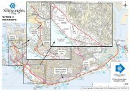
<strong>Hampshire</strong> <strong>Surface</strong> <strong>Water</strong> <strong>Management</strong> <strong>Plan</strong>s (SWMP)Eastleigh1. IntroductionThis document is one of a suite of intermediate level <strong>Surface</strong> <strong>Water</strong><strong>Management</strong> <strong>Plan</strong>s (SWMPs) being prepared for individual districts in<strong>Hampshire</strong>. It should be read alongside the <strong>Surface</strong> <strong>Water</strong> <strong>Management</strong> <strong>Plan</strong>Strategic Assessment and Background Information document which providesgeneric background and supporting information relevant to each of the districtSWMPs.The overall aim of this SWMP study is to ensure that all flood risk partnerswork together to understand the locations, causes and effects of floodingwithin the borough of Eastleigh and to identify measures to mitigate againstflooding in the form of an Action <strong>Plan</strong> (see Appendix E). Once in place, thisAction <strong>Plan</strong> should be reviewed and updated on a regular basis, inaccordance with Defra guidance.The scope of this report is to expand on the strategic assessment carried outunder the Flood Risk Regulations, in the form of the Preliminary Flood RiskAssessment and to carry out an intermediate assessment, within Eastleigh.2. BackgroundIn 2009, Defra produced a National Rank Order of Settlements Susceptible to<strong>Surface</strong> <strong>Water</strong> Flooding, ranked by the estimated number of propertiessusceptible to surface water flooding resulting from severe rainfall. This rankorder was populated using a new national methodology indicating the relativeeffect between settlements if each was subjected to a similar severe rainfallevent.This ranked list of settlements was developed using the EnvironmentAgency’s Areas Susceptible to <strong>Surface</strong> <strong>Water</strong> Flooding maps. These mapsindicate areas considered to be susceptible to flooding from surface water,categorised within three bandings; less, intermediate and more susceptible.The Areas Susceptible to <strong>Surface</strong> <strong>Water</strong> Flooding map was produced using asimplified modelling technique that assumes underground sewerage anddrainage systems, and smaller over ground drainage systems are full tocapacity so preventing surface water draining from the surface. The impactsof buildings are not considered. This method uses a single rainfall event with a1 in 200 chance of occurring in any year.Priority locations within <strong>Hampshire</strong> were identified by Defra where evidenceindicating the risk and potential impact of surface water flooding could behighest and where SWMPs would be most effective to understand andmanage flooding. Using this assessment, as well as historic floodinginformation, Defra identified a need for SWMPs to be produced for three1