Download Full Catalogue - swalim
Download Full Catalogue - swalim
Download Full Catalogue - swalim

Create successful ePaper yourself
Turn your PDF publications into a flip-book with our unique Google optimized e-Paper software.
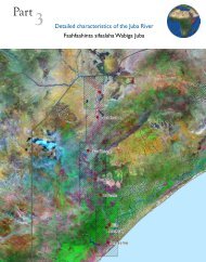
2.3 Land Resources Mapshttp://www.fao<strong>swalim</strong>.org/Category Description Area FormatLand CoverLandformsLand Cover of Somalia. Published by FAO AfricoverProject in 2003 at scale 1:200,000. Produced by visualinterpretation of digitally enhanced Landsat TM images(bands 4, 3 & 2)Land Cover of North-West Somalia. Published by FAO-SWALIM. Produced by visual interpretation of digitallyenhanced Landsat ETM images (bands 4, 3 & 2) of 2001Land Cover of Southern Somalia. Published by FAO-SWALIM. Produced by visual interpretation of digitallyenhanced Landsat ETM images (bands 4, 3 & 2) of 2001.Scale 1:100,000Land Cover North and South Garowe (Puntland). Publishedby FAO-SWALIM. Produced by visual interpretation ofdigitally enhanced Landsat ETM images (bands 4, 3 & 2) of2001. Scale 1:100,000. Field surveys in April 2007Land cover North and South Garowe (Puntland). Publishedby FAO-SWALIM. Produced by automatic classificationof Landsat MSS images (bands 4, 3 & 2) of 1988. Scale1:100,000. Field surveys in April 2007Land Cover North and South Garowe (Puntland). Publishedby FAO-SWALIM. Produced by automatic classificationof Landsat MSS images (bands 4, 3 & 2) of 2001. Scale1:100,000. Field surveys in April 2007Herbaceous Biomass for North Garowe (Puntland).Published by FAO-SWALIM. Produced by automaticclassification of Landsat MSS images (bands 4, 3 & 2)of 2001. Scale 1:100,000. Field surveys in April 2007.Produced by visual interpretation of digitally enhancedLandsat ETM images (bands 4, 3 & 2) of 2001. Scale1:100,000.Landforms of Somalia. Published by FAO AfricoverProject in 2003 at scale 1:300,000. Produced by visualinterpretation of digitally enhanced Landsat TM images(bands 4, 3 & 2) of 1995 and 1998.Relief of North-West Somalia. Published by FAO-SWALIMusing satellite images (Landsat ETM, ASTER, Ikonos,Quickbird), existing maps and datasets and literature.Landscape of North-West Somalia. Published by FAO-SWALIM using satellite images (Landsat ETM, ASTER,Ikonos, Quickbird), existing maps and datasets andliterature.Relief of Southern Somalia. Published by FAO-SWALIMusing satellite images (Landsat ETM, ASTER, Ikonos,Quickbird), existing maps and datasets and literature.Landscape of Southern Somalia. Published by FAO-SWALIM using satellite images (Landsat ETM, ASTER,Ikonos, Quickbird), existing maps and datasets andliterature.SomaliaNorth-WestSomaliaSouth SomaliaPuntlandPuntlandPuntlandPuntlandSomaliaNorth-WestSomaliaNorth-WestSomaliaSouth SomaliaSouth SomaliaPDFPDFPDFPDFPDFPDFPDFPDFPDFPDFPDFPDF24