10.Atlas of Somali Waterand Land Resources
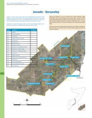
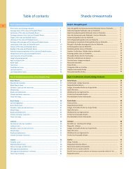
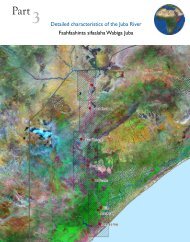
10.1 Atlas of Somali Water and LandResourcesEach month, SWALIM receives many requests for maps of Somalia. The requests coverboth general and specific topics on water and land resources. In the process of servingthese requests, SWALIM has developed a large set of maps which are served to clientsthrough a diverse range of platforms. To increase access to these maps, SWALIM hascompiled them into an Atlas of Somali Water and Land Resources. The first edition of theAtlas was published in January 2009. It has over 120 maps and an accompanying DVDwith digital versions of the maps.The maps in the atlas are grouped into five chapters – Administration, Physicalenvironment, Climate, Water and Land. Each chapter starts with a short explanation,followed by a series of maps. A reference index is included at the end of the atlas.A standard layout is adopted throughout the Atlas and each map has a reference numberto facilitate easy referencing when requesting these maps from SWALIM – either to getlarger formats or additional copies.The atlas is free and is to be distributed widely in Nairobi and Somalia.ChapterAdministrationPhysicalEnvironmentClimateWaterLandSome of the maps includedAdministrative boundaries, Settlements, Roads, Towns, Airstrips andAirports, Schools, Health facilities, Satellite Images of TownsDrainage basins, Bathymetry, Topography, Slope, Hillshade andMorphologyCurrent and Pre-War rainfall stations, Rainfall Variability, SeasonalAverage Rainfall – Gu and Dyer, Temperature, Annual Wind Speed,Relative Humidity, Annual Potential Evapotranspiration, ClimateclassificationDrainage basins and their hydro-geomorphological characteristics,River gauging stations, Pre-War river barrages, Irrigation schemesand their infrastructure by district, Flood extent (68, 81, 97, 00,02,06), Groundwater aquifers, Water sources, Water supply mapsfor selected towns and Rain water harvesting for selected townsGeology, Landform, Landscape, Relief, Soil, Soil erosion risk, Landcover, Land use, Agro ecological zones, Length of growing period,Land suitability for selected areas - Suitability assessment donefor Acacia nilotica, Acacia tortilis, Azadirachta indica, Balanitesaegyptica, Casuarina equisetifolia, Conocarpus lancifolius, Doberaglabra, Faidherbia albida, Cowpea, Maize, Sorghum, Citrus,Cotton, Cowpea, Irrigated rice, Irrigated sugarcane, Tamarindusindica, Camels, Cattle, Goats and Sheep.45