Download Full Catalogue - swalim
Download Full Catalogue - swalim
Download Full Catalogue - swalim

Create successful ePaper yourself
Turn your PDF publications into a flip-book with our unique Google optimized e-Paper software.
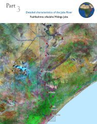
Land Resources contd.LivestockMaps of land use, drainage and possible improvement fromSogreah Consulting Engineers (NW Somalia)Length of growing period. Refined LGP using SWALIM climatedataSoils - European Digital Archive of Soil Maps DVD - Soil Mapsof Africa. Scanned maps of historical soil and other land relatedmapsSoils (1:100,000) for the Northern and Southern SWALIM Area ofInterestLivestock - bovine density, cattle density, pigs density, poultrydensity, sheep density, small ruminants density, from layersprovided by FAO-LADA for the Global LADA stratification- TIFFSomaliaAfricaNW &SouthernSomaliaSomaliaShapefileJPEGShapefileGridOrientationPopulation1:100,000 and 1:500,000 scales Topographic Maps (scanned and Somalia TIFFgeoreferenced)Detailed vector data for selected towns, supplied by UN-HABITAT Towns ShapefileSUDP project, MadMappers, UNICEF, UNOSAT and SWALIM(roads, rivers, buildings, points of interest) (Afgooye, Mogadishu,Beletweyne, Adale, Baidoa, Berbera, Borama, Bosasso, Burao,Erigavo, Galkaio, Gardo, Garowe, Gebiley, Hargeisa, Xudur,Jowhar, Sheikh, Zaafun, Las Anod, BaidoaAir routes map of the region from major airportsHorn of TIFFAfricaAirfields collated from WFP, UNCAS, DIMU and ICAO. Checked Somalia Shapefileagainst Landsat imagery by SWALIMAdministrative boundaries (Districts, Regions) Somalia ShapefileTowns and settlements (UNDP) 2006 Somalia ShapefileTowns and settlements (UNDP) 1999 Somalia ShapefileLocation of UNHCR offices, refugee camps and IDP settlementssupplied by UNHCRSomalia/Horn ofAfricaShapefileMarket locations (incl Livestock markets) from FSAU Somalia ShapefileRoads digitized from 1:100,000 Topographic Maps Somalia ShapefileRoads - primary and secondary corridors, from WFP Somalia ShapefileLocation of Schools (UNICEF) Somalia ShapefileSomalia Reference Grid (SWALIM product) – grid to report Somalia Shapefilelocations without the use of a GPS deviceTactical Pilotage ChartsHorn of JPEGAfricaUS NIMA town maps (not referenced) Towns JPEGClan distribution of Somalis by Abikar A. 1999 Somalia TIFFClan distribution in the Horn of Africa, based on Lewis IM, 1955,Peoples of the Horn of AfricaHorn ofAfricaEthnicity Map of Africa from Meur, CL:2001 Peoples of Africa Africa JPEGIDP movements in Somalia, provided by UNHCR (2006/2007) Somalia ShapefileTIFF52