Download Full Catalogue - swalim
Download Full Catalogue - swalim
Download Full Catalogue - swalim

Create successful ePaper yourself
Turn your PDF publications into a flip-book with our unique Google optimized e-Paper software.
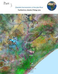
12.1 Other Spatial DatasetsMajorThemeAerial PhotographyRasterDescription Area TypeOrthophotographs: Available both in Visible and Near Infraredbands. The images have a resolution of 25cm in the lower reach ofthe rivers and a 50cm on the upper reach.DTM: Digital Terrain Model in two parts, for the lower and upperreach. DTMs of the lower reach have horizontal resolution (pixelsize) of 50cm and vertical accuracy of 25cm, while those of theupper reach have horizontal resolution (pixel size) of 100cm andvertical accuracy of 25cmJuba/ShabelleShabelle/JubaTIFFGridAerial PhotographyVectorContours: Available at a vertical interval of 25cm and 50cm.Irrigation canals: Canal distribution, canals profiles can beobtained from the high resolution DTMSettlements and Infrastructure: Settlements, built-up areasand other infrastructure within the area covered by the aerialphotography surveyRiver Morphology: River centre line, extent, flow path, channel etccaptured from the high resolution. Other hydrological features.Juba/ShabelleJuba/ShabelleJuba/ShabelleJuba/ShabelleShapefileShapefileShapefileShapefileClimateEuropean Centre for Medium-range Weather Forecast (ECWMF)(http://www.ecmwf.int/) Climate Model Data (1989-2005). Thisincludes surface data for Average temperature, Evapotranspirationover water and soil, Global Radiation, Max and Min Temperatureand PrecipitationCurrent and historical Rainfall Observation stations (SWALIMproduct)AfricaSomaliaTIFFShapefileMonthly and yearly average Rainfall and Temperature grids(SWALIM products)SomaliaGridElevationBasins, Aspect, Flow accumulation, Flow direction, Shaded Relief,Slope derived from 30 metre SRTM by USGS for SWALIM (Juba &Shabelle basins). Similar products derived from the 90 metre SRTMby SWALIM for the rest of SomaliaCliffs, Contour Lines and Spot Heights for the whole countrydigitized from 1:100,000 Topographic MapsGlobal Bathymetry data (about 3.7 km/degree resolution)(www.shadedrelief.com/cleantopo2)Juba &ShabelleBasins(30m);Somalia(90m)SomaliaGlobalGridShapefileTIFFShuttle Radar Topography Mission (SRTM) 90 metre DigitalElevation Model (DEM) date for Somalia (cleaned, gaps filledversion from the CGIAR centre (http://srtm.csi.cgiar.org/)Horn ofAfricaTIFF49