


Create successful ePaper yourself
Turn your PDF publications into a flip-book with our unique Google optimized e-Paper software.
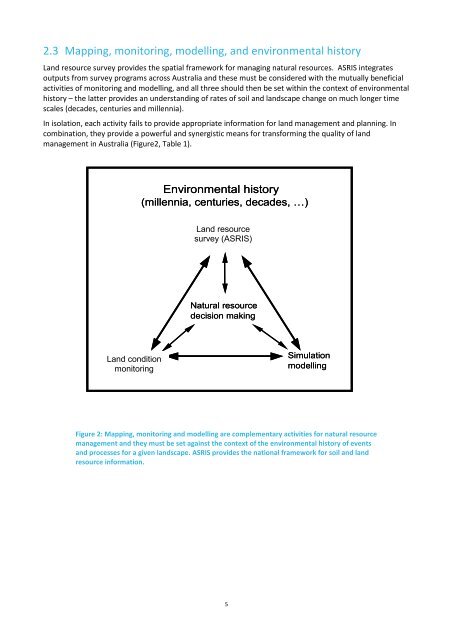
2.3 Mapping, monitoring, modelling, and environmental historyLand resource survey provides the spatial framework for managing natural resources. <strong>ASRIS</strong> integratesoutputs from survey programs across Australia and these must be considered with the mutually beneficialactivities of monitoring and modelling, and all three should then be set within the context of environmentalhistory – the latter provides an understanding of rates of soil and landscape change on much longer timescales (decades, centuries and millennia).In isolation, each activity fails to provide appropriate information for land management and planning. Incombination, they provide a powerful and synergistic means for transforming the quality of landmanagement in Australia (Figure2, Table 1).Environmental history(millennia, centuries, decades, …)Land resource conditionsurvey monitoring(<strong>ASRIS</strong>)Natural resourcedecision makingLand Landresourceconditionmonitoring survey(<strong>ASRIS</strong>)SimulationmodellingFigure 2: Mapping, monitoring and modelling are complementary activities for natural resourcemanagement and they must be set against the context of the environmental history of eventsand processes for a given landscape. <strong>ASRIS</strong> provides the national framework for soil and landresource information.5


