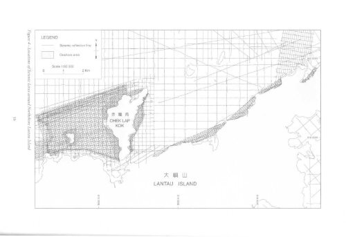
Seismic reflection line8Onshore areaaS3x m LULANTAU ISLAND
Chapter 2Outline <strong>of</strong> Geology<strong>The</strong> main part <strong>of</strong> the district lies across the northern faulted boundary <strong>of</strong> the Lantau Caldera (Langford etal,1995) which separates Mesozoic volcanic rocks in the south from Mesozoic sedimentary and intrusiverocks in the north. <strong>The</strong> volcanic rocks are composed mostly <strong>of</strong> rhyolite lava and tuff with minor intercalatedvolcaniclastic sandstone and siltstone, tuffite and tuff breccia. <strong>The</strong> intrusive rocks consist mostly <strong>of</strong> graniteand quartz monzonite plutons in the west and feldsparphyric and quartzphyric rhyolite dykes in the east(Table 2, Figure 5). Representative whole-rock geochemical analyses <strong>of</strong> the rock types are given in Table 3.Palaeozoic sedimentary rocks <strong>of</strong> the San Tin Group are the oldest rocks in the district. <strong>The</strong>y are exposedonly on Tze Kan Chau (1585 2090) in the northeast, but are known to underlie parts <strong>of</strong> the <strong>of</strong>fshore area tothe south and east <strong>of</strong> <strong>The</strong> Brothers islands. On Tze Kan Chau, the rocks comprise mainly quartz metasandstoneand graphitic metasiltstone <strong>of</strong> the Carboniferous Lok Ma Chau Formation, whereas <strong>of</strong>fshore they consist <strong>of</strong>marble belonging to the Yuen Long Formation. Limestone <strong>of</strong> Permian age, together with sandstone andsiltstone, has been identified in boreholes at Tung Chung. <strong>The</strong>se rocks have also been encountered in boreholesfarther north <strong>of</strong>fshore and have been tentatively assigned to the Tolo Harbour Formation (Sewell et al.,2000).Metasiltstone and sandstone are exposed in the far west <strong>of</strong> the district against the fault marking the boundary<strong>of</strong> the Lantau Caldera. Previously, these rocks were considered to be <strong>of</strong> Carboniferous age and assigned tothe Lok Ma Chau Formation (GEO, 1994; Langford et al, 1995). However, following the discovery <strong>of</strong>Jurassic fossils in these rocks near Tai O (Ng et al, 1997), they have been reassigned to the Lower JurassicTai O Formation (Sewell et al, 2000). <strong>The</strong> Tai O Formation forms a northeast-trending outcrop along thecoast <strong>of</strong> Lantau Island from Tai O to San Shek Wan.Lapilli-bearing coarse ash crystal tuff <strong>of</strong> the Yim Tin Tsai Formation (Tsuen Wan Volcanic Group) isstratigraphically the oldest Mesozoic volcanic rock in the district and is confined to <strong>of</strong>fshore boreholesalong the North Lantau coast from Sham Shui Kok to Kwai Shek. <strong>The</strong>se rocks have been dated elsewhere(Sewell et al, 2000) at 164.5 Ma and they conformably overlie lapilli-bearing coarse to fine ash crystal tuff<strong>of</strong> the Shing Mun Formation. <strong>The</strong>y are intruded by porphyritic fine- to medium- and medium-grainedgranite belonging to the Tai Lam Granite and Lantau Granite plutons <strong>of</strong> the Lamma Suite (Sewell et al, op.cit). In the western part <strong>of</strong> the district, the fine-grained Chek Lap Kok Granite (Lamma Suite) intrudesporphyritic fine- to medium-grained Lantau Granite.Eastnortheast-trending feldsparphyric and quartzphyric rhyolite dykes <strong>of</strong> the Lantau Dyke Swarm intrudegranites <strong>of</strong> the Lamma Suite in the northeastern and northwestern parts <strong>of</strong> the district. <strong>The</strong> dykes have beendated at approximately 146 Ma and are truncated by the fault marking the boundary <strong>of</strong> the Lantau Caldera.<strong>The</strong> dykes were emplaced in at least two phases (Li et al, 2000) and may vary internally from feldsparphyricrhyolite to porphyritic microgranite. Quartzphyric rhyolite dykes are considered to have been emplacedmostly during the younger phase.Welded lapilli- to block-bearing crystal tuff, tuff breccia, tuffite and flow-banded rhyolite lava, withintercalated volcaniclastic sedimentary rocks infill the Lantau Caldera. Previously, these rocks were namedas the Lantau Formation (Langford et al, 1995), but they have now been reassigned to the Lantau VolcanicGroup (undifferentiated) (Sewell et al, 2000). <strong>The</strong>se rocks have been dated at approximately 146 Ma andrepresent the products <strong>of</strong> a number <strong>of</strong> discrete eruptions.<strong>The</strong> volcanic and granitic rocks <strong>of</strong> the district are intruded along the caldera-bounding fault by quartzmonzonite belonging to the Lion Rock Suite. Minor basalt, microdiorite and aplite dykes occur sporadicallyin the northern part <strong>of</strong> the district intruding the granitic rocks and rhyolite dykes. <strong>The</strong>se mafic and felsicdykes are considered to Cretaceous in age.<strong>The</strong> geological structure <strong>of</strong> the district is complex, owing to the close proximity <strong>of</strong> intersecting regionalfault trends and faults related to the caldera boundary. <strong>The</strong> dominant regional fault trend is to the northeast.17
- Page 2 and 3: THE UNIVERSITY OF HONG KONGLIBRARIE
- Page 4 and 5: ,11 DEC'£• Government of the Hon
- Page 7: CONTENTSPageTitle Page 1Foreword 3C
- Page 10: 11 Location Map Showing the Distrib
- Page 20 and 21: Table 2 - Summary of the Onshore an
- Page 23: These faults offset the caldera bou
- Page 27 and 28: Chapter 4Mesozoic Sedimentary and V
- Page 29 and 30: Tuffite. A prominent outcrop of ban
- Page 31 and 32: Lantau GraniteThe Lantau Granite is
- Page 33 and 34: " .-.": •' - • • *"» JI i I
- Page 35 and 36: Quartz VeinsQuartz veins are ubquit
- Page 37 and 38: LEGENDOoI2PhotolineamentFaultConcea
- Page 39 and 40: No. of Joints measured=82No. of Joi
- Page 41 and 42: Chapter 7Metamorphism and Alteratio
- Page 43 and 44: Offshore superficial deposits withi
- Page 45 and 46: Plate 8 - Tung Chung Wan from the N
- Page 47 and 48: Sham Wat FormationThe formation, kn
- Page 49 and 50: to infill depressions and channels
- Page 52: ased on recommendations contained i
- Page 57 and 58: over a wider area. The survey resul
- Page 59 and 60: Chapter 10Economic GeologyEconomic
- Page 61 and 62: ReferencesAllen, P.M. & Stephens, E
- Page 63 and 64: Li, X.C., Sewell, RJ. & Fletcher, C
- Page 65 and 66: microgranite, 17, 28, 31, 32, 48 Tu
- Page 67 and 68:
Marine sedimentDescriptionUnconsoli
- Page 73:
Plate Ala- Marble. The generally da
- Page 76 and 77:
Plate A9 - Skarn from Site 3 showin
- Page 78 and 79:
1 8Plate Alia - Cavity-fill deposit
- Page 80 and 81:
Plate A12b - Pervasively weathered
- Page 82 and 83:
RhyoliteDescriptionAcid igneous roc
- Page 84 and 85:
Plate A 16a - Pervasively weathered
- Page 86 and 87:
1 f < 1 9 2 OPlate A 18b - A Itered
- Page 88 and 89:
2 1 2 2Plate A21 - Lamprophyric roc
- Page 90 and 91:
Residual soil derived from metasedi