General Plan Policy Document (Adopted 7-11 ... - City of Wheatland
General Plan Policy Document (Adopted 7-11 ... - City of Wheatland
General Plan Policy Document (Adopted 7-11 ... - City of Wheatland

Create successful ePaper yourself
Turn your PDF publications into a flip-book with our unique Google optimized e-Paper software.
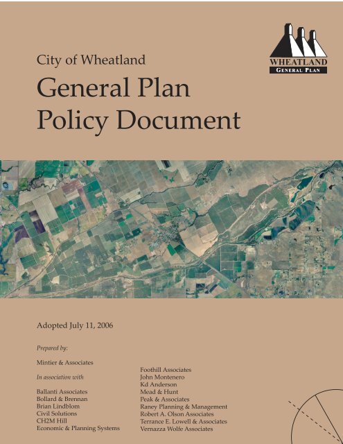
<strong>City</strong> <strong>of</strong> <strong>Wheatland</strong><strong>General</strong> <strong>Plan</strong>WHEATLANDG ENERAL PLAN<strong>Policy</strong> <strong>Document</strong><strong>Adopted</strong> July <strong>11</strong>, 2006Prepared by:Mintier & AssociatesIn association withBallanti AssociatesBollard & BrennanBrian LindblomCivil SolutionsCH2M HillEconomic & <strong>Plan</strong>ning SystemsFoothill AssociatesJohn MonteneroKd AndersonMead & HuntPeak & AssociatesRaney <strong>Plan</strong>ning & ManagementRobert A. Olson AssociatesTerrance E. Lowell & AssociatesVernazza Wolfe Associates
C i t y o f W h e a t l a n d G e n e r a l P l a nT a b l e o f C o n t e n t sTABLE OF CONTENTS.......................................................................................................................................................... iLIST OF FIGURES .................................................................................................................................................................. vPART I: GENERAL PLAN SUMMARY............................................................................................................................. 1Introduction ................................................................................................................................................................ 1Purpose and Nature <strong>of</strong> the <strong>General</strong> <strong>Plan</strong>................................................................................................................ 1Implementing the <strong>General</strong> <strong>Plan</strong> ............................................................................................................................... 2Revising and Amending the <strong>General</strong> <strong>Plan</strong> ............................................................................................................. 3Regional Setting and <strong>Plan</strong>ning Areas...................................................................................................................... 3<strong>Plan</strong>ning Area and Study Area ......................................................................................................................... 3<strong>Wheatland</strong>’s Historical Development ..................................................................................................................... 4Early European Settlement ................................................................................................................................ 4The Donner Party in <strong>Wheatland</strong>....................................................................................................................... 51849 Gold Rush ................................................................................................................................................... 5Incorporation ....................................................................................................................................................... 5Hop Farm Riots ................................................................................................................................................... 5Beale Air Force Base ........................................................................................................................................... 6Recent History..................................................................................................................................................... 6Earlier <strong>Plan</strong>ning Efforts in <strong>Wheatland</strong> .................................................................................................................... 6How this <strong>General</strong> <strong>Plan</strong> was Prepared ..................................................................................................................... 6Organization <strong>of</strong> the <strong>General</strong> <strong>Plan</strong> ............................................................................................................................ 7<strong>Wheatland</strong> <strong>General</strong> <strong>Plan</strong> Context ............................................................................................................................ 9Regional Growth Pressures ............................................................................................................................... 9Physical Constraints ........................................................................................................................................... 9Community Form and Character ................................................................................................................... 10Guiding Principles <strong>of</strong> the <strong>General</strong> <strong>Plan</strong> ................................................................................................................ <strong>11</strong>Orderly Development ...................................................................................................................................... 12Downtown Revitalization................................................................................................................................ 12Residential Neighborhoods............................................................................................................................. 12Economic Growth ............................................................................................................................................. 13State Route 65 Bypass....................................................................................................................................... 13Summary <strong>of</strong> Major <strong>General</strong> <strong>Plan</strong> Proposals ......................................................................................................... 13Chapter 1: Land Use and Community Character......................................................................................... 13Chapter 2: Transportation and Circulation ................................................................................................... 16Chapter 3: Economic Development................................................................................................................ 17Chapter 4: Housing........................................................................................................................................... 17Chapter 5: Public Facilities and Services ....................................................................................................... 18Chapter 6: Recreational, Educational and Community Services................................................................ 18Chapter 7: Historic Preservation..................................................................................................................... 19Chapter 8: Environmental Resources............................................................................................................. 19Chapter 9: Health and Safety ........................................................................................................................ 19Chapter 10: Administration and Implementation........................................................................................ 20Pagei
PART II: GOALS, POLICIES, AND IMPLEMENTATION PROGRAMSIntroduction .............................................................................................................................................................. 22Goals, Policies, and Implementation Programs................................................................................................... 22Guiding Principles <strong>of</strong> the <strong>General</strong> <strong>Plan</strong> ................................................................................................................ 23Chapter 1: Land Use and Community CharacterLand Use Diagram and Standards ....................................................................................................................... 1-1<strong>General</strong> <strong>Plan</strong> Area............................................................................................................................................ 1-1Development Standards.................................................................................................................................. 1-1Residential Uses ........................................................................................................................................ 1-1Non-Residential Uses............................................................................................................................... 1-2Land Use Designations ................................................................................................................................... 1-3Residential ................................................................................................................................................. 1-3Commercial................................................................................................................................................ 1-4Employment .............................................................................................................................................. 1-4Public, Park, and Open Space ................................................................................................................. 1-4Urban Reserve ........................................................................................................................................... 1-5Goals, Policies, and Implementation Programs.................................................................................................. 1-6<strong>City</strong>wide Growth and Development............................................................................................................. 1-6Residential Development................................................................................................................................ 1-8New Residential Neighborhoods .................................................................................................................. 1-9Neighborhood Conservation and Enhancement....................................................................................... 1-<strong>11</strong>Commercial Land Use................................................................................................................................... 1-13Downtown ...................................................................................................................................................... 1-15Employment ................................................................................................................................................... 1-16Urban Reserve ................................................................................................................................................ 1-17Agriculture...................................................................................................................................................... 1-18Landscape and Streetscape........................................................................................................................... 1-19Chapter 2: Transportation and CirculationCirculation Diagram and Standards................................................................................................................... 2-1Circulation Diagram........................................................................................................................................ 2-1Roadway Classifications ................................................................................................................................. 2-2Goals, Policies, and Implementation Programs ................................................................................................ 2-4Street and Roadway System........................................................................................................................... 2-4Regional Coordination .................................................................................................................................... 2-7Residential Streets............................................................................................................................................ 2-8Automobile Parking ...................................................................................................................................... 2-10Transit Facilities and Services ...................................................................................................................... 2-10Non-Motorized Transportation ................................................................................................................... 2-<strong>11</strong>Airport Overflight Zones.............................................................................................................................. 2-13Chapter 3: Economic DevelopmentGoals, Policies, and Implementation Programs ................................................................................................ 3-1Business Attraction and Formation............................................................................................................... 3-2Downtown Economic Development ............................................................................................................. 3-4Tourism ............................................................................................................................................................. 3-5ii
Chapter 4: HousingHousing Element Sections ................................................................................................................................... 4-1Section I: Goals, Policies and Implementation Programs ................................................................................ 4-2Section II: Adequate Sites................................................................................................................................... 4-13Section III: Quantified Objectives...................................................................................................................... 4-15Section IV: Public Participation......................................................................................................................... 4-16Section V: Consistency with <strong>General</strong> <strong>Plan</strong>....................................................................................................... 4-18Chapter 5: Public Facilities and ServicesGoals, Policies, and Implementation Programs ................................................................................................ 5-1<strong>General</strong> Public Facilities and Services........................................................................................................... 5-1Water Supply and Delivery............................................................................................................................ 5-4Wastewater Collection, Treatment, Disposal and Reuse............................................................................ 5-6Stormwater Drainage ...................................................................................................................................... 5-7Solid Waste Collection and Disposal ............................................................................................................ 5-9Law Enforcement........................................................................................................................................... 5-10Fire Protection ................................................................................................................................................ 5-12Gas and Electric Utilities............................................................................................................................... 5-14Information Technology ............................................................................................................................... 5-15Chapter 6: Recreational, Educational, and Community ServicesGoals, Policies, and Implementation Programs ................................................................................................ 6-1Parks and Recreation Development Framework......................................................................................... 6-1Civic Center ...................................................................................................................................................... 6-5Senior Center .................................................................................................................................................... 6-6Education .......................................................................................................................................................... 6-7School Siting and Financing ........................................................................................................................... 6-8Child Care Supply and Quality ..................................................................................................................... 6-9Libraries........................................................................................................................................................... 6-10Community Involvement and Participation .............................................................................................. 6-<strong>11</strong>Chapter 7: Historic PreservationGoals, Policies, and Implementation Programs ................................................................................................ 7-1Historic Preservation-<strong>General</strong>........................................................................................................................ 7-1Economic Incentives for Historic Preservation............................................................................................ 7-2Historic Preservation Education and Awareness........................................................................................ 7-3Archaeological Resources ............................................................................................................................... 7-4Chapter 8: Environmental ResourcesGoals, Policies, and Implementation Programs ................................................................................................ 8-1Water Resources............................................................................................................................................... 8-1Fish and Wildlife Habitat................................................................................................................................ 8-3Vegetation ......................................................................................................................................................... 8-4Open Space for the Preservation <strong>of</strong> Natural Resources.............................................................................. 8-5Air Quality-<strong>General</strong>......................................................................................................................................... 8-6Air Quality-Transportation ............................................................................................................................ 8-8Energy Conservation....................................................................................................................................... 8-8iii
Chapter 9: Health and SafetyGoals, Policies, and Implementation Programs ................................................................................................ 9-1Health and Safety – <strong>General</strong>........................................................................................................................... 9-1Seismic and Geologic Hazards....................................................................................................................... 9-3Flood Hazards and Protection ....................................................................................................................... 9-4Fire Hazards ..................................................................................................................................................... 9-6Aircraft Crash Hazards ................................................................................................................................... 9-7Hazardous Materials ....................................................................................................................................... 9-8Noise.................................................................................................................................................................. 9-9Chapter 10: Administration and ImplementationGoals, Policies, and Implementation Programs .............................................................................................. 10-1Administration and Implementation .......................................................................................................... 10-1APPENDIX A: GLOSSARY OF TERMS ................................................................................................................... A-1iv
C i t y o f W h e a t l a n d G e n e r a l P l a nL i s t o f F i g u r e sPageFigure 1: Location Map ................................................................................................................................................. 3Figure 2: <strong>Plan</strong>ning Area and Study Area Map .......................................................................................................... 4Figure 3: Land Use Diagram .....................................................................................................................................1-1Figure 4: Circulation Diagram ..................................................................................................................................2-1v
GENERAL PLAN SUMMARYPART IGENERAL PLAN SUMMARYINTRODUCTIONThis <strong>General</strong> <strong>Plan</strong> sets out a long-term vision for the physical evolution<strong>of</strong> <strong>Wheatland</strong> and outlines policies, standards, and programs to guideday-to-day decisions concerning <strong>Wheatland</strong>’s development throughthe year 2025. Designed to meet State planning requirements, the<strong>General</strong> <strong>Plan</strong> consists <strong>of</strong> two documents: this <strong>General</strong> <strong>Plan</strong> <strong>Policy</strong><strong>Document</strong> and a <strong>General</strong> <strong>Plan</strong> Background Report. This <strong>Policy</strong><strong>Document</strong> is divided into two main parts. Part I is this <strong>General</strong> <strong>Plan</strong>Summary, which provides background about the <strong>General</strong> <strong>Plan</strong> andreviews the plan’s guiding principles and major themes and proposals.The lengthier and more detailed Part II <strong>of</strong> the <strong>Policy</strong> <strong>Document</strong>presents the <strong>City</strong> <strong>of</strong> <strong>Wheatland</strong>’s formal statements <strong>of</strong> <strong>General</strong> <strong>Plan</strong>policy in the form <strong>of</strong> goals, policies, standards, and implementationprograms, expressed in both text and diagrams. Throughout thisdocument, a symbol denotes more information is available to the leftin the shaded text boxes.PURPOSEANDNATUREOFTHEGENERALPLANEvery city and county in California must adopt a general plan. Ageneral plan is a legal document that serves as a community’sconstitution for land use and development. The plan must becomprehensive and long-term, outlining proposals for the physicaldevelopment <strong>of</strong> the county or city, and any land outside its boundarieswhich in the planning agency’s judgment bears relation to its planning(Government Code Section 65300 et seq.) The plan must becomprehensive in covering all territory within the adopting jurisdictionand it must be comprehensive in addressing all physical aspects <strong>of</strong>the community’s development. While State law does not define longterm,most general plans look 15 to 25 years into the future.<strong>Wheatland</strong>’s <strong>General</strong> <strong>Plan</strong> uses a time frame <strong>of</strong> 2025.State law specifically requires that the general plan address seventopics or elements. These are land use, circulation, housing,conservation, open space, noise, and safety. The general plan may alsoaddress other topics the community feels are relevant to itsdevelopment. For each topic addressed, the plan must analyze thesignificance <strong>of</strong> the issue in the community, set forth policy in text anddiagrams, and outline specific programs for implementing thesepolicies. The format and structure <strong>of</strong> the general plan is left to localdiscretion, but regardless <strong>of</strong> the format or issues addressed, allsubstantive parts <strong>of</strong> the plan must be consistent with one another.<strong>Wheatland</strong> <strong>General</strong> <strong>Plan</strong> <strong>Policy</strong> <strong>Document</strong>, Part I 1July <strong>11</strong>, 2006
GENERAL PLAN SUMMARYREVISINGANDAMENDINGTHEGENERALPLANREGIONALSETTINGANDPLANNINGAREAPLANNINGAREAANDSTUDYAREAit approves are consistent with its adopted general plan. The courtshave supported and furthered this trend through their interpretations<strong>of</strong> State law. <strong>General</strong>ly, zoning must be consistent with the generalplan. Local government approval <strong>of</strong> subdivisions must be consistentwith the general plan. Local public works projects must be consistentwith the general plan. The same is true for development agreements,redevelopment plans, specific plans, and many other plans and actions<strong>of</strong> cities and counties.The general plan is a long-term document typically with a planninghorizon <strong>of</strong> 15 to 25 years. To achieve its purposes, the plan must besufficiently flexible to adjust to changing conditions and at the sametime specific in guiding day-to-day land use and developmentdecisions. Over the years, conditions and community needs changeand new opportunities arise; the plan needs to keep up with thesechanges. Every year the <strong>Plan</strong>ning Commission should review theplan’s implementation programs to assess the <strong>City</strong>’s progress incarrying out the plan. Every five to seven years, the plan should bethoroughly reviewed and updated as necessary.From time to time, the <strong>City</strong> will entertain proposals for specificamendments to the plan. The <strong>City</strong> will initiate some <strong>of</strong> these proposalsitself, but most will be initiated by property owners and developers.State law limits general plan amendments to four times per year, buteach amendment can include multiple changes. Like the adoption <strong>of</strong>the general plan itself, general plan amendments are subject toenvironmental review, public notice, and hearing requirements andmust not create inconsistencies with the rest <strong>of</strong> the plan.<strong>Wheatland</strong> is located in Northern California’s Central Valley alongState Route 65 (SR 65) in Yuba County. The city is locatedapproximately one mile north <strong>of</strong> the Bear River and the tri countyboundary <strong>of</strong> Sutter, Placer, and Yuba Counties. Marysville (the countyseat) and Yuba <strong>City</strong>, which are both about twelve miles to the north <strong>of</strong><strong>Wheatland</strong>, are the closest cities <strong>of</strong> significant size. Sacramento isapproximately forty miles to the south and Beale Air Force Base islocated eight miles to the northeast. <strong>Wheatland</strong> is also the gatewaycity to Camp Far West, a recreation area <strong>of</strong> regional significance.Located within a primarily agricultural region, <strong>Wheatland</strong> iscompletely surrounded by agricultural lands. Figure 1 shows<strong>Wheatland</strong>’s location within the county, region, and the State.The <strong>Plan</strong>ning Area for the <strong>Wheatland</strong> <strong>General</strong> <strong>Plan</strong> coversapproximately 4,650 acres and is bounded on the north by Dairy Roadand Dry Creek, on the east by the Sphere <strong>of</strong> Influence (SOI) line, on thesouth by Bear River, and on the west by ACE Hardware and the SOI<strong>Wheatland</strong> <strong>General</strong> <strong>Plan</strong> <strong>Policy</strong> <strong>Document</strong>, Part I 3July <strong>11</strong>, 2006
GENERAL PLAN SUMMARYWHEATLAND’SHISTORICALDEVELOPMENTEarlyEuropeanSettlementline. The larger Study Area encompasses approximately 24,300 acres<strong>of</strong> land in which information has been collected for the <strong>General</strong> <strong>Plan</strong>Update. Figure 2 shows the boundaries <strong>of</strong> the <strong>Plan</strong>ning Area andStudy Area.The <strong>General</strong> <strong>Plan</strong>’s Study Area lies within the territory once claimedby the Valley Nisenan (or Southern Maidu) which are a Penutianspeakingcentral California group. Their traditional homelands onceincluded the lower drainages <strong>of</strong> the American, Yuba, and Bear Rivers,and the lower reaches <strong>of</strong> the Feather River.Few villages occupied the valley plain between the Sacramento Riverand the foothills. Although both the valley and foothill people huntedand gathered there, the resource focus was along the edges <strong>of</strong> richecotones, either the rivers and the valley floor, or the valley floor andthe foothills. The plains surrounding <strong>Wheatland</strong> fall in between thesetwo rich ecotones, and consist <strong>of</strong> exposed terrain. It is not likely thatNative Americans would have spent an appreciable amount <strong>of</strong> time inthe <strong>Wheatland</strong> area, instead they would have resided in villages alongthe Yuba River to the north and the hills to the east.Early European settlement in the <strong>Wheatland</strong> area came withexpeditions led by Gabriel Moraga in 1808 and Luis Arguello in 1821,both <strong>of</strong> whom crossed portions <strong>of</strong> present day Yuba County.Throughout the 1820s and 1830s, Yuba County was visited by trappersfrom the Hudson’s Bay Company and American Fur Company, whoexploited beaver and other fur resources.In 1822 California came under Mexican rule when Mexico becameindependent <strong>of</strong> Spain. As British and Americans were allowed tobecome Mexican citizens, they acquired large tracts <strong>of</strong> land granted tothem by Mexico and initially dominated the business and commercialaffairs <strong>of</strong> the region. John Sutter established land holdings thatincluded much <strong>of</strong> what is now Yuba County. Sutter owned more thanMexican law permitted; therefore, he sublet parts <strong>of</strong> his estate to othersettlers. In 1844, a Mexican who had been in the employ <strong>of</strong> Sutter, DonPablo Guttierez, obtained a grant <strong>of</strong> five leagues on the north side <strong>of</strong>Bear River, now known as the Johnson Grant. The land grant, datedDecember 22, 1844, was first known as Rancho de Pablo, for PabloGuttierez, the grantee. <strong>Wheatland</strong> falls within the center <strong>of</strong> this landgrant.By 1849 there were a number <strong>of</strong> settlements along Bear Riverestablished by people engaged in mining, the livestock trade, tradingpost, sawmills, hotels, cutting hay, and raising cattle. Johnson’s Ranchprovided a way station for teams engaging in hauling freight fromSacramento to the northern mines. It also became a stopping place fortrappers, explorers, and travelers.<strong>Wheatland</strong> <strong>General</strong> <strong>Plan</strong> <strong>Policy</strong> <strong>Document</strong>, Part I 4July <strong>11</strong>, 2006
<strong>City</strong> <strong>of</strong> <strong>Wheatland</strong> <strong>General</strong> <strong>Plan</strong>FIGURE 2: PLANNING AREA AND STUDY AREA<strong>Plan</strong>ning AreaStudy Area
GENERAL PLAN SUMMARYTheDonnerPartyin<strong>Wheatland</strong>1849GoldRushIncorporationHopFarmRiotsIn the 1840s Johnson’s Ranch was well known as the first settlementreached by the overland immigrants after crossing the Sierra and isconsidered to be the end <strong>of</strong> the Emigrant Trail. Here immigrantsrested and obtained supplies, and it was even the base for survivors <strong>of</strong>the infamous Donner Party after they were rescued in 1847.During the gold rush <strong>of</strong> 1849, placer gold was recovered from creeksand streams near <strong>Wheatland</strong>. The gold rush helped to quicklypopulate the region with prospectors, entrepreneurs, and othersseeking easy fortunes.During this time the first building were erected in <strong>Wheatland</strong>. Theseincluded a general store, saloon, blacksmith shop, hotel, and a fewresidences in the first year. It was not until 1871-72 that the sale <strong>of</strong>individual lots boomed.At the time <strong>of</strong> <strong>Wheatland</strong>’s incorporation in 1874, the population was900, <strong>of</strong> which 300 were Chinese. Most Chinese came to work on therailroad and service industries (laundries, restaurants, etc.) and laterwere employed as hop workers. A thriving Chinatown existed fromthe 1860s through the early 20th century, when anti-Chinese sentimentforced its relocation several times. The center <strong>of</strong> the Chinese burialrite was a ceremonial pyre near the <strong>Wheatland</strong> Cemetery where finalmeals were cooked for the deceased. The Chinese were buried nearbyuntil they could be shipped back to China for final internment.Another significant event in <strong>Wheatland</strong>’s history was the inauguration<strong>of</strong> Mayor Edward P. Duplex in 1888. Mayor Duplex was the firstAfrican-American man to be elected mayor <strong>of</strong> a western United Statescity. His barbershop still stands today on Main Street in downtown.Hop raising on a small scale was carried on in Yuba County aroundthe 1860s, and D.P. Durst planted the first hops in the <strong>Wheatland</strong> areain 1874. This ranch was the largest privately owned hops field in theworld and <strong>Wheatland</strong> soon became known as the “Hop Center.”Migrant workers throughout the region were drawn to Durst’s ranch.The Durst hop ranch was also the scene <strong>of</strong> one <strong>of</strong> the first labordisturbances in California history. In 1913, violence erupted at ameeting organized by the Industrial Workers <strong>of</strong> the World (IWW) toprotest low pay and intolerable living conditions <strong>of</strong> the hops pickers.The California State militia had to be called in to break up the riot,only after the sheriff, the district attorney, and two workers werekilled. The organizers <strong>of</strong> the strike were later convicted <strong>of</strong> murder andsentenced to life imprisonment.In the wake <strong>of</strong> this tragedy, Governor Hiram Johnson created acommission to investigate the condition <strong>of</strong> migratory farm laborers,<strong>Wheatland</strong> <strong>General</strong> <strong>Plan</strong> <strong>Policy</strong> <strong>Document</strong>, Part I 5July <strong>11</strong>, 2006
GENERAL PLAN SUMMARYBealeAirForceBaseRecentHistoryEARLIERPLANNINGEFFORTSINWHEATLANDHOWTHISGENERALPLANWASPREPAREDand some reform legislation was passed. However, no substantiveimprovements occurred and the influence <strong>of</strong> the IWW in the CentralValley waned. By 1925, <strong>Wheatland</strong>, then with a population <strong>of</strong> about450, was listed as the second largest hops producer, employing 4,000during harvest seasons. Later in the 1920s, frequent slumps in thehops commodity led the landowners and growers to turn to fruit andvegetables with marked success. Fruit and nut orchards soon replacedhops in importance. Four abandoned hop kilns at the E. ClemonsHorst Ranch and the Damon Estate are reminders <strong>of</strong> an exciting periodin <strong>Wheatland</strong> history.In 1942 the U.S. government selected 86,000 acres <strong>of</strong> land in Yuba andNevada Counties for the establishment <strong>of</strong> an Army base, Camp Beale,seven miles east <strong>of</strong> <strong>Wheatland</strong>. With the formation <strong>of</strong> Camp Beale, thesmall communities <strong>of</strong> Erle, Waldo, and Spenceville declined. CampBeale was used as a training base for armored and infantry divisions,as a personnel replacement depot, and as a German prisoner <strong>of</strong> warcamp. Following World War II, the camp was declared surplus, and70 percent <strong>of</strong> the buildings were removed. Today, the base’s primarymission is to house the 9th Reconnaissance Wing, a branch <strong>of</strong> the AirForce that maintains U2 and Global Hawk spy planes. Many <strong>of</strong> thebases personnel and their families rely on support services in<strong>Wheatland</strong>.<strong>Wheatland</strong>’s first subdivision was built in 1953 when Charles Nicholsdeveloped his property bordering the northeastern part <strong>of</strong> the city.Ten homes were built in the first project that led to the first housingdevelopment within the city. <strong>Wheatland</strong>’s rate <strong>of</strong> commercial andresidential development has been slow relative to the growth rates <strong>of</strong>nearby areas such as Marysville/Yuba <strong>City</strong> and particularly southPlacer County. Over 78 percent <strong>of</strong> the city’s housing was built prior to1960 and only 14 percent has been built since 1975.The <strong>City</strong> first adopted a <strong>General</strong> <strong>Plan</strong> in August 1971, and laterupdated the plan in 1981. The 1981 update planned physical andeconomic growth to the year 2000, and assumed a built out <strong>of</strong> the citylimits with a population <strong>of</strong> 5,000 peopled by 2000. The plan alsoassumed significant traffic impacts to SR 65 by the year 2000. Inretrospect, the plan accurately projected the conditions <strong>of</strong> the city in2000, although <strong>Wheatland</strong>’s actual population was about half (2,500).Since 1981 various elements <strong>of</strong> the <strong>Plan</strong> have been updated, includingthe Land Use Element and the Transportation and Circulation Elementin 1986, and the Housing Element in 2005.The <strong>City</strong> <strong>of</strong> <strong>Wheatland</strong> initiated its <strong>General</strong> <strong>Plan</strong> Update in 2004 inresponse to regional and local population projections, two majordevelopment proposals, and the need for additional research on the<strong>City</strong>’s Wastewater Treatment <strong>Plan</strong>t capacity, fire and police protection<strong>Wheatland</strong> <strong>General</strong> <strong>Plan</strong> <strong>Policy</strong> <strong>Document</strong>, Part I 6July <strong>11</strong>, 2006
GENERAL PLAN SUMMARYcapacity, and Dry Creek and Bear River flooding potential. The <strong>City</strong>retained planning consultants Mintier & Associates in February 2004to assist the <strong>City</strong> in its comprehensive update effort. The planningeffort coordinated the <strong>General</strong> <strong>Plan</strong> update with five ongoing technicalstudies (Circulation and Fee Study, Housing Element Update,Wastewater Treatment Facilities Master <strong>Plan</strong>, Fire Protection Master<strong>Plan</strong>, and Fee Study) in order to analyze development constraints andopportunities for the community. The technical studies were primarilyinitiated in response to two development proposals, Heritage OaksEstates and Jones Ranch, which needed further analysis before theycould be approved. MOREINFO...<strong>Wheatland</strong>’s SteeringCommittee is comprised <strong>of</strong>the <strong>City</strong> Council and<strong>Plan</strong>ning Commission.Through numerous <strong>Plan</strong>ning Commission and <strong>City</strong> Council studysessions, the <strong>City</strong> developed five guiding principles for the <strong>General</strong><strong>Plan</strong> as well as exploring four growth alternatives. Followingdevelopment <strong>of</strong> these principles and consideration <strong>of</strong> several <strong>of</strong> themajor issues to be addressed in the new <strong>General</strong> <strong>Plan</strong>, the SteeringCommittee approved a Preferred Land Use Alternative on April 4,2005.Through the winter <strong>of</strong> 2004 and summer <strong>of</strong> 2005, the <strong>City</strong> held over 20meetings and workshops to review information developed as part <strong>of</strong>the <strong>General</strong> <strong>Plan</strong> Update.ORGANIZATIONOFTHEGENERALPLANThe policy direction provided by the <strong>General</strong> <strong>Plan</strong> Update SteeringCommittee through workshops and meetings laid the foundation fordevelopment <strong>of</strong> new policies and modification <strong>of</strong> existing policies forincorporation into this <strong>Policy</strong> <strong>Document</strong>.The <strong>Wheatland</strong> <strong>General</strong> <strong>Plan</strong> consists <strong>of</strong> two documents: theBackground Report and the <strong>Policy</strong> <strong>Document</strong>. The BackgroundReport inventories and analyzes existing conditions and trends in<strong>Wheatland</strong>, and provides the formal supporting documentation forgeneral plan policies. The Background Report addresses the followingseven subject areas: Chapter 1: Chapter 2: Chapter 3: Chapter 4: Chapter 5: Chapter 6: Chapter 7:Land Use and Community CharacterTransportationEconomic ConditionsHousingPublic Facilities and ServicesNatural and Cultural ResourcesSafety and NoiseThis <strong>General</strong> <strong>Plan</strong> <strong>Policy</strong> <strong>Document</strong> is divided into two main parts.Part I is a summary <strong>of</strong> the <strong>General</strong> <strong>Plan</strong>, describing the nature andpurpose <strong>of</strong> the plan, highlighting the guiding principles <strong>of</strong> the plan,and outlining the plan’s main proposals. It does not constitute formalgeneral plan policy, but is rather a guide to understanding andinterpreting Part II <strong>of</strong> the <strong>Policy</strong> <strong>Document</strong>.<strong>Wheatland</strong> <strong>General</strong> <strong>Plan</strong> <strong>Policy</strong> <strong>Document</strong>, Part I 7July <strong>11</strong>, 2006
GENERAL PLAN SUMMARYPart II contains explicit statements <strong>of</strong> goals, policies, standards,implementation programs, and quantified objectives that constitutethe formal policy <strong>of</strong> the <strong>City</strong> <strong>of</strong> <strong>Wheatland</strong> for land use, development,and environmental quality. Part II is divided into the followingchapters: Chapter 1: Chapter 2: Chapter 3: Chapter 4: Chapter 5: Chapter 6: Chapter 7: Chapter 8: Chapter 9: Chapter 10:Land Use and Community CharacterTransportation and CirculationEconomic DevelopmentHousingPublic Facilities and ServicesRecreational, Educational, & Community ServicesHistoric PreservationEnvironmental ResourcesHealth and SafetyAdministration and ImplementationEach chapter includes several goal statements relating to different subissuesor different aspects <strong>of</strong> the topic addressed in the chapter. Foreach goal statement there are several policies that amplify the goalstatement. Implementation programs are listed at the end <strong>of</strong> eachpolicy section and describe briefly the proposed action, the <strong>City</strong>agencies or departments with primary responsibility for carrying outthe program, and the time frame for accomplishing the program.Chapter 1 (Land Use and Community Character) contains the LandUse Diagram, describes the designations appearing on the Diagram,and outlines the standards <strong>of</strong> population density and buildingintensity for these land use designations. Chapter 2 (Transportationand Circulation) contains the Circulation Diagram and a description <strong>of</strong>the roadway classification system. Chapter 4 (Housing) also includesa statement <strong>of</strong> quantified housing objectives required by State law aspart <strong>of</strong> the housing element.The following definitions describe the nature <strong>of</strong> the statements <strong>of</strong>goals, policies, standards, implementation programs, and quantifiedobjectives as they are used in this document:Goal: The ultimate purpose <strong>of</strong> an effort stated in a way that isgeneral in nature and immeasurable.<strong>Policy</strong>: A specific statement in text or diagram guiding action andimplying clear commitment.Standard: A specific, <strong>of</strong>ten quantified guideline, incorporated in apolicy or implementation program, defining the relationshipbetween two or more variables. Standards can <strong>of</strong>ten translatedirectly into regulatory controls.Implementation Program: An action, procedures, program, ortechnique that carries out general plan policy. Implementation<strong>Wheatland</strong> <strong>General</strong> <strong>Plan</strong> <strong>Policy</strong> <strong>Document</strong>, Part I 8July <strong>11</strong>, 2006
GENERAL PLAN SUMMARYprograms also specify primary responsibility for carrying out theaction and a time frame for its accomplishment.Quantified Objective (housing only): The number <strong>of</strong> housing unitsthat the <strong>City</strong> expects to be constructed or the number <strong>of</strong>households the <strong>City</strong> expects will be assisted through HousingElement programs and based on general market conditions duringthe time frame <strong>of</strong> the Housing Element. MOREINFO...For more information onthe CaliforniaEnvironmental Quality Act,please visit:www.ceres.ca.gov/ceqaWHEATLANDGENERALPLANCONTEXTREGIONALGROWTHPRESSURESPHYSICALCONSTRAINTSThis <strong>Policy</strong> <strong>Document</strong> includes three supporting appendices. AppendixA is a Glossary <strong>of</strong> key terms used in the <strong>Policy</strong> <strong>Document</strong>.Appendices B and C are informational appendices that do notconstitute <strong>City</strong> policy but assist in implementing the plan. Appendix Bis a general plan/zoning consistency matrix and Appendix Csummarizes the <strong>City</strong>’s Levels <strong>of</strong> Service guidelines.In addition to the <strong>General</strong> <strong>Plan</strong> Background Report and <strong>General</strong> <strong>Plan</strong><strong>Policy</strong> <strong>Document</strong>, an Environmental Impact Report (EIR) analyzingthe impacts and implications <strong>of</strong> the <strong>General</strong> <strong>Plan</strong> was preparedfollowing publication <strong>of</strong> the Draft <strong>Policy</strong> <strong>Document</strong>. The EIR, which isnot formally part <strong>of</strong> the <strong>General</strong> <strong>Plan</strong>, was prepared to meet therequirements <strong>of</strong> the California Environmental Quality Act.The following discussions briefly describe growth projections, physicalconstraints, and the issues that provide the context for preparation andadoption <strong>of</strong> this <strong>General</strong> <strong>Plan</strong>.<strong>Wheatland</strong>’s location just 40 miles north <strong>of</strong> Sacramento places it withinone <strong>of</strong> the fastest growing regions in the state. Located on SR 65between Marysville/Yuba <strong>City</strong> and Lincoln, <strong>Wheatland</strong> is subject tomajor growth pressures. This <strong>General</strong> <strong>Plan</strong> projects <strong>Wheatland</strong>’spopulation to increase from 3,000 in 2004 to 30,100 in 2025, whileemployment is projected to increase from 500 to <strong>11</strong>,080 during thesame time period. <strong>Wheatland</strong> has statutory obligations to try to meetits projected fair share <strong>of</strong> regional housing needs. This <strong>General</strong> <strong>Plan</strong>creates the capacity to accommodate projected growth through 2025,and also sets policies and standards to ensure orderly and high-qualitydevelopment along with provision <strong>of</strong> needed public facilities andservices.The <strong>City</strong> has successfully phased growth and physical expansion overthe years, leaving only a limited amount <strong>of</strong> land in 2005 for residentialinfill development. To accommodate projected growth over the longterm, <strong>Wheatland</strong> must annex additional land outside <strong>of</strong> the city limits,continue infill development where land is avaliable, and encourage there-use <strong>of</strong> underutilized lands. As discussed below, several physicalconstraints limit the ability <strong>of</strong> the city to expand.<strong>Wheatland</strong> <strong>General</strong> <strong>Plan</strong> <strong>Policy</strong> <strong>Document</strong>, Part I 9July <strong>11</strong>, 2006
GENERAL PLAN SUMMARYFloodplains<strong>Wheatland</strong> is surrounded by watercourses that periodically flood,mainly Dry Creek to the north and the Bear River to the south. Areassubject to 100- to 500-year flood events include the western part <strong>of</strong> theStudy Area encompassing undeveloped land along <strong>Wheatland</strong> Road.Wastewater Treatment Facilities and CapacitiesCOMMUNITYFORMANDCHARACTERThe <strong>City</strong>’s existing (2006) wastewater collection and treatment systemcan only accommodate growth within the city limits. The domesticwastewater treatment plant is located south <strong>of</strong> the city, adjacent to theBear River levee. As part <strong>of</strong> the <strong>General</strong> <strong>Plan</strong> Update, a study wasprepared that analyzed the possibility <strong>of</strong> increasing the capacity <strong>of</strong> theexisting wastewater treatment plant, or constructing a new plant tomeet current and future needs. The <strong>City</strong>’s domestic wastewatertreatment plant, however, represents a major <strong>City</strong> investment and the<strong>General</strong> <strong>Plan</strong> provides options and recommendations for its eventualrelocation within the time frame <strong>of</strong> this <strong>General</strong> <strong>Plan</strong> (2025). Issues <strong>of</strong>compatibility <strong>of</strong> development adjacent to the treatment plant also limitthe type and configuration <strong>of</strong> development that might be appropriate.<strong>Wheatland</strong> has a strong historic heritage, which is reflected in thestock <strong>of</strong> historic buildings in the city’s Downtown. <strong>Wheatland</strong>’sagricultural setting is largely responsible for the community’s distinctidentity and plays an important economic role in <strong>Wheatland</strong>.Role <strong>of</strong> Downtown<strong>Wheatland</strong>’s Downtown is an important symbol <strong>of</strong> the city’s smalltownatmosphere and historic heritage. Maintaining the Downtown asthe center <strong>of</strong> government, specialty retail, entertainment, and culture isimportant to preserving <strong>Wheatland</strong>’s small-town atmosphere as thecity grows. A centralized Downtown also helps knit the communitytogether as a place where everyone in the community gathers.Maintaining Downtown’s central location and accessibility in thelarger city is important to achieving this goal. Providing for expansion<strong>of</strong> the district’s girded street pattern to the east reinforces Downtown’scentralized location and accessibility.Residential NeighborhoodsTo ensure that <strong>Wheatland</strong> maintains its small-town feeling and quality<strong>of</strong> life, the <strong>General</strong> <strong>Plan</strong> seeks to preserve existing neighborhoods, andto promote development <strong>of</strong> new neighborhoods that incorporate thebest qualities <strong>of</strong> existing neighborhoods. While new neighborhoodsshould reflect a mix <strong>of</strong> housing types and sizes, similar to the existingcity, the <strong>General</strong> <strong>Plan</strong> also provides for more employment center andcommercial/retail growth.<strong>Wheatland</strong> <strong>General</strong> <strong>Plan</strong> <strong>Policy</strong> <strong>Document</strong>, Part I 10July <strong>11</strong>, 2006
ECONOMICGROWTH4. Create a strong local employment base.GENERAL PLAN SUMMARYThe <strong>General</strong> <strong>Plan</strong> seeks to capitalize on <strong>Wheatland</strong>’s location andassets by supporting and assisting business development that meetslocal and regional needs. To this end, the <strong>Plan</strong> designates sufficientland to accommodate projected demand and provides for servicessufficient to meet employment and commercial needs. The <strong>Plan</strong> alsoincludes provisions for housing to meet the needs <strong>of</strong> new workers.The <strong>Plan</strong> seeks to diversify <strong>Wheatland</strong>’s economic base by promotingmore primary-wage-earner jobs through business and <strong>of</strong>fice parks;high-tech, bio-tech and research and development industries tosupport Beale Air Force Base; and tourism.STATEROUTE65BYPASS 5. <strong>Plan</strong> the city to accommodate eventual development <strong>of</strong> a SR 65bypass.SUMMARYOFMAJORGENERALPLANPROPOSALSCHAPTER1:LANDUSEANDCOMMUNITYCHARACTERThe <strong>General</strong> <strong>Plan</strong> establishes a recommended location for the easternbypass <strong>of</strong> SR 65. Adjacent to the bypass will be local and regionalemployment and commercial uses, capitalizing on regionalcommuters.As indicated earlier, the formal policy content <strong>of</strong> the <strong>General</strong> <strong>Plan</strong> iscontained in Part II <strong>of</strong> this <strong>Policy</strong> <strong>Document</strong>. Part II is divided into tenchapters, each <strong>of</strong> which deals with a broad topic and several sub-issuesrelated to the main topic. The following is a chapter-by-chaptersummary <strong>of</strong> the major proposals set forth in the <strong>Wheatland</strong> <strong>General</strong><strong>Plan</strong>, including references to show how the goals, policies,implementation programs, and diagrams in each chapter relate to themajor themes described above.This part is the most familiar <strong>of</strong> all <strong>of</strong> the policy chapters in the<strong>General</strong> <strong>Plan</strong>. It contains the Land Use Diagram that prescribes usesfor all <strong>of</strong> the <strong>General</strong> <strong>Plan</strong> Area, describes standards for each <strong>of</strong> theland use designations shown on the Land Use Diagram, and defines aseries <strong>of</strong> goals, policies, and programs designed to guide decisionsconcerning land use, development, and environmental protection in<strong>Wheatland</strong>.<strong>Wheatland</strong> <strong>General</strong> <strong>Plan</strong> <strong>Policy</strong> <strong>Document</strong>, Part I 13July <strong>11</strong>, 2006
GENERAL PLAN SUMMARYLandUseDiagramThe Land Use Diagram includes 10 land use designations fallingwithin 5 major categories, as shown in the following chart:ResidentialCATEGORYCommercialLDRLMDRMDRHDRCOMMUDESIGNATIONLow-Density ResidentialLow-Medium-Density ResidentialMedium-Density ResidentialHigh-Density Residential<strong>General</strong> CommercialMixed-UseEmployment EMP EmploymentPublic and Open Space PUBLICPARKPublicPark and Open SpaceReserve UR Urban ReserveIt is important that the users <strong>of</strong> this <strong>Policy</strong> <strong>Document</strong> understand thatthe goals, policies, standards and programs described in Part II are asimportant, if not more so, than the Land Use Diagram in representingthe <strong>City</strong>’s land use and development policy. Accordingly, anydevelopment proposals or review there<strong>of</strong> must consider this <strong>Policy</strong><strong>Document</strong> as a whole, rather than focusing solely on the Land UseDiagram or on particular policies and programs.ResidentialLandUseLowDensityResidentialLowMediumDensityResidentialFollowing are summaries <strong>of</strong> the <strong>General</strong> <strong>Plan</strong>’s key land use proposalsaccording to each <strong>of</strong> the major designation categories that appear onthe Land Use Diagram.The four residential designations that appear on the Land UseDiagram combine with a set <strong>of</strong> residential and neighborhooddevelopment policies to create a strong foundation for preservationand maintenance <strong>of</strong> <strong>Wheatland</strong>’s existing healthy residentialneighborhoods, improvement <strong>of</strong> other residential areas, andestablishment <strong>of</strong> new residential development that follows principlesthat will create vital neighborhoods.Residential policies <strong>of</strong> the plan emphasize two main themes. First,preservation and enhancement <strong>of</strong> the city’s existing neighborhoods ispromoted through maintenance and rehabilitation efforts and throughcontinued infill development that maintains the character <strong>of</strong> existingneighborhoods. Second, new residential development is to occur indistinct neighborhoods that incorporate a range <strong>of</strong> support servicesessential to day-to-day living, including parks, schools, andneighborhood shopping opportunities, and that encourage walkingand bicycling use.Existing residential areas are designated with a mix <strong>of</strong> designations.Low-Density Residential is the primary residential category reflectingtypical single family housing. Low-Medium-Density Residentialcovers areas developed with single family homes at a slightly higherdensity. Medium-Density Residential is found in various pockets<strong>Wheatland</strong> <strong>General</strong> <strong>Plan</strong> <strong>Policy</strong> <strong>Document</strong>, Part I 14July <strong>11</strong>, 2006
GENERAL PLAN SUMMARYthroughout the community and includes attached and detachedhousing at higher densities. High-Density Residential is located nearemployment centers and neighborhood nodes to provide attachedhousing for a combination <strong>of</strong> rental and ownership opportunitiesMediumDensityResidentialHighDensityResidentialCommercialLandUseandDevelopmentThe Commercial designation allows for a mix <strong>of</strong> commercial uses. The<strong>Plan</strong> envisions expansion <strong>of</strong> regional commercial services adjacent tothe proposed SR 65 bypass, the Downtown, and the northeasternportion <strong>of</strong> the <strong>Plan</strong>ning Area.EmploymentLandUseandDevelopmentThe Mixed-Use designation covers infill areas in Downtown. Theseareas requite a mix <strong>of</strong> housing and commercial uses on the samesite/building and encourage housing at increased densities within theDowntown area.In addition, the plan promotes continued infill development and reuse<strong>of</strong> vacant and underutilized commercial centers.The Employment designation is applied primarily in areas <strong>of</strong> the citythat have adequate access to existing SR 65, the proposed SR 65bypass, and the ring-road. This land use will implement the <strong>City</strong>’sdesire to attract primary-wage-earner jobs, such as high technologyand biotechnology uses. The plan also includes a chapter promotingeconomic development in <strong>Wheatland</strong>.<strong>Wheatland</strong> <strong>General</strong> <strong>Plan</strong> <strong>Policy</strong> <strong>Document</strong>, Part I 15July <strong>11</strong>, 2006
GENERAL PLAN SUMMARYPublicandOpenSpaceLandUseUrbanReservePublic uses represent an important element in the overall fabric <strong>of</strong> acommunity. Accordingly, this <strong>Policy</strong> <strong>Document</strong> provides a frameworkfor development <strong>of</strong> such public uses as government <strong>of</strong>fices andfacilities, schools, and parks and recreation facilities. Recognizing thestatus <strong>of</strong> governmental services, this <strong>Policy</strong> <strong>Document</strong> supports themaintenance <strong>of</strong> a vital public presence in Downtown. In addition, this<strong>Policy</strong> <strong>Document</strong> includes land use policies and programs thatrecognize and reinforce the essential role that public uses (i.e., parksand schools) play in the development and maintenance <strong>of</strong> healthyneighborhoods.The <strong>General</strong> <strong>Plan</strong> designates the area east <strong>of</strong> Japer Lane and west <strong>of</strong>Grasshopper Slough as Urban Reserve, indicating that the <strong>City</strong> willstudy this area and consider it for future development. Nodevelopment can occur within the Urban Reserve area without a<strong>General</strong> <strong>Plan</strong> amendment.CHAPTER2:TRANSPORTATIONANDCIRCULATIONThe <strong>General</strong> <strong>Plan</strong> addresses several transportation issues that arecritical to the continued development <strong>of</strong> <strong>Wheatland</strong>. The CirculationDiagram depicts the proposed circulation system to supportdevelopment under the Land Use Diagram. This circulation system isrepresented on the diagram as a set <strong>of</strong> roadway classifications thathave been developed to guide <strong>Wheatland</strong>’s long-range planning andprogramming. Roadways are systematically classified based on thelinkages they provide and their function, both <strong>of</strong> which reflect theirimportance to the land use pattern, traveler, and general welfare.New roadways required to serve new development include an easternbypass for SR 65, an arterial “ring-road” that will connect the city westto east, and provide access across the existing SR 65 and the railroadtracks. In addition, several arterial and collector streets would beextended from the north to south to serve the new area <strong>of</strong> plannedresidential development.In addition to addressing future roadway plans and improvements,Chapter 3 <strong>of</strong> Part II <strong>of</strong> this <strong>Policy</strong> <strong>Document</strong> contains goals, policies,and programs related to the following issues: Street and Roadway System Regional Coordination Residential Streets Automobile Parking Transit Facilities and Services<strong>Wheatland</strong> <strong>General</strong> <strong>Plan</strong> <strong>Policy</strong> <strong>Document</strong>, Part I 16July <strong>11</strong>, 2006
Non-Motorized Transportation Road and Rail Freight Movement Airport Overflight ZonesGENERAL PLAN SUMMARYCHAPTER3:ECONOMICDEVELOPMENTThe overall emphasis <strong>of</strong> the policies and programs under theseheadings is the establishment and maintenance <strong>of</strong> a well-roundedtransportation network that includes fully-connected and intersectingstreets, pedestrian paths, and bike paths.This chapter addresses the economic development issues. Key issuesinclude the maintenance and enhancement <strong>of</strong> the quality <strong>of</strong> life in<strong>Wheatland</strong> by: retaining and encouraging the expansion <strong>of</strong> existingindustries and businesses in the community; encouraging thedevelopment <strong>of</strong> new industries and businesses in the communitythereby creating new jobs for <strong>Wheatland</strong> residents; and preserving andenhancing the rich historic character <strong>of</strong> the community.Redevelopment and public and private partnerships will be importantin stimulating these activities.This chapter contains goals, policies and implementation programsthat provide the framework for economic development for the city <strong>of</strong><strong>Wheatland</strong>. The goals and policies <strong>of</strong> this section are organizedtopically according to the following categories, each <strong>of</strong> which relates toa particular economic development focus:CHAPTER4:HOUSING Business Attraction and Formation Downtown Economic Development TourismThis chapter includes goals, policies, and programs for the generalprovision <strong>of</strong> housing in <strong>Wheatland</strong> and quantified objectives for thedevelopment <strong>of</strong> housing for the years 2005 through 2008.The chapter includes four primary housing goals as follows:1. Provide for the <strong>City</strong>’s regional share <strong>of</strong> new housing for allincome groups.2. Improve/conserve the supply <strong>of</strong> existing housing.3. Meet the special housing needs <strong>of</strong> homeless persons, seniors, largefamilies, disabled persons, and farmworkers.4. Ensure equal housing opportunityThe policies and programs encourage the construction <strong>of</strong> housing to:meet the city’s projected housing needs for very low-, low-, andmoderate-income households; provide for decent housing for allincome levels, emergency shelters, and housing for other groups withspecial needs; provide for a balance <strong>of</strong> residents and jobs; preserveexisting residential neighborhoods; and ensure safe, sanitary housing.<strong>Wheatland</strong> <strong>General</strong> <strong>Plan</strong> <strong>Policy</strong> <strong>Document</strong>, Part I 17July <strong>11</strong>, 2006
GENERAL PLAN SUMMARYPolicies also encourage the conservation and rehabilitation <strong>of</strong> existingdwelling units as well as for the development <strong>of</strong> new housing.CHAPTER5:PUBLICFACILITIESANDSERVICESThis chapter addresses the <strong>City</strong>’s housing production targets throughthe time frame <strong>of</strong> the element, which are the <strong>City</strong>’s quantifiedobjectives pursuant to State housing law.An important result <strong>of</strong> comprehensive planning should be theassurance that all facilities and services needed to adequately servedevelopment will be provided in a timely fashion. While thedevelopment <strong>of</strong> detailed plans for facilities and services is beyond thepurview <strong>of</strong> the <strong>General</strong> <strong>Plan</strong>, the <strong>General</strong> <strong>Plan</strong> does establish aframework for guiding planning decisions related to facilitydevelopment and service provision. The general emphasis <strong>of</strong> thepolicies and programs in Chapter 4 <strong>of</strong> Part II is on ensuring theprovision and maintenance <strong>of</strong> adequate services, while discouragingunnecessary, wasteful, or inefficient extension <strong>of</strong> existing systems ordevelopment <strong>of</strong> new facilities. Specifically, this <strong>Policy</strong> <strong>Document</strong>contains goals, policies, and programs related to the following facilitiesand services: <strong>General</strong> Public Facilities and Services Public Facilities and Services Funding Water Supply and Delivery Wastewater Collection, Treatment, Disposal, and Reuse Stormwater Drainage Solid Waste Collection and Disposal Law Enforcement Fire Protection Gas and Electric Services Information TechnologyCHAPTER6:RECREATIONAL,EDUCATIONAL,ANDCOMMUNITYSERVICESThe policies and programs articulated under these headings willensure that current and future residents <strong>of</strong> and businesses in<strong>Wheatland</strong> are served by a well-rounded, efficient, andenvironmentally-sound system <strong>of</strong> public facilities and services.The diversity and quality <strong>of</strong> life in <strong>Wheatland</strong> is reflected in itsrecreational, educational, and other community services. The <strong>City</strong>develops and maintains public parks, but this meets only part <strong>of</strong> thecommunity’s need for recreation. The need for park facilities andrecreation services span all age and income groups. The <strong>General</strong> <strong>Plan</strong>sets the framework for an expanded park and open space trail systemwith facilities to provide opportunities for a wide variety <strong>of</strong>recreational activities.<strong>City</strong> decisions concerning growth and development affect school andchild care facilities, and the <strong>City</strong> has an important role to play in thesiting and planning <strong>of</strong> these facilities. The <strong>General</strong> <strong>Plan</strong> also promotes<strong>Wheatland</strong> <strong>General</strong> <strong>Plan</strong> <strong>Policy</strong> <strong>Document</strong>, Part I 18July <strong>11</strong>, 2006
GENERAL PLAN SUMMARYthe creation <strong>of</strong> a civic center with library services and arts and culturalactivities.The goals, policies, and programs in Chapter 5 <strong>of</strong> Part II <strong>of</strong> this <strong>Policy</strong><strong>Document</strong> articulate the <strong>City</strong> <strong>of</strong> <strong>Wheatland</strong>’s commitment to ensuringhigh quality recreational and educational opportunities for <strong>Wheatland</strong>residents and visitors, and promote a high quality <strong>of</strong> life for allsegments <strong>of</strong> <strong>Wheatland</strong>’s population. The policy content <strong>of</strong> the sectionis divided into the following eight topics:• Parks and Recreation Development Framework• Civic Center• Senior Center• Education• School Siting and Financing• Child Care Supply and Quality• Libraries• Community Involvement and ParticipationCHAPTER7:HISTORICPRESERVATION<strong>Wheatland</strong> has a rich historic heritage, and contains many significanthistoric buildings, districts, events, and artifacts which reflect its past.These are symbols <strong>of</strong> <strong>Wheatland</strong>’s unique heritage and identity.The <strong>General</strong> <strong>Plan</strong> sets the framework for comprehensive efforts t<strong>of</strong>oster historic preservation in Downtown <strong>Wheatland</strong> through asystematic program, community education, and coordination withinthe <strong>City</strong> and with other historic preservation groups.The goals and policies <strong>of</strong> this chapter are organized topically accordingto the following categories:• Historic Preservation - <strong>General</strong>• Economic Incentives for Historic Preservation• Historic Preservation Education and Awareness• Archaeological ResourcesCHAPTER8:ENVIRONMENTALRESOURCES<strong>Wheatland</strong>’s environmental resources (water, vegetation, wildlife, andopen space) contribute to the city’s economy and are importantelements in the quality <strong>of</strong> life <strong>of</strong> <strong>Wheatland</strong>’s residents. These naturalresources exist in limited quality and are at risk <strong>of</strong> destruction ordegradation through continued urban development. The <strong>General</strong> <strong>Plan</strong>seeks to balance the need for growth with the need for conservationand enhancement <strong>of</strong> the area’s natural resources, frequently incooperation with other agencies. This chapter addresses the followingissues:• Water Resources• Fish and Wildlife Habitat<strong>Wheatland</strong> <strong>General</strong> <strong>Plan</strong> <strong>Policy</strong> <strong>Document</strong>, Part I 19July <strong>11</strong>, 2006
GENERAL PLAN SUMMARY• Vegetation• Open Space for the Preservation <strong>of</strong> Natural Resources• Air Quality – <strong>General</strong>• Air Quality – Transportation• Energy ConservationCHAPTER9:HEALTHANDSAFETYThis chapter contains goals, policies, programs, and standardsdesigned to minimize the harmful effects <strong>of</strong> natural and man-madehazards. This information is organized under the following topics,each <strong>of</strong> which relates to specific conditions and concerns relevant to<strong>Wheatland</strong>:• Health and Safety – <strong>General</strong>• Seismic and Geologic Hazards• Flood Hazards and Protection• Fire Hazards• Aircraft Crash Hazards• Hazardous Materials• NoiseCHAPTER10:ADMINISTRATIONANDIMPLEMENTATIONThis final chapter contains goals, policies, and programs designed toensure that the <strong>City</strong> <strong>of</strong> <strong>Wheatland</strong> maintains a high level <strong>of</strong> attentionto the <strong>General</strong> <strong>Plan</strong> by providing for routine review and update <strong>of</strong> the<strong>Policy</strong> <strong>Document</strong> and Background Report and ensuring that other <strong>City</strong>regulations and ordinances are consistent with the <strong>General</strong> <strong>Plan</strong>.<strong>Wheatland</strong> <strong>General</strong> <strong>Plan</strong> <strong>Policy</strong> <strong>Document</strong>, Part I 20July <strong>11</strong>, 2006
PART IIGOALS, POLICIES, ANDIMPLEMENTATION PROGRAMSINTRODUCTIONPart II <strong>of</strong> this <strong>Policy</strong> <strong>Document</strong> contains explicit statements <strong>of</strong>goals, policies, standards, implementation programs, andquantified objectives that constitute the formal policy <strong>of</strong> the <strong>City</strong><strong>of</strong> <strong>Wheatland</strong> for land use, development, and environmentalquality. Part II is divided into the following ten chapters: Chapter 1: Land Use and Community Character Chapter 2: Transportation and Circulation Chapter 3: Economic Development Chapter 4: Housing Chapter 5: Public Facilities and Services Chapter 6: Recreational, Educational, and CommunityServices Chapter 7: Historic Preservation Chapter 8: Environmental Resources Chapter 9: Health and Safety Chapter 10: Administration and ImplementationGOALS,POLICIES, ANDIMPLEMENTATIONPROGRAMSEach chapter includes several goal statements relating to differentsub-issues or different aspects <strong>of</strong> the issue addressed in thechapter. For each goal statement there are several policies whichamplify the goal statement. Implementation programs are listedat the end <strong>of</strong> each goal section and describe briefly the proposedaction, the <strong>City</strong> agencies or departments with primaryresponsibility for carrying out the program, and the time frame foraccomplishing the program.Chapter 1 (Land Use and Community Design) also describes thedesignations appearing on the Land Use Diagram and outlines thestandards <strong>of</strong> population density and building intensity for theseland use designations. Chapter 3 (Transportation and Circulation)contains the Circulation Diagram which depicts the proposedcirculation system and a description <strong>of</strong> the roadway classificationsystem.<strong>Wheatland</strong> <strong>General</strong> <strong>Plan</strong> <strong>Policy</strong> <strong>Document</strong>, Part II 22July <strong>11</strong>, 2006
INTRODUCTIONThe following definitions describe the nature <strong>of</strong> the statements <strong>of</strong>goals, policies, standards, implementation programs, andquantified objectives as they are used in this document:Goal: The ultimate purpose <strong>of</strong> an effort stated in a way that isgeneral in nature and immeasurable.<strong>Policy</strong>: A specific statement in text or diagram guiding action andimplying clear commitment.Standard: A specific, <strong>of</strong>ten quantified guideline, incorporated in apolicy or implementation program, defining the relationshipbetween two or more variables. Standards can <strong>of</strong>ten translatedirectly into regulatory controls.Implementation Program: An action, procedures, program, ortechnique that carries out general plan policy. Implementationprograms also specify primary responsibility for carrying outthe action and a time frame for its accomplishment.Quantified Objective (Housing Element only): The number <strong>of</strong>housing units that the <strong>City</strong> expects to be constructed and thenumber <strong>of</strong> households the <strong>City</strong> expects will be assisted throughhousing programs and based on general market conditionsduring the time frame <strong>of</strong> the Housing Element (Chapter 4).GUIDING PRINCIPLESOF THE GENERALPLANThe following five guiding principles provide the foundation forthe Land Use Diagram, Circulation Diagram, and the goals,policies, and implementation programs which constitute theformal substance <strong>of</strong> the <strong>Plan</strong>.1. Balance development on both sides <strong>of</strong> existing SR 65 and therailroad tracks.2. Reinforce Downtown as the traditional and cultural core <strong>of</strong>the city, but not as the central commercial district.3. Emphasize neighborhood–oriented growth to retain smalltown feel.4. Create a strong local employment base.5. <strong>Plan</strong> the city to accommodate eventual development <strong>of</strong> a SR65 bypass.<strong>Wheatland</strong> <strong>General</strong> <strong>Plan</strong> <strong>Policy</strong> <strong>Document</strong>, Part II 23July <strong>11</strong>, 2006
CHAPTER 1LAND USE AND COMMUNITY CHARACTERThis chapter outlines proposed patterns <strong>of</strong> land use and policies and standards for futuredevelopment and redevelopment. This chapter is divided into two major sections. The first sectionincludes the Land Use Diagram and the related land use classification system and standards. Thesecond section contains goals, policies, and implementation programs related to existing and futureland use and development.LAND USE DIAGRAMAND STANDARDSThe most familiar part <strong>of</strong> any general plan is the land use diagramshowing the types and locations <strong>of</strong> existing and futuredevelopment the plan envisions. To appreciate and use the variousdesignations shown on the diagram, the reader must firstunderstand the purpose <strong>of</strong> each designation and the uses andstandards associated with the designation. The following sectionsdescribe the standards and outline the allowable uses for each <strong>of</strong>the designations shown on the <strong>City</strong> <strong>of</strong> <strong>Wheatland</strong>’s <strong>General</strong> <strong>Plan</strong>Land Use Diagram.GENERAL PLAN AREAThe <strong>General</strong> <strong>Plan</strong> Area includes all land designated for or to beconsidered for future development as part <strong>of</strong> <strong>Wheatland</strong>. Thisboundary is the same as the <strong>City</strong>’s Sphere <strong>of</strong> Influence, andincludes areas designated for urban reserve. Figure 2 shows theboundary <strong>of</strong> the <strong>General</strong> <strong>Plan</strong> Area and Figure 3 is the <strong>General</strong> <strong>Plan</strong>Land Use Diagram.DEVELOPMENTSTANDARDSThe Land Use Diagram shows ten land use designations. These aredefined in the following subsection. State law mandates thatgeneral plans include standards <strong>of</strong> population density and buildingintensity for all <strong>of</strong> the territory covered by the plan. To satisfy thisrequirement, the <strong>General</strong> <strong>Plan</strong> includes such standards for each <strong>of</strong>the land use designations appearing on the Land Use Diagram.These standards are stated differently for residential and nonresidentialdevelopment. Following are explanations <strong>of</strong> how thesestandards operate.RESIDENTIAL USESStandards <strong>of</strong> population density for residential uses can be derivedby multiplying the maximum allowable number <strong>of</strong> dwelling unitsper gross acre by the average number <strong>of</strong> persons per dwelling unit<strong>Wheatland</strong> <strong>General</strong> <strong>Plan</strong> <strong>Policy</strong> <strong>Document</strong>, Part II 1-1July <strong>11</strong>, 2006
<strong>City</strong> <strong>of</strong> <strong>Wheatland</strong> <strong>General</strong> <strong>Plan</strong>FIGURE 3: LAND USE DIAGRAMSpenceville RoadUnion Pacific RR TracksSR 65 Bypass Location65Dry CreekESMSHSYuba CountyPlacer CountyESCivic CenterLewis Rd.Yuba CountySutter CountyESOakley Lane<strong>Wheatland</strong> RoadESESBear RiverMSHSESESExistingWastewater Treatment<strong>Plan</strong>t SiteSutter CountyPlacer CountyMSESLEGENDSymbol UseUrban Reserve.............................................................6,340.............0...........6.340Low Density Residential (3-4du/acre)..........................1,810.........200...........2,010Low-Medium Density Residential (4.1-6du/acre)............470.............2..............470Medium Density Residential (6.1-8du/acre)...................260............20..............280High Density Residential (8.1-16du/acre)........................70.............60.............130Commercial....................................................................125.............35.............160Employment*..................................................................300..............0..............300Park................................................................................230............13..............243Public (HS = high school, MS = middle school, and ES = elementary school)..........200.............93.............2939,805 421 10,226State Route 65 BypassRivers, Streams & SloughsPedestrian & Bike Trails<strong>City</strong> LimitsSphere <strong>of</strong> Influence*Employment includes <strong>of</strong>fice, pr<strong>of</strong>essional, research & development, and light industrial uses.Acreage <strong>of</strong> NewDevelopment<strong>General</strong> <strong>Plan</strong> <strong>Plan</strong>ning AreaCounty LinesNorthAcreagewithin<strong>City</strong> LimitsTotalMintier& AssociatesPLANNING CONSULTANTSJuly <strong>11</strong>, 2006
LAND USE AND COMMUNITY CHARACTER, Chapter 1 MOREINFO...Gross acreage includes allland (including proposedstreets and rights-<strong>of</strong>-way)designated for a particularresidential use. Grossacreage is a standard that ismore typically used ingeneral plans.Net acreage excludesexisting and proposedstreets, rights-<strong>of</strong>-ways,drainage areas, and otherpublic facilities such asschools, parks, andgreenbelts. In urban areas,net acreage is normally 20to 25 percent less than grossacreage. In rural areas andopen space areas, thedifference between net andgross can be as low as 5percent. Net acreage is thestandard typically used inzoning ordinances.assumed for the applicable residential designation. Standards <strong>of</strong>building intensity for residential uses are stated as the allowablerange <strong>of</strong> dwelling units per gross acre.The assumed average number <strong>of</strong> persons per dwelling unit for eachresidential designation has been extrapolated from population andhousing unit estimates prepared by the Sacramento Area Council<strong>of</strong> Governments (SACOG) and the State <strong>of</strong> California Department<strong>of</strong> Finance. These are summarized in Table 1-1 following thedescriptions <strong>of</strong> the land use designations. It is important to notethat the average person per dwelling unit figures cited under eachresidential designation do not represent <strong>City</strong> policy; they simplyprovide the basis for correlating the permitted number <strong>of</strong> dwellingunits per acre with the potential residents <strong>of</strong> those units.NON-RESIDENTIAL USESStandards <strong>of</strong> building intensity for non-residential uses in the<strong>General</strong> <strong>Plan</strong> are stated as maximum floor-area ratios (FARs). Afloor-area ratio is the ratio <strong>of</strong> the gross building square footage on alot to the net square footage <strong>of</strong> the lot.For example, on a lot with 10,000 net square feet <strong>of</strong> land area, aFAR <strong>of</strong> 1.00 will allow 10,000 square feet <strong>of</strong> gross building floorarea to be built, regardless <strong>of</strong> the number <strong>of</strong> stories in the building(e.g., 5,000 square feet per floor on two floors or 10,000 square feeton one floor). On the same lot, a FAR <strong>of</strong> 0.50 would allow 5,000square feet <strong>of</strong> floor area, and a FAR <strong>of</strong> 0.25 would allow 2,500square feet. The diagram to the left illustrates conceptually howbuildings <strong>of</strong> one, two, and four stories could be developed on agiven lot with a FAR <strong>of</strong> 1.00.Standards <strong>of</strong> population density for non-residential uses can bederived by multiplying one acre (43,560 square feet) by theapplicable FAR and then dividing by the assumed average squarefootage <strong>of</strong> building area per employee. The assumed averagesquare footage <strong>of</strong> nonresidential building floor area per employeeis based on historic averages and market studies. These aresummarized in Table 1-1 following the descriptions <strong>of</strong> the land usedesignations. It is important to note that the average employeedensity figures cited under each nonresidential designation do notrepresent <strong>City</strong> policy; they simply provide the basis for correlatingthe permitted FAR with the potential number <strong>of</strong> employees innonresidential development.<strong>Wheatland</strong> <strong>General</strong> <strong>Plan</strong> <strong>Policy</strong> <strong>Document</strong>, Part II 1-2July <strong>11</strong>, 2006
LAND USE AND COMMUNITY CHARACTER, Chapter 1LAND USEDESIGNATIONSThe <strong>General</strong> <strong>Plan</strong> includes ten residential, commercial,employment, and other land use designations to depict the types <strong>of</strong>land uses that will be allowed in the <strong>General</strong> <strong>Plan</strong> Area.Each land use designation is defined in terms <strong>of</strong> the allowable usesand density and intensity standards. Land use designations alsoallow for similar and compatible uses which may be implementedthrough the <strong>Plan</strong>ned Development (PD) overlay zone.The <strong>General</strong> <strong>Plan</strong> is implemented largely through zoning.Appendix C <strong>of</strong> this <strong>Policy</strong> <strong>Document</strong> is a matrix showingcorrespondence between the <strong>General</strong> <strong>Plan</strong> land use designationsand zoning districts.ResidentialLow Density Residential (LDR)This designation provides for single family detached homes,secondary residential units, public and quasi-public uses, andsimilar and compatible uses. Residential densities shall be in therange <strong>of</strong> 3.0 to 4.0 units per gross acre. The FAR for nonresidentialuses shall not exceed 0.30.Low Density ResidentialLow-Medium Density Residential (LMDR)This designation provides for single family detached homes,secondary residential units, public and quasi-public uses, andsimilar and compatible uses. Residential densities shall be in therange <strong>of</strong> 4.1 to 6.0 units per gross acre. The FAR for nonresidentialuses shall not exceed 0.40.Low-Medium Density ResidentialMedium Density ResidentialHigh Density ResidentialMedium Density Residential (MDR)This designation provides for single family detached and attachedhomes, secondary residential units, public and quasi-public uses,and similar and compatible uses. Residential densities shall be inthe range <strong>of</strong> 6.1 to 8.0 units per gross acre. The FAR fornonresidential uses shall not exceed 0.50.High Density Residential (HDR)This designation provides for single-family detached and attachedhomes, secondary residential units, multi-family residential units,and similar and compatible uses. Residential densities shall be inthe range <strong>of</strong> 8.1 to 16.0 units per gross acre. The FAR fornonresidential uses shall not exceed 0.50.<strong>Wheatland</strong> <strong>General</strong> <strong>Plan</strong> <strong>Policy</strong> <strong>Document</strong>, Part II 1-3July <strong>11</strong>, 2006
LAND USE AND COMMUNITY CHARACTER, Chapter 1CommercialCommercial (COM)This designation provides for neighborhood and locally-orientedretail and service uses, retail and service uses, restaurants, banks,entertainment uses, pr<strong>of</strong>essional and administrative <strong>of</strong>fices, publicand quasi-public uses, and similar and compatible uses. The FARshall not exceed 0.50.Mixed-Use (MU)This designation provides for retail and service uses, restaurants,banks, entertainment uses, pr<strong>of</strong>essional and administrative <strong>of</strong>fices,residential units above the ground floor, public and quasi-publicuses, and similar and compatible uses.The FAR for commercial uses shall not exceed 0.50. The FAR fornonresidential uses shall not exceed 0.4. Residential densities shallbe in the range <strong>of</strong> 8.0 to 16.0 units per gross acre. Residential usesshall be subject to discretionary review and approval.EmploymentEmployment (EMP)This designation provides for <strong>of</strong>fice parks, research anddevelopment, warehouses and light manufacturing related toresearch and development, general commercial uses that cater toindustrial uses in this designation, pr<strong>of</strong>essional <strong>of</strong>fices, public andquasi-public uses, and similar and compatible uses. The FAR shallnot exceed 0.50.Public, Park, and OpenSpacePublic (PUBLIC)This designation provides for public facilities such as schools,hospitals, sanitariums, penal institutions, libraries, museums,government <strong>of</strong>fices and courts, churches, meeting halls, cemeteriesand mausoleums, public facilities, and similar and compatible uses.The FAR shall not exceed 0.50.Park and Open Space (PARK)This designation provides for outdoor recreational uses, equestrianuses, habitat protection, irrigation canals, reservoirs, watershedmanagement, public and quasi-public uses, and areas typicallylimited for human occupation due to public health and safetyhazards such as floodways, unstable soils, or areas containingwildlife habitat and other environmentally-sensitive features. Suchland areas are primarily publicly owned, but may include privateproperty. The FAR for nonresidential uses shall not exceed 0.10.<strong>Wheatland</strong> <strong>General</strong> <strong>Plan</strong> <strong>Policy</strong> <strong>Document</strong>, Part II 1-4July <strong>11</strong>, 2006
LAND USE AND COMMUNITY CHARACTER, Chapter 1Urban ReserveUrban Reserve (UR)This designation is applied to land which may be considered fordevelopment in the future with urban uses. No urbandevelopment may occur on lands designated Urban Reserve beforethe <strong>General</strong> <strong>Plan</strong> is amended to specify a primary land usedesignation for the property. Allowable uses shall include wastewatertreatment facilities and other uses specified under theAgriculture (A) and Open Space (OS) designations.LandUseDesignationTABLE 1-1CITY OF WHEATLAND GENERAL PLANSUMMARY OF LAND USE DESIGNATIONS AND STANDARDSResidentialDensity Range(DUs pergross acre)AssumedAveragePopulation perHousehold aNonresidentialBuildingIntensities(MaximumFAR) bAssumedAverageEmployeeDensity(square feetper employee)ResidentialLDR Low-Density Residential 3.0 to 4.0 2.4 0.3 -LMDR Low-Medium Density Residential 4.1 to 6.0 2.4 0.4 -MDR Medium-Density Residential 6.1 to 8.0 2.4 0.5 -HDR High-Density Residential 8.1 to 16.0 2.4 0.5 -CommercialCOM Commercial - - 0.5 400MU Mixed-Use 8.0 to 16.0 2.4 0.5 400EmploymentEMP Employment - - 0.5 350Public, Park, and Open SpacePUBLIC Public - - 0.1 -PARK Park and Open Space - - 0.1 -Urban ReserveUR Urban Reserve Not applicablea Assumed average household size for the purposes <strong>of</strong> estimating population holding capacityb FARs apply to nonresidential uses only; FARs in residential designations apply to the limited permitted nonresidential uses in residentialdesignations.DUs - Dwelling UnitsFAR - Floor Area Ratio<strong>Wheatland</strong> <strong>General</strong> <strong>Plan</strong> <strong>Policy</strong> <strong>Document</strong>, Part II 1-5July <strong>11</strong>, 2006
LAND USE AND COMMUNITY CHARACTER, Chapter 1GOALS, POLICIES, AND IMPLEMENTATION PROGRAMSThe goals and policies <strong>of</strong> this section are organized topically according to the following categories,each <strong>of</strong> which relates to a key set <strong>of</strong> issues pertaining to land use and development in <strong>Wheatland</strong>.Other issues related to land use are contained throughout other chapters <strong>of</strong> this <strong>Policy</strong> <strong>Document</strong>,including open space (Chapter 5, Recreational and Cultural Resources), lands within the floodplain(Chapter 8, Health and Safety), and economic development (Chapter 9, Economic Development). <strong>City</strong>wide Growth and Development Residential Development New Residential Neighborhoods Neighborhood Conservation and Enhancement Commercial Land Use Downtown Employment Development Urban Reserve Agriculture Landscape and StreetscapeThe overall focus <strong>of</strong> this section is on setting standards and policies for future development andredevelopment in <strong>Wheatland</strong>, focusing on high-quality, orderly growth to achieve a balance inresidential, commercial, and employment development. Development should occur consistent withthe <strong>City</strong>’s ability to assimilate growth and maintain the small-town feeling and quality <strong>of</strong> life in<strong>Wheatland</strong>.CITYWIDE GROWTHAND DEVELOPMENTLocated along SR 65 in the northern part <strong>of</strong> the Sacramentometropolitan area, many forces are encouraging new residentialand employment development in <strong>Wheatland</strong>. The <strong>General</strong> <strong>Plan</strong>projects population growth from approximately 3,178 in 2004 to30,100 by 2025. During the same period, the <strong>Plan</strong> projectsemployment to increase from 500 (2003) to <strong>11</strong>,080 (2025) based onprojected population growth. The <strong>General</strong> <strong>Plan</strong> designates land toaccommodate projected growth through 2025 and to achieve abalance <strong>of</strong> residential and employment opportunities.GOAL 1.ATo grow in an orderly pattern consistent with economic, social, andenvironmental needs, while preserving <strong>Wheatland</strong>’s small towncharacter, and historic significance.POLICIES1.A.1. The <strong>City</strong> shall strive to preserve <strong>Wheatland</strong>’s traditionalsmall-town qualities and historic heritage, while expandingits residential and employment base.<strong>Wheatland</strong> <strong>General</strong> <strong>Plan</strong> <strong>Policy</strong> <strong>Document</strong>, Part II 1-6July <strong>11</strong>, 2006
LAND USE AND COMMUNITY CHARACTER, Chapter <strong>11</strong>.A.2. The <strong>City</strong> shall ensure that development occurs in an orderlysequence based on the logical and practical extension <strong>of</strong>public facilities and services.1.A.3. The <strong>City</strong> shall designate land for development consistentwith the needs <strong>of</strong> the community and consistent with itsefforts to maintain a positive fiscal balance for the <strong>City</strong>.1.A.4. The <strong>City</strong> shall manage residential growth to keep pace withplanned facilities and services improvements.1.A.5. The <strong>City</strong> shall encourage the acquisition <strong>of</strong> CommunityDevelopment Block Grants (CDBG) to revitalize infill areas.1.A.6. The <strong>City</strong> shall work with the Sacramento Area Council <strong>of</strong>Governments (SACOG) and Yuba County to coordinate the<strong>City</strong>’s <strong>General</strong> <strong>Plan</strong> with regional planning efforts.1.A.7. The <strong>City</strong> shall manage urban growth in areas withhazardous conditions such as flooding and unstable soils.1.A.8. The <strong>City</strong> shall establish a Memorandum <strong>of</strong> Understandingwith Yuba County in order to maintain agriculturalpreservation zoning on farmland surrounding the city.1.A.9. The <strong>City</strong> shall require new development to pay its fairshare <strong>of</strong> capital costs for necessary infrastructureimprovements pursuant to the <strong>City</strong>’s Fee Study.1.A.10. The <strong>City</strong> shall assure that the Zoning Ordinance andZoning Map are consistent with the <strong>General</strong> <strong>Plan</strong>.1.A.<strong>11</strong>. The <strong>City</strong> shall require future large planning efforts,including specific plans, to provide an appropriate jobshousingbalance to ensure an adequate mix <strong>of</strong> economicand residential opportunities.1.A.12 Specific <strong>Plan</strong>s or site plans submitted to the <strong>City</strong> as a part <strong>of</strong>an application for land development must substantiallyconform to the <strong>General</strong> <strong>Plan</strong> Land Use Diagram. The<strong>Plan</strong>ning Director shall make a determination <strong>of</strong> substantialconformance with the Land Use Diagram for everydevelopment application. If such a determination cannot bemade, the application for development shall include arequest to amend the <strong>General</strong> <strong>Plan</strong> accordingly.<strong>Wheatland</strong> <strong>General</strong> <strong>Plan</strong> <strong>Policy</strong> <strong>Document</strong>, Part II 1-7July <strong>11</strong>, 2006
LAND USE AND COMMUNITY CHARACTER, Chapter 1IMPLEMENTATION PROGRAMS1.1. The <strong>City</strong> shall annually review the <strong>General</strong> <strong>Plan</strong> to assurethe adopted policies and programs reflect the developmentneeds <strong>of</strong> the community.Responsibility:Time Frame:<strong>City</strong> Council<strong>Plan</strong>ning CommissionAnnually1.2. The <strong>City</strong> shall monitor housing and population growth andregional growth projections and report annually to the <strong>City</strong>Council.Responsibility:Time Frame:<strong>City</strong> Manager<strong>Plan</strong>ning DirectorAnnually1.3. The <strong>City</strong> shall revise and update the Zoning Ordinance andZoning Map to assure consistency with the <strong>General</strong> <strong>Plan</strong>.Responsibility:<strong>City</strong> Manager<strong>Plan</strong>ning DirectorTime Frame: FY 2006-2007RESIDENTIALDEVELOPMENT<strong>Wheatland</strong>’s character is largely determined by the quality <strong>of</strong> itsneighborhoods. The city’s neighborhoods reflect a mix <strong>of</strong> housingtypes, sizes, and architectural styles. To provide for projectedpopulation growth and associated economic development, the<strong>General</strong> <strong>Plan</strong> designates additional residential land toaccommodate projected residential demand through 2025 in a mix<strong>of</strong> housing types and densities. Policies <strong>of</strong> the <strong>Plan</strong> address theoverall quality and style <strong>of</strong> the new residential development. Infill,reuse, and intensification within developed areas is encouraged, aslong as it reflects the character <strong>of</strong> the surrounding neighborhoodand does not result in significant negative effects. <strong>Policy</strong> section1.C addresses the development <strong>of</strong> new residential neighborhoodsand Section 1.D addresses conservation <strong>of</strong> existing neighborhoods.<strong>Wheatland</strong> <strong>General</strong> <strong>Plan</strong> <strong>Policy</strong> <strong>Document</strong>, Part II 1-8July <strong>11</strong>, 2006
LAND USE AND COMMUNITY CHARACTER, Chapter 1GOAL 1.BTo provide adequate land in a range <strong>of</strong> residential densities toaccommodate the housing needs <strong>of</strong> all income groups expected toreside in <strong>Wheatland</strong>.POLICIES1.B.1. The <strong>City</strong> shall support residential development at a manageablepace to achieve its fair share <strong>of</strong> regional housingneeds and provide for orderly extension <strong>of</strong> infrastructureand public services.1.B.2. The <strong>City</strong> shall require residential project design to reflectand consider natural features, noise exposure <strong>of</strong> residents,visibility <strong>of</strong> structures, circulation, access, and the relationship<strong>of</strong> the project to surrounding uses. Residential densitiesand lot patterns will be determined by these and otherfactors.1.B.3. The <strong>City</strong> shall discourage the development <strong>of</strong> isolated,remote, disconnected, and/or gated residential projects,which do not contribute to the sense <strong>of</strong> an integratedcommunity.1.B.4. The <strong>City</strong> shall encourage multi-family housing to be locatedthroughout the community, but especially near transportationcorridors, Downtown, major commercial areas,neighborhood commercial centers, and employmentcenters.1.B.5. The <strong>City</strong> shall discourage leapfrog development anddevelopment in peninsulas extending into agriculturallands to avoid adverse effects on agricultural operations.IMPLEMENTATION PROGRAMSee Implementation Program 4.<strong>11</strong>.NEW RESIDENTIALNEIGHBORHOODSMajor new residential development should be planned asneighborhoods, with a mix <strong>of</strong> housing types and sizes, integratedwith community facilities including parks, schools, child carefacilities, and other institutional uses. New neighborhoods shouldbe designed to encourage walking, bicycling, and use <strong>of</strong> transit.<strong>Wheatland</strong> <strong>General</strong> <strong>Plan</strong> <strong>Policy</strong> <strong>Document</strong>, Part II 1-9July <strong>11</strong>, 2006
LAND USE AND COMMUNITY CHARACTER, Chapter 1GOAL 1.CTo provide for new residential development in planned neighborhoodsthat are designed to promote walking, bicycling, and transituse.New residential developmentPOLICIES1.C.1. The <strong>City</strong> shall promote new residential development in arange <strong>of</strong> residential densities that reflects the positivequalities <strong>of</strong> <strong>Wheatland</strong> (e.g., street trees, pedestrianorientation, mix <strong>of</strong> housing types and sizes).1.C.2. The <strong>City</strong> shall encourage the creation <strong>of</strong> well-definedresidential neighborhoods that have a clear focal point,such as a park, school, or other open space and communityfacility, and are connected to the existing city core as well aseach other.1.C.3. The <strong>City</strong> shall require that development plans for newresidential neighborhoods address the following:a. The distribution, location, and extent <strong>of</strong> land uses,including standards for land use intensity.b. Compatibility <strong>of</strong> new development with adjacentexisting and proposed development.c. Provision <strong>of</strong> a range <strong>of</strong> housing types to ensure sociallyandeconomically-integrated neighborhoods.d. Distribution and location <strong>of</strong> roadways, including designstandards for and the precise alignment <strong>of</strong> arterial,collector, and local streets, and bikeways.e. Provisions for the extension <strong>of</strong> the existing city roadwaysystem into new development areas. New developmentshall be linked to adjacent existing neighborhoods andplanned neighborhoods by collector and local streets. .f. Provisions for adequate schools and child care facilities.g. Distribution and location <strong>of</strong> neighborhood commercialcenters, parks, schools, child care centers, and otherpublic- and quasi-public facilities.h. Provisions for linking residential neighborhoods, parks,schools, Downtown, shopping areas, and employmentcenters through a system <strong>of</strong> pedestrian pathways,bicycle routes, and linear open-space corridors alongsloughs, Dry Creek, and the Bear River.i. Provisions for development phasing to ensure orderlyand contiguous development.<strong>Wheatland</strong> <strong>General</strong> <strong>Plan</strong> <strong>Policy</strong> <strong>Document</strong>, Part II 1-10July <strong>11</strong>, 2006
LAND USE AND COMMUNITY CHARACTER, Chapter 1j. Provisions for minimizing conflicts between newdevelopment and agricultural uses.1.C.4. The <strong>City</strong> shall require residential subdivisions to providewell-connected internal and external street, bicycle, andpedestrian systems.1.C.5. The <strong>City</strong> shall encourage installation <strong>of</strong> current andemerging technological infrastructure in new and existingdevelopment for home telecommuting and electric vehiclecharging.IMPLEMENTATION PROGRAM1.4. The <strong>City</strong> shall prepare residential development and designguidelines to promote interesting, well designedneighborhoods, open space, streetscapes, walking,bicycling, and transit use and access.Responsibility:<strong>City</strong> Manager<strong>Plan</strong>ning DirectorTime Frame: FY 2006-2007NEIGHBORHOODCONSERVATIONAND ENHANCE-MENTHistoric <strong>Wheatland</strong> neighborhoodThe greatest assets <strong>of</strong> older neighborhoods are mature trees andlandscaping, architectural variety in homes and buildings, andhistoric character and structures. If left unchecked, however, thenatural aging process can lead to poorly maintained homes andyards, loss <strong>of</strong> trees, poorly maintained streets, alleys, andsidewalks, deteriorating infrastructure, graffiti, dilapidated andvacant buildings, crime, and decline in property values. Since thepotential for new development in existing residential areas islimited, most <strong>of</strong> the neighborhood conservation efforts focus onmaintenance <strong>of</strong> both public and private property. The policies andprograms <strong>of</strong> this section aim to ensure maintenance <strong>of</strong> quality inexisting neighborhoods over time.GOAL 1.DTo conserve and enhance the best qualities <strong>of</strong> existing residentialneighborhoods as the city grows.POLICIES1.D.1. The <strong>City</strong> shall ensure that decisions concerning land useand development are not detrimental to the positive<strong>Wheatland</strong> <strong>General</strong> <strong>Plan</strong> <strong>Policy</strong> <strong>Document</strong>, Part II 1-<strong>11</strong>July <strong>11</strong>, 2006
LAND USE AND COMMUNITY CHARACTER, Chapter 1character and identity <strong>of</strong> <strong>Wheatland</strong>’s existing residentialneighborhoods.1.D.2. The <strong>City</strong> shall sponsor community volunteer clean-upcampaigns.1.D.3. The <strong>City</strong> shall encourage infill and reuse in existing neighborhoodsthat maintain the character and quality <strong>of</strong> thesurrounding neighborhood and does not negatively affectsurrounding land uses.1.D.4. The <strong>City</strong> shall promote street tree planting andmaintenance and seek ways to establish ongoing fundingfor street tree maintenance.1.D.5. The <strong>City</strong> shall provide for infrastructure improvements inolder neighborhoods through redevelopment funding.1.D.6. The <strong>City</strong> shall enforce <strong>City</strong> nuisance and fire safetyordinances for property and buildings that becomeeyesores and present health and safety problems.IMPLEMENTATION PROGRAMS1.5. The <strong>City</strong> shall institute a sidewalk repair program toidentify funding sources for ongoing sidewalk repair andmaintenance.Responsibility:<strong>City</strong> ManagerPublic Works DirectorTime Frame: FY 2007-20081.6. The <strong>City</strong> shall investigate methods <strong>of</strong> establishing permanentfunding sources for ongoing street tree replacementsand maintenance.Responsibility:<strong>City</strong> Manager<strong>City</strong> EngineerTime Frame: FY 2007-2008<strong>Wheatland</strong> <strong>General</strong> <strong>Plan</strong> <strong>Policy</strong> <strong>Document</strong>, Part II 1-12July <strong>11</strong>, 2006
LAND USE AND COMMUNITY CHARACTER, Chapter <strong>11</strong>.7. The <strong>City</strong> shall institute an Annual Community CleanupDay.Responsibility:<strong>City</strong> Council<strong>City</strong> ManagerPublic Works DirectorTime Frame: FY 2006-2007COMMERCIALLAND USESign for future shopping center<strong>Wheatland</strong>’s commercial land uses provide limited shopping andemployment opportunities for its residents, employees, andvisitors. Existing commercial in <strong>Wheatland</strong> is concentratedprimarily in Downtown, and along State Route 65. New regionalcommercial centers are planned along the SR 65 bypass and in thenortheast. Neighborhood commercial centers are also planned inresidential neighborhoods.The policies in this section address the design <strong>of</strong> commercialfacilities to reflect the character <strong>of</strong> <strong>Wheatland</strong>, preserve andenhance Downtown, and provide accessibility for pedestrians,bicyclists, and transit riders. This section includes policiespromoting well-located and designed commercial development.<strong>Policy</strong> section 1.F specifically addresses Downtown.GOAL 1.ETo designate adequate commercial land for development <strong>of</strong> localand regional commercial uses compatible with surrounding landuses that will meet the present and future needs <strong>of</strong> <strong>Wheatland</strong>residents and visitors and enhance <strong>Wheatland</strong>’s economic vitality.POLICIES1.E.1. The <strong>City</strong> shall designate commercial land in appropriatelocations to provide for various kinds <strong>of</strong> commercialdevelopment to meet the needs <strong>of</strong> <strong>Wheatland</strong> residents andvisitors, with necessary access, exposure, and utilities.1.E.2. The <strong>City</strong> shall strive to avoid creating an oversupply <strong>of</strong>commercially-designated land to prevent the dilution ordeterioration <strong>of</strong> currently viable commercial areas, as wellas efforts to improve and extend Downtown.1.E.3. The types and locations <strong>of</strong> future outlying commercial usesshould be examined to minimize any adverse effects on theefforts to improve and extend Downtown.<strong>Wheatland</strong> <strong>General</strong> <strong>Plan</strong> <strong>Policy</strong> <strong>Document</strong>, Part II 1-13July <strong>11</strong>, 2006
LAND USE AND COMMUNITY CHARACTER, Chapter <strong>11</strong>.E.4. Commercial facilities should be designed to encourage andpromote transit, pedestrian, and bicycle access. The <strong>City</strong>shall require that new commercial development be designedto encourage and facilitate pedestrian circulationwithin and between commercial sites and nearbyresidential areas.1.E.5. The <strong>City</strong> shall require pedestrian and bicycle access in thedesign <strong>of</strong> sound walls, buffers, detention basins, fencing, orother physical features between commercial and residentialuses.1.E.6. The <strong>City</strong> shall require new commercial development to bedesigned to minimize the visual impact <strong>of</strong> parking areas onpublic roadways.1.E.7. New commercial development adjacent to residentialdevelopment shall provide buffers from noise, trespassing,lighting, or other annoyances, through methods such aslandscaping or fencing.1.E.8. The <strong>City</strong> shall reserve sites for neighborhood commercialdevelopment in specific plans for new neighborhoods.1.E.9. The <strong>City</strong> shall minimize hindrance and obstacles tobusiness establishment by streamlining the developmentapproval process and providing clear direction todevelopers.IMPLEMENTATION PROGRAM1.8. The <strong>City</strong> shall prepare commercial development designguidelines to encourage good design, create a sense <strong>of</strong>place, and support walking, bicycling, and transit use andaccess.Responsibility:<strong>Plan</strong>ning Director<strong>City</strong> CouncilTime Frame: FY 2006-2007<strong>Wheatland</strong> <strong>General</strong> <strong>Plan</strong> <strong>Policy</strong> <strong>Document</strong>, Part II 1-14July <strong>11</strong>, 2006
LAND USE AND COMMUNITY CHARACTER, Chapter 1DOWNTOWNDowntown <strong>Wheatland</strong> is an important part <strong>of</strong> <strong>Wheatland</strong>’s smalltowncharacter and community heritage. Downtown is centrallylocated in the community with access to SR 65 and contains historicbuildings. The policies in this section seek to preserve and enhancethe commercial district by promoting increased retail, <strong>of</strong>fice,government, mixed-use, and entertainment uses, providing forparking, streetscape, building facade improvements, and extendingDowntown eastward to include a new civic center.Downtown <strong>Wheatland</strong>GOAL 1.FTo develop and maintain an economically, socially, and physicallyattractiveDowntown.POLICIES1.F.1.1.F.2.1.F.3.1.F.4.1.F.5.The <strong>City</strong> shall work with Downtown property and businessowners to revitalize and extend the Downtown east to theproposed civic center.The <strong>City</strong> shall form a Redevelopment Agency to initiateDowntown revitalization programs.The <strong>City</strong> shall work with Downtown property and businessowners to form a Downtown Improvement Association.The <strong>City</strong> shall work jointly with Downtown property andbusiness owners to create and support programs thatimprove the appearance <strong>of</strong> Downtown. These can includeclean-ups, active Building Code and other <strong>City</strong> Codeenforcement, and beautification programs.The <strong>City</strong> shall promote the overall safety in Downtownthrough greater police visibility, increased lighting, andprotection for pedestrians.IMPLEMENTATION PROGRAMS1.9. The <strong>City</strong> shall form a Redevelopment Agency.Responsibility:<strong>City</strong> Council<strong>City</strong> ManagerTime Frame: FY 2006-2007<strong>Wheatland</strong> <strong>General</strong> <strong>Plan</strong> <strong>Policy</strong> <strong>Document</strong>, Part II 1-15July <strong>11</strong>, 2006
LAND USE AND COMMUNITY CHARACTER, Chapter <strong>11</strong>.10. The <strong>City</strong> shall initiate a Downtown Revitalization andExpansion Study.Responsibility:<strong>City</strong> Manager<strong>Plan</strong>ning DirectorTime Frame: 2006-20071.<strong>11</strong>. The <strong>City</strong> will assist with the formation <strong>of</strong> a DowntownImprovement Association.Responsibility:<strong>City</strong> Council<strong>City</strong> ManagerTime Frame: FY 2006-2007EMPLOYMENT <strong>Wheatland</strong> currently has a limited employment sector. The<strong>General</strong> <strong>Plan</strong> designates a large amount <strong>of</strong> employmentgenerating land uses to encourage economic development andemployment opportunities for <strong>Wheatland</strong> residents.GOAL 1.GTo support development <strong>of</strong> employment uses to meet the presentand future needs <strong>of</strong> <strong>Wheatland</strong> residents for jobs and to maintain<strong>Wheatland</strong>’s economic vitality.POLICIES1.G.1. The <strong>City</strong> shall designate specific areas suitable foremployment development and reserve such lands in arange <strong>of</strong> parcel sizes to accommodate a variety <strong>of</strong>employment uses.1.G.2. The <strong>City</strong> shall only approve new employment developmentthat has adequate infrastructure and services. Employmentdevelopment shall be required to provide sufficient bufferingfrom residential areas to avoid impacts associated withnoise, odors, and the potential release <strong>of</strong> hazardous materials.1.G.3. The <strong>City</strong> shall promote the development <strong>of</strong> new hightechnology uses in the employment locations near the SR 65bypass.1.G.4. The <strong>City</strong> shall promote the development <strong>of</strong> business parkand research and development uses in <strong>Wheatland</strong>.<strong>Wheatland</strong> <strong>General</strong> <strong>Plan</strong> <strong>Policy</strong> <strong>Document</strong>, Part II 1-16July <strong>11</strong>, 2006
LAND USE AND COMMUNITY CHARACTER, Chapter <strong>11</strong>.G.5. The <strong>City</strong> shall require new developments projects to paytheir fair share <strong>of</strong> infrastructure construction costs aspursuant to the <strong>City</strong>’s Infrastructure Financing <strong>Plan</strong>.1.G.6. The <strong>City</strong> shall require that proposed commercial,employment, and residential development is phased inorder to insure the continuation <strong>of</strong> an adequate tax base t<strong>of</strong>und necessary infrastructure and <strong>City</strong> services.1.G.7. The <strong>City</strong> shall ensure that intensive industrial ormanufacturing uses are located in areas compatible withadjacent use.URBAN RESERVEThe Land Use Diagram designates the area east <strong>of</strong> Jasper Lane,portions <strong>of</strong> the Study Area between the county line and the BearRiver, and a small area north <strong>of</strong> Dry Creek, as Urban Reserve.This indicates that the <strong>City</strong> will study this area and may considerit for future development. Policies <strong>of</strong> this section call for the <strong>City</strong>to study the implications <strong>of</strong> future development <strong>of</strong> the UrbanReserve area to determine if this area is feasible and appropriatefor future development.Ranch landGOAL 1.HTo maintain land as Urban Reserve for consideration for futuredevelopment.POLICIES1.H.1. No urban development <strong>of</strong> Urban Reserve areas will bepermitted without a <strong>General</strong> <strong>Plan</strong> amendment. No <strong>General</strong><strong>Plan</strong> amendment will be considered without an analysisthat includes the factors listed in <strong>Policy</strong> 1.H.2.1.H.2. The <strong>City</strong> shall, when deemed necessary, consider theappropriateness <strong>of</strong> development <strong>of</strong> Urban Reserve landsbased upon the following factors:a. Possible location and mix <strong>of</strong> land uses.b. Implications for overall community form and relationshipto the existing community and Downtown<strong>Wheatland</strong>.c. Flooding and drainage implications.d. Market feasibility <strong>of</strong> development in this area, includingthe expected rate <strong>of</strong> absorption.<strong>Wheatland</strong> <strong>General</strong> <strong>Plan</strong> <strong>Policy</strong> <strong>Document</strong>, Part II 1-17July <strong>11</strong>, 2006
LAND USE AND COMMUNITY CHARACTER, Chapter 1e. Availability <strong>of</strong> water supply.f. Consideration <strong>of</strong> circulation patterns and improvementsg. Effect on and compatibility with existing <strong>City</strong>infrastructure (e.g., wastewater treatment plant).h. Implications <strong>of</strong> providing law enforcement and fireprotection services.i. Potential impacts on sensitive biological resources.j. Noise contour implications <strong>of</strong> Beale Air Force Base.AGRICULTURE<strong>Wheatland</strong>’s agricultural surroundings play a central role in itshistory and character <strong>of</strong> the community. The continued growth <strong>of</strong><strong>Wheatland</strong> will inevitably convert agricultural land to urban uses.Policies <strong>of</strong> the plan, however, seek to maintain agricultural uses aslong as possible and to protect adjacent agricultural lands fromthe negative effects <strong>of</strong> urban development.GOAL 1.IOrchardsTo maintain the productivity and minimize developments affectson agricultural lands surrounding <strong>Wheatland</strong>.POLICIES1.I.1. The <strong>City</strong> shall discourage leapfrog development anddevelopment in peninsulas extending into agriculturallands to avoid adverse effects on agricultural operations.1.I.2. The <strong>City</strong> shall support the local agricultural economy byencouraging the location <strong>of</strong> agricultural support industriesin the city, establishing and promoting marketing <strong>of</strong> localfarm products, exploring economic incentives, and supportfor continuing agricultural uses adjacent to the city, andproviding its fair share <strong>of</strong> adequate housing to meet theneeds <strong>of</strong> agricultural labor.1.I.3. The <strong>City</strong> shall promote good neighbor policy betweenresidential property owners and adjacent farming operationsby supporting the right <strong>of</strong> the farmers and ranchers toconduct agricultural operations in compliance with Statelaws.1.I.4. The <strong>City</strong> shall work with agribusiness to reduce vandalism,trespassing, roadway hazards, and other public safetyissues.<strong>Wheatland</strong> <strong>General</strong> <strong>Plan</strong> <strong>Policy</strong> <strong>Document</strong>, Part II 1-18July <strong>11</strong>, 2006
LAND USE AND COMMUNITY CHARACTER, Chapter 1IMPLEMENTATION PROGRAM1.12. The <strong>City</strong> shall prepare and adopt a Right-to-Farmordinance.Responsibility:<strong>City</strong> Council<strong>City</strong> Manager<strong>Plan</strong>ning DirectorTime Frame: FY 2006-2007LANDSCAPE ANDSTREETSCAPE<strong>Wheatland</strong>’s streetscape and landscape is critical to its identity.The city’s major corridors -- existing State Route 65, Fourth Street,Main Street, <strong>Wheatland</strong> Road, Spenceville Road – carry heavytraffic volumes and are major elements in the city’s developmentpattern.GOAL 1.JTo maintain and enhance the quality <strong>of</strong> <strong>Wheatland</strong>’s major travelcorridors, city entrances, landscape, and streetscape.State Route 65 through <strong>Wheatland</strong>POLICIES1.J.1.New development within major transportation corridorsmust comply with the following minimum buildingrequirements:a. All outdoor storage <strong>of</strong> goods, materials, and equipment,and loading docks areas shall be screened from majorroadways.b. Developments with multiple buildings should have auniform design theme and sign program.c. Earth tones shall be used as the dominant color; colorssuch as white, black, blue, and red should be used asaccents. Building surfaces should have color schemesthat reduce their apparent size.d. Metal buildings will be allowed only with enhancedarchitectural and landscaping treatment (such as use <strong>of</strong>trim bands, wing walls, parapets, and reveals).e. All exterior elevations visible from major roadwaysshould have architectural treatment to alleviate longvoid surfaces. This can be accomplished throughvarying setbacks, breaking buildings into segments,pitched ro<strong>of</strong> elements, columns, indentations, patios,and incorporating landscaping into architectural design.<strong>Wheatland</strong> <strong>General</strong> <strong>Plan</strong> <strong>Policy</strong> <strong>Document</strong>, Part II 1-19July <strong>11</strong>, 2006
LAND USE AND COMMUNITY CHARACTER, Chapter <strong>11</strong>.J.2.1.J.3.1.J.4.1.J.5.1.J.6.The <strong>City</strong> shall encourage increased building setbacks andwider landscape areas along major corridors.The <strong>City</strong> shall require that all new development incorporatethe planting <strong>of</strong> trees and other vegetation that extends thevegetation pattern <strong>of</strong> older adjacent neighborhoods intonew development.As a condition <strong>of</strong> the approval <strong>of</strong> larger developmentprojects, the <strong>City</strong> shall require establishment <strong>of</strong> fundingmechanisms for the ongoing maintenance <strong>of</strong> street treesand landscape strips. The <strong>City</strong> shall explore the potentialfor putting all new development in a master landscape andlighting district for maintenance <strong>of</strong> street trees and landscapestrips.The <strong>City</strong> shall promote efforts to improve the visual quality<strong>of</strong> entrances to <strong>Wheatland</strong> and to Downtown.The <strong>City</strong> shall work with State highway <strong>of</strong>ficials concerninglandscaping maintenance <strong>of</strong> State highway property.IMPLEMENTATION PROGRAMS1.13. The <strong>City</strong> shall explore the use <strong>of</strong> a citywide Landscape andLighting District and other programs to fund themaintenance <strong>of</strong> street trees and other landscaping.Responsibility:Time Frame:<strong>City</strong> Manager<strong>City</strong> EngineerOngoing<strong>Wheatland</strong> <strong>General</strong> <strong>Plan</strong> <strong>Policy</strong> <strong>Document</strong>, Part II 1-20July <strong>11</strong>, 2006
CHAPTER 2TRANSPORTATION AND CIRCULATIONA city is both defined and constrained by the network <strong>of</strong> highways, roads, and railroads that move itsresidents and goods through and in and out <strong>of</strong> the city. While <strong>Wheatland</strong> is not a large city, mobilitythrough the city is hindered by congestion on SR 65 and the Union Pacific railroad tracks. The<strong>General</strong> <strong>Plan</strong> provides for the development <strong>of</strong> new roads, overpasses, and the widening andimprovement <strong>of</strong> existing roadways to serve new development. It also promotes alternative forms <strong>of</strong>transportation to reduce air pollution, reduce the need for costly roadway improvements, andfacilitate the travel <strong>of</strong> those who cannot or do not wish to use automobiles for all their trips.This chapter addresses various transportation issues, including automobile travel and parking,transit, non-motorized transportation (e.g., bicycle and pedestrian travel), and freight movement(truck and rail). It is divided into two major sections. The first, Circulation Diagram and Standards,describes the Circulation Diagram and the roadway classification system and standards. The secondsection includes the goals, policies, and implementation programs related to the various forms <strong>of</strong>transportation.SECTION ICIRCULATIONDIAGRAM ANDSTANDARDS<strong>Wheatland</strong>’s planned roadway network is designed to meet year2025 development levels based on the land uses shown on the LandUse Diagram. The <strong>General</strong> <strong>Plan</strong> seeks to maintain satisfactory trafficconditions while accommodating future growth. The <strong>City</strong>’s mostimportant policy tool for upgrading and maintaining its roadways toprovide for effective and efficient traffic movement is the CirculationDiagram and its associated standards.CIRCULATION DIAGRAMThe Circulation Diagram (Figure 4) depicts the proposed circulationsystem to support development under the Land Use Diagram. Thiscirculation system is represented on the diagram as a set <strong>of</strong> roadwayclassifications that have been developed to guide <strong>Wheatland</strong>’s longrangeplanning and programming. Roadways are systematicallyclassified based on the linkages they provide and their function, both<strong>of</strong> which reflect their importance to the land use pattern, traveler,and general welfare.New major roadways required to serve new development include aneastern bypass to SR 65 and an arterial ring-road that will encompassthe existing city limits. This new roadway would include gradeseparated crossings <strong>of</strong> SR 65 in the absence <strong>of</strong> relocating SR 65 andthe railroad tracks. New collector streets will link the northernportion <strong>of</strong> the ring-road to the southern portion, and also will linkthe ring-road with the Downtown. In addition, several collector<strong>Wheatland</strong> <strong>General</strong> <strong>Plan</strong> <strong>Policy</strong> <strong>Document</strong>, Part II 2-1July <strong>11</strong>, 2006
Ring Road<strong>City</strong> <strong>of</strong> <strong>Wheatland</strong> <strong>General</strong> <strong>Plan</strong>FIGURE 4: CIRCULATION DIAGRAMLEGEND Mintier& AssociatesCollectorArterialArterial transitioning toamenity corridor with otherroadway improvementsState Route 65 Bypass<strong>City</strong> LimitsCounty LineSphere <strong>of</strong> Influence<strong>General</strong> <strong>Plan</strong> <strong>Plan</strong>ning Area0 0.5 1 1.52 milesscale: 1 inch = 1,200 feetPLANNING CONSULTANTSJuly <strong>11</strong>, 2005NorthSpenceville RoadSR 65 Bypass LocationSR 65 BypassNew Road 4Grade separatedrailroad crossingNew Road 3Nichols RoadB StreetMain St.Ring RoadC StreetState Route 65Evergreen Dr.At graderailroad crossingExisting ProposedPlacer CountyYuba CountySpenceville RoadPlacer CountySutter County4th StreetAt graderailroad crossingsNew Road 5Union Pacific RR Tracks65Grade separatedrailroad crossingDry CreekLewis Rd.Lewis Rd.Oakley Oakley Lane LaneNew Road <strong>11</strong>st StreetMcDevitt Rd.New Road 2<strong>Wheatland</strong> Road<strong>Wheatland</strong> RoadYuba CountySutter CountyBear River
TRANSPORTATION AND CIRCULATION, Chapter 2streets would be extended to serve new planned residentialdevelopment on all sides <strong>of</strong> the city.Relocation <strong>of</strong> SR 65 and the Union Pacific railroad tracks to the east<strong>of</strong> the existing Downtown, parallel to Jasper Lane, could dramaticallychange the circulation and development characteristics <strong>of</strong> central<strong>Wheatland</strong>. Relocation <strong>of</strong> these two important elements <strong>of</strong> the city’scirculation system continues to be evaluated.ROADWAYCLASSIFICATIONSRoadways serve two functions that tend to conflict from a designstandpoint: provide mobility and provide property access. High andconstant speeds are desirable for mobility, while low speeds are moredesirable for property access. A functional classification systemprovides for specialization in meeting the access and mobilityrequirements <strong>of</strong> the development permitted under the <strong>General</strong> <strong>Plan</strong>.Local streets emphasize property access; arterials emphasize highmobility for through-traffic; and collectors attempt to achieve abalance between both functions.Figure 2-1, the Circulation Diagram, presents the <strong>of</strong>ficial functionalclassification <strong>of</strong> existing and proposed streets, roadways, andhighways in <strong>Wheatland</strong>. The hierarchy <strong>of</strong> the functionalclassifications in the city consists <strong>of</strong> principal arterials, minorarterials, collectors, and local roads and streets as described below.The Circulation Diagram depicts the arterial and collector roadwaysystem in <strong>Wheatland</strong>. All other roadways not identified on theCirculation Diagram are classified as local streets.Arterials are new roadways that emphasize mobility with limitedaccess. These include freeways, expressways, and those arterials thatare specifically designed to provide a high level <strong>of</strong> mobility withlimited access to adjoining properties.Transitioning Arterials are existing arterials that interconnect withand augment the new arterial system while providing a somewhatlower level <strong>of</strong> travel mobility due to less stringent access limitations.Collectors provide a balanced function <strong>of</strong> land access and mobilitywithin residential neighborhoods and commercial and industrialareas.Local Roads and Streets have a primary function to provide directaccess to abutting lands and connections to the higher orderfunctional classifications.Table 2-1 lists the <strong>City</strong>’s standards for the right-<strong>of</strong>-way required forlocal, collector, and arterial streets. Note that these standards applyonly to <strong>City</strong> streets; State highways are not subject to local standards.<strong>Wheatland</strong> <strong>General</strong> <strong>Plan</strong> <strong>Policy</strong> <strong>Document</strong>, Part II 2-2July <strong>11</strong>, 2006
TRANSPORTATION AND CIRCULATION, Chapter 2TABLE 2-1STREET RIGHT-OF-WAY AND SECTION WIDTHStreet Classification Right-<strong>of</strong>-Way* Street Section*Arterial 80’ to 150’ 64’ to <strong>11</strong>5’Transitioning Arterial 80’ to 150’ 64’ to <strong>11</strong>5’Collector 50’ to 90’ 40’ to 74’Local Roads and Streets 44’ to 50’ 34’ to 40’*The right-<strong>of</strong>-way and street section widths will vary within this rangedepending on the number and type <strong>of</strong> vehicular lanes and the number andtype <strong>of</strong> pedestrian/bicycle facilities planned.<strong>Wheatland</strong> <strong>General</strong> <strong>Plan</strong> <strong>Policy</strong> <strong>Document</strong>, Part II 2-3July <strong>11</strong>, 2006
TRANSPORTATION AND CIRCULATION, Chapter 2GOALS, POLICIES, AND IMPLEMENTATION PROGRAMSThis section describes the goals, policies, and implementation programs guiding the development andmaintenance <strong>of</strong> the city’s transportation network. The goals and policies <strong>of</strong> this section are organizedtopically according to the following categories, each <strong>of</strong> which relates to a particular aspect <strong>of</strong> thetransportation system. Street and Roadway System Regional Coordination Residential Streets Automobile Parking Transit Facilities and Services Non-motorized Transportation Road and Rail Freight Movement Airport Overflight ZonesSTREET ANDROADWAY SYSTEM MOREINFO...Level <strong>of</strong> Service (LOS) is away <strong>of</strong> measuring trafficconditions, with A being thebest conditions and E thelowest satisfactoryperformance. (See fulldefinition in glossary)Future growth in <strong>Wheatland</strong> will require the development <strong>of</strong> abypass to SR 65 (see Goal 2.B), new roadways, andwidening/improvements <strong>of</strong> existing roadways. To maintain thecity’s small-town qualities and ensure smooth-flowing conditions on<strong>City</strong> roadways, the <strong>General</strong> <strong>Plan</strong> establishes Level <strong>of</strong> Service (LOS)C or better as the roadway standard for most areas, with Level <strong>of</strong>Service D or better in more heavily-traveled areas, and includesprovisions for the funding <strong>of</strong> new roadways to serve newdevelopment.GOAL 2.ATo provide for the long-range planning and development <strong>of</strong> the<strong>City</strong>'s roadway system to ensure the safe and efficient movement <strong>of</strong>people and goods.POLICIESExisting SR 652.A.1. The <strong>City</strong> shall plan, design, and regulate the development <strong>of</strong>the <strong>City</strong>'s street system in accordance with the functionalclassification system described in this chapter and reflectedin the Circulation Diagram and the <strong>City</strong>'s Street Standardsand Specifications.2.A.2. The <strong>City</strong> shall develop and manage its roadway system tomaintain LOS "C" or better on all roadways, except withinone-quarter mile <strong>of</strong> state highways. In these areas, the <strong>City</strong>shall strive to maintain LOS “D” or better.2.A.3. The <strong>City</strong> shall identify economic, design, and planningsolutions to improve existing levels-<strong>of</strong>-service currently<strong>Wheatland</strong> <strong>General</strong> <strong>Plan</strong> <strong>Policy</strong> <strong>Document</strong>, Part II 2-4July <strong>11</strong>, 2006
TRANSPORTATION AND CIRCULATION, Chapter 2below the LOS specified above. Where physical mitigation isinfeasible, the <strong>City</strong> shall consider developing programs thatenhance alternative access or otherwise minimize traveldemand.2.A.4. The <strong>City</strong> shall assure that new development effectively linksboth sides <strong>of</strong> SR 65 and the railroad tracks at the north andsouth ends <strong>of</strong> town.2.A.5. The <strong>City</strong> shall strive to meet the level <strong>of</strong> service standardsthrough a balanced transportation system that providesalternatives to the automobile and by promoting pedestrian,bicycle, and transit connections between employment areasand major residential and commercial areas.2.A.6. The <strong>City</strong> shall require an analysis <strong>of</strong> the effects <strong>of</strong> traffic fromproposed major development projects. Each such projectshall construct or fund improvements necessary to mitigatethe effects <strong>of</strong> traffic from the project. Such improvementsmay include a fair share <strong>of</strong> improvements that providebenefits to others.2.A.7. The <strong>City</strong> shall proactively pursue financing in a timelymanner for all components <strong>of</strong> the transportation system,including securing right <strong>of</strong> way, particularly an easternalignment <strong>of</strong> the SR 65 bypass, to achieve and maintainadopted level <strong>of</strong> service standards.2.A.8. The <strong>City</strong> shall assess fees on new development sufficient tocover the fair share portion <strong>of</strong> that development's impacts onthe local and regional transportation system.2.A.9. The <strong>City</strong> shall limit private access along arterial streetswherever possible.2.A.10. The <strong>City</strong> shall give priority to street and highwayimprovements that increase safety, minimize maintenancecosts, and increase the efficiency <strong>of</strong> the street system.2.A.<strong>11</strong>. The <strong>City</strong> shall ensure that highways and arterial streetswithin its jurisdiction provide for the efficient flow <strong>of</strong> traffic.Therefore, the following shall be undertaken: Minimize the number <strong>of</strong> intersections along arterials. Reduce curb cuts along arterials through the use <strong>of</strong>common access easements, backup lots, and otherdesign measures. Provide grade separations at all major railroadcrossings with arterials, except for an at-grade crossing<strong>Wheatland</strong> <strong>General</strong> <strong>Plan</strong> <strong>Policy</strong> <strong>Document</strong>, Part II 2-5July <strong>11</strong>, 2006
TRANSPORTATION AND CIRCULATION, Chapter 2at McDevitt. Extend arterials over waterways and throughdeveloped and undeveloped areas to provide for thecontinuous flow <strong>of</strong> through traffic and appropriate areaaccess.2.A.12. The <strong>City</strong> shall install and maintain traffic warning signsalong <strong>City</strong> roads that are used by farm equipment.2.A.13. The <strong>City</strong> shall require that all farm equipment traveling on<strong>City</strong> roads must: Operate only on local roads; Operate during daylight hours, unless absolutelynecessary and only when vehicle and equipment isadequately lighted for night travel; Display slow-moving-vehicle (SMV) signs if travelingslower than 25 mph; Not allow extra riders at any time for any reason; Equip large trailers or equipment with separate brakes; Securely tie down all equipment to transport trailersand/or truck beds; Maintain speeds that are appropriate for the area, roadconditions, and time <strong>of</strong> the year; To the extent possible, make equipment compact; Use pilot vehicles with flashing amber lights andoversized load signs to assist large machines, such ascombines; and Drive slow moving vehicles as far to the right aspossible while remaining on the road.IMPLEMENTATION PROGRAMS2.1. The <strong>City</strong> shall establish and maintain the Street Master <strong>Plan</strong>consistent with the updated <strong>General</strong> <strong>Plan</strong>.Responsibility:<strong>City</strong> Council<strong>City</strong> EngineerTime Frame: FY 2006-2007Ongoing maintenance<strong>Wheatland</strong> <strong>General</strong> <strong>Plan</strong> <strong>Policy</strong> <strong>Document</strong>, Part II 2-6July <strong>11</strong>, 2006
TRANSPORTATION AND CIRCULATION, Chapter 22.2. The <strong>City</strong> shall prepare a Major Projects Financing <strong>Plan</strong>.Responsibility:<strong>City</strong> Manager<strong>City</strong> EngineerTime Frame: FY 2006-2007REGIONALCOORDINATIONThe reduction <strong>of</strong> regional traffic congestion in Downtown<strong>Wheatland</strong> is important to the quality <strong>of</strong> life and small-towncharacter <strong>of</strong> <strong>Wheatland</strong>. At the same time, SR 65 provides neededregional connections which facilitate economic development. The<strong>General</strong> <strong>Plan</strong> calls for improvements to the regional transportationsystem, most notably an eastern bypass to SR 65. The <strong>General</strong> <strong>Plan</strong>also calls for exploration <strong>of</strong> the potential for relocation <strong>of</strong> the UnionPacific railroad tracks parallel to the SR 65 bypass to further reducetraffic congestion and reduce impediments to orderly development<strong>of</strong> <strong>Wheatland</strong>.GOAL 2.BTo coordinate <strong>City</strong>–planned transportation and circulationimprovements with county, State, and Federal transportationsystems, and to promote the financing and construction <strong>of</strong> a bypassto SR 65.POLICIES2.B.1. The <strong>City</strong> shall complete a study <strong>of</strong> the eastern SR 65 bypassalignment to reduce the use <strong>of</strong> <strong>Wheatland</strong> streets by regionalthrough traffic, and shall provide corridor protection for theselected route.2.B.2. The <strong>City</strong> shall proactively pursue the relocation <strong>of</strong> the UnionPacific railroad tracks to parallel the relocated SR 65 easternbypass.2.B.3The <strong>City</strong> shall continue its cooperative participation in theactivities and plans <strong>of</strong> the Sacramento Area Council <strong>of</strong>Governments (SACOG) and Yuba-Sutter Transit.2.B.4. The <strong>City</strong> shall cooperate with Yuba and Placer Counties, aswell as Caltrans, in the development <strong>of</strong> bypass location andfunding options for SR 65.2.B.5. The <strong>City</strong> shall ensure that <strong>Plan</strong> Lines for future roadways onthe fringe <strong>of</strong> the city are prepared in coordination with theCounty and/or Caltrans, as appropriate.<strong>Wheatland</strong> <strong>General</strong> <strong>Plan</strong> <strong>Policy</strong> <strong>Document</strong>, Part II 2-7July <strong>11</strong>, 2006
TRANSPORTATION AND CIRCULATION, Chapter 22.B.6. The <strong>City</strong> shall work with the County, SACOG, Caltrans, andother jurisdictions and agencies to maximize additionalfunding for transportation facilities.IMPLEMENTATION PROGRAMS2.3. The <strong>City</strong> shall complete a study <strong>of</strong> the eastern alignment forthe SR 65 bypass, consistent with the updated <strong>General</strong> <strong>Plan</strong>.Responsibility:<strong>City</strong> Engineer<strong>Plan</strong>ning DirectorTime Frame: FY 2005-20062.4. The <strong>City</strong> shall initiate the formation <strong>of</strong> a Joint PowersAuthority to fund construction <strong>of</strong> the SR 65 bypass.Responsibility:<strong>City</strong> Council<strong>City</strong> Manager<strong>City</strong> EngineerTime Frame: FY 2005-20062.5. The <strong>City</strong> shall continue coordination with appropriateagencies and organizations and complete a study <strong>of</strong> therelocation <strong>of</strong> the Union Pacific railroad tracks to parallel theeastern alignment <strong>of</strong> the SR 65 bypass.Responsibility:<strong>City</strong> Council<strong>City</strong> Manager<strong>City</strong> EngineerTime Frame: FY 2006-2007RESIDENTIALSTREETSThe <strong>General</strong> <strong>Plan</strong> seeks to protect the quality and safety <strong>of</strong>residential neighborhoods from high-volume and high-speed traffic.Policies <strong>of</strong> this <strong>Plan</strong> also encourage walking and bicycling in existingand new neighborhoods through maintenance <strong>of</strong> streets andsidewalks and by promoting the design <strong>of</strong> new neighborhoods thatprovide for direct pedestrian/bike routes through grid andmodified grid street patterns, and along open space corridors.<strong>Wheatland</strong> <strong>General</strong> <strong>Plan</strong> <strong>Policy</strong> <strong>Document</strong>, Part II 2-8July <strong>11</strong>, 2006
TRANSPORTATION AND CIRCULATION, Chapter 2GOAL 2.CTo protect residential areas from high-volume and high-speed trafficand its effects and promote bicycling and walking on residentialstreets.Typical residential streetPOLICIES2.C.1. The <strong>City</strong> shall consider the effects <strong>of</strong> new development onlocal streets in residential areas and require newdevelopment to mitigate significant impacts on residentialneighborhoods.2.C.2. The <strong>City</strong> shall promote street, alley, and sidewalkmaintenance to encourage their safe use.2.C.3. The <strong>City</strong> shall consider future needs for street and sidewalkmaintenance in approving new development.2.C.4. The <strong>City</strong> shall require ADA compliance for existing andproposed street sidewalks.2.C.5. The <strong>City</strong> shall promote elderly friendly roadways, includingthe use <strong>of</strong> bikeways for golf carts and motorizedwheelchairs.IMPLEMENTATION PROGRAMS2.6. The <strong>City</strong> shall complete a study identifying methods <strong>of</strong>providing for street and sidewalk maintenance in existingneighborhoods.Responsibility:<strong>City</strong> Engineer<strong>Plan</strong>ning DirectorTime Frame: FY 2007-20082.7. The <strong>City</strong> shall complete a study identifying methods <strong>of</strong>providing elderly friendly roadways that meet ADAcompliance.Responsibility:<strong>City</strong> Engineer<strong>Plan</strong>ning DirectorTime Frame: FY 2008-2009<strong>Wheatland</strong> <strong>General</strong> <strong>Plan</strong> <strong>Policy</strong> <strong>Document</strong>, Part II 2-9July <strong>11</strong>, 2006
TRANSPORTATION AND CIRCULATION, Chapter 2AUTOMOBILEPARKINGThe <strong>General</strong> <strong>Plan</strong> requires that new development provide foradequate and appropriately-located parking. Parking requirementsare implemented primarily through the <strong>City</strong>’s Zoning Ordinance.GOAL 2.DTo provide a sufficient amount <strong>of</strong> convenient, available, accessible,safe, and attractive parking to serve existing and new developmentthroughout the city as needed.ParkingPOLICIES2.D.1. The <strong>City</strong> shall require provision <strong>of</strong> adequate <strong>of</strong>f-streetparking in conjunction with new development. Theadequacy and appropriateness <strong>of</strong> parking requirements inthe Zoning Ordinance shall be periodically reevaluated.2.D.2. The <strong>City</strong> shall require that parking lots be designed formaximum pedestrian safety and convenience, motoristconvenience and safety, and handicapped access.2.D.3. The <strong>City</strong> shall continue to implement Zoning Ordinanceparking standards that establish minimum and maximumnumber <strong>of</strong> spaces for parking lots.2.D.4. The <strong>City</strong> shall require new parking lots to be designed tominimize visual impacts on public roadways andneighboring areas.2.D.5. The <strong>City</strong> shall allow shared parking where different adjacentuses generate peak parking demand at different times.TRANSITFACILITIES ANDSERVICESThe availability <strong>of</strong> a good transit system provides alternatives toautomobile use, and is especially important for those who cannot ordo not drive. As <strong>Wheatland</strong> grows, the potential for transit use andthe need for transit will increase. Policies <strong>of</strong> the <strong>General</strong> <strong>Plan</strong>support the enhancement <strong>of</strong> the existing transit system, especially inconnection with new development.GOAL 2.ETo promote a safe and efficient transit system to reduce congestion,improve the environment, and provide viable non-automotivemeans <strong>of</strong> transportation in and through <strong>Wheatland</strong>.<strong>Wheatland</strong> <strong>General</strong> <strong>Plan</strong> <strong>Policy</strong> <strong>Document</strong>, Part II 2-10July <strong>11</strong>, 2006
TRANSPORTATION AND CIRCULATION, Chapter 2POLICIES2.E.1. The <strong>City</strong> shall work with Yuba-Sutter Transit to implementbus transit services that are timely, cost-effective, andresponsive to growth patterns and existing and future transitdemand.2.E.2. The <strong>City</strong> shall consider the transit needs <strong>of</strong> senior, disabled,minority, low-income, and transit-dependent persons inmaking decisions regarding transit services and incompliance with the Americans with Disabilities Act.2.E.3. The <strong>City</strong> shall consider families’ needs in transportationplanning efforts and shall promote safe and convenientmethods <strong>of</strong> transportation between school, home, retailshopping, and child care.2.E.4. The <strong>City</strong> shall encourage the creation <strong>of</strong> rail transit to link<strong>Wheatland</strong> with Marysville/Yuba <strong>City</strong> and the SacramentoArea.2.E.5. The <strong>City</strong> shall work with Yuba-Sutter Transit to locate busturnouts and shelters throughout the city.NON-MOTORIZEDTRANSPORTATIONNon-motorized transportation includes pedestrian and bicycletravel. Making it easier for <strong>Wheatland</strong> residents and workers tobike or walk not only reduces automobile trips, with benefits for airquality, but it also promotes greater community interaction, one <strong>of</strong>the small-town qualities the <strong>General</strong> <strong>Plan</strong> seeks to preserve andenhance. Non-motorized transportation also reduces the demandfor street and road widening and maintenance and also reduces thedemand for parking areas and related land required fordevelopment.Policies <strong>of</strong> the <strong>General</strong> <strong>Plan</strong> seek to establish a comprehensive bikesystem and design new development to foster walking andbicycling.GOAL 2.FTo provide a safe, comprehensive, and integrated system <strong>of</strong> facilitiesfor non-motorized transportation for both transportation andrecreation.POLICIES2.F.1. The <strong>City</strong> shall promote the development <strong>of</strong> a comprehensiveand safe system <strong>of</strong> recreational and commuter bicycle routes<strong>Wheatland</strong> <strong>General</strong> <strong>Plan</strong> <strong>Policy</strong> <strong>Document</strong>, Part II 2-<strong>11</strong>July <strong>11</strong>, 2006
TRANSPORTATION AND CIRCULATION, Chapter 2that provide connections between the city's majoremployment and housing areas, between its existing andplanned bikeways, and between schools, parks, retailshopping, and residential neighborhoods.2.F.2. The <strong>City</strong> shall require developers to finance and installpedestrian pathways, bikeways, and multi-purpose paths innew development, as appropriate.2.F.3. The <strong>City</strong> shall encourage the development <strong>of</strong> adequate,convenient, and secure bicycle parking at employmentcenters, schools, recreational facilities, transit terminals,commercial businesses, the Downtown, and in otherlocations where people congregate.2.F.4. The <strong>City</strong> shall consider the needs <strong>of</strong> bicyclists when newroadways are constructed and existing roadways areupgraded.2.F.5. The <strong>City</strong> shall consider the needs <strong>of</strong> bicyclists whendetermining street widths.2.F.6. The <strong>City</strong> shall develop safe and pleasant pedestrian ways. Tothis end, the <strong>City</strong> shall ensure sidewalks are wide enough forpedestrian convenience, and conform to ADA standards.2.F.7. The <strong>City</strong> shall cooperate with the schools in maintaining andupdating the Safe Routes to School program.2.F.8. The <strong>City</strong> shall require crosswalks and other pedestrian safetymeasures be designed and installed according to <strong>City</strong> <strong>of</strong><strong>Wheatland</strong> Ordinances.2.F.9. The <strong>City</strong> shall encourage major employment centers (50 ormore total employees) to install showers, lockers, and secureparking areas for bicyclists as part <strong>of</strong> any entitlement.2.F.10. The <strong>City</strong> shall ensure that bikeways are maintained in amanner that promotes their local and regional use.IMPLEMENTATION PROGRAMS2.8. The <strong>City</strong> shall prepare a Bike Master <strong>Plan</strong>.Responsibility:<strong>Plan</strong>ning Director<strong>City</strong> EngineerTime Frame: FY 2007-2008<strong>Wheatland</strong> <strong>General</strong> <strong>Plan</strong> <strong>Policy</strong> <strong>Document</strong>, Part II 2-12July <strong>11</strong>, 2006
TRANSPORTATION AND CIRCULATION, Chapter 22.9. The <strong>City</strong> shall revise the Zoning Ordinance to incorporatebicycle parking standards into its parking requirements.Responsibility:<strong>Plan</strong>ning DirectorTime Frame: FY 2006-2007AIRPORT OVER-FLIGHT ZONES<strong>Wheatland</strong> is situated close to Beale Air Force Base. Proximity tothis base provides benefits to the city in terms <strong>of</strong> employment andeconomic development. The base can also create noise and safetyconcerns, requiring careful planning in connection with flightoperations and changes in airport activity. Policies in this sectionencourage convenient and efficient flight operations whileminimizing any negative effects on <strong>Wheatland</strong>.GOAL 2.G MOREINFO...Overflight zones for<strong>Wheatland</strong> are establishedby SACOG in coordinationwith Beale Air Force Base.These zones identify areaswhere noise levels exceed a65 Community NoiseEquivalent Level (CNEL).Above this level is assumedto be unacceptable forresidential development.To support the continued operation <strong>of</strong> Beale Air Force Base and itsassociated facilities while ensuring compatibility between urbandevelopment in <strong>Wheatland</strong> and aircraft operations.POLICIES2.G.1. The <strong>City</strong> shall work closely with appropriate agencies,including Beale Air Force Base and the Sacramento AreaCouncil <strong>of</strong> Governments (SACOG), to ensure compatibility<strong>of</strong> land uses that fall within overflight zones.2.G.2. The <strong>City</strong> shall work with Beale Air Force Base to coordinatechanges to their flight patterns with land use decisions.<strong>Wheatland</strong> <strong>General</strong> <strong>Plan</strong> <strong>Policy</strong> <strong>Document</strong>, Part II 2-13July <strong>11</strong>, 2006
CHAPTER 3ECONOMIC DEVELOPMENTBusiness activity is part <strong>of</strong> the city’s fabric, providing a source <strong>of</strong> jobs and livelihood, and alsoproviding for the wants and needs <strong>of</strong> residents and visitors. It is crucial that economic developmentbe balanced with adequate housing for city resident workers and that it contributes to the characterand quality <strong>of</strong> life in <strong>Wheatland</strong>. The city’s economic health affects its quality <strong>of</strong> life as well as itsability to achieve the wide range <strong>of</strong> goals identified in the <strong>General</strong> <strong>Plan</strong>.This chapter addresses economic development for the city <strong>of</strong> <strong>Wheatland</strong>. A key issue includes themaintenance and enhancement <strong>of</strong> the quality <strong>of</strong> the life in <strong>Wheatland</strong> by encouraging thedevelopment <strong>of</strong> new industries and businesses. Businesses locate and expand in a community for avariety <strong>of</strong> reasons, including location, available work force, adequacy <strong>of</strong> infrastructure and resources,availability <strong>of</strong> land, incentives, and quality <strong>of</strong> life in the community. <strong>Wheatland</strong> has manyadvantages for economic development, including its location along SR 65, and its proximity to theYuba-Sutter, Roseville-Rocklin-Lincoln, and Sacramento metropolitan areas. The city is also uniquelylocated near Beale Air Force Base and the Camp Far West Reservoir Recreational Area. The city alsohas regional access to the University <strong>of</strong> California, Davis, Sacramento State University, and theSacramento Metropolitan Airport.GOALS, POLICIES, AND IMPLEMENTATION PROGRAMSThis chapter contains goals, policies, and implementation programs that provide the framework foreconomic development for the city <strong>of</strong> <strong>Wheatland</strong>. The goals and policies <strong>of</strong> this section are organizedtopically according to the following categories, each <strong>of</strong> which relates to a particular economicdevelopment focus. Business Attraction and Formation Downtown Economic Development Tourism<strong>Wheatland</strong> <strong>General</strong> <strong>Plan</strong> <strong>Policy</strong> <strong>Document</strong>, Part II 3-1July <strong>11</strong>, 2006
ECONOMIC DEVELOPMENT, Chapter 3BUSINESSATTRACTION ANDFORMATIONPerception <strong>of</strong> a community as a competitive site location is built onseveral factors, including the cost <strong>of</strong> land, fees and tax rates, ease <strong>of</strong>doing business, availability <strong>of</strong> suitable sites, transportation access,and available financing. The attraction program works best and ismost successful as part <strong>of</strong> a total economic development effort andnot as the sole focus.GOAL 3.ATo recruit new industry and business that will benefit the localcommunity.New businesses in LincolnPOLICIES3.A.1. The <strong>City</strong> shall promote <strong>Wheatland</strong> as an emerging place forbusiness in the Sacramento Valley <strong>of</strong> California.3.A.2. The <strong>City</strong> shall ensure the development <strong>of</strong> up-to-dateinformation useful to private business and pertinent to the<strong>Wheatland</strong> economy, such as demographics, localemployment and market statistics, future plans, andpopulation growth, to help evaluate business opportunitiesin the city and surrounding region.3.A.3. The <strong>City</strong> shall market <strong>Wheatland</strong> as a business locationthrough the preparation and distribution <strong>of</strong> informationalpackets and attendance at marketing seminars andconferences.3.A.4. The <strong>City</strong> shall seek the development <strong>of</strong> new businesses,especially those that provide primary-wage-earner jobs, bydesignating adequate land and providing infrastructure inareas where resources and public facilities and services canaccommodate employment generators.3.A.5. The <strong>City</strong> shall support the development <strong>of</strong> primary-wageearnerjob opportunities to provide <strong>Wheatland</strong> residents analternative to commuting outside <strong>Wheatland</strong>.3.A.6. The <strong>City</strong> shall coordinate <strong>City</strong> Departments and create a“one-stop-shop” for information on economic developmentand for development review services.3.A.7. The <strong>City</strong> shall focus economic development efforts onprojects that will maximize long-term net revenues to the<strong>City</strong> and diversify the city’s economic base.<strong>Wheatland</strong> <strong>General</strong> <strong>Plan</strong> <strong>Policy</strong> <strong>Document</strong>, Part II 3-2July <strong>11</strong>, 2006
ECONOMIC DEVELOPMENT, Chapter 33.A.8. The <strong>City</strong> shall strive to coordinate its economicdevelopment efforts with the efforts <strong>of</strong> the County <strong>of</strong> Yubaand economic development organizations.3.A.9. The <strong>City</strong> shall encourage selective attraction <strong>of</strong> industrialuses that do not pollute or use excessive resources, such aswater and energy, and are appropriate for <strong>Wheatland</strong>character, and shall discourage inappropriate uses fromconsidering a <strong>Wheatland</strong> location.3.A.10. The <strong>City</strong> shall promote and develop a clean, visuallyinvitingand safe shopping environment, recognizing theimportance <strong>of</strong> a positive social environment in enhancingretail trade.3.A.<strong>11</strong>. The <strong>City</strong> shall encourage home-based businessescompatible with the surrounding neighborhoods andsupport opportunities for alternative employment formsand incubators for small businesses.3.A.12. The <strong>City</strong> will strive to keep the regulatory/permit costs aslow as financially feasible.3.A.13. The <strong>City</strong> shall encourage the Yuba-Sutter Chamber <strong>of</strong>Commerce to promote the <strong>Wheatland</strong> area as a good areafor light industry.3.A.14. The <strong>City</strong> shall invest strategically in infrastructure tosupport its job growth goals.3.A.15. The <strong>City</strong> shall maintain the economic growth <strong>of</strong> the city inline with residential development through the use <strong>of</strong>economic development incentives and an economicdevelopment strategy.IMPLEMENTATION PROGRAMS3.1. The <strong>City</strong> shall prepare an Economic Development Strategic<strong>Plan</strong>.Responsibility:<strong>City</strong> Council<strong>City</strong> Manager<strong>Plan</strong>ning DirectorTime Frame: FY 2007-2008<strong>Wheatland</strong> <strong>General</strong> <strong>Plan</strong> <strong>Policy</strong> <strong>Document</strong>, Part II 3-3July <strong>11</strong>, 2006
ECONOMIC DEVELOPMENT, Chapter 33.2. The <strong>City</strong> shall annually evaluate its progress in its economicdevelopment efforts and make plans for additional actionsfor updating and implementing the Economic DevelopmentStrategic <strong>Plan</strong>.Responsibility:Time Frame:<strong>City</strong> Manager<strong>Plan</strong>ning DirectorAnnuallyDOWNTOWNECONOMICDEVELOPMENTThe <strong>General</strong> <strong>Plan</strong> emphasizes revitalization and extension <strong>of</strong> thecity’s Downtown area. Currently, the Downtown’s economy is notviable. There are a number <strong>of</strong> vacant buildings and buildings inneed <strong>of</strong> structural and aesthetic rehabilitation.Revitalization <strong>of</strong> the Downtown is envisioned as an impetus toeconomic development. Activity would include promoting the areaby providing information to potential investors and propertyowners, locating available financing, and finding solutions toremove impediments to development.DowntownGOAL 3.BTo economically revitalize and extend the Downtown as thecommercial, civic, and cultural center <strong>of</strong> the community.POLICIES3.B.1. The <strong>City</strong> shall intensify and extend Downtown <strong>Wheatland</strong> asa principle retail and commercial district <strong>of</strong> the city andregion.3.B.2. The <strong>City</strong> shall create a distinctive and active pedestrianenvironment that supports Downtown as a uniquedestination.3.B.3. The <strong>City</strong> shall maximize opportunities for outdoor eating toreinforce Downtown as a food and entertainmentdestination.3.B.4. The <strong>City</strong> shall actively pursue the creation <strong>of</strong> significant newhousing opportunities within and immediately adjacent toDowntown.<strong>Wheatland</strong> <strong>General</strong> <strong>Plan</strong> <strong>Policy</strong> <strong>Document</strong>, Part II 3-4July <strong>11</strong>, 2006
ECONOMIC DEVELOPMENT, Chapter 3IMPLEMENTATION PROGRAMSSee implementation programs 1.9, 1.10, and 1.<strong>11</strong> in Chapter 1: LandUse and Community Character.TOURISMHop KilnsTourism needs to be expanded to strengthen <strong>Wheatland</strong>’seconomy. Creation and enhancement <strong>of</strong> cultural, entertainment,and recreational activities and facilities in <strong>Wheatland</strong> will attracttourists and, therefore, positively affect sales tax revenues.Activities and special events sponsored by various special interestgroups should be encouraged to create a regional draw <strong>of</strong>individuals to the community. Recreational entertainment andcultural facilities and activities for youth should also beencouraged to provide this service to the youth <strong>of</strong> the <strong>Wheatland</strong>community as well as to encourage tourism.Promotion <strong>of</strong> <strong>Wheatland</strong>’s historical character and attractionsincluding the Hop Kilns and Bishop Pumpkin Farm is an importantpart <strong>of</strong> this effort. Additionally, music and art in public placesshould be encouraged and promoted to attract tourists.GOAL 3.CTo promote the growth <strong>of</strong> tourism by enhancing the city’s potentialto attract tourists through preservation <strong>of</strong> historic resources,promotion and development <strong>of</strong> visitor attractions, and provision <strong>of</strong>a variety <strong>of</strong> overnight accommodations.POLICIES3.C.1. The <strong>City</strong> shall define the <strong>City</strong>’s visitor target market andwork to develop a comprehensive tourism management andprogram, while monitoring the negative effects <strong>of</strong> tourismand making necessary improvements to ensure citywidebenefit and maintain the quality <strong>of</strong> life.3.C.2. The <strong>City</strong> shall seek to develop and expand tourism in<strong>Wheatland</strong> by attracting, developing, and expanding specialevents, public and private recreational and entertainmentfacilities and programs, and capitalizing on the historiccharacter <strong>of</strong> the city.3.C.3. The <strong>City</strong> shall attempt to attract quality hotel and conferencefacilities in locations and at a scale appropriate to the city’scharacter to enhance the quality <strong>of</strong> visitor-serving areas andpromote development <strong>of</strong> the conference-tourism market.<strong>Wheatland</strong> <strong>General</strong> <strong>Plan</strong> <strong>Policy</strong> <strong>Document</strong>, Part II 3-5July <strong>11</strong>, 2006
ECONOMIC DEVELOPMENT, Chapter 33.C.4. The <strong>City</strong> shall encourage, sponsor, and increase the numberand quality <strong>of</strong> special events and recreational programs thatare attractive to both visitors and residents.3.C.5. The <strong>City</strong> shall cooperate with efforts to expand activities andfacilities <strong>of</strong> the Bishop Pumpkin Farm.IMPLEMENTATION PROGRAM3.3. The <strong>City</strong> shall produce and implement a TourismDevelopment Program.Responsibility:<strong>City</strong> Council<strong>City</strong> Manager<strong>Plan</strong>ning DirectorTime Frame: FY 2008-2009<strong>Wheatland</strong> <strong>General</strong> <strong>Plan</strong> <strong>Policy</strong> <strong>Document</strong>, Part II 3-6July <strong>11</strong>, 2006
CHAPTER 4HOUSINGThe Housing Element is a comprehensive assessment <strong>of</strong> current and projected housing needs for alleconomic segments <strong>of</strong> the community. It sets forth local housing policies and programs to implementthose policies. The element is different than other elements in the <strong>General</strong> <strong>Plan</strong> <strong>Policy</strong> <strong>Document</strong>because it requires coordination, review, and approval by the State <strong>of</strong> California’s Department <strong>of</strong>Housing and Community Development.The Housing Element consists <strong>of</strong> two documents: The Background Report and the <strong>Policy</strong> <strong>Document</strong>.The Background Report is designed to meet housing element requirements to provide informationand analysis to support the goals, policies, programs, and quantified objectives in the HousingElement <strong>Policy</strong> <strong>Document</strong>. The Public Review Draft Housing Element Background Report dated July1, 2004, was made available for public review on July 2, 2004. Comments on the Background Reportwere submitted to the <strong>City</strong> by August 12, 2004. After comments were submitted to the <strong>City</strong>, the <strong>City</strong>Council adopted the Housing Element on May 6, 2005. The following chapter is the <strong>City</strong> <strong>of</strong><strong>Wheatland</strong>’s adopted Housing Element <strong>Policy</strong> <strong>Document</strong>.HOUSING ELEMENTSECTIONSThe <strong>Policy</strong> <strong>Document</strong> includes the following five sections:Section I: Goals, Policies, and Implementation ProgramsThis Housing Element <strong>Policy</strong> <strong>Document</strong> includes four goalstatements. Under each goal statement, the element sets outpolicies that amplify the goal statement. Implementation programsare listed at the end <strong>of</strong> each sub-section and describe briefly theproposed action, the Time Frame for accomplishing the program,and funding source where it can be identified.The following are definitions <strong>of</strong> terminology used in the HousingElement <strong>Policy</strong> <strong>Document</strong>:Goal: The ultimate purpose <strong>of</strong> an effort stated in a way that isgeneral in nature and immeasurable.<strong>Policy</strong>: A specific statement in text or diagram guiding action andimplying clear commitment.Standard: A specific, <strong>of</strong>ten quantified guideline, incorporated in apolicy or implementation program, defining the relationshipbetween two or more variables. Standards can <strong>of</strong>ten translatedirectly into regulatory controls.<strong>Wheatland</strong> <strong>General</strong> <strong>Plan</strong> <strong>Policy</strong> <strong>Document</strong>, Part II 4-1July <strong>11</strong>, 2006
HOUSING, Chapter 4Implementation Program: An action, procedures, program, ortechnique that carries out general plan policy. Implementationprograms also specify primary responsibility for carrying out theaction and a time frame for its accomplishment.Quantified Objective: The number <strong>of</strong> housing units that the <strong>City</strong>expects to be constructed and the number <strong>of</strong> households the <strong>City</strong>expects will be assisted through housing programs and based ongeneral market conditions during the time frame <strong>of</strong> the HousingElement.In this document, the term “affordable housing” means housingaffordable to very low-, low-, or moderate-income households.Section II: Adequate SitesThis section describes the available site capacity in <strong>Wheatland</strong> tomeet housing needs. It estimates developable land available forresidential uses in <strong>Wheatland</strong>, and the holding capacity forhousing units based on this inventory.Section III: Quantified ObjectivesThis section summarizes the quantified objectives for housingconstruction, conservation, and rehabilitation for the HousingElement planning period.Section IV: Public ParticipationThis section describes the opportunities the <strong>City</strong> provided forpublic participation during the preparation <strong>of</strong> the updatedHousing Element.Section V: Consistency with the <strong>General</strong> <strong>Plan</strong>This section describes the internal coordination between theupdated Housing Element and the other elements <strong>of</strong> the updated<strong>General</strong> <strong>Plan</strong>.SECTION I:GOALS, POLICIES ANDIMPLEMENTATIONPROGRAMSGOAL 4.AProvide for the city’s regional share <strong>of</strong> new housing for all incomegroupsPOLICIES4.A.1. The <strong>City</strong> shall continue to monitor residential land usedesignations and zoning annually to ensure that sufficient<strong>Wheatland</strong> <strong>General</strong> <strong>Plan</strong> <strong>Policy</strong> <strong>Document</strong>, Part II 4-2July <strong>11</strong>, 2006
HOUSING, Chapter 4land is designated and zoned at various densities to meetthe city’s regional share <strong>of</strong> housing.4.A.2. The <strong>City</strong> shall designate and zone areas for higher densityresidential development that are within or adjacent toexisting developed areas in which public facilities andservices can be extended, or within large, master-planneddevelopments which have the financial capability <strong>of</strong>providing needed public facilities and services for higherdensity development.4.A.3. The <strong>City</strong> shall ensure that developers and residents aremade aware <strong>of</strong> key housing programs and developmentopportunities.4.A.4. The <strong>City</strong> shall ensure that its zoning ordinance is consistentwith State law.4.A.5. The <strong>City</strong> shall work with other public agencies and privateorganizations to build affordable housing.4.A.6. The County shall continue to implement State energyefficiency standards.4.A.7. The County shall encourage energy conservingdevelopment patterns during its site design review process.IMPLEMENTATION PROGRAMS4.1 The <strong>City</strong> shall redesignate and re-zone 4.1 acres <strong>of</strong> land formulti-family use at 18 units per acre in order toaccommodate at least an additional 73 multi-family unitsneeded to provide adequate sites for affordable housing.The redesignated and re-zoned land shall be suitable formulti-family development and shall be available fordevelopment during the housing element planning period.Responsibility:<strong>Plan</strong>ning Commission<strong>City</strong> CouncilTime Frame: 20054.2 The <strong>City</strong> shall amend its Zoning Ordinance to provide foraffordable housing density bonuses consistent with Statelaw.Responsibility:<strong>Plan</strong>ning Commission<strong>City</strong> Council<strong>Wheatland</strong> <strong>General</strong> <strong>Plan</strong> <strong>Policy</strong> <strong>Document</strong>, Part II 4-3July <strong>11</strong>, 2006
HOUSING, Chapter 4Time Frame: 2005/064.3 The <strong>City</strong> shall revise its Zoning Ordinance to permit seconddwelling units. The new second unit ordinance shall beconsistent with State law.Responsibility:<strong>Plan</strong>ning Commission<strong>City</strong> CouncilTime Frame: 2005/064.4 The <strong>City</strong> shall allow partial fee waivers to affordablehousing developers on a case-by-case basis, to the extentthat the partial fee waivers are not cost-prohibitive to the<strong>City</strong>.Responsibility:Time Frame:<strong>Plan</strong>ning Commission<strong>City</strong> CouncilOngoing4.5 The <strong>City</strong> shall expedite (fast track) processing <strong>of</strong> affordablehousing developments, to the extent that it does not resultin higher costs to either the <strong>City</strong> or the applicant.Responsibility:Time Frame:<strong>Plan</strong>ning Commission<strong>City</strong> CouncilOngoing4.6 The <strong>City</strong> shall evaluate the parking requirements in itsZoning Ordinance for multi-family and single-familyhousing to determine whether a reduction in the number <strong>of</strong>spaces for affordable multi-family housing and/orrequirements for covered parking in affordable singlefamilyhousing can be waived or reduced to encourage theproduction <strong>of</strong> such housing. If such a determination ismade, the <strong>City</strong> shall amend its Zoning Ordinanceaccordingly.Responsibility:<strong>Plan</strong>ning Commission<strong>City</strong> CouncilTime Frame: 2004/054.7 The <strong>City</strong> shall research inclusionary housing programs andrecommend a policy.Responsibility:<strong>City</strong> Staff<strong>Wheatland</strong> <strong>General</strong> <strong>Plan</strong> <strong>Policy</strong> <strong>Document</strong>, Part II 4-4July <strong>11</strong>, 2006
HOUSING, Chapter 4Time Frame: 2004<strong>Plan</strong>ning Commission4.8 The <strong>City</strong> shall consider whether to adopt the SacramentoRegional Compact for the production <strong>of</strong> affordable housingas proposed by the Sacramento Area Council <strong>of</strong>Governments (SACOG). According to this Compact, at least10 percent <strong>of</strong> all new housing construction in participatingjurisdictions would meet an affordability standard. The 10percent goal would be guided by the following rules:• At least 4 percent <strong>of</strong> all new housing construction willbe affordable to very low-income families.• At least 4 percent <strong>of</strong> all new housing construction willbe affordable to low-income families.• If necessary, up to 2 percent <strong>of</strong> the 10 percent goalcould be met by housing affordable to moderateincomefamilies.Responsibility:<strong>Plan</strong>ning Commission<strong>City</strong> CouncilTime Frame: 20044.9 The <strong>City</strong> shall encourage the development <strong>of</strong> self-helphousing within the city to create affordable homeownershipopportunities for low- and very low-income families. The<strong>City</strong> shall accomplish this by assisting interested housingorganizations and providing incentives as feasible.Responsibility:Time Frame:<strong>Plan</strong>ning Commission<strong>City</strong> CouncilOngoing4.10 The <strong>City</strong> shall continue working with developers <strong>of</strong>affordable housing by identifying potential building sitesand by providing support to funding applications.Responsibility:Time Frame:<strong>City</strong> Staff<strong>City</strong> CouncilOngoing<strong>Wheatland</strong> <strong>General</strong> <strong>Plan</strong> <strong>Policy</strong> <strong>Document</strong>, Part II 4-5July <strong>11</strong>, 2006
HOUSING, Chapter 44.<strong>11</strong> During the remaining three-year planning period, the <strong>City</strong>shall monitor the progress in meeting the affordablehousing objectives presented in this housing element. The<strong>City</strong> Administrator shall prepare an annual status report <strong>of</strong>the <strong>City</strong>’s progress in meeting its housing element goals.<strong>City</strong> staff shall present these reports at an annual publichearing held before the <strong>City</strong> Council and shall also send acopy to the California Department <strong>of</strong> Housing andCommunity Development (HCD).Responsibility:Time Frame:<strong>City</strong> AdministratorOngoing annually4.12 In its review <strong>of</strong> tentative maps, the <strong>City</strong> shall encourage sitedevelopment features that encourage energy conservation,including narrower streets, the use <strong>of</strong> landscaping to reduceenergy use, the orientation and configuration <strong>of</strong> buildingson a site, and other site design factors affecting energy use,such as provision <strong>of</strong> adequate structural support for solarcollectors.Responsibility:<strong>City</strong> Administrator in consultation withthe California Energy CommissionTime Frame: 20064.13 The <strong>City</strong> shall continue annexation efforts for the HeritageOaks Estates and Jones Ranch projects to ensure that theyare available for development during this Housing Elementplanning period. The <strong>City</strong> shall also ensure that the finalzoning applied to the Heritage Oaks Estates and JonesRanch projects provide for at least the amount <strong>of</strong> R-2 and R-3 zoned land that was approved in the “pre-zoning” for thesites and inventoried in Table 26 <strong>of</strong> the Housing ElementBackground Report (Heritage Oaks Estates: 7 acres <strong>of</strong> R-2,and 6 acres <strong>of</strong> R-3 land; Jones Ranch: 9 acres <strong>of</strong> R-2, and 5acres <strong>of</strong> R-3 land).Responsibility:<strong>Plan</strong>ning Commission<strong>City</strong> CouncilTime Frame: 2005<strong>Wheatland</strong> <strong>General</strong> <strong>Plan</strong> <strong>Policy</strong> <strong>Document</strong>, Part II 4-6July <strong>11</strong>, 2006
HOUSING, Chapter 4GOAL 4.BImprove/conserve the supply <strong>of</strong> existing housing.POLICIES4.B.1. The <strong>City</strong> shall encourage the preservation <strong>of</strong> existingneighborhoods and the provision <strong>of</strong> safe and sanitaryhousing for all residents.4.B.2. The <strong>City</strong> shall encourage the preservation and rehabilitation<strong>of</strong> the existing affordable housing stock.4.B.3. The <strong>City</strong> shall support efforts to prevent substandard homesfrom becoming dilapidated structures.4.B.4. The <strong>City</strong> shall inspect and identify code violations inresidential buildings.4.B.5. The <strong>City</strong> shall require the abatement or demolition <strong>of</strong>substandard housing that is not economically feasible torepair.4.B.6. The <strong>City</strong> shall periodically survey housing conditions tomaintain a current database on housing conditions.4.B.7. The <strong>City</strong> shall ensure that potential developers, landlords,and income-eligible homeowners are aware <strong>of</strong> availableaffordable rehabilitation programs provided by YubaCounty.IMPLEMENTATION PROGRAMS4.14 The <strong>City</strong> shall work with a local housing organization toapply for a CDBG Rehabilitation Grant to fund a housingrehabilitation program to be operated by the housingorganization. The recent housing conditions survey,conducted for this Housing Element update, will facilitatethe completion <strong>of</strong> this application for funding. If thisapplication is funded, the <strong>City</strong> shall support the newprogram in an advisory capacity.Responsibility:Funding:<strong>City</strong> Administrator<strong>City</strong> CouncilCommunity Development Block Grant(CDBG)Time Frame: 2004-05<strong>Wheatland</strong> <strong>General</strong> <strong>Plan</strong> <strong>Policy</strong> <strong>Document</strong>, Part II 4-7July <strong>11</strong>, 2006
HOUSING, Chapter 4QuantifiedObjective:5 units ($250,000 grant at $50,000 perunit) rehabilitated for Programs 14 and15 combined; 5 units conserved forPrograms 14 and 15 combined (no costestimate)4.15 The <strong>City</strong> shall apply for HOME funds to supportrehabilitation <strong>of</strong> renter- and owner-occupied affordablehousing. If the <strong>City</strong> is successful in obtaining these funds, itshall contract with either a non-pr<strong>of</strong>it local housingorganization or Yuba County to administer these funds.Responsibility:Funding:<strong>City</strong> Administrator<strong>City</strong> CouncilHOMETime Frame: 2005QuantifiedObjective:See Program 2.14 above4.16 The <strong>City</strong> shall consider an Abatement Ordinance thatauthorizes the <strong>City</strong> to initiate appropriate action againstowners <strong>of</strong> properties with severe code violations. Acomponent <strong>of</strong> this ordinance may include a case-by-caseremoval <strong>of</strong> dilapidated dwellings. Another component <strong>of</strong>this ordinance could require the property owners to pay forthe costs <strong>of</strong> abatement.Responsibility:Building InspectionTime Frame: Ordinance to be considered in 20054.17 The <strong>City</strong> shall prepare a brochure <strong>of</strong> housing rehabilitationand conservation programs available for city residents.Responsibility:<strong>City</strong> AdministratorTime Frame: 2005<strong>Wheatland</strong> <strong>General</strong> <strong>Plan</strong> <strong>Policy</strong> <strong>Document</strong>, Part II 4-8July <strong>11</strong>, 2006
HOUSING, Chapter 4GOAL 4.CMeet the special housing needs <strong>of</strong> homeless persons, seniors, largefamilies, disabled persons, and farmworkers.POLICIES4.C.1. The <strong>City</strong> shall provide referrals for housing and services tohomeless persons.4.C.2. The <strong>City</strong> shall promote increased housing opportunities forseniors, large families, and disabled persons.4.C.3. The <strong>City</strong> shall encourage developers <strong>of</strong> rental units to buildunits for large families.4.C.4. The <strong>City</strong> shall encourage the incorporation <strong>of</strong> child care inresidential areas and employment-based land uses to helphouseholds with young children.4.C.5. The <strong>City</strong> shall provide reasonable accommodation forindividuals with disabilities to ensure equal access tohousing.IMPLEMENTATION PROGRAMS4.18 The <strong>City</strong> shall advertise services available from public andnon-pr<strong>of</strong>it organizations, such as FREED and In-HouseSupportive Services, that assist disabled individuals andseniors.Responsibility:Time Frame:<strong>City</strong> Staff2005 and ongoing thereafter4.19 The <strong>City</strong> shall amend its Zoning Ordinance to allow homechild care facilities as a conditional use in R-1 areas. The<strong>City</strong> shall continue to allow home day care facilities withinthe other residential zones as a conditional use.Responsibility:<strong>Plan</strong>ning Commission<strong>City</strong> CouncilTime Frame: 2005-064.20 The <strong>City</strong> shall work with the Yuba/Sutter Counties ChildCare Coordinator to determine whether additional changesto the Zoning Ordinance are needed to promote child care<strong>Wheatland</strong> <strong>General</strong> <strong>Plan</strong> <strong>Policy</strong> <strong>Document</strong>, Part II 4-9July <strong>11</strong>, 2006
HOUSING, Chapter 4centers as well as home child care facilities.Responsibility:<strong>Plan</strong>ning Commission<strong>City</strong> CouncilTime Frame: 2005-064.21 The <strong>City</strong> shall amend its Zoning Ordinance to allow grouphomes serving six or fewer individuals by right in allresidential zones, consistent with State law; and to allowgroup homes serving six or more individuals by conditionaluse permit in selected zones (such as the R-2 and R-3, andcommercial zones).Responsibility:<strong>Plan</strong>ning Commission<strong>City</strong> CouncilTime Frame: 20054.22 The <strong>City</strong> shall amend its Zoning Ordinance provisionsregarding group homes to directly reference transitionalhousing and emergency shelters. Such amendments willalso include provisions regarding residential care facilitiesand employee housing.Responsibility:<strong>Plan</strong>ning Commission<strong>City</strong> CouncilTime Frame: 20054.23 The <strong>City</strong> shall evaluate the setback requirements in itsZoning Ordinance for single-family housing to determinewhether they make housing less accessible for the disabledpopulation. If this determination is made, the <strong>City</strong> shallestablish an exception process for disabled accessibility topermit development within the setback when it can bedetermined that such features will not be detrimental to thepublic welfare, injurious to other property, and that specialcircumstances exist that would deprive the property owner<strong>of</strong> privileges enjoyed by other properties in the vicinity. Theintent <strong>of</strong> this process is to make it easier to constructnecessary features for disabled accessibility.Responsibility:<strong>City</strong> Staff<strong>Plan</strong>ning Commission<strong>City</strong> CouncilTime Frame: 2006<strong>Wheatland</strong> <strong>General</strong> <strong>Plan</strong> <strong>Policy</strong> <strong>Document</strong>, Part II 4-10July <strong>11</strong>, 2006
HOUSING, Chapter 44.24 The <strong>City</strong> shall consider funding a program to makeaccessibility improvements to rental units to be occupied bypersons with disabilities. The <strong>City</strong> could use a portion <strong>of</strong>future CDBG Grant funds for this purpose. The <strong>City</strong> wouldcontract with a public agency or non-pr<strong>of</strong>it housingorganization to administer the program.Responsibility:Funding Source:<strong>City</strong> StaffCommunity Development Block GrantCDBGTime Frame: 20064.25 The <strong>City</strong> shall amend its municipal code to provideindividuals with disabilities reasonable accommodationthrough rules, policies, practices, and procedures that maybe necessary to ensure equal access to housing. The purpose<strong>of</strong> this is to provide a process for individuals withdisabilities to make requests for reasonable accommodationin regard to relief from the various land use, zoning, orbuilding laws, rules, policies, practices and/or procedures<strong>of</strong> the <strong>City</strong>.Responsibility:<strong>City</strong> Staff<strong>Plan</strong>ning Commission<strong>City</strong> CouncilTime Frame: 20064.26 The <strong>City</strong> shall distribute literature on universal design,disabled accessibility, and the <strong>City</strong>’s reasonableaccommodation procedures (see Program 25) through theBuilding Department.Responsibility:Time Frame:<strong>City</strong> Staff2005 (2006 for reasonableaccommodation procedures)4.27 The <strong>City</strong> will support and assist with applications forfarmworker housing funding. The <strong>City</strong> shall makeinformation available about potential sites for farmworkerhousing.Responsibility:Time Frame:<strong>City</strong> StaffOngoing<strong>Wheatland</strong> <strong>General</strong> <strong>Plan</strong> <strong>Policy</strong> <strong>Document</strong>, Part II 4-<strong>11</strong>July <strong>11</strong>, 2006
HOUSING, Chapter 4GOAL 4.DEnsure equal housing opportunityPOLICIES4.D.1. The <strong>City</strong> shall support equal housing opportunities to allwithout regard to race, color, religion, sex, national origin,age, marital status, sexual orientation, ancestry, familystatus, size <strong>of</strong> household, or physical handicap.4.D.2. The <strong>City</strong> shall undertake educational efforts to ensure thatall segments <strong>of</strong> the population are aware <strong>of</strong> their rights andresponsibilities regarding fair housing.4.D.3. The <strong>City</strong> shall ensure that fair housing practices are appliedto all housing <strong>of</strong>fered within the city.4.D.4. The <strong>City</strong> shall encourage the housing industry to complywith fair housing laws and practices.IMPLEMENTATION PROGRAMS4.28 The <strong>City</strong> shall display multi-lingual fair housing posters inprominent locations in <strong>City</strong> buildings and facilities, andthroughout the city, and shall distribute informationalmaterials about fair housing laws to social service and otherpublic agencies within the city.Responsibility:Time Frame:<strong>City</strong> Staff2005 and ongoing thereafter4.29 The <strong>City</strong> shall develop working agreements with local fairhousing organizations to expedite referrals to fair housingenforcement agencies, and ensure that complainants receiveassistance in filing charges with enforcement agencies.Responsibility:Time Frame:<strong>City</strong> Staff2005 and ongoing thereafter4.30 The <strong>City</strong> shall meet annually with the building industryand provide industry representatives with informationfrom the State Department <strong>of</strong> Fair Employment andHousing regarding Fair Housing Laws, and shall encouragelocal builders to include equal housing opportunityreferences in their advertising.<strong>Wheatland</strong> <strong>General</strong> <strong>Plan</strong> <strong>Policy</strong> <strong>Document</strong>, Part II 4-12July <strong>11</strong>, 2006
HOUSING, Chapter 4Responsibility:Time Frame:<strong>City</strong> Staff2005 and ongoing thereafterSECTION II:ADEQUATE SITESThe following section provides an analysis <strong>of</strong> the land available forresidential development and compares this to <strong>Wheatland</strong>’sassigned need for new housing. This includes both sites that areavailable within incorporated <strong>City</strong> <strong>of</strong> <strong>Wheatland</strong> boundaries and inunincorporated areas that will be annexed within the HousingElement planning period. The Housing Element BackgroundReport provides a full discussion <strong>of</strong> this issue. The key informationfrom the Background Report is summarized and presented here.The inventory <strong>of</strong> vacant land includes potential development sitesthat were in the discussion or approval stages at the time <strong>of</strong> theinventory. Additionally, the capacity for second units on existingor new single-family lots was not calculated.Table 4.1 below (identical to Table 27 in the Background Report)provides a summary <strong>of</strong> residential holding capacity in <strong>Wheatland</strong>compared to <strong>Wheatland</strong>’s assigned housing need. The figures forthe total Regional Housing Needs <strong>Plan</strong> (RHNP) allocation, unitsbuilt, and net allocation to be met are from Table 20 in theBackground Report. The figures for holding capacity on vacantland are from Tables 25 and 26 <strong>of</strong> the Background Report. Asshown in Table 4.1, <strong>Wheatland</strong> has a total residential capacity <strong>of</strong>units in excess <strong>of</strong> its net allocation to be met (total need <strong>of</strong> 702 unitscompared to the holding capacity <strong>of</strong> 1,796 units).Because the capacity for housing production exceeds <strong>Wheatland</strong>’snet need for new housing during the Housing Element planningperiod, a primary objective for the <strong>City</strong> over the Housing Elementplanning period will be to provide adequate sites to accommodatethe housing needs <strong>of</strong> very low–, low-, and moderate-incomehouseholds. The California Department <strong>of</strong> Housing andCommunity Development (HCD) assumes, in general, that thehigher the density, the more affordable the housing. It is HCD’sposition that local jurisdictions can facilitate and encourageaffordable housing development by allowing development athigher densities, which helps to reduce per unit land costs.As shown in Table 4.1, after taking into account building permitsissued from January 1, 2000, through April 30, 2004, <strong>Wheatland</strong> hasa net allocation to be met <strong>of</strong> 436 moderate-income and below units.<strong>Wheatland</strong> has a capacity for 368 moderate-income and belowunits, for a deficit in capacity <strong>of</strong> 68 units, including 65 very lowandlow-income units and 3 moderate-income units. The 368 unitcapacity for moderate-income and below units could be increased,<strong>Wheatland</strong> <strong>General</strong> <strong>Plan</strong> <strong>Policy</strong> <strong>Document</strong>, Part II 4-13July <strong>11</strong>, 2006
HOUSING, Chapter 4with application <strong>of</strong> the maximum 25 percent density bonus, to 460units; however, density bonuses are not reflected in the table.Because <strong>of</strong> the 68-unit deficit in capacity for moderate-income andbelow units, <strong>Wheatland</strong> needs to identify additional site(s) orincrease densities on currently identified sites to meet theremaining identified need for affordable units. In order to providethe potential for the 68 net remaining housing unit allocation forvery low-, low-, and moderate-income units, 3.78 additional acres<strong>of</strong> vacant High Density Residential-designated land, would have tobe made available (assuming development densities at 18 units peracre).TABLE 4.1CITY OF WHEATLAND RESIDENTIAL HOLDING CAPACITY ANALYSISVery LowLow CombinedLow- andVery LowModerateAboveModerateTotalTotal RHNP Allocation (1) 164 133 297 139 266 702Building Permits: 20000 0 0 0 384 384through 4/30/2004 (1)Net Allocation to be Met: 164 133 297 139 - 436January 2000-June 2007 (1)Holding Capacity –- - 64 - 346 410Incorporated Land (2)Holding Capacity –- - 163 136 1,082 1,381Unincorporated Land to beAnnexed (3)Remaining Need (4) - - 70 3 0 73Notes:(1) See Table 20 Background Report.(2) See Table 25 Background Report.(3) See Table 26 <strong>of</strong> the Background Report.(4) Total need shown in table is sum <strong>of</strong> very low-, low-, and moderate-income need. There is a surplus holdingcapacity <strong>of</strong> 1,473 total units (702 unit need minus 384 building permits issued, minus 410-unit holding capacity onincorporated land, minus 1,381-unit holding capacity on unincorporated land) when income levels are not takeninto account.Implementation Program 1 calls for the <strong>City</strong> to “re-zone 4.1 acres <strong>of</strong>land for multi-family use at 18 units per acre in order toaccommodate at least an additional 73 multi-family units needed toprovide adequate sites for affordable housing. The redesignatedand re-zoned land shall be suitable for multi-family developmentand shall be available for development during the housing elementplanning period.”<strong>Wheatland</strong> plans to redesignate land in Almond Estates and/or the<strong>Wheatland</strong> <strong>General</strong> <strong>Plan</strong> <strong>Policy</strong> <strong>Document</strong>, Part II 4-14July <strong>11</strong>, 2006
HOUSING, Chapter 4unincorporated “island” between the new junior high & seniorhigh schools to meet the Implementation Program 1 goal and<strong>Wheatland</strong>’s remaining RHND for the Housing Element planningperiod.As shown in Table 25 <strong>of</strong> the Background Report, Almond Estates isa 47 acre site with a LDR land use designation and R-1 zoning. It iscurrently planned for a total <strong>of</strong> 205 single-family units, which isequivalent to a total site density <strong>of</strong> 4.36 units per acre. As stated inthe table, the site is constrained somewhat by drainage and access,but the constraints do not rule out development within theHousing Element planning period.As shown in Table 26 <strong>of</strong> the Background Report, the “Island” has atotal site area <strong>of</strong> 31 acres and is currently projected to have acapacity <strong>of</strong> 50 single-family units in addition to the 8 existing units.Just as the other unincorporated land that is planned to beannexed, developers <strong>of</strong> this property will be required to extendinfrastructure or fund service and facility expansion (in particular,the wastewater treatment plant does not have the capacity for alarge amount <strong>of</strong> development beyond build-out <strong>of</strong> the existing citylimits).SECTION III:QUANTIFIEDOBJECTIVESThis section inventories the quantified objectives for affordablehousing units to be created, conserved, and rehabilitated as a directresult <strong>of</strong> affordable housing programs.Table 4.2 below summarizes the quantified objectives for affordablehousing units for the Housing Element Implementation Programs.TABLE 4.2SUMMARY OF QUANTIFIED OBJECTIVES –IMPLEMENTATION PROGRAMSMAY 1, 2004 TO JUNE 30, 2007ImplementationProgramsCombinedVery Lowand Low ModerateTotalAffordableHousingPrograms 14 & 15 (1) –Rehabilitation5 0 5Programs 14 & 15 (1) –Conservation5 0 5Table 4.3 on the next page summarizes the <strong>City</strong>’s housing needs, itsprogress towards meeting those needs to date, and its quantifiedobjectives for production, rehabilitation, and conservation <strong>of</strong>housing through the end <strong>of</strong> the Housing Element planning period.<strong>Wheatland</strong> <strong>General</strong> <strong>Plan</strong> <strong>Policy</strong> <strong>Document</strong>, Part II 4-15July <strong>11</strong>, 2006
HOUSING, Chapter 4TABLE 4.3QUANTIFIED OBJECTIVES:JANUARY 1, 2000 TO JUNE 30, 2007 HousingNeeds(1)HousingNewNeeds:Total Progressto Construction ConservationRHNP Date:2000 NetAllocationto Objectivefrom andIncome Allocation through beMet:May2004 Implementation RehabilitationCategory 20002007 4/30/2004(2) June2007 Programs (3)VeryLow 164 0 164 0 Low 133 0 133 0 Combined 297 0 297 0 10LowandVeryLowModerate 139 0 139 0 0Subtotal 436 0 436 0 0AffordableUnitsAbove 266 384 0 0ModerateTotal 702 384 436 0 10Sources:<strong>City</strong><strong>of</strong><strong>Wheatland</strong>,Mintier&Associates,andVWANotes:(1)SeeTable4.1.(2)BuildingpermitsissuedfromJanuary2000throughApril30,2004fromTable4.1.(3)SeeTable4.2As shown in Table 4.3, after accounting for new units constructedand under construction from January 2000 through April 2004,<strong>Wheatland</strong> has a remaining need for 436 housing units, including164 very-low income units, 133 low-income units, and 139moderate-income units, for a total <strong>of</strong> 436 affordable units.<strong>Wheatland</strong>’s quantified objectives for the remaining HousingElement Time Frame May 1, 2004 - June 30, 2007) are 5 rehabilitatedand 5 conserved affordable units.SECTION IV:PUBLICPARTICIPATIONThis Housing Element reflects input from a wide variety <strong>of</strong> sources.The primary mechanism to gather public input for the HousingElement was a series <strong>of</strong> forums, workshops, and hearings.The following meetings were held for the Housing ElementUpdate. These were workshops conducted to elicit comments fromthe public regarding housing needs and programs and to help the<strong>City</strong> identify its housing needs and to identify an effective package<strong>of</strong> regulatory, incentive, and financing programs to meet<strong>Wheatland</strong> <strong>General</strong> <strong>Plan</strong> <strong>Policy</strong> <strong>Document</strong>, Part II 4-16July <strong>11</strong>, 2006
HOUSING, Chapter 4<strong>Wheatland</strong>’s housing needs.• July 8, 2004:<strong>City</strong> Council/<strong>Plan</strong>ning Commission meeting andStakeholders Workshop• August 5, 2004:<strong>City</strong> Council/<strong>Plan</strong>ning Commission meeting andStakeholders WorkshopAll <strong>of</strong> these meetings were formally noticed by posting publicnotice 14 days before each workshop, and 160 notices orannouncements were sent out to individuals and organizations.These included public <strong>of</strong>ficials, non-pr<strong>of</strong>it and for-pr<strong>of</strong>it housingdevelopers, housing advocates, and the California Department <strong>of</strong>Housing and Community Development (HCD). Numerous citizensand other interested individuals attended and provided commenton issues related to the Housing Element.In addition, the research conducted as part <strong>of</strong> the Housing Elementpreparation process involved interviews with staff from the <strong>City</strong> <strong>of</strong><strong>Wheatland</strong> and a variety <strong>of</strong> social service agencies and otherinterested organizations that serve the <strong>Wheatland</strong> community.On August 5, 2004, the <strong>City</strong> Council and <strong>Plan</strong>ning Commissionapproved sending the draft Housing Element for review by HCD.On August 31, 2004, the <strong>City</strong> <strong>of</strong> <strong>Wheatland</strong> Draft Housing Elementwas submitted to HCD. HCD had 60 days to review the draft andsubmit comments to the <strong>City</strong>. The <strong>of</strong>ficial HCD comment letter wasreleased on October 29, 2004. This Housing Element documentaddresses HCD’s comments.On December 14, 2004, the <strong>City</strong> <strong>of</strong> <strong>Wheatland</strong> determined that theHousing Element update project will not have a significant effecton the environment, and that the <strong>City</strong> will adopt a NegativeDeclaration pursuant to CEQA. The comment period for this notice<strong>of</strong> intent to adopt a negative declaration ran until January 13, 2005.As required by State law, the <strong>Plan</strong>ning Commission and the <strong>City</strong>Council will each hold one adoption hearing before the finalHousing Element is approved. Each public hearing will beadvertised by posting in three locations in <strong>Wheatland</strong>, the localnewspaper, and to individuals and organizations on the <strong>General</strong><strong>Plan</strong> Update (GPU) notification list.After the <strong>City</strong> approves the final Housing Element, the <strong>City</strong> willsubmit it to HCD for State certification, which will take 90 days.<strong>Wheatland</strong> <strong>General</strong> <strong>Plan</strong> <strong>Policy</strong> <strong>Document</strong>, Part II 4-17July <strong>11</strong>, 2006
HOUSING, Chapter 4SECTION V:CONSISTENCY WITHTHE GENERAL PLANThis section discusses the coordination <strong>of</strong> this Housing Elementwith other elements <strong>of</strong> the <strong>Wheatland</strong> <strong>General</strong> <strong>Plan</strong>. Housingelement law requires the California Department <strong>of</strong> Housing andCommunity Development (HCD) to review local housing elementsfor compliance with State law and to report its written findings tothe local government. The Housing Element must be consistentwith all other parts <strong>of</strong> the <strong>Wheatland</strong> <strong>General</strong> <strong>Plan</strong> (CaliforniaGovernment Code, Section 65302).Housing Element policies and programs were developed subject tothe constraints <strong>of</strong> the policies and programs contained in the other<strong>General</strong> <strong>Plan</strong> elements. Of all the other <strong>General</strong> <strong>Plan</strong> elements, theHousing Element is most closely related to the Land Use Elementin the <strong>General</strong> <strong>Plan</strong> because the Land Use Element specifies thelands within the <strong>City</strong> that may be utilized for housingdevelopment.Areas available for residential development along with the range <strong>of</strong>allowable densities and direction on appropriate housing types aredesignated through the Land Use Diagram and the land usedefinitions in the Land Use Element, thereby laying the foundationfor all other goals, policies, and programs related to the provision<strong>of</strong> housing. The Land Use Element also provides further detail inthe implementation <strong>of</strong> housing policies. The Housing Elementupdate was conducted concurrently with the rest <strong>of</strong> the <strong>General</strong><strong>Plan</strong> update for <strong>Wheatland</strong> in 2004-2006.Other elements in the <strong>General</strong> <strong>Plan</strong> also discuss policy directionsfor residential development. For example, the Circulation Elementwill identify new streets and these streets will be designed toaccommodate new residential developments The Noise Elementwill ensure new residential neighborhoods will not be exposed tointrusive sound. The Safety Element will ensure the location <strong>of</strong>new residential neighborhoods will not be exposed to geologichazards or surface hazards (wildfires).These policies and programs have been taken into consideration inthe preparation <strong>of</strong> the Housing Element update. Any futureamendments to the <strong>General</strong> <strong>Plan</strong> will maintain consistency withpolicies and programs in the Housing Element.<strong>Wheatland</strong> <strong>General</strong> <strong>Plan</strong> <strong>Policy</strong> <strong>Document</strong>, Part II 4-18July <strong>11</strong>, 2006
CHAPTER 5PUBLIC FACILITIES AND SERVICES<strong>City</strong> development is dependent on a complicated network <strong>of</strong> public facilities and services. Each type<strong>of</strong> facility or service has a unique set <strong>of</strong> opportunities and constraints and must adapt to growth andchange differently. This chapter focuses on water, sewer collection and treatment, flood protection,storm drainage, solid waste collection and disposal, fire protection, law enforcement, and otherutilities such as gas, electricity, and communications.Transportation facilities are discussed separately in Chapter 2, and parks and schools are addressedin Chapter 6.GOALS, POLICIES, AND IMPLEMENTATION PROGRAMSThis chapter contains goals, policies, and implementation programs that establish the framework forthe provision <strong>of</strong> public facilities and services to meet the demands generated by existing and futuredevelopment in <strong>Wheatland</strong>. The goals and policies <strong>of</strong> this section are organized topically according tothe following categories, each <strong>of</strong> which relates to a particular type <strong>of</strong> facility or service. <strong>General</strong> Public Facilities and Services Public Facilities and Services Funding Water Supply and Delivery Wastewater Collection, Treatment, Disposal, and Reuse Stormwater Drainage Solid Waste Collection and Disposal Law Enforcement Fire Protection Gas and Electric Services Information TechnologyGENERAL PUBLICFACILITIES ANDSERVICESUrban development requires a wide range <strong>of</strong> publicly-providedservices, such as water, sewer, storm drainage, and garbagecollection. The <strong>City</strong> <strong>of</strong> <strong>Wheatland</strong> directly provides or contracts formost <strong>of</strong> these services. The <strong>General</strong> <strong>Plan</strong> provides guidance for thelogical and efficient extension <strong>of</strong> these services as new developmentoccurs. The <strong>City</strong> will provide for the development <strong>of</strong> major publicfacilities through its Infrastructure Financing <strong>Plan</strong>, which identifiescapital improvement projects to accommodate growth projectedunder the <strong>General</strong> <strong>Plan</strong> consistent with applicable State and Federallaw.<strong>Wheatland</strong> <strong>General</strong> <strong>Plan</strong> <strong>Policy</strong> <strong>Document</strong>, Part II 5-1July <strong>11</strong>, 2006
PUBLIC FACILITIES AND SERVICES, Chapter 5New development is generally responsible for providing for theextensions <strong>of</strong> the services it requires. The policies in this section alsoseek to identify funding methods for new facilities and services asnew development occurs, and to consider how the ongoingmaintenance and operations <strong>of</strong> these facilities will be funded toensure that operational levels do not decline.GOAL 5.ATo ensure the timely development <strong>of</strong> public facilities and services,the maintenance <strong>of</strong> specified service levels for public facilities, andthat adopted facility and service standards are achieved andmaintained through the use <strong>of</strong> equitable funding methods.POLICIES5.A.1. Where new development requires the construction <strong>of</strong> newpublic facilities, new development shall fund its fair share <strong>of</strong>the construction <strong>of</strong> those facilities.5.A.2. The <strong>City</strong> shall ensure through the development reviewprocess that adequate public facilities and services areavailable to serve new development. The <strong>City</strong> shall notapprove new development where existing facilities areinadequate unless the following conditions are met:a. The applicant can demonstrate that all necessary publicfacilities will be installed or adequately financed(through fees or other means); andb. The facility improvements are consistent with applicablemaster or facility plans adopted by the <strong>City</strong>.5.A.3. The <strong>City</strong> shall require development proposals to includeplans for development and financing <strong>of</strong> public facilities andservices.5.A.4. The <strong>City</strong> shall prepare and annually review public facilitymaster plans, and every five years update the plans to ensurecompliance with appropriate State and Federal laws, use <strong>of</strong>modern and cost-effective technologies, and compatibilitywith current land use policy.5.A.5. Through fiscal revenues generated by new development, the<strong>City</strong> shall expand, as needed, general government services(e.g., <strong>City</strong> administrative services) in connection with newdevelopment.<strong>Wheatland</strong> <strong>General</strong> <strong>Plan</strong> <strong>Policy</strong> <strong>Document</strong>, Part II 5-2July <strong>11</strong>, 2006
PUBLIC FACILITIES AND SERVICES, Chapter 55.A.6. The <strong>City</strong> shall prepare and annually review the InfrastructureFinancing <strong>Plan</strong> (IFP) and every five years update the IFP toensure the implementation and adequacy <strong>of</strong> the plan.5.A.7. The <strong>City</strong> shall continue to use developer fees, the <strong>City</strong>'spublic facilities fees, and other methods (i.e., grant fundingand assessment districts) to finance public facility design,construction, operation, and maintenance.5.A.8. The <strong>City</strong> shall ensure through the development reviewprocess that public facilities and infrastructure are designedand constructed to meet ultimate capacity needs, pursuant toa master plan, to avoid the need for future replacement toachieve upsizing.5.A.9. The <strong>City</strong> shall ensure through the development reviewprocess that public facilities and infrastructure are designedto meet ultimate capacity needs, pursuant to a master plan, toavoid the need for future replacement to achieve upsizing.For facilities subject to incremental sizing, the initial designshall include adequate land area and any other elements noteasily expanded in the future.5.A.10. The <strong>City</strong> shall require that new development pay its fairshare <strong>of</strong> the cost <strong>of</strong> providing new public services and/or thecosts <strong>of</strong> upgrading <strong>of</strong> all existing facilities it uses, based onthe demand for these facilities attributable to the newdevelopment.5.A.<strong>11</strong>. The <strong>City</strong> shall seek broad-based funding sources for publicfacilities and services that benefit current and future residents<strong>of</strong> the city.5.A.12. The <strong>City</strong> shall require preparation <strong>of</strong> a fiscal impact analysisfor all specific plans or significant general plan land useamendments. The analysis will examine the fiscal impacts onthe <strong>City</strong> and other service providers that result fromlarge-scale development. The fiscal analysis shall project apositive fiscal impact from new development or includemechanisms to fund projected fiscal deficits.IMPLEMENTATION PROGRAMS5.1. The <strong>City</strong> shall prepare, annually review, and update everyfive years a Water Master <strong>Plan</strong>, Wastewater Master <strong>Plan</strong>, andStorm Drainage Master <strong>Plan</strong>.Responsibility:<strong>City</strong> Council<strong>Wheatland</strong> <strong>General</strong> <strong>Plan</strong> <strong>Policy</strong> <strong>Document</strong>, Part II 5-3July <strong>11</strong>, 2006
PUBLIC FACILITIES AND SERVICES, Chapter 5<strong>City</strong> EngineerTime Frame:FY 2005-2006, Annually5.2. The <strong>City</strong> shall prepare, annually review, and update everyfive years the Infrastructure Financing <strong>Plan</strong>.Responsibility:Time Frame:<strong>City</strong> Council<strong>City</strong> EngineerFinance DirectorFY 2005-2006, Annually5.3. The <strong>City</strong> shall prepare and periodically update a StormwaterManagement <strong>Plan</strong>.Responsibility:<strong>City</strong> Council<strong>City</strong> EngineerFinance DirectorTime Frame: FY 2006-20075.4. The <strong>City</strong> shall prepare and periodically update a PavementManagement <strong>Plan</strong>.Responsibility:<strong>City</strong> Council<strong>City</strong> EngineerFinance DirectorTime Frame: FY 2007-20085.5. The <strong>City</strong> shall prepare development fee schedules based onthe Infrastructure Financing <strong>Plan</strong>.Responsibility:<strong>City</strong> Council<strong>City</strong> EngineerFinance DirectorTime Frame: FY 2005-2006WATER SUPPLY ANDDELIVERY<strong>Wheatland</strong> relies on groundwater for its municipal water supply, asdo most <strong>of</strong> the surrounding agricultural operations. The <strong>General</strong><strong>Plan</strong> seeks to ensure a safe and adequate water supply for existingand future development. Policies <strong>of</strong> the plan also promote waterconservation and reuse. See also section on “Water Resources” inChapter 8, Environmental Resources.<strong>Wheatland</strong> <strong>General</strong> <strong>Plan</strong> <strong>Policy</strong> <strong>Document</strong>, Part II 5-4July <strong>11</strong>, 2006
PUBLIC FACILITIES AND SERVICES, Chapter 5GOAL 5.CTo ensure a safe and reliable water supply sufficient to meet thefuture needs <strong>of</strong> the city.POLICIES5.C.1. The <strong>City</strong> shall protect the groundwater basin from overdraftfrom city use <strong>of</strong> groundwater. To this end, the <strong>City</strong> shallstudy, working closely with other public and private entitiesas deemed appropriate, the safe yield <strong>of</strong> the groundwaterbasin. Water management programs such as conjunctive useand recharge programs will also be considered. The <strong>City</strong>shall use this information to determine the most appropriatelong-term water supply to serve <strong>Wheatland</strong>.5.C.2. If the results <strong>of</strong> studies undertaken pursuant to <strong>Policy</strong> 5.C.1indicate an imbalance between safe groundwater yield andprojected water requirements, the <strong>City</strong> shall develop aresponse plan to address the imbalance. This response planwill include an appropriate mix <strong>of</strong> water conservationmeasures, reuse, surface water supplements, and other watermanagement techniques.5.C.3. The <strong>City</strong> shall promote efficient water use and reduced waterdemand by:a. Requiring water-conserving building design andequipment in new construction;b. Encouraging water-conserving landscaping and otherconservation measures; andc. Encouraging retr<strong>of</strong>itting <strong>of</strong> existing development withwater-conserving devices.5.C.4. The <strong>City</strong> shall work with other agencies to promote waterconservation measures countywide for both urban andagricultural uses.5.C.5. The <strong>City</strong> shall only approve new development that relies onan adequate <strong>City</strong> water supply and delivery system.5.C.6. The <strong>City</strong> shall plan, secure funding for, and procure sufficientwater treatment capacity and infrastructure to meet projectedwater demands.5.C.7. The <strong>City</strong> shall monitor water demand growth trends toanticipate water supply needs.<strong>Wheatland</strong> <strong>General</strong> <strong>Plan</strong> <strong>Policy</strong> <strong>Document</strong>, Part II 5-5July <strong>11</strong>, 2006
PUBLIC FACILITIES AND SERVICES, Chapter 55.C.8. The <strong>City</strong> shall monitor water quality regularly to ensure thatsafe drinking water standards are met and maintained inaccordance with State and EPA regulations and takenecessary measures to prevent contamination.5.C.9. The <strong>City</strong> shall ensure that water supply capacity andinfrastructure are in place prior to granting building permitsfor new development.5.C.10. The <strong>City</strong> shall ensure through the development reviewprocess that public facilities and infrastructure are designedto meet ultimate capacity needs, pursuant to a master plan, toavoid the need for future replacement to achieve upsizing.5.C.<strong>11</strong>. The <strong>City</strong> shall ensure adequate water pressure throughoutthe urban area for fire protection purposes.IMPLEMENTATION PROGRAMSAlso see programs 5.1, 5.2, 5.3, 5.4., and 5.5.5.6. The <strong>City</strong> shall conduct a study <strong>of</strong> future water supply alternativesto determine the most appropriate long-term watersupply to serve <strong>Wheatland</strong>.Responsibility:<strong>City</strong> Council<strong>City</strong> EngineerTime Frame: FY 2007-20085.7. The <strong>City</strong> shall prepare a Water Management <strong>Plan</strong> to includefire protection needs, water conservation, and managementmeasures, as required by State law.Responsibility:<strong>City</strong> CouncilPublic Works Director<strong>City</strong> EngineerTime Frame: FY 2007-2008WASTEWATERCOLLECTION,TREATMENT,DISPOSAL, ANDREUSEThe <strong>City</strong> provides sewer collection, treatment, and disposal services.The <strong>City</strong>’s wastewater treatment plant is located south <strong>of</strong> the city,adjacent to the Bear River levee. New development will requireconstruction <strong>of</strong> a new treatment plant and new trunk lines. Thepolicies in this section seek to provide for the logical expansion andextension <strong>of</strong> the wastewater system to serve new development.<strong>Wheatland</strong> <strong>General</strong> <strong>Plan</strong> <strong>Policy</strong> <strong>Document</strong>, Part II 5-6July <strong>11</strong>, 2006
PUBLIC FACILITIES AND SERVICES, Chapter 5GOAL 5.DTo ensure adequate wastewater collection and treatment and the safedisposal <strong>of</strong> effluent.POLICIESExisting wastewater treatment plant5.D.1. The <strong>City</strong> shall complete a Wastewater Facilities Master <strong>Plan</strong>which will identify treatment facilities and collection systemlocations and sizes to serve the needs <strong>of</strong> the expanding city.5.D.2. The <strong>City</strong> shall require all sewage generators within its servicearea to connect to the <strong>City</strong>’s system.5.D.3. The <strong>City</strong> shall require that collection systems be designed ona gravity-flow basis except where a site-specific engineeringanalysis clearly demonstrates the long-term cost-effectivenessor need for pumping facilities.5.D.4. The <strong>City</strong> shall comply with the requirements <strong>of</strong> the CleanWater Act with the intent <strong>of</strong> minimizing the discharge <strong>of</strong>pollutants to surface waters.IMPLEMENTATION PROGRAMSSee programs 5.1., 5.2, 5.3., 5.4., and 5.5.5.8. The <strong>City</strong> shall prepare and adopt the Wastewater FacilitiesMaster <strong>Plan</strong>.Responsibility:<strong>City</strong> Manager<strong>City</strong> EngineerTime Frame: FY 2005-2006STORMWATERDRAINAGEThe <strong>City</strong>’s storm drainage system consists <strong>of</strong> collection, conveyance,detention, and pumping facilities. Stormwater is ultimately pumpedand discharged directly into the Bear River and Dry Creek. Futuredevelopment will require the development <strong>of</strong> a new storm drainageand flood protection system. In addition, Federal and State waterquality standards will require examination <strong>of</strong> the quality <strong>of</strong>stormwater released into public waterways. Policies <strong>of</strong> this sectionrequire the development <strong>of</strong> a new storm drainage and floodprotection system in the safest and most efficient manner.<strong>Wheatland</strong> <strong>General</strong> <strong>Plan</strong> <strong>Policy</strong> <strong>Document</strong>, Part II 5-7July <strong>11</strong>, 2006
PUBLIC FACILITIES AND SERVICES, Chapter 5GOAL 5.ETo collect and dispose <strong>of</strong> stormwater in a manner that protects thecity’s residents and property from the hazards <strong>of</strong> flooding, managesstormwater in a manner that is safe and environmentally sensitive,and enhances the environment.POLICIES5.E.1. The <strong>City</strong> shall prepare a Storm Drainage Master <strong>Plan</strong> andFlood Protection Master <strong>Plan</strong> to assure adequate protectionfor residents and property.5.E.2. The <strong>City</strong> shall encourage project designs that minimize drainageconcentrations and impervious coverage.5.E.3. The <strong>City</strong> shall prohibit grading activities during the rainyseason, unless adequately mitigated, to avoid sedimentation<strong>of</strong> storm drainage facilities.5.E.4The <strong>City</strong> shall require new development projects to preparean erosion control plan.5.E.5. The <strong>City</strong> shall require projects that have significant impactson the quantity and quality <strong>of</strong> surface water run<strong>of</strong>f toincorporate mitigation measures for impacts related to urbanrun<strong>of</strong>f.5.E.6. Future drainage system requirements shall comply withapplicable State and Federal pollutant dischargerequirements.5.E.7. The <strong>City</strong> shall encourage stormwater detention facilities to bedesigned for multiple purposes, including recreational (e.g.,parks, ball fields, etc.) and/or stormwater qualityimprovement.5.E.8. The <strong>City</strong> shall consider using stormwater <strong>of</strong> adequate qualityto replenish local groundwater basins, restore wetlands andriparian habitat, and irrigate agricultural lands.5.E.9. The <strong>City</strong> shall require detention storage with measuredrelease to ensure that the capacity <strong>of</strong> downstream creeks andsloughs will not be exceeded. To ensure downstream capacityis not exceeded, the following measures will be applied:a. Outflow to creeks and sloughs shall be monitored andcontrolled to avoid exceeding downstream channel<strong>Wheatland</strong> <strong>General</strong> <strong>Plan</strong> <strong>Policy</strong> <strong>Document</strong>, Part II 5-8July <strong>11</strong>, 2006
PUBLIC FACILITIES AND SERVICES, Chapter 5capacities; andb. Storage facilities shall be coordinated and managed toprevent problems caused by timing <strong>of</strong> storage outflows.5.E.10. The <strong>City</strong> shall require the preparation <strong>of</strong> watershed drainageplans for proposed developments. These plans shall defineneeded drainage improvements and estimate constructioncosts for these improvements.IMPLEMENTATION PROGRAMSSee programs 5.1, 5.2, 5.3., 5.4., and 5.5.5.9. The <strong>City</strong> shall prepare and adopt a Stormwater and FloodProtection Ordinance to implement the updated StormDrainage and Flood Protection Master <strong>Plan</strong> to addressstormwater run<strong>of</strong>f and flood protection.Responsibility:<strong>City</strong> Council<strong>City</strong> Manager<strong>City</strong> EngineerTime Frame: FY 2006-2007SOLID WASTECOLLECTION ANDDISPOSALSolid waste collection and disposal and curbside recycling in<strong>Wheatland</strong> are provided by a franchise agreement, with disposal atthe Ostrom Road Landfill. Waste generated by new residential,commercial, and industrial development will hasten the rate atwhich the landfill is filled. Policies in this section seek to reduce theamount <strong>of</strong> waste produced through source reduction, reuse, andrecycling, and to ensure safe disposal <strong>of</strong> waste. The goal <strong>of</strong> this planis to reduce the total amount <strong>of</strong> waste generated and disposed <strong>of</strong>through source reduction, recycling and composting, and safetransformation and land disposal <strong>of</strong> solid wastes. State law enactedin 1989 requires that a minimum <strong>of</strong> 25 percent <strong>of</strong> the total wastesgenerated are diverted from landfills by 2006 and a minimum <strong>of</strong> 50percent are diverted by the year 2010.GOAL 5.FTo ensure the safe and efficient disposal or recycling <strong>of</strong> solid wastegenerated in <strong>Wheatland</strong>.<strong>Wheatland</strong> <strong>General</strong> <strong>Plan</strong> <strong>Policy</strong> <strong>Document</strong>, Part II 5-9July <strong>11</strong>, 2006
PUBLIC FACILITIES AND SERVICES, Chapter 5POLICIES5.F.1. The <strong>City</strong> shall require waste collection in all newdevelopments.5.F.2. The <strong>City</strong> shall promote maximum use <strong>of</strong> solid waste sourcereduction, recycling, composting, and environmentally-safetransformation <strong>of</strong> wastes.5.F.3. The <strong>City</strong> shall participate in regional or countywide studiesand solutions for solid waste disposal problems.5.F.4. The <strong>City</strong> shall encourage recycling in public and privateoperations to reduce demand for solid waste disposalcapacity.5.F.5. The <strong>City</strong> shall investigate using recycled materials andproducts where economically feasible.5.F.6. The <strong>City</strong> shall require the proper disposal and recycling <strong>of</strong>hazardous materials.5.F.7. The <strong>City</strong> shall require the recycling <strong>of</strong> construction debris.5.F.8. The <strong>City</strong> shall ensure that all new development hasappropriate provisions for solid waste storage, handling, andcollection pickup.IMPLEMENTATION PROGRAM5.10. The <strong>City</strong> shall review its opportunities to contract solid wastecollection services with an appropriate vendor, and ifnecessary the <strong>City</strong> shall prepare a request for proposals forsolid waste services and complete a selection process for theappropriate vendor.Responsibility:<strong>City</strong> CouncilTime Frame: FY 2005-2006LAW ENFORCEMENTPublic safety is one <strong>of</strong> the most important aspects <strong>of</strong> small townquality and enjoyment <strong>of</strong> a community. In recognition <strong>of</strong> thisimportance, law enforcement expenditures represent a significantpercentage <strong>of</strong> the <strong>City</strong>’s <strong>General</strong> Fund expenditures each year. Thepolicies in this section address public safety by setting standards forpolice service. Public safety can also be addressed through other<strong>Wheatland</strong> <strong>General</strong> <strong>Plan</strong> <strong>Policy</strong> <strong>Document</strong>, Part II 5-10July <strong>11</strong>, 2006
PUBLIC FACILITIES AND SERVICES, Chapter 5public safety programs and the design <strong>of</strong> new residential andcommercial development and remodels and public facilities such asparks, schools, and pedestrian and bike trails.GOAL 5.G<strong>Wheatland</strong> Police Department HeadquartersTo deter crime and to meet the growing demand for police servicesassociated with increasing population and commercial/employmentdevelopment in the city.POLICIES5.G.1. Within the <strong>City</strong>'s overall budgetary constraints, the <strong>City</strong> shallstrive to maintain a staffing ratio <strong>of</strong> 2.0 personnel per 1,000residents (0.5 non-sworn and 1.5 sworn).5.G.2. Within the <strong>City</strong>'s overall budgetary constraints, the <strong>City</strong> shallprovide police support (including patrol and other vehicles,necessary equipment, and support personnel) sufficient tomaintain its service standards.5.G.3. The <strong>City</strong> shall require new development to develop or fundpolice facilities and equipment that, at a minimum,financially support standards identified in <strong>Policy</strong> 5.H.1.5.G.4. The <strong>City</strong> shall require new development, as demonstratedthrough positive fiscal impacts or through specific fundingmechanisms in the event <strong>of</strong> fiscal deficits, to fund policepersonnel and operations and maintenance that, at aminimum, maintain the above standards.5.G.5. The <strong>City</strong> shall include facilities for the Police Department inthe new Civic Center.5.G.6. The <strong>City</strong> shall promote and work with Yuba County tosupport public safety programs, including neighborhoodwatch, child identification and fingerprinting, substanceabuse prevention, violence prevention, conflict resolution,and other public education and crime prevention efforts.5.G.7. The <strong>City</strong> shall work with Yuba County to promote servicesfor children at risk <strong>of</strong> abuse, neglect, youth violence, andexploitation.5.G.8. The <strong>City</strong> shall consider public safety issues in all aspects <strong>of</strong>public facility, commercial, and residential project design,including crime prevention through environmental design.<strong>Wheatland</strong> <strong>General</strong> <strong>Plan</strong> <strong>Policy</strong> <strong>Document</strong>, Part II 5-<strong>11</strong>July <strong>11</strong>, 2006
PUBLIC FACILITIES AND SERVICES, Chapter 55.G.9. The <strong>City</strong> shall increase levels <strong>of</strong> traffic enforcement,particularly along SR 65.IMPLEMENTATION PROGRAMS5.<strong>11</strong>. The <strong>City</strong> shall adopt a Public Safety Services Master <strong>Plan</strong> forpolice services based on future development trends. The <strong>City</strong>shall incorporate necessary service equipment and facilitiesinto the Development Fee Schedule.Responsibility:<strong>City</strong> CouncilPolice ChiefTime Frame: FY 2005-20065.12. The <strong>City</strong> shall include a new police facility in the plannedCivic Center.Responsibility:<strong>City</strong> Council<strong>City</strong> ManagerPolice ChiefTime Frame: FY 2008-2009FIRE PROTECTIONFire protection is a critical component <strong>of</strong> public safety. <strong>Wheatland</strong>currently has a volunteer fire department that provides fireprotection to the city. The Plumas Brophy Fire Protection Districtprovides fire protection to the region surrounding <strong>Wheatland</strong>. Fireprotection depends on several factors: personnel and equipment,available water supply and pressure, response time, and reducingpotential fire hazards. Buildings can also be constructed with fireresistant materials, smoke alarms, or sprinkler systems to reduce firehazards.GOAL 5.HTo protect residents, employees, and visitors in <strong>Wheatland</strong> frominjury and loss <strong>of</strong> life and to protect property from fires.POLICIES5.H.1. The <strong>City</strong> shall establish a full-time fire department.5.H.2. The <strong>City</strong> shall, through adequate staffing and patrol arrangements,endeavor to maintain the minimum feasible response<strong>Wheatland</strong> <strong>General</strong> <strong>Plan</strong> <strong>Policy</strong> <strong>Document</strong>, Part II 5-12July <strong>11</strong>, 2006
PUBLIC FACILITIES AND SERVICES, Chapter 5times for fire and emergency medical service (EMS) calls. Tothis end, the <strong>City</strong> shall attempt to maintain the following fireflow and response time standards shown in Table 5-3:TABLE 5-3FIRE FLOW AND RESPONSE TIME GOALSType <strong>of</strong> Fire FlowResponse StandardDevelopment StandardCommercial and 3,500 gallons per First response within 4 minutesEmployment minute (GPM)Multi-Family 2,500 GPM First response within 4 minutesSingle-Family 1,500 GPM First response within 4 minutesEMS - First response within 4 minutes5.H.3. The <strong>City</strong> shall comply with the provisions <strong>of</strong> the Uniform FireCode.5.H.4. The <strong>City</strong> shall require new development to develop or fundfire protection facilities that, at a minimum, maintain theabove service level standards.5.H.5. The <strong>City</strong> shall require new development, as demonstratedthrough positive fiscal impacts or through specific fundingmechanisms in the event <strong>of</strong> fiscal deficits, to fund fire protectionpersonnel and operations and maintenance that, at aminimum, maintain the above standards.5.H.6. The <strong>City</strong> shall assure consistent and full fire protection onboth sides <strong>of</strong> SR 65.5.H.7. The <strong>City</strong> Fire Department shall attempt to maintain responsetime <strong>of</strong> four minutes for emergency medical service (EMS)calls.5.H.8. The <strong>City</strong> shall include a fire station in the new Civic Center.5.H.9. The <strong>City</strong> shall support efforts to form a Joint PowersAuthority with the Plumas Brophy Fire Protection District.IMPLEMENTATION PROGRAMSSee implementation program 5.12.5.13. The <strong>City</strong> shall adopt a Public Safety Service Master <strong>Plan</strong>,establish a priority and schedule for implementation <strong>of</strong> planrecommendations, and include appropriate fire protectionfees in the Development Fee Schedule.<strong>Wheatland</strong> <strong>General</strong> <strong>Plan</strong> <strong>Policy</strong> <strong>Document</strong>, Part II 5-13July <strong>11</strong>, 2006
PUBLIC FACILITIES AND SERVICES, Chapter 5Responsibility:<strong>City</strong> Council<strong>City</strong> ManagerFire ChiefTime Frame: FY 2006-20075.14. The <strong>City</strong> shall include a new fire station and water storagefacilities on the west side <strong>of</strong> SR 65 in the CapitalImprovement Program.Responsibility:<strong>City</strong> Council<strong>City</strong> ManagerFire ChiefTime Frame: FY 2006-20075.15. The <strong>City</strong> shall update the plan for fire protection servicesincluding the location <strong>of</strong> fire stations based on futuredevelopment trends. The <strong>City</strong> shall incorporate necessaryservice equipment and facilities in the InfrastructureFinancing <strong>Plan</strong>.Responsibility:<strong>City</strong> Council<strong>City</strong> ManagerFire ChiefTime Frame: FY 2006-2007GAS AND ELECTRICUTILITIESGas and electrical utilities are important for future residential andeconomic growth in <strong>Wheatland</strong>. Although provided by privateutility companies, most <strong>of</strong> these services are critical for existing andnew development. These facilities should be sited carefully tominimize health hazards and negative aesthetic impact. Existingoverhead lines in older parts <strong>of</strong> the city are unsightly.GOAL 5.ITo promote adequate levels <strong>of</strong> utility services provided by privatecompanies and to ensure that these are constructed in a fashion thatminimize their negative effects on surrounding development.POLICIES5.I.1.The <strong>City</strong> shall communicate its major development planswith utility companies and coordinate planning <strong>of</strong> facilityextensions.<strong>Wheatland</strong> <strong>General</strong> <strong>Plan</strong> <strong>Policy</strong> <strong>Document</strong>, Part II 5-14July <strong>11</strong>, 2006
PUBLIC FACILITIES AND SERVICES, Chapter 55.I.2.5.I.3.5.I.4.The <strong>City</strong> shall require underground installation <strong>of</strong> electricaldistribution utility lines in new developments and areas thatare redeveloped, except where infeasible for operationalreasons.The <strong>City</strong> shall promote technological improvements andupgrading <strong>of</strong> utility services in <strong>Wheatland</strong>.The <strong>City</strong> shall coordinate with gas and electricity serviceproviders to locate and design gas and electric systems tominimize environmental and other impacts to existing andfuture residents.INFORMATIONTECHNOLOGYComputer labThe <strong>City</strong> <strong>of</strong> <strong>Wheatland</strong> will make a conscious effort to foster the use<strong>of</strong> emerging information technology. Increased use <strong>of</strong> informationtechnology can increase interaction and cooperation among thecommunity, government, industry, and education. Use <strong>of</strong> thistechnology can improve the lives <strong>of</strong> <strong>Wheatland</strong> residents byincreasing mobility (while lessening the burden on the physicaltransportation structure and reducing related environmentalpollutants). Enhanced technology availability can improveeducational opportunities in schools and attract new technologydependent employers. Residents can also increase control over thedemands placed upon their lives through the convenience <strong>of</strong>fered bya communitywide information infrastructure.GOAL 5.JTo expand the use <strong>of</strong> information technology as a communicationtool in order to improve personal convenience, to reducedependency on nonrenewable resources, to take advantage <strong>of</strong> theecological and financial efficiencies <strong>of</strong> new technologies, and todevelop a better-informed citizenry.POLICIES5.J.1.5.J.2.The <strong>City</strong> shall facilitate and support development <strong>of</strong> theinfrastructure necessary for all residents to use and benefitfrom new and emerging communication technologiesincluding wireless communications.The <strong>City</strong> shall formally monitor information technologydevelopment and city infrastructure issues (both planningand enforcement).<strong>Wheatland</strong> <strong>General</strong> <strong>Plan</strong> <strong>Policy</strong> <strong>Document</strong>, Part II 5-15July <strong>11</strong>, 2006
PUBLIC FACILITIES AND SERVICES, Chapter 55.J.3.5.J.4.5.J.5.5.J.6.5.J.7.5.J.8.The <strong>City</strong> shall work with Yuba County and other agencies tocoordinate on a regional basis telecommunicationinfrastructure planning for both telephone and data.The <strong>City</strong> shall strive to make essential <strong>City</strong> documentsavailable for immediate retrieval by electronic transfertechnologies.The <strong>City</strong> shall incorporate a telecommunications center in thenew Civic Center, which will allow video conferencing,telecommuting, and will provide an access point forelectronic resources and general computer training for thepublic.The <strong>City</strong> shall require that all new residential, commercial,and employment areas be wired for modern informationtechnologies.The <strong>City</strong> shall establish and maintain a website that willcontain information about the <strong>City</strong> government, <strong>City</strong>services, and <strong>City</strong>-produced documents in a downloadableformat.To minimize the visual impact <strong>of</strong> wireless communicationfacilities (e.g., cell towers), the <strong>City</strong> shall require that theymeet the following conditions:a. Are located away from residential and open space areas;b. Are not visibly intrusive to residential neighborhoods orpublic right-<strong>of</strong>-way;c. When possible, are co-located with other wirelessfacilities on existing buildings, towers, poles, or otherexisting support structures; and,e. Are painted, camouflaged, or textured in a manner as toreduce their visual impacts.IMPLEMENTATION PROGRAMS5.16. The <strong>City</strong> shall designate a Technology Coordinator, within a<strong>City</strong> department or agency, with responsibility for oversightover communitywide information technology infrastructuredevelopment. This coordinator should have sufficientauthority to conduct standards planning and enforcement.Responsibility:<strong>City</strong> Council<strong>City</strong> Manager<strong>Wheatland</strong> <strong>General</strong> <strong>Plan</strong> <strong>Policy</strong> <strong>Document</strong>, Part II 5-16July <strong>11</strong>, 2006
PUBLIC FACILITIES AND SERVICES, Chapter 5Time Frame: FY 2005-20065.17. The <strong>City</strong> shall designate a <strong>City</strong> department, agency, or hiredtechnician, to develop and maintain <strong>of</strong> an <strong>of</strong>ficial <strong>City</strong>website.Responsibility:<strong>City</strong> Council<strong>City</strong> ManagerTime Frame: FY 2006-20075.18. The <strong>City</strong> shall develop and expand telecommunicationsprograms at the new Civic Center.Responsibility:<strong>City</strong> Council<strong>City</strong> ManagerTime Frame: FY 2008-2009<strong>Wheatland</strong> <strong>General</strong> <strong>Plan</strong> <strong>Policy</strong> <strong>Document</strong>, Part II 5-17July <strong>11</strong>, 2006
CHAPTER 6RECREATIONAL, EDUCATIONAL, ANDCOMMUNITY SERVICESThe <strong>City</strong> provides and maintains public park facilities and services for all age and income groups.The <strong>General</strong> <strong>Plan</strong> sets the framework for an expanded park system with physical recreational facilitiesto provide the opportunity for a variety <strong>of</strong> recreational activities. <strong>City</strong> decisions concerning growthand development affect schools, child care, and senior citizen facilities. Even when the <strong>City</strong> is notdirectly responsible for their development and operation, the <strong>City</strong> plays an important role in thesiting and planning <strong>of</strong> these facilities. The <strong>General</strong> <strong>Plan</strong> also promotes the creation/expansion <strong>of</strong> aCivic Center, library services, and arts and cultural activities.GOALS, POLICIES, AND IMPLEMENTATION PROGRAMSThis chapter contains goals, policies, and implementation programs that establish the framework forthe provision <strong>of</strong> recreational, educational, and community services for <strong>Wheatland</strong> residents andvisitors. The goals and policies <strong>of</strong> this chapter are organized topically according to the followingcategories. Parks and Recreation Development Framework Civic Center Senior Center Education School Siting and Financing Child Care Supply and Quality Libraries Community Involvement and ParticipationPARKS ANDRECREATIONDEVELOPMENTFRAMEWORKParks and recreation activities foster community interaction and asense <strong>of</strong> community involvement. The <strong>City</strong> seeks to provide anopportunity for residents to enjoy active and passive recreationfacilities.The <strong>General</strong> <strong>Plan</strong> sets standards and seeks to provide for thedevelopment <strong>of</strong> new parks and recreation facilities, including a newCivic Center/community park/sports and ball field east <strong>of</strong>Downtown, new neighborhood parks, youth center, senior center,and expanded recreation activities. The <strong>City</strong> will continue to work<strong>Wheatland</strong> <strong>General</strong> <strong>Plan</strong> <strong>Policy</strong> <strong>Document</strong>, Part II 6-1July <strong>11</strong>, 2006
RECREATIONAL, EDUCATIONAL, AND COMMUNITY SERVICES, Chapter 6with the school districts and other public and community groups tojointly use facilities and operate programs.The precise location <strong>of</strong> future park sites will be determined by the<strong>City</strong> in conjunction with new development and based uponavailable and appropriately-located land. Figure 6-1 shows thegeneralized locations <strong>of</strong> future parks based on projected growththrough 2025.<strong>Wheatland</strong> <strong>City</strong> ParkThe section on “Open Space for the Preservation <strong>of</strong> NaturalResources” in Chapter 8 also addresses the use <strong>of</strong> parks for openspace.GOAL 6.ATo establish and maintain a public park system, recreational, andcivic facilities suited to the needs <strong>of</strong> <strong>Wheatland</strong> residents,employees, and visitors.POLICIES MOREINFO...Active Recreation: includessports fields, pools, skateparks, etc.Passive Recreation:includes walking trails,open space corridors, viewsheds,etc.6.A.1. The <strong>City</strong> shall initiate the financing, design, anddevelopment <strong>of</strong> a <strong>City</strong>-owned community park adjacent tothe new Civic Center site, in accordance with the Land UseDiagram.6.A.2. The <strong>City</strong> shall develop and promote the use <strong>of</strong> its parksystem to include a balance <strong>of</strong> passive and active recreationopportunities.6.A.3. The <strong>City</strong> shall strive to achieve the following standards forthe development <strong>of</strong> <strong>City</strong>-owned park facilities, shown inTable 6-1:TABLE 6-1PARK DEVELOPMENT STANDARDSFacility Type Size StandardNeighborhood Park 5 to 10 acres 2 acres/1,000 populationCommunity Park 20 to 30 acres 1 acre/1,000 populationRegional Park 50+ acres 2 acres/1,000 population6.A.4. The <strong>City</strong> shall require new development to provide aminimum <strong>of</strong> 5 acres <strong>of</strong> parkland for every 1,000 newresidents.6.A.5. The <strong>City</strong> shall strive to achieve the standards shown in Table6-2 for existing or new sports and recreational facilities.These standards may be satisfied through any combinationor joint development <strong>of</strong> public facilities, private recreationalfacilities, and school facilities.<strong>Wheatland</strong> <strong>General</strong> <strong>Plan</strong> <strong>Policy</strong> <strong>Document</strong>, Part II 6-2July <strong>11</strong>, 2006
RECREATIONAL, EDUCATIONAL, AND COMMUNITY SERVICES, Chapter 6TABLE 6-2SPORTS AND RECREATIONAL FACILITY STANDARDSStandard(Facilities perFacility Typeunit <strong>of</strong> pop.) Minimum SizeFacilities to be located at ParksTennis Courts 1/5,000 7,500 sq. ft. courtVolleyball Courts 1/7,500 4,000 sq. ft. courtMultipurpose Courts 1/10,000 10,000 sq. ft. courtBasketball Courts 1/5,000 7,300 sq. ft. courtPlay Apparatus 1/5,000 2,500 sq. ft.Picnic Unit 1/10,000 2,500 sq. ft.Ball Fields, Skate Park, Pool, Gym (See <strong>Policy</strong> 6.A.5)Baseball Fields 1/7,500 7 acresS<strong>of</strong>tball Fields 1/7,500 7 acresSoccer Fields 1/10,000 5 acresMultipurpose Fields 1/7,500 5 acresSkate Park 1/30,000 5 acresGyms 1/30,000 3 acre site (250person capacity)Other FacilitiesCivic Center (outdoorauditorium)1/30,000 10 acre site (500person capacity)Youth Center 1/15,000 5 acre site (250person capacity)Senior Center 1/15,000 3 acre site (8,000 sf)Park / Recreation Office 1/30,000 2 acre site (8,000 sf)6.A.6. The <strong>City</strong> shall seek to establish and maintain a linear parksystem <strong>of</strong> greenbelts, bicycle paths, and pedestrianwalkways that link city park facilities and other keydestinations. This linear park system should not be countedtowards meeting acreage standards for neighborhood orcommunity parks and recreation facilities.6.A.7. The <strong>City</strong> shall ensure that appropriate funding mechanismsare identified to adequately fund the development <strong>of</strong> newparks and recreational facilities and the redevelopment <strong>of</strong>existing parks and recreational facilities.6.A.8. The <strong>City</strong> shall ensure that appropriate funding mechanismsare identified to cover the cost <strong>of</strong> maintaining parks andrecreational facilities on an ongoing basis.6.A.9. The <strong>City</strong> shall consider the following factors in the design <strong>of</strong>new parks:a. Safety<strong>Wheatland</strong> <strong>General</strong> <strong>Plan</strong> <strong>Policy</strong> <strong>Document</strong>, Part II 6-3July <strong>11</strong>, 2006
RECREATIONAL, EDUCATIONAL, AND COMMUNITY SERVICES, Chapter 6b. Securityc. Maintenanced. Accessibilitye. Landscaping complimentary to the surroundingenvironmentf. Travel distance <strong>of</strong> usersg. Passive versus active use areash. Restroom facilitiesi. Citizen inputj. Adequacy <strong>of</strong> <strong>of</strong>f-street parkingk. Flexibility for programming activities6.A.10. The <strong>City</strong> shall investigate the potential for joint useagreements with the school districts for the use <strong>of</strong> shared-usepark and school facilities.6.A.<strong>11</strong>. The <strong>City</strong> shall encourage local service clubs and non-pr<strong>of</strong>itorganizations to participate in the development andimprovement <strong>of</strong> <strong>City</strong> parks and recreation facilities.6.A.12. The <strong>City</strong> shall encourage the establishment or jointdevelopment <strong>of</strong> commercial or private recreation facilitieswithin the <strong>Wheatland</strong> area.6.A.13. The <strong>City</strong> shall ensure that recreation facilities are sited tominimize negative impacts (i.e., parking, night lighting, andexcessive noise) on surrounding neighborhoods.6.A.14. The <strong>City</strong> shall prepare and implement a Parks Master <strong>Plan</strong>.6.A.15. The <strong>City</strong> shall provide supervision <strong>of</strong> park areas to protectthe users <strong>of</strong> the parks and reduce vandalism, and shall workwith law enforcement agencies to eliminate crime at parksand recreation facilities.IMPLEMENTATION PROGRAMS6.1. The <strong>City</strong> shall prepare a Parks Master <strong>Plan</strong> to identifylocations <strong>of</strong> major parks and recreational facilities, specificcriteria and standards for the development <strong>of</strong> sports andrecreation facilities, funding sources for the developmentand maintenance <strong>of</strong> parks, recreation centers, and openspace resources. This shall include provision for thedevelopment <strong>of</strong> new parks in connection with newdevelopment and the development <strong>of</strong> parks to addressexisting deficiencies.<strong>Wheatland</strong> <strong>General</strong> <strong>Plan</strong> <strong>Policy</strong> <strong>Document</strong>, Part II 6-4July <strong>11</strong>, 2006
RECREATIONAL, EDUCATIONAL, AND COMMUNITY SERVICES, Chapter 6Responsibility:<strong>City</strong> Council<strong>City</strong> Manager<strong>Plan</strong>ning DirectorTime Frame: FY 2006-20076.2. The <strong>City</strong> shall initiate a funding study for the development<strong>of</strong> a <strong>City</strong>-owned park, sports, and ball field complex to belocated on the Civic Center site. Once completed, the <strong>City</strong>shall coordinate efforts with development interests to design,construct, and manage the <strong>City</strong>-owned park.Responsibility:<strong>City</strong> Council<strong>City</strong> Manager<strong>Plan</strong>ning DirectorTime Frame: FY 2007-2008CIVIC CENTER<strong>Wheatland</strong>’s existing <strong>City</strong> Hall and public safety service facility areinadequate to accommodate the growth <strong>of</strong> the city. The <strong>General</strong><strong>Plan</strong> calls for the creation <strong>of</strong> a Civic Center close to the Downtownto house these functions.GOAL 6.BTo develop a permanent, centralized home for <strong>City</strong> departments,while providing valuable public services and facilities within theDowntown area <strong>of</strong> <strong>Wheatland</strong>.POLICIES6.B.1. The <strong>City</strong> shall develop a site plan for a Civic Center.6.B.2. The <strong>City</strong> shall develop the Civic Center which will serve asthe community gathering place and center for communityevents and recreation. The Civic Center shall reflectcommunity history and help to establish the Downtown as avibrant community center.6.B.3. The <strong>City</strong> shall develop the Civic Center to accommodate thePolice Department, Fire Department, <strong>City</strong> Library, and <strong>City</strong>Hall, and for possible expansion <strong>of</strong> Public Works and other<strong>City</strong> departments as needed.6.B.4. The <strong>City</strong> shall locate the Civic Center west <strong>of</strong> the proposedCommunity Park along Spenceville Road (see the Land UseDiagram).<strong>Wheatland</strong> <strong>General</strong> <strong>Plan</strong> <strong>Policy</strong> <strong>Document</strong>, Part II 6-5July <strong>11</strong>, 2006
RECREATIONAL, EDUCATIONAL, AND COMMUNITY SERVICES, Chapter 66.B.5. The <strong>City</strong> shall actively seek funding for, and involve youth inthe planning <strong>of</strong>, a citywide youth recreation center to belocated on the Civic Center site, which will include agymnasium, game rooms, meeting rooms, <strong>of</strong>fices, and apatio area.IMPLEMENTATION PROGRAM6.3. The <strong>City</strong> shall initiate a study for the development <strong>of</strong> a CivicCenter. Once the study is completed, the <strong>City</strong> shallcoordinate efforts to develop the site.Responsibility:<strong>City</strong> Council<strong>Plan</strong>ning DirectorTime Frame: FY 2006-2007SENIOR CENTERCommunity involvement and activity is an important component <strong>of</strong>the quality <strong>of</strong> life and small-town character <strong>of</strong> <strong>Wheatland</strong>. Policies<strong>of</strong> the plan seek to provide for facilities where groups can gather forfunctions and activities.GOAL 6.CTo provide facilities which bring citizens together to meet theirsocial, cultural, recreational, and educational needs.POLICIES6.C.1. The <strong>City</strong> shall actively seek funding for, and involve seniorcitizens in the planning <strong>of</strong>, either the expansion <strong>of</strong> thecurrent Senior Center or establishment <strong>of</strong> a new larger SeniorCenter. The Senior Center should include meeting rooms,<strong>of</strong>fices, game rooms, dining areas/kitchens, and a patio area.6.C.2. The <strong>City</strong> shall site the Senior Center so that it is easilyaccessible to transit, the library and Civic Center, medicalfacilities, and other key destinations within the <strong>City</strong>.IMPLEMENTATION PROGRAM6.4. The <strong>City</strong> shall conduct a study concerning development andfinancing <strong>of</strong> a Senior Center, in coordination withImplementation Program 6.3.Responsibility:<strong>City</strong> Council<strong>Plan</strong>ning Director<strong>Wheatland</strong> <strong>General</strong> <strong>Plan</strong> <strong>Policy</strong> <strong>Document</strong>, Part II 6-6July <strong>11</strong>, 2006
RECREATIONAL, EDUCATIONAL, AND COMMUNITY SERVICES, Chapter 6Time Frame: FY 2007-2008EDUCATIONThe availability and quality <strong>of</strong> education in <strong>Wheatland</strong> is animportant factor in quality <strong>of</strong> life, and is also important in terms <strong>of</strong>the attractiveness <strong>of</strong> <strong>Wheatland</strong> for economic development.<strong>Wheatland</strong> School District (WSD) and the <strong>Wheatland</strong> Union HighSchool District (WUHSD) are the providers <strong>of</strong> primary andsecondary education.GOAL 6.DBear River Middle SchoolTo provide for the educational needs <strong>of</strong> all <strong>Wheatland</strong> residents.POLICIES6.D.1. The <strong>City</strong> shall work with the <strong>Wheatland</strong> School District and<strong>Wheatland</strong> Union High School District in providing qualityeducation facilities that will accommodate projected studentgrowth.6.D.2. The <strong>City</strong> shall encourage the provision <strong>of</strong> social, recreational,and educational services that complement and enrich thoseprovided by public, private, and parochial educationalfacilities.6.D.3. The <strong>City</strong> shall encourage the use <strong>of</strong> schools as communityand neighborhood centers to provide a range <strong>of</strong> services.6.D.4. The <strong>City</strong> shall support the development <strong>of</strong> appropriatelylocatedprivate school facilities to provide additionaleducational facilities in <strong>Wheatland</strong>.6.D.5. The <strong>City</strong> shall work with Yuba College and other institutionsto provide post secondary education and to ensure thathigher education programs and facilities are available toresidents <strong>of</strong> <strong>Wheatland</strong>.6.D.6. The <strong>City</strong> shall seek to locate a higher education facilitywithin the city limits to serve the needs <strong>of</strong> <strong>Wheatland</strong>residents and to support future economic growth.6.D.7. The <strong>City</strong> shall encourage educational facilities to <strong>of</strong>fer jobtrainingand retraining programs to assist <strong>Wheatland</strong>residents.6.D.8. The <strong>City</strong>, <strong>Wheatland</strong> School District, and <strong>Wheatland</strong> UnionHigh School District shall explore the potential for joint<strong>Wheatland</strong> <strong>General</strong> <strong>Plan</strong> <strong>Policy</strong> <strong>Document</strong>, Part II 6-7July <strong>11</strong>, 2006
RECREATIONAL, EDUCATIONAL, AND COMMUNITY SERVICES, Chapter 6financing and use <strong>of</strong> services and facilities for thecommunity to meet mutual needs.SCHOOL SITINGAND FINANCINGGrowth in <strong>Wheatland</strong> will necessitate the development <strong>of</strong> additionalpublic, private, and parochial schools. Funding for new publicschools has become a complicated matter, with scarce State funding.Policies <strong>of</strong> the <strong>General</strong> <strong>Plan</strong> seek to promote high quality educationfacilities in <strong>Wheatland</strong> and assist the <strong>Wheatland</strong> School District and<strong>Wheatland</strong> Union High School District in planning for and fundingthe development <strong>of</strong> needed new school facilities.The specific sites <strong>of</strong> new schools will depend upon decisions by theSchool Boards <strong>of</strong> the two districts, and the availability <strong>of</strong>appropriate land. The Land Use Diagram indicates generallocations for new public school facilities.GOAL 6.ETo ensure that adequate school facilities are available andappropriately located to meet the needs <strong>of</strong> <strong>Wheatland</strong> residents.POLICIES6.E.1. The <strong>City</strong> shall work cooperatively with the <strong>Wheatland</strong>School District and <strong>Wheatland</strong> Union High School District inmonitoring housing, population, and school enrollmenttrends and in planning for future school facility needs, andshall assist the District in locating appropriate sites for newschools.6.E.2. The <strong>City</strong>'s land use planning shall be coordinated with theplanning <strong>of</strong> school facilities and shall involve the <strong>Wheatland</strong>School District and <strong>Wheatland</strong> Union High School District inthe early stages <strong>of</strong> the land use planning process.6.E.3. The <strong>City</strong> shall plan and approve residential uses that areaccessible to school sites in order to enhance neighborhoods,minimize transportation requirements and costs, andminimize safety problems.6.E.4. The <strong>City</strong> shall encourage school facility siting that establishesschools as focal points within the neighborhood andcommunity.6.E.5. The <strong>City</strong> shall encourage the location <strong>of</strong> schools in areas withsafe pedestrian and bicycle access.<strong>Wheatland</strong> <strong>General</strong> <strong>Plan</strong> <strong>Policy</strong> <strong>Document</strong>, Part II 6-8July <strong>11</strong>, 2006
RECREATIONAL, EDUCATIONAL, AND COMMUNITY SERVICES, Chapter 66.E.6. The <strong>City</strong> shall encourage the design and improvement <strong>of</strong>school facilities to provide adequate <strong>of</strong>f-street parking andareas for student pick-up and drop-<strong>of</strong>f to minimize safetyproblems and neighborhood impacts.6.E.7. The <strong>City</strong> shall work with the <strong>Wheatland</strong> School District and<strong>Wheatland</strong> Union High School District to obtain “SafeRoutes to Schools” grants. These grants will provide safebike routes to schools, crossing guards at intersections,designated vehicle drop-<strong>of</strong>f routes, and child drop-<strong>of</strong>f zones.6.E.8. The <strong>City</strong> shall work closely with the <strong>Wheatland</strong> SchoolDistrict and <strong>Wheatland</strong> Union High School District tosupport adequate funding for new school facilities.6.E.9. The <strong>City</strong> and residential developers should coordinate withthe <strong>Wheatland</strong> School District and <strong>Wheatland</strong> Union HighSchool District to ensure that needed school facilities areavailable for use in a timely manner.CHILD CARE SUPPLYAND QUALITYMany <strong>of</strong> <strong>Wheatland</strong>’s families include a single working parent ortwo working parents. These families need help with child care.Child care takes many forms, from friends and relatives, unlicensedbabysitters, to licensed family day care homes and child carecenters. As <strong>Wheatland</strong> continues to grow, demand for child carewill increase. The availability and affordability <strong>of</strong> high-quality childcare is an important factor in the quality <strong>of</strong> life for many <strong>Wheatland</strong>residents.Other chapters and sections <strong>of</strong> the <strong>General</strong> <strong>Plan</strong> <strong>Policy</strong> <strong>Document</strong>also include policies related to child care. The following policiespromote the availability <strong>of</strong> an adequate, diverse supply <strong>of</strong> highquality child care to meet the needs <strong>of</strong> <strong>Wheatland</strong> residents.GOAL 6.FTo ensure that an adequate and diverse supply <strong>of</strong> quality child carefacilities and services is available in <strong>Wheatland</strong>.POLICIES6.F.1. The <strong>City</strong> shall encourage the development <strong>of</strong> a range <strong>of</strong> childcare facilities and arrangements, including family day carehomes, quasi-public and private child care centers, beforeandafter-school programs, and recreational activities, inorder to provide alternatives to fulfill the needs <strong>of</strong><strong>Wheatland</strong> residents and employees.<strong>Wheatland</strong> <strong>General</strong> <strong>Plan</strong> <strong>Policy</strong> <strong>Document</strong>, Part II 6-9July <strong>11</strong>, 2006
RECREATIONAL, EDUCATIONAL, AND COMMUNITY SERVICES, Chapter 66.F.2. The <strong>City</strong> shall encourage the <strong>Wheatland</strong> School District toprovide after-school care and activities for children.6.F.3. The <strong>City</strong> shall encourage the development <strong>of</strong> child carefacilities in multi-family housing developments, near majortransportation corridors, and at employment sites.6.F.4. The <strong>City</strong> shall support efforts to establish a child care referralsystem that is available to the citizens and businesses <strong>of</strong><strong>Wheatland</strong>.IMPLEMENTATION PROGRAMS6.5. The <strong>City</strong> shall review and revise as necessary ZoningOrdinance provisions affecting child care facilities to ensurethat they do not pose unnecessary hindrances to thedevelopment <strong>of</strong> child care facilities and to allow on-site childcare at commercial and industrial locations when thelocation is safe for children.Responsibility:<strong>Plan</strong>ning DirectorTime Frame: FY 2006-20076.6. The <strong>City</strong> shall develop a plan for the provision <strong>of</strong> child carefacilities within schools, residential neighborhoods, andemployment centers.Responsibility:<strong>Plan</strong>ning DirectorTime Frame: FY 2006-2007LIBRARIES<strong>Wheatland</strong> currently (2005) does not have a public library. The<strong>General</strong> <strong>Plan</strong> seeks to provide information that remains free andaccessible to everyone, including books, magazines, referencematerials, multilingual materials, and Internet access. The policies<strong>of</strong> this section seek to promote and help establish the library’s vitalrole in the community and provide for its development as growthincreases the demand for library services.GOAL 6.GTo ensure that library facilities are available to all current and future<strong>Wheatland</strong> residents, in order to carry out the Yuba CountyLibrary’s mission to inform, to enhance the quality <strong>of</strong> life, and t<strong>of</strong>oster lifelong learning.<strong>Wheatland</strong> <strong>General</strong> <strong>Plan</strong> <strong>Policy</strong> <strong>Document</strong>, Part II 6-10July <strong>11</strong>, 2006
RECREATIONAL, EDUCATIONAL, AND COMMUNITY SERVICES, Chapter 6POLICIES6.G.1. The <strong>City</strong> shall develop library facilities as part <strong>of</strong> the newCivic Center.6.G.2. The <strong>City</strong> shall require new development to fund its fair share<strong>of</strong> new library facilities.6.G.3. The <strong>City</strong> shall strive to maintain library standards.6.G.4. The <strong>City</strong> shall work with the <strong>Wheatland</strong> School District,<strong>Wheatland</strong> Union High School District, Yuba County LibrarySystem, and Yuba College to provide library services to thecommunity.IMPLEMENTATION PROGRAM6.7. The <strong>City</strong> shall develop a plan for the provision <strong>of</strong> libraryservices.Responsibility:<strong>City</strong> Council<strong>City</strong> ManagerTime Frame: FY 2008-2009COMMUNITYINVOLVEMENT ANDPARTICIPATIONPart <strong>of</strong> what constitutes <strong>Wheatland</strong>’s small-town character is thesense <strong>of</strong> local involvement in the community and its decisionmakingprocess. Policies <strong>of</strong> the <strong>Plan</strong> seek to promote and enhancethe sense <strong>of</strong> belonging and participation in all sectors <strong>of</strong> thecommunity, including young people.GOAL 6.HTo promote and enhance community involvement and participationby all sectors <strong>of</strong> the community.POLICIES6.H.1. The <strong>City</strong> shall foster the participation <strong>of</strong> residents in localgovernment decision-making and in the social, cultural, andrecreational activities <strong>of</strong> the community.6.H.2. The <strong>City</strong> shall encourage participation by youth in a variety<strong>of</strong> community service and public policy activities.6.H.3. The <strong>City</strong> shall work with public and private schools to bringstudents into <strong>City</strong> Hall and have <strong>City</strong> Council members visitthe classroom.<strong>Wheatland</strong> <strong>General</strong> <strong>Plan</strong> <strong>Policy</strong> <strong>Document</strong>, Part II 6-<strong>11</strong>July <strong>11</strong>, 2006
RECREATIONAL, EDUCATIONAL, AND COMMUNITY SERVICES, Chapter 6IMPLEMENTATION PROGRAM6.8. The <strong>City</strong> shall hold periodic “youth sessions” where issuesrelated to youth are discussed, including participation by theyouth in the development <strong>of</strong> the agendas for these sessions.Responsibility:Time Frame:<strong>City</strong> Council<strong>City</strong> ManagerParks and Recreation DirectorFY 2006-2007; ongoing<strong>Wheatland</strong> <strong>General</strong> <strong>Plan</strong> <strong>Policy</strong> <strong>Document</strong>, Part II 6-12July <strong>11</strong>, 2006
CHAPTER 7HISTORIC PRESERVATION<strong>Wheatland</strong> has a rich historic heritage, and many significant historic buildings, events, and artifactsreflect its past. Downtown <strong>Wheatland</strong> in particular includes over twenty-five historically-significantbuildings. The <strong>General</strong> <strong>Plan</strong> sets the framework for a comprehensive program to foster historicpreservation efforts in <strong>Wheatland</strong> through a systematic program, community education, andcoordination within the <strong>City</strong> and with historic preservation groups.GOALS, POLICIES, AND IMPLEMENTATION PROGRAMSThis chapter contains goals, policies, and implementation programs that establish the framework forthe preservation <strong>of</strong> <strong>Wheatland</strong>’s historic resources. The goals and policies <strong>of</strong> this chapter areorganized topically according to the following categories. Historic Preservation - <strong>General</strong> Economic Incentives for Historic Preservation Historic Preservation Education and Awareness Archaeological ResourcesHISTORICPRESERVATION-GENERALPreservation <strong>of</strong> <strong>Wheatland</strong>’s significant buildings and sites haslargely relied on individual initiative. The policies in thissection seek to develop a systematic and comprehensive historicpreservation program to ensure that <strong>Wheatland</strong>’s historicallyandarchitecturally-significant resources are preserved.GOAL 7.ATo preserve and maintain sites, structures, and landscapes thatserve as significant, visible connection to the city’s social,architectural, and agricultural history.Hop kilnsPOLICIES7.A.1. The <strong>City</strong> shall establish a Historic Resources Inventory toinclude all historically and architecturally significantbuildings, sites, landscapes, signs, and features withinthe city limits.<strong>Wheatland</strong> <strong>General</strong> <strong>Plan</strong> <strong>Policy</strong> <strong>Document</strong>, Part II 7-1July <strong>11</strong>, 2006
HISTORIC PRESERVATION, Chapter 77.A.2. The <strong>City</strong> shall seek to develop incentives for owners <strong>of</strong>historically-significant income-producing buildings tohave their buildings designated a <strong>City</strong> HistoricLandmark.7.A.3. The <strong>City</strong> shall give highest restoration priority to thosebuildings and open space areas identified as havinghistoric, cultural, or architectural significance that are inimminent danger <strong>of</strong> decay or demolition.7.A.4 The <strong>City</strong> shall encourage the incorporation <strong>of</strong> naturalresources such as land and water into historic sites andstructures when they are important to the understandingand appreciation <strong>of</strong> the history <strong>of</strong> the site.7.A.5. The <strong>City</strong> shall consult with property owners early in theprocess <strong>of</strong> designating properties or buildings as historicallyand/or architecturally significant.IMPLEMENTATION PROGRAMS7.1. The <strong>City</strong> shall complete a historic resources inventory <strong>of</strong>all historically and architecturally significant buildingsand sites in the city and surrounding planning area.Responsibility:<strong>Plan</strong>ning DirectorTime Frame: FY 2006-20077.2. The <strong>City</strong> shall adopt a Historic Preservation Ordinancethat regulates the preservation, rehabilitation,conversion, demolition, or other changes to historicbuildings and sites.Responsibility:<strong>Plan</strong>ning DirectorTime Frame: FY 2007-2008ECONOMICINCENTIVES FORHISTORICPRESERVATIONThe most effective way <strong>of</strong> preserving a historic structure is bymaking it economically viable. Policies in this section promoteeconomic assistance for historic preservation. This can beaccomplished through incentives, assistance, grants, and bypromoting <strong>Wheatland</strong>’s historic resources as unique attractionsfor shoppers and tourists.GOAL 7.BTo combine historic preservation and economic development so<strong>Wheatland</strong> <strong>General</strong> <strong>Plan</strong> <strong>Policy</strong> <strong>Document</strong>, Part II 7-2July <strong>11</strong>, 2006
HISTORIC PRESERVATION, Chapter 7as to encourage owners <strong>of</strong> historic properties to upgrade andpreserve their properties in a manner that will conserve theintegrity <strong>of</strong> such properties in the best possible condition.POLICIES7.B.1. The <strong>City</strong> shall consider waiving building permit feesand/or providing other appropriate incentives forowners <strong>of</strong> small properties with historic significance whoare unable to benefit from other government programsfor historic preservation and for historic preservationprojects that provide low-income housing or essentialcity services.IMPLEMENTATION PROGRAM7.3. The <strong>City</strong> shall pursue Federal and State grants forhistoric preservation projects involving public-privatepartnerships, including HOME, CommunityDevelopment Block Grant (CDBG), and TransportationEnhancement Activities (TEA) grant applications, whereappropriate.Responsibility:<strong>Plan</strong>ning DirectorTime Frame: FY 2006-2007HISTORICPRESERVATIONEDUCATION ANDAWARENESSAwareness and appreciation <strong>of</strong> <strong>Wheatland</strong>’s historic resourceswill foster a greater enjoyment <strong>of</strong> the city and greater supportfor historic preservation efforts. Policies in this section seek todevelop innovative community education programs to promotehistoric preservation.GOAL 7.CTo promote community awareness and appreciation <strong>of</strong><strong>Wheatland</strong>’s history and architecture.POLICIES7.C.1. The <strong>City</strong> shall formally recognize private and publicquality rehabilitation and restoration work throughawareness ceremonies.7.C.2. The <strong>City</strong> shall encourage <strong>Wheatland</strong> schools to integratelocal architectural history into their curriculum.<strong>Wheatland</strong> <strong>General</strong> <strong>Plan</strong> <strong>Policy</strong> <strong>Document</strong>, Part II 7-3July <strong>11</strong>, 2006
HISTORIC PRESERVATION, Chapter 77.C.3. The <strong>City</strong> shall coordinate historic preservation effortswith other agencies and organizations, including theYuba-Feather Historical Association and other historicsocieties.ARCHAEOLOGICALRESOURCESFar less is known about the <strong>Wheatland</strong> area prior to Europeansettlement, and evidence <strong>of</strong> early native peoples who occupiedthe area is scarce. Any artifact or information is, therefore,valuable. Policies in this section seek to identify and preserveany archaeological resources that might be disturbed bydevelopment activity.GOAL 7.DTo protect <strong>Wheatland</strong>’s Native American heritage.POLICIES7.D.1. The <strong>City</strong> shall refer development proposals that mayadversely affect archaeological sites to the North CentralInformation Center at California State University,Sacramento, and the Northeast Information Center atCalifornia State University, Chico.7.D.2. The <strong>City</strong> shall not knowingly approve any public orprivate project that may adversely affect anarchaeological site without first consulting the CaliforniaArchaeological Inventory, the North Central InformationCenter at California State University, Sacramento, theNortheast Information Center at California StateUniversity, Chico, conducting a site evaluation as may beindicated, and attempting to mitigate any adverseimpacts according to the recommendations <strong>of</strong> a qualifiedarchaeologist.<strong>Wheatland</strong> <strong>General</strong> <strong>Plan</strong> <strong>Policy</strong> <strong>Document</strong>, Part II 7-4July <strong>11</strong>, 2006
CHAPTER 8ENVIRONMENTAL RESOURCES<strong>Wheatland</strong>’s environmental resources (water, air, vegetation, wildlife, and open space) contribute tothe city’s economy and are important elements in the quality <strong>of</strong> life <strong>of</strong> <strong>Wheatland</strong>’s residents. Thesenatural resources exist in limited quantity and are at risk <strong>of</strong> destruction or degradation throughcontinued urban development. The <strong>General</strong> <strong>Plan</strong> seeks to balance the need for growth with the needfor the conservation and enhancement <strong>of</strong> the area’s natural resources, frequently in cooperation withother agencies.GOALS, POLICIES, AND IMPLEMENTATION PROGRAMSThis chapter contains goals, policies, and implementation programs that establish the framework forthe protection <strong>of</strong> valuable environmental resources in the <strong>Wheatland</strong> area. The goals and policies areorganized topically according to the following categories, each <strong>of</strong> which relates to a key objective forprotection <strong>of</strong> <strong>Wheatland</strong>’s environmental resources. Water Resources Fish and Wildlife Habitat Vegetation Open Space for the Preservation <strong>of</strong> Natural Resources Air Quality–<strong>General</strong> Air Quality–Transportation Energy ConservationWATERRESOURCESThe availability, quantity, and quality <strong>of</strong> water is vital to naturalprocesses and human activities. Water is essential to thedevelopment <strong>of</strong> housing, commerce, industry, and agriculture, torecreation, and to the maintenance <strong>of</strong> high quality fish and wildlifehabitats.The Bear River, Dry Creek, and Grasshopper Sloughs are all locatedwithin the <strong>General</strong> <strong>Plan</strong> Area boundary, and the Feather River iswithin five miles <strong>of</strong> the city. A groundwater aquifer underlies<strong>Wheatland</strong> and serves as the <strong>City</strong>’s municipal water supply. Most <strong>of</strong>these resources are regional in nature and require a cooperativeeffort to ensure protection <strong>of</strong> water quality in these bodies. Policiesin this section seek to protect these resources and maintain thehighest quality for human and natural use. Water supplies are alsodiscussed in Chapter 5 under “Water Supply and Delivery.”<strong>Wheatland</strong> <strong>General</strong> <strong>Plan</strong> <strong>Policy</strong> <strong>Document</strong>, Part II 8-1July <strong>11</strong>, 2006
ENVIRONMENTAL RESOURCES, Chapter 8GOAL 8.ATo protect and enhance the natural quantity and qualities <strong>of</strong> the<strong>Wheatland</strong> area’s rivers, creeks, sloughs, and groundwater.POLICIESBear River8.A.1. The <strong>City</strong> shall cooperate with Yuba County in the conservation<strong>of</strong> Bear River and Dry Creek for the protection <strong>of</strong> waterresources and open space qualities.8.A.2. The <strong>City</strong> shall monitor any activities that may degrade theaquifers <strong>of</strong> Bear River or Dry Creek as it impacts city watersupply and shall support the maintenance <strong>of</strong> high waterquality in these water bodies.8.A.3. The <strong>City</strong> shall cooperate with other jurisdictions in jointlystudying the potential for using surface water sources tobalance the groundwater supply so as to protect againstaquifer overdrafts and water quality degradation.8.A.4. The <strong>City</strong> shall help protect groundwater resources fromoverdraft by promoting water conservation and groundwaterrecharge efforts.8.A.5. The <strong>City</strong> shall require proposed developments to complywith streambed alteration and watershed protectionregulations as administered by the California Department <strong>of</strong>Fish and Game and regulations adopted by theEnvironmental Health Department.8.A.6. The <strong>City</strong> shall retain to the extent feasible the environmentaland ecological features <strong>of</strong> the creeks, sloughs, and rivers intheir natural state.8.A.7. The <strong>City</strong> shall endeavor to protect, preserve, and improveriparian corridors.8.A.8. The <strong>City</strong> shall require run<strong>of</strong>f controls in conjunction withdevelopment projects and agriculture production to limittoxics and nutrients from entering waterways.IMPLEMENTATION PROGRAM8.1. The <strong>City</strong> shall monitor any activities that may degrade theaquifers <strong>of</strong> Bear River and Dry Creek and affect <strong>City</strong> watersupplies.Responsibility:<strong>City</strong> Manager<strong>Wheatland</strong> <strong>General</strong> <strong>Plan</strong> <strong>Policy</strong> <strong>Document</strong>, Part II 8-2July <strong>11</strong>, 2006
ENVIRONMENTAL RESOURCES, Chapter 8<strong>City</strong> Engineer<strong>Plan</strong>ning DirectorTime Frame:Ongoing8.2. The <strong>City</strong>’s Zoning Ordinance shall be reviewed andamended where appropriate to assure that adequatestandards for watershed protection have been adopted.Responsibility:<strong>City</strong> Manager<strong>City</strong> Engineer<strong>Plan</strong>ning DirectorTime Frame: FY 2006-2007FISH ANDWILDLIFEHABITATFish and wildlife resources in the <strong>Wheatland</strong> area occur in bothnatural and altered habitats. Habitats altered either by agriculturalcultivation or urban development make up most <strong>of</strong> the <strong>Plan</strong>ningArea. Although altered by human activities, these areas may still bevaluable for wildlife. Natural habitats in and around <strong>Wheatland</strong>include Grasshopper Slough, riparian areas, alkali sinks, and naturaloaks.Policies in this section encourage the protection <strong>of</strong> important habitatsand commit the <strong>City</strong> to address the effects <strong>of</strong> growth on thesehabitats.GOAL 8.BTo protect, restore, and enhance habitats that support fish andwildlife species so as to maintain populations at viable levels.POLICIES8.B.1. The <strong>City</strong> shall support preservation <strong>of</strong> the habitats <strong>of</strong>Federally- or State-listed rare, threatened, endangered, and/orother special status species. Federal and State agencies, as wellas other resource conservation organizations, shall beencouraged to acquire and manage endangered species'habitats.8.B.2. The <strong>City</strong> shall support and cooperate with efforts <strong>of</strong> otherlocal, State, and Federal agencies and private entities engagedin the preservation and protection <strong>of</strong> significant biologicalresources. Significant biological resources includeendangered, threatened, or rare species and their habitats,wetland habitats, wildlife migration corridors, andlocally-important species/communities.<strong>Wheatland</strong> <strong>General</strong> <strong>Plan</strong> <strong>Policy</strong> <strong>Document</strong>, Part II 8-3July <strong>11</strong>, 2006
ENVIRONMENTAL RESOURCES, Chapter 88.B.3. The <strong>City</strong> shall support preservation, restoration, andenhancement <strong>of</strong> the designated habitats <strong>of</strong> State or Federallylisted rare, threatened, endangered and/or other sensitive andspecial status species.8.B.4. The <strong>City</strong> shall support the management <strong>of</strong> wetland andriparian plant communities for passive recreation,groundwater recharge, and wildlife habitat. Where possibleand appropriate, such communities shall be restored orexpanded.8.B.5. The <strong>City</strong> shall require careful planning <strong>of</strong> new development inareas that are known to have particular value for biologicalresources to maintain sensitive vegetation and wildlife habitat.8.B.6. The <strong>City</strong> shall review development proposals in accordancewith applicable Federal, State, and local statutes protectingspecial-status species and jurisdictional wetlands.8.B.7. The <strong>City</strong> shall impose, where appropriate, mitigation measuresusing protocols defined by the applicable statutes.8.B.8. On sites that have the potential to contain critical or sensitivehabitats or special species or are within 100 feet <strong>of</strong> such areas,the <strong>City</strong> shall require the project applicant to have the sitesurveyed by a qualified biologist. A report on the findings <strong>of</strong>this survey shall be submitted to the <strong>City</strong> as part <strong>of</strong> theapplication process.8.B.9. The <strong>City</strong> shall require levee vegetation management beconsistent with flood control and reclamation districtconstraints.VEGETATIONLike fish and wildlife habitat, the diverse stands <strong>of</strong> vegetation in<strong>Wheatland</strong> include both native and non-native species. Policies inthis section support the preservation <strong>of</strong> important plant species andpromote the use <strong>of</strong> native species, where possible, in newdevelopment and landscaping.GOAL 8.CTo preserve and protect the valuable vegetation resources <strong>of</strong> the<strong>Wheatland</strong> area.POLICIES8.C.1. The <strong>City</strong> shall require developers to use native and compatible<strong>Wheatland</strong> <strong>General</strong> <strong>Plan</strong> <strong>Policy</strong> <strong>Document</strong>, Part II 8-4July <strong>11</strong>, 2006
ENVIRONMENTAL RESOURCES, Chapter 8non-native species, especially drought- resistant species, to theextent possible in fulfilling landscaping requirements imposedas conditions <strong>of</strong> permits or for project mitigation.8.C.2. The <strong>City</strong> shall support the preservation <strong>of</strong> outstanding areas <strong>of</strong>natural vegetation, including, but not limited to, oakwoodlands and riparian areas.8.C.3. The <strong>City</strong> shall require that new development preserve naturalwoodlands to the maximum extent possible.8.C.4. The <strong>City</strong> shall encourage the planting <strong>of</strong> native trees, shrubs,and grasslands in order to preserve the visual integrity <strong>of</strong> thelandscape, provide habitat conditions suitable for nativewildlife, and ensure that a maximum number and variety <strong>of</strong>well-adapted plants are maintained.IMPLEMENTATION PROGRAM8.3. The <strong>City</strong> shall prepare and adopt a Historic Oak TreePreservation Ordinance.Responsibility:<strong>City</strong> Council<strong>Plan</strong>ning DirectorTime Frame: FY 2007-2008OPEN SPACEFOR THEPRESERVATIONOF NATURALRESOURCESPart <strong>of</strong> the enjoyment <strong>of</strong> <strong>Wheatland</strong> is its open space resources, bothmanmade and natural. <strong>Wheatland</strong>’s open space resources includeparks, mature trees in the neighborhoods and along roadways, andthe agricultural lands surrounding <strong>Wheatland</strong>. Other goals andpolicies related to open space can be found in the “Landscaping andStreetscaping” section <strong>of</strong> Chapter 1.GOAL 8.DTo preserve and enhance open space lands to maintain the naturalresources <strong>of</strong> the <strong>Wheatland</strong> area.POLICIES8.D.1. The <strong>City</strong> shall support the preservation and enhancement <strong>of</strong>natural land forms, natural vegetation, and natural resourcesas open space to the maximum extent feasible.8.D.2. The <strong>City</strong> shall, where appropriate, permanently protect asopen space areas <strong>of</strong> natural resource value, including wetlands<strong>Wheatland</strong> <strong>General</strong> <strong>Plan</strong> <strong>Policy</strong> <strong>Document</strong>, Part II 8-5July <strong>11</strong>, 2006
ENVIRONMENTAL RESOURCES, Chapter 8preserves, riparian corridors, woodlands, and floodplains.8.D.3. The <strong>City</strong> shall require that new development be designed andconstructed to preserve significant stands <strong>of</strong> vegetation andany areas <strong>of</strong> special ecological significance as open space to themaximum extent feasible.8.D.4. The <strong>City</strong> shall support the maintenance <strong>of</strong> open space andnatural areas that are interconnected and <strong>of</strong> sufficient size toprotect biodiversity, accommodate wildlife movement, andsustain ecosystems.8.D.5. The <strong>City</strong> shall encourage the development <strong>of</strong> natural openspace areas in regional, community, and neighborhood parks.8.D.6. The <strong>City</strong> shall serve as the steward <strong>of</strong> public open space andensure that the use and maintenance <strong>of</strong> the open space iscarried out in an environmentally-responsible manner.8.D.7. The <strong>City</strong> shall plan and establish natural open space parklandas a part <strong>of</strong> the overall <strong>City</strong> park system.AIR QUALITY-GENERAL<strong>Wheatland</strong> is located within the Sacramento Valley Air Basin, inwhich the air quality does not meet some state and federal healthstandards, particularly for ozone and small particulates (PM10).While emission control requirements on motor vehicles and industrialoperations have substantially reduced air pollution from thesesources, increased development and the associated increase inemissions from automobiles threatens to <strong>of</strong>fset these gains. TheFeather River Air Quality Management District monitors andregulates air quality in the <strong>Wheatland</strong> area and regulates air pollutionemissions <strong>of</strong> commercial and industrial operations.This section includes policies generally addressing ways to improveregional air quality. The next section specifically addresses thetransportation-related policies pertaining to air quality.GOAL 8.ETo protect and improve air quality in the <strong>Wheatland</strong> area with thegoal <strong>of</strong> attaining State and Federal health-based air quality standards.<strong>Wheatland</strong> <strong>General</strong> <strong>Plan</strong> <strong>Policy</strong> <strong>Document</strong>, Part II 8-6July <strong>11</strong>, 2006
ENVIRONMENTAL RESOURCES, Chapter 8POLICIES8.E.1.8.E.2.8.E.3.8.E.4.8.E.5.8.E.6.8.E.7.8.E.8.The <strong>City</strong> shall cooperate with other agencies to develop aconsistent and effective approach to regional air qualityplanning and management.The <strong>City</strong> shall support the Feather River Air Quality ManagementDistrict in its development <strong>of</strong> improved ambient airquality monitoring capabilities and the establishment <strong>of</strong>standards, thresholds, and rules to more adequately addressthe air quality impacts <strong>of</strong> new development.The <strong>City</strong> shall require major new development projects tosubmit an air quality analysis for review and approval. Basedon this analysis, the <strong>City</strong> shall require appropriate mitigationmeasures.In cooperation with the Feather River Air QualityManagement District, the <strong>City</strong> shall develop emissionthresholds to serve as the basis for requiring air qualityanalysis and mitigation.The <strong>City</strong> shall solicit and consider comments from local andregional agencies on proposed projects that may affectregional air quality. The <strong>City</strong> shall submit developmentproposals to the Feather River Air Quality ManagementDistrict for review and comment in compliance with theCalifornia Environmental Quality Act (CEQA) prior toconsideration by the <strong>City</strong>.In reviewing project applications, the <strong>City</strong> shall requireconsideration <strong>of</strong> alternatives or amendments that reduceemissions <strong>of</strong> air pollutants.The <strong>City</strong> shall require the use <strong>of</strong> EPA-certified woodstovesand fireplace inserts in lieu <strong>of</strong> wood burning indoor fireplacesin new development.The <strong>City</strong> shall encourage inclusion <strong>of</strong> exterior electrical outletsand natural gas hookups in new residential development toencourage the use <strong>of</strong> electric, rather than gas-powered, equipment,and to encourage the use <strong>of</strong> natural gas-firedbarbecues.<strong>Wheatland</strong> <strong>General</strong> <strong>Plan</strong> <strong>Policy</strong> <strong>Document</strong>, Part II 8-7July <strong>11</strong>, 2006
ENVIRONMENTAL RESOURCES, Chapter 8AIR QUALITY-TRANSPORTATIONThe relationship between development patterns and thetransportation system has important air quality implications. This<strong>General</strong> <strong>Plan</strong> encourages land use patterns and alternative forms <strong>of</strong>transportation that reduce the length and number <strong>of</strong> automobile trips(see Chapters 1 and 2). Policies in this section address specific actionsto address the air quality implications <strong>of</strong> automobile transportationassociated with future growth.GOAL 8.FTo integrate air quality planning with the land use and transportationplanning process.POLICIES8.F.1.8.F.2.8.F.3.8.F.4.Consistent with <strong>Policy</strong> 2.A.2, the <strong>City</strong> shall require newdevelopment to be planned to result in satisfactory trafficconditions for major roadways. This includes traffic signalsand traffic signal coordination, parallel roadways, and intraandinter-neighborhood connections where significantreductions in overall emissions can be achieved.The <strong>City</strong> shall use synchronized traffic signals on roadwayssusceptible to emissions improvement through approachcontrol.The <strong>City</strong> shall encourage the use <strong>of</strong> alternative modes <strong>of</strong>transportation by incorporating public transit, bicycle, andpedestrian modes in <strong>City</strong> transportation planning and byrequiring new development to provide adequate pedestrianand bikeway facilities.The <strong>City</strong> shall promote the use <strong>of</strong> clean alternative fuelvehicles.ENERGYCONSERVATIONThe relationship between development patterns and energyconservation has important regional implications. This <strong>General</strong> <strong>Plan</strong>encourages energy conservation. Policies in this section addressspecific actions to address energy conservation measures to beassociated with future growth.GOAL 8.GTo encourage energy conservation in new and existing developments.<strong>Wheatland</strong> <strong>General</strong> <strong>Plan</strong> <strong>Policy</strong> <strong>Document</strong>, Part II 8-8July <strong>11</strong>, 2006
ENVIRONMENTAL RESOURCES, Chapter 8POLICIES8.G.1. In addition to the energy regulations <strong>of</strong> Title 24, the <strong>City</strong> shallencourage the energy efficiency <strong>of</strong> new development. Possibleenergy efficient design techniques include: provisions for solaraccess; building sitting to maximize natural heating andcooling; and landscaping to aid passive cooling and protectionfrom winter winds.8.G.2. The <strong>City</strong> shall encourage the planting <strong>of</strong> shade trees along all<strong>City</strong> streets to reduce radiation heating.8.G.3. The <strong>City</strong> shall coordinate with local utility providers topromote public education energy conservation programs.8.G.4. The <strong>City</strong> will promote local and State programs that strive toreduce the consumption <strong>of</strong> natural or manmade energysources.8.G.5. The <strong>City</strong> shall ensure that new development incorporates openspace areas that provide community and neighborhoodidentity and insulate conflicting land uses and noisegenerators.<strong>Wheatland</strong> <strong>General</strong> <strong>Plan</strong> <strong>Policy</strong> <strong>Document</strong>, Part II 8-9July <strong>11</strong>, 2006
CHAPTER 9HEALTH AND SAFETY<strong>Plan</strong>ning for urban growth and development requires consideration <strong>of</strong> a wide range <strong>of</strong> public safetyissues. Safety hazards may be naturally-induced, such as seismic and geologic, flood, and wildlandfire hazards; some hazards may be the result <strong>of</strong> natural hazards which are exacerbated by humanactivity and alteration <strong>of</strong> the natural environment, such as dam failure, urban fire, and developmentin sensitive areas such as floodplains and areas subject to erosion and landsliding; and some hazardsare manmade, including aircraft crash hazards, hazardous materials, and crime. In addition to safetyissues related to hazardous conditions, the planning process should account for other issues related tocommunity health and safety, including crime and noise exposure.Many <strong>of</strong> the health and safety risks associated with development can be avoided through locationaldecisions made at the planning stages <strong>of</strong> development, while others may be lessened through the use<strong>of</strong> mitigation measures in the planning and land use regulation process. This chapter outlines the<strong>City</strong>’s strategy for ensuring the maintenance <strong>of</strong> a healthy and safe physical environment in<strong>Wheatland</strong>.GOALS, POLICIES, AND IMPLEMENTATION PROGRAMSThis chapter contains goals, policies, programs, and standards intended to protect <strong>Wheatland</strong>residents, businesses, and visitors from the harmful effects <strong>of</strong> natural and man-made hazards. Thisinformation is organized under the following topics, each <strong>of</strong> which relates to specific conditions andconcerns relevant to <strong>Wheatland</strong>. Health and Safety–<strong>General</strong> Seismic and Geologic Hazards Flood Hazards and Protection Fire Hazards Aircraft Crash Hazards Hazardous Materials NoiseHEALTH ANDSAFETY–GENERALThe policies in this section seek to ensure that general health andsafety concerns are met within the community.GOAL 9.ATo protect the community from injury and damage resulting fromnatural catastrophes and hazardous conditions.<strong>Wheatland</strong> <strong>General</strong> <strong>Plan</strong> <strong>Policy</strong> <strong>Document</strong>, Part II 9-1July <strong>11</strong>, 2006
HEALTH AND SAFETY, Chapter 9POLICIES9.A.1. The <strong>City</strong> shall prepare and regularly update emergencyservices plans.9.A.2. The <strong>City</strong> shall have major public and private developmentproposals reviewed by the Fire and Police Departments aswell as other <strong>City</strong> department heads to insure compatibilitywith safety objectives.9.A.3. The <strong>City</strong> shall initiate fire inspection programs for buildingsand premises to identify safety needs.9.A.4. The <strong>City</strong> shall consider safety hazards in prioritizing capitalimprovements.9.A.5. The <strong>City</strong> shall incorporate safety provisions in <strong>City</strong> ordinanceswhenever applicable.9.A.6. The <strong>City</strong> shall permit development only in areas where thepotential danger to the health and safety <strong>of</strong> people can bemitigated to an acceptable level.9.A.7. The <strong>City</strong> shall ensure that during natural catastrophes andemergencies the <strong>City</strong> can continue to provide essentialemergency public services.9.A.8. The <strong>City</strong> shall update building, fire, and other codes toaddress earthquakes, fire, and other hazards.9.A.9. The <strong>City</strong> shall coordinate disaster preparedness planning withother public agencies and organizations.IMPLEMENTATION PROGRAM9.1. The <strong>City</strong> shall prepare and adopt an Emergency Management<strong>Plan</strong> in coordination with the Yuba County Office <strong>of</strong>Emergency Services.Responsibility:<strong>City</strong> Council<strong>City</strong> ManagerFire ChiefPolice ChiefTime Frame: FY 2006-2007<strong>Wheatland</strong> <strong>General</strong> <strong>Plan</strong> <strong>Policy</strong> <strong>Document</strong>, Part II 9-2July <strong>11</strong>, 2006
HEALTH AND SAFETY, Chapter 9SEISMIC ANDGEOLOGICHAZARDSThe primary seismic and geologic hazards affecting development in<strong>Wheatland</strong> include earthquakes and expansive soils. <strong>General</strong>ly flat intopography, <strong>Wheatland</strong> does not face risks from landsliding orseiches.All soils have properties and characteristics such as erosion potential,shrink-swell behavior, and permeability that determine theirsuitability and constraints for building sites, grading, infrastructure,and drainage systems. Such soils require special engineeringattention to design to ensure the safety <strong>of</strong> any buildings orimprovements.The policies in this section seek to ensure that new buildings andfacilities are designed to withstand seismic and geologic hazards.GOAL 9.BTo minimize the loss <strong>of</strong> life, injury, and property damage due toseismic and geological hazards.POLICIES9.B.1. The <strong>City</strong> shall require the preparation <strong>of</strong> a soils engineeringand geologic/seismic analysis prior to permitting developmentin areas prone to geological or seismic hazards (i.e.,groundshaking, liquefaction, expansive soils).9.B.2. The <strong>City</strong> shall require submission <strong>of</strong> a preliminary soils report,prepared by a registered civil (geotechnical) engineer andbased upon adequate test borings, for every subdivision.9.B.3. The <strong>City</strong> shall require that new structures intended for humanoccupancy be designed and constructed to minimize risk tothe safety <strong>of</strong> occupants due to groundshaking.9.B.4. The <strong>City</strong> shall require that new structures and alterations toexisting structures comply with the current edition <strong>of</strong> theUniform Building Code.9.B.5. The <strong>City</strong> shall develop evacuation routes and a disaster plan inthe remote event that an earthquake does occur, especially inthe Camp Far West Dam inundation area.9.B.6. The <strong>City</strong> shall require that new structures intended for humanoccupancy, public facilities (i.e., treatment plants and pumpingstations, major communication lines, evacuation routes, etc.),and emergency/disaster facilities (i.e., police and fire stations,etc.) are designed and constructed to minimize risk to thesafety <strong>of</strong> people due to ground shaking.<strong>Wheatland</strong> <strong>General</strong> <strong>Plan</strong> <strong>Policy</strong> <strong>Document</strong>, Part II 9-3July <strong>11</strong>, 2006
HEALTH AND SAFETY, Chapter 99.B.7. The <strong>City</strong> shall require all proposed developments,reconstruction, utilities, or public facilities situated withinareas subject to geologic/seismic hazards as identified in thesoils engineering and geologic/seismic analysis to be sited,designed, and constructed to mitigate the risk associated withthe hazard (e.g., expansive, liquefaction, etc.).9.B.8. The <strong>City</strong> shall require that alterations to existing buildings andall new buildings be built according to the seismicrequirements <strong>of</strong> the Uniform Building Code.9.B.9. The <strong>City</strong> shall support and encourage seismic upgrades toolder buildings that may be structurally deficient.9.B.10. The <strong>City</strong> shall inventory unreinforced masonry structures,including emergency facilities and other critical facilitiesconstructed prior to 1948, used for human occupancy(excluding single family residential structures), and evaluatethe facilities for seismic safety. If found below acceptablestandards, the <strong>City</strong> shall implement a program to mitigatepotential hazards.IMPLEMENTATION PROGRAMSee also Implementation Program 9.1.9.2. The <strong>City</strong> shall complete an inventory <strong>of</strong> non-single family unreinforcedmasonry structures.Responsibility:Building InspectorFire ChiefTime Frame: FY 2006-2007FLOOD HAZARDSAND PROTECTIONHigh water on the Bear River<strong>Wheatland</strong> is located near the Bear River and Dry Creek. In the event<strong>of</strong> a severe storm, these water bodies could overtop levees or leveescould fail, resulting in flooding in <strong>Wheatland</strong>. The FederalEmergency Management Agency (FEMA) conducts studies to identifyfloodplains and to require existing development in those areas tosecure flood insurance. The FEMA-mapped 100-year floodplainwithin the <strong>Plan</strong>ning Area includes portions <strong>of</strong> the <strong>General</strong> <strong>Plan</strong> StudyArea. The policies <strong>of</strong> this section seek to protect development fromdamage, and to require new development within the floodplain to bedesigned to avoid flood damage.<strong>Wheatland</strong> <strong>General</strong> <strong>Plan</strong> <strong>Policy</strong> <strong>Document</strong>, Part II 9-4July <strong>11</strong>, 2006
HEALTH AND SAFETY, Chapter 9GOAL 9.CTo protect the lives and property <strong>of</strong> the citizens <strong>of</strong> <strong>Wheatland</strong> fromhazards and manage floodplains for their open space and naturalresource values.POLICIES9.C.1. The <strong>City</strong> shall continue to implement floodplain zoning andundertake other actions required to comply with Statefloodplain requirements, and to maintain the <strong>City</strong>'s eligibilityunder the Federal Flood Insurance Program.9.C.2. The <strong>City</strong> shall require evaluation <strong>of</strong> potential flood hazardsprior to approval <strong>of</strong> development projects. The <strong>City</strong> shallrequire proponents <strong>of</strong> new development to submit accuratetopographic and flow characteristics information.9.C.3. The <strong>City</strong> shall not allow development in areas subject t<strong>of</strong>looding unless adequate mitigation is provided to includeproject levees designed for a standard project flood.9.C.4. The <strong>City</strong> shall require flood-pro<strong>of</strong>ing <strong>of</strong> structures andoutdoor storage areas for hazardous materials in areas subjectto flooding. Hazardous materials and wastes shall be containedwithin floodpro<strong>of</strong>ed structures or storage areas.9.C.5. The <strong>City</strong> shall prohibit the construction <strong>of</strong> facilities essentialfor emergencies and large public assembly in the 100-yearfloodplain, unless the structure and road access are free fromflood inundation.9.C.6. The <strong>City</strong> shall continue to work closely with the U.S. ArmyCorps <strong>of</strong> Engineers, Reclamation Districts 2103 and 817, theFederal Emergency Management Agency (FEMA), and theState Department <strong>of</strong> Water Resources in defining existing andpotential flood problem areas and solutions.9.C.7. The <strong>City</strong> shall preserve floodways and floodplains for nonurbanuses, except that development may be allowed in afloodplain with mitigation measures that are in conformancewith the <strong>City</strong>’s Flood Protection Master <strong>Plan</strong> and InternalSource Drainage Master <strong>Plan</strong>.9.C.8. The <strong>City</strong> shall formulate emergency management plans for thesafe evacuation <strong>of</strong> people from areas subject to inundationfrom dam failure. <strong>Plan</strong>s shall be reviewed and periodicallyupdated.<strong>Wheatland</strong> <strong>General</strong> <strong>Plan</strong> <strong>Policy</strong> <strong>Document</strong>, Part II 9-5July <strong>11</strong>, 2006
HEALTH AND SAFETY, Chapter 99.C.9. The <strong>City</strong> shall participate in the National Flood InsuranceProgram.9.C.10. The <strong>City</strong> shall require that roadway systems for areasprotected from flooding by levees be designed to providemultiple escape routes for residents in the event <strong>of</strong> a leveefailure.9.C.<strong>11</strong>. The <strong>City</strong> shall develop evacuation routes and a disaster plan inthe remote event <strong>of</strong> a failure to Camp Far West Dam.9.C.12. The <strong>City</strong> shall coordinate with and support the efforts <strong>of</strong>Reclamation Districts 2103 and 817, to provide floodprotection to the new development in the city.IMPLEMENTATION PROGRAMSee also Implementation Program 9.1.9.3. The <strong>City</strong> shall complete a Flood Protection Master <strong>Plan</strong>.Responsibility:<strong>City</strong> Manager<strong>Plan</strong>ning Director<strong>City</strong> EngineerTime Frame: FY 2005-2006FIRE HAZARDSStructural and wildland fire hazards can threaten life and property in<strong>Wheatland</strong>. Wildland fires resulting from either natural or manmadecauses occur in forest, brush, or grasslands, so the threat is minimal in<strong>Wheatland</strong>, although vacant lots and fallow agricultural areas withweeds can be fire hazards. Structural fires usually result frommanmade causes and can spread easily. Structural fire hazards aregreatest in those structures built before building and fire codes wereestablished.The policies <strong>of</strong> this section seek to ensure that new development isconstructed to minimize potential fire hazards and to provide publiceducation concerning fire prevention. The “Fire Protection” section inChapter 5 addresses the service levels and maintenance <strong>of</strong> the <strong>City</strong>’sFire Department.GOAL 9.DTo minimize the risk <strong>of</strong> loss <strong>of</strong> life, injury, and damage to propertyand watershed resources resulting from fires.<strong>Wheatland</strong> <strong>General</strong> <strong>Plan</strong> <strong>Policy</strong> <strong>Document</strong>, Part II 9-6July <strong>11</strong>, 2006
HEALTH AND SAFETY, Chapter 9POLICIES9.D.1. The <strong>City</strong> shall require that new development meets State andlocal standards for fire protection. The <strong>City</strong> Fire Departmentshall review development proposals for compliance with firesafety standards.9.D.2. The <strong>City</strong> shall ensure that existing and new buildings <strong>of</strong> publicassembly incorporate adequate fire protection measures toreduce the potential loss <strong>of</strong> life and property in accordancewith State and local codes and ordinances.9.D.3. The <strong>City</strong> shall encourage and promote installation andmaintenance <strong>of</strong> smoke detectors in existing residences andcommercial facilities that were constructed prior to therequirement for their installation.9.D.4. The <strong>City</strong> shall develop high-visibility fire prevention programs,including those <strong>of</strong>fering voluntary home inspectionsand promoting awareness <strong>of</strong> home fire prevention measures.9.D.5. The <strong>City</strong> shall enforce building and fire codes and <strong>City</strong>ordinances in regard to fire and fire protection.9.D.6. The <strong>City</strong> shall continue to improve fire protection services,equipment, and facilities as required and as economically aspossible.9.D.7. The <strong>City</strong> shall require and maintain adequate street widths,clearances around structures, and turning radii to provide forfire and safety protection and access.9.D.8. The <strong>City</strong> shall maintain water supply requirements for firefighting needs in accordance with the Insurance ServicesOffice "Fire Suppression Rating Schedule.”9.D.9. The <strong>City</strong> shall require that areas within the natural/urbaninterface, at a minimum, provide fire and safety protectionthat meet California Department <strong>of</strong> Forestry and FireProtection (CDF) Fire Safe standards.AIRCRAFT CRASHHAZARDS<strong>Wheatland</strong> is located under the flight path <strong>of</strong> Beale Air Force Base.While unlikely, any crash landing <strong>of</strong> an aircraft is a potentiallydisastrous event. This section includes policies to encourage safedevelopment patterns within flight zones to minimize risk. There areadditional policies related to air transportation in Chapter 2 under“Airport Overflight Zones.”<strong>Wheatland</strong> <strong>General</strong> <strong>Plan</strong> <strong>Policy</strong> <strong>Document</strong>, Part II 9-7July <strong>11</strong>, 2006
HEALTH AND SAFETY, Chapter 9GOAL 9.ETo minimize the risk <strong>of</strong> loss <strong>of</strong> life, injury, damage to property, andeconomic and social dislocations resulting from aircraft hazards.U2 Over Beale AFBPOLICIES9.E.1. The <strong>City</strong> shall work with Beale Air Force Base to ensure thatnew development does not create safety hazards such as lightsfrom direct or reflective sources, smoke, electrical interference,hazardous chemicals, or fuel storage in violation <strong>of</strong> adoptedsafety standards.9.E.2. The <strong>City</strong> shall ensure that development within the Beale AirForce Base approach and departure zones comply with Part 87<strong>of</strong> the Federal Aviation Administration Regulations (objectsaffecting navigable airspace).HAZARDOUSMATERIALS<strong>Wheatland</strong> may now or in the future include industries and activitiesthat involve the transport, storage, or use <strong>of</strong> toxic or hazardouschemicals, posing potential safety hazards in the event <strong>of</strong>unintentional exposure, leak, fire, or accident. Some <strong>of</strong> thebyproducts <strong>of</strong> industrial processes in <strong>Wheatland</strong> are hazardousmaterials, which need proper disposal. Residents and businesses in<strong>Wheatland</strong> also generate household hazardous wastes such as wasteoil, paint, and solvents. Policies in this section ,therefore,focus on safedisposal, use, storage, and transport <strong>of</strong> hazardous materials, as well asproper siting between hazardous waste storage and use and sensitiveland uses such as homes and schools.GOAL 9.FTo minimize the risk <strong>of</strong> loss <strong>of</strong> life, injury, serious illness, damage toproperty, and economic and social dislocations resulting from the use,transport, treatment, and disposal <strong>of</strong> hazardous materials and hazardousmaterials wastes.POLICIES9.F.1. The <strong>City</strong> shall ensure that the use and disposal <strong>of</strong> hazardousmaterials in the city complies with local, State, and Federalsafety standards.9.F.2. The <strong>City</strong> shall strictly regulate the storage <strong>of</strong> hazardousmaterials and wastes.<strong>Wheatland</strong> <strong>General</strong> <strong>Plan</strong> <strong>Policy</strong> <strong>Document</strong>, Part II 9-8July <strong>11</strong>, 2006
HEALTH AND SAFETY, Chapter 99.F.3. The <strong>City</strong> shall ensure that industrial facilities are constructedand operated in accordance with current safety and environmentalprotection standards.9.F.4. The <strong>City</strong> shall require that new industries that store andprocess hazardous materials provide a buffer zone betweenthe installation and the property boundaries sufficient toprotect public safety. The adequacy <strong>of</strong> the buffer zone shall bedetermined by the <strong>City</strong>.9.F.5. The <strong>City</strong> shall require that applications for discretionarydevelopment projects that will generate hazardous wastes orutilize hazardous materials include detailed information onhazardous waste reduction, recycling, and storage.9.F.6. The <strong>City</strong> shall require that any business that handles ahazardous material prepare a plan for emergency response toa release or threatened release <strong>of</strong> a hazardous material.9.F.7. The <strong>City</strong> shall work with other agencies to ensure an adequatecountywide response capability to hazardous materialsemergencies.IMPLEMENTATION PROGRAMSee implementation program 9.1.NOISENoise generating uses can include railroads and industrial sites.A feature <strong>of</strong> <strong>Wheatland</strong>’s small-town character and quality <strong>of</strong> life is itsrelatively quiet atmosphere. Noise results from many sources,including road traffic, railroad operations, aircraft, and industrialactivities. Exposure to excessive noise has <strong>of</strong>ten been cited as a healthproblem, not so much in terms <strong>of</strong> actual physiological damage such ashearing impairment, but more in terms <strong>of</strong> general well-being andcontributing to undue stress and annoyance. The policies <strong>of</strong> thissection set noise standards and include policies to protect noisesensitiveuses from excessive noise. Noise-sensitive uses in<strong>Wheatland</strong> include residential areas, motels, medical facilities,nursing homes, churches, meeting halls, <strong>of</strong>fices, schools, playgrounds,and parks.New development must be designed so as not to result in excessivenoise on adjacent properties, and development <strong>of</strong> new noise-sensitiveuses in areas projected to have high noise levels must be constructedso as to reduce interior noise levels.<strong>Wheatland</strong> <strong>General</strong> <strong>Plan</strong> <strong>Policy</strong> <strong>Document</strong>, Part II 9-9July <strong>11</strong>, 2006
HEALTH AND SAFETY, Chapter 9GOAL 9.GTo protect <strong>Wheatland</strong> residents from the harmful and annoyingeffects <strong>of</strong> exposure to excessive noise.POLICIES9.G.1. The <strong>City</strong> shall prohibit development <strong>of</strong> new noise-sensitiveuses where the noise level due to non-transportation noisesources will exceed the noise level standards <strong>of</strong> Table 9-1 asmeasured immediately within the property line <strong>of</strong> the newdevelopment, unless effective noise mitigation measures havebeen incorporated in the development design to achieve thestandards set out in Table 9-1.9.G.2. The <strong>City</strong> shall require that noise created by newnon-transportation sources be mitigated so as not to exceedthe noise level standards <strong>of</strong> Table 9-1 as measured immediatelywithin the property line <strong>of</strong> lands designated for noisesensitiveuses.TABLE 9-1NOISE LEVEL PERFORMANCE STANDARDSNEW PROJECTS AFFECTED BY OR INCLUDING NON-TRANSPORTATION SOURCES*Noise Level DescriptorDaytime Nighttime(7am-10pm) (10pm to 7am)Hourly L eq , dB 50 45Maximum Level, dB 70 65Each <strong>of</strong> the noise levels specified above shall be lowered by five dB for simple tonenoises, noises consisting primarily <strong>of</strong> speech or music, or for recurring impulsive noises.These noise level standards do not apply to residential units established in conjunctionwith industrial or commercial uses (e.g., caretaker dwellings).*For the purposes <strong>of</strong> compliance with the provisions <strong>of</strong> this section, the <strong>City</strong> definestransportation noise sources as traffic on public roadways, railroad line operations, andaircraft in flight. Control <strong>of</strong> noise from these sources is preempted by Federal and Stateregulations. Other noise sources are presumed to be subject to local regulations. Nontransportationnoise sources may include industrial operations, outdoor recreationfacilities, HVAC units, and loading docks.9.G.3. Where proposed non-residential land uses are likely toproduce noise levels exceeding the performance standards <strong>of</strong>Table 9-1 at existing or planned noise-sensitive uses, the <strong>City</strong>shall require an acoustical analysis as part <strong>of</strong> the environmentalreview process so that noise mitigation may be included inthe project design. The acoustical analysis shall meet thefollowing requirements:a. It shall be the financial responsibility <strong>of</strong> the applicant.<strong>Wheatland</strong> <strong>General</strong> <strong>Plan</strong> <strong>Policy</strong> <strong>Document</strong>, Part II 9-10July <strong>11</strong>, 2006
HEALTH AND SAFETY, Chapter 9b. It shall be prepared by a qualified person experienced inthe fields <strong>of</strong> environmental noise assessment and architecturalacoustics.c. It shall include representative noise level measurementswith sufficient sampling periods and locations to adequatelydescribe local conditions and the predominantnoise sources.d. It shall include estimates <strong>of</strong> existing and projected cumulative(20 years) noise levels in terms <strong>of</strong> L dn or CNELand/or the standards <strong>of</strong> Table 9-1, and compare thoselevels to the policies and standards <strong>of</strong> this section <strong>of</strong> the<strong>General</strong> <strong>Plan</strong>.e. It shall recommend appropriate mitigation to achievecompliance with the policies and standards <strong>of</strong> this section<strong>of</strong> the <strong>General</strong> <strong>Plan</strong>, giving preference to proper siteplanning and design over mitigation measures whichrequire the construction <strong>of</strong> noise barriers or structuralmodifications to buildings which contain noise-sensitiveland uses. Where the noise source in question consists <strong>of</strong>intermittent single events, the report must address theeffects <strong>of</strong> maximum noise levels in sleeping rooms in terms<strong>of</strong> possible sleep disturbance.f. It shall include estimates <strong>of</strong> noise exposure after theprescribed mitigation measures have been implemented.g. It shall describe a post-project assessment program whichcould be used to evaluate the effectiveness <strong>of</strong> the proposedmitigation measures.9.G.4. The <strong>City</strong> shall prohibit new development <strong>of</strong> noise-sensitiveland uses in areas exposed to existing or projected levels <strong>of</strong>noise from transportation noise sources which exceed thelevels set out in Table 9-2, unless the project design includeseffective mitigation measures to reduce exterior noise andnoise levels in interior spaces to the levels set out in Table 9-2.9.G.5. The noise created by new transportation noise sources shall bemitigated so as not to exceed the levels specified in Table 9-2 atoutdoor activity areas or interior spaces <strong>of</strong> existing noisesensitiveland uses.<strong>Wheatland</strong> <strong>General</strong> <strong>Plan</strong> <strong>Policy</strong> <strong>Document</strong>, Part II 9-<strong>11</strong>July <strong>11</strong>, 2006
HEALTH AND SAFETY, Chapter 9Land UseTABLE 9-2MAXIMUM ALLOWABLE NOISE EXPOSURETRANSPORTATION NOISE SOURCESOutdoorActivityAreas 1L eq /CNELdBInterior SpacesL eq / L eq , dB 2CNEL,dBResidential 60 3 45 --Transient Lodging 60 3 45 --Hospitals, Nursing Homes 60 3 45 --Theaters, Auditoriums,-- -- 35Music HallsChurches, Meeting Halls 60 3 -- 40Office Buildings -- -- 45Schools, Libraries,-- -- 45MuseumsPlaygrounds,Neighborhood Parks70 -- --1 Where the location <strong>of</strong> outdoor activity areas is unknown, the exterior noise levelstandard shall be applied to the property line <strong>of</strong> the receiving land use. Forresidential uses with front yards facing the identified noise source, an exteriornoise level criterion <strong>of</strong> 65 dB Ldn shall be applied at the building facade, in additionto a 60 dB Ldn criterion at the outdoor activity area.2 As determined for a typical worst-case hour during periods <strong>of</strong> use.3 Where it is not possible to reduce noise in outdoor activity areas to 60 dBLdn/CNEL or less using a practical application <strong>of</strong> the best-available noise reductionmeasures, an exterior noise level <strong>of</strong> up to 65 dB Ldn/CNEL may be allowedprovided that available exterior noise level reduction measures have beenimplemented and interior noise levels are in compliance with this table.9.G.6. New roadway improvement projects will be needed toaccommodate development permitted according to the LandUse Diagram. Where existing noise-sensitive uses may beexposed to increased noise levels due to increased roadwaycapacity and increases in travel speeds associated withroadway improvements, the <strong>City</strong> will apply the followingcriteria to determine the significance <strong>of</strong> increases in noiserelated to roadway improvement projects:a. Where existing traffic noise levels are less than 60 dB L dn atthe outdoor activity areas <strong>of</strong> noise-sensitive uses, a +5 dBL dn increase in noise levels due to a roadway improvementproject will be considered significant; andb. Where existing traffic noise levels range between 60 and 65dB L dn at the outdoor activity areas <strong>of</strong> noise-sensitive uses,a +3 dB L dn increase in noise levels due to a roadwayimprovement project will be considered significant; and<strong>Wheatland</strong> <strong>General</strong> <strong>Plan</strong> <strong>Policy</strong> <strong>Document</strong>, Part II 9-12July <strong>11</strong>, 2006
HEALTH AND SAFETY, Chapter 9c. Where existing traffic noise levels are greater than 65 dBL dn at the outdoor activity areas <strong>of</strong> noise-sensitive uses, a +1.5 dB L dn increase in noise levels due to a roadwayimprovement project will be considered significant.9.G.7. An increase <strong>of</strong> 3 dB L dn or greater due to additional trafficvolumes is considered a potentially significant impact.GOAL 9.HTo protect the economic base <strong>of</strong> the city by preventing incompatibleland uses from encroaching upon existing or planned noiseproducinguses.9.H.1. Where noise-sensitive land uses are proposed in areas exposedto existing or projected exterior noise levels exceeding thelevels set out in Table 9-2 or the performance standards <strong>of</strong>Table 9-1, an acoustical analysis shall be required as part <strong>of</strong> theenvironmental review process so that noise mitigation may beincluded in the project design.9.H.2. Where noise mitigation measures are required to achieve thestandards <strong>of</strong> Tables 9-1 and 9-2, the emphasis in such measuresshall be placed upon site planning and project design.The use <strong>of</strong> noise barriers shall be considered as a means <strong>of</strong>achieving the noise standards only after all other practicaldesign-related noise mitigation measures have been integratedinto the project.9.H.3. The <strong>City</strong> shall support the Right-to-Farm Ordinance, especiallyas it relates to noise emanating from the agriculturaloperations adjacent to urban uses.9.H.4. The <strong>City</strong> shall work with the Sacramento Area Council <strong>of</strong>Governments (SACOG) to ensure that <strong>City</strong>’s noise policies andcontours are consistent with the Beale Air Force Base Land Use<strong>Plan</strong>.IMPLEMENTATION PROGRAMSee implementation program 1.13, in Chapter 1: Land Use andCommunity Character.<strong>Wheatland</strong> <strong>General</strong> <strong>Plan</strong> <strong>Policy</strong> <strong>Document</strong>, Part II 9-13July <strong>11</strong>, 2006
CHAPTER 10ADMINISTRATION AND IMPLEMENTATIONThe effectiveness <strong>of</strong> the <strong>General</strong> <strong>Plan</strong> ultimately depends on how it is implemented and maintainedover time. State law requires that most actions <strong>of</strong> local government affecting the physicalenvironment be consistent with the general plan, and sets out guidelines for the plan’s monitoring,updating, and amendment.GOALS, POLICIES, AND IMPLEMENTATION PROGRAMSThis chapter contains goals, policies, and programs to ensure that the <strong>City</strong> <strong>of</strong> <strong>Wheatland</strong> maintains ahigh level <strong>of</strong> attention to the <strong>General</strong> <strong>Plan</strong> by providing for regular review and updating <strong>of</strong> the <strong>Policy</strong><strong>Document</strong> and Background Report and ensuring that other <strong>City</strong> regulations and ordinances areconsistent with the <strong>General</strong> <strong>Plan</strong>.ADMINISTRATIONANDIMPLEMENTATIONGOAL 10.ATo provide for the ongoing administration and implementation <strong>of</strong>the <strong>General</strong> <strong>Plan</strong>.POLICIES10.A.1. The <strong>City</strong> shall review the <strong>General</strong> <strong>Plan</strong> annually and reviseit as deemed necessary.Downtown <strong>Wheatland</strong>10.A.2. The <strong>General</strong> <strong>Plan</strong> shall be amended no more than fourtimes per year. Each amendment, however, may includemultiple changes.10.A.3. The <strong>City</strong> shall conduct a major review <strong>of</strong> the <strong>General</strong> <strong>Plan</strong>,including the <strong>General</strong> <strong>Plan</strong> <strong>Policy</strong> <strong>Document</strong> andBackground Report, beginning every five years from thedate <strong>of</strong> final approval <strong>of</strong> this <strong>General</strong> <strong>Plan</strong> and shall reviseit as deemed necessary. Prior to undertaking this review,the <strong>City</strong> shall identify the process for updating the planand addressing public participation.10.A.4. The <strong>City</strong> shall review and amend, as necessary, applicableordinances and regulations to ensure consistency with the<strong>General</strong> <strong>Plan</strong>.<strong>Wheatland</strong> <strong>General</strong> <strong>Plan</strong> <strong>Policy</strong> <strong>Document</strong>, Part II 10-1July <strong>11</strong>, 2006
ADMINISTRATION AND IMPLEMENTATION, Chapter 10IMPLEMENTATION PROGRAMS10.1. The <strong>Plan</strong>ning Commission shall review the <strong>General</strong> <strong>Plan</strong>annually, focusing principally on actions undertaken inthe previous year to carry out the implementationprograms <strong>of</strong> the plan. The <strong>Plan</strong>ning Commission's reportto the <strong>City</strong> Council shall include, as the Commissiondeems appropriate, recommendations for amendments tothe <strong>General</strong> <strong>Plan</strong>. This review shall also be used to satisfythe requirements <strong>of</strong> Public Resources Code §21081.6 for amitigation monitoring program.Responsibility:Time Frame:<strong>Plan</strong>ning Commission<strong>City</strong> Manager<strong>Plan</strong>ning DirectorFY 2006-2007; annually thereafter10.2. The <strong>City</strong> shall conduct a major review <strong>of</strong> the <strong>General</strong> <strong>Plan</strong>,including the <strong>General</strong> <strong>Plan</strong> <strong>Policy</strong> <strong>Document</strong> andBackground Report, beginning every five years from thedate <strong>of</strong> final approval <strong>of</strong> this <strong>General</strong> <strong>Plan</strong>, and shallrevise it as deemed necessary.Responsibility:Time Frame:<strong>City</strong> Council<strong>Plan</strong>ning Commission<strong>City</strong> Manager<strong>Plan</strong>ning DirectorFY 2010-20<strong>11</strong>; every five yearsthereafter10.3. The <strong>City</strong> shall investigate and implement, as appropriate,mechanisms to be used for funding the five-year update<strong>of</strong> the <strong>General</strong> <strong>Plan</strong>.Responsibility:<strong>City</strong> Manager<strong>Plan</strong>ning DirectorFinance DirectorTime Frame: FY 2006-2007<strong>Wheatland</strong> <strong>General</strong> <strong>Plan</strong> <strong>Policy</strong> <strong>Document</strong>, Part II 10-2July <strong>11</strong>, 2006
ADMINISTRATION AND IMPLEMENTATION, Chapter 1010.4. The <strong>City</strong> shall review and amend, as necessary, applicableordinances and regulations referenced herein to ensureconsistency with the <strong>General</strong> <strong>Plan</strong>. These shall includethe following:a Zoning Ordinanceb Subdivision Ordinancec. Building CodeResponsibility:Time Frame:<strong>City</strong> Council<strong>City</strong> Manager<strong>Plan</strong>ning Director<strong>City</strong> EngineerFY 2006-2007; as necessary10.5. The <strong>City</strong> shall implement the provisions <strong>of</strong> this <strong>General</strong><strong>Plan</strong> through its ongoing project review process.Responsibility:Time Frame:<strong>City</strong> Council<strong>Plan</strong>ning Commission<strong>City</strong> Manager<strong>Plan</strong>ning DirectorOngoing<strong>Wheatland</strong> <strong>General</strong> <strong>Plan</strong> <strong>Policy</strong> <strong>Document</strong>, Part II 10-3July <strong>11</strong>, 2006
APPENDIX APOLICY DOCUMENT GLOSSARY100-year FloodplainAffordable HousingArchaeologyAquiferBest ManagementPractices (BMPs)BufferCaliforniaEnvironmentalQuality Act (CEQA)Cell TowerChannel CapacityCNELDbAreathathasa1percentchance<strong>of</strong>beingfloodedinanygivenyear.Overthelongterm,theareawillbecoveredwithfloodwatersonanaverage<strong>of</strong>onceevery100years.Housingcapable<strong>of</strong>beingpurchasedorrentedbyahouseholdwithverylow,low,ormoderateincome.Housingisconsideredaffordablewhenahouseholdpayslessthan30percent<strong>of</strong>itsgrossmonthlyincome(GMI)forhousing,includingutilities.Thestudy<strong>of</strong>historicorprehistoricpeoplesandtheirculturesbyanalysis<strong>of</strong>theirartifactsandmonuments.Adeposit<strong>of</strong>rock,suchassandstone,containingwaterthatcanbeusedtosupplywells.Anyprogram,technology,process,sitingcriteria,operatingmethod,measure,ordevicewhichcontrols,prevents,removes,orreducesstormwaterpollution.Themosteffective,orbesttechniquesareappliedtoeachspecificcircumstancedependingonthepollutionproblemandphysicalandgeopoliticalsetting.Areasorbands<strong>of</strong>landormechanismsthatservetoseparateorprotectpotentiallyincompatiblelanduses,suchasresidentialareasandheavyindustrialusesorresidentialareasandintensiveagriculture.AStatelawrequiringStateandlocalagenciestoregulateactivitieswithconsiderationforenvironmentalprotection.Ifaproposedactivityhasthepotentialforasignificantadverseenvironmentalimpact,anEnvironmentalImpactReport(EIR)mustbepreparedandcertifiedastoitsadequacybeforetakingactionontheproposedproject.Apermanent/semipermanentstructureusedforoperatingaradionetwork.Theflowratethatthedrainagechannelwillcarrywhenaccountingforrequiredfreeboardandenvironmentalorlegalconsiderations.CommunityNoiseEquivalentLevel;24hourenergyequivalentlevelderivedfromavariety<strong>of</strong>singlenoiseevents,withweightingfactors<strong>of</strong>5and10dBAappliedtotheevening(7PMto10PM)andnighttime(10PMto7AM)periods,respectively,toallowforthegreatersensitivitytonoiseduringthesehours.Decibel;aunitusedtoexpresstherelativeintensity<strong>of</strong>asoundasitisheardbythehumanear.<strong>Wheatland</strong> <strong>General</strong> <strong>Plan</strong> <strong>Policy</strong> <strong>Document</strong> A-1July <strong>11</strong>, 2006
APPENDIX A: POLICY DOCUMENT GLOSSARYDesign GuidelinesDetention BasinDevelopmentDigital SubscriberLine (DSL)DisinfectionDiscretionaryDevelopmentDrainageDrainage ChannelEasementEconomic BaseEffluentEmerging IndustriesAsusedinspecificprogramsinthis<strong>Policy</strong><strong>Document</strong>,theseguidelineswouldpromoteconceptsandurbandesignprinciplesforplanningfornewdevelopmenttoimplement<strong>General</strong><strong>Plan</strong>policiest<strong>of</strong>osternewpedestrianandbicyclefriendlydevelopment.Thesewouldnotincludespecificbuildingmaterialrequirements.Thetemporarystorage<strong>of</strong>stormrun<strong>of</strong>ftoattenuatepeakrun<strong>of</strong>fandtoprovidewaterqualitytreatmentbenefits.Thephysicalalteration<strong>of</strong>landbyhumans.Developmentincludes:subdivision<strong>of</strong>land;constructionoralteration<strong>of</strong>structures,roads,utilities,andotherfacilities;installation<strong>of</strong>septicsystems;grading;deposit<strong>of</strong>refuse,debris,orfillmaterials;andclearing<strong>of</strong>naturalvegetativecover(withtheexception<strong>of</strong>agriculturalactivities).Developmentdoesnotincluderoutinerepairandmaintenanceactivities.Internettechnologythatusesexistingtwowirecoppertelephonewiringtodeliverhighspeeddataservicesatspeedsgreaterthanbasicinternetdialup.Aprocessfollowingsecondaryortertiarytreatmentthattypicallyinvolvestheuse<strong>of</strong>chlorine,ultraviolet(UV)radiation,orreverseosmosistodestroybacteriaandotherpathogens.Developmentprojectwhichrequirestheexercise<strong>of</strong>judgmentordeliberationwhenthe<strong>City</strong>decidestoapproveordisapproveaparticularactivity,asdistinguishedfromsituationswherethe<strong>City</strong>hastodeterminewhethertherehasbeenconformitywithapplicablestatutes,ordinances,orregulations.Thecontrolandremoval<strong>of</strong>excessrainfallrun<strong>of</strong>forgroundwaterbytheuse<strong>of</strong>surfaceorsubsurfacefeaturesordrains.Anopenchannelsuchasaswale,constructedchannel,ornaturaldrainagecoursethatmayconvey,storeandtreatrun<strong>of</strong>f.Alimitedrighttomakeuse<strong>of</strong>apropertyownedbyanother,forexample,aright<strong>of</strong>wayacrosstheproperty.Theportion<strong>of</strong>thelocaleconomythatprimarilysellsitsgoodsandservicestocustomersoutsidethecountyorlocalregion.Theseindustriesdrawincomeintothecountythatisthenrecirculatedinlocalserving“NonBasic”businessessuchasretailandserviceestablishments.Treatedwastewaterthatisdischargedfromawastewatertreatmentfacility.Industriesthatcurrentlyhavelowconcentrationinthecounty,butaregrowingrapidly.<strong>Wheatland</strong> <strong>General</strong> <strong>Plan</strong> <strong>Policy</strong> <strong>Document</strong> A-2July <strong>11</strong>, 2006
APPENDIX A: POLICY DOCUMENT GLOSSARYFaultFederal EmergencyManagement Agency(FEMA)FloodplainFloodplainManagementFloor-Area-Ratio(FAR)Frequency<strong>General</strong> <strong>Plan</strong> AreaGoalAfaultisafractureintheEarth’scrustthatisaccompaniedbydisplacementbetweenthetwosides<strong>of</strong>thefault.Anactivefaultisdefinedasafaultthathasmovedinthelast10,000to12,000years(Holocenetime).Apotentiallyactivefaultisonethathasbeenactiveinthepast1.6millionyears(Quaternaryperiod).AsufficientlyactivefaultisonethatshowsevidencethatHolocenedisplacementoccurredononeormore<strong>of</strong>itssegmentsorbranches(Hart,1997).TheFederalagencythatregulatesfloodplainsandmanagesthenation’sfloodinsuranceprogram.Landadjacenttoastream,slough,orriverthatissubjectt<strong>of</strong>loodingorinundationfromastormevent.FEMAdefinesthefloodplaintobetheareainundatedbythe100yearflood.Theimplementation<strong>of</strong>policiesandprogramstoprotectfloodplainsandmaintainstheirfloodcontrolfunction.Theratio<strong>of</strong>thegrossbuildingsquarefootagepermittedonalottothenetsquarefootage<strong>of</strong>thelot.Forexample,onalotwith10,000netsquarefeet<strong>of</strong>landarea,anFAR<strong>of</strong>1.00willallow10,000squarefeet<strong>of</strong>grosssquarefeet<strong>of</strong>buildingfloorareatobebuilt,regardless<strong>of</strong>thenumber<strong>of</strong>storiesinthebuilding(e.g.,5,000squarefeetperfloorontw<strong>of</strong>loorsor10,000squarefeetononefloor).Onthesamelot,anFAR<strong>of</strong>0.50wouldallow5,000squarefeet<strong>of</strong>floorareaandanFAR<strong>of</strong>0.25wouldallow2,500squarefeet.How<strong>of</strong>tenaneventwilloccurexpressedbythereturnperiodorbyexceedanceprobability.Thelandwithinthecitylimitsandthatlandoutsidewhichinthe<strong>City</strong>’sjudgmentbearsrelationtoitsplanning(SeeFigure12).Theultimatepurpose<strong>of</strong>aneffortstatedinawaythatisgeneralinnatureandimmeasurable.GroundwaterBasin Agroundwaterbasinistheabovegroundareafromwhichwaterflowsorseepsintoaparticularaquiferorseries<strong>of</strong>linkedaquifers.Hazardous MaterialsAhazardousmaterialisdefinedbytheCaliforniaCode<strong>of</strong>Regulations(CCR)asasubstancethat,because<strong>of</strong>physicalorchemicalproperties,quantity,concentration,orothercharacteristics,mayeither(1)causeanincreaseinmortalityoranincreaseinserious,irreversible,orincapacitating,illness;or(2)poseasubstantialpresentorpotentialhazardtohumanhealthortheenvironmentwhenimproperlytreated,stored,transportedordisposed<strong>of</strong>(CCR,Title22,Division4.5,Chapter10,Article2,Section66260.10).<strong>Wheatland</strong> <strong>General</strong> <strong>Plan</strong> <strong>Policy</strong> <strong>Document</strong> A-3July <strong>11</strong>, 2006
APPENDIX A: POLICY DOCUMENT GLOSSARYHazardous WastesHistoric PreservationDistrictImplementationProgramImportant FarmlandsL dnLabor ForceLandmark TreesLeveeLevel <strong>of</strong> ProtectionLiquefactionLevel <strong>of</strong> Service(LOS) StandardSimilarly,hazardouswastesaredefinedasmaterialsthatnolongerhavepracticaluse,suchassubstancesthathavebeendiscarded,discharged,spilled,contaminated,orarebeingstoredpriortoproperdisposal.AccordingtoTitle22<strong>of</strong>theCCR,hazardousmaterialsandhazardouswastesareclassifiedaccordingt<strong>of</strong>ourproperties:toxic,ignitable,corrosive,andreactive(CCR,Title22,Chapter<strong>11</strong>,Article3).Anarea<strong>of</strong>the<strong>City</strong>havinghistoric,architectural,culturaloraestheticsignificanceanddesignatedasaHistoricPreservationDistrictundertheprovisions<strong>of</strong>the<strong>City</strong>’s<strong>Plan</strong>ningandZoningCode.Anaction,procedure,program,ortechniquethatcarriesoutgeneralplanpolicy.Implementationprogramsalsospecifyprimaryresponsibilityforcarryingouttheactionandatimeframeforitsaccomplishment.CollectivetermforfarmlandsdesignatedasPrime,Unique,orasFarmlands<strong>of</strong>StatewideImportanceundertheDepartment<strong>of</strong>Conservation’sFarmlandMappingandMonitoringProgram.Theenergyequivalentlevel,definedastheaveragesoundlevelonthebasis<strong>of</strong>soundenergy(orsoundpressuresquared).TheLeqisadosagetypemeasureandisthebasisforthedescriptorsusedincurrentstandards,suchasthe24hourCNELusedbytheState<strong>of</strong>California.Personsthatareeitheremployedorareactivelyseekingwork.Atreeorgrove<strong>of</strong>treesdesignatedbyresolution<strong>of</strong>the<strong>Wheatland</strong><strong>City</strong>Counciltobe<strong>of</strong>historicorculturalvalue,anoutstandingspecimen,anunusualspecies,and/or<strong>of</strong>significantcommunitybenefit.Adikeorembankmentconstructedtoconfineflowtoastreamchannelandtoprovideprotectiontoadjacentland.Aleveedesignedtoprovide100yearfloodprotectionmustmeetFEMAstandards.Theamount<strong>of</strong>protectionthatadrainageorfloodcontrolmeasureprovides.Liquefactioninsoilsandsedimentsoccursduringsomeearthquakeevents,whenmaterialistransformedfromasolidstatetoaliquidstatebecause<strong>of</strong>increasesinpressureinthepores(thespacesbetweensoilparticles).Earthquakeinducedliquefactionmost<strong>of</strong>tenoccursinlowlyingareaswithsoilsorsedimentscomposed<strong>of</strong>unconsolidated,saturated,clayfreesandsandsilts,butitcanalsooccurindry,granularsoilsorsaturatedsoilswithsomeclaycontent.Astandardusedbygovernmentalagenciestomeasurethequalityoreffectiveness<strong>of</strong>aserviceortheperformance<strong>of</strong>afacility.<strong>Wheatland</strong> <strong>General</strong> <strong>Plan</strong> <strong>Policy</strong> <strong>Document</strong> A-4July <strong>11</strong>, 2006
APPENDIX A: POLICY DOCUMENT GLOSSARYLevel <strong>of</strong> Service(traffic)Ascalethatmeasurestheamount<strong>of</strong>trafficthatcanbeaccommodatedonaroadwaysegmentoratanintersection.Trafficlevels<strong>of</strong>servicerangefromAtoF,withArepresentingthehighestlevel<strong>of</strong>service,asfollows:Level<strong>of</strong>ServiceA:Indicatesarelativelyfreeflow<strong>of</strong>traffic,withlittleornolimitationonvehiclemovementorspeed.Level<strong>of</strong>ServiceB:Describesasteadyflow<strong>of</strong>traffic,withonlyslightdelaysinvehiclemovementandspeed.Allqueuesclearinasinglesignalcycle.Level<strong>of</strong>ServiceC:Denotesareasonablysteady,highvolumeflow<strong>of</strong>traffic,withsomelimitationsonmovementandspeed,andoccasionalbackupsoncriticalapproaches.Level<strong>of</strong>ServiceD:Denotesthelevelwheretrafficnearsanunstableflow.Intersectionsstillfunction,butshortqueuesdevelopandcarsmayhavetowaitthroughonecycleduringshortpeaks.Level<strong>of</strong>ServiceE:Describestrafficcharacterizedbyslowmovementandfrequent(althoughmomentary)stoppages.Thistype<strong>of</strong>congestionisconsideredsevere,butisnotuncommonatpeaktraffichours,withfrequentstopping,longstandingqueues,andblockedintersections.Level<strong>of</strong>ServiceF:Describesunsatisfactorystopandgotrafficcharacterizedbytrafficjamsandstoppages<strong>of</strong>longduration.Vehiclesatsignalizedintersectionsusuallyhavetowaitthroughoneormoresignalchanges,andupstreamintersectionsmaybeblockedbythelongqueues.Local AgencyFormationCommission(LAFCO)Major ProjectsFinancing <strong>Plan</strong>(MPFP)MagnitudeNet AcreageAstatutorilyrequiredcommissioninYoloCountythatreviewsandevaluatesallproposalsforformation<strong>of</strong>specialdistricts,incorporation<strong>of</strong>cities,annexationtospecialdistrictsorcities,consolidation<strong>of</strong>districts,andmerger<strong>of</strong>districtswithcities.TheCapitalImprovementProgramadoptedbyacitythatschedulesphysicalimprovements,usuallyforaminimum<strong>of</strong>fiveyearsinthefuture,t<strong>of</strong>ittheprojectedfiscalcapability<strong>of</strong>thejurisdiction.Theprogramgenerallyshouldbereviewedannuallyforconsistencywiththegeneralplan.EarthquakemagnitudeismeasuredbytheRichterscale,indicatedasaseries<strong>of</strong>Arabicnumberswithnotheoreticalmaximummagnitude.Thegreatertheenergyreleasedfromthefaultrupture,thehigherthemagnitude<strong>of</strong>theearthquake.MagnitudeincreaseslogarithmicallyintheRichterscale;thus,anearthquake<strong>of</strong>magnitude7.0isthirtytimesstrongerthanone<strong>of</strong>magnitude6.0.Earthquakeenergyismostintenseatthepoint<strong>of</strong>faultslippage,theepicenter,whichoccursbecausetheenergyradiatesfromthatpointinacircularwavepattern.Thefartheranareaisfromanearthquake’sepicenter,thelesslikelyitisthatgroundshakingwilloccur.Thedevelopablearea<strong>of</strong>alotorparcel,excludingstreetsandrights<strong>of</strong>way.<strong>Wheatland</strong> <strong>General</strong> <strong>Plan</strong> <strong>Policy</strong> <strong>Document</strong> A-5July <strong>11</strong>, 2006
APPENDIX A: POLICY DOCUMENT GLOSSARYNoise Sensitive UsesOpen SpaceOzone<strong>Policy</strong>Primary TreatmentPrincipal DwellingPriority One CallsRetentionRiparian habitatSanitary SewerSecondary TreatmentLandusesthatinvolveactivitieswhereexcessivenoiselevelscouldcauseadversehealtheffectsordisrupttheactivity.Noisesensitiveusesincluderesidentialuses,theaters,auditoriums,musichalls,meetinghalls,churches,hospitals,nursinghomes,andothersimilaruses.Openspaceisanyparcel,area,orwaterwaythatisessentiallyunimprovedanddevotedtoanopenspaceuse.UnderSection65560<strong>of</strong>theCaliforniaStateGovernmentCode,openspacelandisbroadlydefinedaslanddesignatedforpreservation<strong>of</strong>naturalresources(i.e.,lakeshoreandwatershedlands);managedproduction<strong>of</strong>resources(i.e.,landsforagriculture,forestry,recharge<strong>of</strong>groundwaterbasins);outdoorrecreation(i.e.,parks,scenichighwaycorridors,andareaswithoutstandingscenic,historicandculturalvalues);andpublichealthandsafety(i.e.,floodplains,unstablesoilareas).Ozoneisapungent,colorlesstoxicgascreatedintheatmosphereratherthanemitteddirectlyintotheair.Ozoneisproducedincomplexatmosphericreactionsinvolvingoxides<strong>of</strong>nitrogenandreactiveorganicgaseswithultravioletenergyfromthesun.Motorvehiclesarethemajorsources<strong>of</strong>ozoneprecursors.Aspecificstatementintextordiagramguidingactionandimplyingaclearcommitment.Treatment<strong>of</strong>wastewaterpriortootherforms<strong>of</strong>treatmentandinvolvingsettlingandremoval<strong>of</strong>suspendedsolids.Asinglefamilydetacheddwellingthatgenerallyisestablishedfirstandisthelargestdwellingonalot.Emergencycallswhichrequireimmediatedispatchresponse.Priorityonecallsareemergencycallswherethereisareasontobelievethatanimmediatethreattolifeexists.Longertermstoragewithnooutletprovided.Retainedwaterwouldinfiltrateintothesoilorevaporate.Riparianlandsarecomprised<strong>of</strong>thevegetativeandwildlifeareasadjacenttoperennialandintermittentstreams.Riparianareasaredelineatedbytheexistence<strong>of</strong>plantspeciesnormallyfoundnearfreshwater.Pipes,pumpstations,manholes,andotherfacilitiesthatconveyuntreatedwastewaterfromthevarioussourcesaroundthe<strong>City</strong>totheStocktonRegionalWastewaterControlFacility.Treatment<strong>of</strong>wastewaterthattypicallyfollowsprimarytreatmentandinvolvesbiologicalprocessesandsettlingtankstoremoveorganicmaterial.<strong>Wheatland</strong> <strong>General</strong> <strong>Plan</strong> <strong>Policy</strong> <strong>Document</strong> A-6July <strong>11</strong>, 2006
APPENDIX A: POLICY DOCUMENT GLOSSARYSensitive NaturalCommunityService AreaSloughSpecific planAsensitivenaturalcommunityisabiologicalcommunitythatisregionallyrare,providesimportanthabitatopportunitiesforwildlife,arestructurallycomplex,orareinotherways<strong>of</strong>specialconcerntolocal,State,orFederalagencies.TheCDFGtrackssensitivenaturalcommunitiesintheCNDDBandtheCaliforniaEnvironmentalQualityAct(CEQA)identifiestheeliminationorsubstantialdegradation<strong>of</strong>suchcommunitiesasasignificantimpact.Theareaforwhichapurveyorisresponsiblefordistributingwatersupplies.Atributarytoariver.AStateauthorizedlegaltooladoptedbycitiesandcountiesfordetaileddesignandimplementation<strong>of</strong>adefinedportion<strong>of</strong>theareacoveredbyageneralplanand/orareaplan.Aspecificplanmayincludealldetailedregulations,conditions,programs,and/orproposedlegislationthatmaybenecessaryorconvenientforthesystematicimplementation<strong>of</strong>anygeneralplanelement(s).<strong>Wheatland</strong> <strong>General</strong> <strong>Plan</strong> <strong>Policy</strong> <strong>Document</strong> A-7July <strong>11</strong>, 2006
APPENDIX A: POLICY DOCUMENT GLOSSARYSpecial-StatusSpeciesSpecialstatusspeciesarethoseplantsandanimalsthat,because<strong>of</strong>theirrecognizedrarityorvulnerabilitytohabitatlossorpopulationdecline,arerecognizedbyFederal,State,orotheragencies.Some<strong>of</strong>thesespeciesreceivespecificprotectionthatisdefinedbyFederalorStateendangeredspecieslegislation.Othershavebeendesignatedassensitiveonthebasis<strong>of</strong>adoptedpoliciesandexpertise<strong>of</strong>Stateresourceagenciesororganizationswithacknowledgedexpertise,orpoliciesadoptedbylocalgovernmentalagenciessuchascounties,cities,andspecialdistrictstomeetlocalconservationobjectives.Thesespeciesarereferredtocollectivelyasspecialstatusspeciesinthisreport,followingaconventionthathasdevelopedinpracticebuthasno<strong>of</strong>ficialsanction.Thevariouscategoriesencompassedbytheterm,andthelegalstatus<strong>of</strong>each,arediscussedinSection10.3.3“RegulationsThatAffectBiologicalResources.”Forthepurposes<strong>of</strong>thisassessment,theterm“specialstatus”includesthosespeciesthatare:FederallylistedorproposedundertheFederalEndangeredSpeciesAct(50CFR17.<strong>11</strong>17.12); CandidatesforlistingundertheFederalEndangeredSpeciesAct(61FR75967613); StatelistedorproposedundertheCaliforniaEndangeredSpeciesAct(14CCR670.5); SpecieslistedbytheU.S.FishandWildlifeService(USFWS)ortheCaliforniaDepartment<strong>of</strong>FishandGame(CDFG)asaspecies<strong>of</strong>concern(USFWS),rare(CDFG),or<strong>of</strong>specialconcern(CDFG); Fullyprotectedanimals,asdefinedbytheState<strong>of</strong>California(CaliforniaFishandGameCodeSection35<strong>11</strong>,4700,and5050); Speciesthatmeetthedefinition<strong>of</strong>threatened,endangered,orrareunderCaliforniaEnvironmentalQualityAct(CEQAGuidelinesSection15380); <strong>Plan</strong>tslistedasrareorendangeredundertheCaliforniaNative<strong>Plan</strong>tProtectionAct(CaliforniaFishandGameCodeSection1900etseq.);and <strong>Plan</strong>tslistedbytheCaliforniaNative<strong>Plan</strong>tSociety(CNPS)asrare,threatened,orendangered(List1AandList2statusplantsinSkinnerandPavlik1994).Soil QualitySphere <strong>of</strong> Influence(SOI)StandardThecapacity<strong>of</strong>aspecifickind<strong>of</strong>soilt<strong>of</strong>unction,withinnaturalormanagedecosystemboundaries,tosustainplantandanimalproductivity,maintainorenhancewaterandairquality,andsupporthumanhealthandhabitation.Theprobableultimatephysicalboundariesandservicearea<strong>of</strong>alocalagency(cityordistrict)asdeterminedbytheLocalAgencyFormationCommission(LAFCO)<strong>of</strong>theCounty.Aspecific,<strong>of</strong>tenquantifiedguidelineincorporatedinapolicyorimplementationprogramdefiningtherelationshipbetweentwoormorevariables.Standards<strong>of</strong>tentranslatedirectlyintoregulatorycontrols.<strong>Wheatland</strong> <strong>General</strong> <strong>Plan</strong> <strong>Policy</strong> <strong>Document</strong> A-8July <strong>11</strong>, 2006
APPENDIX A: POLICY DOCUMENT GLOSSARYState Point <strong>of</strong>Historical InterestState HistoricalLandmarkStormwaterManagement <strong>Plan</strong>(SWMP)Surface waterTertiary TreatmentUrbanVernal poolsWastewaterWastewaterCollection SystemWater QualityWatershedHistoricstructureorsite<strong>of</strong>localorcountywideinterest.Historicstructureorsite<strong>of</strong>localorstatewideinterest.AdocumentsubmittedtotheRegionalWaterQualityControlBoard.TheSWMPdescribeshowthe<strong>City</strong>willreducethedischarge<strong>of</strong>pollutantsinstormwatertothemaximumextentpracticalandeffectivelylimitnonstormwaterdischargesintothe<strong>City</strong>’sstormdrainsystems.Waterontheearthssurface,asdistinguishedfromsubterraneanwater;typicallyfoundflowinginnaturalormanmadewatercoursessuchasrivers,streams,orcanals,orcontainedinlakesorstoragereservoirs.Treatment<strong>of</strong>wastewaterthatfollowssecondarytreatmentandinvolvesfiltrationprocessestoremovefinesuspendedandcolloidalmaterial,providingamoreadvancedlevel<strong>of</strong>treatmentthansecondarytreatmentalone.Areasgenerallycharacterizedbymoderateandhigherdensityresidentialdevelopment(e.g.,3ormoredwellingunitsperacre),commercialdevelopment,andindustrialdevelopment.Basinsthatforminsoilsoveranimperviousrockorclaylayerthatcollectsurfacerun<strong>of</strong>ffromwinterstormsandgraduallydryoutbyevaporationastheweatherbecomeswarmerinthespring.Vernalpoolssupportdiverseanduniqueplantandwildlifespeciesspecificallyadaptedtotheseconditions.Thishabitatsupportsanumber<strong>of</strong>threatenedandendangeredspecies.Sewage(eithertreatedoruntreated)fromresidential,commercial,industrial,andinstitutionalsources.Thetotality<strong>of</strong>thepipes,pumpstations,manholes,andotherfacilitiesthatconveyuntreatedwastewaterfromthevarioussourceswithinthe<strong>Plan</strong>ningArea.Thechemicalpurity<strong>of</strong>thewatermeasuredinterms<strong>of</strong>avariety<strong>of</strong>constituentsorparameters(e.g.,turbidity,metalsconcentration,organicsconcentration,andsalinity).Similartoagroundwaterbasin,awatershedistheareaorregionfromwhichsurfacewaterflowstoaparticularwaterbody.<strong>Wheatland</strong> <strong>General</strong> <strong>Plan</strong> <strong>Policy</strong> <strong>Document</strong> A-9July <strong>11</strong>, 2006
APPENDIX A: POLICY DOCUMENT GLOSSARYWetlandsWetlandsareecologicallycomplexhabitatsthatsupportavariety<strong>of</strong>bothplantandanimallife.Inajurisdictionalsense,theFederalgovernmentdefineswetlandsinSection404<strong>of</strong>theCleanWaterActas“areasthatareinundatedorsaturatedbysurfaceorgroundwateratafrequencyanddurationsufficienttosupport(anddosupport,undernormalcircumstances)aprevalence<strong>of</strong>vegetationtypicallyadaptedforlifeinsaturatedsoilconditions”(33CFR328.3[b]and40CFR230.3).Undernormalcircumstances,theFederaldefinition<strong>of</strong>wetlandsrequiresthatthreewetlandidentificationparametersbepresent:wetlandhydrology,hydricsoils,andhydrophyticvegetation.Examples<strong>of</strong>wetlandsincludefreshwatermarsh,seasonalwetlands,andvernalpoolcomplexesthathaveahydrologiclinktootherwaters<strong>of</strong>theU.S.(seedefinitionbelowforotherwaters<strong>of</strong>theU.S.).TheU.S.ArmyCorps<strong>of</strong>Engineers(Corps)istheresponsibleagencyforregulatingwetlandsunderSection404<strong>of</strong>theCleanWaterAct,whiletheEPAhasoverallresponsibilityfortheAct.CDFGdoesnothavejurisdictionoverwetlandsunlesstheyaresubjecttojurisdictionunderStreambedAlterationAgreements(affectingthebed,channel,orbank<strong>of</strong>awaterway)ortheysupportStatelistedendangeredspecies.<strong>Wheatland</strong> <strong>General</strong> <strong>Plan</strong> <strong>Policy</strong> <strong>Document</strong> A-10July <strong>11</strong>, 2006
WHEATLANDCITYCOUNCILMayorEnitaElphick,MayorLisaMcIntosh,ViceMayorRoyV.CrabtreeJamesPendergraphJamesBarringtonWHEATLANDPLANNINGCOMMISSIONTomMihalyi,ChairpersonTomBrunetMarkBeamanKevinKuntzMarkPfaffWHEATLANDCITYDEPARTMENTSStephenWright,<strong>City</strong>ManagerLisaThomason,<strong>City</strong>ClerkRichardShanahan,<strong>City</strong>AttorneyTimRaney,<strong>Plan</strong>ningDirectorLarryPanteloglow,Sr.,Director<strong>of</strong>PublicWorksCONSULTANTSMintier&AssociatesBallantiAssociatesBollard&BrennanBrianLindblomCarstensConsultingCivilSolutionsCH2MHillEconomic&<strong>Plan</strong>ningSystemsFoothillAssociatesJohnMonteneroKdAndersonMead&HuntPeak&AssociatesRaney<strong>Plan</strong>ning&ManagementRobertA.OlsonAssociatesTerranceE.Lowell&AssociatesVernazzaWolfeAssociates

![[Read-Only].pdf - City of Wheatland - State of California](https://img.yumpu.com/37333564/1/190x146/read-onlypdf-city-of-wheatland-state-of-california.jpg?quality=85)