- Page 1 and 2:
LISBONSTRATEGYNATIONALPLANOFREFORMS
- Page 3 and 4:
PRESIDÊNCIADOCONSELHODEMINISTROSGA
- Page 5 and 6:
#1PARTPNACE2005/2008AProgrammeinful
- Page 7 and 8:
|INTRODUCTIONPNACE2005/2008isanagen
- Page 9 and 10:
Within this strategic framework, Po
- Page 11 and 12:
|Responsetorecommendation1:• Theg
- Page 13 and 14:
Thestructuresthatmakeupthesystemare
- Page 15 and 16:
nationalandinternationalmobilityofs
- Page 17 and 18:
|3. MODERNISING LEGISLATION AND EMP
- Page 19 and 20:
Responsetorecommendation3:Consolida
- Page 21 and 22:
companiesbyattractingproductiveinve
- Page 23 and 24:
oadband); Portugal was ranked third
- Page 25 and 26:
December,andnº171/2007dated8thMay,
- Page 27 and 28:
urdens maintained, eliminated, redu
- Page 29 and 30:
The ministries’ commitment to thi
- Page 31 and 32:
|9.REDUCTIONOFGREENHOUSEGASEMISSION
- Page 33 and 34:
friendly environment (including acc
- Page 35 and 36:
The Local Social Development Contra
- Page 37 and 38:
|INDEXIntroduction.................
- Page 39 and 40:
modernisation of the public service
- Page 41 and 42:
are transversal to all areas such a
- Page 43 and 44:
In its current formulation, the app
- Page 45 and 46:
objectivealongwithitsimpactsonthein
- Page 47 and 48:
Measures1.1.1. ConsolidationandSust
- Page 49 and 50:
In the scope of the planning, contr
- Page 51 and 52:
• Increase in qualifications and
- Page 53 and 54:
• In relation to the tax system,
- Page 55 and 56:
partycandelivertoanypublicorprivate
- Page 57 and 58:
• Preparation of a practical guid
- Page 59 and 60:
continuingthereductionofadministrat
- Page 61 and 62:
• Client/SupplierProgramme.Thepro
- Page 63 and 64:
commercialisation of technologies,
- Page 65 and 66:
• Sustainedexploitationofresource
- Page 67 and 68:
services by 31/12/2010 (including n
- Page 69 and 70:
|AREA3-MORER&DANDABETTERINNOVATIONS
- Page 71 and 72:
competitiveness,employmentandinnova
- Page 73 and 74:
• PortuguesePresidencyoftheEurope
- Page 75 and 76:
actionsareplannedperyearleadingtoth
- Page 77 and 78:
disseminating the practice of open
- Page 79 and 80:
preference to interventions oriente
- Page 81 and 82:
• Solar:Constructionofthebiggestp
- Page 83 and 84:
• Photovoltaic:MouraPowerStationw
- Page 85 and 86:
|AREA 5 - MORE POSITIVE MOBILITY TH
- Page 87 and 88:
ealisationofthisreformprocesswaswid
- Page 89 and 90:
(EFAcourses)aswellasvalorisingprofe
- Page 91 and 92:
throughoutthecountry.Theobjectiveof
- Page 93 and 94:
computer with broadband internet co
- Page 95 and 96:
promotingthismobility,asistheeffect
- Page 97 and 98:
o Recognitionofqualificationsthroug
- Page 99 and 100:
the alteration of the survival syst
- Page 101 and 102:
o ContinuationoftheAnnualNationalPl
- Page 103 and 104:
o SocialFacilities.TheboostintheSoc
- Page 105 and 106:
|AREA6-PROMOTINGANINTELLIGENTTERRIT
- Page 107 and 108:
national market, covering more than
- Page 109 and 110:
most suitable means of transport fo
- Page 111 and 112:
statisticsandinformationstructuresi
- Page 113 and 114:
• UpdatingoftheCleanSeaPlan;• A
- Page 115 and 116:
#3PARTOUTCOMEOFPNACEEXECUTION2005
- Page 117 and 118:
|INTRODUCTIONInordertoemphasisethee
- Page 119 and 120:
levelofsustainabilityofeducationand
- Page 121 and 122:
The Government has strengthened its
- Page 123 and 124:
Consideringtheoutcomeoffightingfrau
- Page 125 and 126:
TheworkofCOPhasbeencomplementedbyan
- Page 127 and 128:
Asforpublicworkers’SocialSecurity
- Page 129 and 130:
ministries’centralservices,streng
- Page 131 and 132:
The“SuccessionandInheritance”Pr
- Page 133 and 134:
República.The information and elec
- Page 135 and 136:
(3) Science and Technology Infrastr
- Page 137 and 138:
WithinthescopeoffulfillingthePledge
- Page 139 and 140:
Establishedin2006,theinnovativeprog
- Page 141 and 142:
• TheLiveScienceCentresNetworkwas
- Page 143 and 144:
In particular we highlight the rece
- Page 145 and 146:
the National Strategy for the Sea,
- Page 147 and 148:
At a local level, the sustainable d
- Page 149 and 150:
Equallydirectedtowardsentrepreneurs
- Page 151 and 152:
The pilot‐project lasted a total
- Page 153 and 154:
with the objective of stimulating i
- Page 155 and 156:
Support Offices, IRC/EIC - Innovati
- Page 157 and 158:
operatingoneofaround60Tier2worldcen
- Page 159 and 160:
Driver5.EnergyEnergypolicyisincreas
- Page 161 and 162:
• Hydro/energy:Bringingforwardthe
- Page 163 and 164:
Driver6.PortugalLogisticoLogisticsS
- Page 165 and 166:
includesthepublicationofDecreeLaw15
- Page 167 and 168:
ApprovaloftheLawOnPortscreatedaregu
- Page 169:
Eightcoastalstations(fromMinhotothe
- Page 172 and 173:
market with negative reflexes, nota
- Page 174 and 175:
theregionofLisbon(AlcoaFujikura,whi
- Page 176 and 177:
first time since 2002, the total nu
- Page 178 and 179:
certificationandinclusioninthesuppl
- Page 180 and 181:
and means of proof of the actions u
- Page 182 and 183:
12,500workposts.Furthermore,twoproc
- Page 184 and 185:
oth prevention and monitoring and r
- Page 186 and 187:
Portugal, responding objectively to
- Page 188 and 189:
• ThePEJENEProgrammewasstrengthen
- Page 190 and 191:
timely recovery from the country’
- Page 192 and 193:
ofintervention.- As a complement to
- Page 194 and 195:
torespondtoitsprimarygoalofprovidin
- Page 196 and 197:
ANNEXES1
- Page 198 and 199:
|LINKSTOCONNECTEDPROGRAMMESANDRELEV
- Page 200 and 201:
• NEOTEC-NewTechnologicallyBasedC
- Page 202 and 203:
http://www.portugal.gov.pt/Portal/P
- Page 204 and 205:
9• NewOpportunitiesCentrefortheme
- Page 206 and 207:
three pillars of the PT (Knowledge,
- Page 208 and 209:
necessary to think in terms of the
- Page 210 and 211:
ANNEX-ResultsIndicators15
- Page 212 and 213:
• ForeigndirectinvestmentinPortug
- Page 214 and 215:
which determine the definition of t
- Page 216 and 217:
esourcesinalimitedrangeofOperationa
- Page 218:
2008‐2010,despitethefactthetimere
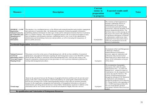
- Page 221 and 222: MeasureDescriptionCurrentstatus: in
- Page 223 and 224: MeasureDescriptionCurrentstatus: in
- Page 225 and 226: MeasureDescriptionCurrentstatus: in
- Page 227 and 228: MeasureDescriptionCurrentstatus: in
- Page 229 and 230: MeasureDescriptionCurrentstatus: in
- Page 231 and 232: MeasureDescriptionCurrentstatus: in
- Page 233 and 234: MeasureDescriptionCurrentstatus: in
- Page 235 and 236: MeasureDescriptionCurrentstatus: in
- Page 237 and 238: MeasureDescriptionCurrentstatus: in
- Page 239 and 240: MeasureDescriptionCurrentstatus: in
- Page 241 and 242: MeasureDescriptionCurrentstatus: in
- Page 243 and 244: MeasureDescriptionCurrentstatus: in
- Page 245 and 246: MeasureDescriptionCurrentstatus: in
- Page 247 and 248: MeasureDescriptionCurrentstatus: in
- Page 249 and 250: MeasureDescriptionCurrentstatus: in
- Page 251 and 252: MeasureDescriptionCurrentstatus: in
- Page 253 and 254: MeasureDescriptionCurrentstatus: in
- Page 255 and 256: MeasureDescriptionCurrentstatus: in
- Page 257 and 258: MeasureDescriptionCurrentstatus: in
- Page 259 and 260: MeasureDescriptionCurrentstatus: in
- Page 261 and 262: MeasureDescriptionCurrentstatus: in
- Page 263 and 264: MeasureDescriptionCurrentstatus: in
- Page 265 and 266: MeasureDescriptionCurrentstatus: in
- Page 267 and 268: MeasureDescriptionCurrentstatus: in
- Page 269: MeasureDescriptionCurrentstatus: in
- Page 273 and 274: MeasureDescriptionCurrentstatus: in
- Page 275 and 276: MeasureDescriptionCurrentstatus: in
- Page 277 and 278: MeasureDescriptionCurrentStatus: in
- Page 279 and 280: MeasureDescriptionCurrentStatus: in
- Page 281 and 282: MeasureDescriptionCurrentStatus: in
- Page 283 and 284: MeasureDescriptionCurrentStatus: in
- Page 285 and 286: MeasureDescriptionCurrentStatus: in
- Page 287 and 288: MeasureDescriptionCurrentStatus: in
- Page 289 and 290: MeasureDescriptionCurrentStatus: in
- Page 291 and 292: MeasureDescriptionCurrentStatus: in
- Page 293 and 294: MeasureDescriptionCurrentStatus: in
- Page 295 and 296: MeasureDescriptionCurrentStatus: in
- Page 297 and 298: MeasureDescriptionCurrentStatus: in
- Page 299 and 300: MeasureDescriptionCurrentStatus: in
- Page 301 and 302: MeasureDescriptionCurrentStatus: in
- Page 303 and 304: MeasureDescriptionCurrentStatus: in
- Page 305 and 306: MeasureDescriptionCurrentStatus: in
- Page 307 and 308: MeasureDescriptionCurrentStatus: in
- Page 309 and 310: MeasureDescriptionCurrentStatus: in
- Page 311 and 312: MeasureDescriptionCurrentStatus: in
- Page 313 and 314: MeasureDescriptionCurrentStatus: in
- Page 315 and 316: MeasureDescriptionCurrentStatus: in
- Page 317 and 318: MeasureDescriptionCurrentStatus: in
- Page 319 and 320: MeasureDescriptionCurrentStatus: in
- Page 321 and 322:
MeasureDescriptionCurrentStatus: in
- Page 323 and 324:
MeasureDescriptionCurrentStatus: in
- Page 325 and 326:
MeasureDescriptionCurrentStatus: in
- Page 327 and 328:
MeasureDescriptionCurrentStatus: in
- Page 329 and 330:
MeasureDescriptionCurrentStatus: in
- Page 331 and 332:
MeasureDescriptionCurrentStatus: in
- Page 333 and 334:
MeasureDescriptionCurrentStatus: in
- Page 335 and 336:
MeasureDescriptionCurrentStatus: in
- Page 337 and 338:
MeasureDescriptionCurrentStatus: in
- Page 339 and 340:
MeasureDescriptionCurrentStatus: in
- Page 341 and 342:
MeasureDescriptionCurrentStatus: in
- Page 343:
MeasureDescriptionCurrentStatus: in