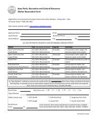
Parks, Recreation, Greenways, and Open Space ... - Town of Apex
Parks, Recreation, Greenways, and Open Space ... - Town of Apex
Parks, Recreation, Greenways, and Open Space ... - Town of Apex

Create successful ePaper yourself
Turn your PDF publications into a flip-book with our unique Google optimized e-Paper software.
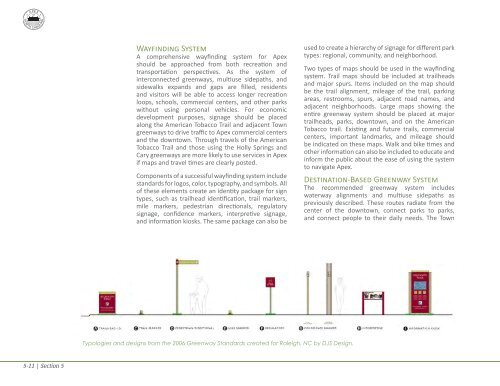
Wayfinding SystemA comprehensive wayfinding system for <strong>Apex</strong>should be approached from both recreation <strong>and</strong>transportation perspectives. As the system <strong>of</strong>interconnected greenways, multiuse sidepaths, <strong>and</strong>sidewalks exp<strong>and</strong>s <strong>and</strong> gaps are filled, residents<strong>and</strong> visitors will be able to access longer recreationloops, schools, commercial centers, <strong>and</strong> other parkswithout using personal vehicles. For economicdevelopment purposes, signage should be placedalong the American Tobacco Trail <strong>and</strong> adjacent <strong>Town</strong>greenways to drive traffic to <strong>Apex</strong> commercial centers<strong>and</strong> the downtown. Through travels <strong>of</strong> the AmericanTobacco Trail <strong>and</strong> those using the Holly Springs <strong>and</strong>Cary greenways are more likely to use services in <strong>Apex</strong>if maps <strong>and</strong> travel times are clearly posted.Components <strong>of</strong> a successful wayfinding system includest<strong>and</strong>ards for logos, color, typography, <strong>and</strong> symbols. All<strong>of</strong> these elements create an identity package for signtypes, such as trailhead identification, trail markers,mile markers, pedestrian directionals, regulatorysignage, confidence markers, interpretive signage,<strong>and</strong> information kiosks. The same package can also beused to create a hierarchy <strong>of</strong> signage for different parktypes: regional, community, <strong>and</strong> neighborhood.Two types <strong>of</strong> maps should be used in the wayfindingsystem. Trail maps should be included at trailheads<strong>and</strong> major spurs. Items included on the map shouldbe the trail alignment, mileage <strong>of</strong> the trail, parkingareas, restrooms, spurs, adjacent road names, <strong>and</strong>adjacent neighborhoods. Large maps showing theentire greenway system should be placed at majortrailheads, parks, downtown, <strong>and</strong> on the AmericanTobacco trail. Existing <strong>and</strong> future trails, commercialcenters, important l<strong>and</strong>marks, <strong>and</strong> mileage shouldbe indicated on these maps. Walk <strong>and</strong> bike times <strong>and</strong>other information can also be included to educate <strong>and</strong>inform the public about the ease <strong>of</strong> using the systemto navigate <strong>Apex</strong>.Destination-Based Greenway SystemThe recommended greenway system includeswaterway alignments <strong>and</strong> multiuse sidepaths aspreviously described. These routes radiate from thecenter <strong>of</strong> the downtown, connect parks to parks,<strong>and</strong> connect people to their daily needs. The <strong>Town</strong>Typologies <strong>and</strong> designs from the 2006 Greenway St<strong>and</strong>ards created for Raleigh, NC by DJS Design.5-11 | Section 5