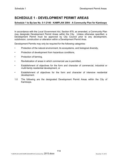
SCHEDULE 1 - DEVELOPMENT PERMIT AREAS - City of Kamloops
SCHEDULE 1 - DEVELOPMENT PERMIT AREAS - City of Kamloops
SCHEDULE 1 - DEVELOPMENT PERMIT AREAS - City of Kamloops

Create successful ePaper yourself
Turn your PDF publications into a flip-book with our unique Google optimized e-Paper software.
Schedule 1Development Permit Areas<strong>SCHEDULE</strong> 1 - <strong>DEVELOPMENT</strong> <strong>PERMIT</strong> <strong>AREAS</strong>Schedule 1 to By-law No. 5-1-2146 - KAMPLAN 2004: A Community Plan for <strong>Kamloops</strong>In accordance with the Local Government Act, Section 879, as amended, a Community Planmay designate Development Permit Areas within the <strong>City</strong>. Unless otherwise specified, aDevelopment Permit must be approved by <strong>City</strong> Council prior to any development,subdivision, construction or alteration within a Development Permit Area.Development Permits may only be required for the following categories:• Protection <strong>of</strong> the natural environment, its ecosystems, and biological diversity,• Protection <strong>of</strong> development from hazardous conditions,• Protection <strong>of</strong> farming,• Revitalization <strong>of</strong> areas in which commercial use is permitted,• Establishment <strong>of</strong> objectives for the form and character <strong>of</strong> commercial, industrial ormulti-family residential development, or• Establishment <strong>of</strong> objectives for the form and character <strong>of</strong> intensive residentialdevelopment.1.0 The following are the designated Development Permit Areas within the <strong>City</strong> <strong>of</strong><strong>Kamloops</strong>.114T:\DES\PLAN & DEV\KAMPLAN\KAMPLAN Combined Dec 2013.docx December 19, 2013
Schedule 1<strong>City</strong> Centre1.1 CITY CENTRE <strong>DEVELOPMENT</strong> <strong>PERMIT</strong> AREAApplication: Category (e) Form and character <strong>of</strong> intensive residential development.A Development Permit shall be required for any improvements to a property,including alterations, additions, site design, landscaping, new construction,building permit or subdivision, for all commercial, industrial, institutional ormultiple family residential development. Development Permits shall detail:parking, access and vehicular circulation, pedestrian circulation and access,landscaping, building elevations, site layout, and street enhancements.Area:<strong>City</strong> Centre Development Permit Area is the area shown shaded grey on theattached map.Exemptions: Applications for the following shall not be required to apply for DevelopmentPermits:Implementation:• internal renovations,• external renovations which do not affect the form and character <strong>of</strong> thebuilding, or• single or two family dwellings.In accordance with By-law No. 5-1-2277, delegated authority to issue a Development Permitcan fall to the Development and Engineering Services Department for applications <strong>of</strong> aconstruction value <strong>of</strong> $250,000 or less, multiple family development <strong>of</strong> eight or fewer units,where variances to zoning regulations are not requested; where Development Permits onlypertain to site planning or landscaping; and/or where existing Development Permits are beingamended. Any other Development Permit applications that fall outside <strong>of</strong> these parameterswill require the approval <strong>of</strong> <strong>City</strong> Council.Justification:The <strong>City</strong> Centre is <strong>Kamloops</strong>’ focal point. The concentration <strong>of</strong> <strong>of</strong>fice space, civic facilities,river front amenities, main street retail and well established residential neighbourhoodsprovides a strong, vibrant community centre. <strong>Kamloops</strong> is growing, and major newdevelopments are anticipated within this area. The objective <strong>of</strong> the designation is to ensurethat new development is compatible with the form and character <strong>of</strong> existing development.GuidelinesDevelopment Permits issued in this area shall be in accordance with the following guidelines:a) New buildings should be designed so that their form and character are compatible withexisting adjacent development.b) Continuity <strong>of</strong> building height is important in maintaining a pedestrian oriented streetwall. Buildings should generally conform to the heights <strong>of</strong> adjacent buildings. Whennew buildings will be taller than their neighbours, they should be set back from thestreet front with a podium <strong>of</strong> the same height as adjacent buildings.115T:\DES\PLAN & DEV\KAMPLAN\KAMPLAN Combined Dec 2013.docx December 19, 2013
Schedule 1<strong>City</strong> Centrec) Buildings taller than three storeys will require a building height impact assessment toidentify impacts and suggest possible mitigation measures.d) Buildings should be oriented to the primary street on which the building fronts. Streetcharacter should be enhanced through ground level retail activity, ground level access,and use <strong>of</strong> a variety <strong>of</strong> building materials, textures and scales at ground level. Largeexpanses <strong>of</strong> blank wall should be avoided.e) Buildings should maintain the same setbacks as adjacent development. Buildings atintersections should provide corner cuts. Where buildings are set back from thestreet, parking should not be permitted in the front yard. These areas should belandscaped.f) Parking lots should be screened and landscaped. Parking should be undergroundwherever possible and accessible from rear lanes rather than primary street fronts.g) Buildings should be designed with architectural features or setbacks at regularintervals to avoid the appearance <strong>of</strong> long, homogenous facades and to reduceapparent building mass.h) The <strong>City</strong> Centre Plan, 2005, Section 11.5, Design Guidelines, should be referred to formore specific guidance.CITY CENTRE <strong>DEVELOPMENT</strong> <strong>PERMIT</strong> AREA116T:\DES\PLAN & DEV\KAMPLAN\KAMPLAN Combined Dec 2013.docx December 19, 2013
Schedule 1 - Development Permit AreasNorth Shore(5-1-2398)1.2 NORTH SHORE <strong>DEVELOPMENT</strong> <strong>PERMIT</strong> AREA117T:\DES\PLAN & DEV\KAMPLAN\KAMPLAN Combined Dec 2013.docx December 19, 2013
Schedule 1 - Development Permit AreasNorth Shore118T:\DES\PLAN & DEV\KAMPLAN\KAMPLAN Combined Dec 2013.docx December 19, 2013
Schedule 1 - Development Permit AreasNorth Shore119T:\DES\PLAN & DEV\KAMPLAN\KAMPLAN Combined Dec 2013.docx December 19, 2013
Schedule 1 - Development Permit AreasNorth Shore120T:\DES\PLAN & DEV\KAMPLAN\KAMPLAN Combined Dec 2013.docx December 19, 2013
Schedule 1 - Development Permit AreasNorth Shore121T:\DES\PLAN & DEV\KAMPLAN\KAMPLAN Combined Dec 2013.docx December 19, 2013
Schedule 1 - Development Permit AreasNorth Shore122T:\DES\PLAN & DEV\KAMPLAN\KAMPLAN Combined Dec 2013.docx December 19, 2013
Schedule 1 - Development Permit AreasNorth Shore123T:\DES\PLAN & DEV\KAMPLAN\KAMPLAN Combined Dec 2013.docx December 19, 2013
Schedule 1 - Development Permit AreasNorth Shore124T:\DES\PLAN & DEV\KAMPLAN\KAMPLAN Combined Dec 2013.docx December 19, 2013
Schedule 1 - Development Permit AreasNorth Shore125T:\DES\PLAN & DEV\KAMPLAN\KAMPLAN Combined Dec 2013.docx December 19, 2013
Schedule 1 - Development Permit AreasNorth Shore126T:\DES\PLAN & DEV\KAMPLAN\KAMPLAN Combined Dec 2013.docx December 19, 2013
Schedule 1 - Development Permit AreasNorth Shore127T:\DES\PLAN & DEV\KAMPLAN\KAMPLAN Combined Dec 2013.docx December 19, 2013
Schedule 1 - Development Permit AreasNorth Shore129T:\DES\PLAN & DEV\KAMPLAN\KAMPLAN Combined Dec 2013.docx December 19, 2013
Schedule 1 - Development Permit AreasNorth Shore130T:\DES\PLAN & DEV\KAMPLAN\KAMPLAN Combined Dec 2013.docx December 19, 2013
Schedule 1 - Development Permit AreasNorth Shore131T:\DES\PLAN & DEV\KAMPLAN\KAMPLAN Combined Dec 2013.docx December 19, 2013
Schedule 1 - Development Permit AreasNorth Shore132T:\DES\PLAN & DEV\KAMPLAN\KAMPLAN Combined Dec 2013.docx December 19, 2013
Schedule 1 - Development Permit AreasNorth Shore133T:\DES\PLAN & DEV\KAMPLAN\KAMPLAN Combined Dec 2013.docx December 19, 2013
Schedule 1 - Development Permit AreasNorth Shore134T:\DES\PLAN & DEV\KAMPLAN\KAMPLAN Combined Dec 2013.docx December 19, 2013
Schedule 1 - Development Permit AreasNorth Shore135T:\DES\PLAN & DEV\KAMPLAN\KAMPLAN Combined Dec 2013.docx December 19, 2013
Schedule 1 - Development Permit AreasNorth Shore136T:\DES\PLAN & DEV\KAMPLAN\KAMPLAN Combined Dec 2013.docx December 19, 2013
Schedule 1 - Development Permit AreasNorth Shore137T:\DES\PLAN & DEV\KAMPLAN\KAMPLAN Combined Dec 2013.docx December 19, 2013
Schedule 1 - Development Permit AreasNorth Shore138T:\DES\PLAN & DEV\KAMPLAN\KAMPLAN Combined Dec 2013.docx December 19, 2013
Schedule 1 - Development Permit AreasNorth Shore139T:\DES\PLAN & DEV\KAMPLAN\KAMPLAN Combined Dec 2013.docx December 19, 2013
Schedule 1 - Development Permit AreasNorth Shore140T:\DES\PLAN & DEV\KAMPLAN\KAMPLAN Combined Dec 2013.docx December 19, 2013
Schedule 1 - Development Permit AreasNorth Shore141T:\DES\PLAN & DEV\KAMPLAN\KAMPLAN Combined Dec 2013.docx December 19, 2013
Schedule 1 - Development Permit AreasNorth Shore142T:\DES\PLAN & DEV\KAMPLAN\KAMPLAN Combined Dec 2013.docx December 19, 2013
Schedule 1 - Development Permit AreasNorth Shore143T:\DES\PLAN & DEV\KAMPLAN\KAMPLAN Combined Dec 2013.docx December 19, 2013
Schedule 1 - Development Permit AreasNorth Shore144T:\DES\PLAN & DEV\KAMPLAN\KAMPLAN Combined Dec 2013.docx December 19, 2013
Schedule 1 - Development Permit AreasNorth Shore145T:\DES\PLAN & DEV\KAMPLAN\KAMPLAN Combined Dec 2013.docx December 19, 2013
Schedule 1 - Development Permit AreasNorth Shore146T:\DES\PLAN & DEV\KAMPLAN\KAMPLAN Combined Dec 2013.docx December 19, 2013
Schedule 1 - Development Permit AreasNorth Shore147T:\DES\PLAN & DEV\KAMPLAN\KAMPLAN Combined Dec 2013.docx December 19, 2013
Schedule 1 - Development Permit AreasNorth Shore148T:\DES\PLAN & DEV\KAMPLAN\KAMPLAN Combined Dec 2013.docx December 19, 2013
Schedule 1 - Development Permit AreasWestsyde Core Area1.3 WESTSYDE CORE <strong>DEVELOPMENT</strong> <strong>PERMIT</strong> AREAApplication: Category (e) Form and character <strong>of</strong> intensive residential development.A Development Permit shall be required for any improvements to a property,including alterations, additions, site design, landscaping, new construction,building permit or subdivision, for all commercial industrial, institutional ormultiple family residential development. Development Permits shall detail:parking, access and vehicular circulation, pedestrian circulation and access,landscaping, building elevations, site layout, and street enhancements.Area:Westsyde Core Development Permit Area is the area shown shaded grey onthe attached map.Exemptions: Applications for the following shall not be required to apply for DevelopmentPermits:Implementation:• internal renovations,• external renovations which do not affect the form and character <strong>of</strong> thebuilding, or• single or two family dwellings.In accordance with By-law No. 5-1-2277, delegated authority to issue a Development Permitcan fall to the Development and Engineering Services Department for applications <strong>of</strong> aconstruction value <strong>of</strong> $250,000 or less, multiple family development <strong>of</strong> eight or fewer units,where variances to zoning regulations are not requested; where Development Permits onlypertain to site planning or landscaping; and/or where existing Development Permits are beingamended. Any other Development Permit applications that fall outside <strong>of</strong> these parameterswill require the approval <strong>of</strong> <strong>City</strong> Council.Justification:The Westsyde Shopping Plaza/Secondary School area is the primary retail commercial andinstitutional/recreational centre in Westsyde. Intensive land uses including higher densityresidential are considered more appropriate in proximity to major services and amenities.While the plaza and the school provide the necessary support, the designated area bordersan established neighbourhood predominantly consisting <strong>of</strong> single family dwellings with sometwo family houses. The objective <strong>of</strong> the designation is to ensure that new development in thearea is compatible with the form and character <strong>of</strong> the existing neighbourhood.149T:\DES\PLAN & DEV\KAMPLAN\KAMPLAN Combined Dec 2013.docx December 19, 2013
Schedule 1 - Development Permit AreasWestsyde Core AreaGuidelinesDevelopment Permits issued in this area shall be in accordance with the following guidelines:a) The shape, siting, ro<strong>of</strong>line and exterior finish <strong>of</strong> buildings should be sufficiently variedto avoid a monotonous appearance.b) Continuity <strong>of</strong> building height with the adjacent neighbourhood is important inmaintaining a compatible building scale and mass. New development building heightsshould generally conform to the heights <strong>of</strong> adjacent buildings. When new buildings willbe taller than their neighbours, they should be internally located on the site such thatthey are not directly situated across from existing development.c) Buildings taller than two storeys should be sited such that shadows and views do notadversely impact the immediate neighbourhood.d) Buildings on the exterior <strong>of</strong> the development abutting local residential roads should beoriented to the adjacent street. Where this occurs, permitted fencing and landscapingshall not exceed 1.0 m in height.e) Large expanses <strong>of</strong> parking should be internally located. Where parking is sitedadjacent to a local residential street, it should be provided in smaller clusters nogreater than three stalls and screened from view.f) All areas not covered by buildings, structures or asphalt shall be landscaped. Internalpaths and walkways should be provided to ensure ease <strong>of</strong> circulation to both on- and<strong>of</strong>f-site services and amenities. The provision <strong>of</strong> landscaping should consider the use<strong>of</strong> xeriscaping and native landscape materials.g) The principal form <strong>of</strong> development should be detached dwellings, duplexes andtriplexes. Should this be exceeded, the buildings should be located internally on thesite and not abutting local residential streets.h) Building components housing publicly accessible <strong>of</strong>fice and/or customer service areasshall incorporate architectural details such as windows, entry features, distinctivero<strong>of</strong>lines, and exterior finish materials that distinguish such areas from more utilitarianwarehousing, manufacturing, and processing areas. The use <strong>of</strong> vinyl siding is stronglydiscouraged in such publicly accessible areas, while the use <strong>of</strong> natural wood, rock,and stone details is encouraged.i) Landscaping islands shall be used to separate large expanses <strong>of</strong> parking into smallersubsections appropriate to the use. Landscaping islands shall be located at each end<strong>of</strong> every parking aisle. In the case <strong>of</strong> longer parking aisles, landscape islands shall beprovided in the middle <strong>of</strong> the aisle, with a maximum separation <strong>of</strong> 12 to 15 parkingstalls between landscape islands.j) Site plans must demonstrate the capacity for safe and efficient movement <strong>of</strong> peopleand traffic on the site. Site design must include pedestrian walkways along buildingfrontages, as well as continuous pedestrian connections between walkways alongbuilding frontages, and on neighbouring sites. Pedestrian walkways shall bedistinguished from driving surfaces by using varied treatments and by raisingwalkways to curb level.k) Entrances to buildings shall be located to maximize pedestrian safety.150T:\DES\PLAN & DEV\KAMPLAN\KAMPLAN Combined Dec 2013.docx December 19, 2013
Schedule 1 - Development Permit AreasWestsyde Core Areal) Raised curbs shall define entry driveways.m) Outdoor storage areas, garbage bins, or loading/unloading areas shall be situated in aside or rear yard in order to minimize exposure <strong>of</strong> storage areas to public roadways.n) All areas not covered by buildings or structures and not required for parking, loading,storage, assembly, processing, or manufacturing shall be suitably landscaped. Theprovision <strong>of</strong> landscaping shall consider the use <strong>of</strong> xeriscaping and native landscapingmaterials.o) Landscape design shall prioritize security and pedestrian safety. The use <strong>of</strong> CrimePrevention through Environmental Design (CPTED) principles such as enhancinglighting and minimizing dark areas, encouraging opportunities for natural surveillance,and using visual cues to control access to the site should be considered whendesigning landscaping.p) External lighting shall be incorporated into building and landscaping design.q) Landscape plans prepared and sealed by a landscape architect must be included inDevelopment Permit applications; Development Permit approval will be contingentupon submission <strong>of</strong> security in the amount <strong>of</strong> 125% <strong>of</strong> the estimated value <strong>of</strong>landscape work and British Columbia Society <strong>of</strong> Landscape Architects (BCSLA)Schedules <strong>of</strong> Assurance (Schedules L-1 and L-2)."151T:\DES\PLAN & DEV\KAMPLAN\KAMPLAN Combined Dec 2013.docx December 19, 2013
Schedule 1 - Development Permit AreasWestsyde Core AreaWESTSYDE CORE <strong>DEVELOPMENT</strong> <strong>PERMIT</strong> AREA152T:\DES\PLAN & DEV\KAMPLAN\KAMPLAN Combined Dec 2013.docx December 19, 2013
Schedule 1 - Development Permit AreasPineview Valley1.4 PINEVIEW VALLEY <strong>DEVELOPMENT</strong> <strong>PERMIT</strong> AREAApplication: Category (e) Form and character <strong>of</strong> intensive residential development.A Development Permit shall be required for any improvements to a property,including alterations, additions, site design, landscaping, new construction,building permit or subdivision, for all commercial industrial, institutional ormultiple family residential development. Development Permits shall detail:parking, access and vehicular circulation, pedestrian circulation and access,landscaping, building elevations, site layout, and street enhancements.Area:Pineview Valley Development Permit Area is the area shown shaded grey onthe attached map.Exemptions: Applications for the following shall not be required to apply for DevelopmentPermits:Implementation:• internal renovations,• external renovations which do not affect the form and character <strong>of</strong> thebuilding, or• single or two family dwellings.In accordance with By-law No. 5-1-2277, delegated authority to issue a Development Permitcan fall to the Development and Engineering Services Department for applications <strong>of</strong> aconstruction value <strong>of</strong> $250,000 or less, multiple family development <strong>of</strong> eight or fewer units,where variances to zoning regulations are not requested; where Development Permits onlypertain to site planning or landscaping; and/or where existing Development Permits are beingamended. Any other Development Permit applications that fall outside <strong>of</strong> these parameterswill require the approval <strong>of</strong> <strong>City</strong> Council.Justification:The Pineview Valley area is a large tract <strong>of</strong> prezoned land with a high proportion <strong>of</strong> multiplefamily residential development. As development is expected to occur over a five to ten yeartime frame, development standards may change during this period. The objective <strong>of</strong> thedesignation is to ensure that new development in the area is compatible with the form andcharacter <strong>of</strong> the adjacent single family neighbourhood and the linear park.GuidelinesDevelopment Permits issued in this area shall be in accordance with the following guidelines:a) The shape, siting, ro<strong>of</strong>line and exterior finish <strong>of</strong> buildings should be sufficiently variedto avoid a monotonous appearance.153T:\DES\PLAN & DEV\KAMPLAN\KAMPLAN Combined Dec 2013.docx December 19, 2013
Schedule 1 - Development Permit AreasPineview Valleyb) Continuity <strong>of</strong> building height with the adjacent neighbourhood is important inmaintaining a compatible building scale and mass. New development building heightsshould generally conform to the heights <strong>of</strong> adjacent buildings. When new buildings willbe taller than their neighbours, they should be internally located on the site such thatthey are not directly situated across from existing development.c) Buildings taller than two storeys should be sited such that shadows and views do notadversely impact the immediate neighbourhood.d) Buildings on the exterior <strong>of</strong> the development abutting local residential roads should beoriented to the adjacent street. Where this occurs, permitted fencing and landscapingshall not exceed 1.0 m in height.e) Large expanses <strong>of</strong> parking should be internally located. Where parking is sitedadjacent to a local residential street, it should be provided in smaller clusters nogreater than three stalls and screened from view.f) All areas not covered by buildings, structures or asphalt shall be landscaped. Internalpaths and walkways should be provided to ensure ease <strong>of</strong> circulation to both on- and<strong>of</strong>f-site services and amenities. The provision <strong>of</strong> landscaping should consider the use<strong>of</strong> xeriscaping and native landscape materials.g) The principal form <strong>of</strong> development should be detached dwellings, duplexes andtriplexes. Should this be exceeded, the buildings should be located internally on thesite and not abutting local residential streets.PINEVIEW VALLEY <strong>DEVELOPMENT</strong> <strong>PERMIT</strong> AREA154T:\DES\PLAN & DEV\KAMPLAN\KAMPLAN Combined Dec 2013.docx December 19, 2013
Schedule 1 - Development Permit AreasMt. Dufferin1.5 MT. DUFFERIN <strong>DEVELOPMENT</strong> <strong>PERMIT</strong> AREAApplication: Category (e) Form and character <strong>of</strong> intensive residential development.A Development Permit shall be required for any improvements to a property,including alterations, additions, site design, landscaping, new construction,building permit or subdivision, for all commercial industrial, institutional ormultiple family residential development. Development Permits shall detail:parking, access and vehicular circulation, pedestrian circulation and access,landscaping, building elevations, site layout, and street enhancements.Area:Mt. Dufferin Development Permit Area is the area shown shaded grey on theattached map.Exemptions: Applications for the following shall not be required to apply for DevelopmentPermits:Implementation:• internal renovations,• external renovations which do not affect the form andcharacter <strong>of</strong> the building, or• single or two family dwellings.In accordance with By-law No. 5-1-2277, delegated authority to issue a Development Permitcan fall to the Development and Engineering Services Department for applications <strong>of</strong> aconstruction value <strong>of</strong> $250,000 or less, multiple family development <strong>of</strong> eight or fewer units,where variances to zoning regulations are not requested; where Development Permits onlypertain to site planning or landscaping; and/or where existing Development Permits are beingamended. Any other Development Permit applications that fall outside <strong>of</strong> these parameterswill require the approval <strong>of</strong> <strong>City</strong> Council.Justification:The Mt. Dufferin area is a large tract <strong>of</strong> prezoned land with a significant proportion <strong>of</strong> multiplefamily residential development. As development is expected to occur over a long time frame,development standards may change. The objective <strong>of</strong> the designation is to ensure that newdevelopment in the area is compatible with the standards and principles established throughthe Mt. Dufferin Plan process and is in keeping with the form and character <strong>of</strong> the adjacentneighbourhood and the city-wide park.The Mt. Dufferin Land Use Plan identified several significant natural features in theDevelopment Permit Area worthy <strong>of</strong> special attention and consideration, including prominentknolls, view corridors, vegetation and mature stands <strong>of</strong> trees. The Development Permit AreaGuidelines attempt to strike a balance between the negotiated density expectations and theimportance and value <strong>of</strong> these natural features to the city-wide park and the existingneighbourhood.155T:\DES\PLAN & DEV\KAMPLAN\KAMPLAN Combined Dec 2013.docx December 19, 2013
Schedule 1 - Development Permit AreasMt. DufferinGuidelinesDevelopment Permits issued in this area shall be in accordance with the following guidelines:a) The Development Permit Area is located within the urban/wildland interface andhazard area. Applications for development are subject to the Urban/Wildland Interfacepolicies.b) The layout and design <strong>of</strong> access roads, internal streets, building sites and overallgrading patterns should demonstrate an effort to preserve and protect significantnatural features, including prominent knolls, vegetation, view corridors and maturestands <strong>of</strong> trees.c) The following information and drawings may be required upon submission <strong>of</strong> aDevelopment Permit application:• Site photographs and/or drawings showing the subject area and proposedbuildings in relation to the surrounding area.• A grading plan showing existing and proposed grades.• A tree inventory plan indicating existing tree cover and trees proposed to beremoved, retained or replaced.d) The shape, siting, ro<strong>of</strong>line, height, facade and exterior finish <strong>of</strong> buildings should besufficiently varied to avoid a monotonous appearance.e) All areas not covered by buildings, structures or asphalt shall be landscaped. Internalpaths and walkways should be provided to ensure easy circulation to both on- and <strong>of</strong>fsiteservices and amenities. The provision <strong>of</strong> landscaping should consider the use <strong>of</strong>xeriscaping and natural landscape materials.f) Parking:• Parking within the individual unit will be encouraged.• Where surface parking is planned, it should be provided in small clusters nogreater than three stalls and should be visually separated by curbing, lighting,directional signage, landscaping or any combination <strong>of</strong> these elements.g) Large areas <strong>of</strong> building walls should be avoided. Where extensive wall areas areplanned, this should be visually relieved by a combination <strong>of</strong> windows, colour,material, textures and mature landscaping.h) Site staking may be required indicating the proposed location <strong>of</strong>:• corners <strong>of</strong> buildings,• access and internal roads, and• ro<strong>of</strong>lines <strong>of</strong> buildings.156T:\DES\PLAN & DEV\KAMPLAN\KAMPLAN Combined Dec 2013.docx December 19, 2013
Schedule 1 - Development Permit AreasMt. DufferinMT. DUFFERIN <strong>DEVELOPMENT</strong> <strong>PERMIT</strong> AREA157T:\DES\PLAN & DEV\KAMPLAN\KAMPLAN Combined Dec 2013.docx December 19, 2013
Schedule 1 - Development Permit AreasSouth Thompson Silt Bluffs Red Zone1.6 SOUTH THOMPSON SILT BLUFFS RED ZONE<strong>DEVELOPMENT</strong> <strong>PERMIT</strong> AREAApplication: Category (b) Protection <strong>of</strong> development from hazardous conditions.A Development Permit shall be required for any improvements to a property,including alterations, additions, site design, landscaping, new construction,building permit or subdivision, for all commercial industrial, institutional ormultiple family residential development. Development Permits shall detail:parking, access and vehicular circulation, pedestrian circulation and access,landscaping, building elevations, site layout, and street enhancements.Area:South Thompson Development Permit Area is the area shown shaded grey onthe attached map.Exemptions: Applications for the following shall not be required to apply for a DevelopmentPermits:Justification:• Internal renovations to an existing building or structure, or• New buildings or structures less than 10 m² in size.Detailed geotechnical analysis and study have identified significant and extensive silts in andadjacent to the bluffs bordering the South Thompson River. The hazardous zoneencompasses an area extending approximately from Rose Hill Road to Campbell Creek atthe eastern boundary <strong>of</strong> the <strong>City</strong>. Substantial harm and/or damage could result shoulddevelopment occur in this area. The objective <strong>of</strong> the Development Permit Area designationis to regulate development in the area in such a manner as to protect it from the identifiedhazardous condition.GuidelinesDevelopment Permits issued in this area shall be in accordance with the following guidelines:a) No development shall be permitted in the area designated as the Red Zone on theattached map except that accessory structures and buildings may be permitted onparcels <strong>of</strong> land having an existing residential dwelling where it can be demonstrated bya pr<strong>of</strong>essional engineer that the proposed accessory structure or building is able tomeet the special conditions required for the development in the Foreset/Backset Zoneand that the accessory structure/building is not used as a dwelling unit.b) Development may be permitted in the area designated as the Foreset/Backset Zoneon the attached map subject to the following special conditions:• Every application for development shall be accompanied by a geotechnicalreport prepared by a pr<strong>of</strong>essional engineer qualified to practice in the field <strong>of</strong>geotechnical engineering. The geotechnical report shall:- define the extent <strong>of</strong> all surficial geologic materials and the ground waterregime in the area proposed for development;158T:\DES\PLAN & DEV\KAMPLAN\KAMPLAN Combined Dec 2013.docx December 19, 2013
Schedule 1 - Development Permit AreasSouth Thompson Silt Bluffs Red Zone- define the extent <strong>of</strong> hazard zones within the area; and- recommend specific criteria for development such that potentialhazards are eliminated or accommodated.• All development within the Foreset/Backset Zone shall be under the directsupervision <strong>of</strong> a pr<strong>of</strong>essional engineer.• At the option <strong>of</strong> the <strong>City</strong>, a "save harmless" covenant shall be registeredagainst each legal parcel.SOUTH THOMPSON SILT BLUFFS RED ZONE <strong>DEVELOPMENT</strong> <strong>PERMIT</strong> AREA159T:\DES\PLAN & DEV\KAMPLAN\KAMPLAN Combined Dec 2013.docx December 19, 2013
Schedule 1 - Development Permit AreasDallas Commercial Zone1.7 DALLAS COMMERCIAL CORE <strong>DEVELOPMENT</strong><strong>PERMIT</strong> AREAApplication: Category (e) Form and character <strong>of</strong> intensive residential development.A Development Permit shall be required for any improvements to a property,including alterations, additions, site design, landscaping, new construction,building permit or subdivision, for all commercial industrial, institutional ormultiple family residential development. Development Permits shall detail:parking, access and vehicular circulation, pedestrian circulation and access,landscaping, building elevations, site layout, and street enhancements.Area:Dallas Commercial Core Development Permit Area is the area shown shadedgrey on the attached map.Exemptions: Applications for the following shall not be required to apply for DevelopmentPermits:Implementation:• internal renovations, and• external renovations which do not affect the form and character <strong>of</strong> thebuilding.In accordance with By-law No. 5-1-2277, delegated authority to issue a Development Permitcan fall to the Development and Engineering Services Department for applications <strong>of</strong> aconstruction value <strong>of</strong> $250,000 or less, multiple family development <strong>of</strong> eight or fewer units,where variances to zoning regulations are not requested; where Development Permits onlypertain to site planning or landscaping; and/or where existing Development Permits are beingamended. Any other Development Permit applications that fall outside <strong>of</strong> these parameterswill require the approval <strong>of</strong> <strong>City</strong> Council.Justification:The designated permit area borders an established single family neighbourhood, a servicestation/convenience store and the East Trans Canada Highway. The site is intended to bedeveloped as a Neighbourhood/District commercial centre servicing Dallas, Barnhartvale,Campbell Creek, areas east beyond the city boundary, as well as the travelling public. Therange <strong>of</strong> Shopping Centre commercial uses which could be concentrated in this location mayinclude retail, personal services, <strong>of</strong>fice, convenience and food outlets.The objective <strong>of</strong> the Development Permit Area designation is to ensure that the impact <strong>of</strong>new development in the area is minimized for adjacent residential areas, as well as to ensurean attractive commercial area adjacent to the highway.160T:\DES\PLAN & DEV\KAMPLAN\KAMPLAN Combined Dec 2013.docx December 19, 2013
Schedule 1 - Development Permit AreasDallas Commercial ZoneGuidelinesDevelopment Permits issued in this area shall be in accordance with the following guidelines:a) The site must be developed in a comprehensive manner to ensure the form andcharacter <strong>of</strong> the building(s) have a common architectural scheme/design.b) All principal buildings shall be sited adjacent to the Trans Canada Highway. Satellitebuildings may be located adjacent to Dallas Drive to break up large expanses <strong>of</strong>parking and to provide screening <strong>of</strong> the parking areas.c) Large expanses <strong>of</strong> parking must be separated into smaller sections by curbing, lightstandards, signage, landscaping or a combination <strong>of</strong> these elements. Parkingimmediately adjacent to Dallas Drive should be provided in smaller clusters no greaterthan ten stalls.d) Lighting shall be directed away from residential uses. No freestanding or animatedsigns shall be permitted on Dallas Drive. The maximum sign height permitted onDallas Drive shall not exceed 1.5 m.e) Buildings facing residential uses shall be visually relieved by a combination <strong>of</strong>windows, building materials and textures, and architectural features.f) Continuous perimeter landscaping and supplemental landscaping adjacent to theresidential areas must be provided. This landscaping is to include street trees <strong>of</strong>sufficient height to provide effective screening.g) Ro<strong>of</strong>lines should relate to adjacent building forms and styles. Varied ro<strong>of</strong>lines must beused to avoid the appearance <strong>of</strong> a long, flat building facade. Ro<strong>of</strong>top mechanicalequipment must be screened from view by purpose built structures or the inherentform <strong>of</strong> the ro<strong>of</strong>.h) Outdoor storage areas, garbage bins or loading/unloading areas shall be visuallyscreened and landscaped from adjacent residential areas.i) Building height should not exceed one storey and the form and character <strong>of</strong>development should relate to, and appear compatible with adjacent residentialdevelopment.j) Access points shall be located in a manner which does not adversely impact the safeuse <strong>of</strong> the adjoining highway.k) Site plan must demonstrate the capacity for safe and efficient movement <strong>of</strong> peopleand traffic on the site.l) Sidewalks along Dallas Drive and Nina Place extension must be provided.161T:\DES\PLAN & DEV\KAMPLAN\KAMPLAN Combined Dec 2013.docx December 19, 2013
Schedule 1 - Development Permit AreasDallas Commercial ZoneDALLAS COMMERCIAL CORE <strong>DEVELOPMENT</strong> <strong>PERMIT</strong> AREA162T:\DES\PLAN & DEV\KAMPLAN\KAMPLAN Combined Dec 2013.docx December 19, 2013
Schedule 1 - Development Permit AreasCampbell Creek Industrial Park1.8 CAMPBELL CREEK INDUSTRIAL PARK<strong>DEVELOPMENT</strong> <strong>PERMIT</strong> AREAApplication: Category (e) Form and character <strong>of</strong> intensive residential development.A Development Permit shall be required for any improvements to a property,including alterations, additions, site design, landscaping, new construction,building permit or subdivision, for all commercial industrial, institutional ormultiple family residential development. Development Permits shall detail:parking, access and vehicular circulation, pedestrian circulation and access,landscaping, building elevations, site layout, and street enhancements.Area:Campbell Creek Industrial Park Development Permit Area is the area shownshaded grey on the attached map.Exemptions: Applications for the following shall not be required to apply for DevelopmentPermits:Implementation:• internal renovations,• external renovations which do not affect the form and character <strong>of</strong> thebuilding,• external renovations or additions which are not visible from a publicright-<strong>of</strong>-way, commercial, or residentially zoned property, and• single or two-family dwellings.In accordance with By-law No. 5-1-2277, delegated authority to issue a Development Permitcan fall to the Development and Engineering Services Department for applications <strong>of</strong> aconstruction value <strong>of</strong> $250,000 or less, multiple family development <strong>of</strong> eight or fewer units,where variances to zoning regulations are not requested; where Development Permits onlypertain to site planning or landscaping; and/or where existing Development Permits are beingamended. Any other Development Permit applications that fall outside <strong>of</strong> these parameterswill require the approval <strong>of</strong> <strong>City</strong> Council.Justification:The Campbell Creek Industrial Park is located at the eastern gateway to the <strong>City</strong> adjacent tothe Trans Canada Highway, serving as the primary access route. The <strong>City</strong>'s OfficialCommunity Plan encourages the preparation <strong>of</strong> highway corridor guidelines to ensure a highstandard <strong>of</strong> development and further encourages the protection <strong>of</strong> significant public viewcorridors.163T:\DES\PLAN & DEV\KAMPLAN\KAMPLAN Combined Dec 2013.docx December 19, 2013
Schedule 1 - Development Permit AreasCampbell Creek Industrial ParkCampbell Creek is a highly visible tract <strong>of</strong> land that is appropriate for the development <strong>of</strong>service commercial and light to general industrial uses. Care must be taken to ensure apositive impression <strong>of</strong> the <strong>City</strong> is transmitted to the travelling public. The area has significantexposure as the Trans Canada Highway runs in an east/west direction through the full length<strong>of</strong> the industrial park area. The environmentally sensitive silt bluffs provide a visuallyimpressive border to the north and south. To provide safe highway access to the futuredevelopment, a portion <strong>of</strong> the Trans Canada Highway was elevated to accommodate anoverpass. The elevated portion creates additional need to ensure the site development ismanaged from an aesthetic perspective. The substantial landscaping and screeningassociated with a major industrial plant (Moly-Cop) at the park's eastern edge establishes thedevelopment standard envisaged for the remaining undeveloped parcels in the park. Thewell-established residential area <strong>of</strong> Dallas is located along the western boundary <strong>of</strong> theDevelopment Permit area.The objectives <strong>of</strong> the Development Permit Area are:• To achieve a positive, identifiable, and coordinated image <strong>of</strong> the Campbell CreekIndustrial Park which conveys the impression <strong>of</strong> high quality development through theimplementation <strong>of</strong> architectural, landscaping, and sign guidelines unique to thisneighbourhood;• To ensure that new development exemplifies the high development standardestablished by an existing major industrial use (Moly-Cop);• To maintain the carrying capacity <strong>of</strong> Dallas Drive;• To ensure compatibility with the existing residential neighbourhood and with futureuses; and• To serve as a visually appealing entranceway to the <strong>City</strong>.GuidelinesDevelopment Permits issued in this area shall be in accordance with the following guidelines:Commercial Developmenta) Large areas <strong>of</strong> building walls shall be articulated by a combination <strong>of</strong> windows, entryfeatures, building materials, textures, architectural features, and landscaping.b) Varied ro<strong>of</strong>lines are encouraged to avoid the appearance <strong>of</strong> long, flat building facadeswherever possible.c) Ro<strong>of</strong>top mechanical equipment shall be screened from view by the inherent form <strong>of</strong> thero<strong>of</strong> or by purpose built structures constructed from durable all-weather materials.Industrial Developmenta) Building components housing publicly accessible <strong>of</strong>fice and/or customer service areasare encouraged to incorporate architectural details such as windows, entry features,distinctive ro<strong>of</strong>lines, and exterior finish materials which distinguish such areas frommore utilitarian warehousing, manufacturing, and processing areas.164T:\DES\PLAN & DEV\KAMPLAN\KAMPLAN Combined Dec 2013.docx December 19, 2013
Schedule 1 - Development Permit AreasCampbell Creek Industrial Parkb) There shall be continuous perimeter landscaping along road frontages. Landscapingwill include shrubs and trees <strong>of</strong> sufficient height and quality acceptable to the <strong>City</strong> toprovide effective screening. Where fencing is proposed along road frontages, thelandscaping shall be placed between the fence and the property line.Commercial and Industrial Developmenta) Buildings on corner sites or with double road frontage should be designed toacknowledge the building's visibility from each street through continuity <strong>of</strong> design,colour, materials, exterior finish, signage, and landscaping.b) The use <strong>of</strong> unfinished and untextured concrete and unfinished metal or aluminum as afinal building finish is discouraged. Buildings should be finished in natural, earth tonecolours. Extensive use <strong>of</strong> bold, obtrusive colour is discouraged.c) Lots with double road frontage shall be developed such that the longest buildingelevation is generally perpendicular to the road frontages.d) Parking areas are encouraged to be shared between neighbouring properties andshould give the appearance <strong>of</strong> a common parking area.e) Storage areas are encouraged to be situated in a side yard in order to minimizeexposure <strong>of</strong> storage areas to the public rights-<strong>of</strong>-way and appropriately screened.f) Access driveways are encouraged to be shared in order to minimize the number <strong>of</strong>,and to provide maximum spacing (a minimum 30 m on centre) between, entry/exitpoints along the public right-<strong>of</strong>-way (see example diagram below).Example - Double Road Frontage Site Plan (NOT TO SCALE)165T:\DES\PLAN & DEV\KAMPLAN\KAMPLAN Combined Dec 2013.docx December 19, 2013
Schedule 1 - Development Permit AreasCampbell Creek Industrial Parkg) Access to and from parking and loading areas shall not impede traffic flows on publicroadways.h) Landscaping islands shall be used to separate large expanses <strong>of</strong> parking into smallersubsections appropriate to the use.i) Parking, outdoor storage areas, garbage bins, or loading/unloading areas shall bevisually screened by landscaping from adjacent residential areas, streets, and theTrans Canada Highway.j) Where visual screening is desirable, the use <strong>of</strong> evergreen shrubs, trees, and otherplantings forming an opaque visual barrier is encouraged.k) Where security is required, the use <strong>of</strong> dark coloured chain-link is acceptable as afencing material.l) Fencing along the front property line is discouraged if not essential to site security.m) A comprehensively designed fenced and landscaped buffer strip 3 m in width shall beprovided to screen the mobile home park from commercial or industrial use. Designand plant materials utilized in this buffer strip should be consistent along the entirelength <strong>of</strong> the mobile home park interface.n) There shall be perimeter landscaping within a minimum 3 m buffer along roadfrontages. Where fencing is proposed along road frontages, the landscaping shall beplaced between the fence and the property line.o) Installation <strong>of</strong> raised landscaped berms is encouraged where appropriate to enhancethe effect <strong>of</strong> visual screening. Berms required for on-site drainage control shall belandscaped.p) All plant material shall be suited to the local climate, healthy, free <strong>of</strong> disease and pests,showing good growth characteristics, and shall be No. 1 Grade Canadian grown plantmaterial suited to the site's soil types and moisture availability.q) All areas not covered by buildings or structures and not required for parking, loading,storage, assembly, processing, or manufacturing shall be suitably landscaped. Theprovision <strong>of</strong> landscaping shall consider the use <strong>of</strong> xeriscaping and native landscapingmaterials.r) A landscaped buffer strip a minimum <strong>of</strong> 6 m in width shall be provided parallel to theTrans Canada Highway. Within this buffer strip, massed plantings shall be spaced atminimum 50 m intervals. For the purposes <strong>of</strong> these guidelines, a massed planting isdefined as a grouping <strong>of</strong> shrubs and trees, one-third <strong>of</strong> which shall have a minimumheight <strong>of</strong> 3 m at maturity, planted densely yet in accordance with sound landscapingpractice and not less than 20 m².s) The landscape plan shall be drawn to scale and include footprints <strong>of</strong> all existing andproposed buildings, parking, loading, driveway, and walkway areas; existing andproposed plantings including common and botanical names, quantity, caliper, root ballsize, height at planting, and maturity; height and location <strong>of</strong> berms; garbagereceptacles; a plan <strong>of</strong> the irrigation system; location <strong>of</strong> underground utilities; propertylines; easements; rights-<strong>of</strong>-way; drainage storage and/or retention areas; and direction<strong>of</strong> drainage and catchment systems.166T:\DES\PLAN & DEV\KAMPLAN\KAMPLAN Combined Dec 2013.docx December 19, 2013
Schedule 1 - Development Permit AreasCampbell Creek Industrial Parkt) Lighting and illuminated signage shall be oriented so as not to create a glare orreflection on the street, neighbouring buildings, or residential areas. Monument stylefreestanding signs should be unlit or externally lit.u) South <strong>of</strong> the Trans Canada Highway, freestanding signs shall be no higher than 2 mand shall have a sign area not exceeding 10 m².v) No freestanding sign shall contain more than the corporate name, logo, and streetnumber on its face.w) For multi-tenant buildings, all lettering and logos on signs shall be <strong>of</strong> similar size.CAMPBELL CREEK INDUSTRIAL PARK <strong>DEVELOPMENT</strong> <strong>PERMIT</strong> AREA167T:\DES\PLAN & DEV\KAMPLAN\KAMPLAN Combined Dec 2013.docx December 19, 2013
Schedule 1 - Development Permit AreasMcGill Corridor1.9 MCGILL CORRIDOR <strong>DEVELOPMENT</strong> <strong>PERMIT</strong> AREAApplication: Category (e) Form and character <strong>of</strong> intensive residential development.Area:A Development Permit shall be required for any improvements to a property,including alterations, additions, site design, landscaping, new construction,building permit or subdivision, for all commercial industrial, institutional ormultiple family residential development. Development Permits shall detail:parking, access and vehicular circulation, pedestrian circulation and access,landscaping, building elevations, site layout, and street enhancements.The McGill Corridor Development Permit Area has been designated alongMcGill Road from Columbia Street through the industrial park. The designatedareas include portions <strong>of</strong> the Thompson Rivers University and the SouthgateIndustrial Park as shown on the attached map <strong>of</strong> the McGill CorridorDevelopment Permit Area.The guidelines apply either generally to all lands within the designated area orthey are specifically referenced to the "Main Street" or "Technology Park" landuses designated on the Urban Design Concept Plan map.Exemptions: Applications for the following shall not be required to apply for DevelopmentPermits:Implementation:• internal renovations, and• external renovations that do not change the form and character <strong>of</strong> thebuilding.In accordance with By-law No. 5-1-2277, delegated authority to issue a Development Permitcan fall to the Development and Engineering Services Department for applications <strong>of</strong> aconstruction value <strong>of</strong> $250,000 or less, multiple family development <strong>of</strong> eight or fewer units,where variances to zoning regulations are not requested; where Development Permits onlypertain to site planning or landscaping; and/or where existing Development Permits are beingamended. Any other Development Permit applications that fall outside <strong>of</strong> these parameters willrequire the approval <strong>of</strong> <strong>City</strong> Council.Justification:In 2002, the <strong>City</strong> <strong>of</strong> <strong>Kamloops</strong> in association with the Thompson Rivers University undertookthe McGill Corridor/Southgate Concept Plan. The participants felt that the interface betweenthe Southgate Industrial Park and the University was not well defined and that there was apotential to enhance the relationship through better land use planning. The planning processset out to more clearly define preferred land uses and development options along the McGillCorridor and in Southgate generally. Specifically, the Concept Plan designated the south side<strong>of</strong> McGill Road between Summit Drive and Hillside Drive "Main Street" with the intent toencourage mixed use development consisting <strong>of</strong> ground floor commercial uses with residentialor <strong>of</strong>fice uses above.168T:\DES\PLAN & DEV\KAMPLAN\KAMPLAN Combined Dec 2013.docx December 19, 2013
Schedule 1 - Development Permit AreasMcGill CorridorThe remainder <strong>of</strong> the McGill Corridor is designated for light industrial and technology relateduses.The Concept Plan included a design strategy, which recognized that design issues would bean important consideration along the McGill Corridor because <strong>of</strong> the need to treat the corridoras a unified place, to build on the established architectural heritage <strong>of</strong> the Thompson RiversUniversity, and to recognize the role <strong>of</strong> quality streetscapes in successful retail and technologyareas.GuidelinesDevelopment Permits issued in this area shall be in accordance with the following guidelines:Built Form and AppearanceThe McGill Corridor Development Permit Area is a critical interface between the ThompsonRivers University and the Southgate Industrial Park, where design standards are required toensure long-term land use compatibility.a) Buildings within the McGill Corridor shall maintain the high design standards and usesimilar exterior finish materials as found on buildings on the Thompson Rivers Universitycampus such as the Campus Activity Centre and the Applied Trades and Technologybuilding.b) Principal facades should be finished with brick and glazing. The brick should use colourtones that are similar to or compatible with buildings on the TRU campus such as theCampus Activity Centre and the Applied Trades and Technology building.c) A minimum <strong>of</strong> 50% <strong>of</strong> the ground floor <strong>of</strong> the principal facade shall be glazed.d) The principal facades <strong>of</strong> buildings shall be oriented to McGill Road.e) Awnings and canopies a minimum 1.5 m wide shall be used to provide pedestrianweather protection and add visual interest.f) Metal cladding may be used to complement brick finishes.g) Secondary facades or accessory buildings may use split face concrete block or stuccopainted in a colour tone complementary to the principal facade.h) The front setback from McGill Road, between Summit Drive and Hillside Drive/UniversityDrive, should provide a minimum setback <strong>of</strong> 3 m and a maximum setback <strong>of</strong> 6 m topromote a relatively continuous street facade.i) A minimum <strong>of</strong> 50% <strong>of</strong> the frontage shall be occupied by buildings.169T:\DES\PLAN & DEV\KAMPLAN\KAMPLAN Combined Dec 2013.docx December 19, 2013
Schedule 1 - Development Permit AreasMcGill Corridorj) The Urban Design Concept Plan identifies two major gateway nodes and one minorgateway node along the McGill Corridor. Corner buildings at these intersections shouldbe designed as landmark corner buildings to identify their strategic location within theUrban Design Concept Plan. Landmark corner buildings should:• consist <strong>of</strong> a dominant form that can be carried along the street;• occupy a significant terminus <strong>of</strong> view;• consider all street frontages equally and provide equal quality <strong>of</strong> design,orientation, and detail;• respond to intersection focal points and pedestrian orientation with cornersetbacks (4.5 m), building articulation, and landscape treatment; and• should incorporate peaks, gables, turrets, clock towers, and other distinctivearchitectural features to emphasize that these intersections act as gateways orfocal points to the university and to the adjacent technology park areas.• should incorporate peaks, gables, turrets, clock towers, and other distinctivearchitectural features to emphasize that these intersections act as gateways orfocal points to the university and to the adjacent technology park areas.k) Buildings shall provide ground floor retail or <strong>of</strong>fice uses accessible at grade along the"Main Street" portion <strong>of</strong> McGill Road between Summit Drive and HillsideDrive/University Drive.(5-1-2416) l) Buildings having a minimum height <strong>of</strong> three storeys shall be encouraged. There is amaximum height <strong>of</strong> 12 storeys on Thompson Rivers University lands within theDevelopment Permit area.Vehicle and Pedestrian CirculationThe urban design concept accommodates vehicular traffic in rear yards and encourages thedevelopment <strong>of</strong> "Main Street" as a visually pleasing pedestrian environment.a) Forecourts, landscaped islands, and patios are encouraged for commercial and publicpurposes to enhance the streetscape for pedestrians.b) Provide a continuous 3 m wide sidewalk between curb line and the principal facade <strong>of</strong>the building, designed to complement and enrich the pedestrian character, amenities,and commercial activity along the "Main Street" segment <strong>of</strong> McGill Road.c) In the "Main Street" segment <strong>of</strong> McGill Road, no parking or circulation roadways shallbe provided between the principal facade and McGill Road. Parking shall be located atthe rear <strong>of</strong> the buildings and will be accessed by internal circulation or maneuveringaisles. A continuous major circulation aisle shall be provided at the rear <strong>of</strong> thebuildings to facilitate on-site circulation in the "Main Street" segment <strong>of</strong> McGill Road.Reciprocal parking agreements may be required between adjoining lots to betterfacilitate on-site circulation.d) Parking areas will be landscaped with planted islands a minimum <strong>of</strong> 2 m in width. Theplanted islands will separate major circulation aisles from parking access aisles.e) Entrances to buildings will be located to maximize pedestrian safety, particularly inrelation to crossing McGill Road.170T:\DES\PLAN & DEV\KAMPLAN\KAMPLAN Combined Dec 2013.docx December 19, 2013
Schedule 1 - Development Permit AreasMcGill Corridorf) Mid-block entrances to residential buildings will be discouraged, except where theyprovide access to private outdoor patio space. Access to residential buildings will beencouraged from side yards.LandscapingLandscaping is a major visual element that has the ability to provide a unified developmentalong McGill Road. The corridor will be landscaped with street trees and amenity spaces.a) The area between the principal facade and McGill Road shall be landscaped with streettrees.b) Landscape design should complement landscape treatments on the Thompson RiversUniversity campus, including street trees along McGill Road.c) Landscape design should address security and pedestrian safety by enhancing lightingand minimizing dark areas.d) Site planning in the "technology park" segment <strong>of</strong> McGill Road should protect naturallandscape elements including existing trees and rock knolls.e) Xeriscape and native landscape treatment similar to that used on the Terasen buildingat the westerly end <strong>of</strong> McGill Road will be encouraged in the "technology park" portion<strong>of</strong> McGill Road.f) Buildings located on corner lots should include a minimum 4.5 m corner cut or similarpedestrian treatment to expand the sidewalk adjacent to these intersections.171T:\DES\PLAN & DEV\KAMPLAN\KAMPLAN Combined Dec 2013.docx December 19, 2013
Schedule 1 - Development Permit AreasMcGill Corridor172T:\DES\PLAN & DEV\KAMPLAN\KAMPLAN Combined Dec 2013.docx December 19, 2013
Schedule 1 - Development Permit AreasMcGill Corridor(5-1-2316) Site Specific Development Permit Area GuidelinesThe following development permit guidelines are applicable to Lot A, Plan KAP76624, K.D.Y.D.and are intended to supplement the McGill Corridor Development Permit Area guidelines andthe <strong>City</strong>-wide Multi-Family Development Permit Area guidelines.ApplicationUpon application for a subdivision or building permit for lands within the area shown on Map 1, adevelopment permit shall be required. The development permit submission shall detail thefollowing:• Parking, access, and vehicular circulation;• Pedestrian circulation;• Landscaping;• Building elevations;• Site layout; and• Streetscape enhancement.GuidelinesDevelopment Permits issued in this area shall be in accordance with the following guidelines.The illustrative examples shown as Sketches 1-6 will be used for additional detail and guidanceto assist in interpreting the guidelines:General Design PrinciplesThe <strong>City</strong> is encouraging adherence to LEED (Leadership in Energy and Environmental Design)standards as a fundamental part <strong>of</strong> programming, design, life-cycle analysis, and budgetingprocesses for development. Initiatives may include reduced water consumption, reduceddemand on non-renewable resources, lowered energy use, and reduced impacts associatedwith eco-friendly maintenance, and operational practices.The following "Green" building design principles, as expressed in the LEED program <strong>of</strong> theCanada Green Building Council, are to be used, where feasible, to ensure the development isenvironmentally responsible and sustainable.a) Water efficiency in landscaping, reduced water usage features in the commercial andresidential units, and reduced wastewater enhancements will be encouraged.b) Energy and atmosphere impacts should be minimized through building systems,commissioning, energy performance, CFC reductions in equipment, optimizedperformance and energy consumption, and ozone protection.c) Material and resource impacts should be minimized through recycling, reuse <strong>of</strong> materialson site, construction waste management, landfill diversion, and use <strong>of</strong> recycled materials,regional materials, and renewable materials.d) Indoor environmental quality should be addressed with effective ventilation, qualitymanagement, low emitting materials, systems controls, and daylight and viewenhancements.173T:\DES\PLAN & DEV\KAMPLAN\KAMPLAN Combined Dec 2013.docx December 19, 2013
Schedule 1 - Development Permit AreasMcGill CorridorBuilt Form and Appearancea) All buildings shall be designed to exemplify and utilize Thompson Rivers University(TRU) campus related materials and forms.b) All principle facades (i.e. facades facing/having street frontage) shall include brick andhave extensive glazing at the ground floor for retail uses.c) Awnings shall be incorporated into all ground floor commercial facades oriented to McGillRoad and to Summit Drive.d) Upper and secondary facades shall incorporate exterior finishes that complement thebrick in order to maintain the character. The use <strong>of</strong> vinyl siding and finished concretefacing shall be discouraged.e) Variation <strong>of</strong> street frontage setbacks shall be used to provide visual interest and toaddress grade issues, with building forms related to provide continuity along streetfacades.f) Off-street parking will not be permitted in street frontages.g) Buildings oriented at the intersection <strong>of</strong> McGill Road and Summit Drive shall form orincorporate a landmark character feature, and building frontage shall extend along thestreet frontage. Additional features to create interest and focal points, such as public art,are required.h) The streetscape shall be enhanced to encourage pedestrian use by creating widesidewalks, retail uses at grade, landscape, and planting features. The streetscape shallbe <strong>of</strong> sufficient width so as to be functional.i) Brick features shall incorporate complimentary colors to Thompson Rivers Universitycampus colors including, but not limited to, "Light Tweed", "Dark Tweed", and "KootenayBrown".j) Glass and frames for commercial spaces shall complement the Thompson RiversUniversity campus plan.k) Ro<strong>of</strong>ing on sloped ro<strong>of</strong>s shall use colors complementing the existing Thompson RiversUniversity campus colors.l) Ro<strong>of</strong>ing styles shall be a blend <strong>of</strong> sloped (Minimum 4:12 pitch) and flat pitched. In allinstances the majority <strong>of</strong> ro<strong>of</strong> pitches shall be sloped.m) For buildings greater than three storeys in height, a minimum 3.0 m setback shall beprovided for all storeys above the third storey to create a podium. To mitigate foradditional building height, higher levels must be stepped back and articulated.Landscapinga) Sidewalk treatment along McGill Road and Summit Drive street frontages shall be inaccordance with Paving Option A, as shown on the detailed sketch appended to theseguidelines.b) Landscaped feature details (e.g. paving patterns, sitting areas, artwork) shall be requiredat all access point, both vehicle and pedestrian, to the site.c) Bus stop locations shall be required along Summit Drive and McGill Road.d) The Summit Drive street frontage boulevard space shall be developed as park like greenspace to create a pedestrian corridor and linkage, complete with shade opportunities.e) Landscaped pods and green spaces shall be maximized in public parking areas.174T:\DES\PLAN & DEV\KAMPLAN\KAMPLAN Combined Dec 2013.docx December 19, 2013
Schedule 1 - Development Permit AreasMcGill CorridorSite Specific Development Permit Area GuidelinesMap 1175T:\DES\PLAN & DEV\KAMPLAN\KAMPLAN Combined Dec 2013.docx December 19, 2013
Schedule 1 - Development Permit AreasMcGill CorridorSite Specific Development Permit Area Guidelines176T:\DES\PLAN & DEV\KAMPLAN\KAMPLAN Combined Dec 2013.docx December 19, 2013
Schedule 1 - Development Permit AreasMcGill CorridorSite Specific Development Permit Area Guidelines177T:\DES\PLAN & DEV\KAMPLAN\KAMPLAN Combined Dec 2013.docx December 19, 2013
Schedule 1 - Development Permit AreasMcGill CorridorSite Specific Development Permit Area Guidelines178T:\DES\PLAN & DEV\KAMPLAN\KAMPLAN Combined Dec 2013.docx December 19, 2013
Schedule 1 - Development Permit AreasMcGill CorridorSite Specific Development Permit Area Guidelines179T:\DES\PLAN & DEV\KAMPLAN\KAMPLAN Combined Dec 2013.docx December 19, 2013
Schedule 1 - Development Permit AreasNotre Dame Drive1.10 NOTRE DAME DRIVE <strong>DEVELOPMENT</strong> <strong>PERMIT</strong> AREAApplication: Category (b) Protection <strong>of</strong> development from hazardous conditions.(e) Form and character <strong>of</strong> intensive residential development.A Development Permit shall be required for any improvements to a property,including alterations, additions, site design, landscaping, new construction,building permit or subdivision, for all commercial industrial, institutional ormultiple family residential development. Development Permits shall detail:parking, access and vehicular circulation, pedestrian circulation and access,landscaping, building elevations, site layout, and street enhancements.Area:The Notre Dame Drive Development Permit Area Guidelines are applicable toall properties within the designated Development Permit Area as shown on thefollowing map.Exemptions: Applications for the following shall not be required to apply for DevelopmentPermits:Implementation:• internal renovations, and• external renovations that do not change the form and character <strong>of</strong> thebuilding, or• external renovations which do not extend into hazardous areas.In accordance with By-law No. 5-1-2277, delegated authority to issue a Development Permitcan fall to the Development and Engineering Services Department for applications <strong>of</strong> aconstruction value <strong>of</strong> $250,000 or less, multiple family development <strong>of</strong> eight or fewer units,where variances to zoning regulations are not requested; where Development Permits onlypertain to site planning or landscaping; and/or where existing Development Permits are beingamended. Any other Development Permit applications that fall outside <strong>of</strong> these parameterswill require the approval <strong>of</strong> <strong>City</strong> Council.Justification:The Notre Dame Drive corridor is part <strong>of</strong> the Southgate Industrial Park and was developed inthe 1970s and 1980s to accommodate traditional light industrial uses in large warehouseformat buildings. Strong growth in the Southwest Sector has recently generated interest inthe redevelopment <strong>of</strong> properties along Notre Dame Drive for arterial commercial use.Commercial development at the intersection <strong>of</strong> Notre Dame and Dalhousie Drives, followedby the construction <strong>of</strong> the Wal-Mart Centre, has been a major event marking the progress <strong>of</strong>land use change.180T:\DES\PLAN & DEV\KAMPLAN\KAMPLAN Combined Dec 2013.docx December 19, 2013
Schedule 1 - Development Permit AreasNotre Dame DriveThe Notre Dame Drive Development Permit Area is established to ensure that the form andcharacter <strong>of</strong> new development is consistent with principles <strong>of</strong> good urban design and thegoals and objectives <strong>of</strong> the Official Community Plan. The guidelines promote designstandards and concepts which support the redevelopment <strong>of</strong> an existing industrial area into avibrant arterial commercial corridor. Attractive designs and efficient site layouts will ensurethat new commercial developments evolve as a functional commercial node while minimizingimpacts on the adjoining industrial neighbourhood and road network. Guidelines encouragesite planning to address the functional relationship between adjoining properties, particularlyin terms <strong>of</strong> vehicular and pedestrian movement.GuidelinesDevelopment Permits issued in this area shall be in accordance with the following guidelines:Built Form, Appearance, and Sanitary LandfillThe Notre Dame Drive Development Permit Area is located along a major urban arterialthrough the Southgate Industrial Park. Attention to building design will ensure a highdevelopment standard is maintained throughout the corridor.a) The principal building shall address the street frontage in a direct relationship, withmain public entrances clearly articulated and identified. Articulation shall be achievedthrough variation in building planes and materials. The resulting design shall providevisual interest along the street frontage.b) The architectural style <strong>of</strong> buildings containing multiple tenants shall remain cohesiveover the entire frontage. Each individual entry point shall be identifiable withoutdetracting from the building's overall appearance.c) Canopies and awning style shall complement building architectural style and shallremain consistent over the entire building.d) Signage shall be designed as an integral element <strong>of</strong> the building's facade.e) Ro<strong>of</strong>lines shall contain architectural elements that add visual interest. Where flat ro<strong>of</strong>sare used, the ro<strong>of</strong>line shall be no more than 25 m without modulation (e.g. change <strong>of</strong>elevation, projection, or architectural feature).f) Corner lot buildings shall be designed with regard for the high priority <strong>of</strong> publicexposure and shall incorporate specific corner lot design features such as landmarkarchitectural elements.g) Corner lot site planning and building design shall consider all street frontages equallyand provide equal quality <strong>of</strong> design, orientation, and detail.h) Corner lot buildings shall be separated from street frontages by landscaping andpedestrian walkways. Corner lot setbacks should not contain parking areas orcirculation aisles.i) The maximum front yard setback for all buildings shall be 23 m.j) Building exteriors shall use earth tone colours with complementary accents. Secondaryfacades shall be in a colour tone that is the same as or complementary to the principalfacade.181T:\DES\PLAN & DEV\KAMPLAN\KAMPLAN Combined Dec 2013.docx December 19, 2013
Schedule 1 - Development Permit AreasNotre Dame Drivek) Guerin Creek Sanitary Landfill: The development permit area also contains portions <strong>of</strong>the former Guerin Creek Sanitary Landfill. The development permit area guidelinesprovide an opportunity to address concerns relating to hazardous conditions caused bymitigating gasses and differential soil settlement.l) Site planning must include an environmental impact assessment relating to thehazardous conditions imposed on this site by the location <strong>of</strong> the former Guerin CreekSanitary Landfill.m) Site development plans must implement recommendations <strong>of</strong> environmental impactassessment to address the hazardous conditions imposed on this site by the location <strong>of</strong>the former Guerin Creek Sanitary Landfill.Circulation and ParkingAutomobiles will long remain the primary means <strong>of</strong> access to properties on Notre Dame Drive.Careful site planning is required to address this automobile orientation. Planning must alsorecognize the arterial function <strong>of</strong> Notre Dame Drive in the <strong>City</strong>'s overall transportation network.a) Loading and other ancillary services shall be located at the rear <strong>of</strong> the building.b) Designated staff parking areas shall be located at the rear <strong>of</strong> the building.c) Pedestrian walkways shall be provided along the length <strong>of</strong> the building frontage. Thewalkway shall have a minimum width <strong>of</strong> 1.5 m. Walkways located adjacent to parkingareas shall be 0.6 m wider than the minimum to allow for vehicle overhang. Wherewalkways have been widened for vehicle overhang, the adjacent parking spaces maybe shortened by 0.6 m.d) Well defined, continuous pedestrian walkways shall be provided to connect:• pedestrian walkways along building frontages,• walkways on street frontages, and• walkways on neighbouring sites.e) Access points (driveways) are to be shared with adjacent development to minimize thenumber <strong>of</strong> driveways on Notre Dame Drive.f) The driveway spacing shall be a minimum <strong>of</strong> 70 m measured between the centre <strong>of</strong>adjacent driveways.g) The driveway throat width shall be a minimum <strong>of</strong> 9 m to a maximum <strong>of</strong> 12 m.h) Driveway locations shall be determined by the Development and Engineering ServicesDepartment in accordance with the Notre Dame Drive Access Management Plan.i) All entry drives from Notre Dame Drive shall be flanked on both sides by a landscapedarea a minimum 2 m wide and extending 4 m into the property.j) Raised curbs shall define entry drives.182T:\DES\PLAN & DEV\KAMPLAN\KAMPLAN Combined Dec 2013.docx December 19, 2013
Schedule 1 - Development Permit AreasNotre Dame Drivek) Parking areas at the rear <strong>of</strong> the buildings shall be designed with circulation aisles thatconnect to circulation aisles on adjacent properties. Circulation aisles shall accommodatetwo-way traffic with a minimum width <strong>of</strong> 7.3 m to provide access to multipleproperties.l) Circulation aisles shall be treated (e.g. signs or speed humps) to manage operatingspeeds every 100 m and where circulation aisles intersect.m) Circulation aisles connecting adjoining properties shall be protected through reciprocalagreements.n) Bollards or signage are encouraged to define safe pedestrian crossings. Placement <strong>of</strong>bollards should address turning radii <strong>of</strong> large vehicles and should also consider snowremoval needs.o) Public access to the rear <strong>of</strong> buildings may be required to support and encourage theuse <strong>of</strong> large parking areas in rear yards.LandscapingLandscaping is a major visual element that has the ability to provide a unified look along NotreDame Drive and to contribute to an attractive business setting.a) Landscaped areas should include amenity spaces (e.g. benches).b) Required landscaping shall be concentrated in the front yard.c) High branching deciduous trees shall be incorporated into landscape plans as a designfeature. Trees shall be located in the front yard, ensuring there are no conflicts withtraffic visibility.d) A minimum <strong>of</strong> 2 m landscaped area shall be developed along street frontages.e) Landscaped areas should be located at key points along the pedestrian walkway at thebuilding frontage (e.g. to accentuate building entrances).Lighting and SignageDesign guidelines for lighting and signage will ensure consistent quality and image alongNotre Dame Drive.a) Lighting design should complement the design <strong>of</strong> the development and provide for asafe, attractive environment for pedestrian and vehicular circulation.b) Exterior lighting should not spill over onto adjacent properties and streets.c) Floodlighting <strong>of</strong> buildings or their focal points is encouraged, particularly at majorcorners.d) The preferred design for lighting within front yards is by ground-mounted units locateddiscreetly within landscaped areas. This approach limits the number <strong>of</strong> light standardsin the streetscape zone.e) Lighting and light standards in all public areas, including parking lots, should relate tothe pedestrian and shall be limited to a maximum 6 m height.183T:\DES\PLAN & DEV\KAMPLAN\KAMPLAN Combined Dec 2013.docx December 19, 2013
Schedule 1 - Development Permit AreasNotre Dame Drivef) To improve safety, adequate lighting shall be provided throughout developments,particularly in isolated areas.g) Signage will be designed as an integral element <strong>of</strong> the building's facade.h) Sandwich board signs are not permitted.i) Monument signs or ground signs with solid bases are encouraged rather than polemounted signs. Ground signs should be integrated in terms <strong>of</strong> design and size intodevelopment projects. They should relate to the architecture, landscaping, andmaterials. For example, building identification may be incorporated into a planter wall.Loading, Servicing, and StorageServicing functions can be placed in accessible locations and designed to contribute to overallsite development standards.a) All loading, storage, and servicing areas shall be located in rear yards and beeffectively screened with materials that are consistent with the exterior finishes <strong>of</strong> theprincipal building.b) A storage area screened with solid material is required for garbage collection services.The screened area shall contain sufficient space for at least one standard commercialgarbage bin and shall also provide storage areas for ancillary materials such as pallets.c) All storage areas shall be finished with a hard surface such as asphalt, concrete, orinterlocking stone.d) Utility installations shall be integrated into landscaped areas.184T:\DES\PLAN & DEV\KAMPLAN\KAMPLAN Combined Dec 2013.docx December 19, 2013
Schedule 1 - Development Permit AreasNotre Dame DriveNOTRE DAME <strong>DEVELOPMENT</strong> <strong>PERMIT</strong> AREA185T:\DES\PLAN & DEV\KAMPLAN\KAMPLAN Combined Dec 2013.docx December 19, 2013
Schedule 1 - Development Permit AreasSahali Commercial Area1.11 SAHALI COMMERCIAL <strong>DEVELOPMENT</strong> <strong>PERMIT</strong> AREAApplication: Category (b) Protection <strong>of</strong> development from hazardous conditions.(e) Form and character <strong>of</strong> intensive residential development.Area:A Development Permit shall be required for any improvements to a property,including alterations, additions, site design, landscaping, new construction,building permit or subdivision, for all commercial industrial, institutional ormultiple family residential development. Development Permits shall detail:parking, access and vehicular circulation, pedestrian circulation and access,landscaping, building elevations, site layout, and street enhancements.Sahali Commercial Development Permit Area are applicable to all propertieswithin the designated Development Permit Area as shown on the followingmap.Exemptions: Applications for the following shall not be required to apply for DevelopmentPermits:Implementation:• internal renovations, and• external renovations that do not change the form and character <strong>of</strong> thebuilding, or• external renovations which do not extend into hazardous areas.In accordance with By-law No. 5-1-2277, delegated authority to issue a Development Permitcan fall to the Development and Engineering Services Department for applications <strong>of</strong> aconstruction value <strong>of</strong> $250,000 or less, multiple family development <strong>of</strong> eight or fewer units,where variances to zoning regulations are not requested; where Development Permits onlypertain to site planning or landscaping; and/or where existing Development Permits are beingamended. Any other Development Permit applications that fall outside <strong>of</strong> these parameterswill require the approval <strong>of</strong> <strong>City</strong> Council.Justification:The Development Permit Area is located on Columbia Street in the lower Sahalineighbourhood. The Sahali Commercial Area has developed as one <strong>of</strong> the <strong>City</strong>'s majorcommercial districts. As well, some <strong>of</strong> the <strong>City</strong>'s major transportation corridors converge uponthis area. The <strong>City</strong>'s long-term plan is to ensure the viability <strong>of</strong> the commercial district whileprotecting the efficiency <strong>of</strong> the transportation system.New developments must provide careful site planning to ensure that the transportationnetwork functions at a high standard. New development is also to be <strong>of</strong> a high developmentstandard to provide a positive impression <strong>of</strong> this gateway to the <strong>City</strong> centre and ThompsonRivers University and to reflect the existing development standard <strong>of</strong> the Sahali CommercialDistrict. The subject properties also link major development cells such as the ThompsonRivers University, Columbia Place, and the Sahali Centre Mall. Development <strong>of</strong> the subjectproperties should recognize pedestrian links between existing development cells by providingpedestrian corridors, particularly along McGill Road.186T:\DES\PLAN & DEV\KAMPLAN\KAMPLAN Combined Dec 2013.docx December 19, 2013
Schedule 1 - Development Permit AreasSahali Commercial AreaThe Development Permit Area also contains a portion <strong>of</strong> the former Guerin Creek SanitaryLandfill. The Development Permit Area Guidelines provide an opportunity to addressconcerns relating to hazardous conditions caused by migrating gases and differential soilsettlement.GuidelinesDevelopment Permits issued in this area shall be in accordance with the following guidelines:a) Buildings fronting on McGill Road should be comprised <strong>of</strong> numerous commercial retailunits, or the building frontage should give the impression <strong>of</strong> multiple stores (i.e. thebuilding should not have continuous window or wall areas with no public access).b) Blank walls fronting onto or easily viewed from streets should be avoided.c) Blank walls (surfaces over 40 m² lacking an architectural feature) should be screenedwith landscaping. Landscaping must include trees that cover 50% <strong>of</strong> the blank wallsurface (width and height) within five years <strong>of</strong> planting.d) Flat or shed style ro<strong>of</strong> types should be avoided. Where flat ro<strong>of</strong>s are used, the length<strong>of</strong> any ro<strong>of</strong>line should be no more than 25 m without modulation (e.g. change <strong>of</strong>elevation, projection or architectural feature).e) Ro<strong>of</strong>top mechanical equipment must be screened from view by purpose built structuresor the inherent form <strong>of</strong> the ro<strong>of</strong>.f) There should be continuous perimeter landscaping along all road frontages. Existingmature landscaping must be retained wherever possible.g) Large expanses <strong>of</strong> parking must be separated into smaller sections by curbing, lightstandards, signage, landscaping or a combination <strong>of</strong> these elements.h) Adjoining properties should make use <strong>of</strong> reciprocal access agreements to minimize thenumber <strong>of</strong> access/egress points. Site plans must demonstrate the capacity for safeand efficient movement <strong>of</strong> vehicles and people. Site planning must be accompanied bya traffic impact analysis.i) Site plans must demonstrate the capacity for safe and efficient movement <strong>of</strong> people.Sidewalks with adjacent landscaping must be provided along McGill Road andColumbia Street. Sidewalks must also be provided for the safe movement <strong>of</strong> peoplethrough the site.j) Outdoor storage areas, garbage bins or loading/unloading areas shall be visuallyscreened or landscaped from adjacent roadways.k) Where more than one building is to be constructed on the site, the buildings shall sharecommon architectural features.l) Buildings shall be set back to minimize massing impact along streets.m) Site planning must include an environmental impact assessment relating to thehazardous conditions imposed on this site by the location <strong>of</strong> the former Guerin CreekSanitary Landfill.n) Site development plans must implement recommendations <strong>of</strong> environmental impactassessment to address the hazardous conditions imposed on this site by the location <strong>of</strong>the former Guerin Creek Sanitary Landfill.187T:\DES\PLAN & DEV\KAMPLAN\KAMPLAN Combined Dec 2013.docx December 19, 2013
Schedule 1 - Development Permit AreasSahali Commercial AreaSAHALI COMMERCIAL <strong>DEVELOPMENT</strong> <strong>PERMIT</strong> AREA188T:\DES\PLAN & DEV\KAMPLAN\KAMPLAN Combined Dec 2013.docx December 19, 2013
Schedule 1 - Development Permit AreasOrchards Walk1.12 ORCHARDS WALK <strong>DEVELOPMENT</strong> <strong>PERMIT</strong> AREA(5-1-2212)Application: Category (e) Form and character <strong>of</strong> intensive residential development.A Development Permit shall be required for any improvements to a property,including alterations, additions, site design, landscaping, new construction,building permit or subdivision, for all commercial industrial, institutional ormultiple family residential development. Development Permits shall detail:parking, access and vehicular circulation, pedestrian circulation and access,landscaping, building elevations, site layout, and street enhancements.Area:The Orchards Walk Development Permit Area is applicable to all propertieswithin the designated Development Permit Area as shown on the followingmap.Exemptions: Applications for the following shall not be required to apply for DevelopmentPermits:Implementation:• internal renovations, and• external renovations that do not affect the form and character <strong>of</strong> thebuilding, or• result in increased lot coverage.In accordance with By-law No. 5-1-2277, delegated authority to issue a Development Permitcan fall to the Development and Engineering Services Department for applications <strong>of</strong> aconstruction value <strong>of</strong> $250,000 or less, multiple family development <strong>of</strong> eight or fewer units,where variances to zoning regulations are not requested; where Development Permits onlypertain to site planning or landscaping; and/or where existing Development Permits are beingamended. Any other Development Permit applications that fall outside <strong>of</strong> these parameterswill require the approval <strong>of</strong> <strong>City</strong> Council.Justification:Orchards Walk is a comprehensively planned mixed-use pedestrian-oriented developmentthat is situated on a highly visible tract <strong>of</strong> land adjacent to the Trans-Canada Highway East.The objective <strong>of</strong> the designation is to ensure that the form and character <strong>of</strong> developmentwithin Orchards Walk respects the unique natural qualities <strong>of</strong> the area, welcomes bothresidents and visitors alike to the <strong>Kamloops</strong> region, and reinforces the compact, walkable,pedestrian-oriented vision for the site.189T:\DES\PLAN & DEV\KAMPLAN\KAMPLAN Combined Dec 2013.docx December 19, 2013
Schedule 1 - Development Permit AreasOrchards WalkGuidelinesDevelopment Permits issued in this area shall be in accordance with the following guidelines:(i)General Design Guidelines• The site must be designed and developed in a comprehensive manner tomaximize view corridors towards the river and towards the bluffs and to ensurethat streetscape elements such as lighting, furniture, paving treatments andtree plantings display a unified design theme.• The streets shall be designed developed to provide a safe and pleasantenvironment for both pedestrians and vehicles. Major road corridors should bedesigned to safely accommodate on or <strong>of</strong>f-road bike lanes whenever possible.• The site will accommodate a variety <strong>of</strong> building types, forms and heights tocreate visual interest and to appeal to a variety <strong>of</strong> income levels and agegroups.• The site must create a centrally located pedestrian-oriented village centre that,not only serves the daily needs <strong>of</strong> adjacent residents, but also serves as aneighbourhood gathering space and focal point for the community.• Consider opportunities to share parking with adjacent complimentary uses (e.g.meet retail demand during the day and residential demand at night) whereverpossible, to reduce space dedicated to parking and to encourage walkingwithin the community.• Ensure quality materials are used to evoke a sense <strong>of</strong> permanence and toreflect the dramatic natural setting.• Encourage development entrance signage that is visually appealing to thetravelling public and is consistent with the scale, character, quality and image<strong>of</strong> the development.• Encourage signage within the development that is pedestrian-oriented, smallscale and is consistent with the architectural character <strong>of</strong> the building or usethat it is advertising. To this end, hanging and window signs will beencouraged within the Village Centre Commercial area with monument stylefree-standing signs and directional signs located at key entrances and atgateways throughout the development.• On-site parking will be discouraged in any yard abutting Valleyview Drive or theGrand Boulevard.(ii)Multiple Family Residential in Single and Two Family Residential FormDevelopment Permits, including Multiple Family Residential development in Single and TwoFamily Residential form, shall be issued in accordance with the following guidelines:• Ensure buildings are oriented toward the street. This can be accommodatedby having the main entrance face the internal road or public street.• Encourage an urban form <strong>of</strong> housing that strongly related to the street andmaximizes the potential <strong>of</strong> the site by respecting the following guidelines:190T:\DES\PLAN & DEV\KAMPLAN\KAMPLAN Combined Dec 2013.docx December 19, 2013
Schedule 1 - Development Permit AreasOrchards Walk• Ensure a minimum lot size <strong>of</strong> 200 m².• Permit variations in the front yard setback, from a minimum <strong>of</strong> 1.5 m to amaximum <strong>of</strong> 6.0 m (or the foreset line, whichever is greater) to providetransition space from public to private space and to provide opportunityfor decks and balconies.• Ensure a minimum side yard setback <strong>of</strong> 1.2 m from interior lot lines and3.0 m from exterior lot lines.• Ensure a minimum rear yard setback <strong>of</strong> 3.0 m, except where anattached garage faces a rear lane where the minimum rear yard setbackis reduced to 1.5 m.• Accessory buildings are not permitted in the front yard and shall have aminimum side yard setback <strong>of</strong> 0.0 m, or 1.2 m where an accessorybuilding accommodates a secondary suite, and a rear yard setback <strong>of</strong>1.5 m.• Permit a maximum site coverage <strong>of</strong> 60%.• Permit a maximum building height <strong>of</strong> 2 storeys, not to exceed 10 m.• Permit a secondary suite within the principal dwelling or within an accessorybuilding, provided the secondary suite is clearly incidental in size and scale tothe primary single family use <strong>of</strong> the site and meets other design guidelines(e.g. building height, lot coverage).• Permit fences to a maximum height <strong>of</strong> 1.0 m in the front yard, except that themaximum fence height in the front yard may be increased to 1.5 m for a lengthnot to exceed 25% <strong>of</strong> the width <strong>of</strong> the lot.• Permit fences to a maximum <strong>of</strong> 2 m in the side and rear yard, except that themaximum fence height in the side yard shall be 1.0 m where the side yardabuts a street.• Encourage the creation <strong>of</strong> usable outdoor amenity space in the form <strong>of</strong> frontand rear courtyards that provide shade in hot summer months and windprotection in cool winter months.• A minimum <strong>of</strong> 25% <strong>of</strong> the site shall be landscaped.(iii)Multiple Family Residential in Semi-Detached and Townhouse FormDevelopment Permits, including Multiple Family Residential development in Semi-Detachedand Townhouse forms, shall be issued in accordance with the following guidelines:• Ensure buildings are oriented toward the street which includes an internalaccess roadway. This can be accomplished by having the main entrance facethe street.• Encourage an urban form <strong>of</strong> housing that strongly relates to the street andmaximizes the potential <strong>of</strong> the site by respecting the following siting guidelines:191T:\DES\PLAN & DEV\KAMPLAN\KAMPLAN Combined Dec 2013.docx December 19, 2013
Schedule 1 - Development Permit AreasOrchards Walk• Permit variations in the front yard setback, from a minimum <strong>of</strong> 1.5 m to amaximum <strong>of</strong> 6.0 m (or the foreset line, whichever is greater) to providetransition space from public to private space and to provide opportunityfor decks and balconies.• Ensure a minimum side yard setback <strong>of</strong> 0.0 m from interior lot lines and3.0 m from exterior lot lines and 2.4 m between detached buildings.• Ensure a minimum rear yard setback <strong>of</strong> 3.0 m, except where anattached or detached garage faces a rear lane where the minimum rearyard setback is reduced to 1.5 m.• Permit a maximum site coverage <strong>of</strong> 60%.• Permit a maximum building height <strong>of</strong> 3 storeys, not to exceed 12 m.• Building forms shall ensure visual variety through articulation, modulation,varied setbacks, indentations, building separation, ro<strong>of</strong> modulation, varied ro<strong>of</strong>pitch, finish and the use <strong>of</strong> various natural building materials (e.g. brick, wood,stone) and colours to reflect the dry <strong>Kamloops</strong> landscape.• Facilitate strong street edges by ensuring general consistency in the front yardsetbacks within the same street block.• Parking will be discouraged in the front yard on ground oriented multiple familyresidential development fronting Valleyview Drive or the Grand Boulevard.• RV parking shall be intensively screened and landscaped and shall not belocated adjacent to Valleyview Drive.• Common parking areas should be broken down into small clusters and shouldbe visually separated by curbing, lighting, directional signage, landscaping, orany combination <strong>of</strong> these elements.• Permit fences to a maximum height <strong>of</strong> 1.0 m in the front yard, except that theminimum fence height in the front yard may be increased to 1.5 m for a lengthnot to exceed 25 % <strong>of</strong> the width <strong>of</strong> the lot.• Permit fences to a maximum height <strong>of</strong> 2 m in the side and rear yard except thatthe maximum fence height in the side yard shall be 1 m where the side yardabut a street.• Encourage the creation <strong>of</strong> usable outdoor amenity space in the form <strong>of</strong> frontand rear courtyards that provide shade in hot summer months and windprotection in cool winter months.• A minimum <strong>of</strong> 25% <strong>of</strong> the site shall be landscaped.iv)Multiple Family Residential in Multiple Storey Walk-Up Apartment FormDevelopment Permits, including Multiple Family Residential development in Multiple StoreyWalk-Up Apartment form, shall be issued in accordance with the following guidelines:• Ensure buildings are oriented towards the street. This can be accomplished byhaving the main entrance face the street.192T:\DES\PLAN & DEV\KAMPLAN\KAMPLAN Combined Dec 2013.docx December 19, 2013
Schedule 1 - Development Permit AreasOrchards Walk• Encourage an urban form <strong>of</strong> housing that strongly relates to the street andmaximizes the potential <strong>of</strong> the site by respecting the following siting guidelines:• Permit variations in the front yard setback, from a minimum <strong>of</strong> 1.5 m to amaximum <strong>of</strong> 6.0 m (or the foreset line, whichever is greater) to providetransition space from public to private space and to provide opportunityfor decks and balconies.• Ensure a minimum side yard setback <strong>of</strong> 0.0 m interior lot lines and 3.0 mfrom exterior lot lines and 2.4 m between detached buildings.• Ensure a minimum rear yard setback <strong>of</strong> 6.0 m, except where anattached or detached garage faces a rear lane where the minimum rearyard setback is reduced to 1.5 m.• Permit a maximum lot coverage <strong>of</strong> 60%.• Permit a maximum building height <strong>of</strong> 4 storeys, not to exceed 18.0 m,with the exception that no more than 20% <strong>of</strong> the ro<strong>of</strong> area may beconstructed to a maximum height <strong>of</strong> 20.0 m to accommodate variousvertical architectural elements.• Building forms shall ensure visual variety through articulation, modulation,varied setbacks, indentations, building separation, ro<strong>of</strong> modulation, varied ro<strong>of</strong>pitch and finish, and the use <strong>of</strong> various natural building materials (e.g. brick,wood, stone) and colours to reflect the dry <strong>Kamloops</strong> landscape.• Parking will be discouraged in the front yard <strong>of</strong> multiple storey walk-upapartments fronting Valleyview Drive or the Grand Boulevard.• RV parking shall be intensively screened and landscaped and shall not belocated adjacent to Valleyview Drive.• Common parking areas should be broken down into small clusters and shouldbe visually separated by curbing, lighting, directional signage, landscaping, orany combination <strong>of</strong> these elements.• Permit fences to a maximum height <strong>of</strong> 1.0 m in the front yard, except that themaximum fence height in the front yard may be increased to 1.5 m for a lengthnot to exceed 25% <strong>of</strong> the width <strong>of</strong> the lot.• Permit fences to a maximum height <strong>of</strong> 2 m in the side and rear yard except thatthe maximum fence height in the side yard shall me 1 m where the side yardabuts a street.• A minimum <strong>of</strong> 25% <strong>of</strong> the site shall be landscaped.v) Village Centre CommercialDevelopment Permits, including commercial and mixed-use development, shall be issued inaccordance with the following guidelines:• Encourage a highly pedestrian-oriented village centre by:• ensuring buildings are oriented toward the street;193T:\DES\PLAN & DEV\KAMPLAN\KAMPLAN Combined Dec 2013.docx December 19, 2013
Schedule 1 - Development Permit AreasOrchards Walk• ensuring a higher level <strong>of</strong> architectural detail that provides visual interestat street level;• accommodating transparent ground-level commercial to animate thestreet space;• clearly identify the primary entrance to a building by using specialarchitectural treatments, signage and landscaping;• discouraging stand-alone buildings surrounded by parking;• providing visual variety through articulation, modulation, varied setbacks,indentations, building separation, ro<strong>of</strong> modulation, varied ro<strong>of</strong> pitch andfinish, the use <strong>of</strong> various natural building materials (e.g. brick, wood,stone) and colours that reflect the dry <strong>Kamloops</strong> landscape.• Encourage an urban village centre that strongly relates to the street, ispedestrian-oriented and has a human scale by respecting the following sitingguidelines:• Encouraging commercial development to locate close to the street edgeto enliven the street and to reinforce an urban character.• Setbacks from the street are encouraged where outdoor courtyards,seating areas or plaza space is provided.• Permitting a maximum lot coverage <strong>of</strong> 90% and a maximum FAR <strong>of</strong> 3.0.• Permitting a maximum building height <strong>of</strong> 4 storeys, not to exceed16.0 m, with the exception that no more than 20% <strong>of</strong> the ro<strong>of</strong> area maybe constructed to a maximum height <strong>of</strong> 18.0 m to accommodate variousvertical architectural elements.• Encourage a landmark vertical architectural element at a highly visible locationwithin the Village Centre Commercial area to reinforce a sense <strong>of</strong> place and tovisually identify the centre <strong>of</strong> Orchards Walk.• Permit mixed-use multiple family residential and commercial developmentwithin the Village Centre Commercial area, provided the ground floor ispreserved for commercial uses.• Pedestrian-level commercial uses shall be distinguished architecturally fromattached residential units using horizontal architectural features, buildingindentations and varying colors and material types.• Ground level entries to residential development must be separate from thecommercial entrance and shall be clearly visible from the street.• Encourage upper level outdoor activity spaces adjacent to residential uses,including decks, balconies and patios.• Common parking areas should be broken down into small clusters and shouldbe visually separated by curbing, lighting, directional signage, landscaping orany combination <strong>of</strong> these elements.194T:\DES\PLAN & DEV\KAMPLAN\KAMPLAN Combined Dec 2013.docx December 19, 2013
Schedule 1 - Development Permit AreasOrchards Walk• Encourage the development <strong>of</strong> a central plaza area to function as both thevillage centre and the community gathering space.• Ensure the pedestrian bridge is integrally linked to the village centre and isdesignated to reflect the character and quality <strong>of</strong> the village centre andsurrounding community.• A minimum <strong>of</strong> 15% <strong>of</strong> the site shall be landscaped.• Encourage low level monument, fascia or hanging projecting signage that is <strong>of</strong>a scale and level <strong>of</strong> detail that reflects the pedestrian orientation <strong>of</strong> the villagecentre.• Ensure site lighting is directed to minimize light pollution and potential impacton adjacent residential areas.vi)Landscaping and Screening• Ensure public open space is usable, is located in highly visible areas, andwhere possible, includes trees that provide necessary shade in hot summermonths and an open canopy to facilitate sun access in cool winter months.• Preserve and creatively integrate existing trees and topographical features intothe development where feasible.• Use tree species and vegetation commonly found within the <strong>Kamloops</strong> area.• Use landscaping to define public and private areas and to provide visual andphysical breaks in hard urban surfaces (e.g. parking areas, facades,courtyards, patios, etc.).• Garbage containers, utility connections, ro<strong>of</strong> top mechanical equipment andthe like, should be appropriately located and screened from the view <strong>of</strong> buildingtenants, the street and other prominent viewpoints.• Use additional landscaping, tree planting, signage and lighting to emphasizeneighbourhood entrance points.• Encourage a wide variety <strong>of</strong> sound attenuation facilities adjacent to the TransCanada Highway East, including fences, landscaped walls, berms and othersimilar techniques, designed to reduce noise impacts and to complement thecharacter and quality <strong>of</strong> the adjacent development.195T:\DES\PLAN & DEV\KAMPLAN\KAMPLAN Combined Dec 2013.docx December 19, 2013
Schedule 1 - Development Permit AreasOrchards WalkORCHARDS WALK <strong>DEVELOPMENT</strong> <strong>PERMIT</strong> AREA196T:\DES\PLAN & DEV\KAMPLAN\KAMPLAN Combined Dec 2013.docx December 19, 2013
Schedule 1 - Development Permit AreasJuniper Corner(5-1-2205) 1.13 JUNIPER CORNER <strong>DEVELOPMENT</strong> <strong>PERMIT</strong> AREAApplication: Category (e) Form and character <strong>of</strong> intensive residential development.A Development Permit shall be required prior to any improvements to aproperty, including alterations, additions, site design, landscaping, newconstruction, the issuance <strong>of</strong> a building permit or approval <strong>of</strong> a subdivisionapplication, for all commercial, industrial, institutional, or multiple familyresidential development. Development Permits shall detail: parking, accessand vehicular circulation, pedestrian circulation and access, landscaping,building elevations, site layout, and street enhancements.Area:Development Permit Area 13, as shown on the attached map.Exemptions: Applications for the following shall not be required to apply for DevelopmentPermits:Implementation:• internal renovations;• external renovations that do not affect the form and character <strong>of</strong> thebuilding; or• single or two-family dwellings.In accordance with By-law No. 5-1-2277, delegated authority to issue a Development Permitcan fall to the Development and Engineering Services Department for applications <strong>of</strong> aconstruction value <strong>of</strong> $250,000 or less, multiple family development <strong>of</strong> eight or fewer units,where variances to zoning regulations are not requested; where Development Permits onlypertain to site planning or landscaping; and/or where existing Development Permits are beingamended. Any other Development Permit applications that fall outside <strong>of</strong> these parameterswill require the approval <strong>of</strong> <strong>City</strong> Council.Justification:The Juniper Corner area is a 1.98 ha site located at the intersection <strong>of</strong> the only access road tothe Juniper Ridge neighbourhood. A combination <strong>of</strong> residential and commercial developmentis expected to occur and is required to integrate within the existing neighbourhood. Theobjective <strong>of</strong> the designation is to ensure that new development on the site is compatible withthe standards and principles established through the rezoning process.The Juniper Corner Development Permit Area establishes comprehensive urban designguidelines for this prime gateway site. The guidelines incorporate crime prevention principlesand support a quality residential design that is consistent for both residential and commercialuses.Guidelines:Development Permits issues in this area shall be in accordance with the following guidelines:a) Ro<strong>of</strong>lines shall retain a residential character, using exposed trusses, dormers and apitched ro<strong>of</strong> modulation.197T:\DES\PLAN & DEV\KAMPLAN\KAMPLAN Combined Dec 2013.docx December 19, 2013
Schedule 1 - Development Permit AreasJuniper Cornerb) Exterior building finishes and facades shall integrate natural wood wherever possible,particularly on decks, eaves and window trim.c) Commercial buildings shall be designed to project a residential appearance throughcareful use and positioning <strong>of</strong> windows, doors and patios.d) On-site parking shall not be located in the yards fronting Qu'appelle Boulevard orHighland Road.e) All areas not covered by buildings, structures or asphalt shall be landscaped. Internalpathways and walkways shall be provided to ensure ease <strong>of</strong> circulation to both on and<strong>of</strong>f-site services and amenities. The provision <strong>of</strong> landscaping shall consider the use <strong>of</strong>xeriscaping and native landscaping materials.f) Landscaping shall maintain a residential character with a minimum <strong>of</strong> a 6 m setback forlandscaping along Qu'appelle Boulevard and Highland Road.g) Landscaping and fencing oriented to the street shall not exceed 1 m in height.h) Residential units above commercial ground-floor units are to instill a feeling <strong>of</strong> securityby providing opportunities for increased visibility to the street.i) Public, private, and semi-private areas are to be clearly defined. Public and semiprivatespaces are to be designed so as to maximize surveillance.j) Buildings are to provide maximum opportunity for surveillance <strong>of</strong> sidewalks, entryways,circulation routes and/or parking areas.k) Any recessed entryways and/or blind corners are to be avoided. Exterior stairwellsshould be visible.l) Lighting shall be set up in such as way as to ensure clear visibility, both during the dayand night, <strong>of</strong> all access routes, landscaped areas, and parking areas, without causingexcessive lighting levels or glare.198T:\DES\PLAN & DEV\KAMPLAN\KAMPLAN Combined Dec 2013.docx December 19, 2013
Schedule 1 - Development Permit AreasJuniper CornerJUNIPER CORNER <strong>DEVELOPMENT</strong> <strong>PERMIT</strong> AREA199T:\DES\PLAN & DEV\KAMPLAN\KAMPLAN Combined Dec 2013.docx December 19, 2013
Schedule 1 - Development Permit AreasRiparian Areas1.14 APPENDIX 1 - RIPARIAN <strong>AREAS</strong> REGULATION<strong>DEVELOPMENT</strong> <strong>PERMIT</strong> AREAApplication: Category (a) Protection <strong>of</strong> the natural environment, its ecosystems, andbiological diversity.A Development Permit shall be required for all activity defined as development under theRiparian Areas Regulation (RAR) that is located within 30 m <strong>of</strong> the high watermark or top <strong>of</strong> astream’s ravine bank. The Riparian Areas Regulation and all associated documentation,including the Implementation Guidebook should be referenced for greater detail.Development is defined as follows:a) removal, alteration, disruption, or destruction <strong>of</strong> vegetation;b) disturbance <strong>of</strong> soils;c) construction or erection <strong>of</strong> buildings and structures;d) creation <strong>of</strong> non-structural impervious or semi-pervious surfaces;e) flood protection works;f) construction <strong>of</strong> roads, trails, docks, wharves, and bridges;g) provision and maintenance <strong>of</strong> sewer and water services;h) development <strong>of</strong> drainage systems;i) development <strong>of</strong> utility corridors; andj) subdivision as defined in Section 872 <strong>of</strong> the Local Government Act.Area:This Development Permit Area applies to all privately owned land abutting theNorth and South Thompson Rivers, <strong>Kamloops</strong> Lake, all their tributaries, and allwaterbodies containing fish habitat within the <strong>City</strong> <strong>of</strong> <strong>Kamloops</strong>. The RARDevelopment Permit Area map identifies most watercourses and water bodiessubject to this development permit area. However, the map is not inclusive <strong>of</strong>all watercourses or water bodies within <strong>City</strong> limits. Should a stream or otherwatercourse not identified on the map be identified, it is the responsibility <strong>of</strong> theproponent to contact the <strong>City</strong> <strong>of</strong> <strong>Kamloops</strong> to determine whether or not thisRAR Development Permit Area applies.Guidelines:Prior to undertaking any <strong>of</strong> the activities defined as development within the Riparian AreasRegulation Development Permit Area, an owner <strong>of</strong> property or appropriate delegate shallapply to the <strong>City</strong> <strong>of</strong> <strong>Kamloops</strong> for a Development Permit, and the application shall meet thefollowing guidelines:a) A Qualified Environmental Pr<strong>of</strong>essional (QEP) will be retained at the expense <strong>of</strong> theapplicant, for the purpose <strong>of</strong> preparing a report on the riparian area pursuant to theRAR Assessment Methodology Guidebook. The report will be submitted to the Ministry<strong>of</strong> Environment, Fisheries and Oceans Canada, and the <strong>City</strong> <strong>of</strong> <strong>Kamloops</strong>.200T:\DES\PLAN & DEV\KAMPLAN\KAMPLAN Combined Dec 2013.docx December 19, 2013
Schedule 1 - Development Permit AreasRiparian Areasb) Where the QEP report proposes a Harmful Alteration, Disruption, or Destruction(HADD) to fish habitat pursuant to the Canada Fisheries Act and/or other applicablefederal regulations, the Development Permit shall not be issued unless the HADD issubsequently approved by Fisheries and Oceans Canada (FOC). In order to apply fora HADD, the <strong>City</strong> must express support in principle for the HADD and identify thecontext as identified by the QEP report.c) Where the QEP report describes an area designated as Streamside Protection andEnhancement Area (SPEA), the Development Permit will not allow any developmentactivities to take place therein, and the owner will be required to provide a plan forprotecting the SPEA over the long term through measures to be implemented as acondition <strong>of</strong> the Development Permit, such as:• A dedication back to the Crown, Province, or the <strong>City</strong> <strong>of</strong> <strong>Kamloops</strong>;• Gifting to a nature protection organization such as a conservation authority;and• The registration <strong>of</strong> a restrictive covenant over the SPEA securing it as ariparian buffer to remain free <strong>of</strong> development.d) Where the QEP report describes an area as suitable for development with mitigatingmeasures, the Development Permit shall allow the development in strict compliancewith the measures described in the report. Monitoring and regular reporting bypr<strong>of</strong>essionals retained by the applicant may be required, as specified in theDevelopment Permit.e) Variances to the Zoning By-law may be granted in compliance with the QEP report.f) If the nature <strong>of</strong> a proposed project in a riparian assessment area changes, the QEP willbe required to re-assess the proposal with respect to the SPEA.Exemptions: Applications for the following shall be exempt from requiring a DevelopmentPermit:a) Renovations, repairs, and maintenance to existing buildings andstructures that are determined to be legally non-conforming underSection 911 <strong>of</strong> the Local Government Act;b) Reconstruction <strong>of</strong> a building or structure damaged beyond 75 per cent <strong>of</strong>its value, as described by Section 911(8) <strong>of</strong> the Local Government Act,provided it remains on its original foundation;c) Farming activities;d) Minor interior and exterior renovations to existing buildings, excludingany additions or increases in building volume;e) Developments that have been approved but not yet constructed arehonoured provided the approval has not changed;f) Mining activities, hydroelectric facilities, and forest management,including the logging <strong>of</strong> land; andg) Institutional developments.201T:\DES\PLAN & DEV\KAMPLAN\KAMPLAN Combined Dec 2013.docx December 19, 2013
Schedule 1 - Development Permit AreasRiparian AreasExisting permanent structures, roads, or other development within the riparian area areconsidered legal and conforming. Consequently, landowners are entitled to continue usingtheir land in the same manner as they have historically, even if a SPEA is designated on it.CONCURRENT <strong>DEVELOPMENT</strong> <strong>PERMIT</strong> <strong>AREAS</strong>Approval under the Riparian Areas Regulation Development Permit Area does not constituteapproval under other development permit areas, which may apply to the same land.202T:\DES\PLAN & DEV\KAMPLAN\KAMPLAN Combined Dec 2013.docx December 19, 2013
Schedule 1 - Development Permit AreasMultiple Family Development Area1.15 MULTIPLE FAMILY <strong>DEVELOPMENT</strong> <strong>PERMIT</strong> <strong>AREAS</strong>ection 1.15Multiple FamilyDevelopment Permit Area2006 March 8 1203T:\DES\PLAN & DEV\KAMPLAN\KAMPLAN Combined Dec 2013.docx December 19, 2013
Schedule 1 - Development Permit AreasMultiple Family Development Area204T:\DES\PLAN & DEV\KAMPLAN\KAMPLAN Combined Dec 2013.docx December 19, 2013
Schedule 1 - Development Permit AreasMultiple Family Development Area205T:\DES\PLAN & DEV\KAMPLAN\KAMPLAN Combined Dec 2013.docx December 19, 2013
Schedule 1 - Development Permit AreasMultiple Family Development AreaC i t y o f K a m l o o p s1.0 ContextDESIGN PRINCIPLE:Development should respond to existing site conditions and opportunities, reinforcethe street as the foundation <strong>of</strong> the urban structure, and respect adjacent sites.Topography• Buildings and structures should reflect,rather than obscure, natural topography.Particularly buildings and structures onslopes should be designed to have the hillsidestep up in a gradual manner wherebybuildings and retaining walls are integratedinto a slope, reducing visual impact. Forexample, wherever possible, the first floor <strong>of</strong>a building should be below grade, retainingwalls should be low in height, and one ormore terraces are encouraged in favour <strong>of</strong>installing one large wall, and landscapingshould be used to connect and blend terracelevels.A multiple family development that steps up the hillside to matchthe topography and reduce the impact on neighbouring buildingsExisting Vegetation& Natural Features• Opportunities should be considered to carefullylocate buildings around significant on-site trees ortree clusters, existing vegetation, or other importantnatural features that could be preserved to reinforcea ‘green’ image and provide a natural and visualamenity.Views• Developments should be planned tooptimize existing views and vistas, andcreate new ones where possible.Property owners, however, are entitledto zoning rights such as maximumheight and floor area ratios.• Site planning and building designshould consider the view and shadowimpact onto adjacent developments and,wherever possible, preserve viewsthrough creative building placement andmodified building forms.Solar Orientation• Properties should be designed tominimize shadow impacts onadjacent buildings and public areas.Wherever possible, solar exposureshould be maximized• On hillsides or in other prominentlocations, developers may be required toprovide a detailed visual or heightimpact assessment to illustrate theimpact <strong>of</strong> the development on adjacentproperties.A development that is aligned to preserve asignificant on-site tree. In this case, setbackvariances have been permitted to allow for theunique site design.M u l t i p l e F a m i l y D e v e l o p m e n t P e r m i t A r e a206T:\DES\PLAN & DEV\KAMPLAN\KAMPLAN Combined Dec 2013.docx December 19, 2013
Schedule 1 - Development Permit AreasMultiple Family Development AreaC i t y o f K a m l o o p sStreetscapeCompatibility• Where possible, buildings should front ontoa street or, at minimum, appear to front onto astreet. Buildings should be designed toencourage natural surveillance <strong>of</strong> the street.• Where buildings are set back asignificant distance from the street, theyshould have a sufficient presence tocontribute to that street. Such buildingsshould be appropriately scaled to relate tothe street and surrounding building lines,consider opportunities for porches, picturewindows, and garden space, andincorporate suitable edge treatments, suchas fencing or landscaping, that contributeto the enclosure <strong>of</strong> the street.• Apartment buildings should have at leastone common entrance that is clearly visiblefrom the street. Emphasis and interest forentrances can be provided by special detailingor architectural features such as ornamentalglazing, railings, awnings, canopies,decorative pavement and lighting, seats,planter boxes, or art work near the doorway.A multiple family development that defines andoverlooks the public right-<strong>of</strong>-way.• In buildings with little or no front yard setback,the first floor should be elevated higher than thestreet to enable better supervision <strong>of</strong> the street andto increase the privacy <strong>of</strong> first floor units.Notwithstanding this point, convenient accessshould be provided for people with mobilityproblems.• Where possible, first-floor units shouldprovide individual entrances to the street toenhance the level <strong>of</strong> vitality, activity, andpedestrian comfort on the street.• Buildings on corner lots should be oriented bothto the corner and to the street fronts, and designshould add significance or prominence to thecorner. This can be accomplished by providingvisual and physical access to the building from thecorner, expressing height or additional buildingmass at the corner, or providing other distinctivearchitectural elements at the corner.In this suburban townhouse development, the unitsin the foreground relate well to the public street,whereas the units in the distance turn their back tothe street and are screened by the site landscaping.This development contributes to the vitality <strong>of</strong>the street through the use <strong>of</strong> appropriatebuilding height, picture windows, balconies,gardens, and a transparent, low-level fenceat the property line.Integration withAdjacent Sites• To achieve harmonious integration withsurroundings, development should besensitive to the scale, mass, and form <strong>of</strong>adjacent buildings.• Continuity <strong>of</strong> frontage should be providedby ensuring the use <strong>of</strong> a common buildingline amongst new and existing development.• Building height should consider proportionand the relationship to adjacent buildings andpublic open space. Where proposed buildingheight is lower or higher than that <strong>of</strong> adjacentdevelopment, consideration should be givento step up or step down to adjacentdevelopment or to reflect similar ro<strong>of</strong>treatments, horizontal and vertical buildingarticulation, varying materials, and differentcolours to provide visual relief.PreferAvoidIn the Prefer example above, the multiple family developmentrespects the adjacent site by matching the form <strong>of</strong> theadjacent single detached home, using a similar ro<strong>of</strong>treatment, and maintaining a relationship to the street.Safety• Site design should encouragenatural surveillance and reinforcea sense <strong>of</strong> ownership over place.The boundaries <strong>of</strong> a place shouldbe accomplished throughlandscaping, fencing, accentuatedbuilding entrances, and otherarchitectural features.Consideration may be given to theguidelines and principles <strong>of</strong> CrimePrevention through EnvironmentalDesign (CPTED).M u l t i p l e F a m i l y D e v e l o p m e n t P e r m i t A r e a207T:\DES\PLAN & DEV\KAMPLAN\KAMPLAN Combined Dec 2013.docx December 19, 2013
Schedule 1 - Development Permit AreasMultiple Family Development AreaC i t y o f K a m l o o p s2.0 Form and CharacterDESIGN PRINCIPLE:Development should be designed so that its form and character is at a human scale, compatiblewith existing adjacent development and reflective <strong>of</strong> <strong>Kamloops</strong>’ natural setting.Building Mass& ScaleA multiple family development that creates visualinterest by breaking the building mass down intovolumes using both horizontal and vertical articulation.• In larger buildings, building mass or bulkshould be broken down into a number <strong>of</strong>volumes to improve the human scale,enhance visual interest, and create buildingrhythm. This can be accomplished throughthe use <strong>of</strong> horizontal and verticalarticulation, varying materials, and differentcolour treatments. Repetitious formswithout significant articulation will bediscouraged, and buildings should avoidhaving large, blank walls, especially whenfacing the street. If blank walls areunavoidable, they should receive a designtreatment to increase visual interest andpedestrian comfort.• In mixed-use commercial and residentialdevelopments, pedestrian-level commercialdevelopment should be distinguished fromthe residential development above it byusing horizontal architectural features,building indentations, and by varyingcolours and building materials.Building Height• Decisions about building height shouldbe made to create a functional andattractive street.• Zoning measures such as "Floor AreaRatios", and in some instances "BuildingHeight", determine a maximum buildingheight within a zone. Depending on thecircumstances, taller and narrowerbuildings, exceeding height maximums,may be better suited to a particular site.The advent <strong>of</strong> steeper pitched ro<strong>of</strong>s mayalso exceed height restrictions.• In order to facilitate good integrationwith neighbourhoods and adjacentproperties, building height variances maybe considered. Development thatproposes to exceed maximum buildingheight may be varied by a developmentpermit upon submission <strong>of</strong> a visual impactassessment to determine the shadowimpact <strong>of</strong> building height on adjacentproperty and important view areas. Tomitigate for additional building height,higher levels should be stepped back.Building height variances shall notincrease habitable floor area beyond limitsidentified in zoning.Ro<strong>of</strong> Design• Ro<strong>of</strong> design should be similar to that <strong>of</strong>surrounding residential areas. Sloped andvaried ro<strong>of</strong> lines are encouraged, as aresecondary ro<strong>of</strong> forms such as dormers andvaried ro<strong>of</strong> pitches. Elements such as these canadd visual interest and break up long expanses<strong>of</strong> ro<strong>of</strong>.An example <strong>of</strong> varied ro<strong>of</strong> forms and secondary elementssuch as dormers, which are used to break up a long expanse<strong>of</strong> ro<strong>of</strong>.Building FormMaterials & Colours• Building form should be varied indevelopments with two or morebuildings. Varied ro<strong>of</strong> forms, buildingshape, and site layout may all contributeto a visually interesting design.Repetition <strong>of</strong> a building form isstrongly discouraged.• Building materials should be durableand contribute to an appearance <strong>of</strong>quality construction that evokes a sense<strong>of</strong> permanence. The use <strong>of</strong> naturalproducts such as stone, brick, and woodmay enhance buildings in this regard.• Opportunities to use more than onematerial type are encouraged, to providevisual variety in built form. Wherepossible, changes in material, buildingarticulation, texture, or colour should beused to break up large expanses <strong>of</strong>smooth material.In this development, visual interest is enhancedthrough the use <strong>of</strong> a variety <strong>of</strong> materials, includingstone detailing at the base.• Exterior cladding should be varied bymaterial and colour to create visualdiversity and avoid a uniformappearance. Building colours shouldinduce a sense <strong>of</strong> richness andliveliness. To reflect <strong>Kamloops</strong>’ naturalsetting, earth tones and warm coloursshould be considered, while boldercolours may be used as accents or trim.M u l t i p l e F a m i l y D e v e l o p m e n t P e r m i t A r e a208T:\DES\PLAN & DEV\KAMPLAN\KAMPLAN Combined Dec 2013.docx December 19, 2013
Schedule 1 - Development Permit AreasMultiple Family Development Area209T:\DES\PLAN & DEV\KAMPLAN\KAMPLAN Combined Dec 2013.docx December 19, 2013
Schedule 1 - Development Permit AreasMultiple Family Development AreaC i t y o f K a m l o o p s4.0 Open Space and Amenity AreasDESIGN PRINCIPLE:Open Space and Amenity areas should provide a sanctuary for residents and be comfortable, safeand clearly definedAmenity Areas• Common amenity areas, required throughzoning, must be provided to allow for activerecreation or passive activities such aslounging or socializing. Examples <strong>of</strong>amenity areas include activity centres,daycare facilities, swimming pools, tenniscourts, clubhouses, playgrounds, and similarrecreational/social facilities. Outdooramenity areas like gardens and courtyardsare also encouraged.• The size and type <strong>of</strong> amenity areas shouldbe consistent with the requirements set up inthe Zoning By-law and meeting a minimum<strong>of</strong> 30 per cent <strong>of</strong> the total site area.• Outdoor amenity areas should be usableand located in highly visible areas that areoverlooked by the development. Theyshould incorporate seating areas, an entrycourt to the building, or other features t<strong>of</strong>oster social interaction and a sense <strong>of</strong>community. Such amenity areas should beoriented to receive the maximum sunlightpossible, using trees or overhangs to provideshade from sun or relief from snow asnecessary.• Notwithstanding the amenity spacerequirements <strong>of</strong> the zoning bylaw, wheremultiple family developments are located inclose proximity to neighbourhood parks,schools, or open space areas, opportunitiesto reduce the required amenity area will beconsidered on a case-by-case basis. In thesesituations, the <strong>City</strong> will explorepartnership/funding opportunities with thedeveloper to provide recreational equipmentin the neighbourhood park space for the use<strong>of</strong> all neighbourhood residents.Entries facing the street provide a clear distinctionbetween public and private space. Changes in gradeprovide privacy while allowing for a small semi-privateopen space within the front yard setback.Definition• There should be a clear definitionbetween public, semi-private, andprivate spaces. This transition helpsusers to define what is ‘mine’ versus‘ours,’ and it can be accomplishedthrough changes in grade, landscaping,or other design features.Comfort, Safety &Crime Prevention• Where possible, pedestrian routesshould be provided to connect toneighbouring commercial properties oropen spaces. Dead-end pathways withinthe development should be avoided.• Major pedestrian walkways shouldhave a hard, slip-resistant surface, andborders should be well-defined throughthe use <strong>of</strong> alternate materials, textures, orlandscaping.• To enhance outdoor safety, blind spotsshould be avoided, particularly neardumpsters, parking areas, and other openspaces.• Active recreational areas such asplaygrounds must be safely accessiblewithout vehicular traffic interference,and shall be located in areas that permitvisual supervision by residents.• Dark or shadowy places should beavoided. All entrances, pedestrianpathways, open spaces and parking areasshould have adequate lighting at a humanlevel. Light fixtures that complement thecharacter <strong>of</strong> the development andsurrounding area are encouraged, andlight pollution onto adjacent propertiesshould be avoided.An example <strong>of</strong> a welloverlookedpedestrian routethat is well-defined throughthe use <strong>of</strong> alternate pavingmaterials and landscaping.M u l t i p l e F a m i l y D e v e l o p m e n t P e r m i t A r e a210T:\DES\PLAN & DEV\KAMPLAN\KAMPLAN Combined Dec 2013.docx December 19, 2013
Schedule 1 - Development Permit AreasMultiple Family Development AreaC i t y o f K a m l o o p s5.0 Parking and CirculationDESIGN PRINCIPLE:Access points and parking areas should be designed to minimize impact <strong>of</strong> the vehicle andmaintain a pedestrian character on the street and within the developmentLocation <strong>of</strong> Parking• Parking areas should be located close to mainbuilding entrances or have a direct access routeto the building. As appropriate, signageshould be used to assist in locating pedestrianroutes and building entrances.• Large expanses <strong>of</strong> parking should beinternally located rather than being adjacent tothe length <strong>of</strong> the street front. If parking areasmust be sited adjacent to a street, they shouldbe provided in small clusters and be partiallyscreened from view with durable, attractivematerials.• On corner lots, parking lots should bedirected away from the corner, whichshould be defined instead by a building.AvoidSite Access• Vehicular entrance points should bedefined with additional landscaping,tree planting, signage, lighting, or otherdesign features.• The number and width <strong>of</strong> curb cutsand driveways should be minimized.Shared access points with adjacentproperties are encouraged whenpossible.Pedestrians &CyclistsPrefer• Bicycle storage should be provided ina secure location.The multiple family development orients itself to thestreet front to fit in with the existing neighbourhood.Parking is provided in small clusters in the interior<strong>of</strong> the block.• High-density multiple family developmentsare encouraged to have underground parking,be gated, and lit for safety and security.Entrances to underground parking should havelandscaped edges and be screened fromadjacent residential units. In most cases, onstreetvisitor parking is encouraged,particularly as a means <strong>of</strong> both calming trafficand reducing <strong>of</strong>f-street parking demands.• Any outdoor parking for apartments isencouraged to locate to the side or rear <strong>of</strong> thebuilding, and in clusters, away from publicopen amenity space.• In townhouses and other cluster forms <strong>of</strong>development, parking spaces and garagesshould be located to the side or rear <strong>of</strong>principal buildings, or recessed behind themain building line.Parking is best located internally, as opposed tobeing adjacent to the street front.• Parking spaces should be located such thatcasual surveillance is possible from anumber <strong>of</strong> locations.Paving Treatment• The use <strong>of</strong> special paving, e.g. brick orstamped concrete, is encouraged to enhanceproject design and accent entryways,pedestrian crosswalks, walkways, andcommon areas.• Developments should be designedwith an internal pedestrian and bicyclesystem providing access to all units,common areas, and <strong>of</strong>f-site connectionsas appropriate. Off-site connections areto provide access to schools, parks, andother community amenities locatedadjacent to or in immediate vicinity <strong>of</strong>the site.• Pedestrian access should not be limitedto vehicle access routes only. Allconnections should be designed with apriority on personal safety and thedeterrence <strong>of</strong> vandalism.M u l t i p l e F a m i l y D e v e l o p m e n t P e r m i t A r e aInternal Circulation• Development applications for multiplefamily developments will be required tosubmit a traffic circulation plan to ensureease <strong>of</strong> access and <strong>of</strong>f-street circulationwithin driveways and parking areas.211T:\DES\PLAN & DEV\KAMPLAN\KAMPLAN Combined Dec 2013.docx December 19, 2013
Schedule 1 - Development Permit AreasMultiple Family Development AreaC i t y o f K a m l o o p sParking Spaces& Lots• Large expanses <strong>of</strong> contiguous, outdoorparking will be discouraged. Largeparking areas should be broken up intoclusters or smaller areas using landscapedislands to create a pedestrian-friendly,park-like environment. Within largeparking areas, defined movement corridorsshould be provided for pedestrians.Landscaped islands can break up parking lotsand provide shade for both vehicles andpedestrians. Low-level planting can also be usedto screen vehicles from views withoutcompromising safety.• Assigned parking spaces should not bemarked with unit numbers, but should beidentified in an attractive and subtlemanner and should not be painted directlyonto the asphalt.• Visitor parking should be adequatelyidentified and provided for and should belocated in such a manner that is convenientfor visitors and that is preferably integratedinto the residences parking area.• In addition to the requirements <strong>of</strong> thezoning bylaw, the number <strong>of</strong> requiredparking spaces may be varied by adevelopment permit on a case-by-casebasis for development near ThompsonRivers University or major transitexchanges, or for development that isdesigned specifically for users with lowerparking needs.• Parking areas have the potential to be asource <strong>of</strong> noise and light that may affectadjacent residential areas, as well asdwelling units. To reduce this potentialimpact, areas between dwelling units andparking areas shall be landscaped withberming and/or foliage to achieve aminimum 0.9 metre screen.The visual impact <strong>of</strong> headlights adjacent to unitscan be effectively mitigated through the use <strong>of</strong>low-level planting.M u l t i p l e F a m i l y D e v e l o p m e n t P e r m i t A r e a212T:\DES\PLAN & DEV\KAMPLAN\KAMPLAN Combined Dec 2013.docx December 19, 2013
Schedule 1 - Development Permit AreasMultiple Family Development AreaC i t y o f K a m l o o p s6.0 Residential Highrise DevelopmentThe following residential highrise guidelines are provided as a supplement to the general multiple family development permit area guidelines.The intent is not to replace these guidelines, but to provide guidance that is unique to residential highrise development. For the purposes <strong>of</strong> theseguidelines, residential highrise development shall be defined as development <strong>of</strong> 6 or more storeys.DESIGN PRINCIPLE:Residential highrise development should benefit the public realm, be compatible in scale andmassing with surrounding development, enhance street character and the street-level pedestrianenvironment, and provide a high-quality, livable environment for residents.The Street• Residential highrise development shouldenhance the on-street environment. At streetlevel,a pedestrian character should be evident.To accomplish this, podium and towerdevelopment is encouraged, with row housingor retail space provided at street-level.In this development, street-level row housingcreates a comfortable pedestrian environment ands<strong>of</strong>tens the visual magnitude <strong>of</strong> the tower. The rowhousing provides a 3-storey podium for the tower,which is set back from the street.• At sidewalk eye-level, building elementsshould be attractive and in scale with thepedestrian. Edges should be animated withfrequent doors and windows, few or no blankwalls, articulation <strong>of</strong> facades, and projectionssuch as porches or stoops.• Street-level residential units should beelevated approximately 1.5 metres higher thanthe street. This allows for better supervision<strong>of</strong> the street, and it increases the privacy <strong>of</strong>first floor units.Open Space• Residential highrise development shouldprovide on-site open space that represents asignificant addition to neighbourhood greenand plaza spaces.Although there are no entries to this development fromthe street frontage shown, the public realm has beenenhanced through the use <strong>of</strong> a water feature, public art,trees, and seating areas for pedestrians.• Public art is encouraged as a permanentelement <strong>of</strong> the building or public realm.Highrise projects need not turn their back to majorstreets. This development provides a significant greencourt directly adjacent to an arterial street. A waterwall and lush landscaping provide a foil to the busystreet.Building Mass& Scale• To preserve views and adequate light ontoadjacent sites, slender point towers arepreferred over bulkier, horizontal towerswith a large apparent mass.• The apparent bulk and mass <strong>of</strong> towersshould be reduced through the use <strong>of</strong>articulation. Flat building facades aregenerally discouraged.• On sites with more than one highrise, thetowers should not be flush with oneanother. Rather, the tall buildings shouldbe massed at either end <strong>of</strong> the site to permitlight penetration and to add diversity to theskyline.Relationship toSurroundings• Towers should be compatible withsurrounding structures, contribute to thegeneral skyline, and sensitively considercolour, reflectivity, shape, fenestration,materials, and detailing. In general,lighter-coloured buildings are preferred.• Building design should s<strong>of</strong>ten mass tominimize contrast with surroundings.• Towers should be located to minimizethe shadows they may cast on adjacentbuildings and public areas. Developersmay be required to provide an analysisshowing the impact <strong>of</strong> a proposal on sunand shade conditions.M u l t i p l e F a m i l y D e v e l o p m e n t P e r m i t A r e a213T:\DES\PLAN & DEV\KAMPLAN\KAMPLAN Combined Dec 2013.docx December 19, 2013
Schedule 1 - Development Permit AreasSite Specific Commercial andIndustrial Development Permit Area(5-1-2529) 1.16 SITE SPECIFIC COMMERCIAL AND INDUSTRIAL<strong>DEVELOPMENT</strong> <strong>PERMIT</strong> AREAApplication: Category (e) Form and character <strong>of</strong> commercial, industrial, or multiple familyresidential developmentA Development Permit shall be required for any improvements to a property,including alterations, additions, site design, landscaping, new construction,building permit or subdivision, for all commercial industrial, institutional ormultiple family residential development. Development Permits shall detail:parking, access and vehicular circulation, pedestrian circulation and access,landscaping, building elevations, site layout, and street enhancements.Area:The Site Specific Commercial and Industrial Development Permit Area appliesto all appropriately zoned lands identified on the attached map, as amendedfrom time to time. In those cases where the Site Specific Commercial andIndustrial Development Permit Area overlaps with existing multi-family or areaspecific Development Permit Areas, the guidelines <strong>of</strong> those other DevelopmentPermit Areas will take precedence over these guidelines, although theseguidelines may also be considered.Justification: The majority <strong>of</strong> <strong>Kamloops</strong>' commercial and industrial areas are located eitheron or near highways such as the Trans Canada Highway or major arterialssuch as Columbia Street, Summit Drive, and Westsyde Road. Theseguidelines are intended to encourage a high standard <strong>of</strong> built form, site design,and landscaping in these highly visible areas; ensure that new developmentcompliments existing development on adjacent properties; and balance thedesire for efficient traffic flows with the need to move towards a morepedestrian-friendly environment.Exemptions: Applications for the following shall not be required to apply for DevelopmentPermits:• internal renovations;• external renovations that do not change the form and character <strong>of</strong> thebuilding;• single or two-family dwellings;• small storage sheds that are not visible from a public road; and• temporary buildings and structures permitted by a TemporaryCommercial or Industrial Use Permit.214T:\DES\PLAN & DEV\KAMPLAN\KAMPLAN Combined Dec 2013.docx December 19, 2013
Schedule 1 - Development Permit AreasSite Specific Commercial andIndustrial Development Permit AreaDelegation <strong>of</strong> Authority:Design Guidelinesi) Built FormIn accordance with the <strong>Kamloops</strong> Development Permit Procedure By-law,Council approval is not required for the following Development Permitapplications:• Development Permits pertaining to only site planning or landscaping;• amendments to existing Development Permits; and• any new improvement to a property or building equalling $250,000 orless in building permit value, where that development is in compliancewith all applicable regulations and by-laws pertaining to the subjectproperty.• Buildings shall be designed with architectural features and/or variation intreatment to avoid the appearance <strong>of</strong> long, homogenous façades and to reduceapparent building mass.• Ro<strong>of</strong>lines shall relate to adjacent building forms and styles. Varied ro<strong>of</strong>linesshall be used to avoid the appearance <strong>of</strong> a long, flat building façade. Ro<strong>of</strong>topmechanical equipment must be screened by ro<strong>of</strong>lines or well designedarchitectural details.• Building exteriors shall use subdued rather than bright hues as the dominantcolour tones and employ bold, complimentary accents. Secondary façadesshall be treated in a colour tone that is the same as or complimentary to that <strong>of</strong>the principal façade. Bright, contrasting colours should be used for trims andaccents only.• Large expanses <strong>of</strong> highly reflective treatments and glazing (i.e. mirror glass)shall be avoided on exterior walls so as to prevent heat and glare impacts onadjacent properties and roads.• Buildings on corner sites or with double road frontage shall be designed toacknowledge the buildings' visibility from each street through continuity <strong>of</strong>design, colour, materials, exterior finish, and signage.• Buildings on corner sites shall be designed with regard for the high priority <strong>of</strong>public exposure and shall incorporate specific corner lot design features suchas landmark architectural elements.• Where feasible, buildings shall be oriented towards the street with parkinglocated in the side or rear yard. Required front yard and side street yardsetback regulations may be varied through a Development Permit to facilitatestreet oriented development.• The architectural style <strong>of</strong> buildings containing multiple tenants shall remaincohesive over the entire frontage. Each individual entry point shall beidentifiable without detracting from the building's overall appearance.215T:\DES\PLAN & DEV\KAMPLAN\KAMPLAN Combined Dec 2013.docx December 19, 2013
Schedule 1 - Development Permit AreasSite Specific Commercial andIndustrial Development Permit Area• Fascia signs shall be integrated into the building's façade, compliment existingsignage, and comply with the <strong>City</strong> <strong>of</strong> <strong>Kamloops</strong> Sign Regulations By-law.• Building components housing publicly accessible <strong>of</strong>fice and/or customer serviceareas shall incorporate architectural details such as windows, entry features,distinctive ro<strong>of</strong>lines, and exterior finish materials that distinguish such areasfrom more utilitarian warehousing, manufacturing, and processing areas. Theuse <strong>of</strong> vinyl siding is discouraged in such publically accessible areas, while theuse <strong>of</strong> natural wood, rock, and stone details is encouraged.• New buildings shall be designed so that their form, character, and massingcompliment existing adjacent development.• Buildings taller than two storeys should be sited such that shadows and viewsdo not adversely impact adjacent properties. Shadow and/or view impactstudies may be required.• Buildings taller than two storeys that are adjacent to a street may require upperstoreys to be stepped back a minimum <strong>of</strong> 3 m to reduce the apparent mass <strong>of</strong>the building and reduce negative shadow and view impacts.• Buildings facing residential uses shall be visually relieved by a combination <strong>of</strong>windows, building materials and textures, and architectural features.ii)Site Design, Parking, and Circulation• On-site parking shall be located underground or at the side or rear <strong>of</strong> theproperty. Parking lots shall be screened and landscaped.• Landscaping islands shall be used to separate large expanses <strong>of</strong> parking intosmaller subsections appropriate to the use. Landscaping islands shall belocated at each end <strong>of</strong> every parking aisle. In the case <strong>of</strong> longer parking aisles,landscape islands shall be provided in the middle <strong>of</strong> the aisle, with a maximumseparation <strong>of</strong> 12 - 15 parking stalls between landscape islands.• Landscaping islands shall have a minimum width 2.5 m and include one treeper parking aisle.• Site plans must demonstrate the capacity for safe and efficient movement <strong>of</strong>people and traffic on the site. Site design must include pedestrian walkwaysalong building frontages as well as continuous pedestrian connections betweenwalkways along building frontages, street frontages, and on neighbouring sites.• Pedestrian walkways shall be distinguished from driving surfaces by usingvaried treatments and by raising walkways to curb level.• Entrances to buildings shall be located to maximize pedestrian safety.• Bicycle racks shall be located near building entrances.216T:\DES\PLAN & DEV\KAMPLAN\KAMPLAN Combined Dec 2013.docx December 19, 2013
Schedule 1 - Development Permit AreasSite Specific Commercial andIndustrial Development Permit Area• Where drive-thrus are used, they shall be located at the side or rear <strong>of</strong> theproperty and away from sensitive adjacent uses such as residential and outdooramenity areas in order to prevent conflicts between vehicles and pedestriansand encourage pedestrian safety. Drive-thrus shall not be located adjacent tothe street frontage.• Drive-thru stacking lanes shall include an adequate number <strong>of</strong> queuing spaces,as well as escape lanes, and shall be separated from parking areas anddriveways by landscape islands. Stacking lanes shall be separated frompedestrian walkways so as to allow safe and comfortable pedestrian access tothe building.• Site layout shall incorporate Crime Prevention Through Environmental Design(CPTED) strategies such as encouraging the use <strong>of</strong> pedestrian thoroughfares toand from adjacent properties and avoiding the creation <strong>of</strong> dead ends.• Raised curbs shall define entry driveways.• Corner lot site design and landscaping shall consider all street frontages equallyand provide equal quality <strong>of</strong> design, orientation, and detail.• Outdoor storage areas, garbage bins, or loading/unloading areas shall bevisually screened by landscaping from adjacent residential areas and streets.• Outdoor storage areas, garbage bins, or loading/unloading areas shall besituated in a side or rear yard in order to minimize exposure <strong>of</strong> storage areas topublic roadways.• Access driveways are encouraged to be shared in order to minimize the number<strong>of</strong> entry/exit points along the road and to provide maximum spacing betweenthem.• Circulation aisles connecting adjoining properties shall be protected throughreciprocal access agreements.• Circulation aisles shall use signs or speed humps to manage operating speedsevery 100 m and where circulation aisles intersect.• Except where the property fronts a highway, all free-standing signage shall bemonument-style and pedestrian-oriented, with a maximum sign area <strong>of</strong> 4 m²;shall relate to the façade <strong>of</strong> the building; and shall comply with the <strong>City</strong> <strong>of</strong><strong>Kamloops</strong> Sign Regulations By-law (the Sign Regulations By-law requires thatthe number <strong>of</strong> signs on site shall not exceed the lesser <strong>of</strong> one for every twobusinesses or one for each street frontage, provided that the total number <strong>of</strong>free-standing signs shall not exceed three).• Parking structures shall be built to a high standard <strong>of</strong> design that is consistentwith the "Built Form" guidelines detailed above in terms <strong>of</strong> colour, treatment,massing, ro<strong>of</strong>lines, view protection, and respect for adjacent development, butshall be oriented towards the rear <strong>of</strong> the property.217T:\DES\PLAN & DEV\KAMPLAN\KAMPLAN Combined Dec 2013.docx December 19, 2013
Schedule 1 - Development Permit AreasSite Specific Commercial andIndustrial Development Permit Area• Detailed traffic analysis shall be required where the proposed development willgenerate in excess <strong>of</strong> 100 vehicle trips during peak hours or otherwisesignificantly impact traffic flows and transportation infrastructure, as determinedby the Development and Engineering Services Department.iii)Landscaping• All areas not covered by buildings or structures and not required for parking,loading, storage, assembly, processing, or manufacturing shall be suitablylandscaped. The provision <strong>of</strong> landscaping shall consider the use <strong>of</strong> xeriscapingand native landscaping materials.• A 4 m wide continuous perimeter <strong>of</strong> landscaping and supplemental landscapingadjacent to the residential areas must be provided. This landscaping is toinclude street trees <strong>of</strong> sufficient height to provide effective screening.• Required landscaping shall be concentrated in the front yard.• Where visual screening is required, the use <strong>of</strong> evergreen shrubs, trees, andother plantings forming an opaque visual barrier is encouraged.• Landscape design shall prioritize security and pedestrian safety. The use <strong>of</strong>CPTED principles such as enhancing lighting and minimizing dark areas,encouraging opportunities for natural surveillance, and using visual cues tocontrol access to the site should be considered when designing landscaping.• The preferred design for lighting within front yards is by ground mounted unitslocated discreetly within landscaped areas. This approach limits the number <strong>of</strong>light standards in the streetscape zone.• Lighting and light standards in all public areas, including parking lots, shallrelate to the pedestrian, be limited to a maximum 6 m height, and be directedtoward the ground so as to avoid light pollution on neighbouring properties.Lighting plans may be required.• External lighting shall be incorporated into building and landscaping design.• Utility installations shall be integrated into landscaped areas and shall not belocated in the front yard or side street yard.• Landscape plans prepared and sealed by a landscape architect must beincluded in Development Permit applications; Development Permit approval willbe contingent upon submission <strong>of</strong> security in the amount <strong>of</strong> 125% the estimatedvalue <strong>of</strong> landscape work and British Columbia Society <strong>of</strong> Landscape Architects(BCSLA) Schedules <strong>of</strong> Assurance (Schedules L-1 and L-2).• Parking and building height regulations may be varied through the DevelopmentPermit process in order to meet landscaping guidelines.218T:\DES\PLAN & DEV\KAMPLAN\KAMPLAN Combined Dec 2013.docx December 19, 2013
Schedule 1 - Development Permit AreasSite Specific Commercial andIndustrial Development Permit Area219T:\DES\PLAN & DEV\KAMPLAN\KAMPLAN Combined Dec 2013.docx December 19, 2013
Schedule 1 - Development Permit AreasSite Specific Commercial andIndustrial Development Permit Area(5-1-2640)(5-1-2661)220T:\DES\PLAN & DEV\KAMPLAN\KAMPLAN Combined Dec 2013.docx December 19, 2013
Schedule 1 - Development Permit AreasSite Specific Commercial andIndustrial Development Permit Area(5-1-2672)221T:\DES\PLAN & DEV\KAMPLAN\KAMPLAN Combined Dec 2013.docx December 19, 2013
Schedule 1 - Development Permit AreasIntensive Residential Design Guidelines(5-1-2563) 1.17 INTENSIVE RESIDENTIAL DESIGN GUIDELINES222T:\DES\PLAN & DEV\KAMPLAN\KAMPLAN Combined Dec 2013.docx December 19, 2013
Schedule 1 - Development Permit AreasIntensive Residential Design Guidelines223T:\DES\PLAN & DEV\KAMPLAN\KAMPLAN Combined Dec 2013.docx December 19, 2013
Schedule 1 - Development Permit AreasIntensive Residential Design Guidelines224T:\DES\PLAN & DEV\KAMPLAN\KAMPLAN Combined Dec 2013.docx December 19, 2013
Schedule 1 - Development Permit AreasIntensive Residential Design Guidelines225T:\DES\PLAN & DEV\KAMPLAN\KAMPLAN Combined Dec 2013.docx December 19, 2013
Schedule 1 - Development Permit AreasIntensive Residential Design Guidelines226T:\DES\PLAN & DEV\KAMPLAN\KAMPLAN Combined Dec 2013.docx December 19, 2013
Schedule 1 - Development Permit AreasIntensive Residential Design Guidelines227T:\DES\PLAN & DEV\KAMPLAN\KAMPLAN Combined Dec 2013.docx December 19, 2013
Schedule 1 - Development Permit AreasIntensive Residential Design Guidelines228T:\DES\PLAN & DEV\KAMPLAN\KAMPLAN Combined Dec 2013.docx December 19, 2013
Schedule 1 - Development Permit AreasIntensive Residential Design Guidelines229T:\DES\PLAN & DEV\KAMPLAN\KAMPLAN Combined Dec 2013.docx December 19, 2013
Schedule 1 - Development Permit AreasIntensive Residential Design Guidelines230T:\DES\PLAN & DEV\KAMPLAN\KAMPLAN Combined Dec 2013.docx December 19, 2013
Schedule 1 - Development Permit AreasIntensive Residential Design Guidelines231T:\DES\PLAN & DEV\KAMPLAN\KAMPLAN Combined Dec 2013.docx December 19, 2013
Schedule 1 - Development Permit AreasIntensive Residential Design Guidelines232T:\DES\PLAN & DEV\KAMPLAN\KAMPLAN Combined Dec 2013.docx December 19, 2013
Schedule 1 - Development Permit AreasIntensive Residential Design Guidelines233T:\DES\PLAN & DEV\KAMPLAN\KAMPLAN Combined Dec 2013.docx December 19, 2013
Schedule 1 - Development Permit AreasIntensive Residential Design Guidelines234T:\DES\PLAN & DEV\KAMPLAN\KAMPLAN Combined Dec 2013.docx December 19, 2013
Schedule 1 - Development Permit AreasIntensive Residential Design Guidelines235T:\DES\PLAN & DEV\KAMPLAN\KAMPLAN Combined Dec 2013.docx December 19, 2013
Schedule 1 - Development Permit AreasIntensive Residential Design Guidelines236T:\DES\PLAN & DEV\KAMPLAN\KAMPLAN Combined Dec 2013.docx December 19, 2013
Schedule 1 - Development Permit AreasIntensive Residential Design Guidelines237T:\DES\PLAN & DEV\KAMPLAN\KAMPLAN Combined Dec 2013.docx December 19, 2013
Schedule 1 - Development Permit Areas Iron Mask West Industrial Development Permit Area(5-1-2608)1.19 IRON MASK WEST INDUSTRIAL <strong>DEVELOPMENT</strong><strong>PERMIT</strong> AREAApplication: Category (f) Form and character <strong>of</strong> commercial, industrial, or institutionaldevelopment.A Development Permit shall be required for any improvements to aproperty, including alterations, additions, site design, landscaping, newconstruction, building permit or subdivision, for all industrial development.Development Permits shall detail parking, access, and vehicular circulation;pedestrian circulation and access; landscaping; retaining walls; buildingelevations; site layout; and street enhancements.Area:Justification:Exemptions:The Iron Mask West Industrial Development Permit Area is the areaoutlined on the attached map.The Iron Mask West Special Industrial Development Area has beenidentified as an appropriate location for an industrial park, given its relativeproximity to the core <strong>of</strong> <strong>Kamloops</strong> and access to the Trans CanadaHighway. The area is appropriate for light, medium, and heavy industrialuses utilizing a range <strong>of</strong> parcel sizes. Given that Iron Mask West is highlyvisible from the Trans Canada and Coquihalla Highways, care is needed toensure that a positive impression is communicated to the travelling public.Additionally, the integrity <strong>of</strong> Bowers Lake should be preserved. Theseguidelines are intended to encourage a high standard <strong>of</strong> built form, sitedesign, and landscaping in this highly visible area.Applications for the following shall not be required to apply forDevelopment Permits:• Internal renovations;• External renovations, which do not affect the form and character <strong>of</strong>the building;• Small storage sheds that are not visible from a public road; and• Temporary buildings and structures permitted by a TemporaryCommercial or Industrial Use Permit.Delegation <strong>of</strong>Authority:In accordance with the <strong>Kamloops</strong> Development Permit Procedure By-law,Council approval is not required for the following Development Permitapplications:• Development Permits pertaining to only site planning orlandscaping;• Amendments to existing Development Permits; and• Any new improvement to a property or building equalling $250,000or less in Building Permit value, where that development is incompliance with all applicable regulations and by-laws pertaining tothe subject property.238T:\DES\PLAN & DEV\KAMPLAN\KAMPLAN Combined Dec 2013.docx December 19, 2013
Schedule 1 - Development Permit Areas Iron Mask West Industrial Development Permit AreaDesign Guidelinesa) Built Form• Buildings shall be designed so as to create a positive visual impression fromthe Trans Canada and Coquihalla Highways, as well as Sugarloaf Road.• Building components housing publicly accessible <strong>of</strong>fice and/or customerservice areas shall be oriented toward the front <strong>of</strong> the building andincorporate architectural details such as windows, entry features, distinctivero<strong>of</strong>lines, and exterior finish materials that distinguish such areas from moreutilitarian warehousing, manufacturing, and processing areas. The use <strong>of</strong>vinyl siding is discouraged in such publically accessible areas, while the use<strong>of</strong> natural wood, rock, and stone details is encouraged.• Buildings shall be designed with architectural features and/or variation intreatment to avoid the appearance <strong>of</strong> long, homogenous façades and toreduce apparent building mass.• Ro<strong>of</strong>lines shall relate to adjacent building forms and styles. Varied ro<strong>of</strong>linesshall be used to avoid the appearance <strong>of</strong> a long, flat building façade. Ro<strong>of</strong>topmechanical equipment must be screened from adjacent properties andstreets by ro<strong>of</strong>lines or well designed architectural details.• Building exteriors shall use subdued rather than bright hues as the dominantcolour tones and employ bold, complimentary accents. Secondary façadesshall be treated in a colour tone that is the same as or complimentary to that<strong>of</strong> the principal façade.• Large expanses <strong>of</strong> highly reflective treatments and glazing (i.e. mirror glass)shall be avoided on exterior walls so as to prevent heat and glare impacts onadjacent properties and roads.• Buildings on corner sites or with double road frontage shall be designed toacknowledge the buildings' visibility from each street through continuity <strong>of</strong>design, colour, materials, exterior finish, and signage.• The architectural style <strong>of</strong> buildings containing multiple tenants shall remaincohesive over the entire frontage. Each individual entry point shall beidentifiable without detracting from the building's overall appearance.• Fascia signs shall be integrated into the building's façade, complimentexisting signage, and comply with the <strong>City</strong> <strong>of</strong> <strong>Kamloops</strong> Sign RegulationsBy-law.b) Site Design, Parking, and Circulation• Landscaping islands shall be used to separate large expanses <strong>of</strong> parking intosmaller subsections appropriate to the use. Landscaping islands shall belocated at each end <strong>of</strong> every parking aisle. In the case <strong>of</strong> longer parkingaisles, landscape islands shall be provided in the middle <strong>of</strong> the aisle, with amaximum separation <strong>of</strong> 12 - 15 parking stalls between landscape islands.Landscaping islands shall have a minimum width 2.5 m and include at leastone tree per parking aisle.239T:\DES\PLAN & DEV\KAMPLAN\KAMPLAN Combined Dec 2013.docx December 19, 2013
Schedule 1 - Development Permit Areas Iron Mask West Industrial Development Permit Area• Raised curbs shall define entry driveways.• Outdoor storage and processing areas, garbage bins, and loading/unloadingareas shall be situated in a side or rear yard in order to minimize exposure <strong>of</strong>storage areas to public roadways and visually screened by landscaping fromadjacent residential areas and streets.• Site plans must demonstrate the capacity for safe and efficient movement <strong>of</strong>people and traffic on the site. To achieve this:- Site design must include pedestrian walkways along buildingfrontages as well as continuous pedestrian connections betweenwalkways along building frontages, street frontages, and onneighbouring sites;- Entrances to buildings shall be located to maximize pedestrian safety;- Pedestrian walkways shall be distinguished from driving surfaces byusing varied treatments and by raising walkways to curb level; and- Bicycle racks shall be located near building entrances.• Site layout shall incorporate Crime Prevention Through Environmental Design(CPTED) strategies such as encouraging the use <strong>of</strong> pedestrian thoroughfaresto and from adjacent properties and avoiding the creation <strong>of</strong> dead ends.• Corner lot site design and landscaping shall consider all street frontagesequally and provide equal quality <strong>of</strong> design, orientation, and detail.• Access driveways are encouraged to be shared in order to minimize thenumber <strong>of</strong> entry/exit points along the road and to provide maximum spacingbetween them.• Circulation aisles shall use signs or speed humps to manage operatingspeeds every 100 m and where circulation aisles intersect.• Except where the property fronts a highway, all free-standing signage shallbe monument-style and pedestrian-oriented, with a maximum sign area <strong>of</strong>4 m²; shall relate to the façade <strong>of</strong> the building; and shall comply with the <strong>City</strong><strong>of</strong> <strong>Kamloops</strong> Sign Regulations By-law (the Sign Regulations By-law requiresthat the number <strong>of</strong> signs on site shall not exceed the lesser <strong>of</strong> one for everytwo businesses or one for each street frontage, provided that the totalnumber <strong>of</strong> free-standing signs shall not exceed three).• Detailed traffic analysis shall be required where the proposed developmentwill generate in excess <strong>of</strong> 100 vehicle trips during peak hours or otherwisesignificantly impact traffic flows and transportation infrastructure, asdetermined by the Development and Engineering Services Department.• Site design and landscape design shall respect and preserve the integrity <strong>of</strong>Bowers Lake. An environmental assessment will be required prior to sitedevelopment to determine appropriate setbacks and/or other measuresachieve this end.240T:\DES\PLAN & DEV\KAMPLAN\KAMPLAN Combined Dec 2013.docx December 19, 2013
Schedule 1 - Development Permit Areas Iron Mask West Industrial Development Permit Areac) Landscaping• To create a positive impression from streets and highways, a continuousperimeter <strong>of</strong> landscaping shall be provided along road frontages and requiredlandscaping shall be concentrated in the front yard. Landscaped areas shouldbe irrigated and include a combination <strong>of</strong> trees, clustered shrubs andperennials, and ground covers.• All areas not covered by buildings or structures and not required for parking,loading, storage, assembly, processing, or manufacturing shall be suitablylandscaped. The provision <strong>of</strong> landscaping shall consider the use <strong>of</strong>xeriscaping and native landscaping materials.• Outdoor storage, utility installations, and garbage and recycling areas shallbe screened by a combination <strong>of</strong> fencing, shrubs, trees, perennials, and otherplantings.• Landscape design shall prioritize security and pedestrian safety. The use <strong>of</strong>CPTED principles such as enhancing lighting and minimizing dark areas,encouraging opportunities for natural surveillance, and using visual cues tocontrol access to the site should be considered when designing landscaping.• The preferred design for lighting within front yards is by ground mounted unitslocated discreetly within landscaped areas. This approach limits the number<strong>of</strong> light standards in the streetscape zone.• Lighting and light standards in all public areas, including parking lots, shallrelate to the pedestrian, be limited to a maximum 6 m height, and be directedtoward the ground so as to avoid light pollution on neighbouring properties.Lighting plans may be required.• External lighting shall be incorporated into building and landscaping design.• Landscape plans prepared and sealed by a landscape architect must beincluded in Development Permit applications; Development Permit approvalwill be contingent upon submission <strong>of</strong> security in the amount <strong>of</strong> 125% theestimated value <strong>of</strong> landscape work and British Columbia Society <strong>of</strong>Landscape Architects (BCSLA) Schedules <strong>of</strong> Assurance (Schedules L-1and L-2).• Retaining walls shall be <strong>of</strong> Gabion, Lock-Block, Redi-rock, or other split-facedstyles. The use <strong>of</strong> non-textured concrete walls is discouraged.• The use <strong>of</strong> hydroseeding is discouraged in highly visible areas such as frontand side street yards. Where utilized, hydroseeding shall be carried out asper MMCD (Master Municipal Construction Document Association)guidelines, including grade preparation, seeding, and maintenance.Hydroseeded areas shall be well established and free <strong>of</strong> weeds prior toproject completion.• Installation <strong>of</strong> raised berms is encouraged where appropriate to enhance theeffect <strong>of</strong> visual screening. Berms required for on-site drainage control shallbe landscaped.241T:\DES\PLAN & DEV\KAMPLAN\KAMPLAN Combined Dec 2013.docx December 19, 2013
Schedule 1 - Development Permit Areas Iron Mask West Industrial Development Permit AreaIRON MASK WEST INDUSTRIAL <strong>DEVELOPMENT</strong> <strong>PERMIT</strong> AREA242T:\DES\PLAN & DEV\KAMPLAN\KAMPLAN Combined Dec 2013.docx December 19, 2013