SCHEDULE 1 - DEVELOPMENT PERMIT AREAS - City of Kamloops
SCHEDULE 1 - DEVELOPMENT PERMIT AREAS - City of Kamloops
SCHEDULE 1 - DEVELOPMENT PERMIT AREAS - City of Kamloops

You also want an ePaper? Increase the reach of your titles
YUMPU automatically turns print PDFs into web optimized ePapers that Google loves.
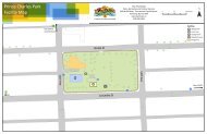
Schedule 1 - Development Permit AreasSouth Thompson Silt Bluffs Red Zone1.6 SOUTH THOMPSON SILT BLUFFS RED ZONE<strong>DEVELOPMENT</strong> <strong>PERMIT</strong> AREAApplication: Category (b) Protection <strong>of</strong> development from hazardous conditions.A Development Permit shall be required for any improvements to a property,including alterations, additions, site design, landscaping, new construction,building permit or subdivision, for all commercial industrial, institutional ormultiple family residential development. Development Permits shall detail:parking, access and vehicular circulation, pedestrian circulation and access,landscaping, building elevations, site layout, and street enhancements.Area:South Thompson Development Permit Area is the area shown shaded grey onthe attached map.Exemptions: Applications for the following shall not be required to apply for a DevelopmentPermits:Justification:• Internal renovations to an existing building or structure, or• New buildings or structures less than 10 m² in size.Detailed geotechnical analysis and study have identified significant and extensive silts in andadjacent to the bluffs bordering the South Thompson River. The hazardous zoneencompasses an area extending approximately from Rose Hill Road to Campbell Creek atthe eastern boundary <strong>of</strong> the <strong>City</strong>. Substantial harm and/or damage could result shoulddevelopment occur in this area. The objective <strong>of</strong> the Development Permit Area designationis to regulate development in the area in such a manner as to protect it from the identifiedhazardous condition.GuidelinesDevelopment Permits issued in this area shall be in accordance with the following guidelines:a) No development shall be permitted in the area designated as the Red Zone on theattached map except that accessory structures and buildings may be permitted onparcels <strong>of</strong> land having an existing residential dwelling where it can be demonstrated bya pr<strong>of</strong>essional engineer that the proposed accessory structure or building is able tomeet the special conditions required for the development in the Foreset/Backset Zoneand that the accessory structure/building is not used as a dwelling unit.b) Development may be permitted in the area designated as the Foreset/Backset Zoneon the attached map subject to the following special conditions:• Every application for development shall be accompanied by a geotechnicalreport prepared by a pr<strong>of</strong>essional engineer qualified to practice in the field <strong>of</strong>geotechnical engineering. The geotechnical report shall:- define the extent <strong>of</strong> all surficial geologic materials and the ground waterregime in the area proposed for development;158T:\DES\PLAN & DEV\KAMPLAN\KAMPLAN Combined Dec 2013.docx December 19, 2013