Technical Paper 4 â Visual Impact Assessment - Transport for NSW
Technical Paper 4 â Visual Impact Assessment - Transport for NSW
Technical Paper 4 â Visual Impact Assessment - Transport for NSW

You also want an ePaper? Increase the reach of your titles
YUMPU automatically turns print PDFs into web optimized ePapers that Google loves.
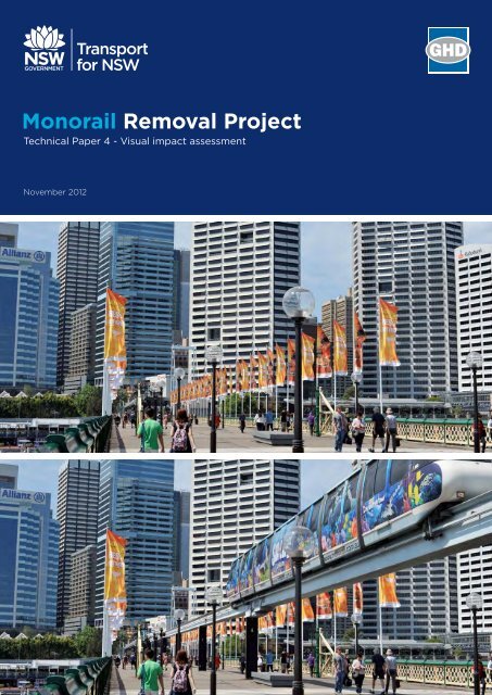
Monorail Removal Project<strong>Visual</strong> <strong>Assessment</strong>Prepared <strong>for</strong>:November 2012Prepared by:GREEN BEAN DESIGNl a n d s c a p ea r c h i t e c t s
Project:Monorail Removal ProjectProject Number: 12-163Report Title:<strong>Visual</strong> <strong>Assessment</strong>Revision:Revision V7 – FinalAuthor:Andrew Homewood, BSc. (Dual Hons), DipLM, DipHortRegistered Landscape Architect, AILA, MEIANZDate: 12 November 2012Green Bean Design – Capability StatementGreen Bean Design (GBD) is an experienced landscape architectural consultancy specialising inlandscape and visual impact assessment. As an independent consultant GBD provide professional adviceto a range of Clients involved in large infrastructure project development. GBD Principal LandscapeArchitect Andrew Homewood is a Registered Landscape Architect and member of the AustralianInstitute of Landscape Architects and Environmental Institute of Australia and New Zealand.Andrew has over 20 years continuous employment in landscape consultancy and has completednumerous landscape and visual impact assessments <strong>for</strong> a variety of large scale State significant projects.GREEN BEAN DESIGNl a n d s c a p ea r c h i t e c t sGREEN BEAN DESIGN l a n d s c a p e a r c h I t e c t s PO Box 3178 Austral <strong>NSW</strong> 21792
ContentsPage1 Introduction 52 Existing guidelines and policies 73 Methodology and study area 84 The Sydney Monorail and existing visual elements 95 Existing views and visibility 166 Urban Character Areas: 25– Haymarket 28– Liverpool Street and Pitt Street 29– Pitt Street and Market Street 31– Pyrmont Bridge 34– Darling Drive (north) 36– Darling Drive (south) 37– Western Distributor 397 Civil works 418 Street trees 429 Photomontages 4510 Mitigation measures 5511 Conclusion 56GREEN BEAN DESIGN l a n d s c a p e a r c h I t e c t s PO Box 3178 Austral <strong>NSW</strong> 21793
– redundant electrical and other servicing infrastructure such as wiring and substations– ticketing, signage and other equipment associated with the stations and monorailnetwork.• closing the remaining four stations, making safe, and removing infrastructure and equipmentassociated with the Monorail;• transporting all materials removed to appropriate facilities <strong>for</strong> re-use, recycling and/or disposal; and• repair and make safe public and/or private assets affected by the removal, such as building facadesand footpaths.The concrete and rein<strong>for</strong>cement below the pile caps would generally remain in place or be removed at alater date. This would be undertaken in discussion with the City of Sydney.The following activities are outside the scope of the proposal and are there<strong>for</strong>e not considered by thisREF. These activities would be subject to separate approval and assessment processes:• any reuse of the monorail infrastructure, including stations, tracks and/or rolling stock• any improvements to the public domain not described in section 5• provision of any future public transport links between Darling Harbour and the CBD.It is noted that the proposal methodology described in the REF is indicative and conceptual at this stage,and does not preclude <strong>Transport</strong> <strong>for</strong> <strong>NSW</strong> from making further refinements during development of thedetailed methodology.The key objectives of this visual assessment include:• describing the existing urban environment surrounding the proposal;• determining and describing potential visual impacts associated with the removal of the Monorail;• determining the extent and nature of positive, negative or neutral impacts on the character of theurban landscape and surrounding visual receptors following the Monorail removal; and• recommending mitigation measures to enhance positive impacts or minimise potential negativeimpacts.GREEN BEAN DESIGN l a n d s c a p e a r c h I t e c t s PO Box 3178 Austral <strong>NSW</strong> 21796
2 Existing guidelines and policiesThe Monorail loop extends <strong>for</strong> approximately 3.6 km though urban areas administered by the City ofSydney Council (Sydney CBD) and the Sydney Harbour Foreshore Authority (SHFA) (Darling Harbourprecinct).A number of the Sydney CBD streets along and surrounding the Monorail loop are encompassed bySpecial Character Areas identified and described in the City of Sydney Councils Draft SydneyDevelopment Control Plan 2010 (DCP). Special Character Areas within the proposal study area include:• York Street;• Clarence Street;• Kent Street; and• Haymarket/Chinatown.The removal of the Monorail is considered to be consistent with a number of the visions and guidingprinciples outlined in the DCP such as:• retain and enhance the unique character of each Special Character Area;• conserve and protect heritage items and their settings;• encourage active street frontages to the public domain; and• conserve maintain and enhance existing views and vistas to buildings and places of historic andaesthetic significance.Portions of streetscapes within some Special Character Areas have been included within this visualassessment and are further described in Section 6 Urban Character Areas.GREEN BEAN DESIGN l a n d s c a p e a r c h I t e c t s PO Box 3178 Austral <strong>NSW</strong> 21797
3 Methodology and study areaThis visual assessment includes the following activities:• desktop study;• site inspection and photography;• assessment of existing urban character areas;• assessment and determination of residual visual impacts; and• preparation of illustrations and photomontages.The visual assessment study area is predominantly confined to the streets and built structures whichdefine the Monorail loop corridor or areas that are proximate to the Monorail and its associatedstructures. Whilst the Monorail is a highly visible element, its overall scale and presence does not tendto dominate the surrounding urban environment and views toward the Monorail are readily blocked bybuildings and structures within the Sydney CBD.GREEN BEAN DESIGN l a n d s c a p e a r c h I t e c t s PO Box 3178 Austral <strong>NSW</strong> 21798
4 The Sydney Monorail and existing visual elementsThe Monorail was constructed between 1987 and 1988 and became operational in July 1988. The NewSouth Wales State Government has announced that the Monorail will cease operations in June 2013.The Monorail connects the city with Pyrmont, Darling Harbour and Chinatown. The Monorail is used bya mix of passengers including local residents, commuters and visitors to Sydney. It provides connectionsto a number of venues within the Sydney CBD such as:• shopping at Galeries Victoria, the Queen Victoria Building and Pitt Street Mall;• Sydney Tower;• Darling Harbour <strong>for</strong> Sydney Aquarium, IMAX Theatre, Harbour Cruises and jet boat rides;• Cockle Bay and King Street Wharf restaurant and bar precincts;• the Maritime Museum;• the Convention and Exhibition Centre;• the Ian Thorpe Aquatic Centre and Ultimo Community Centre;• the Entertainment Centre;• Powerhouse Museum and National Maritime Museum; and• Chinatown’s restaurants and Paddy’s Markets.A map of the Monorail loop is provided in Figure 1.GREEN BEAN DESIGN l a n d s c a p e a r c h I t e c t s PO Box 3178 Austral <strong>NSW</strong> 21799
Base image source: Google Earth Pro 2012 Sinclair Knight Merz Whereis Sensis Pty Ltd (Image date 2009)Darling DriveMaritimeMuseumHarboursideHarboursidePyrmont BridgeCockle BayCockle BayWharfDarling ParkSussex StKent StClarence StYork StMarket StQVBGeorge StPitt St MallCity CentreConventionConventionCentreDarling DriveExhibitionCentreTumbalongParkChineseGardensSussex StKent StLiverpool StGeorge StTownHallGalleries VictoriaPitt St Pitt StPark StBathurst StChinatownWorld SquareEntertainmentCentreHarbour StPaddy's MarketsLegend 0 m 100 mMonorail loop Monorail station Heritage Item - General (indicative location)(Sydney LEP 2011 - Draft)Monorail loop within Cityof Sydney legislative areaMonorail loop within SydneyHarbour Foreshore Authoritylegislative areaStabling, maintenance and workshop facilityFigure 1Location PlanMONORAIL REMOVAL PROJECT
The Monorail’s key visual elements include:• rolling stock (trains);• Monorail stations;• stabling, maintenance workshop and control facilities; and• Monorail beams (track), support columns and pedestals.Rolling stock (trains)There are four Monorail trains in operation which run seven days a week, 364 days of the year. Thetrains are approximately 32 m long and 2 m wide. The Monorail trains are the principal dynamic visualelement of the proposal and complete one circuit of the Monorail loop approximately every fifteenminutes. The frequency of trains passing any one location is approximately 3 to 5 minutes. Each traincarries various advertising artwork (which changes on a periodic basis) and can make the rolling stockvisually conspicuous against various backdrops around the Monorail loop.Plate 1a Rolling StockPlate 1b Rolling StockMonorail stationsThere are eight Monorail stations located around the loop:• Paddy’s Markets;• Chinatown (closed in 2009);• World Square;• Galeries Victoria;GREEN BEAN DESIGN l a n d s c a p e a r c h I t e c t s PO Box 3178 Austral <strong>NSW</strong> 217911
• City Centre;• Darling Park;• Harbourside; and• Convention.The Monorail stations comprise free standing built elements, structures appended to, or constructedwithin buildings. The majority of stations incorporate tubular designs which remain visually distinct inthe contemporary built environment.Photographs of the existing Monorail stations are provided in Figure 2.GREEN BEAN DESIGN l a n d s c a p e a r c h I t e c t s PO Box 3178 Austral <strong>NSW</strong> 217912
Paddy's Markets339 mPaddy's Markets StationCity Centre StationPitt StreetChinatown738 m459 mConventionWorld Square404 mChinatown Station (closed 2009)Darling Park StationPyrmont Bridge (east)490 mHarboursideGalleries Victoria437 m231 mCity CentreDarling ParkWorld Square StationLiverpool StreetHarbourside StationPyrmont Bridge (west)502 mGaleries Victoria StationPitt StreetConvention StationDarling DriveFigure 2Monorail StationsMONORAIL REMOVAL PROJECT
Monorail beams (track), support columns and pedestalsThe continuous rail beam is supported by UC steel columns of varying height typically spaced at 20 to 40m apart. The support columns are located in a variety of streetscape situations including pedestrianfootpaths, roadside parking, traffic medians and public open space areas.Plate 2a Curved beam sectionPlate 2b Straight beam sectionPlate 2c Steel support columnPlate 2d Concrete pedestalStabling, maintenance workshop and control facilitiesThe stabling, maintenance workshop and control facilities are located to the west of Darling Drive(between the Convention and Paddy’s Markets Monorail stations) alongside the light rail corridor.GREEN BEAN DESIGN l a n d s c a p e a r c h I t e c t s PO Box 3178 Austral <strong>NSW</strong> 217914
Plate 3a Stabling and workshop facility from ConventionLR StationPlate 3b Stabling and workshop facility from DarlingDriveGREEN BEAN DESIGN l a n d s c a p e a r c h I t e c t s PO Box 3178 Austral <strong>NSW</strong> 217915
5 Existing views and visibilityThere are numerous opportunities to obtain direct and indirect views toward the Monorail andassociated structures, including short distance views from a variety of public and private view locations.The majority of views occur from:• water bodies (Cockle Bay and the harbour);• public footpaths and walkways (including the Pyrmont Bridge);• road corridors;• retail outlets;• cafes and restaurants;• residential units;• hotels; and• commercial offices.A series of digital photographs have been taken during the course of site inspections to illustrateexisting views toward the Monorail from a number of locations in the vicinity of the proposal.The photographs provide a visual record of the urban character areas through which the Monorail islocated and illustrates the context and relationship of the Monorail loop to a number of surroundingview locations and view categories. The photographs also provide partial views along street corridorsand illustrate the relationship of longitudinal streetscape views where the Monorail runs parallel andperpendicular to the main view axis.The photograph locations are provided in Figure 3 and photographs (P1 to P41) in Figure 4 to Figure 10.The photographs commence at Paddy’s Markets and follow a counter clockwise route following theMonorail train direction of travel.GREEN BEAN DESIGN l a n d s c a p e a r c h I t e c t s PO Box 3178 Austral <strong>NSW</strong> 217916
Figure 3 Photograph locationsGREEN BEAN DESIGN l a n d s c a p e a r c h I t e c t s PO Box 3178 Austral <strong>NSW</strong> 217917
Base image source: Google Earth Pro 2012 Sinclair Knight Merz Whereis Sensis Pty Ltd (Image date 2009)P36HarboursideP35P34P37P33P32Pyrmont BridgeCockle BayDarling ParkP30P31P29P28P27P26P25P24P22P21P20City CentreP23P18P19P38ConventionTownHallP17Galleries VictoriaP39P16ExhibitionCentreP7P15P4P8P9P10P14P40ChinatownP5P6P11World SquareP13P12P41EntertainmentCentreP3P1Paddy's MarketsP2Legend 0 m 100 mMonorail alignmentMonorail stationP36Photo locationFigure 3Photo LocationsMONORAIL REMOVAL PROJECT
Photo source: Green Bean Design 2012Photo Location 1 - Paddy's Markets (toward Darling Street) Photo Location 2 - Entertainment Centre (toward Paddy's Markets)Photo Location 3 - Harbour Street (toward Hay Street) Photo Location 4 - Tumbalong Park walkway toward Liverpool StreetPhoto Location 5 - Tumberlong Park walkway toward Harbour StreetPhoto Location 6 - Liverpool Street and Sussex Street intersectionFigure 4Photo Sheet 1MONORAIL REMOVAL PROJECT
Photo source: Green Bean Design 2012Photo Location 7 - Liverpool Street and Sussex Street intersectionPhoto Location 8 - Liverpool Street toward Kent Street intersectionPhoto Location 9 - Kent Street (toward Liverpool Street)Photo Location 10 - George Street (toward Liverpool Street intersection)Photo Location 11 - Liverpool Street toward George Street intersectionPhoto Location 12 - Liverpool Street and Pitt Street intersectionFigure 5Photo Sheet 2MONORAIL REMOVAL PROJECT
Photo source: Green Bean Design 2012Photo Location 13 - Pitt Street toward Liverpool StreetPhoto Location 14 - Pitt Street north toward Bathurst StreetPhoto Location 15 - Pitt Street south toward Bathurst StreetPhoto Location 16 - Pitt Street north toward Park StreetPhoto Location 17 - Park Street toward Pitt Street intersection Photo Location 18 - Pitt Street south toward Park StreetFigure 6Photo Sheet 3MONORAIL REMOVAL PROJECT
Photo source: Green Bean Design 2012Photo Location 19 - Pitt Street north toward Market Street Photo Location 20 - Pitt Street south toward Park Street intersectionPhoto Location 21 - George Street south toward Market StreetPhoto Location 22 - Market Street and George Street intersectionPhoto Location 23 - George Street north toward Market Street Photo Location 24 - York Street north toward Market StreetFigure 7Photo Sheet 4MONORAIL REMOVAL PROJECT
Photo source: Green Bean Design 2012Photo Location 25 - Market Street and York Street intersection Photo Location 26 - Market Street and Clarence Street intersectionPhoto Location 27 - Sussex Street pedestrian overpassPhoto Location 28 - Sussex Street and Market Street intersectionPhoto Location 29 - Sussex Street pedestrian overpassPhoto Location 30 - Darling Park - pedestrian bridgeFigure 8Photo Sheet 5MONORAIL REMOVAL PROJECT
Photo source: Green Bean Design 2012Photo Location 31 - Pyrmont BridgePhoto Location 32 - Pyrmont BridgePhoto Location 33 - Pyrmont BridgePhoto Location 34 - Pyrmont BridgePhoto Location 35 - Pyrmont BridgeFigure 9Photo Sheet 6MONORAIL REMOVAL PROJECT
Photo source: Green Bean Design 2012Photo Location 36 - Darling Drive pedestrian overpass (Harbourside)Photo Location 37 - Darling DrivePhoto Location 38 - Darling Drive, beneath Western DistributorPhoto Location 39 - Darling DrivePhoto Location 40 - Light rail corridor (Exhibition Station)Photo Location 41 - Darling DriveFigure 10Photo Sheet 7MONORAIL REMOVAL PROJECT
6 Urban Character AreasThe Monorail loop extends through the south west portion of the Sydney CBD and Darling Harbourprecinct as well as a number of surrounding streets and public open spaces.In order to assist the assessment of potential residual impact resulting from the Monorail removal, theurban landscape surrounding the Monorail route has been divided into seven urban character areas.The urban character areas have been identified as areas having largely similar features or land usefunctions and include:• Haymarket;• Liverpool and Pitt Streets;• Pitt and Market Streets;• Pyrmont Bridge;• Darling Drive (north);• Darling Drive (south); and• Western distributor.Each urban character area has been described with regard to existing use, key view locations andcategories as well as the extent and condition of view corridors extending along and around theMonorail loop. The majority of view corridors extending around the Monorail loop are non continuousand disrupted by street alignment and levels (on east west street alignments).The urban character areas and streetscape view corridors are provided in Figures 11 and 12, and aredescribed below. The potential residual visual impact following the removal of the Monorail is alsoconsidered and outlined.GREEN BEAN DESIGN l a n d s c a p e a r c h I t e c t s PO Box 3178 Austral <strong>NSW</strong> 217925
Base image source: Google Earth Pro 2012 Sinclair Knight Merz Whereis Sensis Pty Ltd (Image date 2009)DNDarling DriveHarboursidePyrmont BridgeCockle BayPBDarling ParkWDSussex StMarket StKent StClarence StYork StPMGeorge StPitt St MallCity CentreConventionWDDarling DriveConventionCentreExhibitionCentreTownHallGalleries VictoriaPitt St Pitt StPark StBathurst StDSLiverpool StLPChinatownWorld SquareEntertainmentCentreHarbour StHAPaddy's MarketsLegend0 m 100 mMonorail alignmentPBPyrmont BridgeHAHaymarketMonorail stationDNDarling Drive NorthLPLiverpool/Pitt StreetWDWestern DistributorDSDarling Drive SouthPMPitt/Market StreetFigure 11Urban CharacterAreasMONORAIL REMOVAL PROJECT
Base image source: Google Earth Pro 2012 Sinclair Knight Merz Whereis Sensis Pty Ltd (Image date 2009)Darling DriveMaritimeMuseumHarboursideHarboursidePyrmont BridgeCockle BayCockle BayWharfDarling ParkSussex StMarket StKent StClarence StYork StQVBGeorge StPitt St MallCity CentrePitt StConventionCentreConventionTownHallGalleries VictoriaPark StDarling DriveExhibitionCentreTumbalongParkChineseGardensSussex StKent StLiverpool StGeorge StPitt StBathurst StChinatownWorld SquareEntertainmentCentreHarbour StPaddy's MarketsLegend 0 m 100 mMonorail alignment Monorail station Heritage Item - General(Sydney LEP 2011 - Draft)Lateral view corridorCross view corridorFigure 12View CorridorsMONORAIL REMOVAL PROJECT
6.1 HaymarketPhoto Locations: P1 to P5 (Figure 4 )Monorail street location:The Monorail track extends east from Paddy’s Markets station, bisects theEntertainment Centre plaza then spans Harbour Street and runs parallel toHarbour Street (east) with support columns and pedestals located in thepedestrian footpath. The Monorail turns east along Liverpool Street to theSussex Street intersection.Monorail cross streetintersections:The Monorail spans and is visible from portions of the Goulburn Street andSussex Street intersections.Key view locations:Street level views occur from:• Paddy’s Markets light rail corridor;• Entertainment Centre plaza;• Harbour Street pedestrian footpath;• motorists on Harbour, Little Hay and Goulburn Street; and• Harbour Plaza.Elevated views occur from adjoining:• residential units;• hotel accommodation (Holiday Inn); and• commercial offices.Existing land useadjoining andsurrounding Monorail:• commercial office;• residential dwellings (units); and• open space/recreational areas.GREEN BEAN DESIGN l a n d s c a p e a r c h I t e c t s PO Box 3178 Austral <strong>NSW</strong> 217928
View corridor:A non continuous view corridor extends in a north south alignment alongHarbour Street and is terminated by Market City/Paddy’s Markets to thesouth and the pedestrian bridge connection (from Liverpool Street toTumbalong Park) to the north.The Harbour Street view corridor is largely contained by multi storeybuildings on the east side of Harbour Street, and the Entertainment Centreto the west. The view corridor opens to the north of the EntertainmentCentre where the Chinese Gardens present a contrasting and softer ‘green’edge to the view corridor.The Monorail has low to moderate impact on the view corridor as the loopextends north south along the Harbour Street building frontage (and runsparallel to the view corridor).Potential residual visualimpact followingMonorail removal:Positive – the removal of the Monorail will likely result in an overallbeneficial visual impact on the urban environment surrounding theEntertainment Centre precinct and Harbour Street. The beneficial impactswill include high visibility locations where the Monorail spans roadintersections as well as more intimate and sensitive views from residentialdwellings and offices from buildings directly adjacent to the Monorail loop.6.2 Liverpool Street and Pitt Street (to Park Street intersection)Photo Locations: P4 to P16 (Figures 4 - 6)Monorail street location:The Monorail track extends west to east along the south side of LiverpoolStreet be<strong>for</strong>e turning north along the west side of Pitt Street, extending tothe Park Street intersection.GREEN BEAN DESIGN l a n d s c a p e a r c h I t e c t s PO Box 3178 Austral <strong>NSW</strong> 217929
Monorail cross streetintersections:The Monorail spans and is visible from the Liverpool Street intersectionswith:• Sussex Street;• Kent Street;• George Street; and• Pitt Street.The Monorail also spans the Pitt Street intersections with:• Bathurst Street; and• Park Street.Key view locations:Street level views occur from:• north and south Liverpool Street pedestrian footpaths;• Pitt Street pedestrian footpaths;• main road intersections; and• the Central Court precinct.Elevated views occur from adjoining:• residential units;• hotel accommodation; and• commercial offices.Existing land useadjoining andsurrounding Monorail:• commercial office development (including World Square);• residential dwellings (units); and• Spanish Quarter restaurants.View corridor:A non continuous view corridor extends east to west along Liverpool Street(terminated by the Darling Harbour pedestrian footbridge to the west).GREEN BEAN DESIGN l a n d s c a p e a r c h I t e c t s PO Box 3178 Austral <strong>NSW</strong> 217930
The view corridor extends toward the George Street intersection and thento the Liverpool Street and Pitt Street intersection.The view corridor is largely contained by multi storey buildings to the northand south of Liverpool Street and east and west of Pitt Street.The Monorail has low to moderate impact on the Liverpool and Pitt Streetview corridors as the loop extends along the Liverpool Street southbuilding frontage and Pitt Street west building frontage (running parallel tothe view corridor).Potential residual visualimpact followingMonorail removal:Positive – the removal of the Monorail will likely result in an overallbeneficial visual impact on the Liverpool and Pitt Street urbanenvironments. The beneficial impacts will include an improvement inreduction of ‘visual clutter’ as well as providing a more sympathetic visualpresentation of remaining heritage items. There will be an overallimprovement to views from areas of high visibility including locationswhere the Monorail spans road intersections as well as more intimate andsensitive views from residential dwellings and offices in buildings directlyadjacent to the Monorail loop.6.3 Pitt Street and Market StreetPhoto Locations: P17 to P30 (Figures 6 - 8)Monorail street location:The Monorail track extends north from the Pitt Street and Park Streetintersection toward the central Sydney CBD. The Monorail track turnswest at the Pitt Street and Market Street intersection (south end of PittStreet Mall) and continues west along the north side of Market Streettoward Darling Harbour. The Monorail track spans Market Street at theGREEN BEAN DESIGN l a n d s c a p e a r c h I t e c t s PO Box 3178 Austral <strong>NSW</strong> 217931
• retail outlets.Existing land use adjoiningand surroundingMonorail:View corridor:• commercial offices;• retail outlets; and• residential dwellings (units).A short view corridor extends in a north south alignment along PittStreet between Park Street and Market Street. The view corridor isdelineated and contained by large to moderate scale built <strong>for</strong>m oneither side of the road corridor. The view corridor is softened by treeplanting in the pedestrian footpath on the west side of Pitt Street andvisually terminated by an elevated pedestrian walkway linking retailstores in Pitt Street Mall. The Market Street view corridor provides arange of spatial sequences from east to west and is delineated by alargely disparate set of architectural styles and various attempts toaddress the street frontage. The Monorail crosses the Market Streetview corridor at Clarence Street and tends to have a greater degree ofvisual impact on the view corridor east along Market Street back intothe Sydney CBD.Potential residual visualimpact following Monorailremoval:Positive – the removal of the Monorail will likely result in an overallbeneficial visual impact on the Pitt Street and Market Street urbanenvironments. The beneficial impacts will include an improvement inreduction of ‘visual clutter’ as well as providing a more sympatheticvisual presentation of remaining heritage items. There will be an overallimprovement to views from areas of high visibility including locationswhere the Monorail spans road intersections as well as more intimateGREEN BEAN DESIGN l a n d s c a p e a r c h I t e c t s PO Box 3178 Austral <strong>NSW</strong> 217933
and sensitive views from residential dwellings and offices in buildingsdirectly adjacent to the Monorail loop.6.4 Pyrmont BridgePhoto Locations: P31 to P35 (Figure 9)Monorail street location:The Monorail extends from east to west across the Pyrmont Bridgebetween the Darling Park and Harbourside Monorail stations.Monorail cross streetintersections:There are no cross street intersections; however, the Monorail spansthe interface of Cockle Bay and Darling Harbour water bodies.Key View Locations:Street level views from:• Pyrmont Bridge deck (pedestrian/cyclists);• Harbourside and Cockle Bay Wharf pedestrian areas;• cafes and restaurants; and• retail outlets.Water views from:• private yachts and boats;• commercial charter boats and ferries; and• the Cockle Bay Marina .Elevated views from non adjacent:• residential units;• hotel accommodation; and• commercial offices.GREEN BEAN DESIGN l a n d s c a p e a r c h I t e c t s PO Box 3178 Austral <strong>NSW</strong> 217934
Existing land use adjoiningand surrounding Monorail:• open space/recreational areas• commercial office• residential dwellings (units).View corridor:The Pyrmont Bridge provides opportunities <strong>for</strong> open and middledistance views to areas surrounding Cockle Bay south of the bridge,as well as a visual corridor north toward the harbour. Views from thebridge toward also extend toward the central Sydney CBD along astrong vertically defined corridor punctuated by the Sydney Tower(Centrepoint). A view from the midpoint and west portion of thebridge also provides opportunities to view the city built <strong>for</strong>m (andcomplex skyline views) along the western edge of the Sydney CBD.The bridge presents a strong lineal visual element (as does theMonorail beam elevated above the bridge); however the regularityand repetitiveness of the Monorails support columns tend to disruptviews along and beyond the bridge.Potential residual visualimpact following Monorailremoval:Positive – the removal of the Monorail will likely result in an overallbeneficial visual impact <strong>for</strong> views toward and from the PyrmontBridge. Pedestrian views (and circulation) will be significantlyenhanced following the removal of the Monorail structural columns.The residual impact on views from boats and areas on the fringe ofCockle Bay will tend to be neutral overall given the diverse visualenvironment within the Bay. As a state significant heritage item, theoverall aesthetics of the bridge and the finer details within itsconstruction will be enhanced following the removal of theMonorail.GREEN BEAN DESIGN l a n d s c a p e a r c h I t e c t s PO Box 3178 Austral <strong>NSW</strong> 217935
6.5 Darling Drive (north)Photo Locations: P36 to P38 (Figure 10)Monorail street location:The Monorail track extends north to south between theHarbourside and Convention Monorail stations.Monorail cross streetintersections:There are no cross street intersections; however the Monorailpasses beneath the western distributor interchange.Key View Locations:Street level views from:• Darling Drive pedestrian footpaths and surrounding publicspaces• Harbourside and Convention Centre service access areas• Darling Drive road corridor.Elevated views from adjoining:• hotel accommodation• residential units• commercial offices.Existing land use adjoiningand surrounding Monorail:• Commercial office• Residential dwellings (units)• Harbourside and Convention Centre domains• Hotels• Light rail corridor.View corridor:A non continuous view corridor extends north to south alongDarling Drive (north) and is delineated by built <strong>for</strong>m to the rear ofGREEN BEAN DESIGN l a n d s c a p e a r c h I t e c t s PO Box 3178 Austral <strong>NSW</strong> 217936
the Harbourside and Convention Centre development on theeast, and hotel/serviced apartments to the west.Potential residual visualimpact following Monorailremoval:Neutral – the removal of the Monorail will likely result in anoverall neutral (and potentially beneficial) visual impact along theDarling Drive urban streetscape environment. There is a low levelof pedestrian activity (compared to the CBD and Pyrmont Bridge)and the overwhelming visual function of the street is one ofservice, delivery and car park access to the function centres.Despite this there are some minor pedestrian connectionsbetween Pyrmont and Cockle Bay; however the Monorail doesnot present itself as a dominant visual element when comparedwith its visibility within the narrowly defined Sydney CBDstreetscape corridors.6.6 Darling Drive (south)Photo Locations: P39 to P41 (Figure 10)Monorail street location:The Monorail track extends north to south between theConvention and Paddy’s Markets Monorail stations. TheMonorail stabling, maintenance workshop and controlfacilities are located to the west of Darling Drive opposite theExhibition Centre.Monorail cross streetintersections:There are no cross street intersections; however the Monorailpasses beneath the Pier Street and Darling Drive intersection.Key View Locations:Street level views from:• Darling Drive pedestrian footpaths and surrounding publicGREEN BEAN DESIGN l a n d s c a p e a r c h I t e c t s PO Box 3178 Austral <strong>NSW</strong> 217937
spaces• Harbourside and Convention Centre service access areas• Darling Drive road corridor.Elevated views from adjoining:• Power House Museum• car parks• residential units• commercial offices.Existing land use adjoining andsurrounding Monorail:• commercial office• residential dwellings (units)• Exhibition Centre• light rail corridor.View corridor:A non continuous view corridor extends north to south alongDarling Drive and is delineated by built <strong>for</strong>m to the rear of theExhibition and Entertainment Centre developments.Potential residual visual impactfollowing Monorail removal:Neutral – the removal of the Monorail and associated facilitieswill likely result in an overall neutral (and potentiallybeneficial) visual impact along the Darling Drive (south) urbanstreetscape environment. There is a low level of pedestrianactivity (compared to the CBD and Pyrmont Bridge) and thedominant visual function of the street is one of service,delivery and car park access to the Exhibition andEntertainment Centres. Despite this there are some minorpedestrian connections between Pyrmont and Cockle Bay;however the Monorail and associated facilities do not presentGREEN BEAN DESIGN l a n d s c a p e a r c h I t e c t s PO Box 3178 Austral <strong>NSW</strong> 217938
themselves as dominant visual elements when compared withits visibility within the narrowly defined Sydney CBDstreetscape corridors.6.7 Western distributorPhoto Locations: -Monorail street location:The Monorail track extends east to west and spans thewestern distributor to the east of Pyrmont Bridge and passesnorth to south beneath the western distributor between theConvention and Exhibition Centres.Monorail cross streetintersections:There are no cross street intersections, but visual connectionsextend across and along a number of interconnecting roadsand bridge structures.Key View Locations:Street level views from:• pedestrian footpaths and surrounding public spaces; and• road corridors.Elevated views from adjoining:• car parks• residential units• commercial offices.Existing land use adjoining andsurrounding Monorail:• commercial office• residential dwellings (units)• light rail corridor.View corridor:Short view corridors that extend along and beneath thewestern distributor are visually defined by traffic andGREEN BEAN DESIGN l a n d s c a p e a r c h I t e c t s PO Box 3178 Austral <strong>NSW</strong> 217939
transport elements.Potential residual visual impactfollowing Monorail removal:Neutral – the removal of the Monorail will likely result in anoverall neutral (and potentially beneficial) visual impact alongshort portions of the western distributor. There is a low levelof pedestrian activity (compared to the CBD and PyrmontBridge) and the local visual environment is dominated bytraffic movement and large scale built structures.GREEN BEAN DESIGN l a n d s c a p e a r c h I t e c t s PO Box 3178 Austral <strong>NSW</strong> 217940
7 Civil worksThe civil works to remove the Monorail will be undertaken in two separate tasks. The first task willremove the Monorail beam and support column, and a second task to break out the concrete pedestalto the top of the pile cap.Whilst removal works will be highly visible from streetscape and surrounding locations it is notuncommon to see civil work activities within the Sydney CBD. Subject to timing there may be someshort term potential <strong>for</strong> cumulative visual impacts to occur where other building works within theSydney CBD are being carried out simultaneously. The level of cumulative visual impact will also bedependent on the type and location of additional civil works.The temporary nature of civil works to remove the Monorail will result in relatively short term andtransient visual impacts from the majority of view locations within the Sydney CBD and Darling Harbourprecinct.GREEN BEAN DESIGN l a n d s c a p e a r c h I t e c t s PO Box 3178 Austral <strong>NSW</strong> 217941
8 Street treesStreet trees add significant visual value to the urban environment and may be installed to soften theharshness of roads and buildings or strengthen and sharpen view corridors. Trees may also planted (asis the case along Darling Drive) to screen views toward constructed elements, including the Monorail.The “City of Sydney Design Code” recognises the importance of street trees noting their function to“provide environmental quality, enhance visual continuity and unity and to rein<strong>for</strong>ce local identify andcharacter”.There are a relatively small number of street trees located within pedestrian pavements beneath oradjoining the Monorail loop through the Sydney CBD. Where trees are located in proximity to theMonorail, <strong>for</strong>mative pruning has been carried out to establish and maintain necessary clearances.Plate 4 Existing street trees in Market StreetPlate 5 Existing tree detail in Market StreetPlate 6 Existing street trees in Harbour StreetPlate 7 Existing trees Darling Drive (south)GREEN BEAN DESIGN l a n d s c a p e a r c h I t e c t s PO Box 3178 Austral <strong>NSW</strong> 217942
The following table identifies the indicative location of existing trees adjoining or within proximity to theMonorail loop.Table 1 - Existing street trees along the Monorail loopLocation Species Existing impacts Potential impactsEntertainment CentreplazaSchinus molle(Peppercorns)MinorPotentially impacted byMonorail removal worksHarbour StreetRobiniapseudocacia(Robinia)Minor <strong>for</strong>mationpruningSmall number of treespotentially impacted byMonorail removal worksLiverpool Street (southpavement) belowSussex Streetintersection atCommerce BuildingEucalyptus sp.Eucalypt treeSome existing pruningto accommodateMonorail beamTree potentially impacted byMonorail removal worksPitt Street (westpavement)No street tree plantingbeneath or adjoiningMonorail loopMarket Street (northpavement) betweenGeorge and York StreetintersectionsUnknown No existing impacts 3 trees potentially impactedby Monorail removal worksMarket Street (northpavement) betweenYork and ClarenceStreet intersectionsPlatanus x hybridPlane trees5 trees with existingpruning toaccommodate MonorailbeamPotentially impacted byMonorail removal worksMarket Street andSussex Streetintersection (adjoiningpedestrian walkway)Platanus x hybridPlane treeMinor pruningPotentially impacted byMonorail removal worksDarling Drive (north)Various treeplantingalongside andSome <strong>for</strong>mationpruning to trees belowMonorail beamSome tree plantingpotentially impacted byMonorail removal worksGREEN BEAN DESIGN l a n d s c a p e a r c h I t e c t s PO Box 3178 Austral <strong>NSW</strong> 217943
Location Species Existing impacts Potential impactsbeneath MonorailloopDarling Drive (south)Various treeplantingalongside andbeneath MonorailloopSome <strong>for</strong>mationpruning to trees belowMonorail beamSome tree planting will beimpacted by Monorailremoval worksThe City of Sydney Council has conducted a preliminary inspection to identify significant treessurrounding the Monorail loop to be avoided and protected where possible during the removal works.Council has identified the Market Street trees as providing much needed amenity, and that these trees,along with others surrounding the Monorail loop, be retained and protected during the removal works.Where necessary tree protection should be in accordance with the Australian Standard <strong>for</strong> theprotection of trees on development sites (AS4970).Tf<strong>NSW</strong> do not propose to remove any trees <strong>for</strong> the purposes of the removal works. In the event of atree needing to be removed <strong>for</strong> access or safety issues, the contractor will need approval to do sothrough the Tf<strong>NSW</strong> “Application <strong>for</strong> Removal or Trimming of Vegetation” as well as any necessaryconsents from the City of Sydney or SHFA. Any trees removed would be subject to the <strong>Transport</strong> ProjectDivision’s “Vegetation Offset Guide”.Whilst the proposal may require some remedial actions to existing trees, the removal of the Monorailwill present future opportunities <strong>for</strong> street tree planting works to be developed and implemented.GREEN BEAN DESIGN l a n d s c a p e a r c h I t e c t s PO Box 3178 Austral <strong>NSW</strong> 217944
9 PhotomontagesEight photomontages have been prepared to illustrate typical streetscape and local views with andwithout the Monorail. The selected photomontage locations include:• Photomontage P1 Sussex Street view south toward Liverpool Street intersection;• Photomontage P2 Park Street view north toward Pitt Street intersection.• Photomontage P3 Pitt Street view north toward Market Street intersection;• Photomontage P4 York Street view south toward Market Street;• Photomontage P5 Pyrmont Bridge view east toward Sydney CBD;• Photomontage P6 Pyrmont Bridge view west toward Harbourside;• Photomontage P7 Cockle Bay view north east toward Pyrmont Bridge; and• Photomontage P8 HMAS Vampire view north east toward Pyrmont Bridge.The photomontages locations are provided in Figure 12 and the photomontages in Figure 13 to Figure18.GREEN BEAN DESIGN l a n d s c a p e a r c h I t e c t s PO Box 3178 Austral <strong>NSW</strong> 217945
Base image source: Google Earth Pro 2012 Sinclair Knight Merz Whereis Sensis Pty Ltd (Image date 2009)HarboursideP7P8P5P6Pyrmont BridgeCockle BayDarling ParkP4City CentreConventionP2P3TownHallGalleries VictoriaExhibitionCentreP1ChinatownWorld SquareEntertainmentCentrePaddy's MarketsLegend 0 m 100 mMonorail alignmentMonorail stationP2Photomontage locationFigure 13PhotomontageLocationsMONORAIL REMOVAL PROJECT
Photomontage Location P1 - Sussex Street and Liverpool Street intersection, existing viewPhoto source: Green Bean Design 2012Photo source: Green Bean Design 2012Photomontage Location P1 - Sussex Street and Liverpool Street intersection, proposed viewFigure 14PhotomontageLocation P1MONORAIL REMOVAL PROJECT
Photomontage Location P2 - Park Street toward Pitt Street intersection, existing viewPhoto source: Green Bean Design 2012Photo source: Green Bean Design 2012Photomontage Location P2 - Park Street toward Pitt Street intersection, proposed viewFigure 15PhotomontageLocation P2MONORAIL REMOVAL PROJECT
Photomontage Location P3 - Pitt Street toward Market Street, existing viewPhoto source: Green Bean Design 2012Photo source: Green Bean Design 2012Photomontage Location P3 - Pitt Street toward Market Street, proposed viewFigure 16PhotomontageLocation P3MONORAIL REMOVAL PROJECT
Photomontage Location P4 - York Street toward Market Street, existing viewPhoto source: Green Bean Design 2012Photo source: Green Bean Design 2012Photomontage Location P4 - York Street toward Market Street, proposed viewFigure 17PhotomontageLocation P4MONORAIL REMOVAL PROJECT
Photomontage Location P5 - Pyrmont Bridge toward Sydney CBD, existing viewPhoto source: Green Bean Design 2012Photo source: Green Bean Design 2012Photomontage Location P5 - Pyrmont Bridge toward Sydney CBD, proposed viewFigure 18PhotomontageLocation P5MONORAIL REMOVAL PROJECT
Photomontage Location P6 - Pyrmont Bridge view west toward Harbourside, existing viewPhoto source: Green Bean Design 2012Photo source: Green Bean Design 2012Photomontage Location P6 - Pyrmont Bridge view west toward Harbourside, proposed viewFigure 19PhotomontageLocation P6MONORAIL REMOVAL PROJECT
Photomontage Location P7 - Pyrmont Bridge from Cockle Bay, existing viewPhoto source: Green Bean Design 2012Photo source: Green Bean Design 2012Photomontage Location P7 - Pyrmont Bridge from Cockle Bay, proposed viewFigure 20PhotomontageLocation P7MONORAIL REMOVAL PROJECT
Photomontage Location P8 - Pyrmont Bridge from HMAS Vampire, existing viewPhoto source: Green Bean Design 2012Photo source: Green Bean Design 2012Photomontage Location P8 - Pyrmont Bridge from HMAS Vampire, proposed viewFigure 21PhotomontageLocation P8MONORAIL REMOVAL PROJECT
10 Mitigation measuresWhilst there are no specific mitigation measures to address largely positive residual visual impactsfollowing the Monorail removal works, there are some mitigation measures which may be implementedto minimise or avoid visual impacts during the course of the removal works. These include:• sequencing removal work activities to avoid residential locations at night time where possible;• mounting directional lighting to avoid light spill into adjoining buildings at night time;• screening removal work activities by fencing or placement of hoardings where practicable;• minimising potential <strong>for</strong> dust emission;• appropriate placement of any necessary signage associated with the removal works;• maintaining all removal work areas in a neat and tidy condition at all times; and• retention and protection of existing street trees within the Sydney CBD and SHFA Darling Harbourprecinct.GREEN BEAN DESIGN l a n d s c a p e a r c h I t e c t s PO Box 3178 Austral <strong>NSW</strong> 217955
11 ConclusionThe Monorail is a highly visible and recognisable element of transport infrastructure within the SydneyCBD and the SHFA Darling Harbour precinct. The Monorail is elevated along, and spans, a number ofsignificant city streets as well as major road intersections with high pedestrian and vehicular trafficvolumes.The Monorail (rolling stock and track) is a distinct visual element which extends both parallel andperpendicular to a number of significant streetscape view corridors. Although the Monorail does notentirely block or terminate the majority of streetscape view corridors, it can disrupt and restrict viewsfrom street level depending upon the proximity and orientation of the viewer to the Monorail.The Monorail also runs parallel to, and is elevated against, multiple building types within the SydneyCBD, including heritage items which add visual interest and architectural diversity to the builtenvironment. The Monorail also provides passengers with direct (and potentially intrusive) viewopportunities into buildings (offices, residential units and hotels) adjoining the loop.The key residual positive visual impacts arising from the removal of the Monorail will include:• enhancement of existing streetscape view corridors through removal of Monorail pedestals,columns and beams;• providing more legible street level visual connections, including short distance views towardbuilding facades;• improving the significance of views toward built heritage items and addressing visual conflictbetween significant heritage structures (<strong>for</strong> example the Pyrmont Bridge);• reducing visual clutter through narrow streetscape vistas; and• removing direct visual impacts <strong>for</strong> residents, office workers and people occupying buildingsadjoining the Monorail loop.GREEN BEAN DESIGN l a n d s c a p e a r c h I t e c t s PO Box 3178 Austral <strong>NSW</strong> 217956
Civil works involved in the removal of the Monorail, including night time lighting, may result in shortterm and largely transient visual impacts <strong>for</strong> residents, visitors and employees within the Sydney CBD aswell as pedestrians in open space surrounding the Darling Harbour and Entertainment Centre precincts.The removal of the Monorail will also eliminate a number of existing physical constraints to futureurban design and landscape works (such as street design and tree planting) that may be implementedby the City of Sydney Council to improve the visual quality of the existing urban environment.GREEN BEAN DESIGN l a n d s c a p e a r c h I t e c t s PO Box 3178 Austral <strong>NSW</strong> 217957
LimitationsGBD has prepared this report in accordance with the usual care and thoroughness of the consultingprofession <strong>for</strong> the use of GHD Pty Ltd and only those third parties who have been authorised in writingby GBD to rely on the report. It is based on generally accepted practices and standards at the time it wasprepared. No other warranty, expressed or implied, is made as to the professional advice included inthis report. It is prepared in accordance with the scope of work and <strong>for</strong> the purpose outlined in the GBDProposal dated 22 August 2012.The methodology adopted and sources of in<strong>for</strong>mation used are outlined in this report. GBD has madeno independent verification of this in<strong>for</strong>mation beyond the agreed scope of works and GBD assumes noresponsibility <strong>for</strong> any inaccuracies or omissions. No indications were found during our investigationsthat in<strong>for</strong>mation contained in this report as provided to GBD was false.This report was prepared between September and October 2012 and is based on the conditionsencountered and in<strong>for</strong>mation reviewed at the time of preparation. GBD disclaims responsibility <strong>for</strong> anychanges that may have occurred after this time.This report should be read in full. No responsibility is accepted <strong>for</strong> use of any part of this report in anyother context or <strong>for</strong> any other purpose or by third parties. This report does not purport to give legaladvice. Legal advice can only be given by qualified legal practitioners.© Green Bean Design 2012. This report is subject to copyright. Other than <strong>for</strong> the purposes and subjectto conditions prescribed under the Copyright Act, or unless authorised by GBD in writing, no part of itmay, in any <strong>for</strong>m nor by any means (electronic, mechanical, micro copying, photocopying, recording orotherwise), be reproduced, stored in a retrieval system or transmitted without prior written permission.Inquiries should be addressed to GBD in writing.GREEN BEAN DESIGN l a n d s c a p e a r c h I t e c t s PO Box 3178 Austral <strong>NSW</strong> 217958