Annual Report 2005 (62.7MB) - Western Riverside County Regional ...
Annual Report 2005 (62.7MB) - Western Riverside County Regional ...
Annual Report 2005 (62.7MB) - Western Riverside County Regional ...
- No tags were found...

Create successful ePaper yourself
Turn your PDF publications into a flip-book with our unique Google optimized e-Paper software.
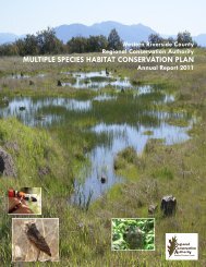
2.0 HABITAT GAINS AND LOSSES2.0 HABITAT GAINS AND LOSSES (RESERVE ASSEMBLYACTIVITIES)The MSHCP, and coverage for the 146 species identified in the Plan, are based on theestablishment of a 500,000-acre Conservation Area, of which approximately 347,000 acres arecurrently in public or quasi-public ownership. The additional 153,000 acres of additionalReserve lands will be assembled from private land acquisitions, donations, and through the landdevelopment entitlement process. As of December 31, <strong>2005</strong>, approximately 23,382 acres ofadditional Reserve lands had been acquired by local Permittees and state and federal agencies.As the Reserve is assembled, habitat is also lost to development, construction of infrastructure,and other activities. Habitat gains are the additional Reserve lands acquired or otherwisepermanently protected for conservation pursuant to the Plan. Habitat gained (or conserved) isreported from the period February 2000 through December 31, <strong>2005</strong>, because the <strong>County</strong>,CDFG, California Department of Parks and Recreation, and the USFWS, in anticipation ofMSHCP permit issuance, began an early, aggressive campaign to assemble the Reserve prior toPlan permit issuance. Since the Plan’s state and federal permits were not issued until June 22,2004, habitat losses are only tracked starting from June 22, 2004.The MSHCP is a criteria-based plan that has three main performance measures. Theseperformance measures were intended to ensure that conservation was occurring simultaneouswith development. Each of these performance measures is equally important in the Plan. Thissection reviews the progress, as of December 31, <strong>2005</strong>, toward meeting the followingperformance measures:• Rough step within key vegetation communities• Area Plan and subunit• Jurisdiction (Cities and <strong>Riverside</strong> <strong>County</strong>).2.1 Rough Step Acreage SummariesThe rough step measure is one of the MSHCP performance measures used to monitor success ofthe Plan. Rough step is a tool to help direct conservation within vegetation communities ofsimilar weather patterns, geographies, soils, and geologies as development occurs. The roughstep measure is intended to ensure that conservation of specific narrowly distributed habitatsoccurs in rough step with development. The rough step analysis functions as an early warningsystem to signal where development is outpacing conservation and where conservation effortstherefore need to be focused (see Figure 2, <strong>Western</strong> <strong>Riverside</strong> <strong>County</strong> MSHCP Rough StepAnalysis Units).<strong>Western</strong> <strong>Riverside</strong> <strong>County</strong> MSHCP October 2006<strong>Annual</strong> <strong>Report</strong> (January 1, <strong>2005</strong> through December 31, <strong>2005</strong>) 2-1