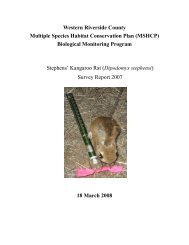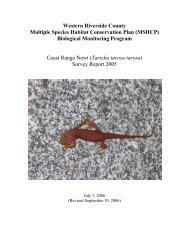
Annual Report 2005 (62.7MB) - Western Riverside County Regional ...
Annual Report 2005 (62.7MB) - Western Riverside County Regional ...
Annual Report 2005 (62.7MB) - Western Riverside County Regional ...
- No tags were found...

Create successful ePaper yourself
Turn your PDF publications into a flip-book with our unique Google optimized e-Paper software.
3.0 ACTIVITIES WITHIN PLAN AREARCA plans to review the existing ERP parcels to establish top priority large parcels that are inkey Conservation Areas (e.g., in Rough Step Units 4 and 5). The RCA also is working with<strong>County</strong> and City planning staff to ensure that property owners are informed of all availableincentives associated with conservation easements as early in the permit application process aspossible.3.3 Agricultural Lands3.3.1 BackgroundExisting agricultural uses and conversion of natural lands to agricultural use are CoveredActivities within the Criteria Area. Establishment of new agricultural uses within the CriteriaArea is covered up to 10,000 acres over the life of the Plan. The MSHCP defines agriculturaloperations as production of all plants (horticulture), fish farms, animals and related productionactivities, including the planting, cultivation, and tillage of the soil, dairying, and apiculture; andthe production, plowing, seeding, cultivation, growing, harvesting, pasturing, and fallowing forthe purpose of crop rotation of any agricultural commodity, including viticulture, apiculture,horticulture, and the breeding, feeding, and raising of livestock, horses, fur-bearing animals, fish,or poultry and all uses conducted as a normal part of such operations, provided such actions arein compliance with all applicable laws and regulations. In order to verify the location of theexisting agricultural operations, the <strong>County</strong> was mandated to establish an existing agriculturaloperations database. Once this database was established, the additional 10,000 acres of newagricultural activity could be measured.Between August 2001 and August 2002, <strong>County</strong> GIS staff worked with the AgriculturalCommissioner’s Office to develop a GIS database of existing agricultural uses. Both theAgricultural Commissioner’s Office staff and <strong>County</strong> GIS staff sorted through historicagriculture data to determine location, extent, and type of use as much as possible. The multipletypes of agriculture occurring on the same parcel presented an interpretation challenge. Theinformation was deemed sufficient for analysis in the MSHCP; however, it was recognized that aprogram would need to be developed to complete, verify, and establish procedures and methodsto add and remove agricultural activities from the newly established GIS database. The 2004annual report described a work program for the RCA, <strong>County</strong> staff, and AgriculturalCommissioner’s Office staff for the <strong>2005</strong> calendar year. This work program outlined a methodto review and validate the existing GIS data to establish an existing agriculture baseline.<strong>Western</strong> <strong>Riverside</strong> <strong>County</strong> MSHCP October 2006<strong>Annual</strong> <strong>Report</strong> (January 1, <strong>2005</strong> through December 31, <strong>2005</strong>) 3-4