Final Report - City of Charlottetown
Final Report - City of Charlottetown
Final Report - City of Charlottetown
- No tags were found...

You also want an ePaper? Increase the reach of your titles
YUMPU automatically turns print PDFs into web optimized ePapers that Google loves.
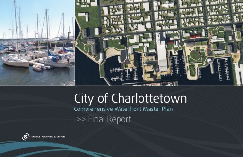
<strong>Final</strong> <strong>Report</strong> • December 2012CITY OF CHARLOTTETOWN: COMPREHENSIVE WATERFRONT MASTER PLAN<strong>City</strong> <strong>of</strong> <strong>Charlottetown</strong>Comprehensive Waterfront Master Plan>> <strong>Final</strong> <strong>Report</strong>
CITY OF CHARLOTTETOWN: COMPREHENSIVE WATERFRONT MASTER PLAN<strong>Final</strong> <strong>Report</strong> • December 2012
<strong>Final</strong> <strong>Report</strong> • December 2012CITY OF CHARLOTTETOWN: COMPREHENSIVE WATERFRONT MASTER PLANTABLE OF CONTENTS1.0 Origins........................................................................11.1 Waterfront Renaissance................................................................ 21.2 <strong>Report</strong> Overview........................................................................... 21.3 Study Purpose and Commission .................................................. 41.4 Study Intent................................................................................... 51.5 Plan Policy Alterations ................................................................. 61.6 Community Engagement Outcomes............................................ 61.7 Ten Principles <strong>of</strong> Waterfront Development................................ 92.0 Building Blocks.........................................................112.1 The Study Area.............................................................................. 112.2 Demographic Pr<strong>of</strong>ile .................................................................... 132.3 Market Analysis............................................................................ 142.4 Planning Context........................................................................... 202.5 Site Analysis ................................................................................. 222.6 Opportunities & Constraints........................................................ 243.0 Planning Policy.........................................................293.1 Official Plan.................................................................................... 293.2 Form Based Zoning Overview..................................................... 323.3 Land Use Bylaw Amendments..................................................... 324.0 The plan....................................................................354.1 Plan Principles............................................................................... 364.2 Waterfront Vision.......................................................................... 404.3 Plan Components.......................................................................... 414.4 Open Space & Infrastructure....................................................... 424.4 Built Form...................................................................................... 544.5 Development Pro-Forma............................................................. 564.6 Potential Development Parcels (east to west).......................... 584.4 Port Zone....................................................................................... 635.0 Realization................................................................655.1 Administration <strong>of</strong> the Planning Process...................................... 675.2 Economic Impact Assessment..................................................... 675.3 Conclusions & Recommendations............................................... 69Appendices.....................................................................73Zoning & Development Bylaw Amendments................................... 73Online Survey Results......................................................................... 85
CITY OF CHARLOTTETOWN: COMPREHENSIVE WATERFRONT MASTER PLAN<strong>Final</strong> <strong>Report</strong> • December 2012
<strong>Final</strong> <strong>Report</strong> • December 2012CITY OF CHARLOTTETOWN: COMPREHENSIVE WATERFRONT MASTER PLAN1.0 ORIGINS<strong>Charlottetown</strong>’s waterfront has been undergoing a constant and steady evolution sincethe Town was laid out by Charles Morris in 1768. The strategic location at the confluence<strong>of</strong> the Hillsborough, North and West Rivers owes itself to the deep Hillsboroughwaters <strong>of</strong>fshore and the ability to control all three branches <strong>of</strong> the river. These rivers were theearly highways <strong>of</strong> their time and were the backbone <strong>of</strong> a regional transportation network thatmoved people and goods to and from the new colonial capital <strong>of</strong> St. John’s Island. By the time<strong>Charlottetown</strong> was incorporated in 1855, almost a dozen long finger piers extended over 500 feetinto the river, bringing industry, commerce and activity to the fledgling city. By the 1870s, thepiers were connected with a new PEI Railway (east <strong>of</strong> Great George Street) which significantlyincreased the waterfront’s role as a regional distribution hub for the Island. In the late 1960s,federal urban renewal programs encouraged cities to begin actively planning their downtowns forchange. The Halifax waterfront plan <strong>of</strong> 1968 gave rise to the Waterfront Development CorporationLtd. (WDCL). Five years later in 1973, the Stevenson Kellog <strong>Report</strong> gave rise to the <strong>Charlottetown</strong>Area Development Corporation (CADC), setting the context for the redevelopment <strong>of</strong> the westernwaterfront. Spin <strong>of</strong>f projects from the SK plan included Harbourside (1978), Waterfront Delta Hotel(1982), and Peakes Quay (1990). With the abandonment <strong>of</strong> rail on PEI in 1989, the stage was setfor the redevelopment <strong>of</strong> the eastern end <strong>of</strong> the waterfront, with projects such as the routes fornature and health (1989), Confederation Landing Park (1995), the restoration <strong>of</strong> the CN Car shop,the Brass shop and the CN Station into Founders Hall (1996) and the Workers Compensation Boardbuilding (1996), the Naval Reserves and the new <strong>Charlottetown</strong> Event Grounds (2012).So, while the pace <strong>of</strong> change in the <strong>City</strong> has been modest but steady over the last century,the pace <strong>of</strong> waterfront change over the last 40 years (since Stevenson Kellog report <strong>of</strong> 1973)has been accelerating at a feverish pace. Previous heavy industrial lands have given rise to arange <strong>of</strong> developments from the eight storey Delta to the single storey Peakes Quay, waterfrontparks, boardwalks and streetscape enhancements. This trend is not limited to <strong>Charlottetown</strong> andis occurring all over Atlantic Canada and the world.1
<strong>Final</strong> <strong>Report</strong> • December 20121.1 Waterfront RenaissanceUrban waterfronts around the world are seeing a renaissance as heavy marine industriesleave their downtown locations and as people realize the power <strong>of</strong> the waters edge in placemaking.These redeveloped sites are becoming highly desirable places to live, work, and play, andare quickly becoming major tourist and event destinations. In most Canadian cities, waterfrontland values have increased faster than other parts <strong>of</strong> the downtown. “Waterfront propertiesin the UK command on average 56% higher prices than their inland counterparts with someexceptional pieces <strong>of</strong> real estate achieving premiums <strong>of</strong> 300%, according to a new index”1. Some<strong>of</strong> the most expensive urban developments around the world are reserved for waterfront land.Entirely new cities are springing up to take advantage <strong>of</strong> a waterfront address and the returnsit can provide. The caveat is that in all these cases, the waterfront must be planned as a wholeto create a series <strong>of</strong> unique public experiences; shopping, dining, walking, recreation, boating,high quality architecture, special events, interpretation, art and performance, etc. As long as therules <strong>of</strong> successful waterfront development are followed, land values will increase and therewill be positive feedback for high quality development which will , in turn, increase destinationpotential. The public wins, the developer wins, and the <strong>City</strong> wins. Without proper or coordinatedplanning, however, one poorly done development can undermine years <strong>of</strong> positive waterfrontenhancements.1.2 <strong>Report</strong> OverviewThis report outlines some <strong>of</strong> the rules <strong>of</strong> successful urban waterfront development and a 30year plan for the continued revitalization <strong>of</strong> <strong>Charlottetown</strong>’s waterfront. A thorough communityinvolvement process throughout this three month study defined how <strong>Charlottetown</strong> citizens valuetheir own waterfront and how they would like to see it evolve. The plan suggests a balancedapproach to preserving and enhancing critical waterfront open space, while ensuring the higheststandard <strong>of</strong> infill development will create activity and destination potential. The consultants heardclearly from the community that no development should be able to locate on the waterfront unlessit meaningfully gives back to the waterfront in a measurable way. The consultants also heard thatthe waterfront should be 100% public and continuous, linking Victoria Park to the HillsboroughBridge. <strong>Charlottetown</strong> residents want the waterfront to evolve in a manner that is mindful <strong>of</strong>its heritage, economically viable, and conducive to multiple uses with broad public benefit. Itmust promote and reflect high quality urban and architectural design, provide continuous publicwaterfront access, and create nodes <strong>of</strong> activity and energy for residents and visitors alike.In <strong>Charlottetown</strong>, the past 30 years <strong>of</strong> development since the Stevenson Kellog <strong>Report</strong> havebeen mostly positive for the <strong>City</strong> and its residents. Residents and Council alike understand theeconomic potential <strong>of</strong> the waterfront and the need for a coordinated plan to manage its longtermdevelopment. Tourists have found the waterfront to be a highly desirable destination alongwith the historic downtown. The renaissance <strong>of</strong> <strong>Charlottetown</strong>’s waterfront is only just beginning.When one thinks <strong>of</strong> <strong>Charlottetown</strong> in the future, they will fondly remember their experiences onthe waterfront.1 http://www.propertywire.com/news/europe/waterside-property-price-premium-201208026810.html2
<strong>Final</strong> <strong>Report</strong> • December 2012CITY OF CHARLOTTETOWN: COMPREHENSIVE WATERFRONT MASTER PLANThe <strong>Charlottetown</strong> Waterfront master plan provides the opportunity to structure futuregrowth in a manner that is both visionary and pragmatic. The plan depicts a 30 year, fully builtout waterfront that balances density, use, and height while emphasizing the need for publicaccess to the waterfront. While it is expected that the final location, extent and type <strong>of</strong> thedevelopments may change somewhat compared to the plan, the principles and intentions <strong>of</strong> theplan will not change and no development will be permitted to conflict the intent <strong>of</strong> this study.The plan recognizes that the economics <strong>of</strong> waterfront development are different than other areas<strong>of</strong> the city. Waterfront land is always more expensive to develop as a result <strong>of</strong> environmental,microclimatic, and geotechnical issues. The extra costs for development and additional open spaceand public benefit will require some additional density and height. In addition, the higher designstandards (e.g. underground parking, ground floor activity, use <strong>of</strong> high quality building materials,open space standards, etc.) create additional challenges for developers which may result in a lack<strong>of</strong> project feasibility until land values increase or the market matures. In this case, the land shouldbe ‘banked’ until conditions improve. Building the wrong type <strong>of</strong> development because its theonly feasible option today is the wrong approach for any urban waterfront. The <strong>City</strong> will have tostand firm in upholding the principles <strong>of</strong> this plan if it is to fully realize the potential <strong>of</strong> the 2040waterfront <strong>of</strong> the future. In the end, the economic potential <strong>of</strong> the waterfront will be unlocked andit will have been worth the effort.The plan will evolve one development at a time and one success at a time. Eventually, thewaterfront will be knit together with activities, things to experience, places to visit, tastes to savour,and places to live, shop, and work. Commerce, livability and recreation will blend seamlesslyinto one and the waterfront will be the must-see experience for any Islander or tourist on aregular basis throughout every season. This plan sets the foundation for an exciting future for<strong>Charlottetown</strong>; it is up to residents, the <strong>City</strong> and the Province to see this vision realized and to holdthose that develop and design the future waterfront accountable to the highest standards.3
CITY OF CHARLOTTETOWN: COMPREHENSIVE WATERFRONT MASTER PLAN<strong>Final</strong> <strong>Report</strong> • December 20121.3 Study Purpose and CommissionThis report was prepared by Ekistics Planning and Design, in association with ColliersInternational, & Phil Wood and Associates, and is the culmination <strong>of</strong> an intense three month studyprocess that integrated extensive public consultation and best practices research. The study wascommissioned by the <strong>City</strong> <strong>of</strong> <strong>Charlottetown</strong>, in acknowledgement <strong>of</strong> the need to complete awaterfront planning process for a zone <strong>of</strong> influence stretching from the Eastern Gateway area toVictoria Park. The original RFP acknowledged that a ‘sense <strong>of</strong> place’ is one <strong>of</strong> the most importantaspects relating to the success <strong>of</strong> a city’s social and economic growth. Understanding that the<strong>Charlottetown</strong> waterfront is a key component in the city’s economic strategy, and recognizing thatthe waterfront’s ‘sense <strong>of</strong> place’ was in jeopardy to a number <strong>of</strong> factors, it was determined thata strategic Master Planning initiative was needed- the goal <strong>of</strong> which was to ensure that futurewaterfront development would proceed in a manner sympathetic with the unique qualities andcharm <strong>of</strong> the downtown.This plan is tasked with laying out a comprehensive vision for residents, businesses, and the<strong>City</strong>. It will also provide a balance <strong>of</strong> expectations between residents and developers with regardto new development. The RFP stated that the Master Plan would be integrated into the <strong>City</strong>’sOfficial Plan which will be reviewed in the near future; thus, any codes, plans, or suggested by-lawamendments must be in accord with the existing legal framework <strong>of</strong> the <strong>City</strong>.The original RFP also asked that the Master Plan focus on several specific issues including:««an integrated pedestrian corridor from Victoria Park on the Western edge <strong>of</strong> thewaterfront to the <strong>Charlottetown</strong> Concert and Entertainment Venue on the East;««the importance <strong>of</strong> water for recreational, commercial, and tourism purposes;««future development opportunities that may arise as a result <strong>of</strong> propertyredevelopment and / or reclamation;««the relationship and integration <strong>of</strong> commercial uses and adjacent residentialproperties and ways to mitigate potential impacts;««transportation services including vehicle and pedestrian access and circulationparking, public transit services, and seasonal tour operators;««the definition <strong>of</strong> appropriate view planes both to and from the water and themeasures required to protect them.As will be outlined in subsequent chapters, these focus points neatly match up with the public’sopinions on what ought to be the guiding principles <strong>of</strong> the Master Plan. Their principles weredetermined through a series <strong>of</strong> public workshops, interviews, and surveys conducted by Ekistics. Apublic process component was critical to this master planning initiative, as the <strong>City</strong> acknowledgesthat the power <strong>of</strong> the plan is derived from its public support and involvement.4
<strong>Final</strong> <strong>Report</strong> • December 2012CITY OF CHARLOTTETOWN: COMPREHENSIVE WATERFRONT MASTER PLAN<strong>Final</strong>ly, the <strong>City</strong> asked that Ekistics would, while carrying out a comprehensive review <strong>of</strong> thewaterfront:««review existing background studies, policies, and bylaws««identify opportunities and constraints««Ensure ample opportunities for citizens and public interest groups to be involvedat throughout the process««Interview stakeholders including, but not limited to, Members <strong>of</strong> Council,Planning Staff, members <strong>of</strong> the Harbour Authority, the <strong>Charlottetown</strong> AreaDevelopment Corporation (CADC), local land owners, and developers;««Develop sound rationale for public and private investment in the waterfront««develop sound rationale for proposed regulatory changes««define a vision statement for the waterfront area;««develop criteria for an appropriate mix <strong>of</strong> land uses for new development;««propose connectivity with the neighbouring residential area, the easterngateway and the city core;««rationalize the master plan by providing phased development strategies;««ensure the plan contributes to the overall image and economic viability <strong>of</strong> thewaterfront; and««provide continuity with existing plans, such as the Eastern Gateway, 500 Lots,the <strong>Charlottetown</strong> Integrated Community Sustainability Plan, and the ParksMaster Plan.This report, the graphic Waterfront Plan and its associated detailed plans, and the proposedby-law changes contained within are all derived from the <strong>City</strong>’s original focus points and willaddress the above stated issues1.4 Study IntentThe intent <strong>of</strong> this plan is to guide waterfront development (both private and public) in abalanced approach that maximizes public benefit and mitigates potential constraints. While much<strong>of</strong> the study area is privately owned land, it is still important to show a development context forthe waterfront so that all land owners and local residents can benefit. Such context encouragesprivate development to focus on public benefit while still achieving economic objectives.A culmination <strong>of</strong> this master planning process is the suggested revision <strong>of</strong> existing planningpolicy for <strong>Charlottetown</strong>. The new policy is intended to clarify the development process, clearingoutlining the <strong>City</strong>’s vision for the waterfront while giving more flexibility to developers with respectto fluctuating market conditions.Creating a waterfront that is all public open space or low density single family development isnot economically viable, and does not support the creation <strong>of</strong> a vibrant civic zone. Alternatively,excessive development that does not consider the uniqueness, heritage, and context <strong>of</strong><strong>Charlottetown</strong> is not socially responsible. There needs to be a balance <strong>of</strong> public open space anddevelopment to balance cost and revenue. The <strong>Charlottetown</strong> Waterfront Master Plan mustbe feasible for the <strong>City</strong>, supportive <strong>of</strong> the public good, and practical for developers. Ultimately,the intent <strong>of</strong> this plan is to help the waterfront evolve into a place that is vibrant, economicallyvital, contextually sensitive, future-forward yet heritage reflective, and reflective <strong>of</strong> the uniquecharacter that defines <strong>Charlottetown</strong>.While the <strong>Charlottetown</strong> waterfront is home to a mixture <strong>of</strong> commercial, tourism, open space,and residential uses, there is still a singular-season focus to most <strong>of</strong> the activity. Many retail andcommercial operations have limited winter hours, and when the tourism season winds down, most<strong>Charlottetown</strong> residents do not visit the waterfront. In recent years, while residential developmenthas been moderately successful at bringing year-round activity to the waterfront, there is stillmore work to be done to increase diversity and vibrancy in this area <strong>of</strong> the <strong>City</strong>.5
CITY OF CHARLOTTETOWN: COMPREHENSIVE WATERFRONT MASTER PLAN<strong>Final</strong> <strong>Report</strong> • December 20121.5 Plan Policy AlterationsThe Current <strong>Charlottetown</strong> Official Plan (OP) and land use bylaw (LUB) sets out the specificzones and legal requirements/covenants for land development in the city. The OP has a briefsection on the waterfront and the LUB shows 5 zones covering the waterfront (R3, DMU-DowntownMixed Use, Institutional, MUC-Mixed Use Corridor and CDA -Comprehensive Development Area).The bulk <strong>of</strong> the waterfront is covered by the CDA zone. The uncertainty surrounding the CDA (adevelopment agreement) process and the lack <strong>of</strong> concrete design guidance it provides makes theCDA process an unlikely fit for the waterfront. Instead, this report sets out the general waterfrontprinciples which can be used to update the OP policy intent. Similarly, this Waterfront Plan planemploys Form Based Code (design based zoning) to replace the 5 zones <strong>of</strong> the current waterfront.The detailed LUB policy is intended to be as ‘plug-and-play’ as possible to allow the plan to bequickly implemented in 2013 as a stop-gap measure until the new OP and LUB is created sometimein late 2013 or 2014. This step will still require work by the <strong>City</strong> staff to ensure that other sections<strong>of</strong> the LUB do not undermine or supersede the new Waterfront Zone and Port Zone standards. Toaccomplish this, Council must adopt the Waterfront Plan and must direct staff to proceed with theBylaw updates and and the Design Review Committee recommendations in this report. Ideally, thechanges and new design review committee will go into effect in the spring <strong>of</strong> 2013.1.6 Community Engagement OutcomesThe <strong>Charlottetown</strong> Waterfront Master Plan is derived from an extensive process <strong>of</strong> publicconsultation, interviews, workshops, and surveys. Over the course <strong>of</strong> a four day charette week,the design team engaged with the public and key interest groups at visioning workshops, in-depthinterviews (both in person and over the phone), a drop-in design charette, and a communitywalkabout along the waterfront. The design team also met with the three project oversightcommittees (advanced planning, planning, and the steering committee) and <strong>City</strong> Council twiceduring this time and presented their initial findings to the public during a preliminary presentation.The overarching intent <strong>of</strong> charette week was to better ascertain the goals <strong>of</strong> the community andto get a solid understanding <strong>of</strong> the study area, the plan context, and the overall opportunities, andconstraints.6
<strong>Final</strong> <strong>Report</strong> • December 2012CITY OF CHARLOTTETOWN: COMPREHENSIVE WATERFRONT MASTER PLANThe first workshop was held with a group <strong>of</strong> invited interest group representatives, such asDowntown <strong>Charlottetown</strong> Inc, the <strong>Charlottetown</strong> Yacht Club, and various local developers. A list <strong>of</strong>interest groups was provided to the Design Team by the <strong>City</strong>. Valuable insight was acquired duringthis session on both the priorities and future vision for the waterfront. The participants werebroken into four tables <strong>of</strong> five to seven individuals, and each table was lead through a collaborativevisioning process. Participants were asked to review broad waterfront design principles, and thento sketch out possible physical plans which would incorporate these goals. General feedbackarising from this session included:The public visioning workshop followed a similar format, where following a brief presentationand introduction by the design team, participants were asked to breakout into small tables <strong>of</strong>4-6 individuals. Participants reviewed waterfront design principles for their applicability to<strong>Charlottetown</strong>, and then applied them to a map <strong>of</strong> the study area. Key session outcomes included:««The history <strong>of</strong> the area must be respected in any future development««Views to the water should be protected««Development needs to anticipate future sea level rise««Protect open vistas to the water from all streets««Future development must be sympathetic with existing architecture and uses««Waterfront access needs to be improved««The Port Authority is in a mess- its an eyesore for people coming <strong>of</strong>f the ship««The boardwalk needs improvement and better year-round maintenance««There should be more public boat launches««There needs to be more events programming««There needs to be more year-round activities to keep stores economically viableall year««Industry is important and needs to be maintained in the area««There needs to be unimpeded access to the waterfront««Sea level rise should be factored into the plan««The public should have unrestricted access to the waterfront and even privatedevelopments should strive for public access and benefit««There needs to be a balance between retail, recreation, residential, and <strong>of</strong>ficespace««The city needs the tools and teeth to ensure higher design standards aremaintained««The quality <strong>of</strong> design needs to be sympathetic to the existing history but itshould be modern and representative <strong>of</strong> todays best standards <strong>of</strong> design««Greater connectivity is needed so pedestrians can get from one end <strong>of</strong> thewaterfront to the other unimpeded.««Connection to a larger, regional trail system is necessary««The waterfront needs to be active and accessible for all four seasons««Wayfinding needs to be improved««Healthy living is important- there is a need to increase active lifestyleopportunitiesIn general, the outcomes <strong>of</strong> both workshops were similar, with consensus emerging on theoverarching design principles essential to the waterfront. These design principles were refinedfurther and presented back to the public for confirmation prior to proceeding with the development<strong>of</strong> the framework plan.7
Online SurveyFor those interested residents who were unable to attend either <strong>of</strong> the two workshops, anonline survey was development to invite feedback. The survey was available online for a period <strong>of</strong>eight weeks, and at the conclusion <strong>of</strong> the survey period, over 250 participants had provided theirfeedback. Full survey results may be found in Appendix A. The survey polled general demographics,visitation and uses <strong>of</strong> the site, transportation habits, and personal perception. Many questionswere open ended and allowed users to provide comments and suggestions. A summary <strong>of</strong> thesurvey is provided below.The average respondent to the survey is a 42 year old woman, who has lived and workedin the downtown area for at least 5 years (this matches up with the mean demographics <strong>of</strong><strong>Charlottetown</strong> as a whole- indicating that the survey is reflective <strong>of</strong> the general community.)The average respondent drives to the park on Saturday evenings, goes to restaurants on Sundaynights, and feels that the current retail / business / housing mix is well balanced (though thereare too many large scale buildings). She does not bike, but probably would if bike routes felt saferand were better connected. At present, the adequate amount <strong>of</strong> parking does not deter her fromdriving to the downtown area.The average survey respondent takes pride in the downtown waterfront area, finds thestorefronts to be well maintained and appealing, enjoys bringing friends to it, recommends it tovisitors, and believes that its most vital aspect is its proximity to the ocean. She believes that theenvironment could be improved by programming more seasonal festivals and open air marketsandthat these could best be served by providing new open space along the waterfront. She findsthe historic character <strong>of</strong> the downtown waterfront to be <strong>of</strong> great importance and believes thatany new buildings should be in keeping with that character. Any new buildings should be smalland <strong>of</strong> a historic design- nothing modern. She also strongly believes in maintaining waterfrontaccess to pedestrians, and would like to see greater emphasis placed on the improvement <strong>of</strong> theboardwalk.<strong>Final</strong> <strong>Report</strong> • December 2012In general, the survey results indicate a fairly even breakdown <strong>of</strong> demographic cohorts, withthe largest group <strong>of</strong> respondents between the ages <strong>of</strong> 35 - 49 (35%) and 50 - 64 (34%), equallysplit between men and women. An overwhelming majority (85%) have lived in <strong>Charlottetown</strong>for more than five years, and most respondents live (63%) and work (56%) in the downtown.The waterfront is most visited by <strong>Charlottetown</strong> residents on the weekends, typically for regularwalks in the area. The parks, open spaces, bars and restaurants are the most popular waterfrontdestinations. Most respondents drive to the waterfront, and find the current quantity <strong>of</strong> parkingacceptable. Approximately one third <strong>of</strong> waterfront users regularly cycle, and this may be due tothe current lack <strong>of</strong> overall cycling connectivity.With respect to the mixture <strong>of</strong> uses in the waterfront area, while most people indicated thatthey felt there was a sufficient quantity <strong>of</strong> single family homes, only slightly more than half(54% and 53% respectively) felt there were enough small or large scale multi-family dwellings.In general, the existing mixture <strong>of</strong> retail, shopping and restaurant was perceived to be adequate,giving the seasonal nature <strong>of</strong> waterfront traffic. Other uses, such as parks and open space, signage,pedestrian connections, and tourism kiosks were desired by approximately half <strong>of</strong> the surveyrespondents.The majority <strong>of</strong> survey respondents bring visitors to the waterfront, and recommend it as adestination for visitors due to its historic character, proximity to the ocean and downtown, andits open space. When asked what each participant did not like about the waterfront and whatthey would change, respondents cited the discontinuous nature <strong>of</strong> the waterfront, its lack <strong>of</strong>pedestrian connectivity, existing built form that seems in conflict to the character <strong>of</strong> the area, andthe perception <strong>of</strong> a singular focus (in this case tourism) <strong>of</strong> waterfront facilities. As the waterfrontcontinues to evolve, survey results strongly suggested a focus on providing public access andenhanced pedestrian connectivity, the preservation <strong>of</strong> heritage and prominent views, and theimprovement <strong>of</strong> shoreline ecology.While the above mentioned character represents the average response, framing the surveyoutcomes as a unique individual helps in envisioning the master plan from a personal point <strong>of</strong>view.
<strong>Final</strong> <strong>Report</strong> • December 2012CITY OF CHARLOTTETOWN: COMPREHENSIVE WATERFRONT MASTER PLAN1.7 Ten Principles <strong>of</strong> Waterfront DevelopmentThere are many good books and scholarly articles written on urban waterfront redevelopment.One document in particular (The Remaking <strong>of</strong> the Urban Waterfront2) outlines ten principles <strong>of</strong>waterfront development which have applicability to <strong>Charlottetown</strong>. These include:These key principles are expanded upon in this report. Chapter 2 outlines the demographicand economic building blocks <strong>of</strong> the waterfront; chapter 3 describes the waterfront plan policies,and chapter 4 describes the detailed waterfront development plan; Chapter 5 concludes with therecommendations and next steps.««The transformation along the urban waterfront is a recurring event in the life<strong>of</strong> a city, and tends to occur when major economic or cultural shifts lead toconflicting visions <strong>of</strong> contemporary urban life.««The aura <strong>of</strong> a city largely resides and endures along its waterfront, allowingsubstantial changes to occur without inevitably harming its enduring qualities <strong>of</strong>place.««Despite periodic and sometimes rapid change, a waterfront preserves for itsbordering city some inherent and unalterable stability.««As valuable and <strong>of</strong>ten contested realms, urban waterfronts bring forth theopposing, though reconcilable, human desires to preserve and to reinvent.««Even though a waterfront serves as a natural boundary between land and water,it must not be conceptualized or planned as a thin line.««Waterfront redevelopments are long-term endeavors with the potential toproduce long-term value. Endangering this for short-term riches rarely producesthe most desirable results.««Underused or obsolete urban waterfronts come alive when they becomedesirable places to live, not just to visit.««The public increasingly desires and expects access to the water’s edge.This usually requires overcoming historic barriers—physical, proprietary, andpsychological— while persuading new investors that there is merit in maintainingthat valuable edge within the public domain.««The success and appeal <strong>of</strong> waterfront development is intrinsically tied to theinterrelationship between landside and adjacent waterside uses—and to theenvironmental quality <strong>of</strong> both the water and the shore.««Distinctive environments, typically found at waterfronts, provide significantadvantages for a city’s competitiveness in its region or in relation to its rivalcities.2 http://www.nbbj.com/externals/approach/changedesign/RemakingtheUrbanWaterfront.pdf9
CITY OF CHARLOTTETOWN: COMPREHENSIVE WATERFRONT MASTER PLAN<strong>Final</strong> <strong>Report</strong> • December 201210
<strong>Final</strong> <strong>Report</strong> • December 2012CITY OF CHARLOTTETOWN: COMPREHENSIVE WATERFRONT MASTER PLAN2.0 BUILDING BLOCKSThe <strong>Charlottetown</strong> Waterfront Master Plan outlines the function, form, and character<strong>of</strong> future development along the waterfront over the next thirty years. It will clearlydefine the waterfront as a major civic destination for residents and visitors to the <strong>City</strong>,and as a valuable asset to the surrounding neighbourhoods. This plan recognizes that in order tocreate a strong, vibrant, and multi-seasonal waterfront, many factors must work together, andmany considerations must be balanced. Factors such as the physical land area, current real estatemarket, ecology <strong>of</strong> the waterfront, existing built infrastructure, current planning context, and longterm civic open space aspirations provide important background understanding upon which tobase the proposed plan and guide the waterfront’s evolution.2.1 The Study AreaThe <strong>City</strong> <strong>of</strong> <strong>Charlottetown</strong> is the largest city on Prince Edward Island, and is the regional servicecentre. Named after the wife <strong>of</strong> King George III, <strong>Charlottetown</strong> was incorporated as a Town in1855, and is famous for its role in the confederation <strong>of</strong> Canada. In 1995, the city was amalgamatedwith the adjacent communities <strong>of</strong> Sherwood, Parkdale, and West and East Royalty.The study area under consideration in this study extends along the <strong>Charlottetown</strong> Harbourshoreline from Victoria Park to the Eastern Gateway area. Historically an industrial zone thatwas defined by extensive rail and shipping operations, the modern waterfront is mixed use areathat integrates an active port and cruise ship terminal with public open space and residential,tourism, and commercial uses. Most <strong>of</strong> the lands within the study area are privately owned, withintermittent public waterfront access and connectivity.11
CITY 2.1 Study OF CHARLOTTETOWN: AreaCOMPREHENSIVE WATERFRONT MASTER PLAN<strong>Final</strong> <strong>Report</strong> • December 201212
<strong>Final</strong> <strong>Report</strong> • December 2012CITY OF CHARLOTTETOWN: COMPREHENSIVE WATERFRONT MASTER PLAN2.2 Demographic Pr<strong>of</strong>ile<strong>Charlottetown</strong> is home to approximately 65,000 people spread out over an area <strong>of</strong> 44.32square kilometers. The city has an overall density <strong>of</strong> roughly 725 residents per square kilometer,by far the highest in all <strong>of</strong> Prince Edward Island, and a higher density than most cities in all <strong>of</strong> theAtlantic Provinces. <strong>Charlottetown</strong> continues to see a steady population growth, rising 3.7% sincethe last census.The mean age <strong>of</strong> the population is 41.3 years, slightly older than the Province as a whole, butin keeping with the general demographics <strong>of</strong> the Atlantic region. 54% <strong>of</strong>-age citizens are educatedbeyond high school. The majority <strong>of</strong> the work force is employed in the sales and service industry,business, or other trade. Health pr<strong>of</strong>essionals, education, and science-oriented occupations arethe second most popular lines <strong>of</strong> work. The majority <strong>of</strong> the public takes a personal vehicle to work,or ride-shares with others. Only about 1% <strong>of</strong> workers use public transit. The average earnings <strong>of</strong>city dwellers are about 20% higher than those in other regions <strong>of</strong> the country. Of the people mostrecently immigrated to <strong>Charlottetown</strong>, 3% came from within the province, 3% came from withinCanada, and less than 1% came from a foreign country.There are nearly 13,000 private dwellings in <strong>Charlottetown</strong>. Forty-eight percent are singledetached houses, 34% are apartment buildings under 5 stories, 8% are semi-detached houses,and the remaining are row houses, duplexes, moveable dwellings, etc. The vacancy rate for allrental units is at approximately 3.5%, higher than the Canadian average, with accordingly lowerthan average rental rates.<strong>Charlottetown</strong>, like most cities and provinces in the region, is experiencing an aging <strong>of</strong> itspopulation as the baby-boomer generation approaches retirement. Average age is climbing, andmore senior-oriented services will become necessary. Walkable neighbourhood demand willincrease, pedestrian-friendly design will be <strong>of</strong> greater importance to a population with increasingconstrained mobility issues.13
CITY OF CHARLOTTETOWN: COMPREHENSIVE WATERFRONT MASTER PLAN<strong>Final</strong> <strong>Report</strong> • December 20122.3 Market AnalysisThis section provides an overview <strong>of</strong> the dynamics associated with the real estate market indowntown <strong>Charlottetown</strong>. The intent is not to provide an exhaustive market analysis, but ratherto gain insight into the dynamics <strong>of</strong> the market, and to identify steps the <strong>City</strong> can take to improvethe development climate in the waterfront zone.The <strong>Charlottetown</strong> waterfront has been transformed over the past four decades from anindustrial area with warehouses, oil storage tanks, and railway lines, to a mixed use area withapartments, retail, hotels and <strong>of</strong>fice space. This transformation has occurred in stages, and hasmoved from the west to the east. The 1970’s saw the construction <strong>of</strong> the Harbourside project,which included apartments and <strong>of</strong>fice space, while the biggest development in the 1980s wasthe Delta Hotel. Development continued its way east in the 1990s and into the new century,including Peakes Quay the renovation <strong>of</strong> Founders Hall and the construction <strong>of</strong> several residentialcomplexes.Today, most <strong>of</strong> the large sections <strong>of</strong> vacant land have been developed, and the areas availablefor redevelopment include infill locations (e.g., Water and Prince, the land between Founders Halland the new residential building, and the former Coast Guard site, among others). As such, thissummary is intended to help provide input that is appropriate to the redevelopment <strong>of</strong> these sites.The following paragraphs provide a summary <strong>of</strong> the development potential <strong>of</strong> these sectors:residential; <strong>of</strong>fice space; hotel rooms; retail; and institutional uses.ResidentialResidential housing can be a big driver <strong>of</strong> demand for waterfront land. While not a waterdependent land use, residential housing is enhanced by an adjacency to water. As well, the addition<strong>of</strong> new residential units in the waterfront zone creates more overall activity; an important step tosupport retail and <strong>of</strong>fice uses. The adjacent chart illustrates the total number <strong>of</strong> housing starts inthe <strong>Charlottetown</strong> Census Area over the past 7 to 8 years.The most interesting fact depicted by the housing starts chart is the dramatic increase <strong>of</strong> multifamilyhousing as a percentage <strong>of</strong> total housing starts in the <strong>Charlottetown</strong> area. For example,from 2006 to 2008, single family housing starts exceeded multi-family starts by a large margin.This changed in 2009, and since that time multi-family construction has dramatically out paced theconstruction <strong>of</strong> single family homes. In addition to this shift in demand, total housing starts haveincreased 32% from an average <strong>of</strong> 429 per year (2006-2008) to 568 units per year (2009-2012).CMHC research indicates that this increase in overall demand has been driven by low interestrates, migration to <strong>Charlottetown</strong> from other parts <strong>of</strong> PEI, and increased immigration to PEI vis-à-visthe Provincial Nominee Program (PNP). It is the PNP that has the largest ability to destabilize thelocal housing market, as the program is coming to an end in 2013, and although 6,000 immigrantshave come to PEI since the program was started, many have no direct ties to the area and willlikely re-locate once regulations allow them to. One large apartment landlord indicates that many<strong>of</strong> PNP nominees rented apartments but never occupied them. This same landlord has also noticedthat as PNP residents vacate their apartments, a large number <strong>of</strong> security deposit refund chequesare being mailed to the same community in Central Canada (Branford, Ontario). This indicatesthat these immigrants are relocating to another community with a larger immigrant population;something with which <strong>Charlottetown</strong> cannot compete. CMHC is reflecting this outmigration intheir estimate <strong>of</strong> multi-family vacancy rates for 2013, which they are projecting will reach 5%.14
<strong>Final</strong> <strong>Report</strong> • December 2012CITY OF CHARLOTTETOWN: COMPREHENSIVE WATERFRONT MASTER PLANIRAC has recently approved rental increases <strong>of</strong> 3.2% for heated units and 2.0% for unheatedunits for the 2012. This will continue the trend <strong>of</strong> rent increases in the <strong>Charlottetown</strong> area, asevidenced by the following graph, which shows a steady increase in apartment rental rates since2006. While these rental increases have been impressive, they are also skewed by the addition <strong>of</strong>newer and larger apartments (e.g., Duck’s Landing, Stratford) which rent for a much higher ratethat the existing stock <strong>of</strong> older rental housing.Due to the relatively modest cost <strong>of</strong> housing within the <strong>Charlottetown</strong> area (the average homeprice is about $250,000), the majority <strong>of</strong> all multi-family housing starts are rental apartments, withfew condominiums bring built. This dynamic is a reflection <strong>of</strong> the reasonable cost <strong>of</strong> existing andnew single family housing within minutes <strong>of</strong> the downtown core, and aversion many Maritimershave to paying condominium fees. In addition, developers must pre-sell more than 50% to 60% <strong>of</strong>any proposed condominium project before a bank will grant them construction financing, which isa hard proposition for a large project being sold based on paper plans. As a result, many developersare building larger apartments with condominium quality finishes, using CMHC mortgage insuranceto secure apartment financing in the short term, and then taking a longer view to condominiumsales at some later date. It is anticipated that this trend will continue.The track record <strong>of</strong> new condominium projects downtown is not clear, with some successful(Paoli’s Wharf, Rosemont) and others languishing in the market (The Northumberland, HillboroughWaterfront Condos). The only condominium project to have achieved a quick sellout was thePaoli’s Wharf, which many believe was sold too cheaply by the nonpr<strong>of</strong>it developer Avide. BothPhilip O’Halloran and Paul Madden have completed new condominium projects on the waterfront(by the Port Authority Wharf) in recent years, with Madden’s project mostly rented due to the lack<strong>of</strong> condo sales. Market prices are currently hovering at $400,000 per unit, which is consideredexpensive given the modest size <strong>of</strong> the units (1,200 to 1,600 SF)Although the market for multi-family buildings in <strong>Charlottetown</strong> is poised to slow down in thenear term, well located condominium (and upscale rental) projects in downtown <strong>Charlottetown</strong>will still be in demand. The key to making these projects financial viable will be to find sites thatare reasonably priced, and don’t require extensive site improvements (e.g., piling, undergroundparking, etc.). Should the Armory site become available for development, this would be a premiumsite for multi-family housing.15
CITY OF CHARLOTTETOWN: COMPREHENSIVE WATERFRONT MASTER PLAN<strong>Final</strong> <strong>Report</strong> • December 2012Office SpaceIn 2011, Turner Drake and Partners conducted a survey <strong>of</strong> twenty-eight <strong>of</strong> the major <strong>of</strong>ficebuildings in <strong>Charlottetown</strong> (i.e., those over 5,000 SF) which included a total <strong>of</strong> 885,978 squarefeet <strong>of</strong> <strong>of</strong>fice space (December 2011). According to this data, the vacancy rate in <strong>Charlottetown</strong>increased from 1.2% to 12.95%; the fifth consecutive year in a row for such an increase. As <strong>of</strong>December 2011, there was 115,000 square feet <strong>of</strong> vacant space available for rent in <strong>Charlottetown</strong>.By contrast, other <strong>of</strong>fice vacancy rates in other parts <strong>of</strong> Atlantic Canada are much lower. Forexample, St. John’s (3.5%); Fredericton (6.4%); Moncton (6.7%); Halifax Regional Municipality(7.89%); and Saint John (10.7%) all have significantly lower vacancy rates than <strong>Charlottetown</strong>.Given the relatively high vacancy rates in <strong>Charlottetown</strong>, and the modest net effective rentalrates being achieved ($15.25 per SF for Class A space), it is hard to imagine the construction <strong>of</strong> new<strong>of</strong>fice space. Having a large concentration <strong>of</strong> <strong>of</strong>fice space in the downtown is very important forthe future vitality <strong>of</strong> the area, and this type <strong>of</strong> development not only provides daytime customersfor retail activity, but also makes living in the downtown an attractive option.In spite <strong>of</strong> the modest rental rates and large amount <strong>of</strong> vacant space downtown, <strong>Charlottetown</strong>continues to see a steady supply <strong>of</strong> new <strong>of</strong>fice construction. The following table summarizes thejust over 250,000 square feet <strong>of</strong> new space that has been built in the <strong>Charlottetown</strong> market overthe past 5 years.One common thread to all <strong>of</strong> this development is either some form <strong>of</strong> government subsidy,or an anchor lease to a government tenant. The range <strong>of</strong> intervention includes cash subsidy (e.g.,ACOA subsidy for CGI, Invesco), parking subsidy (Ceridian Building), heritage subsidy (Kay Building),disposition <strong>of</strong> surplus space at a bargain price (Dominion Building), or an anchor government lease(APM Place, DFO building).To date, <strong>Charlottetown</strong> does not have a large suburban <strong>of</strong>fice market, and the shift inconstruction <strong>of</strong> new <strong>of</strong>fice space to the Lower Malpeque Road and West Royalty Industrial Parkis a relatively new phenomenon. While some “leakage” to the suburbs is to be expected, the <strong>City</strong><strong>of</strong> <strong>Charlottetown</strong> would be well advised to take what steps it can to keep as much <strong>of</strong>fice spacedowntown as possible, as <strong>of</strong>fice workers spend money during the workday and are more likely tolive close to downtown. Possible strategies include:««reducing the parking requirement associated with <strong>of</strong>fice space;««subsidizing the construction <strong>of</strong> a new parking garage closer to the waterfrontzone, and;««making it easier to develop <strong>of</strong>fice space “as <strong>of</strong> right” as opposed to the currentprocess through the CDA zone, which can be appealed to IRAC. Planning delaysare not conducive to the construction <strong>of</strong> new <strong>of</strong>fice space.16
<strong>Final</strong> <strong>Report</strong> • December 2012HotelThe hotel market in <strong>Charlottetown</strong> is highly seasonal as it relies largely on both tourism andconventions & meetings; both <strong>of</strong> which are focused on the prime visitation season from June toSeptember. This seasonal influx creates a distortion in the marketplace, as people outside theindustry complain about the lack <strong>of</strong> room availability in July and August, and assume that thereis sufficient demand to support the construction <strong>of</strong> new hotel rooms. In reality, mortgage andoperating costs occur 12 months a year, and the pr<strong>of</strong>its associated with a full hotel during July andAugust are not enough to <strong>of</strong>fset the losses sustained during the s<strong>of</strong>t months <strong>of</strong> January, February,March, etc.The following table provides a summary <strong>of</strong> hotel occupancy and average daily room ratesfor the <strong>Charlottetown</strong> hotel market. It illustrates that the collective occupancy rate in downtown<strong>Charlottetown</strong> doesn’t even break the 50% barrier, and is projected to decline slightly to 47% in2013 as a result <strong>of</strong> the construction <strong>of</strong> the Holman Grand (which added 29,280 room nights to thelocal market). The only good news for the market is that the average daily rate achieved for hotelroom sales is projected to increase in 2013 to $132 per day; this is likely a result <strong>of</strong> the increasedroom rates being charged by the Holman Grand ($170 to $175 per night).While the data presented above do not present a positive picture <strong>of</strong> the hotel market in<strong>Charlottetown</strong>, its important to remember that these figures are averages, and that some hotelscan over penetrate their fair share <strong>of</strong> a particular market segment. Although specific data is notavailable, it is not unreasonable to assume larger business hotels such as the Delta Prince Edwardhave higher occupancy and ADR rates when compared to the general market. As well, there isan adage in the industry that says “new bed wins”. This refers to the fact that given a choice,most customers will pay a few dollars more to get a brand new hotel room. Given the rightcircumstances, this can create opportunities for new construction, although the availability <strong>of</strong>project financing is ultimately the deciding factor.As a result <strong>of</strong> these dynamics, the <strong>Charlottetown</strong> hotel market has had very few new hotelsbuilt during the past few decades. Exceptions include the new Holiday Express on the LowerMalpeque Road during the 1990s, The Inn on Great George, and the recent construction <strong>of</strong> the80 room Holman Grand. Hotels can also be either demolished or converted to other uses (e.g.,Holland College), which in turn reduces the supply <strong>of</strong> rooms available within the market.The construction <strong>of</strong> the new convention centre adjacent to the Delta Prince Edward has thepotential to change this dynamic, as the increased amount <strong>of</strong> convention space will generateincremental demand for room nights in <strong>Charlottetown</strong>. Should this occur, the sites best ableto capitalize on this demand would be immediately adjacent to the new convention centre, asconvention planners prefer to keep as many delegates in one hotel as possible, and if not inone hotel, in two hotels close together. It would appear from mid construction photos <strong>of</strong> thenew convention centre that pilings for the harbor side <strong>of</strong> the new space have been sized toaccommodate the future construction <strong>of</strong> new hotel space above it. In 2011, local hotelier DP Murphyannounced plans to build a 124 unit Hilton Garden Inn on the site <strong>of</strong> the Kayes Brothers building(corner <strong>of</strong> Queen and Water), but withdrew his plans based on opposition to demolition <strong>of</strong> thestructure. The Kayes Brothers building has subsequently been purchased by APM Developmentand is being redeveloped for commercial retail and <strong>of</strong>fice space; this deal included $1 million <strong>of</strong>subsidy to save the heritage structure.Similar to the <strong>of</strong>fice market, the construction <strong>of</strong> the Holman Grand was stimulated by theprovision <strong>of</strong> a Provincial loan guarantee which allowed this project to proceed in a weak hotel andtight financial market. Since its construction the Holman Grand has operated below its pro formaoccupancy and ADR and as a result is now in foreclosure proceedings.Over time, and given the right conditions, it would reasonable to expect demand for either theexpansion <strong>of</strong> the existing Delta Prince Edward, or the construction <strong>of</strong> a new convention qualityhotel in the immediate vicinity. Now that the Kayes Brothers site is no longer available, the onlylogical location for a hotel expansion on the waterfront is either on top <strong>of</strong> the new conventioncentre (as part <strong>of</strong> the Delta) or as part <strong>of</strong> the redevelopment <strong>of</strong> the Coast Guard site. This secondoption would likely include a direct connection to the existing Delta which ideally would beaccomplished via an underground connection, and not a second floor pedway that would impedethe view corridor to the Harbour from Queen Street.17
<strong>Final</strong> <strong>Report</strong> • December 2012CITY OF CHARLOTTETOWN: COMPREHENSIVE WATERFRONT MASTER PLANFrom a land use policy perspective, parking requirements can have a huge implication on thefuture build out <strong>of</strong> the waterfront. As additional residential and <strong>of</strong>fice space would provide 24/7activity in the waterfront zone there are several options available to the <strong>City</strong> to address parkingissues on the waterfront:««Keep parking requirements “as is” with the result that a larger percentage <strong>of</strong> landavailable for development will be used for parking (or parking will be included onthe ground floor <strong>of</strong> new buildings;««Force developers to put parking below grade in new developments. In the shortterm, this is not economically viable and will likely prevent the construction <strong>of</strong>new projects until such time as the cost/benefit makes economic sense;««Reduce the parking requirements for new developments in waterfront precinct,and hope that developers take the market risk associated with providing lessparking; or««Identify a central area for shared parking and/or a new parking garage in oradjacent to the waterfront precinct. The construction <strong>of</strong> this garage would befunded through the traditional mechanisms used by the <strong>City</strong> and CADC (e.g.,parking in lieu fees, etc.).ImplicationsPlanning Documents Need to Provide Clarity So That Waterfront Proposals Aren’t PenalizedWith Protracted Approvals Periods. There is a need to clarify the planning regulations related tonew construction downtown. As it currently exists, the CDA zone can be appealed to IRAC, whichcreates delays and additional risk for land with this designation. A preferable option would bemore “as or right” development, with building heights, setbacks and lot coverage ratios specifiedin the Municipal Plan. Zoning should be limited to active ground floor uses, with no restrictionson land uses in the upper floors (e.g., anything but industrial). This could also be accomplishedthrough the creation <strong>of</strong> a new waterfront zone with design based by-laws to control the form(height, setbacks, etc.) <strong>of</strong> proposed buildings. In many areas, this design based zoning approach isreferred to as “form based code”.Development Costs Are Higher in the Waterfront Zone: Increased Density is Needed to OffsetThese Costs. Most <strong>of</strong> the waterfront has been in-filled and development in this zone requiresexpensive piling to support new construction. Sites directly on the harbor also have the added cost<strong>of</strong> expensive wharf structures or sheet piling, and below grade parking is extremely expensive dueto existing water conditions and the future potential for future damage due to tidal storm surges,which is not readily recoverable through increased development revenue (i.e., the premium paidfor a waterfront location does not <strong>of</strong>fset these additional costs).The most obvious location that will require increased density is the former Coast Guard site.The plan for this site should have a combination <strong>of</strong> lower density buildings adjacent to the water’sedge, with a higher tower allowed on the portion <strong>of</strong> the property back towards Water Street.Parking is Not a Good Allocation <strong>of</strong> Scarce Waterfront Land; Reduce Parking Requirementsand/or Build a New Structured Parking Garage. The <strong>City</strong> should identify a location in or near thewaterfront precinct that can be used to create a new structured parking garage. This should belocated at least 1 to 2 blocks away from the water’s edge so as not to negatively impact the visualaesthetic <strong>of</strong> the waterfront and within a few blocks <strong>of</strong> where new development can occur. Thisparkade might include a combination parking that is above and below grade, as well as a veneer<strong>of</strong> development facing the street so that the structure fits into the neighbourhood and does notlook like a traditional garage.19
CITY OF CHARLOTTETOWN: COMPREHENSIVE WATERFRONT MASTER PLAN<strong>Final</strong> <strong>Report</strong> • December 20122.4 Planning ContextPrevious studies have touched on issues relating to the <strong>Charlottetown</strong> Waterfront. Whereoverlap occurs, this report endeavors to merge gracefully where applicable, or suggest alternativesolutions which better fit the current socio-economic climate and public perceptions. In each casehowever, great effort was made to thoroughly understand the implications <strong>of</strong> related reports andto weave this Master Plan within the framework previously established.500 Lot StudyThe 500 Lot Development Standard & Design Guideline study, completed in 2011, is intended todirect and guide ongoing and future development within the central historic core <strong>of</strong> <strong>Charlottetown</strong>.Building upon previous studies <strong>of</strong> the 500 Lot Area, this plan outlines a holistic design approachthat focuses development and revitalization while protecting and enhancing heritage and builtform.The urban design and revitalization <strong>of</strong> the 500 Lot area is <strong>of</strong> particular importance to thewaterfront master plan due to the overlapping nature <strong>of</strong> the study areas. To continue to supportand enhance the ongoing revitalization <strong>of</strong> <strong>Charlottetown</strong>’s core area, it is essential that thewaterfront and the 500 Lot Area adopt an integrated and overarching urban design strategy. Many<strong>of</strong> the ideas put forth for the 500 Lot Area have direct and relevant applicability for the waterfront,including a suggested adoption <strong>of</strong> a form-based zoning approach to land use planning.Other key aspects <strong>of</strong> the 500 Lot study include guiding principles such as the preservation<strong>of</strong> key views and vistas at the terminus <strong>of</strong> roads, the creation and expansion <strong>of</strong> a continuouswaterfront active transportation route, and an emphasis on visionary urban design and built form.The plan also speaks to the need to encourage development form <strong>of</strong> similar scale and characterto the 500 Lot District, creating a consistent environment for <strong>Charlottetown</strong>’s core.Eastern Gateway StudyThe Eastern Gateway Master Plan envisions a new role for the lands immediately east <strong>of</strong> thecentral waterfront that is at the beginning <strong>of</strong> a shift away from exclusive industrial use. The plancreates a development framework for the site while balancing its function as a key gateway withincreased public amenity and private development opportunities.Of particular relevance to this study is the proposal for the Eastern Waterfront Park, locatedbetween the HMCS <strong>Charlottetown</strong> site and the Hillsborough Bridge. While contingent upon therealignment <strong>of</strong> Water Street further north to connect to Grafton Street, this move would allow fora significant public space along the water’s edge.The park is anticipated to be a key element <strong>of</strong> the Eastern Gateway’s open space networkand is envisioned to contain a number <strong>of</strong> uses to make it a year-round public asset. Programmingincludes a performance area for <strong>Charlottetown</strong>’s larger scale festivals and concerts, a new bermto provide lawn seating for events and a tobogganing hill during winter, a naturalized creek, smallpublic boat launch for canoes, kayaks and small sailboats, dog runs, outdoor public art, walkingtrails and other passive areas for waterfront enjoyment.It is suggested that a trail head could be situated within the park, connecting users intodowntown, to the Confederation Trail and to other elements <strong>of</strong> the Eastern Gateway open spacenetwork. The new Master Plan will recognize the importance <strong>of</strong> the park’s location as a key node,which could be a significant destination along a continuous waterfront boardwalk system.20
<strong>Final</strong> <strong>Report</strong> • December 2012CITY OF CHARLOTTETOWN: COMPREHENSIVE WATERFRONT MASTER PLANRegional Active Transportation PlanThe <strong>City</strong> <strong>of</strong> <strong>Charlottetown</strong>, Town <strong>of</strong> Stratford, Town <strong>of</strong> Cornwall and the PEI Department <strong>of</strong>Transportation and Infrastructure Renewal produced a report outlining a plan to help improveconditions for cycling and walking in the Greater <strong>Charlottetown</strong> Area. The report references anumber <strong>of</strong> previous studies such as the Parks and Open Space Master Plan, and the EasternGateway Waterfront Master Plan to demonstrate how these plans support expanding the objectives<strong>of</strong> an active transportation network plan. Additionally, the report recommends further actions tosupport and promote active transportation in the region, including approximate time frames forimplementation, potential partners, and range <strong>of</strong> cost. Key recommendations <strong>of</strong> the plan includethe creation <strong>of</strong> a high quality walking and cycling connection through downtown <strong>Charlottetown</strong>to connect the Confederation Trail to Victoria Park, the definition <strong>of</strong> a winter network <strong>of</strong> prioritycycling and walking routes, and the development <strong>of</strong> an overarching wayfinding & signage strategy.Parks and Open Space Master PlanIn June <strong>of</strong> 2007, Environmental Design and Management (EDM) issued the <strong>City</strong> <strong>of</strong> <strong>Charlottetown</strong>Parks and Open Space Master Plan. The parks report derived much <strong>of</strong> its drive from public workshopsand interviews, thus establishing a fundamental set <strong>of</strong> goals and strategies derived directly fromthe public. The main goals called out by the plan include a current preference for passive overactive parks, a perceived need for more passive parks, a desire to see greater linkages betweenexisting parks and the need for greater waterfront access and preservation.Based upon these core goals, several strategies, or ‘campaigns’ were outlined, each providinga focus for the recreational desires <strong>of</strong> the community, and providing a primary point <strong>of</strong> interesthighlighted for development.The <strong>Charlottetown</strong> Waterfront Master Plan will take into account the above recommendedactions, with particular focus on developing a continuous walking and cycling connection throughthe Downtown at the water’s edge.Integrated Community Sustainability PlanCompleted in 20120 by Stantec, the Integrated Community Sustainability Plan (ICSP) providesstrategic direction for the community to identify its broad sustainability objectives. The Planidentifies through a series <strong>of</strong> public visioning sessions four principles or ‘pillars’. These pillarsrepresent the values, goals, and objectives <strong>of</strong> the community regarding the future direction <strong>of</strong> anyreports, plans, developments, or designs which may be undertaken in the future. These principlesinclude Environmental, Economic, Social, and Cultural factors. In some way, all future plans mustaddress each <strong>of</strong> these factors.21
CITY OF CHARLOTTETOWN: COMPREHENSIVE WATERFRONT MASTER PLAN<strong>Final</strong> <strong>Report</strong> • December 2012Sea Level Rise <strong>Report</strong>The <strong>Report</strong> Titled ‘Projecting and Visualizing Future Extreme Levels for Climate ChangeAdaptation in <strong>Charlottetown</strong> Harbour, Prince Edward Island, Canada’ written by Forbes, Webster,and MacDonald in 2012, summarizes the current understanding <strong>of</strong> sea level rise and extreme waterlevels in <strong>Charlottetown</strong> Harbour and presents information on the extent and depth <strong>of</strong> flooding thatmay be expected during severe storms over the next 100 years.The study presents three plausible scenarios for future high water levels in <strong>Charlottetown</strong> andsurrounding communities. The predictions combine these sea-level scenarios with statistics forstorm effects (combined tide and storm surge water levels) to project 100-year storm water levelsin 2100. The high water levels obtained for the three scenarios are as follows:««• 5.00 m Chart Datum, (3.31 m CGVD28)««• 5.28 m Chart Datum, (3.59 m CGVD28)««5.73 m Chart Datum, (4.04 m CGVD28)These numbers are respectively 0.77 m, 1.05 m and 1.50 m higher than the historic recordwater level.For planning purposes, the <strong>City</strong> <strong>of</strong> <strong>Charlottetown</strong> currently adopts a flooding prediction for theharbour derived from a 2002 study (McCulloch et al.). This prediction assumes a local sea-levelrise (including land subsidence) <strong>of</strong> 0.7 m over 100 years and suggests that a 100-year storm eventoccurring in 2100 could reach an elevation <strong>of</strong> 4.93 m Chart Datum, (3.24 m CGVD28).Additionally, the most conservative scenario is a minimum <strong>of</strong> 0.70 m higher than the waterlevel <strong>of</strong> the earlier study. The selection <strong>of</strong> a design-to water level for future planning purposesis ultimately a municipal planning policy decision. Nonetheless, these most up-to-date scenariosand their implications have been taken into serious consideration and will be addressed withinthe Master Plan.Stevenson Kellog <strong>Report</strong> (1973)In 1973, the Greater <strong>Charlottetown</strong> Urban Area Opportunity Study was released to assess theeconomic potential <strong>of</strong> the greater urban area now considered to be the downtown. At that timemany <strong>of</strong> the recommended projects were suggested to build on the tourism and conferencecentre potential <strong>of</strong> the city. The waterfront was seen as one <strong>of</strong> the catalytic development areasto leverage tourism potential. As such the plan for the waterfront (and the associated graphicimagery) showed small scale craft shops, restaurants, a waterfront hotel, a Maritime Museum,improvements to Great George Street, and several downtown parking structures. The report wasone <strong>of</strong> the most influential studies to transforming <strong>Charlottetown</strong> and resulted in Peakes Quay, theDelta Waterfront Hotel, Harbourside, upgrades to the Yacht Club, streetscape improvements forQueen, Water and Great George and the preservation <strong>of</strong> some <strong>of</strong> the cities heritage buildings. Thescale <strong>of</strong> development was not addressed and hence there was no guidance on the appropriateness<strong>of</strong> a 10 storey hotel bordered by 1 single storey Peakes Quay. The idea <strong>of</strong> using housing or <strong>of</strong>fice asa catalyst for groundfloor retail development was also not a focus <strong>of</strong> the plan, however, the veryfirst project <strong>of</strong> the plan (Harbourside) included many <strong>of</strong> the elements <strong>of</strong> a successful waterfronttoday including underground parking, ground floor retail and 1-2 storeys <strong>of</strong> residential above.Today, planners would reconfigure the buildings perpendicular to the waterfront so that the openspace is connected to the waterfront open space system and so that more units have waterfrontviews. In any case, this report still provides some good advice for the waterfront even thoughthe scale, waterfront principles and cultural practices <strong>of</strong> residents and tourists have changedconsiderably in 40 years.2.5 Site AnalysisA significant part <strong>of</strong> determining the direction and suggestions which the Master Plan willmake is based upon an analysis <strong>of</strong> the existing site conditions. During this process the team lookedat and evaluated the site with an honest and critical eye to determine what areas work and whatareas don’t. The conclusions <strong>of</strong> which inform the Master Plan. Coupled with this somewhat sitespecific analysis is a further study <strong>of</strong> Opportunities and Constraints, which looks at the broaderfactors at work which influence the potential growth and development <strong>of</strong> the site.22
2.2Site Analysis <strong>Final</strong> <strong>Report</strong> • December 2012CITY OF CHARLOTTETOWN: COMPREHENSIVE WATERFRONT MASTER PLAN23
CITY OF CHARLOTTETOWN: COMPREHENSIVE WATERFRONT MASTER PLAN<strong>Final</strong> <strong>Report</strong> • December 20122.6 Opportunities & ConstraintsA study <strong>of</strong> the opportunities and constraints is a broad look at some <strong>of</strong> the considerations thatwill influence the potential growth and direction <strong>of</strong> the waterfront. In contrast to the site analysiswhich looks at very specific areas, the opportunities and constraints analysis is more a summary<strong>of</strong> issues thatOpportunities:««Historic Character- The story and significance <strong>of</strong> Confederation give<strong>Charlottetown</strong> extra cache in promoting tourism and visitation. Much <strong>of</strong><strong>Charlottetown</strong>’s history is still alive today in the architecture and character <strong>of</strong>the city. It’s mixed uses, traditional building materials, and Victorian buildings alllend the town a unique and authentic air. The use <strong>of</strong> clay brick after the Greatdowntown fire <strong>of</strong> 1866 gives the downtown a unique architectural vernacularthat can be incorporated into more modern buildings on the waterfront.««Cruise Ship Port- The waterfront is the receiving point for thousands <strong>of</strong> annualvisitors arriving via cruise ship. That many people arriving at one single entryprovides an amazingly intense focal point and captive audience. The port shouldbe a node <strong>of</strong> retail, photo-opportunities, scenic development, art, historicinterpretation, or any number <strong>of</strong> memorable experiences.««Public Involvement- Based upon the workshop attendance, the eagerness<strong>of</strong> people to be questioned and interviewed, the amount <strong>of</strong> interest receivedduring the design drop-ins, and the nearly 250 respondents to the online survey,it is obvious that <strong>Charlottetown</strong> has dedicated and civically minded public. This isan asset that can not be undervalued.««Well Defined Path <strong>of</strong> Tourist Travel- The pedestrian dynamics created by currentbuilding placement and walkway patterns direct the flow <strong>of</strong> foot traffic withina very limited and easily recognized path <strong>of</strong> travel. The fact that cruise shipvisitors are generally not dispersed but directed promotes synergy with localtourism operators.««Well Known Green Space- Confederation Landing, situated in the heart <strong>of</strong> thewaterfront, is a well known and high pr<strong>of</strong>ile public space. Confederation Landingis large enough to play host to many outdoor public activities and events, and isfrequently the site for festivals and programs during peak season. Activation <strong>of</strong>this green space with multi-seasonal events will be key to encouraging vibrancyyear-round.««Popular Citizen / Visitor Locale- The unique qualities <strong>of</strong> the waterfront havemade it a popular tourist destination, and it is a well known area for locals. Thewaterfront can capitalize upon its distinct historic and cultural significance t<strong>of</strong>urther promote activities, events, and its retail environment.««Available Lots- There are several high quality waterfront redevelopmentsites. These undeveloped (or redevelopment potential) lots have the potentialto set the stage for new development, usher in a new design paradigm forthe waterfront area, and begin a transformative process which captures theimagination <strong>of</strong> the city and brings people to the waterfront year round.««Good Filtration <strong>of</strong> Downtown- There are no real or perceived barriers betweenthe downtown retail environment and the waterfront experience. The streets,shopfronts, traffic patterns, and historic character <strong>of</strong> the two areas blendseamlessly together. This cohesion between the two areas allows for a greatamount <strong>of</strong> shared pedestrian traffic and flow. The proximity <strong>of</strong> the CBD and goodconnections to the waterfront via Queen, Hillsborough and Great George Streets,provide a year round benefit to the waterfront. If the waterfront can be treatedas an extension to the downtown instead <strong>of</strong> as a suburban waters-edge, thewaterfront will thrive symbiotically with the downtown.««Waterfront Anchors - There has been a good start on the waterfront with a mix<strong>of</strong> retail developments like Peakes Quay, hotel and residential opportunities,an interpretive centre and VIC, urban parks and most importantly, a cohesivewaterfront boardwalk. These anchors are a good start to the waterfront.« « Water Based Activity - Unlike many waterfronts, the water based infrastructureis in good shape and is well used. There are over 250 marine slips, significantquayside berth potential, several boat launches, 3 yacht clubs, and activecruiseship use. There is a lot <strong>of</strong> water activity in the harbour which appeal toresidents and visitors alike. These sites also create several gateways from thewater into the city.24
<strong>Final</strong> 2.3 <strong>Report</strong> Opportunities • December & Constraints 2012CITY OF CHARLOTTETOWN: COMPREHENSIVE WATERFRONT MASTER PLAN25
<strong>Final</strong> <strong>Report</strong> • December 2012CITY OF CHARLOTTETOWN: COMPREHENSIVE WATERFRONT MASTER PLAN2.4Framework Plan27
CITY OF CHARLOTTETOWN: COMPREHENSIVE WATERFRONT MASTER PLAN<strong>Final</strong> <strong>Report</strong> • December 201228
<strong>Final</strong> <strong>Report</strong> • December 2012CITY OF CHARLOTTETOWN: COMPREHENSIVE WATERFRONT MASTER PLAN3.0 PLANNING POLICYThis chapter provides a summary <strong>of</strong> the recommended policy amendments to beconsidered as part <strong>of</strong> an overall update to the planning process for the Waterfront Area.While these are intended to act as ‘plug and play’ updates, there will need to be somethought and structure given to their integration into existing <strong>Charlottetown</strong> Planning Policy.3.1 Official PlanThe Official Plan for <strong>Charlottetown</strong> (OP) sets out the vision and general land use principlesand policies for the <strong>City</strong>, while the land use bylaw (LUB) sets out the specific zones and legalrequirements/covenants for land development in the city. The OP and LUB need to be coordinatedso that the specific ordinances reflect the generalized policies and vice versa. At times, morespecific land use studies are undertaken to provide more detail about specific areas like the EasternGateway, the 500 Lot area, the Waterfront or, more generally, the city’s open space network. ThisWaterfront Plan is one <strong>of</strong> those more detailed studies who’s recommendations will eventually befiltered into the OP and LUB to create legal, enforceable land use policies.The current Official Plan, created in 1999 and amended in 2005, will be undergoing an overhaulin 2013. The results <strong>of</strong> this Waterfront Plan will be incorporated into the new OP and LUB sometimein 2013. That process will include a further public process in addition to the one undertaken on thisstudy to ensure that overall vision and policies are reflective <strong>of</strong> the current community sentiment.It is the goal <strong>of</strong> this study to provide as much ‘plug and play’ guidance as possible to both theOP and the LUB. That said, the eventual future OP/LUB will need to incorporate the findings <strong>of</strong> allpast studies who’s recommendations may have conflicting goals and strategies which will need tobe resolved and precedence assigned. In as much as possible, this plan has tried to incorporate thethinking and findings <strong>of</strong> previous plans. The following sections outline the recommended changesto eventually be incorporated into the OP and LUB.29
CITY OF CHARLOTTETOWN: COMPREHENSIVE WATERFRONT MASTER PLAN<strong>Final</strong> <strong>Report</strong> • December 2012Official Plan ChangesThe <strong>of</strong>ficial Plan is already rather comprehensive in its general policies for various districts, andits philosophical approaches to sustainability, open space, healthy living, growth management,servicing and infrastructure, etc. There are three areas that will need improvement in order todovetail with the future city LUB, and in particular, the new waterfront zone. These include:1. The document needs to describe better a future vision for the <strong>City</strong>. Chapter 1, theOverview, hints at a vision and chapter 2, the Foundation for the Future, providesmore insight; however, a clear and concise vision for the future <strong>of</strong> the city needsto be articulated. This should include the importance <strong>of</strong> heritage, open space,healthy communities, sustainable development, industrial development, theNew Knowledge Economy and how <strong>Charlottetown</strong> fits into a regional strategy.Clearly in that vision, the waterfront should be singled out as a key driver forthe city’s future, both from a port industrial perspective and from a ‘must see’activity, living and shopping perspective and from a future urban growth centreperspective. As waterfront values continue to escalate in urban areas, thewaterfront should be reserved for only the highest and best examples <strong>of</strong> mixeduse urban development. In addition, the urban waterfront trail (which shouldeventually be branded) should be expanded and better linkages provided toother areas <strong>of</strong> the city to create walkable, active transportation networks.2. The future OP should provide a more comprehensive list <strong>of</strong> development andconservation principles. In its current format, those principles are inferred anddistributed throughout the various chapters which focus on specific topics.It would provide a more complete overview to the entire OP by listing theseprinciples which underly the foundation <strong>of</strong> the plan in one complete section.In most cases, these principles belong with the vision. This report is laid out inthat format and should be incorporated into the eventual OP. Chapter 3 <strong>of</strong> thisreport outlines the vision and principles for the waterfront that can be taken andadapted for the future OP.3. Section 3.5 <strong>of</strong> the OP describes “Waterfront Development”. This section requires amore comprehensive update and more direct policies.A. Generally speaking the section needs to address the waterfront as:i. a key urban growth centre for downtown <strong>Charlottetown</strong> and major regionaldestination for locals and tourists alikeii. an important part <strong>of</strong> an active transportation strategy for the city with the needfor a fully public waters edge and key linkages to other city wide trail systemslike the Confederation Trail, Eastern Gateway and Victoria Park.iii. a place for active groundfloor uses which will activate the waterfront andcreate a must see/experience destination. Single purpose private uses shouldalways be discouraged on the groundfloor if they don’t encourage public activity(.e.g. residential uses, <strong>of</strong>fices, general industrial uses, parking garages, etc.).The groundfloors should always be reserved for commercial uses like retail,restaurants, pubs, visitor centres, galleries, etc. These uses should be encouragedto have an active address on the waterfront.iv. a major gateway from the water and recognizing that many people willexperience the city starting at the waterfront. At these key gateway locations,the city must present itself in the best possible light using the highest qualitydesign standards.v. a year round activity centre with sites and destinations around the waterfrontthat appeal to the widest possible audience from kids, to young families, toseniors, to boaters and non-Canadians.vi. A working port that contributes to the GDP <strong>of</strong> the <strong>City</strong> in a significant way andshould be protected.vii. An urban area that is always in transition and needs to accommodate a widevariety <strong>of</strong> users, sea level rise, potential infill lots.3. Policy Objectives. There are currently 3 policy objectives on page 17 (publicaccess, sensitive redevelopment, preserve viewscapes and open space). Thefollowing additions should be considered:30
<strong>Final</strong> <strong>Report</strong> • December 2012CITY OF CHARLOTTETOWN: COMPREHENSIVE WATERFRONT MASTER PLANA. Accessibility Policy Additions:i. Our Policy shall be to encourage a completely public waterfront from VictoriaPark to the Eastern Gateway through a passive strategy <strong>of</strong> ‘right-<strong>of</strong>-first-refusal’ 1with existing property owners and the <strong>City</strong> at the land-owners discretion.ii. Our Policy shall be to provide strong trail linkages from the waterfront trail to theConfederation Trail, the Hillsborough Bridge trail, the Victoria Park trail, QueensStreet and Great George Street.iii. Our Policy shall be to recognize Global Sea Level Rise as a real threat to the<strong>Charlottetown</strong> Waterfront. In accordance, the <strong>City</strong> should strive to raise theboardwalk over time by the designated 2100 predicted level <strong>of</strong> 0.59m abovecurrent boardwalk elevation AND ensure no residential uses on the groundfloor.iv. Our Policy will work with the Town <strong>of</strong> Stratford and Province <strong>of</strong> PEI to improveactive transportation linkages across the Hillsborough Bridge1.B. Sensitive Urban Development Policy Additionsi. Our Policy shall ensure that only the highest quality mixed use development isreserved for the waterfrontii. Our Policy shall adopt the Waterfront Master Plan which outlines potential infillareas, development massing, and Form Based Code to ensure harmonious highquality development.iii. Our Policy shall allow density bonusing in the waterfront zone provided there isevidence <strong>of</strong> measurable public benefitiv. Our Policy shall be to establish a Design Review Committee to assist Council inreviewing development proposals for the waterfront.v. Our Policy shall recognize the importance <strong>of</strong> Water Street as a streetscape andurban design corridor and shall provide support for streetscape enhancements,protection <strong>of</strong> historic buildings and considerate urban infill.vi. Our Policy shall recognize the value <strong>of</strong> waterfront land for open space anddevelopment and in accordance, support a parking structure/lot close to thewaterfront which minimizes the need for using the waterfront for surface parking.In addition, future development on the waterfront should require undergroundparking or other alternatives to surface parking.Port Zone Policy (Addition)i. Our Policy shall establish a Port Zone to protect the economic viability <strong>of</strong> oururban Port.ii. Our Policy shall outline measures for the sound rating <strong>of</strong> future residentialbuildings within 200m <strong>of</strong> the Port Zone.iii. Our Policy shall be to recognize the importance <strong>of</strong> the Port Wharf for arrivingcruise ship passengers and work with the CPA (and Transport Canada) to create awelcoming plaza staging area for the Port.iv. Eastern Gateway Policy (Addition)v. Our Policy shall adopt the Eastern Gateway Plan for implementation in phases asfunds become available in Association with CADC.1 Should a land owner ever wish to sell a waterfront property, the <strong>City</strong> shall have first right <strong>of</strong> refusalto <strong>of</strong>fer fair market value for the property in order to, over time, assemble a public waterfront trail.31
CITY OF CHARLOTTETOWN: COMPREHENSIVE WATERFRONT MASTER PLAN<strong>Final</strong> <strong>Report</strong> • December 20123.2 Form Based Zoning OverviewForm Based Zoning, or Form Based Code is an alternative to standard Use-Based Zoningprinciples. Use-Based Zoning designates particular uses within the confines <strong>of</strong> pre-determineddistricts. This sequestering <strong>of</strong> uses, while originally intended to ensure for the public health, safety,and welfare, has had the unintended consequence <strong>of</strong> leading to urban sprawl, increasing traffic,and limiting developer’s abilities to build compact, mixed-use areas.Form Based Zoning (FBZ) is a new way <strong>of</strong> canonizing publicly vetted design principleswithin the framework <strong>of</strong> jurisdictional by-laws in order to better craft workable and appealingneighbourhoods. Form Based Codes directly challenge the largely unforeseen problems <strong>of</strong>use-base zoning, by giving primacy to architectural and streetscape aesthetics which promotea particular neighbourhood character. Single-use zoning has discouraged compact, walkablepedestrian-friendly urbanism even though economic studies have shown that these are exactlythe characteristics which citizens and visitors look for in commercial and residential areas.FBZs create more site specific area by addressing the relationship between building facade andthe public realm, mandating the form and mass <strong>of</strong> buildings, as well as the scale and character <strong>of</strong>adjacent streets. While conventional zoning focuses on the management and segregation <strong>of</strong> landuses, controlling density through tools such as floor-area-ratios, setbacks, parking ratios, unitsper-acre,etc., FBZs regulate the aesthetics <strong>of</strong> built outcome and allow the market to determinebest possible use (within the still relevant confines <strong>of</strong> allowable uses.)Perhaps the most important aspect <strong>of</strong> FBZs are their origins in public vision. Since Form BasedZoning determines building and street characteristics, they rely heavily upon, and derive theirauthority from, the public desire for particular aesthetics. This allows unique areas to maintain3.3 Land Use Bylaw AmendmentsPresently, the waterfront falls under five distinct zones (R3, DMU-Downtown Mixed Use,Institutional, MUC-Mixed Use Corridor and CDA -Comprehensive Development Area), with themajority <strong>of</strong> the study area within the CDA zone. The complexity <strong>of</strong> the CDA process has provento be an obstacle for both the development community and Planning staff, and is intendedto be addressed in the forthcoming planning review. The following section <strong>of</strong> proposed LUBpolicy is intended to be a ‘plug-and-play’ interim solution, until the plan review is completed.In the interim, <strong>City</strong> staff will have to ensure that other sections <strong>of</strong> the LUB do not undermine orsupersede the new zoning standards.The proposed zoning amendments create a new Waterfront Zone (WF) and Port Zone (PZ),<strong>of</strong> which the boundaries are described in the attached maps and would replace current zoneboundaries. Schedule ‘G’ <strong>of</strong> the current LUB lists the provisions <strong>of</strong> all approved developmentproposals to date. This schedule should be rescinded, and all existing development from thewaterfront CDA zone would comply with the recommended standards whenever modificationsare proposed. All existing developments would then essentially become non-conforming useswhich would hopefully come into compliance over time.For Section 2, Operation and Interpretation, text has been drafted under the governancemodel <strong>of</strong> a design review committee. Other options (to be reviewed at draft stage) include PeerReview. Other LUB sections to be reviewed for integration with the proposed FBZ approachinclude section 5 - signs, and section 6 - heritage provisions.their qualities, and for new areas to become unique.32
<strong>Final</strong> <strong>Report</strong> • December 2012CITY OF CHARLOTTETOWN: COMPREHENSIVE WATERFRONT MASTER PLAN33
CITY OF CHARLOTTETOWN: COMPREHENSIVE WATERFRONT MASTER PLAN<strong>Final</strong> <strong>Report</strong> • December 201234
<strong>Final</strong> <strong>Report</strong> • December 2012CITY OF CHARLOTTETOWN: COMPREHENSIVE WATERFRONT MASTER PLAN4.0 THE PLANThis Plan describes the waterfront vision, planning rationale, physical layout, content, andcomponents <strong>of</strong> the <strong>Charlottetown</strong> Waterfront Master Plan. The waterfront principleshave been developed based on best practices for urban waterfront planning anddesign, and with specific and deliberate refinement to reflect the unique context <strong>of</strong> <strong>Charlottetown</strong>based on resident values collected during the public consultation process. The adoption <strong>of</strong> theseprinciples provide an insight into a future 2030 vision for the waterfront.The physical plan is merely an ‘illustration’ <strong>of</strong> the planning principles contained in the previouspolicy chapter <strong>of</strong> this document. It represents a probable 20-year build-out <strong>of</strong> development andopen space to the year 2030 if the principles <strong>of</strong> this report are followed. It is not the intention<strong>of</strong> this report to dictate where development should go, instead it is intended that any futuredevelopment follow the principles and requirements <strong>of</strong> this report to ensure that it conforms tothe ideals <strong>of</strong> the overall waterfront plan.The plan is designed to achieve a balanced approach to the waterfront, where appropriatelyscaled development occurs within a landscape fabric <strong>of</strong> public open space and amenities whichare sensitive to the public values <strong>of</strong> <strong>Charlottetown</strong> residents and sound development economics.The plan is presented in terms <strong>of</strong> the overarching principles and specific planning areas throughdetailed graphics, illustrations, and narrative text.35
CITY OF CHARLOTTETOWN: COMPREHENSIVE WATERFRONT MASTER PLAN<strong>Final</strong> <strong>Report</strong> • December 20124.1 Plan PrinciplesFour overarching principles guide the <strong>Charlottetown</strong> Waterfront Master Plan. These principlesoriginated during the best practices review, and were refined for the study context during thepublic consultation process. The four plan principles structure the forms, values, inspirations, andelements <strong>of</strong> the completed plan, and are central to the overarching intent <strong>of</strong> this document.BalanceThe Waterfront Plan will balance the physical mix <strong>of</strong> land uses and a range <strong>of</strong> programmaticelements. Retail, residential, open space, and businesses development will be integrated in acontextually sensitive manner, ensuring that the waterfront is active and vibrant twelve monthsa year. Event schedules and programmed activities will encourage and support use by localresidents, complimenting the seasonal tourism traffic. All private developments will need tohave some public benefit component to ensure that waterfront access is maintained and thatall developments interface well with public spaces. Existing waterfront port industry needs to bemaintained while opportunities for new developments need to be available. Most importantly,no one demographic group should be favoured over another - residents, tourists, and businessesalike need to be supported and engaged and every age group and ethnicity should find thewaterfront their home.Balance will be achieved by:««Focusing renewal and development projects on <strong>Charlottetown</strong> residents firstinstead <strong>of</strong> tourists. Tourists will appreciate the authenticity <strong>of</strong> a resident-firstfocus.««Providing an equal mixture <strong>of</strong> programmed and flexible spaces. Currently thereare very few programmed spaces on the waterfront. There needs to be moreactivity centres which focus activities on a wide range <strong>of</strong> waterfront users (kidsto seniors).««Encouraging public space right up to the footprint <strong>of</strong> buildings. The urbanwaterfront is no place for suburban ‘front-yards’ or large surface parking lots.Future development and open space mentality needs a more ‘urban’ mind shift.««Promoting a mixture <strong>of</strong> land uses (retail, residential, hospitality, <strong>of</strong>fice, etc).Traditional zoning separates uses, the new zoning approach should be moreinclusive about mixing uses so long as high design standards are followed.««Supporting diversity through a variety <strong>of</strong> housing and unit typologies. Theseinclude unit sizes for singles, couples and families.« « Considering the public good over individual benefit. All developments mustgive back to create public benefit to the waterfront, contributing to the positiveexperience rather than taking from the positive experience.36
<strong>Final</strong> <strong>Report</strong> • December 2012CITY OF CHARLOTTETOWN: COMPREHENSIVE WATERFRONT MASTER PLANCharacter & DesignThe Master Plan will ensure that the unique character <strong>of</strong> the waterfront is maintained andcelebrated, and that any future developments compliment the existing context. The size, character,and spacing <strong>of</strong> future developments must blend with the context, and design principles such asrhythm and pattern should be used to integrate new architectural styles with traditional forms.Urban plazas and green spaces should be given more prominence as the overarching backdropthat connects the waterfront. Key water views need to be protected, and efforts must be madeto ensure that the waterfront is transparent - no buildings block these identified views frompublic streets. Additionally, skyline views <strong>of</strong> the city from the water should be maintained so thatthe historic nature <strong>of</strong> the city is evident to people who approach the <strong>City</strong> by boat. Continuouswaterfront pedestrian access should be developed over time, linking Victoria Park to the EasternGateway. <strong>Final</strong>ly, in order to accomplish these goals, the <strong>City</strong> needs to be given the tools tomandate and enforce these design standards through design review or form based zoning.The plan must focus on the character <strong>of</strong> the waterfront by:««Creating high quality public spaces that are flexible, beautiful, and serve thepublic good.««Providing a variety <strong>of</strong> public spaces at different scales and forms, both greenspaces and urban plazas. Plazas should be designed for a wide variety <strong>of</strong> users,from young families and teenagers, to active adult and senior lifestyles.««Designing spaces for specific programs, and emphasizing a year-roundwaterfront.««Requiring every development to contribute to the public good.««Providing active ground floor uses, such as retail or commercial if they front on astreet or the boardwalk.««Balancing parking requirements with the provision <strong>of</strong> open space.««Encouraging public art and civic beautification« « Protecting the Port Zone but improving public compatibility and recognition thatthe Port is also part <strong>of</strong> a major urban public waterfront.37
<strong>Final</strong> <strong>Report</strong> • December 2012ConnectionConnection, both physical, visual, and social, is an essential aspect <strong>of</strong> a vibrantwaterfront. To support and enhance connection to the <strong>Charlottetown</strong> waterfront, a publicright <strong>of</strong> way should be established from Victoria Park all the way to the Hillsborough Bridge.There are currently many private properties which go right up to the waters edge and cut<strong>of</strong>f public access, effectively privatizing the waterfront. In the long term, the <strong>City</strong> shouldpassively acquire strategic properties (with a policy <strong>of</strong> purchasing properties that, over time,come up for sale) with the intent <strong>of</strong> completing a public walkway. It was also noted thatexisting thoroughfares and right <strong>of</strong> ways should be improved through upgraded signageand lighting, and that all areas should be made accessible for decreased-mobility citizensand visitors. Furthermore, maintenance should be upgraded throughout the area especiallyduring the winter months when much <strong>of</strong> the waterfront remains unplowed.Connection shall be achieved by:««Providing a continuous public walkway along the waterfront edge (in thelong term) from Victoria Park to the Hillsborough Bridge and beyond.««Eliminating fences and walls (real or perceived) on the waterfront. Privatespace and public space should coalesce.««Protecting views <strong>of</strong> the water at the end <strong>of</strong> waterfront streets and creatingkey urban spaces at the foot <strong>of</strong> every street««Strengthening physical and social connections to Downtown withstreetscape improvements, downtown/waterfront events, wirelessinternet access, coordinated wayfinding signage, programs and urbanspaces.««Integrating Active Transportation into the waterfront and linking it to othernetworks in the city like the Routes for Nature and Health.SustainabilityIssues <strong>of</strong> environmental sustainability will be incorporated into the plan with importanceplaced upon the resultant economic sustainability which they can bring. Namely, the feasibility<strong>of</strong> seawalls and breakwaters need to be explored to protect investments and existing propertiesfrom future sea level rise. Sustainability needs to be embraced in both the planning and thearchitecture <strong>of</strong> any future developments. An integrated stormwater plan should be implemented.<strong>Final</strong>ly, sustainability should be encouraged by awarding LEED buildings with density bonuses, andencouraging every development to ‘give back’ to the public with public space, public art, publicinvolvement, an active ground floor, etc.The waterfront shall demonstrate sustainability by:««Planning for the impacts <strong>of</strong> climate change and sea level rise globally on thewaterfront and with each development site.««Encouraging green building practices.««Enhancing shoreline ecology and improving water quality by integrated urbanwatershed planning.««Pro-actively managing stormwater and promoting infiltration (green ro<strong>of</strong>s andparking lots).««Greening the waterfront through urban forest management.««Supporting the provision <strong>of</strong> affordable housing or other quality <strong>of</strong> life benefits.««These principles are essential to the evolution <strong>of</strong> a waterfront that reflects the wishes anddesires <strong>of</strong> the <strong>Charlottetown</strong> community, and have informed the proposed planning policy in theprevious chapter, and are applied as a demonstration in the attached illustrative plan.««Achieving universal accessibility wherever possible.38
<strong>Final</strong> <strong>Report</strong> • December 2012CITY OF CHARLOTTETOWN: COMPREHENSIVE WATERFRONT MASTER PLAN4.1<strong>Charlottetown</strong> Waterfront Plan39
CITY OF CHARLOTTETOWN: COMPREHENSIVE WATERFRONT MASTER PLAN<strong>Final</strong> <strong>Report</strong> • December 20124.2 Waterfront VisionBy 2030, <strong>Charlottetown</strong>’s waterfront has become a fully functioning extension <strong>of</strong> thedowntown area with 700 new residential units, over 10,000 square metres <strong>of</strong> new commercialspace, 5,000 square metres pf new <strong>of</strong>fice space and a fully connected open space network whichrivals any other Canadian city. The “Victoria Passage”, the rebranded waterfront boardwalk, nowextends from the west end <strong>of</strong> Victoria Park all the way to Stratford along the entire harbour.The Passage has been developed as a multi-use trail with thousands <strong>of</strong> pedestrians and cyclistsusing it for pleasure and transportation daily, throughout all four seasons. Along the way are aseries <strong>of</strong> signature open spaces that range from the naturalized historic Victoria Park on the westend, through a series <strong>of</strong> urban parks, outdoor plazas, a splash park, an adventure playgroundand to the concert grounds near the Hillsborough Bridge. A portion <strong>of</strong> the financing for theseplazas has been procured from revenue generated by the new developments that reside on thewaterfront. Also along the Passage, a historic interpretive tour has been developed, providing anoutdoor museum experience that engages local residents and tourists alike with recounts <strong>of</strong> thehistory <strong>of</strong> the First Nations Peoples, the areas <strong>of</strong> the French and British forts, the founding <strong>of</strong> the<strong>City</strong>, the <strong>Charlottetown</strong> Conference, the Great Fires and the natural history <strong>of</strong> the three heritagerivers. The trail system is kept bustling with <strong>Charlottetown</strong> residents traveling between workand home. Children and families are busy exploring the interactive water parks which providea hands-on experience where they learn about tidal changes and build actual model dams andlevies, exemplifying how the new lock system works across the mouth <strong>of</strong> the ocean inlet (builtto maintain constant water levels in the inner basin in response to rising sea levels). In warmerseasons, Tai Chi and yoga classes are <strong>of</strong>fered in the parks every morning, an influence <strong>of</strong> newresidents from other countries whose cultures have added new flavor to the Island. Young urbanresidents heavily use the Harbour Pool, a modified barge turned into an outdoor swimming pool.On weekends the pool can be booked for private events or it can be moved along the rivers toother communities creating a mobile recreational experience.40
<strong>Final</strong> <strong>Report</strong> • December 2012The new buildings along the waterfront help the open spaces expand and contract into aseries <strong>of</strong> discoverable event spaces. Every new building blends seamlessly with the existingsmaller scale historic buildings and the other surrounding structures. Residents <strong>of</strong> these buildingshave great views <strong>of</strong> the harbour from their ro<strong>of</strong>top gardens, which are constructed to managestorm water run<strong>of</strong>f and provide urban heat island cooling. At the ground floor <strong>of</strong> most <strong>of</strong> thebuildings, there is a selection <strong>of</strong> interesting retail shops that include local artisans, c<strong>of</strong>fee shops,world cafes, an Apple store with the latest iCar showroom, a social exchange area, gymnasiums,and other modern services. The traditional Island <strong>of</strong>ferings are also present and many <strong>of</strong> theirwares are made onsite to showcase the Island’s unique history to its many visitors. Many newknowledge-based <strong>of</strong>fices have relocated to the waterfront, including a commercialized researchfacility as a branch <strong>of</strong> UPEI and Holland College. Many other high-end <strong>of</strong>fices for commerce andlaw call the waterfront home.Activity in the harbour has shown a steady increase over the last 20 years. Cruise ship trafficis up to over 100 visits per year and regularly, three large cruise ships can be seen jockeying forspace at the old pier and new Queens Wharf pier. On a sunny day in August, five cruise ships couldbe seen in the harbor at one time. The <strong>Charlottetown</strong> marinas have grown significantly as wellas a result <strong>of</strong> the new electric sail facilities. Over 600 berths dot the shoreline <strong>of</strong> the waterfrontturning the water view into a kaleidoscopic canvas, with transparent sails mirroring a rainbow<strong>of</strong> colour. The annual wooden boat building festival taking place on the shoreline has broughtthousands <strong>of</strong> tourists to the Island. Luckily a new waterfront hotel has been built to accommodatethe throng <strong>of</strong> enthusiasts.The <strong>City</strong>, in partnership with CADC, has been able to invest in the waterfront infrastructureas a result <strong>of</strong> some <strong>of</strong> the smart decisions made when creating the waterfront plan, which beganin 2012. It all seems so distant now, but the decisions made by council 20 years earlier have paiddividends, which reap huge benefits to the <strong>City</strong> now and will continue to do so into the future.The Waterfront has become THE place to live, work and play in <strong>Charlottetown</strong>, and the forefatherswould be proud.4.3 Plan ComponentsAs was noted earlier, the physical plan is a representation <strong>of</strong> the possible buildout future <strong>of</strong>the guiding principles. It has been designed to stimulate thinking about what the future mighthold if the plan principles are followed. The overall intent is to move towards realizing the visionin small but strategic steps. Some <strong>of</strong> these steps can be directly implemented by the <strong>City</strong> and/orCADC. These include infrastructure, services, roads, and open space. The remaining developmentparcels will be implemented by the development community following the standards establishedby the <strong>City</strong> through this plan. The plan distinguishes between the elements that the <strong>City</strong> candirectly effect (open space and infrastructure) and the elements that developers can directlyeffect (the developments). The intent <strong>of</strong> this plan is to modify the current uncertain CDA zoninginto a more certain ‘as-<strong>of</strong>-right’ but strict code for new development.The most successful model <strong>of</strong> civic economic development uses public investment bymunicipal governments (in partnership with funding from higher levels <strong>of</strong> government) on publicinfrastructure like open space and servicing to leverage private investment in new development.With new development, the benefits to the <strong>City</strong> and Province include higher tax revenue, higherarea assessments, increased household spending (with all the new residents) and constructionrelated spending (which could be in close to a half billion dollars over the life <strong>of</strong> the plan) andjob creation. Investing in the waterfront is a smart civic decision that could have significantpaybacks. -The following text describes some <strong>of</strong> the projects which make up the 20 year waterfrontplan. We believe that 20 years is an accurate estimate for buildout assuming economic conditionsdon’t change dramatically. The city is currently adding 500 multi-units per year and if thewaterfront could grab 10% <strong>of</strong> the multi-unit market that would be about 50 units per year. Theplan envisions 700 new units over the life <strong>of</strong> the plan so that means about 14 years for build-out.Considering that it may take 5 years for market conditions to ripen to support the high quality <strong>of</strong>development, a 20 year timeframe is probably not unrealistic.41
CITY OF CHARLOTTETOWN: COMPREHENSIVE WATERFRONT MASTER PLAN<strong>Final</strong> <strong>Report</strong> • December 20124.4 Open Space & InfrastructureThe primary and driving component <strong>of</strong> this master plan is open space. Open space is the fabricand foundation <strong>of</strong> the plan; the one asset that connects all the projects together and defines thecharacter <strong>of</strong> the waterfront. The waterfront open space has been broken down into componentparks and urban plazas, linked together by a future pedestrian walkway that provides a continuousconnection from Victoria Park to the Eastern Gateway.Continuous Pedestrian Boardwalk (Victoria Passage)The study team heard loud and clear from the public that a continuous boardwalk from VictoriaPark to the Hillsborough Bridge is desired. The existing boardwalk is one <strong>of</strong> the gems <strong>of</strong> thewaterfront and it sees heavy use. While much <strong>of</strong> the waterfront between the Port and the Deltahotel is accessible by boardwalk, only patchy connections exist south beyond the hotel (with alarge discontinuous segment between the Culinary Institute and Victoria Park) and east from thePort to the Hillsborough Bridge.The trail is currently generically known as the ‘Boardwalk’. Branding the boardwalk is part <strong>of</strong>the formula for securing its eventual continuous success. Halifax has the ‘Halifax Boardwalk’. StJohn’s has the ‘Grand Concourse’. The consultants have gone through a quick branding exercise(see table 4.3) for the boardwalk and recommend that the <strong>City</strong> adopt the ‘Victoria Passage’ as thename for the waterfront boardwalk. ‘Victoria’ has several references; Queen Victoria (daughter<strong>of</strong> Prince Edward) for which ‘Victoria Park’ is named, the SS Victoria which brought the Canadiandelegates to the <strong>Charlottetown</strong> Conference and curiously, ‘Ria’ is a drowned river valley thatremains open to the sea. Victoria Passage is a fitting name for the new waterfront boardwalkwhich will connect Victoria Park to the Hillsborough Bridge and beyond. A more detailed brandingand identity wayfinding study should be undertaken to develop the brandmark in more detail.Once residents see the Passage as more than just a short local boardwalk, they will realize itis part <strong>of</strong> a comprehensive waterfront multi-use trail system. There will be more support forencouraging the steps needed to create it.424.2Boardwalk Renewal & Expansion
<strong>Final</strong> <strong>Report</strong> • December 2012CITY OF CHARLOTTETOWN: COMPREHENSIVE WATERFRONT MASTER PLANIn support <strong>of</strong> a public access to the waterfront, the <strong>City</strong> should adopt a long term and passiveland acquisition strategy to connect the boardwalk between the Culinary Institute and VictoriaPark. As lots become available for sale, the <strong>City</strong> should acquire these at fair market value. Afterpurchase, a boardwalk easement can be obtained, and the property resold or redeveloped bythe private sector. Alternatively, if the land owners wish to redevelop their property (for instance,more than a 400 sq.ft change), under the development agreement process the <strong>City</strong> should seekthe integration <strong>of</strong> the boardwalk easement. These tools should facilitate the completion <strong>of</strong> thisconnection within the thirty-year time frame <strong>of</strong> the plan. The <strong>City</strong> should establish a formalpolicy for passive acquisition <strong>of</strong> these properties as they become available for fair market value.Many <strong>City</strong>’s use this passive approach to secure open space easements.As sections <strong>of</strong> the boardwalk are replaced or renewed, efforts should be made to widen thecross section to at least 4 m to better accommodate multi-modal access. A wider cross sectionwould facilitate increased use by pedestrians, and would also better accommodate cyclists,wheeled users such as parents with strollers and individuals with mobility devices.Historic Geographic Noun Others Possible TitlesPort La Joye <strong>Charlottetown</strong> boardwalk prospect Victoria PassageFort Amherst coast circuit outlook the ConfluenceHillsborough seafront deck fit Colonial SeawaySS Victoria Harbour Esplanade confluence <strong>City</strong> PromenadeConfederation sea gallery great/grand Colonial Trailconference seabank mallcolonial shore marinaSt. John’s River paradeCanada beach passageunion coastland passagewaydelegation waterfront Promenadecircus waterside routeabegweit tide strollloyalist tidal terracefathers estuary trackpope harbourside trailisland vacation walkaboutmonarch Northumberland paseobirthplace shore cornichePatterson port trackcolony side strollcradle ria (drowned river valley) wayseanecklacewaves<strong>City</strong>4.3Boardwalk Branding Ideas43
4.4 Looking southwest to Paoli’s WharfCITY OF CHARLOTTETOWN: COMPREHENSIVE WATERFRONT MASTER PLAN<strong>Final</strong> <strong>Report</strong> • December 201244
<strong>Final</strong> <strong>Report</strong> • December 2012CITY OF CHARLOTTETOWN: COMPREHENSIVE WATERFRONT MASTER PLANHillsborough Landing (Eastern Gateway)First impressions are always the most important. Although this master plan focuses on theprovision <strong>of</strong> year-round facilities for residents AND visitors, it is still essential to consider thespecific needs <strong>of</strong> arriving tourists. A significant number <strong>of</strong> visitors arrive every year on cruise ships,and disembark at the Port Terminal. Presently, they arrive to the working waterfront and emergefrom the ship into a functional courtyard surrounded by barbed wire with little or no space fortourism services. Recognizing that Transport Canada security regulations have the most influenceover the configuration <strong>of</strong> this space, we still believe there is significant room for improvement atthis important gateway.The reconfiguration <strong>of</strong> this space has benefit for both the Port itself, and arriving visitors. Aphysical separation <strong>of</strong> the active port traffic from cruise ship operations provides space to developa new urban plaza at the Port landing. This welcoming urban space showcases high quality urbandesign, local native plants and indigenous landscapes, and low key historic interpretation throughcivic art. Electrical needs for small performances are built into this new plaza. During the <strong>of</strong>fseason,this space is ideal for event staging or smaller civic festivals or for even hosting specialconventions (as was discussed in the Harbour Plan, 2007 Ekistics). During the cruise months,the plaza provides easy access for bus tour loading and dedicated space for small scale tourismvendors and kiosks. The team observed how cruise passengers used this space and the amount<strong>of</strong> photographs taken, and the team believes firmly that this investment is a wise one for the Portand the <strong>City</strong>.Hillsborough Street has been extended down to the Port providing an address for futuredevelopment and short term access for buses, taxis and other cruise related traffic. Along withthis extension, Weymouth Street has been slightly relocated east to provide a Port Industrial onlyroad for dump trucks and other active industrial users.The boardwalk connects along the waterfront to the west and east on a future expandedboardwalk, facilitating easy travel for passengers down to Confederation Landing and beyond.Despite the heavy operations and materials storage occurring in the yard, the plan calls for a publicwaterfront along the waters edge. The only place on the waterfront does not require full publicaccess is the cruise pier (for obvious security reasons). The team believes that although the Portwould prefer not to create this connection, the added density benefits for Port lands outlined inthis plan balances <strong>of</strong>f the negatives <strong>of</strong> the reconfiguration <strong>of</strong> the boardwalk.4.5Hillsborough Landing45
CITY OF CHARLOTTETOWN: COMPREHENSIVE WATERFRONT MASTER PLAN<strong>Final</strong> <strong>Report</strong> • December 20124.6Open Space Network46
<strong>Final</strong> <strong>Report</strong> • December 2012CITY OF CHARLOTTETOWN: COMPREHENSIVE WATERFRONT MASTER PLANConfederation LandingConfederation Landing is the jewel <strong>of</strong> the <strong>Charlottetown</strong> Waterfront, and its most prominentpublic open space next to Victoria Park. Its wide open elliptical lawn has played host to manyevents and activities, and the adjacent Peakes Quay provides waterfront retail and diningopportunities. During the <strong>of</strong>f-season, this space is quiet, as most <strong>Charlottetown</strong> residents do nottake advantage <strong>of</strong> its expansive views. Integrating new uses along the periphery will breathenew life into this signature park. An urban fountain activates the edge, catching the eye <strong>of</strong> thecasual passerby. Children will enjoy splashing in the interactive sprays <strong>of</strong> water, transformingpublic art into urban play. Simple renewal projects like the addition <strong>of</strong> a fountain or splash parkwill support the evolution <strong>of</strong> the waterfront into a destination for <strong>Charlottetown</strong> families, and willcompliment the <strong>City</strong>’s extensive parks system. The plan shows this kind <strong>of</strong> active use in the northportion <strong>of</strong> the Landing. Once <strong>of</strong> the other ideas brought up by residents is the lack <strong>of</strong> children’splay space on the waterfront. The Boat Playground in Halifax brings hundreds <strong>of</strong> families to thewaterfront every weekend. There is room in the north end <strong>of</strong> the park for an interactive watersculpture park or even an accessible playground done in a marine theme. As more people start tolive on the waterfront, dedicated children’s facilities will become more important.4.7Confederation Landing47
CITY OF CHARLOTTETOWN: COMPREHENSIVE WATERFRONT MASTER PLAN<strong>Final</strong> <strong>Report</strong> • December 2012Waterfront Floating PoolEnhancing the diversity <strong>of</strong> waterfront activities and the destination appeal for local<strong>Charlottetown</strong> residents is an important aspect <strong>of</strong> the long term vision. Considering theestablishment <strong>of</strong> a innovative and interesting project such as a floating pool would be a significantdraw to the waterfront, while meeting the needs <strong>of</strong> the community. Given the popularity <strong>of</strong> theVictoria Park Pool and the uncertain future <strong>of</strong> the Simmons Sports Centre Pool, the <strong>City</strong> may needto explore alternative solutions for aquatic recreation. The conversion <strong>of</strong> a barge to a floatingpool is a project recently undertaken in New York, with incredible success. Most cost effectivethan the construction <strong>of</strong> a new indoor facility, a floating pool is a high pr<strong>of</strong>ile attraction with a veryutilitarian function. Tourists would enjoy the ‘attraction’ nature <strong>of</strong> this facility, while residentswould enjoy all the benefits <strong>of</strong> a public outdoor pool. The very nature <strong>of</strong> the pool as a floatingfacility allows for private rentals, or even loans to other communities. Such a project wouldbenefit the <strong>Charlottetown</strong> waterfront in the long term, raising its pr<strong>of</strong>ile while meeting a verypractical civic recreational need.48
<strong>Final</strong> <strong>Report</strong> • December 2012CITY OF CHARLOTTETOWN: COMPREHENSIVE WATERFRONT MASTER PLAN4.8Hillsborough Landing49
4.9Roundhouse ParkCITY OF CHARLOTTETOWN: COMPREHENSIVE WATERFRONT MASTER PLANRoundhouse Park<strong>Final</strong> <strong>Report</strong> • December 2012The rail history is one <strong>of</strong> the more interesting aspects <strong>of</strong> the waterfront, and much <strong>of</strong> that builtheritage has been lost as the area evolved. The CN Shops and Brass buildings have been retainedin the area where the old roundhouse used to stand. The creation <strong>of</strong> a new roundhouse park isan important opportunity to reintegrate the industrial history into the modern waterfront. A highpr<strong>of</strong>ile site in front <strong>of</strong> Founder’s Hall, the Roundhouse Park was the original location <strong>of</strong> the railyard turntable, and some infrastructure remains to this day. By preserving this site as open space,instead <strong>of</strong> a development parcel, it provides a visual connection to the waterfront from WaterStreet, and invites visitors into the area.A park on this site also benefits Founders Hall, as it will not restrict visibility <strong>of</strong> this facility,and will provide for additional outdoor event space. A park themed on the rail history <strong>of</strong> thesite compliments the present use <strong>of</strong> Founder’s Hall but would still work under another use, andprovides for outdoor historical interpretation. This site is important in terms <strong>of</strong> its prominence inthe study area, and its preservation for open space will help to balance the land uses along thewaterfront.East <strong>of</strong> Founders Hall, a new mixed use parking lot has been established which can doubleas an events plaza for certain events. This plaza/lot may be important if the programming inFounders Hall ever changes in the future. The wide open nature <strong>of</strong> Prince Street should beconsolidated into a cohesive streetscape with a blend <strong>of</strong> modern and historic details. The roadshould terminate with a large cul-de-sac bulb to allow for bus parking and turn around and onstreetparking.50
4.10 Queen’s Wharf<strong>Final</strong> <strong>Report</strong> • December 2012CITY OF CHARLOTTETOWN: COMPREHENSIVE WATERFRONT MASTER PLANQueen’s WharfWhat was once a one storey brick structure at the foot <strong>of</strong> Queens Street (The Coast GuardBuilding), the new convention centre is going to inject energy and activity into the <strong>Charlottetown</strong>Waterfront. The provision <strong>of</strong> an accessible boardwalk will bridge an important connection betweenPeakes Quay and the <strong>Charlottetown</strong> Yacht Club. An important principle <strong>of</strong> this master plan is themaintenance and enhancement <strong>of</strong> key waterfront views. The redevelopment <strong>of</strong> Queen’s Wharfopens up the view-shed at the end <strong>of</strong> the street (that haven;t been open for 40 years), reinforcinga strong visual connection down the length <strong>of</strong> Queen Street.The creation <strong>of</strong> a new urban plaza at the terminus <strong>of</strong> Queen Street serves a number <strong>of</strong>purposes beyond the creation <strong>of</strong> a new view-shed. It provides valuable spill out space for theconvention centre, facilitating outdoor activities or events. During times <strong>of</strong> peak Cruise traffic, asecond ship may dock at Queens Wharf, and new plaza space provides much needed bus stagingand facilities associated tourism traffic. It provides a functional and aesthetic connection alongthe north-south axis, encouraging pedestrians to continue along the waterfront boardwalk, and itfacilitates outdoor dining space for future restaurants and bars. As a hard-surfaced space, in times<strong>of</strong> peak demand or special events, it could even serve as overflow parking or event staging. Bydeveloping public open space <strong>of</strong> an urban plaza character, as opposed to a park, Queen’s Landingbecomes a multi-functional public asset that serves a variety <strong>of</strong> potential uses.51
<strong>Final</strong> <strong>Report</strong> • December 2012<strong>Charlottetown</strong> Yacht ClubThe <strong>Charlottetown</strong> Yacht Club, founded in 1922, sits in a strategic location on thewaterfront. It is an activity centre in and <strong>of</strong> itself with over 100 berths and a high rate <strong>of</strong>occupancy. The Club has posited over the years about how to expand and how to solveone <strong>of</strong> its main problems, southerly harbour fetches which can wreak havoc on dockedships. The low 2 storey yacht club has been well used by members however, as landvalues increase, there is the potential <strong>of</strong> partnering with a developer to create a mixeduse development which could house the club in 1 or two storeys and have residential unitsabove.The plan shows a significant redevelopment <strong>of</strong> the yacht club property. Improvements includea new breakwater which would provide another 50 =/- berths, a new clubhouse and mixed usedevelopment which would have synergistic benefits (the units above would have people eatingin the restaurant below and using the services <strong>of</strong> the club, and the club could see increasedmembership from residents). A new public beach is shown on the plan as well as facilities forkayaks and smaller vessels in a protected basin. The new Victoria Passage extends behind theexisting properties to link the Yacht Club with the Armories property. The breakwater, boardwalkand beach would have to deal with some property ownership issues over the long term so theseare not immediate projects. Confirmation <strong>of</strong> pre-confederation waterlots (which are easier to infillor otherwise develop than post confederation) should be explored further by CADC. The Club, the<strong>City</strong> and CADC should continue to work together to realize some <strong>of</strong> these important projects.524.11<strong>Charlottetown</strong> Yacht Club
4.12Armory Site<strong>Final</strong> <strong>Report</strong> • December 2012CITY OF CHARLOTTETOWN: COMPREHENSIVE WATERFRONT MASTER PLANArmory ParkThe <strong>Charlottetown</strong> Armory Site has incredible potential for public benefit, if and when itbecomes available for redevelopment from the federal government. If the site is made availablefor a development renaissance, it is essential that a large portion on the point be retained aspark space. Its central location between Victoria Park and Confederation Landing make it an idealnode for green space along the waterfront, and its views <strong>of</strong> the harbour are unparalleled. Futuresite development should explore the possibility <strong>of</strong> either relocating or reconfiguring the watertreatment plant to free up additional green space. Wide grassy lawns encourage casual activitysuch as kite flying or frisbee, or could provide functional space for outdoor festivals or events.The adjacent development parcel supports extensive open space through a mid-rise heightrestriction and an underground parking requirement. Ground floor commercial serves the adjacentboardwalk and local residents, and the provision <strong>of</strong> new multi-unit buildings brings additionalactivity and life to the waterfront. This is one <strong>of</strong> the few sites along the waterfront that won’thave geotechnical issues so its use should be maximized as both open space and development.53
CITY OF CHARLOTTETOWN: COMPREHENSIVE WATERFRONT MASTER PLAN<strong>Final</strong> <strong>Report</strong> • December 20124.4 Built FormThe form and character <strong>of</strong> the built environment is as much a part <strong>of</strong> this master planningprocess as the open space, and is an essential aspect <strong>of</strong> a vibrant waterfront. This plan identifies19 possible development sites with an approximately total footprint <strong>of</strong> 181,000 square feet.Policy recommendations have been made to evoke desired urban form and a mixture <strong>of</strong> uses,in support <strong>of</strong> activity generation and public good.Street NetworkThe terminus <strong>of</strong> any street is not only an end, but more importantly a beginning. Within thewaterfront zone, the ending <strong>of</strong> the street is an opportunity to capitalize on important views,address functional circulation issues, and deliver people and services to the shoreline. As such,street endings should be given due consideration as important waterfront interfaces. Wherespace allows, the primary east-west streets (Hillsborough Street, Prince Street, Great GeorgeStreet, Queen Street, and Pownal Street), and long Water Street should terminate in a propercul-de-sac. Development should not be permitted in the waterside right-<strong>of</strong>-way to permit acontinuous view-shed down the street and out into the harbour.The streetscape should be considered part <strong>of</strong> the open space network, with the integration<strong>of</strong> site furnishings, bump-outs, and other pedestrian-friendly amenities. Sidewalks should beconstructed <strong>of</strong> distinctive materials, to visually separate them from the boardwalk. However,where possible sidewalks should connect to the boardwalk (the Victoria Passage), to supportthe overall walkability <strong>of</strong> the waterfront area. An important best practice for urban design is thepromotion <strong>of</strong> walkable streets. Beyond design benefits, walkable streets have economic, social,and public health benefits for a community. Within the waterfront zone, the walkability <strong>of</strong> thestreets should be emphasized through comfortable streetwall heights and setbacks, the provision<strong>of</strong> site furnishings and amenities, and ground-floor commercial uses. There should be a cleartransition between public and private spaces, with greater emphasis placed on public access andtransparency.One new Street has been proposed in the plan. This is a link between Great George Streetand Prince Street. The street shows lots <strong>of</strong> on-street parking and possibly below ground parkingunderneath the new buildings and street. In discussions with CADC, there would need to be someenvironmental remediation to accomplish this project, however, it is one project that would createsome very good benefits for the waterfront.The plan also shows the extension <strong>of</strong> Hillsborough Street to create a vital connection to thecommercial part <strong>of</strong> the Port lands and a extension <strong>of</strong> Water Street on the west end when theArmories property is divested.54
<strong>Final</strong> <strong>Report</strong> • December 2012CITY OF CHARLOTTETOWN: COMPREHENSIVE WATERFRONT MASTER PLANBuilding HeightsAs noted in the market assessment, there are only a few remaining development sites availableon the waterfront. This limited stock places increased importance on each site to ensure that futurebuilt form is reflective <strong>of</strong> the community’s desired character and intent. Development should seekto balance height and sprawl in a manner that is considerate <strong>of</strong> the context <strong>of</strong> <strong>Charlottetown</strong>and economically viable for the waterfront. Low-rise buildings (10 storey) maximizes available open spacebut is not appropriate for the <strong>Charlottetown</strong> context. Surface parking is much more affordable fordevelopers, but compromises the integrity <strong>of</strong> the waterfront and as such should be minimizedwherever possible.If market forces do not make underground parking economically feasible, the <strong>City</strong> anddevelopers should be encouraged to wait for land values to increase, as opposed to the <strong>City</strong>permitting expansive surface lots. This approach will protect the urban design quality and character<strong>of</strong> the waterfront in the long term, something that should not be compromised for short term gain.Additionally, the <strong>City</strong> should consider the relaxation <strong>of</strong> parking requirements in the waterfront zone,permitting develops to allow market pressures to set parking needs (i.e. no parking requirements).The <strong>City</strong> and CADC should explore the potential <strong>of</strong> a new waterfront parking garage somewhereclose to the 100% <strong>of</strong> the future waterfront (in the vicinity <strong>of</strong> Queen Street). This structure wouldrequire a dedicated feasibility study & business plan.Mid-rise development (4-10 storeys), with underground parking should achieve an appropriatebalance for the waterfront. The proposed plan amendments permit a maximum height <strong>of</strong> sixstoreys (with a minimum height <strong>of</strong> 4 storeys), with an additional two storeys available undera ‘public benefit’ density bonusing formula. The density bonus permits additional height if thedeveloper provides specific and quantifiable public benefit as part <strong>of</strong> his / her proposal, to apredetermined maximum. This approach is used in most cities now and is permissible under thecurrent PEI Planning Act legislation.4.13Below Grade Parking55
CITY OF CHARLOTTETOWN: COMPREHENSIVE WATERFRONT MASTER PLAN<strong>Final</strong> <strong>Report</strong> • December 2012<strong>Charlottetown</strong> Pro FormaBuilding IndexBuilding ResidentialUnit CountFootprint(sq.ft.)Total Residential(sq.ft.)*Retail Space(sq.ft.)Office Space Storeys Storeys withBonus1 44 10,000 55,000 5,000 62 40 10,000 50,000 10,000 63 75 14,000 77,000 7,000 6 84 12 5,000 15,000 35 40 10,000 30,000 10,000 4 66 40 10,000 50,000 10,000 6 77 24 10000 30,000 10000 20,000 6 88 24 10,000 30,000 10,000 20,000 69 80 10,000 50,000 10,000 610 0 4,000 0 4,000 111 40 10,000 50,000 10,000 612 72 14,000 70,000 14,000 6 713 20 8,000 24,000 8,000 414 24 6,000 30,000 6,000 6 815 72 14,000 70,000 14,000 616 40 10,000 30,000 10,000 4 617 40 10,000 50,000 10,000 618 40 10,000 30,000 10,000 4 619 15 6,000 18,000 6,000 44.5 Development Pro-FormaA summary <strong>of</strong> the waterfront’s proposed pro-forma is shown in Table 4.14. The intent is toshow the ‘potential’ build-out resulting from implementation <strong>of</strong> the plan according to the guidingprinciples and planning policy outlined in this report. As the lands within the study area arepredominantly privately owned, development will occur if and when the landowner chooses,and as such will evolve in a more organic fashion. However, the pro-forma demonstrates thetypes <strong>of</strong> heights, footprints, and densities that would be appropriate under the proposed policyamendments.The table illustrates the development breakdown <strong>of</strong> the waterfront and provides an inputinto the economic impact model. The adjacent map figure 4.X corresponds with the table andidentifies each building on the plan. The total potential build-out for the master plan is 963,000square feet (204,00 square feet <strong>of</strong> commercial and 759,000 square feet <strong>of</strong> residential). The totalunit count is proposed is 742 new residential units; assuming a diverse break down <strong>of</strong> unit types.Total 742 181,000 759,000 164,000 40,000 963,000* Without Density Bonus4.14Waterfront Pro-forma56
<strong>Final</strong> <strong>Report</strong> • December 2012CITY OF CHARLOTTETOWN: COMPREHENSIVE WATERFRONT MASTER PLAN4.15Pro-forma Map57
CITY OF CHARLOTTETOWN: COMPREHENSIVE WATERFRONT MASTER PLAN<strong>Final</strong> <strong>Report</strong> • December 20124.6 Potential Development Parcels (east to west)The PortThe Port has indicated an interest in a new commercial facility next door to the RoseportCondominiums. As has been discussed, a low single use development would not serve the longterm needs <strong>of</strong> the waterfront. Instead, the Port should partner with a developer for a morecomprehensive mixed-use development. The new zoning requirements require sound ratedglass on any new buildings within 100m <strong>of</strong> the Port, which will help minimize the impacts <strong>of</strong>the boundary condition . Several additional buildings have been shown on Port Lands (east <strong>of</strong>the Hillsborough Street extension). The Port currently has no plans for this kind <strong>of</strong> development,however, that may change over time.4.16Hillsborough StreetHillsborough/Water StreetThe parking lot on the west side <strong>of</strong> the proposed Hillsborough extension is another highlysuitable development site. This site would have full ground floor retail, underground parking and5-7 storeys <strong>of</strong> residential or <strong>of</strong>fice space above. This building will be instrumental in extending theurban feel <strong>of</strong> east Water Street down towards the Port.Prince Street/ Founders Hall InfillNorth <strong>of</strong> the new Hillsborough Waterfront Condos, there is a small parcel <strong>of</strong> land that could beinfilled as a new development. An important consideration for this site is that the rear at-gradeparking lot needs to double as an events plaza in much the same way as Bishop’s Landing on theHalifax Waterfront. These event plaza should be co-managed by the owner and CADC/<strong>City</strong> as part<strong>of</strong> the development process, if at all possible. Underground parking will be required for this site.Some <strong>of</strong> the public benefit concessions (if requested) could go into streetscape improvements onPrince Street.58
<strong>Final</strong> <strong>Report</strong> • December 2012CITY OF CHARLOTTETOWN: COMPREHENSIVE WATERFRONT MASTER PLAN4.17Eastern Waterfront Area59
4.18Confederation Landing SiteCITY OF CHARLOTTETOWN: COMPREHENSIVE WATERFRONT MASTER PLAN<strong>Final</strong> <strong>Report</strong> • December 20124.19Confederation Landing SiteCADC Confederation Landing Parking LotThe plan shows the eventual connection <strong>of</strong> a new road between Great George and PrinceStreets, through the current CADC parking lot. This road should eventually be coordinated withstreetscape improvements to Great George Street and urban sculptures and art should be includedas was noted in the 1999 Historic District Streetscape Study (Ekistics 1999). This parking lot hasbeen transformed on the plan into several development sites which would front directly ontoConfederation Landing. While there would be some loss <strong>of</strong> surface parking, there would be anoverall increase, as underground capacity is extended under the buildings and the street, resultingin a doubling <strong>of</strong> lots. These development sites would have full ground floor retail and <strong>of</strong>fice/residential space above up to the eight storey maximum height. There are environmental issuesthat would have to be overcome before this project could proceed. CADC could proceed with anexpression <strong>of</strong> developer interest for this parcel(s). An additional building is shown on the Cox &Palmer property in case there is a desire to take advantage <strong>of</strong> the new connector street if/whenit is constructed.60
<strong>Final</strong> <strong>Report</strong> • December 2012CITY OF CHARLOTTETOWN: COMPREHENSIVE WATERFRONT MASTER PLAN4.20 Queen’s Wharf4.21 <strong>Charlottetown</strong> Yacht ClubQueen’s WharfQueens Landing could be one <strong>of</strong> the earliest redevelopment sites <strong>of</strong> this waterfront plan. Theland has just been divested by the Canadian Government to be developed in the near future.The current wharf structure can only structurally support a three storey building; however, threestoreys and a series <strong>of</strong> surface parking lots would be a tragic misuse <strong>of</strong> this important waterfrontdevelopment parcel. The consultants believe that the developer should look at the possibility<strong>of</strong> leaving the current piled wharf structure intact for all areas except the new buildings portion(350‘x 160’). In the building area, the existing wharf deck should be removed, new deep pilesconstructed to support several 8 storey structure(s), a 160 lot underground parking lot created andseveral surface parking ‘plazas’ (parking lots constructed with stone pavers which can double asan event plaza during events). The boardwalk would likely have to be raised between 1.2-1.6 mabove the existing wharf deck to interface with the new finished floor elevation <strong>of</strong> the buildings.The orientation <strong>of</strong> the proposed buildings on the plan is important in that it affords each a view tothe mouth <strong>of</strong> the harbour out to the ocean and minimizes their visual scale for pedestrians on theboardwalk. One large building, like the Delta, should be avoided in favour <strong>of</strong> two or three smallerbuildings.<strong>Charlottetown</strong> Yacht ClubThe Yacht Club has been active for over 90 years on the waterfront and has become aninstitution for <strong>Charlottetown</strong>. The property will soon need some very expensive shorelinestabilization to restore the failing timber piles. This could run into the millions <strong>of</strong> dollars and couldvery possibly overburden the Club. There are currently no plans for development however, theclub is open to the idea <strong>of</strong> partnering with a developer in the future to create a revenue stream forimprovements and possibly new facilities for the club. The plan shows a new 6-8 storey buildingreplacing the current facilities. The ground floor would be commercial and a new CYC clubhouse,with residential or <strong>of</strong>fice space above. Similarly, the vacant lot at the corner <strong>of</strong> Pownal and WaterStreet could accommodate a 6-8 storey structure with underground parking. Underground parkingcould also be accommodated under the current boat storage yard, leaving the yard to function inmuch the same way as it does today. Obviously there are many different redevelopment scenariosfor this property....or, the club could simply leave the property as is. The plan tries to provide asmuch flexibility to the Club as possible while accounting for future growth <strong>of</strong> the waterfront.61
CITY OF CHARLOTTETOWN: COMPREHENSIVE WATERFRONT MASTER PLAN<strong>Final</strong> <strong>Report</strong> • December 20124.22 Armories Property4.23 Armories PropertyArmories PropertyThe Armories property will undoubtably be one <strong>of</strong> the most sought after sites in <strong>Charlottetown</strong>if and when it is divested. The size <strong>of</strong> the property has significant development and open spacepotential. The property is one <strong>of</strong> the few on the waterfront that likely will not be encumberedby geotechnical or severe environmental constraints. The plan shows the point left as a newurban waterfront park with the streetside left for redevelopment. There will likely be room forcommercial kiosks on the waterfront in this location. The <strong>City</strong> should use the public benefit fundswhich will come from this development to relocate or redesign the existing sewage lift station.10 Haviland Street ApartmentsThere is a large tract <strong>of</strong> developable land behind the 10 Haviland five storey apartments. Thecurrent land owner has proposed a 2-storey townhouse development. The consultants firmlybelieve there is much more development potential for this important parcel, which could easilyaccommodate a 40-60 unit mixed use development. One <strong>of</strong> the trends that should be exploredand that is now occurring close to universities and colleges is parents buying condos and rentingto their student children. Under this scenario, typical student apartment rental units or ‘microboutique’ apartments are in the range <strong>of</strong> 300 to 400 square feet. Alternately, upscale condos orapartments could be created. This could be another very early development site with this plan’sadoption. The owner should work with a skilled design firm (and possibly another developer) tomaximize the mutual benefit potential for both the owner and the waterfront.62
<strong>Final</strong> <strong>Report</strong> • December 2012CITY OF CHARLOTTETOWN: COMPREHENSIVE WATERFRONT MASTER PLAN4.24The Port Zone4.4 Port ZoneThe study area has been divided into two zones or precincts, a waterfront zone and a portzone. These designations support the unique uses <strong>of</strong> the study area, while addressing the needfor integration along the edge condition.The creation <strong>of</strong> a port zone is a much needed step to protect the economic vitality <strong>of</strong> thewaterfront, while still encouraging and support the public good. The port zone would be a securedand physically separate area, with a transitional zone that permits the continuation <strong>of</strong> the boardwalkthrough to the Hillsborough Bridge. The secure zone should be pulled back to the northwesternhalf <strong>of</strong> the site, permitting the new development <strong>of</strong> the arrivals plaza, Hillsborough Landing.Weymouth Street should be slightly redirected to provide for a complete physical separation fromthe extended Hillsborough Street / new Hillsborough Landing plaza, and restricted to port trafficonly. This realignment permits a green buffer zone to be created which will benefit adjacent landuses.The Port Zone will likely need secure fencing, due to Transport Canada requirements. Fencingis acceptable to separate the zones so long as it does not compromise the connection <strong>of</strong> theboardwalk from Hillsborough Landing through to the Eastern Gateway area.63
CITY OF CHARLOTTETOWN: COMPREHENSIVE WATERFRONT MASTER PLAN<strong>Final</strong> <strong>Report</strong> • December 201264
<strong>Final</strong> <strong>Report</strong> • December 2012CITY OF CHARLOTTETOWN: COMPREHENSIVE WATERFRONT MASTER PLAN5.0 REALIZATIONThis report describes the long term vision for the <strong>Charlottetown</strong> Waterfront, and outlinesa program <strong>of</strong> policy changes and updates designed to encourage the desired forms andfunctions. The proposed illustrative plan is based on a series <strong>of</strong> planning principles thatemerged from a best practices review and were refined by the public consultation process.In moving forward, it will be important for the various stakeholder groups, municipal units, anddevelopment partners to work together to fulfillment <strong>of</strong> the ultimate vision for the waterfront.65
CITY OF CHARLOTTETOWN: COMPREHENSIVE WATERFRONT MASTER PLAN<strong>Final</strong> <strong>Report</strong> • December 2012Pre-Applicationfor DevelopmentStaff ReviewApplication forDevelopmentOptional Pre-Application ReviewApplicationConsultationNon-substantiveApplicationSubstantiveApplicationDepartmentalReviewDepartmentalReviewProponentRevisionPublic Meeting(If Needed)Design ReviewProponentRevisionStaffRecommendationStaffRecommendationPlanning BoardCouncilDecisionIssuance <strong>of</strong>DevelopmentPermitIssuance <strong>of</strong>DevelopmentPermitAppeal to IRACDevelopmentdoes not proceed5.1Proposed Planning Process66
<strong>Final</strong> <strong>Report</strong> • December 2012CITY OF CHARLOTTETOWN: COMPREHENSIVE WATERFRONT MASTER PLAN5.1 Administration <strong>of</strong> the Planning ProcessMore detailed text on the administration <strong>of</strong> the Planning Process can be found in the draftzoning and development bylaw text in the appendix. In general, the proposed administrativemodel depicted in figure 5.1 outlines how the form based zoning & design review process wouldbe integrated into the current planning process for <strong>Charlottetown</strong>.To commence the process, a proponent would be invited to submit a pre-application review.This step allows the proponent to familiarize themselves with the planning policy and process,and receive feedback from staff on their proposed submission. This step would be optional fordevelopers.All full planning applications would be received at an application consultation, at which timesubstantive applications would be separated from non-substantive, as defined in the zoning anddevelopment bylaw. Non-substantive applications would continue to be reviewed by all relevantinternal departments, but pending compliance with the zoning and development bylaw wouldbe granted a development permit. Any issues that would preclude staff approval are sent backto the proponent for mitigation, and once addressed rejoin the process. This separation <strong>of</strong> nonsubstantiveapplications will streamline the development process for simple and uncomplicatedapplications.In additional to the internal departmental review, all substantive applications would be setto an external design reviewer. This reviewer would be selected from a pre-screened roster<strong>of</strong> design pr<strong>of</strong>essionals who would serve the <strong>City</strong> for a set period. The design reviewer’scomments, together with those <strong>of</strong> the relevant <strong>City</strong> departments and planning staff would formthe recommendation package presented at Planning Board. Issues <strong>of</strong> non-compliance with thezoning bylaw identified by either staff or the design reviewer would require mitigation by theproponent, prior to proceeding to Planning Board. As is the current process, all Planning Boardrecommendations would be reviewed by Council.The proponent would still be able to appeal Council’s decision to the Island Regulatory andAppeals Commission (IRAC).5.2 Economic Impact AssessmentThe following provides an analysis <strong>of</strong> the proposed mixed use residential, retail and <strong>of</strong>fice/commercial development <strong>of</strong> <strong>Charlottetown</strong>’s waterfront lands. The analysis is expressed in terms<strong>of</strong>:««The economic benefits from the “one time only” 1 construction impacts resultingfrom the spending on goods and services in relation to the development. Thisactivity spans from site preparation though to the commissioning <strong>of</strong> the facilities;««The employment impacts associated with the full occupancy <strong>of</strong> the retail andcommercial space based on intended site uses;««The impact <strong>of</strong> consumer spending associated with the household units that willoccupy the residential space that is provided by the development; and,««The fiscal contribution <strong>of</strong> development though the impact <strong>of</strong> the development onthe municipality’s tax base and, consequently, the taxes paid to the municipalityas a result <strong>of</strong> the new development.When completed, this development will generate 742 residential units, 164,000 square feet<strong>of</strong> retail space, and 40,000 square feet <strong>of</strong> Commercial space, as well as a variety <strong>of</strong> outdoor andpublic realm spaces. At the end <strong>of</strong> a 20-year build cycle, the completed project will have resultedin more than $135 million in construction related spending, including $102 million in multi-unitresidential construction, $26.2 million in retail construction spending, and $6.4 million in <strong>of</strong>ficerelated construction spending.Construction ImpactsEkistics Planning and Design provided construction cost data and providing an economic impactanalysis <strong>of</strong> one-time-only construction related spending. Information from a proprietary Inter-Regional Input-Output model that is based on Canada’s National System <strong>of</strong> Accounts was used toassess the impact <strong>of</strong> the planned expenditures on the economy <strong>of</strong> PEI as well as all provinces andterritories in Canada. Impacts are reported for the entire Province.1 They are ‘one time only’ because, although they may occur over a period <strong>of</strong> several years, thespending ends when the facilities are completed (i.e. the Construction Phase).67
CITY OF CHARLOTTETOWN: COMPREHENSIVE WATERFRONT MASTER PLAN<strong>Final</strong> <strong>Report</strong> • December 2012The total value <strong>of</strong> this projects amounts to $135 million, mixed between commercial andresidential construction activities. The direct, spin-<strong>of</strong>f (indirect and induced) impacts associatedwith this one-time-only construction related spending 2««$91 million in GDP at market prices,««$44 million in direct and spin-<strong>of</strong>f 3 wages and salaries and income <strong>of</strong>unincorporated enterprises (household income),««1,633 direct and spin-<strong>of</strong>f jobs, and««$11 million in direct and spin-<strong>of</strong>f taxes through $6 million in Federal Taxes and $5million in Provincial TaxesDue to the localized nature <strong>of</strong> construction spending, most <strong>of</strong> the benefits calculated by theinterregional model accrue to PEI, and within PEI, most <strong>of</strong> the benefits will accrue to the regionaround <strong>Charlottetown</strong> – the location <strong>of</strong> the proposed construction.Municipal ImpactsThe assessment <strong>of</strong> municipal tax impacts is defined based on:««Construction costs and first round purchase prices,««Project expectations and assumptions concerning increases in property marketvalues (once built and over time),««The phasing <strong>of</strong> the development, and««Prevailing residential and commercial mil rates for <strong>Charlottetown</strong>.Accordingly, the property tax impacts are expressed as accruing to the <strong>City</strong>. Once built, thecompleted development could contribute as much as $$2.5 million to the Municipality throughcommercial and residential property tax revenues. Within this model, the fully completeddevelopment will provide an additional tax base <strong>of</strong> approximately $220 million, not including landvalues.Household Operations Impacts2 The following defines the types <strong>of</strong> impacts discussed in this report:Direct Impacts – are production, income, employment, taxes, and spending on goods and services associatedwith the direct spending on those contractors, designers, engineers, etc. who are directly involved inthe associated project. This would include wages and salaries paid to construction workers, building suppliersand engineers in activities from site preparation to commissioning <strong>of</strong> the facilities;Indirect Effects – are production, income, employment, tax, resource or environmental changes in backwardlinked industries. For example, these are the impacts associated with the suppliers to the building contractors,and in turn, suppliers <strong>of</strong> these suppliers. Examples <strong>of</strong> indirect effects would be the impacts associatedwith the transactions between the an excavation/site preparation contractor and an a company thatservices this contractor’s heavy equipment during the course <strong>of</strong> the Project; and,Induced Effects – are the changes in household spending caused by changes in household income. Theseare the impact from contractor employees and/or their supplier employees spending their wages and salarieson goods and services. As an example, it is the engineer who spends the wages they earned duringtheir project work on the personal operation <strong>of</strong> their household.3 Spin-<strong>of</strong>f impacts are sum <strong>of</strong> the indirect (e.g., contractors buying from their suppliers) and inducedimpacts (e.g., direct contract staff and employees <strong>of</strong> supplier companies spending their wages and salaries)The analysis shows that the development will accommodate approximately 742 householdscomprised on approximately 2,000 individuals. These households will spend approximately$34 million annually on goods and services related to the operations and maintenance <strong>of</strong> theirhouseholds. This includes:««$9.4 million on transportation««$6.1 million on Clothing««$5.2 million on Shelter (2)««$2.6 million on Food««$2.4 million on Health care««$1.8 million on Recreation««$1.5 million on Household furnishings and equipment««$1.2 million on Household operation««$3.9 million on a variety <strong>of</strong> other goods and services68
<strong>Final</strong> <strong>Report</strong> • December 2012CITY OF CHARLOTTETOWN: COMPREHENSIVE WATERFRONT MASTER PLANWhile it is difficult to identify how much <strong>of</strong> this spending is incremental or new spending in<strong>Charlottetown</strong>, the majority <strong>of</strong> these purchases will occur in the local area. As such, purchases forhousehold operations will benefit the local retail and service sectors.Commercial OperationsThe development will provide a just over 200,000 square feet <strong>of</strong> mixed commercial space.At this stage <strong>of</strong> the project, it is difficult to estimate the specific attributes <strong>of</strong> the businesses thatwill take up occupancy within the site; however tenants are expected to include a mix <strong>of</strong> retailand personal services, from food services sectors to clothing retailers, to pr<strong>of</strong>essional <strong>of</strong>fices,among others. When fully occupied, the commercial tenants could provide local employment foras many as 350 people on the site, based on the average pr<strong>of</strong>ile <strong>of</strong> various store retailers and<strong>of</strong>fice operations.Limitations & Major Assumptions««Economic impacts considered in this analysis are project spending only.««The impacts from the on-going commercial and residential use <strong>of</strong> the completeddevelopment have not been addressed.««The economic assessment is applied to the conceptual expenditure details basedon the proposed illustrative plan.««All dollars are assumed to be in ‘constant dollars’ based on the time <strong>of</strong> theexpenses (2012 - current).««The model assumes that the construction expense is a one-time only expenseand occurs in one period. The reality is that these impacts occur over a period<strong>of</strong> several years and several phases, based on the timing <strong>of</strong> the expenses or theduration <strong>of</strong> the construction activity.5.3 Conclusions & RecommendationsIn moving the <strong>Charlottetown</strong> Waterfront Master Plan forward, the vision and efforts <strong>of</strong> manypeople will have to come together. As much <strong>of</strong> the plan area is privately owned land, it willbe important for the <strong>City</strong> <strong>of</strong> <strong>Charlottetown</strong> to provide a framework <strong>of</strong> planning policy that willencourage the realization <strong>of</strong> the communitys’ vision for the waterfront. The <strong>City</strong> should also takean active role in strategic investment into public infrastructure as a method for leveraging privatefunding. This approach, along with the development <strong>of</strong> key partnerships will help to ensure thewaterfront evolves in a manner consistent with the development principles and public visiondescribed in this plan.Key recommendations for moving foward have been outlined for planning policy, partnershipdevelopment, open space, and urban design.Planning Policy Recommendations:««Amend the zoning and development bylaw to create a new waterfront zone andport zone.««Integrate a design review into the current planning approvals process.««Reinforce the planning policy connection between the waterfront and 500 Lot /Downtown area.««Continue to streamline the development approval process as part <strong>of</strong> theforthcoming Official Plan and Zoning & Development Bylaw Review.The reported impacts should be interpreted as cumulative over the duration <strong>of</strong> the project. Aconstruction project <strong>of</strong> this type could run for several years.69
CITY OF CHARLOTTETOWN: COMPREHENSIVE WATERFRONT MASTER PLAN<strong>Final</strong> <strong>Report</strong> • December 2012Partnership Recommendations««The <strong>City</strong> should work with key partners and strategically aligned organizationsto move waterfront development in the right direction. Key partnershipopportunities may include:• <strong>Charlottetown</strong> Area Development Corporation• The <strong>Charlottetown</strong> Port Authority• Downtown <strong>Charlottetown</strong> INC & the Chamber <strong>of</strong> Commerce• Area Residents• Private Landowners• The Province <strong>of</strong> Prince Edward Island• The Government <strong>of</strong> Canada««Establish a relationship with other waterfront municipalities (such as Halifax),to exchange information, experiences, and best practices for urban waterfrontdevelopment.Open Space & Recreation Recommendations««Develop a civic policy for passive land acquisition to complete a continuouswaterfront trail from Victoria Park to the Eastern Gateway & beyond.««Create a branding strategy to raise the pr<strong>of</strong>ile <strong>of</strong> the waterfront boardwalk.««Work with CADC on boardwalk renewal projects to widen and enhance thewaterfront boardwalk.««Integrate active transportation connects to and through the waterfront area.Provide additional active transportation amenities such as bicycle parking.««Continue to program Confederation Landing and other waterfront open spacewith year-round events.««Acquire the site for Roundhouse Park.« « Explore the feasibility <strong>of</strong> a high pr<strong>of</strong>ile waterfront recreation project, such as afloating pool.««Encourage high quality development from all proponents interested in the<strong>Charlottetown</strong> waterfront, and work proactively with development partners onthe creation <strong>of</strong> high quality public amenities.70
<strong>Final</strong> <strong>Report</strong> • December 2012CITY OF CHARLOTTETOWN: COMPREHENSIVE WATERFRONT MASTER PLANUrban Design Recommendations:««Develop design guidelines for the waterfront area, including direction onstreetscape character, open space, public art, and signage.««Undertake a signage & wayfinding strategy for the waterfront area.««Encourage a diverse mixture <strong>of</strong> waterfront uses. Strategically direct seasonalretail & commercial uses by providing rental kiosks in pre-determined locations,such as along the back side <strong>of</strong> the Delta Hotel.««Accept only the highest quality development along the waterfront.««Advocate for below-grade parking.<strong>Charlottetown</strong>’s waterfront is one <strong>of</strong> the <strong>City</strong>’s most important civic assets. Over the nextthirty years, as it evolves into a high quality, vibrant space where residents live, work, and playit will be important to return to the development principles articulated by the public during thismaster planning process. The <strong>Charlottetown</strong> waterfront is a unqiue area <strong>of</strong> the <strong>City</strong> that servesa variety <strong>of</strong> needs; industry, tourism, open space. The waterfront is an area <strong>of</strong> civic pride thatmust be reflective <strong>of</strong> the needs and desires <strong>of</strong> the Community, where development occurs in abalanced manner that is sensitive to the unique context <strong>of</strong> the <strong>City</strong>. By focusing on these endgoals, the public’s vision for the waterfront will become realized, and <strong>Charlottetown</strong> will set a newstandard for contemporary waterfront design.««Create proper termini for waterfront streets, with visual and physicalconnections to the waterfront.71
CITY OF CHARLOTTETOWN: COMPREHENSIVE WATERFRONT MASTER PLAN<strong>Final</strong> <strong>Report</strong> • December 201272
<strong>Final</strong> <strong>Report</strong> • December 2012CITY OF CHARLOTTETOWN: COMPREHENSIVE WATERFRONT MASTER PLANAPPENDICESZoning & Development Bylaw Amendments73
CITY OF CHARLOTTETOWN: COMPREHENSIVE WATERFRONT MASTER PLANZoning & Development Bylaw: AmendmentsSection 2: Operation and Interpretation2.1 AdministrationThis By-law shall be administered by the Development Officer.2. 2 Design Review RosterThere is hereby created a design review roster.1. The roster shall consist <strong>of</strong> no more than five members who shall be appointed by <strong>Charlottetown</strong><strong>City</strong> Council in accordance with the following:a. Residents <strong>of</strong> one <strong>of</strong> the four maritime provinces (Prince Edward Island, Nova Scotia, NewBrunswick, or Newfoundland & Labrador).b. At least one member <strong>of</strong> the roster shall be a locally (PEI) based Design pr<strong>of</strong>essional.c. Only those applicants with pr<strong>of</strong>essional expertise in the fields <strong>of</strong> architecture, landscapearchitecture, urban design, urban planning, or a similar pr<strong>of</strong>ession shall be eligible to applyto the roster.d. All pr<strong>of</strong>essionals on the roster must hold an accredited pr<strong>of</strong>essional degree for theirrespective field.e. Rostered design reviewers shall be appointed by Council for a period <strong>of</strong> two years. At theend <strong>of</strong> the roster period, a new call for members shall be issued.f. A rostered design reviewer is eligible for reappointment.g. A rostered design reviewer who declines three consecutive reviews without cause shall bedeemed to have resigned.h. Should a vacancy on the roster occur for any reason other than the completion <strong>of</strong> the term<strong>of</strong> a member, Council shall, within 30 days <strong>of</strong> the notification <strong>of</strong> vacancy, appoint a personto fill the vacancy and the person so appointed shall hold <strong>of</strong>fice for the remainder <strong>of</strong> theterm <strong>of</strong> the member in whose place he or she was appointed.2.3 Design Review1. A design review process is initiated by the Manager <strong>of</strong> Planning upon receipt <strong>of</strong> a substantiveplanning application.2. The review is triggered upon receipt <strong>of</strong> the completed application and related application fee($1,500.00)2.4 Design Reviewer Role1. The design reviewer(s) shall review:a. Substantive site plan applications per section 2.12 <strong>of</strong> this Bylaw.<strong>Final</strong> <strong>Report</strong> • December 20122. The Design Reviewer shall:a. Conduct a review <strong>of</strong> the proposed plan for conformance with the intent <strong>of</strong> this bylaw.b. Submit written comments on various aspects <strong>of</strong> the submission. Written comments maybe supported by redline ‘markups’ <strong>of</strong> the submission.c. Consider the advice <strong>of</strong> the Heritage Advisory Committee on site plan applications onregistered heritage properties or abutting registered heritage properties, and onapplications within the designated heritage district.d. Advise the Development Officer on matters pertaining to bonus zoning.e. Provide feedback and comments within a specified 10 business day review period.2.5 Design Review Honorarium1. Upon receipt by the <strong>City</strong> <strong>of</strong> <strong>Charlottetown</strong> <strong>of</strong> the design review comments and mark-ups, theselected rostered pr<strong>of</strong>essional is paid a $1,000.00 honorarium by the <strong>City</strong>.2.6 Approval <strong>of</strong> the Application1. Comments / markups from the design review are forwarded back to the applicant, if necessary.2. The applicant will revise their submission accordingly. Revised plans are resubmitted to the <strong>City</strong>,along with a $250 compliance (secondary) review fee.3. The revised plans are forwarded to the design reviewer(s) for the compliance review.4. If the review is satisfactory, plans are forwarded to the Planning Board along with theDevelopment Officer’s comments for the Board’s consideration in preparing its recommendationto <strong>City</strong> Council.2.7 Development Permit1. No person shall undertake a development without first obtaining a development permit.2. No person shall erect, construct, alter, or reconstruct any building or locate or carry on anyindustry, business, trade, or call or use any land or building without complying with the provisions<strong>of</strong> this ByLaw.3. A development permit shall expire 12 months from the date <strong>of</strong> issue if the development has notcommenced.2.8 Development Permit: Application1. An application for a development permit shall be accompanied by a site plan drawn to scaledepicting the following:a. The items required to be shown in the application for a Building Permit under the BuildingByLawb. The dimensions <strong>of</strong> the site and location <strong>of</strong> all proposed and existing buildings.c. Identification, location, and gradients <strong>of</strong> all parking areas including the location and width<strong>of</strong> driveways, entrances and exits to parking areas, maneuvering areas for vehicles, serviceareas, visitor parking and loading areas.d. The location and details <strong>of</strong> proposed open space.74!1!2
<strong>Final</strong> <strong>Report</strong> • December 2012d. The location and details <strong>of</strong> proposed open space.e. Any additional information related to the site, buildings, or adjacent properties as may berequired by the Development Officer to determine if the proposal conforms with theprovisions <strong>of</strong> this bylaw.2. Where the proposed development requires a relaxation <strong>of</strong> the requirements <strong>of</strong> this bylaw, theapplicant shall provide a written proposal explaining the rationale for the request.2.9 Site Plan Approval: Application1. All applications for site plan approval shall be accompanied by a site plan drawing to anappropriate scale and depicting the information required in section 2.8.2. All applications for site plan approval shall be accompanied by architectural plans indicatingcompliance with this bylaw.2.10 Site Plan Approval: Exemptions1. The following developments shall be exempt from design review:a. A change in the size <strong>of</strong> windows and doors that do not face streetlines.b. Building repairs.c. Window and door replacement in existing openings.d. Installation or repair <strong>of</strong> minor building features.2.11 Site Plan Approval: Non-Substantive Applications1. The following developments are non-substantive site plan approval applications and do notrequire design review or planning board approval:a. Accessory buildings or structures.b. Development that does not materially change the external appearance <strong>of</strong> a building facingstreetlines.c. New window and door openings or alterations to existing window and door openingsabutting streetlines.d. Alteration <strong>of</strong> external cladding material that does not affect the external appearance <strong>of</strong> abuilding facing streetlines.e. Signs.f. Decks, patios, and similar unenclosed features.g. Steps, stairs, and other entryways.2. A non-substantive site plan application may be approved by the Development Officer.2.12 Site Plan Approval: Substantive Applications1. Any application that is not listed in sections 2.10 or 2.11 is a substantive site plan approvalapplication and shall be subject to a design review & planning board approval.2. In addition to the requirements <strong>of</strong> section 2.11, unless otherwise specified, all development withinthe Waterfront Zone, as shown on Map B, shall be subject to the substantive application process.CITY OF CHARLOTTETOWN: COMPREHENSIVE WATERFRONT MASTER PLAN3. Prior to a substantive application for site plan approval being submitted, the applicant shallconfirm with the development <strong>of</strong>ficer if a public consultation process is required.4. If the project is deemed necessary to undertake public consultation, the proponent is responsibleto engage in a city-lead <strong>City</strong> consultation process that may include a combination <strong>of</strong> the followingmethods:a. Open Houseb. Public Kioskc. Website or Online Forum2.13 Site Plan Approval: Public Notification1. The area <strong>of</strong> public notification for non-substantive site plan approval shall be 30 metres from theproperty boundary <strong>of</strong> the lot subject to approval.2. The area <strong>of</strong> notification for a substantive site plan approval shall be the entire waterfront zone(WF-1) plus 30 metres.3. Notification <strong>of</strong> non-substantive site plan applications shall occur by letter to civic addresses withinthe zone <strong>of</strong> notice. Notification <strong>of</strong> substantive site plan application shall be through public notice(the newspaper and <strong>City</strong> website) and through the installation <strong>of</strong> on-site signage.2.14 Licenses, Permits, and Compliance with Other Bylaws1. Nothing in this bylaw shall exempt any person from complying with the requirements <strong>of</strong> anyother bylaw <strong>of</strong> the <strong>City</strong> <strong>of</strong> <strong>Charlottetown</strong> or from obtaining any license, permission, permit,authority or approval required by any other <strong>City</strong> <strong>of</strong> <strong>Charlottetown</strong> bylaw or any regulation <strong>of</strong> theProvince <strong>of</strong> Prince Edward Island or the Government <strong>of</strong> Canada.2. Where the regulations <strong>of</strong> the bylaw conflict with those <strong>of</strong> any other bylaw <strong>of</strong> the <strong>City</strong> orregulation <strong>of</strong> either the Province or the Government <strong>of</strong> Canada, the more restrictive provisionshall apply.2.15 Maps and Schedules1. The following maps and schedules form an <strong>of</strong>ficial part <strong>of</strong> this bylaw as pertaining to the WF andPZ zones.a. Zoning and Scheduleb. Waterfront Areac. Walkable Streetsd. Maximum Heightse. Maximum Bonus Heightsf. Streetwall Setbacksg. Streetwall Heights2.16 Permitted Uses and Requirements1. The Permitted Uses, the minimum sizes and dimensions <strong>of</strong> Lots, the minimum Setback distances,the Maximum Lot Coverage, the minimum Landscaped Open Space, the maximum Height <strong>of</strong>!3!475
CITY OF CHARLOTTETOWN: COMPREHENSIVE WATERFRONT MASTER PLANBuildings, and all other zone requirements are set out herein for the respective zones in whichthey Shall apply.2. Matters set out in the General Provisions <strong>of</strong> Section 4, pertain to requirements which apply in allzones or in specified groups <strong>of</strong> zones.3. With the exception <strong>of</strong> the matters set out in the General Provisions, all land Shall be Used and allBuildings or Structures or parts there<strong>of</strong>, Shall be placed, Erected, Altered, or Used only inconformity with the provisions <strong>of</strong> the zone in which the said land, Buildings or Structures aresituated.4. The requirements pertaining to the Subdivision <strong>of</strong> land, the placement <strong>of</strong> Signs and the protection<strong>of</strong> Heritage Resources Shall apply in all zones.2.17 Posting <strong>of</strong> Building PermitsThe <strong>City</strong> Shall post Building and Development Permits, subdivision/consolidation, and demolition permitsthat have been issued by the <strong>City</strong> on their webpage and this Shall be deemed to be notification under theBylaw <strong>of</strong> a permit being issued. The website posting shall:1. Be updated at least every second week;2. State the parcel number, property address and type <strong>of</strong> work approved.2.18 Interpretation1. Application <strong>of</strong> Requirementsa. Where a development is comprised <strong>of</strong> more than one use, unless otherwise specified therequirements within this bylaw for each use shall apply.2. Zones & Schedulesa. For the purpose <strong>of</strong> this bylaw and the map entitled map A, zoning and schedule, thefollowing zones and schedules are hereby established:i) Waterfront Zone (WF)ii) Port Zone (PZ)1. Interpretation <strong>of</strong> Zoning Boundariesa. The boundary <strong>of</strong> a zone as shown on Map 1 shall be determined as follows:i) Where a zone boundary is indicated as following a street, the boundary shall be thestreetline <strong>of</strong> the street unless otherwise indicated.ii) Where a zone boundary as indicated as approximately following lot lines, the boundaryshall follow lot lines unless said lot lines are the subject <strong>of</strong> a subdivision approval afterthe date <strong>of</strong> amendment <strong>of</strong> this bylaw, in which case the zone shall remain as it isshown on the map.<strong>Final</strong> <strong>Report</strong> • December 2012iv) Where a part <strong>of</strong> the harbour is in-filled beyond the limits <strong>of</strong> a zone or a building isconstructed over water, said land or building shall be deemed to be included withinand subject to the requirements <strong>of</strong> that abutting zone.Section 3: Definitions (to be added)1. Accessory means naturally and normally incidental, subordinate, and exclusively devoted to.2. Accessory Surface Parking Lot means on-site, surface parking provided in support <strong>of</strong> the main use<strong>of</strong> the land.3. Adult Entertainment Use means a massage parlour, sex-aid shop, an adult bookstore, or an adultcabaret.4. Adult Cabaret means any premises or part there<strong>of</strong>, whether public, semi-public, or private,wherein is provided the opportunity to feel, handle, touch, paint, be in the presence <strong>of</strong>, or beentertained by the nude body <strong>of</strong> another person, or to observe, view or photograph any suchactivity.5. Adult Bookstore includes any establishment or place for the purpose <strong>of</strong> retail trade where 20% ormore <strong>of</strong> the value <strong>of</strong> the total stock in trade or 20% or more <strong>of</strong> the area used for display <strong>of</strong>materials in any such establishment or place is comprised <strong>of</strong> books, magazines, or otherperiodicals relating to, or portrayed as relating to, sexual activities.6. Alcohol related establishment means a permanent use (not subject to a temporary permit) that islicensed to serve alcohol without a meal pursuant to the Prince Edward Island Liquor Control Act.7. Alter means to make any change in the size, shape, structure or materials <strong>of</strong> a building or any partthere<strong>of</strong>.8. Attached Building means a building otherwise complete in itself, which depends for structuralsupport or complete enclosure upon a division wall or walls shared in common with an adjacentbuilding or buildings.9. Average grade means the average finished elevation around the perimeter <strong>of</strong> the lot.10. Bicycle Parking, Class A means a facility which secures the entire bicycle and protects it frominclement weather, and includes any key secured areas such as lockers, bicycle rooms, andbicycle cages.11. Bicycle Parking, Class B means bicycle racks, including wall mounted varieties, which permit thelocking <strong>of</strong> a bicycle by the frame and the front wheel and support the bicycle in a stable positionwith two points <strong>of</strong> contact.12. Bicycle Parking, Enhanced means any <strong>of</strong> the following: bicycle parking in excess <strong>of</strong> the requiredminimums in terms <strong>of</strong> quantity or class; the provision <strong>of</strong> sheltered bicycle parking; the provision <strong>of</strong>showers, at the rate <strong>of</strong> one for every six bicycle spaces, and clothes lockers, at the rate <strong>of</strong> one forevery bicycle space.iii)Where a zone boundary follows a shoreline, the boundary shall be the ordinary highwater mark.76!5!6
<strong>Final</strong> <strong>Report</strong> • December 201213. Billboard means any freestanding sign and supporting structure, maintained or used for display <strong>of</strong>advertising matter, or any advertising sign displayed in conjunction with mural artwork occupyingan equal or greater surface area on a building, wall or fence.14. Building includes any structure placed on, over, or under the land and every part <strong>of</strong> the same andany external chimney, staircase, porch, or other structure used in connection with such buildings.15. Building height means the vertical distance between the average grade and a horizontal planeextended across the top <strong>of</strong> the building.16. Building width means the width <strong>of</strong> a building face, being the horizontal width that is enclosed bytwo lines extending perpendicular from a streetline or two lines that extend perpendicular from aline that is drawn between the points where the side lot lines meet the street where thestreetline is a curve.17. Commercial Parking Garage means a building whose primary use is the provision <strong>of</strong> parking to thegeneral public for a fee.18. Commercial Recreation Use means a building or part <strong>of</strong> a building in which a recreational activityis performed and for which a membership or instruction fee is charged, and without limiting thegenerality <strong>of</strong> the foregoing, shall include weight-lifting or fitness centres, boxing or racquet sportclubs, martial arts schools and dance studios.19. Commercial Surface Parking Lot means an area <strong>of</strong> land used for the provision <strong>of</strong> parking to thegeneral public for a fee.20. Commercial use means the use <strong>of</strong> a building for the purpose <strong>of</strong> buying and selling goods andsupplying services.21. Community Facility means a building or site owned by a government agency or non-pr<strong>of</strong>itorganization or religious institution or philanthropic institution and used as a meeting place forentertainment or education or social activities by the general public on a regular or occasionalbasis and includes a church hall or a public hall.22. Corner lot means a lot situated at the corner <strong>of</strong> two streets, unless such streets form an angle <strong>of</strong>greater than 135 degrees in which case such a lot shall be an interior lot.23. Cultural use means the presentation <strong>of</strong> art, artistic performances, musical performances, lectures,or other exhibits.24. Depth means a specified distance along a horizontal plane towards the interior <strong>of</strong> a building or alot from a streetline or lot line.25. Facia Sign means a sign which is attached directly to or painted on a building wall, and whichdoes not extend therefrom nor extend above the ro<strong>of</strong> line.26. Flanking lot means a lot situated at the intersection <strong>of</strong> three or more streets.27. Flat ro<strong>of</strong> means a ro<strong>of</strong> that is sloping no greater than 1:12.28. Floor area ratio means the gross area <strong>of</strong> all floors in a building, measured from the outside <strong>of</strong>external walls, divided by the area <strong>of</strong> a lot.CITY OF CHARLOTTETOWN: COMPREHENSIVE WATERFRONT MASTER PLAN29. Front Yard means a yard extending across the full width <strong>of</strong> a lot between the street line and thenearest wall <strong>of</strong> any main building or structure on the lot.30. Front lot line means the lot line abutting a street.31. Ground Sign means a sign supported by one or more uprights, poles or braces, placed in theground.32. High-rise Building means a building or that portion <strong>of</strong> a building that is greater than 33.5 metres inheight.33. Housing Affordability means all types <strong>of</strong> housing whereby the provincial government providessome form <strong>of</strong> subsidy or rent assistance, including public, non-pr<strong>of</strong>it and co-operative housing, aswell as rent supplements for people living in private market housing.34. Institutional use means any educational or religious use, museum, public library, fire or policestation, public works, hospital, nursing home, community facility, recreational, cultural or openspace use.35. Interior lot means a lot abutting only one street.36. Interior lot line means any lot line that is not coincident with a streetline.37. Landscaped Area means any combination <strong>of</strong> trees, shrubs, flowers, grass or other horticulturalelements, decorative stonework, pavers, screening or other landscape architectural elements, all<strong>of</strong> which are designed to enhance the visual amenity <strong>of</strong> a property or to provide an amenity forcommon use by the occupants <strong>of</strong> a building.38. Low-rise Building means a building or that portion <strong>of</strong> a building that is less than 18.5 metres inheight.39. Marine related use means a use that is dependant upon access to the Harbour and includes,without restricting the generality <strong>of</strong> the foregoing, marinas, tugboat facilities, and boat buildingand repair facilities.40. Massage Parlour includes any premises or part there<strong>of</strong>, by whatever name designated, where amassage, body rub, alcohol rub, bath or similar activity is performed, <strong>of</strong>fered, advertised orsolicited by persons in pursuance <strong>of</strong> a trade, calling, business, or occupation or which is equippedor arranged so as to provide such activity, but does not include any premises or part there<strong>of</strong>where treatment is routinely <strong>of</strong>fered or performed for the purpose <strong>of</strong> medical or therapeutictreatment and is performed or <strong>of</strong>fered by or under the supervision or direction <strong>of</strong> a physician,licensed naturopath, chiropractor, osteopath, massage therapist, physiotherapist, or nurse licensedor registered under the laws <strong>of</strong> the Province <strong>of</strong> Prince Edward Island.41. Mid-rise Building means a building or that portion <strong>of</strong> a building that is no less than 18.5 metres inheight and no more than 33.5 metres in height.42. Multiple Unit Dwelling means a building containing four or more dwelling units.43. Playground means an area <strong>of</strong> outdoor landscaped open space equipped with play equipment suchas slides, swings or climbing structures or other recreational equipment.!7!877
CITY OF CHARLOTTETOWN: COMPREHENSIVE WATERFRONT MASTER PLAN44. Projecting Sign means a sign which projects from and is supported by or which extends beyond awall <strong>of</strong> a building.45. Recreation use means the use <strong>of</strong> land, buildings or structures for active or passive recreationalpurposes and may include indoor recreation facilities, sports fields, sports courts, playgrounds,multi-use trails, picnic areas, scenic view points and similar uses to the foregoing, together withthe necessary accessory buildings and structures, but does not include commercial recreationuses.46. Registered heritage building means a building on a registered heritage property pursuant to theHeritage Property Act <strong>of</strong> Nova Scotia.47. Registered heritage property means a municipal heritage property or a provincial heritageproperty pursuant to the Heritage Property Act <strong>of</strong> Nova Scotia.48. Required front yard means the minimum depth required by this By-law <strong>of</strong> a front yard on a lotbetween the front lot line and the nearest main wall <strong>of</strong> any building or structure on the lot.49. Storey means that portion <strong>of</strong> a building between any floor and floor or any floor and ceiling,provided that any portion <strong>of</strong> a building partly below grade shall not be deemed to be a storyunless its ceiling is at least 2 metres above grade.50. Streetline grade means the elevation <strong>of</strong> a streetline at a point that is perpendicular to thehorizontal midpoint <strong>of</strong> the streetwall. Separate streetline grades shall be determined for eachstreetwall segment that is greater than 38 metres in width or part there<strong>of</strong>.51. Streetwall means the wall <strong>of</strong> a building or portion <strong>of</strong> a wall facing a streetline that is below theheight <strong>of</strong> a specified stepback or angular plane, which does not include minor recesses forelements such as doorways or intrusions such as bay windows.52. Streetwall height means the vertical distance between the top <strong>of</strong> the streetwall and the streetlinegrade, extending across the width <strong>of</strong> the streetwall.53. Streetwall setback means the distance between the streetwall and the streetline.54. Stepback means a specified horizontal recess from the top <strong>of</strong> a streetwall, which shall beunobstructed from the streetwall to the sky except as otherwise specified.55. Viewing triangle means the triangular shaped area which is that part <strong>of</strong> and within a corner lotmeasured from the intersection <strong>of</strong> the projected curb line <strong>of</strong> two intersecting streets 6 metresalong each curb line and within a straight line joining the two points within which visibility fromany street or driveway shall be unobstructed above a height <strong>of</strong> 1 metre.Section 4: General Provisions -Parking4.42 Parking Space Standards1. For parking in the Waterfront Zone (WF-1) refer to section 28: Parking Standards<strong>Final</strong> <strong>Report</strong> • December 2012Section 28: Waterfront Zone (WF)28.1 General Provisions - Permitted Land Uses1. The following uses shall be permitted in the WF Zone:a) Commercial Uses, excluding adult entertainment uses;b) Cultural uses;c) Tourism & Hotel Uses;d) Institutional Uses;e) Marine-related Uses;f) Open Space Uses;g) Residential Uses; and,h) Uses accessory to the foregoing.28.2 Walkable Street Uses1. Notwithstanding subsection 28.1, only those uses listed below shall be permitted on the groundfloor <strong>of</strong> a building in the WF zone immediately abutting the street <strong>of</strong> designated walkable streets,as outlined on Map C.a. Restaurants & Eating Establishments;b. Tourism service Establishments;c. Retail Uses;d. Licensed Alcohol Establishments;e. Cultural Facilities;f. Banks;g. Uses accessory to the foregoing.28.3 Residential Uses1. Buildings erected, altered, or used as multiple unit dwellings shall be required to provide a mixture<strong>of</strong> unit types and bedroom configurations.2. Residential uses shall have direct access to the exterior ground level separate from any nonresidentialuse.3. There shall be no dwelling units on the ground floor <strong>of</strong> an multi-unit buildings.4. All units within 100m <strong>of</strong> the Port Zone (PZ) are required to have windows with an STC rating <strong>of</strong>45, and walls with an STV rating <strong>of</strong> 60.28.4 Residential Uses: Storm Surge Protection1. No portion <strong>of</strong> a building on a lot within the waterfront zone (Map B) shall have a ground floorfinished floor elevation (FFE) below the ordinary high water mark.2. Subsection 28.4.1 shall not apply to parking garages, or accessory structures.3. Notwithstanding subsection 28.4.1, any existing residential use presently below the requiredelevation may expand, provided the expansion area has a finished floor elevation (FFE) above theordinary high water mark.78!9!10
<strong>Final</strong> <strong>Report</strong> • December 20124. Every application for development shall submit relevant scaled plans with sufficient information(i.e. contours, elevations, lot grading) to demonstrate that the required elevation has been met.28.5 Waterfront View Corridors1. To preserve waterfront view corridors, every new structure shall be set back a minimum <strong>of</strong> 10mfrom the mean centre line <strong>of</strong> the prolongation <strong>of</strong> Great George Street, Queen Street, Prince Streetand Hillsborough Street, extending from their intersection with Water Street towards the ordinaryhigh water mark.2. To preserve waterfront view corridors, every new structure shall be set back a minimum <strong>of</strong> 7mfrom the mean centre line <strong>of</strong> the prolongation <strong>of</strong> Water Street and Sydney Street, extending fromtheir intersection with Haviland Street towards the ordinary high water mark.28.6 Built Form Requirements - Lot Requirementsa. Every lot shall have street frontage.b. All buildings shall be set back a minimum <strong>of</strong> 8 metres from the ordinary high water mark.28.7 Building Height: Maximum Pre and Post Bonus Heights1. No building shall be erected, constructed, altered, reconstructed, or located so that it exceeds themaximum height, as outlined on Map D.2. Notwithstanding section 28.7.1, the maximum height specified on Map D may be exceeded to themaximum bonus height specified on Map E, pursuant to 28.15.3. All buildings in the WF zone shall have a minimum height <strong>of</strong> 10 metres, or three storeys,whichever is greater.4. The following structures or appurtenances shall be exempt from the height requirements insection 28.7.1, and do not count towards the height requirement in section 28.7.3.a. Church Spireb. Lightning Rodc. Elevator enclosured. Flag Polee. Antennaf. Heating, Ventilation, or Air Conditioning Equipment or the associated enclosureg. Skylighth. Chimneyi. Ro<strong>of</strong>top Vegetationj. Clock Towerk. Solar Collectorl. Architectural Details including but not limited to Ro<strong>of</strong> Top Cupola, Parapets, Cornices, Eaves,Penthouses; provided that the total area <strong>of</strong> such features does not occupy more than 30%<strong>of</strong> the total ro<strong>of</strong> area.CITY OF CHARLOTTETOWN: COMPREHENSIVE WATERFRONT MASTER PLAN28.8 Registered Heritage Properties1. In addition to the requirements <strong>of</strong> this bylaw, development on a registered heritage property shallbe subject to the provisions <strong>of</strong> the Heritage bylaw.28.9 Green Ro<strong>of</strong>s1. Any building designed with a flat ro<strong>of</strong> shall provide a fully landscaped area or green ro<strong>of</strong> on allspace not required for mechanical equipment or architectural detailing. The green ro<strong>of</strong> spacedoes not need to be accessible; however it is encouraged that this space be allocated as amenityspace.2. Green ro<strong>of</strong> space would count towards a measurable public benefit, provided that it is fullyaccessible to building occupants.28.10 Land Uses at Grade1. The ground floor <strong>of</strong> any building fronting on a street or open space shall have a minimum floor t<strong>of</strong>loor height <strong>of</strong> 4.0m.b. On all designated walkable streets (Map C) at grade commercial & retail spaces fronting onto thestreetline or public open space shall have non-reflective and non-tinted glass along at least 60%<strong>of</strong> their facades between 1.0m and 2.5m above grade.c. Seasonal patios permitted on designated walkable streets (Map C) must be constructed on theoutside <strong>of</strong> the existing sidewalk or boardwalk. Continuous pedestrian right <strong>of</strong> way must bemaintained at all times.28.11 Accessory Buildings1. Accessory Buildings shall be permitted, subject to the following requirements:a. The building shall be a maximum <strong>of</strong> 5m high, with a maximum gross floor area <strong>of</strong> 23.5m.b. No accessory building or portion there<strong>of</strong> shall be permitted between a streetline and astreetwall.c. No accessory building or portion there<strong>of</strong> shall be located within a required setback.d. An accessory building shall not require any setback from an interior lot line if the building islocated entirely within the rear yard <strong>of</strong> said lot, or immediately adjacent to the water.28.12 Prohibited External Cladding Materials1. The following external cladding materials are not permitted within the waterfront zone (WF)a. vinylb. plasticc. plywoodd. concrete blocke. stucc<strong>of</strong>. metal siding with exposed fastenersg. darkly tinted or mirrored glass.h. stone tile!11!1279
CITY OF CHARLOTTETOWN: COMPREHENSIVE WATERFRONT MASTER PLAN<strong>Final</strong> <strong>Report</strong> • December 2012face <strong>of</strong> the building. The aggregate length <strong>of</strong> such balconies must not exceed 60% <strong>of</strong> thehorizontal width <strong>of</strong> the building face.28.13 Streetwalls1. Streetwalls shall have a setback as outlined on Map F.2. The maximum streetwall height has been outlined on Map G.3. The minimum streetwall height shall be 8m height, or the height <strong>of</strong> thebuilding in instances where the building height is less than 8 metres.4. The following minimum step-backs above the streetwall shall apply:a. a minimum <strong>of</strong> 3 metres for any remaining height above the streetwall.28.14 Building Setback and Stepbacks1. Low Rise Buildingsa. A low rise building will not exceed 4 stories in height.b. No setback is required from an interior lot line for a low-risebuilding.c. With the exception <strong>of</strong> required streetwall setbacks, a low-risebuilding is permitted to cover 100% <strong>of</strong> the lot upon which it issituated.d. A low rise building may be setback from an interior lot line. This setback may not exceed20% <strong>of</strong> the width <strong>of</strong> the lot.2. Mid-Rise Buildingsa. A mid rise building will not exceed 8 stories in height, afterdensity bonusing.b. Above a height <strong>of</strong> 13 metres or the height <strong>of</strong> the streetwall, themid-rise portion <strong>of</strong> a building shall be setback from interior lotlines no less than 10% <strong>of</strong> the lot width, or 5.5m; whichever isless. Where a lot has more than one streetline, the greater lotwidth shall be applied.c. The mid rise portion <strong>of</strong> a building shall not project beyond the vertical plane <strong>of</strong> the exteriorwalls <strong>of</strong> the low-rise portion.d. The low rise portion <strong>of</strong> the building may meet the mid-rise stepback for no more than 20%<strong>of</strong> the lot width or 6m, whichever is greater.3. Permitted Encroachmentsa. Eaves, gutters, downspouts, cornices, and other similar architectural features shall bepermitted to encroach into a required setback or stepback to a maximum distance <strong>of</strong> 1.0m.b. Balconies are permitted encroachments into a setback or stepback above or on the secondstorey <strong>of</strong> a building, provided that the intrusion is no wider than 2.5m from the vertical28.15 Density Bonus Provisions- Bonus Height Provisions1. A building that exceeds the maximum pre-bonus height as shown on Map D shall be required toprovide a public benefit on the lot to a value <strong>of</strong> not less than $4.00 per 0.1 square metre <strong>of</strong> grossfloor area for all or part <strong>of</strong> any story above the pre-bonus height.a. When and where it is not feasible to provide the public benefit on the lot in question, thedeveloper shall provide the benefit <strong>of</strong>fsite, as agreed to by the <strong>City</strong> and the developer.b. The developer shall submit cost estimates in a format acceptable to the developer <strong>of</strong>ficerto quantify the detailed costs <strong>of</strong> this public benefit. The cost estimate may be subject toverification by a third party estimator at the expense <strong>of</strong> the developer.c. The specified rate <strong>of</strong> $4.00 per 0.1 square metre in subsection 1a shall be adjusted at mostevery two years, in accordance with the Consumer Price Index.d. The public benefit shall be completed at the time <strong>of</strong> the issuance <strong>of</strong> an occupancy permit ,or at such other time as mutually agreed upon by the <strong>City</strong> and the Developer.e. The provisions <strong>of</strong> 28.7 do not apply to additional height that provides for unoccupiedarchitectural features or permitted height encroachments.f. Development that proposes demolition <strong>of</strong> a registered heritage property will not be eligiblefor bonus height and cannot exceed the specified maximum pre-bonus height shown onMap D.28.16 Public Benefit Categories1. Development meeting requirements <strong>of</strong> subsection 28.15 shall be permitted as long as thedeveloper provides one or more <strong>of</strong> the following public benefits:a. Adaptive reuse, maintenance, preservation, or enhancement <strong>of</strong> a registered heritageproperty.b. the provision <strong>of</strong> 5% affordable housing, at a rate <strong>of</strong> 60% <strong>of</strong> the area median income forrental units, or 100% <strong>of</strong> the area median income for condominium units.c. the provision <strong>of</strong> three or four bedroom units with dedicated outdoor amenity space.d. the provision <strong>of</strong> public open space, such as urban park, plaza, boardwalk or other facilitywhere a deficiency exists or as indicated by the <strong>City</strong>.e. the provision <strong>of</strong> public art.f. investment in active transportation or public transit.g. the mitigation <strong>of</strong> sea level rise through proactive design practices.h. the provision <strong>of</strong> a LEED-gold standard certified building, at a minimum.i. the provision <strong>of</strong> subsidized commercial space for arts and cultural uses.j. the provision <strong>of</strong> a 20% <strong>of</strong> dwelling units that incorporate universal design requirements inaccordance with ICC/ANSI A117.1 Type C, Visitable Unit.80!13!14
<strong>Final</strong> <strong>Report</strong> • December 201228.17 Public Benefit Agreement1. Prior to the issuance <strong>of</strong> a development permit, the developer shall enter into an agreement withthe <strong>City</strong> that shall:a. identify the parcel <strong>of</strong> land to be developed as well as specifying the location <strong>of</strong> theproposed public benefit either on site or <strong>of</strong>f site.b. include design drawings provided by the developer detailing the proposed public benefit.If necessary, construction drawings or architectural renderings, cost estimates,specifications or schematics may be required to communicatethe necessary information.c. identify the required process and conditions for supervision andacceptance <strong>of</strong> the proposed public benefit before the work isaccepted by the <strong>City</strong>.28.18 Waterfront Zone Parking - Accessory Surface Lots1. Accessory surface parking lots shall be located in the rear or side yard.2. Surface parking lots shall be hard surface with asphalt, concrete, or pavers, and delineated byconcrete curbing. All parking stalls and drive aisles shall be delineated by painted lines or pavers.3. Any parking lot visible from a street shall have a landscaped buffer zone<strong>of</strong> no less than 2.0 metres width between the street and the parkinglot, exclusive <strong>of</strong> driveway access. A minimum landscape buffer <strong>of</strong> 1.5mshall be provided along all other lot lines.4. Accepted landscaping includes grassed areas or planters. Shrubs shouldobtain a minimum <strong>of</strong> 1.0m in height, to reduce glare from headlights,and shall be provided at a frequency <strong>of</strong> 1 shrub for every 2 metres <strong>of</strong>rear and side yard lot length. Trees shall be a minimum <strong>of</strong> 50mm caliperin size, and shall be provided at a frequency <strong>of</strong> one tree for every 4.5m <strong>of</strong> length abutting astreet.5. parking spaces shall not be immediately adjacent to doors or passages from buildings.6. parking between the street and building is prohibited.28.18 Location for Parking Structures1. Commercial parking garages are permitted in the Waterfront (WF) zone.2. The following requirements shall apply to commercial parking garages:a. individual parking stalls shall be no less than 2.6m by 5.5.b. parking stalls shall not be adjacent to doors or passageways from buildings.3. Commercial parking garages shall provide a streetwall as specified on the Streetwall Height Map(Map G), and in no case shall the streetwall height be less than 8m.4. Ro<strong>of</strong>top parking and mechanical equipment shall be visually obscured from the street through theuse <strong>of</strong> architectural detailing.CITY OF CHARLOTTETOWN: COMPREHENSIVE WATERFRONT MASTER PLAN5. At grade uses abutting a street shall be limited to uses outlined in section 28.2, walkable streets,for all street or boardwalk related facades.6. For any appurtenances on top <strong>of</strong> the building, the provisions <strong>of</strong> section 28.7 shall apply.28.19 Bicycle Parking1. The minimum and maximum number <strong>of</strong> required bicycle parking spaces shall be as follows:UseMultiple Unit Dwelling (four or moredwelling units)0.5 spaces per dwellingunit.Parking Requirement80% class A, 20% class BHotels 0r Inns 1 space / 30 rooms. 80% class A, 20% class BCommercial / Office 1 space / 500 sq.m GFA 80% class A, 20% class BEntertainment 1 space / 25 seats 20% class A, 80% class BInstitutional Uses 1 space / 250 sq.m GFA 20% class A, 80% class BParking Garages 1 space /20 parking stalls Maximum <strong>of</strong> 50 bikespaces.Any other use 1 space / 500 sq.m GFA 50% class A, 50% class B2. Class A Bicycle Parking means:a) Covered parking spaces protected from precipitation within 50 meters <strong>of</strong> the building’sprimary entrance.b) Parking spaces shall be highly visible, at ground level or monitored by constantsecurity cameras. Parking areas to be well lit.c) Directional signage shall be provided.d) Parking spaces shall have a minimum overhead clearance <strong>of</strong> 2 metres.e) Parking stalls shall be no less than 0.6 meters long and 1.2 meters high, and have anassociated aisle <strong>of</strong> 1.5m in width. Door openings shall have an opening <strong>of</strong> 0.6 meters.3. Class B Bicycle Parking means:a) Parking is located within 200m <strong>of</strong> the primary building entrance.b) Parking spaces shall be no less than 0.6 meters long and 1.2 meters high, and have anassociated aisle <strong>of</strong> 1.5m in width.c) Bicycles should be supported at all times by a minimum <strong>of</strong> two attachment points.!15!1681
CITY OF CHARLOTTETOWN: COMPREHENSIVE WATERFRONT MASTER PLAN<strong>Final</strong> <strong>Report</strong> • December 2012Section 30: Port Zone (PZ)30.1 General Provisions - Permitted Land Uses1. The following uses shall be permitted in the PZ Zone:a) Port Usesb) Marine UsesGREAT GEORGEPRINCECUMBERLANDWEYMOUTHQUEENHILLSBOROUGHPOWNALHAVILANDc) Outdoor Storaged) Retaile) Office30.2 Buffer Zone Requirements1. A continuous linear boardwalk connection shall be provided along the waterfront, excludingwharfs and piers.2. The Port Zone shall be buffered from adjacent buildings by an open space corridor <strong>of</strong> no less than5m in width.RICHMONDSYDNEYDORCHESTERKINGWATER STREETWFPZ3. Acceptable uses for the open space buffer include boardwalk, linear trail, greenway, orlandscaped area.4. The open space buffer shall be planted with street trees and shrubs. Trees shall be a minimum <strong>of</strong>50mm caliper in size, and shall be provided at a frequency <strong>of</strong> one tree for every 8m <strong>of</strong> lengthalong the boundary line.0 80 160mWaterfront ZonePort ZoneMAP A: WATERFRONT ZONESNORTH30.3 New Buildings1. Any new building constructed in the Port Zone (PZ) is subject to the building requirements andprocedures <strong>of</strong> the WF Zone.GREAT GEORGE30.4 Parking1. For any new buildings, parking is not permitted between the streetline and the building.PRINCECUMBERLANDWEYMOUTHQUEENHILLSBOROUGHPOWNALHAVILANDRICHMONDSYDNEYDORCHESTERKINGWATER STREETNORTH0 80 160mWATERFRONT IMPACT ZONEMAP B: WATERFRONT IMPACT ZONE82!17
<strong>Final</strong> <strong>Report</strong> • December 2012CITY OF CHARLOTTETOWN: COMPREHENSIVE WATERFRONT MASTER PLANGREAT GEORGEGREAT GEORGEPRINCECUMBERLANDPRINCECUMBERLANDWEYMOUTHWEYMOUTHQUEENHILLSBOROUGHQUEENHILLSBOROUGHPOWNALPOWNALHAVILANDHAVILANDRICHMONDSYDNEYDORCHESTERKINGWATER STREETRICHMONDSYDNEYDORCHESTERKINGWATER STREET6 STOREYS8 STOREYS0 80 160mWALKABLE STREETSMAP C: WALKABLE STREETSNORTH0 80 160mMAP E: MAXIMUM BONUS HEIGHTNORTHGREAT GEORGEGREAT GEORGEPRINCECUMBERLANDPRINCECUMBERLANDWEYMOUTHWEYMOUTHQUEENHILLSBOROUGHQUEENHILLSBOROUGHPOWNALPOWNALHAVILANDHAVILANDRICHMONDSYDNEYDORCHESTERKINGWATER STREET4 STOREYS6 STOREYSRICHMONDSYDNEYDORCHESTERKINGWATER STREET0 80 160mMAP D: MAXIMUM HEIGHTNORTH0 80 160mVARY 0 - 1.5 mVARY 0 - 4 mMAP F: STREETWALL SETBACKSNORTH83
CITY OF CHARLOTTETOWN: COMPREHENSIVE WATERFRONT MASTER PLAN<strong>Final</strong> <strong>Report</strong> • December 2012GREAT GEORGEPRINCECUMBERLANDWEYMOUTHQUEENHILLSBOROUGHPOWNALHAVILANDRICHMONDSYDNEYDORCHESTERKINGWATER STREET0 80 160m15.5 m STREETWALL18.5 m STREETWALLMAP G: STREETWALL HEIGHTSNORTH84
<strong>Final</strong> <strong>Report</strong> • December 2012CITY OF CHARLOTTETOWN: COMPREHENSIVE WATERFRONT MASTER PLANOnline Survey Results3. How long have you lived or worked in <strong>Charlottetown</strong>?<strong>Charlottetown</strong> Waterfront Master PlanResponsePercentResponseCountless than one year 5.3% 131. What is your approximate age?one to five years 11.3% 28ResponsePercentResponseCountmore than five years 83.4% 206under 21 1.2% 321-34 21.1% 53answered question 247skipped question 635-49 33.9% 8550-64 31.5% 7965+ 12.4% 314. Do you live in the downtown waterfront area or within walking distance to it?ResponsePercentResponseCountanswered question 251Yes 62.4% 156skipped question 2No 37.6% 942. What is your gender?answered question 250skipped question 3ResponsePercentResponseCountfemale 51.2% 128male 48.8% 1225. Do you work in the downtown waterfront area or within walking distance to it?ResponsePercentResponseCountanswered question 250yes 56.2% 140skipped question 3no 43.8% 109answered question 249skipped question 485
CITY OF CHARLOTTETOWN: COMPREHENSIVE WATERFRONT MASTER PLAN<strong>Final</strong> <strong>Report</strong> • December 20126. Do you drive to the waterfront area more <strong>of</strong>ten than you walk?8. What time <strong>of</strong> day do you most frequently use the area?ResponsePercentResponseCountResponsePercentResponseCountyes 52.2% 130morning 18.8% 45no 47.8% 119afternoon 39.3% 94answered question 249evening 41.8% 100skipped question 4answered question 239skipped question 147. On which days do you most frequently use the area?Response ResponsePercent CountMonday 56.9% 1369. How <strong>of</strong>ten are you in the Waterfront Area?ResponsePercentResponseCountTuesday 50.2% 120daily 47.5% 112Wednesday 60.7% 145weekly 40.3% 95Thursday 54.8% 131monthly 10.2% 24Friday 69.0% 165yearly 2.1% 5Saturday 79.9% 191answered question 236Sunday 71.5% 171skipped question 17answered question 239skipped question 1410. Do you regularly walk in the area?ResponsePercentResponseCountyes 82.4% 197no 17.6% 4286answered question 239skipped question 14
<strong>Final</strong> <strong>Report</strong> • December 2012CITY OF CHARLOTTETOWN: COMPREHENSIVE WATERFRONT MASTER PLAN11. Do you regularly bicycle in the area?14. What are your most common destinations while in the area? (click all that apply)ResponsePercentResponseCountResponsePercentResponseCountyes 29.3% 70personal home 26.8% 64no 70.7% 169friend / relative's home 16.7% 40answered question 239my place <strong>of</strong> employment 26.8% 64skipped question 14personal banking 24.7% 59shopping 35.6% 8512. Do you regularly drive in the area?restaurant/bar 58.2% 139ResponsePercentResponseCountpr<strong>of</strong>essional <strong>of</strong>fice (i.e. Lawyer,Financial, Medical)13.8% 33yes 75.7% 181no 24.3% 58answered question 239skipped question 14parks/open space 66.1% 158museum 5.4% 13tourist bureau 2.1% 5I do not visit the area 0.0% 013. Do you regularly park in the area?Other (please specify)34.7% 83ResponsePercentResponseCountanswered question 239skipped question 14yes 56.1% 134no 43.9% 105answered question 239skipped question 1487
CITY OF CHARLOTTETOWN: COMPREHENSIVE WATERFRONT MASTER PLAN<strong>Final</strong> <strong>Report</strong> • December 201215. What are your secondary destinations while in the area? (click all that apply)Response ResponsePercent Countpersonal home 4.2% 1016. How many <strong>of</strong> the storefronts in the area, in general, do you consider to be wellmaintained and appealing?ResponsePercentResponseCountfriend / relative's home 21.8% 52my place <strong>of</strong> employment 3.8% 9personal banking 20.5% 49shopping 38.5% 92restaurant/bar 40.2% 96pr<strong>of</strong>essional <strong>of</strong>fice (i.e. Lawyer,Financial, Medical)23.4% 56parks/open space 25.9% 62all 5.6% 13most 82.1% 192very few 10.7% 25none 1.7% 4answered question 234skipped question 1917. How easy is it to find parking in the area?museum 9.6% 23tourist bureau 7.1% 17I do not visit the area 0.8% 2Other (please specify)7.9% 19ResponsePercentResponseCounteasy 9.0% 21acceptable 51.3% 120difficult 39.7% 93answered question 239answered question 234skipped question 14skipped question 1988
<strong>Final</strong> <strong>Report</strong> • December 2012CITY OF CHARLOTTETOWN: COMPREHENSIVE WATERFRONT MASTER PLAN18. The current directional and shop signage is:21. What appeals to you about the Waterfront Area? (Check all that apply)ResponsePercentResponseCountResponsePercentResponseCountpoor 9.0% 21Its historic character 74.2% 173fair 61.5% 144Its proximity to the Ocean 85.0% 198good 29.5% 69answered question 234skipped question 19Its variety <strong>of</strong> shopping / retailvenues28.8% 67Its beauty 63.9% 149Its events schedule 15.9% 3719. Would you bring visitors to the Waterfront area?Its open spaces / public areas 64.4% 150ResponsePercentResponseCountIts entertainment opportunities 32.6% 76Its proximity to Downtown activities 57.9% 135yes 97.9% 229no 2.1% 5Other (please specify)28answered question 234skipped question 19answered question 233skipped question 2020. Would you recommend the Waterfront Area to tourists?22. What (if anything) do you not like about the Waterfront area?ResponsePercentResponseCountyes 96.2% 225no 3.8% 9answered question 234ResponseCount140answered question 140skipped question 113skipped question 1989
CITY OF CHARLOTTETOWN: COMPREHENSIVE WATERFRONT MASTER PLAN<strong>Final</strong> <strong>Report</strong> • December 201223. During the workshops several overarching design principles for the Waterfront weresuggested by the public. Which ones do you feel are important?24. During the workshops several specific design suggestions were made. Which ones doyou feel are important?Least Importance Some Importance Greatest ImportanceResponseCountLeast Importance Some Importance Greatest ImportanceResponseCountPedestrian Connectivity 2.3% (5) 24.4% (53) 73.3% (159) 217Strengthening the 'Blue Line' 18.6% (38) 62.3% (127) 19.1% (39) 204Maintaining Public Water Access 4.6% (10) 23.0% (50) 72.4% (157) 217Connecting to Victoria Park 9.3% (20) 32.9% (71) 57.9% (125) 216Improving Wayfinding / Signage 30.6% (64) 55.5% (116) 13.9% (29) 209Improving Wayfinding / Signage 31.0% (65) 56.7% (119) 12.4% (26) 210Activating the Waterfront all fourSeasonsImproving / Protecting theEnvironment10.6% (23) 44.9% (97) 44.4% (96) 2162.8% (6) 31.5% (68) 65.7% (142) 216Improving the Seasonal Ice Rink 31.4% (66) 50.5% (106) 18.1% (38) 210Creating more Boat Launches 41.8% (89) 39.4% (84) 18.8% (40) 213Limiting future Building Heights 13.2% (28) 29.2% (62) 57.5% (122) 212Design Sustainibility 3.3% (7) 37.2% (80) 59.5% (128) 215Connecting the Boardwalk 5.1% (11) 26.9% (58) 68.1% (147) 216Heritage Preservation 5.6% (12) 32.2% (69) 62.1% (133) 214Improving accessibility issues 8.0% (17) 40.1% (85) 51.9% (110) 212Building for the Residents not theTourists14.2% (30) 51.9% (110) 34.0% (72) 212Other (please specify)25Preserving Views 3.3% (7) 30.8% (66) 65.9% (141) 214answered question 217Designing for Anticipated Sea LevelRise5.7% (12) 34.1% (72) 60.2% (127) 211skipped question 36Other (please specify)27answered question 217skipped question 3690
<strong>Final</strong> <strong>Report</strong> • December 2012CITY OF CHARLOTTETOWN: COMPREHENSIVE WATERFRONT MASTER PLAN25. During the workshops several specific areas were mentioned for improvement. Whichones do you feel are important?Least Importance Some Importance Greatest ImportanceResponseCountThe Cruise Ship Terminal 25.1% (53) 45.5% (96) 29.4% (62) 211Peake's Quay 19.1% (40) 53.1% (111) 27.8% (58) 209Confederation Landing 10.6% (22) 47.1% (98) 42.3% (88) 208Yacht Club 27.1% (57) 34.3% (72) 38.6% (81) 210Victoria Park 9.1% (19) 29.7% (62) 61.2% (128) 20926. During the workshops several specific programmed activities were mentioned for thewaterfront. Which ones do you feel are important?Least Importance Some Importance Greatest ImportanceResponseCountFarmer's Market 15.4% (33) 38.8% (83) 45.8% (98) 214Art in the Park 17.5% (37) 41.0% (87) 41.5% (88) 212Allow in-line skating 54.3% (114) 35.7% (75) 10.0% (21) 210Exercise Circuits 34.3% (72) 50.0% (105) 15.7% (33) 210Seasonal Ice Rinks 19.7% (42) 55.4% (118) 24.9% (53) 213Other (please specify)21Movies in the Park 41.6% (87) 39.7% (83) 18.7% (39) 209Seasonal Festivals 14.2% (30) 35.4% (75) 50.5% (107) 212answered question 214skipped question 39Other (please specify)14answered question 216skipped question 3727. What about the Retail Environment would you like to see changed? If anything?Need Less Adequate Need MoreResponseCount<strong>of</strong>fice space 24.8% (51) 66.5% (137) 8.7% (18) 206retail / shopping 4.8% (10) 62.3% (129) 32.9% (68) 207cafes / restaurants 4.3% (9) 54.5% (115) 41.2% (87) 211bars / pubs / taverns 14.8% (31) 62.4% (131) 22.9% (48) 210gift shops / tourist stops 18.6% (39) 72.4% (152) 9.0% (19) 210hotels / inns 20.6% (43) 69.9% (146) 9.6% (20) 20991answered question 212skipped question 41
CITY OF CHARLOTTETOWN: COMPREHENSIVE WATERFRONT MASTER PLAN<strong>Final</strong> <strong>Report</strong> • December 201228. What about the Housing Environment would you like to see changed? If anything?30. What about the Architectural Environment would you like to see changed? If anything?Need Less Adequate Need MoreResponseCountNeed Less Adequate Need MoreResponseCountSingle Family Homes 15.1% (31) 67.3% (138) 17.6% (36) 205buildings <strong>of</strong> an historical character 3.8% (8) 35.5% (75) 60.7% (128) 211Small Scale Apartments 13.9% (29) 55.8% (116) 30.3% (63) 208modern buildings 43.5% (91) 44.5% (93) 12.0% (25) 209Large Scale Apartments 53.9% (110) 39.2% (80) 6.9% (14) 204taller buildings 71.4% (152) 22.5% (48) 6.1% (13) 213answered question 209denser / more active buildings 32.4% (69) 35.2% (75) 32.4% (69) 213skipped question 44answered question 214skipped question 3929. What about the Open Space / Visitor Experience would you like to see changed? Ifanything?Need Less Adequate Need MoreResponseCountOpen Space 0.9% (2) 46.9% (100) 52.1% (111) 213Parks 0.5% (1) 51.4% (110) 48.1% (103) 214Wider Sidewalks 4.3% (9) 47.4% (100) 48.3% (102) 211Information Kiosks 10.5% (22) 67.9% (142) 21.5% (45) 209Historic Information / Signage 6.2% (13) 55.0% (116) 38.9% (82) 211Landmark Opportunities 6.3% (13) 55.6% (115) 38.2% (79) 207answered question 215skipped question 3892
<strong>Final</strong> <strong>Report</strong> • December 2012CITY OF CHARLOTTETOWN: COMPREHENSIVE WATERFRONT MASTER PLAN31. Which safety issues, in your opinion, need to be addressed in the area?Response ResponsePercent Counthours <strong>of</strong> commerce 22.0% 4832. What services/businesses would you like to see added downtown? And why do youthink they would help in the development <strong>of</strong> the area?Response ResponsePercent Countloitering 19.3% 42first priority100.0% 122foul language 13.8% 30perceived lack <strong>of</strong> care <strong>of</strong> environs(i.e. litter, pet droppings)35.8% 78speed <strong>of</strong> automobiles 24.3% 53bicycle parking 45.0% 98second prioritythird priorityfourth priority69.7% 8543.4% 5327.9% 34pedestrian crosswalks 36.7% 80answered question 122bicycle routes 60.6% 132skipped question 131accessibility 35.8% 78lighting and visibility 37.6% 82sidewalk conditions 41.7% 91more sidewalks 23.4% 51Other (please specify)13.3% 29answered question 218skipped question 3533. Thank you for participating in this Survey for the <strong>City</strong> <strong>of</strong> <strong>Charlottetown</strong> WaterfrontMaster Plan. If you have any other suggestion which were not covered, or if you have anycomments about the workshops or this survey we appreciate your feedback.ResponseCount61answered question 61skipped question 19293
CITY OF CHARLOTTETOWN: COMPREHENSIVE WATERFRONT MASTER PLAN<strong>Final</strong> <strong>Report</strong> • December 201294
<strong>Final</strong> <strong>Report</strong> • December 2012CITY OF CHARLOTTETOWN: COMPREHENSIVE WATERFRONT MASTER PLAN95
<strong>Final</strong> <strong>Report</strong>