STORM TIDE EVACUATION GUIDE - Townsville City Council
STORM TIDE EVACUATION GUIDE - Townsville City Council
STORM TIDE EVACUATION GUIDE - Townsville City Council
- No tags were found...

You also want an ePaper? Increase the reach of your titles
YUMPU automatically turns print PDFs into web optimized ePapers that Google loves.
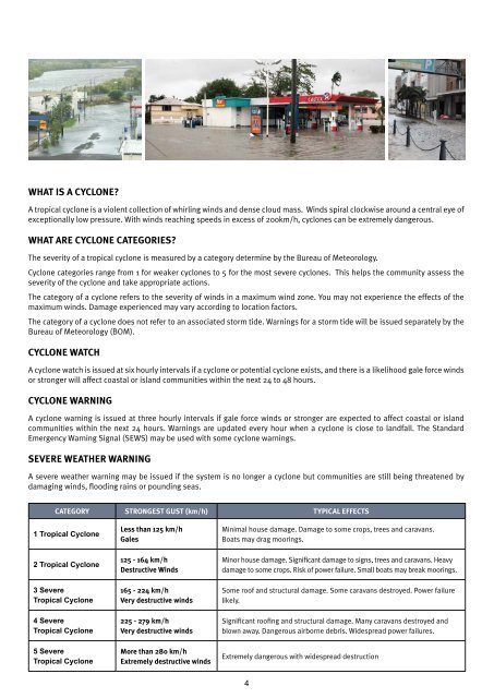
What is a cyclone?A tropical cyclone is a violent collection of whirling winds and dense cloud mass. Winds spiral clockwise around a central eye ofexceptionally low pressure. With winds reaching speeds in excess of 200km/h, cyclones can be extremely dangerous.What are cyclone categories?The severity of a tropical cyclone is measured by a category determine by the Bureau of Meteorology.Cyclone categories range from 1 for weaker cyclones to 5 for the most severe cyclones. This helps the community assess theseverity of the cyclone and take appropriate actions.The category of a cyclone refers to the severity of winds in a maximum wind zone. You may not experience the effects of themaximum winds. Damage experienced may vary according to location factors.The category of a cyclone does not refer to an associated storm tide. Warnings for a storm tide will be issued separately by theBureau of Meteorology (BOM).Cyclone WatchA cyclone watch is issued at six hourly intervals if a cyclone or potential cyclone exists, and there is a likelihood gale force windsor stronger will affect coastal or island communities within the next 24 to 48 hours.Cyclone WarningA cyclone warning is issued at three hourly intervals if gale force winds or stronger are expected to affect coastal or islandcommunities within the next 24 hours. Warnings are updated every hour when a cyclone is close to landfall. The StandardEmergency Warning Signal (SEWS) may be used with some cyclone warnings.Severe Weather WarningA severe weather warning may be issued if the system is no longer a cyclone but communities are still being threatened bydamaging winds, flooding rains or pounding seas.CATEGORY STRONGEST GUST (km/h) TYPICAL EFFECTS1 Tropical Cyclone2 Tropical Cyclone3 SevereTropical Cyclone4 SevereTropical Cyclone5 SevereTropical CycloneLess than 125 km/hGales125 - 164 km/hDestructive Winds165 - 224 km/hVery destructive winds225 - 279 km/hVery destructive windsMore than 280 km/hExtremely destructive windsMinimal house damage. Damage to some crops, trees and caravans.Boats may drag moorings.Minor house damage. Significant damage to signs, trees and caravans. Heavydamage to some crops. Risk of power failure. Small boats may break moorings.Some roof and structural damage. Some caravans destroyed. Power failurelikely.Significant roofing and structural damage. Many caravans destroyed andblown away. Dangerous airborne debris. Widespread power failures.Extremely dangerous with widespread destruction4