STORM TIDE EVACUATION GUIDE - Townsville City Council
STORM TIDE EVACUATION GUIDE - Townsville City Council
STORM TIDE EVACUATION GUIDE - Townsville City Council
- No tags were found...
You also want an ePaper? Increase the reach of your titles
YUMPU automatically turns print PDFs into web optimized ePapers that Google loves.
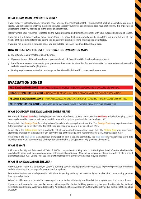
What if I am in an Evacuation Zone?If your property is located in an evacuation zone, you need to read this booklet. This important booklet also includes colouredlabels. <strong>Council</strong> suggests that you place one coloured label in your meter box and one under your kitchen sink. It is important tounderstand what you need to do in the event of a storm tide.Identify where your residence is located on the evacuation map and familiarise yourself with your evacuation zone and routes.If you are in a red, orange, yellow or blue zone, there is a chance that your property may be inundated in a storm tide event. Theheight of the predicted storm tide during the disaster event will determine which zones are affected.If you are not located in a coloured zone, you are outside the storm tide inundation threat area.How to read and the use the storm tide evacuation maps1. Identify where your residence is on the map.2. If you are in one of the coloured zones, you may be at risk from storm tide flooding during cyclones.3. Identify your evacuation route to your pre-determined safer location. For further information on evacuation visit council’swebsite www.townsville.qld.gov.au.4. During a cyclone event tune into warnings, authorities will advise which zones need to evacuate.Evacuation ZonesRED <strong>EVACUATION</strong> ZONE - INDICATES AREAS AT HIGHEST RISK OF FLOODING FROM CYCLONE <strong>STORM</strong> <strong>TIDE</strong>.ORANGE <strong>EVACUATION</strong> ZONE - INDICATES AREAS AT HIGH RISK OF FLOODING FROM CYCLONE <strong>STORM</strong> <strong>TIDE</strong>.YELLOW <strong>EVACUATION</strong> ZONE - INDICATES AREAS AT MODERATE RISK OF FLOODING FROM CYCLONE <strong>STORM</strong> <strong>TIDE</strong>.BLUE <strong>EVACUATION</strong> ZONE - INDICATES AREAS AT LOW RISK OF FLOODING FROM CYCLONE <strong>STORM</strong> <strong>TIDE</strong>.What do storm tide evacuation zones mean?Residents in the Red Zone face the highest risk of inundation from a cyclone storm tide. The Red Zone includes low-lying coastalareas and areas that may experience storm tide inundation up to approximately 1 metre above HAT.Residents in the Orange Zone face a high risk of inundation from a cyclone storm tide. The Orange Zone may experience stormtide inundation up to 1m above the top of the red zone (approximately 2 metres above HAT).Residents in the Yellow Zone face a moderate risk of inundation from a cyclone storm tide. The Yellow Zone may experiencestorm tide inundation at levels up to 2m above the top of the orange zone (approximately 2 to 4 metres above HAT).Residents in the Blue Zone face a low risk of inundation from a cyclone storm tide. The Blue Zone may experience storm tideinundation up to 2m above the top of the yellow zone (higher than approximately 4 metres above HAT).What is HAT?HAT stands for Highest Astronomical Tide. A HAT is comparable to a king tide. It is the highest level of water which can bepredicted to occur under any combination of astronomical conditions. BOM advices regarding storm tide will refer to a height(in metres) above HAT. <strong>Council</strong> will use this BOM information to advise which zones may be affected.What is an evacuation shelter?An evacuation shelter is a building, or part of a building, specifically designed and constructed to provide protection from windand debris during the passage of a severe tropical cyclone.Evacuation shelters are a safe place that will allow for seating and may not necessarily be capable of accommodating personsfor extended periods.Where possible, evacuees should be encouraged to seek shelter with family and friends in higher places outside the at risk area.If you are self evacuating and not be staying within a public shelter building, please register your location via the NationalRegistration and Inquiry System available on the Australian Red Cross website (N.B. this will be activated at the time of the pendingdisaster).5


