

Earthquakes in the Canberra Region - Geoscience Australia
Earthquakes in the Canberra Region - Geoscience Australia
Earthquakes in the Canberra Region - Geoscience Australia
- No tags were found...

You also want an ePaper? Increase the reach of your titles
YUMPU automatically turns print PDFs into web optimized ePapers that Google loves.
<strong>Earthquakes</strong> <strong>in</strong> <strong>the</strong> <strong>Canberra</strong> <strong>Region</strong><strong>Earthquakes</strong> <strong>in</strong> <strong>the</strong> <strong>Canberra</strong> <strong>Region</strong>Compiled December 2007byMarion Leiba 11. <strong>Geoscience</strong> <strong>Australia</strong>, GPO Box 378, <strong>Canberra</strong>, Act 2601
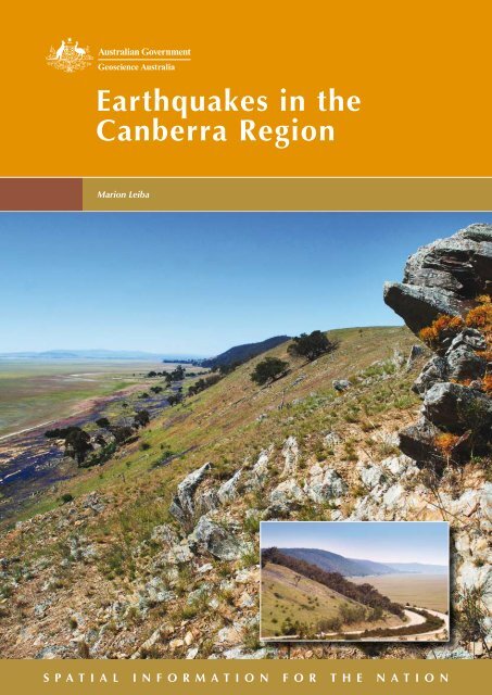
<strong>Earthquakes</strong> <strong>in</strong> <strong>the</strong> <strong>Canberra</strong> <strong>Region</strong>Department of Resources, Energy and TourismM<strong>in</strong>ister for Resources, Energy and Tourism: The Hon. Mart<strong>in</strong> Ferguson, MPSecretary: Dr Peter Boxall<strong>Geoscience</strong> <strong>Australia</strong>Chief Executive Officer: Dr Neil Williams© Commonwealth of <strong>Australia</strong> 2007This work is copyright. Apart from any fair deal<strong>in</strong>gs for <strong>the</strong> purpose of study, research, criticism orreview, as permitted under <strong>the</strong> Copyright Act 1968, no part may be reproduced by any processwithout written permission. Copyright is <strong>the</strong> responsibility of <strong>the</strong> Chief Executive Officer,<strong>Geoscience</strong> <strong>Australia</strong>. Requests and enquiries should be directed to <strong>the</strong> Chief Executive Officer,<strong>Geoscience</strong> <strong>Australia</strong>, GPO Box 378 <strong>Canberra</strong> ACT 2601.<strong>Geoscience</strong> <strong>Australia</strong> has tried to make <strong>the</strong> <strong>in</strong>formation <strong>in</strong> this product as accurate as possible.However, it does not guarantee that <strong>the</strong> <strong>in</strong>formation is totally accurate or complete. Therefore, youshould not solely rely on this <strong>in</strong>formation when mak<strong>in</strong>g a commercial decision.ISBN: 978 1 921236 40 2 (hardcopy)ISBN: 978 1 921236 39 6 (web)GeoCat No. 65045Bibliographic reference: Leiba, M., 2007. <strong>Earthquakes</strong> <strong>in</strong> <strong>the</strong> <strong>Canberra</strong> <strong>Region</strong>.Cover: Lake George escarpment. (Photos by Jim Mason)ii
<strong>Earthquakes</strong> <strong>in</strong> <strong>the</strong> <strong>Canberra</strong> <strong>Region</strong>CONTENTSINTRODUCTION .................................................................................................................................. 1REGIONAL SETTING .......................................................................................................................... 1GEOLOGY OF THE CANBERRA REGION........................................................................................ 2LOCAL CANBERRA EARTHQUAKES.............................................................................................. 3Largest earthquakes with<strong>in</strong> 20 km of <strong>Canberra</strong> GPO.......................................................................... 5Frequency of occurrence of earthquakes with<strong>in</strong> 20 km of <strong>Canberra</strong> GPO.......................................... 6Heard or felt earthquakes, 1982 - 1995............................................................................................... 6Heard or felt earthquakes, January 1996 – November 2007.............................................................. 12<strong>Earthquakes</strong> <strong>in</strong> <strong>the</strong> Sutton area, January 1996 – November 2007 ..................................................... 17EARTHQUAKES ON THE LAKE GEORGE FAULT....................................................................... 18MURRUMBATEMAN EARTHQUAKES .......................................................................................... 20DALTON-GUNNING EARTHQUAKES AND THEIR EFFECT ON CANBERRA......................... 22CANBERRA EARTHQUAKE HAZARD........................................................................................... 26EARTHQUAKE FREQUENCY IN THE CANBERRA 1:100 000 MAP SHEET.............................. 27REFERENCES ..................................................................................................................................... 27APPENDIX 1: MODIFIED MERCALLI (MM) SCALE OF EARTHQUAKE INTENSITY ........... 29APPENDIX 2: EARTHQUAKE ACTION GUIDE............................................................................. 31iii
<strong>Earthquakes</strong> <strong>in</strong> <strong>the</strong> <strong>Canberra</strong> <strong>Region</strong>iv
<strong>Earthquakes</strong> <strong>in</strong> <strong>the</strong> <strong>Canberra</strong> <strong>Region</strong>INTRODUCTIONThis booklet is an update of <strong>Earthquakes</strong> <strong>in</strong> <strong>the</strong> <strong>Canberra</strong> <strong>Region</strong> published by <strong>the</strong><strong>Australia</strong>n Geological Survey Organisation (AGSO, now <strong>Geoscience</strong> <strong>Australia</strong>) and <strong>the</strong>ACT Emergency Services Bureau <strong>in</strong> 1996. As 10 years have passed s<strong>in</strong>ce <strong>the</strong> previousbooklet was published, it was considered appropriate to produce an updated version which<strong>in</strong>cludes <strong>the</strong> more recent earthquake activity <strong>in</strong> <strong>the</strong> ACT and surround<strong>in</strong>g region.REGIONAL SETTINGThe map of <strong>Australia</strong>n earthquake epicentres (Figure 1) shows earthquakes from 1841-2001 with magnitudes of 3.0 or more on <strong>the</strong> Richter scale. Events of magnitude 4.0 ormore are capable of caus<strong>in</strong>g damage to build<strong>in</strong>gs. <strong>Canberra</strong> lies with<strong>in</strong> a broad NE-SWtrend<strong>in</strong>g belt of epicentres. The largest events recorded <strong>in</strong> this zone were of Richtermagnitude ML 5.6, <strong>the</strong> same size as <strong>the</strong> December 1989 Newcastle earthquake. Smallearthquakes occur under <strong>Canberra</strong>'s suburbs but <strong>the</strong> nearest active seismic zone is 60 kmnorth of <strong>Canberra</strong> <strong>in</strong> <strong>the</strong> Dalton – Gunn<strong>in</strong>g area, NSW.Figure 1. Epicentres of earthquakes with magnitudes of 3.0 or more on <strong>the</strong> Richter scale,1841- 2001.1
<strong>Earthquakes</strong> <strong>in</strong> <strong>the</strong> <strong>Canberra</strong> <strong>Region</strong>GEOLOGY OF THE CANBERRA REGIONThe rocks of <strong>the</strong> <strong>Canberra</strong> region are ma<strong>in</strong>ly metamorphosed Middle to Late Ordoviciansedimentary and Silurian igneous and sedimentary rocks, rang<strong>in</strong>g <strong>in</strong> age from about 408-468 million years. They have been subjected to several periods of reverse fault<strong>in</strong>g, that is,<strong>the</strong> lower older rocks were thrust up and over <strong>the</strong> younger ones, on north-south faults,some of which may be as old as <strong>the</strong> Late Silurian.Fold<strong>in</strong>g and fault<strong>in</strong>g occurred <strong>in</strong> <strong>the</strong> mid Devonian (around 380 million years ago) andaga<strong>in</strong> <strong>in</strong> <strong>the</strong> post mid-Devonian to Carboniferous (about 350 million years ago). Asmentioned above, <strong>the</strong> earlier faults trended north-south, whereas later faults trended NEand NW. Both sets were caused by east-west compression. Rejuvenation of <strong>the</strong> northsouthfaults commenced dur<strong>in</strong>g uplift <strong>in</strong> <strong>the</strong> Miocene, approximately 20 million years ago,and this <strong>in</strong>itiated escarpments such as that at Lake George. M<strong>in</strong>or earthquake activity hascont<strong>in</strong>ued <strong>in</strong> <strong>the</strong> region. The geology of <strong>the</strong> <strong>Canberra</strong> region is summarised <strong>in</strong> <strong>the</strong>publication by Abell (1992).The major faults <strong>in</strong> <strong>the</strong> region are shown <strong>in</strong> Figure 2. The one best known to most<strong>Canberra</strong>ns is <strong>the</strong> Lake George Fault. Its scarp has eroded back approximately 0.5 kmfrom its orig<strong>in</strong>al position near <strong>the</strong> western edge of <strong>the</strong> lake, but it is still a spectaculartopographic feature (Figure 14).Figure 2. Faults, l<strong>in</strong>eaments and earthquake epicentres <strong>in</strong> <strong>the</strong> <strong>Canberra</strong> region.2
<strong>Earthquakes</strong> <strong>in</strong> <strong>the</strong> <strong>Canberra</strong> <strong>Region</strong>LOCAL CANBERRA EARTHQUAKES<strong>Canberra</strong> is occasionally shaken by earthquakes <strong>in</strong> <strong>the</strong> surround<strong>in</strong>g region, particularly <strong>in</strong><strong>the</strong> Dalton-Gunn<strong>in</strong>g zone (see later), but <strong>Canberra</strong> also has its own earthquakes (Leiba,1993, 1994). <strong>Earthquakes</strong> which have been recorded with<strong>in</strong> a radius of 20 km of <strong>the</strong><strong>Canberra</strong> GPO are shown <strong>in</strong> Figure 3. The more recent of <strong>the</strong>se that have occurredbetween 1996 and November 2007 with<strong>in</strong> this area are listed <strong>in</strong> Table 1.Figure 3. <strong>Earthquakes</strong> with<strong>in</strong> 20 km of <strong>the</strong> <strong>Canberra</strong> GPO recorded up to November2007.3
<strong>Earthquakes</strong> <strong>in</strong> <strong>the</strong> <strong>Canberra</strong> <strong>Region</strong>Table 1. <strong>Earthquakes</strong> with<strong>in</strong> a square with sides 20 km from <strong>the</strong> <strong>Canberra</strong> GPO, for<strong>the</strong> period 1996 – November 2007.DATE TIME(UTC) LAT LON DEPTH MAG COMMENTS19960410 234524.2 -35.165 149.177 0.0 1.7 7 km W of SuttonNSW. Heard.19960620 201615.8 -35.171 149.292 4.0 1.0 Sutton NSW.19960625 152218.0 -35.415 148.976 5.0 1.2 Tidb<strong>in</strong>billa ACT.Heard.19971021 160634.8 -35.177 149.252 4.0 2.0 Sutton NSW19990618 64034.9 -35.224 149.118 0.0 2.4 Kaleen/ Gungahl<strong>in</strong>ACT. Felt.19990621 135935.9 -35.193 149.164 7.0 2.5 Mitchell/Gungahl<strong>in</strong>ACT. Felt.20010919 150120.1 -35.189 149.298 NULL 1.8 Sutton NSW20011227 152327.3 -35.155 149.341 5.0 1.9 Sutton NSW. Felt.20020114 102853.02 -35.165 149.322 0.0 1.6 Sutton NSW. Felt.20020116 133952.6 -35.182 149.329 0.0 1.5 Sutton NSW. Felt.20020120 94253.72 -35.169 149.299 0.0 1.8 Sutton NSW. Felt.20020123 24412.1 -35.162 149.309 0.0 2.3 Sutton NSW.20020123 90047.3 -35.174 149.278 0.0 2.5 Sutton NSW. Felt.20020129 14720.5 -35.193 149.278 1.6 1.5 Sutton NSW. Felt.20020129 133946.7 -35.177 149.304 0.0 1.4 Sutton NSW.20020129 160154.5 -35.172 149.292 0.0 1.7 Sutton NSW.20020131 165506.5 -35.179 149.274 0.9 1.3 Sutton NSW.20020201 193500.8 -35.169 149.3 0.0 1.4 Sutton, NSW.20020202 70705.76 -35.189 149.265 1.3 2.2 Sutton, NSW. Felt.20020313 210008.6 -35.212 149.277 2.7 1.2 Sutton NSW.20020418 5155.55 -35.167 149.301 0.0 1.7 Sutton NSW. Felt.20020810 151947.28 -35.195 149.268 2.9 1.3 Sutton NSW.20020813 45106.06 -35.2 149.274 1.7 1.4 Sutton NSW. Felt20021202 20804.19 -35.386 149.225 3.9 1.8 Sutton NSW.20021202 63017.18 -35.182 149.297 0.5 1.9 Sutton NSW.20021203 12149.82 -35.338 149.146 4.4 1.5 Sutton NSW.20030612 62857.32 -35.425 149.101 5.5 2.0 Tuggeranong ACT.Felt.20030705 34824.58 -35.195 149.258 0.0 2.4 Sutton NSW. Felt.20030705 112016.75 -35.173 149.286 2.4 1.4 Sutton NSW.20031003 222509.58 -35.299 149.085 2.3 1.4 Yarralumla ACT.Felt.20060120 22001.7 -35.396 149.278 10.8 1.4 SE of QueanbeyanNSW.The data have been obta<strong>in</strong>ed largely by cooperation between <strong>Geoscience</strong> <strong>Australia</strong> and <strong>the</strong>Research School of Earth Sciences at <strong>the</strong> <strong>Australia</strong>n National University (ANU). Threeseismographs <strong>in</strong> <strong>the</strong> ACT and a number of o<strong>the</strong>rs, run by ei<strong>the</strong>r ANU or <strong>Geoscience</strong><strong>Australia</strong>, <strong>in</strong> neighbour<strong>in</strong>g parts of NSW were used to determ<strong>in</strong>e <strong>the</strong> locations of <strong>Canberra</strong>region earthquakes as small as magnitude 1.0 or occasionally lower. ANU <strong>in</strong>stalled <strong>the</strong>first ACT seismograph, at Mt Stromlo, <strong>in</strong> 1958. O<strong>the</strong>rs <strong>in</strong> <strong>the</strong> <strong>Canberra</strong> region followed <strong>in</strong>1959. <strong>Geoscience</strong> <strong>Australia</strong>'s at East Kowen Forest and Kambah were <strong>in</strong>stalled <strong>in</strong> 1979and December 1985 respectively. The ANU network of seismographs <strong>in</strong> sou<strong>the</strong>astern4
<strong>Earthquakes</strong> <strong>in</strong> <strong>the</strong> <strong>Canberra</strong> <strong>Region</strong>NSW, which was useful for more accurately determ<strong>in</strong><strong>in</strong>g <strong>the</strong> epicentres of very smallearthquakes <strong>in</strong> <strong>the</strong> <strong>Canberra</strong> region, was closed around <strong>the</strong> year 2000. The epicentres oflarger earthquakes, with magnitudes of 2.5 or above, can be located us<strong>in</strong>g more distantseismographs run by <strong>Geoscience</strong> <strong>Australia</strong> or o<strong>the</strong>r organisations (Figure 4a), so are not asdependant on a sensitive local network of seismographs..At present (December 2007) <strong>the</strong>re are three seismographs <strong>in</strong> <strong>the</strong> ACT with readilyaccessible data for determ<strong>in</strong><strong>in</strong>g <strong>the</strong> locations of <strong>Canberra</strong> earthquakes. The <strong>Canberra</strong>seismograph (CNB) at East Kowen Forest near Bungendore is a digital <strong>in</strong>strument. Its datais displayed and analysed readily and accurately us<strong>in</strong>g a computer. S<strong>in</strong>ce 2001, <strong>the</strong>Kambah seismograph (KBH) has been privately owned by Marion Leiba. It is an oldanalogue seismograph (1970s technology), record<strong>in</strong>g data <strong>in</strong> <strong>in</strong>k on paper wrapped arounda rotat<strong>in</strong>g drum (Figure 4b). Measurements are made us<strong>in</strong>g a ruler and hand lens. A thirdACT seismograph run by <strong>the</strong> <strong>Australia</strong>n National University at Mt Stromlo that is part of aworldwide network (Geonet) of digital seismograph stations, and <strong>the</strong> data from this areavailable on l<strong>in</strong>e to <strong>Geoscience</strong> <strong>Australia</strong> on l<strong>in</strong>e <strong>in</strong> late 2006.Figure 4. (a) A telemetred digital station of <strong>the</strong> <strong>Australia</strong>n National Sesimograph Networkoperated by <strong>Geoscience</strong> <strong>Australia</strong> at Mangrove Creek. (b) Analogue seismograph <strong>in</strong>Kambah, ACT operated by Marion Leiba record<strong>in</strong>g <strong>the</strong> Magnitude 3.3 Oolong earthquakethat occurred at 11.30 pm on 13 August 2006.<strong>Geoscience</strong> <strong>Australia</strong>’s digital seismographs at Young, Mangrove Creek Dam (nearGosford), and near Bemboka are used, along with <strong>the</strong> ACT seismographs, for determ<strong>in</strong><strong>in</strong>g<strong>the</strong> locations of <strong>Canberra</strong> region earthquakes with magnitudes as small as 1.4, oroccasionally lower.Largest earthquakes with<strong>in</strong> 20 km of <strong>Canberra</strong> GPOThe two largest earthquakes with<strong>in</strong> 20 km of <strong>the</strong> GPO, s<strong>in</strong>ce <strong>the</strong> <strong>in</strong>stallation of <strong>the</strong> ANUrecorder, occurred on 9 February 1961 and 25 April 1970 (local dates) and had Richtermagnitudes ML 3.5 and 3.0 respectively. Both were reported <strong>in</strong> <strong>the</strong> press.5
<strong>Earthquakes</strong> <strong>in</strong> <strong>the</strong> <strong>Canberra</strong> <strong>Region</strong>The <strong>Canberra</strong> Times of 9 February 1961 noted that “a slight earth tremor shook <strong>Canberra</strong>early this morn<strong>in</strong>g, wak<strong>in</strong>g many residents. At <strong>the</strong> height of <strong>the</strong> tremor crockery onshelves rattled, pictures shifted on walls and w<strong>in</strong>dows were shaken”. It occurred at 4.56am local time. “Residents described it as ‘like a long clap of thunder’. It could be heardapproach<strong>in</strong>g <strong>the</strong> city and later mov<strong>in</strong>g away”. Its epicentre was south of Sutton and 18 kmENE of <strong>the</strong> <strong>Canberra</strong> GPO; no damage was reported.The earthquake at 8.54 pm local time on 25 April 1970 was mentioned <strong>in</strong> <strong>the</strong> <strong>Canberra</strong>Times of 27 April. It stated that “an earth tremor over a wide area of <strong>the</strong> ACT on Saturdaynight caused houses to sway slightly and shook crockery and ornaments. A low rumbl<strong>in</strong>gaccompanied <strong>the</strong> tremor” which was reported to be felt at Belconnen, Garran,Narrabundah, Naas and Williamsdale. The epicentre was at Tuggeranong.Frequency of occurrence of earthquakes with<strong>in</strong> 20 km of <strong>Canberra</strong> GPOSeventy-two earthquakes occurred with<strong>in</strong> 20 km of <strong>the</strong> GPO <strong>in</strong> <strong>the</strong> 36 years prior to <strong>the</strong>end of 1995, and dur<strong>in</strong>g this period yearly numbers varied between zero and n<strong>in</strong>e with amean number of 2.0. Dur<strong>in</strong>g <strong>the</strong> period January 1996 to November 2007, 30 earthquakeswith Richter magnitudes 1.0-2.5 occurred with<strong>in</strong> this same area, giv<strong>in</strong>g a mean number of2.5 earthquakes per year. Yearly numbers varied between 0 <strong>in</strong> 1998, 2000, 2004 and 2005and a maximum of 18 <strong>in</strong> 2002 when a swarm of earthquakes occurred at Sutton. Theepicentres of <strong>the</strong>se earthquakes (except <strong>the</strong> June 1996 Tidb<strong>in</strong>billa ACT event which isoutside <strong>the</strong> <strong>Canberra</strong> map sheet) are shown <strong>in</strong> Figure 3 .These earthquakes <strong>in</strong>clude foreshocks and aftershocks, which ei<strong>the</strong>r precede or followlarger earthquakes, and which may be considered as part of <strong>the</strong> one event (<strong>the</strong> ‘ma<strong>in</strong>shock’) . When foreshocks and aftershocks are excluded, <strong>the</strong>re were 47 ma<strong>in</strong> shocks <strong>in</strong> <strong>the</strong>36 years to <strong>the</strong> end of 1995 - a mean of 1.3 per year, with yearly numbers rang<strong>in</strong>g fromzero to six. Between 1 January 1996 and 30 November 2007, <strong>the</strong>re were 15 ma<strong>in</strong> shocks,a mean of 1.3 per year with yearly numbers vary<strong>in</strong>g between zero and five.In summary, <strong>the</strong> mean level of earthquake activity <strong>in</strong> <strong>Canberra</strong> has changed little <strong>in</strong> <strong>the</strong>past 10 years from that <strong>in</strong> <strong>the</strong> previous 36 years. Look<strong>in</strong>g at <strong>the</strong> data for <strong>the</strong> past 40-50years, on average, one can expect 1-2 ma<strong>in</strong> shocks per year with<strong>in</strong> 20 km of <strong>the</strong> <strong>Canberra</strong>GPO, or 2-3 earthquakes per year if foreshocks and aftershocks are <strong>in</strong>cluded.Actual (not average) yearly numbers of earthquakes are highly variable - anyth<strong>in</strong>g <strong>in</strong> <strong>the</strong>range 0-18, or 0-6 if foreshocks and aftershocks are excluded, is likely.Heard or felt earthquakes, 1982 - 1995Most of <strong>the</strong> <strong>Canberra</strong> events are very shallow, at depths of 0-15 km beneath <strong>the</strong> Earth'ssurface. Consequently, seven of <strong>the</strong>se little earthquakes were reported heard or felt, andare described below.6
<strong>Earthquakes</strong> <strong>in</strong> <strong>the</strong> <strong>Canberra</strong> <strong>Region</strong>A magnitude ML 2.4 earthquake, <strong>the</strong> largest <strong>in</strong> metropolitan <strong>Canberra</strong> dur<strong>in</strong>g this period,occurred at 7.51 am Eastern <strong>Australia</strong>n Summer Time on 29 November 1985. Theepicentre, shown <strong>in</strong> Figure 5, was <strong>in</strong> <strong>the</strong> Turner-Black Mounta<strong>in</strong> area, where <strong>the</strong>earthquake was felt strongly. The numbers on <strong>the</strong> map are <strong>in</strong>tensities on <strong>the</strong> ModifiedMercalli (MM) Scale (Appendix 1).Figure 5. Isoseismal map of <strong>the</strong> <strong>Canberra</strong> earthquake, magnitude ML 2.4, of 29November 1985 (local date). The red triangle is <strong>the</strong> epicentre. Reported MM <strong>in</strong>tensityvalues and isoseismal contours are shown; <strong>in</strong>tensity values of 0 <strong>in</strong>dicate <strong>the</strong> earthquakewas not felt.At 2.07 am Eastern <strong>Australia</strong>n Summer Time on 3 December 1990 a very smallearthquake occurred under <strong>the</strong> western part of Kambah. It was well recorded (Figure 6)on <strong>the</strong> Kambah seismograph, KBH, 3 km from <strong>the</strong> epicentre. An appeal made through <strong>the</strong>local media, who were quite excited by this small earthquake (Michael-Leiba, 1990),resulted <strong>in</strong> felt reports that are plotted on <strong>the</strong> isoseismal map (Figure 7) <strong>in</strong> MM <strong>in</strong>tensityunits.7
<strong>Earthquakes</strong> <strong>in</strong> <strong>the</strong> <strong>Canberra</strong> <strong>Region</strong>Figure 6. Seismogram of <strong>the</strong> Kambah earthquake of 3 December 1990 (local date). TheKambah seismograph that recorded this was 3 km from <strong>the</strong> epicentre.The three observers nearest to <strong>the</strong> earthquake described it as an explosion which shook <strong>the</strong>house, or an enormous bang. The o<strong>the</strong>r three Kambah observers were about 3 km from<strong>the</strong> epicentre. One awoke suddenly, ano<strong>the</strong>r experienced a deep huge boom which wentright through her body, and <strong>the</strong> third was disturbed by his dog howl<strong>in</strong>g (a very unusualoccurrence for this geriatric Pek<strong>in</strong>gese) half to one m<strong>in</strong>ute before he felt a shudder. Themagnitude of this earthquake is only MD 1.2. MD is <strong>the</strong> duration magnitude, anapproximation for <strong>the</strong> Richter magnitude ML derived from <strong>the</strong> maximum amplitude of <strong>the</strong>oscillations on <strong>the</strong> seismogram.8
<strong>Earthquakes</strong> <strong>in</strong> <strong>the</strong> <strong>Canberra</strong> <strong>Region</strong>Figure 7. Isoseismal map of <strong>the</strong> magnitude MD 1.2 Kambah earthquake of 3 December1990 (local date). The red triangle is <strong>the</strong> epicentre. Reported MM <strong>in</strong>tensity values andisoseismal contours are shown.An earthquake <strong>in</strong> Evatt woke people at 1.29 am local time on 21 July 1991. It wasdescribed as sound<strong>in</strong>g like an “explosion” and <strong>the</strong> “whole house shook”. The magnitudeof this microearthquake was MD 1.3. On <strong>the</strong> isoseismal map (Figure 8, compiled byMarion Leiba), <strong>the</strong> epicentre is shown as a triangle and <strong>the</strong> numbers are MM <strong>in</strong>tensities.9
<strong>Earthquakes</strong> <strong>in</strong> <strong>the</strong> <strong>Canberra</strong> <strong>Region</strong>Figure 8. Isoseismal map of <strong>the</strong> magnitude MD 1.3 Evatt earthquake of 21 July 1991(local date). The red triangle is <strong>the</strong> epicentre. Reported MM <strong>in</strong>tensity values andisoseismal contours are shown; <strong>in</strong>tensity values of 0 <strong>in</strong>dicate <strong>the</strong> earthquake was not felt.At 7.34 pm local time on 10 August 1991, a small earthquake occurred under a horserac<strong>in</strong>g stud at Burbong, 20 km ESE of <strong>the</strong> <strong>Canberra</strong> GPO. Hav<strong>in</strong>g a magnitude of onlyMD 1.0, it was heard by <strong>the</strong> owners of <strong>the</strong> stud, but not felt. They thought it was blast<strong>in</strong>g.Two events occurred under <strong>the</strong> suburb of Hawker, 10 km WNW of <strong>the</strong> GPO, on 28 July1993.at 9.53 and 10.00 pm Eastern <strong>Australia</strong>n Standard Time. The magnitudes of <strong>the</strong>seevents were MD 1.3 and 1.4. The first earthquake was heard as a muffled explosion atHawker. People near <strong>the</strong> epicentre ran outside to <strong>in</strong>vestigate because <strong>the</strong>y thought it mighthave been <strong>the</strong> work of a letterbox bomber who had been active <strong>the</strong>re recently. The secondshook houses and rattled th<strong>in</strong>gs, conv<strong>in</strong>c<strong>in</strong>g residents that both events were <strong>in</strong>deedearthquakes and not <strong>the</strong> work of vandals! It was felt <strong>in</strong> <strong>the</strong> suburbs of Hawker, Scull<strong>in</strong> andHigg<strong>in</strong>s but <strong>the</strong> <strong>in</strong>tensity with which it was experienced varied from not felt to one reportof th<strong>in</strong>gs be<strong>in</strong>g shaken off shelves. These two earthquakes were clearly related, <strong>the</strong> firstbe<strong>in</strong>g a foreshock to <strong>the</strong> second.10
<strong>Earthquakes</strong> <strong>in</strong> <strong>the</strong> <strong>Canberra</strong> <strong>Region</strong>On 6 September 1994 at 11.44 pm local time a magnitude MD 1.6 earthquake occurred atGungahl<strong>in</strong>, 10 km NNE of <strong>the</strong> <strong>Canberra</strong> GPO. The isoseismal map (compiled by MarionLeiba and Trevor Jones) is shown <strong>in</strong> Figure 9. Near <strong>the</strong> epicentre it sounded like anexplosion. It was reported felt to <strong>the</strong> west over a radius of about 12 km. There was anisolated felt report from Gordon, 31 km SSW of <strong>the</strong> epicentre.Figure 9. Isoseismal map of <strong>the</strong> magnitude MD 1.6 Gungahl<strong>in</strong> earthquake of 6 September1994. The red triangle is <strong>the</strong> epicentre. Reported MM <strong>in</strong>tensity values and isoseismalcontours are shown; <strong>in</strong>tensity values of 0 <strong>in</strong>dicate <strong>the</strong> earthquake was not felt.In 1995, two <strong>Canberra</strong> region earthquakes were felt <strong>in</strong> <strong>the</strong> ACT.The first was <strong>in</strong> <strong>the</strong> Br<strong>in</strong>dabella Range, 40 km west of <strong>the</strong> <strong>Canberra</strong> GPO. It happened at3.20 am local time on 3 January 1995 and was <strong>the</strong> largest event <strong>in</strong> n<strong>in</strong>e years with<strong>in</strong> 45 kmof <strong>the</strong> GPO. Its magnitude was ML 2.5. It was reported felt <strong>in</strong> Kambah and Curt<strong>in</strong> andheard <strong>in</strong> Watson, Lyons and Deak<strong>in</strong>.The second was at 7.10 pm local time on 10 October 1995 and its epicentre was nearBirrigai Camp and Tidb<strong>in</strong>billa Nature Reserve, 23 km SSW of <strong>the</strong> <strong>Canberra</strong> GPO. Itsmagnitude was MD 2.0, mak<strong>in</strong>g it <strong>the</strong> largest earthquake with<strong>in</strong> 25 km of <strong>the</strong> GPO s<strong>in</strong>ce<strong>the</strong> Black Mounta<strong>in</strong> earthquake <strong>in</strong> November 1985. At Birrigai Camp, it was heard as aloud explosion, felt very strongly and made th<strong>in</strong>gs rattle <strong>in</strong>side. Outside, it was felt by a11
<strong>Earthquakes</strong> <strong>in</strong> <strong>the</strong> <strong>Canberra</strong> <strong>Region</strong>teacher and children camp<strong>in</strong>g. The <strong>Canberra</strong> Times of 12 October 1995 said that “DavidDwyer, one of <strong>the</strong> three rangers liv<strong>in</strong>g <strong>in</strong> a 100-year-old house on <strong>the</strong> Tidb<strong>in</strong>billa NatureReserve, said <strong>the</strong> earthquake sounded like a person runn<strong>in</strong>g along <strong>the</strong> ceil<strong>in</strong>g.”Heard or felt earthquakes, January 1996 – November 2007This section excludes earthquakes <strong>in</strong> <strong>the</strong> Sutton and Dalton-Gunn<strong>in</strong>g areas because <strong>the</strong>yare discussed later.In 1996, three earthquakes were heard or felt <strong>in</strong> <strong>the</strong> ACT. The first was a magnitude ML3.6 earthquake at 6.34 am daylight sav<strong>in</strong>g time on 19 February 1996 with an epicentreabout 10 km east of Eucumbene. It was reported heard and felt <strong>in</strong> <strong>Canberra</strong>, about 100 kmNE of <strong>the</strong> epicentre. Felt reports came from <strong>the</strong> follow<strong>in</strong>g suburbs of <strong>Canberra</strong>:Theodore: Felt by people doz<strong>in</strong>g. The bedroom and w<strong>in</strong>dows shook and it opened <strong>the</strong>front door.Chifley: W<strong>in</strong>dows rattled.Caldwell: Woke person sleep<strong>in</strong>g lightly. She felt it. It sounded like a soft explosion andw<strong>in</strong>dows shook.Red Hill: It felt like a heavy truck pass<strong>in</strong>g and <strong>the</strong> w<strong>in</strong>dows rattled.Duffy: People heard two dist<strong>in</strong>ct rumbles that sounded like a garage door be<strong>in</strong>g taken upand <strong>the</strong>n down. Then <strong>the</strong> house shook and <strong>the</strong>y felt it.Conder: House creaked.At 1.22 am on 26 June 1996 a magnitude MD 1.2 earthquake occurred 20 km SW of <strong>the</strong><strong>Canberra</strong> GPO. Its epicentre was near <strong>the</strong> Tidb<strong>in</strong>billa Nature Reserve and it was heard 7km SW of <strong>the</strong> epicentre as a deep rumbl<strong>in</strong>g sound like a pass<strong>in</strong>g aircraft but last<strong>in</strong>g only ashort time.At 5.23 am local time on 15 February 1998, a magnitude ML 4.2 earthquake occurred <strong>in</strong><strong>the</strong> Br<strong>in</strong>dabella Mounta<strong>in</strong>s, near Br<strong>in</strong>dabella Homestead. The report and isoseismal map(Figure 10) were compiled by Kev<strong>in</strong> McCue, who stated that <strong>the</strong> “few residents ofhomesteads <strong>in</strong> <strong>the</strong> Br<strong>in</strong>dabella Mounta<strong>in</strong>s were reportedly shaken out of <strong>the</strong>ir beds; atArgalong Station a w<strong>in</strong>dow was broken and m<strong>in</strong>or non-structural crack<strong>in</strong>g of <strong>the</strong> walls ofan outhouse was reported. The noise of th<strong>in</strong>gs shak<strong>in</strong>g woke many <strong>Canberra</strong> and Tumutresidents and at Burr<strong>in</strong>juck Dam <strong>the</strong> shak<strong>in</strong>g woke most people. It was felt as far away asHarden-Murrumburrah to <strong>the</strong> northwest and Cooma to <strong>the</strong> south. A bushwalker and hisfamily camped at <strong>the</strong> summit of Mt G<strong>in</strong>gera were surprised by <strong>the</strong> <strong>in</strong>tensity of shak<strong>in</strong>g,”frighten<strong>in</strong>g <strong>the</strong> children.12
<strong>Earthquakes</strong> <strong>in</strong> <strong>the</strong> <strong>Canberra</strong> <strong>Region</strong>Figure 10. Isoseismal map of <strong>the</strong> magnitude ML 4.2 Br<strong>in</strong>dabella NSW earthquake of 15February 1998 (local date). Open triangles are seismographs, <strong>the</strong> red triangle is <strong>the</strong>epicentre. Reported MM <strong>in</strong>tensity values and isoseismal contours are shown; <strong>in</strong>tensityvalues of 0 <strong>in</strong>dicate <strong>the</strong> earthquake was not felt.On 19 August 1998 at 9.12 pm local time, a magnitude ML 3.0 earthquake occurred <strong>in</strong> <strong>the</strong>Orroral Valley, Namadgi National Park, ACT, approximately 43 km SSW of <strong>the</strong> <strong>Canberra</strong>GPO and 19 km SSW of Tharwa. Its epicentre was just west of <strong>the</strong> 1:100,000 <strong>Canberra</strong>map sheet area (Figure 2). The report and isoseismal map (Figure 11) for this earthquakewere compiled by Y Li and Andrew McEw<strong>in</strong>.13
<strong>Earthquakes</strong> <strong>in</strong> <strong>the</strong> <strong>Canberra</strong> <strong>Region</strong>Figure 11. Isoseismal map of <strong>the</strong> magnitude ML 3.0 Orroral Valley earthquake of 19August 1998. The red triangle is <strong>the</strong> epicentre. Reported MM <strong>in</strong>tensity values andisoseismal contours are shown; <strong>in</strong>tensity values of 0 <strong>in</strong>dicate <strong>the</strong> earthquake was not felt.Despite its remote location, <strong>the</strong> earthquake was felt weakly by a few people <strong>in</strong> <strong>the</strong><strong>in</strong>nermost North <strong>Canberra</strong> suburbs and strongly, although briefly, by some <strong>in</strong> <strong>the</strong> sou<strong>the</strong>rnsuburbs, where alarmed Garran residents apparently ran out <strong>in</strong>to <strong>the</strong> street. Li andMcEw<strong>in</strong> summarised a selection of <strong>the</strong> approximately 100 reports as follows:Kambah: Felt by all <strong>in</strong> <strong>the</strong> house, w<strong>in</strong>dows rattled, strong vibrations felt with<strong>in</strong> <strong>the</strong> house.Also heard loud, rumbl<strong>in</strong>g sound.Curt<strong>in</strong>: Felt by all five of us and sounded like a low rumble as if a very large truck wasgo<strong>in</strong>g past.Gordon: We heard it com<strong>in</strong>g <strong>the</strong>n it shook <strong>the</strong> house but <strong>the</strong> w<strong>in</strong>dows didn’t rattle, <strong>the</strong>furniture, book shelf did.Wanniassa: Huge 20 sec shudder – <strong>the</strong> ground vibrated and made a thunder<strong>in</strong>g noise,wasn’t aware of <strong>the</strong> w<strong>in</strong>dows rattl<strong>in</strong>g but my daughter’s bed shook.Tharwa: Heard <strong>the</strong>n felt big rumble, everyth<strong>in</strong>g rattled, foundations shook.On 31 December 1998, a magnitude ML 3.2 earthquake occurred at 5.11 pm local timebetween Bredbo and Michelago, just east of <strong>the</strong> ACT border. Although it was felt moststrongly east of <strong>the</strong> ACT from Burra to Bredbo, <strong>the</strong>re were a number of felt reports from<strong>the</strong> sou<strong>the</strong>rn part of <strong>Canberra</strong> and from Cooma. The report and isoseismal map (Figure12) were compiled by Kev<strong>in</strong> McCue.14
<strong>Earthquakes</strong> <strong>in</strong> <strong>the</strong> <strong>Canberra</strong> <strong>Region</strong>Figure 12. Isoseismal map of <strong>the</strong> magnitude Ml 3.2 Michelago NSW earthquake of 31December 1998.In 1999, two earthquakes, only three days apart were felt <strong>in</strong> <strong>Canberra</strong>.The first, at 4.40 pm local time on 18 June 1999, with an epicentre <strong>in</strong> northwestern Kaleennear <strong>the</strong> boundary with Gungahl<strong>in</strong>, was felt <strong>in</strong> Giralang. Its magnitude was ML 2.4.The second, a magnitude ML 2.5 event at 11.59 pm on 21 June 1999, with an epicentrenor<strong>the</strong>ast of Mitchell, was felt <strong>in</strong> Gungahl<strong>in</strong>, Belconnen, and North <strong>Canberra</strong>, as well as<strong>in</strong> Sutton and Queanbeyan (Figure 13). The isoseismal map and report on <strong>the</strong> earthquakewere compiled by Andrew McEw<strong>in</strong>, Y Li, and Kev<strong>in</strong> McCue. They quote <strong>the</strong> follow<strong>in</strong>gemail report from a Gungahl<strong>in</strong> resident:15
<strong>Earthquakes</strong> <strong>in</strong> <strong>the</strong> <strong>Canberra</strong> <strong>Region</strong>Figure 13. Isoseismal map of <strong>the</strong> magnitude ML 2.5 Gungahl<strong>in</strong> earthquake of 21 June1999 The red triangle is <strong>the</strong> epicentre. Reported MM <strong>in</strong>tensity values and isoseismalcontours are shown; <strong>in</strong>tensity values of 0 <strong>in</strong>dicate <strong>the</strong> earthquake was not felt.I was <strong>in</strong> bed <strong>in</strong> that state of relaxed bliss that precedes <strong>the</strong> onset of sleep, when a loudsomewhat muffled noise caused me to sit bolt upright. The house shook momentarily and<strong>the</strong> glass <strong>in</strong> <strong>the</strong> w<strong>in</strong>dows of my bedroom rattled <strong>in</strong> its frame. My first thought was that myhouse was a road-rage target or that a ham-fisted burglar was break<strong>in</strong>g <strong>in</strong>to my house.The possibility of an earthquake also passed through my m<strong>in</strong>d. I looked at my watch: spoton <strong>the</strong> witch<strong>in</strong>g hour; ‘It must be a paranormal phenomenon”, I thought. I got up andchecked <strong>the</strong> front door of <strong>the</strong> house and <strong>the</strong> door to <strong>the</strong> garage. Noth<strong>in</strong>g amiss wasapparent. ‘Bloody earthquake’, I thought and returned to bed.McEw<strong>in</strong>, Li and McCue also note that “<strong>in</strong> Aranda, one person ly<strong>in</strong>g <strong>in</strong> bed read<strong>in</strong>gthought that a large possom was jump<strong>in</strong>g on <strong>the</strong> deck but resolved that it must have beenan earthquake because possoms aren’t that big. A neighbour<strong>in</strong>g sleep<strong>in</strong>g seismologist wasnot awakened.”At 11.20 am local time on 23 October 2000, a magnitude ML 2.9 earthquake occurrednear Bendoora Dam, about 20 km west of Kambah. It was felt at several localities,<strong>in</strong>clud<strong>in</strong>g Bonython, Evatt and Theodore.The next <strong>Canberra</strong> earthquake to be felt, happened at 4.28 pm on 12 June 2003. It had aRichter magnitude of 2.0. The epicentre was <strong>in</strong> Tuggeranong and it was reported felt <strong>in</strong>Kambah, Gordon, Calwell, Isabella Pla<strong>in</strong>s, Monash and Conder. It was heard atDerr<strong>in</strong>gton Crescent, Bonython, as a very loud explosion followed by a smaller bang. It isprobable that <strong>the</strong> epicentre was <strong>in</strong> or near Bonython. The smaller bang may have been a16
<strong>Earthquakes</strong> <strong>in</strong> <strong>the</strong> <strong>Canberra</strong> <strong>Region</strong>little aftershock immediately follow<strong>in</strong>g <strong>the</strong> ma<strong>in</strong> shock. In Conder, it was heard as a quickboom and <strong>the</strong> “walls vibrated and thudded”.On 4 October 2003 at 8.25 am local time, a magnitude ML 1.4 earthquake <strong>in</strong> Yarralumlawas felt by many residents <strong>in</strong> <strong>the</strong> <strong>in</strong>ner sou<strong>the</strong>rn suburbs of <strong>Canberra</strong>. In Yarralumla andDeak<strong>in</strong> it gave <strong>the</strong> impression of a small explosion and w<strong>in</strong>dows rattled. In Garran it wasexperienced as a sharp, s<strong>in</strong>gle shake accompanied by quite a loud noise like a blast.However, at one locality <strong>in</strong> Norman Street, Deak<strong>in</strong>, <strong>the</strong> earthquake was experienced morespectacularly. The resident reported a “massive” explosion dur<strong>in</strong>g which <strong>the</strong> whole houseshook, w<strong>in</strong>dows rattled violently, <strong>the</strong> front door opened, and <strong>the</strong> TV, small tables andornaments all moved. Even <strong>the</strong> dogs stopped bark<strong>in</strong>g for a m<strong>in</strong>ute.<strong>Earthquakes</strong> <strong>in</strong> <strong>the</strong> Sutton area, January 1996 – November 2007Small earthquakes <strong>in</strong> <strong>the</strong> vic<strong>in</strong>ity of Sutton are not uncommon, and because of <strong>in</strong>creasedactivity (an “earthquake swarm”) dur<strong>in</strong>g this period, Sutton earthquakes are discussedseparately <strong>in</strong> this section. However, for <strong>the</strong> first part of <strong>the</strong> decade, activity was not high.In 1996, two earthquakes occurred <strong>in</strong> <strong>the</strong> Sutton area.On 11 April 1996 at 9.45 am local time, a magnitude 1.7 earthquake, 7 km west of Suttonand about 14 km NNE of <strong>the</strong> <strong>Canberra</strong> GPO, was heard near <strong>the</strong> epicentre as a loudexplosion. It was also heard at Deak<strong>in</strong>.The second earthquake happened at 6.16 am local time on 21 June 1996 and had amagnitude of 1.0. Its epicentre was 4 km east of Sutton and 20 km nor<strong>the</strong>ast of <strong>the</strong><strong>Canberra</strong> GPO. It probably was too small and too early <strong>in</strong> <strong>the</strong> morn<strong>in</strong>g for residents tohave felt it, and no reports were received.<strong>Geoscience</strong> <strong>Australia</strong>’s earthquake database has records of only one o<strong>the</strong>r Suttonearthquake before <strong>the</strong> start of <strong>the</strong> swarm activity. It was a magnitude ML 2.0 event at 2.06am local time on 22 October 1997. It was not reported felt, presumbly because peoplewere asleep.The Sutton earthquake swarm started <strong>in</strong> September 2001 and cont<strong>in</strong>ued until December2002. The earthquake database has records of 21 earthquakes with magnitudes <strong>in</strong> <strong>the</strong>range ML 1.2 - 2.5 <strong>in</strong> <strong>the</strong> vic<strong>in</strong>ity of Sutton, NSW, dur<strong>in</strong>g this period. Ten of <strong>the</strong>se werereported heard/felt, <strong>the</strong> first be<strong>in</strong>g at 2.23 am local time on 28 December 2001, when aresident of Bywong, <strong>in</strong> Harriot Road off Macs Reef Road, heard a loud bang like anexplosion and her house rattled. She said that this magnitude ML 1.9 earthquake wokeher neighbour.The highest level of seismic activity <strong>in</strong> <strong>the</strong> Sutton area dur<strong>in</strong>g 2001-2002 was <strong>in</strong> January –February 2002 when 12 earthquakes were recorded by <strong>Geoscience</strong> <strong>Australia</strong>’sseismographs. Seven of those <strong>in</strong> <strong>the</strong> earthquake database, <strong>in</strong>clud<strong>in</strong>g one as small asmagnitude ML 1.2, were reported heard/felt <strong>in</strong> Bywong. In addition, five not <strong>in</strong> <strong>the</strong>database were reported heard/felt by a family <strong>in</strong> New<strong>in</strong>gton Road, off Macs Reef Road,Bywong - two on January 17th, one on <strong>the</strong> 23rd, one on <strong>the</strong> 25th and one on <strong>the</strong> 29th. The17
<strong>Earthquakes</strong> <strong>in</strong> <strong>the</strong> <strong>Canberra</strong> <strong>Region</strong>Table 2. <strong>Earthquakes</strong> on or near <strong>the</strong> Lake George Fault, January 1960 – November2007DATE TIME(UTC) LAT LON DEPTH MAG COMMENTS19620206 182929.6 -34.96 149.39 6.0 2.019670124 232556.1 -34.94 149.42 3.0 3.6 4 km SSW ofCollector. Felt andcaused m<strong>in</strong>ordamage 20 kmSSW of epicentre19790313 41839.8 -35.01 149.37 16.0 1.619820313 160659.0 -34.97 149.36 6.0 1.519830101 215133.0 -35.01 149.36 0.0 1.519830123 133726.2 -34.98 149.36 7.0 1.619870614 33559.0 -34.99 149.37 NULL 1.519870614 181959.0 -34.99 149.4 NULL 0.719920110 131126.3 -35.17 149.408 15.0 1.0 Sou<strong>the</strong>rn LakeGeorge – on fault?19920110 133121.5 -35.158 149.403 14.0 1.3 Sou<strong>the</strong>rn LakeGeorge – on fault?19930618 3906.6 -35.072 149.379 4.0 2.0 Lake George - felt19951217 144845.1 -35.178 149.371 1.0 0.7 Lake GeorgeRange19970531 184428.4 -35.012 149.366 0.0 1.2 Western side ofLake George – onfault?19980618 133510.6 -35.16 149.42 0.0 1.5 Lake George FaultThe largest was north of <strong>the</strong> map <strong>in</strong> Figure 2. Its epicentre was 2 km east of <strong>the</strong> fault and4 km SSW of Collector. A Richter magnitude of 3.6 was calculated from measurementson <strong>the</strong> seismogram from Riverview College Observatory <strong>in</strong> Sydney. It occurred at 9.25am E.A.S.T. on 25 January 1967. This earthquake was not mentioned <strong>in</strong> <strong>the</strong> <strong>Canberra</strong>Times, Even<strong>in</strong>g Post (Goulburn), Queanbeyan Age or Yass Tribune so, <strong>in</strong> early March1996, telephone <strong>in</strong>terviews were conducted with residents of <strong>the</strong> Gearys Gap area whowere <strong>the</strong>re at <strong>the</strong> time of <strong>the</strong> earthquake. A lady liv<strong>in</strong>g about 20 km SSW of <strong>the</strong> epicentreheard and felt it. She said that it was <strong>the</strong> second strongest she had experienced s<strong>in</strong>cemov<strong>in</strong>g to <strong>the</strong> district <strong>in</strong> <strong>the</strong> early 1930s. She was <strong>in</strong>side at <strong>the</strong> time. The shak<strong>in</strong>g wasvery strong and <strong>the</strong>re was a roar<strong>in</strong>g sound like a truck dump<strong>in</strong>g gravel. The earthquakeproduced cracks <strong>in</strong> plaster <strong>in</strong> <strong>the</strong> section near <strong>the</strong> ground of external stone and plasterchimneys of <strong>the</strong>ir old house. Ano<strong>the</strong>r resident said that a crack <strong>in</strong> <strong>the</strong>ir brick lounge roomwall which <strong>in</strong>corporates a chimney may also have been caused by this earthquake. Helives about 23 km SW of <strong>the</strong> epicentre. A lady on a property about 20 km SW of <strong>the</strong>epicentre thought she had felt <strong>the</strong> earthquake but that it was not very severe.In 1993 a small earthquake, magnitude 2.0, had its epicentre near <strong>the</strong> western marg<strong>in</strong> ofLake George and 32 km NE of <strong>the</strong> <strong>Canberra</strong> GPO. It occurred at 10.39 am E.A.S.T. on 18June and was heard and felt by residents near <strong>the</strong> epicentre. Closest to <strong>the</strong> epicentre, itwas described by a resident as 'an almighty bang as though someth<strong>in</strong>g hit <strong>the</strong> house'. She19
<strong>Earthquakes</strong> <strong>in</strong> <strong>the</strong> <strong>Canberra</strong> <strong>Region</strong>actually heard a series of three bangs <strong>in</strong> quick succession with <strong>the</strong> first be<strong>in</strong>g <strong>the</strong> loudest.Two to 3 km south of <strong>the</strong> epicentre, it was experienced as "a bit of a rumble" which shook<strong>the</strong> house. N<strong>in</strong>e to 10 km SSW of <strong>the</strong> epicentre, a woman play<strong>in</strong>g <strong>the</strong> piano felt itmomentarily and said it sounded like a loud truck and wall beams creaked. Thirteen to 14km ESE of <strong>the</strong> epicentre, <strong>the</strong> earthquake was reported felt like a big explosion. There wasa loud noise and a shake with only <strong>the</strong> fly screens rattl<strong>in</strong>g a bit.It is important to note that uncerta<strong>in</strong>ties <strong>in</strong> earthquake locations <strong>in</strong> <strong>the</strong> <strong>Canberra</strong> region canbe as large as 5 km or more. This makes it difficult to ascerta<strong>in</strong> if an earthquake isassociated with a particular fault. Consequently, it is uncerta<strong>in</strong> whe<strong>the</strong>r <strong>the</strong> Lake GeorgeFault is still active, but it appears likely.Figure 14. Lake George. The escarpment, at <strong>the</strong> left of <strong>the</strong> picture, has wea<strong>the</strong>red backfrom its orig<strong>in</strong>al position on <strong>the</strong> Lake George Fault which is to <strong>the</strong> right of <strong>the</strong> highway.This has occurred by erosion and landslides, like this one <strong>in</strong> June 2005 (<strong>in</strong>set) whichcaused a semi trailer to jack knife.MURRUMBATEMAN EARTHQUAKESThe cluster of earthquake epicentres at <strong>the</strong> northwest corner of Figure 2 is just south of <strong>the</strong>township of Murrumbateman, 35 km NNW of <strong>the</strong> <strong>Canberra</strong> GPO.Fourteen earthquakes, with Richter magnitudes rang<strong>in</strong>g from 1.2-2.4 have occurred with<strong>in</strong>a square with sides 10 km from <strong>the</strong> township dur<strong>in</strong>g <strong>the</strong> period 1981-1995. Of <strong>the</strong>seevents, n<strong>in</strong>e were ma<strong>in</strong> shocks (an average of 0.6 per year), and five of <strong>the</strong>se were <strong>in</strong> <strong>the</strong>area of Figure 2.20
<strong>Earthquakes</strong> <strong>in</strong> <strong>the</strong> <strong>Canberra</strong> <strong>Region</strong>A magnitude MD 2.1 earthquake, with an epicentre 3 km west of <strong>the</strong> northwest corner ofFigure 2, and 33 km NNW of <strong>the</strong> <strong>Canberra</strong> GPO, was felt at Hall and Flynn <strong>in</strong> <strong>the</strong> ACT at9.27 am E.A.S.T. on 9 August 1987.In 1993, two small earthquakes were felt at Murrumbateman. Their epicentres were 31and 32 km NNW of <strong>the</strong> <strong>Canberra</strong> GPO and <strong>the</strong>y happened at 5.16 pm on 29 May and 7.34pm E.A.S.T. on 1 June. They are probably related. Their magnitudes were ML 1.2 and1.6 respectively. The first of <strong>the</strong>se earthquakes was felt <strong>in</strong>side and <strong>in</strong> <strong>the</strong> open byresidents near <strong>the</strong> epicentre. It made w<strong>in</strong>dows and saucepan lids rattle and sounded asthough someth<strong>in</strong>g had hit <strong>the</strong> house or landed on <strong>the</strong> roof. The second was felt byresidents of <strong>the</strong> township and sounded like a loud explosion.Table 3. <strong>Earthquakes</strong> with<strong>in</strong> a square with sides 10 km from Murrumbateman,January 1996 – November 2007DATE TIME- LAT LON DEPTH MAG COMMENTS(UTC)19970215 211915.2 -34.968 149.103 3.0 1.2 27km S DaltonNSW20000425 32405.1 -35.052 149.007 8.0 2.5 MurrumbatemanNSW. Felt20000723 3624.4 -34.97 148.97 0.0 1.5 MurrumbatemanNSW20010109 214554.7 -35.059 149.01 3.0 2.5 Murrumbatemanarea NSW.Felt20010324 120701.9 -34.984 149.085 2.0 1.8 MurrumbatemanNSW20010324 133856.7 -34.99 149.04 7.0 2.8 MurrumbatemanNSW. Felt20030114 134315.3 -35.019 149.012 1.3 3.1 MurrumbatemanNSW. Felt<strong>Earthquakes</strong> <strong>in</strong> <strong>the</strong> vic<strong>in</strong>ity of Murrumbateman dur<strong>in</strong>g <strong>the</strong> period January 1996 –November 2007 are listed <strong>in</strong> Table 3. A total of seven events occurred dur<strong>in</strong>g this period,six of which were ma<strong>in</strong> shocks. This gives an average of 0.5 ma<strong>in</strong> shocks per year, similarto <strong>the</strong> period 1981-1995, suggest<strong>in</strong>g that <strong>the</strong> average level of earthquake activity hasrema<strong>in</strong>ed almost <strong>the</strong> same. Three of <strong>the</strong>se events were <strong>in</strong> <strong>the</strong> area of Figure 2.Four of <strong>the</strong> earthquakes <strong>in</strong> Table 3 were felt.The magnitude 2.5 event at 1.24 pm local time on 25 April 2000 was felt by all residentsof a Murrumbateman property, 1 km from <strong>the</strong> Boral quarry, and all thought it was anexplosion. Our <strong>in</strong>formant noted that th<strong>in</strong>gs <strong>in</strong> <strong>the</strong> kitchen s<strong>in</strong>k lifted <strong>the</strong>n fell, but noth<strong>in</strong>gfell off <strong>the</strong> shelves.The same person also reported that she and her neighbours felt <strong>the</strong> magnitude 2.5earthquake of 10 January 2001 at 8.45 am local time. This sounded and felt like anexplosion, and she felt <strong>the</strong> “air” pick up and drop <strong>the</strong> house on one corner. Her pet catsstood with <strong>the</strong>ir hair on end. Her property was at <strong>the</strong> epicentre of <strong>the</strong> earthquake, but itwas also reported felt by one person <strong>in</strong> Spence, ACT. He was sitt<strong>in</strong>g at a desk when hefelt/heard a rumble <strong>the</strong>n a shake with <strong>the</strong> vibration of <strong>the</strong> floor.21
<strong>Earthquakes</strong> <strong>in</strong> <strong>the</strong> <strong>Canberra</strong> <strong>Region</strong>One person <strong>in</strong> Murrumbateman reported feel<strong>in</strong>g <strong>the</strong> magnitude 2.8 event at 12.38 am localtime on 25 March 2001, but no details are available. It seems that most people wereasleep <strong>the</strong>n.By contrast, <strong>the</strong> magnitude 3.1 earthquake of 15 January 2003 at 12.43 am local time wasfelt by many people <strong>in</strong> <strong>the</strong> Murrumbateman area, and woke a number of <strong>the</strong>m. It wasexperienced as an explosion which shook several houses. One person, who was wokenup, felt as though a car ran <strong>in</strong>to his house, while ano<strong>the</strong>r reported that a tap handle fell off.A seismologically-m<strong>in</strong>ded resident described hear<strong>in</strong>g a “loud explosive bang as p wavecame straight up, like many events at Dalton Gunn<strong>in</strong>g. Heard s wave fa<strong>in</strong>tly rumbl<strong>in</strong>gaway to <strong>the</strong> south”. The explosion-like bang woke <strong>the</strong>m, and her husband went outside tolook around.The largest known earthquake with<strong>in</strong> 10 km of Murrumbateman had an <strong>in</strong>tensity-basedRichter magnitude of 4.0. It happened on 7 March 1924 at 9.45 am local time and itsepicentre was 8 km northwest of <strong>the</strong> township. Accord<strong>in</strong>g to Cotton (1925), "At <strong>the</strong> townof Murrumbateman <strong>the</strong> shock was exceptionally severe; articles were thrown down fromshelves, and <strong>the</strong> plaster fell <strong>in</strong> several houses, be<strong>in</strong>g thrown right across <strong>the</strong> room from <strong>the</strong>north west wall to <strong>the</strong> south east <strong>in</strong> one case. The ground was observed to heave andwave, and fences and trees rocked perceptibly. A 1000-gallon water tank swayed <strong>in</strong> analarm<strong>in</strong>g manner." Its isoseismal map (Ever<strong>in</strong>gham and o<strong>the</strong>rs, 1982) <strong>in</strong>dicates that <strong>the</strong>earthquake was felt <strong>in</strong> <strong>the</strong> northwesternmost part of <strong>the</strong> ACT.DALTON-GUNNING EARTHQUAKES AND THEIR EFFECT ON CANBERRAThe Dalton-Gunn<strong>in</strong>g Zone, only 60 km north of <strong>Canberra</strong>, has been assessed as one of <strong>the</strong>highest hazard earthquake areas <strong>in</strong> eastern <strong>Australia</strong> (Gaull and o<strong>the</strong>rs, 1990). Threeearthquakes with Richter magnitudes of 5.5 or greater are known to have occurred, dur<strong>in</strong>g<strong>the</strong> last 130 years, <strong>in</strong> November 1886, November 1934 and March 1949 (McCue ando<strong>the</strong>rs, 1989). All three were felt strongly <strong>in</strong> <strong>the</strong> <strong>Canberra</strong> area.The 1886 event caused damage <strong>in</strong> Yass and was felt <strong>in</strong> Queanbeyan with a ModifiedMercalli (MM) <strong>in</strong>tensity of IV-V. The magnitude of 5.5 was deduced from <strong>the</strong> radius overwhich <strong>the</strong> shock was felt as <strong>the</strong>re were no seismographs to record it (Ever<strong>in</strong>gham ando<strong>the</strong>rs, 1982).In <strong>the</strong> 1934 earthquake, practically every brick and stone build<strong>in</strong>g <strong>in</strong> Gunn<strong>in</strong>g wasdamaged and <strong>the</strong> event was felt over much of SE New South Wales. In <strong>Canberra</strong>, treesvibrated violently, a road appeared to be undulat<strong>in</strong>g, and <strong>the</strong> water <strong>in</strong> <strong>the</strong> swimm<strong>in</strong>g poolat Manuka was shaken, as was <strong>the</strong> telephone <strong>in</strong> <strong>the</strong> pool office. It wobbled so much that itbegan r<strong>in</strong>g<strong>in</strong>g. The magnitude of <strong>the</strong> earthquake was ML 5.6 (McCue and o<strong>the</strong>rs, 1989),<strong>the</strong> same as that of <strong>the</strong> December 1989 Newcastle event.The magnitude ML 5.5 1949 earthquake was felt from Sydney and Katoomba <strong>in</strong> <strong>the</strong> northto J<strong>in</strong>dabyne, Cooma and Narooma <strong>in</strong> <strong>the</strong> south (Ever<strong>in</strong>gham and o<strong>the</strong>rs, 1982).Accord<strong>in</strong>g to The Sun newspaper (Sydney) of 11 March 1949, <strong>the</strong> worst damage was <strong>in</strong><strong>the</strong> Dalton area where ``build<strong>in</strong>gs swayed crazily, walls cracked, chimneys toppled, water22
<strong>Earthquakes</strong> <strong>in</strong> <strong>the</strong> <strong>Canberra</strong> <strong>Region</strong>tanks burst, and more than 100 bottles of liquor <strong>in</strong> an hotel were smashed. In <strong>Canberra</strong>,m<strong>in</strong>or cracks were reported <strong>in</strong> <strong>the</strong> walls of some houses, and doors burst open. A numberof cracks have appeared <strong>in</strong> walls of <strong>the</strong> Government adm<strong>in</strong>istrative block near ParliamentHouse. A lift stopped work<strong>in</strong>g''.A recent smaller event caus<strong>in</strong>g m<strong>in</strong>or damage at Oolong (6 km south of Dalton) was <strong>the</strong>Oolong earthquake of 9 August 1984. It was felt over a radius of about 70 km and with an<strong>in</strong>tensity of MM III <strong>in</strong> <strong>Canberra</strong>, and it occurred at a depth of 5 km (McCue and o<strong>the</strong>rs,1989). Although its magnitude (ML 4.0) was much lower than <strong>the</strong> 1886, 1934 and 1949events, it cracked walls <strong>in</strong> Oolong and <strong>in</strong> Dalton where it knocked <strong>the</strong> cross crooked on StMat<strong>the</strong>ws Anglican Church (Figure 15). The epicentral <strong>in</strong>tensity was relatively highbecause <strong>the</strong> earthquake was very shallow.Figure 15. St Mat<strong>the</strong>ws Anglican Church, Dalton <strong>in</strong> 1988. The cross was knockedcrooked by <strong>the</strong> magnitude ML 4.0 Oolong earthquake of 9 August 1984.For four years from June 1993, AGSO (now <strong>Geoscience</strong> <strong>Australia</strong>) published a monthlybullet<strong>in</strong> of events recorded with<strong>in</strong> 15 km of <strong>the</strong> seismograph on <strong>the</strong> Kle<strong>in</strong>'s property atDalton. Dur<strong>in</strong>g <strong>the</strong> 29 months, June 1993 - December 1995 (exclud<strong>in</strong>g May and June1994 when <strong>the</strong> Dalton seismograph was not operat<strong>in</strong>g), <strong>the</strong>se bullet<strong>in</strong>s reported a total of185 events with Richter magnitudes rang<strong>in</strong>g from -0.1 to 2.7. This is an average of six permonth. If foreshocks and aftershocks are excluded, <strong>the</strong> monthly average decreases tothree. Dur<strong>in</strong>g this period 24 little earthquakes with Richter magnitudes 0.6 to 2.7 werereported felt, and an additional n<strong>in</strong>e were heard only, but several may have goneunreported as heard or felt earthquakes <strong>in</strong> this area are so frequent that <strong>the</strong>y are notconsidered newsworthy!23
<strong>Earthquakes</strong> <strong>in</strong> <strong>the</strong> <strong>Canberra</strong> <strong>Region</strong>It is clear that <strong>the</strong> average activity dur<strong>in</strong>g <strong>the</strong> period 1996 to November 2007 is <strong>the</strong> lowest<strong>in</strong> more than 45 years, but three earthquakes with magnitude ML greater than 3.0happened <strong>in</strong> <strong>the</strong> first eight months of 2006. This may be a random fluctuation or may<strong>in</strong>dicate an <strong>in</strong>crease <strong>in</strong> seismic activity.The seismograms recorded from <strong>the</strong> magnitude ML 3.3 Oolong earthquake of 13 August2006 are shown <strong>in</strong> Figure 16. These were recorded by <strong>Geoscience</strong> <strong>Australia</strong>’s digitalseismographs at <strong>Canberra</strong>, Young, Riverview (at Lane Cove, Sydney) and MangroveCreek The record<strong>in</strong>g on <strong>the</strong> Kambah seismograph is shown <strong>in</strong> Figure 4b. This earthquakewas felt widely and <strong>the</strong> felt reports are summarised below.Dalton: A loud noise. W<strong>in</strong>dows and small objects rattled. People felt it and wereawakened. Dogs were frightened. There was a report of slight plaster crack<strong>in</strong>g.Gunn<strong>in</strong>g: Felt by all <strong>in</strong> community and woke people. Dogs barked. Loud doublebarrelledbang and a stone house jerked. One person said it was <strong>the</strong> loudest bang <strong>in</strong> 30years, w<strong>in</strong>dows rattled, doors banged, and <strong>the</strong>re were a couple of new small cracks (<strong>in</strong>w<strong>in</strong>dows?).Goulburn: Felt by several people, shelves rattled, ornaments toppled.Yass: Awakened and felt by all <strong>in</strong> house. Very low-frequency rumble that lasted 30-45seconds.Murrumbateman: Felt by very few. Rumble lasted about 15 seconds. Slight rattle.Ngunnawal ACT: Felt by one person <strong>in</strong> house. Sound similar to thunder. W<strong>in</strong>dowsrattled slightly. Small copper bucket full of baby bath items vibrated.Kambah ACT: Child woken some time after 11 pm – an unusual occurrence. W<strong>in</strong>dowsrattled.Cowra: W<strong>in</strong>dows rattled some time dur<strong>in</strong>g <strong>the</strong> period 11.30 pm – 12.30 am.25
<strong>Earthquakes</strong> <strong>in</strong> <strong>the</strong> <strong>Canberra</strong> <strong>Region</strong>Figure 16. Seismograms of <strong>the</strong> magnitude ML 3.3 Oolong earthquake of 13 August 2006,recorded by <strong>Geoscience</strong> <strong>Australia</strong>’s digital seismographs at <strong>Canberra</strong>, Young, Riverview(Sydney) and Mangrove Creek.In <strong>the</strong> Dalton-Gunn<strong>in</strong>g zone, <strong>the</strong> average time <strong>in</strong>terval between large, potentiallydamag<strong>in</strong>g magnitude ML 6.0 earthquakes is of <strong>the</strong> order of 120 years (McCue and o<strong>the</strong>rs,1989). Events of this magnitude occurr<strong>in</strong>g <strong>in</strong> <strong>the</strong> part of <strong>the</strong> zone closest to <strong>Canberra</strong>would be expected to produce <strong>in</strong>tensities <strong>in</strong> <strong>the</strong> city rang<strong>in</strong>g from MMIV to MMVII,depend<strong>in</strong>g on <strong>the</strong> foundation conditions. Thus, <strong>the</strong>se earthquakes may cause some damage<strong>in</strong> <strong>Canberra</strong>.CANBERRA EARTHQUAKE HAZARDLet us assume that <strong>the</strong> frequency of occurrence of earthquakes is <strong>the</strong> same for <strong>Canberra</strong> asfor <strong>the</strong> rest of eastern New South Wales and nor<strong>the</strong>rn Victoria (exclud<strong>in</strong>g <strong>the</strong> Dalton-Gunn<strong>in</strong>g Zone). Then we can calculate <strong>the</strong> average time <strong>in</strong>terval which would beexpected between earthquakes with<strong>in</strong> 20 km of <strong>the</strong> GPO with magnitudes equall<strong>in</strong>g orexceed<strong>in</strong>g a given value. A magnitude ML 3.0 or greater would occur on average onceevery 15 years, magnitude ML 4.0 once every 170 years, and magnitude ML 5.5 onceevery 6000 years. A Richter magnitude 5.6 or greater event, <strong>the</strong> size of <strong>the</strong> December1989 Newcastle earthquake, would be expected to occur on average once every 8000years. Remember that earthquakes are not evenly spaced <strong>in</strong> time, and <strong>the</strong>se time <strong>in</strong>tervalsare only very approximate average values. For example, <strong>the</strong> return period for a magnitudeML 5.5 or greater event, given as 6000 years above, could actually be anyth<strong>in</strong>g from 3000to 9000 years. The uncerta<strong>in</strong>ty comes from <strong>the</strong> best estimate of 6000 years be<strong>in</strong>g based ona very small amount of data, as earthquakes of this size are rare <strong>in</strong> sou<strong>the</strong>astern <strong>Australia</strong>.For magnitude ML 4.0 or greater earthquakes, <strong>the</strong> return period could range from 150 to26
<strong>Earthquakes</strong> <strong>in</strong> <strong>the</strong> <strong>Canberra</strong> <strong>Region</strong>210 years, with 170 years be<strong>in</strong>g <strong>the</strong> best estimate, as mentioned above. However, <strong>the</strong>return periods give a rough idea of <strong>the</strong> expected frequency of earthquakes with<strong>in</strong> 20 km of<strong>the</strong> GPO.For build<strong>in</strong>g design, disaster plann<strong>in</strong>g and <strong>in</strong>surance purposes, it is useful to have anassessment of <strong>the</strong> probability of experienc<strong>in</strong>g a certa<strong>in</strong> <strong>in</strong>tensity of ground shak<strong>in</strong>g fromearthquakes <strong>in</strong> a given period of time. This was done for <strong>the</strong> whole of <strong>Australia</strong> by Gaulland o<strong>the</strong>rs (1990). They produced maps show<strong>in</strong>g contours of <strong>the</strong> ground motion whichhas a 10% probability of be<strong>in</strong>g exceeded <strong>in</strong> a 50 year period. For <strong>Canberra</strong>, <strong>the</strong>y assessedthis Modified Mercalli <strong>in</strong>tensity to be MM VI-VII. As mentioned previously, shallowearthquakes are usually felt more strongly than deeper ones. Gaull and o<strong>the</strong>rs (1990)adopted an average depth for eastern <strong>Australia</strong>n earthquakes of 10 km. However, <strong>in</strong><strong>Canberra</strong> and <strong>the</strong> Dalton region, earthquakes are commonly at a depth of 5 km or less. Ifthis depth is used, <strong>the</strong> <strong>in</strong>tensity with a 10% chance of be<strong>in</strong>g equalled or exceeded <strong>in</strong> 50years may be as high as MMVII for <strong>the</strong> <strong>Canberra</strong> GPO and o<strong>the</strong>r localities <strong>in</strong> <strong>the</strong> nor<strong>the</strong>rnpart of <strong>the</strong> ACT.An earthquake action guide, outl<strong>in</strong><strong>in</strong>g what to do before, dur<strong>in</strong>g and after anearthquake, is given <strong>in</strong> Appendix 2.EARTHQUAKE FREQUENCY IN THE CANBERRA 1:100 000 MAP SHEETThe <strong>Canberra</strong> 1:100 000 map sheet (Figure 2) has a much bigger area than <strong>the</strong> circle ofradius 20 km centred on <strong>the</strong> <strong>Canberra</strong> GPO discussed <strong>in</strong> <strong>the</strong> previous section.Consequently, earthquakes would be expected to be more frequent <strong>in</strong> <strong>the</strong> region coveredby Figure 2 and <strong>the</strong> average expected time <strong>in</strong>tervals between <strong>the</strong>m will be less. Amagnitude ML 3.0 or greater would occur on average once every 7 years and a potentiallydamag<strong>in</strong>g ML 4.0 or greater once every 85 years. An event <strong>the</strong> size of <strong>the</strong> December 1989Newcastle earthquake (ML 5.6) or greater would be expected to happen on average onceevery 4000 years. Aga<strong>in</strong> it must be remembered that earthquakes are not evenly spaced <strong>in</strong>time, and that <strong>the</strong>se calculated average <strong>in</strong>tervals between events are only very approximateestimates. For example, <strong>the</strong> best estimate for <strong>the</strong> average time <strong>in</strong>terval between magnitudeML 5.5 or greater earthquakes is 3000 years, but it could be anyth<strong>in</strong>g from 1000 to 5000years. The return period for a magnitude ML 4.0 or greater earthquake could lie between75 and 105 years, with <strong>the</strong> best estimate be<strong>in</strong>g 85 years, as mentioned above.REFERENCESAbell, R.S., 1992 - Geology of <strong>the</strong> <strong>Canberra</strong> 1:100000 sheet area. BMR Bullet<strong>in</strong> 233.Cotton, L.A., 1925 - Note on <strong>the</strong> earthquakes at Murrumbateman dur<strong>in</strong>g March and April,1924, and January to April, 1925. Journal of <strong>the</strong> Proceed<strong>in</strong>gs of <strong>the</strong> Royal Society of NewSouth Wales, 59, 325-328.Eiby, G.A., 1966 - The Modified Mercalli Scale of earthquake <strong>in</strong>tensity and its use <strong>in</strong> NewZealand. New Zealand Journal of Geology and Geophysics, 9, 1-2.27
<strong>Earthquakes</strong> <strong>in</strong> <strong>the</strong> <strong>Canberra</strong> <strong>Region</strong>Ever<strong>in</strong>gham, I.B., McEw<strong>in</strong>, A.J. & Denham, D., 1982 - Atlas of isoseismal maps of<strong>Australia</strong>n earthquakes. BMR Bullet<strong>in</strong> 214.Gaull, B.A., Michael-Leiba, M.O. & Rynn, J.M.W., 1990 - Probabilistic earthquake riskmaps of <strong>Australia</strong>. <strong>Australia</strong>n Journal of Earth Sciences, 37, 169-187.McCue, K., Kennett, B.L.N., Gaull, B.A., Michael-Leiba, M.O., Weekes, J. & Krayshek,C., 1989 - A century of earthquakes <strong>in</strong> <strong>the</strong> Dalton-Gunn<strong>in</strong>g region of New South Wales.BMR Journal of <strong>Australia</strong>n Geology & Geophysics, 11, 1-9.Leiba, M, 1993 - <strong>Earthquakes</strong> <strong>in</strong> <strong>the</strong> <strong>Canberra</strong> region. The Macedon Digest 8(4), 13-18.Leiba, M., 1994. - <strong>Earthquakes</strong> <strong>in</strong> <strong>the</strong> <strong>Canberra</strong> region, 1993. The Macedon Digest 9(2),15-17.Michael-Leiba, M., 1990 - The Kambah, ACT, earthquake of 2 December 1990.Geophysics Down Under. Newsletter of <strong>the</strong> Specialist Group on Solid Earth Geophysics,12, 35-36.28
<strong>Earthquakes</strong> <strong>in</strong> <strong>the</strong> <strong>Canberra</strong> <strong>Region</strong>APPENDIX 1: MODIFIED MERCALLI (MM) SCALE OF EARTHQUAKEINTENSITY (after Eiby, 1966)MM I Not felt by humans, except <strong>in</strong> especially favourable circumstances, but birds andanimals may be disturbed. Reported ma<strong>in</strong>ly from <strong>the</strong> upper floors of build<strong>in</strong>gs more thanten storeys high. Dizz<strong>in</strong>ess or nausea may be experienced. Branches of trees, chandeliers,doors, and o<strong>the</strong>r suspended systems of long natural period may be seen to move slowly.Water <strong>in</strong> ponds, lakes, reservoirs, etc., may be set <strong>in</strong>to seiche oscillation.MM II Felt by a few persons at rest <strong>in</strong>doors, especially by those on upper floors oro<strong>the</strong>rwise favourably placed. The long-period effects listed under MMI may be morenoticeable.MM III Felt <strong>in</strong>doors, but not identified as an earthquake by everyone. Vibrations may belikened to <strong>the</strong> pass<strong>in</strong>g of light traffic. It may be possible to estimate <strong>the</strong> duration, but not<strong>the</strong> direction. Hang<strong>in</strong>g objects may sw<strong>in</strong>g slightly. Stand<strong>in</strong>g motorcars may rock slightly.MM IV Generally noticed <strong>in</strong>doors, but not outside. Very light sleepers may beawakened. Vibration may be likened to <strong>the</strong> pass<strong>in</strong>g of heavy traffic, or to <strong>the</strong> jolt of aheavy object fall<strong>in</strong>g or strik<strong>in</strong>g <strong>the</strong> build<strong>in</strong>g. Walls and frame of build<strong>in</strong>g are heard tocreak. Doors and w<strong>in</strong>dows rattle. Glassware and crockery rattle. Liquids <strong>in</strong> open vesselsmay be slightly disturbed. Stand<strong>in</strong>g motorcars may rock, and <strong>the</strong> shock can be felt by<strong>the</strong>ir occupants.MM V Generally felt outside, and by almost everyone <strong>in</strong>doors. Most sleepers awakened.A few people frightened. Direction of motion can be estimated. Small unstable objectsare displaced or upset. Some glassware and crockery may be broken. Some w<strong>in</strong>dowscrack. A few ear<strong>the</strong>nware toilet fixtures crack. Hang<strong>in</strong>g pictures move. Doors andshutters sw<strong>in</strong>g. Pendulum clocks stop, start, or change rate.MM VI Felt by all. People and animals alarmed. Many run outside. Difficultyexperienced <strong>in</strong> walk<strong>in</strong>g steadily. Slight damage to masonry D. Some plaster cracks orfalls. Isolated cases of chimney damage. W<strong>in</strong>dows and crockery broken. Objects fallfrom shelves, and pictures from walls. Heavy furniture moves. Unstable furnitureoverturns. Small school bells r<strong>in</strong>g. Trees and bushes shake, or are heard to rustle.Material may be dislodged from exist<strong>in</strong>g slips, talus slopes, or slides.MM VII General alarm. Difficulty experienced <strong>in</strong> stand<strong>in</strong>g. Noticed by drivers ofmotorcars. Trees and bushes strongly shaken. Large bells r<strong>in</strong>g. Masonry D cracked anddamaged. A few <strong>in</strong>stances of damage to Masonry C. Loose brickwork and tilesdislodged. Unbraced parapets and architectural ornaments may fall. Stone walls crack.Weak chimneys break, usually at <strong>the</strong> roof-l<strong>in</strong>e. Domestic water tanks burst. Concreteirrigation ditches damaged. Waves seen on ponds and lakes. Water made turbid bystirred-up mud. Small slips, and cav<strong>in</strong>g-<strong>in</strong> of sand and gravel banks.MM VIII Alarm may approach panic. Steer<strong>in</strong>g of motor cars affected. Masonry Cdamaged, with partial collapse. Masonry B damaged <strong>in</strong> some cases. Masonry Aundamaged. Chimneys, factory stacks, monuments, towers, and elevated tanks twisted orbrought down. Panel walls thrown out of frame structures. Some brick veneers damaged.29
<strong>Earthquakes</strong> <strong>in</strong> <strong>the</strong> <strong>Canberra</strong> <strong>Region</strong>Decayed wooden piles break. Frame houses not secured to <strong>the</strong> foundation may move.Cracks appear on steep slopes and <strong>in</strong> wet ground. Landslips <strong>in</strong> roadside cutt<strong>in</strong>gs andunsupported excavations. Some tree branches may be broken off.MM IX General panic. Masonry D destroyed. Masonry C heavily damaged, sometimescollaps<strong>in</strong>g completely. Masonry B seriously damaged. Frame structures racked anddistorted. Damage to foundations general. Frame houses not secured to <strong>the</strong> foundationsshift off. Brick veneers fall and expose frames. Crack<strong>in</strong>g of <strong>the</strong> ground conspicuous.M<strong>in</strong>or damage to paths and roadways. Sand and mud ejected <strong>in</strong> alluviated areas, with <strong>the</strong>formation of earthquake founta<strong>in</strong>s and sand craters. Underground pipes broken. Seriousdamage to reservoirs.MM X Most masonry structures destroyed, toge<strong>the</strong>r with <strong>the</strong>ir foundations. Some wellbuiltwooden build<strong>in</strong>gs and bridges seriously damaged. Dams, dykes, and embankmentsseriously damaged. Railway l<strong>in</strong>es slightly bent. Cement and asphalt roads and pavementsbadly cracked or thrown <strong>in</strong>to waves. Large landslides on river banks and steep coasts.Sand and mud on beaches and flat land moved horizontally. Large and spectacular sandand mud founta<strong>in</strong>s. Water from rivers, lakes, and canals thrown up on <strong>the</strong> banks.MM XI Wooden frame structures destroyed. Great damage to railway l<strong>in</strong>es. Greatdamage to underground pipes.MM XII Damage virtually total. Practically all works of construction destroyed orgreatly damaged. Large rock masses displaced. L<strong>in</strong>es of slight and level distorted.Visible wave-motion of <strong>the</strong> ground surface reported. Objects thrown upwards <strong>in</strong>to <strong>the</strong> air.Categories of non-wooden constructionMasonry A Structures designed to resist lateral forces of about 0.1g, such as thosesatisfy<strong>in</strong>g <strong>the</strong> New Zealand Model Build<strong>in</strong>g By-law, 1955. Typical build<strong>in</strong>gs of this k<strong>in</strong>dare well re<strong>in</strong>forced by means of steel or ferro-concrete bands, or are wholly of ferroconcreteconstruction. All mortar is of good quality and <strong>the</strong> design and workmanship aregood. Few build<strong>in</strong>gs erected prior to 1935 can be regarded as Masonry A.Masonry B Re<strong>in</strong>forced build<strong>in</strong>gs of good workmanship and with sound mortar, but notdesigned <strong>in</strong> detail to resist lateral forces.Masonry C Build<strong>in</strong>gs of ord<strong>in</strong>ary workmanship, with mortar of average quality. Noextreme weakness, such as <strong>in</strong>adequate bond<strong>in</strong>g of <strong>the</strong> corners, but nei<strong>the</strong>r designed norre<strong>in</strong>forced to resist lateral forces.Masonry D Build<strong>in</strong>gs with low standards of workmanship, poor mortar, or constructed ofweak materials like mud brick and rammed earth. Weak horizontally.30
<strong>Earthquakes</strong> <strong>in</strong> <strong>the</strong> <strong>Canberra</strong> <strong>Region</strong>APPENDIX 2: EARTHQUAKE ACTION GUIDEThis <strong>in</strong>formation is provided by courtesy of <strong>the</strong> Disaster Awareness Program,Emergency Management <strong>Australia</strong>.If your area has an earthquake history or potential, this advice could help save you <strong>in</strong>juryand distress.Know your local earthquake risk.Ask your State/Territory Emergency Service (S/TES), council and <strong>in</strong>surancecompany for this <strong>in</strong>formation:• Whe<strong>the</strong>r tremors or earthquakes have ever occurred <strong>in</strong> your area and what damageresulted.• Ask your S/TES for a free pamphlet and/or poster which show <strong>Australia</strong>'s earthquakerisk zones.• Study that <strong>in</strong>formation and ask your council about ways to make your house safer <strong>in</strong> anearthquake.• Check that your <strong>in</strong>surance covers earthquake damage.Emergency kit and check listDur<strong>in</strong>g and after an earthquake you will need:• A portable radio and torch with fresh batteries.• Candles, matches and conta<strong>in</strong>ers of fresh water.• A first aid kit and basic first aid knowledge.• Plan toge<strong>the</strong>r where your family will meet if separated.• Know your safe areas dur<strong>in</strong>g an earthquake (see below).• Your emergency contact numbers. For life threaten<strong>in</strong>g situations (police, fire,ambulance) 000. For o<strong>the</strong>r emergency numbers, see your phone book.Watch for possible warn<strong>in</strong>g signs• Erratic animal behaviour - Scared, confused pets runn<strong>in</strong>g about, or bird calls notusually heard at night.• Ground water levels - Watch for sudden water level changes <strong>in</strong> wells or artesian bores.Dur<strong>in</strong>g <strong>the</strong> earthquake• If <strong>in</strong>doors, stay <strong>the</strong>re (clear of fall<strong>in</strong>g debris outside). Keep clear of w<strong>in</strong>dows, chimneysand overhead fitt<strong>in</strong>gs. Shelter under and hold a door frame, table, bench etc.• In high rise build<strong>in</strong>gs, stay clear of w<strong>in</strong>dows and outer walls. Get under a desk near apillar or <strong>in</strong>ternal wall.• Do not use elevators.• In crowded areas or stores, do not rush for doors. Move clear of overhead fitt<strong>in</strong>gs andshelves.• If outside, keep well clear of build<strong>in</strong>gs, overhead structures, walls, bridges, power l<strong>in</strong>es,trees, etc.• In a city street, shelter from fall<strong>in</strong>g debris under strong archways or doorways ofbuild<strong>in</strong>gs. Don't go under awn<strong>in</strong>gs or parapets as <strong>the</strong>y may collapse.• If <strong>in</strong> a vehicle, stop <strong>in</strong> an open area until shak<strong>in</strong>g stops. Beware of 'downed' power l<strong>in</strong>esand road damage, <strong>in</strong>clud<strong>in</strong>g overpasses and bridges. Listen to your car radio for warn<strong>in</strong>gsbefore mov<strong>in</strong>g.31
<strong>Earthquakes</strong> <strong>in</strong> <strong>the</strong> <strong>Canberra</strong> <strong>Region</strong>After <strong>the</strong> earthquakeWatch for hazards and tend <strong>in</strong>juries as follows:• Turn off electricity, gas, water. Do not light matches until you have checked for gas orfuel leaks.• Check for <strong>in</strong>juries. Apply first aid. Do not move <strong>the</strong> seriously <strong>in</strong>jured unless <strong>in</strong>immediate danger.• Check for broken water, sewerage or electrical ma<strong>in</strong>s.• Do not use <strong>the</strong> telephone immediately (to avoid congestion) unless <strong>the</strong>re is a serious<strong>in</strong>jury or fire etc.• Check for cracks/damage, <strong>in</strong> roof, walls, chimneys etc.• Evacuate if badly damaged. Be prepared for aftershocks.• Do not waste food and water as supplies may be <strong>in</strong>terrupted. Collect emergency waterfrom heaters, ice cubes, toilet tanks and canned foods.• Listen to local radio and heed warn<strong>in</strong>gs and advice on damage and service disruptions.• Avoid driv<strong>in</strong>g unless for emergency (keep streets free).• Do not go sight-see<strong>in</strong>g or enter damaged build<strong>in</strong>gs.• Stay calm and help o<strong>the</strong>rs if possible.This booklet was prepared by: <strong>Geoscience</strong> <strong>Australia</strong>, GPO Box 378, <strong>Canberra</strong> ACT2601 Phone:(02) 6249 9111AcknowledgementsI am grateful to Virg<strong>in</strong>ia Stern for extract<strong>in</strong>g felt reports, Liz Saikal for provid<strong>in</strong>g datawhenever requested, Clive Coll<strong>in</strong>s for encouragement and for provid<strong>in</strong>g a number of <strong>the</strong>Figures, and Clive Coll<strong>in</strong>s and Dan Jaksa for arrang<strong>in</strong>g for this update to happen. ChrisFitzgerald drafted <strong>the</strong> isoseismal maps from <strong>the</strong> orig<strong>in</strong>als, Jim Mason assisted withpublication and provided <strong>the</strong> cover photographs, Dan Clark generated <strong>the</strong> <strong>Australia</strong>nearthquake map and Chris Thompson provided support for this publication.32


