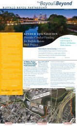
History of the Shepherd to Sabine project area - Buffalo Bayou Park
History of the Shepherd to Sabine project area - Buffalo Bayou Park
History of the Shepherd to Sabine project area - Buffalo Bayou Park

You also want an ePaper? Increase the reach of your titles
YUMPU automatically turns print PDFs into web optimized ePapers that Google loves.
encompassing <strong>the</strong> city in its present condition and an "outer" system which, heestimated, would s a t isfy <strong>the</strong> needs <strong>of</strong> <strong>the</strong> city as it expanded during <strong>the</strong> next thirty-fiveyears. For <strong>the</strong> western stretch <strong>of</strong> <strong>Buffalo</strong> <strong>Bayou</strong>, he emphasized <strong>the</strong> desirability <strong>of</strong>acquiring as soon as possible all property within <strong>the</strong> stream valley from Pres<strong>to</strong>nAvenue <strong>to</strong> Cleveland <strong>Park</strong>, as V i c k ' s <strong>Park</strong> had been <strong>of</strong>ficially designated. For <strong>the</strong>future, Comey advised acquisition <strong>of</strong> bayou property from four <strong>to</strong> six miles beyond <strong>the</strong>existing corporate limits. He specifically recommended that along <strong>Buffalo</strong> <strong>Bayou</strong>,about one and one-half miles <strong>to</strong> <strong>the</strong> west <strong>of</strong> Cleveland <strong>Park</strong>, property be acquired in largeacreage allotments <strong>to</strong> create a "forest reservation" as part <strong>of</strong> <strong>the</strong> outer system. Comeyincluded in his report a typical cross-section for <strong>the</strong> bayou parkway which indicated thattwo lane thoroughfares along <strong>the</strong> crest <strong>of</strong> <strong>the</strong> slope were <strong>to</strong> flank <strong>the</strong> route <strong>of</strong> <strong>the</strong> bayou.(20)Ano<strong>the</strong>r segment <strong>of</strong> <strong>the</strong> report which related <strong>to</strong> <strong>Buffalo</strong> <strong>Bayou</strong> was <strong>the</strong> proposalthat Hous<strong>to</strong>n establish a civic center in or near <strong>the</strong> central commercial district wherepublic buildings might be constructed in a harmonious style <strong>to</strong> achieve monumentaleffect. One <strong>of</strong> Comey's suggested locations, although not his first choice, was amulti-block site at <strong>the</strong> west end <strong>of</strong> Capi<strong>to</strong>l Avenue which could be integrated in<strong>to</strong> <strong>the</strong>proposed <strong>Buffalo</strong> <strong>Bayou</strong> parkway.(21) This site still lay outside <strong>the</strong> central <strong>area</strong> andmoreover was not really in <strong>the</strong> best part <strong>of</strong> <strong>to</strong>wn; its principal advantage appeared <strong>to</strong> bethat <strong>the</strong> Harris County Criminal Courts Building, built in 1895-1896, was already located<strong>the</strong>re.Comey's recommendations had <strong>the</strong>ir effect. While his report was in preparation,Hous<strong>to</strong>n voters authorized a $250,000 bond issue <strong>to</strong> finance parks acquisition in July1912. This was a significant indication <strong>of</strong> public support and <strong>the</strong> Board <strong>of</strong> <strong>Park</strong>Commissioners was apparently influenced by Comey's suggestions, for <strong>the</strong>y proceeded<strong>to</strong> acquire property on <strong>the</strong> north bank <strong>of</strong> White Oak <strong>Bayou</strong> from <strong>the</strong> Sou<strong>the</strong>rn PacificHospital in <strong>the</strong> Fifth Ward all <strong>the</strong> way west <strong>to</strong> <strong>the</strong> Hous<strong>to</strong>n Heights city limit. Along <strong>Buffalo</strong><strong>Bayou</strong> two extensive tracts <strong>of</strong> land were acquired. One tract bordered on <strong>the</strong> east byCleveland <strong>Park</strong> and on <strong>the</strong> south by <strong>Buffalo</strong> <strong>Bayou</strong>, lay just across <strong>the</strong> water from HebrewCemetery and comprised about twenty acres. The o<strong>the</strong>r tract lay on <strong>the</strong> south bank <strong>of</strong> <strong>the</strong>bayou just west <strong>of</strong> Hebrew Cemetery and was bordered on <strong>the</strong> west by <strong>Shepherd</strong>'s DamRoad and on <strong>the</strong> south by San Felipe Road. This consisted <strong>of</strong> about thirty-five acres. TheCity closed on this tract in April 1913. Mayor Rice, in his annual report for 1912, dated 28February 1913, commended <strong>the</strong> board on <strong>the</strong>se extensions <strong>to</strong> <strong>the</strong> park system. Riceurged that future administrations maintain a commitment <strong>to</strong> park planning andparticularly endorsed <strong>the</strong> idea <strong>of</strong> acquirinq a large park along <strong>Buffalo</strong> <strong>Bayou</strong> "that willfor all time be <strong>of</strong> sufficient maqnitude for our people. (22)In April 1913, H. Baldwin Rice was defeated in <strong>the</strong> mayoral election by BenCampbell. Whatever political differences may have existed between <strong>the</strong> two, Campbellfully shared Rice's enthusiasm for parks and c i v i c planning. However, during <strong>the</strong> firstyear <strong>of</strong> his administration, little seems <strong>to</strong> have been accomplished, at least in terms <strong>of</strong>