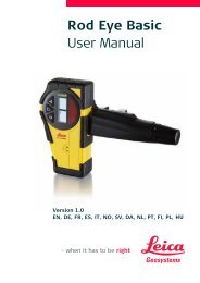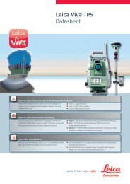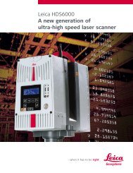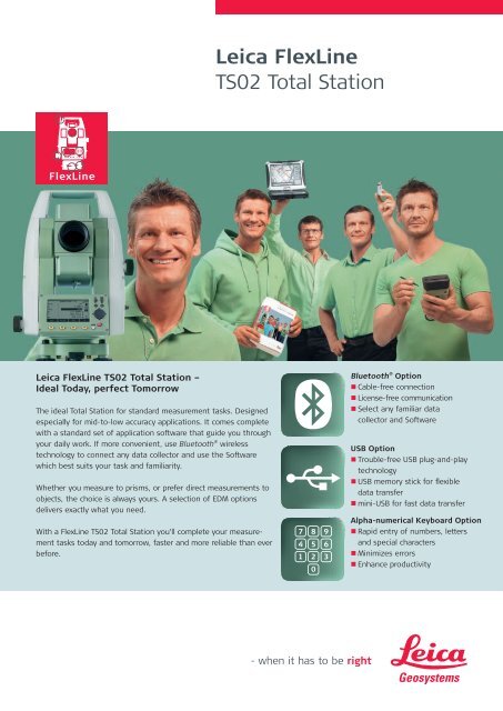
Leica FlexLine TS02 Total Station
Leica FlexLine TS02 Total Station
Leica FlexLine TS02 Total Station

You also want an ePaper? Increase the reach of your titles
YUMPU automatically turns print PDFs into web optimized ePapers that Google loves.
<strong>Leica</strong> <strong>FlexLine</strong> <strong>TS02</strong> <strong>Total</strong> <strong>Station</strong> –Ideal today, perfect tomorrowAngle Measurement (Hz, V)Accuracy (Standard deviation ISO-17123-3) 3” (1 mgon), 5” (1.5 mgon), 7” (2 mgon) optionalMethodAbsolute, continuous, diametricalDisplay resolution1” / 0.1 mgon / 0.01 milCompensationQuadruple axis compensation (Setting On, Off)Compensator Setting accuracy 1”, 1.5”, 2”Distance Measurement with ReflectorRange Round prism GPR1Range Reflective tape (60 mm x 60 mm)Accuracy / Measurement time(Standard deviation ISO-17123-4)3’500 m250 mStandard: 1.5 mm+2 ppm / typ. 2.4 s, Fast: 3 mm+2 ppm / typ. 0.8 s, Tracking: 3 mm+2 ppm / typ. 400 m>1000 m2 mm+2 ppm 2 / typ. 3 sAt 30 m: approx. 7 mm x 10 mm, At 50 m: approx. 8 mm x 20 mmoptionaloptionaloptionalData storage / CommunicationExtended Internal memoryMax.: 24’000 fixpoints, Max.: 13’500 measurementsUSB memory stick 1 Gigabyte, Transfer time 1’000 points/second optionalInterfaces Serial (Baudrate 1’200 to 115’200)USB Type A and mini B, Bluetooth ® WirelessoptionalData formatsGSI / DXF / LandXML / user definable ASCII formatsEmitting Guide Light for Stake Out (optional)Working Range(average atmospheric conditions)Positioning accuracy5 m – 150 m5 cm at 100 moptionaloptionalGeneralTelescopeMagnification30 xResolving power 3”Field of view1° 30’ (1.66 gon) / 2.7 m at 100 mFocusing range1.7 m to infinityReticleIlluminated, 5 brightness levelsKeyboard and DisplayDisplayGraphics, 160 x 280 pixels, illuminated, 5 brightness levelsKeyboardStandard keyboardAlpha-numerical keyboard, Second keyboardOperating SystemWindows CE5.0 CoreLaserplummetTypeLaser point, 5 brightness levelsCentering accuracy1.5 mm at 1.5 m Instrument heightBatteryTypeLithium-IonOperating time approx. 20 hours 1Weight<strong>Total</strong> <strong>Station</strong> including GEB211 and tribrach 5.1 kgEnvironmental specificationsTemperature range (operation) -20° C to +50° C (-4° F to +122° F)Arctic Version -35° C to 50° C (-31° F to +122° F)Dust & splash proof (IEC 60529)IP55Humidity95%, non condensingoptionaloptionalFlexField Onboard SoftwareApplication programsTopography (Orientation & Surveying), Stake Out, Resection, Height Transfer, Construction,Area (Plan & Surface), Volume calculation, Tie Distance (MLM), Remote Height, Hidden Point,Offset, Reference LineApplication programs Reference Arc, Reference Plane, COGO, Road 2D optional1Single Measurement every 30 second at 25° C with GEB221. Battery time may be shorter if battery is not new.2Range >500 m 4 mm+2 ppm<strong>Total</strong> Quality Management –our commitment to totalcustomer satisfaction.Guide light (EGL):LED class 1 in accordancewith IEC 60825-1 resp.EN 60825-1Distance meter:(PintPoint R400 / R1000):Laser class 3R in accordancewith IEC 60825-1 resp.EN 60825-1Laser plummet:Laser class 2 in accordancewith IEC 60825-1 resp.EN 60825-1Distance meter:(Prism Mode)Laser class 1 in accordancewith IEC 60825-1 resp.EN 60825-1Illustrations, descriptions and technical data are not binding. All rights reserved. Printed in Switzerland –Copyright <strong>Leica</strong> Geosystems AG, Heerbrugg, Switzerland, 2008. 768707en – VIII.08 – RDV<strong>Leica</strong> Geosystems AGHeerbrugg, Switzerlandwww.leica-geosystems.com