the use of lidar technology in autonomous cruise control systems for ...
the use of lidar technology in autonomous cruise control systems for ...
the use of lidar technology in autonomous cruise control systems for ...

You also want an ePaper? Increase the reach of your titles
YUMPU automatically turns print PDFs into web optimized ePapers that Google loves.
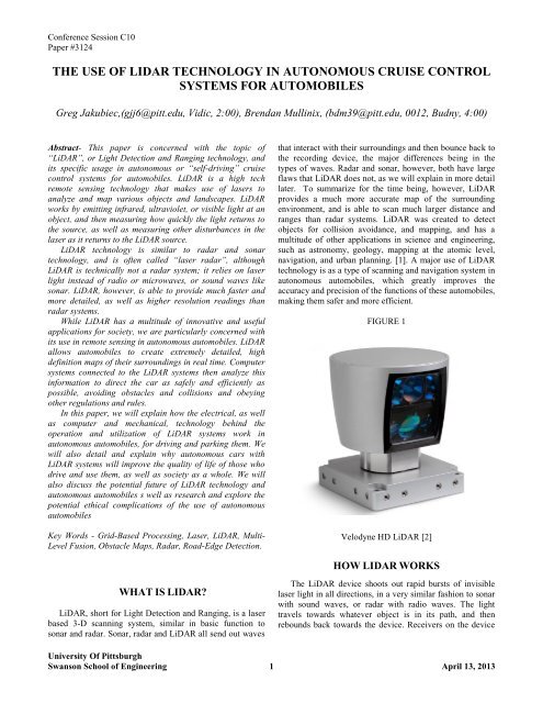
Conference Session C10Paper #3124THE USE OF LIDAR TECHNOLOGY IN AUTONOMOUS CRUISE CONTROLSYSTEMS FOR AUTOMOBILESGreg Jakubiec,(gjj6@pitt.edu, Vidic, 2:00), Brendan Mull<strong>in</strong>ix, (bdm39@pitt.edu, 0012, Budny, 4:00)Abstract- This paper is concerned with <strong>the</strong> topic <strong>of</strong>“LiDAR”, or Light Detection and Rang<strong>in</strong>g <strong>technology</strong>, andits specific usage <strong>in</strong> <strong>autonomous</strong> or “self-driv<strong>in</strong>g” <strong>cruise</strong><strong>control</strong> <strong>systems</strong> <strong>for</strong> automobiles. LiDAR is a high techremote sens<strong>in</strong>g <strong>technology</strong> that makes <strong>use</strong> <strong>of</strong> lasers toanalyze and map various objects and landscapes. LiDARworks by emitt<strong>in</strong>g <strong>in</strong>frared, ultraviolet, or visible light at anobject, and <strong>the</strong>n measur<strong>in</strong>g how quickly <strong>the</strong> light returns to<strong>the</strong> source, as well as measur<strong>in</strong>g o<strong>the</strong>r disturbances <strong>in</strong> <strong>the</strong>laser as it returns to <strong>the</strong> LiDAR source.LiDAR <strong>technology</strong> is similar to radar and sonar<strong>technology</strong>, and is <strong>of</strong>ten called “laser radar”, althoughLiDAR is technically not a radar system; it relies on laserlight <strong>in</strong>stead <strong>of</strong> radio or microwaves, or sound waves likesonar. LiDAR, however, is able to provide much faster andmore detailed, as well as higher resolution read<strong>in</strong>gs thanradar <strong>systems</strong>.While LiDAR has a multitude <strong>of</strong> <strong>in</strong>novative and <strong>use</strong>fulapplications <strong>for</strong> society, we are particularly concerned withits <strong>use</strong> <strong>in</strong> remote sens<strong>in</strong>g <strong>in</strong> <strong>autonomous</strong> automobiles. LiDARallows automobiles to create extremely detailed, highdef<strong>in</strong>ition maps <strong>of</strong> <strong>the</strong>ir surround<strong>in</strong>gs <strong>in</strong> real time. Computer<strong>systems</strong> connected to <strong>the</strong> LiDAR <strong>systems</strong> <strong>the</strong>n analyze this<strong>in</strong><strong>for</strong>mation to direct <strong>the</strong> car as safely and efficiently aspossible, avoid<strong>in</strong>g obstacles and collisions and obey<strong>in</strong>go<strong>the</strong>r regulations and rules.In this paper, we will expla<strong>in</strong> how <strong>the</strong> electrical, as wellas computer and mechanical, <strong>technology</strong> beh<strong>in</strong>d <strong>the</strong>operation and utilization <strong>of</strong> LiDAR <strong>systems</strong> work <strong>in</strong><strong>autonomous</strong> automobiles, <strong>for</strong> driv<strong>in</strong>g and park<strong>in</strong>g <strong>the</strong>m. Wewill also detail and expla<strong>in</strong> why <strong>autonomous</strong> cars withLiDAR <strong>systems</strong> will improve <strong>the</strong> quality <strong>of</strong> life <strong>of</strong> those whodrive and <strong>use</strong> <strong>the</strong>m, as well as society as a whole. We willalso discuss <strong>the</strong> potential future <strong>of</strong> LiDAR <strong>technology</strong> and<strong>autonomous</strong> automobiles s well as research and explore <strong>the</strong>potential ethical complications <strong>of</strong> <strong>the</strong> <strong>use</strong> <strong>of</strong> <strong>autonomous</strong>automobilesKey Words - Grid-Based Process<strong>in</strong>g, Laser, LiDAR, Multi-Level Fusion, Obstacle Maps, Radar, Road-Edge Detection.that <strong>in</strong>teract with <strong>the</strong>ir surround<strong>in</strong>gs and <strong>the</strong>n bounce back to<strong>the</strong> record<strong>in</strong>g device, <strong>the</strong> major differences be<strong>in</strong>g <strong>in</strong> <strong>the</strong>types <strong>of</strong> waves. Radar and sonar, however, both have largeflaws that LiDAR does not, as we will expla<strong>in</strong> <strong>in</strong> more detaillater. To summarize <strong>for</strong> <strong>the</strong> time be<strong>in</strong>g, however, LiDARprovides a much more accurate map <strong>of</strong> <strong>the</strong> surround<strong>in</strong>genvironment, and is able to scan much larger distance andranges than radar <strong>systems</strong>. LiDAR was created to detectobjects <strong>for</strong> collision avoidance, and mapp<strong>in</strong>g, and has amultitude <strong>of</strong> o<strong>the</strong>r applications <strong>in</strong> science and eng<strong>in</strong>eer<strong>in</strong>g,such as astronomy, geology, mapp<strong>in</strong>g at <strong>the</strong> atomic level,navigation, and urban plann<strong>in</strong>g. [1]. A major <strong>use</strong> <strong>of</strong> LiDAR<strong>technology</strong> is as a type <strong>of</strong> scann<strong>in</strong>g and navigation system <strong>in</strong><strong>autonomous</strong> automobiles, which greatly improves <strong>the</strong>accuracy and precision <strong>of</strong> <strong>the</strong> functions <strong>of</strong> <strong>the</strong>se automobiles,mak<strong>in</strong>g <strong>the</strong>m safer and more efficient.FIGURE 1Velodyne HD LiDAR [2]HOW LIDAR WORKSWHAT IS LIDAR?LiDAR, short <strong>for</strong> Light Detection and Rang<strong>in</strong>g, is a laserbased 3-D scann<strong>in</strong>g system, similar <strong>in</strong> basic function tosonar and radar. Sonar, radar and LiDAR all send out wavesThe LiDAR device shoots out rapid bursts <strong>of</strong> <strong>in</strong>visiblelaser light <strong>in</strong> all directions, <strong>in</strong> a very similar fashion to sonarwith sound waves, or radar with radio waves. The lighttravels towards whatever object is <strong>in</strong> its path, and <strong>the</strong>nrebounds back towards <strong>the</strong> device. Receivers on <strong>the</strong> deviceUniversity Of PittsburghSwanson School <strong>of</strong> Eng<strong>in</strong>eer<strong>in</strong>g 1 April 13, 2013
Gregory JakubiecBrendan Mull<strong>in</strong>ixEach LiDAR device conta<strong>in</strong>s one scanner <strong>for</strong> each laser.In <strong>the</strong> case <strong>of</strong> <strong>the</strong> Velodyne HD system, 64 lasers andscanners are <strong>use</strong>d [2].Position<strong>in</strong>g SystemsA key part <strong>of</strong> creat<strong>in</strong>g a detailed map <strong>of</strong> <strong>the</strong> environmentis know<strong>in</strong>g where <strong>the</strong> LiDAR device is actually located <strong>in</strong><strong>the</strong> larger environment, on a global level. LiDAR alone isable to scan every aspect <strong>of</strong> its surround<strong>in</strong>gs, but without aprecise read<strong>in</strong>g <strong>of</strong> its own location, accurate maps cannot becreated. This is done by Global Position<strong>in</strong>g System (GPS).GPS is a satellite-based navigation system [6], created by <strong>the</strong>US government. The GPS satellites send <strong>in</strong><strong>for</strong>mation about<strong>the</strong>ir location, <strong>in</strong> relation to <strong>the</strong> GPS device, and <strong>the</strong> positionon <strong>the</strong> ground is <strong>the</strong>n calculated. GPS <strong>systems</strong> allow <strong>the</strong>LIDAR system to keep track <strong>of</strong> its exact location at alltimes. This enables it to create highly detailed images <strong>of</strong> <strong>the</strong>correct location, and connect <strong>the</strong>se scanned images to abroader geographic location.around this by only search<strong>in</strong>g <strong>for</strong> “Doppler-shifted” [8]Signals. This aga<strong>in</strong> works aga<strong>in</strong>st <strong>the</strong> goal <strong>of</strong> mapp<strong>in</strong>g <strong>the</strong>entire environment, as <strong>the</strong> radar beam is “tightly foc<strong>use</strong>d”[8] on one area. This is where LiDAR excels. It is able tomap entire areas very quickly and accurately. The lasers<strong>use</strong>d do not encounter <strong>the</strong> same <strong>in</strong>terference, so <strong>the</strong>re can beno mistakes <strong>in</strong> measur<strong>in</strong>g <strong>the</strong> distance to objectsUSES OF LIDAR TECHNOLOGYAlthough LiDAR did not become commerciallysuccessful until <strong>the</strong> late 1970’s <strong>the</strong> current number <strong>of</strong> <strong>use</strong>s<strong>for</strong> LiDAR <strong>technology</strong> <strong>systems</strong> are great.Mapp<strong>in</strong>g/CartographyThe <strong>use</strong> <strong>of</strong> LiDAR scann<strong>in</strong>g has been implemented <strong>in</strong><strong>the</strong> creation <strong>of</strong> maps <strong>use</strong>d alongside aerial photography [1].LiDAR can assist <strong>in</strong> creat<strong>in</strong>g 3-D representations <strong>of</strong> allenvironments.WHY LIDAR?Now that we know how LiDAR works, <strong>the</strong> ma<strong>in</strong> questionis: why is it better than already exist<strong>in</strong>g <strong>technology</strong> such asradar and sonar? Radar and sonar had both been around <strong>for</strong>decades be<strong>for</strong>e LiDAR ga<strong>in</strong>ed popularity.The major problems with sonar are relativelystraight<strong>for</strong>ward. First <strong>of</strong> all, sonar makes <strong>use</strong> <strong>of</strong> sound wavesas opposed to radio or light waves, which travel muchslower, as <strong>the</strong> speed <strong>of</strong> light is magnitudes faster than that <strong>of</strong>sound. Light travels at approximately 29980000 m/s, whilesound only travels at approximately 343 m/s (<strong>in</strong> air at roomtemperature) [7]. This leads to a much lower frequency <strong>of</strong>measurements be<strong>in</strong>g taken, and <strong>the</strong>re<strong>for</strong>e a much lowerdegree <strong>of</strong> accuracy.Radar, although much more accurate than sonar, still fallsshort <strong>of</strong> LiDAR <strong>in</strong> many aspects. A major differencebetween <strong>the</strong> two is <strong>the</strong> way radar detects objects. The radardevice sends out radio waves that bounce <strong>of</strong>f objects andreturn to <strong>the</strong> receiver. Radio waves are <strong>the</strong> largest <strong>in</strong> <strong>the</strong>electromagnetic spectrum, rang<strong>in</strong>g from 1cm to 1000m.They are also silent, <strong>in</strong>visible, and easily detectable. Theradar set measures <strong>the</strong> time it takes <strong>for</strong> <strong>the</strong> echo to arrive,and also measures <strong>the</strong> Doppler Effect which allows radar todirectly measure velocities (this is one <strong>of</strong> <strong>the</strong> few advantagesradar does have over LiDAR) [8].The problem with radar, however, is that <strong>the</strong>re are manymore opportunities <strong>for</strong> <strong>in</strong>terference. When <strong>use</strong>d on <strong>the</strong>ground <strong>the</strong> return<strong>in</strong>g echo could be from any object such astrees, people, and animals, not just cars. This would be<strong>use</strong>ful, but <strong>the</strong> many return<strong>in</strong>g radio waves make it difficultto differentiate between objects. Some have found a wayUrban plann<strong>in</strong>gLiDAR is <strong>use</strong>d to create “Digital Surface Models” [1] <strong>of</strong><strong>the</strong> surface <strong>of</strong> <strong>the</strong> planet. Digital surface models are <strong>use</strong>d <strong>in</strong>conjunction with city planners to create models <strong>of</strong> <strong>the</strong>proposed area.Navigation“LiDAR is becom<strong>in</strong>g more and more popular as aguidance system <strong>for</strong> <strong>autonomous</strong> vehicles” [1]. Beca<strong>use</strong>LiDAR <strong>use</strong>s high-speed pulses <strong>of</strong> laser light, data isprovided <strong>in</strong> real-time [1]. This is <strong>the</strong> most attractive feature<strong>of</strong> LiDAR when <strong>use</strong>d <strong>in</strong> <strong>autonomous</strong> vehicles. The real-timedata feedback allows collision detection, and navigation likeno o<strong>the</strong>r device.Military and law en<strong>for</strong>cementOne <strong>of</strong> <strong>the</strong> most well-known <strong>use</strong>s <strong>of</strong> LiDAR is <strong>in</strong> Policespeed scanners. It has started to replace radar traffic gunsbeca<strong>use</strong> it has more accuracy, and does not face <strong>the</strong> same<strong>in</strong>terference problems. LiDAR is also be<strong>in</strong>g <strong>use</strong>d <strong>in</strong> <strong>the</strong>autonomy <strong>of</strong> robots and UAV drones <strong>for</strong> <strong>the</strong> military.3
Gregory JakubiecBrendan Mull<strong>in</strong>ixLIDAR IN AUTOMOBILESThe direct application <strong>of</strong> LiDAR <strong>systems</strong> that we aremost concerned with is its <strong>use</strong> <strong>in</strong> self-driv<strong>in</strong>g automobiles.Autonomous cars that utilize LiDAR generally have multipleLiDAR devices onboard, <strong>in</strong> addition to various o<strong>the</strong>rimportant devices <strong>use</strong>d to sense <strong>the</strong>ir surround<strong>in</strong>gs, such asradar, cameras and video <strong>systems</strong>. They also carry complexcomputer process<strong>in</strong>g <strong>systems</strong> that analyze <strong>the</strong> data. It shouldbe noted that LiDAR can’t effectively navigate an<strong>autonomous</strong> car by itself. It must work <strong>in</strong> conjunction withvarious o<strong>the</strong>r devices, such as cameras and radar <strong>systems</strong>, aswell as advanced computer hardware and s<strong>of</strong>tware.There have been multiple specific methods <strong>of</strong> analyz<strong>in</strong>gand utiliz<strong>in</strong>g <strong>the</strong> LiDAR data that have been experimentedwith, although <strong>the</strong> majority <strong>of</strong> <strong>the</strong>m are heavily based on <strong>the</strong>concept <strong>of</strong> grid based process<strong>in</strong>g (which will itself later beexpla<strong>in</strong>ed <strong>in</strong> much greater detail), <strong>in</strong> order to mapenvironments <strong>in</strong> real time.FIGURE 4LiDAR and Radar IntegrationIn addition to LiDAR, many cars also have radar <strong>systems</strong>onboard. Although LiDAR can take measurements acrosslarger ranges and distances, as well as operate much better <strong>in</strong><strong>in</strong>clement wea<strong>the</strong>r, radar is able to provide <strong>the</strong> vehicle withmore detailed <strong>in</strong><strong>for</strong>mation, due to <strong>the</strong> Doppler Effect.LiDAR <strong>technology</strong> is our ma<strong>in</strong> focus, although radar doeshave its place <strong>in</strong> <strong>autonomous</strong> cars as well, and is not to be<strong>for</strong>gotten. The most efficient <strong>autonomous</strong> car should utilizeboth [5].When <strong>use</strong>d to operate automobiles, LiDAR andtraditional radar both serve <strong>the</strong>ir respective purposes. Inorder <strong>for</strong> a LiDAR mach<strong>in</strong>e to measure velocity, <strong>for</strong><strong>in</strong>stance, it must take different distance measurements atdifferent times, and <strong>use</strong> <strong>the</strong>m to compute <strong>the</strong> velocity <strong>of</strong> <strong>the</strong>object be<strong>in</strong>g tracked. This leads to a relatively <strong>in</strong>accuratevalue <strong>of</strong> velocity, which <strong>in</strong> turn leads to an <strong>in</strong>accurate value<strong>of</strong> acceleration. Radar, however, makes <strong>use</strong> <strong>of</strong> <strong>the</strong> DopplerEffect, which allows <strong>systems</strong> to measure <strong>the</strong> disturbances <strong>in</strong><strong>the</strong> frequency <strong>of</strong> <strong>the</strong> return signal, which correspond directlyto velocity <strong>of</strong> <strong>the</strong> po<strong>in</strong>t be<strong>in</strong>g measured. [5]Although LiDAR may not provide as accurate velocity<strong>in</strong><strong>for</strong>mation as radar <strong>systems</strong>, it does operate at much largerranges and fields <strong>of</strong> view. This is essential to a vehiclemov<strong>in</strong>g through curves and around corners at high speeds[5]. The most efficient <strong>autonomous</strong> navigation system is onethat utilizes both LiDAR and radar <strong>in</strong> harmony, cover<strong>in</strong>g <strong>the</strong>weaknesses and exploit<strong>in</strong>g <strong>the</strong> strengths <strong>of</strong> both <strong>systems</strong>.Below is a diagram <strong>of</strong> one example <strong>of</strong> an <strong>autonomous</strong> car<strong>systems</strong> utiliz<strong>in</strong>g multiple types <strong>of</strong> sens<strong>in</strong>g <strong>technology</strong> tonavigate.Diagram <strong>of</strong> Radar, and Ultrasonic collision detector sensorson a vehicle. [4]Grid Based Process<strong>in</strong>gThere have been multiple methods <strong>of</strong> analyz<strong>in</strong>g andutiliz<strong>in</strong>g <strong>the</strong> LiDAR data that have been experimented with,although <strong>the</strong> majority <strong>of</strong> <strong>the</strong>m are heavily based on <strong>the</strong>concept <strong>of</strong> grid based process<strong>in</strong>g.Grid based process<strong>in</strong>g is a general technique <strong>use</strong>d <strong>in</strong><strong>autonomous</strong> cars to map <strong>the</strong>ir environments. The basic idea<strong>of</strong> this type <strong>of</strong> data process<strong>in</strong>g is that very small amounts <strong>of</strong>data are each stored <strong>in</strong> very specific “locations”,correspond<strong>in</strong>g to <strong>the</strong>ir actual physical locations, with<strong>in</strong> agigantic grid. This allows <strong>the</strong> system to quickly andefficiently locate and analyze whatever specific data may berelevant at <strong>the</strong> current moment, and <strong>the</strong>n update all <strong>of</strong> it <strong>in</strong>real time.The environment around <strong>the</strong> car is divided up <strong>in</strong>to smallsections <strong>of</strong> grid with<strong>in</strong> <strong>the</strong> comput<strong>in</strong>g system. The LiDARand radar <strong>systems</strong> <strong>the</strong>n collect data about each piece <strong>of</strong> thisgrid, return<strong>in</strong>g it to <strong>the</strong> analysis s<strong>of</strong>tware. Us<strong>in</strong>g <strong>the</strong> responsefrom <strong>the</strong> different <strong>systems</strong>, a probability is determ<strong>in</strong>ed <strong>for</strong> aspecific grid square to be occupied, and assigned to thatspot. With each <strong>of</strong> <strong>the</strong>se small grid spaces be<strong>in</strong>g extremelysmall, a large grid environment is <strong>for</strong>med [9]. Conclusionscan <strong>the</strong>n be made by <strong>the</strong> computer regard<strong>in</strong>g <strong>the</strong> shapes andtextures <strong>of</strong> objects by analyz<strong>in</strong>g <strong>the</strong> similarities anddifferences <strong>of</strong> clusters <strong>of</strong> grid squares to each o<strong>the</strong>r, andsubsequently what types <strong>of</strong> objects <strong>the</strong>y are most likely tobe. This <strong>in</strong><strong>for</strong>mation is <strong>the</strong>n <strong>use</strong>d to navigate <strong>the</strong> careffectively throughout this constantly chang<strong>in</strong>g grid.4
Gregory JakubiecBrendan Mull<strong>in</strong>ixcars. “Someth<strong>in</strong>g similar to this happened after <strong>the</strong> ThreeMile Island and Chernobyl accidents with <strong>the</strong> nuclear<strong>in</strong>dustry, and it has only recently partly recovered from thosedisasters” [13]. An event such as <strong>the</strong>se would set <strong>the</strong><strong>autonomous</strong> automobile <strong>in</strong>dustry back decades, andpotentially destroy any chances it had at large scaleimplementation.Although <strong>the</strong> majority <strong>of</strong> relevant ethical concerns regard<strong>autonomous</strong> automobiles specifically, LiDAR also carriespotential ethical problems <strong>in</strong> and <strong>of</strong> itself. For <strong>in</strong>stance,many people are likely to be anxious <strong>of</strong> <strong>the</strong> widespread <strong>use</strong><strong>of</strong> laser <strong>technology</strong> due to fears <strong>of</strong> lasers harm<strong>in</strong>g humanbe<strong>in</strong>gs or <strong>the</strong> environment [1]. These fears are unfounded,however, as <strong>the</strong> lasers utilized <strong>in</strong> <strong>the</strong>se <strong>use</strong> a wavelength andfrequency that has been tested and proven to be safe <strong>for</strong>humans and not damage eyes or o<strong>the</strong>r bodily functions.In order to successfully <strong>in</strong>tegrate <strong>the</strong>se mach<strong>in</strong>es <strong>in</strong>to oursociety without dissent, it must be made sure that any and all<strong>of</strong> <strong>the</strong> devices <strong>use</strong>d are safe to humans, through extensiveresearch and test<strong>in</strong>g They should also be <strong>in</strong>tegrated <strong>in</strong>towidespread <strong>use</strong> fairly slowly, so that society can adapt to<strong>the</strong>ir <strong>use</strong> as should occur naturally.Although LiDAR and <strong>autonomous</strong> cars do have <strong>the</strong>irethical complications <strong>for</strong> society, <strong>the</strong>y are <strong>of</strong> a magnitudethat can be overcome over time through responsible <strong>use</strong> <strong>of</strong><strong>the</strong>se <strong>systems</strong>. After all, <strong>the</strong> <strong>in</strong>itial advent <strong>of</strong> cars <strong>the</strong>mselvesmet plenty <strong>of</strong> dissent from <strong>the</strong> public, and now a majority <strong>of</strong>American families own vehicles, or at least make <strong>use</strong> <strong>of</strong>public transportation, and it has led to a far more advancedand efficient society, as will LiDAR and self-driv<strong>in</strong>g cars <strong>in</strong>years to come.Pre-Crash SystemsOne important part <strong>of</strong> <strong>autonomous</strong>, as well as semi<strong>autonomous</strong>vehicle <strong>systems</strong> is pre-crash <strong>systems</strong>. These are<strong>systems</strong> that are implemented <strong>in</strong> <strong>the</strong> event <strong>of</strong> an impend<strong>in</strong>gcrash to m<strong>in</strong>imize <strong>the</strong> damage ca<strong>use</strong>d, and <strong>the</strong>re<strong>for</strong>e helpmake <strong>the</strong>se cars safer, <strong>for</strong> passengers that may ride <strong>in</strong> <strong>the</strong>m,as well as decreas<strong>in</strong>g <strong>the</strong> likelihood <strong>of</strong> accidents betweennon-passenger cars. These are already be<strong>in</strong>g <strong>use</strong>d <strong>in</strong> <strong>use</strong>rdriven cars that are currently on <strong>the</strong> road <strong>in</strong> order tom<strong>in</strong>imize <strong>in</strong>juries and fatalities to <strong>the</strong> passengers.Basically, <strong>the</strong> vehicle sense when an emergency is aboutto occur through LiDAR and radar and activates anemergency reaction sequence. The vehicle will <strong>the</strong>nautomatically react by tighten<strong>in</strong>g seatbelts, adjust<strong>in</strong>g headrestra<strong>in</strong>ts, and deploy<strong>in</strong>g airbags early, <strong>in</strong> order to protect allonboard passengers. It will also activate emergency steer<strong>in</strong>gand brak<strong>in</strong>g, as fast as physically possible, to avoidoncom<strong>in</strong>g collisions, and set <strong>of</strong>f emergency signals [9]. Thisis one major aspect <strong>of</strong> what makes self-driv<strong>in</strong>g cars saferthan human driven cars. Humans will <strong>of</strong>ten panic dur<strong>in</strong>gemergency situations, whereas <strong>autonomous</strong> cars canconsistently act as logically as possible and do whatever ispossible to avoid an accident, or at least m<strong>in</strong>imize <strong>the</strong>damage ca<strong>use</strong>d by one.THE FUTURE OF LIDAR ANDAUTONOMOUS AUTOMOBILESJudg<strong>in</strong>g by <strong>the</strong> current state <strong>of</strong> <strong>autonomous</strong> automobile<strong>technology</strong>, self-driv<strong>in</strong>g cars are a very real possibility <strong>for</strong><strong>the</strong> relatively near future. Although still be<strong>in</strong>g heavilyref<strong>in</strong>ed and researched, <strong>the</strong> required <strong>technology</strong> is certa<strong>in</strong>ly<strong>in</strong> existence. Google has successfully created a small group<strong>of</strong> function<strong>in</strong>g semi-<strong>autonomous</strong> cars, which have driven atotal <strong>of</strong> around 140,000 miles around Cali<strong>for</strong>nia, although all<strong>of</strong> <strong>the</strong>se are done with a driver who can take <strong>control</strong> ifnecessary. “Cars are approach<strong>in</strong>g <strong>the</strong> po<strong>in</strong>t that smartphoneplat<strong>for</strong>ms had reached just be<strong>for</strong>e <strong>the</strong> <strong>in</strong>troduction <strong>of</strong> <strong>the</strong>Apple iPhone and <strong>the</strong> Motorola Android” [4].Implementation <strong>of</strong> self-driv<strong>in</strong>g vehicles <strong>in</strong>to th<strong>in</strong>gs such as<strong>the</strong> shipp<strong>in</strong>g bus<strong>in</strong>ess, would completely automate truckdriv<strong>in</strong>g, elim<strong>in</strong>at<strong>in</strong>g human error and decreas<strong>in</strong>g excesspollution. This will also allow <strong>for</strong> th<strong>in</strong>gs to be shipped muchcheaper, as drivers would not be utilized, but ra<strong>the</strong>r a smallgroup <strong>of</strong> technicians to service <strong>the</strong> vehicles.In Cali<strong>for</strong>nia, a bill was signed <strong>in</strong>to law by GovernorJerry Brown on September 25, 2012 that will legally allow<strong>autonomous</strong> cars to travel on public roads along with <strong>use</strong>rdriven cars, once <strong>the</strong>y have been certified as safe [12].Sergey Brian, <strong>of</strong> Google has also said that it would take“fewer years than he had f<strong>in</strong>gers on his right hand” <strong>for</strong> <strong>the</strong>secars to become available to <strong>the</strong> general public, although <strong>the</strong>yare likely to be very expensive at first [12].With advancements and promises such as <strong>the</strong>sehappen<strong>in</strong>g outside <strong>of</strong> <strong>the</strong> science and eng<strong>in</strong>eer<strong>in</strong>g world, aswell <strong>the</strong> technological advances that cont<strong>in</strong>ue to occurwith<strong>in</strong> <strong>the</strong> s<strong>of</strong>tware and operation <strong>of</strong> <strong>autonomous</strong>automobiles and <strong>the</strong>ir <strong>use</strong> <strong>of</strong> LiDAR <strong>systems</strong>, it likely willnot be very long be<strong>for</strong>e we beg<strong>in</strong> to see <strong>the</strong>se cars on <strong>the</strong>road alongside our own.REFERENCES[1] (2012). “How does LIDAR Work?” LIDAR-UK.(Onl<strong>in</strong>e article). http://www.<strong>lidar</strong>-uk.com/how-<strong>lidar</strong>-works/[2] (2012). “HD-64e.” Velodyne LIDAR. (Onl<strong>in</strong>e article).http://velodyne<strong>lidar</strong>.com/<strong>lidar</strong>/hdlproducts/hdl64e.aspx[3] (2012). “LIDAR Overview.” Wash<strong>in</strong>gton.edu. (Onl<strong>in</strong>earticle).http://<strong>for</strong>sys.cfr.wash<strong>in</strong>gton.edu/JFSP06/<strong>lidar</strong>_<strong>technology</strong>.htm[4] M. Conner. (2011). “Automobile sensors may usher <strong>in</strong>self driv<strong>in</strong>g cars.” EDN Network. (Onl<strong>in</strong>e article).http://www.edn.com/design/automotive/4368069/Automobil7
Gregory JakubiecBrendan Mull<strong>in</strong>ixe-sensors-may-usher-<strong>in</strong>-self-driv<strong>in</strong>g-cars[5] G¨ohr<strong>in</strong>g, Daniel, Wang, Miao, Schn¨urmacher, Micheal,Ganj<strong>in</strong>eh, T<strong>in</strong>osch. (2011). “Radar/Lidar Sensor Fusion <strong>for</strong>Car-Follow<strong>in</strong>g on Highways” 5th International Conferenceon Automation, Robotics and Applications (ConferencePaper).http://ieeexplore.ieee.org/stamp/stamp.jsp?tp=&arnumber=6144918[6] (2013). “What is GPS?” Garm<strong>in</strong>.http://www8.garm<strong>in</strong>.com/aboutGPS/[7] Halliday, Resnick, Walker. (2012). “Fundamentals <strong>of</strong>Physics” Department <strong>of</strong> Physics and Astronomy University<strong>of</strong> Pittsburgh. (Textbook)[8] Kaydee. (2011). “Self-Driv<strong>in</strong>g Cars: Here Sooner ThanYou Th<strong>in</strong>k, Courtesy <strong>of</strong> Google?” Eng<strong>in</strong>eer<strong>in</strong>g Ethics Blog.(Onl<strong>in</strong>e Blog Article).http://eng<strong>in</strong>eer<strong>in</strong>gethicsblog.blogspot.com/2011/08/selfdriv<strong>in</strong>g-cars-here-sooner-than-you.html[9] L<strong>in</strong>dner, Philipp and Wanielik, Gerd. (2009). “3DLiDAR Process<strong>in</strong>g <strong>for</strong> Vehicle Safety and EnvironmentRecognition.” (Onl<strong>in</strong>e article).http://ieeexplore.ieee.org/stamp/stamp.jsp?tp=&arnumber=4938725[10] Peterson, Kev<strong>in</strong>, Ziglar, Jason,and Rybski, Paul E..(2008). “Fast Feature Detection and Stochastic ParameterEstimation <strong>of</strong> Road Shape us<strong>in</strong>g Multiple LIDAR” TheRobotics Institute, Carnegie Mellon University (ConferencePaper).http://ieeexplore.ieee.org/stamp/stamp.jsp?tp=&arnumber=4651161[11] (2012). “Moral Mach<strong>in</strong>es.” The New Yorker. (Onl<strong>in</strong>earticle).http://www.newyorker.com/onl<strong>in</strong>e/blogs/newsdesk/2012/11/google-driverless-car-morality.html[12] Stiller, Christoph, and Ziegler, Julius. (2012). “9 thInternational Multi-conference on Systems, Signals, andDevices” (Conference Paper).http://ieeexplore.ieee.org/stamp/stamp.jsp?tp=&arnumber=6198130[13] Thompson, Ia<strong>in</strong>. (2012). “Google PromisesAutonomous Cars <strong>for</strong> all with<strong>in</strong> 5 Years” (Onl<strong>in</strong>e NewsArticle).http://www.<strong>the</strong>register.co.uk/2012/09/25/google_automatic_cars_legal/Research & Development Division Automotive Research &Test<strong>in</strong>g Center (Conference Paper).http://ieeexplore.ieee.org/stamp/stamp.jsp?tp=&arnumber=5514860(2012). “Google’s Self-Driv<strong>in</strong>g Car with Bl<strong>in</strong>d Driver”.Universal Design Style (Onl<strong>in</strong>e Article)http://www.universaldesignstyle.com/wpcontent/uploads/2012/04/01458sz1i28643900.jpgLard<strong>in</strong>ois, Frederic (2012). “Google’s Self-Driv<strong>in</strong>g CarsComplete 300K Miles Without Accident, Ready ForCommut<strong>in</strong>g” Tech Crunch. (Onl<strong>in</strong>e Article).http://techcrunch.com/2012/08/07/google-cars-300000-miles-without-accident/Moras, Julien, Cherfaoui, V´eronique and Bonnifait.,Phillipe. (2011). “A <strong>lidar</strong> Perception Scheme <strong>for</strong> IntelligentVehicle Navigation” 2010 11th Int. Conf. Control,Automation, Robotics and Vision (Conference Paper).http://ieeexplore.ieee.org/stamp/stamp.jsp?tp=&arnumber=5707962(2012). “LIDAR Boosts Bra<strong>in</strong> Power <strong>for</strong> Self-Driv<strong>in</strong>g Cars.”Earth Imag<strong>in</strong>g Journal. (Onl<strong>in</strong>e article).http://eijournal.com/<strong>lidar</strong>-solutions-showcase/<strong>lidar</strong>-boostsbra<strong>in</strong>-power-<strong>for</strong>-self-driv<strong>in</strong>g-cars(2012). “User’s Manual and Programm<strong>in</strong>g Guide.” (Onl<strong>in</strong>earticle) http://velodyne<strong>lidar</strong>.com/<strong>lidar</strong>/products/manual/63-HDL64ES2h%20HDL-64E%20S2%20CD%20HDL-64E%20S2%20Users%20Manual.pdfACKNOWLEDGMENTSWe would like to thank our co-chair, Traci Smith, <strong>for</strong>help<strong>in</strong>g us write and revise our paper and po<strong>in</strong>t<strong>in</strong>g us <strong>in</strong> <strong>the</strong>right direction. We also would like to thank Red Bull, <strong>for</strong>help<strong>in</strong>g us to stay awake <strong>for</strong> <strong>the</strong> long hours required to writethis paper.[14] (susta<strong>in</strong>ability)http://ieeexplore.ieee.org/stamp/stamp.jsp?tp=&arnumber=4534692ADDITIONAL SOURCESChan Wei Hsu, Tsung Hua Hsu, Chun Hsiung Chen andYung Yuan Kuo. (2010). “A Path Plann<strong>in</strong>g Achievement <strong>of</strong>Car Follow<strong>in</strong>g <strong>in</strong> Motion Control via LiDAR Sens<strong>in</strong>g.”8