- Page 1:
A Bibliography Related to Crime Sce
- Page 4 and 5:
AcknowledgmentsThis bibliography be
- Page 6 and 7:
and analyzing residual blood eviden
- Page 8 and 9:
Training in polar coordinate mappin
- Page 10 and 11:
Bank, P. and P. Dahlstrom1974 Colli
- Page 12 and 13:
Duncan, Jack1983 Search Techniques.
- Page 14 and 15:
Hochrein, Michael J. (compiler)1998
- Page 16 and 17:
McManamon, F.P. and D.J. Ives1980 D
- Page 18 and 19:
Ragir, Sonia1972 A review of techni
- Page 20 and 21:
Stone, G.D.1981 On Artifact Density
- Page 23 and 24:
Allan, Arthur Laidlaw, J.R. Hollwey
- Page 25 and 26:
Brown, KA. Robson, A. Chalmers, T.
- Page 28 and 29:
Grinsell, L., P. Rahtz and J.P. Wil
- Page 30 and 31:
Krakiwsky, E., and J. McLellan1995
- Page 32 and 33:
Moffitt, Francis H., and John D. Bo
- Page 34 and 35:
Roelofs, R.1950 Astronomy Applied t
- Page 36 and 37:
Van Sickle, Jan1993 1001 Solved Sur
- Page 38 and 39:
Photography of latent fingerprint e
- Page 40 and 41:
1977 Interpretation of Aerial Photo
- Page 42 and 43:
1996c High-Resolution Satellite Ima
- Page 44 and 45:
Ray, Richard Godfrey1960 Aerial Pho
- Page 46 and 47:
Williams, J.C.1969 Simple Photogram
- Page 48 and 49: DeFranco, Liz2000 Going Digital: Fo
- Page 50 and 51: Janoski, Kathleen N.1998 Autopsy Ph
- Page 52 and 53: 1987 Photography and Video for the
- Page 54 and 55: Van Enckevort, H.J., and J.A. Bella
- Page 56 and 57: Betts, James2003 Adobe Photoshop fo
- Page 58 and 59: Kinne, R.1975 The Complete Book of
- Page 60 and 61: 1994 The Invisible Image - A Tutori
- Page 62 and 63: 1979a What's Ahead for Police Dogs?
- Page 64 and 65: Fox, M.W.1979 Canine Behavior: A Hi
- Page 66 and 67: Lasseter, Alanna E., Keith P. Jacob
- Page 68 and 69: Serpell, J.A., and Y. Hsu2001 Devel
- Page 70 and 71: Zwickey, J.1987 Is There a Future f
- Page 72 and 73: Two types of ground penetrating rad
- Page 74 and 75: Church, Ronald H., and William E. W
- Page 76 and 77: Leckebusch, Jürg, and Ronald Peike
- Page 78 and 79: Smith D.G. and H.M. Jol1995 Ground
- Page 80 and 81: Gaussorgues, G.1994 Infrared Thermo
- Page 82 and 83: 1969 Magnetic location. In Science
- Page 84 and 85: Ciminale, Marcello2003 A High Resol
- Page 86 and 87: 2000 Palaeomagnetic Studies of Burn
- Page 88 and 89: Pearson, Charles E., et al.1982 A T
- Page 90 and 91: 2002 Soil and Susceptibility: Aspec
- Page 92 and 93: Campbell, James B.1987 Introduction
- Page 94 and 95: 1994a Satellite Image Processing fo
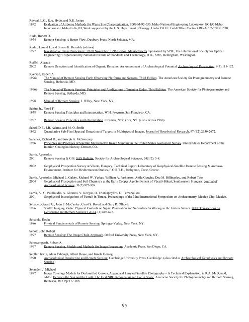
- Page 96 and 97: Kvamme, Kenneth L.1998 Anthropology
- Page 100 and 101: Sever, T.L.1988 Remote Sensing. In
- Page 102 and 103: Adderley, W. Paul, Ian A. Simpson,
- Page 104 and 105: Carabelli, E.1966 A New Tool for Ar
- Page 106 and 107: Doolittle, J.A., and F. Miller1992
- Page 108 and 109: Hargrave, Michael L., Lewis E. Some
- Page 110 and 111: Llopis, José and Michael K. Sharp1
- Page 112 and 113: Palmer, L.S.1959 Examples of Geoele
- Page 114 and 115: Sheehan, K.1999 An Integrated Marin
- Page 116 and 117: Will, John W.1987 SONAR: Underwater
- Page 118 and 119: Adair, Thomas W.1998 Survival of Ph
- Page 120 and 121: Bell, Edward L.1993 Historical Arch
- Page 122 and 123: 1997bBabies in the Well: An Insight
- Page 124 and 125: Custer, J.F.1992 A Simulation Study
- Page 126 and 127: Dockall, Helen Danzeiser1995 Applic
- Page 128 and 129: Garrow, P.H., S.A. Symes, and H.W.
- Page 130 and 131: Hedges H.W.M. (editor)1987 In situ
- Page 132 and 133: 2000 Archaeology. In J.A. Siegel, P
- Page 134 and 135: 1978b1978cA Double Child Burial in
- Page 136 and 137: McKillop, Heather1995 Recognizing C
- Page 138 and 139: Odell, G.H., F. Cowan1987 Estimatin
- Page 140 and 141: 1962 The West Kennett Long Barrow:
- Page 142 and 143: Ross, Anne, and Ryan Duffy2000 Fine
- Page 144 and 145: Sigler-Lavelle, B.J.1981 Familiar C
- Page 146 and 147: Synecki, Karen A.1985 Understanding
- Page 148 and 149:
Weiner, S., S. Schiegl, P. Goldberg
- Page 150 and 151:
Human tibia and fibula fragment in
- Page 152 and 153:
Artz, Joe Alan1985 A Soil-Geomorphi
- Page 154 and 155:
Bintliff, J.L., C. Gaffney, A. Wate
- Page 156 and 157:
Carter, Martin R. (editor)1993 Soil
- Page 158 and 159:
Daugherty, LeRoy A.1997 Soil Scienc
- Page 160 and 161:
1985 Theoretical and Practical Cons
- Page 162 and 163:
Gardiner, M.J., and T. Walsh1966 Co
- Page 164 and 165:
Hare, P.E.1980 Organic Geochemistry
- Page 166 and 167:
Humphreys, G.S., P. Hunt, and R. Bu
- Page 168 and 169:
Kumada, K.1987 Chemistry of Soil Or
- Page 170 and 171:
Lyford, W.H.1963 Importance of Ants
- Page 172 and 173:
Morisawa, Marie1968 Streams: Their
- Page 174 and 175:
Peacock, David, and David Williams1
- Page 176 and 177:
Sánchez, A., M.L. Cañabate, and R
- Page 178 and 179:
Smith, H.W. and C.D. Moodie1947 Col
- Page 180 and 181:
Texas Police Association1975 Soil,
- Page 182 and 183:
Weide, David L.1966 Soil pH as a Gu
- Page 184 and 185:
Victim's remains affected by decomp
- Page 186 and 187:
Andrews, P, and J. Cook1985 Natural
- Page 188 and 189:
Bereuter, T.L., W. Mikenda, and C.
- Page 190 and 191:
Brown, W.E.1973 Solubilities of Pho
- Page 192 and 193:
Crowther, J.2002 The Experimental E
- Page 194 and 195:
1991bFossilization: The Process of
- Page 196 and 197:
Giertsen, J.C., and I. Morild1989 S
- Page 198 and 199:
Hansen, J.P.H., and J. Nordqvist199
- Page 200 and 201:
Janaway, R.C.1996 The Decay of Huma
- Page 202 and 203:
Komar, Debra A.1998 Decay Rates in
- Page 204 and 205:
Lyman, R. Lee1979 Faunal Analysis:
- Page 206 and 207:
Marks, Murray K., and Mariateresa A
- Page 208 and 209:
Nawrocki, S.P. and M.A. Clark1994 E
- Page 210 and 211:
1991bLindow Man, Tollund Man and Ot
- Page 212 and 213:
Reinhard, J.1996 Peru's Ice Maidens
- Page 214 and 215:
Semal, Patrick, and Rosine Orban199
- Page 216 and 217:
Swann, H., and N. Spafford1951 Body
- Page 218 and 219:
Tykot, R.H., N.J. van der Merwe, an
- Page 220 and 221:
Wiechmann, Ingrid, Elisabeth Brandt
- Page 222 and 223:
Aufderheide, Arthur C., and Donald
- Page 224 and 225:
Edgar, H.J.H.1997 Paleopathology of
- Page 226 and 227:
Killoran, P.E., F. Tarricone, and T
- Page 228 and 229:
Ortner, Donald J.1981 Lesions of th
- Page 230 and 231:
Rathbun, Ted A.1985 Health and Dise
- Page 232 and 233:
Tillier, A.M., B. Arensburg, H. Dud
- Page 234 and 235:
Excavation of a concentration of ca
- Page 236 and 237:
Craig, Emily2002 Intentional Postmo
- Page 238 and 239:
Hettinger, Jennifer, and David J. R
- Page 240 and 241:
Murray, K.A., and J.C. Rose1993 The
- Page 242 and 243:
Stevens, P.J.1977 Identification of
- Page 244 and 245:
Scavenged hand of a homicide victim
- Page 246 and 247:
Chapenoire, S., B. Camaide, and M.
- Page 248 and 249:
Hughes, A.R.1954 Hyenas vs. Austral
- Page 250 and 251:
Rodriguez, William C. III1987 Postm
- Page 252 and 253:
Villa, P., and L.E. Bartram1996 Fla
- Page 254 and 255:
Anderson T.1996 Cranial Weapon Inju
- Page 256 and 257:
Bixler, R.P., C.R. Ahrens, R.P. Ros
- Page 258 and 259:
Bunn, H.T., and J.A. Ezzo1993 Hunti
- Page 260 and 261:
Cragg, J.1967 Nail Gun Fatality. Br
- Page 262 and 263:
1984a Pattern of Intersecting Fract
- Page 264 and 265:
Fenton, Todd W., Joyce L. de Jong,
- Page 266 and 267:
Graver, Sally, Kristin D. Sobolik,
- Page 268 and 269:
Hershkovitz, I., L. Bedford, L.M. J
- Page 270 and 271:
Judd, Margaret A.2002a Ancient Inju
- Page 272 and 273:
Klepinger, Linda L.1999 Unusual Ske
- Page 274 and 275:
Liston, Maria A., and Brenda J. Bak
- Page 276 and 277:
Massie, Robert K.1995 The Romanovs:
- Page 278 and 279:
Missliwetz, J.1995 Fatal Impalement
- Page 280 and 281:
2001 FOCUS: The Scapula Representat
- Page 282 and 283:
1998b Analysis of Beveling in Gunsh
- Page 284 and 285:
Rowe, W.F.1981 Interpretation of Sh
- Page 286 and 287:
Shakir, Abdulrezzak, Steven A. Koeh
- Page 288 and 289:
Spence, M.W., M.J. Shkrum, C. White
- Page 290 and 291:
Symes, Steven A., John A. Williams,
- Page 292 and 293:
Vanezis, P., and I.E. West1983 Tent
- Page 294 and 295:
Wenham, S.J.1989 Anatomical Interpr
- Page 296 and 297:
Zugibe, F.T., J.T. Costello and M.K
- Page 298 and 299:
Jungbluth, W.D.1989 Knuckle Print I
- Page 300 and 301:
Ambrose, Stanley H., and M. Anne Ka
- Page 302 and 303:
Cattaneo, Cristina, and Eric Baccin
- Page 304 and 305:
Grauer, A.L., E.M. McNamara, and S.
- Page 306 and 307:
Kempton, J.B., et al.1992 Compariso
- Page 308 and 309:
Mundorff, Amy Zelson2002 Urban Anth
- Page 310 and 311:
Rowe, Walter F.2002a Review of: Adv
- Page 312 and 313:
Thilaud, P.L.1996 Paléopathologie
- Page 314 and 315:
Netting of flying insects over a ca
- Page 316 and 317:
1997 The Use of Insects to Determin
- Page 318 and 319:
Bauch, R., K. SZiesenhenn, and C. G
- Page 320 and 321:
Borror, Donald Joyce, and Dwight M.
- Page 322 and 323:
Campbell, A., B.D. Frazer, N. Gilbe
- Page 324 and 325:
Cornelison, Jered B.1999a Microenvi
- Page 326 and 327:
1997 The Use of Insects to Determin
- Page 328 and 329:
Forbes, G.1942 The Brown House Moth
- Page 330 and 331:
Goff, M. Lee and Wayne D. Lord1994a
- Page 332 and 333:
Hall, R.D., P.C. Anderson, and D.P.
- Page 334 and 335:
Higley, Leon G., and Neal H. Haskel
- Page 336 and 337:
James, M.T., and R.F. Harwood1969 H
- Page 338 and 339:
Knipling, E.F.1936 A Comparative St
- Page 340 and 341:
Linville, Jason G., Jack Hayes, and
- Page 342 and 343:
1985bSources of Postmortem Damages
- Page 344 and 345:
1969 Biolimatic Studies of the Aphi
- Page 346 and 347:
Nuorteva, P. and S.L. Nuorteva1982
- Page 348 and 349:
Peterson, J.J. and B.M. Pawson1988
- Page 350 and 351:
Richards, R.D., and R.R. Gerrish198
- Page 352 and 353:
Seaquist, E.R., T.R. Henry, E. Cheo
- Page 354 and 355:
Solomon, M.E.1965 Archaeological Re
- Page 356 and 357:
Tournel, Gilles, Benoît Bourel, Va
- Page 358 and 359:
1992a Blowfly Species Composition i
- Page 360 and 361:
Wilson, Z., S. Hubbard, and D.J. Po
- Page 362 and 363:
Perennial Pokeweed stalk growing th
- Page 364 and 365:
Krstic, Svetislav, Aleksej Duma, Bi
- Page 366 and 367:
Chun, J., J. Lee, M. Cole, and A. L
- Page 368 and 369:
1974bPollen Analysis of Prehistoric
- Page 370 and 371:
1984 A 20-Year Investigation into D
- Page 372 and 373:
2004 An Example of the Use of Foren
- Page 374 and 375:
Zippi, Pierre A.1995 Palynological
- Page 376 and 377:
Bever, Robert A., Matthew Cimino, E
- Page 378 and 379:
Dean J.S., and R.L. Warren1983 Dend
- Page 380 and 381:
Gray, Jane, and Watson Smith1962 Fo
- Page 382 and 383:
Keepax, Carole1975 Scanning Electro
- Page 384 and 385:
Miller, R.B.1994 Identification of
- Page 386 and 387:
Renfrew, C.1973 Palaeoethnobotany.
- Page 388 and 389:
Vogel, G.1997 Forensic Science: Phy
- Page 390 and 391:
Cigarette butt and organic debris d
- Page 392 and 393:
Amick, Janeice, Dale Bivins, Kerrie
- Page 394 and 395:
Brandt, Elisabeth, Ingrid Weichmann
- Page 396 and 397:
Cohen, J.E.1990 DNA Fingerprinting
- Page 398 and 399:
Endo, Ko, and Randy Nagy2003 The Ne
- Page 400 and 401:
Grubb, A.1993 Legal Aspects of DNA
- Page 402 and 403:
Hogdal, Jon2001 Mothers Transmit DN
- Page 404 and 405:
Kocher, T.D., W.K. Thomas, A. Meyer
- Page 406 and 407:
Lindahl, T.1993 Instability and Dec
- Page 408 and 409:
Merriwether, D.A., F. Rothhammer, a
- Page 410 and 411:
Parsons, T.J., and V. Weedn1997 Pre
- Page 412 and 413:
Rutty, G.N., S. Watson, and J. Davi
- Page 414 and 415:
Stone, A.C., G.R. Milner, S. Pääb
- Page 416 and 417:
Van Oorschot, R.A., R.K. Weston, an
- Page 418 and 419:
2002 The Effect of Small Particle R
- Page 420 and 421:
Culliford, B.J.1971 The Examination
- Page 422 and 423:
Jaret, Y., M. Meriau, and A. Donche
- Page 424 and 425:
Spalding, Robert P.1994 Bloodstain
- Page 426 and 427:
Britt, Michael C., and Marta U. Cob
- Page 428 and 429:
Keating, S.M.1989 Information from
- Page 430 and 431:
Petraglie, M.D., D. Knepper, P. Glu
- Page 432 and 433:
Fecal or Coprolite EvidenceBryant,
- Page 434 and 435:
Reinhard, Karl J.1990 Archaeoparasi
- Page 436 and 437:
Birbeck, M.S.C. and E.H. Mercer1956
- Page 438 and 439:
Exline, D.L., F.P. Smith, and B.S.
- Page 440 and 441:
Hrdy, D., and H. Baden\1973 Biochem
- Page 442 and 443:
Mc Grath, C.2000 Biodeterioration o
- Page 444 and 445:
Robertson, C.H. and J. Govan1984 Th
- Page 446 and 447:
Thorton, J.I.1997 Genetic basis of
- Page 448 and 449:
Fabric impression with imbedded fib
- Page 450 and 451:
Decke, U.1998 The Significance of F
- Page 452 and 453:
1993 The Textiles. In J. Reeve and
- Page 454 and 455:
Robertson, James (editor)1992 Foren
- Page 456 and 457:
Wiggins, Ken, Peveline Drummond, an
- Page 458 and 459:
Bessman, C.W., and A. Schmeiser2001
- Page 460 and 461:
Davis, R.J.1981 An Intelligence App
- Page 462 and 463:
Hamer., P., and C. Price1993 A Tran
- Page 464 and 465:
Johnson, Matt G.2004 Dental Stone C
- Page 466 and 467:
Mc Cluggage, Denise1978 Tales Your
- Page 468 and 469:
Robbins, Louise M.1978 The Individu
- Page 470 and 471:
Varanell, Andrew1979 Unique Positiv
- Page 472 and 473:
Biasotti, A., and J. Murdoch1987 Cr
- Page 474 and 475:
Maheswari, H.S.1981 Influence of Ve
- Page 476 and 477:
1991b Glass Cutter Impression Ident
- Page 478 and 479:
Brozek-Mucha, Zuzanna2003 Examinato
- Page 480 and 481:
Gamboe, T.E.1989 Small Particle: De
- Page 482 and 483:
Krishnan, S.S.1977 Detection of Gun
- Page 484 and 485:
Romolo, F.S., and P. Margot2001 Ide
- Page 486 and 487:
Wessel, Carl J., and H.C.S. Thom195
- Page 488 and 489:
Anker, R. and F. Taylor1989 The Tra
- Page 490 and 491:
1982 The Rockne Crash: American Com
- Page 492 and 493:
Luke, James L.1990 The Medical-Lega
- Page 494 and 495:
Steele, R.M.G.1983 Trajectory Plots
- Page 496 and 497:
n.d.Brazil: An Investigation into t
- Page 498 and 499:
Drawdy, Shuala M.2003 Location, Ide
- Page 500 and 501:
Kowalski, B.J.1994 Guatemala Mass G
- Page 502 and 503:
1994 Forensic Anthropology in Guate
- Page 504 and 505:
United States Institute of Peace199
- Page 506 and 507:
Asad, Talal1997 On Torture, or Crue
- Page 508 and 509:
Brodie, Thomas Graham1995 Bombs and
- Page 510 and 511:
Clark, Roger C., and Medline Sann19
- Page 512 and 513:
Erickson, Paul A.1999 Emergency Res
- Page 514 and 515:
2001 Forensic Dentistry in the Okla
- Page 516 and 517:
International Criminal Police Organ
- Page 518 and 519:
Laska, Paul R.2003 Incorporating th
- Page 520 and 521:
McCullen, J.1981 Natural Disasters.
- Page 522 and 523:
1993 Analysis of Medical Needs Duri
- Page 524 and 525:
Redsicker, David R.2003 Basic Fire
- Page 526 and 527:
Sledzik, Paul S., and Allison Webb
- Page 528 and 529:
Twibell, J.D., J.M. Home, K.W. Smal
- Page 530 and 531:
Warren, Michael W., Kendra R. Smith
- Page 532 and 533:
General and Cultural Anthropology o
- Page 534 and 535:
Bartel, Brad1982 A historical revie
- Page 536 and 537:
Burnston, Sharon Ann1982 Babies In
- Page 538 and 539:
Eliade, M., (editor)1987 The Encycl
- Page 540 and 541:
Harrah, Barbara K., and David F. Ha
- Page 542 and 543:
Knox, Jean1989 Death and Dying (Enc
- Page 544 and 545:
Mason, Michael Atwood1993 The Blood
- Page 546 and 547:
Pardi, M.M.1977 Death: An Anthropol
- Page 548 and 549:
Reeve, J., and M. Cox1999 Research
- Page 550 and 551:
Sonsino, R., and D. Syme1990 What H
- Page 552 and 553:
Wright, G.R.H.1988 The Severed Head
- Page 554 and 555:
1984a1984bAdvances in Forensic Psyc
- Page 556 and 557:
Casey, C.1993 Mapping Evil Minds. P
- Page 558 and 559:
Ekman, P. and W.V. Friesen1986 A ne
- Page 560 and 561:
Grinage, Bradley D.2003 Volitional
- Page 562 and 563:
1998a1998bSerial Murder. Sage Publi
- Page 564 and 565:
Kleinman, A.1988 Rethinking Psychia
- Page 566 and 567:
McNamara, James J., and Robert J. M
- Page 568 and 569:
Porter, B.1983 Mind Hunters: Tackin
- Page 570 and 571:
Schlesinger, Louis B.1980 Distincti
- Page 572 and 573:
1997 The Psychological Autopsy. In
- Page 574 and 575:
Young, Thomas W., Suzanna Wooden, J
- Page 576 and 577:
1999 E1188-95 Standard Practice for
- Page 578 and 579:
Brogdon, B.G.1998a Forensic Radiolo
- Page 580 and 581:
Coker, James A.2004 Hazardous Mater
- Page 582 and 583:
DiMaio, Vincent J.M., and Suzanne E
- Page 584 and 585:
Fox, Richard H. and Carl L. Cumming
- Page 586 and 587:
Harris, Barbara1999 Crime Scene Inv
- Page 588 and 589:
Inman, Keith and Norah Rudin2001 Pr
- Page 590 and 591:
Lang, T., and B.M. Dixon2000 The Po
- Page 592 and 593:
Mueller, Gerhard O.W. (editor)1961
- Page 594 and 595:
Peay, Jill1996 Inquiries After Homi
- Page 596 and 597:
1993 Forensic Science Handbook. Vol
- Page 598 and 599:
Swobodzinski, Kimberle2004 Written
- Page 600 and 601:
Warner, Garold C.2003 Crime Scene E
- Page 602 and 603:
Nonfiction AccountsThe following ci
- Page 604 and 605:
Jackman, Tom, and Troy Cole19__ Rit
- Page 606 and 607:
Scammell, Henry1991 Mortal Remains:
- Page 608 and 609:
Expert TestimonyThe least taught, a
- Page 610 and 611:
Connors, Edward, Thomas Lundregan,
- Page 612 and 613:
Himberg, Kimmo2002 From Crime Scene
- Page 614 and 615:
2003 Effective Expert Witnessing, F
- Page 616 and 617:
Smith, Derek A.1993 Being an Effect
- Page 618 and 619:
Related WebsitesThe Internet contai
- Page 620 and 621:
Department of Defense, Global Emerg
- Page 622 and 623:
World Health Organizationhttp://www
- Page 624 and 625:
Law Enforcement Technologyhttp://ww
- Page 626 and 627:
Stefan Schmitt's Human Rights and F
- Page 628:
(Global Positioning System) Departm


