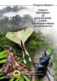
Forest Management Plan - Sabah Forestry Department
Forest Management Plan - Sabah Forestry Department
Forest Management Plan - Sabah Forestry Department

You also want an ePaper? Increase the reach of your titles
YUMPU automatically turns print PDFs into web optimized ePapers that Google loves.
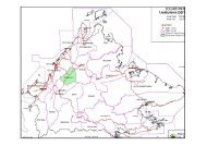
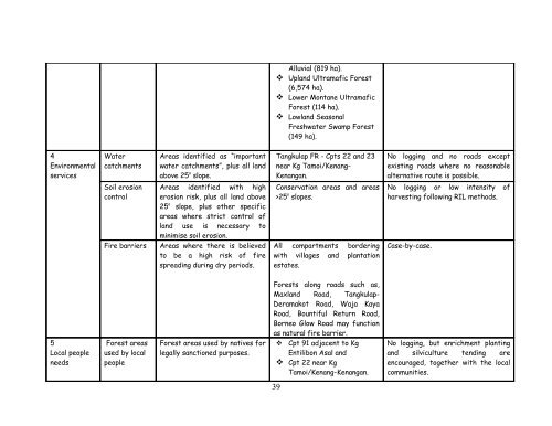
Alluvial (819 ha). Upland Ultramafic <strong>Forest</strong>(6,574 ha). Lower Montane Ultramafic<strong>Forest</strong> (114 ha). Lowland SeasonalFreshwater Swamp <strong>Forest</strong>(149 ha).4EnvironmentalservicesWatercatchmentsAreas identified as “importantwater catchments”, plus all landabove 25 o slope.Tangkulap FR - Cpts 22 and 23near Kg Tamoi/Kenang-Kenangan.No logging and no roads exceptexisting roads where no reasonablealternative route is possible.Soil erosioncontrolFire barriersAreas identified with higherosion risk, plus all land above25 o slope, plus other specificareas where strict control ofland use is necessary tominimise soil erosion.Areas where there is believedto be a high risk of firespreading during dry periods.Conservation areas and areas>25 o slopes.All compartments borderingwith villages and plantationestates.No logging or low intensity ofharvesting following RIL methods.Case-by-case.5Local peopleneeds<strong>Forest</strong> areasused by localpeople<strong>Forest</strong> areas used by natives forlegally sanctioned purposes.<strong>Forest</strong>s along roads such as,Maxland Road, Tangkulap-Deramakot Road, Waja KayaRoad, Bountiful Return Road,Borneo Glow Road may functionas natural fire barrier. Cpt 91 adjacent to KgEntilibon Asal and Cpt 22 near KgTamoi/Kenang-Kenangan.No logging, but enrichment plantingand silviculture tending areencouraged, together with the localcommunities.39