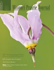
Fall 2007: Volume 28, Number 4 - Missouri Prairie Foundation
Fall 2007: Volume 28, Number 4 - Missouri Prairie Foundation
Fall 2007: Volume 28, Number 4 - Missouri Prairie Foundation

Create successful ePaper yourself
Turn your PDF publications into a flip-book with our unique Google optimized e-Paper software.
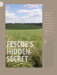
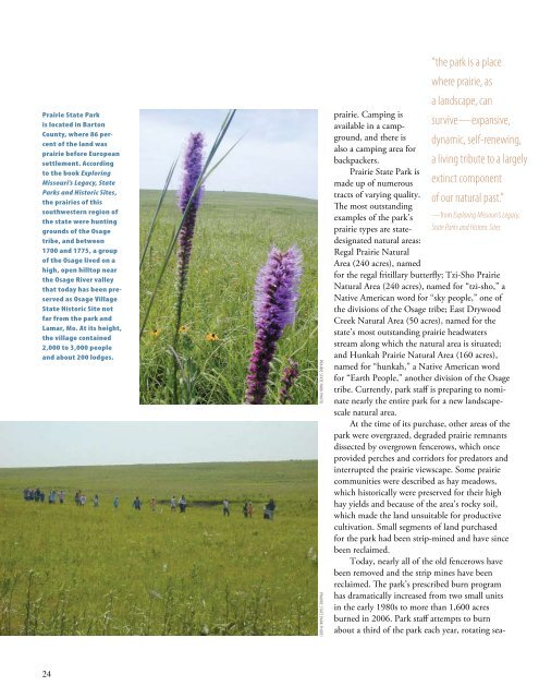
<strong>Prairie</strong> State Parkis located in BartonCounty, where 86 percentof the land wasprairie before Europeansettlement. Accordingto the book Exploring<strong>Missouri</strong>’s Legacy, StateParks and Historic Sites,the prairies of thissouthwestern region ofthe state were huntinggrounds of the Osagetribe, and between1700 and 1775, a groupof the Osage lived on ahigh, open hilltop nearthe Osage River valleythat today has been preservedas Osage VillageState Historic Site notfar from the park andLamar, Mo. At its height,the village contained2,000 to 3,000 peopleand about 200 lodges.<strong>Prairie</strong> State Park Photo<strong>Prairie</strong> State Park Photoprairie. Camping isavailable in a campground,and there isalso a camping area forbackpackers.<strong>Prairie</strong> State Park ismade up of numeroustracts of varying quality.The most outstandingexamples of the park’sprairie types are statedesignatednatural areas:Regal <strong>Prairie</strong> NaturalArea (240 acres), named“the park is a placewhere prairie, asa landscape, cansurvive—expansive,dynamic, self-renewing,a living tribute to a largelyextinct componentof our natural past.”—from Exploring <strong>Missouri</strong>’s Legacy,State Parks and Historic Sitesfor the regal fritillary butterfly; Tzi-Sho <strong>Prairie</strong>Natural Area (240 acres), named for “tzi-sho,” aNative American word for “sky people,” one ofthe divisions of the Osage tribe; East DrywoodCreek Natural Area (50 acres), named for thestate’s most outstanding prairie headwatersstream along which the natural area is situated;and Hunkah <strong>Prairie</strong> Natural Area (160 acres),named for “hunkah,” a Native American wordfor “Earth People,” another division of the Osagetribe. Currently, park staff is preparing to nominatenearly the entire park for a new landscapescalenatural area.At the time of its purchase, other areas of thepark were overgrazed, degraded prairie remnantsdissected by overgrown fencerows, which onceprovided perches and corridors for predators andinterrupted the prairie viewscape. Some prairiecommunities were described as hay meadows,which historically were preserved for their highhay yields and because of the area’s rocky soil,which made the land unsuitable for productivecultivation. Small segments of land purchasedfor the park had been strip-mined and have sincebeen reclaimed.Today, nearly all of the old fencerows havebeen removed and the strip mines have beenreclaimed. The park’s prescribed burn programhas dramatically increased from two small unitsin the early 1980s to more than 1,600 acresburned in 2006. Park staff attempts to burnabout a third of the park each year, rotating sea-24