Destination: Mars - ER - NASA
Destination: Mars - ER - NASA
Destination: Mars - ER - NASA
- No tags were found...

Create successful ePaper yourself
Turn your PDF publications into a flip-book with our unique Google optimized e-Paper software.
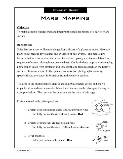
Student Sheet<strong>Mars</strong> MappingObjectiveTo make a simple features map and interpret the geologic history of a part of <strong>Mars</strong>’surface.BackgroundScientists use maps to illustrate the geologic history of a planet or moon. Geologicmaps show present day features and evidence of past events. The maps showfeatures that were formed earlier or later than others, giving scientists a relative timesequence of events, although not precise dates. On Earth these maps are made usingphotographs taken from airplanes and spacecraft, and from research on the Earth’ssurface. To make maps of other planets we must use photographs taken byspacecraft and use lander information from the planet’s surface.The area in the photograph of <strong>Mars</strong> is about 200 kilometers across and showsimpact craters and river channels. Mark these features on the photograph using theexamples below. Then answer the questions on the back of this page.Features found in the photograph are:1. Craters with continuous, sharp-edged, unbroken rims.Carefully outline the rims all such craters Red.2. Craters with uneven, eroded, broken rims.Carefully outline the rims of all such craters Green3. River channels.Color (not outline) all channels Blue.10/97 <strong>NASA</strong> JSC <strong>Destination</strong>: <strong>Mars</strong> 31