ASDP: Environmental And Social Management Framework
ASDP: Environmental And Social Management Framework
ASDP: Environmental And Social Management Framework
- No tags were found...

You also want an ePaper? Increase the reach of your titles
YUMPU automatically turns print PDFs into web optimized ePapers that Google loves.
Development activities at the national level are to be funded based on the strategic plansof the line ministries while activities at the district level are to be implemented by localGovernment Authorities (LGAs), based on District Agricultural Development Plans(DADPs). The DADPs are to be part of the broader District Development Plan(DDP).The <strong>ASDP</strong> is to be supported through a multi-donor “basket funded” arrangementto prevent high transaction costs of parallel programs. The basket would move towardsbudget support and, through detailed design of the program, would ensure improvedefficiency of these sector expenditures. Efforts would be made to ensure that the“basket” abides by the principles of the budget process to ensure greater sustainability ofthe program.The <strong>ASDP</strong> is designed as a three phase program with Phase1, 2 and 3 each planned forthree years.However, since the exact locations of the areas where DADP sub projects are to belocated was not known at the time the <strong>ASDP</strong> was being prepared, the Laws of theUnited Republic in Tanzania and Operational Policy 4.01 of the Bank requires theGovernment of Tanzania (GoT) to prepare an <strong>Environmental</strong> and <strong>Social</strong> <strong>Management</strong><strong>Framework</strong> (ESMF) which is to establish a mechanism to determine and assess futurepotential environmental and social impacts of all program activities to be financed under<strong>ASDP</strong>, and then to set out mitigation , monitoring and institutional measures to be takenduring implementation and operation of the program activities to eliminate adverseenvironmental and social impacts, offset them, or reduce them to acceptable levels.Furthermore, the GoT is also required to prepare a Resettlement Policy <strong>Framework</strong>(RPF) to address the needs of those who might be affected when an operatorsoperations causes the involuntary taking of land and other assets resulting in: (a)relocation or loss of shelter, (b) loss of assets or access to assets (c) loss of incomesources or means of livelihoods, whether or not the affected person must move toanother location. The RPF has been prepared as a stand alone and separate document.The GoT is further required to disclose both documents (the ESMF and the RPF) incountryas two separate and stand alone documents so that they are accessible by thegeneral public, local communities, potential project-affected groups, local NGO’s and allother stakeholders and also at the Infoshop of the World Bank and the date fordisclosure must precede the date for appraisal of the program.The key highlights in this ESMF are as follows;• Detailed and comprehensive environmental and social baseline data which willprovide the environmental and social management process with key baselineinformation when identifying adverse impacts. The information contains data onTanzania’s bio-physical environmental features such as its ecosystems, geology,hydrology in terms of ground and surface water resources, major and sensitivewetlands, flora and fauna. On social baselines the report discusses the mainfeatures of Tanzania’s demographics, public health features and poverty.• A thorough review of the World Banks Safeguards Policies is made. Thetriggered policies are:4/114
- OP 4.01 <strong>Environmental</strong> Assessment- OP 4.09 Pest <strong>Management</strong>- OD 4.12 Involuntary Resettlement- OP 4.37 Safety of Dams- OP 7.50 Projects on International WatersTable 5.1 presents a summary of the requirements to comply with these polices. Thereport states that other Bank policies may apply and includes a summary in Annex A ofall the Bank Safeguards Policies that are likely to apply to the sub projects.• The administrative, policy, legislative and regulatory framework in Tanzania forthe Agriculture Sector in particular and for environmental management in generalis presented in chapter 6.0.• Generic potential adverse environmental and social concerns and impacts fromanticipated program/ DADP sub project activities with root and immediate causesis presented in detail in Section 7.0• The roles and responsibilities of key institutions and players for the purposes ofthis ESMF are discussed in Chapter 8.0 and they are;• District Level AuthoritiesThe District Agricultural Development Plans (DADPs), which would be based on theDistrict Agricultural Development Strategy (DADS) and would be part of the overallDistrict Development Plan (DDP), and which would provide a comprehensive plan forLGA uses of resources.The DADP’s are to be approved by the respective District Councils.The DALDOs and District <strong>Environmental</strong> Coordinators on their own, or when supportingthe beneficiaries of the DADPs such as farmer groups (who in turn can be assisted byextension services) will be responsible ; (i) for complying with all national laws regardingthe environment and with all social/poverty guidelines, parameters and targets set by theGoT, and of all triggered World Bank Safeguards policies, (ii) to implement their DADPsub project activities according to and consistent with the provisions of this ESMF,implementing, inter alia, all appropriate mitigation measures identified in their completedESIA and/or environmental and social management plan (ESMP) into the constructionplanning cycle, technical and engineering designs and drawings, and civil workscontracts, etc. (iv) to ensure that these mitigation measures are complied with duringconstruction and post construction (i.e. operations ) stages of their activities, by selfmonitoring of their activities and by periodically reporting to their respective District<strong>Environmental</strong> Coordinator and , (v) to maintain an adequate budget to implement theappropriate maintenance procedures and practices for their operations , to ensurerelevant mitigation measures identified in the ESIA and/or environmental and socialmanagement plan (ESMP) are implemented and sustained in their operations and (vi) tocomply with any directives that may be issued from time to time from the NEMC, <strong>ASDP</strong>SC, <strong>ASDP</strong> Secretariat, the Zones and Regional authorities.5/114
• Regional Level AuthoritiesThe regions would be responsible for, (i) receiving, reviewing and commenting, requiringrevisions where necessary for category C type DADP sub projects and theircorresponding environmental and social management plans (ESMP), prior to approval ofthe DADP by the District council, (ii) to carry out a regular and intrusive monitoringregime during planning, implementation, construction, operations and maintenancestages of the all DADP sub projects/activities ( incl. category A, B and C) (iii) forpreparing periodic monitoring reports on the DADP sub projects/activities at all stages ofthe operations and to send these reports on a regular basis to their respective Zonaladministration for compiling and monitoring of cumulative impacts across Tanzania, (iv)to comply with ( consistent with national laws) the directives of the NEMC and the zonalauthorities (v) to issue directives to the districts consistent with national laws onenvironmental requirements.• Zonal Level AuthoritiesFor the purposes of environmental and social management of the DADPs, the roles ofthe zonal authorities are as follows:For environmental management – the zones will act as coordinators and reviewers ofthe periodic monitoring and oversight process, collecting and compiling monitoringreports of the regions for direct reporting on this to the NEMC. Also, the zonal irrigationengineers and zonal environmental specialist will carry out routine and periodicmonitoring and backstopping the regions as may be required.Further, when Dam Safety issues are involved, the zonal irrigation engineers will serveas the experts on this issues and advice and support the districts on what may berequired of them on these issues, for planning, design, contracting, construction,supervision during construction and for monitoring and operations, when dam is in use.For issues involving resettlement, the zonal land authorities would be directlyresponsible for reviewing and clearing the resettlement action plans and for monitoringthe process of delivery of the emoluments on the resettlement plans.• The National Environment <strong>Management</strong> Council (NEMC)The NEMC is responsible for ensuring that all development projects in Tanzania complywith all relevant environmental laws. The new law, the Environment <strong>Management</strong> Act,2004, specifically states that NEMC’s role, among many other others is to review andrecommend for approval/clear EIA’s. Therefore, the overall role of the NEMC will be toreview ESIA’s for all but Category A and B type sub project activities in the DADP’s.Overall the NEMC will perform three critically important and significant roles as follows;(i) Review, the ESIA’s/process for Category A and B subprojects/activities of the DADP’s.(ii) Training of District Staff (DALDO, District <strong>Environmental</strong>Coordinators and Zonal <strong>Environmental</strong> Specialists) to carryout monitoring.(iii) Monitoring Oversight.6/114
• National River Basin OfficesThe nine national river basin offices are responsible for issuing and managing waterrights. They will issue water rights only when the ESIA’s have been reviewed by theNEMC and recommended positively to the Minister responsible for environmentmanagement.Section 8.0 also contains a training program and a training of US$400,000.• The <strong>Environmental</strong> and <strong>Social</strong> <strong>Management</strong> Process is contained in Section 9.0with the following key features/steps.a) The FIRST step in the process begins at the start of the planning cycle for thepreparation of the DADP’s.b) The first step is for the potential sub project owner, implementer or operator to assignan <strong>Environmental</strong> Category for their sub project type, using table 9.1 below.c) This group can either be the DALDO or the farmer group. But in either case they willbe assisted by the District <strong>Environmental</strong> Coordinator’s (DEC), and in the case offarmer groups further assistance can be sought from the empowerment services(extension services) of the <strong>ASDP</strong>.Table 9.1 provides a list of sub project types that may be considered by for inclusion inthe DADPs.Table 1.1: Potential DADP Sub Project Types, Major <strong>Environmental</strong> and <strong>Social</strong>Concerns and Probable CategoryDADP Sub Project Type*A. IrrigationPotential Major <strong>Environmental</strong> and<strong>Social</strong> ConcernsSub Project+<strong>Environmental</strong>CategoryLarge scale irrigation definedin this case as over 300haMedium Scale, i.e between50 ha and 300haWater pollution and water quality, waterextraction and water rights, land loss andresettlement, natural habitats, species loss,land degradation, Dam safety. Significantconstruction issues such as spoil disposalmanagement.Water pollution and water quality, waterextraction and water rights, land loss andresettlement, natural habitats, species loss,land degradation. Construction issues.Significant construction issues such as spoildisposal management.Land degradation, water pollutionAB*B**/ CSmall scale, i.e. less than 50ha and with no resettlement.B. Other types of subprojectsWater harvesting, small Soil erosion, water source contamination. B7/114
watershed management,ground water charging, etc.May involve significant construction issuessuch as spoil disposal management.* Resettlement is also likely to be a factor for most sub project types involving land acquisition or restrictionfor new irrigation sites or extension of existing sites.** Although most irrigation sub projects are expected to be medium scale and therefore fall within aCategory B, it is possible that some may require the use of dams and involve water storage/reservior. Thiscould include the impoundment of large relatively flat areas. As such, these areas could remove land fromcultivation and possibly result in involuntary resettlement. In such cases, the sub project would fall into aCategory A.*** Any sub project with resettlement will be Category B, at a minimum, even if they are less than 50 hairrigation or small market.+ The <strong>ASDP</strong> Category is B for the program as a whole. Not to be confused with sub project category.d) The SECOND step is to determine which of the World Bank’s safeguards policies maybe triggered by the sub-project and what the requirements are to comply with thetriggered policy.e) This requires the sub project potential owner/implementer/operator to use theSafeguards Tables in Annex A. Further information on these policies is available on theBank’s website, www.worldbank.org.f) The assumption is that the Environment Assessment OP 4.01 is already triggered andhence the need for compliance with this ESMF. OP 4.01 is included in Annex A toprovide additional guidance and information to the sub project potential owner /implementer / operator. Therefore, compliance by the sub project potentialowner/implementer/operator with this ESMF process is deemed to be accepted ascompliance with OP 4.01.The following Safeguards Policies are not included in Annex A, because they are notlikely to apply for the reasons noted in brackets next to the OP.;1.Indigenous Peoples (OD 4.20) ( no recognized indigenous people in URT)2.Projects in Disputed Areas (OP 7.60, BP 7.60, GP 7.60) (no disputed borders withneighbors of Tanzania).3.Projects on International Waters (OP 7.50, BP 7.50, GP 7.50) ( To be addressed at thenational level by the government of the URT by bank appraisal of the <strong>ASDP</strong> and not bysub project owner/implementer/operators.)g) However, Annex A contains information to help the potential operators determinewhich of the following Bank safeguard policies may be triggered by their sub project;1. <strong>Environmental</strong> Assessment (OP4.01, BP 4.01, GP 4.01) (Always Applies)2. Pest <strong>Management</strong> (OP 4.09)3. Natural Habitats (OP 4.04, BP 4.04, GP 4.04)4. Forestry (OP 4.36, GP 4.36)5. Cultural Property (OPN 11.03)6. Involuntary Resettlement (OP/BP 4.12)7. Safety of Dams (OP 4.37, BP 4.37)h) If any of the Bank safeguards policies are triggered by sub project, the owner /implementer/operator will modify the design, implementation, operation, maintenance8/114
• Chapter 11.0 presents a Cost Table for the ESMF which is as follows.Cost for <strong>Environmental</strong> and <strong>Social</strong> <strong>Management</strong> of the<strong>ASDP</strong>(in US$)Training 400000Review of ESIAs/ESMPs 250,000Monitoring Plan 400,000Total Costs US$ 850,000Table 1.2Annexes A – I contain tools that are designed to assist this process by providinginformation and methods to ensure the desired goal of satisfactory environmental andsocial management is achieved for the <strong>ASDP</strong>.10/114
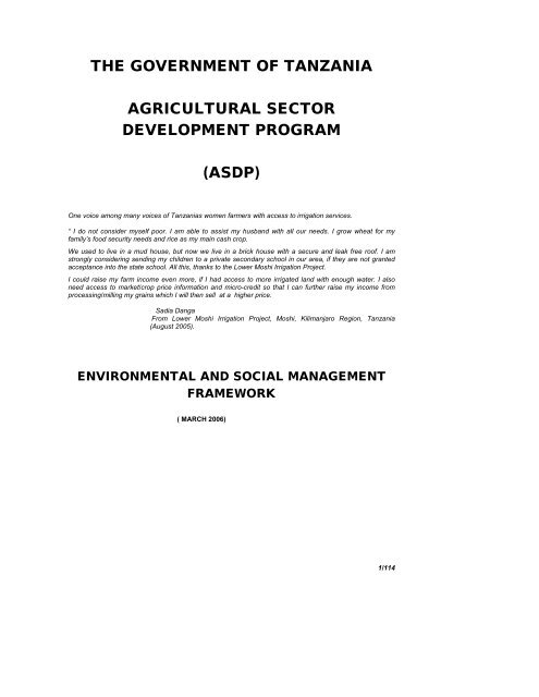
2.0 INTRODUCTIONThe Government of United Republic of Tanzania (GoT) has asked the World Bank,IFAD, the EU and its other major development partners for continued support for itsAgriculture Development Sector Program (<strong>ASDP</strong>). All investments from the <strong>ASDP</strong> wouldbe through the District Agricultural Development Plans (DADPs).However, since the exact locations of the areas where DADP sub projects are to belocated was not known at the time the <strong>ASDP</strong> was being prepared, the Laws of theUnited Republic in Tanzania and Operational Policy 4.01 of the Bank requires theGovernment of Tanzania (GoT) to prepare an <strong>Environmental</strong> and <strong>Social</strong> <strong>Management</strong><strong>Framework</strong> (ESMF) which is to establish a mechanism to determine and assess futurepotential environmental and social impacts of all program activities to be financed under<strong>ASDP</strong>, and then to set out mitigation , monitoring and institutional measures to be takenduring implementation and operation of the program activities to eliminate adverseenvironmental and social impacts, offset them, or reduce them to acceptable levels.Furthermore, the GoT is also required to prepare a Resettlement Policy <strong>Framework</strong>(RPF) to address the needs of those who might be affected when an operatorsoperations causes the involuntary taking of land and other assets resulting in: (a)relocation or loss of shelter, (b) loss of assets or access to assets (c) loss of incomesources or means of livelihoods, whether or not the affected person must move toanother location. The RPF has been prepared as a stand alone and separate document.The GoT is further required to disclose both documents (the ESMF and the RPF) incountryas two separate and stand alone documents so that they are accessible by thegeneral public, local communities, potential project-affected groups, local NGO’s and allother stakeholders and also at the Infoshop of the World Bank and the date fordisclosure must precede the date for appraisal of the program.Since the participating and qualifying districts will be become known during <strong>ASDP</strong>implementation, each DADP sub project location that is subsequently identified andapproved by the District Councils, the <strong>ASDP</strong> NSC and the LGCDG SC, would besubjected to environmental and social planning prior to approval of the DADP for fundingunder the <strong>ASDP</strong> basket. Other program activities under the <strong>ASDP</strong> which may not befinanced by the World Bank are also subject to the provisions of OP 4.01 and hence thisESMF.2.1 Scope of WorkThe scope of work is to:• Prepare an <strong>Environmental</strong> and <strong>Social</strong> <strong>Management</strong> and <strong>Framework</strong> (ESMF)• Resettlement Policy <strong>Framework</strong> ( a separate document) – who’s processesare also included in the ESMFThis ESMF presents a framework for screening, monitoring and mitigating potentialimpacts.11/114
3. DESCRIPTION OF THE PROPOSED PROGRAM.3.1 Program BackgroundMeeting Tanzania’s Poverty Reduction Strategy and Millennium Development Goal ofhalving poverty by 2015, will require annual GDP growth of at least 6-7 percent which issignificantly higher than that achieved over the last decade. As agriculture remains thelargest sector in the economy accounting for about half of GDP and exports and 70percent of rural incomes, higher agricultural growth is a key requirement to meeting theMDGs. Future agricultural growth and profitability will need to rely more on productivitygains with the reduced space for further improvements in macro-economic policy, a keycontributing factor to improved agricultural incentives in the late 1980s and 1990s.In August 2001, The Government of Tanzania (GoT) approved the Agricultural SectorDevelopment Strategy (ASDS) which envisages an agricultural sector that, by 2025, ismodernized, commercial, highly productive and profitable, and utilizes natural resourcesin a sustainable manner. The ASDS has identified five strategic issues:• Strengthening the institutional framework.• Creating a favorable environment for commercial activities.• Clarifying public and private sector roles in improving support services.• Strengthening marketing efficiency for inputs and outputs, and• Mainstreaming planning for agricultural development in other sectors.The key policy features of the ASDS are;• Sustained agricultural growth target of at least 5% per annum, to be achievedthrough the transformation from subsistence to commercial agriculture, as a coreelement of the Poverty Reduction Strategy.• Transformation is to be private sector-led through an improved enablingenvironment for enhancing the productivity and profitability of agriculture, with theremoval of constraints to private sector involvement.• Sector development to be facilitated through public/private partnerships,including increased contract farming (vertical integration), with a delineation ofpublic/private roles.• Focus on participatory planning and implementation, using the framework of theDistrict Agricultural Development Plans (DADPs), which is part of the DistrictDevelopment Plans (DDPs).• Decentralization of service delivery responsibilities to Local Governments.• Mainstreaming of cross-cutting and cross-sectoral issues in agriculturaldevelopment operations.Policies, Legislative and Regulatory arising out of the ASDS and <strong>ASDP</strong> will beaddressed through the framework of the rolling PRSC process.12/114
Whereas, the Agricultural Sector Development Program (<strong>ASDP</strong>), developed jointly bythe four Agriculture Sector Lead Ministries (ASLM’s) 2 , provides the overall frameworkand operational process for implementing the ASDS. To this end, the GoT with financialassistance from the World Bank, International Fund for Agricultural Development (IFAD)and other bilateral donors is planning to implement the Agricultural Sector DevelopmentProgram (<strong>ASDP</strong>). The <strong>ASDP</strong> also provides GoT, especially the four ASLM’s with asector-wide framework for overseeing the institutional reforms and investment priorities.3.2 PROGRAM DESCRIPTIONDevelopment activities at the national level are to be funded based on the strategic plansof the line ministries while activities at the district level are to be implemented by localGovernment Authorities (LGAs), based on District Agricultural Development Plans(DADPs). The DADPs are to be part of the broader District Development Plan (DDP).The <strong>ASDP</strong> is to be supported through a multi-donor “basket funded” arrangement toprevent high transaction costs of parallel programs. The basket would move towardsbudget support and, through detailed design of the program, would ensure improvedefficiency of these sector expenditures. Efforts would be made to ensure that the“basket” abides by the principles of the budget process to ensure greater sustainability ofthe program.The <strong>ASDP</strong> is designed as a three phase program with Phase1, 2 and 3 each planned forthree years.3.2.1 Program Development ObjectivesThe Program Development Objectives of the <strong>ASDP</strong> are;(iii) Sustained 5 percent annual growth of agricultural GDP (averaged over arolling three year period) through improved productivity and profitability of thesector and(iv) Higher farm productivity, profitability and incomes through improved accessto and use of relevant agricultural knowledge and technology by farmers;increased district level investment; and improved market development.This three phased Adaptable Program Loan, APL, would allow over a 9-10 year periodsupport by development partners to the Government’s efforts to (i) improve theresponsiveness of agricultural services to farmer needs; (ii) implement districtagricultural development plans; and (ii) market development (local, regional andinternational). Over the three phases the program would progressively increase both itssectoral and geographic coverage. The sequencing and main thrust of the three phaseswould be:• Phase I (three years): focus on empowering farmers/clients to make betterinformed decisions on technology choice; introducing a more contestable anddecentralized system of agricultural services and extension to improve itsrelevance and encourage pluralism in service provision with a greater role for the2 The ASLMs include the three sector line ministries: The Ministry of Agriculture, Food and Cooperatives(MAFC), Ministry of Livestock Development (MLD) and Ministry of Industries, Trade and Marketing(MITM), as well as the Prime Minister’s Office – Regional Administration and Local Government (PMO-RALG)13/114
private sector; clarifying the strategy for technical services and training;strengthening capacity for implementation of the district agricultural developmentplans, including irrigation; and identification of models for local, regional andinternational market development.• Phase II (three years): continued roll-out of the competitive grant schemes forresearch and extension together with empowerment activities; support fortechnical services and training; implementation of the district agriculturaldevelopment plans through investment and capacity building; andimplementation of market development models.• Phase III (three years): continued expansion of the competitive grant scheme forresearch and extension and support for the implementation of the districtagricultural development plans; implementation of market development.Dependant on implementation progress, IDA funding could be integrated intodirect budget support (PRSC) in this phase – although the basket and supportthe ongoing activities would continue to be financed by development partners.3.2.2 Program ComponentsTo achieve these objectives, Phase 1 of the <strong>ASDP</strong> is structured into two components:• Component 1 – National Level Support• Component 2 – District Level SupportComponent 1. National Level Support: The program will provide funding through thestrategic plans of the agriculture line ministries, initially for support to agricultureresearch (through the zones), to larger scale irrigation based on demand from thedistricts, and for market development. The components of the national level support are:Sub-component 1.1: Agricultural Research: Building on previous support for zonalagricultural research, this sub-component will endeavor to improve the relevance andresponsiveness of agricultural research through improving the management of the ZonalAgricultural Research Institutes (ZARDIs) with the implementation of a Client OrientedResearch and Development <strong>Management</strong> Approach (CORDEMA), and through areconstitution and expansion of the Zonal Agricultural Research and Development Fund(ZARDEF), which will allow on a competitive basis, participation of a broader range ofresearch providers in the delivery of publicly funded research. This component willinclude: public sector re-orientation and capacity building, private sector provider supportand provision of services.Sub-component 1.2: Irrigation: Most publicly supported irrigation will be through thedistrict agricultural development grant of component 2. This sub-component wouldfinance a District Irrigation Development Fund (DIDF). A separate fund will beestablished to complement the formula based direct district support. As fundingrequirements depend on local irrigation potential and implementation capacity, additionalbudget allocations will not be needed in every district and not in every year andaccounting for these differences in a formula based allocation is difficult. The DIDFwould be centrally located in the Ministry of Finance, from where funds would flowdirectly to qualifying districts. The DIDF would finance: (i) those irrigation schemes inselected water basins based on a more strategically planning approach, such as interdistrictirrigation schemes, and complex irrigation infrastructure, including ground water,14/114
and requiring higher financing levels than what can be accommodated by the districts;and (ii) supplemental cost of small scale district irrigation schemes (derived fromdemand through the O&OD process) funded by the general annual allocations for smallscale irrigation schemes from the LGCDG/DADG. Only districts that meet the accesscriteria for the LCDG and the DADG would be able to apply to the fund forsupplementary irrigation funds for specific identified irrigation and/or water harvestingschemes. A Board, consisting of representatives of the Ministry of Finance and theASLMs, the Basin Authorities, and others as relevant, would govern the DIDF.Sub-component 1.3: Market Development: to finance studies, pilot activities, couldinclude work on rural financial markets.Component 2. District Level Support: The program will provide fundingthrough District Agricultural Development Plans (DADPs) for agricultural investments,support for improvements of LGA core regulatory functions, and support to reforming theagricultural extension system. Consistent with the local government capital developmentgrant transfer system, districts will be assessed on performance against progress onthese elements which will determine the level of funding they can access from theprogram, which will take the form of three formula-based block grant transfers whichform the sub-components of the district level support.Sub-component 2.1: District Agricultural Investments: Investments will be fundedthrough an earmarked grant top-up to the Local Government Capital Development Grantin support of agricultural development. The District Agricultural Development Grant(DADG) will support implementation of District Agricultural Development Plans (DADPs)on a cost-sharing basis. Criteria and procedures to assess the feasibility of proposedinvestments from a technical, economical, financial, social and environmentalperspective will be included in the DADP guidelines. Investments will be in accordancewith local needs, as determined through local participatory planning and budgetprocesses.Sub-component 2.2: District Agricultural Services: This sub-component would facilitateand oversee effective and efficient provision of services responsive to farmer groups andfora demands. It would be financed through the existing discretionary, formula-basedAgricultural Extension Block Grant (EBG) This sub-component would have providefunding for both public extension services and for private service providers. The latterwould be engaged through agreements and contracts directly between farmer clients orthrough local government outsourcing.Sub-component 2.3: District Agricultural Capacity Building and Reform: This subcomponentwould provide resources for public sector re-orientation and performanceimprovement; and for capacity building and greater involvement of private extensionservice providers. Part of the funds will be an earmarked to-up to the Local GovernmentCapacity Building Grant (CBG), and part will be managed through a centrally managedreform fund that would assist local government authorities to reform their services andmeet the requirements and incentives provided through the annual assessments for theDADG and CBG.15/114
Examples of Typical Irrigation Sub projects:• Traditional Irrigation Schemes – schemes that have been initiated andoperated by farmers themselves using local skills and materials, with nointervention from external agencies. These would include schemes based ontraditional furrows for the production of fruit and vegetables in the highland areas,and simple diversion on the lowlands for paddies. As for this category, at present,the schemes in Arusha and Kilimanjaro accounts for over 60% of the total area.• Water Harvesting Schemes – water harvesting schemes and flood recessionschemes, on which subsistence farmers have themselves introduced simpletechniques to artificially control the availability of water to crop. These schemesinvolve a process whereby rainfall is concentrated or is captured as runoff from alarge area and is canalized for use in a smaller targeted area. Water applicationto the scheme is essentially uncontrolled under farmer-managed practices. Theobjective is simply to capture as much water as possible and store it within reachof plant(s) in the soil profile of cultivated area or into a storage reservoir. Theyare mainly located in such regions as Dodoma, Mara, Mwanza, Shinyanga,Singida, Tabora and Manyara.• Modern irrigation schemes – these are formally planned and designedsmallholder schemes, on which full irrigation facilities have been provided byexternal agencies with or without some contribution from the beneficiaries, andon which there is usually a strong element of management provided byGovernment or other external agency. The major regions, where the schemeshave been developed, are Morogoro followed by Kilimanjaro and Mbeya.• Improved Traditional Irrigation Scheme – schemes which have been initiatedand operated by semi-subsistence farmers themselves and on which there hassubsequently been some intervention by an external agency in the form ofconstruction of a new diversion structure, gated canal intakes, water diversionboxes and other farm related structures. The layout of irrigation canals anddrainage system is well defined.• Small Scale Farmers Irrigation – this is relatively new but growing sector,where individual farmers or small groups irrigate homestead or vegetablegardens of small to medium size (0.2 to 1.0ha), using small scale technologysuch as treadle pumps.• (ex)Parastatal Large Irrigation Estates – There are a number of these largeirrigation estates, such as Kapunga and Dakawa that are in the state of beingprivatized. At present different strategies are being contemplated by governmentfor the privatization of these estates, which range from selling to largecommercial enterprise (as in the case of the sugar estates of Morogoro andKagera), to converting these estates in smallholder irrigation schemes. Atpresent there is no clear government policy outlining the manner of privatizationfor the remaining Government controlled rice irrigation schemes, which is beingdecided upon case-by-case.• Private Commercial Sector – Export commodity based private enterprisesranging from large scale enterprises as the sugar estates in Morogoro andKagera, coffee estates and horticulture and flower enterprises around Arusha.16/114
Types of Irrigation No. of Schemes Existing Area (ha)Traditional Irrigation 982 122,600Water Harvesting 42 7,900Modern Irrigation 52 35,900Improved Traditional Irrigation 113 25,500Small Scale Farmers Irrigation - -(ex) Para-Statal LargeIrrigation Estates5 25,464Private Commercial Sector - -Total 1,194 217,364Table 3.1 : Types of Existing Irrigation ProjectsWhile the National Irrigation Master Plan (NIMP) sets ambitious targets for irrigationdevelopment in Tanzania, investments in irrigation development is capped by thenational implementation capacity. Past experience shows that a total of 6,000 – 7000 haannually was developed through support of GoT and development partners. This istaken as the low case scenario. In a high case scenario, 10,000ha annually could bedeveloped, but this would require significant support to strengthen capacities at theDistrict and Zonal level. Adoption of the high case scenario would increase total irrigatedarea in Tanzania by 75% in 2017. Yet, it would fall far short in achieving the NIMPtargets of 405,000 ha in 15 years.Acreage(ha)High CaseTotalamount (mUS$, 15years)Annualamount(m US$)Acreage(ha)Low CaseTotalamount(m US$,15 years)Annualamount(m US$)LGCDG * 20,000 60.0 4.0 20,000 60.0 4.0DADG * 50,000 150.0 10.0 50,000 150.0 10.0DIDG 80,000 240.0 16.0 35,000 105.0 7.0Extension BlockGrant0 0 0 0 0 0Total 150,000 450.0 30.0 105,000 315.0 21.0* estimates* US$3,000 per hectareTable 3.2: Probable Irrigation investments and Services under <strong>ASDP</strong>17/114
4.0 BASELINE DATA4.1 The Bio-Physical <strong>Environmental</strong> FeaturesThe United Republic of Tanzania lies between 29°30’E and 40°30’E, and 1°00’S and11°48’S. Located on the east coast of Africa, it covers an area of approximately 945,000km 2 , of which the Zanzibar Islands cover 2,400 km 2 . The islands of Mafia, Pemba andZanzibar are included in this area. Of this area 61,495 km 2 is covered by the inlandwaters of the Great Lakes (Victoria, Nyasa/Malawi and Tanganyika). The country isbordered by Uganda to the north for 396km, Rwanda and Burundi to the north-west for217km and 451km respectively, the Democratic Republic of Congo (DRC) to the west for459km (a water border on lake Tanganyika), Zambia and Malawi to the south-west forabout 338km and 475km respectively, Mozambique to the south for 756km, and Kenyato the northeast for 769km. The Indian Ocean, whose shores are characterized by coralreefs and small islands, lies to the east. The continental shelf within the 200-m depthcontour varies from 4–60 km from the shore.Tanzania is a land of contrasts, being the home of Africa’s highest mountain(Kilimanjaro, at 5,895m and its lowest point (the floor of Lake Tanganyika, which is1,470m deep).Except for the coastal belt and islands, most of the country is part of the Central AfricanPlateau (1,000–1,500 m above sea level) characterized by gently sloping plains andplateaux, broken by scattered hills and low-lying wetlands. The Central African Plateauis deeply incised by two arms of the Rift Valley: the eastern arm, which includes LakesNatron and Manyara, and the deeper western arm, which contains Lake Tanganyika.Both arms of the Rift converge in the south of the country near the northern end of LakeNyasa( Malawi).The flora of Tanzania is extremely diverse, with over 12,700 plant species – a figurecomprising more than one-third of the total plant species in Africa (UNEP 1998). Thishigh diversity of plants is not evenly distributed throughout the country, they are found insix specific ecological zones, namely –• Moist Forest Mosaic• Coastal Forests and Thickets• Afromontane• Acacia–Savannah Grassland• Acacia–Commiphora Thornbush, and• Brachystegia–Julbernardia–Savannah Woodland.Proportionately, Tanzania has a much bigger land surface area devoted to resourceconservation (29%) than most countries. The hierarchical protected-area systemconsists of national parks (12), game reserves (28), the Ngorongoro Conservation Area(1), and game-controlled areas (38), comprising a total of 240,000 km2. In addition to thewildlife-protected areas, there are 540 forest reserves covering 132,000 km 2 , equivalentto 15% of the total woodland and forest area in Tanzania. There is also the Mafia IslandMarine Park.18/114
4.1.1 ClimateTanzania experiences a variety of climatic conditions, ranging from the alpine deserts onthe top slopes of Mount Kilimanjaro that are permanently covered by snow, to thetropical coastal areas that are under the influence of two monsoon winds. The north-eastmonsoon wind which blows southwards from December to March brings the hottestweather, while the southeast monsoon winds which blow northwards from March toSeptember bring intermittent rains. The main rainy season on the coast is from March toMay (the ‘long rains’) with a second season between October and December (the ‘shortrains’). Mean annual rainfall varies from 400 mm in the central regions to over 2,500 mmin the highlands and the western side of Lake Victoria. Mean annual temperatures areinfluenced by altitude, ranging from 21 °C in high mountain areas to 29 °C at sea level.4.1.2 HydrologyTotal water withdrawal in mainland Tanzania was estimated for the year 2002 to be 5142million m 3 . Agriculture consumes the largest share with 4624 million m 3 (almost 90% oftotal) of which 4 417 million m 3 for irrigation and 207 million m 3 for livestock, while thedomestic sector uses 493 million m 3 . Total water withdrawal of the domestic sector andirrigation in Zanzibar is estimated to be about 42 million m 3 . Of this, withdrawal onUnguja Island is 33 million m 3 and on Pemba Island it is 9 million m 3 . Industry inTanzania consumes an estimated 25 million m 3 .Tanzania is divided into five major drainage systems (the Indian Ocean DrainageSystem, the Internal Drainage of Lakes Eyasi, Natron and Bubu Depression Complex,the Internal Drainage of Lake Rukwa, the Atlantic Ocean Drainage and theMediterranean Sea Drainage System). These systems have been further divided intonine river and lake basins for ease of management of the Country’s water resources ona “River-Basin” basis 3 .The nine drainage water basins as follows:Pangani River Basin, Wami Ruvu River Basin, Rufiji River Basin, Ruvuma River and theSouthern Coast Basin, Lake Nyasa/Malawi Basin, The Internal Drainage Basins of LakeEyasi, Manyara and Bubu depression, Lake Rukwa Basin, Lake Tanganyika Basin, LakeVictoria Basin.Tanzania’s main rivers include the Pangani, Rufiji, Wami Ruvu and Ruvuma andSouthern Coast.The freshwater availability in Tanzania in 1994 is illustrated by the figures in Table 1 asprovided by Gleick (1998) 4 :3 National Water Sector Development Strategy – 2005 to 20154 Gleick, P.H. : 1998. “The Worlds Water 1998-1999. The biennial Report on Freshwater Resources”.Island Press, Washington DC.19/114
Annual renewable water resources 89 km 3 /yearTotal freshwater withdrawal1.17 km 3 /yearEstimated year 2000 per capita withdrawal 35 m 3 /person/year ~ 96 l/person/dayDomestic use3 m 3 /person/year ~ 8 l/person/dayIndustrial use1 m 3 /person/year~ 3 l/person/day 31 m 3 /person/year ~ 85 l/person/dayTable 4.1Freshwater availability in TanzaniaThe relative share of agricultural use in Tanzania according to Table 1 is higher than the70-80% figure often associated with developing countries. The 9% domestic use inTable 1 is less than one half of the share similarly quoted for developing countries as awhole 5 .Following a commonly used, if crude, criterion, suggested by the Swedish hydrologistMalin Falkenmark, water becomes scarce when there is less renewable water (surfacewater runoff and groundwater recharge) than 1700 m 3 /person/year. It is termed waterstressedif the renewable water is 1000 - 2000 m 3 /person/year and water-scarce if it isless than 1000 m 3 /person/year.The total figure for annual renewable water resources of Tanzania in Table 1 isequivalent to 2700 m 3 /person/year. This means that Tanzania is not water-stressed bythe Falkenmark criterion. However, rainfall is unevenly distributed in time and space, andmany areas receive on the average between 450-700 mm/year. In these areas there arealready signs that demand for water is exceeding the availability. Thus, Tanzania faceschallenges to manage its water resources in a sustainable way. 64.1.2.1 RiversPangani BasinThe Pangani River drains the southern side of Africa's greatest mountain (MtKilimanjaro) as well as its neighbour (Mt Meru) and a large part of the Pare andUsambara Mountains of the famous Eastern Arc chain in Tanzania. While the principalwatersheds of the Pangani are mountainous areas of high precipitation, the main riverchannel runs through the dry Maasai Steppe of northern Tanzania where rainfall rarelyexceeds 500 mm per annum.The Pangani River Basin covers about 42,000 km2 and is shared by Kenya andTanzania. The mean annual flow of the Pangani has decreased over the last fourdecades but averages about 37 m3s-1 although this has been drastically reduced inrecent years. The main north-western tributary of the Pangani (the Kikuletwa River)brings slightly sodic waters from the volcanic slopes of Mt Meru and Mt Kilimanjaro while5 FAO6 Ministry of Water, United Republic of Tanzania, Review of Water Resources <strong>Management</strong> Policy,Legislation and Institutional <strong>Framework</strong>20/114
the other northern tributary, the Ruvu River, drains a complex in Kenya and Tanzaniathat surrounds Lake Jipe on the international border.The sodic waters from lake Jipe pass through an extensive swamp and emerge muchfresher to join the Kikuletwa in the Nyumba ya Mungu reservoir. This impoundment, ofaround 140 km2, was built in 1965 for irrigation, fisheries, water management andhydropower generation. Downstream of the dam, the Pangani travels 430 km to the seaand traverses extensive swamps before fuelling the Hale hydropower station and theturbines at Pangani Falls.The Pangani river basin thus includes some of the most biodiverse areas in EasternAfrica including for example the endemic-rich flora and fauna of Mt Kilimanjaro and MtMeru, the famous plant and animal diversity of the East Usambara Mountains, the Jipelake and wetland systems, the dry Maasai Steppe, the Pangani Falls system, and theestuary and mangrove swamps.The basin includes the municipality of Moshi, many smaller urban centres and millions ofsubsistence farmers on the fertile slopes of its mountains, irrigators on the lower slopesand pastoralists in the drier areas. The main arteries from Dar es Salaam toneighbouring Nairobi pass through the basin which has extensive sisal estates as wellas commercial farms. Production and watershed forests are found on all the mountainsystems and both tea and coffee are grown in the basin.Unfortunately, the Pangani River and its watershed are increasingly suffering fromenvironmental problems which are threatening the water resources, the plant and animaldiversity and the people that depend upon these resources. Water extraction for smallandlarge-scale irrigation has severely reduced the flow of the river and its tributaries - astudy in 1991 showed that 2,092 extraction schemes, most of them un-regulated, wereextracting about 40 m3s-1.The runoff from many irrigation schemes is adding nutrients to the Pangani River andthere is significant pollution entering the river system from sisal factories along the drierparts of the basin.The needs of power generation tend to dominate the water management regimes so thatthe mid-reach swamps are often denied their necessary flows. Water hyacinth is a pestin the lower reaches of the river - indicating a relative high level of nutrients as well ascausing nuisance to hydropower generation and affecting aquatic biodiversity 7 .More than half of the Pangani basin is under semi-arid conditions, where annual rainfall is500 mm on the average. The dry areas are situated immediately south of MountainsKilimanjaro and Meru. West and east areas of the Pare Mountains are also under semi aridconditions. Higher falls are recorded in the mountain areas around Kilimanjaro, and Meru.Annual average totals are 2000 mm on the southern slopes of the Kilimanjaro, 1200 mm onmount Meru, 1000 mm on the Pare Mountains and well above 1800 mm on the westUsambara mountains 8 .7 IUCN8 Ministry of Water, The United Republic of Tanzania21/114
Wami/Ruvu BasinThe Wami/Ruvu basin consists of two main river systems, the Wami 40,000 km 2 and theRuvu 17,700 km2. Coastal rivers south of Dar es Salaam are part of this basin. The basinas a whole covers an area of 72.930 km2.The Wami River, near Mandera gauging site 1G2, has a catchment area of 36,400 km2and a mean annual runoff of 54 mm. About 60 to 70 percent of flow at Mandera originatesfrom a small part of the catchment on the slopes of Nguru, Ukaguru and Rubeho mountainswhere rainfall is high. The Wami may be divided into four hydrological areas as follows: theKinyasungwe which drains the dry north and east of Dodoma, the mountain areas ofUkaguru, Rubeho and Nguru mountain ranges, the northern semi desert area in the Masaisteppe and the lower Wami.The Ruvu river basin is 13,300 km 2 above the lowest gauging station 1H8 at MorogoroRoad Bridge. The total catchment area is 17,700 km2. The major source area of the Ruvuriver is the Uluguru mountains. The mean annual flow at 1H8 is 65.1 cumecs. The riversystem can be divided into four zones as follows: the upper Ruvu, the Mgeta plains, theNgerengere and the lower Ruvu flood plain which extends over 100 km to Bagamoyo intothe Indian Ocean. This basin consists of wide plains and large mountain ranges. Fourmountain blocks are distinguished and these are the Uluguru mountains south east ofMorogoro , Nguru mountains west of Kilosa, Rubeho mountain, west of Kilosa and Ukagurumountains to the north of the Wami. The most noticeable plains are, Lower Ruvu Plainsand Mgeta plains in the Ruvu system and the Mkata-Wami, (400-800 m), lower Wami (200-400) and the Berega valley 800-1200 m.Mean annual rainfall of over 2500 m is recorded on the eastern slopes of the UluguruMountains, while the western part of the Uluguru Mountains lie in the rain shadow andsmall amounts of rain are observed. The Nguru-Rubeho mountain complex receivesbetween 800-1200 m and 1000-1800 m are observed in the Ukaguru mountain ranges.Rainfall is much less in the plains; 800-1000 m near the coast, but these rainfall amountsreduce as you go inland towards Dodoma and north of Wami basin. These areas receivebetween 500-600 mm of rain per year on the average. The persistence of extreme variationof rainfall within the basin results in vegetation cover, drainage properties of the soils andsurface runoff also to vary greatly.Rufiji BasinThe Rufiji basin covers an area of 177,000 km 2 , about 25% of Tanzania. This basincomprises of three distinct major river systems: Great Ruaha river system, Kilombero riversystem, and the Luwegu river system.The Great Ruaha covers 83970 km 2 of the Rufiji basin or about 47%. Important features ofthis sub-catchment are the Poroto mountain ranges, the Usangu and Pawaga plains andthe Utengule swamps. The Great Ruaha can be divided into three distinct river systems:the Great Ruaha, the Little Ruaha and the Kisigo. From the west the Kisigo river startsfrom Manyoni and Rungwa Game Reserve. It drains the dry areas in the Ruaha NationalPark and joins the Great Ruaha at Mtera. The Great Ruaha originates from the PorotoMountains and Njombe where, numerous rivers flow into the Usangu plains and the vastUtengule swamps, passes the Ruaha National Park plains, and collects the Little Ruaha22/114
efore joining the Kisigo at Mtera. It then flows westward through the Ruaha Gorge intoKilombero plains before joining the Rufiji.Kilombero RiverThe Kilombero is 39,990 km 2 about 23% of the total area, but contributes about 65% of theflow to the Rufiji. An important features of the Kilombero basin is the great fertile Kilomberovalley below the eastern scarp of the Udzungwa mountains. Numerous rivers flow on thescarp from the Udzungwa plateau. Some of the important rivers are Ruhudji, Kihansi,Luhombero, Kigogo-Ruaha and Mpanga. The Ruhudji and the Luhombero form theKilombero river. After Shughuri rapids on the old basement step, the Kilombero joins theLuwegu flowing from south east to form the Rufiji. Mean flow of some of the Rivers in theKilombero are as follows:The Rufiji basin is large, with differing rainfall and catchment characteristics. The areanorth of Poroto and Udzungwa Mountain is under semi-arid conditions with mean annualrainfall of 500 mm. Rainfall increases southward and larger falls of 1800 mm per year areobserved on the slopes at the Udzungwa and Kipengere range. The rainfall pattern is suchthat there is one rainy season (mid-November to May) and one dry season. This pattern isthe same all over the basin with the exception of coastal areas where there is slighttendency to bimodal rain pattern. There is a tendency for the dry season to set earlier inthe Great Ruaha basin than the Kilombero basin. The Kilombero floods occur at the end ofApril or the beginning of May.Runoff pattern is closely related to the rainfall pattern. Rivers start rising in December witha peak in March-April.Ruvuma River and Southern CoastIn this basin, independent river systems drain into the Indian Ocean, the major riversystems are: River Matandu, River Mavuji, River Mbwemkuru, River Lukuledi, RiversMambi and Mbuo River Ruvuma. The dominant features are the Makonde and Rondoplateaux separated by the Lukuledi valley. Except for these raised plateaux, the land risesgradually from the Indian Ocean to the hinterland. A large part of the area of the Matandu,Mavuji, Mbwemkuru, Lukuledi, Mambi and Mbuo rivers lie at or below 500 metres abovemean sea level.The Ruvuma is shared by Tanzania and Mozambique and forms almost the entireTanzania and Mozambique boarder. A large portion of the Ruvuma river is in theMozambique. Several large tributaries originate in Tanzania in Mbinga, Songea, Tunduruand Masasi districts. The total basin area on the Tanzanian side is about 104,000kmk 2 .The mean temperature in the coastal area is 26 o C and that of the hinterland is 24 o C. Theannual and daily variations in the temperature are small.The rainfall pattern is such that there is one dry season June to November and the wet orrainy season the rest of the year. This pattern is very regular. The annual mean rainfall is800 to 1200mm recorded on the Rondo and Makonde plateaux and in the Matengohighlands while elsewhere rainfall is between 800 - 1000m. The year to year variation inrainfall is very high. The annual precipitation may rise up to 2,000mm once in twenty yearsand may fall to 500mm once in twenty years in places where the mean annual rainfall is1000mm per year. Rainfall as low as 200mm have been recorded at Mtwara and Lindi.23/114
About 500mm were recorded at Nyangao within a duration of 24 hours in 1990 whichresulted into extensive land slides from the escarpments of Makonde plateaux causingsevere floods. The flow regimes of the rivers in the basin follow closely the rainfall pattern.Many river channels are dry during the dry season.4.1.2.2 LakesTanzania shares three major lakes (Nyasa, Tanganyika and Victoria) with othercountries in the region. Other lakes in the country include Burigi, Eyasi, Magadi, Masoko,Manyara, Natron and Rukwa.Lake Nyasa BasinLake Nyasa, the third largest lake in Africa is about 560 km long and 75 km wide at itswidest point, with a total drainage area of about 132,000km 2 and a surface area of about33,000km 2 . The lake is an international drainage basin bordered by Tanzania in the northand northeast, Mozambique in the east, and Malawi in the south and west. The basinarea draining into the lake from the Tanzania side is about 37,000 km 2 .The lake isbounded by steep mountains, except in the south. Major rivers are Songwe (shared withMalawi), Kiwira, Lufirio, Ruhuhu, and Rumakali. The Ruhuhu River is its main tributary isin the northeast; the Shire (in the south), a tributary of the Zambezi, is the lake's soleoutlet. Its outlet is the Shire River; its largest tributary is the Ruhuhu. About threequarters of the lake is in Malawi; the rest is in Mozambique. The lake lies in the GreatAfrican Rift Valley, a large graben caused by crustal extension. It probably formed about40,000 years ago.The mean annual rainfall varies between 1000mm to over 2600mm. Much of this rainsoccur in the rainy season from November through May. The highest rainfall is recorded inthe northern part of Lake Nyasa, whereas a small portion on the lower Ruhuhu valleyrecords the lowest rainfall of about 800mm. The basin in general may be classified ashumid to sub-humid with abundant water resources 9 .Internal Drainage BasinThe Internal Drainage Basin is described as rivers/streams draining into a group of inlandwater bodies (lakes) that are located around the north-central part of the country. Thesystem, mainly of troughs and faults runs southward from Lake Natron at the border withKenya to central Tanzania in the Bahi depression and varies in width from 30-90 km. Totalbasin area on the Tanzanian side is about 153,800 km 2 .The major drainage systems in this basin includes: the Lake Eyasi System, which drainsareas in North Tabora Region and East Shinyanga by the Wembere and Manonga riversystems, the Lake Manyara System, the Bubu complex where important features are theBubu and Bubu swamps. Several other small independent lakes and swamps with no outletexisting in this basin include Lake Basuto and Lake Natron.9 Ministry of Water, The United Republic of Tanzania24/114
The basin is situated in the semi-arid region of Tanzania. The mean annual rainfall rangefrom 500 mm/yr at Bahi to 900mm/yr in the highlands of Mbulu district. Rainfall variesgreatly from year to year.Lake RukwaLake Rukwa basin is an internal drainage system which is described by all catchmentsdrawing into the lake with no outlet. The lake has a surface area of about 2,300 km 2 with atotal basin area of about 88,000 km 2 . Rukwa Basin may be divided into several distinctareas according to topography. The main characteristics are related to the Rift ValleySystem of East Africa.The Western part of the Lake rises rapidly to the Ufipa plateau. This area is very broken,with many small incised rivers flowing down the escarpment into Rukwa valley which runsfrom northeast to southeast. The northern side of the Rukwa Valley rises gently towardsLake Tanganyika basin. The East is dominated by the Mbeya range of mountains. TheAltitude varies from the Lake Level of 800m to 1500m a.m.s.l. on the Mbeya range.Lake Tanganyika BasinLake Tanganyika Basin is situated in the Western Part of the country. All the catchmentsthat drain in Lake Tanganyika constitute the Lake Tanganyika basin. The total catchmentsof Lake Tanganyika basin as a whole are 239.000km 2 and the area of the lake is 32,000km 2 . The land surface of the basin on Tanzania side is 151,000km 2 which contributes 60%of the total runoff to Lake Tanganyika.The basin is dominated by the Malagarasi river system which is 130,000 km 2 . The mainriver, the Malagarasi originates in the mountainous area close to the border with Burundi atan altitude of 1750 m.a.m.s.l. from where it runs northeasterly through hilly andmountainous landscape and then southward into the Malagarasi Swamps. Its majortributaries, the Myowosi and Igombe Rivers meet the Malagarasi in the seasonal LakeNyamagoma. The Ugalla and Ruchugi Rivers join the main river downstream of LakeNyamagoma. The river then runs west, through the Misito Escarpment where it forms therapids and waterfalls before entering Lake Tanganyika.The Ugalla River drains an area of approximately 52,000km 2 and before the confluencewith the Malagarasi, it passes through large areas of swamps and marshlands, forming theseasonal Lakes of Sagara and Ugalla.Other major tributaries are the Ruchugi River which drains the hilly landscape north ofKasulu, running in a southerly direction through a low, partly swampy, undulatinglandscape, before it enters the Malagarasi River at Uvinza.In addition to the Malagarasi, there are smaller basins draining into Lake Tanganyika. Tothe north west of Kigoma, the Luiche is an important river. The lower part of the river formsthe Luiche Delta which floods often during the rainy season.The rainfall regime is unimodal; there is one long wet season and a corresponding long dryseason. The wet season is from November-May and the dry season June - October. Themain part of basin has a mean annual rainfall of 800 - 1,000mm and the minimum expected25/114
annual rainfall is of the order 500 - 750mm. The areas north of Kigoma are wet receivingmore than 1000mm of rain per year.The Malagarasi basin is gauged at 18 locations of which 12 have automatic water levelrecorder, the Luiche is gauged at 5 locations. Other gauged rivers in the southern part ofthe Malagarasi basin are Lugufu, Luegele, Kalambo and Luamfi. It is noted thatcatchments with area below 1,000sq.km. have a runoff coefficient between 33.6% and22.1%, the bigger catchments below 22%. The Ugalla at Sindi has a runoff coefficient of2.6 and that of Malagarasi at Mbelagule 4.1%. These low coefficients are due to water usein the Ugalla, and Myowosi extensive swamps.Lake Victoria BasinThe Lake Victoria is the largest freshwater lake in Africa and source of the White Nile. LakeVictoria lies across the equator, between latitudes 0 31’N and 3 54' S and longitudes 31 18'to 34 54' E. The Lake is contained in a wide basin at 1124 metres above sea level, with anaverage depth of 80m. The total surface area of the lake is estimated to be 69,000km2.The Lake Victoria basin drains an area of 115,380 square kilometres in Tanzania. About52% of the lake area and about 46% of the total basin area is within Tanzania. The Lake isshared between Uganda, Kenya and Tanzania. The main rivers draining into the lakeinclude Kagera, Simiyu, Mbarageti, Grumet, Mara and Mori. Kagera, Mara and Simiyu arethe principal river systems flowing into lake Victoria. Kagera and Mara rivers originate fromoutside the country. The Kagera river head waters are in the humid Burundi and Rwanda,while the Mara originates from the Highlands in Kenya. Rivers from the south of the Lakeflow intermittently each year.In eastern part of the basin especially in the highlands of Tarime, the rainfall is distinctivelybimodal. In the southern area the pattern is unimodal with a wet and dry season. TheWestern part receives rainfall almost throughout the year with minimum in July. There areconsiderable variations in the average yearly rainfall over the Lakes’ surface and thesurrounding land area. Over the extreme eastern area of the Lake rainfall is between 500and 750 mm. per year. Westward from this area rainfall increases to an annual average ofover 2,000 mm in areas around Bukoba and the Ssese Islands. To the south of the lake, inMwanza Region the yearly average rainfall is 750 to 1100 mm and in the eastern part inMara Region rainfall is between 750 - 1000mm increasing to 1600 on the highland areas ofTarime.The flow of the Kagera river after the Ruhuhu-Kagera confluence at Rusumo falls is 9,501million cubic metres and only 6,934 flows out at Nyakanyasi (Station 5A13). About 2,276million cubic metres (or 27%) are lost presumably at the extensive and papyrus overgrownL. Rushwa. The lake greatly regulates the flows of the Kagera downstream. The minimumflow at 5F13 is 150 cumecs and the high flow is about 250 cumecs.4.1.3 Tanzania has the following international waterways:• Pangani River (shared with Kenya)• Ruvuma River (shared with Mozambique)• Lake Victoria (shared with Kenya, Uganda, Burundi and Rwanda. The River Nile(Nile Countries) sources from the lake. Kagera River a confluence of two riversfrom Burundi and Rwanda and Mara River from Kenya drain into the lake.26/114
• Lake Tanganyika (shared with Congo, Zambia and Burundi)• Lake Nyasa (shared with Malawi and Mozambique) The Songwe, Ruhuhu andKiwira) Unsustainable abstraction from Lake Nyasa waters may lead to negativeeffects along Shire River and ultimately the Zambezi River affecting fisheries andirrigation.The Congo River BasinThe Congo River Basin is the largest river basin of Africa, covering over 12% of thecontinent. It extends over nine countries and the largest area is in the DRC. It is also,one of the most humid basins of Africa. Most of the flows of the Congo River Basin inRwanda, is into Lake Kivu, which is connected with Lake Tanganyika through the Rusiziborder river between Congo, Rwanda and Burundi.CountryTotal areaof thecountry(km 2 )Area ofthecountrywithin theBasin(km 2 )As % oftotal area ofthe Basin(%)As % oftotal areaof theCountry(%)Average annualrainfall in thebasin area(mm)Min Max MeanZambia 752,610 177,735 4.7 23.6 985 1420 1195Tanzania 945,090 244,593 6.5 25.9 720 1385 970Burundi 27,834 14,574 0.4 52.4 920 1565 1155Rwanda 26,340 6,464 0.2 24.5 1135 1580 1365Central Africa 622,980 403,570 10.7 64.8 1065 1680 1465Cameroon 475,440 96,395 2.5 20.3 1440 1670 1545Congo – 342,000 246,977 6.5 72.2 1190 1990 1660BrazzavilleAngola 1,246,700 285,395 7.5 22.9 785 1635 1375Congo – 2,344,860 2,313,350 61.1 98.7 775 2115 1540DRC/KinshasaFor CongoRiver Basin3,789,053 100.0 720 2115 1470Table 4.2 10 The Congo River Basin: Areas and RainfallThe irrigation potential of the Congo River basin in Tanzania has been estimated at 0ha.Irrigation PotentialGross Potential Irrigation WaterRequirementsArea underirrigation (ha)Country(ha)Per ha (m 3 /ha Totalper year) (km 3 /year)Zambia 101,000 19,500 1.970 5,00010 FAO.27/114
Tanzania 0 13,000 0.000 0Burundi 105,000 13,000 1.365 14.4Rwanda 9,000 13,000 0.117 2,000Central África 1,400,000 18,000 25.200 0Cameroon 50,000 14,000 0.700 1,650Congo-Brazzaville255,000 13,000 3.315 217Angola 900,000 20,000 18.000 2,000Congo –DRC/Kinshasa6,980,000 15,500 108.190 10,500For CongoRiver Basin9,8000,000 158.857Table 4.3 11 The Congo River Basin: Irrigation potential, water requirements and areasunder irrigation.The Nile River BasinThe Nile River, with an estimated length of over 6800km, is the longest river in theWorld, flows from south to north over 35 degrees of latitude. It is fed by two main riversystems: the White Nile, with its sources on the equatorial plateau (Tanzania, Burundi,Rwanda, Kenya, Congo and Uganda), and the Blue Nile, with its sources in theEthiopian Highlands. The total area of the Nile basin represents 10.3% of the area of thecontinent of Africa and spreads through 10 countries.CountryTotal areaof thecountry(km 2 )Area of thecountrywithin theBasin(km 2 )As % of totalarea of theBasin(%)As % oftotal areaof theCountry(%)Average annualrainfall in thebasin area(mm)Min Max MeanBurundi 27,834 13,260 0.4 47.6 895 5,570 1,110Rwanda 26,340 19,876 0.6 75.5 840 1,935 1,105Tanzania 945,090 84,200 2.7 8.9 625 1,630 1,015Kenya 580,370 46,229 1.5 8.0 505 1,790 1,260Cong 2,344,860 22,143 0.7 0.9 875 1,915 1,245Uganda 235,880 231,366 7.4 98.1 395 2,060 1,140Etiopía 1,100,010 365,117 11.7 33.2 205 2,010 1,125Eritrea 121,890 24,921 0.8 20.4 240 665 520Sudan 2,505,810 1,978,506 63.6 79.0 0 1,610 500Egypt 1,001,450 326,751 10.5 32.6 0 120 15For NileRiverBasin3,112,369 100.0 0 2,060 61511 FAO.28/114
Table 4.4 12 The Nile River Basin: Areas and RainfallThe irrigation potential of the Nile river basin in Tanzania has been estimated at about30,000 ha.sCountryIrrigationPotential(ha)Gross IrrigationWater RequirementActual FlowsFlows afterdeduction forIrrigation andlossesInflow OutflowAreaalreadyunderirrigationPer ha Total Inflow Outflow(m 3 /ha.yr) (km 3 /yr) (km 3 /yr) (km 3 /yr) (km 3 /yr) (km 3 /yr)(ha)Burundi 80,000 13,000 1.04 0.00 1.50 0.00 0.46 0Rwanda 150,000 12,500 1.88 1.50 7.00 0.46 4.09 2,000Tanzania 30,000 11,00 0.33 7.00 10.70 4.09 7.46 10,000Kenya 180,000 8,500 1.53 0.00 8.40 0.00 6.87 6,000Congo 10,000 10,000 0.10 0.00 1.50 0.00 1.40 0Uganda 202,000 8,000 1.62 28.70 37.00 23.83 30.51 9,120Etiopía 2,220,000 9,000 19.98 0.00 80.10 0.00 6012 23,160Eritrea 150,000 11,000 1.65 0.00 2.20 0.00 0.55 15,124Sudan 2,750,000 14,000 38.50 117.10 55.50 90.63 31.13 1,935,200Egypt 4,420,000 13,000 57.46 55.50 - 31.13 -26.33 3,078,000Sum of Countries 10,192,000 124.08 5,078,604For Nile RiverBasin
of thecountry(km²)countrywithin thebasis (km²)total areaof thebasin (%)total areaof thecountry (%)rainfall in the basinarea(mm)min. max. meanAngola 1246700 235423 17.4 18.9 550 1475 1050Namibia 824900 17426 1.3 2.1 545 690 630Botswana 581730 12401 0.9 2.1 555 665 595Zimbabwe 390760 213036 15.8 54.5 525 1590 710Zambia 752610 574875 42.5 76.4 600 1435 955Tanzania 945090 27840 2.1 2.9 1015 1785 1240Malawi 118480 108360 8.0 91.5 745 2220 990Mozambique 801590 162004 12.0 20.2 555 1790 905For Zambezi1351365 100.0 535 2220 930basinTable 4.6 14 The Zambezi River Basin: Areas and RainfallThe irrigation potential of the Zambezi River basin in Tanzania has been estimated at0ha.CountryIrrigationpotential (ha)Gross potential irrigation waterrequirementPer ha (m³/haper year)total(km³/year)Area underirrigation (ha)Angola 700000 13500 9.450 2000Namibia 11000 5000-25000 0.255 6142Botswana 1080 5500 0.006 0Zimbabwe 165400 10500 1.737 49327Zambia 422000 12000 5.064 41400Tanzania 0 11000 0.000 0Malawi 160900 13000 2.092 28000Mozambique 1700000 11000 18.700 20000Sum of3160380 37.303 146869countriesTotal forZambezi3160380 37.303Table 4.7 15 : The Zambezi River Basin: Irrigation potential, water requirements and areasunder irrigation14 FAO.15 FAO30/114
4.1.4 Water Quality4.1.4.1 Ground Water ResourcesAbout 75% of the country is underlain by the Pre-Cambrian Basement Complex which ishard, consolidated and occasionally metamorphosed. Secondarily developed features ofthe Basement Complex, such as weathered zones, joints, fractures, faults and dykesallow borehole development and yield ranges up to 3litres/sec. The remainder of thecountry is underlain by much younger sedimentary and volcanic formulations such as:Karroo sediments, which include sandstones and conglomerates, and have yield rangesbetween .1 and 5litres/sec. Coastal sedimentary formulations yielding between 1 and 6litres/sec in limestone and up to 2.5 litres/sec in sandstone. Volcano-pyroclastics yieldingan average of 11litres/sec. Alluvial deposits yielding between 0.2 and 2 litres/sec.4.1.5 WetlandsTanzania’s wetlands cover about 10% of the country. They are classified as marine andcoastal wetlands, inland wetland systems, rivers and inland flood plains, and artificialwetlands. The marine and coastal wetlands include the mangrove estuary swamps, coralreefs, seaweed and grasses, and intertidal mudflats. The inland wetlands include the RiftValley lakes (Balangida, Eyasi, Manyara, Natron, Nyasa, Rukwa, and Tanganyika),some depression swamps (Bahi and Wambere) and Lake Victoria. The shores of the RiftValley lakes provide a habitat for birds, while Lake Natron serves as the largest flamingobreeding ground in Africa. The soda lakes (Eyasi, Manyara, Natron and Ngorongoro) aretheir feeding grounds. The waters of these lakes and the adjacent land are ofteninhabited by wildlife, which is a major tourist attraction in Tanzania.4.1.6 SoilsIn Tanzania where over 90 percent of the population is rural and depends on landresources for its livelihood. Declining soil fertility due to inadequate farming practices,deforestation and overgrazing are among the primary impediments to increasedagricultural productivity 16 .Prior independence soil fertility in both wetland and dry land areas were recognized tobe high due to minimal land use, fallow practices because of enough land and also dueto small human population at that time. Measured in terms of the amount of crop yieldper acre, soil fertility declined during the period after independence due to increased inhuman population as well as due to policy changes particularly on land management.Decline in soil fertility during the villagilization period was linked to a further increase inhuman population due to changes in settlement pattern whereby people were broughttogether in Ujamaa villages leading to land scarcity and abandonment of their formerfields. Declining soil fertility in the study area was linked to food shortage in recent years.Deforestation occurs on most of the upper parts of the catchment as land for agricultureis in very short supply in the higher rainfall areas - especially where there are good soils.16 World Bank31/114
The resulting loss of mountain soil and the deposition of silt in the water courses areaffecting many lower level ecosystems. Modification of wetlands for irrigation hasresulted in serious floods and consequent destruction in several areas and increasedgrazing pressures are affecting the drier ends of the watershed.4.1.7 National Parks/Forests at a Glance• Arusha Ngurdoto Crater National Park• Gombe Stream National Park• Katavi National Park• Kilimanjaro National Park• Lake Manyara National Park• Mahale Mountains National Park• Mikumi National Park• Ngorongoro Conservation Area• Ruaha National Park• Selous Game Reserve• Serengeti National Park• Tarangire National Park 17These areas are exclusively reserved for the protection of flora and fauna, eco-tourism,biodiversity conservation, and for geological formations of scientific and aesthetic value.4.1.8 VolcanoesMost of the country’s mountains and volcanoes are located in the north and east of thecountry. They vary from the dramatic crater of Mt. Meru and the active volcano of OlDonyo Lengai to tamer options like the Usambara Mountains and comparatively gentleslopes of the Crater Highlands.4.1.9 Wild LifeAmphibians show high diversity and wide distribution, with high endemism in coastalforests and in the mountain forests of the Eastern Arc Mountains. Tanzania has 293reptile species, which have a wide distribution range and are not greatly threatened byhabitat change. The number of bird species found in Tanzania is 1,065. Of these, 25 areendemic, and all but 3 species are limited to forest habitats. Some 302 species ofterrestrial mammals occur in Tanzania. The keystone species of critical importanceinclude chimpanzee, colobus and mangabey monkeys, elephant, and a dwindlingpopulation of black rhinoceros. The larger carnivores include lion, leopard, cheetah andthe African wild dog. There are over 30 antelope species, and the giraffe populations arethe most numerous in Africa. Tanzania also has a rich menagerie of small mammalspecies, including bats (97species), shrews (32 species) and rodents (100 species).Of the 302 species of terrestrial mammals, 13 species (4%) and 5 subspecies areendemic to Tanzania and Kenya, and one subspecies is endemic to Tanzania andUganda. Tanzania also has high numbers and a great species diversity of millipedes,terrestrial molluscs and butterflies. The marine environment has more than 7,80517 http://www.kilimanjaro.com/tanzania/parktz.htm Accessed 7th August 200532/114
invertebrate species, while about 789 species of freshwater invertebrates (mostlyaquatic insects) are known in Tanzania.4.1.10 Aquatic and Living OrganismsLake Victoria has three major important commercial species (Lates nioticus (Nile Pech);Oreochromis niloticus (Nile Tilapia); and Rastrineobola argentea (Sardine)).Lake Tanganyika has three major commercial fishes (One specie of Centropomedaeand 2 species of Clupeidae).Some swamps are important breeding sites for fish. Lake Tanganyika is home to about217 endemic fish species, while Lake Malawi has the most diverse fish speciespopulation (over 600 species). Both lakes are world-famous for their diversity ofaquarium fish. Lake Tanganyika is important nationally for sardine, while Lake Victoriahas a naturally rich and diverse indigenous fish fauna (178–208 species). However, theintroduction of Nile perch has led to the disappearance of several indigenous species.4.1.11 Agricultural ProduceThere are seven agro-ecological zones of Tanzania based on climate, physicalgeography, soils, vegetation, land use and tsetse fly occurrence, which are the mainphysical factors that influence opportunities and constraints for crop and livestockproduction.The main products in farming are food and cash crops as well as livestock, which arebasically for subsistence. Traditional Export Crops include coffee, cotton, cashewnut,tobacco, tea, sisal, and pyrethrum. The production of major cash crops shows no cleartrend, annual fluctuations are largely influenced by climatic circumstances, incidence ofpests and diseases, and short-term price variations. With only a very small share of theinternational market (except sisal and pyrethrum), increased production of thesecommodities in the country would not affect export prices. According to URT (2000)report, the trend in the production of major cash for 18 years and food crops over thepast 17 years are summarized in Tables 1.2.2 and 1.2.3 respectively.Year Cashew Coffee Cotton Pyrethrum Tobacco Made tea Sisal1995/96 81.7 52.3 250.2 0.4 28.4 21.2 25.01996/9763.044.4252.90.435.419.830.01997/9899.938.0208.20.452.026.215.31998/99110.042.7105.40.137.825.024.0Table 4.8Total Annual Production (in ‘000 Tons)Year Maize Paddy Wheat Sorghum &MilletPulsesCassava33/114
1994/952,875517756651661,9921995/962,822495846291961,4981996/972,387413796451471,4261997/982,9211,4021119595921,528Source: Statistical Abstract, 1994, Bureau of Statistics, President’s Office, PlanningCommision.Table 4.9 Food Crop Production (in ‘000 Tons) and Growth Rates From 1981-1998.4.2 The Sociopolitical Environment4.2.1 The DemographicsTanzania’s population of 36 million in 2002 is made up of more than 120 different tribes,most of them belonging to the big Bantu family. Population density has increased fromthe national average of 26 people in 1988 to 39 people per sq. km. in 2002. Also atregional level, population density varies between regions, from 12 people per squarekilometre for Lindi region to 1,793 people per sq. km. for Dar es Salaam region on thepart of Tanzania Mainland. In Tanzania Zanzibar, regional population density range from111 people per sq. km. in Unguja South to 1,700 people per sq. km. in Urban West. 18Since 1990, poverty in Tanzania declined but it remains widespread, particularly in ruralareas. About 17 million people – half the population – live below the poverty line ofUS$0.65 per day. Approximately 80 percent of the poor live in rural areas where about70 percent of the population lives (URT, 2001). From 1991/92 to 2000/01 overall foodpoverty declined from 22 to 19 percent while basic needs poverty declined from 39 to 36percent. Poverty declines were most rapid in major urban centres such as Dar esSalaam (from 28 to 18 percent) and least rapid in rural areas (from 41 to 39 percent) 19 .Agriculture is the primary economic activity with a GDP of 44.7 % in 2003, hence itsperformance has a significant effect on output and corresponding income and povertylevels. Over the 1990s, agricultural growth was 3.6 percent, which was higher than in the1970s and 1980s when annual agricultural growth averaged 2.9 and 2.1 percentrespectively. Over the 1990s, agricultural exports grew at an annual rate of over 7percent per year, although this rate has slowed in recent years due to declining worldmarket prices. Food crop production has grown at about the rate of population growthand accounts for about 65 percent of agricultural GDP, with cash crops accounting foronly about 10 percent. The sale of food and cash crops accounts for about 70 percent ofrural incomes.1618 http://www.tanzania.go.tz/economicsurvey1/2002/part1/humanresources.htm Accessed 7th August 2005.19 DADP34/114
Despite its potential and rich resource endowment, Tanzania is one of the poorestcountries in the worldwith a per capita GNPTable 4.10 Tanzania: Demographic and <strong>Social</strong> Indicators 20$280 in 2005. Theeconomy dependsheavily on agriculture,which accounts forPopulation ( millions)197515.9198521.8200236about half of GDP,provides 85% ofexports, and employs% Female - 56 90about 80% of the workFertility Rate 6.8 6.5 5.2force. Official estimatesPoverty (Headcount index (%)) - - 35suggest that over halfLife Expectancy 48 51 44of its 36millionInfant Mortality ( per 1000 births) 118 100 99population is poor andUnder 5 Mortality ( per 100036% is very poor.197 160 147births)Poverty is essentially arural phenomenon,Maternal Mortality Rate (per- - 370with almost 61% of the100,000 births)rural population is poorHIV/AIDS Prevalence ( ages 15-- - 10.9compared to 39% of49): urbanthe urban population. HIV/AIDS Prevalence (ages 15-- - 5.3Income distribution is 49yrs): ruraluneven. In the 1998 HIV/AIDS Prevalence (over- - -rural survey the lowest 12yrs) :urbanquintile accounted for Literacy % - - -only 7% of mean Males - - 85expenditures.Females - - 69Gross Primary School Enrolment- - 54.4%Agriculture is the%Girls in total enrolmentprimary economicNet Primary Enrolment - 56 89activity for the 90% ofGross Secondary Schoolthe population living inEnrolment %the rural areas. The% Girls in total enrolmentsevere degradation ofland, forests and waterHigher Education: % girls in totalresources that supportenrolmentagriculture has become an obstacle to the revival of the rural economy.The health status in Tanzania is poor. Life expectancy at birth is 44years ( decline due toAIDS) compared to 50years average in SSA 21 , and infant mortality of 99 per 1000 livebirths compared to 92 for SSA. The incidence of HIV/AIDS is high, with 10.9% of theurban population and 5.3% of the rural population aged between 15-49, seropositive. Inthe 1990’s HIV infection rates increased significantly among this group and was higheramong women. Infection rates are four times higher among young girls compared toboys. Water and sanitation services are deficient, with access to improved water sourceestimated to be about 49% of population. Communicable diseases (HIV/AIDS, persistent20 World Bank21 SSA – Sub-Saharan Africa35/114
malaria, ARI 22 and diarrhea), malnutrition and poor quality health care have been majorfactors in poor survival indicators.The illiteracy rate( % of population age 15+) is 25%. The Gross primary enrollment ( %of school-age population) is 67% for men and 66% for women.The age structure is as follows:0-14 years: 44.3% (male 7,988,898; female 7,938,979)15-64 years: 53.1% (male 9,429,959; female 9,634,102)65 years and over; 2.6% (male 405,803, female 524,713)Median age: total: 17.5years, male: 17.2 years and female: 17.7 yearsIn Tanzania, there are two official languages, Swahili and English.4.2.1 Characteristics of PovertyBased on the results of the in-country consultations with local communities, local andcentral governments and civil society members, during the preparation of this ESMF, thefollowing characteristics of poverty were derived:Who are the Poor?• Rural households.• Female headed households, other households with less than two adult-members,elderly and handicapped persons.• Large households.• Urban households.The groups are not mutually exclusive.Why are they poor?• Rural Households- low agricultural productivity, declining soil fertility and environmental degradation.- lack of access to land, land fragmentation, insecurity of land tenure.- lack of access to markets, absence of rural commercial activity and alternativeincome earning opportunities.- poor quality education, lack of access to education, high cost of education.- poor health services and health standards and rise in HIV/AIDS incidence,impacting negatively on productivity.- Poor nutritional intake- lack of access to low cost capital or micro-credit or micro-grants.- lack of access to affordable and sustainable household energy sources.- Vulnerability• Female-headed households- shortage of household labor.22 ARI – Acute Respiratory Infection36/114
- declining soil fertility- many women have to take care of unemployed/unemployable husbands,dependant parents, dependent orphans,- low education attainment, poor access to land, paid employment and credit- poor social services, e.g. water, health, education etc.• Urban Poor- rapid increase in urban population.- no employment opportunities particularly among poorly educated young people.- poor basic social services and infrastructure.- lack of housing.- lack of land.- high food prices due to low agricultural productivity, high transport costs andrestrictions on petty trade.• Where are the poor?Poverty continues to be essentially a rural phenomenon.37/114
5. DESCRIPTION OF WORLD BANK ENVIRONMENTAL AND SOCIALSAFEGUARDS POLICIES AND TRIGGERS.This ESMF has been designed so that all investments in the DADPs funded under the<strong>ASDP</strong> will comply with all the <strong>Environmental</strong> laws of the United Republic of Tanzania(URT) and the <strong>Environmental</strong> and <strong>Social</strong> Safeguard Policies of the World Bank. In thischapter, the Bank’s safeguards policies and their applicability are discussed and in thesubsequent chapter those of the URT are presented.The World Bank Safeguard Policies are;1. <strong>Environmental</strong> Assessment (OP4.01, BP 4.01, GP 4.01)2. Natural Habitats (OP 4.04, BP 4.04, GP 4.04)3. Forestry (OP 4.36, GP 4.36)4. Pest <strong>Management</strong> (OP 4.09)5. Cultural Property (OPN 11.03)6. Indigenous Peoples (OD 4.20)7. Involuntary Resettlement (OP/BP 4.12)8. Safety of Dams (OP 4.37, BP 4.37)9. Projects on International Waters (OP 7.50, BP 7.50, GP 7.50)10. Projects in Disputed Areas (OP 7.60, BP 7.60, GP 7.60)These policies apply to all activities funded under the <strong>ASDP</strong> irrespective of whether ornot they are being funded in whole or in part by the World Bank, IFAD, Government ofTanzania or any other donor. Therefore, it inconsequential in terms of the applicability ofthis ESMF (and the disclosed RPF) what the source of funding for any activity in <strong>ASDP</strong>is. Once an activity is funded by the <strong>ASDP</strong>, all of the World Bank’s safeguards policiesapply, if the Bank is to fund the <strong>ASDP</strong>. In preparing this ESMF, a consideration of thetype of future investments planned vis-à-vis the baseline data presented in Chapter 4against the requirements of the Bank Safeguard policies, has led to the determinationthat the following Bank policies are likely to apply.OP 4.01 <strong>Environmental</strong> AssessmentOP 4.09 Pest <strong>Management</strong>OP 4.12 Involuntary ResettlementOP 4.37 Safety of DamsOP 7.50 Projects on International WatersNotwithstanding, since qualifying Districts and the exact location of the investments inthe DADPs of these was not known at the time of preparation of the <strong>ASDP</strong>, and sincethe geographic coverage is expected to be country wide, other bank policies may applyand not all policies selected above may apply simultaneously.Therefore, a complete description of the bank safeguards and their triggers forapplicability can be found on the World Bank’s official web site www.worldbank.org andare summarized in Annex 2.0, to be used as part of the <strong>Environmental</strong> and <strong>Social</strong><strong>Management</strong> process presented in chapter 9. of this ESMF.38/114
• 5.1 <strong>Environmental</strong> Assessment (OP4.01, BP 4.01, GP 4.01)This policy requires environmental assessment (EA) of projects/programs proposed forBank financing to help ensure that they are environmentally sound and sustainable, andthus improve decision making. The EA is a process whose breadth, depth, and type ofanalysis depend on the nature, scale, and potential environmental impact of the programinvestments/sub projects under the DADPs in particular but the <strong>ASDP</strong> in general. TheEA process takes into account the natural environment (air, water, and land); humanhealth and safety; social aspects (involuntary resettlement, indigenous peoples, andcultural property) and transboundary and global environmental aspects.The environmental and social impacts of the <strong>ASDP</strong> will come from the sub projects andinvestments contained in the DADPs of the qualifying districts that will receive financingunder the <strong>ASDP</strong>. However, since the location of these sub projects/investments will notbe identified before appraisal of the program, the EA process calls for the GoT toprepare an <strong>Environmental</strong> and <strong>Social</strong> <strong>Management</strong> <strong>Framework</strong> (ESMF) report which willestablish a mechanism to determine and assess future potential environmental andsocial impacts during implementation of the sub project activities and investmentscontained in the approved DADPs under the proposed <strong>ASDP</strong>, and then to set outmitigation, monitoring and institutional measures to be taken during operations of theseactivities, to eliminate adverse environmental and social impacts, offset them, or reducethem to acceptable levels.OP 4.01 further requires that the ESMF report must be disclosed as a separate andstand alone document by the Government of Tanzania and the World Bank as acondition for bank Appraisal of the <strong>ASDP</strong>. The disclosure should be both in Tanzaniawhere it can be accessed by the general public and local communities and at theInfoshop of the World Bank and the date for disclosure must precede the date forappraisal of the program and no later than 120 days prior to the board approval date ofthe World Bank’s Board of Directors as required by the United States Federal Law 23The policy further calls for the <strong>ASDP</strong> as a whole to be environmentally screened todetermine the extent and type of the EA process. The <strong>ASDP</strong> has thus been screenedand assigned an EA Category B. This category of projects/programs is defined asfollows.Category B projects are likely to have potential adverse environmental impactson human populations or environmentally important areas – including wetlands,forests, grasslands, and other natural habitats – and are less adverse than thoseof category A projects. These impacts are site specific, few if any of them areirreversible, and in most cases mitigation measures can be designed morereadily than for category A projects. The EA process for category B projectsexamines the potential negative and positive environmental impacts andrecommends any measures needed to prevent, minimize, mitigate, orcompensate for adverse impacts and improve environmental performance.23 Pelosi Amendment (US Federal Law) prohibits US Executive Directors of multi-national developmentagencies from voting in favor of the agencies lending operations if the EA reports are not publicly disclosed120 days prior to board date.39/114
Therefore, this ESMF sets out to establish the EA process to be undertaken forimplementation of program activities (ie the DADPs in the qualifying districts) in theproposed <strong>ASDP</strong> when they are being identified and implemented.This process requires the implementers/operators/sponsors of the activities in theDADPs, such as the district, ward, village officials and/or farmer groups and associationsto use processes contained in the ESMF, especially section 9.0, to identify potentialadverse impacts of their activities in the DADPs and thereby determine thecorresponding mitigation measures they would need to incorporate into their plannedactivities. Section 9.0 sets the relevant process and requirements for environmental andsocial management.• 5.2 Pest <strong>Management</strong> (OP 4.09)The Bank uses various means to assess pest management in the country and supportintegrated pest management (IPM) and the safe use of agricultural pesticides: economicand sector work, sectoral or project-specific environmental assessments, participatoryIPM assessments, and adjustment or investment projects and components aimedspecifically at supporting the adoption and use of IPM. In Bank-financed agricultureoperations, pest populations are normally controlled through IPM approaches, such asbiological control, cultural practices, and the development and use of crop varieties thatare resistant or tolerant to the pest.An IPMP is a comprehensive plan, developed when there are significant pestmanagement issues such as (a) new land-use development or changed cultivationpractices in an area, (b) significant expansion into new areas, (c) diversification into newcrops in agriculture (d) intensification of existing low-technology systems, (e) proposedprocurement of relatively hazardous pest control products or methods, or (f) specificenvironmental or health concerns (e.g. proximity of protected areas or important aquaticresources; worker safety). An IPMP is also developed when proposed financing of pestcontrol products represents a large component of the project. A pest management planreflects the policies set out in OP 4.09, Pest <strong>Management</strong>. The plan is designed tominimize potential adverse impacts on human health and the environment and toadvance ecologically based IPM.The <strong>ASDP</strong> will not, under any foreseeable circumstances, finance the purchase of anyagricultural inputs. However, as the targeted/significant stakeholders in this program arefarmers, who during the implementation cycle of the <strong>ASDP</strong>, will, independently continueto require the use of inputs, the provisions of OP4.09 are being triggered so that bestpractice methodologies in this field become part of the farmer empowerment activities ofthe <strong>ASDP</strong>, thereby ensuring that it is truly cross-cutting and sector wide.Thus GoT has thus prepared an Integrated Pest <strong>Management</strong> Plan (IPMP), which will beincluded as part of the ESMF to address the needs of OP.The IPMP has the following objectives:• To enhance capacity of the program beneficiaries (individual farmers) to usepesticides in an economic and safeway (ensuring that banned pesticides or40/114
agrochemicals in WHO 24 classes IA, IB and II will not be acquired by farmers), andintroduce them to Integrated Pest <strong>Management</strong> (IPM) approach or concept for whichtechnical capacity will be established in the program• Identify key strategic and institutional issues at the national and local governmentlevels, in order to promote movement towards the development and implementationof a pest management policy.The first phase of the plan is the presentation of an initial reconnaissance to identify themain pest problems and their contexts (ecological, agricultural, public health, economic,and institutional) and to define a baseline. The second phase specifies procedures forscreening pest control products and then develops specific operational plans to addressthe pest problems identified. The IPMP also consist of pest control product screeningprocedures.• 5.3 Involuntary Resettlement (OP/BP 4.12)The district, division, ward, village, individual farmers and farmer groups asimplementers or operators of the DADPs will make every possible effort to avoid impactson people, land, property, including people’s access to natural and other economicresources, as far as possible. Notwithstanding, land acquisition, compensation andresettlement of people seems inevitable for certain type of DADP investments, such asirrigation sub projects located in certain areas. This social issue is of crucial concern tothe Government of Tanzania and the Bank, as its impact on poverty, if left unmitigated,is negative, immediate and widespread. Thus, OP 4.12 will be triggered in those cases.Thus a Resettlement Policy <strong>Framework</strong> (RPF) has been prepared by the governmentand approved by the Bank in compliance with OP 4.12. The RPF sets the guidelines forthe Resettlement and Compensation Plans (RAPs) that would have to be prepared whenany program investment (DADP activity) triggers this policy. The RAPs would beprepared by the sub project operators/sponsors/implementers (e.g. farmer groups) andwould have to be submitted to the District, Regional and Zonal offices for approval. Insome cases the World Bank reserves the right to also approve any RAP as a conditionfor that particular DADP sub project investment to be financed under the <strong>ASDP</strong> basket.This policy would be triggered when a program activity, for instance in this case a farmergroups irrigation sub project, causes the involuntary taking of land and other assetsresulting in: (a) relocation or loss of shelter, (b) loss of assets or access to assets (c)loss of income sources or means of livelihood, whether or not the affected persons mustmove to another location.The World Bank Safeguard policy OP 4.12, in most cases, is not triggered becausepeople are being affected by physical displacement. It is triggered because theprogram/DADP activity causes land acquisition, whereby a physical piece of land isneeded and people may be affected because they are cultivating on that land, they mayhave buildings on the land, they maybe using the land for water and grazing of animalsor they may otherwise access the land economically, spiritually or any other way whichmay not be possible during and after the sub project is implemented. Therefore, peopleare in most cases compensated for their loss (of land, property or access) either in kindor in cash of which the former is preferred.24 WHO refers to the World Health Organization, a UN agency.41/114
The resettlement policy applies to all displaced persons regardless of the total numberaffected, the severity of the impact and whether or not they have legal title to the land.Particular attention should be paid to the needs of vulnerable groups among thosedisplaced. The policy also requires that the implementation of the resettlement plans area pre-requisite for the implementation/start of the construction to ensure thatdisplacement or restriction of access does not occur before necessary measures forresettlement and compensation are in place. For chosen sites involving land acquisition,it is further required that these measures include provision of compensation and of otherassistance required for relocation, prior to displacement, and preparation and provisionof resettlement sites with adequate facilities, where required. In particular, the taking ofland and related assets may take place only after compensation has been paid, andwhere applicable, resettlement sites, new homes, related infrastructure and movingallowances have been provided to displaced persons. For program activities requiringrelocation or loss of shelter, the policy further requires that measures to assist thedisplaced persons are implemented in accordance with the project resettlement plans ofaction. The policy aims to have the displaced persons perceive the process to be fairand transparent.Where there is a conflict between the Laws of Tanzania and the Bank OP4.12, the lattermust take precedence if the Bank is to fund the <strong>ASDP</strong> basket.Finally, OP 4.12 also requires the RPF to be disclosed both in Tanzania and at theinfoshop of the Bank before appraisal and 120 days before World Bank board datepresentation of the <strong>ASDP</strong>, the latter required in compliance with US federal law (seesection 5.1 above).• 5.4 Safety of Dams (OP 4.37, BP 4.37)The Bank may finance types of projects/programs that do no include a new dam but willrely on the performance of an existing dam such as water supply systems that drawdirectly from a reservoir controlled by an existing dam, diversion dams or hydraulicstructures downstream from an existing dam, where failure of the upstream dam couldcause extensive damage to or failure of a new Bank-funded structure; and or irrigation orwater supply projects that will depend on the storage and operation of an existing dam.Projects/programs in this category also include operations that require increases in thecapacity of an existing dam, or changes in the characteristics of the impoundedmaterials, where failure of the existing dam could cause extensive damage to or failureof the Bank-funded facilities.Activities in some types of the qualifying and approved DADP investments, such asirrigation sub projects may involve the use/rehabilitation of existing dams (large orsmall), or the construction of new very 25 small dams/dykes/weirs. Whereas other typesub-projects may depend only on the use of existing dams. In these particular cases, thedams will probably be used for one or a combination of these reasons;i) as a reservoirii) to manage water flow and levels in rivers/lakesiii) provision of head of water to maintain flow in irrigation channels.25 Construction of new small dams/weirs cannot be ruled, but these will not be higher than 5meters.42/114
Therefore, for sub projects that involve the use of existing dams, the Bank requires thatthe sub project sponsors/implementers/operators arrange for one or more independentdam specialists to:(a) inspect and evaluate the safety status of the existing dams or theirappurtenances, and its performance history;(b) review and evaluate the owner’s operation and maintenanceprocedures; and(c) provide a written report of findings and recommendations for anyremedial work or safety-related measures necessary to upgrade theexisting dams to an acceptable standard of safety.The Bank may accept previous assessments of dam safety or recommendations orimprovements needed in the existing dam if the project sponsors or theowners/operators of the Dam provide evidence that;(a) an effective dam safety program is already in operation, and(b) full-level inspections and dam safety assessments of the existingdam, which are satisfactory to the Bank, have already beenconducted and documented.For sub projects that involve the construction of new dams, the Bank requires that thedam be designed and its construction supervised by experienced and competentprofessionals. It also requires that the sub project sponsor/operator adopt and implementcertain dam safety measure for the design, bid, tendering, construction, operation, andmaintenance of the dam and associated works. The Bank distinguishes between smalland large dams.Small dams are normally less than 15m in height. This category includes, for example,low embankment tanks. Large dams at 15m or more in height. Dams that are between10 and 15m in height are treated as large meters in height are treated as large dams ifthey present special design complexities –for example, an unusually large flood-handlingrequirement, location in a zone of high seismicity, foundations that are complex anddifficult to prepare, or retention of toxic materials. Dams under 10 meters are treated aslarge dams if they are expected to become large dams during the operation of thefacility.The <strong>ASDP</strong> activities will not finance any large dams and small dams will be restricted inheight to five (5) meters as an absolute maximum, without exception.For small dams, generic dam safety measures designed by qualified engineers areusually adequate. The screening procedures and mitigation measures contained inSection 9.0 of this framework contains these requirements.For large dams, the Bank requires, (i) reviews by an independent panel of experts of theinvestigation, design, and construction of the dam and the start of operations, (ii)preparation and implementation of detailed plans, a plan for construction supervisionand quality assurance, an instrumentation plan, an operation and maintenance plan, and43/114
an emergency preparedness, (iii) pre-qualification of bidders during procurement and bidtendering, and (iv) periodic safety inspections of the dam after completion.• 5.5 Projects on International Waters (OP 7.50, BP 7.50, GP 7.50)This policy applies when potential international water rights may be an issue, for subprojects on the following type of international waterways in Tanzania:(a) any river, canal, lake, or similar body of water that forms a boundarybetween, or any river or body of surface water that flows through, two or morestatesThe Lakes Victoria, Malawi and Tanganyika are on the borders withneighboring states.(b) Any tributary or other body of surface water that is a component of anywaterway described in (a) above.Many rivers in Tanzania get either their source or flow directly into one theselakes.(c) Any bay, gulf, strait, or channel bounded by two or more states or, if withinone state, recognized as a necessary channel of communication between theopen sea and other states, and any river flowing into such waters.This policy applies to agriculture, water and energy/power type projects funded by theBank.Projects on international waterways may affect relations between the Bank and itsborrowers and between states (whether members of the Bank or not). The Bankrecognizes that the cooperation and goodwill of riparians is essential for the efficient useand protection of the waterway. Therefore, it attaches great importance to riparians’making appropriate agreements or arrangements for these purposes for the entirewaterway or any part thereof. The Bank stands ready to assist riparians in achieving thisend.This policy requires the GoT, formally to notify riparians of the proposed activities of the<strong>ASDP</strong> and its details that are on international waterways as defined in 5.4 (a), (b) and (c)above, as soon as they known .44/114
Summary of Requirements of Bank Safeguards Policies Triggered by the activitiesof the <strong>ASDP</strong>.Bank SafeguardsPolicy Triggered.Action Required byTriggered PolicyBy WhomDate action required by.OP 4.01<strong>Environmental</strong>Assessment (includingPest <strong>Management</strong>OP4.09)1)Preparation of ESMFand IPMP (this document)1) ESMF and IPMPby GoT1) ESMF and IPMP to beapproved by NEMC of theGoT and Bank anddisclosed in Tanzania andBank Infoshop beforeprogram appraisal date and120 days before BankBoard date.2) Preparation of subproject ESIA’s ( seesection 9.0 of this report)2) Sub project ESIA’s,Screening forms, andEMP’s by sub projectsponsors2) Category A sub projectESIA’s to be approved byNEMC office and disclosedin Tanzania and Category Band C sup projects ofDADPs to be approved byzones before DADPs areapproved for funding by therespective District Council.OP 4.12InvoluntaryResettlement1) Preparation of RPF.1) RPF by GoT1) RPF to be approved byMinistry of Lands andHuman Settlement and bythe Bank and disclosed inTanzania and BankInfoshop before programappraisal date and 120days before Bank Boarddate..OP 4.37Safety of Dams2) Preparation of Subproject RAPs.1) Preparation of DamSafety Measures Reportfor rehabilitation ofexisting, construction ofnew, or use of small damsin DADP investments2) RAPS by Subproject sponsors, e.gfarmer groups orDALDO.1) and 2) By subproject operators, e.g.DALDO’s and/orfarmer groups.2) Sub project RAPs to beapproved by zonal landofficer and disclosed inTanzania before DADPsare approved for funding bythe respective DistrictCouncil.1) and 2)To be approved byZonal Irrigation Engineersbefore DADPs areapproved for funding by therespective District Council.OP 7.50Projects onInternational Waters2) Use of experienced andcompetent professional.Notification of RiparianCountriesGoTBefore bank appraisal ofthe projectTable 5.145/114
6.0 DESCRIPTION OF THE ADMINISTRATIVE, POLICY, LEGISLATIVE ANDREGULATORY FRAMEWORK.6.1 Administrative StructureThe United Republic of Tanzania is made of mainland Tanzania and the Indian Oceanislands of Zanzibar.Administratively, the URT is divided into 26 Regions, 130 Districts, Divisions, Wards andVillages. The Village being the smallest administrative area and is closest to thecommunities.The role of Government for the Agricultural Sector is to facilitate development, providestimulus for private investment initiatives, and promote effective regulation, monitoringand co-ordination of the sector.The agricultural sector lead Ministries, namely MAFC, MITM, and MLD supervise theimplementation of the <strong>ASDP</strong> at national level and PMO-RALG oversees itsimplementation at LGA level.Overall policy guidance and coordination of the <strong>ASDP</strong> will continue to be providedthrough the National Steering Committee (NSC). The NSC, chaired by the PermanentSecretary (PS), MAFC, is responsible for policy making and coordinating theimplementation of the <strong>ASDP</strong> and monitoring its performance to ensure that the goals ofthe programme are being achieved. The NSC, which meets at least once in everyquarter, comprises PSs of all the Agriculture Sector Lead Ministries (ASLMs), othercollaborating ministries and stakeholders including Development Partnerrepresentatives.6.2 The Policy <strong>Framework</strong> for Decentralization by DevolutionIn 1998, the Prime Ministers office decided to make changes in the legislation which willenable the government to: (a) proceed with the implementation of the local governmentreform according to the government’s visions and objectives for a strengthened localgovernment system; (b) co-ordinate and give direction to the work on sector reforms sothat they are consistent with objectives for the civil service and local government reform;and (c) to fulfill government commitments.This policy paper on Local Government Reform is based on recommendations from theNational Conference on a shared vision for local government in Tanzania, May 1996; thelocal Government Reform Agenda of November 1996; discussions andrecommendations with the Association of Local Authorities in Tanzania (ALAT),representatives from local authorities, sector ministries and other central governmentorgans in various for fora.The Tanzania local government system is based on political devolution anddecentralization of functions and finances within the framework of a unitary state. Localgovernments will be holistic, i.e. multi-sectoral, government units with a legal status (body corporate) operating on the basis of discretionary, but general powers under thelegal framework constituted by the national legislation. Local governments have the46/114
esponsibility for social development and public provision within their jurisdiction,facilitation of maintenance of law and order and issues of national importance such aseducation, health, water, roads and agriculture. Local governments have constitutedunitary governance systems all over the country based on elected councils andcommittees and a professional administration.Decentralization of government thus includes four main policy areas;B. Political decentralization is a devolution of powers and the setting of the rulesfor councils and committees, etc.C. Financial decentralization is based on a definition of the principles of financialdiscretionary powers of local councils, i.e powers to levy local taxes and theobligation of central government to supply local governments with adequateunconditional grants and other forms of grants.D. Administrative decentralization involves de-linking local authority staff fromtheir respective ministries and procedures for establishment of a local payroll.Local governments will thus have and recruit their own personnel, makingthem accountable to their local councils.E. Changed central-local relations: The role of central government vis-a- vislocal councils will be changed into a system of inter-governmental relationswith central government having the over-riding powers within the frameworkof the constitution. Line ministries will change their role and functions intobecoming , (i) policy making bodies, (ii) supportive and capacity buildingbodies, (iii) monitoring and quality assurance bodies within the localgovernment legislation framework, and (iv) regulatory bodies ( legal controland audit).The Minister responsible for local government will co-ordinate central-local relationsand in particular all initiatives from sectoral ministries on matters relating to localgovernment.6.3 The Legislative and Regulatory <strong>Framework</strong> for DecentralizationThe principal legislation for decentralization by devolution are the following ;• The Local Government ( District Authorities) Act, No. 7 of 1982• The Local Government ( Urban Authorities) Act, No. 8 of 1982• The Local Government Finances Act, No. 9 of 1982• The Local Government Negotiating Machinery Act, No. 11 of 1982• The Local Government Services Act, No. 10 of 1982• The Urban Authorities (Rating) Act, No. 2 of 1983• The Local Authorities Elections Act, No. 4 of 1979• The Local Government Authorities ( Decoration of Building) Act, No. 9 of 1968• The Regional Administration Act, No. 19 of 19976.4 <strong>Management</strong> and Administration <strong>Framework</strong> for the EnvironmentWith regards to the management of the bio-physical environment throughout Tanzania,the overall responsibility lies with the Office of the Vice President. There is also a cross-47/114
sectoral technical committee for EIA review is composed of members from varioussectors. The members of the Technical Review Committee (TRC) are:• The Ministry responsible for Environment ( Vice President’s Office)• Ministry responsible for forestry, fisheries, wildlife and tourism• Ministry responsible for Urban and Rural Planning• Ministry responsible for Agriculture• Ministry responsible for Water• Ministry responsible for Minerals• Ministry responsible for Works and Communication• Ministry responsible for Industry and Trade• Institute of Resource Assessment – University of Dar es Salaam• National Environment <strong>Management</strong> Council (NEMC)NEMC is the secretariat to the TRC.6.5 The Office of the Vice PresidentThe vision of the Ministry of Environment of the Office of the Vice President is a strongUnion and Sustainable Environment attained.The primary mission of the Vice-President’s Office (VPO) is “to assist the President in allgovernmental matters, facilitate and support the Vice President of the United Republic ofTanzania to effectively play the role of first assistant to the President of the Republic inleading the nation to greater prosperity. In particular, the office has the mission ofcoordinating all Union matters, Environment management efforts and linkage betweengovernment of United Republic of Tanzania and government of Zanzibar on non-unionmatters6.6 The National Environment <strong>Management</strong> Council (NEMC)The National Environment <strong>Management</strong> Council (NEMC) is corporate body withperpetual succession and common seal, established in the Office of the Vice President.The NEMC was established so as to undertake Enforcement, Compliance, Review andmonitoring of <strong>Environmental</strong> Impact Assessment and in that regards, facilitate publicparticipation in environmental decision making, exercise general supervision andcoordination over all matters relation to the environment assigned to the Council underEMA number 20 of 2004 or other written law6.7 <strong>Environmental</strong> SectionsEMA 2004 requires the Establishment of sector Environment Section in each Ministry.Among others the main functions of the Environment Sectoral Section is to ensurecompliance by the Sector Ministry with the requirements of EMA 2004Other functions of sector environment section are to collaborate with other institutions oragencies, evaluate existing and proposed policies and legislation measures to ensurethat those policies and legislation take adequate account of effects on the environment;48/114
to promote public awareness of environmental issues through educational programmesand the dissemination of information; to undertake analysis of environmental impact ofsectoral legislation, regulations, policies, plans, strategies and programs throughstrategic environmental assessment; to oversee the preparation and implementation of<strong>Environmental</strong> Impact Assessments required for investment in the sector; and inconjunction with the Ministry responsible for local government, to provide environmentaladvice and technical support to district level staff working in the sectorCommittees on EnvironmentThe national environmental policy of 1997 requires the establishment of PolicyCommittee on the Environment at the Regional level, composed of DistrictCommissioners within the Region and chaired by the Regional Commissioner. ThisCommittee deals with matters of regional interest affecting the environment; andprovides policy guidance or proposes policy measures and actions.District, Ward and Village Committees facilitate the works of the Regional PolicyCommittee on the Environment on the environment under the auspices of District, Wardand Village Councils, respectively.• 6.8 The EIA Process in TanzaniaThe process for undertaking EIA and other assessments in Tanzania is presented in the<strong>Environmental</strong> <strong>Management</strong> Act, 2004 part VI sections 81 to 103 and it’s subsequent inthe <strong>Environmental</strong> Impact Assessment and Audit Regulations, 2005 –G.N. No.349 of2005, regulations 12 to 43.Steps for conducting <strong>Environmental</strong> Impact AssessmentSteps 1: Project Registration and Screening1. Developer or proponent submits a dully filled registration form and project brief tothe NEMC as per Regulation 7.2. NEMC shall then undertake a review of the project brief in accordance withRegulation 8.3. NEMC undertakes the screening of the proposed project in accordance withRegulation 9 and undertakes the screening in accordance with any guidelinesthat the Minister responsible for Environment may issue for this activity.Steps 2: ScopingThe developer, proponent, environmental experts or firm of experts shallundertake a scoping exercise in order to:(a) identify the main stakeholders that will be negatively or positivelyimpacted by the proposed project;(b) identify stockholder’s main concerns regarding the proposed project,(c) identify main project alternatives;(c) identify likely impacts, data requirements, tool and techniques for impactidentification, prediction and evaluation;(i) identify project boundaries in terms of spatial, temporal and institutional aspects;49/114
(ii) environmental experts or firm of experts must ensure there is adequatestakeholder participation in this and all the other stages of the environmental impactassessment; and the developer or the environmental experts or firm of expertsprepares a scoping report and terms of reference for the environmental impactassessment of a proposed project and submits to the NEMC for approval.Steps 3: Baseline Study(i)(ii)The environmental experts or firm of experts undertake detailedsurvey of the existing social, economic, physical, ecological,social-cultural and institutional environment within the projectboundary area; andThe consultant must ensure adequate stakeholder participation isengaged.Steps 4: Impact Assessment(i)(ii)(iii)The consultant undertakes impact identification, impact predictionand evaluation of impact significance following a variety ofappropriate techniques and approaches as specified in theguidelines issued under this Regulation.The environmental experts or firm of experts must ensure thatconcerns and views from stakeholders are fully taken into accountduring the assessment of impacts; andThe environmental experts or firm of experts assesses all possiblealternatives and their impacts and recommends most appropriateoptionsSteps 5: Impact mitigation and enhancement measures(i) environmental experts or firm of experts prepare impact mitigation measures forall negative significant impacts, either by elimination, reduction or to remedy them;(ii) environmental experts or firm of experts prepare enhancement measures for allsignificant positive effects arising from the project so as to increase the contributionfrom the project to social development and environmental conservation;(iii) environmental experts or firm of experts prepare Mitigation and EnhancementPlan for all significant negative impacts and positive effects, with details aboutinstitutional responsibilities and costs were appropriate; and(iv) environmental experts or firm of experts prepare a Monitoring Plan and<strong>Environmental</strong> and <strong>Social</strong> <strong>Management</strong> Plan with details about institutionalresponsibilities, monitoring framework, parameters, indicators for monitoringand costs of monitoring were appropriate.Steps 6: Preparation of <strong>Environmental</strong> Impact Statement(i) environmental experts or firm of experts prepare anenvironmental impact statement adhering to contents outlined inthese Regulations;(ii) environmental impact statement must be accompanied with astand-alone non-technical summary in both Kiswahili and Englishlanguages; and(iii) All technical details, including assessment methodologies, list of50/114
consulted stakeholders and their signatures, drawings and termsof references are put in the appendix.Steps 7: Review of <strong>Environmental</strong> Impact Statement(i)(ii)(iii)NEMC reviews the <strong>Environmental</strong> Impact Statement adhering tothe review criteria and any guidelines that may be issued underthese Regulations;NEMC may call for a public hearing and public review of the<strong>Environmental</strong> Impact Statement in accordance with conditionsand procedures stipulated under these Regulations; andNEMC shall submit review report to the Minister with itsrecommendations and all documents used in the review forapproval or disapproval.Steps 8: <strong>Environmental</strong> Monitoring and AuditingThe NEMC shall conduct environmental monitoring in order to evaluate theperformance of the mitigation measures following the prepared <strong>Environmental</strong> and<strong>Social</strong> <strong>Management</strong> Plan as well as Monitoring Plan, thus:(i) monitoring include the verification of impacts, adherence toapprove plans, environmental standards and general complianceof terms and conditions set out in the <strong>Environmental</strong> ImpactAssessment certificate;(ii) developer can also undertake monitoring of the implementation ofthe project to ensure if mitigation measures are effective;(iii) both the developer and the Council collects data that can beused in future projects and for environmental management;(iv) NEMC and the developer undertakes environmental audits forthe project;(v) mechanisms for stakeholder participation during the monitoringand auditing process must be defined and followed through;(vi) the auditing exercise may focus in the following areas:(a) implementation/enforcement audit, which takes placewhen the NEMC verifies if the mitigation measures andlevels of pollution are within limits(b) performance/regulatory audit that entails identification ofcompliance to relevant legislation or safety standards(c) impact prediction audits checks the accuracy and efficacyof the impact prediction by comparing them with monitoredimpacts.(d) NEMC collects and compiles information arising fromauditing for future use; and(e) developer collects data from the auditing and compilesinformation for project management and also forsubmission to the NEMCSteps 9: DecommissioningThis is the end of the project life. The decommissioning51/114
eport shall be prepared either as part of the environmentalimpact statement or separately, indicating how impacts willbe dealt with, including costs of mitigation measures:(i) developer undertakes the decommissioning of the project as perthe proposals stipulated in the environmental impact statement;(ii) NEMC shall continue to monitor implementation of thedecommissioning plan, including rehabilitation of the land andother resources that were affected by the project; and(iii) The decommissioning report must ensure issues such aswelfare of workers, resource users as well as their generallivelihoods are not worse off as a result of the decommissioning.The NEMC shall, upon examination of a project brief, require the proponent of a project ordeveloper to carry out an <strong>Environmental</strong> Impact Assessment study and prepare an <strong>Environmental</strong>Impact Statement (EIS)The NEMC is required by law (EMA 2004 section 87-89) within sixty days following submissions of<strong>Environmental</strong> Impact Statement (EIS) carry out its reviewThe Minister responsible for matters relating to the Environment is required by the law (EMA 2004sections 92 -93) within thirty days, upon receipt of recommendations of the NEMC approve theEIS and issue an EIS certificate; or disapprove the EIS or approve an EIS subject to suchconditions as he may determine and issue an EIS certificate6.9 Extent of public participationPublic participation is required during the scoping stages and while fulfilling the terms ofreference for the impact assessment of the EIA process. The operator is responsible foridentifying interested and affected parties and ensuring that all parties concerned aregiven adequate opportunity to participate in the process. A public information program isinitiated, and public notices are issued during the scoping and EIA stages. Whenever astrong public concern over the proposed project is indicated and impacts are extensiveand far-reaching, the NEMC is required to organize a public hearing. The results of thepublic hearing should be taken into account when a decision is taken whether or not apermit is to be issued.6.10 Policy <strong>Framework</strong> for the <strong>Management</strong> of the EnvironmentTanzania published its National <strong>Environmental</strong> Policy (NEP) in December 1997 and theNational Conservation Strategy for Sustainable Development , the National<strong>Environmental</strong> Action Plan (NEAP) and specific sectoral policies such as those on land,mining, energy, water, agriculture, population and fisheries. The NEP recognizes the EIAprocess as a means of ensuring that natural resources are soundly managed, and ofavoiding exploitation in ways that would cause irreparable damage and social costs.The NEP seeks to provide the framework for making the fundamental changes thatare needed in order to incorporate environmental considerations into the52/114
mainstream of decision making. The NEP seeks to provide guidance and planningstrategies in determining how actions should be prioritized, and provides for themonitoring and regular review of policies, plans and programs. It further providesfor sectoral and cross-sectoral policy analysis, so that compatibility amongsectors and interest groups can be achieved and the synergies between themexploited. The overall objectives of the NEP are, therefore, the following:• To ensure the sustainability, security and equitable use of resources in meeting thebasic needs of present and future generations without degrading the environment orrisking health and safety.• To prevent and control the degradation of land, water, vegetation, and air, whichconstitute our life support systems.• To conserve and enhance our natural and man-made heritage, including the biologicaldiversity of Tanzania’s unique ecosystems.• To improve the condition and productivity of degraded areas, as well as rural and urbansettlements, in order that all Tanzanians may live in safe, healthy, productive andaesthetically pleasing surroundings.• To raise public awareness and understanding of the essential links between theenvironment and development, and to promote individual and community participation inenvironmental action, and• To promote international cooperation on the environment agenda, and expandparticipation and contribution to relevant bilateral, sub regional, regional, and globalorganizations and programs, including the implementation of treaties.• 6.11 Legislative <strong>Framework</strong> for the <strong>Management</strong> of the EnvironmentUnder Article 27 of the Constitution, the public is called upon to ensure that the naturalresources of the country are managed properly:(1) Every person is obliged to safeguard and protect the natural resources of the UnitedRepublic, State property and all property jointly owned by the people …(2) All persons shall by law be required to safeguard State and communal property, tocombat all forms of misappropriation and wastage and to run the economy of the nationassiduously, with the attitude of people who are masters of the fate of their nation.At present, The National Environment <strong>Management</strong> Act 2004 is the main legislation thatgoverns how the Environment is managed in Tanzania.Table 6.1: Existing key policies and laws relating to <strong>Environmental</strong> <strong>Management</strong>53/114
Act or policy Key elements Implementing authorityActThe <strong>Environmental</strong><strong>Management</strong> Act 2004The <strong>Environmental</strong><strong>Management</strong> Act number20 of 2004 repealed NEMCAct No.19 of 1983Wildlife Conservation Act,No. 12 of 1974, asamendedFisheries Act, No. 6 of 1970Water Utilization andControlAct, No. 42 of 1974Urban Water SupplyAct, No. 7 of 1981Key ElementsThe Act provides for legaland institutional frameworkfor sustainablemanagement ofenvironment, outlinesprinciples for differentenvironmental functions,provides basis forimplementation ofinternational instruments onenvironment, provides forimplementation of theNational <strong>Environmental</strong>Policy, and repeals theNation Environment<strong>Management</strong> Act 1983.The Act provides for theestablishment of theNEMC, as well as allfunctions and other mattersrelated and incidental to itsestablishment.The Act protects wildlifeand vegetation byrestricting the utilization ofwildlife to license-holders.The use of sensitive wildlifehabitats is restrictedduring certain times of theyear or for specifiedperiods.The Act limits annualcatches. Specificregulations were introducedin 1973 and 1982, puttinglimitations on methods offish harvesting, includingoutlawing of dynamiting andpoisoning.The Act establishestemporary standards forpublic use, as well aseffluent dischargestandards.The Act gives the NationalUrban Water AuthorityImplementing AuthorityThe Vice President’s OfficeNational <strong>Environmental</strong><strong>Management</strong> CouncilMinistry of Tourism andNatural ResourcesDivision of Fisheries,Ministry of Tourism andNatural ResourcesMinistry of LivestockDevelopmentNational Urban WaterAuthority,Comment [U1]:54/114
Mining Act, No. 17 of 1980,as amendedForestry Policy of 1993Land Act, No. 4 of 1999Village Land Act, No. 5 of1999powers to monitor andcontrol surface water andgroundwater pollution andspecifies punitive measuresfor violators of this act.The Act sets outgovernment policy on allforms of mining and issupported by variousregulations covering claims,prospecting rights, miningrights and royalties. Mininglicense applicants arerequired to submit plans forenvironmental protection.Each industry is required toestablish realistic resourcerecovery standards and toadhere to them. Miningplans are required to bepresented beforeoperations begin.The revised Policycontinues to recognize theimportant role of forests inthe maintenance of theenvironment, the provisionof forestry products and theprotection of watershedsand biodiversity.Private Group Property isgiven either throughGranted Rights in Generaland Reserved Land (LandAct, Section 19) or throughCustomary Rights in VillageLands (Village Land Act,Section 22). Provision isalso made forholding land by jointoccupancy or occupancy incommon(Land Act, Part XIII).The Act requires eachvillage to identify andregister all communal land,and obtain the approval ofall members of the villagefor identification andregistration (VillageMinistry of Water andLivestockDevelopmentMinistry of Energy andMineralsDivision of Forestry,Ministry of Tourism andNatural ResourcesMinistry of Lands andHumanSettlementMinistry of Lands andHumanSettlement Development55/114
Local (District and Urban)Authorities Act, No. 7 of1982Merchant Shipping Act of1967Town and Country PlanningOrdinance, of 1966,Chapter 378Public Health, Sewerageand Drainage Ordinance,Chapter 336Assembly, Section 13). ARegister of CommunalLand (Section 13(6)) is tobe maintained by eachVillage Land Council, andland cannot be allocated toindividuals, families, orgroups for privateownership (Section12(1)(a)).Local Authorities areempowered to make bylawsregarding theprotection of soil,agriculture, water suppliesand other naturalresources. The Act containsprovisions to protect humanhealth and regulatepollution problems.Atmospheric pollution isaddressed only minimally inTanzanian legislation. TheAct prohibits the emissionof dark smoke from shipsfor more than five minutesin any hour within the limitsof a port.The Ordinance wasintended to establish aland-use planning schemefor designated areas. TheNational Land Use PlanningCommission wasestablished to adviseGovernment on landconservation anddevelopment.The Ordinance prohibits thedischarge of certainsubstances into sewers.Violation of the Ordinanceis an offence, and penaltiesmay be imposed onoffenders.Local AuthoritiesMinistry of Transport andCommunicationNational Land Use PlanningCommissionMinistry of Health and<strong>Social</strong> Welfare56/114
• 6.12 International ConventionsTanzania is a party to many international agreements on Biodiversity, Climate Change,Desertification, Endangered Species, Ozone layer protection, Marine Life Conservation,etc. Examples are:• Basel Convention on the Control of Transboundary Movements of HazardousWastes and their Disposal (1989)• Convention Concerning the Protection of the World Cultural and NaturalHeritage, Paris (1972)• Development, Production and Stockpiling of Bacteriological ( Biological) andToxin Weapons, and their Destruction, London (1972)• Convention on Biological Diversity• Convention on International Trade in Endangered Species of Wild Fauna andFlora (CITES) (1973)• Convention on the Ban of the Import into Africa and the Control ofTransboundary Movement and <strong>Management</strong> of Hazardous Wastes Within Africa,Bamako, Mali (1991)• UN Convention to Combat Desertification in Countries Experiencing SeriousDrought and/or Desertification particularly in Africa (1994)• Lusaka Agreement on Co-operative Enforcement Operations Directed at illegalTrade in Wild Fauna and Flora (1994)• Montreal Protocol on Substances that Deplete the Ozone Layer (1987)• Phyto-sanitary Convention for Africa, Kinshasa (1967)• UN Convention on the Law of the Sea (1982)• UN <strong>Framework</strong> Convention on Climate Change (UNFCCC) adopted in May,1992; signed by Tanzania on 12 June, 1992, ratified by Tanzania on 1 march1996• Vienna Convention for the Protection of the Ozone Layer, adopted on 16September 1987. Acceded to by Tanzania on 16 April 1993.6.13 Membership of International River Basin Commissions.Tanzania is a member of the following international River Basin Commissions:• The Congo River Basin• The Nile Basin Commission• Southern African Development Community (SADC) - Zambezi River Basin• East African Community – Lake VictoriaThe authorities for the international waterways in Tanzania are:• Pangani River Basin <strong>Management</strong> Authority• Lake Victoria Basin <strong>Management</strong> Authority• Lake Nyasa Basin <strong>Management</strong> Authority• Lake Tanganyika Basin <strong>Management</strong> Authority• Ruvuma River Basin <strong>Management</strong> Authority57/114
The roles of the River Basin Authority include issuing of water Rights to farmers and allwater users and monitoring of river flows.6.14 Notification of Riparian CountriesThe Department of Irrigation (Ministry of Agriculture, Food and Cooperatives) willofficially request the Ministry of Foreign Affairs to notify on its behalf, fellow ripariancountries on the water extraction needs of the <strong>ASDP</strong> through the appropriatebodies/Ministry of Foreign Affairs/ Department of Irrigation/ Water Basin <strong>Management</strong>Authorities in those countries.58/114
7. DETERMINATION OF POTENTIAL ENVIRONMENTAL AND SOCIALIMPACTS.7. 1 Potential <strong>Environmental</strong> Concerns and Impacts7.1.1 Generic <strong>Environmental</strong> ConcernsThe National Environment Policy (NEP) identifies the following as the criticalenvironmental problems facing Tanzania today:• Land Degradation• Lack of accessible, good quality water for both urban and rural inhabitants• <strong>Environmental</strong> Pollution, e.g. Water Contamination• Loss of Biodiversity, Habitat and Wetlands• Deterioration of Aquatic Systems• DeforestationThe Tables 7.1 to 7.7 presents the root and immediate causes for these environmentalproblems and discusses the impacts and their severity, providing the backgroundagainst which any potential adverse impacts on the environment from the activities of theDADPs can be determined and analyzed.Land Degradation: From soil erosion, soil exhaustion and overgrazing. A problem throughout Tanzania.Particularly around the steep hills in Mwanza, Mara, and Kagera region; lakeshoresImmediate Causes Root Causes Impacts Severity• Massive continued loss ofvegetative cover due todeforestation and loss of otherland cover, deterioration ofcatchment buffer zones.• Inappropriate agriculturalpractices leading to decreasedsoil quality and erosion, such asuse of marginal lands,overgrazing and free grazing.• Lack of soil and waterconservation measures and/orabandonment and poormaintenance of anti-erosionworks.• Population pressure andpoverty leading tounsustainable land usepractices.• Topography (uneven relief,high stream flow velocities)and rainfall patterns (floods,droughts, climate variability)• Lack of land use policies andimproper land usemanagement; weakextension service on soilconservation oftenconnected with prevalentland tenure system.• Loss of top soil andreduction of soil fertilityleading to decrease inagricultural production andfood security.• Reduction of vegetativecover and loss of habitatsand biodiversity.• Water quality degradationfrom high sediment loads,siltation of shallow lakes,wetlands, reservoirs, andvalley bottoms and otherlow lying landsdownstream.HIGH• Bush fires and slash and burnpractices.• High livestock density• Lack of awareness of landwaterinteraction• Lack of systematicimplementation of EIA forinfrastructure projects due tolack of financial and humanresources.• Degradation of river bedsand river bank erosion;desertification and winderosion (northern aridregions), sheet and rillerosion and gully formation(after heavy rainfall) inhighlands.• Landslides and floodingleading to destruction ofinfrastructure ( houses,means of communication,communal facilities, etc.)Table 7.159/114
River Bank and Lakeshore Degradation. For e.g. at River estuaries into lakes.• Poor land use and agriculturalpractices such as dry seasoncultivation near banks anddestruction of vegetative cover toincrease arable land area; highanimal density.• Drop in water levels and dryingup of waterways.• Increased urban developmentand construction and industrialactivities near river banks; poorlyplanned tourism centers.• Lack of or insufficientnational land use plans, lawsand regulations, and/orenforcement of existing laws.• Population pressure andrapid growth of urbancenters.• Expansion of farm lands andinadequate agriculturalpractices near river banksand shores, includingovergrazing.• Destruction of vegetativecover especially lake shorebuffer zones.• Erosion, landslides, anddownstream sedimentationleading to change in rivercourse.• Adverse effects on riverineaquatic life and lakeecosystems.MODERATE• Land subsistence; relief andmorphological structure ofsoil.• Climatic variability andconditions; seasonal floodsand intermittent increase inlake levels.Table 7.2Mining: For instance, Mara, Mwanza, parts of Shinyanga, and Kagera regionsImmediate Causes Root Causes Impacts Severity• Use of toxic chemicals and lackof containment and treatmentfacilities (esp. mercury use ingold mining).• Lack of adequate siterehabilitation.• Inadequate mining practices.• High demand for constructionmaterials and indiscriminateclearing of vegetation.• Inadequate policy guidance,lack of or insufficientsafeguards ( EIA, antipollution/environmentallegislation.• No regulation/enforcement ofprivate miningentrepreneurs.• Lack of (government)planning and oversight• Water and air pollution.• Soil degradation anderosion of sites andadjacent river banks;deforestation andlandslides leading to riversiltation.• Adverse impact on floraand fauna.HIGH incertainlocationsTable 7.360/114
Water Contamination: Pollution. Point source pollution localized around urban/growth centers. Non point sources generally are aregional problem mostly from agricultural sources.Immediate Causes Root Causes Impacts Severity• Discharge of run-off of untreatedwater from urban and industrialsources containing dissolvednutrients, industrial pollutants,agricultural chemicals/fertilizers; lackof recycling of waste matter;uncontrolled dumping of waste.• Non-point source pollution fromagriculture due to improper and highapplication rates of agro-chemicals.• Degradation of vegetative coverespecially wetlands, in basins whichcould act as filters.• Weak policies, laws andregulations for environmentalprotections ( e.g. EIA); insufficientenforcement and monitoringespecially in respect to industrialfacilities; low budgetary provisionfor enforcement of existingregulations, lack of sufficienthuman resources.• Point Sources: Inadequatefunding of investments, highcapital costs, high operation andmaintenance costs, inadequatecontainment and treatment ofwastes and lack of sanitaryfacilities.• Non-point sources: Unsustainableland use practices in combinationwith lack of security of landtenure.• Inadequate zoning regulationsand/or enforcement; inadequateenvironmental and land useplanning.• Low environmental awarenessand sense of value orenvironmental protection.• Degradation of waterquality, renderingwater unsuitable fordomestic, agricultural,industrial and otheruses.• Adverse impacts onwater dependent floraand fauna, loss ofhabitats and biodiversity,nutrientdischarges leading toincreasedeutrophication. .• Pollution of lakes andtributaries, resulting incontamination ofdrinking water.• Lack of adequateliquid and solid wastedisposal systems andaccumulation ofrefuse.• Decrease inenvironmental quality,disappearance ofnatural habitats andproliferation of waterhyacinth.MODERATETable 7.461/114
Table 7.5Deforestation:Immediate Causes Root Causes Impacts Severity• Land use conversion due toincreasing need for arable landand grazing areas; burningpractices for land clearing andshifting cultivation.• Uncontrolled logging for fuelwoodand charcoal production fordomestic/household energyconsumption, constructionmaterial and local industry fuelneeds.• Unsustainable and inefficientresource use (e.g. overgrazing,extensive cultivation on steep hillslopes and uncontrolled logging).• Lack of local planting/replanting.• Human migration andresettlement due to increasingnumbers of returnees and otherwar affected groups, encroachinginto forested areas.• Poverty and populationpressure leading tounsustainable pressure onresources; absence ofalternative livelihoods andweak capacity to increaseunit agricultural production.• Insufficient energyalternatives to fuelwood.• Insufficient awareness andknowledge of sustainableland use practices andeffects of deforestation.• Land tenure system leadingto allocation and use ofmarginal lands and lack ofincentives for sustainableland use practices.• Drought and overall aridclimate and topography.• Decreasingvegetation/forest cover;loss of density anddiversity.• Deterioration of watershed:high run-off associated withincreased erosion leadingto loss of fertile soils andsedimentation and siltationdownstream.• Energy crisis associatedwith price increases due todecreased availability offuelwood and charcoal.• Large scale habitatdestruction and loss ofwildlife in terms of numbersand biodiversity;progressive disappearanceof National Parks.• Variability in climate andrainfall patterns.HIGHWater Contamination: Sanitation Aspects• Lack of water supply systemsand/or other reliable drinkingwater source; drinking watercontamination with fecal matterleading to spread of pathogens.• Lack of or insufficient sewerageor alternative sanitation systems;leaks and insufficientmaintenance of existing facilities;lack of urban storm water sewersand solid waste disposal facilities.• Insufficient sanitation and hygienetraining in conjunction withwidespread poor sanitaryconditions.• Increased breeding ground formosquitoes in water weedinfested areas and irrigationcanals.• Lack of environmentalregulations and laws, monitoringand enforcement and generalwaste management strategies.• Rapid growth of urban centersand lack of financial resourcebase to build needed watersupply and sanitationinfrastructure, combined withlack of planning for urbanexpansion and requiredinfrastructure.• High capital costs forinvestments; high operation andmaintenance costs.• Previous low priority given tosanitation by government andagencies, lack of awareness ofconnection between sanitationand safe drinking water; needfor better hygiene education.• Poverty and poor healthcondition of large parts of thepopulation.• Pollution of drinkingwater sources (groundand surface water) andhigh dissolved nutrientloads resulting inincreasingeutrophication andspread of infectiousdiseases ( diarrhea,malaria, bilharzias,dysentery, and intestinalworms).• Risks to public healthdue to poor sanitationconditions, especiallyduring rainy season andfloods.• Increased absence fromwork due to sickness;increase in malnutritionand death ratesespecially amongvulnerable groups suchas small children, thedisplaced and theelderly.SEVERETable 7.662/114
Loss of Biodiversity and Habitats.Immediate Causes Root Causes Impacts SeveritySpecies loss and decline of ecosystemsand unique habitats.• Poaching and illegal trade in valuablespecies as well as intensive andunsustainable resource use and landmanagement, such as deforestation,wetlands conversion, expansion ofagriculture (crops and livestockfarming, overfishing, uncontrolledburning and forest fires).• Lack of alternative income sourcesespecially in areas or resettlement.Loss of agrodiversity.• Expansion of hybrid/high yielding cropand livestock varieties leading todecrease of genetic diversity ofdomestic/national species.• Introduction of exotic species.• Population pressure and povertycombined with high reliance onprimary natural resources andincome from agriculture.• Low financial and staff capacity inmanagement of protected areasand associated lack of controland monitoring; poor enforcementof laws protecting gazettedforests and game sanctuaries;lack of financial resources fordevelopment and implementationof effective and relevantprograms.• Weak agricultural extensionservices.• Lack of awareness of biodiversityconcerns and benefits fromconservation.• Lack of regulations to preventintroduction of exotic species.• Inadequate and unregulated landuse practices; insufficientintegrated programs for peopleliving in protected areas.Species loss and decline ofecosystems and uniquehabitats.• Disappearance ofunique animal and plantspecies, especiallyendemic ones; declineof species diversity.• Decrease in numbers oflarge mammals withnegative impact ontourism and associateddecrease in revenue.• Decrease in forestcover constitutingdecrease in food, fueltimber and shelter.Loss of agrodiversity.• Loss of genetic base(cattle breeds, crops,vegetables/fruits); lossof benefits from localvariety qualities(tolerance productivity,resilience); dependencyon exotic seeds andbreeds/importedvarieties.SEVEREWetlands Degradation; e.g. Simiyu River, Lake Victoria Shores, banks of Kagera River/swamps• Reclamation of wetlands to expandagricultural production.• Deforestation, erosion andsedimentation.• Overuse of natural resources(overfishing/hunting/overgrazing,farmingpractices)• Pollution from industrial, agriculturaland domestic sources.• Lack of wetland protection andmanagement regulations andmeasures and/or lack ofimplementation .• Poverty and populationpressures; shortage of land;inadequate land use policies• Lack of awareness of wetlandsfunction and value, culturalhabits.• Decrease anddegradation of wetlandareas ( reclamation,siltation, flooddamage; water weedinfestation)• Decreased benefitsfrom functioningwetlands, e.g. lessgroundwater recharge,decreasedbuffering of floods,loss of filter function toabsorb and degradepollutants andassociated decreasein water quality;decreasing ability toact as sediment trap;destruction of habitatsand loss ofbiodiversity.SEVERETable 7.763/114
7.2 Some Potential <strong>Environmental</strong> Concerns for the <strong>ASDP</strong>Land Degradation – rain fed agriculture and livestock grazing are the most widespreadland uses in Tanzania and these activities are associated with serious and acceleratingenvironmental degradation. Degradation in this sense means a diminution of thebiological productivity expected of a given tract of land being used in a particular way.On a farm it may be reflected in lower crop yields, on a savannah in fewer livestock unitsand in a nature reserve in fewer plant and animal species. The soil on degraded lands istypically impoverished or eroded, there is less water available due to increased surfacerunoff or contamination, plant and animal productivity is lower, and wildlife less diverse.Soil erosion impacts include dramatic increase in the frequency and intensity of floodsand droughts, habitat damage related to sedimentation impacts downstream anddisruption of natural ground water recharging. Degradation on arid, semi-arid and subhumid lands leads to desertification, as desert like conditions appear when none existedbefore.There are relatively few hard data measuring the extent of degraded land in Tanzania,but the anecdotal evidence supporting accelerated deterioration in land productivity iscompelling. The most causes are deforestation, cultivation of unsuitable marginal lands,inappropriate or excessive use of agricultural technologies and chemicals, over-grazing,and poor management of cultivated land, often exacerbated by drought.Soil erosion harms productivity by depositing silt in dams, irrigation systems and rivertransport channels, and by damaging fisheries resulting in increased deficits in foodproduction, declining food security, and increase in poverty.General Water Stress – drought, shortage of potable water, increased demand foragricultural, energy and industrial purposes is leading to a critical water stress situation.<strong>Management</strong> of water rights issues among and between formal and informal users willcontinue to be particularly challenging if irrigation is significantly scaled up. This wouldbe required to ensure conflict conditions among users are dissipated, water and riparianrights are respected and ecosystems sustainability is not sacrificed.For instance, in a shortage of water situation, wetlands can be lost, threatened ordegraded by drainage for agriculture resulting in loss of biodiversity or conversion fromwetlands to agricultural land.Point and non- Point Pollution of Water Sources – affects water quality which in turnaffects aquatic life (leading to fish loss), human health (due to water borne diseases) andloss of livelihoods for those communities who depend on these basins.The main threats to basin wide water quality are insufficiently treated domestic, urbanand industrial wastes and irrigation drainage water, and non-point source pollution frompesticide and fertilizer residues.To achieve a wider and deeper understanding of these and with the ultimate goal ofensure a more informed policy and planning decision making process, the GoT throughMAFC supported by the NEMC will undertake a Strategic <strong>Environmental</strong> Assessment(SEA) of the National Irrigation Master Plan, which will address these issues and more,and come up with tangible recommendations. The SEA is expected to be complete bymid term review of the <strong>ASDP</strong>.64/114
7.3 Some Potential <strong>Social</strong> Concerns for the <strong>ASDP</strong>The main social issues in Tanzania today are:Acute Poverty – poverty is wide spread in Tanzania. Despite its potential and richresource endowment, Tanzania is one of the poorest countries in the world with a percapita GNP 26 of about US$280 in 2003. Official estimates suggest that over half of its 36million population is poor and 36% is very poor.About 80% of Tanzania’s poor live in rural areas and agriculture accounts for 75% ofrural household incomes, hence significant reductions in overall poverty levels,particularly rural poverty, will require raising agricultural incomes.The Tragedy of HIV/AIDS – Life expectancy in Tanzania has declined to 48years asresult of the aids epidemic. HIV/AIDS affects both education coverage and quality. Itdampens the demand for education as affected households have fewer resources tospend on education either because of reduced income due to morbidity of incomeearners or diversion of scarce resources for health care. Children in these householdsare often taken out of school to care for ill parents or have to work to make up for losthousehold income, and an increasing number are becoming orphans. At the same time,the epidemic affects the supply of educational services at all levels through increasedmortality, morbidity and absenteeism among teachers and education personnel.These effects impact all aspects of rural life, including agriculture in areas such asavailability of farm labor, extra household expenditure on health needs and farmingknowledge transfer to the rural youth.The Crisis in Energy and ICT– Tanzania’s low electricity and ICT access rates areserious constraints in rural areas. Despite healthy real economic growth (above 5% p.a.since 2001), low inflation and adequate foreign exchange reserves, access rates remainlow for electricity and modern Information and Communications Technologies (ICTs):less than 10% of the overall population and only about 1% of the rural population haveaccess to these services. These low rates are a major constraint to higher rural non-farmincomes and an improved quality of life that can be gained not just from improvedhousehold lighting and communications, but also from improved service delivery in ruralhealth, education and water facilities.85% of the total energy is consumed in the rural areas where the majority of Tanzanianslive. Biomass, particularly wood-fuel, constitutes 95% of rural energy consumption.Gender Issues – Women are often poorer than men, own less land and livestock, havefewer years of schooling and have the responsibility of sourcing and providing thehousehold energy and growing the main subsistence crop (hence responsible forhouseholds food security) .Therefore, women need an equal seat at the empowermenttable. Gender imbalances are rooted and sustained by traditional and cultural values. In1990, the Government established the Ministry of Women Affairs and Children with aview to promote gender equality. A gender committee has been created to ensure thatsectoral investments respond to the priority needs of both men and women. The newland legislation has represented an encouraging step towards securing the right of26 World Bank Source65/114
women to own, dispose of and inherit land 27 . Additionally, all stakeholders within the<strong>ASDP</strong> need to participate and take deliberate sensitization actions to encourage womenparticipation in agriculture related education, training, programs and projects, planning,decision-making and, not least, policy implementation. Thus during the implementationof the DADPs, the following should be supported;i) To promote gender equality within the participatory planning, implementationand operations of the DADP investmentsii)To facilitate education and training for women in all <strong>ASDP</strong> components andactivities.iii) To promote awareness on gender issues concerning men and women’ssocial roles in the agriculture sector, including training on appropriatetechnologies.iv)To promote awareness and advocacy on gender issues in the agriculturesector.Inclusiveness - Exclusion of vulnerable groups from participating in and benefiting fromprogram activities, i.e., from barriers to access to due to stigmatization, harmful culturalpractices, acute poverty among vulnerable groups, discrimination, lack of participation inthe planning process etc.Resettlement - Land acquisitions/use resulting in involuntary resettlement from impactson people, land, property, including access to natural and other economic resources.Lack of access to social services – very limited and often too distant access to healthcare, schools, potable water, feeder roads, etc.Lack of access to micro-credit/micro-finance – many of those consulted specificallystated that lack of access to micro-credit was keeping them in poverty as they had noaccess capital to engage in micro-enterprises and expand their small businesses.The environmental and social screening form and checklist contained in Annex … andAnnex … are specifically designed to ensure that adverse social impacts from <strong>ASDP</strong>activities are identified and captured in the planning stages and there-in effectivelymitigated. Both environmental and social mitigation measures would be verifiablemonitored during the various stages of the program cycle.27 See the Resettlement Policy <strong>Framework</strong> for this project for more information on land regulation.66/114
8.0. INSTITUTIONAL ASSESSMENT AND FRAMEWORK FOR ENVIRONMENTALAND SOCIAL MANAGEMENT8.1 <strong>ASDP</strong> Institutional Roles and Responsibilities at the National LevelThe main institutions with key responsibilities for environmental and social managementare:• 8.1.1 National LevelOverall policy guidance and coordination of the <strong>ASDP</strong> will continue to be providedthrough the National Steering Committee (NSC). The NSC, chaired by the PermanentSecretary (PS), MAFC, is responsible for policy making and coordinating theimplementation of the <strong>ASDP</strong> and monitoring its performance to ensure that the goals ofthe programme are being achieved. The NSC, which meets at least once in everyquarter, comprises PS’s of all the Agriculture Sector Lead Ministries (ASLMs), othercollaborating ministries and stakeholders including Development Partnerrepresentatives.The equivalent of the <strong>ASDP</strong> NSC for capital development grant transfers to LocalGovernment Authorities (LGA’s) is the Local Government Capital Development Grant(LGCDG) Steering Committee. The composition of the NSC will be expanded to includedevelopment partners contributing to the Basket Fund for select meetings.An <strong>ASDP</strong> Secretariat supported by an <strong>ASDP</strong> Facilitation team will coordinate the <strong>ASDP</strong>basket funded activities.• 8.1.2 Zonal LevelAgricultural services, primarily research and development, will be provided on the basisof the seven broad agro-ecological zones, corresponding to the coverage of the existingseven Zonal Agricultural Research and Development Institutes (ZARDIs). Overall, themanagement of the Zone will follow the Client Oriented Research and Development<strong>Management</strong> Approach (CORDEMA).• 8.1.3 Regional level.Regional Secretariats will assist LGAs on matters related to DADPs including: assistingcouncils in the preparation of DADPs and quarterly reports; evaluating DADPs and LGAquarterly reports and compliance with DDP guidelines; collate LGA plans and quarterlyreports; undertake regular monitoring visits to review quality of supported investmentsand services; and advise LGA on required improvements and make recommendations toPMO-RALG as to the qualifications of councils for funds disbursements. The RegionalSecretariats may also host temporary contracted technical assistance to support LGAsin the implementation of their agricultural services reform and empowermentinterventions.67/114
• 8.1.4 Local Government Authorities (LGA) Level, i.e. Districts.LGAs will implement the program under the leadership of their executive directors,usually District Executive Directors (DEDs). Day-to-day facilitation and backstopping willbe the responsibility of the District Agricultural and Livestock Development Officer(DALDO) and the District Agricultural Sector Team. LGAs will formulate and implementDADPs as part of the District Development Plans (DDPs) based on the DADPGuidelines; undertake monitoring and reporting of DADP activities; supervise andcoordinate the delivery of support services such as extension, the cooperatives’inspectorate, agricultural information and animal health services; and mobilize resources(financial, human and facilities/equipment) for local development programs. Programfunds for preparing and implementing the reform of districts, as well as for financingoperations, such as the contracting of service providers by client groups, will be handledby the District Treasurer, on the basis of a Memorandum of Agreement.Figure 8.1: National Level Institutional ArrangementsSteering CommitteeLGCDGChaired by PS (PMO)<strong>ASDP</strong> National Steering Committee/<strong>ASDP</strong> Finance CommitteeChaired by PS (MAFC)Technical CommitteeLGCDGChaired by DPS (PMO-RALG)<strong>ASDP</strong> Secretariat[with <strong>ASDP</strong>Facilitation Team]Ministries of AgricultureDPPs(MAFC, MITM, MLD)Director of Local Government68/114
8.2 Institutional Roles and Responsibilities at all levels for Environment and<strong>Social</strong> <strong>Management</strong>The main institutions with key responsibilities for environmental and social managementare:• 8.2.1 District Level AuthoritiesThe District Agricultural Development Plans (DADPs), which would be based on theDistrict Agricultural Development Strategy (DADS) and would be part of the overallDistrict Development Plan (DDP), and which would provide a comprehensive plan forLGA uses of resources.The DADP’s are to be approved by the respective District Councils.The DALDOs and District <strong>Environmental</strong> Coordinators on their own, or when supportingthe beneficiaries of the DADPs such as farmer groups (who in turn can be assisted byextension services) will be responsible ; (i) for complying with all national laws regardingthe environment and with all social/poverty guidelines, parameters and targets set by theGoT, and of all triggered World Bank Safeguards policies, (ii) to implement their DADPsub project activities according to and consistent with the provisions of this ESMF,implementing, inter alia, all appropriate mitigation measures identified in their completedESIA and/or environmental and social management plan (ESMP) into the constructionplanning cycle, technical and engineering designs and drawings, and civil workscontracts, etc. (iv) to ensure that these mitigation measures are complied with duringconstruction and post construction (i.e. operations ) stages of their activities, by selfmonitoring of their activities and by periodically reporting to their respective District<strong>Environmental</strong> Coordinator and , (v) to maintain an adequate budget to implement theappropriate maintenance procedures and practices for their operations , to ensurerelevant mitigation measures identified in the ESIA and/or environmental and socialmanagement plan (ESMP) are implemented and sustained in their operations and (vi) tocomply with any directives that may be issued from time to time from the NEMC, <strong>ASDP</strong>SC, <strong>ASDP</strong> Secretariat, the Zones and Regional authorities.• 8.2.2 Regional Level AuthoritiesThe regions would be responsible for, (i) receiving, reviewing and commenting, requiringrevisions where necessary for category C type DADP sub projects and theircorresponding environmental and social management plans (ESMP), prior to approval ofthe DADP by the District council, (ii) to carry out a regular and intrusive monitoringregime during planning, implementation, construction, operations and maintenancestages of the all DADP sub projects/activities ( incl. category A, B and C) (iii) forpreparing periodic monitoring reports on the DADP sub projects/activities at all stages ofthe operations and to send these reports on a regular basis to their respective Zonaladministration for compiling and monitoring of cumulative impacts across Tanzania, (iv)to comply with ( consistent with national laws) the directives of the NEMC and the zonalauthorities (v) to issue directives to the districts consistent with national laws onenvironmental requirements.69/114
• 8.2.3 Zonal Level AuthoritiesFor the purposes of environmental and social management of the DADPs, the roles ofthe zonal authorities are as follows:For environmental management – the zones will act as coordinators and reviewers ofthe periodic monitoring and oversight process, collecting and compiling monitoringreports of the regions for direct reporting on this to the NEMC. Also, the zonal irrigationengineers and zonal environmental specialist will carry out routine and periodicmonitoring and backstopping the regions as may be required.Further, when Dam Safety issues are involved, the zonal irrigation engineers will serveas the experts on this issues and advice and support the districts on what may berequired of them on these issues, for planning, design, contracting, construction,supervision during construction and for monitoring and operations, when dam is in use.For issues involving resettlement, the zonal land authorities would be directlyresponsible for reviewing and clearing the resettlement action plans and for monitoringthe process of delivery of the emoluments on the resettlement plans.• 8.2.4 The National Environment <strong>Management</strong> Council (NEMC)The NEMC is responsible for ensuring that all development projects in Tanzania complywith all relevant environmental laws. The new law, the Environment <strong>Management</strong> Act,2004, specifically states that NEMC’s role, among many other others is to review andrecommend for approval/clear EIA’s. Therefore, the overall role of the NEMC will be toreview ESIA’s for all but Category A and B type sub project activities in the DADP’s.Since the NEMC is centrally located in Dar es Salaam with no decentralized structure,and an inadequate capacity to carry out on the ground monitoring of implementation ofthe mitigation measures and other activities of the DADP’s, regular and intrusivemonitoring would have to be carried out at the district level, with NEMC providing onlymonitoring oversight. Therefore, NEMC would provide periodic and oversightsmonitoring to ensure no adverse cumulative impacts from the activities of the DADPs areoccurring at the national level and will provide oversight and technical assistance to thedistricts when required.NEMC will perform three critically important and significant roles as follows;(i) Review, of the ESIA’s/process for Category A and B subprojects/activities of the DADP’s.(ii) Training of District Staff (DALDO, District <strong>Environmental</strong>Coordinators and Zonal <strong>Environmental</strong> Specialists) to carryout monitoring.(iii) Monitoring Oversight.Thereby NEMC will provide (i) on the ground ESMF performance reviews/audits both forenforcement purposes, but more importantly to reinforce the training and to keep farmergroups and the District <strong>Environmental</strong> Coordinators cognizant of their ESMFresponsibilities, (ii) training and (iii) periodic/oversight monitoring. With regards training,the NEMC will train District <strong>Environmental</strong> Coordinators according to the Training70/114
Program contained in section 8.4 of this chapter, thereby providing capacity for theDistricts to fill this position with suitably trained personnel.The NEMC will also be responsible for carrying out the following; (i) ensuring theNational, Zonal, Regional and District activities of the <strong>ASDP</strong> comply with Tanzania’senvironmental laws and requirements, and that of the World Bank’s triggered SafeguardPolicies, (ii) for receiving, reviewing and commenting on, requiring revisions wherenecessary and clearing 28 of DADP category A and B sub project activity ESIA’s prior toapproval of the DADPs by their respective District Council, (iii) reviewing and compilingmonitoring reports of the zonal level authorities (iv) issue directives based on monitoringand evaluation reports, to the operators and the District <strong>Environmental</strong> Coordinators.8.2.5 National River Basin OfficesThe nine national river basin offices are responsible for issuing and managing waterrights. They will issue water rights only when the ESIA’s have been reviewed andcleared by the NEMC.8.3 Capacity AssessmentsAs more development assistance pours into Tanzania, the country’s technical capacityfor effective environmental management is being addressed. As stated earlier, the entireregulatory and legislative framework that manages the Environment Sector has beensignificantly strengthened by the passing of a new environment law, the Environment<strong>Management</strong> Act, 2004.Also, other ongoing and planned Bank financed operations such as the SecondaryEducation Development Program (SEDP), the Agricultural Sector Development Program(<strong>ASDP</strong>) , Second Tanzania <strong>Social</strong> Action Fund (TASAF) and the ParticipatoryAgricultural Development Project (PADEP), will all be implementing sub project typeactivities at the District level and will be providing some form of training to District staffon environmentally similar issues, and hence the synergies and complimentarity of theseongoing efforts will build enormous capacity at the district level which will support the<strong>ASDP</strong>.On the other hand, the farmer groups, districts, regions and zones are expected toclearly have the capacity to carry out the environmental and social managementrequirements in this ESMF either from their own staff or through the use of privateconsultants, and in the case of farmer groups’ support through extension services.The District Councils have the post for an <strong>Environmental</strong> District Coordinator, but manyof these positions are not filled. The Regional staff where they exist will review and clearESMPs for Category C sub projects and monitor sub project implementation, as persection 8.2.1 above. The Districts will also be assisted by service providers in situationswhere there is no in-house capacity to perform these roles or when the District<strong>Environmental</strong> Coordinator of their District and/or the DALDO are unavailable or not inpost. The NEMC will have access to funds under this program to cover their additionalcosts required to carryout their responsibilities identified in Section 8.2.4 above, either28 To aid this process, Annex G contains and <strong>Environmental</strong> and <strong>Social</strong> Appraisal Form for use by theNEMC and the District <strong>Environmental</strong> Coordinator.71/114
for expenses or cost of local consultants. The costs for this are accounted for in Table11.1 or elsewhere in overall program budget.72/114
<strong>ASDP</strong> NSC<strong>ASDP</strong> SECRETARIAT<strong>ASDP</strong> FACILITATION TEAMLGCDG SC23District CouncilNational Environment<strong>Management</strong> Council(NEMC)24ZONAL LEVELREGIONAL LEVEL31District AgriculturalDevelopment Plans(DADPs)DALDO/District<strong>Environmental</strong>Coordinators(DECs)/Farmer GroupsNATIONAL RIVERBASIN OFFICESFig 8.1: Linkages between Institutions with <strong>Environmental</strong> and <strong>Social</strong> <strong>Management</strong>Responsibilities.Review/ClearanceFlow of FundsReportingMonitoring1 23473/114
8.4 Proposed Training ProgramDuration<strong>Environmental</strong> and <strong>Social</strong> <strong>Management</strong> process5 days• Review of <strong>Environmental</strong> and <strong>Social</strong> <strong>Management</strong> Process.• Review of DADP guidelines.• Review of Annexes and Section 9. in this ESMF.• EA classification of DADP sub project activities.• How to prepare ESIA’s and ESMP’s.• How to measure cumulative adverse impacts.• Design of appropriate mitigation measures.• How to review and clear the investment activities if the DADPs.• The importance of public consultations in the EA process.• How to monitor mitigation measures.• How to embed the <strong>Environmental</strong> and <strong>Social</strong> <strong>Management</strong> process into the civil workscontract.<strong>Environmental</strong> and <strong>Social</strong> policies, procedures and guidelines3 days• Review and discussion of Tanzania’s national environmental policies, procedures, andlegislation.• Review and discussion of the Bank’s safeguards policies..• Strategies for consultation, participation and social inclusion.Selected topics on environmental protection3 day/course• Land use, land degradation and soil erosion in the local community area.• Natural resource management, sustainable soil conservation and prevention ofDeforestation.• Pollution of water resources and water borne diseases.• Wetland Degradation.• Ground and surface water management.• Preparation of Dam Safety Reports.• Use of Integrated Pest <strong>Management</strong> Plans (IPMP).74/114
• Safe management of Pesticides.• <strong>Environmental</strong> protection of Water resources.• Disaster Preparedness for floods and Droughts.• Loss and destruction of valuable species and ecosystems8.4.1 Training Cost EstimatesThe Training program is to be implemented by the National Environment <strong>Management</strong>Council (NEMC). The costs estimates are based on the assumption that the trainingprogram for the District <strong>Environmental</strong> Coordinators, DALDOs, farmer groups and keyregional and zonal staff, and potential service providers will be held at the regional ordistrict levels; resource persons and these stakeholders are likely to come from otherparts of the country and therefore will require travel allowances and per diems. Theseestimates include an allowance for travel expenses and all costs of the consultants. It isproposed that the training program will be implemented four times a year, at least oncein each quarter in each participating Region over the first two years of the program cycle.The Total Training Budget is estimated at US$400,000.75/114
9.0 ENVIRONMENTAL AND SOCIAL PLANNING, REVIEW AND CLEARINGPROCESS FOR THE AGRICULTURAL SERVICES DEVELOPMENT PROGRAM9.1 ENVIRONMENTAL AND SOCIAL MANAGEMENT PROCESSAt the time the <strong>ASDP</strong> program was being prepared, the subprojects activities in theDADPs were not identified. Consequently, specific information on numbers ofsubprojects, site location of sub projects, land requirements, farmer groups, localcommunities, geo-physical land features, nature, type and use of equipment/plant, etc.was not available. Therefore, exact details and intensity of social and environmentalimpacts and their effective mitigation cannot be determined during <strong>ASDP</strong> preparation.This document referred to as the <strong>Environmental</strong> and <strong>Social</strong> <strong>Management</strong> <strong>Framework</strong>(ESMF) is thus prepared to establish the mechanism to determine and assess futurepotential adverse environmental and social impacts of sub projects that are to beidentified and cleared based on a participatory process described here below, and thento set out mitigation, monitoring and institutional measures to be taken duringimplementation and operation of the DADP subprojects to eliminate adverseenvironmental and social impacts, offset them , or reduce them to acceptable levels.This section therefore, identifies and illustrates the specific steps involved in theenvironmental and social assessment process leading towards the clearance andapproval of the DADPs sub projects from an environmental and social managementstandpoint. This process is embedded into the overall DADP cycle, timeline, phasing andproject implementation process for the entire <strong>ASDP</strong>. The steps in the flow chartincorporate the requirements of both, relevant national laws and the Bank’s triggeredsafeguards policies.The steps of the environmental and social management process as illustrated in Fig. 9.1are:a) The FIRST step in the process begins at the start of the planning cycle for thepreparation of the DADP’s.b) The first step is for the potential sub project owner, implementer or operator to assignan <strong>Environmental</strong> Category for their sub project type, using table 9.1 below.c) This group can either be the DALDO or the farmer group. But in either case they willbe assisted by the District <strong>Environmental</strong> Coordinator’s (DEC), and in the case offarmer groups further assistance can be sought from the empowerment services(extension services) of the <strong>ASDP</strong>.The guidelines in this ESMF are specific to the water harvesting, irrigation, small scalewatershed management infrastructure and small market type infrastructure worksexpected to be typical investments in the DADPs in rural areas. The categorization inTable 9.1 is based on the extent of the potential impacts and their intensity of impactsand not the generic “sub-project type”, which in turn determines the extent of theenvironmental assessment required for it. Depending upon the nature of the sub project,its extent, and the extent of the potential impacts, the Category, and hence the level ofrigor for environmental analysis, is determined. Table 9.1 provides a list of sub projecttypes that may be considered by for inclusion in the DADPs.76/114
Table 9.1: Potential DADP Sub Project Types, Major <strong>Environmental</strong> and <strong>Social</strong>Concerns and Probable CategoryDADP Sub Project Type*A. IrrigationLarge scale irrigation definedin this case as over 300haMedium Scale, i.e between50 ha and 300haSmall scale, i.e. less than 50ha and with no resettlement.B. Other types of subprojectsWater harvesting, smallwatershed management,ground water charging, etc.Potential Major <strong>Environmental</strong> and<strong>Social</strong> ConcernsWater pollution and water quality, waterextraction and water rights, land loss andresettlement, natural habitats, species loss,land degradation, Dam safety. Significantconstruction issues such as spoil disposalmanagement.Water pollution and water quality, waterextraction and water rights, land loss andresettlement, natural habitats, species loss,land degradation. Construction issues.Significant construction issues such as spoildisposal management.Land degradation, water pollutionSoil erosion, water source contamination.May involve significant construction issuessuch as spoil disposal management.Sub Project+<strong>Environmental</strong>CategoryAB*B**/ CB* Resettlement is also likely to be a factor for most sub project types involving land acquisition or restrictionfor new irrigation sites or extension of existing sites.** Although most irrigation sub projects are expected to be medium scale and therefore fall within aCategory B, it is possible that some may require the use of dams and involve water storage/reservior. Thiscould include the impoundment of large relatively flat areas. As such, these areas could remove land fromcultivation and possibly result in involuntary resettlement. In such cases, the sub project would fall into aCategory A.*** Any sub project with resettlement will be Category B, at a minimum, even if they are less than 50 hairrigation or small market.+ The <strong>ASDP</strong> Category is B for the program as a whole. Not to be confused with sub project category.d) The SECOND step is to determine which of the World Bank’s safeguards policies maybe triggered by the sub-project and what the requirements are to comply with thetriggered policy.e) This requires the sub project potential owner/implementer/operator to use theSafeguards Tables in Annex A. Further information on these policies is available on theBank’s website, www.worldbank.org.f) The assumption is that the Environment Assessment OP 4.01 is already triggered andhence the need for compliance with this ESMF. OP 4.01 is included in Annex A toprovide additional guidance and information to the sub project potential owner /implementer / operator. Therefore, compliance by the sub project potentialowner/implementer/operator with this ESMF process is deemed to be accepted ascompliance with OP 4.01.77/114
The following Safeguards Policies are not included in Annex A, because they are notlikely to apply for the reasons noted in brackets next to the OP.;1.Indigenous Peoples (OD 4.20) ( no recognized indigenous people in URT)2.Projects in Disputed Areas (OP 7.60, BP 7.60, GP 7.60) (no disputed borders withneighbors of Tanzania).3.Projects on International Waters (OP 7.50, BP 7.50, GP 7.50) ( To be addressed at thenational level by the government of the URT by bank appraisal of the <strong>ASDP</strong> and not bysub project owner/implementer/operators.)g) However, Annex A contains information to help the potential operators determinewhich of the following Bank safeguard policies may be triggered by their sub project;1. <strong>Environmental</strong> Assessment (OP4.01, BP 4.01, GP 4.01) (Always Applies)2. Pest <strong>Management</strong> (OP 4.09)3. Natural Habitats (OP 4.04, BP 4.04, GP 4.04)4. Forestry (OP 4.36, GP 4.36)5. Cultural Property (OPN 11.03)6. Involuntary Resettlement (OP/BP 4.12)7. Safety of Dams (OP 4.37, BP 4.37)h) If any of the Bank safeguards policies are triggered by sub project, the owner /implementer/operator will modify the design, implementation, operation, maintenanceand decommissioning phases to ensure that the sub project satisfies the requirements ofthat particular policy.i) The THIRD step is for the owner/ implementer/ operator to prepare a comprehensivesub project <strong>Environmental</strong> and <strong>Social</strong> Impact Assessment (ESIA) including anenvironmental and social management plan (ESMP) (see Annex C for guidelines on howto prepare and ESMP). Additionally, for situations where OP 4.12 apply, the Owner/Implementer/ Operator will prepare a Resettlement Action Plan (RAP) consistent withthe separately disclosed RPF. For situations where OP4.37 applies, theowner/implementer/operator will prepare a Dam Safety Measures Report and similarlywhere Pest management issues apply, the use of the IPMP is mandated. Annex H hasspecific guidelines for the assessment and preparation of the Dam Safety MeasuresReport.j) Annex B contains an example of a comprehensive terms of reference (tors) for theESIA.k) For Category C sub projects, the owner/implementer/operator is only required toprepare an <strong>Environmental</strong> and <strong>Social</strong> <strong>Management</strong> Plan (ESMP).L) Annex C contains guidelines for the preparation of an ESMP for Category C subprojects and what the ESMP in Category A or B sub project ESIAs should also contain.m) According to Tanzanian Law and World Bank OP4.01, Public Consultation is requiredas part of the ESIA and/or ESMP process.n) Annex F has a generic guide to an acceptable public involvement process.78/114
o) Step FOUR: Following compliance with these steps the operators submit their ESIAand or ESMP to the required authority as specified.p) The ESIA for Category A and B sub projects will be reviewed by the NEMC andapproved by the Minister responsible for environment management.q) The ESMP for Category C sub projects is to be reviewed and cleared by therespective Regional <strong>Environmental</strong> Engineers/Specialist, with assistance of ZonalIrrigation Engineers as required.r) Annex G contains a generic <strong>Environmental</strong> and <strong>Social</strong> Appraisal Form to be used byNEMC and the Regional and Zonal technical staff, to provide guidance to their reviewprocess and to notify the District Councils of their decision before final approval andfunding is made.s) The first set of cleared ESIA’s for Category A and B sub projects would also have tobe reviewed and cleared by the World Bank, to ensure compliance with its safeguardspolicies. The World Bank reserves the right to not allow funds under the <strong>ASDP</strong> beapplied to sub projects that do not meet the requirements of its safeguards policies.Summary of Key roles in the <strong>Environmental</strong> and <strong>Social</strong> Review process:District Councils will approvethe DADPs for implementationonly after the sub projects arecleared by either the NEMC orthe regional administration.NEMC and or theregional specialist- willreview DADP sub projectsfor compliance with thisESMF.District <strong>Environmental</strong>Coordinators/DALDOs/farmergroups – will prepare subproject design details.Fig. 9.179/114
9.2 <strong>Environmental</strong> and <strong>Social</strong> <strong>Management</strong> Plan (ESMP) for Individual DADPSub Projects.Additional to completing/using the screening form and checklist, the District<strong>Environmental</strong> Coordinators/ DALDO/ Farmer groups, are also required by this ESMF toprepare an <strong>Environmental</strong> and <strong>Social</strong> <strong>Management</strong> Plan (ESMP), for each sub project,before it is sent to NEMC ( for A and B sub projects) or to the Regional <strong>Environmental</strong>Specialist ( for C sub projects) for clearance and the District Council for approval, thatwill consist of a set of mitigation, monitoring and institutional measures to be takenduring implementation and operations to eliminate adverse environmental and socialimpacts, offset them, or reduce them to acceptable levels. The ESMP is sub projectspecific plan, for every sub project and need not be more than a couple of pages long(which will be part of the sub project designs, dossier) but must also include the actionsneeded to implement these measures, including the following features:Mitigation: Based on the environmental and social impacts identified through thechecklist, the ESMP should describe the technical details of each mitigationmeasure, together with designs, equipment descriptions and operatingprocedures as appropriate.Monitoring:. The ESMP should include a monitoring section that will be linked tothe mitigation measures. Specifically, that monitoring section of the ESMP shouldprovide:• A specific description and technical details of monitoring method,including the indicators to be measured, how they will be measured andby whom, the sampling locations, the frequency of measurements,detection limits (where appropriate), and definition of thresholds that willsignal the need for corrective actions, e.g. the need for on-siteconstruction supervision, or the need to test and have a water qualitymonitoring plan, etc.• Monitoring and reporting procedures to ensure early detection ofconditions that necessitate particular mitigation measures and to furnishinformation on the progress and results of mitigation.The ESMP should also provide a specific description of institutional arrangements for thesub project, (i.e. who is responsible for implementing the mitigation measures andcarrying out the monitoring regime for operations, supervision, enforcement, monitoringof implementation, remedial action, financing, reporting and staff training.)Additionally, the ESMP should include an estimate of the costs of the measures andactivities recommended so that the District or the farmer group can budget thenecessary funds. Similar to the process for planning of sub projects, the mitigation andmonitoring measures recommended in the ESMP should be developed in consultationwith all the affected groups to include their concerns and views in the design of theESMP.80/114
9.3 Costs of the <strong>Environmental</strong> <strong>Social</strong> <strong>Management</strong> ProcessThe costs associated with this process would be made up of the cost of serviceproviders/technical assistance/allowances of staff etc, to support the efforts of theDistrict and/or the farmer group.These costs are already included and budgeted elsewhere, in the overall <strong>ASDP</strong> budget.81/114
10.0 MONITORING AND EVALUATION10.1 Goals of the Monitoring and EvaluationThis monitoring and evaluation is not to be confused with the ESMP discussed in section9.2. The ESMP is sub-project specific and therefore site specific only.The monitoring plan discussed here is for the entire <strong>ASDP</strong> project at the national level.The objective for monitoring and evaluation plan is two fold.1) to alert program authorities (e.g. <strong>ASDP</strong> NSC, LGCDG SC, District <strong>Environmental</strong>Coordinators, etc.) and to provide timely information about the success or otherwise ofthe <strong>Environmental</strong> and <strong>Social</strong> <strong>Management</strong> process outlined in this ESMF in such amanner that changes can be made as required to ensure continuous improvement to theprocess.2) to evaluate the performance of the ESMF by determining whether the mitigationmeasures designed into the DADP sub project activities have been successful in such away that the pre- program environmental and social condition has been restored,improved upon or worst than before and to determine what further mitigation measuresmay be required.A number of indicators would be used in order to determine the status of the <strong>ASDP</strong>’sbeneficiaries and targeted farmer groups in the qualifying district areas, as well as theirenvironment (land being used compared to before, number of people with access tosocial services compared to before, level of new investment in soil conservation orirrigation compared to before, how many clean water sources than before, how manypeople employed than before, are the poorest groups being included etc). Therefore, theprogram’s <strong>Environmental</strong> and <strong>Social</strong> <strong>Management</strong> <strong>Framework</strong> will set three majorenvironmental and social performance indicators by which to evaluate its success:• Has the pre-project environmental state of natural resources, bio-diversity andflora and fauna, been maintained or improved upon, and• The extent to which access to irrigation services by the rural poor and vulnerablecommunities has been improved.In order to assess whether the goals of these environmental and social mitigationsmeasures are met, the DADP sub-projects will indicate parameters to be monitored,institute monitoring milestones and provide resources necessary to carry out themonitoring activities.82/114
10.2.1 Monitoring and Evaluation IndicatorsThe following are some pertinent parameters and verifiable indicators to be used tomeasure the ESMF process, mitigation plans and performance;a) ESMF Procedure• Number of farmer groups, DALDO’s, District <strong>Environmental</strong> Coordinators(DECs), Regional and Zonal level authorities, who have successfully receivedESMF training in screening methods etc., evaluate the training content,methodology and trainee response to training through feedback.• Number of qualifying Districts familiar with the ESMF procedure.• Number of Districts using the ESMF procedure• Number of DADP sub projects using the screening form and checklist.• Number of DADP sub projects having a Consultation Plan• Number of Districts applying a Consultation Plan• Number of DADP sub projects with a soil conservation component/aspect.• Number of DADP sub projects with a large scale or medium scalecomponent/aspect.• Improvement of the environmental health and bio-physical state of theparticipating District’s.• Rating of improvements in the sustainable use of land resources.• Rating of DADP sub projects maintenance and operating program.• Number of farmer groups implementing and operating their own sub projects.• Of these, how many successfully adopting the ESMF procedure.• Number of farmer groups who have adopted the ESMF procedure.b) Sub-projects implementation• Number of irrigation sub projects, water harvesting facilities and water points arein good working condition one year after completion• Number of Districts with facilities maintenance program.• Categories of vulnerable farmer groups/individuals identified in each qualifyingDistrict, including their estimated populations number• Categories of vulnerable individual farmers or associations identified andtargeted for provision of access to social services.• Types and scope of social services, provided to beneficiary including targetedvulnerable groups.• Types and scope of social services, provided exclusively to vulnerable groups.• Nature and scope of specific action(s), if any, provided exclusively to vulnerablefarmer groups and or individuals.• Number of sub project’s proposals submitted by vulnerable groups• Number of sub project’s proposals submitted by vulnerable groups that havebeen funded.• Number of sub project’s proposals submitted by vulnerable groups that have notbeen funded.• Percentage number of impacts successfully mitigated in sample number of subprojects using measures contained in approved ESIA/ESMP, at certain periodicintervals in the sub projects life.83/114
• Efficiency of operator’s maintenance and operating performance.• How many RAPS have been fully executed before PAPS are physicallydisplaced?• How many recorded grievances cases have been settled within one year.• For sub projects involving Dams, Number of Dams implementing Dam SafetyMeasures during construction and 1yr, 2yr 3yr, 4yr after construction.• Typologies of reasons why sub-project’s proposals submitted by vulnerablegroups associations have not been funded.c) Overall Project’s implementation• Frequency and rate of Regions monitoring of District’s activities• Number of Regions that are up-to-date with their periodic monitoring reports.• Number of Zonal periodic monitoring reports received by NEMC.• Nature of monitoring concerns (if any) expressed by NEMC.• Is the NEMC compiling the periodic reports of the zones and is it forwarding it tothe <strong>ASDP</strong> NSC?• <strong>ASDP</strong>’ mid term environmental and social impact evaluation• <strong>ASDP</strong>’s overall environmental and social impact evaluation• Has the SEA for the <strong>ASDP</strong> been finalized by mid term review.• Number of SEA recommendations incorporated into the ESMF.Other indicators can be developed based on the findings from the screening form.10.3 Monitoring Roles and Responsibilities 29 (refer to Fig. 8.1)10.3.1 DADP Sub project owners/ implementers/operators (e.g. farmer groups/fora,DALDO, District <strong>Environmental</strong> Coordinators): It is planned that the environmental andsocial impacts and their designed mitigation measures are to be monitored duringimplementation (construction/rehabilitation works) and operation (including maintenance)stages of the sub projects by the owners/implementers/operators, themselves. Noassignment of monitoring responsibilities to other parties will absolve whatsoever, theowners/operators of their responsibility to successfully manage, mitigate or monitor anyadverse impacts caused by their sub project. The main roles and responsibilities of theowners/operators for monitoring impacts of their sub projects and their correspondingmitigation measures will be as follows; the owners/operators assisted by their serviceproviders/consultants/experts/extension agents, will monitor the environmental andsocial impacts and mitigation measures of their own sub project activities as contained intheir cleared and approved ESIA/ESMP and all other documents in their individual subproject package 30 . The owners/operator’s will monitor and evaluate the environmentaland social impacts of their sub project and the mitigation measures designed, regularlyand as frequently as specified in their cleared package and will maintain suitablerecords to be made available to their respective District, Regional , Zonal , NEMC andthe <strong>ASDP</strong> NSC/FT. The owners/operator’s will monitor the impacts and mitigationmeasures during all phases of their sub project execution cycle, i.e., from planning stage29 Capacity building needs to achieve and sustain this have been addressed in Section 830 Package refers to the complete set of operators bid/tender documents including the completed ESIA,ESMP, Dam Safety measures report, IPMP, technical designs, drawings, civil works contracts, etc.84/114
to construction, operations and maintenance stages. The owners/operators will also beresponsible for monitoring the environmental and social impacts and mitigationmeasures resulting from the action of their contractors, sub contractors, transporters,suppliers and all other third parties in the course of their duties. Further, theowners/operators would also be responsible for monitoring the environmental and socialimpacts and mitigation measures of their sub project activities at other locations beyondtheir sub project sites, at end user locations such as in rights of way, servitudes etc. andon nearby wetlands, game parks etc.Therefore, wherever environmental and social impacts are or can be attributed to theirsub project activities the appropriate mitigation measures will apply consistent with thisESMF and their ESIA and/or ESMP, and the owners/operators would be responsible formonitoring and evaluating the same. The owners/operators will prepare and submitperiodic monitoring reports to their respective Districts, Regions and Zones.10.3.2 Districts (<strong>Environmental</strong> Coordinator and or District Agriculture andLivestock Development Officer and or Farmer Groups): The Districts will play theleading role of monitoring the activities of the owners/operator’s in their District. TheDistrict will carry out this role by ensuring that the owners/operators environmental andsocial management plan (ESMP) contained in the cleared sub project design package isbeing implemented as specified therein. That is to say that the Districts will monitor theowners/operators monitoring procedures and reports on a regular basis, perhapsquarterly. They will rely on a bottom up feed back system to them from theowners/operators by going through their monitoring reports and making regular site visitsto inspect and verify for themselves the nature and extent of the impacts and thesuccess or lack off, of the mitigation measures.The Districts will prepare consolidated periodic monitoring reports for submission to theRegions. The Districts will need equipment and transportation to carryout their taskeffectively and this will be provided by the <strong>ASDP</strong> and is budgeted for in Section 11.0 ofthis ESMF.10.3.3 The National Environment <strong>Management</strong> Council (NEMC) assisted byRegions and Zones: The NEMC, assisted by the regions and zones will do on theground ESMF performance reviews/audits both for enforcement purposes and toreinforce the training and to keep the owners/operators and the District <strong>Environmental</strong>Coordinators cognizant of their responsibilities. The NEMC/Zones/Regions will carry outthis role by reviewing in each <strong>ASDP</strong> participating District; (i) the ESIA for Category A andB sub projects and the ESMP for Category C sub projects submitted to their District<strong>Environmental</strong> Coordinator, (ii) the appraisal form completed by the District<strong>Environmental</strong> Coordinators and the clearance decision contained therein (iii) a visit tothe sub project site during construction to ensure construction activities are going on asper ESMP and civil works contract and after construction completion to ensure subproject is being implemented and is operational as designed.In addition to on the ground environmental reviews and implementing the trainingprogram, the role of the NEMC will be monitoring as detailed in Section 8.0. They willperform this role by reviewing consolidated periodic reports from the Zones and preparea national consolidated periodic monitoring report for the <strong>ASDP</strong> and makespot/unannounced site inspections at the District level and at sub project site locations.The NEMC will report its findings to the <strong>ASDP</strong> NSC and LGCDG SC.85/114
10.3.4 The <strong>ASDP</strong> National Steering Committee and LGCDG Steering Committee(<strong>ASDP</strong> NSC and LGCDG SC): The <strong>ASDP</strong> NSC and LGCDG SC will monitor theactivities of the Districts and the roles of the Zones and Regions by reviewing theconsolidated periodic monitoring reports of the NEMC and by conducting periodictechnical audits of the activities of the DADP owners/operators and their sub projects.In conclusion therefore, the system for monitoring functions on a bottom up approach, onthe one hand, in terms of placing monitoring responsibilities on the owners/operatorsand local communities who are then supervised and monitored by their District who inturn are accountable to their Regions, Zones and the NEMC. On the other hand, thissystem is made functional by the transfer of appropriate technology, capacity buildingthrough training (mostly through learning by doing) and technical assistance and, budgetsupport in the top down direction. This system for monitoring is thus strengthened andsustainable and should yield successful results overall.86/114
Table 10.1: <strong>Environmental</strong> Mitigation Plan for the <strong>ASDP</strong>ProgramActivitiesDADPsMitigationMeasures<strong>Environmental</strong> andsocial ImpactAssessments(ESIA) containing<strong>Environmental</strong> and<strong>Social</strong><strong>Management</strong> Plans(ESMP)Publicconsultations/sensitizationPrepare RAPs asnecessaryPrepare DamSafety MeasuresReport asnecessaryImplementingAgenciesOwners/Operatorsserviceproviders/Consultants/extensionagentsNEMC, Zones,RegionsOwner/Operator.DistrictGovernmentsOwners/OperatorOwners/Operatorserviceproviders/Consultants./extensionagents.MonitoringResponsibilityDistrict<strong>Environmental</strong>Coordinator/DALDOs, Farmergroups/farmerfora.NEMC, Zones,Regions<strong>ASDP</strong>NSC/LGCDG SCTimingDuringpreparationof subproject EApackagesDuring DADPplanning andpreparationTBDBeforeimplementation of subprojects.TBDCostsIncludedinprogramIncludedin subprojectsIncludedinprogramIncludedincontractUse of IPMP<strong>Environmental</strong>guidelines forcontractorsOwners/OperatorOngoingIncludedinprogram.Regularmaintenance ofowners/operatorsoperations.Owners/OperatorNEMC, Zones,RegionsTraining of(DistrictEnvironmentCoordinators/Regionaland Zonalstaff) and useof trainingserviceproviders forNEMC)NEMC<strong>ASDP</strong> NSC andsecretariatTBD $400,000Total Costs $400,00087/114
11.0 ESMF Implementation BudgetCost for <strong>Environmental</strong> and <strong>Social</strong> <strong>Management</strong> of the<strong>ASDP</strong>(in US$)Training 400000Review of ESIAs/ESMPs 250,000Monitoring Plan 400,000Total Costs US$ 850,000Table 11.188/114
Annex A: Verification of Safeguards Policies triggered by DADP Sub Projects.I. <strong>Environmental</strong> Assessment (OP 4.01)Summary: The Bank requires environmental and social impact assessment (ESIA) of subprojectsproposed for Bank financing to help ensure that they are environmentally sound andsustainable. The environmental assessment is a process that is conducted to identify thenegative impacts that a project may have on aspects of the biophysical and social environment. Itanalysis the impacts of project alternatives, provides mitigation measures to be undertaken toeliminate or minimize the impacts identified. A more comprehensive description is provided inSection 5 of these guidelines.Objective: To identify potential impacts that a project may have on the environment and toprovide mitigative solutions to eliminate or minimize these impacts.The Sub project operator automatically complies with this policy by complying with themeasures described in this ESMF. Preparation of ESIA’s including ESMP’s are requiredfor Category A and B sub projects, and only an ESMP is required for Category C subprojects.II. Natural Habitat (OP 4.04)Summary: The conservation of natural habitats is essential for long-term sustainabledevelopment. The Bank supports, and expects sub project operators to apply, a precautionaryapproach to natural resource management to ensure opportunities for environmentallysustainable development. The Bank will not support sub projects that, in its opinion, involves thesignificant conversion or degradation of critical natural habitats.Objective: To ensure the protection, maintenance and rehabilitation of natural habitats and theirfunctions within the financed sub project.Questions:i) Will the sub project be sitedon lands that were convertedfrom natural habitat inanticipation of the sub project?ii) Will the project be sited onlands that require conversionof natural habitat?iii) On a site with significantnatural habitat, are therefeasible alternatives for thesub project?iv) Do the overall benefits ofthe sub project substantiallyoutweigh the environmentalcosts?Actions:If ‘yes’, and in the Bank’s opinion that site had been a significanthabitat, the Bank will not support the sub project.If ‘yes’ and in the Bank’s opinion the natural habitat is notsignificant, the project may proceed. If ‘yes’, and the naturalhabitat is significant, proceed to question iii). If ‘no’, proceedwith the sub project.If, ‘yes’ go to the feasible alternative. If ‘no’, go to question iv)If ‘yes’, the Bank may support the sub project. If theenvironmental and social impact assessment indicates that aproject would significantly convert or degrade natural habitats,the sub project will include mitigation measures acceptable tothe Bank and these could include minimizing habitat loss,and/or establishing and maintaining an ecologically similarprotected area. Other forms of mitigation will be approved if theyare technically feasible.Other comments:If ‘no’, the Bank will not support the sub project.89/114
i) In deciding whether to support a sub project with potential impacts on a natural habitat, theBank takes into account the operator’s and the GoT’s ability to implement the appropriateconservation and mitigation measures. If there are potential institutional capacity problems, thesub project and overall <strong>ASDP</strong> includes activities that develop the capacity of national and localinstitutions for effective environmental and social planning and management.ii) The Bank expects the operator and the GoT to take into account the views, roles and rights ofinterest groups including NGOs and local communities affected by the sub project. It expects thatsuch interested parties be involved in the planning, design, implementing and evaluating of suchsub projects.III. Forestry (OP 4.36)Summary: The Bank’s lending operations in the forest sector are conditional on governmentcommitment to undertake sustainable management and conservation-oriented forestry. It doesnot finance commercial logging operations or the purchase of logging equipment for use inprimary tropical moist forest. Where logging is being carried out in borrowing countries the Bankseeks government’s commitment to move towards the sustainable management of those forests.Objective: To reduce deforestation, enhance the environmental contribution of forested areas,promote afforestation, reduce poverty, and encourage economic development.Questions:i) Will the sub project involvethe harvesting of tropical moistforest cover or the purchase ofharvesting equipment toundertake such harvesting?ii) Will the project involve themanagement of forests?Actions:If ‘yes’, the Bank will not approve the sub project.If ‘yes’ the Bank will require that GoT and the operator todemonstrate its commitment towards sustainable managementand conservation oriented forestry. This will include theadoption of appropriate policies and a legal and institutionalframework. It will also require the adoption of a comprehensiveand environmentally and socially sound forestry conservationand development plan identifying the roles and rights ofgovernment, the private sector and local people.iii) Does the forest area have If ‘yes’, the Bank will only finance preservation and light, nonextractiveuse of forest resources.high ecological value?Other comments:i) The Bank requires that that GoT and operators identify and consult with local interest groupsinvolved in the forest area within which the project will occur.ii) The Bank finances plantations only on non forested areas (including previously planted areas)or on heavily degraded forest land.90/114
IV. Involuntary Resettlement (OP 4.12)Summary: Bank experience indicates that involuntary resettlement under development projects,if left unmitigated, often gives rise to severe economic, social and environmental risks: productionsystems are dismantled; people face impoverishment when their production assets or incomesources are lost; people are relocated to environments where their productive skills may by lessapplicable and the competition for resources greater; community institutions and social networksare weakened; kin groups are dispersed; and cultural identity, traditional authority, and thepotential for mutual help are diminished or lost. Where people are forced into resettling as a resultof a Bank project or a component of the project that may be under other financial arrangements,the Bank requires that those who are affected are treated in such a way so as way as tominimize their disruption and to compensate for their losses. The borrower will be responsible forpreparing, implementing, and monitoring a resettlement plan, a resettlement policy framework, ora process framework, as appropriate, that conforms to the policy. The GoT has prepared anddisclosed the Resettlement Policy <strong>Framework</strong> (RPF) which the operator is supposed to complywith should his sub project trigger this policy.Objective: Involuntary resettlement will be avoided where feasible, or minimized. Whereresettlement is required, resettlement activities will be conceived and executed as sustainabledevelopment programs, providing sufficient investment resources to enable the personsdisplaced by the project to share in project benefits. Displaced persons should be assisted in theirefforts to improve their livelihoods and standards of living or at least to restore them to levelsprevailing prior to the beginning of project implementation.Questions:i) Is there any land acquisitionresettling in loss of access,restriction or denial of accessto that acquired land?ii) Will the taking of land resultin relocation or loss of shelter?iii) Will the taking of land resultin a loss of assets or access toassets?iv) Will the taking of land resultin the loss of income sourcesor means of livelihood?Actions:If the answer to one or more of the questions is yes, then aresettlement action plan (RAP) consistent with the disclosedRPF is to be prepared by the operator. Depending upon thesignificance of the impacts (e.g. minor or less than 200resettled) an abbreviated resettlement plan would be requiredonly). The plans will ensure that: i) people are informed of thetheir options and rights pertaining to resettlement; ii) they areconsulted and given feasible resettlement alternatives; iii) theyare provided prompt and full compensation for losses incurred.If physical relocation is required the plan will: i) provideassistance during relocation; ii) be provided with housing,housing sites, or agricultural sites; iii) offered support afterresettlement; iv) provided with development assistance,monitored and granted access to grievance redressmechanisms.Resettlement planning includes early screening, scoping of keyissues, the choice of resettlement instrument, and theinformation required to prepare the resettlement component. Toprepare the plan the borrower will draw upon appropriate social,technical, and legal expertise and on relevant community basedorganizations and NGOs.Other comments:i) At the GoT’s request the Bank may provide technical, legal and financial support forresettlement planning and for institutional capacity strengthening as this relates to resettlementplanning and implementation.ii) The full cost of resettlement activities to achieve the objectives of the project is included in thetotal costs of the sub project to be paid for by the operator.iii) The borrower is responsible for adequate monitoring and evaluation of the activities set forth inthe resettlement instrument (i.e RAP).91/114
V. Cultural Property (OP 4.11)Summary: Cultural property includes sites having archaeological (prehistoric), palaeontological,historical, religious and unique natural values. The Bank will normally decline to finance a subproject that will significantly damage non-replicable cultural property, and will assist only thosesub projects that are sited or designed so as to prevent such damage. The policy pertains to anyproject/sub project in which the Bank is involved, irrespective of the whether the Bank is itselffinancing the part of the project that may affect cultural property.Objective: To assist in the preservation, and to seek to avoid elimination of cultural property.Questions:i) Will the sub project damageor remove cultural property?Actions:If ‘yes’, the operator must take appropriate action to meet theBank requirements of cultural property protection. If the projectbenefits are great and the loss or damage of the culturalproperty is judged by competent authorities to be unavoidable,minor, or otherwise acceptable, the Bank may waive the policy.If significant damage to non-replicable cultural property is likely,the Bank will normally decline its support for the sub project.Other comments:i) The Bank will assist in the protection and enhancement of cultural properties encountered inBank-financed projects, rather than leaving their protection to chance. In some cases, the subproject is best relocated in order that sites and structures can be preserved, studied, and restoredin situ. In other cases, structures can be relocated, preserved, studied, and restored onalternative sites. Often, scientific study, selective salvage, and museum preservation beforedestruction is all that is necessary. Such actions, including the necessary training andstrengthening of the relevant institutions (e.g. local museum specialists) should be included in thescope of the sub project.VI. Safety of Dams (OP 4.37)Summary: For the life of any dam, the owner is responsible for ensuring that appropriatemeasures are taken and sufficient resources provided for dam safety, irrespective of its fundingsources or construction status. For new dams, construction must be supervised by experiencedand competent professionals and the GoT/operator must adopt and implement certain dam safetymeasures for the design, bid tendering, construction, operation and maintenance of the dam andassociated works.Objective: To ensure that all dams designed and built/rehabilitated with, in part or whole, Bankfunding will function properly and will not fail under any circumstances.Questions:i) What is the height of theproposed dam?Actions:Dams less than 15 meters in height, generic dam safetymeasures designed by qualified engineers are usuallyadequate. Dams between 10 and 15 meters in height aretreated as large dams if they present design complexities. Damsfewer than 10 meters in height are treated as large dams if theyare expected to become large dams during the operationfacility.Construction of Large Dams will not by financed by the <strong>ASDP</strong>.ii) Is the dam an existing damor one under construction?If yes, the operator/GoT must arrange for one or moreindependent dam specialists to inspect and evaluate; reviewand evaluate owner’s O and M procedures; and provide writtenreport of remedial work or safety measures required to upgradeexisting dam92/114
Other comments:i) If substantial remedial work is required the work must be designed and supervised by trainedand competent professionals and, a panel of experts may be required in the case of high-hazarddams involving significant and complex remedial work.93/114
Annex BOutline for an <strong>Environmental</strong> and <strong>Social</strong> Impact Assessment ReportThe following is a recommended outline for an ESIA that would be required for CategoryA and Category B DADP sub projects. The owner/operator of the sub project for whichuse of <strong>ASDP</strong> funds is being sought, will be required to submit such a report if the activityfalls within one of these two categories. The rigor of the environmental analysis for aCategory B report will be significantly less than that required for a Category A report. Inthe outline accompanied by brief descriptions, the differences for addressing each of theCategories are provided where appropriate and necessary for clarity.ReportSectionsExecutiveSummaryAcknowledgementsIntroductionSub ProjectDescriptionLegal andAdministrative<strong>Framework</strong>AlternativesMethodologyCategory AStand alone document; comprehensive andsummarizing all of the salient points of the ESIA; not toexceed 15 pagesAcknowledgements to all of those who wereinstrumental in the carrying out and completion of theESIA.Explains the purpose of the ESIA, its structure andaudience; describes the WB and Tanzania’s needs foran ESIADescribes the sub project in detail. Describes subproject goals, objectives, beneficiaries, outcomes, value,schedule, and implementing bodiesDescribes the main legal instrumentation forenvironmental control and management, particularlyspecific instrumentation relating to the type of subproject (e.g. irrigation/dams), and the generaleffectiveness of the legal instruments. Indicatesgovernment bodies responsible for each of the relevantinstruments.Lists relevant ratified international conventions andwhere appropriate and relevant, track record of ensuringthat conventions are adhered to.Describes the institutional framework for theadministration of the relevant environmental legislationand implementation of policy, and analyzes the capacityand effectiveness of the institutions.Discusses the various sub project alternatives that wereconsidered and weighs the environmental merits ofeach. Rationalizes the selected project on variousgrounds including environmental.Describes how the assessment was conductedincluding: screening, scoping and bounding; thecomposition of the assessment team; the impact scoringsystem (if utilized) employed; the public participationprogram (refer to Annex H); sources of data andinformation; field studies conducted and other majorinputs to the assessmentCategory BSame but may beshorter in lengthSameSameSame but the moregeneral descriptionof the sub projectmay be given.Same, but theanalysis may not beas rigorous.SameSame94/114
The Biophysicaland<strong>Social</strong>EnvironmentPotential 31<strong>Environmental</strong>and <strong>Social</strong>Impacts<strong>Environmental</strong><strong>Management</strong>32LiteraturecitedAnnexesDescribes both the physical and social environmentwithin which the project will take place. This will includethe soils, fauna, flora, protected areas, other specialareas, biodiversity, population, ethnicity, relevant culturalpatterns and traits, employment, health and relationshipof the people to the resources, land use, anddevelopment patterns.Selected areas of the above will involve surveys toobtain primary data.Identifies the important potential impacts (biophysicaland social), the most effective mitigation to conduct, theresidual impacts to be expected, and the cumulativeeffect to be expected. Impacts may or may not be ratedon a scale of, for instance, very significant, significant,moderately significant, low significance, or nosignificance.Description of those safeguard policies that may beaffected and how these will be addressed.A detailed description of how each of the impacts will bemitigated included cost, scheduling and the responsiblebody.Includes a monitoring procedure with schedule, cost andresponsibilities, including monitoring feedbackmechanism.Includes a self assessment of institutional capacitybuilding needs for effective environmental managementwith a schedule and cost of various types of capacitybuilding required.A complete reference to all literature cited in theconducting of the assessment and preparation of theESIA report.Various volumes covering separate studies (e.g. socialassessment, biological studies, etc.) as well as an annexincluding detailed descriptions of impacts and mosteffective mitigation.Same but will relymostly on secondarydataSame, but someassessmentexaminations maynot be as rigorousSameSameSame, but separatestudies probably notrequired since mostof the data will besecondary.31 Annex D contains screening forms.32 Annex E contains Generic Mitigation Measures for adverse impacts in Annex D.95/114
96/114
Annex CGuidelines for an <strong>Environmental</strong> and <strong>Social</strong> <strong>Management</strong> Plan (ESMP)EMP Contents usually are:• Description of adverse impacts: The anticipated impacts are identified andsummarized.• Description of Mitigation Measure: Each measure is described with reference tothe effects it is intended to deal with. As needed, detailed plans, designs,equipment description, and operating procedures are described.• Description of monitoring program: Monitoring provides information on theoccurrence of impacts. It helps identify how well mitigation measures areworking, and where better mitigation may be needed. The monitoring programshould identify what information will be collected, how, where and how often. Itshould also indicate at what level of effect there will be a need for furthermitigation. How environmental impacts are monitored is discussed below.• Responsibilities: The people, groups, or organizations that will carry out themitigation and monitoring activities are defined, as well as to whom they reportand are responsible. There may be a need to train people to carry out theseresponsibilities, and to provide them with equipment and supplies.• Implementation Schedule: The timing, frequency and duration of mitigationmeasure and monitoring are specified in an implementation schedule, and linkedto the overall sub project schedule.• Cost Estimates and Source of Funds: These are specified for the initial subproject investment and for the mitigation and monitoring activities as a subproject is implemented. Funds to implement the EMP will be part of the DADPbudget.Monitoring methods:Methods for monitoring the implementation of mitigation measures or environmental andsocial impacts should be as simple as possible, consistent with collecting usefulinformation, so that the sub project implementer/farmer group can apply them. Forinstance, they could just be regular observations of the sub project activities or sitesduring construction and then when in use. Are plant/equipment being maintained anddamages repaired, does a water source look muddier/cloudier different than it should, ifso, why and where is the potential source of contamination. Most observations ofinappropriate behavior or adverse impacts should lead to common sense solutions. Insome case, e.g. high emission of green house gases or loss/death of flora and fauna,there may be need to require investigation by a technically qualified person.97/114
ANNEX DENVIRONMENTAL AND SOCIAL SCREENING FORMThe <strong>Environmental</strong> and <strong>Social</strong> Screening Form (ESSF) has been designed to assist inthe evaluation of sub-projects in the DADPs that are to receive funding from the <strong>ASDP</strong>basket. The form is designed to place information in the hands of reviewers so thatmitigation measures, if any, can be identified and/or that requirements for furtherenvironmental analysis be determined.The ESSF contains information that will allow reviewers to determine if endangered orthreatened species or their habitat, protected areas or forest are likely to be present, andif further investigation is, therefore, required. The ESSF will also identify potential socioeconomicimpacts that will require mitigation measures and or resettlement andcompensation.Name of Sub project:Name of Sub-project’s sponsor:Name of the District:Name of the Region and Zone:Name, department, job title, and contact details for the person who is responsible forfilling out this form.Name:Department and title:Name of District Body:Telephone number:Fax number:E-Mail address:Date :Signature:98/114
1. Sub project DescriptionPlease provide information on the type ( irrigation or not) and scale of the sub project,sub project area, area of plants and buildings , amount of waste (solid, liquid and airgeneration), location and lengths of channel networks, buried and or surface locatedpipes, etc.) including construction work areas and access roads. (Complete on aseparate sheet of paper if necessary).2. The Natural Environment(a) Describe the vegetation/trees in/adjacent to the Sub project area____________________________________________________________________________________________________________________________________________(b) Estimate and indicate where vegetation/trees might need to be cleared____________________________________________________________________________________________________________________________________________(c) Are there any environmentally sensitive areas or threatened species (specify below)that could be adversely affected by the sub project? Yes______ No______(i) Natural Forests Yes______ No______(ii) National Parks Yes______ No______(iii) Rivers Yes______ No______(iv) Lakes Yes______ No______(v) Wetlands (swamps, polder areas, seasonally inundated areas) Yes______No______(vi) Habitats of endangered species for which protection is required underTanzania laws and/or international agreements. Yes______ No______(vii) Others (describe). Yes______ No______3. River EcologyIs there a possibility that, due to installation of structures, such as weirs and otherirrigation structures, the river ecology will be adversely affected? Attention should be99/114
paid to water quality and quantity; the nature, productivity and use of aquatic habitats,and variations of these over time.Yes______ No______4. Protected areasDoes the sub project area (or components of the sub project) occur within/adjacent toany protected areas designated by government (national park, national reserve, worldheritage site etc.)Yes______ No______If the sub project is outside of, but close to, any protected area, is it likely to adverselyaffect the ecology within the protected area areas (e.g., interference with the migrationroutes of mammals or birds)Yes______ No______5. Geology and SoilsBased upon visual inspection or available literature, are there areas of possible geologicor soil instability (erosion prone, landslide prone, subsidence-prone)?Yes______ No______Based upon visual inspection or available literature, are there areas that have risks oflarge scale increase in soil leaching and/or erosion?Yes______ No______6. Landscape/aestheticsIs there a possibility that the sub project will adversely affect the aesthetic attractivenessof the local landscape?Yes______ No______100/114
7. Invasive plant species along feeder road routesIs the sub project likely to result in the spread of invasive plant species (along feederroad routes)?Yes______ No______8. Historical, archaeological or cultural heritage siteBased on available sources, consultation with local authorities, local knowledge and/orobservations, could the sub project alter any historical, archaeological or culturalheritage site (including cemeteries, memorials and graves) or require excavation nearsame?Yes______ No______9. Resettlement and/or Land AcquisitionWill involuntary resettlement, land acquisition, or loss of access to land as defined byWorld Bank OP4.12 be caused by sub project implementation?Yes______ No______10. Loss of Crops, Fruit Trees and Household InfrastructureWill the sub project result in the permanent or temporary loss of crops, fruit trees andhousehold infra-structure (such as granaries, outside toilets and kitchens, etc)?Yes___ No_____11. Noise pollution during Construction and OperationsWill the operating noise level exceed the allowable decibel level for that zone?Yes___ No_____12. Will the project have adverse impacts on Natural Habitats that will not haveacceptable mitigation measures according to OP 4.04 Natural Habitats.?Yes…… No………101/114
13. Solid or Liquid Wastes.Will the sub-project generate solid or liquid wastes?Yes____ No___If “Yes”, does the sub project include a plan for their adequate collection and disposal?Yes____ No____14. Public Consultation Process:Briefly describe the sub project consultation process in terms of when consultations tookplace, where they took place, who participated and how the criteria used to selectparticipants in this process, what were the contributions form the participants, was itrecorded and were contributions from participants included in decision making. Useseparate sheet if necessary and attached a consultation report.15. Vulnerable Groups: Were members of associations from the following vulnerablegroups consulted?Women:Yes_____No ______Youth groupsYes_____No_______Other groups( e.g. orphans, widows/widowers, the elderly, ) Yes____No____If answer is Yes, provide names of groups consulted :16. Will these groups ( in 15. above) have access to and benefit from this sub project.?Yes_______ No _______If answer is Yes, specify which groups and describe how they will benefit.102/114
ANNEX E 33GENERIC ENVIRONMENTAL AND SOCIAL MITIGATION MEASURES CHECKLISTLand Degradation Water Bio-diversity, NaturalHabitats and WetlandsPeoplePlanningSoil Erosion:(i) Training of Subsistence and Cash CropFarmers and Pastoralists on soilconservation methods.(ii) Rehabilitate anti-erosion infrastructuresuch as, micro-basins, micro dams, hill sideterracing, soil bunds etc.(iii) Construct new anti-erosion infrastructureas listed in(ii) above.(iv) Introduce crop rotation management,use of fertilizers, tree planting and soildrainage.(v) Control bush burning and fires.vi) Protection of roadsides by planting ofvegetation.vii) Protection of outlet of drainage canalsand culverts to avoid gully formingdownstream of the canal or culvert.viii) Prepare an effective and sustainablemaintenance plan.i) Promote potable water andsanitation sub projects.ii) Promote environmental healthmeasures and public healtheducation.iii) Improve management ofhousehold and solid waste,including infrastructure forcollection and treatment of liquidwaste and waste water.iv) Review, update and enforcepollution control legislation.v) Strengthen enforcementcapacity.vi) Develop and implement ruralwater supply and sanitationpolicy.vii) Locate sub projects at far/safedistances from water points andsources.viii) Increase public awareness.i) Consideration of alternativelocations/siting of sub projects.ii) Reduce biomass use throughprovision of alternative energysources and constructionmaterials (cooking stoves,photovoltaics).iii) Strengthen natural resourcemanagement capacitiesiv) Develop alternatives to slashand burning clearing, decreaseovergrazing.v) Promote agroforestry.vi) Wetlands management andsmall irrigation development.vii) Protect sensitive ecosystemssuch as forests and wetlands,prevent further encroachment inprotected areas.viii) Enforce existing laws.ix) Locate sub projectsappropriately.x) Training of communities ofsustainable uses of resources.xi) Identify certain species of treesand animals that must beprotected.xii) Exclude ecosystems thatprovided and important habitat forprotected species.xiii) Establish buffer zones aroundi) No involuntary settlementallowed due to land acquisition,denial or restriction of access toeconomic resources such astrees, buildings etc., used bymembers of communities.ii) Provide social services in areasof :• Primary education• Primary health care• Water supply• Micro-finance• Feeder roads• Soil conservation andnatural resourcesmanagement.• Basic and requiredtraining at district andcommunity levels.Ensure that theses services areequitably distributed throughoutthe districts and that as access isopen to all ethnic groupsirrespective of status.iii) Ensure that vulnerable groupsin sub project areas are includedin project activities and benefitfrom them levels of decisionmaking and implementation.iv) Provide employmentopportunities during contracting of33 On completion of the screening form, the Districts would have identified their potential sub project adverse impacts. The District’s will then use this checklist(Annex E) to identify the corresponding mitigation measures to successfully manage these impacts.103/114
protected parks and wetlandscivil works etc.ConstructionDay to DayOperationsMaintenance• Construction in dry season. Protection of soil surfaces during construction.• Adequate protection from livestock entry by fencing the site perimeters.• Employ all unskilled labor from local districts and semi-skilled labor first from local districts when available there in.• Source goods and services from local districts first, when available.• Control and daily cleaning at construction sites.• Provision of adequate waste disposal services. Proper disposal of chemicals and other hazardous materials.• Dust control by water, appropriate design and siting, restrict construction to certain times.• Appropriate and suitable storage of building materials on site.• Siting of Latrines at safe distances from wells and other water points and using closed systems for sewage drainage.• Restrict construction to certain hours• Minimize loss of natural vegetation during construction; alternative sites; various special measures for sensitive species• Restoration of vegetation; cleanup of construction sites.• Safety designs (signage)• Ensure availability of clean potable water for use in latrines, canteens and for drinking.Use of appropriate building materials. No asbestos etc.i) Use facilities/infrastructure as designed and as intended.ii) Employ trained staff to man and secure facilities.iii) Log and report any damages done and repairs needed.iv) Perform periodic monitoring of al aspects as contained in the sub project <strong>Environmental</strong> and <strong>Social</strong> Monitoring Plan.i) Prepare and adopt suitable maintenance plan.ii) Maintain appropriate budget necessary to implement maintenance plan.iii) Implement maintenance plan in two stages : for activities requiring day-to-to maintenance such as repairs to damages done, regular inspections etc andlonger/periodic term maintenance.iv) Have suitably trained staff to carry out maintenance and access to materials/goods/equipment.104/114
Annex FGeneric Guidelines for Preparing and Implementing a Public Consultation Plan foran ESIAThe purpose of community involvement is not to find the ‘right’ answer from thecommunity, but to engage the community in the sub project so that they can shareownership and to give them the opportunity to inform the design process. It will also givethe community the comfort of knowing early on in the process the mechanism throughwhich affected individuals/households will be treated. In developing a strategy for publicinvolvement there are a number of key issues that must be considered:• Define goals clearly• Secure commitment to effective implementation• Plan consultation timing and phasing• Provide adequate resources• Be aware of site specific sensitivities• Be aware of the historical context• Recognize the interest of developers/operators• Be prepared to hear different views.In planning for the process of a public involvement program, the followingprincipals must be followed:• Identify all stakeholder groups (typically integrated with social assessment). Whowill be affected directly and indirectly? Who else might have an interest or feelthat they are affected?• Identify the key issues around which public involvement will be required(scoping). These key issues would include:. environmental and social issues or decisions at stake. key organizations and interested parties involved. local authorities and the agencies involved. size of the issue or importance of the decision. urgency and time frame• Understand the decision making process. identification of parties making the decisions. where in the project cycle decisions are made• Determine the necessary level of involvement. Meaningful public involvementtakes place at three levels:. conveying information to the public. listening to the opinions and preferences of the public. involving the public in making decisionsThe nature and size of the project, combined with both the nature and number ofstakeholders and the status of national legislation, will largely define when,105/114
where, and at what level public involvement is required for an EA and theenvironmental management plan.• Identify key points to be included in the public involvement processTimely disclosure of information is key and it may be useful to develop systems toensure that stakeholders receive information on time and in an accessible format.Whilst it is important that consultation take place before major decision points, theaim should be to facilitate consultation throughout the preparation andimplementation phases. This implies that consultation will often be necessary as partof the research effort of the EA and in the development of mitigation measuresduring the analysis phase of the study.• Select most effective involvement techniques to be used• Define a communication methodology• Develop a budget106/114
ANNEX GENVIRONMENTAL AND SOCIAL APPRAISAL FORM (ESAF)The <strong>Environmental</strong> and <strong>Social</strong> Appraisal Form (ESAF) has been designed to assist inthe evaluation of DADP sub project packages sent for review. The form is designed toplace information in the hands of the District <strong>Environmental</strong> Coordinators, the RegionalLevel <strong>Environmental</strong> specialists and the NEMC so that the respective DADP sub projectproposal/package applications for environmental and social clearance can be reviewedand cleared.The ESAF contains information that will allow reviewers to determine thecharacterization of the prevailing local bio-physical and social environment with the aimto assess the potential sub project impacts on it. The ESAF will also identify potentialsocio-economic impacts that will require mitigation measures and or resettlement andcompensation.DADP Sub project Application Number:………………..Part 1: Identification1. Name of District: Name of Owner/Operator:2. Sub project Location ( this may be more than one location for a sub projectpackage):3. Reason for Field Appraisal: Summarize the issues from the ESIA or ESMP thatdetermined the need for a Field Appraisal.4. Date(s) of Field Appraisal:5. Field Appraisal Officer and Address:6. Extension Agent/Service Provider/Owners/Operators ESIA Consultant’sRepresentative and Address:7. Owners/Operators Representative and Address:Part 2: Description of the Owners/Operators Sub project Application8. DADP Sub project application Details: Provide details that are not adequatelypresented in the sub project application. If needed to clarify application details, attach107/114
sketches of the subproject component(s) in relation to the community and to existingfacilitiesPart 3: <strong>Environmental</strong> and <strong>Social</strong> Issues9. Will the sub project:• Need to acquire land? Yes…… No…….• Affect an individual or the community’s access to land or available resources?Yes…… No…….• Displace or result in the involuntary resettlement of an individual or family?Yes…… No…….If “Yes”, tick one of the following boxes:The Resettlement Action Plan (RAP) included in the subproject application isadequate. No further action required.The RAP included in the subproject application must be improved before theapplication can be considered further.A RAP must be prepared and approved before the application can be consideredfurther.10. Will the sub project:• Encroach onto an important natural habitat? Yes…… No…….• Negatively affect ecologically sensitive ecosystems? Yes…… No…….If “Yes”, tick one of the following boxes:The ESIA and or ESMP included in the operators application is adequate. No furtheraction required.The ESIA and or ESMP included in the operators application must be improved beforethe application can be considered further.An EMP must be prepared and approved before the application can be consideredfurther.11. Will this project involve or result in:• Diversion or use of surface waters?• Construction and/or rehabilitation of Dams?If “Yes”, tick one of the following boxes:The application describes suitable measures for managing the potential adverseenvironmental effects of these activities. No further action required.The application does not describe suitable measures for managing the potentialadverse environmental effects of these activities. An <strong>Environmental</strong> <strong>Management</strong> Planmust be prepared and approved before the application is considered further.The application describes suitable Dam Safety measures. No further action required.The application does not include a Dam Safety Measures. A Dam Safety MeasuresReport must be prepared and approved before the application is considered further.The application describes Dam Safety measures that are not adequate. A Dam SafetyMeasures Report that provides suitable and acceptable dam safety measures must beprepared and approved before the application is considered further.108/114
12. Are there any other environmental or social issues that have not been adequatelyaddressed?If “Yes”, summarize them:_________________________________________________________________________________________________________________________________________________________________________________________________________and tick one of the following boxes: Before it is considered further, the application needs to be amended to includesuitable measures for addressing these environmental or social issues. An <strong>Environmental</strong> <strong>Management</strong> Plan needs to be prepared and approved beforethe application is considered further.Part 4: Field Appraisal DecisionThe sub project application can be considered for approval.Based on a site visit and consultations with both interested and affected parties, the fieldappraisal determined that the community and the proposed operator adequately addressenvironmental and/or social issues as required by the <strong>ASDP</strong>’s ESMF and meets therequirements of Environment Act, in Tanzania, NEMC and the World Bank OP4.01Further subproject preparation work is required before the application can beconsidered further.The field appraisal has identified environmental and/or social issues that have not beenadequately addressed. The following work needs to be undertaken before furtherconsideration of the application:______________________________________________________________________________________________________________________________________________________All required documentation such as an amended application, EMP, RAP, Dam SafetyMeasures Report. Screening Forms, draft Civil works contracts, etc., will be added tothe operators application package before it is considered further.Name of District <strong>Environmental</strong> Coordinator, Regional <strong>Environmental</strong> Specialist andNEMC’s Head of EIA Division (each to sign and print name):…………………………………………………………….Signature:……………………………………………..Date: …………………………………..109/114
110/114
Annex HGuidelines for Assessment of Dams and Preparation of a Dam Safety MeasuresReportPurpose and Scope of Work:The purpose of the dam safety assessment is to prepare a reconnaissance-levelassessment of quality management of a dam or weir, and of the reliability of the watersource. The work will involve initial and wrap-up meetings with personnel responsiblefor the dam/weir; a field examination; and a Dam Safety Report of findings andrecommendations. If deemed necessary, the report will provide terms of reference formore thorough follow-up activities to identify (to feasibility level with cost estimates) theinvestments and other measures needed to ensure the safety of the dam/weir.Qualifications of the Dam Specialist:The work will be carried out by a Dam Specialist (DS) of suitable independence from theowner/operator of the dam/weir, and who has not been associated with the design,construction, and operation of the dam/weir. The DS will have appropriate qualificationsand substantial experience with the design, construction, operation and maintenance ofdams, especially in developing countries.Investigations of Operating Conditions:The owner/operator of the dam/weir will provide the DS with the following information:a) Construction year, first impoundment;b) Dam size: height (m), crest length (m);c) Reservoir size (m3);d) Dam type;e) Estimated population downstream that would be threatened by dam failure; andf) Estimated replacement cost.The DS will discuss with the owner/operator past and current O&M practice withparticular reference to:a) Existing records;b) Maintenance logbooks;c) Instrumentation and monitoring;d) Emergency preparedness;e) O&M resources (human and financial); andf) Status of reservoir sedimentation and measures to prolong the life of storage(reservoir conservation).Investigations of Structural Conditions:Depending on the type of dam/weir, a suitable checklist for the inspection activities willbe used. Inspection details are left to the DS who will carry out the task, however theinspection report should contain the following information:a) Construction year, first impoundment;b) Dam/weir size: height (m), crest length (m);111/114
c) Reservoir size (m3);d) Dam type;e) Geotechnical aspects of foundations;f) Design flood return period (years);g) Availability of as-built drawings;h) Spillway reliability assessment;i) Bottom outlet reliability assessment;j) Seepage;k) Deformations, settlements;l) Conditions of slopes/concrete structures;m) Active storage (m3);n) Estimated population downstream that would be threatened by dam failure; ando) Estimated replacement cost.Investigations of Regulatory <strong>Framework</strong>:The DS will:• Discuss with relevant authorities (regulator, line ministries, utilities, etc.) theexisting regulatory framework for dam/weir safety;• Compare the existing regulatory framework, in a matrix format, with comments asnecessary, to the “essential elements” identified in the World Bank publication“Regulatory <strong>Framework</strong>s for Dam Safety - A Comparative Study” 34 ;• Identify opportunities and constraints to the achievement of the “essentialelements”; and• If judged feasible, develop terms of reference for an action plan aimed atachieving the “essential elements” in the national context (priorities, institutionalreforms, incentives, enforcements, etc.)Dam Safety Report:The DS will produce a Dam Safety Report that includes:• Description of the dam/weir, ownership, and regulatory framework.• Dam safety assessment according to international standards (ICOLD).• Structural measures required to bring safety to acceptable standards, including apreliminary cost estimate differentiating interventions in three categories: a)emergency (human life at immediate risk); b) urgent (likely to pose a risk tohuman life, major assets at risk); c) significant (any needed rehabilitation beyondmeaningful maintenance).• Non-structural measures (instrumentation and monitoring, stand-by electricitysupply, training, dam safety plans) to be implemented to make dam safetysustainable after rehabilitation; reference should be made to OP4.37 “Safety ofDams”, and appendices to the publication “Regulatory <strong>Framework</strong>s for DamSafety - A Comparative Study”.• Preliminary assessment of reservoir sedimentation status, and recommendationsaimed at prolonging the life of storage facilities.• Resources needed for reliable O&M (human resources and recurrent costs).34 D. Bradlow, et al. (2002) “Regulatory <strong>Framework</strong>s for Dam Safety – A Comparative Study” The WorldBank Law, Justice, and Development Series. ISBN 0-8213-5191-5.112/114
• Overall assessment of challenges and opportunities for the management of thedam/weir.• Terms of reference for the preparation of feasibility studies for any requiredrehabilitation measures (structural and non-structural).113/114
ANNEX I 35ENVIRONMENTALLY SENSITIVE AREAS (ESA’S) and ECOSYSTEMS in TANZANIA1. Areas prone to natural disasters (geological hazards, floods, rain storms,earthquakes, landslides, volcanic activity, etc.)2. Wetlands: ( Flood plains. Swamps, lakes, rivers, etc.) water bodies.3. Areas susceptible to erosion e.g. (a) hilly areas with critical slopes and (b)unprotected or bare lands.4. Areas of importance to threatened cultural groups.5. Areas with rare/endangered/or threatened plants and animals.6. Areas of unique socio-cultural, historic archaeological, scientific, tourist areas.7. Polluted areas.8. Area subject to desertification and bush fires.9. Coastal areas and Marine ecosystems, such as coral reefs, Islands, lagoons andestuaries, continental shelves, beach fronts and inter tidal zones.11. Areas declared as, national parks, water shed reserves, forest reserves, wildlifereserves and sanctuaries, sacred areas wildlife corridors and hot spring areas.12. Mountainous areas, water catchment areas and recharge areas of aquifers.13. Areas classified as prime agricultural lands or range lands.14. Green belts or public open spaces in urban areas.15. Burial sites and graves.35 Culled from Appendix 10 of Vol. 1, Tanzania <strong>Environmental</strong> Impact Assessment Procedure andGuidelines (rev. March 2002).114/114