
You also want an ePaper? Increase the reach of your titles
YUMPU automatically turns print PDFs into web optimized ePapers that Google loves.
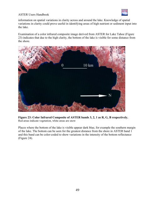
<strong>ASTER</strong> Users Handbookinformation on spatial variations in clarity across and around the lake. Knowledge of spatialvariations in clarity could prove useful in identifying areas of high nutrient or sediment input intothe lake.Examination of a color infrared composite image derived from <strong>ASTER</strong> for Lake Tahoe (Figure23) indicates that due to the high clarity, the bottom of the lake is visible for some distance fromthe shore.Figure 23: Color Infrared Composite of <strong>ASTER</strong> bands 3, 2, 1 as R, G, B respectively.Red areas indicate vegetation, white areas are snowPlaces where the bottom of the lake is visible appear dark blue, for example the southern marginof the lake. The bottom can be seen for the greatest distance from the shore in <strong>ASTER</strong> band 1and this band can be color-coded to show variations in the intensity of the bottom reflectance(Figure 24).49